Printable Version of Topic
Click here to view this topic in its original format
Unmanned Spaceflight.com _ Lunar Exploration _ Lunar Spacecraft Images
Posted by: Phil Stooke Jun 5 2005, 01:27 AM
As promised in another thread... I thought all the images from Surveyor, Apollo etc. needed another place to go than the Mars Forum.
I will start the thing off with a link, not an image. I occasionally have images in Chuck Wood's Lunar Picture of the Day (LPOD) website, www.lpod.org.
This URL:
http://www.lpod.org/LPOD-2005-05-25.htm
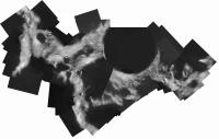
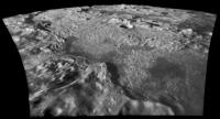
is my latest, a Clementine LWIR mosaic. The text accompanying the image explains how I made it. LWIR images from the PDS look useless but they can be made into very nice image strips. In most areas of the Moon they are the highest resolution images available, since the HIRES camera only functioned well over near-polar latitudes. So image junkies who want to see new scenery emerge from their computers can go wild!
Phil
Posted by: Phil Stooke Jun 5 2005, 01:29 AM
PS - did I mention I'm having the hardest time getting any work done these days...
Phil
Posted by: MizarKey Jun 6 2005, 05:18 PM
Phil, the pages for the images for 6/2 and 6/4 are coming up with 'page cannot be found' messages...do you have any pull to get them back on track?
Eric P / MizarKey
Posted by: Bob Shaw Jun 6 2005, 05:28 PM
Phil:
Well done - I thought Clementine was a bit of a lost cause, with very few good images!
Have you done any landing sites? It'd be nice to see familiar locations in an unfamiliar way...
Bob Shaw
Posted by: Phil Stooke Jun 6 2005, 07:49 PM
Bob - quit asking me questions! I'm supposed to be working...
I have done some landing sites... I'll post a few things later. LWIR images are in pole to pole strips with gaps between them at lower latitudes so not all sites are covered. For instance I made a strip across the Apollo 17 site to see if I could find evidence of the LM ascent stage impact. But I couldn't. But the Apollo 14 SIVB impact shows up. I also used these images to find a candidate for the Ranger 6 impact site, which is on LPOD somewhere.
Clementine had lots of good images... but it made its pics with a high sun to reduce shading, because it was intended for multispectral compositional mapping. At the equator all you see is full moon style albedo variations. But near the poles the sun is always low anyway so those images are excellent. The HIRES camera gave good results too, near the poles. LWIR looks good in most areas.
and Mizarkey - no, I have no pull. Chuck Wood is trying to do the LPOD website from a remote location and is having a few problems. But it should get sorted out eventually.
Phil
Posted by: Phil Stooke Jun 6 2005, 09:02 PM
This is a Clementine HIRES mosaic of the south pole. The prominent crater is Shackleton.
Phil
Posted by: um3k Jun 6 2005, 09:02 PM
Aren't we all!
Posted by: Phil Stooke Jun 11 2005, 04:40 AM
Mizarkey asked about LPOD. They had server problems... and they are temporarily at this URL until they get it fixed:
http://www.perseus.gr/LPOD/index.htm
Phil
Posted by: Phil Stooke Jun 17 2005, 01:12 PM
Here's another unfamiliar lunar scene...
Clementine long-wavelength infrared (LWIR) image strip - very heavily processed, the raw data is impossible to use, but Photoshop can unveil the landscape behind the noise.
This is Mare Anguis, AKA Angus Bay if you are in the Moon Society (no, I'm not). It's on the east end of Mare Crisium, and it's the preferred site for the Moon Society/Artemis lunar base.
Phil
Posted by: dilo Jun 23 2005, 05:38 AM
SMART-1's tribute to Cassini
http://www.esa.int/SPECIALS/SMART-1/SEM4GN1DU8E_0.html
(posted image slightly out of focus? ![]() )
)
Posted by: tedstryk Jun 23 2005, 01:18 PM
Hard to tell...depends how much of the frame that really is. Focus and clarity are hard to determine with ESA images due to their penchant for oversampling.
Posted by: Phil Stooke Jun 23 2005, 02:30 PM
I don't see any evidence for imperfect focus in this image. Also it's interesting to compare it with Lunar Orbiter 4 and Clementine... I'll post something on that later. But this holds up well.
Phil
Posted by: Phil Stooke Jun 23 2005, 04:04 PM
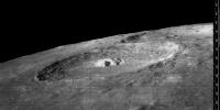
OK, here's the comparison...
I have chosen a small area on the NW rim of Cassini, chosen to give better Clementine coverage from the north periapsis images, with higher resolution in this area.
Lunar Orbiter 4: the new digital version from USGS.
Clementine - from map-a-planet, not raw data which would be a bit better. But I've spent too long on this as it is!
SMART-1 doesn't have the resolution of either of the others... but don't forget that this is jpegged and probably reduced from the original, which might be a bit better. More importantly, though, we are at 40 north, and SMART-1 's orbit is optimised for southern hemisphere viewing. At 40 south the resolution probably exceeds LO4 and Clementine UVVIS, and at 90 south it will be 10x better than LO4 and as good as Clementine HIRES. Plus it's got better lighting than Clem for morphological studies and will have better global coverage than Lunar Orbiter.
Phil
Posted by: Bob Shaw Jun 23 2005, 09:35 PM
The problem I have with both SMART-1 and Mars Express isn't so much the quality of the data, so much as the *quantity*. ESA's miserly approach to image release compares s-o-o-o unfavourably with the situation in the US!
(sigh)
Posted by: Phil Stooke Jun 23 2005, 09:45 PM
Yes, Bob, you're right.
I forgot to mention, about my previous post... the Lunar Orbiter image is presented at full resolution. The other two are enlarged to match it. Some of the apparent fuzziness in the SMART-1 image is caused by my enlargement of it.
Phil
Posted by: djellison Jun 23 2005, 10:05 PM
It shows the comparative 'resolving power' quite well though
ESA is quite shocking really - it's beginning to gte annoying.
Doug
Posted by: ilbasso Jun 23 2005, 10:22 PM
Of course, the other-other possibility is that this is the ONLY picture that SMART-1 has taken lately. (yeah, right!!) ![]()
Posted by: Bob Shaw Jun 23 2005, 10:28 PM
We saw the Huygens images (albeit with all sorts of caveats, but personally that's no grief!) fairly quickly as a result of ESA's liaisons with various universities and some creative accounting (be quiet, Doug!). I wonder whether there are any public resources out there which happen to have Mars Express and SMART-1 images casually available to the academic community, and which we might make some (reasonably informed, if not tenured) comments upon?
It's like pullin' teef, innit?
Posted by: djellison Jun 24 2005, 07:31 AM
Well - the MEX data is slowly getting put in an online archive, but my GOD it's awkward to use.
Doug
Posted by: Phil Stooke Feb 10 2006, 09:41 PM
Here's my latest image from the Jurassic period of lunar exploration.
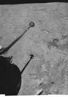
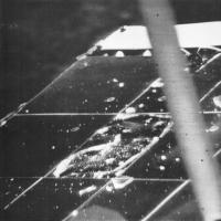
Surveyor 6 - view to the northeast. It shows the landscape lit by a high sun after the 'hop' - and so we see two footpad imprints from the initial landing, plus the effects of rocket firing on the surface. The color chart on the omnidirectional antenna is splattered with dirt.
Phil
Posted by: tedstryk Feb 10 2006, 10:29 PM
Surveyor 6 - view to the northeast. It shows the lanscape lit by a high sun after the 'hop' - and so we see two footpad imprints from the initial landing, plus the effects of rocket firing on the surface. The color chart on the omnidirectional antenna is splattered with dirt.
Phil
Great work!
Posted by: Bernard Feb 11 2006, 10:04 AM
Superb!!!
I really wait for your book;
Thanks
Posted by: edstrick Feb 11 2006, 11:57 AM
<grins and applauds the Surveyor mosaics> So much better than the raw stuff!
Posted by: Bob Shaw Feb 11 2006, 08:10 PM
Yes; Phil should kindly bring forward the publishing date to, say, yesterday!
Bob shaw
Posted by: Phil Stooke Feb 11 2006, 08:38 PM
-Puff!- I'm working as fast as I can! -puff!- that one image took three weeks to make... and it's only one sixth of the entire panorama...
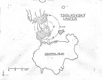
Plus... I just discovered a map of a proposed radio observatory in Tsiolkovsky crater, and I have to see if I can squeeze it in. And I have to wait for SMART-1's impact so I can map that... and I'm hoping the Chandrayaan-1 impact taget will be known in the summer so I can include that - Aaargh! It never ends.
Phil
Posted by: Bob Shaw Feb 11 2006, 09:08 PM
Plus... I just discovered a map of a proposed radio observatory in Tsiolkovsky crater, and I have to see if I can squeeze it in. And I have to wait for SMART-1's impact so I can map that... and I'm hoping the Chandrayaan-1 impact taget will be known in the summer so I can include that - Aaargh! It never ends.
Phil
Phil:
Luxury...
Bob Shaw
Posted by: Phil Stooke Feb 11 2006, 09:10 PM
You're right, Bob.
Phil
Posted by: tedstryk Feb 12 2006, 01:52 AM
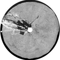
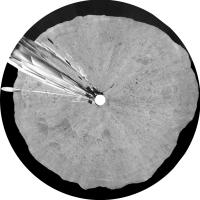
Here is some progress on my Luna 9 work. Enjoy!
http://img153.imageshack.us/my.php?image=luna9panf10es.jpg
http://img134.imageshack.us/my.php?image=luna9polar6eo.jpg
Interestingly enough, the Luna 9 camera position slowly changes, making it difficult to merge data from the pans. Either the craft is slowly settling or tipping, or the camera is sinking. This is illustrated in the slight change in position between pans 2 and 3. The part of the spacecraft in the forground gives great context, but unfortunately washes out the whole scene in pan 1. But nowhere is the motion more obvious.
Posted by: RNeuhaus Feb 12 2006, 02:00 AM
The view on Moon surface is somewhat strange to me. Not like to the Earth colors since we have atmosphere which difracts the light into many colors that in the Moon does not happen. Staying in the Moon is like to take pictures of blank and white. Is not it? Maybe, we will se some gray colors too?
Rodolfo
Posted by: Phil Stooke Feb 12 2006, 05:17 AM
Very nice, Ted. The spacecraft tilted slightly between each pan - I don't know if anyone knows why. I also made a composite view of all three.
One interesting thing to try is to copy out the six thin vertical strips which were viewed in the three dihedral mirrors, reverse them and try to match their positions on the pans. I got some of them but not all. It was an ingenious attempt to measure topography from the thin slices of surface viewed from two positions. Some of the mirror strips add details below the bottom of the main panorama.
Phil
Posted by: BruceMoomaw Feb 12 2006, 06:11 AM
The Soviets remarked on that slight post-landing shift at the time. I imagine it was very delicately balanced on a pebble, and the slight vibration from the rotating camera head dislodged it.
Posted by: tedstryk Feb 12 2006, 03:02 PM
I read about that, but I always assumed it was in the seconds after landing, not a slow progression.
Posted by: Bob Shaw Feb 12 2006, 08:59 PM
No; it was well after landing, and was detected via doppler shift by the Jodrell Bank radio telescope. The fact that it moved made front page headlines in the UK Daily Express, which newspaper had provided Sir Bernard Lovell with a fax machine to print the images. It was as a result of the proportions on the machine being set to standard settings that the Phil-O-Vision surface images came to be. FWIW, in those days fax machines were built round big spinning cylinders and weighed about as much as two journalists!
Bob Shaw
Posted by: BruceMoomaw Feb 12 2006, 11:48 PM
These days fax machines weigh about as two journalists, too -- albeit in the figurative sense.
Posted by: Phil Stooke Feb 13 2006, 12:21 AM
Doppler, Bob? That doesn't sound right. I'm wiling to be proved wrong, but I can't see it being right.
I guess we ought to rename the old vertical exaggeration technique Bernie-Vision. Pity.
Phil
Posted by: Bob Shaw Feb 13 2006, 12:26 AM
I guess we ought to rename the old vertical exaggeration technique Bernie-Vision. Pity.
Phil
Phil:
It's certainly what they said at the time - I was looking at some press cuttings just a few weeks ago. Perhaps they reported a false positive which turned out positive...
...I really *must* scan the things and post them here!
Bob Shaw
Posted by: tedstryk Feb 13 2006, 01:05 AM
Here is a version I am working on flattening out. Also, a version in which I have artifically expanded the sun glare to hide the missing part of the horizon.
http://img213.imageshack.us/my.php?image=luna9pang49fp.jpg
Posted by: edstrick Feb 13 2006, 02:04 AM
I have long looked at the Luna 9 pans and compared them to Surveyor and Apollo pans, and I've been convinced that Luna 9 did *NOT* land in normal mare terrain. The site does not at all resemble the typical flat inter-crater terrain imaged by Surveyor 1, Luna 13 or Apollo 11
The entire terrain around the spacecraft is "rumpled" and rolling-hummocky. The site it resembles most is the Apollo 14 site on the Cayley deposits of Imbrium Ejecta.
Either it landed within a cluster of secondary craters, on low relief highland edge terrain, or on a wrinkle ridge like the one on Surveyor 6's horizon.
Posted by: Phil Stooke Feb 13 2006, 03:55 AM
There certainly is some low to medium scale relief on the Luna 9 horizon... but I'm not sure it's all that unusual for a mare area, if it happened to have a crater rim nearby. Nevertheless, as you can see here:
http://www.lpi.usra.edu/meetings/lpsc2006/pdf/1341.pdf
I have argued that Luna 9 cannot lie at the position usually given for it, which would put it among Apollo 17-scale mountains. The most likely position is shown in that reference. It has to be far enough away from the mountains that they cannot be seen. The area I indicate does indeed contain wrinkle ridges, as well as craters of various sizes. Any combination of them could account for the horizon relief.
Phil
Posted by: ljk4-1 Feb 13 2006, 05:21 AM
Would it be possible to use the Surveyor solar panels as laser reflectors?
Posted by: edstrick Feb 13 2006, 05:56 AM
Luna 9 might be in that cluster of secondaries at the south of your candidate landing circle or the rough terrain (probably more secondaries) by the wrinkle ridge at the right edge of the circle, but another good candidate would be that embayed region of uplands just to the left of the candidate circle. The isolated hills and crater further west would probably be below the local horizon and not noticed. Granted, statistically, any mare surface contains regions of more hummocky and irregular terrain, mostly associated with secondary impacts.
Posted by: djellison Feb 13 2006, 08:54 AM
I think the design of a laser reflector is that specifically so that it will return the incoming laser back in the direction it came from - that is the way they are optically designed. A solar panel would just reflect back out at the angle of the incoming laser. You would have to have the solar panel at exactly the right angle to reflect the light back to the source - an almost impossible task.
Doug
Posted by: Bob Shaw Feb 13 2006, 12:20 PM
Doug
Doug:
Although the panel would not be nearly so reflective as proper LRRR blocks, they ought to reflect sunshine reasonably well. Depending on the orientation of the panel (just one, the other is an aerial) I suspect that at either sunrise or sunset you might get an Iridium-like flare from the surface. Iridium panels must be about three or four times the surface area, however, and are a quarter of a million miles closer to us - but they *do* reach minus magnitudes!
It'd all depend on the orientation of the spacecraft, the position of the Moon, etc, etc, and the whole event, if visible at all, might only be seen over small parts of the Earth's surface at a time. Still, if somebody can work it out, it might be worth looking at as an advanced amateur observational project, much like the attempts to discern the shapes of asteroids etc by grazing occultations.
Bob Shaw
Posted by: ljk4-1 Feb 13 2006, 01:55 PM
Although the panel would not be nearly so reflective as proper LRRR blocks, they ought to reflect sunshine reasonably well. Depending on the orientation of the panel (just one, the other is an aerial) I suspect that at either sunrise or sunset you might get an Iridium-like flare from the surface. Iridium panels must be about three or four times the surface area, however, and are a quarter of a million miles closer to us - but they *do* reach minus magnitudes!
It'd all depend on the orientation of the spacecraft, the position of the Moon, etc, etc, and the whole event, if visible at all, might only be seen over small parts of the Earth's surface at a time. Still, if somebody can work it out, it might be worth looking at as an advanced amateur observational project, much like the attempts to discern the shapes of asteroids etc by grazing occultations.
Bob Shaw
Perhaps someone should recheck the TLP (Transient Lunar Phenomena) records for any such
unusual glints from the various landing sites.
http://www.lpl.arizona.edu/~rhill/alpo/lunarstuff/ltp.html
http://www.mufor.org/tlp/lunar.html
http://en.wikipedia.org/wiki/Transient_lunar_phenomenon
http://www.ltpresearch.org/
http://www.geocities.com/CapeCanaveral/Launchpad/1837/
Wouldn't it be ironic if the Surveyor 2 and/or 4 solar panels happen to fall just right....
Posted by: Phil Stooke Feb 13 2006, 04:22 PM
What about the optical reflectivity of the high gain antenna?
I know nothing about this, but my concern about the solar panel is that I might expect it to be left pointing at the horizon - either west for end of day power or east in case it survived the night, for morning power. Apollo 12 images of Surveyor 3, for instance, show the solar panel facing west at a steep angle, but the antenna nearly (probably exactly) perpendicular to the Earth line of sight. I don't know the limits of motion of the panel, either, but I assume it tracked the sun to some extent. Anyway, the antennae might give glints near full moon, if they are reasonably reflective. I've never heard anybody discuss this... there might be equal or better chances for glints off ALSEP or other surfaces as well.
Phil
Posted by: AndyG Feb 13 2006, 04:35 PM
They do: I see it's about mag -8 at the maximum.
But that distance is killer #1: an iridium flare at lunar distances, compared to the 780km orbit of the satellite, will be about one quarter million times dimmer. Killer #2 is the size and finish of the panels - they're not polished metal as with the Iridium satellites, they're designed specifically as light-absorbing materials. Being generous, let's say they're ten times dimmer. Killer #3 is that they are (as you state) three to four times smaller. So we're dealing with a transient flash perhaps ten million times dimmer than mag -8, which is equal in magnitude to +9.5. Not bright - especially against a lunar background.
The final nail in the coffin, as I see it, is that the angle of the panels are not known with any great precision. At the Moon's distance the Earth only subtends 2 degrees. Iridium flares on the Earth are very localised: just a few miles can take you from a "wow" flare to a "ok, so I saw it" one - I can see that it would be extremely likely for any equivalent lunar flares to miss the Earth completely, for all (or a huge amount) of the time.
Shame though. :-)
Andy
Posted by: Bob Shaw Feb 13 2006, 06:33 PM
Andy and Phil:
I take your points - but remember the famous Mars flashes, from about 150 times further away?
It may well be that nothing is visible, but it's worth a little thought - it'd be great if something *was* seen!
If the Surveyor solar panels (not counting the failures, which are probably debris) were arranged to face the morning or evening sun (depending on when the vehicles turned off) then I wonder whether there might be glints visible from Lunar orbit? One problem might be predicting where the darn things are pointing - as I'm sure you know, Surveyor 3 woke up enough to try to take TV pictures *after* it lost contact with Earth (the vidicon tube was damaged by UV as a result of a filter opening, although it was closed when the spacecraft was last in touch with the ground, so it must have decided to do it all by itself!) so perhaps the solar panels are at some utterly unknown angle!
Bob Shaw
Posted by: dvandorn Feb 13 2006, 11:18 PM
I take your points - but remember the famous Mars flashes, from about 150 times further away?
Ahh, but I have it from reliable sources that a Professor Pearson from Princeton University has identified those Mars flashes as vast explosions of hydrogen gas. While these may seem unusual, they are more than likely simply the result of volcanic activity, and shouldn't concern us in any way...
-the other Doug
Posted by: edstrick Feb 14 2006, 09:55 AM
Nah..... not hydrogen.
Methane!
Posted by: Phil Stooke Feb 14 2006, 01:35 PM
"Surveyor 3 woke up enough to try to take TV pictures *after* it lost contact with Earth (the vidicon tube was damaged by UV as a result of a filter opening, although it was closed when the spacecraft was last in touch with the ground, so it must have decided to do it all by itself!) so perhaps the solar panels are at some utterly unknown angle!
Bob Shaw"
Yes, Bob, but Apollo 12 photos show us the orientation now.
Phil
Posted by: ljk4-1 Feb 14 2006, 04:23 PM
Bob Shaw"
Yes, Bob, but Apollo 12 photos show us the orientation now.
Phil
I was told in this forum that the Surveyors did not have
the computer capacity to do many things on their own.
Was this one of those exceptions?
Makes one wonder if any of the other Surveyors also
tried to do one last task before expiring?
Until we can actually get an exoarchaeological team there
to study these old probes, can the LRO determine anything,
such as an unpredicted orientation, or will we just be lucky
enough to even see them on the lunar surface?
Posted by: Bob Shaw Feb 14 2006, 07:40 PM
Bob Shaw"
Yes, Bob, but Apollo 12 photos show us the orientation now.
Phil
Phil:
Of course! I was describing the matter of the Surveyor solar panels in general, hence the plural 'panels'. The Apollo 12 panel is the only one where utterly accurate predictions could be made, other than best guesses...
the computer capacity to do many things on their own.
Was this one of those exceptions?
Makes one wonder if any of the other Surveyors also
tried to do one last task before expiring?
Until we can actually get an exoarchaeological team there
to study these old probes, can the LRO determine anything,
such as an unpredicted orientation, or will we just be lucky
enough to even see them on the lunar surface?
I think it wasn't so much a commanded action by a lonely old computer so much as a twitch from a half-broken component or two, aided by a still-working solar panel.
The Sojourner story, that's another matter - it may have trundled around for a while after Pathfinder ceased to operate, bravely crying for it's parent! Maybe MRO will have a cPROTO mode developed which will resolve the little guy's position...
Bob Shaw
Posted by: Phil Stooke Feb 27 2006, 03:17 PM
A rather bland image... it's the foreground of the Surveyor 6 post-hop panorama I'm working on. This extends to the right of the previous section. The footpad with its colour disk is at right bottom, with a big patch of disturbed soil. At left are dark streaks made by the thruster firing. A circular pit near the top is an imprint of a shock-absorber, and a pit half-seen at the top edge is a footpad imprint from the imitial landing.
Phil
Posted by: tedstryk Feb 27 2006, 04:51 PM
Phil, admit it. You don't reprocess these images. You sneek up there in your "Apollo-B" module, slip your camera next to the Surveyor camera, and snap the pictures. The only editing is to remove your footprints! ![]()
Seriously, tremendous work!
Posted by: Phil Stooke Feb 27 2006, 06:05 PM
You got it, Ted. The best part is, NASA is paying me $145 billion for the use of my spacecraft in 'the Vision', so now I can pay off my credit card.
Phil
Posted by: Phil Stooke Feb 28 2006, 08:18 PM
This is the current state of the Surveyor 6 pan... the original is 11000 pixels long.
Can you tell which part is cleaned up and which I still have to do?
I'm working along the horizon in the middle right now.
Phil
Posted by: dilo Feb 28 2006, 08:33 PM
Amazing masterpiece, Phil ![]() ... I admire your patience! (what about your Mars atlas project?)
... I admire your patience! (what about your Mars atlas project?)
Posted by: Bob Shaw Feb 28 2006, 09:09 PM
Phil:
If you ever have time, would you consider talking through some of the processes you use? It'd be instructive to see how your work in progress actually takes place!
Bob Shaw
Posted by: Myran Feb 28 2006, 10:09 PM
On the subject on the flashes some claimed to have observed on the Moon and Mars I always have thought those were phosphene flashes in the eyes of the visual observers due to darkness and the late hours they worked.
I think so especially since the few searches with photographic means yielded nothing, even when images were taken simultanously to a claim of a tranisent light, nothing could be seen on the plates.
Posted by: Bob Shaw Feb 28 2006, 10:13 PM
I think so especially since the few searches with photographic means yielded nothing, even when images were taken simultanously to a claim of a tranisent light, nothing could be seen on the plates.
Well, the problem with flashes and old-style photography was that the exposures were just too darn long, and the flashes way too short - but recently there *have* been observation made with video cameras showing meteor impacts on the Moon during well-known meteor showers.
There was an article in S&T a few years back which had some interesting arguments for the reality of the Mars flashes, too...
Bob Shaw
Posted by: Phil Stooke Feb 28 2006, 10:25 PM
My work with Surveyor pans is very tedious and time-consuming. I told myself five years ago I would make a full clean pan of every Surveyor site. Now I tell myself I will never look at another Surveyor image as long as I live.
I work in Photoshop. In the better areas I can just select small areas and lighten or darken them. In general, though, the procedure is like this:
I use the polygon select tool to outline one individual frame from the pan. I copy it and paste it over itself.
I use feathered selections over dark areas to brighten them, and over light areas to darken them, adjusting to equalize contrast in each area as well. This removes the vile tonal gradients across many of the frames.
Then - the slowest part - I zoom in on the frame borders and clean up all the bad edges so the transition from frame to frame is invisible. Many small selections individually processed.
Finally, I remove reseau marks and other defects using a comination of noise filters in tiny selections over each flaw, and (less often) cutting an adjacent good patch and placing it over a larger flaw (dust specks on Surveyor 6 mirror, for instance).
Then I flatten it, back it up, and start all over again.
Phil
Posted by: Myran Feb 28 2006, 10:26 PM
Oh yes you are right there, there was one such videofilmed one last year wasnt it?
Back to the subject of this thread I guess.
Great work on that old vidcon image Phil!
Posted by: dvandorn Feb 28 2006, 11:42 PM
Well, Phil, I hope knowing that your work is extremely and thoroughly appreciated by people like me makes it worthwhile for you.
Though I imagine that, at the core of it, you're doing these for yourself, so you can see the Surveyor sites as they truly appeared.
But, whatever the reason you are doing it -- the work is appreciated.
-the other Doug
Posted by: dilo Mar 1 2006, 12:39 AM
Phil, did you consider the use of a stitch program, at least for the slowest part of your work?
Posted by: Phil Stooke Mar 1 2006, 01:33 AM
Replying to two messages from Dilo -
First, the Mars atlas is off in the future. I have to finish the moon one first! But when I have some spare time at home I play with other topics like maps of the rover routes, shape modelling of Comet Borrelly, or a rather nice cylindrical projection map of Comet Tempel-1 which I'll post one day... after the sources are public!
Second, a stitch program does not help me with the Surveyor pans. What I forgot to add was the source of my data - after all, you can't find Surveyor pans online. I searched the photo archives of LPI in Houston, LPL in Tucson and USGS in Flagstaff. It was a great privilege to be able to work in all those places. The material I scanned was made up of prints of the big mosaics assembled in the 1960s at JPL (the USGS mosaics were less satisfactory for this purpose)
So the mosaics were stitched - by hand - using individually projected hardcopy images, and then photographed years ago. I scanned prints of the photos of already assembled mosaics. What I have to do is remove the flaws in the mosaics. But stitch software would have nothing to contribute.
PS - this project is what academic tenure was created for! I've done nothing else for five years but teach and do this.
Oh, and OD, I do it for me, but I'm glad you appreciate it. One day this will all be on the web.
Phil
Posted by: dilo Mar 1 2006, 06:30 AM
Thanks for details, Phil. Cannot wait for full-res, public release!
Many of us do space image processing only for personal satisfaction (and relax too, see http://www.unmannedspaceflight.com/index.php?s=&showtopic=2280&view=findpost&p=43613)...doing this for work (and be payed for this!) would by the dream of most uf us (for sure is my dream!)... so, in my opinion, you are very lucky man! ![]()
Posted by: Phil Stooke Mar 1 2006, 02:03 PM
oh yeah - I forgot to mention I get paid to play!
Phil
Posted by: dilo Mar 1 2006, 09:27 PM
Many of us do space image processing only for personal satisfaction (and relax too, see http://www.unmannedspaceflight.com/index.php?s=&showtopic=2280&view=findpost&p=43613)...doing this for work (and be payed for this!) would by the dream of most uf us (for sure is my dream!)... so, in my opinion, you are very lucky man!
...damn, this was my 1000th post and I didn't noticed!
Posted by: Bob Shaw Mar 4 2006, 11:10 PM
Apollo 13 and SLA panels in flight - before the, er, problem!
http://www.w7ftt.net/apollo13.html
The same website mentions observations of Apollo 8 at 200,000 miles...
Bob Shaw
Posted by: helvick Mar 5 2006, 08:25 AM
Now that was one hell of a shot. Way cool.
Posted by: antoniseb Mar 5 2006, 10:34 PM
That is a cool shot. I had forgotten about the panels. These are all in quasi solar orbit now (right?). I assume that we didn't track them. Can we guess where they are?
Posted by: Bob Shaw Mar 5 2006, 10:59 PM
The website noted above mentions that the SLA panels were rather bright whenever they caught the sun just so, but quite dim apart from that - this was in the days of film photography, so they eneded up with an 'average' brightness. These days, with video, the max brightness flashes might be picked up and would look pretty far from natural, coming from objects having a rotational period of a few seconds! The Apollo 13 spacecraft was in a non-return trajectory, as we all know, so presumably the S-IVB was too - and the SLA panels too. The S-IVB struck the Moon, but would have had a targetting 'burn' using unburnt residual fuel to bring it to an impact trajectory. The SLAs obviously didn't, so they may or may not have hit the Moon. The Apollo 12 S-IVB turned up again a few years ago, so I suppose it's entirely possible that the SLAs wandered round for a bit then hit the Moon years later.
Bob Shaw
Posted by: edstrick Mar 6 2006, 08:27 AM
Its likely that any panels that did a posigrade lunar flyby were flung into solar orbit, while ones that did a retrograde flyby may have lost enough velocity relative to Earth that they remained in a moon-crossing orbit (very unstable and unpredictable, long term)
Posted by: Phil Stooke Mar 6 2006, 05:06 PM
The next installment of the Surveyor 6 pan. This is just above the last one, extending to the horizon.
The pit in the foreground is a footpad imprint from the initial landing. This is from after the 'hop'.
Phil
Posted by: Phil Stooke Mar 22 2006, 08:34 PM
Here's a full resolution section from the Surveyor 6 panorama. The horizon southeast of the spacecraft.
Phil
Posted by: Bob Shaw Mar 22 2006, 10:11 PM
Phil:
Is this image of any use to you? It's one I've been playing with, and I've been thinking of dropping it into your Tycho panorama...
Bob Shaw
(Eeek! 1500 posts! I ought to get out more...)
Posted by: BruceMoomaw Mar 23 2006, 01:35 AM
(Eeek! 1500 posts! I ought to get out more...)
Yes, the Internet is making modern society bear a closer and closer resemblance to E.M. Forster's "The Machine Stops"...
Posted by: Phil Stooke Mar 23 2006, 02:32 AM
Judging by the number of posts, I'm only half the man Bruce is... and just over half a Bob. Just over half a bob - let's say sixpence ha'penny. I can't afford to get out more - I gotta stay here and post-post-post!
Phil
(PS Bob - add a Surveyor to a pan if you like, I'd enjoy it. I have a pic like that somewhere too, I'll look it out.)
Posted by: BruceMoomaw Mar 23 2006, 03:42 AM
Internet posts are like eating chips out of a bag -- you don't realize how many you've done until it's too late. (I was just harshly reminded of this again this morning, when I got so wrapped up posting at this site and reading others without paying an attention to anything else that I ended up being half an hour later to an appointment.)
Posted by: ljk4-1 Mar 23 2006, 02:14 PM
Which is online thanks to the very same Internet:
http://brighton.ncsa.uiuc.edu/~prajlich/forster.html
Posted by: djellison Mar 23 2006, 02:18 PM
Hmm - pringles.
Doug
Posted by: odave Mar 23 2006, 02:34 PM
This is pretty much why I'm skeptical about the whole http://en.wikipedia.org/wiki/Technological_singularity concept. Rather than work hard to develop faster and better technology, people will tend to spend more time net surfing, reading fora, chatting, or park themselves on the couch to watch bad reality TV shows. ![]()
Posted by: ljk4-1 Mar 23 2006, 03:06 PM
[quote name= quote in reply - removed
[/quote]
It's the machines - better known as Artilects - that will do all the
real work and benefit the most from the Singularity. Humans may
just have been the midwives in all this.
The Artilects may take care of us, ignore us, or get rid of us.
http://www.kurzweilai.net/index.html?flash=1
http://www.cs.usu.edu/~degaris/
Posted by: Bob Shaw Mar 27 2006, 12:36 PM
Today's Space.com post includes an article featuring a chap by the name of Stooke...
http://www.space.com/scienceastronomy/060327_mystery_monday.html
Bob Shaw
Posted by: chris Mar 27 2006, 12:47 PM
[quote name= quote in reply - removed
[/quote]
Very unlikely sounding name. Must be a pseudonym ![]()
chris
Posted by: BruceMoomaw Mar 27 2006, 08:04 PM
I see Phil's LPSC talk on the great Lunar Lander Hunt has made Space.com: http://www.space.com/scienceastronomy/060327_mystery_monday.html . Personally, the one I'm still most interested in is Surveyor 4.
Posted by: Phil Stooke Mar 27 2006, 09:28 PM
I should emphasize I only submitted a "print-only" abstract because I couldn't get to LPSC this year.
Phil
Posted by: Bob Shaw Mar 28 2006, 12:47 PM
Phil:
I was intrigued by the (possible) Clementine Ranger impact image which accompanied the Leonard David article. It seemed to show that the dark ejecta blanket (perhaps 'dust blanket' would be a more accurate description) was quite large, of the order of half a kilometer. What are your views on this? And, indeed, going back to some previous comments about the dark tracks near the LM landing sites, why is the disturbed area darker at all (or is that just an IR artefact?)?
Bob Shaw
Posted by: Phil Stooke Mar 28 2006, 01:45 PM
The possible Ranger 6 ejecta deposit is dark in thermal IR, meaning it's cool (and by extension, so am I), but in visible light it's bright. This like all fresh crater deposits may just be a texture effect.
We don't have a high res image here. Where we do - Rangers 7, 8, 9, Apollo 13, 14 SIVBs, Apollo 14 LM - the story is more confused. Generally there is a dark ejecta patch in visible, but Ranger 9 is bright and Apollo 14 SIVB has mixed bright and dark rays. It's not clear what is going on.
One problem is that the images my comments are based on are very different - Apollo pan and Hasselblad, Lunar Orbiter, Clementine IR. We would really benefit from having systematic coverage of all these sites at very high resolution, with similar illumination, from the same instrument. LRO should help with this.
Phil
Posted by: Bob Shaw Mar 28 2006, 02:06 PM
Phil:
What about the sizes of the areas disturbed by the impact? I appreciate that high lateral velocity impacts are a case all to themselves, but most of the other impacts will, I'd assume, have been pretty well head-on. The S-IVBs and LM ascent stages may also have had some residual propellants which must have turned to gas on impact and presumably added to the distribution of debris. So how *big* an area of disturbance are we looking at? If a Ranger = half a kilometer, then an SIVB = ?
Do you remember the post-impact pictures in the National Geographic articles which covered V2 launches at White Sands? If the V2 nosecone wasn't blown off it came in with little in the way of braking, so it's impact velocity wasn't far off that of something hitting the Moon - and what you got was a 60 foot crater with an engine in it, and confetti. I presume that head-on impacts on the Moon would be like that, but that the grazing impacts by the LM ascent stage might be rather different.
Bob Shaw
Posted by: ljk4-1 Mar 28 2006, 02:09 PM
And wouldn't the color/shading of the impact area also depend on what kind
of surface material the crashing spacecraft would dig up?
A little crude surface science could be done from these old versions of
Deep Impact, I presume?
Posted by: Phil Stooke Mar 28 2006, 02:17 PM
We don't have a good sample, and the different sources of information may be detecting different things. Looking at the two SIVB impacts, Apollo 16 pancam images show disturbed areas about 1 km across (A13) and maybe 4 km across (A14). Ranger 7's disturbed area is about 200 m diameter in Apollo 16 pancam, but (very marginal detection) 1 km across in Clementine IR.
Phil
Posted by: PhilHorzempa Mar 31 2006, 08:02 PM
It would be nice to find the impact location of Luna 2. However, I've been thinking
about the upper stage of the R-7 that sent Luna 2 on its way. Wouldn't it be follwing
essentially the same path as Luna 2? I don't have the numbers handy, but as I recall
that upper stage was much more massive than Luna 2 and, therefore, would have left
a much larger impact crater.
As for the American Ranger and Surveyor probes, does anyone know if the upper
stages of the Atlas boosters impacted the Moon for some of those missions? That would
be Agena upper stages for Ranger and Centaur for Surveyor. In addition, did the upper
stages for other Soviet Luna missions impact the Moon?
Another Phil
Posted by: BruceMoomaw Mar 31 2006, 08:19 PM
The Agena and Centaur stages were deliberately aimed to miss the Moon to eliminate any tiny chance of biocontamination. I believe the Soviets did NOT do this, but am not sure about whether this was true in all cases. (As for identifying their impact craters: there's an awful lot of territory down there, with an awful lot of similar-looking holes in it.)
Posted by: Phil Stooke Mar 31 2006, 08:51 PM
Reports at the time all agree that the Luna 2 upper stage struck the moon about 30 minutes after the spacecraft itself. If it followed the same trajectory, but half an hour behind it, it would be displaced by the moon's orbital motion in 30 minutes, which by my reckoning suggests an impact near the east limb - north of Mare Crisium. But there was no tracking I'm aware of or any other estimate of location I've ever seen.
Luna 5's upper stage crashed near Pitatus crater - mentoned elsewhere on here - while the spacecraft crashed near Lansberg crater close to the equator. As far as I know all other Soviet upper stages missed the moon.
It would be very difficult to find these craters. Impossible, I would think.
Phil
Posted by: Bob Shaw Apr 7 2006, 11:14 PM
An eccentric artistic globe-making enterprise which is recreating many very interesting old globes, including Robert Maxwell's Pergamon 1963 lunar globe.
http://myweb.tiscali.co.uk/greavesandthomas/facsimile/globe_lunar.html
And have a look at the company van! *Joy!*
Bob Shaw
Posted by: Phil Stooke Apr 19 2006, 01:26 PM
Surveyor 6 goodies:
The raw panorama, scanned from hardcopy at USGS Flagstaff.
The cleaned panorama. The full size is 11000 pixels long.
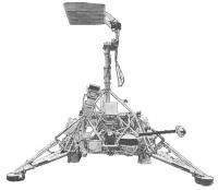
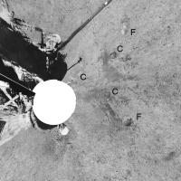
Foreground in vertical projection (approximately). F indicates a footpad imprint from the initial landing (this pan is post-hop). One more is hidden under the spacecraft. C indicates imprints made by the 'crushable block' shock-absorbers. The blast effects of the vernier thrusters, used to make the short hop, are clearly visible in a symmetrical pattern near the C imprints.
And more:
polar projection of the cleaned panorama.
another polar projection showing the distant areas better.
Now I have completed the set of five Surveyor panoramas. I am still planning to get the full res data up on a website eventually.
Phil
Posted by: Bob Shaw Apr 19 2006, 02:44 PM
Phil:
Superb!
And I'm really looking forward to that revamped website! Ever thought of putting up some QuickTime VR images?
Bob Shaw
Posted by: Phil Stooke Apr 19 2006, 03:12 PM
Bob asks: "Ever thought of putting up some QuickTime VR images?"
No. But somebody else is welcome to do it!
Phil
Posted by: Bill Harris Apr 19 2006, 09:56 PM
>Now I have completed the set of five Surveyor panoramas...
Wonderful pans, Phil. And I do like your treatment of the Lunar sky, very realistic... ![]()
--Bill
Posted by: tedstryk Apr 19 2006, 10:03 PM
Great work!
Posted by: edstrick Apr 20 2006, 09:50 AM
AMEN!...I "cut my planetary science teeth" on JPL TR-32-1023, Surveyor 1 Mission Report, Volume II, Science Rsults (Somebody later borrowed it and I never got it back... grrrrrrrrrrrrrrrrrrr). To say I have a soft spot for the Surveyor data is an understatement.
Posted by: tedstryk Apr 20 2006, 10:26 AM
[quote name= quote in reply - removed
[/quote]
I have had this happen quite a few times. It seems when ever I loan out a rare book, it grows legs and runs off....
Posted by: lyford Apr 20 2006, 04:27 PM
Isn't that how rare books are acquired in the first place? ![]()
No, wait, that's how they become rare. ![]()
Despite the wonderfulness of teh internets, a book is so much more...
Over the years, I have lost a few gems, but have gained a few as well from friends moving or whatever. So Kharma=0.
Posted by: PhilHorzempa Apr 20 2006, 04:57 PM
Phil
I commend you on your hard work and excellent results. I do have one
request, however. I have longed to see more of the terrain around Surveyor 7.
All that has been available over the years has been the "periscope" view of
a slice of the surrounding hilly terrain, a small distance North of Tycho.
Could you post a sneak preview of a Surveyor 7 panorama that shows more
of the distant, interesting terrain around that lander?
Another Phil
Posted by: PhilHorzempa Apr 20 2006, 08:04 PM
UNNEEDED QUOTE REMOVED. RULE 3.5
The view is tremendous!
A thousand thanks for that panorama of Surveyor 7's lunar home.
I found intriguing the view in the mirror, as well as the large rock
near one of Surveyor 7's footpads.
Another Phil
Posted by: RNeuhaus Apr 21 2006, 03:07 AM
Interpreting the Moon surface:
The moon regolith has no marks of aeolian erosion. It is interesting to compare it with ones with aeolian erosion (Earth and Mars). The surface looks like that this was punctured by a great amount of micrometeorites.
Nothing smooth surface but porous surface. The surface has no any sharps angles, the hills are curved, it is due that there has no erosion that makes the surface to be rougher and also it has very low gravity that does make the surface to have a sharper angle.
Also, the moon colors are monotonous: white and black, aren't?
Rodolfo
Posted by: BruceMoomaw Apr 21 2006, 06:40 AM
Actually, there IS erosion on the Moon, and it is that erosion which has removed its sharp corners -- namely, that same slow but continuous rain of high-speed micrometeoroids which has very gradually but consistently pulverized the surface, as it does on all airless and nonchanging worlds. The lack of sharp corners is due to the Moon's lack of geological activity, for the last several billion years, that might thrust up new surface features or fissure old ones with faults. The place has been literally "ground down" for eons. This is something which in retrospect should have been obvious to everyone from the beginning, but doesn't seem to have struck most scientists until Ranger 7 provided the first close-up views of lunar features and revealed all the Moon's smaller craters to be blunted and eroded.
And, yes, it is virtually colorless -- which is why the patch of "orangish soil", which turned out to be beads of volcanic glass, so startled the Apollo 17 astronauts.
Posted by: dvandorn Apr 21 2006, 10:16 AM
Well... there *are* sharp and craggy features on the Moon, but they're at relatively small scales. There are tons of angular, sharp-edged rocks up there, ejected from relatively fresh craters. And there are new craters being made most every day, of various (usually rather small) sizes, that have pretty sharp rims. But because the vast majority of the rocks and craters have been softened by millennia of impact erosion, such sharp features do tend to stand out (and were immediately noticeable by the Apollo crews).
And there are colors on the Moon beyond the small patch of orange soil found at Taurus-Littrow. In overall coloration, the highlands have a very slight reddish tinge, while the maria have a very slight bluish tinge. And there are deposits of volcanic and impact glasses that are more brightly colored -- greens, yellows, oranges, reds and golds -- that occur on the surface in such small areal extents that they are only visible at small scales. (And it wasn't just the Apollo 17 crew that found colored glasses -- the Apollo 15 crew found light green glasses coating some rocks. But the coloration was so subtle that, while Irwin spotted it immediately, Scott remained convinced until he saw the samples back on Earth that the greenish cast was a function of the sun visors.)
These sharp and colored features are so subtle and relatively uncommon that the overall appearance of the lunar surface is, as you say, of an almost entirely colorless, softened gray expanse. But the overall impression isn't absolute, and on a planet the size of the Moon, you can find an exception to just about every rule.
-the other Doug
Posted by: ljk4-1 Apr 21 2006, 11:19 AM
Even 2001: A Space Odyssey went for the old-fashioned craggy Moon, despite
knowing better by then. Arthur C. Clarke wrote about how the Moon's mountains
were smooth due to cosmic erosion in his 1964 Time-Life Science book Man and
Space, which he did in a moonlighting capacity while working with Stanley Kubrick
on developing the film. So they knew, but they went with 1960s pre-Apollo audience
expectations of the Moon. A little disappointing considering how often 2001 is touted
as being so accurate.
They did the same thing with the Discovery spacecraft, choosing aesthetics over
accuracy by not having any large vanes on the vessel which would be necessary
to remove excess heat from the nuclear engines. It made the ship look like it had
wings and that would have reduced the "coolness" factor of its look. So they
decided to let Discovery look cool while in reality it would have melted into a
radioactive pile of metal slush from all the heat buildup. Or would it have
exploded?
http://www.palantir.net/2001/
Posted by: PhilHorzempa May 18 2006, 03:58 AM
Has anyone out there in UMSF-land tried to stitch together mosaics from the
digital Lunar Orbiter photos that are now available from the USGS?
The images can be found at
http://cps.earth.northwester.edu/LO/index.html
Another Phil
Posted by: Bob Shaw May 18 2006, 10:25 AM
Another Phil:
Your URL got truncated:
http://cps.earth.northwestern.edu/LO/index.html
The second 'n' got left out of 'northwestern'!
Interesting link, though...
Bob Shaw
Posted by: djellison May 18 2006, 10:51 AM
I've got a few of the interesting Tif's coming down - I might have a play later.
Doug
Posted by: djellison May 18 2006, 11:52 AM
Thought I'd have a bit of a play - and to be honest, I'm sure these images have been presented a thousand times before - but pretty pictures are pretty pictures ![]()
This is from LO3, two frames stitched from their scanning process.
Doug
Posted by: DonPMitchell May 19 2006, 01:56 AM
This is from LO3, two frames stitched from their scanning process.
Doug
Beautiful.
It's interesting that the Lunar Orbiters were phototelevision systems. I think that's the only time the Americans used that technology, but the Russians loved it. Somehow though, the Russian PTU images were always pretty messed up. I know from Zond-8 that they had splendid cameras (those were film-return missions). But when they tried to develop and scan the images, they were scratched up and had pretty bad contrast. I've played a little with the Mars-5 images, and you can make nice pictures, but it takes work.
Posted by: BruceMoomaw May 19 2006, 02:14 AM
The Lunar Orbiter photo system was borrowed practically without any change from our Samos film-scanning reconnaissance satellites (and I believe there was some fuss at the time about the fact that we might be revealing the details of the latter to the Soviets, although I don't know what else we could have done).
Posted by: PhilHorzempa May 19 2006, 03:00 AM
Great work on the LO3 image!
There is another source of digitally scanned Lunar Orbiter photographs
located here.
http://astrogeology.usgs.gov/Projects/LunarOrbiterDigitization/statusmaps.html
As you will notice, there is a clickable map of the Near Side and one for the Far Side
of the Moon at that site. Is it possible to produce a stitched mosaic of part of the Far
Side utilizing some of the Lunar Orbiter frames listed on that map? My favorite
sectors would be Mare Orientale, the area around the Korolev basin, as well
as the area near the Apollo basin.
In addition, back at the original site, listed earlier at
http://cps.earth.northwestern.edu/LO/index.html
it would be interesting to see a stitched mosaic of the high resolution frames, from
Lunar Orbiter 3, of one of the candidate Apollo landing sites. The Lunar Orbiters
produced such magnificent photographs, but, I believe, have not been appreciated
recently because, for so long, they were not available in a digital format. Now that
we are headed back to the Moon, perhaps they will be utilized once again to prepare
for future landings, even in the age of the LRO.
Another Phil
Posted by: DonPMitchell May 19 2006, 03:54 AM
Ah, interesting. The Russians also had a phototelevsion camera (called Baikal) in some early Zenit satellites, but got rid of it. Nothing beats film return for quality. Well maybe some of the modern 100,000 element push-broom cameras do, but I believe we still keep a few film return satellites in orbit for special purposes.
Posted by: BruceMoomaw May 20 2006, 04:12 PM
There's a lot on this in NASA's official 1977 history of Lunar Orbiter, "Destination Moon". I also remember reading about it somewhere more recently, but I can't remember the damned source -- it might well be JBIS, given their detailed coverage of space history.
Posted by: dvandorn May 20 2006, 04:21 PM
There is always the LPI's "Digital Lunar Orbiter Photographic Atlas of the Moon," available online at:
http://www.lpi.usra.edu/resources/lunar_orbiter/
-the other Doug
Posted by: paxdan Jun 2 2006, 11:29 AM
40 years ago today is the anniversary of Surveyor 1, the first soft landing on the moon. http://news.bbc.co.uk/onthisday/hi/dates/stories/june/2/newsid_4081000/4081677.stm
FTFA:
The Surveyor 1 craft landed at 0617 GMT in the Ocean of Storms, about 590 miles (950 km) from where Luna 9 came down.
Posted by: Bob Shaw Jun 2 2006, 12:34 PM
On the Honeysuckle Creek web page are to be found some terrific MP3s of off-air recordings of the landing and the first images, Jack King doing his stuff. The BBC fired up in the middle of the night (an unknown thing in the 1960s) and I saw the first images 'Live from the Moon' as the caption read.
Happy days:
http://honeysucklecreek.net/msfn_missions/preparingforapollo/Surveyor/
Bob Shaw
Posted by: BruceMoomaw Jun 3 2006, 02:17 AM
Yep. I stayed up all night for it myself (in Missouri). I rmember how delighted everyone was -- after the travails with Ranger -- that this time they'd succeeded on the first try and the Lunar Curse was apparently really broken. I also remember how lousy that first 200-line photo of the footpad was -- although the shower of horizon views that came in a little while later was much better.
I also stayed up all night to get TV coverage of the Viking 1 landing -- but, incredibly, the TV networks didn't bother to cover it live on the West Coast! I was only able to get live coverage of the landing from one 30-second announcement on the radio, and I had to wait about 2 hours for "The Today Show" to show the first photos from the surface. I have no idea why the networks thought no one would be interested in that -- whereas 21 years later they drowned us in Pathfinder coverage.
Posted by: Bob Shaw Jun 3 2006, 01:59 PM
Bruce:
Viking 1 landed in mid-afternoon in the UK, and the BBC covered it as well as they could - I can still remember seeing that first 'letterbox' image of the footpad. They apologised for the picture being in B&W, but that made no odds so far as I was concerned, as I only had a B&W TV!. The papers here gave it good coverage, too - right down to a spoof advert from Cadburys (the food company), announcing that proof of intelligent life on Mars had been found (a faked-up image of a packet of Smash instant mashed potato, as promoted by the Smash Martians in TV ads!).
Bob Shaw
Posted by: Phil Stooke Jun 3 2006, 02:18 PM
I detect another case of Topic Drift!
I too recall Viking 1. I was living at the last place on the road on northern Vancouver Island, Winter Harbour. This was back in my bush hippie days, you understand. Now I'm an urban hippie. We lived in a wood house without a TV, but there was one just up the hill in the local one room school. Luckily my wife was the teacher so I had access to it. I snuck up there to watch the TV news and got to see the first image release. I was still there when the first Voyager images of the Galilean satellites were released, but by then we had a TV with the world's crummiest reception at home.
Phil
Posted by: PhilHorzempa May 25 2007, 07:56 PM
I noticed a sequence of photos from the Apollo 12 mission that might make an
interesting mosaic. These appear to be part of a pan taken by the astronauts near
a small crater (named Block) that is inside the Surveyor crater.
These photos are from the Apolo Image Gallery, which is part of the Apollo Archive.
Go to this link -
http://www.apolloarchive.com/apollo_gallery.html
Go to the Apollo 12 collection and scroll down to EVA 2, and
specifically, to image AS12-48-7145, which shows Surveyor 3, even though
the caption does not mention that.
It appears that the pan starts at AS12-48-7140 and continues through to -7147.
I am not proficient enough to stitch these together, but I believe that someone
in the UMSF community could perform such magic.
Another Phil
Posted by: PhilHorzempa May 28 2007, 03:41 PM
Phil S. - That is exactly what I mean! Thanks.
A few thoughts about those mosaics.
First, they give one a better "feel" for how close the Apollo 12 LM landed
to Surveyor 3.
Second, they give a good benchmark to compare to Surveyor 3's own mosaics
of the interior of Surveyor Crater produced in 1967.
Third, they show just how steep was the landing spot of the Apollo 12 LM.
It seems to sitting right on the rim of Surveyor Crater, tipping a bit more than
other photos indicate.
Another Phil
Posted by: dvandorn May 28 2007, 05:44 PM
Actually, the apparent tilt of Intrepid is an illusion because of its proximity to the edge of the scene. Even the best lenses can introduce distortions near the edge of the scene.
According to every other source (including the LM's guidance system), Intrepid landed almost completely flat, almost no pitch and roll excursions. The landing point was indeed only about 5 meters beyond the lip of the Surveyor crater, and had Pete landed her just a little bit shorter than he did, she would have ended up on a significant slope. As it was, there was barely room for unloading the ALSEP.
But yes, these pans do give a very good comparison to the Surveyor pans. Especially nice is the detail it shows in Block Crater... very nice. Thanks for finding these, Phil!
-the other Doug
Posted by: Phil Stooke May 28 2007, 06:25 PM
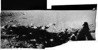
Actually, I didn't find them, I made them. I have assembled every pan from Apollos 11, 12 and 14, and a selection from the three remaining missions. One day I might get them up on my website. Some of my pans look a bit distorted because I have made exact fits at each seam instead of doing what many people have done in the past (just feathered the boundaries). I will post some here.
Phil
Posted by: RedSky May 28 2007, 07:42 PM
On Apollo 12 there are those well know images taken from Surveyor looking back up the slope to the LM. But I've never seen any from the LM area into the crater showing Surveyor. The closest I've been able to find is possibly this panorama... where just poking up from the shadowed interior, just above the near side sunlit lip of the crater is something that looks like the solar panel (on top of the mast... which is below the lip). Don't know if that's it, but it looks like a hard edges of the right shape.
http://moonpans.com/vr/apollo12_lm.htm
(You need quicktime to view the 360 pan)
Posted by: tedstryk May 28 2007, 08:33 PM
I thought Phil found them in an ally under the red sky.... (if there are are any other Dylan fans, you might figure out what I am quoting).
Posted by: Phil Stooke May 28 2007, 09:23 PM
Hmm... am I the little boy or the old man?
Anyway, here's one such pan from EVA 1, Station 2 on Apollo 15. Compare it with the version on the Apollo Lunar Surface Journal, and you will see the interruption in the middle (caused by the astronaut stumbling on the steep slope) is wrongly represented on ALSJ. The tracks don't connect properly.
Phil
Posted by: dvandorn May 29 2007, 06:52 AM
Yes, that's the Surveyor in that pan. I've only seen two images of the Surveyor Crater, which include the Surveyor, taken from the LM landing site, both taken during EVA-1 pans. The one you linked is the better of the two, you can actually make out not only the solar panel and antenna (which were in sunlight), but also the triangular shape of the landing gear structure. The Sun was only about 5 or 6 degrees above the horizon during Apollo 12's first EVA, so the shadow of the crater rim fell about one-third of the way down Surveyor's antenna/solar panel mast.
The other image, from approximately the same perspective, was taken with a higher F-stop and the shadowed portion of the crater shows much less detail. In that picture, only the solar panel and antenna are visible, you can't see anything of the landing gear structure.
Of course, the human eye has a much greater dynamic range than the film stock used during Apollo (or any film stock, for that matter). When Pete Conrad took three steps to clear the LM and look back into the Surveyor Crater, just after he stepped onto the surface, he could clearly see the entire probe, even though most of it was in shadow. (It was illuminated by light backscattered from the opposite, sunlit crater wall.) That's why he cackled, almost immediately after setting foot on the surface, "Guess what I see sitting on the side of that crater?"
-the other Doug
Posted by: tedstryk May 31 2007, 02:14 PM
Definitely the old man...I'm not saying you're old, but he lived in the moon, so that would explain your "reprocessed" lunar images.
Posted by: Phil Stooke Jul 20 2007, 12:42 AM
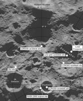
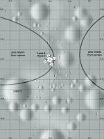
Here's a map of the lunar south polar region with a few sites added. LEx was a lander which competed for the LRO spare capacity opportunity eventually won by LCROSS. The background is the new radar image of the south pole from Arecibo, courtesy Campbell et al.
I have posted a version of this elsewhere (I can't find it now), but this version is corrected from that earlier one.
Phil
Posted by: pgrindrod Jul 20 2007, 09:45 AM
hey all,
after ages of lurking (doesn't everyone say that?) i thought i would finally try and contribute something. the moon certainly isn't my speciality, but i've had fun with these images nonetheless.
while i was achiving some data at work i came across a microfiche from the apollo 15 metric mapping camera, which i hadn't seen before. fortunately for me and my scanner they are all online, with a lot of other apollo stuff, at http://www.lpi.usra.edu/resources/apollo/ - have a look, it's a treasure trove.
i'm sure there are people here who can do the images more justice than i can, but i've had a bit of play around with the apollo 15 set anyway because i hadn't seen it used anywhere on here.
there are a few more on my http://www.homepages.ucl.ac.uk/~ucfbpmg/peter%20grindrod%20-%20moon%20gallery.htm, but here's a low-res panorama (for me to learn how to post images if nothing else!)
apollo 15 rev 4 panorama
cheers,
pete
Posted by: Stu Jul 20 2007, 12:58 PM
Very nice Pete, and welcome aboard UMSF! ![]()
Posted by: djellison Jul 20 2007, 01:18 PM
For those wondering - that's Pete, previously seen here:
http://www.unmannedspaceflight.com/index.php?showtopic=4139![]()
Doug
Posted by: peter59 Dec 29 2007, 03:58 PM
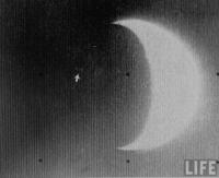
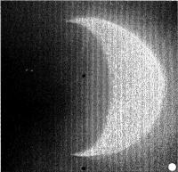
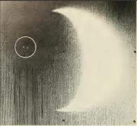
Litte gift for all dissapointed by Smart-1 and Kaguya's fuzzy images.
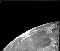
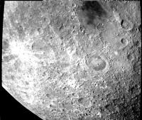
Mariner 10 - one day after launch (November 1973).
Image FDS0002659
Mariner 10 - one day after launch (November 1973).
Image FDS0002667
Posted by: peter59 Dec 29 2007, 05:56 PM
.. and more
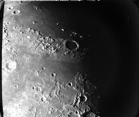
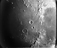
Mariner 10 - one day after launch (November 1973).
Image FDS0004637
Mariner 10 - one day after launch (November 1973).
Image FDS0002267
Posted by: PDP8E Dec 29 2007, 06:39 PM
UMSFers,
Where can I find the complete image library of the Surveyor 3 mission?
(it returned ~10K images, i would like the hi res, hopefully calibrated, -etc...)
Does this exist on-line or do I need to order/buy it?
tnx !
Posted by: Phil Stooke Dec 30 2007, 02:22 AM
It exists only in hard copy. You have to go to the LPI library, search the negatives and scan them.
Phil
Posted by: edstrick Dec 30 2007, 10:56 AM
"Where can I find the complete image library of the Surveyor 3 mission"
Surveyor data was returned by slow-scan analog transmission and recorded on analog tape. A very small amount (punched card computing, almost no hard disk capability... this was 1966-68 or so) was digitized and image processed to sharpen and improve analog ghosting, etc, or for photometric/colorimetric analysis and reported in published papers. I doubt any of that exists anywhere findable and restorable and I have to assume no original analog data tapes of Surveyor images survive, or so close to none they scientifically don't count.
Images were recorded by some sort of data-recorder camera that had essentially a high precision slow-scan TV, and the slowly rendered single-frame image raster was exposed directly onto film.
What I'd like to know is the location and status of such FIRST GENERATION film negatives. They are the primary and original data record.
Posted by: Phil Stooke Dec 30 2007, 02:06 PM
They would be either at JPL or at the National Space Science Data Center at Goddard.
Phil
Posted by: tedstryk Dec 30 2007, 05:36 PM
Cool images, Peter. Mariner 10 really did have an incredible imaging system. It was the first planetary spacecraft with a vidicon system that used a blast of light to get rid of after-images (Viking and Voyager also did this), which makes the image quality much better.
I will say that the Kayuga images we have seen from the science cameras have been quite sharp - we should see more in the future, since Kayuga began its official science mission in the last few days. The images we have been seeing are mostly from the engineering cameras and the HDTV camera, which is there for PR purposes.
Posted by: peter59 Dec 30 2007, 06:21 PM
Apollo 15 landing site observed by Mariner 10. Mount Hadley and Delta Hadley are clearly visible.
Image FDS0002285 (November 1973)
Posted by: PDP8E Dec 30 2007, 07:01 PM
Phil & Ed
thanks for the replies...it just seems short sighted not to transfer these historic data sets to a digital format.
I will gladly fill out the grant papers to do this multi-year task!
cheers!
Posted by: Phil Stooke Dec 30 2007, 10:20 PM
The Surveyor images are archived on negatives at LPI, along with numerous photos of assembled mosaics, many of which come with frame index number overlays. They would help you locate individual frames. But it's a bit of a mess. Surveyor was quickly overshadowed by Apollo and people lost interest - of course, there wasn't an amateur image processing community in those days.
To my mind the most dramatic and interesting early product to make with Surveyor 3 images would be a wide-angle panoramic view shot in the first couple of days after landing. The systematic high resolution imaging I used for my pan was shot late, with high sun and no shadows, so it's very bland. There might be some good coverage at high resolution from early in the mission as well.
Phil
Posted by: nprev Dec 30 2007, 11:35 PM
Phil
What an incredible shame...but also a call to arms for all you imagesmiths out there. I wonder if NASA would react favorably to an organized amateur (and, boy do I use that term loosely here) effort to digitally preserve images from the first Golden Age of UMSF?
Posted by: Phil Stooke Apr 21 2008, 09:08 PM
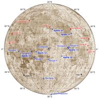
I made this map for another purpose, but just in case it might be useful for anybody else - outreach or education, whatever - I'll post it here. The background is the old US Air Force (ACIC) Lunar Earthside Mosaic (LEM), a classic of lunar cartography in its own right. This time next year we should have two new sites to plot on it - both very near the south pole (LCROSS and Chandrayaan's MIP - Moon Impact Probe). I have not shown everything - could have added a few Lunas, the Apollo LMs and SIVBs, two failed Surveyors... but I chose what I deemed the most significant. A bigger version with everything is in the works.
Phil
Posted by: Phil Stooke Apr 25 2008, 05:25 AM
Here's a blast from the past. The horizon portion of the "Picture of the Century" (never call an image that until the last month of the century!), the mountains north of Copernicus viewed by Lunar Orbiter 2. Nasty processing artifacts are not my fault this time.
Phil
Posted by: Phil Stooke Apr 30 2008, 10:51 AM
I should have added hat these mountains are the Carpathians (Montes Carpatus). On Earth the Carpathians cross Romania, so the Romanian team in the Google Lunar X Prize is planning to land on the mare plains just to the north of them, able to look back at the other side of these mountains.
Phil
Posted by: jekbradbury Jun 14 2008, 02:40 PM
I think I have removed a few of the worst artifacts from that image (the horizontal banding), but it isn't really all that much better:
Posted by: tedstryk Jul 13 2008, 11:57 PM
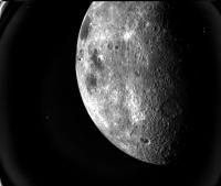
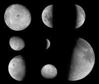
Here is a compilation of relatively recent lunar images (the last decade or so) from spacecraft heading to other places. I only included global views, and I excluded views with orientations similar to that seen from earth (with the exception of the Cassini view because I had already processed it). I also left out some extremely distant images. Due to the lack of Rosetta raw data, Rosetta images are not included (I see absolutely no point in wasting my time trying to reprocess processed images when the raw stuff will be available sooner or later, rendering my effort moot).
The images are as follows: First Column: Top: Nozomi, 1998. Middle: Nozomi, 1998. Bottom: Messenger, 2005. Second Column: Cassini, 1999. Middle: NEAR, 1998. Bottom: Hayabusa, 2004. Third column: Top: Deep Impact, 2005. Middle and Bottom: Stardust, 2001.
Posted by: Decepticon Jul 14 2008, 11:43 PM
T you Rock!
Thats a keeper.
Posted by: Phil Stooke Jul 15 2008, 12:06 AM
Yes, a great job, Ted. I don't think I've seen all of them before. Now I have to go back and check.
Phil
Posted by: tedstryk Jul 15 2008, 01:24 AM
The NEAR image is the one from the famous Earth-Moon mosaic. I just stacked images until I could pull out some lunar detail.
Posted by: ilbasso Jul 15 2008, 04:22 PM
Beautiful images, Ted. I'm struck by how unfamiliar - and downright alien - our Moon can look when viewed from a different perspective than the one we see every day.
For me, this disconnect or disorientation comes from seeing the Moon as an entire disk. It almost looks like a different place, especially in the far side shots where few or none of the familiar craters and maria are visible. From an up-close perspective like Apollo had from orbit, I'm mentally willing to accept that the craters and mountains I see are indeed our Moon. But from farther away, where it's obviously a "world," I get a sense that I'm looking at something else other than good ol' Luna. The far side somehow doesn't look as "beautiful" as the near side.
Maybe my 51+ years of looking at it, most of those years as an amateur astronomer, have helped me feel like I know the near side almost like the back of my hand. I imagine most of you are like me, that whenever we see a photo of the Moon on TV or in a movie, can tell immediately when the image is reversed, or that they substitute one of the Apollo full-disk shots that shows too far around the eastern limb.
If I were to wish one perspective change that we have for the Moon, it's that Mare Orientale would be facing more toward Earth! Wouldn't that be a glorious sight to behold every month?!
Posted by: tedstryk Jul 15 2008, 07:37 PM
The lack of maria gives it an utterly different appearance. I agree that it seems unfamiliar. Also, as a consequence of the basins not being as fully flooded, it looks more rugged.
Posted by: tedstryk Jul 30 2008, 11:42 PM
Here is another rarely seen shot. It is a mosaic of three Apollo 17 35 millimeter shots and shows part of the Orientale Basin. The frames are heavily vignetted, resulting in the outer areas of each image being severely underexposed. Although I corrected for that in terms of brightness, the quality is noticeably worse near the edges.
Here are two other frames showing the Orientale area.
Posted by: tedstryk Aug 1 2008, 02:56 PM
It is today's http://lpod.wikispaces.com/August+1%2C+2008.
Posted by: nprev Aug 1 2008, 04:05 PM
Very nice indeed, Ted; congratulations! ![]()
Posted by: Phil Stooke Nov 10 2008, 11:41 PM
A bit of a teaser:
http://www.spaceref.com/news/viewpr.html?pid=26900
"NASA will hold a media briefing at 3 p.m. PST on Thursday, Nov. 13, 2008, to unveil a newly restored historic image from the early days of lunar exploration and discuss the innovative processing technique used to retrieve the image. "
I see Charles Byrne is a speaker. He has a couple of nice books out on cleaned-up Lunar Orbiter images. Charles worked at Bellcomm during Apollo, including work on the Lunar Orbiter missions and on the Apollo Site Selection Board - he wrote their minutes, which are held now at LPI in Houston. I had dinner with him one night at Ames this summer... I'm trying to remember if he said anything that might relate to this specific image... it's probably one of the Lunar Orbiter images that was too messed up to use.
Phil
Posted by: Phil Stooke Nov 13 2008, 09:13 PM
http://www.nasa.gov/290262main_smallversion.png
Yikes - isn't that something?
Phil
Posted by: stevesliva Nov 13 2008, 10:06 PM
Wow, nice! Some more here, although that seems to be the one released image...
http://www.nasa.gov/topics/moonmars/features/LOIRP/loirp-gallery-index.html
Posted by: Stu Nov 13 2008, 10:08 PM
Man, what a day... the first portraits of planets beyond our own solar system, and a beautiful new portrait of our own planet too... Just wonderful... ![]()
![]()
![]()
![]()
![]()
Posted by: stevesliva Nov 13 2008, 10:17 PM
Ahh. Saw K. Cowing on there, and he mentioned more info here:
http://www.moonviews.com
Posted by: SteveM Nov 14 2008, 08:19 PM
There's a good overview of the background of this interesting archive recovery project at http://www.collectspace.com/news/news-111408a.html
As a historian, I appreciate the comment, "LOIRP's restoration of the Lunar Orbiter images to high resolution will provide the scientific community with a baseline to measure and understand changes that have occurred on the moon since the 1960s."
Steve M
Edit - Correct URL
Posted by: SteveM Nov 14 2008, 09:45 PM
It turns out that there are two separate ways to get at the archival Lunar Orbiter data. Since around 2000 the USGS has been developing procedures to digitize the data from high resolution scans of the original archival film strips derived from the magnetic tapes. They have added a careful image matching procedure to register overlapping parts of adjacent film strips and have also corrected some of the cosmetic defects found in the originally released images. For a discussion and refs to a series of papers at the LPSI conferences from 2001 to 2007 see http://astrogeology.usgs.gov/Projects/LunarOrbiterDigitization/
Isn't archival redundancy wonderful. (or is it that NASA doesn't know what the USGS is doing) ![]()
Steve M
Posted by: DDAVIS Nov 14 2008, 09:51 PM
Yikes - isn't that something?
Yup, but wasn't the rest of that image also processed?
Don
Posted by: ugordan Nov 16 2008, 01:25 PM
That's a great Earthrise shot and very nicely restored!
Just for fun, here's a quickish colorization : http://www.fileden.com/files/2007/9/14/1431389/Lunar_Orbiter_Earthrise.jpg
Posted by: peter59 Nov 22 2008, 12:43 PM
I was sure that Lunar Orbiter's original tapes missing forever. What a wonderful view, the several palettes filled by tapes.
http://www.moonviews.com/archives/2008/11/image_collection_from_a_garage.html#more
Posted by: PhilHorzempa Jan 7 2009, 12:45 AM
A bit more background story on the saga of the Lunar Orbiter data tapes.
Here is a recent article from the Post-Standard, the newspaper in Syracuse, NY, relating the involvement of a member of UMSF (yours truly). I am honored to have been a part of the multi-year effort to save the Lunar Orbiter data tapes.
The image in the background is a colorized version of the Lunar Orbiter Earth-Set image, of August 23, 1966. This colorized version was created by Gordan Ukargovic (ugordan) of UMSF.
http://www.syracuse.com/news/index.ssf/2008/12/cny_man_helps_launch_effort_to.html
Another Phil
Posted by: 4th rock from the sun Jan 8 2009, 04:14 PM
Some interesting handmade image mosaics from Surveyor 7 that I think haven't seen before.
The link is http://nssdc.gsfc.nasa.gov/planetary/lunar/surveyor7_images.html
Posted by: DarthVader Jan 8 2009, 04:28 PM
Pretty nice! It's like a big puzzle! ![]()
Posted by: Zvezdichko Feb 20 2009, 09:46 AM
http://www.moonviews.com/archives/2009/02/lunar_orbiter_image_recovery_p_2.html
Modern archaeology
Posted by: lyford Mar 22 2009, 03:58 AM
ZOMG!!!
http://www.moonviews.com/archives/2009/03/newly_restored_picture_of_the.html
Posted by: ilbasso Mar 23 2009, 03:24 AM
http://www.moonviews.com/archives/2009/03/newly_restored_picture_of_the.html
Anxiously awaiting the new high-res scan - this is one of my favorite pictures of all time!
Posted by: ArMaP Mar 24 2009, 09:47 PM
The 2.2 GB image is already available http://lunarscience.arc.nasa.gov/articles/la-times-article-features-newest-lunar-images.
I have seen it and it's impressive, although I cannot use the 16bits TIFF as I would like.
Posted by: dvandorn Mar 25 2009, 12:31 AM
The linked web page is there, but the image link within that web page is now broken.
-the other Doug
Posted by: ArMaP Mar 25 2009, 10:13 PM
I just tried it and it is working.
Maybe it was some temporary problem, try again. ![]()
Posted by: tty Apr 12 2009, 05:57 PM
I noticed on another blog that the LOIRP project (http://www.moonviews.com/) is trying to find anyone who has access to hardware or manuals related to Ampex FR-900 series tape recorders. Apparently this was a very special model only used by NASA, FAA and USAF.
Apparently this project is not exclusively concerned with Lunar Orbiter imagery, they are also trying for early Nimbus data.
Thought I should mention it here, since some of our forum members seem to have an encyclopedic knowledge of historic space hardware.
Posted by: Lightning Dec 21 2009, 01:50 AM
I'm looking for that view taken by a hardware (I guess a post-mission Apollo hardware) showing a crescent Earth and a laser spot in its night side.
Does anyone has any idea of what I mean ?
Thanks !
Posted by: Hungry4info Dec 21 2009, 02:49 AM
There's an image kinda like that from Galileo.
http://ciclops.org/view/4026/Galileo_Optical_Experiment_GOPEX?js=1
Posted by: JohnVV Dec 21 2009, 03:15 AM
Does anyone has any idea of what I mean ?
???? crescent Earth and a laser spot in its night side. ???? -- I have No idea
is it anything like this Apollo 8 [attachment=20060:2383.jpg]
have you looked here ?
http://apollo.sese.asu.edu/
http://apollo.sese.asu.edu/SUPPORT_DATA/index.html
http://www.lpi.usra.edu/resources/
http://www.lpi.usra.edu/resources/apollo/
Posted by: Holder of the Two Leashes Dec 21 2009, 04:15 AM
That was the Surveyor 7 mission, which landed at Tycho, that photographed the laser beams. I remember seeing a photo that showed two laser spots at once from earth's nightside. I don't know where you would find the photo online, though.
Posted by: NGC3314 Dec 21 2009, 05:38 AM
The Surveyor 7 TV image of the two laser beams (from Kitt Peak and Table Mountain) is reproduced on page 80 of Exploring Space with a Camera, NASA SP-168 (which is listed but not scanned as a PDF by the NTRS server). An overexposed version is on page 208 of part 3 of the Surveyor 7 mission report, which does have a scanned (gigantic) PDF http://ntrs.nasa.gov/archive/nasa/casi.ntrs.nasa.gov/19690008978_1969008978.pdf.
Posted by: Lightning Dec 21 2009, 01:45 PM
OK men, thanks for all, I've finally found it on the web.
No doubt it's possible to post-process it (destripe and uniformize brightness). I'll try it.
By the way, the full Exploring Space with a Camera can be found in pdf here: http://www.archive.org/download/exploringspacewi00cort/exploringspacewi00cort.pdf
One can read:
The Surveyor photograph of the partially simlit
Earth [top left], is described by C. O. Alley, of the
University of Maryland: "Surveyor VII's TV camera
detected as starlike images two narrow laser beams
sent to the Moon from, respectively, the Kitt Peak
National Observatory, near Tucson, Ariz., and the
Table Mountain Observatory, near Los Angeles.
"The blue-green argon-ion laser beams seen within
the white circle on the photograph each contained
only aboiu 1 watt of power," Alley explained, "but
appeared somewhat brighter than the brightest star,
Sirius.
"This engineering test of the aiming of the beams,
a few miles wide at the Surveyor site, was conceived
and coordinated by me and my fellow-professor
D. G. Currie, of the University of Maryland's Department
of Physics and Astronomy, to gain experience
for the Apollo laser-ranging retroreflector experiment,
for which I am principal investigator."
Here attached the 3 versions of the image.
Posted by: Lightning Jan 2 2010, 03:52 PM
Strangely, I have the feeling that the first pictures of Earth as seen from the Moon's Surface are those obtained by Surveyor III during the eclipse.
I guess there were several tests before that, but the Surveyor Program Report does not mention them. What is your opinion ?
Posted by: PhilCo126 Feb 24 2010, 01:15 PM
I believe it was a photographer of LIFE magazine who suggested to add some "color" into the early Surveyor panoramas.
At JPL, hundreds of black-and-white photos were put together on the red concave sides of two half-spheres each three feet in diameter.
The sphere had a hole in the bottom so scientists could put their head into it to see the panorama up close...
Does anyone have a photo of the complete half-sphere, preferably with someone standing near it to get a good idea of the complete thing?
Here's part of the inside:
Posted by: PhilCo126 Feb 24 2010, 01:44 PM
Surveyor panorama; this gives an idea of the half-spheres concept:
Posted by: DEChengst Jul 10 2011, 12:24 PM
In 1986 I was ten years old and I really started to get interested in space. That year we had the Voyager 2 flyby of Uranus, the Challenger disaster and the Giotto flyby of Halley. A very big year in space. 1986 also saw the "Space 86" exhibition in Utrecht. The Dom tower in Utrecht is pretty much the same height as the Saturn V rocket, so that year there was a 1:1 scale model of the mighty Saturn on display at the Dom tower. Yesterday I was at my dad's place and we hunted down the photo we took of it:
http://paranoid.dechengst.nl/apollo/SaturnV-Dom.jpg (850 KB)
Posted by: Paolo Jul 10 2011, 12:43 PM
awesome!
Posted by: kenny Jul 10 2011, 03:03 PM
That's extraordinary. Did they really actually build a 3-D model, or unroll a long picture of it, or what?
Posted by: DEChengst Jul 10 2011, 03:30 PM
Not sure, but iirc it was a 2D image cleverly shaded to look like a 3D model.
Posted by: Phil Stooke Jul 13 2011, 02:32 PM
This thread seems generic enough that I can post this here. A map I made of Lunokhod 2's route based on a Soviet era map (Courtesy Jeanna Rodionova)
The route will be corrected now we have LROC images , but it's not too bad.
Phil
Posted by: ElkGroveDan Jul 13 2011, 02:39 PM
That's in the "Stooke Book" isn't it? I have mine stashed away right now.
Posted by: Phil Stooke Jul 13 2011, 03:40 PM
A version of it! I posted it here to follow up on a discussion in another thread about planetary rovers.
Phil
Posted by: climber Jul 13 2011, 07:29 PM
Thanks so much Phil,
I was missing Lunakhod 1 data and relied on this image to set up the figure in the other thread about planetary rovers...I'll see you there ![]() (http://www.planetology.ru/panoramas/images/big/lunokhod1_c/lunokhod1_l_17_with_map.jpg)
(http://www.planetology.ru/panoramas/images/big/lunokhod1_c/lunokhod1_l_17_with_map.jpg)
Posted by: kenny Jul 14 2011, 07:07 PM
Just compared your new map with the Big Stooke Book.... I see you have been improving your Russian, Phil, as well as refining the track from LRO!
Posted by: Phil Stooke Oct 14 2014, 12:18 PM
There are many Surveyor panoramas further up this thread... I have just been advised that a project to scan all 85000 or so Surveyor images (from photo negatives) has been funded, and the entire dataset will be available on the web eventually. Not sure of the timeline.
Phil
Posted by: 4th rock from the sun Oct 14 2014, 02:50 PM
Nice! Photo negatives are quite good, I'm sure we are in for some nice images.
Posted by: Phil Stooke Oct 14 2014, 03:11 PM
Yes - the set I saw at LPI in Houston were not very well cared for and might have scratches, but the new work is being done at LPL in Tucson (I think) and maybe their set is better.
There is a lot of new work that could be done with these images. One thing would be to make panoramas or partial pans with different lighting conditions. Another would be full documentation of robotic arm activities, including animations, for the two missions with arms (3 and 7). I hope we will get a decent interface to provide access, and also that people will find them interesting enough to play with.
Phil
Posted by: Paolo Apr 29 2015, 07:03 PM
someone on NASAspaceflight posted this nice video of the TV coverage of the landing of Surveyor 1.
imaging starts around minute 26
https://www.youtube.com/watch?v=sqLtNzB_S18
Posted by: jccwrt Dec 13 2015, 11:08 PM
I've started playing around with the Mariner 10 data set. Although I'm really hoping to dig into the Venus data, I wanted to take a look at the check-out images taken while it was still in orbit around the Earth. I really like this view of the Moon, with Mare Moscoviense front and center:
https://flic.kr/p/BAyFmg
I had fun imagining this part of the Moon facing Earth - I wonder if the Moscoviense basin rings would be large enough for a person standing on Earth to see with the naked eye! ![]()
Some processing notes: I mostly used the frames from the A camera, which were a little sharper than those of the B camera. Unfortunately, there was a large gap in coverage on the limb from the A camera images, which forced me to resort to using a B camera image (and wouldn't you know it, it's the most blurred of the bunch!). Photoshop's motion blur removal tool seemed sufficient to fix the worst of it, and I've also applied a slight sharpening filter to the finished mosaic and a half pixel gaussian filter to reduce a bit of marbling that the sharpening created.
Posted by: Phil Stooke Dec 13 2015, 11:38 PM
Very nice! And I think you may be right about those big basin rings being visible from Earth without a telescope, if they faced us. It looks feasible.
Phil
Posted by: Steve G Apr 8 2016, 02:12 PM
Jason Davis of the Planetary Society told me there should be an update on the Surveyor Digitization Project in a week or two. Looking forward to that!
Posted by: Phil Stooke Apr 8 2016, 05:18 PM
I can say that the results I have seen are stunning. One ongoing problem is the lack of proper metadata. I hope raw data can be released without (or prior to the preparation of) PDS-standard metadata.
Remember LOIRP? The recovery of Lunar Orbiter digital data from original tapes. It was largely successful, but the results are still only partially accessible, unless I am missing something.
Phil
Posted by: Phil Stooke Apr 15 2016, 09:46 PM
I spent a few enjoyable days in Flagstaff last month, poking around in the archives with the help of David Portree. Here is something I found which has never been seen since the committees involved considered it. Part of this story is told in Don Wlihelms' To a Rocky Moon and my International Atlas of Lunar Exploration, but the full story revealed here has not been published anywhere.
In June 1969 it was still not certain that Apollo 11 would land successfully, or which site it would land at (it was targeted for Apollo Site 2 in Mare Tranquillitatis, but a launch delay could have moved it to Site 3 in Sinus Medii or Site 5 in Oceanus Procellarum). Nevertheless, Apollo planners were thinking ahead to the second landing, and its goal was a pinpoint landing (within walking distance of a specific target point). Therefore, a list of suitable target points was needed. Before the Apollo Site Selection Board settled on Surveyor 3 as the pinpoint target, small fresh craters in the pre-defined landing ellipses were favoured. Newell Trask of USGS Menlo Park was given the job of selecting the points.
On 19 June 1969 he responded with a memo to James Sasser of the NASA Manned Spacecraft Center (now JSC). He provided coordinates for 8 points in Site 2, 8 points in Site 3 and 9 points in Site 5. But they were not latitude and longitude, they were measurements in centimeters on individual framelets of specific Lunar Orbiter images. I have now mapped those points and have posted the map here. One point at Site 5 did become the backup landing target for Apollo 12. At Site 2 the map also shows the locations of two areas which were modelled at Cinder Lake, near Flagstaff, by setting off explosives to create craters. Google Earth shows those craters still, with the Flagstaff landfill between them.
The Wilhelms version of this story only refers to Site 5 and does not specify the locations. My earlier book included a map for Site 5 based on a list from another memo by Farouk El Baz, taken from Trask's memo, but I had never seen the full list until last month.
Phil
Posted by: Phil Stooke Apr 15 2016, 10:04 PM
Another goody I had not seen before. Planned EVAs at Tsiolkovsky crater on the far side, from the plan for the final Apollo landing promoted by Jack Schmitt. This is from a study of the communication relay satellite that would be needed for that mission.
Phil
Posted by: antipode Apr 15 2016, 10:52 PM
Wow - I had no idea about that Tsiolkovsky mission! That's a very interesting area for all sorts of geological reasons (apart from being visually spectacular). What a shame that never happened.
P
Posted by: Phil Stooke Oct 14 2018, 11:24 PM
While we wait for a new crop of lunar landers, and in honor of John Young, here is an image from Apollo 16. This is the panorama taken at Station 4 on Stone Mountain, the southernmost point of the traverse, in circular form. It gives a great view out to the north across the landing site.
I just recently completed the remapping of Apollo 16 EVA routes using LROC images.
Phil
Posted by: Paolo Oct 15 2018, 05:52 AM
and new images from DSLWP-B
http://lilacsat.hit.edu.cn/dashboard/pages_en/pics-b.html
color corrected farside images
https://twitter.com/cgbassa/status/1051493157056249856
Posted by: Phil Stooke Oct 16 2018, 12:11 AM
Here is another Apollo 16 view - North Ray crater, one of the polarization panoramas.
Phil
Posted by: Steve G Oct 25 2018, 04:36 PM
Has anyone seen the complete catalogue of images from the Surveyor Digitization Project? Jason Davis of the Planetary Society posted a few images back in 2016, but that's the best I could find. I would have assumed Phil would have had a field day with all the raw images after all the hard work he did when he cleaned up the older mosaics. I can't even find a home website for the project.
Posted by: Phil Stooke Oct 25 2018, 04:54 PM
Not released yet. I am not up to date with progress, but my understanding is that they have the pictures but they are trying to put together the metadata - all the information about the time, pointing, exposure time and so on. They need it all to submit it all to the Planetary Data System.
Phil
Posted by: Phil Stooke Jan 7 2019, 11:28 PM
While Yutu 2 is snoozing I can catch up on some other goodies. Here is an Apollo panorama which I have never seen assembled before (yes, there is plenty that an enterprizing image processor can still do with Apollo). This is the Apollo 16 'rover pan' taken in EVA 3 on the rim of Palmetto crater. Charlie Duke took pictures as John Young drove the rover in a tight circle. Duke took pictures for half a panorama, not the whole 360 degrees, looking into Palmetto. The original images are low contrast, and here I have greatly enhanced contrast to show the crater interior.
Phil
Posted by: Phil Stooke Jan 8 2019, 12:37 AM
And another taken a few minutes later as they passed a rimless depression Duke called a 'doodlebug hole'.
Phil
Posted by: John Moore Jan 8 2019, 04:03 AM
Superb, mention, history and recording such, Phil...of times, perhaps, lost if unknown.
Currently reading 'First Man' by Hansen, J. R. - this Amazon link https://www.amazon.co.uk/First-Man-Life-Neil-Armstrong/dp/1476727813 - (intentionally ignored the film): a wonderful history here, too, of Armstrong's life, his experiences, flights and fights, before.... Some wonderful historic, nostalgic images, too.
Mention, may not fall within the UMSF criteria/rules...I know, so apologies (but with appreciation) to the Admin if they allow, the above resource does also involve UMSF references (minimally, let's say)
Posted by: Phil Stooke May 1 2019, 10:37 AM
I am working on a new map of lunar impact and landing sites. This is a preview, and the final map will include a sidebar with a list of all landings and impacts with date and coordinates.
Phil
Posted by: Steve G May 1 2019, 02:15 PM
That's totally awesome, Phil. Thanks for sharing.
Posted by: Phil Stooke May 4 2019, 03:12 PM
This is the current version of the lunar sites map. The empty space is for future events. I am not copyrighting this. Do what you want with it.
Phil
Posted by: Steve G May 6 2019, 01:21 AM
Phil
For the unknown location of the Apollo 16 LM Ascent stage, is there not seismic data of the impact that can give its location? There were four active seismometers back then, was there not?
Posted by: monitorlizard May 6 2019, 05:27 AM
for Phil (or anyone else interested)
Apollo 15 (and possibly Apollo 16) used their 16mm Mauer movie camera mounted on the lunar rover to film part of their surroundings while traveling between stations. Since the camera was in a fixed position, wouldn't it be possible to stitch frames together to show super-long linear photographic strips of terrain? It's just an odd thought I had.
I hope this doesn't violate rules. I'm only discussing photography, nothing else.
Posted by: Phil Stooke May 6 2019, 11:43 AM
Steve - we don't know when the impact happened either, so it is not easy to separate out that impact from any other natural event. If it occurred on the opposite side of the Moon it would be a weak signal as well, maybe too weak. As far as I know, nobody has claimed to have seen that specific signal.
Monitor, it's not a bad thought. Apollo 15's 16 mm camera only worked very briefly. I did actually use its images to locate tracks on the west rim of Dune crater, the only place where it is useful. This is a link to my LPSC poster on the topic:
https://www.hou.usra.edu/meetings/lpsc2018/eposter/1007.pdf
Because the Apollo 15 16mm camera didn't work well it was supplemented on Apollo 16 by images taken by Charlie Duke at frequent intervals. But then the 16mm camera worked well for them. I found the astronaut photos more useful than the 16mm images. Now I'm using the pictures taken by Jack Schmitt on Apollo 17 to map those traverses. More about that soon.
Phil
Posted by: Steve G May 6 2019, 09:09 PM
Apollo 15 (and possibly Apollo 16) used their 16mm Mauer movie camera mounted on the lunar rover to film part of their surroundings while traveling between stations. Since the camera was in a fixed position, wouldn't it be possible to stitch frames together to show super-long linear photographic strips of terrain? It's just an odd thought I had.
I hope this doesn't violate rules. I'm only discussing photography, nothing else.
The DAC 16mm cameras were mostly facing forward during the drives. I think there's potential on EVA 3 near North Ray. There's more potential for orbital shots that can be stitched, even editing out the window frame in some shots. I can't find any good HD quality downloads anywhere. The available locations have blurred (out of focus) edges which means they were transferred poorly via telecine style and not scanned using modern transfer equipment. Spacecraft Films is offering all the onboards for $450 USD but that's a big gamble and they're not very active anymore.
Posted by: 4throck May 6 2019, 09:48 PM
NASA has good quality HD scans available on Archive.org.Here's some from Apollo 15: https://archive.org/details/Apollo-15_Onboard-Film-Mags_EE.mxf
There are some frame-rate conversion and black clipping issues on some videos, but it's a great source.Incredible potential for image processing here.
Posted by: monitorlizard May 7 2019, 08:03 AM
Thanks for that link, 4throck, I really enjoyed watching that footage, though I see it's not really useful for stitching. I suppose a really determined image processor could do a geometric transformation of each frame but it wouldn't be worth the headache. SteveG, I agree about the orbital 16mm movie footage being more promising. I've seen Apollo orbital footprint maps that show long contiguous sequences of 16mm filming, apparently at nadir, that could be stitched into long, thin mosaics. I'm not an image processor, but I'd certainly be interested in seeing what would result if somebody did this. The only thing is, viewing it on a computer screen would look the same as watching the footage!
Posted by: Paolo May 12 2019, 09:08 AM
It looks like you will have to update the map very soon: https://destevez.net/2019/05/dslwp-b-deorbit-and-mission-end/
Posted by: Phil Stooke May 12 2019, 05:34 PM
Yes, and Chandrayaan 2 in about September, and Chang'e 5 in December.
Phil
Posted by: 4throck May 13 2019, 08:28 AM
There are some interesting things on NASA's resource reels, and also on some vintage documentaries.
Looking elsewhere, and to stay on topic, searching Youtube for "Surveyor 3" gets you:
https://www.youtube.com/watch?v=E6yQfbFMBcY
https://www.youtube.com/watch?v=3WFT5_jLLjU
Both are very interesting
There's much more about other missions if you know where to look, including some Pioneer video images, but that's better discussed on a specific topic about image sources I think.
Posted by: Phil Stooke Oct 30 2019, 09:38 PM
Here is the latest version of the Lunar Sites map. I have added Chandrayaan 2 (Vikram) and Longjiang 2 impacts, and moved Chandrayaan 1's MIP impact to the far side as I now believe it should be. Next year will see the Chang'e 5 sample return, I hope, and several events can be expected in 2021 - CLPS landings or attempts by Astrobotic and Intuitive Machines, OMOTENASHI (micro-lander from Japan launched with Artemis 1) and perhaps others including mission-ending impacts for Lunar Flashlight and LunarH-Map (also with Artemis 1).
Phil
Posted by: Steve G May 11 2021, 07:28 PM
Concerning the Surveyor Digitization Project, I have been in contact with Shane Byrne, who is leading the project to digitize all of the Surveyor lunar images. They are still trying to tie off some loose ends with the dataset. The school semester just ended so they will be starting work on this again soon and should have an update later this summer. Looking forward to this image release!
Posted by: Phil Stooke May 12 2021, 06:37 AM
Thanks, Steve, that is good to know. I have not been keeping up with progress but when I talked to the people involved they were talking about the image metadata as a complicated problem. Each frame they scanned off the film included both an image and a table of metadata so they had to use OCR to extract it and then get it all organized. That process sounds like it's coming to an end. They sent me a few examples of processed images including a bit of a panorama and some color processing. There will be some very cool things to do with these images, and for landing sites that are not well known visually. Old-timers may remember the arduous task of building panoramas from very sub-standard materials which I attempted on UMSF many years ago. That could be vastly superseded soon!
Phil
Posted by: john_s May 18 2022, 02:35 AM
So as I mentioned in the Lucy thread, we just made a movie of Sunday night's (US time) total lunar eclipse from the Lucy spacecraft. Lucy is currently near its furthest point from Earth, about 100 million km away, beginning its loop back for its Earth gravity assist next October.
We *think* this is the first movie of a lunar eclipse made from deep space, but does anyone know of other examples?
John
Posted by: Explorer1 May 18 2022, 03:45 AM
Hmm, I suppose DSCOVR's "view" of anhttps://epic.gsfc.nasa.gov/galleries/2015/lunar_occultation/video doesn't really count for your purposes? I expect Lucy's view will be more impressive (at least as far as the eclipse is concerned?)
Posted by: john_s May 18 2022, 04:26 AM
Thanks, though DSCOVR doesn’t quite count as deep space in my book. However we’ve now learned that Messenger did a lunar eclipse movie in 2014 (https://www.planetary.org/space-images/messenger-views-lunar-eclipse), so we’re not the first from “deep space” anyway. Still, we think ours is cooler- we’ll be releasing it fairly soon.
John
Posted by: Hungry4info Aug 14 2023, 01:49 AM
Is there any update to this effort to digitize the Surveyor imagery?
Posted by: mcaplinger Aug 14 2023, 05:24 AM
Based on https://sic.lpl.arizona.edu/collection/surveyor-digitization all of the images were scanned, but then the project seems to have stalled out before any PDS-compliant datasets were built. Last update was in 2018?
Posted by: Phil Stooke Aug 14 2023, 08:18 PM
PDS wants both the image files and the metadata. The people involved probably ran out of time or money before all the metadata could be extracted from the scanned images (there is some detail on this among the links on that page). Ideally the raw scans could be made available without the metadata. I will see if I can find out more.
Phil
Posted by: Phil Stooke Aug 20 2023, 10:01 PM
I have been in touch with the people involved. Money ran out for the metadata part of the job so it has limped along with pro-bono work, but speeded up recently with a student worker. They are close to having it ready for the three later missions and trying to get the first two sorted out.
No timeline yet but good to know progress is being made.
Phil
Posted by: Hungry4info Aug 20 2023, 11:25 PM
Thank you so much! It's great to hear that ![]() I've been looking forward to this ever since I learned of the project.
I've been looking forward to this ever since I learned of the project.
Posted by: Phil Stooke Dec 30 2023, 12:25 AM
I am posting a set of maps to show the gradual unveiling of the Moon's far side. from what was known before the space age (not quite nothing) up to Clementine, step by step for each mission. They cam be found at:
https://mastodon.social/@PhilStooke
Some of them have been posted here in the past.
Phil
Posted by: Phil Stooke Jan 6 2024, 10:26 PM
I am just starting a set of maps of every lunar landing site on:
https://mastodon.social/@PhilStooke
Many of these will have appeared on UMSF in the past but this will collect them in one place. Typically there will be one close-up map and one context map. The set will run in chronological order so Luna 9 will be the first. I'll post the first one here but the rest will be on Mastodon.
Phil
Posted by: Hungry4info Mar 31 2024, 04:19 AM
It looks like the Surveyor Digitizing has been completed?
https://sic.lpl.arizona.edu/surveyor-digitization
Lots of new images here. Many I hadn't seen before. I'm going through them in mission order and I'll attach a few from Surveyor 1. I'm not yet sure if these images exist in a raw form, but I've screenshot them from the scan of the printouts. A couple are of the horizon. One is of the radiator* panel which seems to have been damaged some time in the night.
(*corrected)
Posted by: Phil Stooke Apr 13 2024, 06:22 AM
You didn't get any replies to this but I did spend some time looking at it. Yes, lots of useful things here.
Phil
Powered by Invision Power Board (http://www.invisionboard.com)
© Invision Power Services (http://www.invisionpower.com)
