Printable Version of Topic
Click here to view this topic in its original format
Unmanned Spaceflight.com _ Cassini's ongoing mission and raw images _ New Iapetian image series
Posted by: TritonAntares Sep 11 2006, 09:27 PM
Hi,
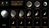
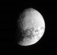
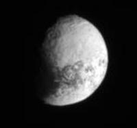
CASSINI has transmitted 184 pics (!) over the last days.
Here five takeouts, 3-4x enlargement:
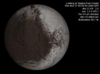
|
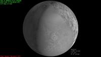
Date: 2009-09-06
Distance: 2.228.548 km
Filters: CL1 and CL2
|
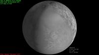
Date: 2009-09-08
Distance: 3.215.284 km
Filters: P120 and GRN
|
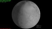
Date: 2009-09-08
Distance: 3.216.610 km
Filters: P60 and GRN
|
Date: 2009-09-09
Distance: 3.390.271km
Filters: P60 and GRN
|
Date: 2009-09-09
Distance: 3.427.313 km
Filters: P120 and GRN
Maybe somebody is able to combine some of those images to show more details.
Bye.
Posted by: Rob Pinnegar Sep 11 2006, 10:43 PM
They certainly took enough images this time around. There must be at least a hundred new ones.
[Edit: oops, 184; didn't read the above post carefully the first time.]
Posted by: Rob Pinnegar Sep 24 2006, 05:07 AM
At the end of November, Cassini will be a bit over two million kilometres from Iapetus. That hardly even qualifies as a "distant encounter" -- it's really just plain "distant".
Nonetheless, looking at the Solar System Simulator for dates around November 25th, any images taken around this time will probably be nice to look at, because they should show a bit more of the trailing, light-coloured part of the Saturn-facing hemisphere, Roncevaux Terra, than we have seen before. (Of course, we've seen some of it relatively close-up in Saturnshine during the New Year's 2005 distant flyby.) Cassini will be near apastron then, so there should be a bit of free time for taking pictures of Iapetus.
We haven't seen much of this part of Iapetus in previous Cassini images. My impression (correct me if I'm wrong) is that this is due to the geometry of Cassini's orbit around Saturn, up to the present time. Whenever Cassini is well placed to photograph the trailing side of Iapetus, it will normally also be very close to Saturn, which means that other things would naturally take priority over getting fuzzy pictures of a moon three million kilometres away.
Posted by: angel1801 Sep 24 2006, 05:27 AM
I just used the Solay System simulator and I have the following:
Date: November 27, 2006
Time: 00 hours (UT)
Distance: 2.008 million km
A full disk view of the Saturn facing hemisphere of Iapetus at 12km/pxl
I'm sure with multiple images and super ehancement, we can fill in a imaging gap of Iapetus
in the high northern latitudes at better than the 9km/pxl that Voyager 2 achived in 1981.
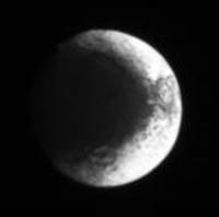
Posted by: TritonAntares Sep 24 2006, 05:54 PM
Hi,
here what you're talking about:
|
Should give some more additional information about northern Roncevaux Terra as well as a nice view of the 'Snowman'.
Bye.
Posted by: Decepticon Sep 24 2006, 10:09 PM
I can't wait to see that!
Posted by: CAP-Team Sep 25 2006, 11:52 AM
[something went wrong here]
Posted by: CAP-Team Sep 25 2006, 11:56 AM
I created the same image with Xplanet and Steve Albers' map:
|
As you can see, it doesn't really cover any lands we haven't seen before..
Posted by: Rob Pinnegar Sep 25 2006, 12:56 PM

Maybe not, but it will give us a chance to see some familiar territory from a different lighting angle. This will also be the case during the three remaining 2-million-kilometre flybys (around Feb 11th, Apr 15 and Jul 5) before the close-up view a year from now.
I think it's during the February encounter that we will see sunrise on "Snowman" over the course of several days -- instead of sunset, which has usually been the case. That should be of some significance for people who are interested in the "moat" (even though, at that distance, we'll hardly be able to see any detail).
Posted by: tedstryk Sep 25 2006, 02:11 PM
I think that super-resolution processing may be needed to pull any nice looking images out of this. But that would have to wait for the PDS release (Stacking the "raw" jpegs will help compensate for compression artifacts, but does litttle else to improve resolution.
Posted by: ugordan Sep 25 2006, 02:43 PM
Now that just sounds silly!

So in 12 months time or so we'll get to unleash our image processing skills on a few 2 million km distant frames... By that time the 1500 km flyby will be over and noone will even look back at these puny frames!
Posted by: TritonAntares Sep 25 2006, 03:39 PM
This will also be the case during the three remaining 2-million-kilometre flybys (around Feb 11th, Apr 15 and Jul 5)
before the close-up view a year from now.
I think it's during the February encounter that we will see sunrise on "Snowman" over the course of several days
- instead of sunset, which has usually been the case.
That should be of some significance for people who are interested in the "moat"
(even though, at that distance, we'll hardly be able to see any detail).
The april and july far-encounters will show some other details in different lightning angle:
|
|
The later one will probably show some parts of the mostly unknown great southern bassin.
Bye.
Posted by: TritonAntares Sep 25 2006, 04:59 PM
Hi again,
new release in the NASA/JPL image gallery - 'Duotone Moon':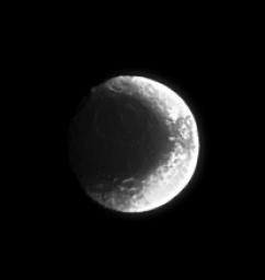
Date: 2006-09-06
Distance: ~2.2 mio km
Resolution: 13 km/pxl
Bye.
Posted by: CAP-Team Sep 25 2006, 10:20 PM
I used NASA's space simulator a lot in the past, but I think their maps aren't quite as good as Steve Albers' maps.
|

|
The view of July is finally giving us a view of unexplored terrain, just prior to the close encounter of september 2007.
Really looking forward to that.
Posted by: tedstryk Sep 25 2006, 10:50 PM
As TritonAntares said, the key is that the illumination conditions will be different. This "flyby" may be useful for albedo mapping.
Posted by: Rob Pinnegar Sep 26 2006, 01:56 PM
Really looking forward to that.
Yeah, that area was imaged in August 2004, but from so far away (10 million kilometres) that the only details visible were the basic outline of the Roncevaux Terra basin, and its central peak. So, although we *have* seen it, it's effectively unexplored.
The LPSC 2005 abstract by Denk et. al., "The first six months of Iapetus observations by the Cassini ISS camera", shows processed versions of these images. It's online and is easily located with a Google search. (Don't bother checking the raw images from August 2004 -- you can't see anything in those.) This gives a good idea of the size of that basin. It's about the same size as the huge one on the Saturn-facing side.
Posted by: TritonAntares Sep 27 2006, 12:15 PM
Hi!
were the basic outline of the Roncevaux Terra basin, and its central peak.
So, although we *have* seen it, it's effectively unexplored.
I've looked through the images of this period and probably found some of those you meant.
Here a takeout:
Date: 2004-07-22
Distance: 3.489.136 km
Filters: CL1 and CL2
Difficult to say wether it's the western rim of the large southern bassin in Roncevaux Terra at the terminator.
This chart could be helpful:
|
The eastern rim of the bassin is nice in this pics from October 2004:

Bye.
Posted by: ugordan Sep 27 2006, 12:53 PM
The lower left image is the same as the one I made a while ago, using stretched color, but toned down to better match the approximate true color. The contrast is stronger in my composite so darker details aren't very visible, though: http://static.flickr.com/105/281244148_a2b17953f1_o.png.
There's also the http://ciclops.org/view.php?id=624 showing the same image sequence in stretched color.
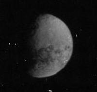
Posted by: TritonAntares Sep 30 2006, 01:49 PM
Hi!
CASSINI took another few Iapetus images about 10 days ago,
here 3 of them:
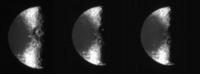
|
Date: 2004-09-18, 20 and 21
Distance: 2.359.595 / 2.486.163 / 2.517.820 km
Filters: CL1 and CL2
Nice sunset out there...

Bye.
Posted by: nprev Sep 30 2006, 05:35 PM
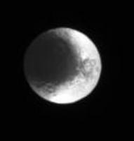
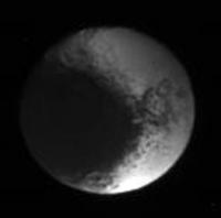
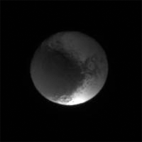
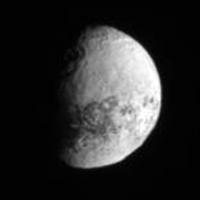
That recent small sequence is really striking to me; Iapetus looks a lot like a CD or DVD! 
In fact...is this significant or coincidental?  It looks like the dark area subtends a suspiciously well-defined angular area in this view (90 deg of the total spherical area of Iapetus?), which in turn would seem to argue for external deposition from some source. In any case, the geometry of the dark area is remarkable.
Posted by: tasp Oct 1 2006, 05:27 PM
I suspect a thermo-reactive gas is introduced into the Iapetan environment at a fixed point in its' orbit about Saturn. Most likely when Iapetus traverses the Saturnian magnetotail.
The gas persists in the vicinity of Iapetus, and in equatorial to the midlatitudes the Iapetan surface temperatures are sufficient for the gas to 'tholinize' and coat the surface. The gas is used up (or dissipates into the void) in less than the ~80 days it takes for Iapetus to return to the place in it's orbit where the gas is replenished, thus, we do not see the darkening extending further around in longitude than we do.
That there is some 'ponding' of the gas in low areas seems apparent, there is some darkening outside of the main areal extent of Cassini Regio in the lower latitudes.
Additionally, the more directly perpendicularly sunward facing segments of crater bowls north and south of Cassini Regio also show the darkening, as expected, the local heating conditions being sufficient for the chemical staining reaction to occur.
The gas also appears to interact with Hyperion. Quantities of it appear to pond in the craters, and when the chaotic rotation of Hyperion causes the sun to shine perpendicularly into a given crater, the crater bowl reflects enough solar radiation onto the crater floor to make a local warm spot. The gas reacts, and we get dark crater bottoms all over Hyperion.
The same basic mechanism, a thermo-reactive gas being introduce into the Hyperionian and Iapetan environments, explains the dark areas of each moon.
Posted by: nprev Oct 2 2006, 01:39 AM
That is both an interesting and highly creative hypothesis, Tasp. Skeptical questions must follow, though:
1. What is the nature of this thermoreactive gas? I presume that it is being scattered off of Saturn's upper atmosphere somehow.
2. Why do no other moons but Iapetus & Hyperion exhibit any apparent effects from this environmental condition? Probable minor compositional differences do not seem adequate. Additionally, this thermoreactive agent would presumably have a relatively high molecular weight, and therefore its transport throughout the region would not necessarily be confined to the outer limits of Saturn's magnetosphere in accordance with magnetic current flow patterns.
Sorry; I am not trying to put you on the spot at all...just trying to flesh out this most interesting thought of yours, which would have never occurred to me! 
Posted by: tasp Oct 2 2006, 01:24 PM
The gas comes from Titan's atmosphere. This implies only objects exterior to Titan's orbit will experience the darkening as there is no transport mechanism running from Titan inward.
The atmospheric gases of Titan contain carban and nitrogen and hydrogen. The thermosensitive chemical reaction (way out of my schooling here) might be a polymerization of those Titanian gases. I suspect the orange color of Titan and the rich brown of Iapetus are derived from similar compounds and elements.
I don't know if slow steady leakage of atmospheric gases from Titan is what is happening, or if big impact events on Titan liberate gases sporadically.
Maybe both processes have occured over the history of the solar system.
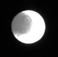
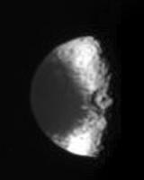
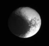
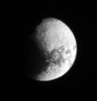
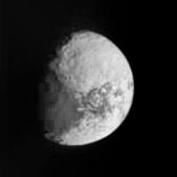
Posted by: TritonAntares Nov 8 2006, 10:11 AM
Hi!
CASSINI took another few Iapetus far distance images 3 days ago,
here a takeout:
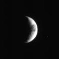
|
Date: 2006-11-05
Distance: 4.438.289 km
Filters: CL1 and CL2
View with Solar System Simulator:
|
By the end of this month we'll get a nice view from about 2 mio. km:

|
|
Finally a little change in the angle of view....
Bye.
Posted by: ugordan Nov 8 2006, 12:10 PM
Here's the http://space.jpl.nasa.gov/cgi-bin/wspace?tbody=608&vbody=-82&month=11&day=27&year=2006&hour=10&minute=00&fovmul=1&rfov=0.273&bfov=30&porbs=1&showsc=1 pixel size Iapetus will appear on Nov 27. Obviously not that useful except for low phase observations.
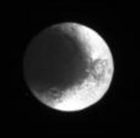
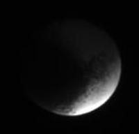
Posted by: TritonAntares Nov 17 2006, 01:06 PM
Hi once again,
CASSINI took another four Iapetus far distance images,
here a takeout: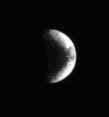
Date: 2006-11-16
Distance: 3.128.691 km
Filters: CL1 and CL2
View with Solar System Simulator:
|
We're getting 'closer'...

Bye.
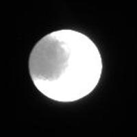
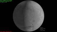
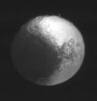
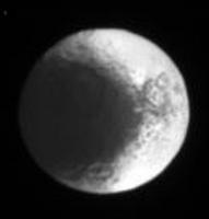
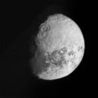
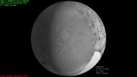
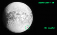
Posted by: TritonAntares Nov 28 2006, 08:49 PM
Hi,
CASSINI took a series of 41 Iapetean far distance pics yesterday,
here a first takeout:
|
Date: 2006-11-27
Distance: 1.997.980 km
Filters: CL1 and CL2
There's an interesting dark feature east (right) of the 'Snowman'.
View with Solar System Simulator:

|
Part of Steve Albers map:
|
The mentioned dark structure contains at least one crater with a dark ground.
Bye.
Posted by: TritonAntares Dec 6 2006, 11:44 AM
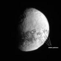
Hello again,
I always wondered about the dark patches in Iapetus' bright region Roncevaux Terra as seen on this map:
|
The left part is illuminated by saturnlight, the right part is made up of VOYAGER findings.
The mentioned dark feature east (right) of the 'Snowman' contains at least one crater with a dark ground.
But what about the dark markings on the bad resolved VOYAGER side?
Are these mostly shadowing effects like the craters in the northern hemisphere presume or real dark patches like the 'horseshoe' next to the border of the saturnlighted part or the black triangle and the spots around it?
Actually the triangle partly seems to overspread an underlying not so dark area...
Some ideas?
Bye.
Posted by: angel1801 Dec 6 2006, 12:29 PM
I would not know either. But we will know alot better after September 10, 2007 when Cassini will image this area with resolution as good as 200m per pixel!
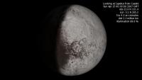
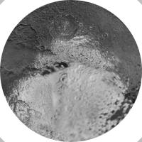
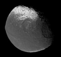
Posted by: Phil Stooke Dec 8 2006, 09:29 PM
The latest two Iapetus images, enlarged and merged.
Phil
|
Posted by: TritonAntares Dec 8 2006, 11:19 PM
Hi,
nice pic Phil - I didn't notice the 2 originals on the JPL/NASA page at all.
It'll may help to measure the depth of Snowman A and the hight of its central peak...
Have you tried to combine some of the Nov.27th images, probably getting some colored ones?
Bye.
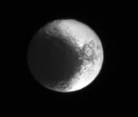
Posted by: TritonAntares Jan 9 2007, 10:49 AM
Hallo,
one probably better resolved and enlarged pic of the last far-encounter http://saturn.jpl.nasa.gov/multimedia/images/image-details.cfm?imageID=2435.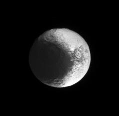
Date: 2006-11-27
Distance: ~2 mio km
Resolution: 12 km/pixel
Sadly no color composite... 
Bye.
Posted by: ugordan Jan 9 2007, 11:49 AM
Me, I've stopped expecting color composites altogether. It's as though they're taboo for the team. That said, they do manage to pull off a good sharpening/deconvolution job on the grayscales.
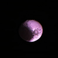
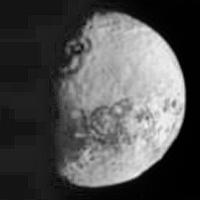
Posted by: Ian R Feb 13 2007, 12:10 PM
Colour composite with Lightness channel consisting of 10 stacked images:
|
Posted by: Rob Pinnegar Feb 14 2007, 01:34 AM
Is Roland the prominent crater at the 11 o'clock position?
Posted by: Ant103 Feb 14 2007, 09:44 AM
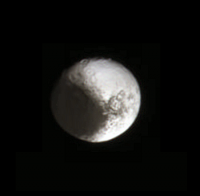
My version made from one RVB picture (saturation at 200%) and 10 b&w stacked and added pictures. 200% approx. size.
|
Posted by: ugordan Feb 14 2007, 11:16 AM
Pink Iapetus, now that's something you don't see every day!
Posted by: TritonAntares Feb 14 2007, 02:58 PM

|
Is Roland the prominent crater at the 11 o'clock position?
|
|
Seems to be Roland due to its position and the large central peak.
But be careful, there are 4 prominent craters in this region - one at the bright-dark border ...
Bye.
Posted by: Michael Capobianco Feb 14 2007, 02:59 PM
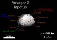
Yes. Here's the Voyager-based map showing the http://history.nasa.gov/SP-474/p128.htm, which closely matches this image. Roland is at the top.
Michael
Posted by: Phil Stooke Feb 14 2007, 04:07 PM
ugordan: "Pink Iapetus, now that's something you don't see every day!"
It's a Valentine!
Phil
Posted by: JRehling Feb 14 2007, 05:08 PM
This could turn into a drug-related discussion...
Posted by: ugordan Feb 14 2007, 05:25 PM
You mean something like: "There are no bad drugs. Just bad trips." ?
Posted by: nprev Feb 14 2007, 11:25 PM
Huh...that "yin-yang" aspect makes Iapetus look like one of the hemispherical views of Fritz Leiber's The Wanderer...art imitating life in yet another subtle way, albeit decades in advance.
Just struck me also how deep & pronounced all these craters are in comparison to those on the inner large icy moons. Is this difference perhaps due to fallout from Enceladus on the latter, as discussed on another thread, or are we seeing evidence of a thicker crust on Iapetus?
Posted by: JRehling Feb 15 2007, 12:00 AM
Just struck me also how deep & pronounced all these craters are in comparison to those on the inner large icy moons. Is this difference perhaps due to fallout from Enceladus on the latter, as discussed on another thread, or are we seeing evidence of a thicker crust on Iapetus?
Remembering that Iapetus is a startling outlier (literally and figuratively) in terms of its distance from its primary (only likely captured asteroids rival it among the natural satellites in the solar system), I suggest that its distance is the prime causative factor.
Look at the crusts of Mercury and the Moon and the Moon's maria. They are all three "old". The oldest crust there is not much more than 25% older than the youngest. But the rate of cratering is profoundly different: The cratering rate changed so sharply around 4 GYA that relatively minor differences in age led to tremendous differences in the preserved-for-all-time proportions of craters left behind.
I think the difference between Iapetus on the one hand and Rhea on the other (virtually identical size and distance from the Sun) is that the heat of proto-Saturn kept Rhea slushy just a bit longer, letting its primordial lumps from coalescing round out and its largest proto-impacts to fade into the slush. Iapetus cooled faster and has kept its original lumps in a way that no body outside the asteroid belt could have because all the planets are too large and all the other midsize satellites are too close to their primaries.
As a result, Ceres and Iapetus are less spherical than Rhea, Titania, and Oberon, and even some of the smaller icy satellites of Saturn and Uranus.
The large craters are just another manifestation of the big, early impacts having been left untouched by any general crustal slushiness during that period.
Posted by: tasp Feb 15 2007, 04:24 AM
To extend this discussion, consider Iapetus accreting from the primordial chaos. Iapetus (or more accurately, the proto-Iapetus) pokes along in its' orbit at 5000 KPH (or was it MPH? no matter) and takes ~80 days to loop around Saturn. Its' accretion process took much longer than any other 'big time' satellite in the solar system. During this longer coalescense, the Al27 in the incoming materials had longer to radiate its' heat to space, and Iapetus had longer to radiate the collisional heating from impacts that formed it. Iapetus will be the satellite most accurately we can describe as cold formed. The crust will have enormous bearing strength. As we saw in the Cassini pix, the lumpy, facety surface of Iapetus exists to this day. The 'cat scratch' feature (IIRC, SW of 'landslide crater') might record an extremely deep penetration into the solid body of Iapetus by the impactor that made the 'landslide basin'.
Assuming a formation via external agency of the equatorial ridge structure long after Iapetus accreted, the structure rests on the surface, is 20 km high (60,000+ feet high!!!), and to date, in the Cassini photos, we see no faulting parallel to the ridge.
Additionally, to date, we see no signs of volcanism, past or present, no geysers, plumes, mud pots or warm spots. Internal heat sources have been inoperative at 'softening' the crust for a very long time.
Something else reducing the heating to the interior of Iapetus ids it's distance from Saturn. Granted, Iapetus is tide locked to Saturn today, but of all the major satellites in the solar system, tidal braking of Iapetus was uniquely slow. Any power dissipated this way had ample time to radiate away in the cryogenic environment, to no or little effect.
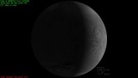
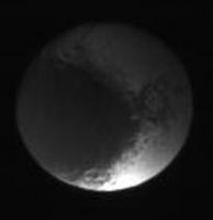
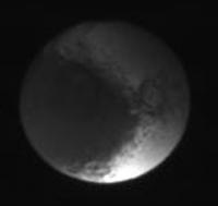
Posted by: TritonAntares Feb 16 2007, 08:50 PM
Hi,
I've just checked the JPL raw images page for new iapetean pics - and was successful:
189 new images between Feb.12th and 16th (!)
Looks like there has been a shadow casting show by saturn during this time on Iapetus...
Here some takeouts:
|
Date: 2007-02-13
Distance: 2.269.440 km
Filters: CL1 and CL2
4x enlarged
|
Date: 2007-02-13
Distance: 2.267.233 km
Filters: CL1 and CL2
4x enlarged
|
Date: 2007-02-13
Distance: 2.264.177 km
Filters: CL1 and CL2
4x enlarged
|
Date: 2007-02-14
Distance: 2.248.671 km
Filters: CL1 and GRN
4x enlarged
|
Date: 2007-02-14
Distance: 2.248.666 km
Filters: CL1 and CL2
4x enlarged
|
Date: 2007-02-14
Distance: 2.248.655 km
Filters: CL1 and UV3
4x enlarged
|
Date: 2007-02-15
Distance: 2.322.227 km
Filters: P120 and MT2
4x enlarged
Have a view at the whole images series and you will recognize a migrating shadow on Feb.13/14th,
maybe somebody can affim an iapetean eclipse using some simulation program?!
Bye.
Posted by: alan Feb 16 2007, 09:27 PM
Confirmed
http://space.jpl.nasa.gov/cgi-bin/wspace?tbody=10&vbody=608&month=2&day=14&year=2007&hour=02&minute=00&fovmul=1&rfov=10&bfov=30&porbs=1&showsc=1
Posted by: ugordan Feb 16 2007, 09:35 PM
No way! Mega cool!
Stretched color snapshots at the start and near maximum eclipse:
|
So... Saturn really is yellow. Who would have known!
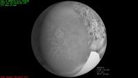
Posted by: elakdawalla Feb 16 2007, 10:20 PM
Way nifty. Here's an animation of the February 14 set, magnified 2x. Note that since this is during an eclipse, the ones that aren't in eclipse are necessarily pretty much zero phase.
|
Those of you who've worked more with making the raw JPEGs pretty, can you suggest improvements?
--Emily
Posted by: ugordan Feb 16 2007, 10:25 PM
Actually, not necessarily zero phase. Remember this isn't the case where the observer is located on the body that's casting the shadow. I get a 14.5 degree phase from Cassini's vantage point at Feb 14, 02:00 UTC
Posted by: elakdawalla Feb 16 2007, 10:31 PM
Oops! Thanks for the correction. Glad I got it here before I posted the wrong thing in the blog
--Emily
Posted by: Rob Pinnegar Feb 17 2007, 02:28 PM
I noticed the "darkened" images of Iapetus and wondered what had caused that -- it never even occurred to me that it might be Saturn's shadow. Neat.
Posted by: TritonAntares Feb 18 2007, 03:47 PM
Btw, I once (2006-03-14) posted this:
2006 Mar 25 to Apr 18: Apr 11 - 602.412 km; 14-3.6 km/pxl; medium to high phase, southern hemisphere as crescent
2006 Jun 17 to 27: Jun 23 - 1.343.000 km; 14-8.1 km/pxl; medium to low phase, sub-Saturn hemisphere
2006 Sep 08 to 09: Sep 02 - 1.816.000 km; ~20 km/pxl; zero phase (3 to 0.05 deg), sub-Saturn
2006 Nov 26: 1.997.000 km; 12 km/pxl; very low phase, sub-Saturn
2007 Feb 12 to 15: Feb 14 - 2.249.000 km; ~14 km/pxl; sub-Saturn; very low phase and eclipse
2007 Apr 14: 2.256.000 km
2007 Jun 22: 1.817.000 km; ~14 km/pxl; med. phase, trailing side
2007 Sep 03 to 09: 8.6-0.7 km/pxl; very high phase, western Cassini Regio
2007 Sep 10: 480-10-540 m/pxl; targeted flyby, trailing side
2007 Sep 11 to 17: 0.7-7.1 km/pxl; low phase (~33 deg) trailing side
2007 Sep 27: 15 km/pxl, low phase sub-Saturn+trailing side
2007 Nov 26: 1.371.000 km; 8.2 km/pxl; very high phase, north pole, possibly graylight
2008 Feb 13: 2.045.000 km; 14 km/pxl; high phase, north pole, possibly graylight
Didn't realize the event of an eclipse at that time!
Bye.
Posted by: tasp Feb 18 2007, 07:31 PM
Interesting . . .
Iapetus traversing the Saturnian shadow and the Saturnian magnetotail. Effluvia wafted from the Titanian atmosphere possibly lofting into Iapetus' space . . . .
Posted by: nprev Feb 19 2007, 12:04 AM
This is probably an FAQ for the unhip (and please feel free to slap me if needed!), but will Cassini get any really good views of the dark/light border areas this September? Seems as if that's key for determining the origin of the Great Dark Splat...
Posted by: Rob Pinnegar Feb 19 2007, 12:09 AM
Yes. Mostly on the side of Iapetus that faces away from Saturn.
Posted by: TritonAntares Feb 19 2007, 12:48 PM
|
We'll get a fairly good view of the most interesting 'White mountains' or 'Voyager mountains' at the western border of Cassini Regio to Roncevaux Terra...
CASSINI will follow the equatorial ridge from east to west first looking at a cresent Iapetus.
Btw, there will be two far encounters before:

|
April 15th
|
July 5th
Both will show some parts of the terra incognita including a huge bassin about 400-500 km in diameter...
Bye.
Posted by: nprev Feb 19 2007, 03:30 PM
Thanks, TA & Rob.
Main thing is that we need to examine the border region with as much high-res as possible. The outer edges of the deposit should provide some clues on exactly how this stuff was laid down. Abrupt or very gradual borders could indicate a radiational origin as Tasp suggests, while streaky, irregular borders would suggest either an eruptive origin or infall from somewhere else.
Posted by: tasp Feb 19 2007, 03:38 PM
We might note a correlation between degree of darkening, altitude, and longitude in the light/dark coverage.
Seems like a mathematical model or simulation analyzing sun exposure (insolation), local slope, altitude, longitude, and the Iapetan parameters of ~80 day long 'days' and introduction of a gaseous discoloring agent at aphelion could be made. Program needs to be recursive, the darkening modifies the local temperature and facilitates further darkening.
Interesting if someone comes up with some random topology to run through the program to see if it generates Cassini Regio like stains on the object.
Posted by: tasp Feb 19 2007, 03:41 PM
Or tackling the problem the other way round, someone (more capable with math than I) confirms images of Cassini Regio darkening does correlate with altitude, local slope, longitude, and insolation . . .
Posted by: TritonAntares Mar 23 2007, 07:58 AM
Hi,
I just http://photojournal.jpl.nasa.gov/catalog/PIA08902 that the Iapetuseclipse in february was actually caused by Saturn's rings:
|
Date: 2007-02-13
Distance: ~ 2.3 mio. km
Image scale: 14 km/pixel
Bye.
Posted by: nprev Mar 23 2007, 08:04 AM
Cool; didn't know that either, thanks!
Hmm. Anybody know exactly how much the illumination is cut down during these events? The total solar energy @ Saturn is only about 15 W/m^2. I can't tell how much loss happened during the Iapetus eclipse, but seems as if knowing that based on Cassini's imaging capabilities might provide some interesting data on the properties of the B-ring.
Posted by: scalbers Mar 24 2007, 04:32 PM
There was also some pre-Cassini info on the B-ring attenuation from the occultation of 28-Sagitarii in 1989 visible from Earth. I watched this visually in my 6" telescope and could see the star fluctuate in brightness. Perhaps there are more accurate measurements that were made?
Also, I believe there were stellar occultations of the rings observed by Voyager and Cassini.
In any case it might be challenging to measure the densest portion of the rings.
Posted by: edstrick Mar 25 2007, 09:16 AM
A Voyager watched a stellar occultation by the entire rings with the (partly crippled) Photo-Polarimiter instrument. With a very high data sample rate, it got radial sampling across the rings of a few ?10's? of meters... Astonishing structural detail. Cassini uses the UV instrument for this, I think. (Voyager also got UV occulation at lower resolution)
The radio science occultation data was limited ... INITIALLY ... to the kilometers-sized beam-spot of the diffraction pattern of the radio beam on the rings. .. That was until they processed the data with time/frequencey analysis much like the synthetic aperture radar processing and got nearly diffraction (and signal-to-noise) limited resolution in the rings. Note that the 2-frequency radio saw dramatic differences in ring opacity at S and X-band wavelengths.. directly due to different abundances of ring particles in the size range difference between the 2 wavelengths!
The B ring is highly opaque, and the shadow on Saturn is essentially truely black. Even multiple scattered light filtered-through the rings barely illuminates b-ring particles on the shadow side of the rings in the most opaque areas, even in long exposures
Posted by: CAP-Team Mar 27 2007, 11:15 AM
Today I was looking at a rendering I created this morning, I noticed a weird spot on Saturn:
It apears to be a shadow of Iapetus, traversing Saturn's disk!
Posted by: ugordan Mar 27 2007, 11:28 AM
Cool! This is no doubt on Cassini's imaging todo list.
Posted by: Rob Pinnegar Mar 27 2007, 07:11 PM
You can see that using the Solar System Simulator too. Just enter "Iapetus seen from Saturn" for 6:50 UTC March 27th.
It looks like a near-miss in the Simulator, but that's just because it's off Saturn's centre a bit. Looks like roughly 10% of the Sun's light was blocked during this transit, at any particular spot under the penumbra.
Posted by: volcanopele Mar 27 2007, 07:35 PM
I hate to burst everyone's bubble, but no images of that are planned. Sorry. Would have been cool though.
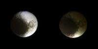
Posted by: ugordan Apr 2 2007, 06:06 PM
From the latest PDS batch, here's an approx. natural color composite of Iapetus from June 2006 and alongside it a view from November 2005 showing almost the same hemisphere, but with different illumination:
http://m1.freeshare.us/view/?130fs65107.png
Both images magnified 2x from original pixel scales.
Posted by: JRehling Apr 2 2007, 07:35 PM
[image]
Both images magnified 2x from original pixel scales.
You know, I think this image pair (and/or others like it) could be incredibly useful to help answer the question of what is going on with Iapetus, but ordinary eyeball power isn't sufficient to help.
Basically, the second image gives us a lot of information about the relief of Snowman-A, while the first image gives us an albedo map. The nontrivial task of correlating the two could offer some important insights. This is one of the few places on Iapetus where the first-order model of Cassini Regio (an ellipse with fuzzy northern and southern borders) can be seen to break down on a macroscopic scale, in concert with relief. So what is happening? Is the eastern slope of Snowman-A's central peak light or dark? What about the inside rims? The outside rims? There are some possible answers here that would offer definitive rejection of some theories for the origin of CR. For example, if there's a relief feature with dark stuff on the eastern slope but white terrain on the western slope, then the theory that something is swept up as it strikes Iapetus's leading side is seemingly refuted.
Posted by: TritonAntares Apr 2 2007, 10:04 PM
Let me just mention the far encounter later this month -
finally a chance to see another form of shadow casting at the Snowman as Iapetus left side is now in dark...

|
Bye.
Posted by: Michael Capobianco Apr 3 2007, 12:05 AM
Here's a stereo view that gives a pretty good idea of the Snowman/Moat topography.
http://mysite.verizon.net/vzepeq2k/iapetus/id3.html
Michael
Posted by: tasp Apr 3 2007, 02:43 AM
Sorry I don't recall where the postings are, but someone here has informed the board that the tilt of Iapetus' orbital plane about Saturn varies over time. This seems to explain the more diffuse N-S boundaries compared to the E-W ones.
There is a consistent relationship to the degree of darkening on the Iapetan surface between elevation, local slope, latitude, and longitude referenced to the meridian directly aligned to the sun when Iapetus is furthest from the sun in it's orbit about Saturn.
There is a simple mathematical relationship correlating the degree of darkening to the above parameters. Sorry, my rudimentary mathematical skills aren't sufficient to write it out.
Posted by: CAP-Team Apr 3 2007, 09:29 PM
finally a chance to see another form of shadow casting at the Snowman as Iapetus left side is now in dark...
Bye.
While a distance of 2,3 million seems fairly close, any pictures taken won't have the fine detail we all want to see. Fortunately the september flyby is only 5 months away
Posted by: scalbers Apr 5 2007, 08:29 PM
http://m1.freeshare.us/view/?130fs65107.png
Both images magnified 2x from original pixel scales.
Ugordan - nice PDS views of these images. The region around 0 degrees longitude at mid-far southern latitudes interests me in that it is somewhat tricky to navigate onto my map, so the more examples there are that show that area, the better. The second view though looks to me more like it's from January 2006, could that be the case? The November 2005 flyby was at a more northerly latitudes I think.
Posted by: ugordan Apr 5 2007, 08:40 PM
No, it really is November 2005. The January 2006 encounter was more distant, in fact I've got the entire sequence assembled into an image and an animation. It can be found http://www.flickr.com/photos/ugordan/345441934/.
The distant approach images from November and January are pretty similar, but if you look closer the January images show more of the Snowman in sunlight.
Posted by: Rob Pinnegar Apr 6 2007, 07:13 PM
That November 2005 image is interesting for another reason. Look at the 8 o'clock position on Iapetus' limb. You can see one of the large basins in profile. This one isn't normally as easy to pick out as some of the others.
It looks to me like the upcoming April 15th shots of Iapetus might have a chance of catching the big Roncevaux Terra basin in a similar profile.
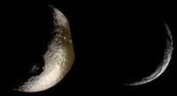
Posted by: TritonAntares Apr 12 2007, 09:06 PM
Hi,
here some infos about the upcoming far-encounter:
april 15 -> 2 clear und 19 color images
april 17 -> 1 clear, 6 color and 3 WAC-images
april 18 -> 2 clear, 34 color and 2 WAC-images
april 21 -> 2 clear, 6 color and 2 WAC-images
Resolution (NAC) will be about 14 km/pxl.
Bye.
Posted by: TritonAntares Apr 15 2007, 08:53 AM
So,
NASA's Solar System Simulator shows this:

|
|
|
|
Bye.
Posted by: ngunn Apr 16 2007, 02:42 PM
More food, Iapetus hounds:
http://saturn.jpl.nasa.gov/multimedia/images/raw/raw-images-details.cfm?feiImageID=107531
Posted by: Rob Pinnegar Apr 16 2007, 02:44 PM
For fans of Roncevaux Terra, the first set of Iapetus images from this very distant encounter are now up.
As I'd hoped, it looks as if the big trailing-side basin can be seen in profile as a "flat spot" on the moon's limb at about the 4:00 position. There seems to be a central peak visible.
There are also a couple of dark spots visible that may not have been seen before. And (once again) we get a tantalizingly fuzzy look at the Snowman crater system.
No sign of the bellyband on the moon's limb -- but 2.2 million kilometres is very long-range -- it may just not be that high at that particular point. We'll find out in a few months.
Posted by: ugordan Apr 16 2007, 03:16 PM
Posted by: TritonAntares Apr 16 2007, 03:41 PM
Ahh,
there they are...
Here two takeouts, ~3x enlarged:
|
Distance: 2,258,272 km
Filters: BL1 and CL2
|
Distance: 2,258,232 km
Filters: UV1 and CL2
The trailing-side basin must have been a really big hit.
Interesting is also huge step/rim in the north polar region.
Is there a hidden basin? A tectonic fracture? Or what else?
Curious to see the moons almost bright side,
doesn't look like Iapetus...
Bye.
Posted by: Rob Pinnegar Apr 16 2007, 03:58 PM
Is there a hidden basin? A tectonic fracture? Or what else?
I noticed that too. I think it's probably a topographic feature that looks brighter than the surrounding area because it is tilted towards the Sun. We saw this kind of thing in the south polar region last year.
Posted by: TritonAntares Apr 16 2007, 04:23 PM
We saw this kind of thing in the south polar region last year.
|
Date: 2004-10-22
Distance: ~1.6 million km
Could be the same or a different one...
I'm not quite sure, wasn't this region observed during the Newyear's flyby 2005?
There were some saturnshine images...
Posted by: Phil Stooke Apr 16 2007, 04:42 PM
This is a composite of four of the new images. I recall that stereo viewing of Voyager images of this northern bright area revealed apparently tectonic lineaments in this area - probably one of the old NASA TM reports on the geology and geophysics program.
Phil
|
Posted by: ngunn Apr 16 2007, 07:05 PM
If I'm not mistaken all these features show up very well on the Iapetus mosaic map on CiCLOPS. The big basin complex lower centre at about longitude 320 and the ones up north at about longitude 0. If I'm totally wrong please tell me gently.
Posted by: TritonAntares Apr 16 2007, 09:33 PM
|
Any idea for these structures? Real or artificial image errors?
Posted by: alan Apr 16 2007, 11:11 PM
Iapetus is a relatively small part of the image thus the image is more likey to get overstretched by the algorithm they are using. Thats what appears to have happened to the bright patches which are located in the area which is receiving the maximum sunlight.
Posted by: Rob Pinnegar Apr 17 2007, 02:24 AM
Thanks for the composite, Phil.
In addition to the poorly known parts of Iapetus that are near its limb on this sequence of photos, we're also getting a much better look at some topography on the terminator. There are a couple of big craters on the northern terminator that have been hinted at in previous images but for one reason or another just haven't been very visible before now.
Over the course of the next few days these craters will become more visible. Cassini seems to be "chasing" Iapetus for the time being -- it will maintain about this distance for the next week or so. Perfect time for shooting stereo pairs!
Posted by: ngunn Apr 17 2007, 11:10 AM
Info on upcoming Iapetus imaging on Rev 43 'looking ahead' on Ciclops now.
Posted by: ngunn Apr 19 2007, 01:28 PM
More images appearing now.
Posted by: TritonAntares Apr 19 2007, 08:35 PM
So,
next series arrived...
Here two further takeouts, ~4x enlarged:
|
Date:2007-04-17
Distance: 2,310,887 km
Filters: CL1 and GRN
|
Date:2007-04-18
Distance: 2,334,981 km
Filters: CL1 and CB2
Interesting craters near the terminator in the northern hemisphere getting more and more visible now...
The huge step/rim in the north polar region is still recognizable - there even seems to be a kind of mountain near the pole at the disk rim there!
And still the bright patches at the sunlight equator region of Roncevaux Terra ...
Bye.
Posted by: Pavel Apr 19 2007, 08:59 PM
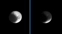
Iapetus, the http://en.wikipedia.org/wiki/Yin_and_yang moon

Posted by: ngunn Apr 19 2007, 09:11 PM
I'd rather say 'tennis ball moon'- more three dimensional and less philosophical baggage.
Posted by: ngunn Apr 20 2007, 10:53 AM
TritonAntares I've just created a cross-eye stereo pair from two of your recent images by photocopying them at 50 and 42 percent to match the sizes. It took only a minute to do and works a treat.
Posted by: TritonAntares Apr 22 2007, 10:53 AM
Hi,
next pics are online...
A takeout, ~4x enlarged:
|
Date:2007-04-21
Distance: 2,442,013 km
Filters: BL1 and CL2
Interesting overlapping craters now visible at the left side near the terminator in the northern hemisphere.
Sadly the distance being so large once again -
what a sight this angle of vision would have offered from say 400.000 km...

Bye.
Posted by: Phil Stooke Apr 22 2007, 12:33 PM
My version of that latest set, 4 images merged, showing the giant basin on the terminator.
Phil
|
Posted by: Phil Stooke Apr 23 2007, 12:36 AM
...and the next one...
Phil
|
Posted by: ngunn Apr 23 2007, 07:49 AM
Wow - those two make a beautiful stereo pair (but you have to place them diagonally).
Posted by: Michael Capobianco Apr 23 2007, 06:51 PM
It looks like the big landslide basin has a subdued inner ring, or am I imagining things?
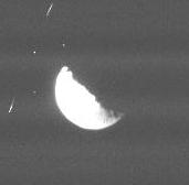
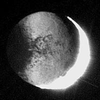
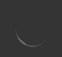
Posted by: TritonAntares Jul 4 2007, 01:56 PM
Hi again,
let me mention tomorrows far encounter of Iapetus:

|
July 5th
There'll be more parts of the terra incognita - including the huge 400-500 km bassin - visible than in April...
Bye.
Posted by: angel1801 Jul 4 2007, 02:17 PM
And I can tell you the images of Iapetus taken on July 3 are in and ready for use.
Posted by: Rob Pinnegar Jul 4 2007, 02:57 PM
Yep, the big basin is nicely visible -- and what's more, it's noticeably lighter in colour than the surrounding area.
That's got to have ramifications for some of the origin theories of Cassini Regio.
Posted by: Michael Capobianco Jul 4 2007, 04:44 PM
So, could ejecta from the big southern basin have covered up a pre-existing dark equatorial band that originally bisected Roncevaux Terra? (Theory number 7,234.)
Michael
Posted by: Phil Stooke Jul 4 2007, 05:03 PM
Here's a composite of four frames, enlarged and contrast-adjusted.

|
The basin is too off-centre to account for the bright hemisphere.
Phil
Posted by: ugordan Jul 4 2007, 05:06 PM
Could the reason for the apparent brightness be purely in different terrain roughness?

|
A couple of enhanced color views. While in natural color the higher albedo ice would probably look white, IR/UV filters show the polar regions are more reflective in UV (cleaner ice? CO2 vs water ice?).
Posted by: TritonAntares Jul 4 2007, 08:15 PM
Hi once again,
additional 12 pics will be transmitted on July 8th showing regions a little bit more eastern under a slightly lower resolution.
This basin really appears strange - bright and without contrast. Even its central peak is not visible.
Looks like one of those depressions of a golf ball...
I never expected it looking like this!
Bye.
Posted by: ngunn Jul 5 2007, 09:00 AM
OK, so what's that darker patch on the middle of it then? (At least I'm guessing it's the middle, though the fact that the whole thing is superimposed on a convex surface makes it harder to judge.)
Posted by: TritonAntares Jul 5 2007, 10:40 AM
A different aspect:

|
All these major dark patches (excluding Snowman A-C) in Roncevaux Terra seem to be on the equator,
like the ridge on the opposite hemisphere.
For sure, no random coincidence...
Bye.
Posted by: Rob Pinnegar Jul 5 2007, 03:43 PM
This is a weird one.
The lack of bright craters in Cassini Regio indicates that the darkening process there is recent, or perhaps even ongoing.
However, the images of the RT basin from October 2004 clearly show that it is surrounded by other, smaller craters. So it must be pretty ancient (as its size would imply). It's hard to imagine how a recent darkening process could spare this basin, but affect other areas at the same latitude.
A couple of possible explanations pop up:
(1) The darkening process in Cassini Regio is different from the one in Roncevaux Terra, at least in most places. If I'm not mistaken, this has been suggested by the Cassini team.
(2) The composition of Iapetus varies with depth, with deeper material being less susceptible to darkening, and the Roncevaux Terra basin is the only one that is deep enough for this effect to be visible.
(3) Far less likely: There has been a recent impact near the middle of the Roncevaux Terra basin that has resurfaced it out to the rim with brighter material. (I don't believe this for a minute, but it's technically possible.)
Iapetus continues to confound attempts to explain it. At least September 10th is coming up. We'll just have to pray that nothing bad happens to Cassini in the next two months.
Posted by: scalbers Jul 5 2007, 06:18 PM
This basin really appears strange - bright and without contrast. Even its central peak is not visible.
Looks like one of those depressions of a golf ball...
I never expected it looking like this!
Those 12 images will be worth looking at to help in mapping the existing July 3 images. Roughly speaking I'm getting a location for the large basin to the west of where I'd expect from previous Cassini and Voyager imagery. Hopefully the July 8 down-link will clear up this mini-mystery in my mapping - or the basin could be even stranger than expected...
Posted by: TritonAntares Jul 7 2007, 10:33 AM
To illustrate the difference in angle of view on July 3 and 8 these two views animated with Solar System Simulator:
|

|
Some approvements should be possible, Steve...
Nice to see that the part of the dark region west of the Voyager Mountains will be visible at the limb.
Perhaps we'll spot one of those mountains in profil there...
Maybe somebody could check this possibility with another simulation program?
Bye.
Posted by: angel1801 Jul 9 2007, 09:16 AM
The images of Iapetus from July 8 are now in and ready to view.
Posted by: Ian R Jul 9 2007, 10:30 AM
Here's my version, consisting of 12 stacked images, plus a simple histogram stretch:

|
It seems like the brightness of the impact basin in the previous set of images was purely due to the phase angle, as opposed to a genuine intrinsic difference.
Posted by: TritonAntares Jul 9 2007, 02:47 PM
Hello again,
a question to be answered - which is the largest of the great basins, and what about their actual diameters?

|
And last but not least...
... they have to be named - finally!
Please IAU, please...
Bye.
Posted by: ngunn Jul 9 2007, 03:05 PM
Once again by the low-tech expedient of printing off, sliding around and glueing together I have a nice cross-eye stereo pair made from Ian R's composite above and Phil Stooke's one in post 106. It's not perfect but it works. The big bright crater definitely has a near rim and a far rim.
Anyone fancy doing it properly?
Posted by: scalbers Jul 9 2007, 06:46 PM
a question to be answered - which is the largest of the great basins, and what about their actual diameters?
|
|
And last but not least...
... they have to be named - finally!
Please IAU, please...
Bye.
I'll try playing around with the newest images to help answer the question I have as to whether the upper left and lower left images shown above are actually the same basin that map together consistently.
Posted by: TritonAntares Jul 9 2007, 08:04 PM
Both show the same basin in southern Roncevaux Terra, for sure.
The older image however offers far more structure - that's why a I was a bit disappointed from this encounters' pics.
Even if this low contrast appearence is only caused by vertical illumination.
But Sep. 10 is not far away...
Bye.
Posted by: scalbers Jul 9 2007, 08:45 PM
I think I might go out on a limb so to speak and illustrate my question. If you compare the two images I'm linking to you can see the first one is the existing map. The second is just the new image mapped onto hopefully the same projection. If this is correct (a big if), then the eastern edge of the basin in the new image corresponds to the central "peaks" in the basin on the previous map, kind of a double basin? If it really is one basin, then I'll be doing some refitting of the images (such as the Voyager image) to the map (it wouldn't be the first time). Where does Occam's razor lie here?
http://laps.noaa.gov/albers/sos/saturn/iapetus/iapetus_rgb_cyl_www_1k.tif
http://laps.noaa.gov/albers/sos/saturn/iapetus/iapetus_rgb_cyl.tif.0
Posted by: Phil Stooke Jul 9 2007, 09:19 PM
I'm fairly confident there is no double rim, and the problem is in the reprojection, perhaps spread over both sides of the gap. The apparent crater on the east rim of the new basin fits nicely in a shadow space in the old image if things are shifted a bit.
Phil
Posted by: scalbers Jul 9 2007, 11:26 PM
I'll be interested to see whether things will shift enough to fully account for the offset I'm now seeing. Here are two more links. The first image is a new preliminary map with all the old and new images added. The second is the ISS map that I'm using for comparison. There are some differences though I've yet to see enough of an obvious difference that would fill the gap.
http://laps.noaa.gov/albers/sos/saturn/iapetus/iapetus_rgb_cyl.1-29.jpg
http://laps.noaa.gov/albers/sos/saturn/iapetus/iapetus_ssi_1k.jpg
One more reason to wait until September
Posted by: Ian R Jul 10 2007, 03:46 AM
Steve,
Could your problems be caused by the fact that Iapteus isn't perfectly spherical? I imagine that might cause some significant distortions in your image reprojections.
Ian.
Posted by: scalbers Jul 10 2007, 08:18 PM
Ian,
That is a possibility to consider. This might be kind of in mid-stream, as for some of the key images I've switched from a spherical assumption to using a triaxial ellipsoid that has been recently published. Hopefully my software is doing that with enough accuracy. However much of the projection error associated with assuming a perfect sphere ends up being in the north-south direction, at least for images with a sub-spacecraft point near the equator. Most of the offset I'm seeing with the basin is in the east-west direction.
The older image with the shadowed version of the basin (Oct 2004) was projected assuming a sphere, so I am thinking of redoing that one. This was released from CICLOPS with a grid overlay so I was assuming things were fairly accurately done. Another thing is that I see the Voyager image may also need to be switched over to a triaxial ellipsoid and that is a key connecting image. Perhaps this being a polar view will show more of a shift?
Posted by: Rob Pinnegar Jul 11 2007, 12:18 AM
Ooooh... trusting that triaxial ellipsoid could be part of your problem. Take a look at this image from 2004:
|
The part of Iapetus that appears on the western limb in the above image is in roughly the same part of the moon as the eastern limb from the images of Roncevaux Terra that came down the pipeline the other day.
Look at the sharp "zenith discontinuity" at the equator. A triaxial ellipsoid can't possibly model that properly. The traxial ellipsoid is probably some sort of best-fit that likely deviates substantially from the true surface in a lot of places. I don't doubt that it's the best we've got, but it won't be anywhere near perfect.
Just eyeballing the new Roncevaux Terra images, it looks as if the true limb is "squashed inwards" near the basin. The triaxial ellipsoid probably lies outside the true surface in this part of Iapetus. This would cause anything lying close to the true limb to appear to be closer to Cassini than it actually is.
Posted by: TritonAntares Jul 11 2007, 05:56 PM
Hi,
http://saturn.jpl.nasa.gov/multimedia/images/raw/casJPGFullS31/N00086061.jpg available now: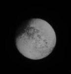
Date: most likely today
Distance: ?
Maybe someone can pump more information out of it ?
Bye.
Posted by: scalbers Jul 11 2007, 06:32 PM
Rob's image in post #125 is a good one to consider also. I redid my fit using the triaxial ellipsoid and allowing for a little scrunching just south of the bellyband on the western side. You can see my fit at this URL:
http://laps.noaa.gov/albers/sos/saturn/iapetus/ortho13_gridded.jpg
The western limb of this image is still quite a distance away from the Ronceveaux Terra basin. My new fit agrees pretty closely with the older one though I have an offset in both a few degrees to the NW of the ISS map. So every correction that can be made will help though there's still quite some ways to go before I can make the RT basin inconsistency go away. I think that my map agrees with the ISS map (post #122) reasonably well for the Snowman craters and with the gridded ISS image for the Voyager mountains. Perhaps one of them may have to move significantly to really close the basin gap. The Voyager mountain agreement is illustrated at this URL:
http://laps.noaa.gov/albers/sos/saturn/iapetus/ortho11_gridded.jpg
In the middle pair of images the lower one is the ISS fit and the upper one is my (still spherical) fit.
I just saw TA's new image so I'll think about that one as well. I see on the raw images page that there's no date or distance info so I wonder if the central longitude has shifted since the July 8 images?
Posted by: volcanopele Jul 11 2007, 07:47 PM
Regardless, it is always best to use the triaxial ellipsoid radii than assuming a spherical body, particularly for Iapetus! However, keep in mind that the region we are looking at now has been pretty poorly mapped before and the DLR map may not be a good fit, yet. Hopefully, after September's flyby, we will have some better results on the control point network and the triaxial ellipsoid shape.
Posted by: JRehling Jul 11 2007, 09:06 PM
Could another component of the "basin gap" be that a broad basin rim shows up as shading on the eastern slopes of the (broad) rim in some lighting and as shading on the western slopes in opposite lighting?
http://www.phys.ncku.edu.tw/~astrolab/mirrors/apod/image/0211/mareOrientale_lunarOrbiter4_c1.jpg
With Mare Orientale on the Moon, for example, lighting from the east will show the eastern rim mainly as a shadow to the west of the highest level. Lighting from the west will show a shadow to the east of the highest level. This could amount to some 50-100 km perhaps if a basin's rims were really broad.
Posted by: TritonAntares Jul 12 2007, 02:09 PM
http://saturn.jpl.nasa.gov/multimedia/images/raw/casJPGFullS31/N00086061.jpg available now:
...
Distance: 2,846,206 km
Filters: CL1 and CL2
Posted by: Rob Pinnegar Jul 12 2007, 03:25 PM
That's a really interesting point, but I don't think it will work in this particular instance. In these images, the basin is pretty close to the longitude of the sub-solar point, so there shouldn't be any shadows at all on the eastern and western slopes. (Mind you, as Steve noted in his previous post, my idea of "pretty close" seems to be about 45 degrees larger than the definition most people would use.
 )
)There *could* be some apparent north-south displacement, of course.
And to reply to Jason: No doubt the triaxial ellipsoid approximation will be *way* better than the spherical approximation. I'm just saying that it's still not really all that great.
However, I could believe that *separate* triaxial ellipsoids, fitted to the northern and southern hemispheres, could do a much better job. Somebody must have tried this by now.
The other thing would be a spherical harmonic approximation out to about 473 terms. This will inevitably turn into someone's senior-year, or master's, thesis project. (I pity the poor kid who gets it. Harbouring intense bitterness towards a ball of ice a billion kilometres away would be difficult to explain to other students at the campus pub. In particular, it could really turn off the girls in English and Philosophy.)
Posted by: scalbers Jul 12 2007, 05:48 PM
Distance: 2,846,206 km
Filters: CL1 and CL2
2x enlarged
Thanks for the info T-A. I'm afraid though we only get a half degree eastward shift in longitude so that would be a limited amount of additional information
EDITs (last at 1800 UTC July 14) :
By the way, looking at the Voyager image refitted with the triaxial ellipsoid showed some modest shifts mainly at higher northern latitudes. I see some issues now with the fit of this image with others in high northern latitudes at around 220 E longitude. In any event, a closer look at the Voyager image along equatorial latitudes suggests to me the "basin gap" may even be slightly larger than I've mapped previously. I'm assuming for example that I can correctly identify the crater Hamon in the July 8 images. The Voyager image alone can reasonably tie in the July 8 imagery to the Oct 2004 images and make a case for the basin gap.
I've also now refitted the Oct 2004 images (including the shadowed basin one) to the triaxial ellipsoid. These had some interesting shifts in the more southerly latitudes. The basin does seem from the July 8 imagery to be rather large, so perhaps it could have some sort of extra rings or shadows on the east side that show up in the Oct 2004 lighting as JRehling suggests? I could still see the possibility of some sort of smaller (perhaps older and partly covered) secondary basin to the east.
Here's the latest version based on various recent refits:
http://laps.noaa.gov/albers/sos/saturn/iapetus/iapetus_rgb_cyl.070712.jpg
Posted by: TritonAntares Jul 15 2007, 09:24 AM
So,
yet http://saturn.jpl.nasa.gov/multimedia/images/raw/casJPGFullS31/N00086061.jpg is online: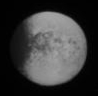
Date: most likely yesterday
Distance: ?
2x enlarged
Maybe someone can pump more information out of the original ?
Bye.
Posted by: TritonAntares Jul 15 2007, 10:16 AM
Looking through all the images of this far encounter I took notice of a dark structure at the eastern rim of the new bright basin in southern Roncevaux Terra:
|
Could this be another landslide?
There seems to be a bright semicircular zone surrounding the dark structure inbound the basin.
Some answers may be hidden in these two images:
|
The possibilty of a second over-/underlying smaller impact structure - as some of you speculated - is very unlikely, I suppose.
Bye.
Posted by: scalbers Jul 15 2007, 01:30 PM
Interesting to look in more detail at structures on the eastern side of the basin. Was it Ian who earlier composed the stacked image for July 8? This appears to show some of the features better than the single image I used in my test map. Would it be OK if I were to try using your stacked image instead to see if it shows things better?
The crescent image is one I've yet to use much in mapping, this might be interesting to give a try and see how it fits in.
It might be easier in some ways to wait until September to see how the basin images fit, yet I'll indulge a bit more in my wild speculation about the potential basin gap that I see. Following up on my mention of the crater Hamon, I will check again how it fits between the Voyager image and the July 8 views. Then using the Voyager image to fit features to the Oct 2004 imagery for the Voyager mountains and environs I think one can come up with a reasonable solution for the location of the basin (or dare I suggest basins ).
Going one tentative step further, my experimental map I think had the location of the rim feature T/A is circling to coincide with the apparent "central peaks" in the Oct 2004 imagery...
Posted by: Ian R Jul 15 2007, 02:45 PM
Steve, you're more than welcome to use the stacked image!
Posted by: scalbers Jul 15 2007, 03:01 PM
Thanks much Ian. Hopefully I'll have some time to try it during this week - given my day job and such.
Regarding the thin crescent image (and hidden answers) T/A showed from post #134, it seems to actually show a hint of a second rim in the interior of the basin, judging by the indentation in the terminator. This inner rim might not be concentric with the outer one. There is also less of a suggestion of central peaks compared with the adjacent wider crescent image to its left. This all makes me wonder further how the thin crescent image would show up if projected onto the map and if it would help in clarifying my hypothesis - in this context meaning two overlapping basins or at least an extra ring on the eastern side.
Posted by: Harkeppler Jul 15 2007, 04:05 PM
These two view of Iapetus was made from 13 and 15 pictures by stacking and quadrupling resolution with giotto 2 software.
In the phto of 18. April 2007 there seems to be a bright feature at the southwestern terminator, maybe a central peak?
I think it can be seen in the photo of 08. July 2007, too.
Harkeppler

|

|
Posted by: TritonAntares Jul 15 2007, 04:44 PM
I'm continung to check and compare various images to see if the results strengthen or weaken my hypothesis about the basin location.
I'm wondering if you are familiar with the crater Hamon and if you have an opinion on how that shows up in both the July 8 imagery and the Voyager image. Using that as a reference point, then using the Voyager mountains and environs as a reference in comparing the Voyager image to the Oct 2004 images could be key in resolving this in my mind.

|

|
...
Posted by: TritonAntares Jul 15 2007, 04:49 PM
...
Difficult to say which one exactly Hamon is, I believe this dark structure:

|
Any other ideas?
Bye.
Posted by: scalbers Jul 15 2007, 04:54 PM
Nice illustration T/A. In some ways this looks possible, yet I'm thinking Hamon is the rightmost red circle you have marked in the July 8 image. Note the cross shaped pattern of craters of which I think Hamon is on the western wing.
The feature circled in green on the July 8 image may not be visible on the map you're showing, however I think I can see it in the original Voyager image.
Posted by: TritonAntares Jul 15 2007, 07:08 PM
yet http://saturn.jpl.nasa.gov/multimedia/images/raw/casJPGFullS31/N00086061.jpg is online:

Distance: 3,210,364 km
2x enlarged
Posted by: scalbers Jul 17 2007, 06:57 PM
Greetings,
I'm in the midst of reviving my mapping efforts with the thin crescent image from Oct 2004 (post #134 lower right). My initial assessment is that the mapped image indeed seems to show the double nature of the basin (see post #137) in a way that is reasonably consistent with my mapping of the July 8 imagery (thanks again Ian), the Voyager imagery, and the other Oct 2004 imagery. I think there are enough matching features between the various images (best seen when mapped individually and blinked) to show a good enough solution. The shadowing effects with the new crescent image are also pretty dramatic.
Here's a look at the current map in progress:
http://laps.noaa.gov/albers/sos/saturn/iapetus/iapetus_rgb_cyl_070717b.jpg
I still have a bit of a shift to clean up in the longitude of Hamon (around 1.7 degrees) between the July 8 imagery and the Voyager image. However I think this wouldn't change the overall picture of the basin(s) since it/they are quite a bit larger.
Posted by: nprev Jul 18 2007, 12:39 AM
New Iapetus article on the Cassini site:
http://saturn.jpl.nasa.gov/news/press-release-details.cfm?newsID=761
Apparently, it lived fast & died young...doesn't explain the dark patch, though.
Posted by: Pavel Jul 18 2007, 01:10 AM
http://laps.noaa.gov/albers/sos/saturn/iapetus/iapetus_rgb_cyl_070717b.jpg
Now that's quite a face!!! But where does it come from? I cannot find the original image. Older maps all have white space in that area. Coincidence? I don't think so

Posted by: scalbers Jul 18 2007, 04:45 PM
It's from the rightmost image at this URL:
http://photojournal.jpl.nasa.gov/catalog/PIA06145
The face may be more challenging to pick out though due to foreshortening near the limb. Iapetus, yes full of mysteries
Posted by: TritonAntares Jul 18 2007, 10:23 PM
Hi once again,
http://saturn.jpl.nasa.gov/multimedia/images/raw/raw-images-details.cfm?feiImageID=116204 has been published:
Date: 2007-07-16
Distance: 3,239,597 km
Filters: CL1 and CL2
2x enlarged
Bye.
Posted by: edstrick Jul 19 2007, 05:08 AM
When this orbit's long-range full-disk sequence of Iapetus images is done, sombody should take the sequence and turn it into a little movie.
Posted by: scalbers Jul 19 2007, 05:29 PM
Greetings,
I thought I'd show a blinking GIF that helps illustrate the correspondence in features that I'm using in the map. There are three images, one is the full map I showed earlier, one subtracts out the Oct 2004 crescent image, and the third image has just the July 8 image from Ian. My take is that features line up rather well in BOTH eastern rims of the basin(s), as well as elsewhere. The fit between various images is generally around 2 degrees or better. I'll try and see if I can figure out how to annotate some of them (though I'll probably never get as good as T/A at that ).
http://laps.noaa.gov/albers/sos/saturn/iapetus/iapetus_blink_map.gif
Posted by: MarcF Jul 19 2007, 06:41 PM
It seems that there are indeed two overlaping big basins in south Roncevaux !
Marc.
Posted by: scalbers Jul 22 2007, 02:58 PM
Yes, I must admit that the more I look at this the more I find the basins (or basin rims) case to be compelling.
Something else I'm noticing today is that the area to the west of the Voyager mountains looks interesting, with the western extension of the peaks having a more continuous and wavy look.
http://laps.noaa.gov/albers/sos/saturn/iapetus/iapetus_rgb_cyl_070717b.jpg
Posted by: TritonAntares Jul 28 2007, 01:35 PM
Something else I'm noticing today is that the area to the west of the Voyager mountains looks interesting,
with the western extension of the peaks having a more continuous and wavy look.

|
Hmm, looks quite curious...
Maybe a kind of artifical effect in the way you are puzzling your maps ?
The eastern rim of the large basin also appears a bit wavy...
Bye.
Posted by: scalbers Jul 28 2007, 04:10 PM
Greetings T-A,
Good questions worth considering given the strange (or perhaps mysterious) appearance. For the wavy extension of the Voyager mountains, the original Voyager imagery had a somewhat similar appearance. I had at the time dismissed this as an artifact of the low resolution and being near the limb. The fact that the wavy appearance looks similar with higher resolution and less foreshortening (with Cassini - at least in the western portion of this feature as we move away from the limb) makes me think it is more real and therefore more intriguing. On the other hand the eastern portion of this feature in the original image is very near the limb and may be distorted in the map due to the higher elevation (a la mountain/bellyband extension). This is visible as a protuberance in the limb when I zoom way in on the http://photojournal.jpl.nasa.gov/catalog/PIA06145. The Voyager image is also being mapped for part of this feature so you're right that this is a puzzle. Hopefully we'll see how this jives with the much better imagery planned for September.
The whole region at the western terminus of the "wave" is somewhat chaotic (like things were stirred up somehow) and after all is at the base of the "dark triangle"  . Note also that I updated the map on 7/25 to clean up the region in question compared to the version you are showing.
The wavy appearance of the easternmost basin rim is somewhat affected by foreshortening. I believe it is real however as evidenced in the blinking GIF (post #149) comparing two of the October 2004 images, as well as the latest version of my map online where you can see the matching rim features in how the two images are superimposed. The rim top features in the lower sun angle image match very nicely with the shadows inside the rim in the higher solar elevation (thinner crescent) image. The current map version is at this URL:
http://laps.noaa.gov/albers/sos/sos.html#IAPETUS
Posted by: edstrick Jul 29 2007, 07:48 AM
I kept trying to convince myself that traces of "white" extending eastwards from the end of Cassini Regio past the big crater toward the white mountains at the west end of the Regio were a continuation of the belly band. I still see little or no real "EVIDENCE" in the saturnlit part of that scene, but keep seeing disconnected blurry traces of white parallel to the equator in that area. The new image data, horribly blurry as they are, really do seem to show that the white-mountains or some other expression of the belly band do extend westwards into that area. This implies that the bellyband is essentially continuous, though it may have been trashed in places by later craters, like by that big basin in eastern Cassini R.
Posted by: Steve G Jul 30 2007, 04:42 AM
Just a quick look tonight at Where is Cassini Now? looks like that Iapetus will appear to go directly behind Saturn as seen from Cassini. Granted that Iapetus is about as far away as it can get, any chances for some imaging of this event?

|
Posted by: ugordan Jul 30 2007, 05:44 PM
Here's another movie of an "ancient" Cassini flyby of the moon. Sixteen stretched color frames taken between 2005-03-14 and 2005-03-30 were processed to better approximate natural color. Closest approach was around 1.3 million km. Magnified 2x. No new terrain visible, it shows the hemisphere Cassini saw over and over and over again, but I like movies so...
http://m1.freeshare.us/view/?163fs256963.gif
Edit: there's a bit of a stereo effect to be had, seen here between the 1st and 3rd image in both a cross-eye stereogram and color anaglyph:
http://m1.freeshare.us/view/?163fs290327.png
http://m1.freeshare.us/view/?163fs290043.png
Posted by: Ian R Jul 31 2007, 06:49 AM
Awesome! Gordan, you're a machine!
Posted by: Pavel Jul 31 2007, 02:11 PM
Gordan, you're a machine!That's a compliment so suitable for unmannedspaceflight.com
Posted by: TritonAntares Jul 31 2007, 08:21 PM
Hi,
let me just mention these three Iapetus far distance pics:

|
Nearly 7 million km - that's 1/8 of a close Mars opposition...

Bye.
Posted by: Rob Pinnegar Aug 2 2007, 12:57 AM
It's 7 million km because that is twice Iapetus' distance from Saturn.
Cassini, right now, is where Iapetus will be in 40 days. They're on opposite sides of Saturn, at about the same distance. Cassini is one orbit away from closest approach, Iapetus half an orbit away.
The flyby's being set up.
Posted by: TritonAntares Aug 2 2007, 06:53 AM
I just wanted to illustrate how large the saturnian system really is.
Cassini is one orbit away from closest approach, Iapetus half an orbit away.
Only the discoveries on Titan an Enceladus will match up with the spectacular images we'll see and the results we'll hopefully get, I guess.
Tension is rising...
Bye.
Posted by: TritonAntares Aug 4 2007, 10:25 AM
Btw., 9 additional far distance pics - including 3 showing Iapetus and Saturn - were updated on the http://saturn.jpl.nasa.gov/multimedia/images/raw/index.cfm.
Use 'Target Iapetus' for searching.
Bye.
Posted by: scalbers Aug 4 2007, 03:50 PM
Neat to see how things are setting up as we have 3 days or so until Cassini is farthest from Iapetus. During the next month we'll see the sunset terminator move from the eastern side of Cassini Regio to the western side as we transition from a gibbous to a crescent phase, as seen in this movie.  iapetus11.avi ( 291K )
: 292
iapetus11.avi ( 291K )
: 292
Posted by: CAP-Team Sep 4 2007, 07:41 AM
We're closing in on Iapetus!
Images from yesterday are up!
|
I combined an IR, UV3 and GRN image to create a "color" image.
Even some Saturn shine is visible.

|
Posted by: ugordan Sep 20 2007, 09:16 PM
There's a rather neat "zero" phase observation from September 9, 2006 at the PDS. Here's an animation of 10 clear filter frames showing the opposition effect (click to enlarge):
http://i108.photobucket.com/albums/n15/ugordan/Zero-Phase-Clear.gif
And an IR3/GRN/UV3 color version of 5 frames around the time of lowest phase: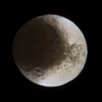
Both are magnified 2x.
If you notice carefully, Cassini Regio doesn't show as big an effect as Roncevaux Terra does. What could that imply about surface characteristics? Coarser grained stuff in CR?
Posted by: scalbers Sep 23 2007, 01:19 PM
Or would the grainier (snowy) material be in Roncevaux Terra with more small shadowed areas between grains that help contribute to the opposition effect? I would surmise then that CR is less granular, perhaps more tarry or something. The actual size of the grains may be less important in deciding whether there's an opposition effect.
Posted by: ugordan Sep 23 2007, 01:54 PM
It's quite possible, I was just trying to spark some discussion. Zero phase behavior difference seen here could be pretty interesting. I'm not acquainted with photometry and backscattering properties of different materials. My comment was based on the fact powdery surfaces (very beaten up regolith) seem to show the strongest opposition effect. It could just as well be dependant on the specific materials. The shadowing effect is only a part of the equation, coherent backscatter (if that's what it's called) is I think more important at zero phase. These shots seem to suggest CR shows very little of that effect.
Posted by: scalbers Sep 23 2007, 02:25 PM
Gordan - these are interesting animations that you put together, and yes there are several factors that can contribute to the opposition effect. I think there was a post (by edstrick) mentioning the morphology of some features in Roncevaux Terra suggesting grainy snow, so the opposition effect may lend more support for this. He also suggested the dark terrain was granular though.
I wonder whether there is more of an opposition effect on the bright side of Iapetus compared with other icy satellites? There is a general discussion by Sanna Kaasalainen in this thesis, particularly in section 1.4.3 where Anne Verbischer is mentioned:
https://oa.doria.fi/bitstream/handle/10024/2893/backscat.pdf?sequence=1
And this paper might be interesting to read if I had a subscription:
http://pubs.nrc-cnrc.gc.ca/cgi-bin/rp/rp2_abst_e?cjp_p02-119_81_ns_nf_cjp
Beyond that, this gives me something to look for when walking around during the upcoming winter days.
Posted by: ugordan Sep 24 2007, 01:54 PM
Interesting PDF from a glance, thanks for the link. Regarding other icy moons, as far as I can see this is by far the lowest phase observation of any moon yet by Cassini (around 0.05 degrees minimum at disc center, comparable to the apparent angular diameter of the moon, 1.5'). I know there were some other low phase moon observations - Rhea comes to mind, but it was nowhere near this low a phase. Cassini did observe the rings at zero phase quite often, though. Earth-based observations such as the recent one are more favorable for catching several moons at the same time, but Cassini has the benefit of actually resolving the moons into discs.
Personally, I don't think Roncevaux Terra can come anywhere near Enceladus when it comes to the opposition surge. It's fairly bright albedo ice (comparable to Europa IIRC), but you can't beat the shiniest object in this stellar neighborhood. It might be interesting to compare it to Rhea on the other hand - similar albedos, but Rhea appears to be slightly dirtier.
Posted by: ngunn Sep 24 2007, 04:20 PM
Interesting. I would expect ice deposited as frost in a near vacuum to be very pure (hence bright), and in very small particles (hence high opposition surge) wherever it happened to be located. If Roncevaux is both less bright and shows less opposition surge than Enceladus I'd be inclined to attribute the differences to radiation damage rather than 'dirt' as such. That would be consistent with a very much lower deposition rate on Iapetus than on Enceladus - not unreasonable.
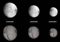
Posted by: CAP-Team Sep 25 2007, 08:58 PM
Below images from 17, 19 and 23 september together with simulated views (using Steve Albers' maps)
|
Posted by: scalbers Sep 29 2007, 01:47 PM
Nice views that you put together CAP-Team. One thing I'm working on is to try and soften the image edge on the map near the terminator in the vicinity of the central meridian in these views. One minor suggestion on the presentation would be to consider rotating the Celestia views (with certain keyboard controls) to match the orientation more closely.
It's interesting to backtrack to what we were looking at with the http://www.unmannedspaceflight.com/index.php?act=attach&type=post&id=11168 (Harkeppler in post #138) from a similar vantage point. For example the dark escarpment on the eastern rim of the western Claude basin was visible in those images.
Powered by Invision Power Board (http://www.invisionboard.com)
© Invision Power Services (http://www.invisionpower.com)