Printable Version of Topic
Click here to view this topic in its original format
Unmanned Spaceflight.com _ Opportunity _ The western route
Posted by: Tesheiner Jul 11 2009, 05:57 PM
Time for a new thread.
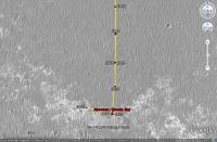
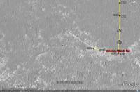
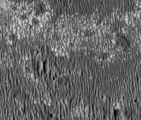
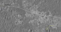
After moving southwards for ages, the "detour" by the western path has started with a 60+ meters drive on sol 1942.
There are no images yet --they should be available on the next update-- so this image was calculated solely based on the rover's mobility info. I'll update the route map later.
Posted by: Marz Jul 12 2009, 03:03 AM
Whoa, didn't realize Oppy was ready to move! I thought the integration at Absecon would take a few more sols. Kinda sad that it looks like we won't get to see the small Talisman crater on the approach. Is there a projected path for the western route (ustrax's route was amazingly prescient, so now I'm lost).
Posted by: MarkG Jul 12 2009, 05:18 AM
So, on this last leg to the Martian west, across mostly pavement, what were the Right Front wheel's currents like?
Posted by: jamescanvin Jul 12 2009, 08:46 AM
I made a quick guess http://www.unmannedspaceflight.com/index.php?s=&showtopic=5476&view=findpost&p=142552 a while back. I don't have Ustrax's gift though.
The 'official' route hasn't been made public yet.
James
Posted by: BrianL Jul 12 2009, 03:34 PM
I thought we would have had a revised TraxMap ™ by now. ![]()
Posted by: ustrax Jul 13 2009, 08:49 AM
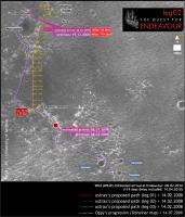
By your special request...
Paths converge once more...not in the direction I expected (no-more-spines please!) but the important thing is that...we're roving!
Posted by: Astro0 Jul 13 2009, 11:52 AM
Ustrax: "...not in the direction I expected..."
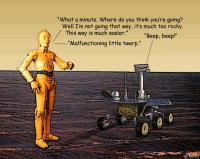
That got me thinking about taking the western route...![]()
Just for laughs folks. I'm sure that Oppy doesn't think that there are "settlements over there".
Posted by: BrianL Jul 13 2009, 01:21 PM
I meant really revised, Rui. What's your take on where the westward route will run?
Posted by: ustrax Jul 13 2009, 02:24 PM
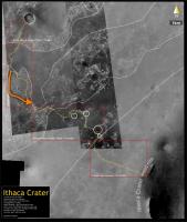
Haven't tought about that Brian...here's the original image of my proposed route with a rough sketch of the westward route in orange...:
I still prefer the Eastward one...
Posted by: Nirgal Jul 13 2009, 05:32 PM
I would be interested in the answer to that question, too ...
Posted by: BrianL Jul 13 2009, 06:21 PM
<clink> <clink>
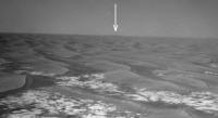
What are those hills and how far away are they? Have they always been visible and I just haven't been paying attention?
Edit: Wait a minute, what direction is that? If that's east, then obviously that's our goal. When I first looked at it, I thought these were some new shots in the direction we're heading.
Posted by: ustrax Jul 13 2009, 06:29 PM
Oh boy...this is going to be a long night...ahahah
http://www.unmannedspaceflight.com/index.php?act=attach&type=post&id=18432
From my ignorant perspective (I am sure James will come up with the right answer...) we can see Cook near the center and elevation to its left (Molyneaux) , we can also see the twin peaks (Banks and Solander) on the North rim but what's new are all those hills to the left...
Are we seing the West/South part of the rim? Edgecombe and friends?
Posted by: fredk Jul 13 2009, 06:52 PM
Thanks for the heads up, guys, these are great views!
The most prominent peaks on the far left in these images are on the near (west) rim of Endeavour. All the fainter peaks are the rim of Iazu crater behind Endeavour. We've had similar views before, but the air is looking clearer now. Compare the latest view:
http://qt.exploratorium.edu/mars/opportunity/pancam/2009-07-12/1P300583241ESFA3PGP2599L5M1.JPG
with the view from sol 1898:
http://marsrovers.jpl.nasa.gov/gallery/all/1/p/1898/1P296679391EFFA13AP2356L6M1.JPG
Posted by: ustrax Jul 13 2009, 07:00 PM
Fred, if that's Iazu, let's wrap this Endeavour story fast... ![]()
How tall is that martian beast?... ![]()
Posted by: jamescanvin Jul 13 2009, 07:35 PM
Fred's right that is Iazu again - great view.
As to the height, Google Earth says that the peaks are 200 - 300 m above the surrounding plain.
In that image the peaks are about 10 pixels high - at roughly 40km that makes what we can see the top 100m or so.
Posted by: Tesheiner Jul 13 2009, 08:20 PM
Wow, what a view! ![]()
I saw that sequence (Iazu's pancam) in the plan but forgot to check it afterwards. The current view at the horizon is, imo, the most exciting since the beginning of this mission.
Posted by: ustrax Jul 13 2009, 08:25 PM
James, sorry for asking but, that's not all Iazu, right? There are some features to the right of Cook that belong to Endeavour, or am I wrong?
I was taking this previous image as a reference:
http://photojournal.jpl.nasa.gov/figures/PIA11837_fig1.jpg
Posted by: Stu Jul 13 2009, 08:39 PM
Craig Covault - speaking live on SpaceflightNow's video coverage of the shuttle launch - has just been saying that MRO has found *clays* inside Endeavour crater... and as (paraphrasing here) clays don't form/last long in acidic water, this suggests that the water there was, for at least some time, less acidic than previously thought...
Anyone know anything about this..?
Posted by: fredk Jul 13 2009, 09:29 PM
Right. See http://www.unmannedspaceflight.com/index.php?s=&showtopic=5503&view=findpost&p=141124 if you need convincing...
Posted by: dvandorn Jul 14 2009, 02:00 AM
Stu, my understanding is that the "clays" that MRO has been discovering are the phylosilicates that have been discussed at length, especially in the site selection deliberations for MSL.
I'd have the think that any clays found within Endeavour would have to be remnants of earlier aqueous conditions than those which were involved in laying down the Meridiani sulfate sandstones. And considering there must be pieces of the crust underlying those sandstone deposits in the walls of Endeavour, I guess that's not terribly surprising.
Now we need to really hope and pray that Oppy can make it to some of the clay deposits and give them a careful examination. For one thing, clays are the most likely places to find fossilized life remnants, especially bacterial fossils. While Oppy is not all that well equipped to look for anything like that, it could very likely constrain the possibilities in a favorable manner.
Take *real* good care of Oppy for us, guys... now, more than ever, it seems the payoff if we get to Endeavour could be truly astounding.
-the other Doug
Posted by: CosmicRocker Jul 14 2009, 05:59 AM
Yeah. When Endeavour became the goal, I perused the raw mineralogical maps available from MRO. I found a very small patch of possible phyllosilicates on the far, eastern side of the crater. It would be significant if newer imagery, or reprocessed imagery was indicating phyllosilicates to be more common.
Posted by: Tesheiner Jul 15 2009, 08:57 PM
Today was another driving sol, where almost 70m were covered in a WNW heading.
I would expect a heading change to NW on the next two or three driving sols to avoid some "purgatoids" due west.
PS: Map update tomorrow, if time permits.
Posted by: CosmicRocker Jul 16 2009, 05:54 AM
I realized that I should have better referenced the CRISM imagery I referred to in http://www.unmannedspaceflight.com/index.php?s=&showtopic=6102&view=findpost&p=143270. The raw imagery I referred to is http://crism-map.jhuapl.edu/summary.php?obs=FRT0000854107IF165L&x=-5.26&y=-2.39. Apparently my recollection of the location was faulty. The small anomaly I described was not on the far, eastern side of the crater. It is closer to the center of the crater. It is on the far, eastern side of the image.
Of course, http://crism-map.jhuapl.edu/popinterpret.php to any interpretations of such non-calibrated imagery.
Posted by: climber Jul 16 2009, 08:31 AM
I while ago somebody wrote, I think it was Phil, that we were heading to higher terrain due in a few kilometers (2?).
Does somebody know whether it's still the case or can we say the western route is just flat for a while?
You'll understand that I'm looking for a vintage high place to get a better view.
Posted by: ElkGroveDan Jul 16 2009, 02:12 PM
millésime? sur Mars?
Posted by: climber Jul 16 2009, 03:38 PM
...and we'll call it (Avril) Lavigne...
Posted by: Zeke4ther Jul 16 2009, 09:24 PM
Ahhh....a touch of Canadian content... ![]()
Posted by: Phil Stooke Jul 16 2009, 09:47 PM
Can't have too much of that. ![]()
Phil
Posted by: dot.dk Jul 19 2009, 12:47 PM
Some good news in the latest update ![]()
http://marsrovers.nasa.gov/mission/status.html#opportunity
The rover performed another long drive on Sol 1946 (July 15, 2009), covering over 70 meters (230 feet). Again, the right front wheel currents showed continued improvement.
Posted by: ustrax Jul 19 2009, 09:17 PM
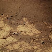
Hey, are these marks left my Oppy's wheels? I don't remember seing this before:
http://qt.exploratorium.edu/mars/opportunity/pancam/2009-07-18/1P301024992EFFA4FFP2514R1M1.JPG
Posted by: Fran Ontanaya Jul 19 2009, 11:02 PM
She has done that before. The bedrock isn't very rocky.
Posted by: Tesheiner Jul 20 2009, 06:35 AM
Check the navcams taken during sol 1950: http://qt.exploratorium.edu/mars/opportunity/navcam/2009-07-19/
There are a few mini-craters in sight. The one to the right (NW) was named "Alvin".
Posted by: Stu Jul 20 2009, 11:48 AM
Not sure which crater this is... taken my eye off Oppy during all the LRO drooling, I'll be honest!... but interesting...
And some nice little rocks for Oppy to snuffle around in, too...
Posted by: Tesheiner Jul 20 2009, 04:26 PM
That's Alvin. Here's a navcam mosaic made with those pictures to put it in context.
BTW, has anybody seen Cape St. Mary these last sols? Is it still visible?
Posted by: fredk Jul 20 2009, 05:00 PM
I've been watching Cape St. Mary (Beacon) in the rear view mirror. Our last definite sighting was sol 1942 navcam, though it was getting a bit hard to make out. I've marked it in this crop:
There've been north-pointing navcams since, but I can't make CSM out unambiguously (determining the exact azimuth might help). The lighting is bad (low contrast between sky and ground), but it may be that we're losing it due to topography. We're certainly no farther from CSM than we were at the last sightings.
The last good view was sol 1938 pancam:
http://marsrovers.jpl.nasa.gov/gallery/all/1/p/1938/1P300226447EDNA3PGP2286L1M1.JPG
edit: this pancam view is so good (at half resolution yet), that given favourable topography we should be able to see CSM for a very long time to come, even from Endeavour (at least from the higher peaks that were visible from Victoria).
Posted by: Tesheiner Jul 20 2009, 05:12 PM
There was an "albedo pan" taken during sol 1949 but I don't know if it's already downlinked or not. We should try locating the cape in those pancams; the heading is... (checking in Google Mars) ... 16 degrees CW.
And speaking again about the mini-craters, the one to the left is "Dolphin".
Posted by: dvandorn Jul 22 2009, 01:18 AM
Hmmm... how much of what looks like good flat pavement-stone rock from MRO is actually this kind of pile-up of (relatively recently-emplaced, at least recently enough not to have eroded down to flat yet) jumbled sandstone?
Hopefully, not a lot... ![]()
-the other Doug
Posted by: glennwsmith Jul 22 2009, 03:30 AM
Stu, very nice job on the small meteor craters. Can you imagine standing nearby when one of those babies hits?!? Any guess as to the size of the original meteorite? I'm thinking about 8 inches in diameter . . .
Posted by: Tesheiner Jul 22 2009, 11:10 AM
I just checked the info from yestersol drive (1952) to find out that Opportunity moved 20m back on her own track. ![]()
Not only that but also the nav/pancam images taken after-drive to plan the next one were pointed back towards the position she were on sol 1947.
Perhaps this path was not a safe one?
In another topic: the 17km mark was crossed near the end of this drive.
Posted by: alan Jul 22 2009, 11:38 AM
Going back for closer look at this perhaps?
From sol 1946, these images weren't downloaded until after she had driven on.
Posted by: Julius Jul 22 2009, 01:27 PM
What should we call that!?looks quite big to me? ![]()
Posted by: Tesheiner Jul 22 2009, 01:48 PM
It was named "Block Island".
01946::p2532::23::13::13::0::0::2::28::pancam_Block_Island_L234567Rall
Posted by: Floyd Jul 22 2009, 03:03 PM
Tesheiner, would it be possible put a label for Block Island on your map (even if too small to actually see on the map image)? I'm confused as to which crater it is sitting in front of. It isn't Alvin?
Posted by: fredk Jul 22 2009, 03:17 PM
"Block Island" is actually a ways south of the sol 1942 location:
http://marsrovers.jpl.nasa.gov/gallery/all/1/n/1942/1N300592418EFFA400P1962R0M1.JPG
(And it's roughly 25 cm tall.) So that would mean some significant backtracking if that were a target. I'm baffled by this reversal.
Edit: perhaps Oppy's gotten tired of seeing her destination in the rearview mirror:
http://marsrovers.jpl.nasa.gov/gallery/all/1/n/1949/1N301215360EFFA4NMP1760R0M1.JPG
and she's revolted! ![]()
![]()
![]()
Posted by: BrianL Jul 22 2009, 03:45 PM
Or this is a repeat of that programming glitch that made her go one way when she meant to go the other, although one would assume they got that issue sorted out.
I'm hopeful this is a sign that the Endeavour clays have become such a high-priority target that they have decided on the shorter, presumably quicker but riskier route to increase their chances of getting there before the overriding enemy that is time ultimately results in a critical system failure that will stop Oppy dead in her tracks. In other words, move from the philosophy that "south is the way to go, and IF we get to Endeavour, that's a bonus" to "we must reach Endeavour or die trying".
Posted by: Tesheiner Jul 22 2009, 05:02 PM
No way that it would be another instance of the "glitch". The evidence is the "post-drive" mosaics because they are pointing WSW, same as the driving direction.
I would expect some news on the next status report in a few days, unless someone in the know posts some tidbits here.
Posted by: Julius Jul 22 2009, 05:04 PM
So now we're sailing in the north atlantic along the northeastern US COAST...watch out for JAWS next! ![]()
Posted by: tim53 Jul 22 2009, 06:21 PM
Block Island is visible in the HiRISE image, meaning it's fairly large, which is one reason we're going back. Other reason(s) I'll leave up to the reader! (more fun that way!)
-Tim.
Posted by: fredk Jul 22 2009, 07:04 PM
I estimate Block Island is roughly 25 cm tall by 50 cm wide (orthogonal to our line of sight). That's assuming it's sitting at the same elevation as Oppy's wheels were, and also that the horizon was level with pancam. (Probably not horrible approximations on Meridiani!)
Could someone who has the full resolution HiRISE post a full res crop showing the area of Block Island? I estimate it's about 50 metres S or SSW from the sol 1942 location.
Posted by: Sunspot Jul 22 2009, 07:06 PM
Looks like a Land Rover stuck in the Sahara..... kind of
Posted by: SFJCody Jul 22 2009, 07:44 PM
Great news! ![]() This will take me more time to tweak my google earth map extension (it's proving trickier than i thought).
This will take me more time to tweak my google earth map extension (it's proving trickier than i thought).
Posted by: Reckless Jul 22 2009, 08:01 PM
Hi FredK
Here's a crop of the region I think you want.
I may be wrong, can't see the rock.
I can crop a different area if you wish.
Roy F
Posted by: tim53 Jul 22 2009, 08:25 PM
Roy:
It's in there!
-Tim.
Posted by: HughFromAlice Jul 22 2009, 09:22 PM
Would someone who can see where it is please circle it and repost the pic! Can't see it. ![]()
Posted by: tim53 Jul 22 2009, 09:35 PM
Posted by: djellison Jul 22 2009, 09:46 PM
I can well understand why we're going to have a look. Not only does it look different to all the surrounding rock - it's also, I'd guess, the single largest rock not in a crater that Opportunity has ever seen.
Posted by: SFJCody Jul 22 2009, 09:50 PM
Wow, that's a long drive back. Whatever it is that the rover team thinks this might be has got to be a lot more interesting than another iron meteorite!
Posted by: Tesheiner Jul 22 2009, 10:22 PM
Thanks for pointing the rock Tim. ![]()
Added it to the latest KML file in the http://www.unmannedspaceflight.com/index.php?s=&showtopic=681&view=findpost&p=143730.
Posted by: Drkskywxlt Jul 23 2009, 12:28 AM
Can someone summarize the reasons their taking the big west (almost northwest) turn? Is it more stable ground to drive on? Sorry if I missed this many pages back. Thanks!
Posted by: nprev Jul 23 2009, 12:48 AM
Hmm. Well, as Doug pointed out, BI is an anomaly in its own right even on cursory examination. However, Tim is hinting that there are other less obvious reasons for the close-up exam.
It sure is dark, which to me indicates that might be a relatively recent, hefty meteorite. On the other hand, it might be an ejecta block from a fresh impact in the area...say, maybe from over near the recently-more-interesting region near Endeavour? Are you guys looking for clay early? ![]()
Posted by: ElkGroveDan Jul 23 2009, 01:06 AM
Was there perhaps a tantalizing mini-TES image taken? Does it even work on Opportunity anymore?
Posted by: fredk Jul 23 2009, 01:22 AM
http://www.unmannedspaceflight.com/index.php?showtopic=6082&st=0&start=0
Posted by: serpens Jul 23 2009, 01:28 AM
So the attempt to clear the dusty mirror by leaving it exposed has failed?
Posted by: serpens Jul 23 2009, 02:50 AM
Glenn, the size would depend on the meteor type and velocity. Was this a secondary? Was it at terminal velocity or faster? The link takes a lot of the effort out of 'what iffing' this question.
http://www.lpl.arizona.edu/tekton/crater_c.html
Posted by: glennwsmith Jul 23 2009, 03:26 AM
Serpens, thanks for the link to the crater diameter calculator -- it is fascinating! And I am perhaps not so far off! A 0.2 m diameter meteor of dense rock (not iron), traveling at 45 km/sec (the upper end of the range for Mars impacts), and striking "competent rock" will create a crater 3.49 m (appx. 12 feet) in diameter.
But Block Island is even more fascinating!!! Is anyone sure that's why we've turned around?
Posted by: tim53 Jul 23 2009, 04:19 AM
Doug has it. It's the biggest thing not associated with a crater that we've seen. And it's not outcrop.
-Tim.
Posted by: nprev Jul 23 2009, 05:04 AM
Certainly reason enough. And there I was, spinning out into left field... ![]()
Posted by: glennwsmith Jul 23 2009, 05:06 AM
Alan, my man! What led you to this felicitous observation? Just your own curiosity about that big black rock?
Posted by: alan Jul 23 2009, 05:36 AM
Just thought 'hey that looks interesting' when MMB downloaded the images, that and 'too bad Oppy has already driven away'
I'm also wondering if it's located far enough south for Oppy to see some of the terrain to the south that's currently hidden from view.
Posted by: CosmicRocker Jul 23 2009, 06:47 AM
-Tim.
I thought there was a significantly larger "http://www.google.com/search?q=define:erratic" boulder observed near Erebus. Some here were surprised that that one was not more closely investigated at the time. I'm not suggesting that either was a glacial erratic, only that it was an erratic boulder on Mars.
Posted by: Burmese Jul 23 2009, 03:01 PM
But what took the team so long to decide to turn around and go investigate BI? Someone maybe took a second look at the downloaded images a few days after their initial evaluation and raised a big flag? Would have been interesting to be a fly on the wall during that ops meeting....
Posted by: fredk Jul 23 2009, 03:04 PM
Thanks for the maps, guys. I now measure the distance to BI to be 66 metres from the sol 1942 location. That gives a size for the rock of about 67 cm wide by 30 cm high.
The approximate size of BI would've been known before they moved away from the 1942 location - the navcams were down and the pancams were targeted. So I'm guessing that the spectral info from the BI pancam sequence was important in the decision to go back.
Do the oldtimers here remember another time that they turned back to study a target? There's been backtracking due to mobility problems, but I don't recall anything like this.
Posted by: fredk Jul 23 2009, 03:14 PM
To add to my post above, the BI pancam sequence only came down late Saturday. The sol 1950 drive was Sunday. So it would make sense that they didn't turn back till 1952 if the pancam sequence was the trigger.
Posted by: alan Jul 23 2009, 04:15 PM
They turned Spirit back on sol 454 when the layering at Methuselah was spotted while Spirit was attempting to drive up Husband Hill. Spirit then spent an additional two month's there.
http://marsrovers.jpl.nasa.gov/newsroom/pressreleases/20050524a.html
Methuselah:
http://marswatch.astro.cornell.edu/pancam_instrument/methuselah_new2.html
Posted by: centsworth_II Jul 23 2009, 04:20 PM
Is this the one?
From http://images.google.com/imgres?imgurl=http://farm1.static.flickr.com/34/70893123_9d10ef3a80.jpg%3Fv%3D0&imgrefurl=http://flickr.com/photos/hortonheardawho/70893123/&usg=__W38KrdV6k8o_Wylybpt8LcKyy1M=&h=500&w=500&sz=198&hl=en&start=1&tbnid=QtE4lU9Oc1lHQM:&tbnh=130&tbnw=130&prev=/images%3Fq%3Dhortonheardawho%2Bopportunity%2Bat%2Berebus%26gbv%3D2%26hl%3Den%26sa%3DG
Posted by: centsworth_II Jul 23 2009, 04:24 PM
There was talk of heading back to Erebus after leaving Victoria. At the same time, the talk was of studying cobbles out on the plain. I wonder if some on the team wished they had taken a closer look at that "erratic boulder" which looked like the Mother of All Cobbles to me.
Posted by: fredk Jul 23 2009, 05:41 PM
Thanks for finding that. That was viewed from the Olympia site. You can see from this image that it's maybe more of a rubble pile than a boulder:
http://marsrovers.jpl.nasa.gov/gallery/all/1/p/657/1P186511209EFF64KCP2283L7M1.JPG
I get around 40 by 17 cm size for it, so BI is a fair bit bigger.
Posted by: serpens Jul 23 2009, 11:21 PM
I think the only other time was for Paso Robles. But that was a short hop.
Posted by: fredk Jul 24 2009, 12:12 AM
http://marsrovers.jpl.nasa.gov/mission/status_opportunityAll.html#sol1947
Posted by: fredk Jul 24 2009, 03:53 AM
Could it be Alvin was a target near the crater? http://marsrovers.jpl.nasa.gov/gallery/press/opportunity/20090723a.html they seem to refer to that crater as "Kaiko."
Posted by: CosmicRocker Jul 24 2009, 04:15 AM
Yeah, I guess it is; but it appeared several times larger in my memory.
Posted by: glennwsmith Jul 24 2009, 04:24 AM
Drksywxlt, yes, the rovers have been sent on some seemingly roundabout routes to avoid bad ground, esp. since Oppy got stuck for several weeks in a sand dune. If there is one thing we have learned here at UMSF, it's that the rover team knows what it is doing.
Posted by: djellison Jul 24 2009, 07:01 AM
I guess in the category of 'turn back to go somewhere' - the traverse of the northern rim of Victoria, only to enter at the very point we arrived must count ![]() But there was a very good reason for that.
But there was a very good reason for that.
Posted by: climber Jul 24 2009, 07:25 AM
Yep, and that... the rovers don't
Posted by: Tesheiner Jul 24 2009, 08:18 AM
Mmm, strange...
There were two pancam shots taken at that site, the first named Alvin pointing to the crater at the NW (right) and the second named Dolphin pointing to another one at the WSW (left). Here's an MMB snapshot with the images in context.
01950::p2385::20::9::0::0::9::1::19::pancam_Alvin_L257
01950::p2386::20::3::0::0::3::1::7::pancam_Dolphin_L257
So, perhaps it should be named Alvin/Kaiko; both are vessels used in deep sea exploration.
Posted by: Tesheiner Jul 24 2009, 09:55 AM
Another interesting note in the http://marsrovers.jpl.nasa.gov/mission/status_opportunityAll.html#sol1947: "As of Sol 1952 (July 21, 2009), Opportunity's solar array energy production was 493 watt-hours with an atmospheric opacity (tau) of 0.462 and a dust factor of 0.559."
That's an almost 20% boost in energy production compared to the previous week (414 Whr). ![]()
Posted by: Phil Stooke Jul 24 2009, 11:00 AM
The crater namers forgot that they had already used the name Alvin. Check out the very first post in the Opportunity Route Map thread many years ago... So they had to re-name the crater.
Phil
Posted by: Tesheiner Jul 24 2009, 11:10 AM
Thanks for the info, Phil.
Time for another map update... ![]()
Posted by: Tesheiner Jul 27 2009, 01:24 PM
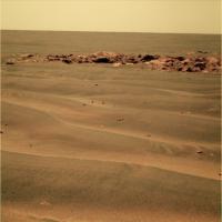
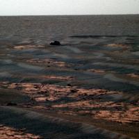
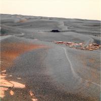
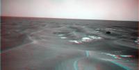
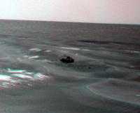
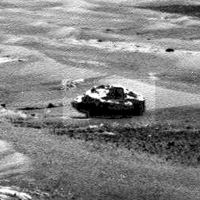
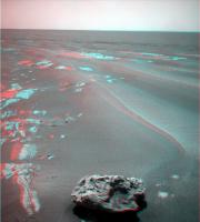
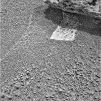
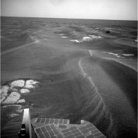
Here's our target "Block Island" in sight some 20m to the south.
We might get there in one driving sol and in position for IDD work in two more.
http://qt.exploratorium.edu/mars/opportunity/navcam/2009-07-27/1N301920678EFFA500P1985L0M1.JPG
Posted by: SFJCody Jul 27 2009, 04:38 PM
Two foreign forms on a sand ribbed plain
One low entropy
The other high
One moves
The other still
One itinerant
The other resident
One seeks
The other found
The seeker approaches
Posted by: BrianL Jul 27 2009, 08:36 PM
At this distance and angle, my mind is turning that object into a tiny boat being tossed about in the waves. ![]()
Posted by: Bobby Jul 27 2009, 08:56 PM
What are those Crab Fishermen from The Deadliest Catch doing here on Mars?
Are they trying to catch cobbles of crabs here? ![]()
Posted by: glennwsmith Jul 27 2009, 10:56 PM
SFJCody, your poem is clever and elegant. It calls to mind this one:
Ozymandias
Percy Bysshe Shelley
I met a traveller from an antique land
Who said: "Two vast and trunkless legs of stone
Stand in the desert. Near them on the sand,
Half sunk, a shattered visage lies, whose frown
And wrinkled lip and sneer of cold command
Tell that its sculptor well those passions read
Which yet survive, stamped on these lifeless things,
The hand that mocked them and the heart that fed.
And on the pedestal these words appear:
`My name is Ozymandias, King of Kings:
Look on my works, ye mighty, and despair!'
Nothing beside remains. Round the decay
Of that colossal wreck, boundless and bare,
The lone and level sands stretch far away".
Hope I am not duplicating the work of someone else who has been inspired by the Meridiani landscape to post this poem . . . (and Stu -- haven't digested your longer poem yet -- but to whom does "The hand that mocked them and the heart that fed" refer to, ie, can you diagram that sentence?)
And a related analog is, of course, the Rosetta Stone -- which is black -- and Block Island may prove to be a geological Rosetta Stone.
Posted by: Enceladus75 Jul 28 2009, 02:25 AM
The latest traverse map looks puzzling. ![]() Does this mean the Oppy team have now abandoned going West and will resume a route to the South?
Does this mean the Oppy team have now abandoned going West and will resume a route to the South?
Or is there some other reason for the U turn?
Posted by: centsworth_II Jul 28 2009, 03:13 AM
Go back to http://www.unmannedspaceflight.com/index.php?s=&showtopic=6102&view=findpost&p=143719 of this thread and read on from there.
Yes, the reason is to go back for a look at the rock, Block Island.
Posted by: Astrophil Jul 28 2009, 10:33 AM
Excuse the jumping in here, but... Shelley, I'd say, is using "survive" in the sense of "outlive". So, the frown shows that the sculptor did a good job of reading the passions of Ozymandias. Thanks to the dead stones they're carved on, these passions outlive both the hand that 'mocked' (imitated) them (ie the sculptor) and the heart that fed them (ie Ozymandias himself).
As glennwsmith says, it's a good poem for Mars.
Posted by: CryptoEngineer Jul 28 2009, 02:12 PM
This is probably a stupid question, but.....
Are meteorites on Mars actually interesting? I'm fully aware that BI may be a piece of deep ejecta, and appreciate why that would make it worth investigating, but the rovers have seen a couple well identified meteorites, and spent some considerable time going over them.
What can we learn from them that is different than what we would learn from meteorites on Earth?
CE
Posted by: Phil Stooke Jul 28 2009, 02:34 PM
What's especially interesting is how many there seem to be. If this is typical, it suggests a rich area of future sampling opportunities during human Mars exploration missions, especially looking for very rare types. Comparing the range of types found on Mars with those found on Earth may be interesting too.
Phil
Posted by: Poolio Jul 28 2009, 04:04 PM
True, but in http://www.unmannedspaceflight.com/index.php?s=&showtopic=6102&view=findpost&p=143741 Tim Parker suggests that there are other reasons as well. We'll just have to wait and see.
(BTW, whenever I see or hear any reference to Ozymandias, all I can think of is Graham Chapman stumbling around drunk in Monty Python's http://www.ibras.dk/montypython/episode41.htm episode. A bit unfortunate...)
Posted by: djellison Jul 28 2009, 05:29 PM
Other reasons we're going to the rock (other than it being big). Not that there are other reasons to go in that direction.
Posted by: PaulM Jul 28 2009, 05:38 PM
Are meteorites on Mars actually interesting? I'm fully aware that BI may be a piece of deep ejecta, and appreciate why that would make it worth investigating, but the rovers have seen a couple well identified meteorites, and spent some considerable time going over them.
What can we learn from them that is different than what we would learn from meteorites on Earth?
CE
I suspect that each time a cobble is investigated it is hoped that it is not a meteorite but rather a rock from some distance away on Mars. Opportunity has studied hundreds of rather simillar local Meridiani rocks and so a rock from elsewhere on Mars is of great interest.
Such a rock is Bounce Rock which was found by Opportunity in April 2004. The rock was named for the fact that it was struck by Opportunity as the craft bounced to a stop during its landing stage. Bounce Rock bears a striking resemblance to a class of meteorites found on Earth known as shergottites, that are believed to have originated from Mars:
http://en.wikipedia.org/wiki/Bounce_Rock
I think that the Mars rock which would be of most interest would be another fragment of the formation of which the Antarctic meteorite AH84001 formed a part:
http://en.wikipedia.org/wiki/Allan_Hills_84001
The large meteorite which blasted AH84001 into space presumably blasted another million fragments of this formation into space. At least one of these fragments must currently be lying on the plain of Meridiani.
I understand that the most interesting meteorites of all would be fragments of the Earth close to 4 billion years old. Metamophism has severely altered all rocks of this age on Earth but it has been suggested that fresh fragments of Earth rocks of this age could be found on the Moon or Mars.
Posted by: fredk Jul 28 2009, 05:52 PM
How can we be sure? Even if the ejecta from the AH84001 impact spread globally over Mars, what would be the surface number density of ejecta pieces large enough for Oppy to study, as a function of distance to the impact antipode?
Posted by: centsworth_II Jul 28 2009, 07:52 PM
The rocks did not become "well identified" until after going over them. An assumption that a rock is a meteorite before inspection could turn out to be wrong. More is learned about the geology of Mars if the rocks turn out to be Martian, but I guess the crater counters are interested in the number of surviving meteors on the surface.
Posted by: centsworth_II Jul 28 2009, 08:31 PM
It would be as interesting as Bounce rock: A piece of Mars from far away. I wonder if Opportunity would even be capable of detecting the carbonates in AH84001.
My vote for most interesting rock would be a chunk of limestone.
Posted by: glennwsmith Jul 28 2009, 11:08 PM
Astrophil, I think your reading is correct -- thanks!
Cryptoengineer, you make a good point re value of Block Island as a meteorite vs. piece of ejecta. But it's hard for us space junkies to ever think about a meteorite as anything but way cool -- even laying on the surface of Mars.
Posted by: Stu Jul 28 2009, 11:52 PM
If ever you want proof of how cool a meteorite is, take a piece of Canyon Diablo (the meteorite that blasted out Meteor Crater) into a school classroom full of 6 year olds and let them hold it... "That's from space... it fell from the sky 50,000 years ago...!" Wow...! Then let them hold a piece (or in my case some VERY small pieces!) of a Mars meteorite... "... and that's from the planet Mars..." Cue eyes wide as saucers and a mouth formed into an amazed "o" shape...
Priceless... ![]()
Posted by: PDP8E Jul 29 2009, 01:52 AM
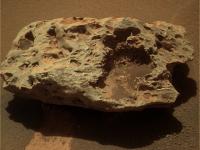
nothing much happening .... so a super zoomed image of Block Island ...hyper processed
(zounds! the jpeg artifacts are awful!)
oh well...
Posted by: CosmicRocker Jul 29 2009, 05:21 AM
I understand that the most interesting meteorites of all would be fragments of the Earth close to 4 billion years old. Metamophism has severely altered all rocks of this age on Earth but it has been suggested that fresh fragments of Earth rocks of this age could be found on the Moon or Mars.
What a far-out thought! Those possibilities had not occurred to me, though they should have. Thanks for mentioning that, Paul.
Posted by: serpens Jul 29 2009, 06:24 AM
Given that any ejecta from an Earth impact would be going the wrong way in the gravitational well, what would be the probability that it could have the kick off velocity necessary to reach the orbit of Mars? And since Mars sweeps a greater orbit than Earth, wouldn't this further diminish the possibility of impact? Given the resouces available on site, how could we identify the provenance in any case?
Posted by: centsworth_II Jul 29 2009, 07:25 AM
The following is a study reported in 1989 which references previous studies.
http://www.thefreelibrary.com/Have+Earth+rocks+gone+to+Mars%3F-a07502179
"According to S.A. Phinney... kicking a rock hard enough to free it from Earth's gravity would require a meteorite capable of making a crater more than 60 miles across. In addition, Mars' orbit is much larger than Earth's, so the chance of an Earth rock hitting Mars is about 10 percent that of the same thing in reverse....
...The group found fewer particles seemed likely to get to Mars than suggested by some previous analyses."
Posted by: SFJCody Jul 29 2009, 08:32 AM
Looks like an iron meteorite. But a very intimidating one with a strange hole in one side. I hope it doesn't bite!
http://qt.exploratorium.edu/mars/opportunity/navcam/2009-07-29/1N302095661EFFA5ARP0713L0M1.JPG
Posted by: djellison Jul 29 2009, 08:35 AM
That is a big ass chunky lump of metal I think. It'd be worth a fortune if it was on Earth ![]()
Posted by: remcook Jul 29 2009, 08:38 AM
Looks like the Beagle-2! *ducks and runs*
Posted by: serpens Jul 29 2009, 09:36 AM
I don't think I would stake my paycheque, small as it may be, on that identification just yet.
Posted by: Ant103 Jul 29 2009, 09:52 AM
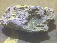
A very incomplete color view of the meteorite ![]()
http://www.astrosurf.com/merimages/Opportunity/2009/1P302095577EFFA5ARP2536RCoul.jpg
Look like they anticipated the shot after the move but the rock is not in the box. Or this is just a part of a mosaic.
The aspect of this rock looks very similar to Heatshield Rock.
Posted by: PaulM Jul 29 2009, 11:35 AM
The first article that I read which discussed the idea looking for Earth rocks on the Moon described the 2002 "Perspectives in Astrobiology" conference:
http://science.nasa.gov/headlines/y2002/18oct_earthrocks.htm?list82388
I remember first reading about extending the search for Earth rocks to Mars at around this time.
At the 2006 "Lunar and Planetary Science Conference" it was suggested that Earth rocks could have been flung as far away from Earth as Titan:
http://www.newscientist.com/article/dn8867-earth-rocks-could-have-taken-life-to-titan.html
Posted by: PDP8E Jul 29 2009, 01:22 PM
A report on Block Island by the Mini-TES would be conclusive...
in the meantime...it looks like its either a dusty iron meteorite or coprolite ![]()
Posted by: djellison Jul 29 2009, 01:29 PM
It would be astonishing - Mini-TES doesn't work anymore.
Posted by: Phil Stooke Jul 29 2009, 01:52 PM
Not too shabby, Stu! I like the little projection casting a shadow into the big pit.
Phil
Posted by: Nirgal Jul 29 2009, 02:43 PM
looks like another iron meteorite similar to:
http://en.wikipedia.org/wiki/Bounce_Rock
http://www.jpl.nasa.gov/news/news.cfm?release=2005-018
http://www.spaceref.com/news/viewsr.html?pid=20976
...
------------------
“It's drive, drive, drive,” said Squyres. ![]()
![]()
![]()
Posted by: diane Jul 29 2009, 02:44 PM
Wouldn't a meteorite of that size make a crater?
It's just sitting there on top of the sand.
Posted by: Stu Jul 29 2009, 03:09 PM
It could just be sitting here after coming from elsewhere; maybe it's a small piece of a larger meteorite that landed a few km away, scattering fragments over a wide area. It does look pretty beaten up.
Posted by: ngunn Jul 29 2009, 03:10 PM
Maybe the surface it landed on has ablated away, crater and all. How long do lumps of iron last on Mars?
Posted by: centsworth_II Jul 29 2009, 03:11 PM
Bounce was not an iron meteorite. It was ejecta from a Mars crater.
Posted by: Phil Stooke Jul 29 2009, 03:11 PM
Nirgal - Bounce Rock resembles rocks found on Earth as meteorites, but on Mars it's an ejecta block. It's not made of iron.
Phil
Posted by: centsworth_II Jul 29 2009, 03:17 PM
What ngunn said: If it is an iron meteorite, the crater it made many millions of years ago would have long since eroded away leaving behind only the "indestructible" chunk of iron. If the impact was recent enough for the crater to still exist, the meteorite would be invisible, buried beneath the floor of the crater.
Posted by: PDP8E Jul 29 2009, 03:36 PM
as far as cratering, I am sure the physicists and meteorite guys will weigh in , but we now have two pretty hefty meteorites (assuming that Block Island is one) that were found lying at the surface within 10 kilometers of each other and within the rover's vision... that is a significant observation.
as for the reasons....
angle of attack, speed, did it bounce or fragment? and the crater is covered over now...are any of the small craters in the near vicinity possibly related? Far away craters related? how long have they been sitting there? if you have 2 big meteorites every 10 sq miles, how many are lying on the surface of the planet? These few questions are from a multitude, that if answered well, will earn someone a PhD in Planetary Geology one fine day.
Posted by: centsworth_II Jul 29 2009, 04:43 PM
The crater no longer exists. If it did, the meteorite creating it would be buried beneath it.
Remember that a significant amount of material has been worn away from the surface that Opportunity is roving over. The layer of "blueberries" lying on the surface were eroded out of a layer of rock that is long gone. The crater was in that rock, or some other long gone layer.
Posted by: MarkG Jul 29 2009, 06:20 PM
Remember that a significant amount of material has been worn away from the surface that Opportunity is roving over. The layer of "blueberries" lying on the surface were eroded out of a layer of rock that is long gone. The crater was in that rock, or some other long gone layer.
The possibility exists of a history of ice coverage at Meridiani, where it is possible that any impact crater in that ice would have since sublimed away, leaving the meteorite intact.
Posted by: CryptoEngineer Jul 29 2009, 06:38 PM
Priceless...
I don't doubt that at all. I think meteorites are way cool. But I didn't see that we could learn much from a meteorite on Mars that we couldn't have learned from much-easier-to-study meteorites on Earth. There have been a couple interesting suggestions since I posted my question:
- They sample metoroids from a different part of the Solar System.
- They may preserve material from other bodies, such as the early Earth, the Moon (and presumably Io, etc).
Thanks for the responses. The photos I see of BI today really do look like an iron or stony-iron meteorite to my untrained eye.
CE
Posted by: ustrax Jul 29 2009, 06:40 PM
How big would be the crater caused by a pretty thing like Block Island?
Looking at the image at a first glance I had the impression of seing a circular pattern with what? help me here...70, 100mts? BI and bigger dunes stay in the center, I'm probably seing too much and this doesn't make any sense at all...
Here's what I mean, sorry but the only available tool is Paint... ![]()
EDITED: I can distinguish it better in http://www.unmannedspaceflight.com/index.php?act=attach&type=post&id=18511
Posted by: serpens Jul 29 2009, 11:33 PM
On this sandblasted plane Block Island is large enough to have caused local wind variations and isn't it possible that the larger ripples in the immediate area could be attributable to this rather than crater remnants? If BI is ejecta rather than an asteroidal meteorite then the impact could well have been at terminal velocity for Mars or less. No more than 1 km/s? That wouldn't punch a particularly large hole. We could even be looking at ejecta from Victoria. So even if it does have the composition of an iron meteorite, if it is a fragment spalled from the Victoria meteorite on impact it would again have hit at less than terminal velocity.
If it is a Victoria impactor fragment spalled on impact and ejected does that make it ejecta or meteorite? ![]()
Posted by: centsworth_II Jul 30 2009, 01:24 AM
My impression is that Victoria is too old for anything spalled from it's impactor to be lying on the current surface. Weren't we speculating a while back that Victoria* was formed before the hundreds of meters of sediment that Opportunity is traveling over were laid down?
*edit: Oops, getting my craters mixed up.. That was Endeavor. But the speculation on Victoria was that it was so old that it has been covered over and uncovered by deposition and erosion, still making it impossible that the current surface could be the surface on which part of it's impactor fell.
Posted by: nprev Jul 30 2009, 01:44 AM
Actually, I think that's really the key concept to understanding the Meridiani meteorites. It doesn't seem like we see much exposed bedrock aside from regions near craters or between dunes. I get the impression that the environment is similar in one respect to Antarctica or glacier tops: the surface gets buried & exhumed periodically, and quite often what isn't sand or snow turns out to be meteoritic.
If this model's true, then these meteorites are probably all one-shot unrelated objects & not secondary artifacts of larger impacts.
Posted by: glennwsmith Jul 30 2009, 01:53 AM
And in line with the drift (pun intended) of Nprev and others, would it be correct to think that an iron meteorite is less likely to shatter on impact than a stony meteorite, and prove more resistant to a billion years or so of subsequent sandblasting?
Posted by: serpens Jul 30 2009, 04:49 AM
The line of demarkation between impact ejecta and the pre existing sandstone is pretty clear at Victoria. In places the breccia is almost eroded away. So wouldn't the surface away fropm the annulus be pretty much at the level it was at the time of impact?
Posted by: CosmicRocker Jul 30 2009, 05:34 AM
Of course. It seems likely that there would be more impact ejectites of Martian origin on earth than those of an earthly origin on Mars, but it is nice to know that some may be out there. For me, it is more exciting to think that our moon may be littered with early earthly ejecta, since that external body is so much more accessible to sample discovery and collection. On Mars, existing resources able to identify provenance are limited, but future instrumentation is in the pipeline.
Posted by: Shaka Jul 30 2009, 05:56 AM
Now, there's an interesting comparison, Tom.
How does the discovery rate of meteorites by the MERs compare with that of the Apollo moonwalkers? ![]()
Are there lessons here for learning, or is it "apples vs. oranges"?
Posted by: ElkGroveDan Jul 30 2009, 07:16 AM
Strictly speaking, our moon IS early earthly ejecta.
Posted by: PaulM Jul 30 2009, 11:37 AM
How does the discovery rate of meteorites by the MERs compare with that of the Apollo moonwalkers?
Are there lessons here for learning, or is it "apples vs. oranges"?
So far as I know none of the rocks collected by the Apollo astronauts have been identified as meteorites from elsewhere. However, this does not mean that every sample of lunar regolith has been examined for small fragments of exotic rocks.:
http://meteorites.wustl.edu/lunar/regolith_breccia.htm
I believe that many of the contributors to UMSF are geologists working for universities. Presumably NASA would respond favourably to those geologists if they requested a few ccs of lunar regolith to look for exotic rock fragments. Perhaps in the Apollo samples somewhere there is a tiny fragment of an Earth meteorite.
Perhaps a "moondust@home" web site could be set up along the lines of the "stardust@home" web site where members of the public could scrutinise a million fragments from the lunar regolith looking for something interesting.
EDIT: One implication of looking for fragments of Earth meteorites in samples of the lunar regolith is to prove that the Earth rock actually came from the Moon and did not represent contamination back on Earth. To overcome this problem the investigation would have to be done in clean room conditions.
(Admin edit. It's best to not cite this place as umsf dot com, as that's actually a functioning, different website that google will pick up on. Just UMSF - or the full URL, but don't turn the acronym into a URL)
Posted by: john_s Jul 30 2009, 03:07 PM
Mars does of course have the advantage of an atmosphere, so hand-specimen sized meteorites can survive their arrival intact. Meteorites of any size hitting the moon are going to be mostly vaporized on impact.
John
Posted by: centsworth_II Jul 30 2009, 03:57 PM
So you're saying that when a crater is buried and subsequently revealed, ejecta and possibly detached pieces of the impactor would be covered and revealed just as the crater is, thus recreating the scene at the time of impact. Sounds good to me, but the process would also reveal all chunks of iron that had fallen to the surface after the crater was formed. The final result would be a removal of all soft material deposited since the crater's formation with a concentration of all resistant material -- berries and iron meteorites. There would be no way of telling if a chunk of iron on the surface fell at the time of the crater's formation or millions of years afterward.
Posted by: Fran Ontanaya Jul 30 2009, 06:25 PM
Perhaps the distribution of fragments around it can tell the story of what happened to the crater, if there was one.
If there was a solid ground that got eroded, maybe they would have piled up due to cracks or slopes.
Posted by: Shaka Jul 30 2009, 07:54 PM
John
Ah yes, of course, even sand grain sizes impact at hypervelocities. Any remains would be mostly minute. I suppose the old studies (1970's) of bulk lunar regolith found a proportion of nickel-iron particles representing such residue. There's no apples vs oranges comparison, just an apples vs. "apple pollen grains".
Posted by: MarkG Jul 30 2009, 08:11 PM
The surface of BI seems to show some signs of atmospheric friction melting (among the pits/vesicles), which puts some constraints on its trajectory. The fact that it survived impact means that it was most like a grazing trajectory (or low-angle secondary). Or so it seems. When we get some composition hints, we will know a bit about how strong this rock is.
Posted by: Stu Jul 30 2009, 08:32 PM
Some musings on martian meteorites here if anyone wants a look...
http://cumbriansky.wordpress.com/2009/07/30/great-martian-meteorites
Posted by: nasaman58 Jul 31 2009, 01:34 AM
Does this look like a meteorite to anyone else? My second thought is weathered basaltic rock to give it that texture.
http://marsrovers.jpl.nasa.gov/gallery/all/1/n/1959/1N302095661EFFA5ARP0713R0M1.HTML
Posted by: centsworth_II Jul 31 2009, 02:30 AM
Latest pancam of http://marsrover.nasa.gov/gallery/all/opportunity_p1959.html, and a reminder ofhttp://marsrover.nasa.gov/gallery/all/opportunity_p346.html
They look suspiciously similar.
Posted by: Shaka Jul 31 2009, 03:14 AM
Two chips off the old block! ![]()
Guess we should get back to the westward trail.
Posted by: CosmicRocker Jul 31 2009, 04:12 AM
Good point, Dan. I can't help but wonder if any parts of the moon escaped melting and homogenization in the event.
Oh, yeah. That changes everything. There are not going to be many macroscopic samples of early earth on the moon. That's a good argument for a sample-return mission to Mars.
Posted by: SFJCody Jul 31 2009, 08:10 PM
http://qt.exploratorium.edu/mars/opportunity/pancam/2009-07-31/1P302280187EFFA5B8P2390L5M1.JPG
Wow, the pits are full of blueberries!
That means that Block Island must have been buried and then exhumed by erosion- just like terrestrial desert meteorites found on deflation surfaces!
Posted by: Phil Stooke Jul 31 2009, 08:14 PM
Maybe - or it might have had showers of ejecta from the small local craters scattered over it from time to time, with the fines blown away and the coarser stuff left behind.
Phil
Posted by: SFJCody Jul 31 2009, 08:22 PM
Good point. Do you think there is there any kind of test that could be done to distinguish between these two possbilities?
Posted by: nprev Jul 31 2009, 08:27 PM
Definite metallic glints apparent as well in this shot; Pasadena, we have an iron-nickel meteorite! ![]()
Phil, I can buy the ejecta covering/exhumation idea for transporting the blueberries up there. The average thickness of the dust layer (dunes excluded) doesn't seem to be more than 50 cm or so (if that) and am beginning to suspect that this thickness has been steady-state over the past billion years or so. The rate of deposition from normal atmospheric fallout is at equilibrium with the rate of erosion...until something big goes splat & buries an area for awhile.
Posted by: Shaka Jul 31 2009, 08:39 PM
The spheres on BI seem to be more uniformly small in size than the populations on the adjacent plain. It would be nice to have MI's of both to see if they have undergone similar degrees of weathering. ![]()
Posted by: nprev Jul 31 2009, 08:56 PM
Yeah, I noticed the apparent blueberry size constraints on BI too, Shaka. My best guess is that IF they were put there by ejecta then the big 'uns tend to get blown off more easily since they present more surface area to the wind. The little ones are concentrated in the hollows.
Easy way to check that idea, maybe: Is there an enrichment of larger blueberries immediately surrounding BI?
Posted by: Ant103 Aug 1 2009, 01:12 AM
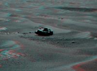
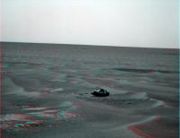
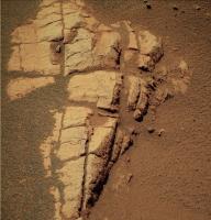
And here is the color views ![]()
http://www.astrosurf.com/merimages/Opportunity/2009/1P302273103ESFA5ARP2537LCoul.jpg
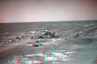
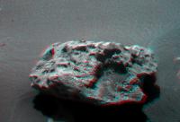
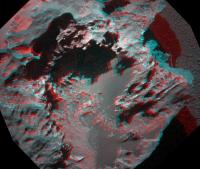
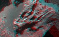
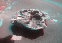
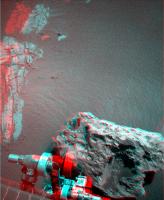
The anaglyph (dedicated to Stu ![]() )
)
http://www.astrosurf.com/merimages/Opportunity/2009/BlockIsland-Sol1961-ana.png
And a closer view with the mosaic :
http://www.astrosurf.com/merimages/Opportunity/2009/BlockIsland-Sol1961-mosaic.jpg
For sure, a very beautiful rock! Very close to HSR.
Posted by: nprev Aug 1 2009, 01:22 AM
Ant, what can I say but WOW!!!! Fantastic, absolutely gorgeous!
I'm especially intrigued by that sort of crystalline-looking structure just above & to the slight right of the big hole...a sharp metal shard?
EDIT: Ant, I defaced your beautiful work in MS Paint to add a circle around the feature I was referring to.
Posted by: CosmicRocker Aug 1 2009, 04:12 AM
Awesome imagery, Ant103. ![]() Thanks.
Thanks.
The first thing that comes to my mind would be a survey of the meteorite's surfaces, studying the three dimensional distribution of blueberries and other sediments in its hollows.
Looking at the distribution of berries apparent in the latest imagery, it seems that the largest berries have collected in the lowest hollow, with smaller concretions at slightly higher elevations. There are very few, if any, visible in the highest hollows. We can't yet see into the hollows around the sides of the meteorite. I can think of several ways to interpret the available observations.
Posted by: john_s Aug 1 2009, 02:50 PM
Beautiful! I'm struck by the contrast between the smoothly rounded left (leeward?) side of the rock and the rougher, pitted, right (windward?) side, indicating that even metal can be eroded by wind-driven grains on Mars. The raised rims around a couple of the "vesicles" inside the big pit are also interesting- do they indicate that the "vesicles" are intrinsic structures and not just erosional features?
John
Posted by: MarkG Aug 1 2009, 03:34 PM
Block Island Ramblings...
Well, Block Island seems to be significantly metallic, with possible stony inclusions (I'm basing this on appearance). The many vesicles seem to be gas bubbles from the ancient solidification, although some of them could be from inclusions that have since evaporated/dissolved/eroded away. The raised rims around some of the vesicles indicates something inside the vesicles reacted with the structure of the meteorite and made that surface slightly more resistant to erosion.
The vesicles could have been refilled for a time after the meteorite fell, with ice, Meridiani sulfur-salt goo, dust, or whatever.
The elaborate filigree structure around the big pit indicates a hard material with tensile strength (metallic), and it looks like it is being slowly eaten away chemically. The filigree structure could also represent a fine-grained soft component in the metallic matrix that is being preferentially eroded.
Looking forward to microscopic images.
The presence of 'blueberries' in the hollows could be remnants of previous burial, and/or wind-driven deposits from an episode where Mars had more atmosphere.
There we go, enough opinionated ramblings to power Oppy for a day, at least!
-- MarkG
Posted by: centsworth_II Aug 1 2009, 03:57 PM
Block Island seems to be sitting on the flat, rocky layer of Meridiani like it was just placed there. If BI at some point had been buried in layers since eroded away, I would expect to see it either sitting in a depression or up on a pedestal. On the other hand, I don't see how it could drop on the surface as it is with no sign of an impact mark.
No depression or pedestal to indicate layers being eroded from around BI, no sign of an impact on the current surface....
I'm confused.
Posted by: SFJCody Aug 1 2009, 05:01 PM
Couldn't they be regmaglypts that have been subsequently enhanced by eolian erosion?
Posted by: dvandorn Aug 1 2009, 05:14 PM
If BI has been eroded by chemical means, is that not something of a confirmation of a highly acidic water table in the area (admittedly, long ago)?
-the other Doug
Posted by: Fran Ontanaya Aug 1 2009, 05:27 PM
Would a big dune be enough to damp the impact before it touched the bedrock? I imagine that, even if the bedrock was damaged, as long as the meteorite was embedded above it, a seasonal water table could have erased the crater before Meridiani dried, the dune was blown away and the meteorite was left on top.
Posted by: glennwsmith Aug 1 2009, 05:43 PM
Stu, thanks for the great review of Rover meteorite finds. And no wonder you're the poet laureate -- from the Lake Country!
SFJCody, in line with your thought on regmaglypts enhanced by aeolian erosion, and extending the same idea to John_S's windward and leeward sides, I am imaging that I can see remnants of an orientation -- bleeding edge on the right -- as Block Island roared through the Martian atmosphere.
Another truly remarkable find by Opportunity! Who would have predicted that it would find, not one, but two picture-perfect iron-nickle meteorites (if that proves to be the case) on the surface of Meridiani?
Posted by: JayB Aug 1 2009, 06:44 PM
BI is very cool...but now we're here I'm waiting for "the other reason"
Block Island is visible in the HiRISE image, meaning it's fairly large, which is one reason we're going back. Other reason(s) I'll leave up to the reader! (more fun that way!)
Posted by: ilbasso Aug 1 2009, 08:35 PM
What about the meteorites that they find in the Antarctic? Don't they frequently find ones just sitting on the surface, with no impact crater? Are there similar aeolian erosion and ice sublimation processes at work over a prolonged period?
Posted by: djellison Aug 1 2009, 08:55 PM
You might be. I'm not. You're miss-interpreting Tim, as I explained earlier.
Posted by: Shaka Aug 1 2009, 09:41 PM
Ilbasso,
Antarctic meteorites mostly represent lag deposits left behind by melting and evaporation of the ice cap they were previously embedded in. They got into the ice after entering the atmosphere, which slowed them to terminal velocity - from maybe 12 kilometers per second down to only 0.1 km/s, more or less. They hit the ice cap or snow without enough energy to make a proper crater or significantly damage themselves. Subsequent snows buried them in the cap and they rode it as far as the dry valleys or other erosion zones where they were lag deposited centuries/millenia later.
It would be premature to postulate a similar ice cap deposition and concentration mechanism for Meridiani, but Block Island need not be sitting on the same surface it originally hit. Erosion could have removed that ages ago. Still, if Oppy had the ability, it would be fascinating to turn BI over and closely examine the bottom and the underlying bedrock for scars of impact.
Posted by: Stu Aug 1 2009, 10:01 PM
Thanks Ant, great work! I missed the new BI pics coming in "live" 'cos we were away camping, again, but back now and having fun with them. This is my fave rock for yonks, and not just 'cos I was getting stir crazy looking at mile after mile of undulating dust ripples... :-)
And amazing structure in the "hollow"...
Posted by: Stu Aug 1 2009, 10:05 PM
... oh, and if you thought the "Yeti" got the tin foil hat wearers excited, wait til they see this HR Giger beauty...
Posted by: MarsIsImportant Aug 1 2009, 11:10 PM
IMHO, this is one of the most important finds for opportunity so far. Why?
...Not because of the iron nickle meteorite. It's because the blueberries in the hollows appear to have been formed basically in place! That is an important clue as to the origin of the blueberries.
Like Antarctica, I'm willing to bet that this meteorite originally landed when a substantial layer of ice was near the surface. The now gone crater was in the ice. Aeolian forces spread dust from the atmosphere into the hollows. Interaction between the dust and the ice created the blueberries over a very long time. Wind eventually blew out the blueberries in the upper hollows. The blueberries in the lower hollows remained somewhat shielded and stayed basically in place. The ice sublimated and left the meteorite on the present surface.
This meteorite almost confirms the newest theory of the icy formation of the blueberries!...In My Humble Opinion. Of course we need a few tests before we accept this explanation, but I think it is a sound one.
Posted by: Shaka Aug 2 2009, 01:03 AM
![]() Imaginative, to be sure, though I can't say I'm convinced.
Imaginative, to be sure, though I can't say I'm convinced.
What, pray tell, is the "newest theory of the icy formation of the blueberries"?
What "few tests" did you have in mind?
Posted by: Hungry4info Aug 2 2009, 01:41 AM
I don't suppose wind could have blown blueberries into the shallow depressions in the rock?
Posted by: alan Aug 2 2009, 01:51 AM
No depression or pedestal to indicate layers being eroded from around BI, no sign of an impact on the current surface....
I'm confused.
There is a part of pedestal visible on the lower left, the rest may be hidden under the ripple. Easier to see in this R721 image
Posted by: CosmicRocker Aug 2 2009, 05:13 AM
It's interesting to see how differently people are interpreting this fascinating rock.
It clearly displays regmaglypts, but I doubt the deepest hollows can be explained as erosionally enhanced regmaglypts. I'm not sure it is appropriate to call them vesicles, either. I'm siding with a previous commenter who suggested that some hollows may be due to inclusions which subsequently corroded or eroded away. I think the deeper pits on the right side of the rock and the surrounding "filigree" features may be mostly primary structures.
It is interesting, however, that certain features seem to be aligned with the current wind regime in this region. I'm not sure how to interpret that. Has the morphology of this meteorite been shaped by recent winds on Mars, or is it due to the winds experienced by the intruder as it entered the atmosphere? If I had to interpret the morphology of this meteorite as being formed by its flight through the atmosphere, I'd suspect the leading edge was on the left.
Finally, regarding the pedestal, good catch, alan. A remnant like this is likely to protect a pedestal beneath it, but this most recently protected pedestal is not likely to have been the first pedestal this lagging boulder has perched upon.
Posted by: MarsIsImportant Aug 2 2009, 08:25 AM
I doubt that is possible given the atmosphere of Mars is too thin. Even if the atmosphere was tens times as thick when this meteorite landed, it would still be too thin to lift those berries vertically on top of the rock. The only plausible way I can think of is for the meteor having been buried and then excavated at a later date.
The simplest explanation is something similar to what I conjectured in my previous post. Certainly other things could have happened, but they would require a lot more complications. Perhaps other meteor strikes threw the berries onto this rock. But if that is the case, then explain why they are so uniform.
If you are unfamiliar with the icy formation theory, then I am surprised. It was all over the news. I don't have a link immediately handy; but I will look for one.
Here is one story that mentions it:
http://www.space.com/scienceastronomy/090216-mm-mars-ice.html
Another more detailed story is in Nature but it is archived now and you have to have a subscription to view it.
There are others. I'll mention good links on the theory as I have an opportunity. (didn't mean to create a pun)
Here is a better one that explains more. I wish I could find the original paper on the topic.
http://www.universetoday.com/2009/02/16/new-theory-bizarre-martian-deposits-from-vast-ice-at-mars-equator/
(Three consecutive posts merged - ADMIN)
Posted by: MarsIsImportant Aug 2 2009, 09:05 AM
Combine the fact that the axis of Mars has shifted many times in the past with this little tidbit...
http://www.universetoday.com/2007/12/20/maybe-sulfur-dioxide-not-carbon-dioxide-kept-mars-warm/
...and you have the makings of a possible viable alternative theory that incorporates water ice into the equation. It might also explain why the concretions don't grow beyond a certain size.
Posted by: nprev Aug 2 2009, 09:33 AM
Sweet anaglyph, Stu!
BI is captivating, visually. That microcavern alone is crazy spectacular!
I literally wouldn't touch this side of it (if that was possible), though; all those shards look quite sharp & "snaggy".
(Me in spacesuit: "Ooo!!! Cool rock! <reaches out...> YEOW!"
Spacesuit: "Sssssssss.....")
Posted by: Stu Aug 2 2009, 09:40 AM
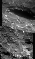
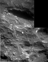
Glad you liked the 3D view ![]() This really is a fascinating object. I think we may well be here for some time. I really am looking forward to seeing what the other side of BI looks like, and a peek underneath would be interesting too. In the meantime, here are the first MI images put together.
This really is a fascinating object. I think we may well be here for some time. I really am looking forward to seeing what the other side of BI looks like, and a peek underneath would be interesting too. In the meantime, here are the first MI images put together.
Posted by: remcook Aug 2 2009, 10:58 AM
Very interesting object! And pretty too!
What cause the criss-cross linear features in the MI images? Some for of crystalization in the meteorite? Are these common?
Posted by: Ant103 Aug 2 2009, 11:36 AM
Yeah, very good anaglyph Stu ![]() .
.
Here is an other view, a 4 frames mosaic showing the immediate surrounding of BI :
http://www.astrosurf.com/merimages/Opportunity/2009/BlockIsland-Sol1961-pano.jpg
PS : happy to see that you appreciate my last pics ![]() .
.
Posted by: serpens Aug 2 2009, 12:26 PM
Could Block Island be a mesosiderite (stony iron meteorite)? Yes they are rare, but that would explain much of what we see. Burial on impact, exposure to acidic groundwater, exhumation and eolian erosian producing yet another Mars mystery to ponder.
Posted by: tfisher Aug 2 2009, 12:57 PM
As the block island meteorite seems very similar to heat shield rock, the discussion regarding impact scenarios for HSR probably applies without much change. See http://www.lpi.usra.edu/meetings/lpsc2006/pdf/1431.pdf for some detailed analysis, which comes to the conclusion that it must have come in at a pretty low angle to arrive in one piece, even in a range of martian atomospheres from today's thin version to a much thicker past version. So however recently it landed, it would have been expected to ricochet and not be near an impact feature from its initial hit.
Posted by: Phil Stooke Aug 2 2009, 01:20 PM
Marsisimportant: "The simplest explanation is something similar to what I conjectured in my previous post."
Phil: "That's odd - I would have said exactly the same, but about MY previous post"
Yes, the simplest explanation is that they were thrown there as ejecta from the many small craters like Dolphin that occur all over the region. I agree that ice is possible, but it requires a change in the current environment. Ejecta doesn't. In fact, even if there were blueberries on the rock left from its icy past (if it had one), they should now be joined by ejecta-deposited blueberries.
Phil
Posted by: centsworth_II Aug 2 2009, 01:39 PM
Besides ejecta and ice, what about the possibility that BI was buried, through deposition, in the rock (not ice) layers in which the berries later formed and berries were left on it just as they were left on the rest of the Meridiani surface as the layers eroded away? And also, the possibility that BI impacted in and buried itself in berry-containing material which was later eroded away.
Posted by: serpens Aug 2 2009, 01:51 PM
Yep, the simplest and most logical explanation.
Posted by: john_s Aug 2 2009, 02:15 PM
Looks like a http://en.wikipedia.org/wiki/Widmanstätten_pattern to me!
Fascinating...
John
Posted by: glennwsmith Aug 2 2009, 03:37 PM
tfisher, thanks for the link to the Lunar and Planetary Science article. It raises the possibility in my mind that Heat Shield and Block Island are part of one and the same fall . . .
Posted by: SFJCody Aug 2 2009, 04:02 PM
Rather than BI being encased in the rock, couldn't it have been slowly buried by migrating ripples at a time when Meridiani had thicker drift deposits than are currently there today?
Fast-forward to today and the really fine-grained material has blown away leaving much smaller ripples (and Block Island) with a surface cover of blueberries.
Posted by: Phil Stooke Aug 2 2009, 04:53 PM
I think all of these mechanisms are possible. Deciding between them will be the hard part.
Phil
Posted by: centsworth_II Aug 2 2009, 05:22 PM
Who knows?
BI could have been covered by migrating ripples that moved on or covered by ripples that were in turn covered and eventually hardened into rock, later to be eroded away.
If BI is REALLY old, it may have lived through a combination of the possibilities being discussed here.
Posted by: Ant103 Aug 2 2009, 08:41 PM
Maybe OT but I wanted to show you an inspiration that make me the scenery just arround BI. I love to incrust 3D letters in realistic way, like the http://www.artofthetitle.com/2008/03/26/panic-room/ ![]() .
.
http://www.db-prods.net/blog/wp-content/uploads/2009/08/blockisland-letters-insert.jpg
Thanks for the correction Nprev ![]()
Posted by: Floyd Aug 2 2009, 09:47 PM
Stu, Clearly triangleform writing of the Widmanstatten variety. Giger is a visionary.
Posted by: Shaka Aug 2 2009, 10:17 PM
(Three consecutive posts merged - ADMIN)
Ah, OK! You were referring to the Niles-Michalski "icy test tubes model". I suspected as much, but had to allow that there might be some recent publication I hadn't seen yet that actually related blueberry formation with ice. Unlike the Niles-Michalski paper.
We did discuss this previously in the http://www.unmannedspaceflight.com/index.php?s=&showtopic=5823&view=findpost&p=137038. There Paul Niles himself assured us that their model did not account for blueberry formation, but was concerned with the formation of the characteristic sulfate deposits of the Meridiani bedrock prior to the diagenesis of concretions. Niles conceded that the MER team's original scenario of blueberries concreting at regularly-spaced intervals within the deposited sulfate sandstones (after the icy phase) fit with the observations. That scenario does not predict concretions forming in closely-packed layers such as we see on Block Island. Such aggregations would only occur by advection of the blueberries after formation.
Posted by: Ant103 Aug 2 2009, 10:30 PM
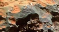
A colorized mosaic of the MI based on the top view of BI :
http://www.astrosurf.com/merimages/Opportunity/2009/BlockIsland-Sol1963-ColorMI.jpg
Posted by: nprev Aug 2 2009, 10:32 PM
Ant, VERY cool marker for BI; I'm sure that the MER Memorial Park Authority will emplace something just like that in a few hundred years...
One correction, and definitely not a criticism: The word is spelled "block", defined roughly as a solid, often massive piece of material in this context. "Bloc" is also an English word usually meaning a political or social coalition.
Again, no criticism implied; I know that English often sucks like this! ![]()
Posted by: alan Aug 2 2009, 11:20 PM
Any of the rockhounds have an explanation for the small gray patches? Are they due to the surface layer being worn off or are they due to variations in composition?
Posted by: SteveM Aug 3 2009, 01:32 AM
The criss-cross lines don't quite look like a Widmanstätten pattern. They have a less crystalline appearance and seem rounded and have something that looks like droplets near the ends.
Let me suggest two more possibilities:
* A Widmanstätten pattern was modified by melting during atmospheric entry.
* Widmanstätten patterns have nothing to do with it, and we're looking at flows of viscous melt during different phases of entry.
Steve M
Posted by: serpens Aug 3 2009, 01:46 AM
I initially though that this could be a Mesosiderite which would explain the deep cavities, but on reflection these cavities and the pronounced etching of the surface are most easily explained by initial burial of the meteorite and exposure to the acidic groundwater proposed by JPL. And there is an example of this process available.
http://en.wikipedia.org/wiki/Willamette_Meteorite
In fact this meteorite could well be the definitive smoking gun supporting the JPL theory for Meridiani and finally putting the surge alternative to bed. (As I duck for cover I wish we had an emoticon with a crash helmet).
Posted by: CosmicRocker Aug 3 2009, 05:00 AM
I'm not a meteorite expert, but regarding the possible Widmanstatten patterns, this would be the first time I've seen them exposed on a naturally weathered, meteorite surface. The geometry of these features seems right, but I would expect the patterns to be more repetitive, if you know what I mean.
I think I see what you're saying, serpens. Since we normally etch iron-nickel meteorites with acid to expose their Widmanstatten structure, the fact that this naturally weathered, Martian meteorite may be displaying such internal crystallinity on its surface suggests that it may have been exposed to an acidic environment in its past. Interesting.
Block Island was definitely worthy of the effort to go to back for a second look. I never dared to dream that I might, one day, be able to explore another world like this. What a ride this has been!
Posted by: MarsIsImportant Aug 3 2009, 06:07 AM
We did discuss this previously in the http://www.unmannedspaceflight.com/index.php?s=&showtopic=5823&view=findpost&p=137038. There Paul Niles himself assured us that their model did not account for blueberry formation, but was concerned with the formation of the characteristic sulfate deposits of the Meridiani bedrock prior to the diagenesis of concretions. Niles conceded that the MER team's original scenario of blueberries concreting at regularly-spaced intervals within the deposited sulfate sandstones (after the icy phase) fit with the observations. That scenario does not predict concretions forming in closely-packed layers such as we see on Block Island. Such aggregations would only occur by advection of the blueberries after formation.
I understand the caution and doubt from a scientific perspective. But you have to start somewhere. You take a bit of speculation and develop it to come up with a hypothesis that can be tested. That's all I've done.
The blueberries need acid to form, but that wouldn't last long in this soil. That suggests a mechanism other than simply groundwater must have played a part. If SO2 from volcanism played a significant part in atmospheric warming instead of the normally accepted CO2, then interaction of dust and atmosphere to make the necessary acid on top of the glacial ice field is a possibility. In fact, its a high probability that this scenario is the correct one because of the sulfates found...yet no limestone deposits have been discovered anywhere on Mars.
Was there groundwater? Of course. If there was glacial melt and sublimation, then there must have been ground water too. But groundwater alone cannot explain all the variables found in the soil at Meridiani. Ice and atmospheric interaction provides a convenient method over an extended period of time to change the top layers of the soil from basic to acid and back to basic again.
The fact is that we don't know how the blueberries were formed. Figure out the real conditions present eons ago, and we might have a chance to figure out exactly how the blueberries developed.
Posted by: serpens Aug 3 2009, 07:19 AM
But a simpler explanation is a groundwater playa in a basaltic environment with a period of volcanism that created an acidic aquifer that overcame the natural buffering until the acidification influence diminished and the natural buffering took over again.
Posted by: MarsIsImportant Aug 3 2009, 07:40 AM
But the distribution of of the berries does not suggest this. In fact, multiple cycles of basic, acid, basic, acid, basic, acid, and basic are suggested because the berries are through all the layers. One prolonged period would have created berries similar to Earth examples...meaning a lot larger and a different distribution.
Why do people continue to fight the obvious? The martian climate has changed drastically in certain ways. A water table appearing and disappearing as you suggest is just another type of climate change, but no less dramatic. So if the climate changed in one way, why not in an alternative way that can explain things? All the ingredients were present. It is just a question of form.
Mars was warmer in the distant past. There was liquid water present at one time or another. Today liquid water cannot exist on the surface of Mars for long because of the thin atmosphere. Is it such a leap of logic that the once liquid water must have gone somewhere, like became frozen near the surface, before it eventually migrated through sublimation to the current poles? And we know for a fact that those poles were not always Mar's poles.
Posted by: djellison Aug 3 2009, 09:26 AM
If you want to have an argument about the history of Meridiani, can you start a new thread please.
edit : I see someone decided to ignore this request. Post deleted. Twice.
Posted by: stevesliva Aug 3 2009, 04:44 PM
What's the prevailing wind direction indicated by the smoothed edge of this rock? It's interesting that the dunes to the east seem to have a longer wavelength. Wake effect?
Posted by: alan Aug 3 2009, 05:49 PM
[quote name='Stu' post='144234' date='Aug 3 2009, 11:30 AM']How big is Block Island? I make it very roughly this size...
It looks like its being held over someones head. Block Island is a foot high and at least two feet across, probably weighs nearly half a ton. It would be more realistic to show someone crushed underneath it.
Posted by: climber Aug 3 2009, 08:45 PM
I thought "you" were not able to convert foot to metrics, I see now you're not even able to make a difference between hand and foot ![]()
![]()
Posted by: Stu Aug 3 2009, 09:48 PM
Anyone else out there guess I wasn't going for "realism"? haha! The hand is simply there for scale!
Posted by: MarsIsImportant Aug 4 2009, 01:34 AM
Well, I guess you could make it a 3D animation where BI is rotating on your index finger like a Harlem Globetrotter's basketball!
Posted by: Fran Ontanaya Aug 4 2009, 04:13 AM
Playing with an image registration tool and the last MI images.
Posted by: Marz Aug 4 2009, 03:13 PM
Looks like a high percentage of metallic minerals reflecting so much light. Seems like these are fairly common on Mars. Are Iron-Nickel meteors more common on Mars because of proximity to the Asteroid Belt, or are meteors preserved due to lack of weathering and other geologic forces that allow them to concentrate on the surface much more than Earth?
Posted by: Stu Aug 4 2009, 04:23 PM
Struggled to align this pair accurately, so apologies in advance for any migraines induced... ![]()
Posted by: dvandorn Aug 4 2009, 07:48 PM
Yes.
Seriously, both functions are probably at work, here. We really don't have the best handle on relative impact rates (as sorted by size and class of impactor) at Earth v. Mars, but it's a decent bet that there is a higher density of potential impactors as you approach the main Belt. And while it hasn't been proven yet, it also appears that this particular hunk of metal was buried for a long time and has since been re-exposed due to the aeolian deflation of the upper rock layers at Meridiani. That has a similar preservation effect that you see with meteorites that land in Antarctica, are buried in ice for very long periods, and are then thrust back to the surface via one or more of a variety of processes.
-the other Doug
Posted by: Shaka Aug 4 2009, 08:21 PM
Rather nice little http://www.newscientist.com/article/dn17553-beachballsized-rock-is-largest-meteorite-found-on-mars.html?full=true on Block Island from New Scientist. Apparently the APXS has confirmed the iron-nickel ID.
Written by one Maggie McKee - indications that she reads UMSF, or do we know her by some other nom de web?
One questionable item: she says Heat Shield rock has been renamed Meridiani Planum!? That's what it sits on, right? ![]()
Posted by: PDP8E Aug 4 2009, 08:50 PM
Shaka,
Meteorites are 'usually' named after the location they are found...locality name, followed by regional information -etc.
(its because geologist rock naming conventions were stretched to cover meteorites)
For example:
* Allan Hills (ALH) 88070 meteorite, Victoria Land, Antarctica
There is a link in the story that brings you here:
http://tin.er.usgs.gov/meteor/metbull.php?code=32789
Cheers
Posted by: Shaka Aug 4 2009, 09:12 PM
Ah, so desuka! Thanx, PD; I guess that means BI will also be named Meridiani Planum, as well as any others Oppy finds? ![]()
So we have to tell them apart by the following number?
ZOUNDS! I think I'll stick with the unofficial names. ![]()
Posted by: HughFromAlice Aug 4 2009, 09:54 PM
Migraine :-( ? Moving my 3D (Dinosaur viewing!!!) glasses a few cms away from my face gave me pleasant unstrained viewing - really good depth :-) !
Posted by: djellison Aug 4 2009, 10:12 PM
So Heatshield Rock should be MP040001 ![]()
Posted by: marsophile Aug 4 2009, 10:37 PM
(its because geologist rock naming conventions were stretched to cover meteorites)
It makes sense to use that identifying nomenclature when the object has been removed from its place of discovery. It seems to make less sense when it has been left there (as is the case here) because of the greater potential for confusion.
Posted by: PDP8E Aug 5 2009, 01:02 AM
what i found interesting was the 'flag' in the bulletin near the end showing where it was found!
check it out:
http://tin.er.usgs.gov/meteor/metbull.php?code=32789
I poked around and then I found this:
http://en.wikipedia.org/wiki/Flag_of_Mars
I guess Emily sewed it on her lap by the flickering light of the fireplace over the winter.... ![]()
*** EDIT: to all you confused emailer's, that was a Betsy Ross (USA flag designer) reference...
Posted by: CosmicRocker Aug 5 2009, 05:36 AM
That makes sense to me, Doug, but when comparing the theoretical impact rates of Earth and Mars, it seems that the trajectories of in-falling meteorites would tend to converge near the sun. Since Earth orbits closer to the center of the system than Mars, would one not expect a higher density of in-falling meteor trajectories to pass near Earth's orbit? Surely this has been modeled by someone.
Posted by: nprev Aug 5 2009, 06:04 AM
Don't forget our good friend Jupiter's influence on meteoroid flux. I suspect that the true situation is more complex than it appears.
Posted by: Fran Ontanaya Aug 5 2009, 09:17 AM
Aren't second chances more common in Mars? Earth may deflect more near misses.
Also, the early Earth-Moon system could have had a barycenter in open space.
Posted by: centsworth_II Aug 5 2009, 07:27 PM
From http://www.planetary.org/news/2009/0731_Mars_Exploration_Rovers_Update_Spirit.html (last sentence):
“Block Island is big enough,” Arvidson said, “and has the characteristics that might tell us something about more recent weathering history than we've been able to retrieve so far.”
This may have been before they knew it was a metallic meteor. Weathering effects on Mars would be overlain on effects of the meteoric plunge through the atmosphere -- a challenge to interpret.
Or is the best information of recent weathering history gotten from the pedestal on which the meteorite sits? That pedestal is a remnant of a surface that no longer exists over the surrounding area.
The simplest scenario I can envision is a meteor crashes into Meridiani, burying itself beneath its crater. Then, over the years, the crater is worn away, revealing this meteorite. Over yet more years the surrounding plain is worn down, raising BI up on a pedestal. Perhaps, as CosmicRocker said, this is not the first such pedestal. Perhaps BI has fallen from previous pedestals as they were worn from beneath it, like walking down a flight of stairs.
While there has been net removal of material from Meridiani since BI's arrival, there may also have been periods of deposition. I wonder if it can be determined if BI arrived before, during, or after the period of blueberry formation.
Posted by: MarsIsImportant Aug 6 2009, 12:14 AM
Several people have mentioned a pedestal underneath this meteorite. Nor do I see one on any previous discovered meteorite. I've searched and don't see it. Alan mentioned the possibility of a previous pedestal but that area simply looks like possible chemical weathering to me.
I highly doubt that there would be aeolian produced pedestals on on any of these rocks. The atmosphere is far to thin to expect such a thing. If there really is a pedestal, then that would suggest major atmospheric change over the years. Perhaps it could have been produced by repeat 'surges', but I doubt that seriously (more likely to have simply covered the whole thing up).
Show me the pedestal because that would be a big discovery.
Posted by: alan Aug 6 2009, 04:41 AM
Take a closer look at the image quoted in centsworth_II 's post. The exposed bedrock, which is flat outside the shadow, turns nearly vertical a short distance into the shadow. Or look at the http://www.unmannedspaceflight.com/index.php?s=&showtopic=6102&view=findpost&p=144103 posted by Ant103
Edit: here is a brightened version of the anaglyph
Posted by: James Sorenson Aug 6 2009, 05:05 AM
If this is a pedestal, and the the likelihood of the meteorite being exhumed by the wind, would this confirm that this meteorite landed at this exact spot as a secondary? or carried by some other fluid process to this spot (i.e.Glacial ice), and sat here disturbing the local bedrock by just the weight, berried, then uncovered? If this meteorite was thrown to this spot as a secondary, could this pedestal (assuming that it us one) provide any sort of trajectory information (by looking how the bedrock is disturbed) about which direction it came from, possibly narrowing out out what crater it came from?
Posted by: centsworth_II Aug 6 2009, 05:07 AM
Looking for the first time at images of BI, I thought there was a flat curve of exposed pavement leading up to the left side of the rock. When alan posted his image, I looked again and it did indeed seem that a pedestal curved up and away from the surface.
Wishful thinking? Is it obvious to most out there that there is a pedestal (or not), or is it still an open question?
Posted by: CosmicRocker Aug 6 2009, 05:18 AM
I was guessing that they might be looking at the large, gaping pit on the right side of BI for recent weathering evidence, but you raise some good points, 2CentsWorth. I guess we'll have to watch to see where the IDD's instruments go.
I thought it was apparent in the image alan posted, but it really would be best if it could be seen in a 3D image. I think some early morning and late evening hazcam imagery could help in that regard, but alan's brightened ant103 anaglyph does the job nicely.
How can you doubt recent aeolian erosional processes on Mars, MarsIsImportant? It is true that the atmosphere is thin, but several of us have posted time lapse imagery of sandy ripples advancing at rover locations during dust storms. Both rovers have captured images of multitudes of eroded rock faces that would be difficult to interpret as anything but eroded by the wind. Recall the eroded blueberries on stalks at Fram crater and other locations. Remember the wafer-thin beds perched in the air where Opportunity was stalled near the walls of Erebus?
Posted by: centsworth_II Aug 6 2009, 05:27 AM
I don't understand how BI could be a secondary. If secondaries are defined as fallout from an impact, then virtually all secondaries on Mars would be martian rocks, which BI is not.
If the meteor broke up in the atmosphere (do iron meteors break up?), all the pieces would still be primaries, no? If the meteor broke up on impact, the vector of all the pieces would still be down, wouldn't it? I don't see how a high speed impact would result in any part of the impactor reversing direction and shooting out of the crater. Admittedly, I am no expert on these matters.
Posted by: centsworth_II Aug 6 2009, 06:15 AM
I'm not so sure anymore. I don't know what the anaglyphs look like, but here the evidence for a pedestal is the sharp edge of the light rock to the right of the yellow line. It looks like the discontinuity between a pedestal's vertical face and loose surface material in the background. However, looking to the right of the orange line, it seems there is a continuous layer of loose surface material leading up to BI. Even if you imagine the light rock to the left of the orange line to be curving up as a pedestal, it is hard to imagine the loose material to the right of the orange line also curving up the face of a pedestal.
The rugged, cliff-like texture of the light rock under BI adds to the impression of a pedestal, but that is mostly due to the contrast and brightening adjustments needed to look into the shadow.
So the edge of the light rock along the yellow line looks like it could be a pedestal but the edge along the orange line does not. I'm starting to think the pedestal may just be wishful thinking after all.
Posted by: James Sorenson Aug 6 2009, 07:00 AM
The 3D images at least to me, show the bedrock material thrust upwards and supporting at least some weight of the meteorite (speculation), as if it impacted that way.
EDIT: Here is a better, High-contrast/brightend version of Ant's 3D image. Its without a doubt this is a "pedestal". The more I look at it, the more I see it as ether impact related or could also be weathered to. Note how the layers of the bedrock bends in conform with how the rock is thrust up. Hmmmm!!!
Posted by: MarsIsImportant Aug 6 2009, 11:17 AM
That's not a pedestal. It is the kind of broken pavement we have seen all over Meridiani. If there is a pedestal it has not been imaged yet.
Wishful thinking? Yes, thinking that was a pedestal was wishful thinking. It is an illusion.
As far as erosion is concerned...of course there is minor aeolian erosion happening on Mars. But that does not mean the forces are powerful enough to create a erosional pedestal. Most of the movement is picking up small grains and transporting them elsewhere. And when that happens the larger of the small grains generally only move a few inches.
Posted by: djellison Aug 6 2009, 01:04 PM
Just look at the aeolian sculptures around Home Plate. The Aeolian erosion may be 'minor' - but it has been happening, almost unimpeded, for billions of years. Do not underestimate its potential.
Posted by: CryptoEngineer Aug 6 2009, 02:46 PM
I'm trying to picture how such a pedestal could form.
(Warning - non-geologist talking here)
A pedestal exists because the capping object modifies things in a way that slows down erosion of the material underneath it. Most typically, on Earth, it protects against rain. That's not happening here.
But: If the entire surface is deflating due to aeolian erosion, you could still get a pedestal: if the iron meteor is much more resistant to erosion than the rock surface it is laying on, it protects the surface it is laying on from erosion from above. That protected rock can only be eroded from the side, as the deflation of the surrounding surface drops below the level the meteor is resting on. As the erosion works inwards, it leaves the meteor perched on the pedestal, until it becomes too thin, or the material under the meteor's center of gravity erodes, at which point it topples off and the process starts over.
Have I got it right?
It seems to me that if we really aren't sure if this is a pedestal or not, there's an easy way to find out: Spirit has been using its MI to get some notion as to what's going on underneath it. Oppy could use it to get a worms-eye view of the base of BI, and see if there is daylight around the edges of BI.
CE
Posted by: marswiggle Aug 6 2009, 03:34 PM
Throwing in a crosseyed image about the supposed pedestal, a crop of the L2 & R2 raw image pair. Not corrected or enhanced in any way. I'm seeing a raised edge at the left side of the outcrop, but as others said we need a better view before making any conclusions.
Posted by: Floyd Aug 6 2009, 05:46 PM
MI Remember that all the bays of Victoria were carved by aeolian erosion. As Doug pointed out, the process goes slow, but in 10's or 100's of millions of years, mountains of material can be eroded away.
Posted by: Phil Stooke Aug 6 2009, 07:30 PM
I would have said those bays were formed by collapse - landslides probably localized by fractures. Wind just moves the debris around a bit.
Maybe the hazcams show the underside of the rock well enough to reveal its shape. - EDIT: the sol 1959 FHAZ images don't seem to show any pedestal.
Phil
Posted by: Fran Ontanaya Aug 6 2009, 09:06 PM
What I see is a little lump, and maybe some hollow space before it, as if the rock tipped. The rock isn't resting on it.
Posted by: MarkG Aug 6 2009, 09:47 PM
RE: BI pedestal, etc....
Over the billion year (+-) life of this landscape there have been occasional hard shakes due to tectonic or impact earthquakes. This would certainly topple any pedestal and otherwise alter the resting of BI. This factor needs to be considered. As an aside, this type of short-term-rare but long-term-likely seismic shake would affect surface cracking in general...
(another side question: why haven't we seen any more "Anatolia" types of gaping cracks snaking across the landscape?)
Sometimes strange things can happen. I recall an article about boulders creeping across a dry lake bed in the California desert. Turns out that with a little rain, the super-concentrated brine acted as a grease, and the desert winds could blow the rocks across the lake bed.
Posted by: HughFromAlice Aug 7 2009, 02:12 AM
Stitch of latest - sol1967 - Block Island MI images. Especially for you geologists to enjoy!!
1 (Posted below) - With min brightness, contrast and intensity adjustment from originals - Full size 1.4M at http://www.flickr.com/photos/kililpi/3797029362/
2 (Not posted here) - With BCI adjusted to give best bottom 2/3rds pic - on my screen! - Full size 1.4M at http://www.flickr.com/photos/kililpi/3797027720/
Posted by: PDP8E Aug 7 2009, 02:55 AM
pedestal or not....(cont.)
here is a pancam view that has been processed using a (slightly modified) classic CLAHE technique
(seeing in shadows)
* The transition from shadow to light has a processing illusion that makes the shadow look depressed (ignore it)
* The other observation is that the jpeg compression in the uniform dark shadow becomes very apparent as the histogram is equalized...
my interpretation is that this just a pavement chunk that we have seen all over the planum. The pavement takes a jog to the left under BI so that it appears to be a vertical structure (i.,e. pedestal from the camera's POV) if you put your finger over that left jog under BI the illusion goes away and it looks like pavement. I am fairly confident that the left jog does not touch BI.
Another image from a different angle (move the rover) will add more data
...your mileage may vary...
cheers
Posted by: CosmicRocker Aug 7 2009, 06:14 AM
It seems to me that if we really aren't sure if this is a pedestal or not, there's an easy way to find out: Spirit has been using its MI to get some notion as to what's going on underneath it. Oppy could use it to get a worms-eye view of the base of BI, and see if there is daylight around the edges of BI. ...
I don't know if you've got it right or not, but your analysis is pretty much the way I see it. The imagery available is provocative, but we can't be certain that the feature being discussed is truly an erosional pedestal, protected by its http://www.google.com/search?q=define:Caprock. I like your idea of using the MI for a closer inspection, but it would be very unusual for the team to use the MI for a task it was not designed for. I think it would also be quite surprising to see them using the rover to intentionally study "geomorphic" processes on Mars.
One would have to suspect that an overlying, resistant rock would tend to protect its base from aeolian erosion, but aside from this rock, we really haven't seen any other obvious pedestals beneath other resistant rocks in the region, or have we?
Posted by: nprev Aug 7 2009, 06:32 AM
I'm going to jump on PDP's bandwagon, actually; that paving stone does look like it jogs to the left, and the underside illumination is tricky enough to play perspective tricks. More data definitely needed, though.
Re studying "geomorphic" features: CR, I think that if in fact this is a pedestal that would indeed be a significant finding worth detailed examination since it could tell us some things about the gross history of Meridiani. Not a Rosetta Stone by any means, but if the overall 'floor' has eroded since BI's been in place (however long THAT is) that would pose the question of why it's so generally uniform & level everywhere else we've seen. Eolian erosion usually doesn't produce flat surfaces; it removes it from one place & piles it up elsewhere (so I'd expect BI to have a tail dune). Furthermore, that might mean that even the local weather patterns have been extraordinarily constant for a very long time, and that might have some implications for the cyclical climate theories.
Posted by: centsworth_II Aug 7 2009, 03:42 PM
Whether it occurred before or after BI arrived, I thought the presence of the layer of loose berries on the surface indicated a meter or so of rock which once contained the berries having been worn away. Am I wrong in assuming that the loose berries indicate a 'proven' removal of about a meter of rock from Opportunity's stomping grounds (according to the mainstream hypothesis)?
Posted by: dvandorn Aug 8 2009, 12:40 AM
I thought the theory here was that the northern plains (where Oppy landed) are blueberry-paved deposits formed as you described, with the deflation of a good meter or so of soft sulfate-rich sandstone that halted when the freed concretions provided an anti-aeolian "armor." The remains of the sulfate rock that was blown away composes the extensive ripple structures to the south (through which we're currently traveling). This terrain didn't have as many concretions buried in its sandstone layers, and so never developed the full armoring. Instead, ripple structures protect the remaining sandstone paving in the ripple fields from further erosion.
-the other Doug
Posted by: fredk Aug 8 2009, 06:14 PM
Here's my attempt at an anaglyph from the sol 1961 pancam closeup of the big jagged pit:
This included a 20.7 degree relative rotation. The result still isn't perfect, but hopefully I've minimized headaches from viewing this...
Posted by: Stu Aug 9 2009, 10:47 AM
Based on pics and Google Earth files posted in the Opportunity route thread, is Block Island just visible on a HiRISE image at full mag..?
Posted by: djellison Aug 9 2009, 11:02 AM
Yes - it is - after all, Tim said it was ![]()
Posted by: HughFromAlice Aug 9 2009, 11:48 AM
Really good - great sense of depth. Those two stalks sticking out at the bottom look really fragile. There's a couple or so more smaller similar structures around the edge of the hole. Fascinating. Anyone, any idea what sort of erosional processes might have been responsible?
Posted by: Stu Aug 9 2009, 11:54 AM
Must have missed that post, sorry.
Posted by: erpol Aug 9 2009, 01:14 PM
What are the HiRISE guys waiting to take a shot with Oppy?
Ok. Back to lurking...
Ermanno
Posted by: centsworth_II Aug 9 2009, 02:57 PM
I wonder if they started as products of the plunge onto Mars. Streamers of molten iron refrozen before impact. Or perhaps they were formed during the creation of the original asteroid. Of course, weathering on Mars would have taken place as well.
Posted by: centsworth_II Aug 9 2009, 03:16 PM
http://www.unmannedspaceflight.com/index.php?s=&showtopic=5853&view=findpost&p=144505 But you're right, an MRO image of Opportunity at BI would be great.
"The powerful Mars Reconnaissance Orbiter (MRO) unexpectedly switched to its redundant Side B computer and subsystems before entering a protective safe mode on Thursday....'Taking the spacecraft back out of safe mode is one of the earlier steps in resuming full science operations, which is expected to take several days,' Webster added."
Posted by: jamescanvin Aug 9 2009, 04:56 PM
Catching up with recent drive direction mosaics.
All these link to the same page
Sol 1910
http://www.nivnac.co.uk/mer/index.php/dd_1910-47
Sol 1912
http://www.nivnac.co.uk/mer/index.php/dd_1910-47
Sol 1920
http://www.nivnac.co.uk/mer/index.php/dd_1910-47
Sol 1942
http://www.nivnac.co.uk/mer/index.php/dd_1910-47
Sol 1946
http://www.nivnac.co.uk/mer/index.php/dd_1910-47
Sol 1947
http://www.nivnac.co.uk/mer/index.php/dd_1910-47
James
Posted by: jamescanvin Aug 9 2009, 05:36 PM
And the Reeds Bay Pan:
http://www.nivnac.co.uk/mer/index.php/reeds_bay
James
Posted by: Stu Aug 10 2009, 04:46 PM
C'mon guys, show us what's on the other side... and the underside...! ![]()
Posted by: fredk Aug 10 2009, 04:52 PM
In case anyone missed it, from http://twitter.com/marsroverdriver/status/3178906030 they may be considering just that:
Posted by: Stu Aug 10 2009, 04:57 PM
What's to discuss? Oppy's sat at the corner of "No" and "Where", next to the biggest, most gorgeous frakking meteorite seen during the whole mission, surrounded by mile after mile of (bleep) all... what else are they gonna do? ![]()
Seriously, I know it's not a priority, and they have a lot of things to consider. The meteorite collector, rock hound and martian tourists in me are all just desperate to see the whole thing. ![]()
Posted by: Floyd Aug 10 2009, 07:06 PM
Clearly should be called South America! ![]()
Posted by: Nirgal Aug 10 2009, 09:58 PM
"Drive, Drive, Drive" Squyres said.
"Opportunity is going for the home run of Endeavour Crater."
http://www.planetary.org/news/2009/0131_Mars_Exploration_Update_Spirit_and.html%20
Our final destination is still 15 kilometers away ... and many more un-seen wonders are waiting to be studied there
SCNR
Nirgal
Posted by: fredk Aug 11 2009, 02:34 AM
There's a lot of interesting info about BI in the http://marsrovers.jpl.nasa.gov/newsroom/pressreleases/20090810a.html For example, in relation to Rocker's comment above,
Also,
"Consideration of existing model results indicates a meteorite this size requires a thicker atmosphere," said rover team member Matt Golombek... "Either Mars has hidden reserves of carbon-dioxide ice that can supply large amounts of carbon-dioxide gas into the atmosphere during warm periods of more recent climate cycles, or Block Island fell billions of years ago."
Posted by: glennwsmith Aug 11 2009, 03:55 AM
Yes, unlike many a press release, the JPL press release cited by Fredk is WELL worth while. And Alan, you have bragging rights for some time on UMSF -- that dark rock off to the South of Oppy's path has turned out to be quite a find!
Posted by: CosmicRocker Aug 11 2009, 05:17 AM
Considering that the meteorite is sitting on a sandy, wind-swept plain, it's logical to assume the patterns were etched by blown sand. I had never seen an example of an Fe-Ni meteorite displaying Widmanstatten structure on a naturally weathered surface, but http://marsrovers.jpl.nasa.gov/gallery/press/opportunity/20090810a.html from that press release contains a nice example found on Earth, on which they say the pattern was enhanced by sand-blasting.
I was hoping that the two hypotheses, abrasive wind blasting and acid etching, might be distinguished with the tools available to the rover. After doing a little digging around, it appears that is going to be difficult. The pattern essentially exists because of alternating crystalline layers of two minerals, taenite and kamacite. The pattern can become visible due to differences in their acid solubilities or their resistances to aolian erosion. It appears that kamacite's hardness is 4, while that of taenite is 5 to 5.5. Kamacite is also more soluble in acid solutions than taenite. The bottom line is, kamacite layers should be eroded or corroded more deeply, regardless of whether acid solutions or blowing grains were the cause.
Posted by: SFJCody Aug 11 2009, 08:41 AM
There's an interesting discussion of BI http://www.mail-archive.com/meteorite-list@meteoritecentral.com/. Look for the thread that starts out titled 'Must-see Martian in 3-D'.
Posted by: HughFromAlice Aug 11 2009, 01:55 PM
I've finally bitten the bullet and done a colour image - I worked on SAmerica but I reckon it's just about worth having another version of, even if it's my first try. Colour looks quite good on my screen!! There's certainly a lot to learn - but it's heaps of fun....and to have fresh Mars pics to do it with!! With the likes of James, Ant, Stu, Astro0 (to mention a few!) there's high standards to aim for..... thanks for inspiring me you guys.
Will try to post now and again when I get time.
Posted by: PDP8E Aug 11 2009, 03:24 PM
Awesome job Hugh! crisp, colorful, and relevant!
Thanks for sharing!
Posted by: HughFromAlice Aug 11 2009, 08:32 PM
Thanks PDP8E! I'll definitely try and do a post or two when I can. Midnight Mars Browser makes it so easy to grab and review MER pics.
Posted by: Stu Aug 11 2009, 09:32 PM
Just got back from work and saw your pic Hugh. Good job! :-)
Posted by: MarsIsImportant Aug 11 2009, 09:52 PM
This always amuses me. ![]() People generally see what they want to see.
People generally see what they want to see.
That image that supposedly looks like South America was cropped. ![]() The actual outcrop extends further up and down, if you zoomed out.
The actual outcrop extends further up and down, if you zoomed out. ![]() Because of the cropping of the image, the illusion is that the outline appears to be South America shaped. In reality, it is far different.
Because of the cropping of the image, the illusion is that the outline appears to be South America shaped. In reality, it is far different. ![]()
Regardless, it is a great image!! I like it too. ![]()
Posted by: Stu Aug 11 2009, 10:07 PM
I saw a crocodile.
Oh. Ok. Just me then. ![]()
Posted by: centsworth_II Aug 11 2009, 10:16 PM
I can't tell if the "South America" outcrop pictured in the Sub-Frame EDRs is seen in any of the larger images.
If it is, I can't pick it out. I don't know if Sub-Frame EDRs would be called crops.
http://marsrover.nasa.gov/gallery/all/opportunity_p1969.html
Posted by: Phil Stooke Aug 11 2009, 10:20 PM
I thought it was Spitsbergen...
Phil
Posted by: Floyd Aug 11 2009, 10:46 PM
The complete outcrop looks nothing like SA, but the crop does.
Posted by: BrianL Aug 11 2009, 11:21 PM
Well, now I see an ichthyosaur. I guess, technically a fossilized Martian Sand Ichthyosaur (Imaginashus runwildus). Very rare. ![]()
Posted by: Floyd Aug 11 2009, 11:48 PM
Very interesting discussion on how Block Island could have soft landed without a denser Martian atmosphere. http://www.mail-archive.com/meteorite-list@meteoritecentral.com/msg76402.htmlwas quite interesting and contradicts Matt Golombek and the JPL news release. Webb suggests that Mars' atmosphere is more dense than Earth's at high altitudes. Because of lower gravity on Mars, the atmosphere is taller than that of Earth.
Can anyone here support the arguments of either Webb or Golombek?
Posted by: fredk Aug 12 2009, 12:24 AM
I can only make some very general comments. Webb doesn't present any actual calculations of trajectories. Golombek refers to such calculations in http://marsrovers.jpl.nasa.gov/newsroom/pressreleases/20090810a.html
Surely these model calculations would include the difference in height of the Martian atmosphere, and well as many other details.
When faced with differing views, I'll go with the guy who actually did a calculation!
Posted by: helvick Aug 12 2009, 12:31 AM
Webb is right about the density at higher altitudes - I thought that the cut over was somewhere in the 50-60km range but my memory might be off and the atmosphere extends quite a bit furthur out than Earth's. I've no problem with most of his calculations regarding survivability either - it is certainly possible for this class of object to survive to "soft land" on earth and the process that Webb describes could lead to a higher quantity of objects of this class surviving to land one way or another. The one thing he doesn't seem to detail is the expected terminal velocity - that would still be in the range of km/sec for something of BI's shape and density. That doesn't really affect his argument though - even at those speeds a metallic block like this would probably survive intact.
I think he does miss the boat a bit in terms of the things he says about how long these may have been around - we're seeing a very ancient surface and even if the rate at which objects survive is incredibly rare there should still be quite a lot of them around and for my money that is what we've been seeing. 4 billion years may be a bit on the long side but I don't see any reason why BI couldn't have remained on the surface for a significant fraction of a billion years if not a bit more.
Posted by: HughFromAlice Aug 12 2009, 01:30 AM
Thanks Stu, MII et al for the encouragement. Appreciate it. I will definitely try to do some more posts.
FYI - We use Corel Draw for our business (just happened to start with it years ago) and so the image was produced using Corel Photopaint!
Posted by: centsworth_II Aug 12 2009, 01:41 AM
Not to mention that the effect of Mars' atmosphere on things falling from space is more than academic for those intent on safely landing stuff on the surface. I'm sure the profile of the Martian atmosphere is as well known to them as to anyone. (Of course, the situation a billion years ago is another matter, more open to academic debate.)
Posted by: fredk Aug 13 2009, 03:01 PM
This doesn't really belong in this thread, but there's a new http://www.nasa.gov/mission_pages/MRO/multimedia/mro20091012a.html
ADMIN: Thanks fredk - see this http://www.unmannedspaceflight.com/index.php?showtopic=5537&st=45&start=45
Posted by: HughFromAlice Aug 13 2009, 09:22 PM
Just about the best track pic I've seen.
Posted by: fredk Aug 14 2009, 03:23 AM
After http://marsrovers.jpl.nasa.gov/gallery/all/1/f/1973/1F303342396EFFA5BXP1214L0M1.JPG we've got this tantalizing quote from the http://marsrovers.jpl.nasa.gov/mission/status_opportunityAll.html#sol1968
I know how much UMSF'ers like to speculate, so any guesses which features they're referring to?
Posted by: Astro0 Aug 14 2009, 03:51 AM
Made in China sticker! ![]()
Powered by Invision Power Board (http://www.invisionboard.com)
© Invision Power Services (http://www.invisionpower.com)
