Printable Version of Topic
Click here to view this topic in its original format
Unmanned Spaceflight.com _ Opportunity _ Cape Tribulation
Posted by: jamescanvin Aug 6 2014, 09:30 PM
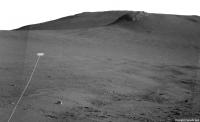
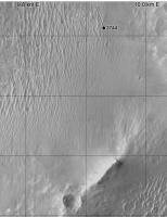
The ~85m drive on sol 3744 was uphill, starting the long climb of Cape Tribulation. ![]()
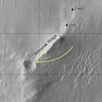
The sol 3744 Drive:
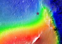
Puts Opportunity about here on a plot with colour for elevation:
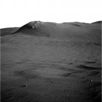
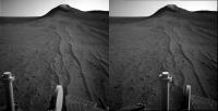
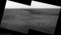
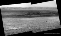
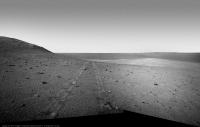
The view ahead:
Posted by: Phil Stooke Aug 6 2014, 10:29 PM
Right! This is where I have it. (proper map update later)
Phil
Posted by: Phil Stooke Aug 9 2014, 03:29 PM
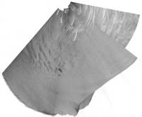
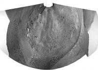
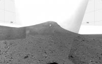
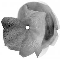
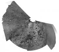
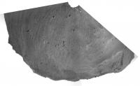
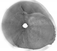
A circular view of a partial panorama from sol 3746.
Phil
Posted by: Floyd Aug 9 2014, 11:18 PM
Do we know if Opportunity will be traveling east or west around Wdowiak Ridge [name corrected]?
Posted by: ngunn Aug 9 2014, 11:32 PM
It won't be east. The slopes on the inside of the crater are too steep. I don't know if they want to visit that outcrop but if they do I'd expect they'd sneak up on it from the right (west) where the gradients are less severe
Posted by: Floyd Aug 10 2014, 12:03 AM
I'm not sure as the Eastern side is actually 200 m from the drop into the crater.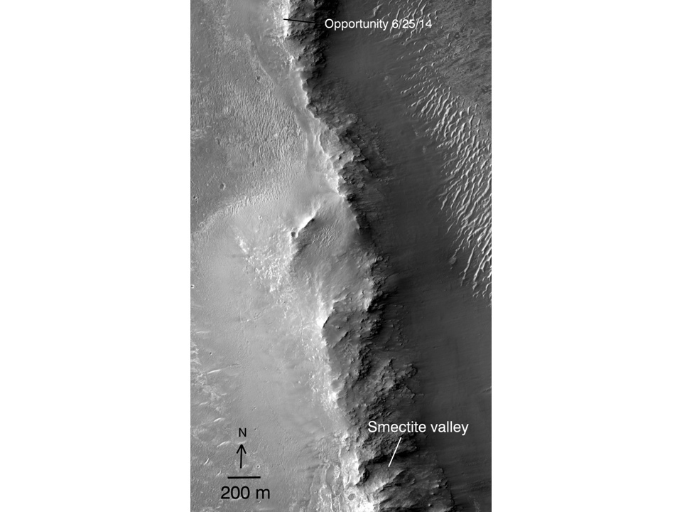
Posted by: fredk Aug 10 2014, 01:13 AM
I'd say the east side is doable. Remember http://www.nmnaturalhistory.org/assets/images/Space_Science_Images/distance.jpg in a recent http://www.nmnaturalhistory.org/sol-3705-june-27-2014.html that has a dashed green line following the eastern ridgeline up and then turning west to get behind Cape Stevens. There was no description of that dashed line, but we've also heard that several options were being considered.
Posted by: Phil Stooke Aug 10 2014, 03:21 PM
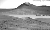
OK... I was wrong. I saw the observation name cape Stevens and assumed it might be the rocky ridge south of us. Not so - it was a bit of outcrop near the rover. The big ridge is called Wdowiak Ridge. I will correct the map soon.
Phil
Posted by: ngunn Aug 11 2014, 03:10 PM
What a picture!
http://qt.exploratorium.edu/mars/opportunity/navcam/2014-08-11/1N461014937EFFCG__P1955L0M1.JPG
Posted by: fredk Aug 11 2014, 03:35 PM
Yeah!
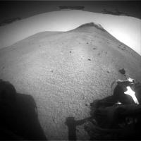
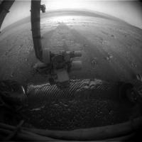
And with this last drive we've really climbed - we're getting back up towards the elevation of Broken Hills, as you can see from these hazcam views:
Posted by: Phil Stooke Aug 11 2014, 04:41 PM
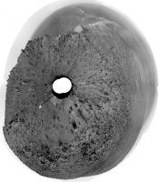
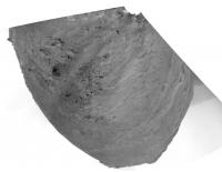
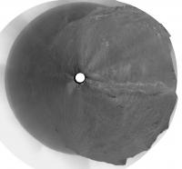
A quick circular view of sol 3749. The foreground features give a pretty good location.
Phil
Posted by: jamescanvin Aug 12 2014, 07:53 AM
Did anyone else get a feeling of deja-vu when seeing the navcams yesterday? ![]()
Posted by: Phil Stooke Aug 12 2014, 03:13 PM
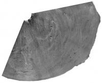
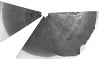
A quick circular view of the sol 3750 images to help locate us.
Phil
Posted by: atomoid Aug 12 2014, 08:55 PM
http://qt.exploratorium.edu/mars/opportunity/navcam/2014-08-11/1N461014937EFFCG__P1955L0M1.JPG
indeed that is a great view in crosseye too!
Posted by: climber Aug 13 2014, 01:18 PM
Still possible to investigate from the top and less risky. We'll see.
Posted by: Phil Stooke Aug 13 2014, 03:03 PM
That is what i would expect to see.
Phil
Posted by: mhoward Aug 13 2014, 04:41 PM
I didn't mean that she won't check out Wdowiak Ridge (I don't know); just that she's literally passing alongside the thing at the moment.
Posted by: atomoid Aug 14 2014, 01:34 AM
really pleasing sky exposure in these http://www.midnightplanets.com/web/MERB/image/03751/1N461185590EFFCHB7P1963L0M1.html pics, i can just relax in a beach chair with the cool radiation pleasantly peppering my molecules ![]() heres a stitch with a little shadow fill for Wdowiak
heres a stitch with a little shadow fill for Wdowiak
Posted by: vikingmars Aug 14 2014, 07:29 AM
A panoramic view would be gorgeous to see from the Wdowiak Ridge : if it cannot reach its summit, Oppy should rove at least a few tens of meters on it and/or take panoramic pictures from the rim of the crater standing at the beginning of the ridge itself (that may be also interesting to see on a scientific point of view for its geological layers).
Spectacular views help us a lot doing our Mars EPO campaigns in France...
Posted by: fredk Aug 14 2014, 02:07 PM
Incredible view now looking back - we can see that we're higher than Solander Point/Murray Ridge now, and so at our highest point yet at Endeavour:
http://qt.exploratorium.edu/mars/opportunity/navcam/2014-08-14/1N461275254EFFCHBSP1960R0M1.JPG?sol3752
A reminder of the early views we had of Wdowiak Ridge - I think this was the first ID of it:
http://www.unmannedspaceflight.com/index.php?s=&showtopic=6897&view=findpost&p=176029
Posted by: Phil Stooke Aug 14 2014, 07:33 PM
Nice panoramas, as usual! Here is a circular projection.
Phil
Posted by: atomoid Aug 14 2014, 08:41 PM
Fredk, many thanks for the http://www.unmannedspaceflight.com/index.php?s=&showtopic=7874&view=findpost&p=212068 of early views of Solander, love seeing those..
nice look back http://www.midnightplanets.com/web/MERB/image/03752/1N461275254EFFCHBSP1960L0M1.html (perhaps this view even includes the spot where http://www.unmannedspaceflight.com/index.php?s=&showtopic=6897&view=findpost&p=176029 was taken) and below in xeye, movin' on up!
Posted by: neo56 Aug 15 2014, 01:18 PM
Wow, really nice crossed-eyes, thanks atomoid !
Posted by: jvandriel Aug 15 2014, 08:14 PM
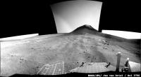
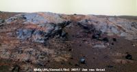
Sol 3752-3753
Added 2 images for the complete view.
Jan van Driel
Posted by: atomoid Aug 15 2014, 09:10 PM
slightly windtailed http://www.midnightplanets.com/web/MERB/image/03753/1F461364542EFFCHBSP1110L0M1.html of interest http://www.midnightplanets.com/web/MERB/image/03753/1M461364365EFFCHBSP2935M2M1.html set 90cw rotated for crosseye
Posted by: fredk Aug 16 2014, 02:37 PM
Some interesting information in the latest http://www.nmnaturalhistory.org/rover-field-reports-from-mars.html
The plan is to inspect the rocks that have come down the scree slope where we are now. After that there's a nice proposed route map taking us along the south side of Wdowiak to Ulysses crater and then on to Marathon valley.
Posted by: centsworth_II Aug 16 2014, 03:35 PM
Posted by: serpens Aug 16 2014, 11:25 PM
Anyone have any information on the Marathon valley contours? I guess that they cannot assume that Marathon Valley and approaches will have the same superb cleaning environment as was the case last winter and Opportunity could well have a stationary mid winter sojourn as was the case on Cape York. Plan for the worst case and be pleasantly surprised if things are better. Couldn't agree more with respect to Larry Crumpler's blog.
Posted by: fredk Aug 18 2014, 04:32 PM
The winter at CY was the only one out of six Oppy needed to hunker down, so even without the intense gusts we've had this winter there's good reason to be optimistic for next winter. But of course they must plan for the possibility.
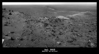
Finally some new images - here's our first real closeup of the rock face in front of us:
Posted by: James Sorenson Aug 18 2014, 05:10 PM
Looks like that image is for the first part of a color panorama. This shall be a scenic one!
Posted by: fredk Aug 19 2014, 09:09 PM
The view keeps getting better and better! ![]()
http://qt.exploratorium.edu/mars/opportunity/pancam/2014-08-19/1P461447052EFFCHBSP2378L5M1.JPG?sol3754
http://qt.exploratorium.edu/mars/opportunity/pancam/2014-08-19/1P461447149EFFCHBSP2378L5M1.JPG?sol3754
See how far you can follow our tracks back to Broken Hills...
Posted by: Floyd Aug 19 2014, 10:00 PM
This is nice--fun to follow those tracks... Great images...
Posted by: walfy Aug 19 2014, 10:46 PM
http://qt.exploratorium.edu/mars/opportunity/pancam/2014-08-19/1P461447052EFFCHBSP2378L5M1.JPG?sol3754
http://qt.exploratorium.edu/mars/opportunity/pancam/2014-08-19/1P461447149EFFCHBSP2378L5M1.JPG?sol3754
See how far you can follow our tracks back to Broken Hills...
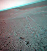
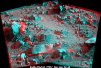
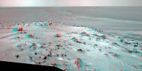
Really nice shots! Here's one in 3D from the NavCam a few sols earlier:
Looking forward to more shots from these heights.
Posted by: atomoid Aug 20 2014, 01:37 AM
Nice stitch, i've been waiting YEARS to see a view like this with an intervening mountain lower than the horizon. but thought we'd have to be higher up Cape Tribulation, pleasant surprise!
would be great to get a super-res of this overlaid with map tracks and SOLs all the way back to the location of Crumplers http://nmnaturalhistory.org/sol-3705-june-27-2014.html Cape York vanatage point.
Posted by: fredk Aug 20 2014, 02:18 AM
Thanks, Astro0! Stunning stitch - this is one of the best views of the mission.
Sketching our path would be very cool - not only would it extend to Cape York, but also back across the great Dune Sea, since we could see Wdowiak Ridge from quite a ways back.
Posted by: James Sorenson Aug 20 2014, 03:38 AM
My take. ![]()
https://flic.kr/p/owPreC
And a false color to better show the tracks.
https://flic.kr/p/oMnduC
Posted by: Astro0 Aug 20 2014, 04:23 AM
We bow to your genius. Beautiful! ![]()
Posted by: Phil Stooke Aug 20 2014, 04:29 AM
I bow too.
Phil
Posted by: vikingmars Aug 20 2014, 09:07 AM
Thanks so much James : how nice !
Posted by: Ant103 Aug 20 2014, 10:23 AM
Very good James ![]()
My take, in Poscard format ![]()
http://www.db-prods.net/blog/2014/08/20/climbing-up-the-hill-sol-3754/
Posted by: Ron Hobbs Aug 20 2014, 02:27 PM
Oh, thank you Damia. I was looking forward to seeing a postcard. This will be a part of my next Mars presentation.
I can really imagine what it would be like to walk up this hill with Opportunity. What a ride!
![]()
![]()
![]()
Posted by: Ron Hobbs Aug 20 2014, 02:33 PM
Oh, and let me also bow to James.
![]()
![]()
![]()
Posted by: James Sorenson Aug 20 2014, 02:55 PM
Damia, your's is now my new desktop background ![]() . Great work, and thank you everyone. What a great place we are at.
. Great work, and thank you everyone. What a great place we are at. ![]()
Posted by: Astro0 Aug 21 2014, 06:40 AM
So while we wait for much better colour views from James and Damia, ![]() here's a quick view across Endeavour Crater
here's a quick view across Endeavour Crater ![]()
Sort of freaks me out that view because I made a fanciful sketch of it over 4 years ago. Called it HOAV!
Posted by: climber Aug 21 2014, 08:44 AM
So, which one is the real one? ![]() I'm wondering how you'll call the view once we'll be a bit higher. HofHOAV? We definitely need a JAR emoticon.Thank you all for taking time to create those beautiful artistic pans
I'm wondering how you'll call the view once we'll be a bit higher. HofHOAV? We definitely need a JAR emoticon.Thank you all for taking time to create those beautiful artistic pans
Posted by: Ant103 Aug 21 2014, 09:16 AM
As you wish ![]()
http://www.db-prods.net/marsroversimages/Opportunity/2014/Sol3754_pancam.jpg
Posted by: Floyd Aug 21 2014, 11:01 AM
James--any chance you have a wider version of the color elevation map for the region between Wdowiak Ridge and Smectite valley?
Posted by: RoverDriver Aug 21 2014, 05:12 PM
The DTM is publicly available:
http://www.uahirise.org/dtm/dtm.php?ID=ESP_018701_1775
in particular, here's the color coded altimetry:
http://hirise-pds.lpl.arizona.edu/PDS/EXTRAS/DTM/ESP/ORB_018700_018799/ESP_018701_1775_ESP_018846_1775/DTEEC_018701_1775_018846_1775_U01.ca.jpg
Paolo
Posted by: Floyd Aug 21 2014, 06:39 PM
Thank you Paolo for pointing me to the links! Will Opportunity climb any higher than the brown elevation on its way to Smectite valley, or just follow the brown contour around. The ridge of the white peaks would have a great view...
Posted by: James Sorenson Aug 21 2014, 08:37 PM
And the 1x2 mosaic looking East.
https://flic.kr/p/oQS2NR
Posted by: fredk Aug 21 2014, 11:21 PM
All we've heard is the proposed route map on http://www.nmnaturalhistory.org/rover-field-reports-from-mars.html It shows the route climbing pretty much to the highest point ("summit lithology"). I seriously hope we make it there...
Posted by: vikingmars Aug 22 2014, 12:32 PM
Totally agree with you Fredk.
People and EPO people like me would not understand if a 360° pan is not made from the very summit of Endeavour Crater's rim.
This would mark a big step and will be seen as a major event in the history of the exploration of Mars !
![]()
![]()
![]()
![]()
![]()
Posted by: fredk Aug 27 2014, 02:03 PM
It's now a week since we've received new pictures - the last were from 3758. It's not just that jpl/exploratorium aren't updating, since http://www.lpl.arizona.edu/~lemmon/mars-tau-b.html also hasn't been updated since 3758.
We have been seeing previously unseen old images appear, though, which sounds like a good sign.
Posted by: Phil Stooke Aug 27 2014, 02:10 PM
The JPL status report says there have been several flash memory faults in a row - typically these result from trying to write data to a bad area. Spirit went through this as well. The long-term fix is a reformatting, but that carries its own risks so it's only done when really necessary. That point might be approaching.
Phil
Posted by: marsophile Aug 27 2014, 04:29 PM
Is there risk in waiting too long to reformat flash? That is, could continuing flash anomalies prevent reformatting falsh? Or is the reformatting process itself independent of flash?
Posted by: MahFL Aug 27 2014, 04:37 PM
The Rover also has 128 MB of DRAM, which is where the formatting program would run from, so it's independent.
Posted by: Greenish Aug 28 2014, 01:04 AM
It is a ground problem, not a rover issue causing delay in images: https://twitter.com/nivnac/status/504757927954362368
Posted by: fredk Aug 28 2014, 02:31 AM
I'm curious how James has learnt this - has the tracking database provided clues?
Posted by: Astro0 Aug 28 2014, 04:24 AM
I guess while we wait for news and images, here's a pan from Sol 3749 using images that appeared on Exploratorium in the last few days.
Uses both left and right hand pancam images, plus some artificial sky.
Posted by: jamescanvin Aug 28 2014, 07:53 AM
I don't know for sure. If I comment that there is no data on Twitter I get a bunch of worried replies, so i was really heading that off as there is no reason to be concerned.
Circumstantial evidence that Oppy is OK:
1) We've seen data/images drop out many times before.
2) Recent comments on Twitter from insiders have sounded routine and unconcerned.
3) There are old images/data downlinked on recent sols.
4) New sequences are appearing in the tracking database (all be it just tau obs)
5) There are a bunch of 'Unexpected sequences' in the on board data list (which implies that the rover has sent data that the database had not been told about, i.e. ground data is missing, rover data fine)
Posted by: djellison Aug 29 2014, 09:04 PM
It's a rover issue.
http://www.jpl.nasa.gov/news/news.php?release=2014-292
An increasing frequency of computer resets on NASA's Mars Exploration Rover Opportunity has prompted the rover team to make plans to reformat the rover's flash memory.
The resets, including a dozen this month, interfere with the rover's planned science activities, even though recovery from each incident is completed within a day or two.
Posted by: PaulM Aug 29 2014, 10:40 PM
When Spirit first landed its software crashed when its flash became more than 50% full. While this bug was being fixed, Spirit was switched to a mode where it did not use flash memory to store data. The picture in the link below was taken during this time:
http://mars.jpl.nasa.gov/mer/gallery/press/spirit/20040128a.html
This shows that Opportunity would be perfectly usable with flash memory disabled, although it would be able to do far less work each day.
Posted by: eoincampbell Aug 30 2014, 06:30 AM
With flash memory disabled, is driving possible?
I recall those tense Spirit flash days when Peter Theisinger
was calming us all down...quite rightly...
Posted by: PaulM Aug 30 2014, 09:19 AM
I recall those tense Spirit flash days when Peter Theisinger
was calming us all down...quite rightly...
If command sequences are stored in different flash memory to that used to store data then I suppose that a 20m blind drive would be possible each day followed by each camera taking one picture at the end of the drive. These 8 pictures could then be transmitted to Earth at the end of the day's 20m drive without ever being stored in data flash memory.
I imagine that it is also possible to instruct Opportunity to do something immediately over its direct Earth link without sending this instruction as part of a command sequence. It therefore might be possible to tell Opportunity to drive a few meters without making this command part of a sequence.
Posted by: climber Aug 30 2014, 10:23 AM
I never heard that Spirit flash memory has been disabled, And I understand they are re formatting Oppy's not disabling
Posted by: Burmese Aug 30 2014, 10:38 AM
That was temporary:
"While this bug was being fixed, Spirit was switched to a mode where it did not use flash memory to store data."
Posted by: RoverDriver Aug 30 2014, 01:15 PM
I imagine that it is also possible to instruct Opportunity to do something immediately over its direct Earth link without sending this instruction as part of a command sequence. It therefore might be possible to tell Opportunity to drive a few meters without making this command part of a sequence.
When the rover is in crippled mode we use part of the RAM as a file system and am not sure that the remaining RAM would support driving with the additional buffers we need for imaging and all that. And driving in real time? No way! The OWLT (One Way Light Time) varies from 5 to 20 minutes, communications take a LOT of power and takes time to switch between driving and communicating. We sometimes have very lengthy discussions on where to drive, how, what safety parameters to set.
Just think yourself driving in a foreign country, no maps, with your mother-in-law providing "suggestions". How long would you last at the wheel?
Paolo
Posted by: MarsInMyLifetime Aug 30 2014, 03:15 PM
Posted by: fredk Sep 4 2014, 04:39 AM
From the http://www.planetary.org/explore/space-topics/space-missions/mer-updates/2014/08-mer-update-opportunity-reboots-reformats.html
Let's hope for the best...
Posted by: Phil Stooke Sep 5 2014, 01:56 PM
Just a thought... should we rename this place Cape Defibrillation?
Phil
Posted by: climber Sep 5 2014, 02:43 PM
No no no, I'm sure they know how to do it... by heart ![]()
Posted by: Burmese Sep 5 2014, 03:33 PM
I would image that after this procedure the formatting process will identify and mark off some bad sectors in the flash memory but is there any information yet on how many flash memory cells have already been marked as bad (both before launch, and as well since arriving at Mars). Also, how much got marked bad when Spirit did the procedure?
Posted by: climber Sep 5 2014, 05:29 PM
Follow Fred's link...
Posted by: Burmese Sep 5 2014, 08:18 PM
Ok, so Spirit lost 7% of total flash capacity when it reformatted, amounting to about 1/2 a bank. Worst case for Oppy could be about double that if they have to stop accessing bank 7 altogether.
Posted by: Gerald Sep 5 2014, 10:09 PM
If I understood the article correctly, the flash memory consists of 8 banks, each bank of 4 packages, each package of 32 sectors of 64 kBytes. The finest granularity for marking as bad is a sector. Total number of sectors is 8 * 4 * 32 = 1024. Hence the memory is marked in 1/1024 steps as bad.
The actual number of bad sectors of these 1024 sectors is known after reformatting. One bank (128 sectors) is excluded from the reformatting, since it contains the operating system, and is not exposed to frequent rewriting cycles.
Whether the reformatting resolves the root cause of the reboots, is known afterwards, too.
Posted by: Astro0 Sep 7 2014, 07:57 AM
Today on Mars ![]()
Sol 3775 - Navcam
NB: Two LH images with partial RH image stitched in to cover a data drop. Artificial sky added for effect.
Posted by: Astro0 Sep 7 2014, 08:58 AM
A few more quick stitches.
Pancam
Navcam
Wider pan of the post above using RH Navcams but with the drop-out image from the LH Navcam, so the reason for the mismatch.
Posted by: James Sorenson Sep 7 2014, 08:49 PM
Sol 3775 - Navcam
Great work!
And my take to.
https://flic.kr/p/p7CHFD
Posted by: jvandriel Sep 8 2014, 09:59 AM
Here is the complete Navcam panoramic view on Sol 3775.
Jan van Driel
Posted by: atomoid Sep 8 2014, 09:32 PM
thanks for the great stitches! its great to be Oppy-rational again. greats sights on http://www.midnightplanets.com/web/MERB/image/03775/1N463314413EFFCHJ3P1966R0M1.html from the parting view going up around the bend and look up to Wdowiak with Klingon face etched atop the rock garden variety slab.
Posted by: Floyd Sep 8 2014, 09:54 PM
So can anyone give us an updated on the flash reformatting? Images are arriving, but from where in the pipeline? I'm assuming all went well.
Posted by: ngunn Sep 8 2014, 10:30 PM
Me too. These are new post-format images as Astro0's celebratory post implies
Posted by: fredk Sep 9 2014, 12:12 AM
We heard that the formatting was probably going to go ahead last week but I haven't heard if it actually went ahead...
Posted by: PaulH51 Sep 9 2014, 12:14 AM
NASA's Mars Exploration Rover Opportunity has successfully reformatted its flash memory. Telemetry downlinked from Mars' most seasoned rover indicates the reformat completed successfully on Sol 3773 (Thursday 2014-09-04). LINK to full report : http://www.jpl.nasa.gov/news/news.php?release=2014-292
Posted by: fredk Sep 9 2014, 01:37 AM
Thanks for pointing that out - I never thought to look for an update in the old press release!
Posted by: Phil Stooke Sep 10 2014, 04:20 PM
This is a circular view of Jan's full panorama from sol 3775. Opportunity shows Rosetta how to land on a double-lobed object. Simples!
Phil
Posted by: atomoid Sep 10 2014, 08:10 PM
..and the shadow-casting http://www.midnightplanets.com/web/MERB/image/03778/1F463592523EFFCHJ8P1212R0M1.html crosseye
Posted by: atomoid Sep 11 2014, 10:18 PM
http://images2.fanpop.com/image/photos/9400000/Lieutenant-Worf-star-trek-the-next-generation-9406774-1694-2560.jpg again? http://1000words1000days.com/wp-content/uploads/2012/04/OuterLimits1.jpg http://www.dvdjournal.com/reviewimgs/o/outerlimits_os_imgs/outerlimits_os_05.jpg http://worldufophotosandnews.org/wp-content/uploads/2014/08/article-543-ALIEN-3.jpg http://ia.media-imdb.com/images/M/MV5BMTYyODI2MzI4OV5BMl5BanBnXkFtZTcwNDgxODMzMQ@@._V1_SY317_CR15,0,214,317_AL_.jpg http://homevideos.com/freezes-outerlimits/OL-KeeperPurple26.jpeg
Posted by: serpens Sep 12 2014, 10:59 PM
Less than 1% flash storage space lost in the reformat. Couldn't ask for a better result. The dust factor is gradually decreasing (now 0.754) so Opportunity is back in a net deposition zone. Potentially I guess, she could always nip across closer to the rim edge in search of wind if required. Always nice to have options.
Posted by: jvandriel Sep 14 2014, 02:50 PM
The L0 Navcam view taken on Sol 3780 and Sol 3781.
Jan van Driel
Posted by: jvandriel Sep 17 2014, 09:38 AM
The Pancam L257 Panoramic view taken on Sol 3780 in colour.
Jan van Driel
Posted by: jvandriel Sep 17 2014, 10:59 AM
The Navcam and Pancam Panoramas taken on Sol 3783.
Jan van Driel
Navcam L2
Pancam L7
Posted by: Phil Stooke Sep 17 2014, 03:37 PM
Very nice!
Phil
Posted by: SpaceListener Sep 17 2014, 03:46 PM
Very interesting passage, a change of landform from sandy to rocky land with many small stones. I think that by that zone has stronger constant wind than the rest places.
Posted by: jvandriel Sep 17 2014, 06:43 PM
Here is the complete Stereo Pancam panoramic view taken on Sol 3785.
Jan van Driel
Posted by: Phil Stooke Sep 17 2014, 07:47 PM
Great, Jan - I put the two scenes together for this circular view which will let me update the map later today.
Phil
Posted by: ngunn Sep 17 2014, 08:57 PM
That circular pan also makes clearly visible how much we've climbed and the opening of a more distant horizon. It might be rewarding to apply non-circular Phil-o-vision to a couple of the original navcam frames as you've done in the past to elucidate plains topography. I hope soon we may scan the horizon to the southwest where distant landmarks first seen from around Concepcion must surely be visible once more.
Posted by: eoincampbell Sep 18 2014, 03:07 AM
Any quick numbers on the the actual slope/grades Oppy's been accomplishing of late...? Steepest yet...?
Go Oppy, our resilient one...!
Posted by: RoverDriver Sep 18 2014, 04:25 AM
These are quite modest slopes. Remember Victoria and Endurance?
Paolo
Posted by: James Sorenson Sep 18 2014, 05:01 AM
Wdowiak Ridge. ![]()
https://flic.kr/p/pgMosB
Posted by: vikingmars Sep 18 2014, 07:20 AM
How nice ! Thanks a lot James !
Posted by: Phil Stooke Sep 18 2014, 03:52 PM
This is a Pancam frame from sol 3786. At A there is a bright fuzzy marking which doesn't appear to be on a previous view (sadly, only a half-resolution albedo pan image from sol 3776) - maybe a wind gust in action. At first I thought the feature at B was another - a vertical column of dust. But no, it does show in the earlier image, so it's a surface marking.
Anyhoo - maybe evidence for more wind activity.
Phil
Posted by: brellis Sep 18 2014, 09:39 PM
Is there a prevailing wind near and/or in Endeavour?
Posted by: fredk Sep 18 2014, 10:31 PM
If those are crescent dunes to our immediate ESE (see Phil's map, eg) that suggests winds blowing from the WNW, although the winds may have changed since those dunes formed. But the orbital imagery also shows what look like wind streaks trailing to the east from the ridge to our east, consistent with a westerly wind. But the winds may be seasonal (I think they were at Victoria, eg) and happened to be from the west when that hirise image was taken.
Dunes farther inside Endeavour suggest winds from the NW.
If you looked carefully at closeup imagery of the ground from Oppy you might get a more local sense of wind directions.
Posted by: serpens Sep 19 2014, 09:47 AM
Fred, you previously posted a nice animation showing a wind gust that seems to be SE.
Can't get the post link facility to work. Post #320 page 22 in topic: Cape York - Shoemaker Ridge and the NE traverse, Starting sol 2735
Posted by: fredk Sep 19 2014, 02:43 PM
I'd forgotten about that - http://www.unmannedspaceflight.com/index.php?s=&showtopic=7081&view=findpost&p=179744
Since we're viewing that from CY, the gust seems to be moving from the south or even SSW. Maybe if you look at the morphology of the many other gusts we've seen you could infer something about their direction?
Posted by: atomoid Sep 19 2014, 08:45 PM
anaglyph of http://www.midnightplanets.com/web/MERB/image/03787/1N464380821EFFCHSKP0755L0M1.html Ulysses view
Posted by: serpens Sep 19 2014, 10:32 PM
I don't think sifting through the images to find the few that show gusts would tell us much Fred. Chojnacki et al did a pretty thorough investigation of dune changes in Endeavour and inferred some aspects of wind direction.
http://onlinelibrary.wiley.com/doi/10.1029/2010JE003675/pdf
As may be expected the winds seem to be influenced by the time of year (stage of transport of atmosphere between poles) and day solar time. However, from the cleaning effect on Oppy there also seems to be local wind blowing out of the crater during the day, as was seen for Victoria. Choinacki's findings show winds stronger than any models predict but he bases his estimates on supposedly sandy dunes which in most cases show deflation not movement. This would seem to make saltation unlikely and possibly the dunes are dust/silt rather than sand with consequent reduction of perceived wind strength.
Posted by: James Sorenson Sep 20 2014, 03:46 AM
OH MYYYYY GOSHHH!!! ![]()
http://qt.exploratorium.edu/mars/opportunity/pancam/2014-09-18/1P464291874EFFCHQNP2396L2M1.JPG
A 10 pointing color panorama as well! ![]()
Posted by: fredk Sep 20 2014, 02:13 PM
I think we can see our tracks waaaay down there:
http://qt.exploratorium.edu/mars/opportunity/pancam/2014-09-20/1P464293858EFFCHQNP2396L5M1.JPG?sol3786
Posted by: algorithm Sep 20 2014, 08:30 PM
A partial L2 PanCam panorama from Sol3786
Some images missing from some filters but hopefully they were captured and will come down soon.
Posted by: Phil Stooke Sep 21 2014, 08:56 PM
This is a circular version of Dig's 3787 panorama - it's a long way from being a simple polar reprojection, it took three goes to get the tilted surface to project into a more realistic map geometry. (rotated a bit too far, north is not at the top here but about 20 degrees clockwise)
Phil
Posted by: jvandriel Sep 22 2014, 08:10 PM
Here is the complete Navcam L view taken on Sol 3789.
Jan van Driel
Posted by: Phil Stooke Sep 22 2014, 08:59 PM
Nice pan - I will play with it later. Meanwhile, Larry Crumpler's latest Field Notes is out, with a nice map of this location:
http://www.nmnaturalhistory.org/rover-field-reports-from-mars.html
Phil
Posted by: ngunn Sep 22 2014, 09:33 PM
Larry Crumpler's latest Field Notes
I've never been able to open these (until they are re-hosted by The Planetary Society where of course they open fine). Do others experience this or is it just me? (Sorry to take up space with a computer bug thing but it's a long running annoyance that someone here may have a simple solution for.)
Posted by: djellison Sep 22 2014, 09:38 PM
They load fine here. Try a different browser ( I'm using Chrome - but it also loads fine in Firefox )
Posted by: ngunn Sep 22 2014, 09:45 PM
I'm on Firefox here and I get 'timed out' every time. I'll try on IE at work tomorrow.
Posted by: James Sorenson Sep 23 2014, 01:50 AM
What a beautiful vantage point we are at. ![]()
https://flic.kr/p/pjnd1L
Posted by: stevesliva Sep 23 2014, 04:12 AM
Hate to say it, but clear cache and if that doesn't work, reset Firefox remembering what your fav addons are. Could be worse... On OSX Firefox seems to stop playing well with Google and Facebook in very short order. Has to do with one of my addons, and I'm not sure which yet.
Posted by: atomoid Sep 23 2014, 10:31 PM
the previous page link had no protocol prefix embedded, not that it should matter (doesnt on my machine anyway), try: http://www.nmnaturalhistory.org/rover-field-reports-from-mars.html oh, i see this forum software just removes those anyway, so never mind... i cant delete this now-pointless post so heres http://www.nmnaturalhistory.org/assets/images/3789_Geosetting-copy.jpg from Larry's site and http://www.nmnaturalhistory.org/assets/images/3790_strategic.jpg so if you still cant load the main page, maybe that will work for you
Posted by: climber Sep 24 2014, 01:49 PM
Jan, you nearly could have posted this picture in Rosetta's topic and been unnoticed.
Posted by: lyford Sep 25 2014, 04:41 AM
James: "Old Rover - New Heights"
Thank you!
Posted by: TheAnt Sep 26 2014, 12:58 AM
Thank you James and Jan, both your images give a good impression of the rovers whereabouts.
And yes it's beautiful after all that flatland we've seen. =)
Posted by: jvandriel Sep 26 2014, 12:47 PM
Here is the complete L0 Navcam view made on Sol 3791.
Jan van Driel
Posted by: anticitizen2 Sep 26 2014, 06:35 PM
Animation of the Sol 3784 drive, the latest long drive parallel to Wdowiak Ridge.
Begins with a CCW turn, then is a straight shot up the slope except for big bumps over rocks along the way.
The anaglyph version is a bit easier to follow because of the bumps.
Right click to show controls, pause, and rewind.
http://gfycat.com/DimwittedWanBufeo --- http://gfycat.com/SaltyUntidyGoral ![]()
Image from afterwards:
Posted by: James Sorenson Sep 28 2014, 12:03 AM
On Sol-3793 there was a 13 point color pan looking across Ulysses Crater. ![]()
EDIT: here is a mosaic of it using the image stamps from the tracking site.
https://flic.kr/p/p979AF
Posted by: marsophile Oct 1 2014, 09:03 PM
Anyone know why no images have been posted to the JPL or Exploratorium sites since Sep 25?
Does some server need to be restarted?
Posted by: fredk Oct 1 2014, 09:26 PM
All I can say is Oppy is still active - both the pancam database (via James Canvin) and the Oppy weather site show tau calibration images and other activities up to 3798.
Posted by: serpens Oct 1 2014, 11:52 PM
Images are available up to 30 September showing Oppy's mountain climbing skills.
Posted by: Phil Stooke Oct 2 2014, 03:03 AM
The JPL status report says there have been some more flash memory 'amnesia' events (after the reformat job). That may be behind the delays.
Phil
Posted by: jvandriel Oct 2 2014, 07:38 AM
Here is the complete Navcam panoramic view on Sol 3798.
Jan van Driel
Posted by: Phil Stooke Oct 2 2014, 08:32 PM
Here is a trio of circular views from Jan's recent pans, showing how Opportunity approached the rim of Ulysses, climbed up to it, and then backed off again. The radial scaling function I have used differs a bit between these views, but if you concentrate on the central part you can see what the rover is doing.
Phil
sol 3789:
sol 3791:
sol 3798:
Posted by: atomoid Oct 3 2014, 07:24 PM
seems theyre taking a look at this little http://www.midnightplanets.com/web/MERB/image/03800/1M465535712EFFCHWNP2935M2M1.html below the stacked rocks http://www.midnightplanets.com/web/MERB/image/03798/1N465355758EFFCHWGP1982R0M1.html (parrellel)
Posted by: fredk Oct 6 2014, 12:55 AM
Lots of detail on the latest flash problems in the http://www.planetary.org/explore/space-topics/space-missions/mer-updates/2014/09-mer-update-opportunity-gets-extension.html From Squyres:
Posted by: charborob Oct 8 2014, 01:19 PM
Pancam images from sol 3793 have come down recently. I assembled them into this panorama:
Posted by: brellis Oct 9 2014, 02:11 AM
Looks like a nice rock-stack Buddha sculpture in the upper right-center. ![]()
Posted by: Burmese Oct 9 2014, 02:12 PM
Since they seem to think all the errors are occurring in bank 7, what about temporarily disabling bank 7 and run that some weeks to see if things clear up? If they do, may have to leave it that way - if they still get errors then they at least know the problem is deeper.
Alternatve would seem to be multiple formats to catch 'iffy' spots, which are even more time consuming
Posted by: Gerald Oct 9 2014, 07:08 PM
The current strategy is, IIRC, to activate a tracer for bank 7 access, to get more detail about the root cause. Relation to bank 7 seems to be likely enough to go that way, first.
Posted by: eoincampbell Oct 9 2014, 08:26 PM
With Oppy's team of flash detectives also soliciting help from former Ricoh employees and their relevant paperwork, I'm sure the issue will be fully understood soon..
Posted by: jvandriel Oct 10 2014, 09:57 AM
Ulysses Crater as seen by the L2 Pancam on Sol 3793.
Jan van Driel
Posted by: jvandriel Oct 11 2014, 12:24 PM
Added a few images and here is the complete Pancam L2 view of
Ulysses Crater taken on Sol 3793.
Jan van Driel
Posted by: fredk Oct 23 2014, 03:53 PM
Yikes - http://www.lpl.arizona.edu/~lemmon/mars-tau-b.html, up to 1.75 on 3820. Not terribly unusual this time of year. But for the comet observations on 3817 tau was 1.2. Had this jump in dust happened a few sols earlier we may have seen nothing at all of the comet.
I don't recall seeing Endeavour this dusty - the far rim almost disappears in these navcams:
http://qt.exploratorium.edu/mars/opportunity/navcam/2014-10-23/1N467319013EFFCH0UP1957R0M1.JPG?sol3820
Posted by: fredk Oct 25 2014, 04:53 PM
Up to 1.91 on 3822. The latest http://www.msss.com/msss_images/subject/weather_reports.html says storms were not yet over Meridiani (or Gale), as of 6 days ago.
Posted by: brellis Oct 25 2014, 06:09 PM
Re: the view of Endeavour on Post #169 - I continue to enjoy putting myself on Mullholland Drive looking into the San Fernando Valley in Southern California as a frame of reference. It's very smoggy/foggy this time of year:
Posted by: Phil Stooke Oct 25 2014, 10:05 PM
A couple of circular views as we move away from Ulysses.
sol 3817:
sol 3821:
Phil
Posted by: jvandriel Oct 28 2014, 09:10 PM
Here is the complete Navcam R0 Panoramic view taken on Sol 3823.
Jan van Driel
Posted by: ngunn Oct 28 2014, 11:23 PM
Oh that's a classic right there. Everybody - alert the press.
Posted by: fredk Oct 30 2014, 01:54 PM
Description of the events leading to a jump in tau recently from http://www.msss.com/msss_images/2014/10/29/:
Posted by: jvandriel Oct 31 2014, 09:38 AM
The complete Navcam L0 view taken on Sol 3825 and Sol 3826.
Jan van Driel
Posted by: James Sorenson Nov 4 2014, 08:12 AM
My version.
https://flic.kr/p/pW9C1L
https://flic.kr/p/pDCVCR
Posted by: jvandriel Nov 4 2014, 04:02 PM
The Navcam view on Sol 3839-3829. ( added 2 images taken on Sol 3829.)
Jan van Driel
Posted by: SFJCody Nov 4 2014, 04:43 PM
Did a double-take and checked the timestamp when I saw this sol's navcams! Haven't seen terrain like this in a while.
Posted by: serpens Nov 5 2014, 12:10 AM
For those who may miss it, A.J Rayl has posted another info filled report on Opportunity.
http://www.planetary.org/explore/space-topics/space-missions/mer-updates/2014/10-mer-update-opportunity-images-comet-siding-spring.html
Posted by: Phil Stooke Nov 6 2014, 12:59 AM
A couple of circular views, one from Jan's pan, one from a rough one I did, to help me locate the rover for the route map.
Phil
sol 3832:
sol 3833:
Posted by: SFJCody Nov 6 2014, 06:08 PM
Low sun, high tau. Lovely shot.
http://qt.exploratorium.edu/mars/opportunity/forward_hazcam/2014-11-06/1F468561716EFFCIQ8P1215L0M1.JPG
Far over the dusty mountain cold
To valleys deep, and outcrops old
We can't away early this sol
The tau is high, but Oppy's bold
Posted by: Phil Stooke Nov 7 2014, 01:07 AM
Here is a circular view of Jan's latest panorama. The outcrop to the right gives a good location on the map.
Phil
Posted by: James Sorenson Nov 7 2014, 10:35 AM
My take on the 3834 Navcam pan.
https://flic.kr/p/pFJXEA
Posted by: climber Nov 7 2014, 01:24 PM
I'd said that the atmosphere seams a little bit less fuzzy? We can better see the rim on the other side.
Posted by: jvandriel Nov 8 2014, 12:40 PM
The last images are down and here is the complete Navcam view taken on Sol 3829.
Jan van Driel
Posted by: anticitizen2 Nov 9 2014, 04:56 PM
Love the views!
From several weeks ago, driving away from Ulysses:
http://i.imgur.com/MpDE8rD.gif --- http://i.imgur.com/aU0XfkL.gif
Posted by: Phil Stooke Nov 10 2014, 12:58 AM
A quick circular view to help locate the sol 3837 site. Rear Hazcam... oops, I should say Front Hazcam since we are driving backwards - uh - rear-facing Hazcam images helped a lot in finding the the location as well.
Phil
Posted by: jvandriel Nov 10 2014, 08:40 PM
The complete Navcam L0 view taken on Sol 3834 and Sol 3835.
Jan van Driel
Posted by: jvandriel Nov 11 2014, 09:11 PM
The Navcam L0 panoramic view taken on Sol 3837 and Sol 3838 and stitched together.
Jan van Driel
Posted by: Phil Stooke Nov 13 2014, 01:33 AM
A quick circular view of the 3840 location - I am not confident enough in the location to map it yet.
Phil
Posted by: Floyd Nov 15 2014, 01:23 PM
Looks like wind cleans this area very very well! With a little luck Opportunity will also experience some cleaning on this ridge.
Posted by: Phil Stooke Nov 16 2014, 02:23 AM
A quick circular view from sol 3841 to help find where we are.
Phil
Posted by: ngunn Nov 16 2014, 07:40 PM
Is that the actual summit of Cape Tribulation visible on the right here?
http://qt.exploratorium.edu/mars/opportunity/navcam/2014-11-16/1N469359402EFFCJC7P1932L0M1.JPG
Posted by: Phil Stooke Nov 17 2014, 03:29 AM
This is where we are on sol 3844 - proper map update later.
Phil
Posted by: fredk Nov 17 2014, 05:37 AM
Looking at Phil's new location and http://www.nmnaturalhistory.org/assets/images/3790_strategic.jpg I think it probably is the summit - there's nothing else between us and the summit that could look that dramatic.
The exposed outcrop just to our east is marked as "science opportunity: crest approach" on that map, so there's a chance we'll stop for a look...
Posted by: Ant103 Nov 19 2014, 11:25 AM
Hi ![]()
I don't know if it's a come back, but I feel the envy to do some stitchings these days (maybe it's because the summit is near). So, Sol 3846 Navcam panoramic :
http://www.db-prods.net/marsroversimages/Opportunity/2014/Sol3846_pano.jpg
Posted by: ngunn Nov 19 2014, 12:40 PM
Yes, thanks everybody. It's nice to reconnect to the wider context around Endeavour now that we're up high. I am (pleasantly) surprised that we can see as far as 60 km just now. Fingers crossed for continued dust clearance and a glimpse of the Miyamoto rim.
Posted by: Phil Stooke Nov 19 2014, 02:46 PM
A circular view of Damia's panorama - showing the fracture very nicely. Thanks for making the panorama, Damia!
Phil
Posted by: tanjent Nov 19 2014, 03:41 PM
Can anyone construct (or link to) a good contour map?
Much of the close terrain is quite gentle here; that makes it pretty difficult to keep track of the gain in altitude just by casual observation of landmarks.
Posted by: ngunn Nov 19 2014, 09:23 PM
Fascinating stuff. A suggestion for admins: Maybe it's worth splitting recent posts off into a new thread, something along the lines of 'Distant Vistas II, the view from Cape Tribulation'? There's bound to be more of this as we approach the summit. (If that's done feel free to delete this post.)
Good Idea, done. - Mod
http://www.unmannedspaceflight.com/index.php?showtopic=7934
Posted by: vikingmars Dec 3 2014, 03:24 PM
All the links originating from the "Return to Mars" webpage http://www.exploratorium.edu/mars/spiritopp.php and leading to our favorite MER images such as :
http://qt.exploratorium.edu/mars/opportunity/pancam/
or : http://qt.exploratorium.edu/mars/opportunity/navcam/)
are BROKEN since last Sunday.
I just sent an e-mail to their Webmaster. I hope that they will be mended soon ![]()
Posted by: dvandorn Dec 3 2014, 06:03 PM
Could this have anything to do with the latest cutbacks at NASA where the JSC Media Center has been closed permanently and all images from various NASA projects are now being posted only to Instagram and Facebook?
I know this information comes more from the JPL side of the farm and not JSC, obviously, and this particular website is the Exploratorium's page (not directly a NASA website) -- but perhaps they have lost all links to the image downloads due to media cutbacks?
Just wondering.
-the other Doug (With my shield, not yet upon it)
Posted by: fredk Dec 3 2014, 08:05 PM
If something like that happened I'd guess exploratorium just wouldn't be updated, like we have seen before. But it's actually down, which suggests a server problem with exploratorium.
Posted by: fredk Dec 4 2014, 03:46 AM
More flash problems, and plans to reformat again from the latest http://www.planetary.org/explore/space-topics/space-missions/mer-updates/2014/11-mer-update-opportunity-roves-from-wdowiak-ridge.html
Posted by: TheAnt Dec 4 2014, 05:22 PM
You covered that well fredk.
I was about to say that our intrepid rover have major problems with the flash memory.
Years back there were some speculation of how long Opportunity would last and what systems that would fail, and the flash memory were one of them.
Now all is not lost, they state it might be able to continue the mission even in 'crippled mode'.
The last word not said yet though, lets wait and see how this latest reformat turn out.
Posted by: elakdawalla Dec 4 2014, 07:09 PM
I'm curious how much this problem resembles the one they had on Mars Express?
Posted by: stevesliva Dec 5 2014, 01:35 AM
It bugs me that flash is the cause of all this headache. Not that flash isn't terrible complex internally, but because it should be reliable as heck regardless.
Oh well. Reminds me in a way of Galileo's sticky tape recorder.
Posted by: djellison Dec 5 2014, 05:48 AM
'Reliable as heck'
3800+ Sols into a 90 sol mission despite the harsh temperature cycles and radiation environment on Mars?
I would call that the epitome of 'Reliable as heck'
Posted by: Gerald Dec 5 2014, 03:20 PM
Flash memory usually has a http://spectrum.ieee.org/semiconductors/memory/flash-memory-survives-100-million-cycles per memory block. So it isn't really surprising, that after more than 10 years of intense use, some of the blocks go bad.
Posted by: mcaplinger Dec 5 2014, 03:29 PM
If you had bought a commercial flash card in 2002 and used it on Earth as heavily as the flash on MER has been used, it would most likely be non-functional by now.
Testing how the flash degrades over time and validating one's flash management code when, say, half the flash blocks have failed, is quite a job. I wouldn't have done it for the short MER mission, so it's great that it's worked as well as it has.
That said, I'd be curious to know the root cause of the problems so they can be mitigated in the future if possible.
Posted by: TheAnt Dec 5 2014, 05:04 PM
Yes, I got one flash stick right beside me that only have been used for the transfer of files, no windows boost or whatever, and it did wear out in a handful of years despite it has been used in our even temperatures and low background radiation here on Earth. And the flash on one of my 2 cameras used in fieldwork even in a shorter time span than that - lots of write cycles on that one but quite some various temperatures that one had operated in -30 to +40 C. So even though it's consumer grade of course, it do show to me that temperature matters for a flash memory.
So there's simply not a single root cause we can point finger at, its a combination of radiation, temperature swings and read cycles - and a lot of the latter not only our treat of many images at each site, but I guess there have been a lot of householding data, communication session, driving paths and manoeuvres and scientific data that get written sent and then overwritten on a daily basis.
I'd rather give the engineers a double thumbs up for amazing engineering, and another for the fact that there's a contingency plan. So I am with djellison here, the flash memory of Opportunity have triumphed over any expectation by far.
And as a sidenote: Merry X-mas to all on the forum. (Said on advance since I will be extremely busy with other things now.)
Posted by: vikingmars Dec 6 2014, 11:32 AM
The Exploratorium MER images links are back ! ![]()
Posted by: jvandriel Dec 6 2014, 03:12 PM
Partial Pancam L1 panorama taken on Sol 3861.
Jan van Driel
Posted by: fredk Dec 6 2014, 05:01 PM
It looks like new server/software at exploratorium - the sort links are much faster now.
Meanwhile, there's been a http://www.lpl.arizona.edu/~lemmon/mars-tau-b.html (as happens periodically) - tau values are now substantially lower than the previous estimates and more in line with previous years. This is good news for visibility from the summit. I've been secretly hoping we spend a lot of time doing science here at the fractures so tau has time to drop more before we reach the summit...
Posted by: James Sorenson Dec 7 2014, 01:10 AM
Here is a context Navcam/Pancam mosaic of the two color pancam segments and the fracture. I'll upload the high resolution pancam mosaics when all of them are down.
https://flic.kr/p/qjxJ3N
Posted by: eliBonora Dec 8 2014, 09:40 AM
PanCam closeup sol 3859 - 3860
https://www.flickr.com/photos/lunexit/15974156855/in/photostream
Posted by: James Sorenson Dec 8 2014, 02:10 PM
The Sol-3861 Pancam L1 Albedo 360 panorama. I figured I'd warm up on this one for any potential 360 pancam summit pan's. ![]()
![]()
360 Normal:
https://flic.kr/p/q4hiqM
Vertical stretched 300%:
https://flic.kr/p/poWuHk
Polar:
https://flic.kr/p/q4hhXc
Posted by: stevesliva Dec 8 2014, 04:21 PM
Testing how the flash degrades over time and validating one's flash management code when, say, half the flash blocks have failed, is quite a job. I wouldn't have done it for the short MER mission, so it's great that it's worked as well as it has.
That said, I'd be curious to know the root cause of the problems so they can be mitigated in the future if possible.
Unsure about that. Write frequency per physical wordline might still be higher on Earth, even with seemingly lower utilization. And if it were simply a high utilization issue, I tend to believe it'd be working surprisingly well as the whole flash architecture is geared towards dealing with a statistical tail of a few bits failing, and continuing to function. And that sort of design leaves a lot of actual overhead. I just do not expect the flash to be the crappiest chip on the board if being old is the only hurdle to jump.
I once participated in what was basically a design review of a flash memory targeted at a 130nm RF process, and the whole system's designed around the flash cells alone being terribly unreliable, in that they fail way too often. They over-test, anneal, repair, throw out bad cells they find at test (they may have had extra wordlines in each sector and an entire extra sector to repair with), then throw ECC on top of memories that test perfect, assuming that some outlier single bits will continue to fail throughout the life of the memory so the ECC *should* be able to repair everything statistically expected for the spec life of the memory.
And for what it's worth, the physical addresses of the sectors have no correspondence to the logical addresses of those sectors, even after test (internally there's an entire spare sector so that any can be marked bad, and after that the logical-to-physical mapping pingpongs around with a write balancing method of some sort right within the memory, on top of whatever firmware *thinks* it's doing... and I've always wondered how well the software write-balancing understands what the circuit designers put in.) And so if they're trying to debug some sort of problem with a physical address (and they are) and have to trace through at least 2 tiers of logical-to-physical address obfuscation... yuck. But that said, there's a lot of overhead in the reliability design of the actual memory cells that if it's still truly bad address problem, that there should be a fat part of the distribution that is still working fine.
So *I* guess they're probably dealing with something other than a bad address problem, and that's a pity because the bits are still working, but you can't write and read them because of a problem in the pipe. I think some people jump to the conclusion that because it's flash, and flash cells truly have a limited life, that this has to be that sort of issue. My comment is that if it truly is that sort of issue, that the memory shouldn't be as crippled as recently described. It should be in the tail of the distribution of single-bit failures, not wholesale unusability, even more than 10 years into the chip's life.
The flipside is that the radiation environment just shifted the bell curve, and they're now into the fat lot of bit failures that the chip's devs would've expected sometime in the far future. And that the overhead's all gone. *That* would be important to know thoroughly.
Posted by: ngunn Dec 8 2014, 09:54 PM
Can anyone here make sense of this? To me it looks like a rock that has been fluidised and deformed, possibly by an impact shock.
http://qt.exploratorium.edu/mars/opportunity/pancam/2004-01-25/1P128287268EFF0000P2303L2M1.JPG
Posted by: djellison Dec 8 2014, 10:04 PM
That's an image from Sol 1. Landing day. It's airbag scrape marks in the dirt.
Look at the date on the URL. 2004-01-25
2004.
It's a single frame from this Mosaic
http://mars.nasa.gov/mer/gallery/press/opportunity/20040125a/Pancam_Sol1_Postcard_part.jpg
Posted by: ngunn Dec 8 2014, 10:34 PM
OK, then ptease delete the post, and this one. But I found that image at Exploratorium labelled with a 2014 date. Is it a temporary problem with Exploratorium? (If the answer's obvious to everyone else and I'm not getting it please move to PMs)
Posted by: djellison Dec 8 2014, 10:43 PM
http://qt.exploratorium.edu/mars/opportunity/pancam/2004-01-25/1P128287268EFF0000P2303L2M1.JPG
Posted by: ngunn Dec 8 2014, 10:53 PM
Im sure you're right about the image, but why do I find it on today's page at exploratorium? How do I identify the genuinely new ones?
Posted by: djellison Dec 8 2014, 10:57 PM
It happens. Sometimes there are pipeline burps and old images appear. Not every image that appears in Exploratorium is 'new'
Only way to be sure is to check the site ID ( in that image it's 0000... currently Opportunity is at CJL1 )
Or take the file name and run it thru something like this : http://www.greuti.ch/oppy/html/filenames_ltst.htm
Posted by: James Sorenson Dec 8 2014, 11:15 PM
It's likely that for whatever the problem was either a new server or failed hard drive, they had to re-add all the images to the /opportunity/pancam directory that were taken throughout the entire mission and thus will give you the last modified date of 2014-12-5 with all of the directory's, even back with images taken in 2004. So yeah, do what Doug suggested for identifying them. I use that MER file name website all the time.
Posted by: mhoward Dec 9 2014, 12:32 AM
... Or you could use the http://www.midnightplanets.com page, which knows what images are new, what sol they're from, what site they're from, etc, etc. Heck, right now it's even showing images that haven't made it to Exploratorium or the JPL raw images site yet. I'm going to pretend that's a feature.
Obviously something strange is up with Exploratorium right now, I have no idea what. I hope it comes back.
Posted by: fredk Dec 11 2014, 03:34 AM
Reformat was planned for 3862 according to the http://mars.nasa.gov/mer/mission/status_opportunityAll.html#sol3852
Posted by: jamescanvin Dec 11 2014, 08:35 AM
I'd be surprised if it was on 3862, http://www.midnightplanets.com/web/MERB/sol/03862.html. Maybe 3865, there is nothing in the tracking database for that one.
EDIT. Furthermore, the tracking data says that on 3865 there was some old data sent down (from 3828) which if correct (and I understand this properly) implies that the flash hadn't been reformatted and was successfully mounted to enable access. Curious.
Posted by: craigmcg Dec 11 2014, 01:21 PM
The project prepared for a reformatting of the flash memory on Sol 3862 (Dec. 4, 2014).
This *could* be read as the date that the reformat planning took places was 3862, implying that the actual reformat would take place after that.
Posted by: Deimos Dec 11 2014, 01:49 PM
Don't over-interpret the database. Putting data in some shiny new flash is not inconceivable. And if you track down the 'new' old products that sol, or from prior sols in crippled mode, you can find that they did not increase the number or completeness of products on the ground. Sometimes things just show up there: I do not know if it is reprocessing on the ground, retransmitting from an orbiter, or something else.
Posted by: peter59 Dec 11 2014, 07:27 PM
Today's surprise ![]()
![]()
![]()
1. What new EDRs from ANY sol were received on sol 3868?
Number of EDRs received by sol, sequence number, and image type:
Sol Seq.Ver ETH ESF EDN EFF ERP Tot Description
----- -------- --- --- --- --- --- ---- -----------
03868 p1211.03 2 0 0 2 0 4 ultimate_front_haz_1_bpp_pri_15
03868 p1305.07 2 0 0 2 0 4 rear_haz_penultimate_0.5bpp_pri17
03868 p1311.07 2 0 0 2 0 4 rear_haz_ultimate_1_bpp_crit15
03868 p1741.03 2 0 0 2 0 4 navcam_1x1_az_252_3_bpp
03868 p1944.07 6 0 0 6 0 12 navcam_3x1_az_162_3_bpp
03868 p2433.35 4 0 0 4 2 10 pancam_Drive_Direction_2x1_L7R1
03868 p2554.35 13 13 0 0 2 28 pancam_Calera_LocustFork_Cottondale_L234567Rall
03868 p2601.05 4 2 0 0 2 8 pancam_tau_L78R48
Total 42 18 4 25 8 97
Posted by: fredk Dec 13 2014, 06:03 AM
From the http://mars.nasa.gov/mer/mission/status_opportunityAll.html#sol3862
A few more details in the http://mars.nasa.gov/mer/newsroom/pressreleases/20141211a.html
Posted by: TheAnt Dec 14 2014, 07:25 AM
You beat me to it again FredK. =)
The short version: One bank making up for 1/7 of the flash memory have been deemed bad. So the hope is to get the remaining flash memory up and working and if all go well Opportunity might very well get back to normal operation - though this RAM only mode appear to work so its a god engineering test if nothing else. ![]()
Posted by: Phil Stooke Dec 15 2014, 03:50 AM
circular views from the last two sols, for location purposes.
Phil
sol 3868:
sol 3670:
Posted by: fredk Dec 16 2014, 11:18 PM
Beautiful gust out on the plains on 3873:
http://qt.exploratorium.edu/mars/opportunity/navcam/2014-12-16/1N472018474EFFCJYGP1797R0M1.JPG?sol3873
It wasn't there (or at least wasn't obvious) in the adjacent frame taken a couple of minuted earlier:
http://qt.exploratorium.edu/mars/opportunity/navcam/2014-12-16/1N472018359EFFCJYGP1797R0M1.JPG?sol3873
Posted by: James Sorenson Dec 17 2014, 07:18 AM
My take on the Sol-3873 Drive Direction, and I couldn't help but make a desktop background as well. ![]()
![]()
https://flic.kr/p/qa41oa
1920x1080
https://www.flickr.com/photos/43581439@N08/15853525818/sizes/o/
Posted by: fredk Dec 19 2014, 05:19 AM
More gust action on 3875:
http://qt.exploratorium.edu/mars/opportunity/navcam/2014-12-18/1N472198886EFFCJ__P1828R0M1.JPG?sol3875
I suppose our elevation is helping us see farther out in the plains than we have before, so we can better see the gusts.
Posted by: Phil Stooke Dec 19 2014, 06:24 PM
here is a circular version of Jan's panorama. The big wind gust dust cloud is visible to the northwest.
Phil
Posted by: James Sorenson Dec 24 2014, 03:38 AM
I made this for my family's Christmas card this year. I hope everyone has wonderful Merry Christmas and a happy and safe New Years.
https://flic.kr/p/qeAjJx
https://flic.kr/p/qessAJ
Posted by: jvandriel Dec 25 2014, 11:53 AM
The Panoramic views taken on Sol 3881.
Jan van Driel
Navcam
Pancam
Posted by: Phil Stooke Dec 27 2014, 05:40 AM
This circular view is made from a combination of Jan's two pans.
Phil
Posted by: jvandriel Dec 28 2014, 01:21 PM
Here is the complete panoramic view stitched
together from images taken on Sol 3881 and Sol 3884.
Jan van Driel.
Posted by: fredk Dec 28 2014, 04:08 PM
Striking hazy-looking region at the near side of the plains in the latest navcams, eg this one:
http://qt.exploratorium.edu/mars/opportunity/navcam/2014-12-27/1N472988331EFFCK00P1787R0M1.JPG?sol3884
At first I thought it might be gusts kicking up dust, but you can see the region in navcams from our last couple of stops. I think what we're seeing is this high-albedo feature:
Posted by: Phil Stooke Dec 29 2014, 09:02 PM
This is Jan's pan (with summit added) in circular form. Fredk's smooth bright area and the circular eroded crater beyond it are clearly visible.
Phil
Posted by: craigmcg Dec 30 2014, 11:57 PM
Getting close to the summit:
http://planetary.s3.amazonaws.com/assets/images/4-mars/2014/20141230_03_3875_SummitApproach.jpg
(credit: Larry Crumpler's blog)
Posted by: fredk Dec 31 2014, 03:59 AM
...and even closer on 3881 according to Phil's map...
Posted by: fredk Dec 31 2014, 09:36 PM
Still a couple of weeks away from masking off bank 7 according to http://news.discovery.com/space/mars-rover-opportunity-suffers-worrying-bouts-of-amnesia-141229.htm
Posted by: James Sorenson Jan 3 2015, 12:51 PM
The summit and the tracks behind us. ![]()
![]()
https://flic.kr/p/qnxkJE
https://flic.kr/p/pH3qJu
Posted by: vikingmars Jan 4 2015, 09:14 AM
Thanks so much James ! ![]()
![]()
![]()
Posted by: Phil Stooke Jan 6 2015, 06:59 PM
A good drive uphill on sol 3893 - this shows where we are now. A proper map update will follow later.
Phil
Posted by: vikingmars Jan 6 2015, 08:57 PM
Thanks so much Phil for this update : we are now so close to the summit !
Posted by: eoincampbell Jan 6 2015, 09:26 PM
So exciting...what a climb...Oppy's anniversary views await...
Congratulations to the MER team ![]()
Posted by: James Sorenson Jan 13 2015, 07:13 AM
A new hazcam image in exploratorium from Sol-3602 (March 13, 2014). My guess is it was stuck in the pipeline, it could not have been just sent from the rover....the flash has been formatted a couple times since then. Unless it was stored in an area of flash that wasn't formatted?
http://qt.exploratorium.edu/mars/opportunity/forward_hazcam/2015-01-12/1F447958540EFFCBCRP1214L0M1.JPG
Posted by: Phil Stooke Jan 19 2015, 10:13 PM
Great! And the crater (Astrolabe) is already far behind us - a 55 m drive today and the scenery gets better all the time:
http://www.midnightplanets.com/web/MERB/image/03906/1P474942725EFFCKN9P2447L2M1.html
Phil
Posted by: Phil Stooke Jan 20 2015, 12:36 AM
A circular half pan (very roughly assembled) to give a location for my map.
Phil
Posted by: jamescanvin Jan 20 2015, 01:19 PM
Colour version of Astrolabe Crater
http://www.nivnac.co.uk/martian_vistas/?p=4
James
Posted by: Habukaz Jan 20 2015, 07:13 PM
I haven't been following Opportunity so closely since it reached the Endeavour crater, but have rover team members speculated about any science targets beyond Endeavour?
As I understand it, there is no "Opportunity MUST stop working beyond this point" restriction, and despite memory issues, it's still working and very much mobile. Once Endeavour was the destination on distant the horizon that we might never reach, because the rover "could potentially break down for good at any time". That's a very long time ago now, so plans far into the future should not seem hopelessly optimistic, right?
Curious. ![]()
Posted by: fredk Jan 20 2015, 08:52 PM
I for one have heard no mention of targets past Marathon Valley.
The main goal at Endeavour has been the clays. The orbital clay signatures continue at least to the next rim segment to the south, Cape Byron. So I could imagine continuing to there after Marathon.
I don't know if there are other interesting signatures elsewhere at Endeavour. But we would probably stick to Endeavour for the foreseeable future, since the next comparably-sized crater, Iazu to the south, would be a trip roughly as long as landing site to Endeavour...
All this hinges on what science arguments could be made for further mission extensions...
Posted by: ngunn Jan 20 2015, 09:29 PM
The question from Habukaz is an interesting and appropriate thing to ponder as we survey the whole landscape from this wonderful vantage point. You have a seemingly immortal rover that can nose around on another planet recording and studying whatever may happen to be there, incredible! Would you really just shut it down, not knowing what it might discover next if you didn't?
Posted by: Explorer1 Jan 20 2015, 09:34 PM
There was the old idea of using Spirit for long term radio science when it became clear mobility was no longer an option, right? I don't recall how long Oppy would have to stay still to get those measurements (and InSight would probably make this redundant anyway next year).
Posted by: monty python Jan 21 2015, 07:17 AM
I don't think the U.S. has ever ended a possibly productive mission on the surface of another body. The apollo ALSEP science packages were turned off, but only when the science return became almost nill.
Posted by: Burmese Jan 21 2015, 11:45 AM
Did they get their last round of funding based solely on planned activities in Marathon Valley? The review board liked what they said and gave a big thumbs up so I'm betting Squyres and Co. listed a lot more than that - surely that proposal can be found and purveyed?
Posted by: climber Jan 21 2015, 12:59 PM
Oppy already did that in Cape York, right?
Posted by: Phil Stooke Jan 21 2015, 01:52 PM
Yes, at Greeley Haven, the winter before last.
Phil
Posted by: brellis Jan 21 2015, 04:24 PM
After a decade of driving, the gradually expanding scale of distance and size of travel targets for Opportunity is just astounding. The Route map in Google Mars demonstrates this fact beautifully. Zoom out from Eagle crater to Endurance to Victoria to Endeavor, and think about how much bigger the dream got as the years progressed. Reaching Iazu in another several years seems like a piece of cake by now. If new science targets aren't nearby after Marathon Valley, maybe she'll get out on the road again!
Posted by: vikingmars Jan 21 2015, 05:26 PM
Seeing up-close the foot of the northernmost point of Iazu's ejecta, that looks like a cape, would be an incredible feat !
Posted by: Phil Stooke Jan 21 2015, 10:14 PM
Wow - a 98 m drive - we're going so fast I would rename Opportunity "Flash"... except that might be inappropriate right now.
http://www.midnightplanets.com/web/MERB/sol/03908.html
Phil
Posted by: serpens Jan 21 2015, 10:48 PM
One day something critical will fail and we will all suffer severe withdrawal symptoms. But while Oppy has communication capability I think they will keep her on the books, albeit with a pretty low DSN allocation.
Posted by: djellison Jan 21 2015, 11:47 PM
DSN costs are amortized across multiple Mars missions thanks to MSPA DSN capabilities.you either operate the rover ( at something around $15m/yr) or you don't. The team can't get much smaller whilst still being a viable ops team.
Posted by: serpens Jan 22 2015, 09:55 PM
I wasn't actually referring to the cost but to the allocation of the available tasking resource across a number of missions.
Powered by Invision Power Board (http://www.invisionboard.com)
© Invision Power Services (http://www.invisionpower.com)
