Printable Version of Topic
Click here to view this topic in its original format
Unmanned Spaceflight.com _ Opportunity _ "Corner Crater"
Posted by: Joffan May 29 2006, 09:10 PM
As suggested in the "Victoria and her features" thread, we can discuss here the possible visit to Corner Crater (or whatever it will be called) [[ETA: now officially confirmed as "Beagle Crater"]].
Personally I think this will be a valuable stop, worth at least a run around 1/4 of the crater rim and a few days of MIs. Understanding the cratering process on Mars, especially the weathering afterwards, by examining craters of different ages can only enhance the understanding of the data we collect in other places.
Posted by: climber May 29 2006, 09:14 PM
Thanks Joffran, I agree with this new topic.
I think that CC is idealy placed, not only for what we'll see inside but even more for the effect it has had on the outcrops next to it since they have been moved more gently than at the place of the impact.
Posted by: Bill Harris May 30 2006, 02:35 AM
That's it exactly. Understanding cratering is related to understanding erosional and depositional processes on Mars which tells us how the present landforms evolved.
--Bill
Posted by: Nix May 30 2006, 07:22 AM
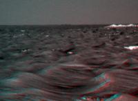
Here's a simple anaglyph, vertical exaggeration x2 -just to have a look at 'Corner Crater' in this new thread.
Nico

|
Posted by: Bob Shaw May 30 2006, 08:36 AM
Hopefully, CC will open a window into the local stratigraphy, thus giving us another point of reference; that's how you go about making geological maps!
Bob Shaw
Posted by: djellison May 30 2006, 08:55 AM
Corner crater might make an interesting venue for the new flight software uplink (assuming that will be done using long HGA passes ) - and they could even manouver for slight sun-favourable slope somewhere around its rim.
Doug
Posted by: MaxSt May 30 2006, 09:05 PM
Corner Crater is very interesting.
High contrast makes me think it's not very old.
Posted by: Bill Harris May 31 2006, 04:38 AM
Here is a de-anaglyphed stereo pair derived from Nix's fine anaglyph for us x-eyed buzzards who can see these things.
Whew, look at the boulders strewn along the way...
--Bill
Posted by: CosmicRocker May 31 2006, 04:46 AM
I tried to post a more thoughtful reply here last night, but managed to lose it when my fingers inadvertently hit some mysterious combination of keys. Here is the executive summary. Corner Crater is obviously a target for the MER team, since they have been making a beeline toward it for some time now. Is that because it is an important scientific target, or simply because it is a distantly visible, navigation marker?
There is potential for science, no doubt. I think we'll only know that for certain once we get there. I expect at least a 180 degeree panorama. I also think the regional northerly tilt of the rock strata reversed a while back, but it is really difficult to be confident in that observation, considering all of the local variations we've seen along the way. It may be helpful to catch some good observations of the rock layers in this crater prior to climbing onto the main ejecta blanket, if only to attempt to learn where in the sectin we might be.
Ignoring all of the above speculation, making ground truth observations of craters on another world will always be an important objective, considering their value in estimating ages, erosion and deposition rates, elucidating stratigraphy, etc. As we learn more about Mars from the rovers, it seems to me that we learn more about how to make the kinds of estimates we need in order to interpret the geology on other worlds. To use a metaphor of the PI, they are our boots on the ground.
Posted by: Bill Harris May 31 2006, 05:09 AM
Well put, Tom. My first informal-name for Corner was "Bullseye Crater" since that was what was happening.
On Mars, craters are our roadcuts...
--Bill
Posted by: Ant103 May 31 2006, 07:37 AM
I think that Corner Crater is an interesting spot. The interior of the crater look very dark and the rims are very bright and strangely elevated, as a sort of "wall". This could be an assembly of layered rocks du to the impact. I've a question : is it a single impact or the impact happened when Victoria was created?
Posted by: Tesheiner May 31 2006, 08:26 AM

I think it's a combination of both factors, and a third one: The rover's path is constrained by the dunes/ripples orientation usually between 160º-180º (SSE-S), and that path places Corner Crater on the way.
I would consider CC as a "bonus", and really believe they won't miss the chance to investigate it.
Posted by: Bill Harris May 31 2006, 11:04 AM
Corner gives us a cross-section through the outer edge of Victoria's ejecta blanket, down to the pre-Victoria land surface.
--Bill
Posted by: Shaka May 31 2006, 05:39 PM
Ant (mind if I call you Ant?), CC is surely interesting for the reasons already mentioned. The apparent depth, the rim "wall", and the ejecta 'rays' that give it an asterisk appearance, all are characteristic of a geologically recent impact. Whether that means a thousand years old or a million may be hard to say, but it certainly is less degraded and so newer than VC. If it is a primary impact, there may be recognizable fragments of the meteorite impactor in the area, but I'm not sure that the PIs will be willing to spend the time looking for them.
Posted by: RNeuhaus May 31 2006, 08:14 PM
The CC is a very original crater. The whitest ones. taller rims than any visited by Oppy on its way from Eagle. I agree with most that CC is younger than VC since its rims is less eroded and also it is on the VC's influence of impact. Hopefully, Oppy will spend many good sols sniffing on CC which favours my bet of outlook VC arrival date.
Rodolfo
Posted by: ustrax May 31 2006, 08:52 PM
Maybe we can find tehre a connection to the brightness of the beacon...
Posted by: kenny May 31 2006, 09:31 PM
What a pleasant, chatty leisurely thread this is, away from the frenetic passions of false democracy evident elsewhere
.
I agree that Corner/Bullseye/Whatever-JPL-Will-Call-It is post-Victoria, relatively fresh, and it really does look fascinating already. I dont think weve yet seen a crater rim so clean of the Meridiani drifting dune material. Speculating on what is perhaps a rim of pale broken evaporite ejecta blocks piled too high to be inundated with dark drifts, I have been thinking of the different types of crater morphologies weve seen on this voyage.
Eagle had no blocks on its sandy rim, while Endurance did have a bedrock exterior rim in places, but lacked scattered ejecta. I keep coming back to little Fram around sol 88, which is fresh enough to have exterior and interior broken blocks, inter-laced with the ubiquitous dark drift. This is in contrast to a significant little crater we passed on sol 818 (new pancams just posted, but I dont have the skills to make a proper pan). This is perhaps a bit larger than Fram size and has a clear circular bedrock rim but not much blocky ejecta evident. The rim of this little crater reminds me of the Payson edge of ancient Erebus. Is it just millennia of slow erosion that turns a jumbled Fram into a flatter crater 818?
Maybe not that simple. What happens when a big impact like Victoria occurs near to an older Erebus or little crater 818? Doesnt a powerful supersonic wind scour the landscape for miles around, blasting away the loose ejecta of older craters and flattening them down to look like rimless Erebus and 818. I dont know whether this is a recognised phenomenon in this field of study, but it does seem to me that big impacts in an atmosphere, like Mars has, are very different from say the moon. And proof if needed that Corner with its raised rim post-dates Victoria.
Kenny
Posted by: Shaka May 31 2006, 10:35 PM
....gasp...whew....'scuse me while I catch my breath in here...
Yes indeed, Kenny, the shock waves, hypersonic blast of superheated air, and gravity flow of proximal ejecta are all parts of the latest hydrocode modelling for impact cratering. I've seen no studies of the effects of these on a neighboring crater, because the research focuses on the larger, more scattered craters on Earth. I have little doubt though that Victoria impact vastly accelerated the erosion of Erebus and any others nearby at the time. The thing about Mars that confuses the issue is that the vast stretches of time surrounding the current topography, combined with a currently slow rate of erosion, allow for multiple cycles of deposition, cratering, burial, exumation, and reburial. If you follow the MOC images at msss.com you've seen copious evidence for these cycles. When a crater, like Corner, has the classic features of freshness, we can assume that it has escaped these cycles. As for the rest, without raised rims, blocky ejecta, etc., who can say?
...right...back into the fray... 
Posted by: Joffan May 31 2006, 10:44 PM
Whew, look at the boulders strewn along the way...
--Bill
Thanks for the X-stereogram, but... boulders? I see no boulders along the way, only drifts and outcrop flats. Are you sure you have your eyes crossed properly?

Otherwise it seems clear that CC is sitting on a ridge - the ground behind it is not visible for a long way off.
Posted by: Bill Harris Jun 1 2006, 02:12 AM
Before the left half of the crater about 2/3 to 3/4 I see rocks larger than usual. Boulders may be an exaggeration, but they're bigger than the usual cobbles...
--Bill
Posted by: Joffan Jun 1 2006, 04:08 PM
I'll agree on a boulder aligned with the east (left) edge of CC, most of the way there. The other white flecks I'm not sure about yet, we'll see! 
Posted by: Nix Jun 1 2006, 09:39 PM
The dark feature on the horizon, has this been visible/discussed yet?
Would that be the edge of the crater ?
Nico
|
Posted by: atomoid Jun 1 2006, 09:57 PM
Would that be the edge of the crater ?
Nico
Interesting how close it looks from here, and if we can see its profile, it really shows that Victoria has no substantial slope up it, were looking pretty flat and there is no slope hiding Victoria's lower flanks. its somewhat of a sunken crater compared to Endurance. Makes me wonder if it compacted the underlying landmass by melting the permafrost or rock, sinking the whoel assembly minimizing its profile on the horizon. Which might account for the small rise separating Victoria and Erebus.
Posted by: Bill Harris Jun 1 2006, 10:34 PM
This is what I think we're looking at. These images are adapted from Nix's anaglyph (de-anaglyphed) and Tesheiner's Route Map (South is up). The edge of the Victoria rim on the left may actually be the nearer west rim, but you get the idea.
--Bill
NOTE: I agree with Joffan, and re-did the image to point at the proper rim-spot on Victoria.
Posted by: Joffan Jun 1 2006, 11:50 PM
I agree that the rough patch on the horizon is the small crater you identify in the diagram Bill, maybe that should be "Garter Crater". Your green arrow should perhaps point to the same place as Tesh's Infallible Route finishes.
I think I was wrong before about Corner being on a ridge; it's just the uniform dark ejecta behind it that gives the illusion of distance behind it.
Posted by: ElkGroveDan Jun 2 2006, 12:19 AM
It's just another beacon. My gut tells me it's on the far rim.

Posted by: dvandorn Jun 3 2006, 05:15 AM
In re the discussion of crater morphologies, specifically as seen in the Meridiani area...
First, if Mars' cratering history is anything akin to the Moon's, then a vast majority of the visible craters were made at the end of the Late Heavy Bombardment. Yes, there has been a continuing cratering process, but the rate has been much slower.
Second, the LHB occurred back in a period when Mars may have had a much thicker atmosphere and a lot more volatiles in and on its crust.
I truly think that one factor in the cratering morphologies is the relative volatiles content of the impact target. I think the old, very subdued craters may have been made by impact into soggy ground (or perhaps even water-covered ground). Sharper-looking craters were made after most of the volatiles disappeared. The former feature subdued rims and ancient crater fill almost level to the rims, while the latter feature much more lunar-like morphologies, arguing against the presence of volatiles in the targets at creation.
So, I would argue that Eagle, Endurance, Fram, Victoria and Corner are all examples of impacts into a dried-out ground target, while Erebus, Terra Nova and other ancient craters in the etched terrain are examples of older impacts into a ground that held an active water table, close to the surface -- if not actually into a body of water.
-the other Doug
Posted by: Shaka Jun 3 2006, 06:29 AM
So, I would argue that Eagle, Endurance, Fram, Victoria and Corner are all examples of impacts into a dried-out ground target, while Erebus, Terra Nova and other ancient craters in the etched terrain are examples of older impacts into a ground that held an active water table, close to the surface -- if not actually into a body of water.
-the other Doug
This all sounds logical, DV, but won't a more parsimonious explanation suffice: Eagle...Corner formed in the last 500 Ma, and Erebus... formed in the 500Ma before that. In other words, do we really need the LHB and the "wet" period on Mars to account for what we see on Meridiani today? How can we distinguish without absolute dates on the craters?
Posted by: Bob Shaw Jun 3 2006, 02:11 PM
We've not really had the chance to examine smaller craters on the ground before the MER missions, but there's a clear set of crater morphologies visible from orbit which certainly *do* demand to be interpreted as impacts into volatile rich materials: the uniquely Martian 'rampart' craters. These are characterised by an ejecta blanket complete with flows, and ending abruptly in lobate scarps. Such craters often resist later water erosion, too, and can form islands in the midst of some of the catastrophic floods.
How tiny craters work in volatile rich periods and/or materials is interesting - but we must remember that secondaries will predominate, with much lower impact speeds and thus lower overall energies.
Bob Shaw
Posted by: dvandorn Jun 3 2006, 04:02 PM
Good points, Bob. And Shaka, as for the importance of knowing how volatile-rich the targets were when given craters were formed -- I would think that this would cause more than just morphological differences. We ou ght to be able to see differrences in the rock types making up the ejecta.
I would think that ejecta from a volatile-rich target would be mineralogically quite different from that from a dried-out target. Without plugging that potential difference into our analysis of the minerology around each type/age of crater, I don't think we're going to be able to come up with analyses that make sense.
-the other Doug
Posted by: Shaka Jun 3 2006, 06:06 PM
-the other Doug
I quite agree, DV, but I'm not sure whether MER is equipped to do these analyses. To start with, we have to find some of the original impact-altered ejecta or melt breccia. That may be a tall order for craters dating back to the wet period. Then we need to analyse for water and other volatile products. Tough row to hoe.
Posted by: dvandorn Jun 3 2006, 06:16 PM
Agreed -- though, to be fair, the MERs were specifically designed to find traces of water in the minerals. They may not have been designed to fully characterize the soils and rocks, but the MER instrument suite was targeted at discovering water and water alteration to rocks.
So, assuming we do find some samples of the original impact melts, we sure do have the right set of tools available to determine their water histories...
-the other Doug
Posted by: kenny Jun 3 2006, 06:47 PM
I truly think that one factor in the cratering morphologies is the relative volatiles content of the impact target. I think the old, very subdued craters may have been made by impact into soggy ground (or perhaps even water-covered ground).
-the other Doug
Well thanks, Other Doug, this does give a start on a plausible sounding explanation for the crater differences that had intrigued me. I could envisage a Fram-type blocky rim turning into a sofer Eagle-type rim with age, but I was struggling to see this evolve towards an Erebus-type, the flat rim with a sharp scarp edge.
Kenny
Posted by: Shaka Jun 5 2006, 07:32 PM
-the other Doug
I hope you're right, DV.
I'm no geochemist, nor do I have any thorough knowledge of the full capabilities of the spectrographic tools on MER, but my ...(dam', nearly said "gut feeling")...my impression is that they were designed to look for mineral species produced in the presence of water at 'cold' temperatures - such as our famous gray hematite. The process of impact melt production is definitely a high-temperature process and may result in different mineral species, to which MER are insensitive. But I don't know.
I do note, however, that there are researchers who managed to get published 'high-temperature interpretations' (viz. impact and volcanic) for the supposedly low-temperature hematite and evaporite we've been riding across since we landed. So maybe the mineral distinctions are not definitive.

Anybody know for sure?
Posted by: Joffan Jun 7 2006, 03:41 PM
I was looking through the new pancams after Oppy's latest great escape, and there seemed to be more loose bright stones lying around (http://qt.exploratorium.edu/mars/opportunity/pancam/2006-06-07/1P202934619EFF71HUP2423L2M1.JPG). I wonder if these are the outer edges of the ejecta from Corner?
Posted by: Shaka Jun 7 2006, 06:02 PM
That's certainly one hypothesis, and if they continue and get even more numerous as we roll south toward CC, I will favor that one. If they get rarer, however, I will propose that they splashed away from the big rubble piles to the west. Those piles may be the remains of big (pickup truck-size) pieces of ejecta from CC or some other recent impact.
Posted by: Bob Shaw Jun 8 2006, 11:41 AM
Joffan:
Seems reasonable. And as for mini-craters (discussed elsewhere), what we want is to see a nice, fresh one, complete with the impactor - we have certainly got a smoking gun in the form of CC...
Bob Shaw
Posted by: WindyT Jun 8 2006, 05:41 PM
Could the study of the outlying ejecta from CC end up providing more clues to the timing of (dune making) events in Meridiani than Corner Crater itself? Perhaps a lens of ejecta covered up by a thin coating of the dune material as exposed by a wheel trench?
Posted by: Shaka Jun 8 2006, 06:25 PM
I would think it quite possible to learn about relative timing. Absolute timing is another matter. Until we can do radioisotopic dating here, that's likely to remain a black box. Mars just smiles like Mona Lisa, and says "Guess."
Posted by: ustrax Jun 8 2006, 07:08 PM
Fresh news from the front:
First I asked Steve Squyres if Corner Crater would be the next planned target:
'Our next major landmark will be a fairly fresh crater that lies about 500 meters this side of Victoria. I think it's roughly 35 m in diameter, so it's probably the one you're talking about* . We've named it Beagle crater. It's named, of course, for Darwin's ship, but the name is also a tip of the hat to our British colleagues who headed for Mars about the same time that we did.'
Then:
There were some thoughts about the nature of the terrain Opportunity is now traversing:
'It appears to me that Opportunity has recently decended into an ancient crater... whose circular outline is apparent on Tesheiner's maps. The decent can be seen in recent anaglyphs from Opportunity. It appears to me that the crater's basin is directly in our path, and I wonder if the aeolian sediment in this crater is more treacherous than elsewhere, and responsible for the recent wheel embedding hazard.' (CosmicRocker)
Looking into the separating the rover from Victoria I think I can see what he means:
http://i16.photobucket.com/albums/b14/ustrax3/scr.jpg
And it looks, in my opinion, that this represents, in fact, serious possibilities of seing Opportunity stuck again...
If this is correct your idea is to keep on following the rocky road and, in the absence of it try to stick to the contour of those old craters rim?
'Regarding our path southward, we'll always travel on rock when we can find it. The terrain we're in right now just doesn't have a lot of rock, so we'll pick our way through it as best we can.
Cheers, SS'
*corner crater
What will our little and dusty Darwin discover there?...
Posted by: Mizar Jun 8 2006, 07:42 PM
ustrax, thanks for sharing this.
Direct communication with SS, not bad.
But I have to remember that Mr. ustrax isn't an average man. He's involved to name features on Mars !
Posted by: Joffan Jun 8 2006, 08:53 PM
Beagle Crater... hmm, I like it.
Image of beagle trotting along at the hem of Queen Victoria's skirt...
Posted by: Tesheiner Jun 8 2006, 08:56 PM
Beagle crater, that's ok; but it'll always be Corner Crater too.
Posted by: Shaka Jun 8 2006, 09:03 PM
Image of beagle trotting along at the hem of Queen Victoria's skirt...
Then again, if we renamed Victoria as "Doghouse"...

Posted by: dilo Jun 8 2006, 09:08 PM
Time to return on target:
Sol843 - stitched and merged (left+right) images, without and with 5x vertical stretch... go Oppy, go to Beagle!

|

|
Posted by: climber Jun 8 2006, 09:09 PM
I'm afraid the other Beagle ended up making a crater too 
Posted by: Shaka Jun 8 2006, 09:21 PM
Sol843 -
Thanx, Amico, I needed an image 'fix' badly.
Say, no one's mentioned it, but there's a nice black beacon right in Beagle's middle. Probably a shadow.
What do your observations indicate about its location? Near rim or far?
Shirley, wanna take a poll?

Posted by: Bill Harris Jun 8 2006, 10:32 PM
Thanks for the merged & stretched look-ahead images. I hope we can still make good travel times, I note a _significant_ change in the sand: there are a lot of small ripples across the N-S trending major ripples, and this is worrisome. It suggests that this sand is "fresher" and actively moving and looser, so Oppy may have to pick her route carefully.
--Bill
Posted by: Joffan Jun 8 2006, 11:45 PM
For cross-eyed stereo fans, here's a view of the road ahead to Beagle Corner:

|
The black Beagle beacon beckons...
Posted by: RNeuhaus Jun 9 2006, 03:53 AM
When I see the surface from Oppy to Corner Crater that is more uneven surface. It might mean, just my toughts and nothing sure, that there has more wind or turbulence wind zone caused by VC and hence sand is looser.
Rodolfo
Posted by: Shaka Jun 9 2006, 04:28 AM
Rodolfo
Excellent hypothesis, Rod. Now, who can design a critical test?
Note added in proof: Perhaps we should call it the Neuhaus-Harris Sloppy Sand Hypothesis.
Posted by: RNeuhaus Jun 9 2006, 04:39 AM
Good Shaka! About the test, I have nothing on my pockets!
 Maybe MSL will carry an aeolianmeter which MERs are missing. This is a needed for wind speed and direction meters.
 Rodolfo
Posted by: Shaka Jun 9 2006, 04:58 AM
Rodolfo
Not a problem, Rod! This is a team effort, and others may have something on their pockets.
Allright, you guys, we can't wait till the 22nd century for
...
Posted by: hendric Jun 9 2006, 05:28 AM
Well, if the wind is more turbulent maybe we'll start seeing cleaning events here? Perhaps taking one pancam pic in the direction behind us to watch for dust movements along our tracks? Pick up a small quantity of dust with the RAT by brushing a vertical hole, then lifting it up and extending the arm, photographing how the dust moves as it falls?
Speaking of which, anyone talk to MSL about adding a flag/pennant yet to their rover?!?
Posted by: Shaka Jun 9 2006, 06:27 AM
Speaking of which, anyone talk to MSL about adding a flag/pennant yet to their rover?!?
O.K., hen (mind if I call you hen?), clearly you are trying to contrive a proxy anemo... wind measurer, but that would require an extensive program of wind velocity measurements all around, and also away from VC. I think this would be a big project even with custom-designed instruments. How would we know that this week's measurements are at all typical of the whole year, the whole century, or the whole millenium? It's scary to ponder how old the ripples are.
No, I think we need to find clues in the regolith surrounding VC today, that support or falsify the N/H SS Hypothesis.
Re MSL design: if they send a rover to Mars, with streaming video capability, without putting on something to wave or twirl or jiggle when the wind blows by... well, I fear for NASA's survival. Imagine looking at months of movies where nothing moves, until dust devil season rolls around again!
Posted by: Shaka Jun 9 2006, 06:43 AM
If they've nothing better, I'd be prepared to donate something like this:

|
Posted by: Stu Jun 9 2006, 07:39 AM
Hmmmm, Beagle Crater... like it! Nice thought on Steve's part.
means I have to go re-write my http://www.sffworld.com/community/story/1566p0.html tho... grrr....
Posted by: Bob Shaw Jun 9 2006, 02:49 PM
Maybe MSL will carry an aeolianmeter which MERs are missing. This is a needed for wind speed and direction meters. Rodolfo
Rodolfo:
It's about time somebody flew an alethiometer, too. Obviously, the results would be very subtle when you put them under the knife, but - for example - you might see the detection of any Martian Northern Lights. It might also sort out - at last - the actual surface colours issue so that the surface doesn't look like we're peering through an amber spyglass.
Bob Shaw
Posted by: Joffan Jun 9 2006, 03:08 PM
Bob: If you have any pull, man, I'm sure it'll happen.
Posted by: Bob Shaw Jun 9 2006, 03:23 PM
Joffan:
There's also the whole possibility of detecting Dark Matter - there's all sorts of materials out there!
Bob Shaw
Posted by: RNeuhaus Jun 9 2006, 03:26 PM
It's about time somebody flew an alethiometer, too. Obviously, the results would be very subtle when you put them under the knife, but - for example - you might see the detection of any Martian Northern Lights. It might also sort out - at last - the actual surface colours issue so that the surface doesn't look like we're peering through an amber spyglass.
Bob Shaw
Sure!
all MER pictures have deceptive colours and I have to wait until any graphic/picture fan designer who put any analgyph and sophisticated colours before to assent so!, before that is with glut feeling
. But the land sand form or relief does not necessary have a colorful pictures. Rodolfo
Posted by: ElkGroveDan Jun 9 2006, 03:43 PM
Shaka's not going to be happy. Now we have a glut of gut feelings.
Posted by: RNeuhaus Jun 9 2006, 04:02 PM
Oppy has started to ride toward south but the following picture looks like that Oppy has again stuck into a sand but a little!! It seems that Oppy is trying to skip over a soft crest of ripple.
Rear
http://qt.exploratorium.edu/mars/opportunity/rear_hazcam/2006-06-09/1R203109587EFF7224P1311R0M1.JPG
Front. Doing IDD to figure out about the flufly sand 
http://qt.exploratorium.edu/mars/opportunity/forward_hazcam/2006-06-09/1F203110086EFF7224P1151L0M1.JPG
Rodolfo
Posted by: ustrax Jun 9 2006, 04:07 PM
Rear
http://qt.exploratorium.edu/mars/opportunity/rear_hazcam/2006-06-09/1R203109587EFF7224P1311R0M1.JPG
Front. Doing IDD to figure out about the flufly sand
http://qt.exploratorium.edu/mars/opportunity/forward_hazcam/2006-06-09/1F203110086EFF7224P1151L0M1.JPG
Rodolfo
Oh boy...This will be a long journey...
EDITED: is it trying to skip the crest or ride the crest? Hang loose!
Posted by: fredk Jun 12 2006, 05:03 PM
Here's a long-baseline cross-eye image of Beagle crater, from sols 823 and 846:
|
|
You can now distinguish a couple of features on the far rim from most of the visible rim which is near; they're on the right side of the crater. This 200% zoom might help:
|
|
Hopefully this won't start another near/far debate!
Posted by: Stu Jun 12 2006, 08:18 PM
Thanks for those views fred, very intriguing! Looks like a fascinating place to explore on the way to VC. I've high hopes we'll find some meteorite fragments here.
Posted by: dilo Jun 12 2006, 08:18 PM
fredk, we had same idea but I used Sol 833/846, so a different baseline (less than 12m, based on last Theseiner maps). Here the crossed eye with 5x vertical stretch...

|
they show clearly that foreground ripples stop well before CC and that east terrain (with higher ripples and dark features) has a complex structure. However, your stereograms is better in revealing CC structures (in particular right boulder seems in the center of crater while leftmost is in front of the close rim...)
Edit: corrected images / different sol
Posted by: Bill Harris Jun 12 2006, 10:51 PM
I look at the current ripples as "choppy seas", something (likely aeolian) has made them more active than the ripples we'vew seen since leaving Erebus. I'd guess a wind rotor on the downwind side of "Heck of a View" hill. Still, it's as though we're in dangerous waters with shoals all about, so we'll have to proceed slowly, with caution.
Sorry, I'm in a nautical mood.
We still need to keep a close watch on the evaporite bedrock underfoot (underwheel?) as we're getting closer to a major impact feature and we need to see what changes are happening.
--Bill
Posted by: RNeuhaus Jun 13 2006, 02:54 AM
The CC has dented rim. It is funny. I am not sure about the width of the CC. Its width is only covered by the light color rim, isn't it?
Rodolfo
Posted by: kenny Jun 13 2006, 07:28 AM
I was assuming that the width of CC (Beagle) was delineated by the distance between the highest white points at the left and right ends of the the white area we see. This would mean that the areas to the left of the "Left White Peak", and to the right of the "Right White Peak" are exposed bedrock outside the crater rim. What we see from our viewing angle is the typical cross section of a crater with raised rim.
Kenny
Posted by: RNeuhaus Jun 13 2006, 04:22 PM
Now Oppy is still between 518-541 meters from Corner Crater. If Oppy transverse with an average of 10meters/sol, this will take about 51-54 soles. That is we have to wait until July 28-31. That is a very long time since the way toward to CC is of full suspensions.
Rodolfo
Posted by: dilo Jun 15 2006, 06:08 AM
Sol849 stack of left+right images, with noise reduction and sharpening:

|
now we clearly see 3 dark boulders...
Posted by: Shaka Jun 15 2006, 06:36 AM
now we clearly see 3 dark boulders...
Bellissimo, Caro. I hope there will be no Civil War, if I suggest that most of the bright rim we see is on the near semicircle. The orbital view shows lots of bright material on both sides. Given that we agree this is a comparatively new crater, which should have a raised rim, we should see the near rim first. The dark spots should be shadows, since we have little reason to expect dark strata above hundreds of meters of pale sedimentary deposits. As with Victoria, we probably won't see much of the far rim or crater interior until we are within "spitting distance" of the rim. I still think Beagle is of secondary interest, compared to VC, so we won't linger there unless we get stuck like poor Spirit.

Posted by: FIN Mars Jun 15 2006, 09:59 AM
http://marsrovers.nasa.gov/gallery/all/1/p/848/1P203470421EFF72DPP2428R2M1.JPG
There is two or three dark pointis at corner crater. Mayde they are rocks?
Posted by: Joffan Jun 19 2006, 06:53 PM
Beagle sits at the transition to the *only* uniquely-Martian splash-pattern ejecta field around a good-sized impact crater that *any* Earth probe has ever visited. The current thinking is very, very strong that such splash-pattern ejecta blankets are due to the target surface being relatively rich in volatiles (specifically, water and/or ice).
I would think that observations along this very well-defined contact (at least in the MOC images) will be able to go far in confirming or disputing those theories. Especially considering that we have a Godsend, a nice, relatively fresh impact drill-hole right through the contact boundary.
That would be a very, very important piece of work with which to crown the MER missions, I think...
-the other Doug
From overhead it's one of the most interesting small craters I've seen, for sure. Obviously VC's beatuifully sinuous rim is a different class.
I certainly hope we spend enough time there to get a good profile of the different areas of CC, even though I know the drivers among us want to investigate Victoria's secrets.
Posted by: elakdawalla Jun 19 2006, 07:11 PM
Could someone fill me in -- and my apologies if this is actually explained somewhere that I can't find. What are the origins of the two names "Corner Crater" and "Beagle Crater?" Is "CC" what USMFers were using to refer to the site, while "BC" came from the MER team? When/where did the name "Beagle" first appear?
--Emily
Posted by: dot.dk Jun 19 2006, 07:25 PM
We got the name from Steve himself with help from ustrax earlier in this thread
http://www.unmannedspaceflight.com/index.php?s=&showtopic=2790&view=findpost&p=57622
Posted by: elakdawalla Jun 19 2006, 07:29 PM
Woops, don't know how I missed that, thank you! --Emily
Posted by: Joffan Jun 19 2006, 10:13 PM
And climber replied:
and I reckon there's 12-15 drives left in the approach to CC, which at three drives this week and next week, then 5 the following week and 1-4 the week after. puts us around 13 July at CC, so yes, just a bit more than 20 sols - say 23-24. First Beagle Panorama and taking MIs by Sol 880.
Posted by: RNeuhaus Jun 20 2006, 03:03 AM
and I reckon there's 12-15 drives left in the approach to CC, which at three drives this week and next week, then 5 the following week and 1-4 the week after. puts us around 13 July at CC, so yes, just a bit more than 20 sols - say 23-24. First Beagle Panorama and taking MIs by Sol 880.
The estimation range is between July 14 to 31 depending to the average speed meters/sol. http://www.unmannedspaceflight.com/index.php?s=&showtopic=1228&view=findpost&p=58215 I promise to update it by this Wednesday.
I have reviewed the path route from now up to BC is of no new novelty that might stop to Oppy to peek for searching. There are two possiblities to reach BC:
1) Same channel up to the latitud of BC and then turn left (East) toward BC.
2) Turn on left when Oppy reach a pool of etched outcrop (about 10 meters from now) up to the proper East longitudinal before turning right hand to south in a straigth line to BC.
I prefer the option 1) for two reasons. there is interesting area on the west of BC and also the soutward road is "really good". So the rovers will be hypnotized driving on the same channel between crests of sand toward the BC.
Rodolfo
Posted by: Tesheiner Jun 20 2006, 07:45 AM
--Emily
Corner Crater got its name because it's located at about the "top left" corner -- thinking of VC enclosed by a square -- on the approach to Victoria.
Posted by: djellison Jun 20 2006, 07:59 AM
Here's my Beagle Crater Itinery
Arrival Sol - final drive
+1 - part one of 180 degree Pancam mosaic ( 4 x 3 frames L256R1 ) and matching Mini TES
+2 - part two of 180 degree Pancam mosaic ( 4 x 3 frames L256R1 ) and matching Mini TES
+3 - Full filter set targetted observations and small FOV MiniTES Observations of potential targets
+4 - begin drive around Beagle Crater
+5 - continue drive around Beagle Crater
+6 - continue drive around Beagle Crater
+7 - Replicated Sol +1
+8 - Replicated Sol +2
+9 - being drive to selected IDD work space
+10 - further drive to selected IDD work space
+11 - approach drive
+12 - +18 - IDD work on selected IDD work space and full filter suite Pancam imagery toward VC
+19 - back off and remote obs of IDD work volume
Repeat +10 to +19 for further IDD targets if identified, otherwise
+20 - leave Beagle en route to VC.
The imagery from BC-Pan1 and BC-Pan2 should also be used, with a few VC-direction L2/R2's to do some moderate baseline stereo imagery of the drive to VC to give a good sense of any obsticles out to 100m or so
Of course, any mission scientist or engineer could now rip my schedule apart - which is why I'm here typing, and they're over there driving rovers
Doug
Posted by: Phil Stooke Jun 20 2006, 12:47 PM
A pic of Beagle using two pancams from the latest downlink, plus a hefty stretch. The geography of the crater is becoming clearer.
Phil

|
Posted by: Shaka Jun 20 2006, 06:53 PM
Phil
Thanx, Phil.
Are we close enough yet to learn something from an anaglyph? Any resolution of near/far rim features?
Posted by: ElkGroveDan Jun 20 2006, 07:25 PM
Especially if we encounter more festoons

Posted by: Shaka Jun 20 2006, 09:35 PM
Or if we don't.
I'd say Doug's research plan is quite a 'generous' investment of time to Beagle. Given the beckoning charms of Vikkie, I could see spending a good deal less than 20 sols playing with the dog.
At BC we will be able to directly assess the traversability of the VC apron. If it looks like a piece of cake, the PIs may be willing to blow some time in BC. If not... Time will tell.
Posted by: Joffan Jun 20 2006, 11:00 PM
Either way.
If the going to her majesty VC looks tough, we might as well maximise the science from her dog BC.
If she looks like an easy win, why hurry?
Woof.
Posted by: Shaka Jun 20 2006, 11:17 PM
Horses for courses.
Meeow.
(Anyone want to add to the Noah's Ark double entendres?)
Posted by: dvandorn Jun 21 2006, 12:00 AM
Doug, I think your schedule sounds perfect. It will get a decent baseline of everything we can eventually pull out of the site, and give the guys in the back rooms a lot of data to chew over while the operators move on towards Victoria. And maybe gives us an idea of what else we might want to look for in any re-visiting of the boundary of Victoria's splash-pattern ejecta blanket.
The only pacing item I can see would be power -- are we still in good enough shape on the power curve with Oppy to be able to withstand the additional time sitting on flat surfaces, not perched on a north-facing inner slope of Victoria?
-the other Doug
Posted by: Bob Shaw Jun 21 2006, 12:01 AM
Meeow.
(Anyone want to add to the Noah's Ark double entendres?)
Shaka:
No. Despite your belief that the citizens of certain nations are addicted to terrible puns, it's just not the case. In fact, regarding such wordplay, me no Laika.
Bob Shaw
Posted by: dvandorn Jun 21 2006, 12:06 AM
Me, either, Bob. Now, pardon me, I'm having HAM for dinner.
-the other Doug
Posted by: Shaka Jun 21 2006, 02:21 AM
[Condition Yellow]
[Condition Yellow]
Posted by: CosmicRocker Jun 21 2006, 04:02 AM
I wanted to make a couple of quick comments. I agree with dvandorn that the edge of the ejecta blanket behind Beagle Crater should make a very interesting science target, worthy of some time to study it. As Doug pointed out, there is also a lot of other science/investigation to be done around here, but I don't know if the decision makers will allow 20 sols for it. I also agree with CryptoEngineer (and perhaps others) who pointed out in the other thread that the ejecta blanket south of Beagle appears to be a bluff, but that a ramped approach to Victoria is available slightly to the east. That seems quite apparent in the MOC anaglyph of the area which I am attaching.
I believe our recently verbose and enthusiastic friend earlier requested anaglyphs of Beagle. I had made some from the longer baseline stereo-pairs provided by fredk and dilo. An extended baseline pair was an excellent idea, guys! I had tried to do some of Victoria earlier, but didn't think about Beagle. I'll also attach them, and attempt to draw a conclusion about whether we are seeing the near or far side of Beagle.
I found it difficult to come to a firm conclusion about Beagle's near/far visibility when I first studied the anaglyphs. But then I realized I should look to the MOC orbital imagery for help. On those, it seems obvious that there was a taller pile of stuff around its southeast side than anywhere else. After realizing that and going back to the anaglyphs made from fredk's and dilo's stereo-pairs, I convinced myself that most of the elevated rim we are seeing on Beagle is on the far side. Those two darker rocks we have been seeing are on the near side. There also appears to be a somewhat darker and lower rim on the near side. An elevated southeast far rim is also consistent with the low western extension we see.
(whoops, had to edit to correct an incorrect file attachement)
|
|
|
|

|
Posted by: RNeuhaus Jun 21 2006, 04:47 AM
Tom:
I have taken your cropped picture to save me the time . It is evident that the BC is the product of a secondary impact crater by splashing by a rock coming from Victoria Crater toward the West side. You can see a 90 degree of angle of outcrop toward West from the BC site.

|
Rodolfo
Posted by: helvick Jun 21 2006, 06:40 AM
I don't seem to have any recent confirmed power numbers from Opportunity but extrapolating out from the last confirmed value (540 whr on Sol 753) we have:
Current (Sol 856): ~ 382whr
Minimum: 339whr from Sol 937 to Sol 965.
Assuming a constant 0.18% incremental loss in power per Sol due to ongoing dust deposition.
So power is tight but it should remain just enough to get in an hour or two of driving in on most Sols.
Posted by: Shaka Jun 21 2006, 07:17 AM
He did, indeed, and, ever true blue, you came through! Thanx, Tom! (I hope that rings of enthusiasm; I'll save the verbosity for later.)
I usually prefer to leave this eye-strain exercise to Dilo, Rod and Tesh, who revel in it, but thought I had committed myself to taking a shot.
I looked at your first (stretched) anaglyph for quite a while, and eventually convinced myself that the third bright peak from the left end of BC, looked closer than those on either side. I can't see much to indicate height in the MOC image, though it seems apparent that the near rim casts a shadow over the majority of the crater bottom. I couldn't calculate sun angles the way Tesh might, but it at least suggests to me that the near rim has some height. In spite of that, when I inverted the MOC view of BC to line it up with the Oppster view, I thought I could see a number of feature correspondences that do put some of the high peaks at the back:

|
I could be quite wrong in this, because the MOC and Oppy viewpoints are 90 degrees out. Everything we see from Oppy could be near rim, but for now I'm supporting a near/far split.
Posted by: climber Jun 21 2006, 09:28 AM
[quote name='Shaka' date='Jun 21 2006, 09:17 AM' post='59252']
I could be quite wrong in this, because the MOC and Oppy viewpoints are 90 degrees out. Everything we see from Oppy [i]could be near rim, but for now I'm supporting a near/far split. [/i]
Shaka, I feel that all the "black stuff" we see correspond to the disturbed terrain that sit father than Beagle. I realy don't see what you see, and the reversed MOC pictures of Beagle you're using is quite confusing to me. By the way, why do you still use (on the picts) CC instead of Beagle? Could it be that when you'll see you were wrong you'll argue that you didn't talk of the same crater?
Posted by: Tesheiner Jun 21 2006, 10:05 AM
I would really like to see Oppy stopped at Beagle some 20 days.

Given the current pace, we'll be there at Beacon/Corner Crater by mid July, almost exactly when my summer vacations starts... and I don't want to miss the arrival at VC!
PS: No, I can't change/delay my vacations.
Posted by: Bob Shaw Jun 21 2006, 12:21 PM
Rodolfo
Rodolfo:
Yes, a secondary - but why associate it with Victoria?
Bob Shaw
Posted by: Shaka Jun 21 2006, 07:24 PM
Note: Does anyone else have trouble getting the "reply" button below each message to work? It works occasionally, but then fails repeatedly. I then try the "Addreply" at the bottom of the page, which usually works, but does not include any "Quote".
Oh well, I'll reply to Climber's Post #97:
"Shaka, I feel that all the "black stuff" we see correspond to the disturbed terrain that sit father than Beagle."
I assume you're referring to the black bars on either side of BC which I connect with yellow arrows. I just noted that the black bars seemed to correspond in location and size with a couple of black spots in the MOC image. They might not be the same, but why not?
"I realy don't see what you see, and the reversed MOC pictures of Beagle you're using is quite confusing to me."
Isn't that strange. I thought it an obvious thing to do - invert the MOC view - so that the left (east) side of the crater and the right (west) side lined up vertically in both images. Does anyone else feel confused by this? It's the only way I feel comfortable doing the image comparison.
"By the way, why do you still use (on the picts) CC instead of Beagle? Could it be that when you'll see you were wrong you'll argue that you didn't talk of the same crater? biggrin.gif"
Ha! Good one! Seriously, I just cropped BC from one of Tesh's route maps, which carries the old label.
Now, the key point I'm trying to explain is why the third white peak from the left end of BC in Tom's anaglyph seems to me to stand forward from the others. Does anyone else see this? Tom?
Posted by: RNeuhaus Jun 21 2006, 08:28 PM
Yes, a secondary - but why associate it with Victoria?
Bob Shaw
Your supposition might be valid. This impact might comes from the other bigger craters which might be few kilometers away from VC.
I tought it might comes from the VC due to the central angle of splash is pointing at more or less to VC. The East of BC has small rays but on the West side has much bigger ones.
http://www.unmannedspaceflight.com/index.php?act=Attach&type=post&id=6354
The final truth that BC is a secondary impact from VC, might be after analyzing the surface composition at the bottom of BC and VC which are identical, might not it? What instrument will disclose that incognite: MiniTES, X-Ray spectometer or Mossbauer spectometer? I tought a more powerful microscopic than PI might reveal it, does not it?
Rodolfo
Posted by: Tesheiner Jun 21 2006, 08:29 PM
Yes, and I think I know why because it happened to me only when replying to climber . Hello, climber!
Sometimes, he answers including a kind of quote that actually contains a quote-start mark but doesn't end with the "slash"-quote. It seems that such a string "hurts" to the forum sw when trying to reply.
[quote]This is an example.
Try to reply to this post; you will probably get an error.
Posted by: Shaka Jun 21 2006, 08:54 PM
Aha! Sherlock Holmes strikes again! Well done, Tesh. I almost can't believe it's so simple. I never noticed that it only happened with Climber's posts. I have noticed for quite a while that Climber has trouble making the quote window work. Probably because, when deleting portions of the quoted message, he also deletes the [/quote]. (Damn, I wonder if that will bugger up my message?)
ATTENTION, CLIMBER! If you want replies to your posts, don't delete that thingie above.
Posted by: CosmicRocker Jun 22 2006, 04:41 AM
You could very well be correct, but I'll reserve my opinion a while longer, until we get closer. I see what you are saying, but using these extended baseline stereo-pairs from raw imagery is right on the cutting edge, as far as I can tell. Using the anaglyph I made from the stretched stereo-pair that dilo gave us, that 3rd peak from the left does appear to be on the near side. But when I look at the anaglyph made from fredk's stereo-pair, I see it on the far side. It would be interesting to hear what dilo and fredk think.
When I made my post last night, I was also putting a lot of faith in my interpretation of the 2D appearance of BC in the MOC image. The asymmetric distribution of the bright material around the crater suggests to me that the impactor that created BC came in from the NW, thus throwing out those longer bright raylets toward the SSE, SE and SW. It seemed logical that such an impact might also create a SE rim that was higher than the NW rim. I still think that is a reasonable hypothesis, but that too, is on my cutting edge.
(attached is my markup of your image, showing my presumed impact direction.) ...looking forward to the ground truth...

|
Posted by: dvandorn Jun 22 2006, 05:05 AM
Tom, yours is an interesting theory (trying to determine the vector of the impactor), and I wouldn't discount it at this point. However, I will say that asymmetric ejecta blankets are more often caused by variations in the target rock beds than they are by the impactor's vector.
It really depends on how fast the impactor is going. Some secondaries are higher-velocity than others (and involve greater impactor masses), and above a certain velocity and/or kinetic energy (i.e., mass of the impactor times velocity), even a very depressed vector will result in a perfectly round crater and a fairly evenly distributed ejecta blanket.
Pre-existing target topography and composition usually controls ejecta asymmetry more than vector, I believe... but, on Mars, we have seen a greater population of grazing impacts than we do on, say, the Moon. What the mechanism for that is, I couldn't tell you.
-the other Doug
Posted by: climber Jun 22 2006, 08:17 AM
ATTENTION, CLIMBER! If you want replies to your posts, don't delete that thingie above.
Can't believe it! Realy sorry for this!
Now I have a doubt! Where do I have to write. Let's try this way
Posted by: ustrax Jun 22 2006, 08:20 AM
Now I have a doubt! Where do I have to write. Let's try this way
It's perfect like that climber, it works.
Posted by: climber Jun 22 2006, 08:20 AM
[quote]This is an example.
Try to reply to this post; you will probably get an error.
Oh thanks Tesheiner!
You're damn right.
Posted by: climber Jun 22 2006, 08:23 AM
Thanks ustrax...even if I was thinkibng you were jocking : I was 3 times an error to answer to you
Thanks to all, but we'd better stop saying it works NOW. I don't want to open a new topic for this
Posted by: climber Jun 22 2006, 08:32 AM
[i]"I realy don't see what you see, and the reversed MOC pictures of Beagle you're using is quite confusing to me."
Isn't that strange. I thought it an obvious thing to do - invert the MOC view - so that the left (east) side of the crater and the right (west) side lined up vertically in both images. Does anyone else feel confused by this? It's the only way I feel comfortable doing the image comparison.[/i]
[/quote]
Well, I understand what you mean now. It's just a different way of interpretation. When I hike up in the mountains, I hold the map in the way I can read it so left on the map is right on the field while some people hold the map the way they go (but have to turn it around to read what is written) : left on the map is left on the field. Sorry I didn't thougth of this before. I'm sure some others are confused too.
Edit : damnit the "[/quote]" is showing again! What do I have to do so it'll not show?
Posted by: remcook Jun 22 2006, 10:54 AM
start with "[quote]"
Posted by: djellison Jun 22 2006, 11:28 AM
It's quite easy
The quote
[/QUOTE]
same with test
Posted by: fredk Jun 22 2006, 04:46 PM
Well, rocker, I won't tell you what I think, I'll just present to you Beagle Crater:

|
This is a the latest long-baseline analglyph, sols 853 and 855, with 200% zoom but no vertical stretch. Even though we're approaching Beagle, there's enough side-to-side motion to give a good 3d effect. It's now absolutely clear where each of the outcrops lie.
I prefer the cross-eyed version (100%, no stretch):
|
|
To save extreme cross-eyeing, I strongly recommend the free http://stereo.jpn.org/eng/stphmkr/ It allows you to pan across the image without having the two sides too far apart. Even at 200% zoom (which I suggest you try with this image!)
Posted by: Shaka Jun 22 2006, 06:36 PM
I prefer the cross-eyed version (100%, no stretch):
Aaarrrrrgghhhh!

|
Help. Freddo, I can't see either of your versions.
But I made a close study of Tom's anaglyph yesterday and thought I could trace in the near rim line:
|
|
Does this agree at all with what you see? Can you try something similar with your anaglyph?
Posted by: fredk Jun 22 2006, 06:49 PM
Shak, what problem are you having with the analglyph? Do you normally have trouble viewing analglyphs?
As for the cross-eyed, the only help is to chop them up into slices easier to fuse, or use StereoPhoto Maker!
Posted by: Shaka Jun 22 2006, 07:10 PM
I'm seeing double images and can't get any sense of depth.
Sometimes. I have no trouble with CosRok's stretched anaglyph, though.
Ouch! Does Mars demand that of me? I thought the stretched baseline was enough.
I just downloaded and started StereoPhoto Maker, and opened your left/right image, but haven't figured out yet how to use it to make things easier. I can actually get some cross-eye pairs to works, but with yours my eye muscles fight this tremendous battle to 'open up' the 3D middle image, but it slams shut, and ...well...you can see the results. It hurts!
Posted by: dilo Jun 22 2006, 07:13 PM
Fred, your stereogram is very impressive, thanks!
Posted by: Michael Capobianco Jun 22 2006, 07:22 PM
I'm afraid I can't get either one to work, either. I normally don't have a problem with anaglyphs.
Michaelc
Posted by: fredk Jun 22 2006, 07:34 PM
I really don't know what the problem with the red/green one is. I have no trouble with it. Keep trying?
Once you've got the cross-eyed loaded in SPM, select 100% view size, or even better 200%. Then, to make it easy to fuse, just grab an edge of the SPM window and drag it to make the window narrower. The L/R images get closer together as you do this, so you won't see the entire crater at once, but you can left-mouse-button drag the image itself to pan across it.
Posted by: Shaka Jun 22 2006, 07:37 PM
Stone the flamin' crows, this is spooky. Michael, are you near or far?
Maybe we need a poll on this? Bobby? Shirley? Warmonger? Now where has that guy gone to when we need him?
Posted by: Shaka Jun 22 2006, 08:04 PM
No joy. I even downloaded it to Photoshop and tried a range of sizes. Same story with SPM.
I definitely think there's a research project here in cognitive psychology. Anybody out there want another degree?
Oh well! What about my traced near rim line? Do you see anything like that in your images?
What do you see?
Posted by: Michael Capobianco Jun 22 2006, 08:22 PM
Stone the flamin' crows, this is spooky. Michael, are you near or far?Maybe we need a poll on this? Bobby? Shirley? Warmonger? Now where has that guy gone to when we need him?
I'm a fence sitter.
I loaded Fred's image into SPM, and I fiddled with it until I produced an image that merges, at least for me. Let's see what happens when I upload it here.

|
Michaelc
Posted by: Shaka Jun 22 2006, 08:53 PM
Michaelc
Oww! My achin' eyes. I gotta go lay down for awhile. Your image is very disturbing, MC. I see things popping in and out the longer I stare. I just can't sort out the unstretched 3D images at this distance. For some reason CosRok's stretched anaglyph (post #93) works well for me. Go figure.
I don't think I want to suffer anymore to see something we'll be sitting on in a couple of weeks. I'll wait.
Posted by: fredk Jun 22 2006, 09:03 PM
Michael, your image has red/green channels switched!
Posted by: Tesheiner Jun 22 2006, 09:13 PM
Man! Usually I consider myself unlucky being unable to see *any* 3D images. But now I should say I feel, er ... lucky.
Posted by: climber Jun 22 2006, 09:22 PM
Can we now compare the relative elevation above the plain of the higher "peak" of Beagle as compared to VC's? Beacon?
Posted by: CosmicRocker Jun 22 2006, 10:07 PM
One thing to keep in mind when viewing these long baseline stereo pairs is that the foreground is very different between the left and right images. Thus, there is no stereo effect there. All of the 3D effect is in the distance. I think that may be one reason why so many people are having trouble with these. I must admit that I sometimes have difficulties with them as well. Sometimes one image will work for me, but later I have trouble with it.
Posted by: Michael Capobianco Jun 22 2006, 10:32 PM
Hmm. I hope I didn't inadvertently cause anybody's eyes to fall out.
My image was taken directly from the standard red-cyan setting in SPM. Unless the images were somehow reversed. My glasses have red on the left and cyan on the right, and although the crater itself doesn't seem to show much depth, I'm clearly seeing that the whole image is in 3-DMaybe I should leave this to the more experienced.
Michaelc
Posted by: Bobby Jun 23 2006, 12:23 AM
Is this the far rim or near rim of Corner (Beagle) Crater???
http://qt.exploratorium.edu/mars/opportunity/pancam/2006-06-22/1P204269526EFF7300P2434L2M1.JPG
New images from today are in at exploratorium web site
Posted by: alan Jun 23 2006, 12:37 AM
I can see part of the far rim through a gap in the near rim
Posted by: Bill Harris Jun 23 2006, 02:25 AM
>I can see part of the far rim through a gap in the near rim
Ah, so it's deja vu all over again...
--Bill
Posted by: CosmicRocker Jun 23 2006, 02:40 AM
I don't know if this will help or not, but I made a small rotational adjustment to fredk's left-eye image. The images were slightly rotated with respect to one another. It seems to work a little better for me. I aligned the left and right images on that dark rock just left of center, so even if you can't make the anaglyh work for you, you can get a sense for the distance of features by the amount of offset between the feature in the red and cyan images. The greater the offset between them, the farther away that feature is.
The attached montage has anaglyphs at 100%, 200%, and one with 3X vertical exaggeration. It seems to me that the 3rd peak from the left is indeed on the near side, the 2nd from the left is somewhat behind it, and the other peaks are on the far side.

|
Posted by: Shaka Jun 23 2006, 03:21 AM
O.K., Tom. We're making some progress here. The stretched anaglyph, like your earlier one, is easier for me to see the lay of the land. I see basically the same as before: The third peak from left is near rim, as is the right-hand portion of the peak at the right end. (The left-hand portion is far rim.) The continuous, low band connecting the peaks is near rim, so the far peaks all jut above it. This is what I would expect from the MOC image, and it confirms my rim line in post #114, as well as my attempt to correlate the two views in post #96.
Additionally, "Black Beacon", to left of center, is in front of near rim, while the smaller black dot to right of center is somewhere behind near rim.
Would you agree? I do hope we can all agree about Beagle. Victoria may just have to go in the "Hopeless Cases" bin. When we finally get to that Beacon, I hope JPL does a complete MI map of the whole slab, so that the Sponge Patrol can finally see, in fine resolution, the Light of Truth.
Posted by: Zeke4ther Jun 23 2006, 03:33 AM
Yup! That did it for me!. Definitely got a more 3D effect.
Thanks Tom.
Posted by: fredk Jun 23 2006, 04:55 AM
Nice job with the analglyph, Tom! When I look at your 3x vert stretch version, Beagle actually looks like a crater, with near rim sloping up from the plains, then curving around the sides, and then bits of the far rim peeking above the near.
Shaka, glad you can see the light! I agree with your diagnosis.
Posted by: CosmicRocker Jun 23 2006, 05:35 AM
Thanks, people. I've been playing with anaglyphs for a while, and it never ceases to amaze me how a slight change can make a big difference for some people, sometimes. It's bad enough working with images taken from the same location, but when pushing it to acheive long baselines, a lot of geometry messes things up. For some reason, the vertically exaggerated image does seem to work the best, here, which is why I suspect dilo posted the earlier one that way.
Is this stuff fun, or what?
Posted by: Shaka Jun 23 2006, 06:04 AM
YeeeeeHawwww!!

|
Posted by: Bob Shaw Jun 23 2006, 10:43 AM
At last! A picture of Shaka for the virtual BBQ!
But who's the guy in the clown suit?
Bob Shaw
Posted by: atomoid Jun 23 2006, 05:53 PM
What about a 'pool for arrival' and parking on the edge of CC? (er um uh, 'Beagle Crater' i meant to say...)
its starting to look like it'll be SOL 876
Posted by: Bill Harris Jun 23 2006, 07:57 PM
>What about a 'pool for arrival'...
Good idea. I'll say "eventually".
--Bill
Posted by: ustrax Jun 26 2006, 01:41 PM
Beagle for the crater is official...
'Opportunity is healthy. The rover has started receiving a new flight software load. It also advanced 138.1 meters (453 feet) toward "Victoria Crater" in three sols of driving and observed outcrop targets. As of sol 855 (June 20) Opportunity was 780 meters (just under half a mile) from Victoria Crater and about 300 meters (984 feet) from "Beagle Crater."'
UMSF had the exclusive...
Posted by: Ant103 Jun 27 2006, 10:35 AM
The view toward Beagle is more and more precise.
http://origin.mars5.jpl.nasa.gov/gallery/all/1/p/860/1P204532828EFF73CNP2435R2M1.JPG
The crater place seems to be a bit complex.
Posted by: alan Jun 30 2006, 01:41 PM
Dune related posts moved here
http://www.unmannedspaceflight.com/index.php?showtopic=2919
Wouldn't want to lose that discussion after Oppy moves beyond Beagle.
Posted by: Sunspot Jun 30 2006, 06:50 PM
Pics are back up
http://qt.exploratorium.edu/mars/opportunity/pancam/2006-06-30/1P204889270EFF73O9P2436L2M1.JPG
http://qt.exploratorium.edu/mars/opportunity/pancam/2006-06-30/1P204889429EFF73O9P2436L2M1.JPG
Posted by: Joffan Jul 1 2006, 01:03 PM
The ejecta blanket behind CC has been a uniform dark background for so long - I'm relieved that we're getting some detail on it now. It only serves to emphasise how close we are now to this bright and bonny crater.
Posted by: RNeuhaus Jul 2 2006, 03:43 AM
An extract from Press Release Images: Opportunity http://marsrovers.jpl.nasa.gov/gallery/press/opportunity/20060628a.html
Even at this distance, blocks of ejecta can be seen around the prominent, raised rim of Beagle crater, suggesting that it may be among the youngest craters visited by Opportunity.
Many of us have been speculating that the Beagle Crater was originated after Victoria crater. On the other hand, after BC, there are others 2 mini-craters on the way to VC. These are measured between 10 to 14 meters of diameters. The curious thing is that Beagle crater is the biggest among the many mini-craters around Victoria Crater. According to the PIA08447 picture, I identified about 22 mini-craters with about 8 or more meters of diameter (The East of VC has a partial view). There are many more smaller mini-crater with less than 8 meters around VC arpon. These have no bright arpon or outcrop. It might be due that they aren't deep or they are close to VC rim sand deposition.
One important thing that I want to mention that about north of Beagle Crater (800 meters) has a rather comparable BC's size. That mini-crater has, indeed, not much bright rims.
Rodolfo
Posted by: Vladimorka Jul 3 2006, 09:40 AM
http://img55.imageshack.us/my.php?image=beagle3d2xu.jpg
Except the obvious near and far rim, still no significant features visible id 3D.
Posted by: Ant103 Jul 3 2006, 05:34 PM
One of the first full filters color pic toward Beagle and Bright Spot (on the NEAR rim ).

|
Posted by: Shaka Jul 3 2006, 06:19 PM
).Attaboy, Ant!
Now if you can stitch on the rest of BC to the left, we'll get a decent look at this sucker.
Posted by: RNeuhaus Jul 3 2006, 07:42 PM
Now if you can stitch on the rest of BC to the left, we'll get a decent look at this sucker.Not possible
, the sol 697 coming pictures does not show a panoramic view but only many pictures of different filters (from L2 to L7 and R1 to R7) on the same view. Rodolfo
Posted by: Ant103 Jul 3 2006, 08:13 PM
Yes RNauhaus, there is no image available to make a pan.
BUT, I can make an incrustation "à la MMB" with a b&w pano L2 filter of Sol 864 and this single color view
http://www.astrosurf.com/merimages/Opportunity/Panoramas/BeagleCraterPanoAndColorPic-Sol864-867.jpg
Now, we have a more decent view of the area
Posted by: David Jul 4 2006, 12:29 AM
Do we think that the floor of Beagle Crater is going to be pretty much flat, sand-filled and continuous with the surrounding plains? Or will it be depressed to some extent?
Posted by: jamescanvin Jul 6 2006, 08:14 AM
Rough Beagle Crater anagyph - which I hope works as I realised after making it that I don't have my specks with me - doh!

|
Posted by: Sunspot Jul 6 2006, 08:39 AM
http://qt.exploratorium.edu/mars/opportunity/pancam/2006-07-06/1P205424908EFF73Z1P2439L2M1.JPG
Towards the right, on the horizon line, I wonder if we are starting to see the far wall of the crater? It looks a little like Endurance did from a distance.
Posted by: jamescanvin Jul 6 2006, 10:13 AM
Which crater? The features toward the right of that image are from one of the small craters on Victoria's Ejecta blanket arn't they?
Posted by: Tesheiner Jul 6 2006, 10:47 AM
If the idenfication I did http://www.unmannedspaceflight.com/index.php?s=&showtopic=2619&view=findpost&p=60803 is correct, those are features A and B.
B is the little crater SE of Beagle.
BTW, the "beacon" is now visible right behind BC.
Posted by: ElkGroveDan Jul 6 2006, 05:13 PM
Towards the right, on the horizon line, I wonder if we are starting to see the far wall of the crater? It looks a little like Endurance did from a distance.
Actually we've been looking at the far wall for some time.
There's just lot's more to see now.
Posted by: CosmicRocker Jul 7 2006, 06:52 AM
It's scary to note that you made it without glasses!
Posted by: Ant103 Jul 7 2006, 01:16 PM
Hello
I've made the Sol 869 color panorama of Corner.... hu.. Beagle Crater.
http://astrosurf.com/merimages/Opportunity/Panoramas_couleur/BeagleCraterPanorama-Sol869.jpg
(click to view the hi-res)
It was hard to have an approximative calibrated view. The sky looks a little green, non? And the uniformisation of the color between the different part of the pano was hard too.
In a second time, I wanted to make a desktop picture of a part of this pano. I've modified the sky to show a more natural rendering.

|
Posted by: Nirgal Jul 7 2006, 02:48 PM
I've made the Sol 869 color panorama of Corner.... hu.. Beagle Crater.
In a second time, I wanted to make a desktop picture of a part of this pano. I've modified the sky to show a more natural rendering.
Good work, Ant103 !
Very nice atmosphere and color mood with the long late-evening shadows
Posted by: Bob Shaw Jul 7 2006, 05:21 PM
It's scary to note that you made it without glasses! Yes - was that without the red/green glasses or without the reading glasses? Or both?
Bob Shaw
Posted by: jamescanvin Jul 8 2006, 03:18 AM
Bob Shaw
Without the red/green, I'd have no chance without my normal glasses.

James
Posted by: fredk Jul 18 2006, 05:50 PM
Sol 870 L5 and L7 pancams are down, and with http://qt.exploratorium.edu/mars/opportunity/pancam/2006-07-18/1P205424734EFF73Z1P2439L7M1.JPG we now have pretty complete colour coverage of Beagle crater.
That frame also contains our first L7 look at our old friend the beacon - the "bump" on the horizon (near rim of VC) just right of centre. Compare with http://marsrovers.jpl.nasa.gov/gallery/all/1/p/870/1P205424529EFF73Z1P2439L2M1.JPG
Posted by: Ant103 Jul 18 2006, 10:38 PM
Thanks Fredk
And I've take the Opportunity to make the color picture of this panorama.
http://www.astrosurf.com/merimages/Opportunity/Panoramas_couleur/BeagleAndVictoria-Sol870.jpg
(click to enlarge the image)
From this, I've made a four time vertical exageration of the horizon to view VC features
|
|
Nobody can confirm the labels I've put on the image?
Posted by: fredk Jul 19 2006, 12:24 AM
Thanks for that ant! Could you post your original (unstretched) colour mosaic as well? I'd love to see more of Beagle in colour!
Posted by: jamescanvin Jul 19 2006, 12:57 AM
Yeah, I noticed your hint as well fredk
Here is my version of the sol 870 drive direction mosaic.
http://www.physics.usyd.edu.au/~jcanvin/mer/index.html#B0870
James.
@Ant103: I really would advise not using the words 'approximate true colour' unless you are using the calibrated images - the jpegs are not and never can be.
Posted by: algorimancer Jul 19 2006, 01:08 AM
|
|
Nobody can confirm the labels I've put on the image?
Near as I can tell, the feature that you have labeled "12 m crater" is the crater I've been referring to as "Delta" (for reference, see: http://www.clarkandersen.com/Jpeg2000/Jpeg2000.htm). I'm not sure about the labels for "Beacon" and "Possible Entry", but I suspect that something in those structures immediately to the right of "Possible Entry" is "Epsilon".
Posted by: fredk Jul 19 2006, 04:39 AM
Beautiful pan James!
Ant, you're definitely correct with the beacon identification. Right edge of VC should be somewhat to the left of where you put it, about halfway to your putative entry point.
Posted by: hortonheardawho Jul 21 2006, 12:05 AM
L2R2 1x4 anaglyph view from west of Beagle:
http://www.flickr.com/photos/hortonheardawho/194315006/
Posted by: fredk Jul 21 2006, 05:16 AM
Spectacular anaglyph, Horton! Notice the small crater (Beta it's been called) just to the left of Beagle.
This is the greatest crater-approach view we've had since Endurance!
Posted by: Ant103 Jul 21 2006, 01:39 PM
Yes, we really have the feeling that we have a crater. It's amazing 
Posted by: jamescanvin Jul 28 2006, 12:28 AM
Nearly there.
Quick sol 891 navcam stitch of Beagle.

|
Wow!
this place is going to be great.
Posted by: jamescanvin Jul 28 2006, 12:52 AM
891 Pancams

|
Posted by: diane Jul 28 2006, 01:18 AM
Wow. Not like any crater we've seen before. Those big blocks of rock in the far rim are interesting. To my untrained eyes, this crater does look rather "recent." Some of those rocks in the foreground look interesting, too.
I was kind of hoping that the SE corner might have an entrance to the crater, but now it looks like it may be too rocky. Maybe there's a good "ramp" to the left of that big hump in the near wall. Wonder what the exploration plan will be...
Posted by: stevesliva Jul 28 2006, 02:06 AM
I can't imagine they'll enter this crater if they can get some good pancams of the various slopes from the rim.
Posted by: hortonheardawho Jul 28 2006, 02:37 AM
L2R2 1x4 anaglyph of sol 891 view of Beagle:
http://www.flickr.com/photos/hortonheardawho/199967902/
Posted by: ElkGroveDan Jul 28 2006, 03:31 AM
I can't imagine them NOT going in there. Remember they are going on the assumption that she could fail any day now. This is a chance to get a look at some deeper layering that we haven't seen since Erebus, and it will be weeks if not longer before there is any chance of descending down into Victoria. Lots of serious failures could happen between here and there. If you ask me this is not only convenient but it's a critical location toward mapping the greater Meridiani sequence. I say we go in and do a few scratch and sniffs on the layering, especially that nice slab if we can get near it (since my Victoria arrival prediction is blown to hell anyway.)
The entire South rim looks accessible -- especially from Horton's glyph. Remember this is the kind of terrain these rovers were designed for....think of the Pathfinder and Viking sites, that's more or less what the designers were expecting.
My guess is that the interior is mildly rocky and blocky with a little puddle of sand in the middle.
Posted by: CosmicRocker Jul 28 2006, 04:09 AM
hortonheardawho: Awesome anaglyph...thanks. I was holding out for the missing frame, but alas, the R2 was only a partial image. Don't you hate when that happens?
ElkGroveDan: I agree that "a bird in the hand is worth two in the bush," as the old adage goes. It looks as if Opportunity could easily enter in a number of places. I don't think it will be very deep, so we'll have to see if there are any inside targets worth going after. I am praying for a relatively intact, and deeper section. If I were driving, and if access ends up being as easy as it appears, I'd dip inside just to get some in-situ measurements. It looks a lot like a mini-Endurance, though perhaps not as steep, doesn't it.
Posted by: CosmicRocker Jul 28 2006, 04:32 AM
this place is going to be great.
Posted by: dilo Jul 28 2006, 05:39 AM
Stunning place, finally!
The fact that terrain rocky texture appear preserved even in the rim internal side disappoint me and seems to suggest a "smooth impact"...
Posted by: Stu Jul 28 2006, 07:48 AM
Horton! Good grief, give us some warning next time! I almost fell off my chair and into the crater when I put my 3D glasses on!
One of your best so far, definitely.
The interior looks a fascinating place, just crying out to be explored properly by a guy (or gal) with a battered rucksack, hammer and pocket lens...
One day... one day...
Posted by: AndyG Jul 28 2006, 08:09 AM
Horton, thanks a bunch! That's wonderful. Possibly one of the most evocative images I've seen from Oppy ever. Truly an alien landscape, but with a beauty all of its own.
Andy
Posted by: Decepticon Jul 28 2006, 09:48 AM
WOW!
Lots of interesting rocks here.
Posted by: Sunspot Jul 28 2006, 10:46 AM
No drive today.. must be back in restricted sols
Posted by: climber Jul 28 2006, 11:45 AM
Most probably charging batteries & studing what (and how) to do next. Both scientists and drivers need a little time to study the situation. Could be the first time Oppy has to drive around rocks, so she need time to figure out how to do that (I suggest she'll have to call Spirit over the week-end)
Now, once they'll approch Beagle, if they can find a place with more North tilt, the'll be able to do more science per sol; that's good news.
Request : I discover Horton anaglyph, now, at work, and don't have my 3D glaces. Can somebody post 3D glasses here for me?
Posted by: djellison Jul 28 2006, 11:52 AM
Climber, send me an email with your postal address ( doug@rlproject.com ) and I'll sort you out.
I think the orig quesiton posed by this thread....is Corner crater a waste of time...has been answered....it looks like a scientific gold mine. we may find it to be the same material as Eagle, Fram and Endurance, or it may provide something different...either way it will teach us something.
Also - from a selfish perspective, I hope they hang around to do enough imaging to create a DEM as they did with Eagle and Endurance.
Doug
Posted by: Stu Jul 28 2006, 12:12 PM
Can't wait for Oppy to start exploring Beagle, it looks like an absolutely fascinating place. I'm particularly interested in what appear to be several shattercones around the rim, and that sloping "scree" of dark, cobbly material on the left hand slope of the crater...
And in advance of the rather "deep" geological discussions you guys will enter into, I've just forked out £4 for a second hand copy of a "Dictionary of geologic terms" so I can (try to!) follow what the **** you're all talking about!
Posted by: Bill Harris Jul 28 2006, 12:33 PM
Looks to be a fascinating place. Not as neat and tidy as we've been seeing, it rather reminds me of a of a pile of minespoil from this view. I imagine that the drivers will look at the crater access and look at what is visible in the crater and assess the risk:benefit before going into the crater. I already see umpty-dozen rocks laying around that I'd like to thwack.
I note with interest that one of those static non-moving ripples doesn't seem to be.
Stu, I find that a quick-and-easy geo dictionary is as close a Google. That is what I use when I need a refresher.
--Bill
Posted by: jvandriel Jul 28 2006, 02:28 PM
The panoramic view of Beagle Crater.
Taken on Sol 891 with the L2 pancam.
jvandriel

|
Posted by: aldo12xu Jul 28 2006, 03:35 PM
Damn! I'm at work and can't enjoy Horton's anaglyph (no 3D glassses, can't do cross-eyed). But just playing with individual frames using the parallel method of viewing, it sure seems to be an amazing site.
Beagle seems to be even more recent than Fram. I think it would be a lucky break if we get a continuous stratigraphic section. But even so, the one huge block in this image shows a possible contact that'd be nice to evaluate, which suggests there will be other blocks of varying composition lying around that can be sampled more easily.
By the way, would someone be able to drop the mystery man into any of these mosaics?
Posted by: Phil Stooke Jul 28 2006, 03:36 PM
A couple of things derived from James's navcam minipan of Beagle:
a polar version...

|
and a stretched version...

|
The stretch is interesting... on the right is Victoria's outer slope, the fabled near rim. On the left is the rise in the etched terrain that Opportunity has just driven over. Between them is a distant rise in the etched terrain to the east of Erebus.
Phil
Posted by: ElkGroveDan Jul 28 2006, 03:38 PM
http://www.geotech.org/survey/geotech/dictiona.html
http://www2.nature.nps.gov/geology/USGSNPS/misc/glossaryAtoC.html
Posted by: aldo12xu Jul 28 2006, 03:51 PM
Here's a very thorough geological dictionary, although you do have to put up with one or two pop ads.
http://www.webref.org/geology/geology.htm
Posted by: Toma B Jul 28 2006, 04:27 PM
Wow!!!
What a view! I wonder if there is a little dune field inside Beagle Crater...images from orbit doesn't have the enough resolution to show us what is it like in the center......anybody for a quick bet?
Horton that anaglyph is just awesome!!! I have showed it to all co-workers and they were amazed!!!
Thank you!!!
Posted by: BrianL Jul 28 2006, 07:15 PM
Sigh... the curse of being 3D impaired. Could someone be so kind as to do a flicker GIF of this amazing sight. Please and thank you.
Brian
Posted by: fredk Jul 28 2006, 07:59 PM
Here are a few mystery men, in a sol 891 navcam mosaic from James Canvin.
The distances are 4.1m, 9.9m, and 57m, according to AlgorimancerPG.
I can't wait to get some men down into the bottom of Beagle!

|
Posted by: climber Jul 28 2006, 08:15 PM
I finaly get my 3D glasses (thanks Doug for your proposition). I think Horton's 3D view is falling within the Best 5 of all Mer mission. I have no word (even in french ).
Do you also feel that Beagle seams to be hand-made? A bit like a cake! It's interesting to note the contrast between the rim/interior of the crater and the surrounding. While approching, we found peables, rocks, etc, that made me feel we'll find a very disturbed place at Beagle. Even if it's a bit true in front of us were we are and up to the rim, the interior look quite smooth : the rocks seam to follow the shape of the crater.
Posted by: Phil Stooke Jul 28 2006, 08:49 PM
Well, it's certainly very scenic, but I can't get too excited about spending much time here. I don't think we'll see any stratigraphy here, just a jumble of ejected rock slabs. Unless multispectral or TES shows something different from recent rock areas I would press on after a good photo survey.
Phil
Posted by: Bill Harris Jul 28 2006, 09:57 PM
Phil, that is where I was heading with my "reminds me of a of a pile of minespoil" comment. We can look at the broken fragments and see if we can match any fragments up with visible stratigraphy in the crater, but I'd suspect that the interior of the crater is too jumbled to see in-place strata. But this will give us the chance to see several "hand specimens" of what exists in the subsurface. I keep hoping to find some sort of marker bed here, that Holy Grail of stratigraphy, but I think they'll keep saying "Ni!".
--Bill
Posted by: Mizar Jul 28 2006, 10:19 PM
If I should say something here about Horton's anaglyph... that is a typical hortonheardawho workmanship.
Q. What does that mean ?
A. It means that the quality of his work is always superb.
So it is. That's one of of his big effort to show us the real (not only Horticolor) Mars.
Q. Huh... what do you really mean with that Mizar ??
A. I don't know, it really opens up my mind... not only a red star out there but ... It's Mars!
Q. Mizar ? ?
A. Ohh... It's only my mindbending fantasy, the way I see it.
Posted by: garybeau Jul 29 2006, 12:07 AM
We have now seen several craters on this side of Mars in various stages of erosion. This one certainly seems
to look like one of the younger ones. Does anyone here have a sense of how old this crater is? Are we still talking in the millions of years old or is this much younger than that? From orbit we can get a general sense of the age of land masses by doing a crater count. Now that we have visited a few craters on the ground, can these be compared to other craters form orbit to get a rough idea of age?
Posted by: CosmicRocker Jul 29 2006, 12:10 AM
Posted by: ElkGroveDan Jul 29 2006, 12:12 AM
a polar version...
|
|
Phil, I love the way you always step up to the plate with the polar version. It's the one thing I make a mess of when I try it myself. Now that I think of it, have you done a polar version of the "barbecue" we had over at home plate?
Posted by: Phil Stooke Jul 29 2006, 12:47 AM
Hmmm, I didn't think of that. Do you think it would be desirable? Someone might fall off.
Phil
Posted by: CosmicRocker Jul 29 2006, 04:14 AM
Now, that's thinking outside of the box. Now, I am wondering how it would appear.
Posted by: dvandorn Jul 29 2006, 05:22 AM
I picked up my geologic education on-the-fly, so I could understand what was going on in re the Apollo expeditions to the Moon. I wanted to understand what the Moon was made of, and how it came to be, and found that I needed something of an education in geology to do so. So, I read a lot of books and came out of it with a pretty decent understanding of the basics. (Because I'm self-taught, though, I do have gaps in my knowledge, and I appreciate y'all's patience when I ask to be filled in on some point I had missed.)
-the other Doug
Posted by: dvandorn Jul 29 2006, 05:39 AM
It looks like a masonry crater to me -- laid fieldstone made in the shape of a crater.
The smooth interior sort of floors me (pardon the pun). This evaporite is one of the most erodable materials we've seen anywhere, it erodes down to smooth, flat paving stones quite easily. The interior surface and rim crest all appear to be made of evaporite blocks which have been eroded smooth, but the ejecta apron around Beagle retains blocks of the stuff that are still almost craggy. I'm also taken aback at how the evaporite blocks and the darker "matrix" into which the blocks are set seem to have been sculpted as a piece, and do not appear to have eroded at differing rates. That darker matrix must have friability similar to the evaporite.
It also appears that the Beagle impact occurred into a substrate that was already substantially jumbled by the Victoria impact. In other words, Beagle exhumes the highly shocked and jumbled Victoria ejecta. Which would imply that the Victoria ejecta blanket is fairly deep, here -- at least as deep as Beagle -- and that it underlies the etched terrain immediately surrounding the currently-visible ejecta apron. I'd have to think that if Beagle impacted into a substrate that retained stratigraphic layering, we wouldn't be seeing such a jumble of fieldstone-like blocks making up the raised rim. We'd be seeing something that looked more like Eagle or Endurance.
I wonder if the dynamics of the impact exhumed the ejecta blanket and, as the fireball expanded from the impact point, then smoothed the very friable evaporite into the very smooth walls we observe? That would mean that the interior of Beagle was never rocky, was smooth from the very start. Which could mean it's a quite young crater, indeed.
-the other Doug
Posted by: dvandorn Jul 29 2006, 05:47 AM
Well, in the overhead MOC image, the floor of Beagle appears dark. That's rather common in MOC overhead images of craters, and often doesn't translate to anything like the same albedo difference when seen from the surface. But it usually does suggest a dust fill in the bottom of the crater. And on Mars, when a crater has some dust fill, it usually displays drift/ripple morphologies.
However, since this is a relatively young crater, there is also the possibility that it started out with a blocky floor. If it's young enough that there is still a decent block population on the floor, then the dust fill might be in an aerodynamically complex position in which only very small ripples, and not a coherent ripple field, would be created.
It will be interesting to see exactly what lies in the bottom of this hole...
-the other Doug
Posted by: hendric Jul 29 2006, 06:25 AM
It was long, it was painful, I violated poor Horton's beautiful anaglyph to get the red and blue somewhat balanced...
...But finally, Gimp gave me a flicker animation. It is scaled down to fit under the 1MB limit.

|
Posted by: CosmicRocker Jul 29 2006, 06:54 AM
dvandorn: It will, indeed. But not just how it appears at the bottom, but also how the whole picture comes together. I'd like to learn if the regional ripple field predates or postdates this crater's formation.
The smooth interior floors me as well. I thought that was supposed to be caused by the slumping of a later overlying layer; as described in the Edgett paper, as I understand it. That doesn't work with a young crater. As you've pointed out, it really seems at odds with the appearance of the ejecta blocks lying about.
Posted by: climber Jul 29 2006, 07:22 AM
Not such an exemple was found back on landing site. Any relation to Fram/Endurance ? I mean, Fram was quite a mess as compared to Eagle.
Posted by: Bill Harris Jul 29 2006, 07:24 AM
oDoug--
Yes, the flagstone crater interior contrasting with the minespoil exterior is distressing to me, also. I'd expected the interior to be cleaned out by the "explosion of the impact", but it has a "sinkhole" appearance with neatly-fitted paving slabs. Of course, we've only seen a small part of the interior so we may be jumping conclusions, but this first look says "strange". I'm seeing two broad type of rocks on the ejecta blanket: light- and dark-toned in L2. The first look into Beagle will be an eye-opener; it may be jumbled because that is the nature of the surface here.
The ripples we see appear to be sandy in the Pancam views thus far; I don't sense Blueberries in thse first views.
--Bill
Posted by: dvandorn Jul 29 2006, 07:31 AM
Well, Climber -- Endurance and Eagle are old enough that their ejecta blankets have been worn down to a flat surface. That doesn't resemble what we see here at Beagle. Fram is a classic small, blocky crater -- it has blocks in the ejecta blanket and also in its inner walls. And Fram is a lot smaller than Beagle. So, even though it's rather a mess, the Fram impact probably wasn't energetic enough to blow a clean hole into the substrate, as Beagle has done. Fram's a mess because its impactor only had enough energy to blast a few rocks around, not to dig very deeply into the target rock.
Beagle seems to exhume a substrate that is made up of a megabreccia-like layer of evaporite within a basaltic sand matrix. In other words, a lot of jumbled rocks contained in hardened sand. Which is what Victoria's outer impact splash ought to have looked like. That's what leads me to think that the Beagle impact has simply exhumed a badly jumbled mess of Victoria ejecta.
-the other Doug
Posted by: dvandorn Jul 29 2006, 07:41 AM
Yeah, Bill, I noticed the lack of blueberries, too. Speaks for this layer of evaporite having a different history from that back along our route -- it never sat and soaked in the same type of water that the evaporite which developed the hematite concretions was soaked in.
Whether this means that the mineral content of the water that soaked this evaporite was different, or that this evaporite was never re-soaked with the amount of groundwater (or standing water) needed to form the concretions, it's impossible to say. But I'd say it's a good bet that one of these two situations is responsible for the lack of blueberries.
Did we see blueberries in the Payson ridges at Erebus? I can't recall, offhand. I'm trying to get a feel for the blueberry distribution around older vs. younger craters, and in (presently) higher vs. lower topography. I know it's dangerous to try and evaluate ancient water levels based on current topography, since volcanic and tectonic forces have warped the crust all over Mars since the times when this land was covered with water. But the blueberry record *does* tell us something about how the water was distributed across our path, I think...
-the other Doug
Posted by: atomoid Jul 29 2006, 09:13 AM
really http://mars.lyle.org/imagery/1P207288021EFF74V1P2352L2M1.JPG.html a http://www.unmannedspaceflight.com/index.php?act=Attach&type=post&id=6805 here... http://mars.lyle.org/imagery/1P207288417EFF74V1P2352L2M1.JPG.html more http://qt.exploratorium.edu/mars/opportunity/pancam/2006-07-26/1P206394073ESF74AZP2551R1M1.JPG i http://mars.lyle.org/imagery/1N207287490EFF74V1P1825R0M1.JPG.html.
Posted by: djellison Jul 29 2006, 09:47 AM
Looks like a weekend stop over - FHAZ obs of the IDD today - IDD MI work tomorrow
Doug
Posted by: Stu Jul 29 2006, 09:47 AM
Having great fun reading my new geology dictionary... lots of "Aaah! NOW I understand why they were so excited!" lightbulbs lighting up above my head as I flick the pages... vugs, festoons, cross-bedding, it's a whole new world!
Thanks to everyone for their suggested links to geology dictionary websites. I appreciate you taking the time to send me those, and looking at the latest pics from Oppy at the geological theme park that is Beagle Crater I can see I'm going to be visiting those sites and thumbing through my book a lot. Even before I started reading up I thought "Hmmm, that looks like a huge piece of breccia..." when I saw the first detailed shots of Beagle's farside, what with all the blocks set into the wall. I knew about breccia because I'm a very modest meteorite collector, and that requires some knowledge of the interiors of rocks etc, and looking at the Exploratorium pics I was specifically reminded of one of my most loved meteorite-related rock specimens, a small, 3"x3" polished piece of the famous "Alamo Breccia" which, the label here tells me, dates back 367M years to the Late Devonian period... beautiful ...
Also learned a lot from that one brilliant episode of FROM THE EARTH TO THE MOON where the Apollo crews are taken out into the desert to learn field geology from Jack Schmidt's old professor (I'm sure you know it... the one that prepared Dave Scott for his mission, and showed him looking out of the top of the lunar module, surveying his surroundings and describing what he could see to the geologists listening back on Earth...stunning stuff!) , that made a huge impression on me, and left me wanting to learn a lot more about rocks and the history of the Earth.
Now, and I still find this amazing, I'm looking at images of rocks on a different planet and, thanks to people on here, am able to make sense out of what I'm seeing, so thanks.
Quick question for anyone with time to indulge an enthusiast here... can anyone yet identify any shattercone candidates around Beagle? And while I'm here, is anyone else intrigued by http://img.photobucket.com/albums/v509/cumbriansky/ring-rockc.jpg and its layering?
Posted by: Reckless Jul 29 2006, 11:15 AM
Thanks hendric for the flicker animation I found it looked best for me from about 4 feet from the screen.
And a few general comments as I havn't posted for a while, Beagle looks great can't wait to see inside and close-up.
Mystery man is very helpful what size shoes does he wear? he often stands near rocks that are about the same size as his feet,so the rocks are about a foot long I guess.
Is there a site where they display mini-TES plots overlaid on the photographs like they did at Eagle crater with Haematite in red and basalt in blue etc?
Roy F
Posted by: BrianL Jul 29 2006, 12:49 PM
...But finally, Gimp gave me a flicker animation. It is scaled down to fit under the 1MB limit.
Cool, thanks! And thank you Horton for allowing your anaglyph to be violated.
Brian
Posted by: fredk Jul 29 2006, 04:45 PM
For those of you who don't check http://marsrovers.jpl.nasa.gov/gallery/all/opportunity_n891.html for images, the full 360 degrees of navcams are in for sol 891. Seems exploratorium is a bit behind.
Posted by: mhoward Jul 29 2006, 06:10 PM
Wow, that was a good drive - "Jesse Chisholm" is barely visible now (well, I guess the Navcam image compression has something to do with that), and we seem to be north and a little east of "East Hillock". I've updated the http://homepage.mac.com/michaelhoward/Opportunity.html for this site with the 360 degree Navcam view.
Posted by: djellison Jul 29 2006, 08:38 PM
When I saw that there was a drive from Jesse I thought "OK - it's going to be either a short drive for new IDD work, or just a beauty across that outcrop to close to Beagle..."
And then when the images came down I went "Ahhh - leadfoot it was then "
Doug
Posted by: CosmicRocker Jul 29 2006, 10:15 PM
Here is a navcam anaglyph of the 360 degree sol 891 panorama.
|
|
Posted by: Bill Harris Jul 30 2006, 03:17 AM
You're correct, oDoug. For some reason I was thinking that Beagle was created in undisturbed evaporite (ie, neatly stratified) and I was having trouble visualizing how the appearance of the crater interior came to be. But as you say, Beagle "seems to exhume a substrate that is made up of a megabreccia-like layer of evaporite within a basaltic sand matrix. In other words, a lot of jumbled rocks contained in hardened sand. Which is what Victoria's outer impact splash ought to have looked like". I was on the lookout for that, but decided somehow that we had flat, layered rocks here.
--Bill
Posted by: CosmicRocker Jul 30 2006, 07:30 AM
Well, let's wait a minute. I've seen some blocks that might support such a view, but there seem to be many more others that display a nicely intact and mostly undisturbed previous history. The darn thing is pretty jumbled up though, isn't it. It's a mess, and although it has some similarities in common with Endurance. I am not ready to claim I understand what has happened here.
Posted by: Jeff7 Jul 30 2006, 09:11 AM
I do like what I see in the latest update:
"Over the past 50 sols the team noticed a gradual cleaning of the solar panels similar to a more-sudden cleaning event experienced one Mars-year ago in "Endurance Crater." Removal of some of the accumulated dust on the panels allows greater production of electricity from sunlight. Opportunity's solar panels are now producing just over 500 watt-hours per sol."
Posted by: climber Jul 30 2006, 10:09 AM
...and they expect Spirit down to 275 by August 8th
Regarding Oppy, I suggest two possibilities :
1- There's an effect due to the proximity of Victoria. I still think that the "relative flatness" of the apron is due to winds accelaration (Ventuty's effect?) when winds enter and leave Victoria, and Oppy is close enough to be feel the wind.
2- Well, just by chance!
Even without explanation, it's good news
Posted by: Myran Jul 30 2006, 10:37 AM
A small thought on the floor of Beagle crater, since it had be befuddled also.
Could it be that there have been a crater here that eroded so much that we no longer see the original crater but one imprint of it in the soft meridianian rock here.
Following this thought it might be one explanation as why we have a hard time seeing any raised rim on Victoria of the type we've been used to see in for example the moon craters, so that the rim might have been eroded away also over the eons.
Posted by: Ant103 Jul 30 2006, 11:38 AM
Hi
Here is two panorama of Beagle Crater.
This one is an anaglyph :
http://www.astrosurf.com/merimages/Opportunity/Panoramas/BeagleCraterAnaglype-Sol891.jpg
This other pic is a simple pano (for thos who have not 3D glasses).
http://www.astrosurf.com/merimages/Opportunity/Panoramas/BeagleCrater-Panorama-Sol891.jpg
Click on the pictures to have the hires
Posted by: Bill Harris Jul 30 2006, 12:38 PM
I'm not sure I understand what has happened here either. I'm rather like Dave Bowman when he exclaimed "my God, it's full of stars". I've been on the lookout for areas on the etched terrain that look disturbed (they look "jumbled"), but many more areas do look undisturbed in that there is that neat and tidy paving-stone appearance.
The exposed evaporite on the approach to Beagle looks undisturbed but the initial views into Beagle and presumably the shallow subsurface look quite disturbed. But Beagle is a fresh crater, possibly the newest one we've seen here and it's ejecta blanket looks as expected.
--Bill
Posted by: Michael Capobianco Jul 30 2006, 03:27 PM
So, how about this for an idea. During the Beagle impact, the evaporite layer that we see now was buried pretty deeply in sand. The impact mostly overturned the sand layer, and the evaporite was heavily shocked but stayed mostly in place.
Michael
The exposed evaporite on the approach to Beagle looks undisturbed but the initial views into Beagle and presumably the shallow subsurface look quite disturbed. But Beagle is a fresh crater, possibly the newest one we've seen here and it's ejecta blanket looks as expected.
--Bill
Posted by: algorimancer Jul 30 2006, 03:27 PM
How's this notion for an explanation of the contrast between relatively smooth floored interior and blocky exterior. Assume the surface was water saturated and frozen at the time of impact, but the heat of the impact was sufficient to melt the interior enough to allow everything to settle and smooth out, while the blocks tossed further away landed upon a surface which stayed frozen and intact. Later the ice sublimed away.
Posted by: Phil Stooke Jul 30 2006, 05:44 PM
A full polar pan from sol 891. Here I have taken one channel (red, I think it was) from CosmicRocker's anaglyph (thanks!) - and reprojected it.
Phil

|
Posted by: fredk Jul 30 2006, 07:18 PM
One curious statement in http://marsrovers.jpl.nasa.gov/mission/status.html#opportunity:
I assume they meant "... to determine a path to Victoria"
Posted by: djellison Jul 30 2006, 08:17 PM
No - Beagle - that was the next drive.
Doug
Posted by: mhoward Jul 30 2006, 08:26 PM
I think what fredk is saying is that the Pancam image of "Sandsheet" was toward Victoria, not Beagle - which it was. Also, it was to the southeast, not to the 'south' strictly speaking. The report seems to be in error.
Edit: Unless of course they really were planning on going that way to Beagle... in that case, they were simply out of their minds.
Posted by: fredk Jul 30 2006, 08:40 PM
That's exactly what I was saying, Mhoward!
I forgive the report writers for "south", and interpret it as "southish".
The report is interesting, as I should have elaborated, since it gives us our first official indication of a potential approach route to Victoria. Recall that there was only a single "sand sheet" pancam image, which defines an approach direction well. It points pretty much towards the northwest corner of Victoria, ie the closest corner to us, not surprizingly!
The crater Epsilon is in that field of view as well, I believe, and I think that would be an obvious intermediate destination to fix our location, since if we just drove to some point of the near rim of VC we'd probably have a heck of a time locating ourselves.
Posted by: Nirgal Jul 30 2006, 10:45 PM
A colorized navcam panorama of Beagle:
http://mitglied.lycos.de/user73289/misc/oppy_n891_col_e.jpg
Although I did use a (saturation enhanced)
palette of colors derived from calibrated pancam images ...
I'm afraid that the first calibrated
multi-filter pancam composites of beagle will prove the colors of this one wrong ...
<usual color diclaimer>
so take this just as my own "impressionist best color guess" view of the scene without any warranty
</usual color disclaimer>
Posted by: mhoward Jul 30 2006, 11:56 PM
A quick stitch, since no one else has done it yet:
http://www.flickr.com/photo_zoom.gne?id=202285344&size=l
Posted by: SacramentoBob Jul 31 2006, 01:49 AM
http://www.flickr.com/photo_zoom.gne?id=202285344&size=l
Nice Pan! The terrain approaching "Beagle" is really interesting.... almost looks like a different planet!
(No pun intended). Should be quite a view when Oppy pops up on the rim. - SB
Posted by: jamescanvin Jul 31 2006, 02:40 AM
My version.
http://www.physics.usyd.edu.au/~jcanvin/mer/index.html#B0894
James
Posted by: CosmicRocker Jul 31 2006, 05:47 AM
They are both gorgeous in their own rights, and nods to Nirgal for the colorized nav version. As much as I love the detail in the pancams, there is something special about the colorized wide-angle view.
Paultry in comparison to the work of the masters, but perhaps of interest to some, here is a very narrow-angled view of the latest bedrock brushing/grinding.

|
Posted by: Nirgal Jul 31 2006, 05:49 AM
now that the L2567 color pancams are available I used them to re-calibrate my
navcam panorama colorization to the following (hopefully) more realistic one:
http://mitglied.lycos.de/user73289/misc/oppy_n891_col_f.jpg
Posted by: RobertEB Jul 31 2006, 03:09 PM
Paultry in comparison to the work of the masters, but perhaps of interest to some, here is a very narrow-angled view of the latest bedrock brushing/grinding.
|
|
My first thought at seeing the two blueberries close together was of a cell splitting into two.
The blueberries probably have a chemical origin, but part of me can't help but wonder if they have a biological origin.
Posted by: Ant103 Jul 31 2006, 03:09 PM
http://www.physics.usyd.edu.au/~jcanvin/mer/index.html#B0894
James
And my version
http://www.astrosurf.com/merimages/Opportunity/Panoramas_couleur/Crat%E8reBeagle-Sol894.jpg
After, I've made a desktop wallpaper :
http://www.astrosurf.com/merimages/Desktop/DesktopBeagle-Sol894.jpg
Nirgal, your Alien Lanscapes are very nice
Posted by: Bobby Jul 31 2006, 03:41 PM
Question for all:
1. How long should we stay at Beagle or Corner Crater and investigate it before we head to Victoria?
2. What rocks from what we see in the images do you think would be interesting targets?
3. Should we drive into Beagle?
4. I wonder if Woodstock is hiding in Beagle (Snoopy) crater <--- Looks like a birds nest???
Posted by: RNeuhaus Jul 31 2006, 04:07 PM
...
2. What rocks from what we see in the images do you think would be interesting targets?
3. Should we drive into Beagle?
...
2. The flat stones from the bottom to the top (about 1.5 meter) which have straits lines. These are of interest to be investigated.
3. Yes, inside Beagle crater is interesting. I have already spoted that BC has strips of some kind of sedimentation or stratification that might by caused by the water or sand depositions.
Rodolfo
Posted by: Sunspot Jul 31 2006, 06:04 PM
Drive into Beagle Crater? I don't think anything around here is worth risking Victoria for.
Posted by: ilbasso Jul 31 2006, 06:11 PM
That's what I thought. Maybe toddle up to the rim and have a look-see, then high-tail it to Victoria while the rover is still healthy. If there's no approach path into Victoria, then come back and play in the rubble pile.
Posted by: Jeff7 Jul 31 2006, 06:40 PM
Maybe get up onto one of the high spots and use the pancam to have a look at the ejecta blanket from Victoria, see what it might offer.
Posted by: JRehling Jul 31 2006, 06:48 PM
The circumference of Victoria is pretty substantial. I think that even if entry is impossible, there'll be an awful lot of observation made from its rim. At least 180 degrees, I'd think. Should take an awful long time; we'll see if the rover outlives that.
Posted by: Nirgal Jul 31 2006, 07:43 PM
I don't think anything around here is worth risking Victoria for.exactly Sunspot!
as tempting and exciting the Beagle Crater site is, I'm afraid that we just have to set priorities
(because of the limited remaining rover life time and the risk of a fatal hardware failure
any time we can not afford to spent too much time and/or risk at Beagle ..
So priority one has to be Victoria, as also repeatedly stated by Steve Squyres ...
I opt for a rather reserved Beagle campaing (i.e. not longer than
2 weeks and without taking any risks of driving into difficult terrain)
Then on to Victoria as fast and safe as possible ... saving all our remaining time and risks for the
Great Victoria Science Campaing there
The situation with the limited remaining life time is that, in essence, we have to to ask ourself
for every single Sol that we are not driving towards Victoria: is it really better to spend this Sol doing science here or at Victoria ... I'm sure the reward of doing the latter will outweigh the price of losing some sols of routine observations along the way ...
That said, I'm sure Begale is worth one or two weeks of investigations too .. then one additional stop
on the Apron terrain ... and we could be at Victoria as early as mid September ...
Posted by: djellison Jul 31 2006, 08:02 PM
Yes - command every day as if it's the last....BUT....there could be excellent science here. If it takes two weeks to do a good investigation of a few pieces of Beagle crater - they'd be mad to turn it down. If nothing else - it's a point of reference between the Erebus area and Victoria - another point on the graph that started with Eagle and will end with Victoria. I think a verbose investigation is more than justified.
Doug
Posted by: RNeuhaus Jul 31 2006, 08:36 PM
I have analyzed the best paths to Beagle which are two. Both of them aren't any complicated and are easier than the ones which Oppy did around the Endurance crater. Then, the path to BC isn't any difficult terrain but in the other words is to drive with some caution and the way is perfectly passable specially on the South-West side of Beagle Crater. The other is ok is on the East-South. There is other good path to approach to BC comming from the North-East but it will be confirmed after a better imaging of terrain.
My philosophy is to take advantage whenever the Oppy is able. If you want to keep it safe from BC for arrinving to Victoria, then, what happens if on the way to Victoria, Oppy becomes impaired for any reason?
Rodolfo
Posted by: dilo Jul 31 2006, 08:45 PM
Nirgal, superb navcam panorama!
Posted by: Bill Harris Jul 31 2006, 09:39 PM
>I think a verbose investigation is more than justified.
Very well put, Doug. Every crater we are able to examine is like a roadcut giving us a view of the subsurface. Even though etched plain where Beagle was created _may_ be jumbled and disrupted compared to Eagle, Endurance or Erebus, the Beagle impact did bring to the surface (apparently) different rock types than we've been driving over and these are valuable. Yet another important point along trhe traverse.
--Bill
Posted by: dot.dk Aug 2 2006, 12:45 AM
Who wants still to go in here?
http://qt.exploratorium.edu/mars/opportunity/navcam/2006-08-01/1N207728298EFF74YKP0666L0M1.JPG

|
Posted by: David Aug 2 2006, 01:06 AM
Ooh, a sandbox. Looks like fun.
Seriously, I don't see it being a problem for Opportunity to navigate the inner edges of Beagle.
Posted by: ups Aug 2 2006, 01:58 AM
Let's take a lap - take several days worth of pics and move on to the grand prize.
Missing Victoria would be very very tough at this point.
---ups
Posted by: jamescanvin Aug 2 2006, 02:03 AM
The navcams.
|
|
Posted by: Bill Harris Aug 2 2006, 02:23 AM
What a wonderful assortment of "float". You can even see a light-toned ray extending to the south-ish from Beagle. What are the dark-toned areas on the crater rim?
Hawg-heaven.
--Bill
Posted by: ups Aug 2 2006, 02:40 AM
http://img205.imageshack.us/my.php?image=b0896beaglenavcamly1.jpg
Nothing amazing - just a bit of enhancement on one of the closer rocks to the pancam, but anything on Mars is special really.
Posted by: fredk Aug 2 2006, 02:52 AM
Thanks for the beautiful pan, James!
One tip for navcam mosaics: The right navcam images always look quite a bit cleaner than the left (especially on smooth areas such as sky). I'm not sure why this is; perhaps they use higher compression on the left, although the "noise" in the left navcams doesn't look like the usual ICER compression artifacts.
Posted by: dvandorn Aug 2 2006, 03:00 AM
Take a good look at Beagle, boys and girls -- this is likely the last *small* Martian crater we will look at from the rim for a while...
-the other Doug
Posted by: jamescanvin Aug 2 2006, 03:00 AM
Your right - good tip.
How strange. I never noticed that before.Don't usually play with the navcams (only doing it now while I help out with the route map) just pancams, and use the left out of habit.
Thanks,
James
Posted by: fredk Aug 2 2006, 03:01 AM
I'm baffled by the latest (sol 896) pancam shots - they're pointing back towards Jesse Chisholm. Any thoughts on this?
Posted by: CosmicRocker Aug 2 2006, 03:07 AM
"Arvidson said. "Beagle crater features ejecta rays [areas of ejecta that look like rays in the orbital images], so we'll explore some of those first, then we'll climb onto the ejecta apron or annulus of Victoria and drive across toward the northwest portion of Victoria.""
The pancam drive direction set is looking generally toward that ray, so I suspect they may have seen enough of this little puppy, and are ready to move on with the rest of the program.
(edit: P.S. Thanks MMB Man for your timely metadata update!
)
Posted by: jamescanvin Aug 2 2006, 03:22 AM
Me too, and they *are* called "Drive Direction" pancams in the tracking database.
I have no idea why they would do a drive in one direction and then, in the same sequence, take drive direction pancams back the other way!
I suspect that someone has made a mistake in the sequence and those pancams should be 180 degrees the other way -- oops!
James
Posted by: mhoward Aug 2 2006, 03:28 AM
)No problem - I am, of course, glued to the screen.
Posted by: fredk Aug 2 2006, 03:33 AM
We can see a ray in the navcams extending off of the right edge of Beagle - that's the one at the 5 o'clock position in the orbital map.
We're currently sitting on (or very nearly on) the ray at the 7 o'clock position (see James's latest route map).
The pancam set looks above the 7 o'clock ray back to Chisholm. Perhaps we're going to head back past Chisholm and continue on to the extremely bright outcrop to the southwest.
Posted by: Phil Stooke Aug 2 2006, 03:47 AM
Here's a half-polar made from James's very nice pan.
Phil

|
Posted by: CosmicRocker Aug 2 2006, 05:24 AM
Well, let me take a second look...
Posted by: djellison Aug 2 2006, 05:32 AM
We don't need to go in to the central dune field to investigate the place We didn't go into the dunes at the middle of Endurance for instance..but investigated its rocks very carefully - plenty of opportunity to investigate some good layers of rock here...I still think they should ( and will ) take a good look.
Doug
Posted by: Bill Harris Aug 2 2006, 06:28 AM
Looking at Phil's demi-polar, based on James' Navcam panorama, I especially get the impression that Beagle was created upon the mega-breccia of Victoria's ejecta apron, as first noted by dvandorn. The dark areas I noticed on the rim of Beagle appear to be areas of dark ejecta, like the hillocks.
I also see a couple of the solution cavity/remineralization that we noticed on the "Eagle Skull".
There is a lot to look at here.
--Bill
Posted by: Stu Aug 2 2006, 07:59 AM
Hang on, hang on...
(sound of Stu frantically flicking through new Geology Dictionary...)
Ah... mmm....
(more flicking...)
Got it.
I must admit I thought Beagle was going to be pretty boring, but it looks fascinating. Don't fancy Oppy driving down into that big bad bunker down in the bottom there, but the rocks and blocks on the rim slopes look intriguing. The next week or so is going to give us (well, some of you!) lots of great images to play with.
Posted by: dilo Aug 2 2006, 08:09 AM
How strange. I never noticed that before.Don't usually play with the navcams (only doing it now while I help out with the route map) just pancams, and use the left out of habit.
Thanks,
James
I highlighted this fact a lot of time ago in this Forum (see the "left vs right" http://www.unmannedspaceflight.com/index.php?s=&showtopic=1285&view=findpost&p=17424) and I encouraged all members to ALWAYS use right images (as I do from the beginning of MER mission)... but fews are following this raccomandation
Note that this effect is often visible in PanCam too!
Nobody knows the reason, perhaps difference is somehow relate to the reversed CCD package on the "camera bar" or the compression used onboard the rover...
Posted by: Nirgal Aug 2 2006, 08:23 AM
Note that this effect is often visible in PanCam too!
Nobody knows the reason, perhaps difference is somehow relate to the reversed CCD package on the "camera bar" or the compression used onboard the rover...
Thanks a lot for this valuable hint re. the better quality of the right eye frames
... unfortunately I must have missed this up to now
... have been using motsly the left eye frames out of habit...
dilo, do you know if the right eye frames are also better for the calibrated images at the PDS site (MER analysts notebook) or if this is just an issue with the compressed JPGs ?
(... looks like I will have to redo most of my work with the other frame set
P.S.: -> follow up to the tech&Imagery board section
Posted by: dilo Aug 2 2006, 09:50 AM
http://www.unmannedspaceflight.com/index.php?s=&showtopic=1285&view=findpost&p=63367.
Meanwhile, here a (rightcam) stretched stitch of Sol896 Panorama showing Beagle and the distant, final target!
(note also the "twin peak" belonging to the 35 Km far crater...)

|
Posted by: Nirgal Aug 2 2006, 10:14 AM
Meanwhile, here a (rightcam) stretched stitch of Sol896 Panorama showing Beagle and the distant, final target!
(note also the "twin peak" belonging to the 35 Km far crater...)
how bizarre
Posted by: Bill Harris Aug 2 2006, 12:57 PM
This is strange. I may be jumping the gun by not waiting for Pancams or closer Navcams, but I noticed this on the first set of Navcams of the interior of Beagle. This image is a crop and 3x stretech of the far wall and sand ripples and shows, apparently, a couple of mini-craters in the sand. Light is from the upper left, and if you want to see the image un-stretched, resize it horizontal=100% and vertical=33%.
I may be wrong, but it "sho does look like a duck"...
--Bill
Posted by: Nirgal Aug 2 2006, 01:23 PM
here is a colorized navcam view.
http://mitglied.lycos.de/user73289/misc/oppy_n896_col_c2.jpg
and an isolated crop of Beagle Crater:
http://mitglied.lycos.de/user73289/misc/oppy_n896_col_c2_bc.jpg
This time I tried to deliberately reduce contrast and color variance to more realistically match
the mood of calibrated pancam images like those published by JPL or on slinted's great site.
To capture this "darkish" slightly hazy "martian feeling" one would probably get from standing
on the surface ...
However I think that the human eye/brain would soon adapt to the more narrow range of colors and
contrast ... which then results in a more contrast rich subjective vision again ... but who knows until
we finally stand there
Posted by: David Aug 2 2006, 01:32 PM
contrast ... which then results in a more contrast rich subjective vision again ... but who knows until
we finally stand there
Well, there's a way to test that -- someone could design "Mars glasses" -- tinted dark glasses that alter both the intensity and color of Earth sunlight to approximate that perceived on the Martian surface. Then we could all try wearing them for a week and see what happens.
Posted by: Ant103 Aug 2 2006, 01:37 PM
Very Nice Colorised Navcam Nirgal. The sky rendering is very good
I'd try to make my own color navcam from pancam picture.

|
Posted by: BrianL Aug 2 2006, 02:22 PM
Is it just a trick of the lighting angle, or is the approach to the NW corner really, really free of ripples of any consequence?
Brian
Posted by: RNeuhaus Aug 2 2006, 02:23 PM
The Beagle Crater is a very interesting thing which are:
1) There is a coincidence that Beagle with Endurance Crater have the surface of the inside crater with plannar stones. I am trying to figure out about how these surface were initially. These might be almost flat after the hit of some stone. With the time, these flat stones becomes degradated with further craking.
2) The bottom of the craters: Endurance, Victoria, Beagle and some degree of Eagle are covered by sand originated by the wind deposition. I think that these sand of very fine grain and they are dangerous for MER-X
3) Beagle as Endurance Crater has showed the striped lines (Endurance has more ones since it has greater depth than Beagle). The case of Beagle, it has few strips of sedimentation and hope to learn about what kind of deposition: water, wind, sand, etc.
Rodolfo
Posted by: aldo12xu Aug 2 2006, 02:35 PM
Well done, Nirgal! Very "true colorish" We clearly see two basic rock types: dark and light toned. The dark toned rocks haven't been seen since Endurance's Burns Cliff, so I hope we give the ones here a good look.
Posted by: ElkGroveDan Aug 2 2006, 03:49 PM
contrast ... which then results in a more contrast rich subjective vision again ...
I agree. Hit the "auto" color/balance feature on Photoshop and you'll see what your brain eventually sees after a long time. If you spend hours at a time building or retouching a color-shifted photo you start to believe that it looks fine. Then activate the auto color feature and it "wakes" your brain out of the illusion. (Disclosure: none of my final products ever include an "auto balance" but it is useful in pointing you in the right direction for final adjustments.)
When I lived in Southern California in the 1970s we had some really huge brush fires that covered the entire LA Basin in smoke and the Sun looked like a dim orange circle. First thing in the morning the entire world seemed to be lit with a grayish-orange hue. After an hour or so you wouldn't notice it. I suspect the same effect would be apparent on Mars.
Posted by: Castor Aug 2 2006, 04:00 PM
I'm sorry, but the more I look at Beagle Crater the more it looks like this cheese I tasted recently called Guinness Cheese:
http://springbankcheese.ca/catalog/index.php/cPath/1_4_45_70_59
Well if the Moon is made of cheese (Wensleydale wasn't it?) then why not Mars? The thought of Guiness flowing between the rocks would certainly generate more interest in future missions. Might make a good site for the next UMSF BBQ as well!
OK back to serious discussion.
Castor
Posted by: Joffan Aug 2 2006, 05:07 PM
I must admit I was thinking of http://www.sausagemaking.org/acatalog/Black_Pudding.html... why not both?
Posted by: Ant103 Aug 2 2006, 06:03 PM
Beuargh!

http://www.saveursdumonde.net/ency_9/france/france.htm
So, stop discussing about food
I have made this color MI by using pancam color pic. This RAT was made on sol 893:
http://img415.imageshack.us/img415/1249/ratcolorfrompancamsol893bh2.jpg
Here is the tool after (or before) the brush:

|
And the work space :

|
Posted by: fredk Aug 2 2006, 07:34 PM
Brian
I've been wondering exactly the same thing. My sense is that the apron/sand sheet towards the southeast of our current location, ie the most direct route to the (NW corner of) Victoria, is free of large ripples. There clearly are sizable ripples towards our south, but I see no reason for us to head directly south next.
Here's evidence for my claim. This first attachment shows the view to the southeast on sol 833:

|
The next view is to the SE (towards Victoria) from the current location (sol 896):

|
Both views are at nearly the same local time (noon). It's pretty clear that if there were sizable ripples towards Victoria, they should be visible, as they were on sol 833.
Posted by: climber Aug 2 2006, 07:37 PM
May be you've noticed that my first reaction seeing Beagle interior was : it looks hand made! That's consistant to what You and Castor are saying.
Posted by: climber Aug 2 2006, 07:46 PM
When I lived in Southern California in the 1970s we had some really huge brush fires that covered the entire LA Basin in smoke and the Sun looked like a dim orange circle. First thing in the morning the entire world seemed to be lit with a grayish-orange hue. After an hour or so you wouldn't notice it. I suspect the same effect would be apparent on Mars.
I agree on what you say. Human brain is set to feel "differences" not absolutes.
As a matter of fact, I listened the radio this morning; they talked about this concept not only for the view but also for the taste. It was an emission about french cooking and the discussion was about how to increase differences within a meal so your brain is more pleased.
By giving this exemple I guess I'll please both the one that are here talking of color-shifted and the one that discuss of black-pudding & Guiness cheese.
Posted by: Ant103 Aug 2 2006, 08:02 PM
I am transparent or ...?
There are two or three post I made and no reactions... My images are so bad?
Posted by: dilo Aug 2 2006, 08:07 PM
There are two or three post I made and no reactions... My images are so bad?
Sometimes happens...
Anyway, I see you... ants are little but not transparent!
(nice coulored MI, I see a rainbow too!)
Posted by: climber Aug 2 2006, 08:07 PM
There are two or three post I made and no reactions... My images are so bad?
TROP belles, surtout le MI...
Posted by: climber Aug 2 2006, 08:11 PM
Lucky we made it to Eagle first and not to Beagle.
Steve would have still say "a hole in one" ...but an Eagle is better than a Duck
Posted by: Joffan Aug 2 2006, 09:53 PM
One thing we can gain by getting into Beagle is the chance to examine a crater-bottom drift from the safety of a rocky platform. Oppy retreated from the most interesting areas of the ripples at the bottom of Endurance, and Victoria's central sands are likely to be similarly inaccessible. Beagle has just enough size to hold rippled sand but is compact enough that maybe Opportunity could reach out and peer deep into parts of the field.
Posted by: Phil Stooke Aug 2 2006, 09:57 PM
It might be accessible, as you say, but since sand (or dust or whatever this is) is mobile, it's not going to be very different in the crater than it's been elswhere. Only id multispectral imaging or TES suggests a different composition is it worth looking at.
Phil
Posted by: stevesliva Aug 2 2006, 10:07 PM
Beagle's outside the landing ellipse! NASA's aim is better
Powered by Invision Power Board (http://www.invisionboard.com)
© Invision Power Services (http://www.invisionpower.com)