Printable Version of Topic
Click here to view this topic in its original format
Unmanned Spaceflight.com _ Tech, General and Imagery _ My personnal MER 3d software
Posted by: Indian3000 May 12 2006, 07:43 PM
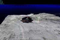
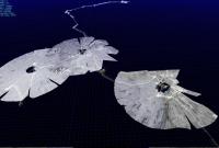
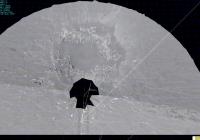
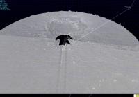
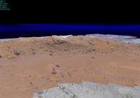
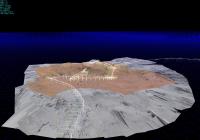
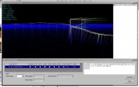
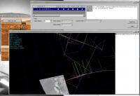
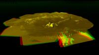
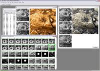
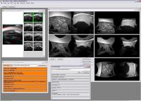
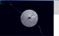
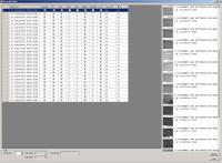
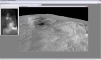
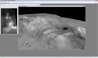
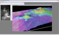
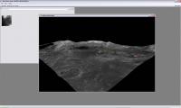
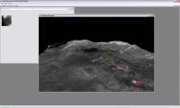
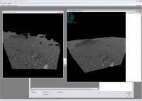
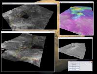
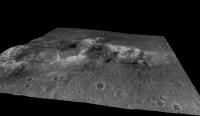
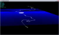
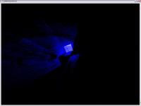
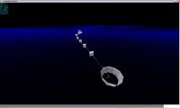
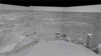
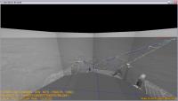
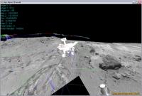
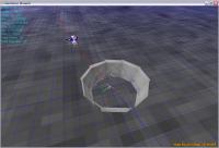
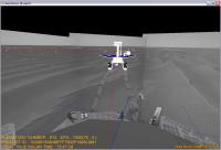
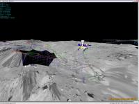
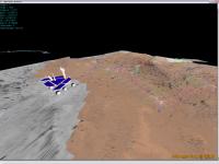
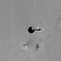
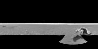
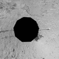
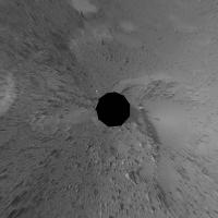
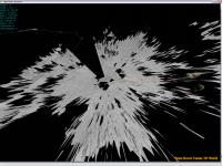
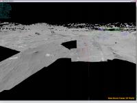
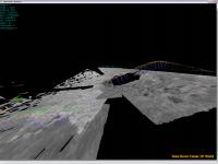
2 screenshot of my personal 3d reconstruction software
this is present "AE" site of spirit.
based on "XYL" et "RSL" NASA product et some algorithms. ![]()
and a small video of my personal 3d software
http://www.youtube.com/watch?v=yxiJ5geuYVE
sorry for bad quality of video, but video file size it's a problem for me, i do'nt have big web space.
edit : sorry for private video setting it's public now
Posted by: Bob Shaw May 12 2006, 10:12 PM
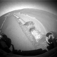
Interesting - and beside it on Youtube is:
http://www.youtube.com/watch?v=O0Ps7Wrcv58
Opportunity at Purgatory Dune.
Bob Shaw
Posted by: djellison May 12 2006, 10:23 PM
I feel the need to use words that I would have to ban myself for...such as
Holy .... that's ........ amazing
Dare one mention words like release...sourceforge....public consumption...doug WANT ![]()
Doug
Posted by: Bob Shaw May 12 2006, 10:35 PM
Doug:
Somehow, I thought your response would be like that, you 3-D geek, you!
Hehehe.
Bob Shaw
Posted by: MaxSt May 12 2006, 10:43 PM
Very nice... please, tell more!
Posted by: tfisher May 13 2006, 12:06 PM
Sweet! Yes, that is very cool. Here's another interested taker if you want to share your program!
Posted by: dilo May 13 2006, 04:47 PM
Seen only now... I have no words too!
Indian3000, very promising as first post!
Really, we want to know/see more!
Posted by: helvick May 13 2006, 05:01 PM
If we were handing out scores for best first post this has definitely got to be up there. Amazing stuff Indian3000, really impressive.
Posted by: edstrick May 14 2006, 07:13 AM
I'm wondering if a parameter could be added to the code so that calculated surfaces that are within some number of degrees of being parallel to the line of sight could be rendered black or transparent.
Posted by: djellison May 14 2006, 07:30 AM
LIke Zorro - he strikes...and he is gone.
Doug
Posted by: Indian3000 May 14 2006, 09:35 AM
Doug
i'm not gone,
I am just a little busy these last days
I prepare of anothers stuffs and a release of 3D site viewer
while waiting, you can downloader required them for the program
only free stuff.
the program is written in C# 2.0 with directX 9.
you need
in first, a graphic card with 32bits indexing surport,
my knowledge about this :
- Nvidia GForce 6, 7 and quadro can,
- GForce 4 can not
- I dont know for ATI, it is necessary to test.
personally I develope with a nvidia 7800GT, AMD X2 4200+ with 3x1Gig mem and 1.37 Tb of disk
Yes-yes "MER" stuffs takes place on the discs
.NET Framework Version 2.0 Redistributable Package
http://msdn.microsoft.com/netframework/downloads/updates/default.aspx
last version of directX 9.0c
here
http://www.microsoft.com/windows/directx/default.mspx
or on recent game ( or demo game ) cd
and SQL Server 2005 Express Edition
http://msdn.microsoft.com/vstudio/express/sql/download/
only the 53.8 MB file and anything else ( if you want, you can
for datas :
on PDS site take in navcam data directory *XYL*.IMG (in general 12Mb file) product and *RSL*.IMG( 2Mb file )
link:
http://pdsimg.jpl.nasa.gov/data/mer/mer1no_0xxx/data/
http://pdsimg.jpl.nasa.gov/data/mer/mer2no_0xxx/data/
you can use *RSL*.IMG.jpg file in browse directory, only RSL not XYL in browse directory, generally file size if 200kb, but I prefer RSL product in data direcotry.
my example uses the following files :
site "AE00"
2n178037159xylae00p0695l0m1.img 2n178037159rslae00p0695l0m1.img.jpg
2n178037195xylae00p0695l0m1.img 2n178037195rslae00p0695l0m1.img.jpg
2n178037282xylae00p0695l0m1.img 2n178037282rslae00p0695l0m1.img.jpg
2n178037333xylae00p0695l0m1.img 2n178037333rslae00p0695l0m1.img.jpg
2n178037431xylae00p0695l0m1.img 2n178037431rslae00p0695l0m1.img.jpg
2n178037631xylae00p0795l0m1.img 2n178037631rslae00p0795l0m1.img.jpg
2n178037831xylae00p0795l0m1.img 2n178037831rslae00p0795l0m1.img.jpg
2n178038024xylae00p0795l0m1.img 2n178038024rslae00p0795l0m1.img.jpg
2n178038204xylae00p0795l0m1.img 2n178038204rslae00p0795l0m1.img.jpg
2n178038412xylae00p0795l0m1.img 2n178038412rslae00p0795l0m1.img.jpg
site "AE93"
2n178659474xylae93p0695l0m1.img 2n178659474rslae93p0695l0m1.img
2n178659546xylae93p0695l0m1.img 2n178659546rslae93p0695l0m1.img
2n178659596xylae93p0695l0m1.img 2n178659596rslae93p0695l0m1.img
2n178659646xylae93p0695l0m1.img 2n178659646rslae93p0695l0m1.img
2n178659697xylae93p0695l0m1.img 2n178659697rslae93p0695l0m1.img
2n178659834xylae93p1895l0m1.img 2n178659834rslae93p1895l0m1.img
2n178660053xylae93p1895l0m1.img 2n178660053rslae93p1895l0m1.img
2n178660273xylae93p1895l0m1.img 2n178660273rslae93p1895l0m1.img
2n178660459xylae93p1895l0m1.img 2n178660459rslae93p1895l0m1.img
2n178660670xylae93p1895l0m1.img 2n178660670rslae93p1895l0m1.img
site "AEVO"
2n182025191xylaevop1640l0m1.img 2n182025191rslaevop1640l0m1.img.jpg
2n182025263xylaevop1640l0m1.img 2n182025263rslaevop1640l0m1.img.jpg
2n182025299xylaevop1640l0m1.img 2n182025299rslaevop1640l0m1.img.jpg
2n182025351xylaevop1640l0m1.img 2n182025351rslaevop1640l0m1.img.jpg
2n182025403xylaevop1640l0m1.img 2n182025403rslaevop1640l0m1.img.jpg
2n182025567xylaevop1640l0m1.img 2n182025567rslaevop1640l0m1.img.jpg
2n182025736xylaevop1640l0m1.img 2n182025736rslaevop1640l0m1.img.jpg
2n182025897xylaevop1640l0m1.img 2n182025897rslaevop1640l0m1.img.jpg
2n182026063xylaevop1640l0m1.img 2n182026063rslaevop1640l0m1.img.jpg
2n182026224xylaevop1640l0m1.img 2n182026224rslaevop1640l0m1.img.jpg
for the path ( white line ) et reference possition ( Red-Green-Blue line ) in use
Rover Motion Counter Data on
http://pds-geosciences.wustl.edu/geodata/mer1-m-eng-6-rmc-ops-v1/
http://pds-geosciences.wustl.edu/geodata/mer2-m-eng-6-rmc-ops-v1/
caution some datas are bad in this file, they need to be filter
ok, i work on release now ...
give me some time to complete and make a user friend ly interface
i thinks some days.
I do not withdraw the idea to still make some screenshots before the release.
ha, another thing, I am French (Belgium-Brussels precisely) and I use has automatic translator from time to time… afflicts for the English fault.
Posted by: djellison May 14 2006, 10:02 AM
Panic not - my co-admin Nico (Nix) is from Belgium as well ( Ghent )
I'm not sure how far you're thinking of taking all this - but the ability to export to a common 3D format ( ![]() )would be a hugely exciting feature
)would be a hugely exciting feature ![]()
Doug
Posted by: Indian3000 May 14 2006, 11:16 AM
I'm not sure how far you're thinking of taking all this - but the ability to export to a common 3D format (
Doug
yes, for the moment I use a format has me, but I already have in my project the fact of saving the mesh in file with the directX format '. X ', 3ds max and others commons can open this format with a simple existing plug-in
Posted by: Indian3000 May 14 2006, 01:19 PM
opporunity on fram
and two video
http://www.youtube.com/watch?v=fLtsKgmuJzc
http://www.youtube.com/watch?v=cjnMRXCJRAc
Posted by: CosmicRocker May 15 2006, 05:10 AM
I've been quietly watching this topic since Indian3000 started it. I guess we all are waiting to see where this goes.
Talk about something coming in from "http://www.google.com/search?q=define%3Aout+of+the+blue (second & third definitions)
Indian3000, you have our undivided attention. ![]()
edited to add... P.S. This is just the kind of thing we need to entertain us on these long and cold winter nights.
Posted by: Nix May 15 2006, 05:51 AM
Amazing stuff Indian ![]()
I'm looking forward to 'play' !
I suppose you couldn't pay me a visit and learn me all this stuff over an afternoon? ![]()
Nico
Posted by: Indian3000 May 15 2006, 06:23 AM
I'm looking forward to 'play' !
I suppose you couldn't pay me a visit and learn me all this stuff over an afternoon?
Nico
if you have plan on Brussels it is with pleasure
Posted by: Nix May 15 2006, 09:40 AM
Cool. I'll be in touch ![]() It's been a while since I was in Brussels..
It's been a while since I was in Brussels..
Do you know, by any chance Paul Vauterin? He's into 3-D modeling as well, made a presentation of the solar system open to visitors here at the observatory in Ghent.
Nico
Posted by: Indian3000 May 15 2006, 09:54 AM
First Release
please do'nt forget to read my preceding post on installation
.NET 2.0, SQLServer 2005 Express Edition, and direct 9.0c
installation
juste unzip file in one directory
launch "MarsRoverCenter3DSiteViewer.exe"
download XYL and RSL product and put it in same directory ( one directory by ROVER/SITE )
Using
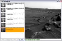
click NEW 3d site
click add file only XYL product, Software autodetect RSL file in same directory
Click View and wait some time ( if the MESH file is not found, software generate it, if he found it, he load the last ... )
keys in 3d world are
left,right, up, down arrows for Rotation
Shift + arrows for Pan
F4 : WireFrame / Solid Draw
wheel : zoom
caution
- no site mix
- you can mix drive on same site
- in first time not load over 30 XYL, try before with 1 .. 2 .. 4 .. 10 XYL.
- use navcam XYL in first time.
- 32 bits graphic card requis.( see my post about this )
please give my a feedback ![]() ( if success or fail, give me the graphic card model )
( if success or fail, give me the graphic card model )
a small tutorial come in little time ![]()
once again it's alpha alpha alpha software
good luck and have fun  MarsRoverCenter3DSiteViewer_R1.zip ( 756.5K )
: 1239
Do you know, by any chance Paul Vauterin? He's into 3-D modeling as well, made a presentation of the solar system open to visitors here at the observatory in Ghent.
Nico
unfortunately, I do not know him
Posted by: Indian3000 May 15 2006, 04:20 PM
addition of the color ![]() .... true color
.... true color ![]()
Radiometrically calibrated color come from
http://www.lyle.org/~markoff/
site AEOP for navcam data
site AENL for pancam data
Posted by: algorimancer May 15 2006, 04:51 PM
Really impressive work. I have this fantasy of someday putting on a VR headset and going for a walk on Mars... and this is taking us in that direction very nicely
Posted by: aldo12xu May 15 2006, 06:52 PM
My jaw is hanging down to the floor!! Wow, Indian3000, that is an absolutely incredible program. I'll look forward to your tutorial to see if I can handle this baby.
Can't wait for some more of your examples!
Posted by: Nix May 15 2006, 07:29 PM
algorimancer -I was thinking exactly the same thing ![]()
superb Indian!
Nico
Posted by: centsworth_II May 15 2006, 07:36 PM
I too am very impressed by the 3d videos. Should "Farm" be "Fram"?
Posted by: tfisher May 16 2006, 02:56 AM
The screenshots really are impressive! I tried downloading everything and running it; on my first attempt to create a new site I get the following error:
System.Data.SqlClient.SqlException: An attempt to attach an auto-named database for file G:\CompagnonDesEtoiles2005\MarsRoverCenterLibrary\Data\MarsRoverDatabase.mdf failed. A database with the same name exists, or specified file cannot be opened, or it is located on UNC share.
at System.Data.SqlClient.SqlInternalConnection.OnError(SqlException exception, Boolean breakConnection)
Looks like you missed a hardcoded filename? Or did I do something wrong?
Posted by: Indian3000 May 16 2006, 04:32 AM
System.Data.SqlClient.SqlException: An attempt to attach an auto-named database for file G:\CompagnonDesEtoiles2005\MarsRoverCenterLibrary\Data\MarsRoverDatabase.mdf failed. A database with the same name exists, or specified file cannot be opened, or it is located on UNC share.
at System.Data.SqlClient.SqlInternalConnection.OnError(SqlException exception, Boolean breakConnection)
Looks like you missed a hardcoded filename? Or did I do something wrong?
yes, it is my fault, .mdf file is hardcode some where … I correct
Posted by: Indian3000 May 16 2006, 12:03 PM
i thing it's ok now ,just unzip file over the old MarsRoverCenter3DSiteViewer.zip ( 709.48K )
: 1312
Posted by: tfisher May 17 2006, 12:57 AM
Okay, now I get as far as generating a site and being able to move around, but I only see the wire frame path and no images. Does this mean my graphics card isn't good enough? Or am I missing something else?
Posted by: CosmicRocker May 17 2006, 02:53 AM
Indian3000: I am having problems getting your software to run. When I try to execute MarsRoverCenter3DSiteViewer.exe, I get an error message saying "MarsRoverCenter3DSiteViewer has encountered a problem and needs to close."
This occurs with both versions you have posted. My operating system is Windows XP Pro SP2, running on a machine very similar to yours: AMD X2 4800, 2 GB memory, NVIDIA 7900GT. I have DX 9.0c, and have installed the .NET and Microsoft SQL Server Express, using the default options. Do you have any suggestions?
Posted by: Indian3000 May 17 2006, 07:14 AM
yes it's your graphics card, but 2 goods news for you, SQL server, .NET and directx work fine
and i work on version without 32bits vertex index, and this problem will disparaitra.
This occurs with both versions you have posted. My operating system is Windows XP Pro SP2, running on a machine very similar to yours: AMD X2 4800, 2 GB memory, NVIDIA 7900GT. I have DX 9.0c, and have installed the .NET and Microsoft SQL Server Express, using the default options. Do you have any suggestions?
Which version of .NET you took
x86, x64 or IA64 ... ?
Posted by: Indian3000 May 17 2006, 07:45 AM
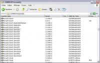
you must have something like this
Posted by: Indian3000 May 17 2006, 09:14 AM
a version without index buffer, normaly, the 32bits index limitation is avoid, but i need someone test.
Posted by: djellison May 17 2006, 09:26 AM
Is it just me or do all the lbl's work but noneo f the rvf's work here
http://pds-geosciences.wustl.edu/geodata/mer2-m-eng-6-rmc-ops-v1/mer2rm_0xxx/data/
Doug
Posted by: Indian3000 May 17 2006, 09:51 AM
http://pds-geosciences.wustl.edu/geodata/mer2-m-eng-6-rmc-ops-v1/mer2rm_0xxx/data/
Doug
I does not understand very well what you want to say, but if is to use my 3DViewer, file RVF and SVF are to already charged and treated in the database mdf.
i know some probleme on inter-site data file ( svf ) but i think is in my traitment i forget a parameter.
but all reference on same site are correct ... juste a problem on inter-site ...
Posted by: djellison May 17 2006, 10:14 AM
What I mean is - the files are unavailable...I try and save one and it's not found....but I remember them all being available a few months ago (as I was looking at them w.r.t. putting together the mobility report maps)
Doug
Posted by: Indian3000 May 17 2006, 11:42 AM
Doug
ha ok, unavailable for me too by web, you can try by ftp,
ftp://pds-geosciences.wustl.edu/mer1-m-eng-6-rmc-ops-v1/mer1rm_0xxx/
ftp://pds-geosciences.wustl.edu/mer2-m-eng-6-rmc-ops-v1/mer2rm_0xxx/
Posted by: djellison May 17 2006, 11:53 AM
Bingo ![]() That works!
That works!
Doug
Posted by: CosmicRocker May 17 2006, 02:39 PM
x86, x64 or IA64 ... ?
Posted by: Indian3000 May 17 2006, 03:38 PM
no, you have the good one, what you say is correct.
launch My HelloWorld, if that does not function, you have a problem with .NET 2.0
 HelloWorld.zip ( 3.39K )
: 1187
HelloWorld.zip ( 3.39K )
: 1187launch My DirectXHelloWorld, if that does not function, you have a problem with Managed DirectX 9 lib.
 DirectXHelloWorld.zip ( 4.25K )
: 1204
DirectXHelloWorld.zip ( 4.25K )
: 1204for directX you need some thing like that in you C:\Windows\assembly\ directory
give me a feed back
Posted by: CosmicRocker May 17 2006, 07:22 PM
Thank you. I will try these tests tonight.
Posted by: tfisher May 18 2006, 02:06 AM
Hmmm... now I'm seeing other problems with the R3 version. Starting over from a clean directory, when I try to create a new site I get:
System.IO.FileNotFoundException: Could not load file or assembly 'ICSharpCode.SharpZipLib, Version=0.83.1.0, Culture=neutral, PublicKeyToken=1b03e6acf1164f73' or one of its dependencies. The system cannot find the file specified.
File name: 'ICSharpCode.SharpZipLib, Version=0.83.1.0, Culture=neutral, PublicKeyToken=1b03e6acf1164f73'
at MarsRoverCenterLibrary.Tools.MRCImg.LoadIMG(String p_filename, Boolean p_compressed)
at MarsRoverCenterLibrary.Tools.MRCImageLoader.LoadImage(String p_filename)
at MarsRoverCenterLibrary.CustomUserControl.ListBoxImage.ImageElement..ctor(String p_filename)
at MarsRoverCenterLibrary.CustomUserControl.ListBoxImage.AddImage(String p_filename)
at MarsRoverCenterLibrary.Forms.FormMRC3DSite.button1_Click(Object sender, EventArgs e)
at System.Windows.Forms.Control.OnClick(EventArgs e)
at System.Windows.Forms.Button.OnClick(EventArgs e)
at System.Windows.Forms.Button.OnMouseUp(MouseEventArgs mevent)
at System.Windows.Forms.Control.WmMouseUp(Message& m, MouseButtons button, Int32 clicks)
at System.Windows.Forms.Control.WndProc(Message& m)
at System.Windows.Forms.ButtonBase.WndProc(Message& m)
at System.Windows.Forms.Button.WndProc(Message& m)
at System.Windows.Forms.Control.ControlNativeWindow.OnMessage(Message& m)
at System.Windows.Forms.Control.ControlNativeWindow.WndProc(Message& m)
at System.Windows.Forms.NativeWindow.Callback(IntPtr hWnd, Int32 msg, IntPtr wparam, IntPtr lparam)
Installed on top of the previous version, trying to load a file with a mesh already generated, I get:
System.Data.SqlClient.SqlException: One or more files do not match the primary file of the database. If you are attempting to attach a database, retry the operation with the correct files. If this is an existing database, the file may be corrupted and should be restored from a backup.
Cannot open user default database. Login failed.
Login failed for user 'FROST\First'.
Log file 'C:\Program Files\MarsRoverCenter3DSiteViewer_R1\MarsRoverDatabase_log.ldf' does not match the primary file. It may be from a different database or the log may have been rebuilt previously.
at System.Data.SqlClient.SqlInternalConnection.OnError(SqlException exception, Boolean breakConnection)
at System.Data.SqlClient.TdsParser.ThrowExceptionAndWarning(TdsParserStateObject stateObj)
at System.Data.SqlClient.TdsParser.Run(RunBehavior runBehavior, SqlCommand cmdHandler, SqlDataReader dataStream, BulkCopySimpleResultSet bulkCopyHandler, TdsParserStateObject stateObj)
at System.Data.SqlClient.SqlInternalConnectionTds.CompleteLogin(Boolean enlistOK)
at System.Data.SqlClient.SqlInternalConnectionTds.OpenLoginEnlist(SqlConnection owningObject, SqlConnectionString connectionOptions, String newPassword, Boolean redirectedUserInstance)
at System.Data.SqlClient.SqlInternalConnectionTds..ctor(DbConnectionPoolIdentity identity, SqlConnectionString connectionOptions, Object providerInfo, String newPassword, SqlConnection owningObject, Boolean redirectedUserInstance)
at System.Data.SqlClient.SqlConnectionFactory.CreateConnection(DbConnectionOptions options, Object poolGroupProviderInfo, DbConnectionPool pool, DbConnection owningConnection)
at System.Data.ProviderBase.DbConnectionFactory.CreatePooledConnection(DbConnection owningConnection, DbConnectionPool pool, DbConnectionOptions options)
at System.Data.ProviderBase.DbConnectionPool.CreateObject(DbConnection owningObject)
at System.Data.ProviderBase.DbConnectionPool.UserCreateRequest(DbConnection owningObject)
at System.Data.ProviderBase.DbConnectionPool.GetConnection(DbConnection owningObject)
at System.Data.ProviderBase.DbConnectionFactory.GetConnection(DbConnection owningConnection)
at System.Data.ProviderBase.DbConnectionClosed.OpenConnection(DbConnection outerConnection, DbConnectionFactory connectionFactory)
at System.Data.SqlClient.SqlConnection.Open()
at System.Data.Common.DbDataAdapter.FillInternal(DataSet dataset, DataTable[] datatables, Int32 startRecord, Int32 maxRecords, String srcTable, IDbCommand command, CommandBehavior behavior)
at System.Data.Common.DbDataAdapter.Fill(DataTable[] dataTables, Int32 startRecord, Int32 maxRecords, IDbCommand command, CommandBehavior behavior)
at System.Data.Common.DbDataAdapter.Fill(DataTable dataTable)
at MarsRoverCenterLibrary.Data.MarsRoverDatabaseDataSetTableAdapters.RAW_LOCATIONTa
leAdapter.GetDataByRefSite(String SPACECRAFT_ID, Nullable`1 SITE_REF, Nullable`1 SITE_DIFF)
at MarsRoverCenterLibrary.Forms.FormMRC3DSite.backgroundWorker1_DoWork(Object sender, DoWorkEventArgs e)
at System.ComponentModel.BackgroundWorker.OnDoWork(DoWorkEventArgs e)
at System.ComponentModel.BackgroundWorker.WorkerThreadStart(Object argument)
Trying to create a site with a new file for which no mesh was previously generated, I get:
System.Data.SqlClient.SqlException: One or more files do not match the primary file of the database. If you are attempting to attach a database, retry the operation with the correct files. If this is an existing database, the file may be corrupted and should be restored from a backup.
Cannot open user default database. Login failed.
Login failed for user 'FROST\First'.
Log file 'C:\Program Files\MarsRoverCenter3DSiteViewer_R1\MarsRoverDatabase_log.ldf' does not match the primary file. It may be from a different database or the log may have been rebuilt previously.
at System.Data.SqlClient.SqlInternalConnection.OnError(SqlException exception, Boolean breakConnection)
at System.Data.SqlClient.TdsParser.ThrowExceptionAndWarning(TdsParserStateObject stateObj)
at System.Data.SqlClient.TdsParser.Run(RunBehavior runBehavior, SqlCommand cmdHandler, SqlDataReader dataStream, BulkCopySimpleResultSet bulkCopyHandler, TdsParserStateObject stateObj)
at System.Data.SqlClient.SqlInternalConnectionTds.CompleteLogin(Boolean enlistOK)
at System.Data.SqlClient.SqlInternalConnectionTds.OpenLoginEnlist(SqlConnection owningObject, SqlConnectionString connectionOptions, String newPassword, Boolean redirectedUserInstance)
at System.Data.SqlClient.SqlInternalConnectionTds..ctor(DbConnectionPoolIdentity identity, SqlConnectionString connectionOptions, Object providerInfo, String newPassword, SqlConnection owningObject, Boolean redirectedUserInstance)
at System.Data.SqlClient.SqlConnectionFactory.CreateConnection(DbConnectionOptions options, Object poolGroupProviderInfo, DbConnectionPool pool, DbConnection owningConnection)
at System.Data.ProviderBase.DbConnectionFactory.CreatePooledConnection(DbConnection owningConnection, DbConnectionPool pool, DbConnectionOptions options)
at System.Data.ProviderBase.DbConnectionPool.CreateObject(DbConnection owningObject)
at System.Data.ProviderBase.DbConnectionPool.UserCreateRequest(DbConnection owningObject)
at System.Data.ProviderBase.DbConnectionPool.GetConnection(DbConnection owningObject)
at System.Data.ProviderBase.DbConnectionFactory.GetConnection(DbConnection owningConnection)
at System.Data.ProviderBase.DbConnectionClosed.OpenConnection(DbConnection outerConnection, DbConnectionFactory connectionFactory)
at System.Data.SqlClient.SqlConnection.Open()
at System.Data.Common.DbDataAdapter.FillInternal(DataSet dataset, DataTable[] datatables, Int32 startRecord, Int32 maxRecords, String srcTable, IDbCommand command, CommandBehavior behavior)
at System.Data.Common.DbDataAdapter.Fill(DataTable[] dataTables, Int32 startRecord, Int32 maxRecords, IDbCommand command, CommandBehavior behavior)
at System.Data.Common.DbDataAdapter.Fill(DataTable dataTable)
at MarsRoverCenterLibrary.Data.MarsRoverDatabaseDataSetTableAdapters.RAW_LOCATIONTa
leAdapter.GetDataByINDEX(String SPACECRAFT_ID, Nullable`1 INDEX1, Nullable`1 INDEX2, Nullable`1 INDEX3, Nullable`1 INDEX4, Nullable`1 INDEX5)
at MarsRoverCenterLibrary.Tools.XYL.FilterByRange(Double p_range)
at MarsRoverCenterLibrary.Forms.FormMRC3DSite.backgroundWorker1_DoWork(Object sender, DoWorkEventArgs e)
at System.ComponentModel.BackgroundWorker.OnDoWork(DoWorkEventArgs e)
at System.ComponentModel.BackgroundWorker.WorkerThreadStart(Object argument)
Thanks for your work to share this with us!
Posted by: CosmicRocker May 18 2006, 03:38 AM
Indian3000: Thank you for your help. You are a genius. Those easy tests quickly identified a problem with DirectX. I installed an update and your software is now working well. ![]()
As proof, here is a screen shot from an Opportunity site. Downloading all of the data files is rather tedious, and apparently I missed one of the RSLs for this site. Hence, the missing wedge. Now that it is working I will find a more interesting area and teach myself to add multiple sites. I am guessing that I can do that if I put each site in a separate directory.
Posted by: lyford May 18 2006, 04:00 AM
I still can't believe it actually works - must be some witchcraft involved! ![]()
Please, cosmic and indian and all who get this working - post screenshot after screenshot for those of use forced to live vicariously through your efforts. Simply beautiful.
Posted by: Indian3000 May 18 2006, 06:26 AM
As proof, here is a screen shot from an Opportunity site. Downloading all of the data files is rather tedious, and apparently I missed one of the RSLs for this site. Hence, the missing wedge. Now that it is working I will find a more interesting area and teach myself to add multiple sites. I am guessing that I can do that if I put each site in a separate directory.
i'm happy for you
but currently, the rules for site mix is as follows, you can load in one time all XYL for the same site
example : you can load All site 'AE' -> 'AE00', 'AE93', 'AEVO', 'AE..' ( is good )
but no 'AE' with 'AD' -> 'AE00', 'AD00' ( it's bad )
but i work on different Site loading ( not "drive", different "drive" work ), i just have a problem with "inter-site" computing, i have a table for this but some "inter-site" data are bad currently.. but this stuff come, quickly, I hope
tfisher :
forget the version R1 it is bad.
i thing with release R3 you try to load a XYL file without RSL. and you receive a FileNotFound Exception.
Posted by: djellison May 18 2006, 06:32 AM
What would be good is to be able to present the mobility traces without any wedges at all - I know it might seem odd, but I'd like it ![]()
Doug
Posted by: Indian3000 May 18 2006, 07:56 AM
Doug
but you can do
you can show/hide wedges with check boxe 1 et 3 ( view screenshot in attach ) and with zone 2 you can change offset loaded path
example :
you load wedge in site "60" with path offset 2 ( by default ), path of site ("58","59","60","61","62" ) are loaded, put "200" or upper, and all path are loaded ...
I do not know if I am very clear, but with this, you can view all opportunity or spirit path in 3D without wedge ...
i have in may plan to add a label on path for more for more clearness.
Posted by: djellison May 18 2006, 08:03 AM
Ahh - so Path offset is the number of site's of mobility data that are shown before and after the site or sites you've added! I was trying to think of a word to describe it - but I can't ![]()
One thing - have you tried some of the XYL's and RSL's from Sol 1? The ones that are only 256 x 256....it just crashes when attempting to add the file for me.
Doug
Posted by: Indian3000 May 18 2006, 08:21 AM
One thing - have you tried some of the XYL's and RSL's from Sol 1? The ones that are only 256 x 256....it just crashes when attempting to add the file for me.
Doug
have you the filename of XYL who causes the crash ?
Posted by: Tesheiner May 18 2006, 08:32 AM
Mmm, site 62TO?
Navcams taken mid-drive on sol 617 just approaching what we called the "Four Lane".
Posted by: CosmicRocker May 18 2006, 02:39 PM
Tesheiner: I don't remember the site ID, but it was from sol 617. The fact that you recognized it in that unlabeled image simply blows my mind. ![]()
Posted by: Tesheiner May 18 2006, 03:02 PM
Don't call it unlabelled image; the rover's path was superimposed on the picture and the left part of it reminded me of the "northwest detour" (sols 619-631), so the actual site would have to be nearby. ![]()
Posted by: Indian3000 May 18 2006, 07:29 PM
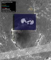
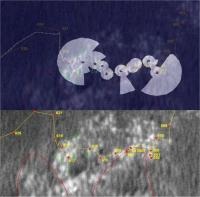
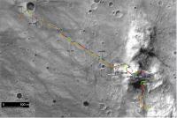
My first attempt to match satelite and ground view
opportunity on site 62 ( sol 582 - 617 )
Generated with my software and XYL/RSL data
superimposed on satellite view
and references marks
and video ( but it's not very good by this way )
http://www.youtube.com/watch?v=nov3QSYsH5c
Posted by: Phil Stooke May 18 2006, 07:43 PM
Amazing stuff. Thanks for this great contribution!
Phil
Posted by: djellison May 18 2006, 07:46 PM
Utterly brilliant stuff.
I scrolled my way around the mobility data for all of Opportunity (I still don't understand how they got back from Pan Pos 2 to Karatepe before going in ![]() ) - and actually, it's not too bad, a few 'burps' in the data
) - and actually, it's not too bad, a few 'burps' in the data
Not sure if it would be any use, but there is new data from OSU that puts each site and drive into an accurate global frame...
http://anserver1.eprsl.wustl.edu/anteam/merb/merb.htm
I'm off to bribe my ISP so I can download thousands of XYLs ![]()
Doug
Posted by: dilo May 18 2006, 07:51 PM
Indian, this strongly recall the work I did with Pov-Ray re-projected images during approach to Erebus! ![]()
Obviously, your work is more rigorous both in terms of path/coordinates both in terms of DEM (I worked with flat terrain!).
I suggest you to increase the contrast of the projected terrain in order to better distinguish/compare these features.
What about more recent data? (I guess official coordinates and DEMs aren't yet available, correct?)
Posted by: tfisher May 19 2006, 01:44 AM
Partial success: by copying the ICSharpCode dll from the earlier zip file I get the R3 version to run and display something of images. But the whole wedges won't show at once; in fact only columns of pixels which are partly in the window and partly offscreen seem to show. Odd.
Posted by: Indian3000 May 19 2006, 04:30 AM
and with R2 you have the same probleme.
try with more xyl ...
Posted by: Indian3000 May 19 2006, 06:06 AM
Doug
yes I am entraint to look at if both are in phase
Posted by: Indian3000 May 19 2006, 06:22 AM
Obviously, your work is more rigorous both in terms of path/coordinates both in terms of DEM (I worked with flat terrain!).
I suggest you to increase the contrast of the projected terrain in order to better distinguish/compare these features.
What about more recent data? (I guess official coordinates and DEMs aren't yet available, correct?)
I think that there are only DEM for Eagle and Endurance, but if somebody has the DEM for Columbia Hill, I am very interest
i can take some screenshoot with a better resolution, if you want ...
Posted by: djellison May 19 2006, 07:05 AM
If you like DEM's..
ftp://ftpflag.wr.usgs.gov/dist/pigpen/mars/usgs/topo/moc_na/
Doug
Posted by: djellison May 19 2006, 10:15 AM
For those that use WGET..
Obviously - mer1 is Oppy - swop that to mer2 for Spirit..and the sol number is self explan. really. It gets just the XYL and IMG's - nothing else.
Alternatively
Doug
Posted by: Indian3000 May 19 2006, 05:54 PM
good work
i dont know the english equivalent expression,but in french
"ce faire couper l'herbe sous le pied"
i work on a same module,
two thing, stereo screenshot and
stereo realtime navigation.
i work too on "dem" viewer
Posted by: Indian3000 May 19 2006, 08:33 PM
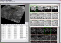
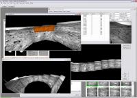
XYL /RSL viewer is only a small part of my program.
here is two year of my life and some thousand hundred of line of code.
the first lines of code one was written little time after the landing of opportunity.
this is screenshot of version 1.0, write version 2.0 now ... ![]()
web update
version 2
you recognize some element
my plan is to share this, but it is still too early. the program is not stable, but in several month, i thing make a release.
Posted by: MaxSt May 19 2006, 09:44 PM
that's crazy... ![]()
By the way, can you make "top views" from very recent Opportunity images?
Posted by: Nix May 19 2006, 10:09 PM
Man that IS crazy. I have so much to learn ![]()
![]()
Top-stuff Indian.
Nico
Posted by: Bob Shaw May 19 2006, 11:01 PM
You either share it *soon* or Doug sends round a white-skinned guy in a monk suit!
Just for a 'chat', capice?
Bob Shaw
Posted by: CosmicRocker May 20 2006, 04:07 AM
Indian3000: We will eagerly anticipate version 2.0. Thanks for sharing your excellent work with us.
Posted by: Nix May 20 2006, 06:19 AM
![]() Bob! Ahum..
Bob! Ahum.. ![]()
shall I make a visit?
Nico
Posted by: djellison May 20 2006, 07:05 AM
Actually, I just completed the game 'Mafia' so I know what to do.
Pretend your name is Paulie, grab a car, get gun's from a guy down on the south side..then go and 'pay him a little visit' to 'offer Mr Salieri's regards'
V2 looks astonishing, downloading tools in there as well. It's basically SAP / RSVP for the amateur community!
Doug
Posted by: djellison May 20 2006, 08:17 AM
I set off grabbing stuff site by site for the drive from Spirit's landing site to Bonneville, but I've found a bug ( i think )
Basically, it's dumping every site on the same spot ![]()
Doug
Posted by: Indian3000 May 20 2006, 10:01 AM
Basically, it's dumping every site on the same spot
Doug
it's not a bug, don't mix site now you can mix drive but no site, see post #44
i need a better Rover Mobility path before site mix.
Posted by: djellison May 20 2006, 10:46 AM
Ahhhh ![]() I get it now.
I get it now.
Not sure how easy it would be - but when it comes to screen-shots and map making - it would be nice to have a value in the top corner that says the current F.O.V - so we can zoom in/out the same ammount every time we load it to make sure we're looking at the same ammount of 'stuff' ![]()
Doug
Posted by: Indian3000 May 20 2006, 11:48 AM
Not sure how easy it would be - but when it comes to screen-shots and map making - it would be nice to have a value in the top corner that says the current F.O.V - so we can zoom in/out the same ammount every time we load it to make sure we're looking at the same ammount of 'stuff'
Doug
yes, why not, a bookmark of view ... cool idea
some informations about parameters you can change the column radius ( 16 by default ) but if you change it you need to "check" the column REGEN ( for regeneretion , i recomputer a new mesh when the column is checked and you click on view ) 16 is a good value, after that, the precission and details are bad.
ha other thing a square in blue grid is a square 1 meter by 1 meter ( ex : radius is 16 then mesh is filtred 16 meter around the rover site-drive.) in others terms 1 unit in 3d world is 1 meter
with a right click in 3d form, you can show/hide Path et Path references, quaternion option is not used any more.
Posted by: djellison May 20 2006, 02:44 PM
Ahh - it's a fixed 45 deg FOV.
Would it be possible to have a height of the 'camera' above the reference plane then - just a means to check the height of the camera ![]()
Also - are these Ortho or Perspective views?
Doug
Posted by: Indian3000 May 20 2006, 03:30 PM
Would it be possible to have a height of the 'camera' above the reference plane then - just a means to check the height of the camera
Also - are these Ortho or Perspective views?
Doug
it's a PerspectiveFovRH view.
 MarsRoverCenter3DSiteViewer_R4.zip ( 769.03K )
: 533
MarsRoverCenter3DSiteViewer_R4.zip ( 769.03K )
: 533Posted by: djellison May 21 2006, 08:59 AM
R4 crashes on 'view' for me...
System.Data.SqlClient.SqlException: One or more files do not match the primary file of the database. If you are attempting to attach a database, retry the operation with the correct files. If this is an existing database, the file may be corrupted and should be restored from a backup.
Cannot open user default database. Login failed.
Login failed for user 'FATBOYSLIM\Doug'.
Log file 'C:\Documents and Settings\Doug\Desktop\3d_site_viewer_R3_without_index_buffer\MarsRoverDatabase_log.LDF' does not match the primary file. It may be from a different database or the log may have been rebuilt previously.
at System.Data.SqlClient.SqlInternalConnection.OnError(SqlException exception, Boolean breakConnection)
at System.Data.SqlClient.TdsParser.ThrowExceptionAndWarning(TdsParserStateObject stateObj)
at System.Data.SqlClient.TdsParser.Run(RunBehavior runBehavior, SqlCommand cmdHandler, SqlDataReader dataStream, BulkCopySimpleResultSet bulkCopyHandler, TdsParserStateObject stateObj)
at System.Data.SqlClient.SqlInternalConnectionTds.CompleteLogin(Boolean enlistOK)
at System.Data.SqlClient.SqlInternalConnectionTds.OpenLoginEnlist(SqlConnection owningObject, SqlConnectionString connectionOptions, String newPassword, Boolean redirectedUserInstance)
at System.Data.SqlClient.SqlInternalConnectionTds..ctor(DbConnectionPoolIdentity identity, SqlConnectionString connectionOptions, Object providerInfo, String newPassword, SqlConnection owningObject, Boolean redirectedUserInstance)
at System.Data.SqlClient.SqlConnectionFactory.CreateConnection(DbConnectionOptions options, Object poolGroupProviderInfo, DbConnectionPool pool, DbConnection owningConnection)
at System.Data.ProviderBase.DbConnectionFactory.CreatePooledConnection(DbConnection owningConnection, DbConnectionPool pool, DbConnectionOptions options)
at System.Data.ProviderBase.DbConnectionPool.CreateObject(DbConnection owningObject)
at System.Data.ProviderBase.DbConnectionPool.UserCreateRequest(DbConnection owningObject)
at System.Data.ProviderBase.DbConnectionPool.GetConnection(DbConnection owningObject)
at System.Data.ProviderBase.DbConnectionFactory.GetConnection(DbConnection owningConnection)
at System.Data.ProviderBase.DbConnectionClosed.OpenConnection(DbConnection outerConnection, DbConnectionFactory connectionFactory)
at System.Data.SqlClient.SqlConnection.Open()
at System.Data.Common.DbDataAdapter.FillInternal(DataSet dataset, DataTable[] datatables, Int32 startRecord, Int32 maxRecords, String srcTable, IDbCommand command, CommandBehavior behavior)
at System.Data.Common.DbDataAdapter.Fill(DataTable[] dataTables, Int32 startRecord, Int32 maxRecords, IDbCommand command, CommandBehavior behavior)
at System.Data.Common.DbDataAdapter.Fill(DataTable dataTable)
at MarsRoverCenterLibrary.Data.MarsRoverDatabaseDataSetTableAdapters.RAW_LOCATIONTa
leAdapter.GetDataByRefSite(String SPACECRAFT_ID, Nullable`1 SITE_REF, Nullable`1 SITE_DIFF)
at MarsRoverCenterLibrary.Forms.FormMRC3DSite.backgroundWorker1_DoWork(Object sender, DoWorkEventArgs e)
at System.ComponentModel.BackgroundWorker.OnDoWork(DoWorkEventArgs e)
at System.ComponentModel.BackgroundWorker.WorkerThreadStart(Object argument)"
Posted by: Indian3000 May 21 2006, 09:18 AM
try delete this file "MarsRoverDatabase_log.LDF"
keep only file in zip
Posted by: djellison May 21 2006, 09:36 AM
Ah - I had to kill the SQL services, but after that I could delete it, restart, and all is good once again ![]()
Nicely done with the camera height ![]()
Doug
Posted by: Bob Shaw May 22 2006, 03:13 PM
Somebody *please* throw a bucket of water over Doug - he'll burst if this goes on!
Not to mention the rest of the 3-D brigade...
Bob Shaw
Posted by: Nix May 22 2006, 08:34 PM
![]() yeah, I'll keep the bucket ready
yeah, I'll keep the bucket ready ![]()
I'm busy on deciding which graphics card to go buy to run this show!
Nico
Posted by: Bob Shaw May 22 2006, 09:36 PM
Some of you guys may also like this:
http://www.spg.cz/ivan/
It's Ivan's 3-D VRML page, with several spacecraft.
Bob Shaw
Posted by: Indian3000 May 24 2006, 10:20 AM
I have a request,
somebody has a good description or better source code about format VST
I can read header but a have some difficult about LOD reading.
thx.
Posted by: djellison May 24 2006, 10:29 AM
These might be usefull
http://www.unmannedspaceflight.com/index.php?showtopic=2456&hl=VST
http://www.unmannedspaceflight.com/index.php?showtopic=2380&hl=VST
Doug
Posted by: MaxSt May 25 2006, 08:12 AM
Here are VST docs and my source code.
Posted by: Indian3000 May 29 2006, 04:06 PM
a very big thanks to MaxSt for vst code ![]()
it was to to me of a very great utility.
I have it code in C#, and see first result
VST file in left and my mesh creation in rigth
we have some differences
VST is in Cam reference and XYL is in Site reference
I do not arrive yet has to make agreed between the two, but I work on this.
I am not sure to exploit the VST correctly
Posted by: Indian3000 Jul 21 2006, 03:57 PM
Release of MarsRoverCenter3DDemViewer
unzip files
MarsRoverCenter3DDemViewer_R1.zip
GusevHills_DEM_R1_1.zip
Texture_R1_1.zip
in one directory
you need something like this
Framework .NET 2.0 and directX 9.0c are requis.
 MarsRoverCenter3DDemViewer_R1.zip ( 168.84K )
: 459
 GusevHills_DEM_R1_1.zip ( 436.66K )
: 414
GusevHills_DEM_R1_1.zip ( 436.66K )
: 414Posted by: Indian3000 Jul 21 2006, 04:00 PM
 Texture_R1_1.zip ( 687.74K )
: 414
command
- left click for pan
- right click for rotation
- wheel for zoom
enjoy. ![]()
Posted by: Nix Jul 21 2006, 04:18 PM
Woaw ![]() It looks awesome but I still haven't tried it out -shame on me. I hope I find some time soon!
It looks awesome but I still haven't tried it out -shame on me. I hope I find some time soon!
Awesome work..
Nico
Posted by: aldo12xu Jul 29 2006, 04:53 AM
Indian3000!!! I got the Columbia Hills DEM to work! It took me a few downloads, mind you before I got it. And now I've been spinning and rotating the image, seeing structures and interesting geological connections that weren't noticeable before. Thanks so much for sharing your program!
I'm going to try tackling your 3D site viewer next, meaning I'll be up to 3 in the morning ![]()
Posted by: Indian3000 Jul 31 2006, 02:10 PM
R2 With "Full" MOC S12-00095 texture ![]()
caution :
Install R2 over R1 because "MarsRoverCenter3DDemViewer_R2.zip" file does not contain all the necessary files.
 MarsRoverCenter3DDemViewer_R2.zip ( 749.28K )
: 495
MarsRoverCenter3DDemViewer_R2.zip ( 749.28K )
: 495Posted by: aldo12xu Jul 31 2006, 03:19 PM
Cool! I can't wait to play with it when I get home from work.......as for "Install R2 over R1" do you mean I delete R1 and then install R2 only?
Posted by: Indian3000 Jul 31 2006, 03:32 PM
no, just unzip in the same repertory that R1, keeping the files which is in R1 and not in R2
Posted by: aldo12xu Aug 1 2006, 02:35 AM
Alright! the cPROTO version is working fine as well. If I do some interpretation and draw lines on the source S12-00095m100-3 image, will your viewer automatically include those lines in your 3D model?
Posted by: Indian3000 Aug 1 2006, 04:56 AM
yes
Posted by: CosmicRocker Aug 2 2006, 04:01 AM
Many thanks, Indian3000. Damn, there is just so much else going on today, and now this long-awaited update. I'll grab the files from the fatter pipe at work, tomorrow. ![]()
Posted by: Indian3000 Aug 3 2006, 02:25 PM
MarsRoverCenterAntiVignetting R1 Release. ( MER .NET Anti-Vignetting )
based on MichaelT methode
http://www.unmannedspaceflight.com/index.php?s=&showtopic=1306&view=findpost&p=18469
you need only a Microsoft .NET Framework 2.0 on your machine.
Batch traitment is supported.
Juste add file in queue and push start ![]()
support only the mer square images.
 MarsRoverCenterAntiVignetting_R1.zip ( 179.21K )
: 507
MarsRoverCenterAntiVignetting_R1.zip ( 179.21K )
: 507Posted by: djellison Aug 3 2006, 02:38 PM
Good grief - it's a one man software empire!
Doug
Posted by: CosmicRocker Aug 4 2006, 05:21 AM
Good grief somehow seems to be an understatement, but after spinning and panning around in the DEM views tonight, I can't find anything more eloquent to say than OMG! The route map overlay was really sweet. I was going to post a screenshot, but I have been too busy playing with this new toy. I haven't even had a chance to try the anti-vignetting module, yet.
Indian3000: It is working beautifully for me. I would like to learn more about the controls, and how to use other DEMs, textures, etc, if that can be done.
Congratulations. This is very, very nice. ![]()
Posted by: aldo12xu Aug 4 2006, 07:12 PM
Truly another great contribution, Indian3000! I always wanted to give Michael's program I try, but never got around to it. Regarding your program, how many photos can I put in there for batch conversion? Once the conversion is done, does it automatically save over the original photos or does it give it a different file name? (I'm still at work so i haven't had a chance to try it out.)
Posted by: Indian3000 Aug 5 2006, 01:53 PM
Queue for batch is unlimited ( just by your memory size )
and after traitment i save result image in a new file with filename + "AV.jpg".
Original file is not modified.
Posted by: aldo12xu Aug 5 2006, 05:20 PM
The anti-vignetting software works great! Easy to install and easy to use. The one thing I discovered is that it only accepts 1024 x 1024 images with the original JPL file name. If I rename the 1024 x 1024 images, the software doesn't recognize them. I'd like to use the software on the front hazcams (for my videos) but I've renumbered all the images according to sols and some of them are smaller than 1024 x 1024. Is it possible to have the program take any square image irregardless the file name?
Original
Corrected
Posted by: Indian3000 Aug 5 2006, 05:50 PM
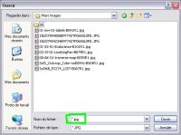
you can avoid the checking of filename, you types just “*.jpg” in the zone of filename and you press key enter
Posted by: aldo12xu Aug 6 2006, 02:19 AM
Perfect! That worked for the file names but it still doesn't like the images that are less than 1024 x 1024. No biggie......especially considering all the great work you've done in the past couple of months!
Posted by: CosmicRocker Aug 6 2006, 04:10 AM
Indian3000: If it wouldn't be too much trouble ![]() , could you say more about controls in the DEM viewer, and how to use other DEMs, textures, etc, if that can be done. Are there controls in the DEM viewer other than the left and right mouse controls? Can other CUB files and textures be used, or is that something you have planned for a future release?
, could you say more about controls in the DEM viewer, and how to use other DEMs, textures, etc, if that can be done. Are there controls in the DEM viewer other than the left and right mouse controls? Can other CUB files and textures be used, or is that something you have planned for a future release?
Posted by: Indian3000 Aug 7 2006, 11:29 AM
CosmicRocker: You do'nt bother me ![]()
DEM viewer controls are only
mouse right and left click ,
wheel mouse,
Arrow key,
F4 Wireframe/ solid draw
and H key to hide/show crosshair
the majority of the parameters are hardcoded in my program.
To make a simple interface which charges the various parameters will not be easy.
Nothing is automatic and the various parameters to match the textures to the model are computed by hand.
I could make a thiny interface to enter the various parameters but I must then make a little tutorial.
Posted by: CosmicRocker Aug 8 2006, 03:21 AM
Ahh! Thank you. In retrospect I suppose I should have been able to figure most of those out, but knowing those controls helps me agreat deal. I should have at least tried the mouse wheel! I now have learned that the figure rotates around the + point, and that by panning the image below it in plan view before changing the perspective, I can more easily manipulate the view to achieve almost the results I want. I couldn't make it display the exact view of the inner basin from the top of Husband Hill, but the attached image is an approximation of it.
I see that it would be difficult to program an interface for other models and textures, but this is very nice as it is. I have also used your ant-vignetting module and I wanted to mention that I love it. The ability to batch process images and save with automatic renaming is very convenient.
Posted by: Indian3000 Aug 8 2006, 02:09 PM
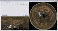
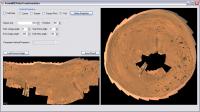
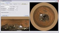
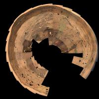
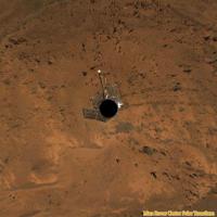
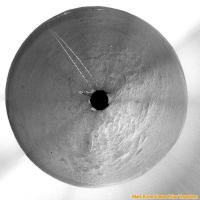
Polar Projection Preview
I still need to add some parameters, and corrects some bugs before making a release. ![]()
Posted by: CosmicRocker Aug 9 2006, 09:13 PM
That looks interesting.
...kind of like Phil, in a box... ![]()
Posted by: Phil Stooke Aug 9 2006, 09:26 PM
I will be in a box if this goes on...
Very nice stuff, Indian3000. Your contributions are really useful and greatly appreciated, I'm sure.
Phil
Posted by: Indian3000 Aug 10 2006, 12:03 PM
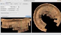
MarsRoverCenterPolarTransform Release R1 MarsRoverCenterPolarTransform_R1.zip ( 193K )
: 446
just load source image and press Make projection, you can play with differents parameters ...
Posted by: Phil Stooke Aug 10 2006, 02:21 PM
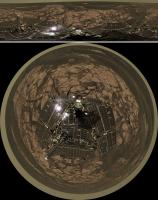
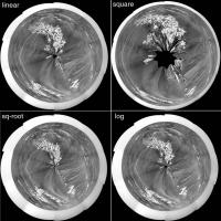
Well, I just had to try this out. It's great. Here is a pan from sol 829 reprojected four times using each of the four geometric options, to show the difference.
(PS I did nothing to the original pan, but for better results I should have added some space at the bottom, creating a blank area in the middle)
The way I usually make my polars stretches out the distant detail a bit more than this. But this is very nice indeed. Thanks, Indian3000. Now I'm going to have to try out your other stuff!
Phil
Posted by: djellison Aug 10 2006, 02:24 PM
[alan sugar]
Phil, You're fired
[/alan sugar]![]()
Doug
Posted by: Phil Stooke Aug 10 2006, 02:27 PM
Oh, OK... do I get a golden handshake?
Phil
Posted by: Indian3000 Aug 10 2006, 02:36 PM
(PS I did nothing to the original pan, but for better results I should have added some space at the bottom, creating a blank area in the middle)
The way I usually make my polars stretches out the distant detail a bit more than this. But this is very nice indeed. Thanks, Indian3000. Now I'm going to have to try out your other stuff!
Phil
hi phil,
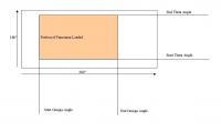
I think that incrementing the option "Start theta angle" you will arrive at the good result…
if I understood well
Posted by: paxdan Aug 10 2006, 03:01 PM
It needs a space adding along the bottom equal to the width of the deck
Posted by: Indian3000 Aug 10 2006, 03:06 PM
use option "Start theta angle"
Posted by: Ant103 Aug 11 2006, 12:23 AM
Great job! ![]()
I've download it and the way of using is very intuitive.
Thanks! ![]()
Here is a try with my own MacMurdo pan :
Posted by: Deeman Aug 11 2006, 09:34 AM
First try on my current project, Spirit Navcam Sol 012.
That software is awesome ! Thank you, Indian3000 !
Dirk,
Posted by: CosmicRocker Aug 11 2006, 04:56 PM
It sure is faster and easier than photoshop.
Ok, I know this was not a 360 degree panorama, but I just had to try it.
Posted by: Phil Stooke Aug 11 2006, 05:46 PM
You can rename it Spiral Barbecue.
Phil
Posted by: lyford Aug 11 2006, 06:43 PM
Until the new software can do polar projections AND corny puns, you will still have job security here, Phil.
Posted by: Indian3000 Aug 16 2006, 04:49 PM
Release R2  MarsRoverCenterPolarTransform_R2.zip ( 216.37K )
: 418
- Add polynomial projection ( for a best extration of the far details ),
- some optimization
- fill after theta > 1.0
in log projection
in polynomial projection K0 = 0.88 and K1 = -0.38
attention the polynomial it is as the women needs to caress with softness
increment and decrement the coeff "K" with softness
tips
try k0=0.9 and k1=-0.4 in first time and after ... refine
Posted by: Indian3000 Aug 17 2006, 11:27 AM
new release of MarsRoverCenter3DSiteViewer
change log ...
- mouse control ( left and middel button )
- updated path to sol 720
 MarsRoverCenter3DSiteViewer_R6.zip ( 882.56K )
: 515
MarsRoverCenter3DSiteViewer_R6.zip ( 882.56K )
: 515Posted by: Ant103 Aug 17 2006, 12:47 PM
Okay Inidian 3000 but the program don't run, it's me or ...? ![]()
Posted by: Indian3000 Aug 17 2006, 12:54 PM
try R6, a small probleme with mdf corrupt ...
 MarsRoverCenter3DSiteViewer_R6.zip ( 882.56K )
: 515
MarsRoverCenter3DSiteViewer_R6.zip ( 882.56K )
: 515Posted by: Tesheiner Aug 17 2006, 01:08 PM
It doesn't work for me; neither R2 nor R1.
Everything I get is a message "The application couldn't start correctly (0xc0000135). Click on accept to finish the application".
Do the DLLs or the EXE files need to be on a special directory (e.g. c:\windows) or do I need any additional library?
Posted by: Indian3000 Aug 17 2006, 01:22 PM
Everything I get is a message "The application couldn't start correctly (0xc0000135). Click on accept to finish the application".
Do the DLLs or the EXE files need to be on a special directory (e.g. c:\windows) or do I need any additional library?
you need Microsoft .NET Framework 2.0
you can download it http://www.microsoft.com/downloads/details.aspx?FamilyID=0856eacb-4362-4b0d-8edd-aab15c5e04f5&displaylang=en
Posted by: Indian3000 Aug 17 2006, 07:58 PM
my first attempt to automatic projection of my path data on map.
i think the differences is the error cumulated in data.
http://marsrovers.jpl.nasa.gov/mission/tm-spirit/images/MERA_A802_1.jpg
Posted by: helvick Aug 17 2006, 08:12 PM
OK - I don't know about the rest of you but this is fantastic ... Wow, one man software dev team is right.
Posted by: Indian3000 Aug 18 2006, 08:01 PM
The explanation of my problem of path ![]()
http://shoreline.eng.ohio-state.edu/publications/ASPRS05_KaichangDi.pdf
it is not an error in my program it is just an error in path data ![]()
Posted by: djellison Aug 18 2006, 08:06 PM
Ooo
"By Sol 282 of Spirit and Sol 263 of Opportunity, we generated timely topographic products including 76
orthophotos and three-dimensional DTM, and five three-dimensional crater models,"
Well - we've seen 2 of the crater dem's (Eagle and End) - perhaps we'll get them for Fram, Bonne, and Missoula - who knows how much will get released!
Doug
Posted by: Indian3000 Aug 18 2006, 08:29 PM
"By Sol 282 of Spirit and Sol 263 of Opportunity, we generated timely topographic products including 76
orthophotos and three-dimensional DTM, and five three-dimensional crater models,"
Well - we've seen 2 of the crater dem's (Eagle and End) - perhaps we'll get them for Fram, Bonne, and Missoula - who knows how much will get released!
Doug
mmmhh ... why not, I will be able to try DEM homemade
I need to reflect a little…
Posted by: Indian3000 Aug 18 2006, 09:32 PM
my first draft to clone PhotSynth:
but … a version usable is not before several weeks or months
it is not for tomorrow .... ![]()
codename project MarsRoverPhotSynth ![]()
Posted by: Indian3000 Aug 22 2006, 12:29 PM
the project advances more quickly than envisaged:)
some screenshots from oppy site 75
here oppy on sol 912 site 7500
here a top view of site 75 path ( sol 912-914 )
here oppy on sol 914 site 75GT with the path behind him
75GT under another angle
Posted by: Indian3000 Aug 22 2006, 07:26 PM
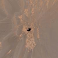
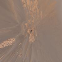
automatic path on Panorama
Opportunity Sol 877 Site 7400
Opportunity Sol 898 Site 74ZT
Opportunity Sol 898 Site 74ZT
Posted by: djellison Aug 22 2006, 07:29 PM
That is extraordinary stuff. Stunning
Doug
Posted by: aldo12xu Aug 24 2006, 04:13 PM
Incredible!!!
Posted by: Indian3000 Aug 25 2006, 07:43 PM
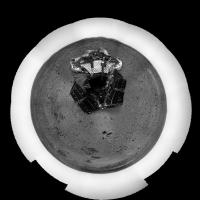
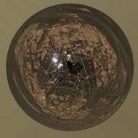
a new version of Mars Rover Center Polar Transform. MarsRoverCenterPolarTransform_R3.zip ( 415.91K )
: 460
I dropped the polynomial, too complicates to have something of correct.
I used another way, which gives good result with parameters less difficult has to configure.
some words on the configuration of new RLog :
use the parameter scale when you have too much sky on the top of the panorama, plus you have sky, plus the parameter scale must be small
( I am not sure English sentence here ![]() )
)
to test various parameters that will be easier ![]()
spirit site A586
opportunity Sol 917
Posted by: Phil Stooke Aug 25 2006, 08:17 PM
If I was wearing a hat, I would take it off to you - this is fantastic. Thank you for sharing these things with us.
Phil
Posted by: Ant103 Aug 25 2006, 08:27 PM
Wow, this third version is ... great!
We can now make without difficulties vertical projection.
There are no such "thanks" to tell you how the software you make are good!
Thanks a much ![]()
Here is my first attempt to vertical projection ![]()
Posted by: dilo Aug 25 2006, 08:38 PM
nice!
Posted by: hendric Aug 26 2006, 05:29 AM
Indian,
Could your software generate a movie starting at one setting and going to another? I'm thinking it would be cool to "float like a ballon" up above the rovers.
Posted by: Indian3000 Aug 26 2006, 09:10 AM
Could your software generate a movie starting at one setting and going to another? I'm thinking it would be cool to "float like a ballon" up above the rovers.
yes, it can but my problem it be to distribute the video, I know youtube but the quality of videos be strongly degrade, I have already some good videos, but it be too impossantes to be distribute by the forum.
I am in the search of space Web to make me a small page to distribute some data et program, but I did not find any yet. the problem it is that that takes much place and band-width, and that quickly becomes very expensive
Posted by: Indian3000 Aug 26 2006, 01:54 PM
I am in the search of file MER_FLAT_SN_XXX_X_X.IMG
ex:
MER_FLAT_SN_103_F_1.IMG
MER_FLAT_SN_104_F_2.IMG
MER_FLAT_SN_112.IMG
…
I already saw them on a ftp, but I do not remember where…
if somebody knows where they are…![]()
they are file FLAT for the radiocorrection
Posted by: djellison Aug 26 2006, 05:57 PM
Might be in one of these ?
http://pds-imaging.jpl.nasa.gov/data/
Doug
Posted by: Indian3000 Aug 28 2006, 06:20 PM
unfortunately, I did not find it there… nevertheless thank you ![]()
my interface starts has to become more complete ![]()
I work on some videos on last sol of opportunity, I hope soon to be able to show them
I am as in the search of free model 3D of a rover, same simple, as I can use in my application
the only ones that I have find are paying,
I need also to be able to distribute them easily
Posted by: djellison Aug 28 2006, 06:29 PM
It's not VERY accurate, but it's there or there abouts..
http://www.turbosquid.com/FullPreview/Index.cfm/ID/257762
Doug
Posted by: Indian3000 Aug 28 2006, 07:45 PM
http://www.turbosquid.com/FullPreview/Index.cfm/ID/257762
Doug
wonderfull
but unfortunately, textures are missing,
it is necessary that I make news texture
Posted by: djellison Aug 28 2006, 07:55 PM
I'd go with block colours to be honest, grey, black and white.
You're not going to achieve what I think you are are you....animated rover following the path of the actual rover within a terrain model?
With the data in this lot - http://anserver1.eprsl.wustl.edu/navigator/mobility.aspx?rover=2 - you could actually animate the rover itself ![]()
Doug
Posted by: Indian3000 Aug 29 2006, 07:48 AM
yes, it is exactly that,
I have already all the data that I need
I miss nothing any more an but little code for the interpolation between differents “drive point",
the model 3D of rover is a good base, it should be improved a little in 3D max,
but good it is not really my speciality
Posted by: Indian3000 Aug 29 2006, 07:32 PM
autopath with "auto" rover on frame
"spirit site AEVO"
and with color
and a small video
http://www.rlproject.com/~marsrovercenter/SPIRIT_SITE_AE_ANIM_1.avi
attention 4.6 meg and you need video codec Xvid.
Posted by: djellison Aug 29 2006, 07:46 PM
Again - I'm left wanting to use words that would cause me to ban myself from the forum ![]()
Posted by: jaredGalen Aug 30 2006, 09:07 AM
Holy cred that's incrapible!! ![]()
Family Guy reference but couldn't resist ![]()
Now I HAVE to install windows. ![]() can't hold back any longer!!
can't hold back any longer!!
Posted by: malgar Aug 30 2006, 09:55 AM
Family Guy reference but couldn't resist
Now I HAVE to install windows.
Awesome!!!!!!!!!!!!!!!!!!
I must install windows me too... hey Indian3000, why don't you think about a porting in linux, mac(?) OS? It would be great, and I would donate some money to support the project. I think that many other users that don't use windows could donate for a such spectacular thing.
Anyway I'll surely try it in windows
Ale
Posted by: bmoskovi Aug 31 2006, 04:41 AM
Maybe Indian3000 could port his software to Mono http://www.mono-project.com. The website says "Mono provides the necessary software to develop and run .NET client and server applications on Linux, Solaris, Mac OS X, Windows, and Unix." ![]()
Posted by: jaredGalen Aug 31 2006, 07:27 AM
Ooooooo thanks for that link. Very nice. I espeicially like the following from the FAQ's...
"What does the name "Mono" mean?
Mono is the word for 'monkey' in Spanish. We like monkeys"
Posted by: Indian3000 Aug 31 2006, 08:45 AM
I know Mono, but its problem it is that there is no really really advanced IDE for develloper, ![]()
then I will see whether there is average to put my code into mono, I am on most of the code will be compatible, but it is directx which me posse a problem, it would be necessary re-coded in opengl. ![]()
MRC is before a whole project that I make to amuse me has my lost hours. ![]()
I do not want too that that is a drudgery. ![]()
I have in my project to have a version which people could easily used, which is not the case for the moment. But later surely. For the migration to mono, I will to reflect there, I know that waitings for a software of this kind are strong. And I do not want to absorb me in a project, it, once again, for me is just amused ![]()
that please also to me to share part of my work,
and I really am very touched by the good remarks of some. ![]()
that gives me sometimes desire for going even further in the analysis of the data.
I would make a Web page a little more formal when this is more usable…![]()
once again, thank you for your remarks ![]()
and to excuse me for my bad English. ![]()
Posted by: Ant103 Aug 31 2006, 08:54 AM
Indian, I have one question to you.
It is possible for you to make a simple software for making 3D scene by using stereo pictures of the rovers and then convert it in 3ds object or lightwave or any 3D format?
I don't want to command you a personnal software, I imagine that this one can be usefull for a lots of users (and not only from mars pics, but from any stereo pic).
Posted by: djellison Aug 31 2006, 09:00 AM
If you look around this forum - someone has already made a utility to convert the data released terrain wedges into a 3d format...
http://www.unmannedspaceflight.com/index.php?showtopic=2456
Doug
Posted by: Ant103 Aug 31 2006, 09:23 AM
Ow! Okay Doug, I haven't seen it.
Thanks ![]()
Posted by: Indian3000 Sep 1 2006, 06:05 PM
my personal auto-panorama, bassed on CAHVOR model ![]()
test with sol 912
Full resolution : 10.000 x 5.000 ( 6 Mb )
http://www.rlproject.com/~marsrovercenter/opportunity_912_.jpg
I still have a small problem with the gain, but ,
I make in this moment research on the automatic correction gamma …
I do not know yet which way to take, but, I have already a solution to estimate the position of the sun, but I do not think that it is the good solution to have correct gamma on all the images.
if somebody has a piece of advice for "gamma equalisation" I am interested
Posted by: algorimancer Sep 1 2006, 07:45 PM
test with sol 912
...
Nicely done
Posted by: Indian3000 Sep 1 2006, 08:35 PM
hi algorimancer,
you have already the solution for the panoramas it is the same technique which for the vertical one except that one needs exchange the plan by a sphere or a cylinder, calculates the intersions with a sphere or a cylinder instead of a plan… and you have your panorama ![]()
I must acknowledge that it is you who my put on the way with your projection vertical:)
opportunity sol 919
Vertical projection using CAHVOR model
1 cm per pixel
2.5 cm per pixel
I do not have all yet made finished with projection vertical, I must still make blend between the frames and corrected gamma (as for the panorama) for the verticals I did not take yet into account the quaternion of the rover vector origin, it is what I code for the moment.
I have also in my plan to make an automatic traversmap with the technique of projection vertical, but a little more advanced, instead of calculating all separately the verticals map, I them calculation all in same time, which enables me to make a filter on the pixels most significant (otherwise say by calculating the distance from the pixel with the rover location )
what I think will make a traversmap more significant, with more significant pixel, considering that more close to the rover
I do not know if I were very clearly here
Posted by: algorimancer Sep 2 2006, 02:06 AM
I have also in my plan to make an automatic traversmap with the technique of projection vertical, but a little more advanced, instead of calculating all separately the verticals map, I them calculation all in same time, which enables me to make a filter on the pixels most significant (otherwise say by calculating the distance from the pixel with the rover location )
what I think will make a traversmap more significant, with more significant pixel, considering that more close to the rover
I do not know if I were very clearly here
Clear enough
Posted by: dilo Sep 2 2006, 05:52 AM
I know this issue
So, I'm happy to see someone (Indian) is planning to make automatic traversmap with the vertical pojection technique and you want to make it in 3D... cannot ask for more!
Posted by: Indian3000 Sep 2 2006, 03:35 PM
quality is not very good yet, but this starts has to become correct:)
I must still take account of the slope of the rover and a best gamma correction, but I start has to become satisfied ![]()
opportunity sol 919 ( 0.5 cm / pixel )
opportunity sol 919 ( 1 cm / pixel )
Posted by: helvick Sep 2 2006, 04:35 PM
Wow.
No seriously - those two projections are absolutely astonishing. They really do appear to have been taken by a camera looking directly down onto Opportunity.
Posted by: Indian3000 Sep 3 2006, 02:30 PM
it is not the most recent site, but it is rather a sympathetic image,
I take again some site to make the tests of my software,
if somebody remember a sympathetic site… that he gives the sol number
opportunity SOL 354
vertical projection generated with CAHVOR Model
and same site - spheric projection generated with CAHVOR Model
Posted by: aldo12xu Sep 3 2006, 04:37 PM
That looks so cool, Indian3000! Here's a suggestion for a Spirit site: Sol 310 Navcam panorama for the rock structures:
http://marsrovers.jpl.nasa.gov/gallery/all/spirit_n310.html
and Sol 112-113 for the dramatic shadow:
3.3Mb: http://marsrovers.jpl.nasa.gov/gallery/press/spirit/20040428a/07-MW-07-NavCamPan-A113R1.jpg
Posted by: Ant103 Sep 3 2006, 05:51 PM
If you want, I've made a logo for your Mars Rovers Center Polar Transform (MRCPT) :
PNG image :
Background image from Mhoward pan and polarized with MRCPT ![]()
And an ICO file :
http://www.astrosurf.com/merimages/Upload/Ic%f4neMarsRoverCenterPolarTransform.ico
I can try to make others icons for Mars3DCenter ![]()
Posted by: Indian3000 Sep 3 2006, 06:32 PM
Ant103 : thanks, it's a good idee,it is in general the kind of small details of which I do not think…![]() , I prefer projection RLOG, it gives of best result
, I prefer projection RLOG, it gives of best result ![]()
aldo12xu : here spirit sol 310 ![]() 112-113 soon
112-113 soon
spheric projection ( browse version )
here a full version
http://www.rlproject.com/~marsrovercenter/SPIRIT_SOL354_spheric_proj.jpg
vertical projection 0.5cm / pixel
vertical projection 1.0cm / pixel
Posted by: aldo12xu Sep 4 2006, 02:57 PM
That looks great and it's a very useful image, too!! As long as we don't get too far from the centre of the projection, we can see a suggestion as to how the rocks are oriented. In this case, they seem to strike NNW and dip to the east, assuming north is at the top. I imagine the flatter the terrain, the less distortion there is as well.
Posted by: dvandorn Sep 4 2006, 04:34 PM
This is just a personal gripe of mine, but... there really is no such word as "orientate." "Orientation" is a noun made from the verb "orient," to position. If you want to use a verb for the purpose, please use the correct one -- orient. The proper way to say the above is "we can see a suggestion as to how the rocks are oriented."
As a writer, I just have to express this kind of thing every once in a while. If I keep it bottled up for too long, you'll end up hearing an enormous explosion centered on the suburbs of Minneapolis...
-the other Doug
Posted by: Indian3000 Sep 4 2006, 08:07 PM
as promised ![]()
Spirit sol 111
vertical projection 1 cm /pixel
I do not put spheric projection, I have small a bug in my program, it is necessary that I correct
Posted by: aldo12xu Sep 5 2006, 12:14 AM
Thanks Indian3000! Another nice one!
And Doug, nothing wrong with letting off a bit of literary steam ![]()
Posted by: Indian3000 Sep 8 2006, 12:34 PM
I hesitated has to show them , but as I left soon in vacancy…
it is not perfect, I still have work above
Posted by: paxdan Sep 8 2006, 01:00 PM
Err yes there is, it is a transient verb. While other back formations from "-tion" words may sound clumsy they can become valid constructions if they find their way into common usage. http://dictionary.oed.com/cgi/entry/00333792?single=1&query_type=word&queryword=orientate&first=1&max_to_show=10 is a valid word and in common usage in the UK.
The beauty of the English language is its malleability and corruptibility. I work for the publisher of the Oxford English Dictionary; we are gardeners not guardians of the English language.
Posted by: dvandorn Sep 8 2006, 11:05 PM
You know, while I admire language's ability to grow and change, I resist the concept that "if enough people use the language wrong for long enough, it becomes acceptable." I'm tending to agree with the French on this -- yes, let the language change and grow. But enforce rules.
Or is the Oxford English Dictionary's next edition going to recognize such constructions as "R U going 2 be there l8ter?" as acceptable? ![]()
-the other Doug
Posted by: paxdan Sep 8 2006, 11:22 PM
I hate to break this to you, but Appendix 7 of the current edition (10th, Revised) of he OED is called: SMS (electronic text messaging) and contains (among others) the following glossary of SMS abbreviations:
CUL8R... see you later
R... are
U... you
2... to, too
Explosion centered on the suburbs of Minneapolis detected in: 5, 4, 3....
Posted by: Pando Sep 8 2006, 11:32 PM
LOL!!! 
<bracing for impact>
Posted by: dvandorn Sep 9 2006, 05:54 AM
Ticktickticktickticktick.....
KABOOM!!!!!
![]()
![]()
![]()
Fine, it's a (very, very inferior) means of communication. Just don't ever call it English in my presence, please... *sigh*...
-the other Doug
Posted by: Indian3000 Oct 30 2006, 09:20 PM
New module in 3d real time navigation module ...
you can load .VST files in 3d world ... ![]() and navigate in realtime ...
and navigate in realtime ... ![]()
release in some weeks ... ![]()
some screenshots ...
spirit in mc murdo
opportunity going down in endurance
Posted by: Indian3000 Oct 30 2006, 09:26 PM
it is not really clean but is spirit on "home plate" ( site 115 )
Posted by: DDAVIS Oct 30 2006, 10:59 PM
[quote name='dvandorn' date='Sep 8 2006, 11:05 PM' post='67344']
You know, while I admire language's ability to grow and change, I resist the concept that "if enough people use the language wrong for long enough, it becomes acceptable."
I have been noticing a lot of usage of 'loose' in place of 'lose' in computer messaging. There are other widely used examples I can't think of now.
Don
Posted by: edstrick Oct 31 2006, 09:23 AM
I've thought one possibly good illumination schemes for such renderings would be to simulate a "sun" at the camera location, but to ignore inverse square illumination dropoff as you get more distant from the source. Just determine pixel brightness by the illumination incidence angle in some simple way.
Posted by: Indian3000 Nov 4 2006, 04:06 PM
a HUGE vertical projection 8000x8000 2 mm /pixel in "True Color" ( a square of 16m x 16m )
2 hours to compute this on AMD 4200+ X2 with 3 GB ram ...
Opportunity Site 64KC Sol 660
here a browse version scale 1/10 800x800
and here the HUGE version in "True Color"
( jpg 12 Mb ) ( original TIF 256 Mb )
http://www.rlproject.com/~marsrovercenter/1P_64KC_VRT_0_002_COLOR.jpg
Posted by: centsworth_II Nov 4 2006, 06:16 PM
"Spirit Spins Out" flashed through my mind when I saw this.
I usually steer clear of these technical threads. But some of the images are fantastic.
It's amazing what can be done with the original images to give new perspective.
Posted by: phase4 Jan 12 2007, 05:36 PM
I am stunned by your software, Indian3000! It puts the MER data into whole new perspectives. (well, for me it does)
Many thanks for your programs! ![]()
Posted by: Indian3000 Mar 2 2007, 08:52 PM
A new ALPHA version a my module "3D site viewer". MarsRoverCenter3DSiteViewer_ALPHA_1_base.zip ( 517.13K )
: 426
dont forget the data file in next post.
Requis :
.NET Framework 2.0.
sql server 2005 express ( or full version work too )
DirectX 9.0c
Installation
unzip all files in one directory ( *base.zip + *data.zip )
Start Application and close it.
The application will have created a standart XML config file in EXE directory.
%MACHINE_NAME%_config.xml
you have something like this
edit it and change entry with your PDS directory on your hard drive.
here a exemple
Notes :
you can add file only in panorama tab or 3D terrain or VST.
you can mix panorama file with VST or mix 3D terrain and VST ... or all three in a same time
BUT
you can not mix Differentes sites, ou can load only same site files. Look my previous post about this.
----------------------------
In Panarama TAB .
add only EFF and RSD left-eye product.
In 3D terrain TAB .
Add only XYL file ( and you need the corresponding RSL left-eye product in the same directory )
In VST TAB.
add Only *vst file.
For vst texture i try to find in the same directory the corresponding RSL file or in a pds local structure (config file)
example : 1n136278048vil1600p1980l0m1.vst texture is 1n136278048rsl1600p1980l0m1.img
----------------------------
I develop on Vista platform, thus I am not sure this work under XP.
I repeat it's a ALPHA version.
----------------------------
this software is developed on the same structure of data that PDS
here a example of necessary PDS data structure on you hard disk ( you can place mer1po_xxx, mer1no_xxx, ... on sub directory just update you xml config file )
----------------------------
Control Keys :
Arrows -> Navigation
Enter -> Rover Mode
in Rover Mode.
N : Next Frame.
V : Left rotation
B : Right rotation
in all mode
Q : FOV++
S : FOV--
Mouse Control :
Left click for pan.
Middle click for rotation.
Wheel for zoom.
----------------------------
you can place the software on USB keys or a mobile hard drive i create one config file per machine and a load automatically the good one.
----------------------------
sorry for my English and my confused explanations, but it's late and and I am tired ...
Indian.
Posted by: Indian3000 Mar 2 2007, 08:53 PM
and data file  MarsRoverCenter3DSiteViewer_ALPHA_1_data.zip ( 706.81K )
: 1083
Posted by: ArMaP Dec 30 2008, 12:22 AM
I am sorry for being so late to this "party", but I downloaded the two zip files and both files give me an error when I try to extract the files from them.
Could anyone help me?
PS: Is there any newer version of this software? It looks great!
Powered by Invision Power Board (http://www.invisionboard.com)
© Invision Power Services (http://www.invisionpower.com)
