Printable Version of Topic
Click here to view this topic in its original format
Unmanned Spaceflight.com _ Messenger _ Mercury Flyby 1
Posted by: MarsIsImportant Dec 5 2007, 06:47 AM
40 days and counting. The long wait is almost over!
I wonder whether we will get enough data to test new simulation theories like this one.
http://space.newscientist.com/article/mg19626325.000-is-mercurys-magnetic-field-sapped-by-solar-wind.html
What do you expect from this first flyby?
Posted by: As old as Voyager Dec 5 2007, 10:04 AM
Personally, I'm looking forward to seeing MESSENEGER's MDIS images.
On Jan 14 MDIS will first see Mercury as a crescent showing previously mapped territory. After the flyby MDIS will take images of the planet in a gibbous phase showing 25% 'new' territory and the huge Caloris impact basin will be visible near the centre of the disc.
Plus, after the encounter and travelling at 140,000 mph, MESSENGER will be the fastest spacecraft of all time!
It should be a real day to remember!
Posted by: monitorlizard Dec 5 2007, 10:06 AM
[.....]
I think the most exciting thing we have some chance of seeing would be evidence of endogenic activity--volcanic flows, maybe even cinder cones or vents, something to indicate Mercury was once active. Some small volcanic flows were seen by Mariner 10, more would certainly be interesting.
Posted by: edstrick Dec 6 2007, 09:27 AM
Mariner 10 had terribly limited color imaging.. Orange, blue, and UV filters, beside "minus blue" (yellow) and clear.
It also had an attitude control deadband that was nearly the field of view of the imaging system, so it's targeting tended to wander around rather drunkenly. The result is that Mariner 10 color mapping was limited, mostly low resolution hemispheric data, and only somewhat useful. Heroic image processing efforts by (I think) Mark Robinson have gotten really useful information out of it, but it's still pretty limited.
This flyby will give multispectral mapping far superiour to Mariner 10's, and will also have near-infrared imaging/spectal mapping that we essentially don't have any of yet. (I haven't dug into what the capabilities of the instruments are)
I expect that beside other interesting results from the first flyby, this will provide a real revolution in understanding crustal diversity and it's geologic history.
Posted by: tedstryk Dec 6 2007, 12:33 PM
That is correct. Also, there heaters that were supposed to control the temperature of the vidicon failed, which made calibration impossible at the time. Using modern computers, Robinson was able to calibrate the data.
Posted by: MarsIsImportant Dec 10 2007, 08:01 PM
From wikipedia...
So which of these six key issues will light be shed upon during the 1st flyby?
P.S. 35 days and counting!
Posted by: JRehling Dec 10 2007, 10:51 PM
[...]
Posted by: nprev Dec 11 2007, 01:41 AM
The most exciting features I could anticipate might be some long-dead cinder cones as there are on the Moon. (Still, I actually would find that pretty exciting... ![]() ) Doubt that they'll see any during the flybys, though.
) Doubt that they'll see any during the flybys, though.
Posted by: Holder of the Two Leashes Dec 11 2007, 03:28 AM
I expect the magnetometer data to provide some helpful hints as to what is causing that magnetic field.
Posted by: IM4 Dec 11 2007, 07:08 PM
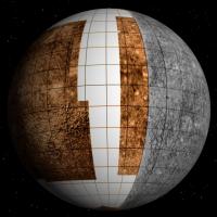
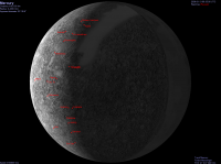
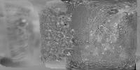
Simple Celestia perspective : Mercury as seen after flyby. Composite texture adopted from original Stooke map = Mariner (BW) + Arecibo radar mapping (color contrasted).
Posted by: MarsIsImportant Dec 14 2007, 04:19 AM
This is an animation of the January 14th, 2008 Messenger Flyby of Mercury.
http://messenger.jhuapl.edu/the_mission/movies/encounters/Mercury%201%20sc%20od095.mov
It shows the spacecraft will get as close as 200 km from the surface. We should get some good images. However, the animation seems to suggest a kind of equatorial trajectory. So perhaps we won't get an immediate answer about the possibility of water ice at the poles. Yet we should get a good chunk of the planet imaged that has not been seen before, close-up at least.
Posted by: JRehling Dec 14 2007, 04:47 AM
[...]
Posted by: MarsIsImportant Dec 15 2007, 08:33 PM
Well, it has been about 33 years since the last measurement of Mercury's magnet field. I would assume that the best science on this flyby will be from the Magnetometer.
The really good image operation will be very short indeed. It should last only 10 to 15 minutes for some close-up visuals once the spacecraft comes out from behind the planet. The imaging could start at 4000 km from the surface and continue as the spacecraft recedes. But the exciting part is that that part of Mercury has not been imaged close-up before. Granted, it is not at the closest approach of 200 km; but 4000 km is good.
Despite the visuals we might get, I'm more excited about the potential for Mapping out Mercury's Magnetic Field. I'm afraid a single pass is not good enough to do that with a high degree of confidence; but I'm hoping we will get a few surprises that will give us a much better model than we currently have.
Posted by: Rob Pinnegar Dec 15 2007, 11:13 PM
Yeah, that magnetic field is sure to be one of the show-stoppers.
I wonder: will we be able to get stuff like quadrupole moment out of the first flyby? We got that sort of information out of the Voyager flybys of Uranus and Neptune, so I guess there's some chance, at least.
It'll also be interesting to compare this data set with the data from the next two flybys. But we'll have to wait for that.
Posted by: JRehling Dec 16 2007, 04:42 AM
[...]
Posted by: Rob Pinnegar Dec 16 2007, 05:53 PM
Actually, my first guess is that Mercury's slow rotation should actually make it easier to map the magnetosphere, and pick up stuff like quadrupole moment. The "nearly-stationary" nature of the field should make it much easier to disentangle rotational effects from translational effects.
Posted by: peter59 Dec 20 2007, 06:53 PM
MESSENGER’s nineteenth trajectory-correction maneuver (TCM-19) completed on December 19 lasted 110 seconds and adjusted the spacecraft's velocity by 1.1 meters per second (3.6 feet per second). The movement targeted the spacecraft close to the intended aim point 200 km (124 miles) above the night-side surface of Mercury for the probe's first flyby of that planet on January 14, 2008.
http://messenger.jhuapl.edu/news_room/status_report_12_19_07.html
Posted by: peter59 Dec 21 2007, 06:06 PM
New animation of MESSENGER's flyby of Mercury that shows the specific instrument operations planned during the encounter.
http://messenger.jhuapl.edu/the_mission/movies/M1_Phase_B_final_text_small.mov
Posted by: tedstryk Dec 21 2007, 06:09 PM
Sweet!
Posted by: volcanopele Dec 21 2007, 06:42 PM
Very nice! Looks like there will some very nice mosaic designs during this encounter.
And I think they did a very good job with this visualization by freezing the frames for a few seconds so you can clearly see the mosaics and where they will be.
Posted by: ugordan Dec 21 2007, 06:43 PM
Wow, that's going to be a LOT of frames!
Great visualization, only thing it misses is event timecodes. Reminds me of Voyager Uranus/Neptune flyby animations a bit.
Posted by: volcanopele Dec 21 2007, 07:14 PM
LOL, I've been working on image processing for too long. As I watch this video, I start thinking about which images would I process first (likely the full-disk WAC mosaic after the Northern hemisphere NAC mosaic), and what order I would process these mosaics in. Looks like the NAC mosaics are composed of single filter frames, which simplifies things quite a bit.
Posted by: tedstryk Dec 21 2007, 08:12 PM
I am looking forward to seeing the rest of Caloris. This is a rough mosaic using this image set I posted earlier and the high-res map coverage (I am on my way out the door for the holidays, so I didn't have much time to work), but it shows the extent of Mariner 10's coverage (I probably could have found some images that were somewhat better just beyond the limb, but, like I said, I am on my way out the door).
Posted by: MarsIsImportant Dec 22 2007, 06:33 AM
Wow! There will be a lot more visual camera mosaics than I thought.
Looking at the timeline and the scientific instruments involved in this Flyby, there is going to be a lot of atmospheric analysis with the UV scanner from the MASCS, especially upon approach while there is just a cresent Mercury visible. Wide angle and narrow angle mosaics will still be made upon approach. Upon closest approach at 200 km, there will be Visual/IR/UV surface spectroscopy of the dark side of Mercury. The wide angle camera will be turned back on around 2000 km in altitude to do color photometry. A High-resolution mosaic will begin with the narrow angle camera when the spacecraft gets near 3000 km in altitude. These high-resolution images will be of the equitorial region on the side of Mercury never seen close-up before. They will then do wide angle color imaging of the same and surrounding area. Then they will switch back to high-resolution and do the entire northern hemisphere that is visible. Switch back again to the wide angle camera and do the whole planet face. Then repeat with the narrow angle camera. The whole flyby sequence will be done in little more than an hour and a half.
I suppose the MAG will be taking measurements the entire time. I don't know where or when the EPPS will come into play; but it will probably be taking measurements too of any charged particles within the magnetosphere. I can hardly wait for clues to solar influence upon Mercury's magnetic field and their interaction.
It looks like this will be a science intensive flyby. There should be a lot of answers or at least clues to a lot of burning questions about Mercury. I'm even more excited now than I was a couple of weeks ago! And I can hardly wait for the eventual orbital insertion.
Posted by: edstrick Dec 22 2007, 11:54 AM
"...all of which add up to the magnetic field being almost stationary while the craft flies through..."
Mariner 10, on one of the two night-side flyby's, got good data on the field configuration on the way in, but then was hit by a magnetosphere substorm on the way out, reducing the "fittabiility" of the data. The magnetic field is weak, the magnetosphere is small, and solar wind is strong.... the magnetosphere "does things fast"
Posted by: CAP-Team Dec 22 2007, 03:05 PM
I'm curious who'll post the first new map of Mercury based on the new images of this first flyby ![]()
Posted by: nprev Dec 22 2007, 03:23 PM
![]() ...we should start a pool! UMSF's imagesmiths are so talented that I know that they'll beat the USGS by several months. Heck, I'd be surprised if someone doesn't post a revised map later than 2 weeks after this encounter.
...we should start a pool! UMSF's imagesmiths are so talented that I know that they'll beat the USGS by several months. Heck, I'd be surprised if someone doesn't post a revised map later than 2 weeks after this encounter.
Posted by: 4th rock from the sun Dec 22 2007, 03:33 PM
Very nice Ted! The Mariner 10 dataset is hard to work with and you've pulled some nice data from it.
A can almost make out half of Caloris basin in your images!
Posted by: ugordan Dec 22 2007, 03:35 PM
You both seem to be forgetting MESSENGER doesn't feature raw image pages like MER and Cassini does.
Posted by: nprev Dec 22 2007, 03:37 PM
Didn't forget; actually, never knew. Bummer. ![]()
Posted by: Phil Stooke Dec 22 2007, 10:12 PM
No, but any press release mosaics etc. could be reprojected fairly quickly.
APL does have a tiny history of daily release. Or did. Right back at the start of the NEAR approach to Eros, just before going into orbit, they said they would release all the images every day. And they actually did, while the asteroid was 10 pixels long or so. At that time I was downloading them and posting a few images on some usenet forum or some such place - whatever it was people did back then. I recall Calvin Hamilton asking me how I got the 16 bit images into Photoshop. Then he put out a few of his own. And then, just as Eros was getting big enough to be interesting, they chickened out and quit.
C'mon, APL, you can do it!
Phil
Posted by: JRehling Dec 22 2007, 10:44 PM
[...]
Posted by: elakdawalla Dec 22 2007, 10:57 PM
In terms of when images get released, a lot depends upon the PI, and from what I understand, this PI is not likely to permit the images to get posted immediately -- though of course I would be delighted to be wrong.
Anyway, this video is the final version of http://www.planetary.org/blog/article/00001086/...
--Emily
Posted by: algorimancer Dec 22 2007, 11:55 PM
It seems to me that it is in Nasa's own interest to encourage this sort of virtually free publicity - I would hope that a plan for public data sharing would be a factor in approving funding for missions.
Posted by: djellison Dec 23 2007, 12:10 AM
Outreach is certainly part of the mission selection process. However, the rapid release of raw imagery in the MER/Cassini style is certainly not 'virtually free'. Just ask their web teams how much bandwidth they get through.
Posted by: nprev Dec 23 2007, 02:18 AM
Yeah...it's easy to forget that it takes a lot of labor & resources to post pics in real time. Not every mission has this.
Posted by: MarsIsImportant Dec 23 2007, 06:20 AM
If we are not pushy and the Messenger team knows about this audience, then they might be willing to give us what they can. The recent animations and interviews clips on their site happened in a timely manner. It is most appreciated and helpful. It almost seemed that they are aware of us. Perhaps they are. Or perhaps it was mere coincidence because of the upcoming flyby.
We didn't expect the MRO team to be so gracious with some of the images; yet they seem to have been. I can only hope that the Messenger team will also follow the MER team example to some extent or another and make public whatever is practical to do so.
Posted by: tfisher Dec 23 2007, 01:38 PM
If it was purely a matter of bandwidth, I would expect they could get google to host for free. (I say google in particular because they most clearly among the internet giants display the attitude of being happy to undertake even expensive projects just to advance their image of being the premier repository of human knowledge, and they show a particular interest in helping the scientific community.) Of course, there are expenses to have a web team at all.
Still I think this kind of decision doesn't really come down to money. The PI and core science team have a strong motivation to try to maximize the amount of scientific credit they personally get, and openness with data is viewed as decreasing their advantage over competing scientists. I think that is still the real story.
Posted by: Rob Pinnegar Dec 23 2007, 07:49 PM
That's probably true, and a good way of addressing it would be to determine whether anyone on the Cassini team has lost credit for something because of the existence of the Raw Images page. If that hasn't happened, the Messenger team could rest a bit easier about it.
In addition, I don't recall having seen anything on UMSF that would indicate that our discussions here had taken anything away from the Cassini team. There have been a few occasions when things got posted and discussed here before they showed up on the Cassini web site, or in a conference abstract volume. These included the re-discovery of the ring spokes, and the changes in the D Ring. That didn't seem to have any really serious negative ramifications.
It's probably inevitable that, sooner or later, someone is going to try to jump the gun and take advantage of one of the Raw Images pages. But then they'd have to try to get it through peer review and that could pose problems for them. Anyone remember those guys who claimed to have found pools of water on Mars the other year?...
Posted by: mcaplinger Dec 23 2007, 10:56 PM
All missions have PDS data release requirements, and that's about it. While outreach is a factor in mission selection, it's a very tiny factor. And I suspect a better outreach plan than just dumping minimally-processed data with no explanation or commentary on the internet would be required to make it be a bigger factor.
Posted by: Doc Dec 24 2007, 10:14 AM
Dont despair, I believe they will post the raw images in the same way they did with New Horizons.
It may take time though.
However, if they dont release the raw images....... well, at least we will enjoy the flyby itself. :-)
Posted by: scalbers Dec 24 2007, 11:00 PM
Wonder if any images will be shown at this public reception?
http://messenger.jhuapl.edu/RSVP/index.php
Posted by: gcecil Dec 25 2007, 10:42 PM
http://messenger.jhuapl.edu/RSVP/index.php
I was told by PI Sean Solomon that "The day of the flyby itself will have drama, but no data. Images and other data will not be downloaded from the spacecraft until several days following closest approach." So, Strom's talk will be a preview only. I've been invited up for some of the downlink; really looking forward to this bit of history making. From the visualization link posted up thread, you can infer that the laser altimeter will scan across the putative ramparts of the Skinakas basin (in the dark during this flyby). Of course, there is only limited radar altimetry of Mercury to provide context; the Harmon et al Arecibo images are insensitive to significant surface tilts.
Update [12/26]: Confirmed that no data will be on ground until 16th. Big data crunch 16-18, followed by press conference/release. Then plenty of people in Laurel MD for a couple of weeks of photo-geology.
Posted by: CAP-Team Dec 29 2007, 09:50 AM
Does anyone know what the field of view of the Narrow Angle and the Wide Angle Camera is?
Posted by: peter59 Dec 29 2007, 03:37 PM
Now Messenger is 10 million kilometers from Mercury.
Power up your Imagination!
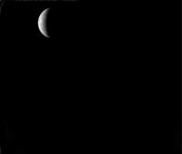
Mariner 10 six days before closest approach (03/23/74).
Image FDS0014342
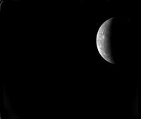
Mariner 10 four days before closest approach (03/25/74).
Image FDS0019143
Mariner 10 two days before closest approach (03/27/74).
Image FDS0023285
Posted by: elakdawalla Dec 29 2007, 05:03 PM
From http://www.lpi.usra.edu/meetings/lpsc2007/pdf/1305.pdf:
--Emily
Posted by: CAP-Team Dec 29 2007, 11:21 PM
Based on Emily's data, this is how Messenger sees Mercury right now:
Narrow angle view:
Wide angle view:
Posted by: gcecil Jan 2 2008, 01:02 PM
Can someone here please point me to updating orbital elements (TLE format) for MESSENGER's trajectory? Am I right that there is still no master repository of deep space heliocentric orbital elements? For that matter, such an archive should include fragments before and after various historical gravitational assists. Anything like that around? Thanks
Posted by: elakdawalla Jan 2 2008, 06:07 PM
Does JPL's HORIZONS system give you what you're looking for?
http://ssd.jpl.nasa.gov/?horizons
--Emily
Posted by: simonbp Jan 2 2008, 09:49 PM
Yeah, LPSC will probably the first real presentation of the results. Of course, abstracts are due next week, so they'll all be placeholders...
Simon
Posted by: gcecil Jan 2 2008, 11:24 PM
http://ssd.jpl.nasa.gov/?horizons
--Emily
Yes. I didn't realize that HORIZONS has spacecraft. Thank you. Now just need to convert these into TLE format.
Posted by: ustrax Jan 4 2008, 10:40 PM
We're back... ![]()
http://spaceurope.blogspot.com/2008/01/messenger-mercury-flyby-1.html
http://spaceurope.blogspot.com/2008/01/messenger-mercury-flyby-1_04.html
This is it for now.
I will not promise anything but...let's try to make of this return to Mercury a great party... ![]()
Posted by: Phil Stooke Jan 5 2008, 09:10 PM
Some new visualizations are up on the MESSENGER page for this flyby.
Phil
Posted by: ustrax Jan 5 2008, 10:36 PM
Phil
Are you referring to the fantastic work done under the http://messenger.jhuapl.edu/encounters/? Astounding...magnificent outreach...
Posted by: NMRguy Jan 7 2008, 04:46 PM
MESSENGER Mission News
January 7, 2008
http://messenger.jhuapl.edu/news_room/status_report_01_07_08.html
One week to go and fortunately no big surprises. Also, the mid-December trajectory correction maneuver (TCM-19) went so well that the scheduled January 10 maneuver will not be necessary. Data gathering should begin in two days. Very exciting times.
EDIT: I just noticed that on January 30 (1 p.m. EST.), there is a "NASA Space Science Update on the Mercury flyby" at NASA Headquarters. Is this the main science press release?
Posted by: PhilCo126 Jan 8 2008, 04:32 PM
Any chance they'll show something on NASA.TV ?
Posted by: NMRguy Jan 8 2008, 04:55 PM
Apparently they will. Here's a link to the schedule.
http://www.nasa.gov/multimedia/nasatv/MM_NTV_Breaking.html
January 30, Wednesday
1 p.m. - MESSENGER M1 Flyby News Conference - HQ (Public and Media Channels)
Posted by: NMRguy Jan 8 2008, 08:15 PM
MESSENGER Mission News
January 8, 2008
http://messenger.jhuapl.edu/news_room/status_report_01_08_08.html
Rapid fire! Another update from MESSENGER team. Mission operators have sent commands to acquire nine sets of optical navigation images at Mercury. APL and the Planetary Society are also hosting a public reception on the evening of the encounter. The reception will include a talk by Robert G. Strom, a professor emeritus at The University of Arizona who was involved in Mariner 10 and is now a member of the MESSENGER Science Team. He'll "share his unique perspective on the significance of the MESSENGER mission." This might be of interest to those of you in the DC-area.
Posted by: JRehling Jan 8 2008, 08:50 PM
[...]
Posted by: Stu Jan 8 2008, 11:08 PM
While we wait for new images to start coming in, I thought I'd do a bit of Googling for existing images... these 3D views are pretty interesting...
http://geoinfo.amu.edu.pl/wpk/pe/a/harbbook/3D/book_2/mercury/M-DISC.GIF
http://geoinfo.amu.edu.pl/wpk/pe/a/harbbook/3D/book_2/mercury/M-RENOIR.GIF
Posted by: Stu Jan 8 2008, 11:41 PM
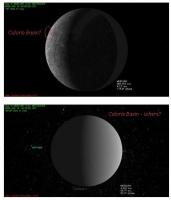
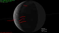
Can someone help me get oriented here? I've always been fascinated by the Caloris Basin, and I'm looking forward to seeing it in more detail during the fly-by. So...
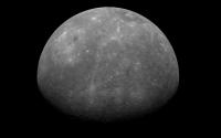
1. Have I labelled its location correctly in the top image (view pre-closest encounter)?
2. Where will Caloris Basin be on the images of Mercury we see post closest encounter? (if we're going to see it at all?)
Over to our magnificent map makers...
Posted by: lyford Jan 8 2008, 11:44 PM
n00b question -
How does a spacecraft like Messenger slew back and forth rhythmically as in http://messenger.jhuapl.edu/the_mission/movies/M1_Phase_B_final_text_small.mov Does that targeting use propellant or can gyros or something else produce that motion?
Or should I go search through the comments on the http://www.unmannedspaceflight.com/index.php?showtopic=4819
Posted by: Ian R Jan 9 2008, 12:04 AM
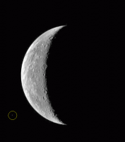
Stu,
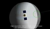
Check out the screenshot I've culled from the following animation:
http://www.youtube.com/watch?v=uFCrvvn57AM
The Caloris basin (or half of it) is visible inside the green circle. Messenger will have a good look at it on the outbound leg of the encounter.
Ian
Posted by: JRehling Jan 9 2008, 12:10 AM
[...]
Posted by: Stu Jan 9 2008, 12:12 AM
Thanks guys, exactly what I wanted. Knew I could count on you. ![]()
Posted by: edstrick Jan 9 2008, 10:09 AM
This will give a rather poor, high-sun-angle view of Caloris on the limb. Some basin ring relief may be visible on the limb. Color differences will be more visible than near the terminator, complementing the mariner 10 terminator data and some indications of chemical differences of the smooth and fractured plains filling the basin from ejecta, etc.
Posted by: ustrax Jan 9 2008, 05:52 PM
http://spaceurope.blogspot.com/2008/01/mascs-update-with-noam-izenberg-ive-e.html by Noam Izenberg about what will be the work done by MASCS and how this will occur.
Posted by: elakdawalla Jan 9 2008, 08:03 PM
http://messenger.jhuapl.edu/news_room/status_report_01_09_08.html
But don't get your hopes up; as far as I can tell, the news release doesn't actually include the images ![]()
EDIT: I've confirmed with the project that they don't plan to release the images until tomorrow's press conference.
--Emily
Posted by: nprev Jan 9 2008, 09:48 PM
I was gonna say "odd", but that's cool; as long as they get released! ![]()
Posted by: CAP-Team Jan 9 2008, 10:03 PM
The NAC images should look something like this: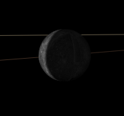
Posted by: ustrax Jan 10 2008, 03:41 PM
We have an happy team over there...Ralph McNutt http://spaceurope.blogspot.com/2008/01/update-with-ralph-mcnutt-i-was-in.html:
"We have a beautiful crescent of Mercury centered in the imager field of view!"
He's teasing us...isn't he?... ![]()
Posted by: Stu Jan 10 2008, 04:27 PM
I know that at least one of the MESSENGER team has been lurking here for a while, so I'd just like to wish everyone involved with MESSENGER all the best for the fly-by next week.
Looking forward to those first images! ![]()
Posted by: ustrax Jan 10 2008, 06:02 PM
http://messenger.jhuapl.edu/gallery/sciencePhotos/image.php?gallery_id=2&image_id=108
Posted by: elakdawalla Jan 10 2008, 06:04 PM
http://messenger.jhuapl.edu/news_room/multi02.html
Posted by: PDP8E Jan 10 2008, 06:23 PM
Here is the output of my hand written trajectory simulator mixed with some of JPL's tool along with some other software and jpegs I had lying around... Mercury!
Go Messenger!!
Posted by: belleraphon1 Jan 10 2008, 10:56 PM
Mercury Ahead indeed.
Really looking forward to this. Since the last flyby in 1975, my two children have grown to adult hood, and I am now a granfather. Hoping the space geek gene jumps a generation to infect my grandsons.
A long time to wait to complete the task of mapping Mercury...
Craig
Posted by: Holder of the Two Leashes Jan 10 2008, 11:10 PM
Those press conference graphics that Emily linked to are pretty impressive. Just about everything you want to know.
Posted by: nprev Jan 10 2008, 11:15 PM
Yeah (sigh)...I'm hoping that the spacebug gene skips a generation as well, Craig; if it isn't on "Entertainment Tonight", my daughter could care less.
MESSENGER is a huge milestone; by the time that the mission is completed, we will have mapped all of the classical planets (pre-1781) and their major moons, in our lifetimes. That is nothing short of astonishing, to say nothing of humbling. We're on our way... ![]()
Posted by: Holder of the Two Leashes Jan 10 2008, 11:48 PM
I've noticed on the animations that some of the NAC images on approach are taken entirely within the night side. What's up with that? Is is possible for them to actually see anything in these? Maybe a bit of light from Venus on that part, but not much else.
Posted by: tedstryk Jan 10 2008, 11:54 PM
It may be to give them some margin of error in camera pointing. At such high resolution, a relatively small error (in terms of position) could wreck havoc on a mosaic.
While we were waiting, I figured I would post a link to my new Mariner-10 mosaic I posted in the Mariner-10 thread. I always wondered why Robinson's global mosaic for the receding side used much more distant frames than the approaching side, which is much larger. He did make a high resolution mosaic of this area, but with a lot of gaps and gores. After trying to work with the data myself, I understand why.
http://img143.imageshack.us/img143/4070/outboundhires1f1yt9.jpg
Posted by: elakdawalla Jan 11 2008, 12:05 AM
I think also it was easier for them to sequence, and then process, an m-by-n rectangular mosaic than to delete frames here and there from the rectangle; you might notice that in some of the post-flyby mosaics, there are several corner frames that shoot right off the disk into space.
Also, a while back, I asked Louise Prockter why they sequence them typewriter style -- do a row, carriage return, do the next row, carriage return -- rather than a more economical left-to-right then right-to-left back-and-forth sweeping. She said they investigated sequencing the mosaics that way, and it's just simpler for them to process and assemble mosaics built up typewriter-style than back-and-forth style, as it makes the variation among frames more consistent.
--Emily
Posted by: JRehling Jan 11 2008, 12:16 AM
[...]
Posted by: gcecil Jan 11 2008, 01:03 AM
http://img143.imageshack.us/img143/4070/outboundhires1f1yt9.jpg
OR, maybe they might catch a small moon out of shadow? I recall from a DPS poster that there are some quasi-stable phase space, searched telescopically without success but with a high background level of course. You'd think "why not wait for orbit?", except that the illumination is different and most importantly because there are no guarantees orbit will be achieved. Get as much from the flybys as possible, no predicting the future.
Re satellites, I'm especially intrigued about an elongated oval feature evident in the radar images below Caloris, so well placed for this flyby (unfortunately in the Doppler ambiguous region so not included in Phil's MESSENGER radar base map). It is inclined only a bit from the equator. Perhaps a spun-down Phobos-like oblique impact? A long shot, but we'll see soon enough, hopefully.
Posted by: nprev Jan 11 2008, 01:59 AM
That would be fascinating, but got my doubts. I'd be much more inclined to believe in possible small moons for Mercury if the planet was truly Sun-synchronous in rotation, but as-is and given the tremendous gravitational influence of the Sun (to say nothing of Mercury's orbital eccentricity) I just don't see it happening due to (however minute) tidal influences.
Would be delighted to be proven wrong, however! ![]() As I mentioned to another forum member in a private message, each first orbital mission around a planet has uncovered at least one surprise; can hardly wait to see what Mercury has in store for us.
As I mentioned to another forum member in a private message, each first orbital mission around a planet has uncovered at least one surprise; can hardly wait to see what Mercury has in store for us.
Posted by: elakdawalla Jan 11 2008, 04:31 AM
http://en.wikipedia.org/wiki/Boustrophedon
Awesome. I knew there had to be a word for that. Boustrophedon. Now if only there would be more than two people in the audience who would understand it if I wrote it.
--Emily
Posted by: volcanopele Jan 11 2008, 05:30 AM
Excellent. All future communications from me will now be written in that style.
Posted by: stevesliva Jan 11 2008, 05:40 AM
Me
.oot
Posted by: peter59 Jan 11 2008, 05:11 PM
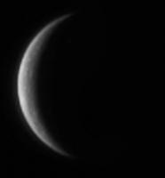
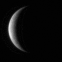
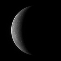
New image snapped with the Narrow Angle Camera, on January 10, 2008, when MESSENGER was a distance of just less than 2 million kilometers from Mercury.
http://messenger.jhuapl.edu/gallery/sciencePhotos/pics/EN0108486541M.IMG.DLS.fits.jpg
Posted by: tedstryk Jan 11 2008, 05:19 PM
Here is a new version of the first image. The processing is heavy, so interpret with caution.
Posted by: Bjorn Jonsson Jan 11 2008, 05:20 PM
Getting closer. Hints of relief/craters visible, especially if you sharpen the image:
Posted by: ugordan Jan 11 2008, 05:23 PM
Interesting, it's just starting to show irregularities in brightness of the crescent, i.e. hints that it's not a smooth globe.
EDIT: I see Bjorn beat me to it ![]()
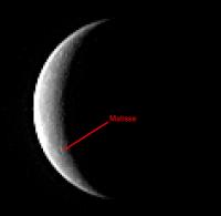
Posted by: volcanopele Jan 11 2008, 05:50 PM
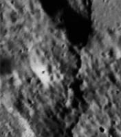
LOL, looks like we all had the same idea. So far I could only identify one surface feature when comparing the image to the Mariner 10 basemaps:
Posted by: climber Jan 11 2008, 07:59 PM
Not my idea actualy, but I hope Nasa will name a yet to be discovered feature on Mercury after Hillary (& Tenzing).
BTW, did you know that when Neil Armstrong first set foot on the Moon, it was on Hillary's 50th birthday !
Posted by: tedstryk Jan 11 2008, 09:13 PM
Looks like our Poet Laureate has given voice to our first views from the vicinity of Mercury since the 1970s.
http://messenger.jhuapl.edu/poem.html
Posted by: ustrax Jan 11 2008, 09:24 PM
HOO-RAH!!! ![]()
Posted by: n1ckdrake Jan 11 2008, 09:44 PM
Beautiful poem. Congrats Stu!
Posted by: Stu Jan 11 2008, 09:55 PM
Thanks! ![]() I'm almost embarrassingly chuffed that they used it. I will never cease to be amazed by how generous and enthusiastic the people behind these multi-gazillion dollar/pound/euro missions are, how they take time from their busy schedules to answer emails from space cadets like me, and put things like that poem up on their official websites. I guess I'm still just that space mad kid who sat in a corner of the library at school reading the science books during breaktimes, when everyone else was outside kicking a ball around...
I'm almost embarrassingly chuffed that they used it. I will never cease to be amazed by how generous and enthusiastic the people behind these multi-gazillion dollar/pound/euro missions are, how they take time from their busy schedules to answer emails from space cadets like me, and put things like that poem up on their official websites. I guess I'm still just that space mad kid who sat in a corner of the library at school reading the science books during breaktimes, when everyone else was outside kicking a ball around... ![]()
Posted by: belleraphon1 Jan 12 2008, 12:10 AM
Stu.... very nice...
You give value to all of us who spent their HS lunch hours buried in books and dreaming of climbing the worldtree.
Keep it up, sir.
Craig
Posted by: nprev Jan 12 2008, 01:04 AM
Let me add my congratulations, Stu; that's just outstanding, we're all extremely proud of you!!! ![]()
Posted by: PDP8E Jan 12 2008, 02:11 AM
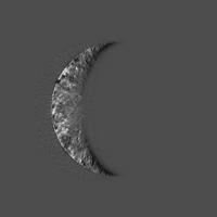
wow...ted and bjorn and others nice work.
I just finished processing the 2nd crecent shot with an adaptive filter I built a few weeks ago.
I think you can see he craters and hills especially near the terminator...enjoy!
Posted by: ElkGroveDan Jan 12 2008, 03:00 AM
What? You mean there were others? Well that's a comfort.
Posted by: tedstryk Jan 12 2008, 03:38 AM
I can't join in there...I usually spent those hours in the office, off somewhere in the school getting in trouble, or not at school really getting in trouble. ![]()
Posted by: alan Jan 12 2008, 06:11 AM
Jumping ahead somewhat, looking at the animation of MESSENGER's trajectory I count three obits of Mercury between flybys one and two. Does that means the flyby two will see the other side?
Posted by: elakdawalla Jan 12 2008, 06:13 AM
Yup, flyby two is almost exactly 1.5 solar days after flyby one, so we see almost exactly the opposite hemisphere. See the little gray sidebar titled "MESSENGER's Mercury encounters" near the top of myhttp://www.planetary.org/news/2008/0110_MESSENGER_Set_for_First_Spacecraft.htmlfor the longitudes that will be sunlit.
--Emily
Posted by: SFJCody Jan 12 2008, 09:18 AM
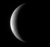
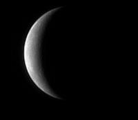
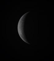
A third image is up:
http://messenger.jhuapl.edu/gallery/sciencePhotos/pics/EN0108529741M.IMG.DLS.fits.jpg
Posted by: ugordan Jan 12 2008, 11:31 AM
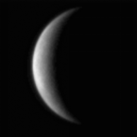
Here's an animation of the OPNAV frames so far: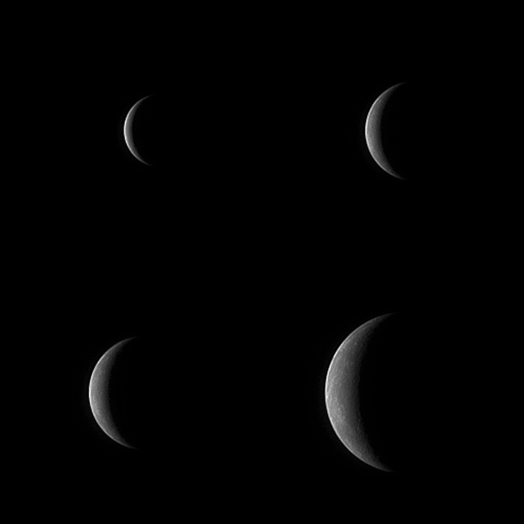
EDIT: Edited to add the 4th frame.
Posted by: SFJCody Jan 12 2008, 04:28 PM
The images have been renamed. New links can be found at:
http://messenger.jhuapl.edu/gallery/sciencePhotos/pics/
Posted by: imipak Jan 12 2008, 07:20 PM
The http://messenger.jhuapl.edu/gallery/sciencePhotos/image.php?gallery_id=2&image_id=111 caught my eye.
ie., the closest approach would appear five pixels from the limb (if it happened to be perfectly situated relative to the camera) in that image! Really brings home the incredible precision of the engineering needed to control a spacecraft.
Posted by: PDP8E Jan 12 2008, 09:58 PM
Here is the latest Mercury image from Messenger that I lightly processed.
As a rule I really dont like working from JPEGs (wish I had the raw data!)
cheers!
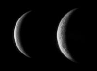
Posted by: tedstryk Jan 12 2008, 10:45 PM
Here is my latest on the newest image. These are not bad for jpegs.
Posted by: tedstryk Jan 13 2008, 01:35 AM
While we are waiting, I made a new stand-in red filter to make an approximate UV/Blue/Green color image (sort of Voyager-esque in that sense - Voyager had an orange filter, but often press release images were UV/Blue(orViolet)/Green). I have attached links not only to the large jpeg (which is heavily compressed), but also to the PNG file, which, be warned, is 7 megabytes.
At the very least, it kept regions which are brighter in UV from simply seeming desaturated like they did in the version I posted earlier.
http://www.strykfoto.org/newoutbound.jpg
http://www.strykfoto.org/newoutbound.png - 7 MB
Posted by: nprev Jan 13 2008, 02:06 AM
Beautiful, Ted; thank you!!! ![]()
Entirely unoriginal here, but can't help remarking on the fact that Mercury looks like the Moon from a distance, but not at closer scales. The large craters seem much shallower (gravitation differential? magma fill?), and the fresh ones (the punchbowls) often produce bright ejecta...very different. The lack of cratering in the wrinkled terrain is also notable.
I can hardly wait. Go MESSENGER!!!!
Posted by: volcanopele Jan 13 2008, 02:46 AM
An attempt at identifying some of the craters in the latest opnav image:
Posted by: Bjorn Jonsson Jan 13 2008, 03:07 AM
Wow! This is by far the best global image of Mercury I have ever seen and should remain so for a few days at least
Posted by: SFJCody Jan 13 2008, 11:40 AM
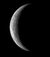
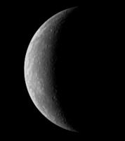
Image 4 reveals *lots* more details!
http://messenger.jhuapl.edu/gallery/sciencePhotos/pics/EN0108616141M.jpg
That image of Ted Stryk's makes me annoyed. Annoyed because Mercury has been represented by old b/w photomosiacs with prominent seams for decades, when that beautiful image was hiding in the data all along. That's what should have been in the textbooks!
Posted by: ugordan Jan 13 2008, 11:57 AM
The 4th image (based on spacecraft clock, it was taken on January 12, 2008, 09:06 UTC, precisely one day after the last one) shows nice detail, indeed. Here's an enhancement to show more details on the sunlit limb, magnified 2x:
I've also added this most recent frame into the enhanced OPNAV animation in post http://www.unmannedspaceflight.com/index.php?s=&showtopic=4812&view=findpost&p=107352.
There'll probably be only one more frame released before the science observations start some 30 hours before C/A. Extrapolating into the "future", this would be the (non-magnified) pixel size of Mercury on Jan 13, 09:06 UTC seen by the NAC camera: http://space.jpl.nasa.gov/cgi-bin/wspace?tbody=199&vbody=-236&month=1&day=13&year=2008&hour=09&minute=06&fovmul=1&rfov=1.171875&bfov=30&porbs=0&showsc=0. 70% larger than the latest one.
That image was presumably already taken and downlinked and MESSENGER should be into the color approach movie sequence right now.
Posted by: Stu Jan 13 2008, 01:18 PM
My own humble attempt to find some detail in the new image... you guys clearly have nothing to be worried about! ![]()
Posted by: Zvezdichko Jan 13 2008, 02:03 PM
Where did you get that 4th image from? I can't find it here -http://messenger.jhuapl.edu/
Posted by: ugordan Jan 13 2008, 02:09 PM
It's uploaded to the web server at http://messenger.jhuapl.edu/gallery/sciencePhotos/pics/ , but no caption was written yet.
Posted by: Zvezdichko Jan 13 2008, 03:10 PM

The same image slightly sharpened by me using ImageMagick, then I added some color.
Now compare this to the old Mariner 10 image (approximately true color):
Posted by: tasp Jan 13 2008, 03:24 PM
I am amazed at how much data we get on this first flyby. And note, it is the fastest one before orbit insertion. NASATV has an animation of the flyby replete with high resolution mosaics, and good WA color images.
Posted by: volcanopele Jan 13 2008, 07:41 PM
Another attempt at identifying the various craters in this latest image:
Posted by: dilo Jan 13 2008, 10:28 PM
Sure, Ted. Is like to see an old friend, lost after elementary school...
I made a resume with further processing of your picture (perhaps too heavy?), joined to original + VP tentative identifications:
Posted by: Stu Jan 13 2008, 11:50 PM
http://messenger.jhuapl.edu/gallery/sciencePhotos/pics/EN0108693445M.jpg...
![]()
![]()
![]()
Posted by: volcanopele Jan 14 2008, 01:35 AM
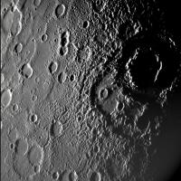
Getting closer. This one really shows quite a bit of detail. Particularly clear near the terminator is the multi-ring basin Vivaldi:
Posted by: belleraphon1 Jan 14 2008, 01:38 AM
Hello, Mercury, old friend....
good to be back......
Craig
Posted by: Phil Stooke Jan 14 2008, 01:42 AM
This already fills a small gap in the Mariner 10 map! A small patch missed between high resolution frames. Also, this area was seen by Mariner 10 with very high sun - near the sub-solar point. The inbound mosaic will improve our existing maps enormously. Then the outbound mosaic will be mostly new territory.
Phil
Posted by: volcanopele Jan 14 2008, 01:56 AM
I think we may have already learned something new. The Mariner 10 stuff, from as far as I can tell, doesn't indicate that Vivaldi is superimposed on an older, larger impact basin.
EDIT: May not be an older basin. May actually be two impact craters to Vivaldi's southwest.
Posted by: tedstryk Jan 14 2008, 02:08 AM
I processed it and colorized it based on my Mariner-10 work.
Posted by: deglr6328 Jan 14 2008, 03:54 AM
I am seeing numerous news reports that 700 GBytes of data will be returned by MESSENGER over the next 2 days. This, being an absurd value for reasons too numerous to count, is obviously a result of a bits/bytes or order of magnitude error. So what is the real amount that will be sent back over this flyby? I see that there are 2 banks of 8 Gbit solid state memory, the amount of data sent back on the Venus flyby was 6 GBITS at 600 images and there should be double that number on the Mercury flyby, the average bitrate at Mercury is 18 Kbit/s and the expected data return for 1 year after orbit insertion is only 135 Gbits................. an obvious actual value for this flyby is not jumping out at me....
Posted by: ustrax Jan 14 2008, 09:15 AM
Bigger and bigger!... ![]()
http://spaceurope.blogspot.com/2008/01/mercury-flyby1-party-post-today-is.html at spacEurope!
Feel free to join in and participate! ![]()
Posted by: ugordan Jan 14 2008, 09:22 AM
Wow, that last image really shows detail. Looks like they deconvolved it already, unlike the last 4 shots. It doesn't show any blur anymore. MDIS cameras may not be awesome cameras in terms of resolution, but they sure produce nice, sharp images.
Posted by: Stu Jan 14 2008, 12:06 PM
To any of the MESSENGER team lurking out there... GOOD LUCK for later today! ![]()
http://journals.aol.com/stuartatk/Cumbrian-Sky/entries/2008/01/14/waiting.../3327
Posted by: NMRguy Jan 14 2008, 12:13 PM
Details, indeed! There's no question that we're finally bearing down on the first planet. Today is the big day--just 7 hours to go before closest approach.
But it is nice to see such details when the craft is still 760,000 km from the planet. I'm really looking forward to the other side where the NAC Mosaics will be taken from distances ~120 and ~66 times closer. Very exciting times.
Posted by: gndonald Jan 14 2008, 02:29 PM
And what better way to celebrate this magnificent achievement than by listening to http://www.judithingolfsson.com/Music/Summer.Japan.mp3 from the 'Four Seasons'.
But seriously as someone who was less than one when Mariner 10 flew past Mercury for the first time and just over that age when it flew-by for the last time, I feel that this mission was well overdue... Here's wishing it the best of luck and may it exceed all the planners expectations now that it has reached it's goal.
Posted by: Pedro_Sondas Jan 14 2008, 03:25 PM
MESSENGER Mission News
January 11, 2008
http://messenger.jhuapl.edu/news_room/status_report_01_11_08.html
“The entire instrumentation suite will be operating during this flyby, taking more than 1,200 images and gathering other scientific observations, filling the on-board data recorder with more than 700 megabytes of history-making measurements, within a period of 55 hours,” said MESSENGER Systems Engineer Eric Finnegan of the Johns Hopkins University Applied Physics Laboratory (APL) in Laurel, Md.
Posted by: Thu Jan 14 2008, 05:08 PM
So thrilling, the images just keep coming, bigger and bigger every hours and I just cannot wait to see the C/A images ![]()
I have a quick question here, there's a small "ring" around Mercury images - it is the image compression artifact, isn't it?
Posted by: mhall Jan 14 2008, 06:29 PM
There was some chat a few days ago, regarding the relatively inefficient camera coverage - the NAC, in particular, sometimes takes a frame of the night-side, or even empty space.
Well, I was just watching the Visualisation Tool on the JHUAPL site, and I'm pretty sure that the approach NAC frames happens to include an image of the Earth, just before it went behind Mercury. It'll be a single pixel, of course, but it will be a nice additional feature to point out on the mosaic.
-- Martin
Posted by: djellison Jan 14 2008, 07:06 PM
WOooooosh
Time Until Closest Approach: 00:00:08 (hh:mm:ss)
Altitude: 201 km (125 mi)
Visible Surface Sunlit: 0.0%
NAC Resolution At Image Center: 7.74 m/pixel
WAC Resolution At Image Center: 54.18 m/pixel
Surface Coordinates At Sensor Center: 3.62 º S 31.54 º E
Posted by: Sunspot Jan 14 2008, 07:15 PM
Lets hope everything worked as planned. ![]() can't wait to see the images.
can't wait to see the images.
Posted by: elakdawalla Jan 14 2008, 07:22 PM
They made a http://messenger.jhuapl.edu/the_mission/mercury_rendezvous.html of the approach images, including four frames not previously posted.
I made an animated GIF version, much faster to download.
--Emily
Posted by: kenny Jan 14 2008, 07:28 PM
If you're not doing so already, this is worth following right now. It refreshes every 30 secs...
http://messenger.jhuapl.edu/encounters/index.php
Posted by: ustrax Jan 14 2008, 07:35 PM
Signal reacquired! ![]()
According to Noam Izenberg: "Closest approach has come and gone, spacecraft signal reacquired and radio science has lock. MASCS is taking surface data, MDIS is imaging, the laser has completed its ground track, and other instruments have all been active. Everything looks great so far!"
Posted by: jsheff Jan 14 2008, 07:35 PM
http://spaceurope.blogspot.com/2008/01/mercury-flyby1-party-post-today-is.html at spacEurope!
Feel free to join in and participate!
That's a nice site, Rui.
Is there any live TV or web coverage of the scenes in the control room at Johns Hopkins? There doesn't seem to be anything on NASA TV; what a wasted opportunity!
- John Sheff
Cambridge, MA
Posted by: ustrax Jan 14 2008, 07:37 PM
Thanks John!
Not that I know of, and you're right...but this team is really making all efforts to make MESSENGER's message pass... ![]()
Posted by: jsheff Jan 14 2008, 07:43 PM
Not that I know of, and you're right...but this team is really making all efforts to make MESSENGER's message pass...
And thank Hermes for this forum and everyone on it! It's the next best thing to being there!
- John Sheff
Cambridge, MA
Posted by: elakdawalla Jan 14 2008, 07:48 PM
Got a phone call in to the science operations center -- they got the signal, Doppler looks good, they're on course following the close approach!
Emily
Posted by: djellison Jan 14 2008, 07:49 PM
This is just as exciting as the Apple keynote tomorrow evening ![]()
Doug
Posted by: lyford Jan 14 2008, 07:50 PM
3 cheers for Doppler!
Hip Hip Horaaaaaaaaaaaaaaaay!
Hip Hip Horaaaaaaaaaaaaaaaay!
Hip Hip Horaaaaaaaaaaaaaaaay!![]()
Posted by: deglr6328 Jan 14 2008, 08:00 PM
January 11, 2008
http://messenger.jhuapl.edu/news_room/status_report_01_11_08.html
“The entire instrumentation suite will be operating during this flyby, taking more than 1,200 images and gathering other scientific observations, filling the on-board data recorder with more than 700 megabytes of history-making measurements, within a period of 55 hours,” said MESSENGER Systems Engineer Eric Finnegan of the Johns Hopkins University Applied Physics Laboratory (APL) in Laurel, Md.
That must be where the mistake is but I still don't understand how a flyby with double the images of the Venus flyby can produce only like 10% more data.
Posted by: elakdawalla Jan 14 2008, 08:07 PM
Don't forget that there are a pile of other instruments on MESSENGER; they say nothing about the data volumes being gathered by those. The 700 Megabytes (I misheard Finnegan and wrote Gigabytes in my story, so I'm one of the culprits) presumably includes all the instruments. On the Venus flyby I think they were trying out a bunch of different operational modes for different instruments in order to narrow down to the best way to sequence MESSENGER for the Mercury flybys.
And they would have substituted away from images toward other instruments for the Venus flyby -- no point in doing 6 high-res mosaics of something that looks pretty much like a cue ball at any scale ![]()
--Emily
Posted by: ustrax Jan 14 2008, 08:07 PM
Some difficulties accessing MESSENGER's site...same happening to you guys?
Posted by: kenny Jan 14 2008, 08:10 PM
Not the visualisation tool, which shows it just complteted Narrow-angle camera of whole visible side, mosaic number 1. Which includes some previoulsy un-seen areas. About to start repeat, NAC mosaic no. 2
Posted by: ugordan Jan 14 2008, 08:11 PM
Emily, the caption under your animation at the blog says the last frame was taken on January 13 at 06:34. The MESSENGER site is inaccessible right now so I can't check, but wasn't the last frame taken at 09:06 UTC?
EDIT: Ah, nevermind, it's working now again. Yep, 06:34 UTC!
Posted by: Bjorn Jonsson Jan 14 2008, 08:18 PM
The site works for me but it's slow, probably due to heavy traffic.
Posted by: kenny Jan 14 2008, 08:54 PM
Well, watching that encounter visualisation tool on the Messenger site was really cool! .. Took me back to 1975, but of course now in real time... just flicking through my NASA Mariner 10 book SP-424 (1978) right now...
Posted by: elakdawalla Jan 14 2008, 09:06 PM
EDIT: Ah, nevermind, it's working now again. Yep, 06:34 UTC!
Yep. Here's how the frames correlate to the already-released images, with my guesses at the probable times at which they were shot:
Frame 1 = EN0108364033M = 1/9 11:08
Frame 2 = 1/9 21:06?
Frame 3 = 1/10 09:06?
Frame 4 = EN0108486541M = 1/10 21:06
Frame 5 = EN0108529741M = 1/11 09:06
Frame 6 = 1/11 21:06?
Frame 7 = EN0108616141M = 1/12 09:06
Frame 8 = 1/13 21:06?
Frame 9 = EN0108693445M = 1/13 06:34
By the way, I doctored their animation a bit. I had just finished assembling my own 5-frame animation and liked how the pointing held constant in the direction of motion so that you could clearly see how MESSENGER was aiming for the dark limb of Mercury. In the one they released, they moved the images so that the center of the sunlit crescent was at the center of the frame. I shifted all the frames laterally to give it that aiming-at-the-dark-side feel.
While I was doing that, I noticed that the frames from their animation seemed to have been processed a bit to bring out more detail than is instantly visible in the individual frames as previously released.
--Emily
Posted by: MarsIsImportant Jan 14 2008, 11:08 PM
It's only approximately 18 hours until the spacecraft turns back towards the Earth to start down-linking the on-board stored data. That's when things get interesting for real. I'm looking forward to it.
I'm glad Messenger is safe and still on the planned trajectory.
Posted by: ugordan Jan 14 2008, 11:18 PM
Yeah, looks like they performed deconvolution on previous frames as well. Turned out nice - after all, they're the ones who know NAC PSF best.
Posted by: JRehling Jan 14 2008, 11:20 PM
[...]
Posted by: elakdawalla Jan 14 2008, 11:40 PM
I just received a cryptic comment from a MESSENGER worker I've been exchanging emails with, to the effect that "the flyby was even more successful than early indications (while the media were there) - stay tuned."
Tease!
Emily
Posted by: stevesliva Jan 14 2008, 11:41 PM
Hopefully there's a nice fat belt of mountains on the equator of the unmapped hemisphere. ![]()
Posted by: ugordan Jan 14 2008, 11:44 PM
Hmmm... To what effect more successful?! Only thing they have up until now is a beacon signal. Surely they couldn't have attempted a radio occultation with the weak signal and actually found out something useful?
Those teasers!
Posted by: Stu Jan 14 2008, 11:47 PM
Hmmm, maybe they detected a moon... ![]()
Posted by: volcanopele Jan 14 2008, 11:52 PM
Early reports suggested that the C/A point ended up being a little further away from Mercury. Perhaps, after deconvolving their Doppler data, they determined they were almost spot on.
Posted by: ugordan Jan 14 2008, 11:54 PM
Any idea how much farther away? It's a longshot, but what are the chances they managed to squeeze a short, "undocumented" burst of high rate telemetry between Earth occultation end and solar occulation end?
Posted by: volcanopele Jan 15 2008, 12:03 AM
Not sure. The Reuters article on the flyby mentioned that C/A altitude was slightly higher than expected (again perhaps this wasn't the case):
http://news.yahoo.com/s/nm/20080114/sc_nm/space_mercury_dc;_ylt=AhVHi4moTEcfL8P8MryaoIghANEA
Posted by: Phil Stooke Jan 15 2008, 12:19 AM
JRehling said: "... time for last-minute predictions. I'll stick my neck out and predict that there will be no major surprises. The unseen side (about 1/3 of which we'll see on the outbound view) will have a big basin (Skinakas) similar to Caloris,..."
I will stick my neck out and say Skinikas doesn't exist. It's just a random patch with fewer ray craters.
Phil
Posted by: tedstryk Jan 15 2008, 12:48 AM
My hope is that they found some sort of unexpected terrain. Or a moon. Not likely, but given the quality of radar coverage, Mariner 10 limb coverage, and the gaps that exist, there would be places for unusual features to hide, particularly if they are not very big. I know that some have interpreted the feature I posted (my stacked 3rd encounter Mariner-10 view) feature, dubbed "Discovery Dome," as an old volcanic dome. Granted, the moon has plenty of nice domes too, but perhaps better examples were found. Anyhow, I will quit my wild speculating for now.
Posted by: nprev Jan 15 2008, 01:00 AM
Just home from work; glad to see that everything went so well!!! ![]()
![]()
Speculation...I'm with Ted on cinder cones, but would love to see the blasted remnants of an ancient shield volcano...of course, that couldn't be the surprise that Emily alluded to.
Posted by: dvandorn Jan 15 2008, 05:46 AM
Ummm... if CA was appreciably different from planned, doesn't that have a fairly significant effect on the trajectory?
-the other Doug
Posted by: JRehling Jan 15 2008, 06:05 AM
[...]
Posted by: IM4 Jan 15 2008, 06:47 AM
By the way a strange faint dot can be seen in the last aproach image. Artifact, star or even MOON?
Posted by: JRehling Jan 15 2008, 07:37 AM
[...]
Posted by: climber Jan 15 2008, 08:08 AM
I thought the same JRehling but, as MESSENGER was heading to the bright face of Mercury, how could we have had an occultation then ?
Posted by: djellison Jan 15 2008, 08:28 AM
There's always a target, with a error range, that is acceptable. The fact that they cancelled the last TCM before the flyby shows that they were happy with the trajectory - appreciably different could be as little as a few hundred metres, or as much as a a couple of 10's of KM's - but if that's within an acceptable range for the trajectory, there's no problem. You just clean up with the TCM you have had scheduled after the flyby anyway.
There was an Earth occultation (you can see it in the flyby timelines - Emily has it excellent documented at TPS blog - 18:22:27 till 19:30:33 ). And Messenger really flew past the dark side - not the lit side.
I strongly doubt that imagery was returned Early - high data rate comms are not something that happens by chance or accident. It's far more likely a radio science result of some sort.
Doug
Posted by: ugordan Jan 15 2008, 08:33 AM
Plus, the latest image is from Jan 13, 06:34 UTC, not Jan 14 18:00 so there's no chance that's Earth. Even Mercury's size in NAC FOV doesn't fit the Jan 14 figure. If you go back through other OPNAV frames you'll find at least one more dot like that, IIRC in the third frame right next to the limb. It's just cosmic ray noise, people.
Posted by: tedstryk Jan 15 2008, 10:43 AM
That crossed my mind when I was processing the images. Because of the deconvolution applied, I can't tell if it is real or not or even how bright it is to figure out if it is a known object. I know what I hope though.
Posted by: Horsell_Common Jan 15 2008, 11:15 AM
It's not entirely impossible. But then again, it might be history repeating:
http://en.wikipedia.org/wiki/Mercury's_moon
But if it is a moon, they really should name it Charley...
Posted by: FordPrefect Jan 15 2008, 11:21 AM
I've read that new images will be presented to the public on January 30th (http://www.spiegel.de/wissenschaft/weltall/0,1518,528580,00.html sorry, German only) Although I do not count much on those general news websites, I hope we won't have to wait till the end of January for any new images being downloadable? ![]()
For now the only new addition is this approach sequence: http://messenger.jhuapl.edu/gallery/sciencePhotos/pics/opnav_9panel.jpg
Posted by: Doc Jan 15 2008, 11:33 AM
http://en.wikipedia.org/wiki/Mercury's_moon
More likely what we are seeing is either a star or an imaging artifact.
Or maybe it is a debris ( new comet or asteroid?)
How bright is this 'anomaly' anyone even if its a guess. Some one might be able to match it with a simulated view and see if its star...
Posted by: ugordan Jan 15 2008, 11:36 AM
It doesn't match any bright star according to Solar System Simulator and, in principle, it would have to be a very bright object to be readily visible with Mercury not overexposed.
I marked some other dots visible in the composite of all images. The simplest explanation is most likely the correct one.
Posted by: edstrick Jan 15 2008, 11:51 AM
The mad bandpass filter image processer strikes again...
I've taken the 5 approach images that were available earlier today and ran a bandpass filtering enhancement parallel to the bright limb in polar coordinates.
You can see lighter and darker regions, and then topographic features in the later images, rotating from the bright limb toward the terminator through the approach sequence. There are even barely-above-noise features in the first approach image that match later image's features, rotating toward the terminator.
I need to register the images at the same km/pixel scale as the last image so you can see the rotation best. I'm overloaded... maybe somebody can photosphop 'm for me and make an animated gif!
These are pretty extreme enhancements, trying to show detail along the bright limb and all the way to the terminator. Not for the faint of heart.
Hot_Damn!... you really can see the features match up in the uploaded thumbnails, even in the first low-low-low rez image
Posted by: Doc Jan 15 2008, 11:55 AM
Then it is most likely an imaging artifact.
Or maybe Messenger has unknowingly uncovered some interstellar espionage;-)
Posted by: ustrax Jan 15 2008, 12:07 PM
If it is a moon it has to be poor http://en.wikipedia.org/wiki/Krokus_(mythology)! Mercury wasn't much of a frisbee player... ![]()
Posted by: tedstryk Jan 15 2008, 12:10 PM
I think that the likely explanation from the data available is noise. Using three frames I fooled around with earlier, you can see that there are plenty of random blips in Messenger images. When I processed the image, I noticed that the last one was slightly brighter, but not so much that I could be confident of anything. However, since the Messenger team has the whole approach sequence, they would be able to tell with most certainty. Most likely it is camera noise, although I think we all really want it to be something else. The fact that these are sharpened images really adds to my suspicion level. I will add that unless it is an object in a long, very elliptical orbit, it is difficult to see how Mariner-10 could have missed something that bright on all three encounters. If it does turn out to be earth, that would also be really cool.
Posted by: Doc Jan 15 2008, 12:34 PM
All this talk about a probable moon brings about an interesting question; why shoudn't Mercury or Venus, of all places, have a satellite.
Even Pluto fares better (with 3 partners!)
What do our men and women of astronomy have to say?
Posted by: ustrax Jan 15 2008, 12:38 PM
Just grab me! I'm delirating! ![]()
But it would be so cool wouldn't it?...
Posted by: Phil Stooke Jan 15 2008, 12:45 PM
Dec: "All this talk about a probable moon brings about an interesting question; why shoudn't Mercury or Venus, of all places, have a satellite.
Even Pluto fares better (with 3 partners!)
What do our men and women of astronomy have to say?"
Solar purturbations on the orbit - there are no stable orbits of Mercury over long periods.
Phil
Posted by: Doc Jan 15 2008, 12:56 PM
Phil
What about Venus?
Posted by: Stu Jan 15 2008, 01:20 PM
Guys, guys... forget moons and Earth... look at that limb...
See them?Look at all those Ho****nd-esque glass towers! Abandoned alien cities on Mercury! Aliens I tell ya!!
Posted by: Stu Jan 15 2008, 01:30 PM
I don't know if this means anything or not, but if you simply boost the Brightness values of the final approach image in Photoshop, more "crud" appears near our mystery object...
Posted by: ugordan Jan 15 2008, 01:35 PM
That would be the diffuse light halo off of Mercury's sunlit limb, quantized to 8 bits and further artifacted by JPEG compression. If you look still deeper into the image, some say you can find out the Big Question itself (since we already know the http://en.wikipedia.org/wiki/The_Answer_to_Life,_the_Universe,_and_Everything).
Posted by: ustrax Jan 15 2008, 02:02 PM
Noam Izenberg details for the following hours:
"The data downlink begins around noonish Eastern time US (GMT-5).
It should take several hours for the data to come down from the spacecraft, and then the Ingestion of the data to the Science Operations center - the translation of raw telemetry to files that can be examined and verified for initial scientific use - takes place either late today or early tomorrow morning, depending on how fast the data comes down.
I think, but am not 100% sure - so no promises - that some early images may be available by the end of the day today."
EDITED: Regarding the 30th of January as next release that seems to be not true according to Mark Perry the team "will release at least one image per day for the next ten days, or so."
Posted by: tedstryk Jan 15 2008, 02:35 PM
My contact with the team also suggests that there will be releases in the near future.
Posted by: Stu Jan 15 2008, 03:01 PM
EDITED: Regarding the 30th of January as next release that seems to be not true according to Mark Perry the team "will release at least one image per day for the next ten days, or so."
That's great news, I'll look forward to those! And it means at least I'll get to see some images before we head off on our hols on Sat (Cyprus... Paphos to be precise... any UMSFers there? Recommendations for restaurants?
Posted by: um3k Jan 15 2008, 03:15 PM
I bet they have abysses, as well!
Posted by: tasp Jan 15 2008, 03:23 PM
Any sign of geysers of molten lead visible on the limb??
Perhaps evidence of a liquid metal 'aquifer' under the surface of mercury ??
{just kidding, btw}
Posted by: mgrodzki Jan 15 2008, 03:41 PM
as phil says above… if there are no stable orbits around mercury, then there can be no moons. besides, wouldn’t someone have seen them by now? if they can detect tiny moons about pluto, wouldn’t they have detected tiny ones as close as mercury (even with the solar imaging issues)?
Posted by: JRehling Jan 15 2008, 05:10 PM
[...]
Posted by: ugordan Jan 15 2008, 05:16 PM
But such small objects would be inherently unstable as light pressure and various effects related to it would destabilize the orbits quickly, no?
Posted by: elakdawalla Jan 15 2008, 05:34 PM
I've just heard that MESSENGER may not get its expected 70-meter time today because of an anomaly going on with another spacecraft -- so we may have to try to exert a bit of patience (and restraint of our desire to wring exciting new science out of optical navigation images) before we see anything new.
Also, remember that if anything new comes down today, it will only be approach stuff; they don't expect departure stuff until at least tomorrow. But with the DSN schedule going haywire it's anybody's guess when the pictures we want will actually start hitting the ground.
--Emily
Posted by: As old as Voyager Jan 15 2008, 05:39 PM
Looking at JPL's Solar System Simulator - That dot is very close to where Earth should be as seen from MESSENGER.
Posted by: ugordan Jan 15 2008, 05:58 PM
*sigh* Again?
http://space.jpl.nasa.gov/cgi-bin/wspace?tbody=199&vbody=-236&month=1&day=13&year=2008&hour=06&minute=34&fovmul=1&rfov=1.171875&bfov=30&porbs=0&showsc=0 is SSS view at the time of the last frame in question, using MESSENGER NAC field-of-view in that it preserves pixel sizes.
http://space.jpl.nasa.gov/cgi-bin/wspace?tbody=199&vbody=-236&month=1&day=14&year=2008&hour=18&minute=00&fovmul=1&rfov=1.171875&bfov=30&porbs=0&showsc=0 is the view at the time Earth was at that relative position, again NAC FOV. http://space.jpl.nasa.gov/cgi-bin/wspace?tbody=199&vbody=-236&month=1&day=14&year=2008&hour=18&minute=00&fovmul=1&rfov=21&bfov=30&porbs=0&showsc=0 is the same view, zoomed out to twice the WAC FOV.
It cannot possibly be Earth.
Posted by: ollopa Jan 15 2008, 06:06 PM
Looks like Ulysses could be troubleshooting for several days. This from the Operations Summary:
15 January EPC 1/TWTA 1 Switch off/on Test 1 - 015.01:18 ERT.
Operational test to validate future mode of operations.
Failure to re-acquire X-band downlink at the expected time.
Commands to switch EPC/TWTA 1 repeated without success.
S/C now configured to S-band downlink.
16 January TBD
17 January TBD
18 January PPSP configuration change - GRU ON - 018.hh:mm SCET.
It's at http://ulysses-ops.jpl.esa.int/ulsfct/opssumm.html
Posted by: ugordan Jan 15 2008, 06:09 PM
Things always seem to work themselves out, don't they? Oh well, at least MESSENGER didn't have a cosmic ray trip 30 minutes or so after C/A.
Do they really need the 70m dish to receive from basically our neighborhood?
Posted by: tedstryk Jan 15 2008, 06:36 PM
I hate to sound mean, but if they were testing some new operations mode that involved turning the transmitter off and on in the middle of the Messenger flyby, they ought to have to wait until the Messenger data is downloaded. This is probably my impatience speaking ![]()
Posted by: robspace54 Jan 15 2008, 06:57 PM
At noon today, the highgain download from MESSENGER was to start, but... my spy in the APL Kremlin reports (I got the email at 12:31 PM) that Ulysses (which is north of the sun on it's polar pass) declared an emergency, AND the 70 meter DSN dish that was to be used has a transmitter problem. So NO high gain down load today from Mercury space.
But the housekeeping data from MESSENGER says that the observations were completed and the data is stored. :-)
Rob
Need more DSN...
Posted by: jasedm Jan 15 2008, 07:19 PM
The state of the Deep Space Network seems to be the hot issue of the moment - competing priorities, dwindling resources.
It's like doing a very good weekly shop, and then getting home to find your fridge ain't big enough...
Posted by: jsheff Jan 15 2008, 08:01 PM
I wouldn't be so quick to rule it out just on orbital stability grounds. Nature has a way of surprising us with all kinds of orbital resonance tricks up its sleeve. It was within my lifetime that everyone was convinced that one side of Mercury always faced the Sun. More to the point, wasn't it at one of the M10 flybys that the UV instrument folks thought (and maybe even announced!) that they had seen a satellite around Mercury? I mention this just to show that the Mercury satellite idea, while unlikely, is not totally out of the question.
- John Sheff
Cambridge, MA
Posted by: scalbers Jan 15 2008, 08:05 PM
Here's a quick (and preliminary) Mercury map update. This utilizes Ted Stryk's color Mariner 10 mosaic and part of his recent colorized Messenger approach image.
Nice to witness such a planetary encounter in the internet age.
Steve
(image revised 1/15 2020 UTC)
Posted by: jabe Jan 15 2008, 08:36 PM
seems that no pics to be released today..
check http://planetary.org/blog/ for blog entry at planetary society.
Posted by: elakdawalla Jan 15 2008, 08:46 PM
Quick change to that -- just got a call from Louise saying they may release that one image late this evening after all, i.e. in the wee hours for those of you in Europe.
I've been told that on top of the Ulysses anomaly, both Mars Express and Dawn have gone in to safe mode ![]()
--Emily
Posted by: ugordan Jan 15 2008, 08:49 PM
Great, now I have to stay up! It's Iapetus all over again!
BTW, what is it with these statistical chances of timing safe modes at the most inconvenient time? One safing event is a fluke, but three is just obnoxious. It's a conspiracy on spacecrafts' part, I tell ya.
Posted by: jabe Jan 15 2008, 08:49 PM
--Emily
Yikes!! mars express is one thing but to have DAWN go into SAFE mode is another..ok..I'm more partial to the dawn mission
Posted by: ngunn Jan 15 2008, 09:11 PM
Are these events related? Have we had a pulse of something nasty passing through the Solar System?
Posted by: deglr6328 Jan 15 2008, 10:19 PM
Well its not the sun, that's for sure. http://sohowww.nascom.nasa.gov/sunspots/ three probes going into safe mode at the same time seems highly improbable. My money is on a very large GRB.
Posted by: gcecil Jan 15 2008, 10:20 PM
Nope Phil et al, there ARE stable satellite orbits, over 5 Myr timescales. Here's the poster that I saw at the Orlando DPS. Johan Warell gave me a quick rundown just before my talk on our non-Mariner hemisphere imaging.
An Optical Imaging Survey for Faint Mecurian Satellites
Johan Warell1, O. Karlsson1
1Uppsala Univ., Sweden.
Presentation Number: 25.03
Facility Keywords: NOT
We present the results of an imaging survey of Mercury's Hill sphere in search for objects dynamically bound to the planet, motivated by the existence of hermeocentric orbits that have been shown to be stable over 5 Myr or more. A six-day survey of Mercury's apparent vicinity from 6 to 140 Mercury radii, with full coverage between 19 and 73 Mercury radii, was performed with the Nordic Optical Telescope on La Palma using ALFOSC in the R-band. The deepest limiting magnitude of 18.6 at a signal-to-noise-level of 3 corresponds to a hermeocentric object size of 0.5 km, while the brightest limiting magnitude corresponds to a size of 1.6 km. While two suspected sources were found, no hermeocentric objects could be confidently identified.
Our survey significantly improves on the results obtained from Mariner 10 data both in terms of aerial coverage and smallest detectable object size, but still no hermeocentric satellite has been identified. This result is however not unexpected for two reasons. Firstly, the survey size limit is 1.6 km, and as any objects likely to be in orbit are of impact debris or captured Inner Earth Object origin, existing natural satellites are probably significantly smaller. Secondly, though the dynamical lifetime of close hermeocentric objects (mean semimajor axes smaller than 30 Mercury radii) are of the order of at least 5 Myr, major impacts capable of ejecting substantial debris fragments are not very likely to have occurred during the past several Myr. This survey is not able to make predictions on the probability of existence of small hermeocentric objects (in the size range less than decameters), which remain undetected. These have to await possible discovery in close-range searches from the MESSENGER and BepiColombo spacecraft
Posted by: ugordan Jan 15 2008, 10:23 PM
Maybe it's actually perfectly "normal" that 3 spacecraft can enter safe mode at any given time, due to the (let's admit it) large number of them currently active. The difference is, most of the time there's nothing big happening so we tend to never hear about all those safe modes.
Or... this could really be something out of the ordinary... A sign of global warming?
*ducks*
gcecil, can 5 million year orbital lifetimes really be regarded as stable, compared to timescales of solar system history?
Posted by: dvandorn Jan 15 2008, 10:40 PM
Hmm... isn't this right about the time that the Sun is supposed to shift the polarity of its magnetic field?
We've had fields-and-particles spacecraft out taking measurements over the last few solar magnetic field cycles. Does anything happen at such times that would impact (either figuratively or literally) three different deep-space probes, all at once?
Just wondering...
-the other Doug
Posted by: Phil Stooke Jan 15 2008, 10:47 PM
I have to agree with ugordan, I don't consider 5 My orbital lifetimes stable. The only mechanism for putting a satellite in orbit today - as the abstract mentions - is the highly unlikely one of a major impact somehow getting debris into orbit. That's not only unlikely in the timescale they refer to, it's practically impossible to do in the first place. What goes up must come down!
Phil
Posted by: JJR2 Jan 16 2008, 12:06 AM
Weird retrograde rotation? Cause or effect of events leading to Venusian a-moon-ness?
Posted by: Astro0 Jan 16 2008, 12:09 AM
Some good news...
The Canberra DSN currently has a good signal lock with Messenger.
We will be transmitting to the spacecraft in about 1 minute and 18 minutes later (RTLT) we should start seeing data coming down...all being well.
Just watched our Operations team do a great job dealing with a few issues outside our control and working to resolve them quickly to ensure that we get the data...keeping everyone at the Messenger mission, and I'm sure most of us on UMSF very happy.
Chill...it's all coming down soon. ![]()
Astro0
Posted by: JJR2 Jan 16 2008, 12:13 AM
Sorry to jump into the middle of the discussion, but is there any TV coverage of the FB1 images before the NASA press conference on teh 30th? ---why no live coverage this time?
Posted by: scalbers Jan 16 2008, 12:19 AM
Slightly updated map (compared with post #218) and increased to 2K resolution:
Steve
Posted by: gndonald Jan 16 2008, 12:32 AM
The Canberra DSN currently has a good signal lock with Messenger.
Excess quoting culled
Here's hoping that one picture you're going to get down isn't blurry (ducks!)
Posted by: climber Jan 16 2008, 12:57 AM
HERE WE ARE !!!! Brand new (half) world : http://messenger.jhuapl.edu/gallery/sciencePhotos/pics/EW0108829708G.4release.jpg
Edited : can't get the image as an image :
When Mariner 10 flew past Mercury three times in 1974 and 1975, the same hemisphere was in sunlight during each encounter. As a consequence, Mariner 10 was able to image less than half the planet. Planetary scientists have wondered for more than 30 years about what spacecraft images might reveal about the hemisphere of Mercury that Mariner 10 never viewed.
On January 14, 2008, the MESSENGER spacecraft observed about half of the hemisphere missed by Mariner 10. This image was snapped by the Wide Angle Camera, part of the Mercury Dual Imaging System (MDIS) instrument, about 80 minutes after MESSENGER's closest approach to Mercury (2:04 pm EST), when the spacecraft was at a distance of about 27,000 kilometers (about 17,000 miles). The image shows features as small as 10 kilometers (6 miles) in size. This image was taken through a filter sensitive to light near the red end of the visible spectrum (750 nm), one of a sequence of images taken through each of MDIS’s 11 filters.
Like the previously mapped portion of Mercury, this hemisphere appears heavily cratered. It also reveals some unique and distinctive features. On the upper right is the giant Caloris basin, including its western portions never before seen by spacecraft. Formed by the impact of a large asteroid or comet, Caloris is one of the largest, and perhaps one of the youngest, basins in the Solar System. The new image shows the complete basin interior and reveals that it is brighter than the surrounding regions and may therefore have a different composition. Darker smooth plains completely surround Caloris, and many unusual dark-rimmed craters are observed inside the basin. Several other multi-ringed basins are seen in this image for the first time. Prominent fault scarps (large ridges) lace the newly viewed region.
Other images obtained during the flyby will reveal surface features in color and in much more detail. Collectively, these images and measurements made by other MESSENGER instruments will soon provide a detailed global view of the surface of Mercury, yielding key information for understanding the formation and geologic history of the innermost planet.
Credit: NASA/Johns Hopkins University Applied Physics Laboratory/Carnegie Institution of Washington
Posted by: nprev Jan 16 2008, 01:00 AM
Thanks for the great news, Astro0! ![]()
Re multiple safing events: Hard to tell. According to http://www.swpc.noaa.gov/, things are very quiet, but of course their perspective is geocentric. There was a small http://helios.izmiran.rssi.ru/cosray/main.htm, but nothing particularly noteworthy.
Posted by: jasedm Jan 16 2008, 01:07 AM
Wow!
First thing to note is the sheer number of very high-albedo crater-rays on this hemisphere.
If I didn't know better, I'd assume this was a Saturnian/Uranian icysat!!
Very intriguing.
Posted by: JRehling Jan 16 2008, 01:08 AM
[...]
Posted by: volcanopele Jan 16 2008, 01:08 AM
Goodbye Skinakas Basin, we hardly knew ye.
Posted by: Bjorn Jonsson Jan 16 2008, 01:09 AM
Hmmm... nothing that looks obviously surprising to me in that first image. Some very bright (fresh?) small craters and some dark rimmed/dark craters in the northern hemisphere. A big scarp at lower left near the terminator. Overall look is a bit more smooth than I expected. A very big, highly degraded impact basin in the northern hemisphere right of center?
EDIT: The big impact basin I mentioned apparently is Caloris. It sure looks different at this phase angle, I didn't recognize it at first.
Posted by: jasedm Jan 16 2008, 01:18 AM
Some of the concentric double craters are very reminiscent of those on Ganymede. Bearing in mind the similar size of the two bodies, this is perhaps to be expected (although Mercury's gravity is more appreciable)
Fantastic to be seeing these results as they come down ![]()
![]()
![]()
Posted by: Rob Pinnegar Jan 16 2008, 01:25 AM
Maybe I am just used to hunting for basins after spending so much time looking for them on Iapetus, but check out that dark smooth area right at the top of the image, north of Caloris. It looks a bit like an old basin.
Posted by: tedstryk Jan 16 2008, 01:26 AM
Tolstoj is very prominent, with its seemingly unique (on Mercury) dark apron.
Posted by: jasedm Jan 16 2008, 01:28 AM
The Arecibo results would also appear to have been spot-on - check out this ray crater...
Posted by: JRehling Jan 16 2008, 01:29 AM
[...]
Posted by: JJR2 Jan 16 2008, 01:29 AM
Yep...that's a picture.
This is Caloris?
Just out of curiosity, at what point in the mission profile would the antipode first be visible?
Posted by: JRehling Jan 16 2008, 01:33 AM
[...]
Posted by: Bjorn Jonsson Jan 16 2008, 01:34 AM
Posted by: jasedm Jan 16 2008, 01:54 AM
The most surprising feature for me so far is the albedo differential.
Some of these ray-craters are hugely brighter than the surrounding plains - comparable, if not exceeding Tycho on the moon, in terms of brightness differences from the surrounding landscape.
I assumed Mercury was fairly homogeneous in terms of it's upper kilometre or so of geology - can't wait for the magnetometer results!!!
Posted by: volcanopele Jan 16 2008, 02:34 AM
Here are some labeled, sharpened, and comparison images (with Mariner 10 and RADAR):
Posted by: gcecil Jan 16 2008, 02:36 AM
Or... this could really be something out of the ordinary... A sign of global warming?
*ducks*
gcecil, can 5 million year orbital lifetimes really be regarded as stable, compared to timescales of solar system history?
30 million Mercury years. All depends on the flux of stuff that might accumulate.
Posted by: gcecil Jan 16 2008, 02:41 AM
The bright crater pair just to the left of the C in Caloris is the brightest albedo feature in our ground-based images of this hemisphere. We suggested the name "Mistral" for it, after Gabriella Mistral (Chilean Nobel prize in literature). Up to the IAU of course (but we did see it first
The dark region left of this extending up from middle of image to terminator at 11 oclock is also striking in our ground images, see my post #79 in the Radar & Mariner 10 thread.
Agreement with rayed radar craters (and their diameters) is given in http://arxiv.org/PS_cache/arxiv/pdf/0708/0708.0146v2.pdf
Posted by: gndonald Jan 16 2008, 02:53 AM
That is indeed, and it's replacing my current wallpaper (an Apollo montage), it'll be interesting to see just how many people mistake this for the Moon (and believe me it will happen).
Posted by: Holder of the Two Leashes Jan 16 2008, 02:55 AM
Excellent! Thank you.
While Caloris appears more subdued here than in the Mariner images, it also appears rather more interesting, with that mix of both dark and light craters.
Posted by: tedstryk Jan 16 2008, 03:14 AM
I applied similar enhancements to this image as I did the opnavs.
Posted by: gcecil Jan 16 2008, 03:44 AM
This image
Posted by: nprev Jan 16 2008, 04:00 AM
Those craters in the northern hemisphere with bright interiors/dark exteriors--or vice versa--are really striking. Why do I sense unexpected minerological complexity...?
Posted by: Steve G Jan 16 2008, 04:41 AM
I've been looking at the icy moons of Jupiter and Saturn so long I had nearly forgotten what good old fashion rock is. I admit, I am quite crestfallen over Caloris. What a let down!
When it comes down to it, I think our moon is the most aesthetic and interesting satellite up there.
Posted by: JRehling Jan 16 2008, 05:21 AM
[...]
Posted by: Astro0 Jan 16 2008, 06:38 AM
Data still streaming in at Canberra DSN.
Extended tracking time until 0725 UTC on the 70-metre and then switching over to one of the 34-metre antennas through to 1000 UTC. Current rate: 25-30 kb per hour. Suspect that this will slow down a bit once we transfer to the 34-metre.
The extended tracking time should allow the majority of data from Messenger to come down.
We did have a short 5 minute break in data due bad weather and will have to pick that up on a second pass.
Hope you'll all enjoy the should that's on the way!
Astro0
Posted by: JRehling Jan 16 2008, 06:48 AM
[...]
Posted by: dvandorn Jan 16 2008, 07:38 AM
Umm... 25 to 30 kilobits per hour? At that rate, wouldn't it take about 40 hours to receive a kilobyte?
Just how compressed is this data?
-the other Doug
Posted by: edstrick Jan 16 2008, 08:02 AM
I ran bandpass filtering on the full disc image. I didn't have to do insane polar projection filtering as I did on the approach images.
The result flattens limb to terminator shading, boosts "mesoscale" albedo markings and provides some sharpening. I'm attaching 2 versions. one, xxxx-2x was filtered with zero and one-level pixel data excluded to avoid ringing artifacts at the bright limb. I've enlarged it 2x in photoslop so you can zoom in on details without them pixelizing. The other included zero and 1 level pixels, has terrible artifacts at the bright limb, but has more contrast than the first and can show a trace (not much, it turns out) of the faintest pixels at the terminator.
Posted by: n1ckdrake Jan 16 2008, 08:03 AM
-the other Doug
I think Astro0 meant 25 to 30 Kilobytes per hour. IIRC the downlink capability at higher data rates averaging 9 kilobits per second.
Posted by: edstrick Jan 16 2008, 08:54 AM
One additional file before an assortment of comments.
Attached is a segment of the bandpass enhanced global image. A rather well defined area of so far un-mentioned (i think) darker terrain north of Caloris is approximately identified by an outline of red dots. Compare with the other image to see the details of the edge of this feature.
Comments. 1.) Satellite Search. After Mariner 10 flew past on it's first encounter, there was a frenzied flurry of activity when the ultraviolet spectrometer team thought they'd identified an object moving near Mercury, triggering a hastily planned satellite search with the imaging cameras (and probably replacing some more valuable intermediate resolution imagery, possibly full disc color coverage or something. It turned out that they'd spotted a far-UV bright star, and the planet was moving RELATIVE TO the star, due to spacecraft flyby motion and Mercury's rapid solar orbit. Similar frienzied discussion of the possibility of stable orbits around Mercury ensued. I'm getting deja vue all over again, double-dose.
2.) Concentric Double craters: They're common on Mercury. Mariner 10 mapped quiet a few of these objects that are transitional to multi-ring basins. You also get peak-ring craters where the central peak forms an incipient ring. The higher gravity on Mercury changes the proportions of scaling laws so they occur for smaller crater sizes than on the Moon, and there's just more surface area on Mercury to host them, so they're fairly common.
3.) It's bland, and kinda ugly. The overall blandness is much like the Mariner 10 departure hemisphere, and (without the postage-stamp mosaic pattern of all versions of that image till the recent one here), resembles the recently re-shown Mariner 10 second encounter Wide Angle image, which for 3 decades, I've thought of as the "moldy orange" image. It does resemble Callisto (without bright crater palimpsests) and Oberon. Mercury has no lava plains that are minerologically grossly distinct from the cratered terrain, unlike the Moon, so eruptive plains are very hard to recognize except on the basis of morphology. Mercury all ***LOOKS*** like Lunar Highlands, and the gross minerology may indeed be similar, but there's stuff going on (as the new image indicates) we only saw traces of in Meriner data. Kinda ugly? "Face only a mother Sol would love!"
4.) The relief is low, the limb is smooth. Yes. It's bigger than the moon, so even if the relief was the same, it would look less in a full disc image. And the bigger gravity makes it harder to build a pile of rubble as high as on the Moon. And at about 10 km per pixel.... strong relief is only visible near the terminator where the low sun lets you see it. Higher resolution images will far, far better show relief at higher sun angles than this image does.
5.) Mariner 10 saw the nothern lattitudes had abundant intercrater plains and cratered plains. This continues to the terminator here, in patches. The southern region seems to continue to have much less plains. Near the terminator, at low latitudes, yes, there's something interesting going on, with hints of buried structures under the plains and ridges, and alignments of features that make me wonder if there's something more interesting just beyond the terminator, though it's old, whatever it is.
6) Mozart crater's a disappointment at high sun. Very bland. Tolstoj, however is going to be very interesting in multispectral data. Don't necessarily expect it's dark outer zone to be the same as the random dark mottles elsewhere on the disc, the dark crater features within Caloris, or the dark half-ring in the terrain north of Caloris i'm "pointering" to at the top of this post.
7) Dark Odds and ends. Numerous small dark ray craters and dark splotch craters are visible here and there. They were studied in Meriner 10 data with suggestions relative to comet impacts or carbonaceous chondrite impacts or I can't remember what. I think there were suggestions toward conclusions, but no strong conclusions. There are regions of patchy dark material, mostly between bright crater rays and splotches that would obscure them, that appear to be darker than just a lack of bright rays and splatter and splotches imply. There's a scattering of them below image center, one vaguely kidney bean shaped, and more left of image center. Colorimetric pecularities of lack of such may tell us to be more or less interested in them. The dark crater materisl in Caloris mostly avoid the outer 20% of the basin diameter. Igneous fill may be deeper there, while the dark features may excavatle deeper crustal material exposed or nearer to the surface in uplifted "Apennine bench like" inner basin ring matierials.
8) Bright oddities. Mariner 10 saw some craters with seemingly anomalous bright material inward of the crater walls, where normal crater floor and central peak material would be. A small crater at 9:00 and another at 11:30 clock angle within Caloris, both with darker rims and close-in ramparts, have bright features. The peak-ring crater, reported in Radar, seems to have brighter than expected peaks in the ring. The double-ring impact basin to the north seems to have decidedly bright peaks in it's ring. Here and there other "interesting" bright features appear that are wiped out by the agressive contrast stretch of the enhanced image.
It will be very intersting to see how different bright materials and different dark materials sort out into classes based on multispectral data. THEN, once we get into orbit, it will be very interesting to see how that mineralogically and physical-properties driven geolgoy correlates with elemental abundances derived from X-ray and Gamma data.
What I'd really like to see is a spectral model based "decomposition" of a global lunar map into spectral classes of 1.) impact glasses, and 2.) non-glassy mineral components. The same could be done to Mercury, based first on color mapping, then with spectroscopid <UV and IR> data added. Lunar and Mercurian surface materials visible in sunlight consist of regolith and rock, which are mixtures of impact <and some volcanic> glass, and mineral fragments. The mineral fragments, when they make up enough of the total population in a pixel, show discrete spectral features that identify some of the minerals present. The glasses behave differently, lacking sharp diagnostic features, but showing colors diagnostic of things like titanium <ilmenite> content and surface "maturity" They're normally presented in one map, mixing varieties of apples and varieties of oranges. I want a pair of maps, showing (where anything is showable -- some areas will be left blank in each map) mineral variety and glass variety data. This might make much more sense of Mercury multispectral data of this moldy orange than we can with monochrome or simple color classifications of surface units.
Posted by: volcanopele Jan 16 2008, 08:59 AM
Well, it is almost time for me to go to sleep, but I wanted to address one of the more interesting features seen in this new image of Mercury: the dark halo (or dark floored) craters, particularly those in Caloris Planitia. Makes me wonder if these craters punched into some iron-rich basalt layer (most of the surface of Mercury IIRC, is supposed to be iron-poor). The distribution certainly suggests that some areas had this darker material at or near the surface while others did not.
It isn't as simple as dark-halo craters mapping to smooth plains areas, is it? Obviously, the terrain west of Caloris counts as smooth plains, but hardly a dark halo/floor crater to be found...
Posted by: edstrick Jan 16 2008, 09:21 AM
Rather than "iron rich basalt", I'm thinking of iron-rich deeper crustal rocks, like those exposed in the S. Polar/Aitkin (We REALLY need to have it named Shoemaker) basin on the Moon. Much of the Mariner-10 visible floor of Caloris is smooth plains, so it appears that the original basin floor was covered by some sort of melt, but it's not lunar-mare dark, so it's either built up a thick dusting of average Mercurian crud to lighten it (I really doubt that), or is a low-iron melt, not that dramatically (or at least visibly) chemically distinct from other Mercurian plains and highlands.
All this makes the very odd dark materials of the Tolstoj basin all the odder, as other medium-large basins (seen by Mariner) don't obviously show something like that, and you'd expect Caloris would show it even more. Maybe there was something INTERESTING at intermediate crustal depth at Tolstoj that other basins didn't dig into as it wasn't present where they hit.
Posted by: jasedm Jan 16 2008, 10:03 AM
Speaking of Shoemaker, is it reasonable to expect to see any Catenae in some of the higher-res images?
Intuitively, I'd expect Mercury to have comparable numbers to the Galilean moons, but don't remember seeing any in Mariner images.
Posted by: edstrick Jan 16 2008, 10:21 AM
I think given the average "more chewed up" nature of the younger terrains on Mercury as Mariner 10 saw them, such features will be less obvious. Relative to some normalized cratering model, Mercury's young terrains are older than Moons, more like Caley Plains than Mare Imbrium. Catenae are rather small features, also. Km and better resolution data from Mariner were a small fraction of the total coverage, and low sun angle data a portion of that (though they did not waste high rez images in high-sun no shadowing areas)
Also, something you can see: Large craters/small basins have a dense peppering of secondary immediately next to them due to the sorter ranges of secondary crater forming ejecta in Mercury's high gravity, compared with the moon.
Posted by: Tayfun Öner Jan 16 2008, 10:25 AM
Here is a quick projection of edstrick's filtered image (without any knowledge of the image geometry).
Posted by: Astro0 Jan 16 2008, 10:37 AM
'n1ckdrake' - I think Astro0 meant 25 to 30 Kilobytes per hour.
Correct Kilobytes. Allowing for glitches, around 7 hours of downlink time. A few repeat passes through the DSN may be needed to get everything cleanly.
The tracking pass at the Canberra DSN finished about an hour ago, and went very well from our point of view. I don't have any figures as to the total of data received, that will be up to the mission teams to let us know. Still even with this one new image, it has kept lots of people on UMSF very busy...can't wait to see the other 1,212 images.
Enjoy
Astro0
Posted by: peter59 Jan 16 2008, 11:00 AM
Correct Kilobytes.
25-30 Kilobytes per hour? Are you sure? Rather 25-30 Kilobytes per second.
Posted by: Bjorn Jonsson Jan 16 2008, 11:08 AM
25-30 kilobits per second (kbps) seems likely. Downlink bandwidth is usually given as kbps and 25-30 kbps is comparable to various inner solar system spacecraft. It would be nice to know for sure the correct value though.
Posted by: ugordan Jan 16 2008, 11:12 AM
Even 25 kbps sounds like a rather low bandwidth for inner solar system standards. Granted, MESSENGER doesn't use a dish antenna, but still - Cassini can get over 100 kbps from 9 AU away.
Posted by: Ant103 Jan 16 2008, 11:22 AM
What extraordinary times we're living ![]()
If you want, I have made a desktop version of the last pic Messenger send us.
Posted by: djellison Jan 16 2008, 11:28 AM
No - Messenger really is quite a low data rate mission. Cassini has a great big HGA. Messenger doesn't.
Doug
Posted by: ugordan Jan 16 2008, 11:44 AM
I guess that's a Discovery class imposed weight limitation. It's expected that MESSENGER will, on average, get up to 80 full resolution images per day once in orbit. This is based on onboard compression speed and mission requirements (which I guess are greatly affected by available bandwidth).
It's remarkable how tight the point spread function of the wide angle camera is, it looks tighter than 1 pixel. In fact, it almost looks like it's causing some aliasing and the WAC images certainly don't need any sharpening applied like the NAC images do. WAC is a great context camera, one of the sharpest imagers I've seen; look at the sharpness of small craters near the terminator. Can't wait to see the color version of the above image.
Posted by: Oersted Jan 16 2008, 01:10 PM
Marvellous images: what a great age to live in!
Posted by: dvandorn Jan 16 2008, 01:23 PM
OK -- 30 kilobits per second, I can see. At 30 kilobytes per hour, you would be getting about 210 kilobytes over seven hours, and even the jpeg'ed images we've already seen are larger than that. Each.
Unless there is some kind of uber-compression going on here of which I'm not aware, I would think it would be hard to fit 1,200 images into a file only 210 KB large.
-the other Doug
Posted by: robspace54 Jan 16 2008, 01:55 PM
When I was a mere boy, Mariner 4 flew past Mars and sent it's fuzzy, smearing 22 photos of Mars back at the rate of 8 1/3 bits per second!!!! That makes 25 kilobits per hour sound high, but the effective bit rate is less than 7 bits per second... In this age of digital instant gratification waiting is not something we like to do.
I am really enjoying the "instant science" here. It reminds me of the Pioneer and Voyager flybys. :-)
Rob
Posted by: tedstryk Jan 16 2008, 03:10 PM
Galileo made us forget how much the internet had advanced things, since it was often months before the data was on the ground.
Posted by: David Jan 16 2008, 03:51 PM
Would anybody like to have some fun matching the new image to this http://history.nasa.gov/SP-423/p15a.htm from the early 20th century?
Posted by: Phil Stooke Jan 16 2008, 04:07 PM
Good luck! Unfortunately, Antoniadi and all astronomers of the time thought Mercury was tidally locked to the sun. That's why his map shows just one side. It's really a composite of all 360 degrees compressed into 180. Every time Antoniadi looked at Mercury and what he saw didn't look the way he imagined it should, he thought clouds were interfering with his view - clouds on Mercury, I mean. A dark spot was hidden by hazes, or a bright spot was a thick cloud.
So this map can't be used as you suggest. When the rotation became known (from radar studies) a new map was compiled and used to redistribute placenames around the planet for the IAU. Rotational effects do make our views selective, so there is some relationship between Antoniadi's map and the later IAU map. But your question really should be applied to the IAU map.
Incidentally, the original names of USGS map sheets are taken from the old albedo nomenclature. Caloris is in Liguria, if you need to know!
Phil
Posted by: SpaceListener Jan 16 2008, 04:10 PM
A quick questions.
I doubt that Messenger will not take zoomed pictures like MRO? I am not able to get the value of image resolution (m/pixel) of narrow and wide angle imagers of Mercury Dual Imaging System.
I am interested if MDIS will be able to take an even more detailed pictures of landforms and surface features than the recently posted ones.
Is the Mercurian landform regolith alike to Moon since Solar energetic particles bombard its surface even stronger and more than on the Moon? This would lead that the Mercurian surface would very dusty like Moon or Mars?
Posted by: djellison Jan 16 2008, 04:19 PM
This single image was picked to be downlinked as it was the highest resolution image image that included the whole planet. It's about 3km/pixel
Now - MDIS will not reach HiRISE resolutions. But the highest resolution images from this flyby will be about 120m/pixel - so about 25 times better than this first returned image.
http://messenger.jhuapl.edu/encounters/index.php?autorefresh=false&time=1200338474×tep=7
Doug
Posted by: JJR2 Jan 16 2008, 04:50 PM
I don't know if I'm quite ready to replace my Spitzer IR montage of the center of our galaxy just yet.
So, will we have to wait until 2011 for the "good stuff"?
Posted by: elakdawalla Jan 16 2008, 05:15 PM
Heavens no. The best stuff from this flyby will be that narrow-angle camera mosaic of the equatorial region that Doug mentioned -- at 100-200 m/pixel, it will be higher-resolution than any images MESSENGER will be able to get of that same area once it's in orbit. MESSENGER's orbit is elliptical with periapsis near the north pole; it'll get slightly higher resolution views of high northern latitudes but the orbit gets farther out at equatorial and southern latitudes, so this flyby mosaic will be as good as it gets. And I'm really looking forward to the departure mosaics, particularly the one taken about an hour after close approach, which should produce an image of Mercury that is superficially similar to the already-released wide-angle shot, except it'll have about 10 times better resolution, and be between 9,000 and 10,000 pixels high. There will be color data taken just before it, so they'll be able to colorize the view. It should be awesome.
--Emily
Posted by: tedstryk Jan 16 2008, 06:05 PM
The image they have now is probably from the set from which they will derive the color data. As for Antoniadi, what would be interesting is to find some of his old drawings from which he compiled the map and see if anything is recognizable.
Posted by: Phil Stooke Jan 16 2008, 06:15 PM
A good project for you, Ted!
Phil
Posted by: Bjorn Jonsson Jan 16 2008, 06:23 PM
A fairly high resolution image is now available:
http://messenger.jhuapl.edu/gallery/sciencePhotos/image.php?gallery_id=2&image_id=118
Posted by: elakdawalla Jan 16 2008, 06:24 PM
Actually, the already-released image was taken after the second NAC departure mosaic. There is a WAC departure mosaic with twice the resolution of the already-released image that will be taken just before the first NAC departure mosaic. Though I suppose it'd be easier, initially, to apply color from the lower-resolution, single-frame WAC observation than to apply color from a 3x3 mosaic onto a different mosaic.
--Emily
Posted by: Stu Jan 16 2008, 06:29 PM
http://messenger.jhuapl.edu/gallery/sciencePhotos/image.php?gallery_id=2&image_id=118
I think we're all going to need new swear jars if that's just a "fairly high resolution" image...
Posted by: volcanopele Jan 16 2008, 06:31 PM
Nice image of Vivaldi!
Posted by: dvandorn Jan 16 2008, 06:41 PM
http://messenger.jhuapl.edu/gallery/sciencePhotos/image.php?gallery_id=2&image_id=118
Broken link:
FATAL ERROR: cannot connect to mySQL server
host: sd-mysql:3307
user: regieal1
-the other Doug
Posted by: akuo Jan 16 2008, 06:44 PM
The whole Messenger site seems to be broken. If anyone grabbed the hi-res pic, posting it here would be very much appreciated!
Posted by: Jyril Jan 16 2008, 06:47 PM
Direct http://messenger.jhuapl.edu/gallery/sciencePhotos/pics/EN0108821483M.png.
Posted by: jamescanvin Jan 16 2008, 06:47 PM
Try This.
http://messenger.jhuapl.edu/gallery/sciencePhotos/pics/EN0108821483M.png
Posted by: dvandorn Jan 16 2008, 07:03 PM
Thanks, guys!
Now, where did that swear jar go...?
WOW!
Yep, that's Mercury, all right. The fold-over ridges and the central rings in the larger craters give it away. Kewl -- first close-ups of Mercury in 30 years!!!
-the other Doug
Posted by: volcanopele Jan 16 2008, 07:04 PM
Interesting new image. Obviously, the most interesting feature is the multi-ring basin, Vivaldi. Many of the smaller impact craters surrounding this feature appear to be secondaries from that impact. You can pick out a few secondary chains that point to Vivaldi. Vivaldi appears to have impacted into a larger basin (or a couple of superimposed impact craters) that is visible to its southwest. Strangely, that basin isn't covered in Vivaldi's secondaries, which may mean that: a) Vivaldi and these smaller basins to its southwest occurred at the same time (plausible if this impactor had satellites); or B) the smaller basins are actually younger (though the superimposed crater density in the heavily crater terrain to the west and southwest of Vivaldi and its siblings is similar to that found in the siblings).
The terrain on the left side of the image appears to be fairly smooth, volcanic plains. You can even make out a few, degraded wrinkle ridges.
Posted by: Stu Jan 16 2008, 07:20 PM
Sharpened up a bit it could be a featured image from the (brilliant) Lunar Picture Of the Day website...
Posted by: Tom Tamlyn Jan 16 2008, 07:23 PM
Unless there is some kind of uber-compression going on here of which I'm not aware, I would think it would be hard to fit 1,200 images into a file only 210 KB large.
Now I'm curious. How big are these images? And how many 7 hour sessions with a 70 meter dish will it take to download 1,200 of them?
TTT
Powered by Invision Power Board (http://www.invisionboard.com)
© Invision Power Services (http://www.invisionpower.com)

