Printable Version of Topic
Click here to view this topic in its original format
Unmanned Spaceflight.com _ LRO & LCROSS _ LROC news and images
Posted by: Zvezdichko Jun 19 2009, 11:25 AM
I know it may be too early for such a thread, but an announcement has to be made.
The official website of the LROC camera is:
http://lroc.sese.asu.edu/
A brief description plus status is available here:
http://www.msss.com/lro/lroc/index.html
Posted by: Greg Hullender Jun 23 2009, 02:49 PM
At the moment, they're saying not to expect images until early July (which is just a week away). That makes some sense, I guess, since they have commissioning to do.
--Greg
Posted by: AndyG Jun 24 2009, 10:20 AM
Curious as to the soon-to-be demonstrated LROC resolution, I've brewed up a "50cm/pixel" image of the Apollo 15 landing site, taken from the ascent 16mm film.
It's going to be fascinating to see what state the descent stages and tracks are now in, after ~ 500 cycles of -150C to 100C. (Descent stages were never manned - does that make it ok for UMSF, Doug? ;-))
Posted by: jabe Jun 24 2009, 10:56 AM
Looks like LOI-2 was successful.....
http://twitter.com/LRO_NASA/status/2308875359
jb
Posted by: Greg Hullender Jun 24 2009, 01:59 PM
Using the yardstick that UMSF is about amateurs producing cool images from raw data from unmanned space probes, I'm hoping this will be fine. These are historical sites now, and that's a big part of what makes the images "cool". Digging through the raw data looking for these things (whether we process them or not) is a cool way to participate.
If people want to get into a discussion about what Apollo did, what value it had, whether it really happened(!), etc., then, yeah, I'd expect someone to pull the plug ASAP. But I can't imagine there'd be a problem just looking for the images of the landing sites. If nothing else, I think it's something 99% of us are eagerly looking forward to seeing!
Of course it ultimately comes down to whatever Doug says, but I think he likes a good rationale. :-)
--Greg
Posted by: MahFL Jun 24 2009, 02:40 PM
I look forward to the LRO images of the human hardware on our Moon.........
I still chuckle at Buzz punching that reporter ![]() ....not that I condone physical violence of course......
....not that I condone physical violence of course......
Posted by: ilbasso Jun 24 2009, 03:08 PM
I'm very much looking forward to those photos, too. Don't hold your breath that any unbelievers will be swayed...they'll just claim that these photos were doctored. The rest of us will cherish the opportunity to see not only the Apollo but also the unmanned lander sites. This is a thrilling time!!
Posted by: djellison Jun 24 2009, 03:18 PM
The admin call is yeah - it's good to talk about the Apollo hardware. It's a history subject rather than a manned spaceflight subject ![]()
But we can knock the conspiracy stuff on the head. No data is going to convince them otherwise. VERY pointless even giving them a passing thought.
Posted by: AndyG Jun 24 2009, 03:53 PM
I think it's also going to be valuable science with practical applications - with a forty-year view over a number of sites spread across the Moon, it'll be interesting to see how the (presumably swept-clean during ascent) lander stages have fared, and how quickly lunar gardening subsumes tracks.
Andy
Posted by: Zvezdichko Jun 24 2009, 06:13 PM
But we can knock the conspiracy stuff on the head. No data is going to convince them otherwise. VERY pointless even giving them a passing thought.
Well, if anybody is interested of talking with me and others on the subject, I have created two threads:
http://www.bautforum.com/conspiracy-theories/89665-beware-apollo-hoaxers-your-silly-theory-finally-coming-end.html
http://apollohoax.proboards.com/index.cgi?board=theories&action=display&thread=2418
I hope this is not considered an ad here.
And yes, I do believe that some of the naysayers may be convinced
Posted by: SFJCody Jun 24 2009, 07:33 PM
I would like to get a look at the ALSEP packages. The Apollo 12 ALSEP holds the longevity record for continuous operation on the surface of another world, longer even than Viking 1! The Apollo 14 ALSEP was also in operation for longer than Viking 1.
Posted by: brellis Jun 24 2009, 07:39 PM
I already can't wait for a surface visit to these historic sites, and I really can't wait for http://www.google.com/moon/ to get the LRO pics! ![]()
Posted by: belleraphon1 Jun 24 2009, 08:49 PM
Speaking historically,
hope LRO can tell how close the APOLLO 14 astronauts actually got to the rim of Cone Crater. Perhaps they scuffed up the regolith enough for LRO to detect the tracks they made. Though that is a long shot.
Craig
Posted by: dvandorn Jun 24 2009, 09:00 PM
Actually the A14 EVA-2 track is quite well worked out, based on the pics the crew took on the surface during the EVA. What I'm more interested in seeing is if the MET tracks are visible. LRV tracks will likely be easier to spot in LRO images than the MET tracks, since the open-mesh LRV tires disturbed the soil more and spun up rooster tails. The MET had actual rubber tires, which left smooth tracks. I'll be mighty interested in seeing if MET tracks are visible (or are as visible as LRV tracks).
Then I want to see those compared to Lunakhod tracks... ![]()
-the other Doug
Posted by: lyford Jun 24 2009, 10:33 PM
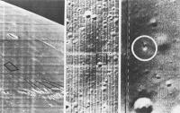
Well we have an good before and after....
http://www.moonviews.com/archives/2009/06/lunar_orbiter_image_recovery_p_6.html
Posted by: belleraphon1 Jun 24 2009, 11:06 PM
Thanks lyford!!!
The Lunar Orbiter III Frame 133-H2 labeled frame is priceless. Lunar Orbiter Image Recovery Project (LOIRP) wonderful project.
I am also interested in whether the MET tracks are visible. I know that for portions of the trek up the rim of Cone crater they actually had to carry the MET to make progress up the slope.
Craig
Posted by: ilbasso Jun 25 2009, 01:58 AM
In addition to the 400+ heating and cooling cycles, I'm really interested to see if there has been any visible evidence of electrostatically-induced movement of dust. There was speculation that the day/night cycle caused electrostatic transport of dust particles - I don't know how big those dust particles are, but 40 years elapsed time may be enough to result in reduced reflectivity on some of the hardware.
Posted by: Phil Stooke Jun 25 2009, 01:58 AM
Actually we know how close the Apollo 14 crew got to Cone Crater's rim, because we can compare the boulders seen in their surface images at Station C1 with the Lunar Orbiter images of the same boulders. They didn't know at the time, but we know it now. They were about 40 m from the rim but couldn't see over it into the depression. It will still be great to see these places at unprecedented resolution, but it won't change our ideas about the location of C1.
Phil
Posted by: belleraphon1 Jun 26 2009, 11:22 AM
It will indeed.... I can't wait to see what we can see at C1 and all the rest
Thanks Phil
Craig
Posted by: John Moore Jun 26 2009, 05:00 PM
A research paper of possible, related interest that appeared in Geophysical Research Letters last April might be something to have a look at -- titled "Direct active measurements of movements of lunar dust: Rocket exhausts and natural effects contaminating and cleansing Apollo hardware on the Moon in 1969"
The paper does get quite technical in parts, however, to have a read go http://www.agu.org/journals/gl/gl0909/2008GL037116/, or for a more 'readable' version see this http://www.sciencedaily.com/releases/2009/04/090417161508.htm article.
John
Posted by: John Moore Jun 26 2009, 05:11 PM
The paper does get quite technical in parts, however, to have a read go http://www.agu.org/journals/gl/gl0909/2008GL037116/, or for a more 'readable' version see this http://www.sciencedaily.com/releases/2009/04/090417161508.htm article.
John
ADDENDUM: Sorry Space Angel if you're having problems accessing the first link as I don't want to point you to a subscripe/purchase option -- which it does. I did a check on the availability of it using the link at the end of the ScienceDaily article and I swear I got acces to the complete article after clicking on 'Full Article' in Geophysical Research Letters. But for some reason it doesn't allow me in anymore on a second try. You might try it at your end as it may have only allowed me access it once (I tried it again just now but, darn it, I'm being put into the subscribe'purchase link.
Sorry if it doesn't work...but the ScienceDaily article does work okay.
John
Posted by: ilbasso Jun 27 2009, 11:54 PM
Also potentially pertinent to the appearance of the Apollo lunar surface hardware is the work that is currently underway at the National Air and Space Museum to replace all the Kapton foil on LM-2, which has been sitting in sunlight at least part of every day for the past 33 years. There's a more detailed summary of the restoration work underway at http://www.collectspace.com/ubb/Forum41/HTML/000274.html, but what I thought was particularly interesting was this little snippet:
If the Kapton crumbled after 33 years in a climate-controlled environment, even with partial sun every day, one wonders as to the state of the Kapton that has been sitting in lunar conditions for 40 years, and if any of this deterioration might be visible from LROC.
Posted by: nprev Jun 28 2009, 03:36 AM
Indeed. There's mounting evidence that Kapton isn't really very durable over time, esp. when exposed to extreme heat. I suspect that the material on the descent stages may have long since crumbled away.
Posted by: mchan Jun 28 2009, 07:11 AM
How much of that evidence is at 1 std atm vs near vacuum? Is it just extreme heat or extreme heat + reacting gases?
Posted by: djellison Jun 28 2009, 08:32 AM
Just look at Hubble Insulation. It's crumbling off. It may be going thru more rapid thermal cycles than Apollo hardware - but there's evidence that long space exposure does end up ruining that sort of insulation material.
Posted by: nprev Jun 28 2009, 09:03 AM
There are a lot of other interesting potential variables to consider, too. For example, the Apollo stuff's obviously exposed directly to the solar wind while Hubble isn't, but at the same time HST is exposed to monatomic oxygen in LEO. Does any of that make any difference? Dunno.
All we seem to know with high confidence is that kapton looks very stable for 5-10 years--long enough for most nominal missions to date--of exposure to the inner Solar System space environments we've spent the most time in, but prospects don't look promising for much longer durations.
Posted by: Zvezdichko Jun 28 2009, 10:23 AM
http://lroc.sese.asu.edu/news/?archives/57-Almost-there!.html
Posted by: mcaplinger Jun 28 2009, 03:03 PM
That was silver FEP (Teflon), not Kapton.
I'm quite doubtful that LROC will be able to resolve the state of the blankets on the Apollo hardware.
Posted by: Zvezdichko Jul 1 2009, 06:04 AM
http://lroupdate.blogspot.com/
LROC camera turned on for a series of preliminary measurements. Images are expected to be taken on 3rd July.
LOLA laser altimeter successfully turned on.
Posted by: Paul Fjeld Jul 2 2009, 02:16 PM
I was the contractor on the LM-2 job. I was really shocked at the quality of the sun-facing Kapton sheets. They only had the 2 mil aluminized Kapton on LM-2 and it broke apart in your hands - not brittle, just a kind of mushy break. It was very dull - looked a bit like the Vbar side of the Kapton coverings from the early Shuttle flights (the elbow camera on the arm for example) which got "eaten" away by atomic oxygen in low earth orbit. For LM-2 we replaced the old stuff with proper variations of Kapton (1/2, 2 and 5 mil thicknesses) so if the complete restoration is not done soon, we might get some idea about how different thicknesses of Kapton handle the heat and light in the relatively benign environment of the museum.
Well, the multi-layer blankets (~20-30 sheets) were constrained around standoffs and were well built with taped seams and different hardware to hold them together. We might see the outer layer, which was screwed to the standoffs, crumble, but the inner layers will peel in sections - my guess is that there will be quite a bit left on the spacecraft once the exterior sheets have popped off from the stresses of their attachment.
Posted by: jabe Jul 2 2009, 05:41 PM
looks like first pics are up if I'm reading it right ![]()
http://lroc.sese.asu.edu/news/?archives/62-First-LROC-Images!.html
cheers
jb
edit:more info http://www.nasa.gov/mission_pages/LRO/multimedia/lroimages/lroc_20090702_a.html
Posted by: Stu Jul 2 2009, 05:52 PM
Thanks for that!
Gorgeous... just gorgeous...
Time to buy a new portable hard drtive, I think...! ![]()
Posted by: Zvezdichko Jul 2 2009, 05:58 PM
These images came early ![]()
Posted by: Zvezdichko Jul 2 2009, 06:33 PM
A WAC image also appeared!
http://lroc.sese.asu.edu/news/index.php?/archives/62-First-LROC-Images!.html#extended
Posted by: peter59 Jul 2 2009, 07:09 PM
Nice and convenient method for viewing large images.
http://wms.lroc.asu.edu/lroc_browse/view/nacl000000fd
Posted by: SFJCody Jul 2 2009, 07:10 PM
For some reason these remind me of Cassini's hi-res images of Phoebe.
How strange it is to look at somewhere just next door and think of something far more distant and alien. Surely a sign of just how long it's been since we last had lunar imagery of this kind.
Posted by: John Moore Jul 2 2009, 09:11 PM
WOW...incredible.
If these early images are anything to go, we're in for a treat over the next year or so ![]()
John
Posted by: Phil Stooke Jul 2 2009, 10:18 PM
Yes, a real treat!
Phil
Posted by: dvandorn Jul 3 2009, 02:16 AM
I'm impressed that the first calibration image, from the "commissioning" orbit (higher than the final science orbit, IIRC) is stated to have a resolution of 73cm per pixel.
Wow!
-the other Doug
Posted by: mcaplinger Jul 3 2009, 03:19 AM
The current orbit is 30kmx199km. Periapsis is at the south pole. The science orbit is nominally 50km circular. So this image, assuming that the resolution is listed correctly, was taken at a lower altitude than the science orbit. The nominal resolution is 50 cm from 50 km (1 m summed).
Posted by: Lewis007 Jul 4 2009, 06:51 AM
On July 3, LRO officially entered the Instrument Commissioning Phase. See http://lroupdate.blogspot.com/ for further details.
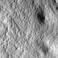
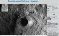
A first LROC picture taken on July 3 has been issued as well (a region south-east of Clavius); see page http://lroc.sese.asu.edu/news/?archives/66-Swooping-over-the-Lunar-Highlands.html
Posted by: dvandorn Jul 4 2009, 05:25 PM
Fascinating -- this surface strongly resembles the "elephant-skin" surface observed in some of the Ranger IX photos of Alphonsus and around Gassendi. Among many other places.
My understanding of the best speculation on what forms this kind of surface is that we're looking at debris flow patterns from large-scale ejecta events (i.e., basin ejecta emplacement events). If this is in the Clavius region, would that imply we're looking at Aiken Basin ejecta debris flow?
-the other Doug
Posted by: John Moore Jul 5 2009, 03:06 PM
I like the 'debris flow' hypothesis -- very interesting.
There definitely are series of striations running diagonally across the picture from upper-left to lower-right. However, depending on the exact location of this lovely shot, I wonder would these be due to Tycho's influence -- just north of Clavius, or, are they, an integrated effect of the above flow hypothesis?
John
Posted by: Hungry4info Jul 6 2009, 10:51 AM
Goldschmidt D in a new LROC image.
http://lroc.sese.asu.edu/news/?archives/68-Peeking-out-of-the-shadows.html
Posted by: Stu Jul 6 2009, 11:39 AM
Many thanks for that heads-up. That's a nice image, very abstract and sparse... like it a lot. I get the feeling that we're going to get quite a few unintentionally "arty" shots from LRO.
Posted by: Stu Jul 6 2009, 03:56 PM
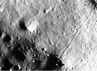
Crop from image http://wms.lroc.asu.edu/lroc_browse/view/iom20090703 shoing some nice boulders around a crater...
Posted by: Sunspot Jul 6 2009, 05:42 PM
Hmmmm that zoomify image doesn't load anymore
Posted by: Stu Jul 7 2009, 05:55 AM
Quite a few pics up now...
http://wms.lroc.asu.edu/lroc_browse
"Zoomify" is working fine for me here right now...
Posted by: djellison Jul 7 2009, 07:59 AM
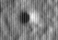
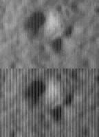
Is it just me, or - when loading the TIF's at full res, there appears to be some sort of interlacing (vertically). i.e. one column of pixels is bright, the next dark..bright, dark etc etc.
Attached zoom from http://wms.lroc.asu.edu/lroc_browse/view/nacl00000145
I guess some sort of adaptive amplification to create a pseudo enhanced dynamic range might be involved....or it might be a processing error, or it might be just something to do with the TIF's.
You can sort of back it out with some VERY rudimentary Photoshopping (doesn't quite get the shadows...someone cleverer than I could do it). I'd expect proper calibration (which is, after all, the point of these early images) would eliminate it. I found a different chunt and had a go at it
Posted by: ugordan Jul 7 2009, 09:18 AM
Definitely looks like something a flatfield (or possibly a dark model) would fix so I wouldn't worry about it much. Reminds me a bit of the awful dark current noise in VIMS visual channel.
Posted by: kenny Jul 7 2009, 11:27 AM
http://wms.lroc.asu.edu/lroc_browse/view/nacl00000141
About one third of the way down from the top of this frame is a truly gigantic boulder with a very smooth sun-facing side, triangular or diamond in shape, casting a very long shadow.
Posted by: SpaceListener Jul 7 2009, 01:56 PM
Nice pictures. The most intriguing thing is that the skin of elephant is very common on the Moon surface. In spite of the fact, these might be originated by any kind of erosion that happens in the Earth.
I seems that they might be occurring when the below surface might have fractures where the regolith sink and it is smoothed by the solar bombard of particles. The others suppositions are that the boulders caused by the impacts are rounded or disintegrated by the solar influence after thousands millions years. Hope this mystery would be cleared up soon.
Posted by: mcaplinger Jul 7 2009, 03:01 PM
As with CTX and MOC, even and odd pixels go through separate signal chains and the offset between them is still being adjusted in these early images.
BTW, the story of how we were able to make NAC run almost 4x faster than CTX with only minimal changes to the hardware is yet to be published
Posted by: SpaceListener Jul 7 2009, 03:16 PM
Useful link http://lroc.sese.asu.edu/whereislro/
Posted by: Stu Jul 7 2009, 03:19 PM
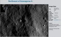
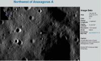
Quite impressive pinnacles and spikes around Anaxagoras A...
How high is this feature, anyone?
Posted by: PDP8E Jul 7 2009, 04:49 PM
back of the envelope, right triangle problem...
~50 pixels long shadow at 2 meters per pixel resolution == 100Meters shadow...low sun angle (?) degrees
(shadow may be running on a downhill slope, making it longer...)
my guess is 4-8 meters tall (WAG)
Posted by: mcaplinger Jul 7 2009, 05:05 PM
Beware anomalist thinking. The sun angle is likely to be so low that these could well be quite ordinary boulders or clumps. Without knowing the sun angle and even the local topography, you just can't tell.
Posted by: Paul Fjeld Jul 7 2009, 05:59 PM
I noticed that on a couple of the images but not all. More interesting is that the Zoomify image on the LROC website doesn't show that artifact.
Posted by: djellison Jul 7 2009, 06:23 PM
Zoomify does....but it only zooms to 100%. If you screen grab and zoom in more - the same effect is in there.
Posted by: Stu Jul 7 2009, 06:39 PM
Anomalist? Moi?!
Why, I'm a monolith of scientific scepticism!
Point taken.
Still cool pics tho.
Posted by: mcaplinger Jul 7 2009, 07:42 PM
You won't notice it on summed images because for those the even and odd pixels are averaged in the instrument. And as Doug says, you have to zoom all the way in to see it on a full-res image, and even then it's less noticeable on some images than others.
Posted by: Paul Fjeld Jul 8 2009, 01:07 AM
I guess my point was that the LROC folks are doing a good job of modifying the raw data so that the striping effect is almost non-existent on the Zoomify images. I went and zoomed up to the pixel limit, grabbed the image and dug deeper. Yes, there is a hint of that striping in some of the image "blocks" but it looks more like a "jpeg-ing." They're very nice anyway!
Posted by: djellison Jul 8 2009, 07:03 AM
Some images have it - some don't - as Mike explained. For those that have it - it IS in the Zoomify images, you just need to zoom in more than Zoomify can. There's no gradient between existing and non existing. It's one or the other.
Posted by: djellison Jul 8 2009, 11:39 AM
Tiny bit of LROC WA mosaic from the calib image released.
It'd be interesting to see if we can pull out a bit of colour variation
Posted by: ilbasso Jul 8 2009, 06:20 PM
There's a 'flyover' movie posted on http://www.youtube.com/v/052DosGtJLs&color1=0xb1b1b1&color2=0xcfcfcf&hl=en&feature=player_embedded&fs=1"></param><param%20name="allowFullScreen"%20value="true"></param><param%20name="allowScriptAccess"%20value="always"></param><embed%20src="http://www.youtube.com/v/052DosGtJLs&color1=0xb1b1b1&color2=0xcfcfcf&hl=en&feature=player_embedded&fs=1"%20type="application/x-shockwave-flash"%20allowfullscreen="true"%20allowScriptAccess="always"%20width="425"%20height="344"></embed></object> today.
Posted by: Paolo Jul 8 2009, 07:16 PM
I am speechless... ![]()
Posted by: jmknapp Jul 8 2009, 09:37 PM
I ran the photo's particulars through SPICE and get a sun elevation of 0.42 degrees, so it's just sitting practically on the horizon and rising.
30JUN2009 16:04:33 UTC, center lon -7.890545, center lat 72.20735 -> sun elevation 0.422, sun azimuth 89.395
Posted by: John Moore Jul 9 2009, 09:48 AM
This is a stupid query, but why are all the images North down and South up ![]()
The usual views of presenting images is to have North up and West on the left -- in accordance to the cardinal points as laid down for the Moon by the IAU in 1961. Will future images see a change in orintation?
John
Posted by: ugordan Jul 9 2009, 10:41 AM
Uncalibrated, raw imaging swaths taken on a descending node in a polar orbit will have north pointed down. Map-projected products take care of this.
Posted by: Zvezdichko Jul 10 2009, 06:52 AM
http://lroc.sese.asu.edu/news/index.php?/archives/72-NAC-Imaging-Hiatus.html#extended
Posted by: Stu Jul 11 2009, 08:24 AM
Cropped / enhanced crater from the floor of Compton Crater...
http://twitpic.com/9zav0
Posted by: SpaceListener Jul 11 2009, 03:02 PM
What instrument will be able to "see" the dark parts of Moon, as the bottom of the Compton crater?
Posted by: jmknapp Jul 11 2009, 03:58 PM
The LAMP instrument takes advantage of background ultraviolet (Lyman Alpha hydrogen emission) coming from all directions from stars & also scattered from hydrogen clouds nearer the solar system to see in otherwise dark areas. Pretty fancy I'd say!
Posted by: Zvezdichko Jul 11 2009, 03:59 PM
SpaceListener: Mini-RF. This instrument is also flying aboard Chandrayaan-1 and we already have maps:
http://www.nasa.gov/mission_pages/Mini-RF/multimedia/index.html
BTW I'm amazed to see objects as small as rocks on the surface on the Moon! These NAC photographs are AWESOME.
Posted by: dvandorn Jul 11 2009, 04:45 PM
I dunno -- some of those rocks are likely the size of a football stadium, if not larger.
-the other Doug
Posted by: Zvezdichko Jul 11 2009, 04:55 PM
Knowing the fact the current resolution is about 1 meter per pixel at least and these rock are larger than a pixel (or even a few pixels), you are right. But they look cool ![]()
Posted by: Zvezdichko Jul 13 2009, 11:05 PM
OK, on topic:
http://lroc.sese.asu.edu/news/?archives/74-Mapping-the-Moon-with-the-Wide-Angle-Camera.html
A new WAC image has been published
Posted by: jmknapp Jul 14 2009, 11:31 PM
Didn't see this recent news item mentioned here:
http://www.spaceflightnow.com/news/n0907/06kaguya/
"Japan's now-finished lunar mission found no water ice"
The LRO press kit mentions two competing theories for why Clementine saw decreased neutron flux at the poles, both involving absorption of same by hydrogen: either in water form, or alternatively hydrogen deposited from solar wind could be more stable and accumulate more due to the cold polar temperatures.
Posted by: dvandorn Jul 15 2009, 01:14 AM
I don't think anyone has ever anticipated finding glaciers of white ice just sitting in the bottoms of polar lunar craters. Exposed ice would sublimate quite quickly when exposed to the vacuum.
Instead, I believe the expectation is to find an "icy regolith" layer (something like a permafrost layer) underneath a completely dry layer of regolith. The minute gaps between the grains of the covering regolith cap would be enough for the tiny amount of sublimation that results in the hydrogen signature detected by Clementine and Lunar Prospector.
-the other Doug
Posted by: jmknapp Jul 15 2009, 02:00 AM
Instead, I believe the expectation is to find an "icy regolith" layer (something like a permafrost layer) underneath a completely dry layer of regolith.
When the Lunar Prospector announcement was made the figure of "1% water" or something like that was given, which added up to a lake's worth if the total input is a gazillion tons or whatever. Later it was pointed out that hard concrete has a similar amount of water, so extracting drinking water seemed less plausible. Let's hope the figure is quite a bit above that!
BTW, according to the materials for the LAMP instrument:
(LRO) Lyman-Alpha Mapping Project (LAMP) is a
UV spectrograph designed to address how
water is formed on the moon, transported through the
lunar atmosphere, and deposited in permanently
shaded regions (PSRs). Its main objectives are to 1)
identify exposed water frost in PSRs, 2) characterize
landforms and albedos in PSRs, 3) demonstrate the
feasibility of using natural starlight and sky-glow illumination
for future lunar surface mission applications,
and 4) assay the lunar atmosphere and its variability.
The production and transport of lunar atmosphere
constituents (e.g., H, Ar, and potentially others) will be
investigated by observation of their resonantly scattered
FUV emissions. LAMP albedo maps of PSR
landforms and potential surface water ice will be used
to investigate the intriguing processes that occur
within PSRs. Potential sites of active outgassing such
as the Aristarchus crater and the Ina structure are
targets of special interest for LAMP spectral map
products.
Would that imply that LAMP is only suited for detecting surface ice/frost?
Posted by: Zvezdichko Jul 22 2009, 10:23 AM
http://lroc.sese.asu.edu/news/?archives/77-The-Moon-in-3D.html
LROC images in 3D
Posted by: glennwsmith Jul 23 2009, 03:54 AM
Yes, Dvandorn, I think the situation on the moon will be similar to what Phoenix found on Mars -- ice (or an ice rich regolith) covered by a relatively thin layer of dry regolith.
Posted by: John Moore Jul 23 2009, 10:47 AM
Very nice bit http://wiki.nasa.gov/cm/blog/lcrossfdblog on the whole LCROSS cruise phase setup -- flight director for LCROSS. Well worth a read.
John
------------
Posted by: Phil Stooke Jul 29 2009, 03:34 AM
A couple of nice new LROC images posted on their site in the last couple of days. This is a really nice camera!
Phil
Posted by: Phil Stooke Jul 29 2009, 01:49 PM
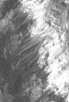
This is a tiny detail from the upper wall of Burg crater in the latest LROC image. Nice dust streamers - I don't recall anything like this in Apollo or Lunar Orbiter images.
Phil
Posted by: nprev Jul 30 2009, 04:48 AM
Hmm. And you of all people would certainly know, Phil.
That's really interesting. If they are in fact dust streamers, what's the sorting mechanism to generate them? It's gotta be a thermal expansion/contraction thing, but nothing obvious springs to mind.
Posted by: John Moore Jul 30 2009, 10:21 AM
Yes...hmmm...I wonder would quakes be a contributing factor?
Phil, is it odd that the albedo of these streamers is lower than from where they originated from -- I would have thought the layer of dust that rolled down wouldn't have changed it much?
John
Posted by: Phil Stooke Jul 30 2009, 11:05 AM
Particle size and surface texture affect reflectivity as well as albedo. We can't separate those factors yet and say the albedo is different.
Electrostatic effects might move dust while leaving coarser material, allowing it to slide downhill on its own.
Phil
Posted by: jmknapp Jul 30 2009, 11:29 AM
How long ago might such a landslide/deposit have taken place? A billion years? Only when the crater formed? Or perhaps more recent?
Posted by: Phil Stooke Jul 30 2009, 11:54 AM
I would guess that the large wall slumps defining the crater terraces occurred immediately after crater formation, the small local landslides which form rubbly deposits on the terraces take place sporadically every few million years, and that these dust treamers are formed by gradual, continual (or short timescale episodic, like every year or two) ongoing processes.
There are some nice rolling boulder tracks below this area.
Phil
Posted by: John Moore Jul 30 2009, 12:26 PM
Thanks Phil
OT: The half-covered crater just on the boundary in the Frigoris Image is simply excellent at very high res...WOW.
John
PS...I see the color camera is now working fine...yeah...sacrilegious, I know ![]()
Posted by: belleraphon1 Jul 30 2009, 05:30 PM
Phil
The Moon ( or Selene - I just do not feel 'the Moon' does her justice) sure ain't boring...
Every time we increase resolution on a planet/moon, a whole new world pops into view. LROC will help reveal processes that operate on a large, airless, volatile free body.
How exactly do electrostatic and exospheric efffects operate, long term and short?
I expect the unexpected.
WOW..
Craig
Posted by: Zvezdichko Aug 4 2009, 09:40 AM
http://lroc.sese.asu.edu/news/?archives/84-Bright-Crater-Rays-and-Boulders.html
Bright crater rays and boulders
Posted by: Zvezdichko Aug 5 2009, 02:59 PM
http://lroc.sese.asu.edu/news/?archives/85-Hummocks-and-blocks-and-craters.html
Tsiolkovsky crater
Posted by: James Fincannon Aug 7 2009, 06:47 PM
Tsiolkovsky crater
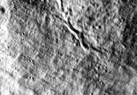
Although its not possible to see in the LRO image browser, this image has many boulder tracks in it if you download the tiff and adjust the contrast/brightness appropriately.
I have attached a sample.
Posted by: Zvezdichko Aug 7 2009, 06:53 PM
Yes! This sample is just another example of rock movement.
Because this is what I think has happened while looking at these images.
We can clearly seen the trails. But what could have caused this? The Moon is a dead body for millions of years.
Posted by: Phil Stooke Aug 7 2009, 08:17 PM
Seismic shaking caused by nearby impacts?
Phil
Posted by: eoincampbell Aug 8 2009, 01:47 PM
Have they mostly slid or tumbled ? Some tracks remind me of Spirits' RF
Eoin
Posted by: antipode Aug 8 2009, 11:16 PM
Pretty weird seeing craters on the tops of those Tsiolkovsky ejecta blocks. Obviously you know they must be there, but it just seems odd seeing them in 'solid rock' compared to the surrounding regolith.
p
Posted by: James Fincannon Aug 9 2009, 03:55 PM
Because this is what I think has happened while looking at these images.
We can clearly seen the trails. But what could have caused this? The Moon is a dead body for millions of years.
Back in the old Lunar Orbiter days they developed alot of theories for why the boulders eventually rolled downhill. I will have to did up the old reports. I recall thermal cycling and impacts of meteors causing tremors factored into it.
My main interest in these is that they permit the deduction of regolith mechanical properties without having to land there. We don't really have any instruments to deduce these mechanical properties remotely. Landers or rovers could of course, but that is way too costly. During the Lunar Orbiter days, they found a slew of these in the very high resolution images (~1-3m/pixel, which only covered a small percentage of the surface) and derived regolith properties in preparation for Apollo landings.
One of the concerns about the regolith is how much variation there is in its properties over the entire surface. Since interest exists for the near polar regions, it would be nice to be assured the properties are the same there as near the equator. Rolling boulders should be distributed fairly equally over the surface and if there aren't many near the poles, that is significant.
Also, looking at these images, I had supposed there would be many more rocks and boulders (which would be especially visible at some of the shallow Sun elevations for the images), but there seems to be many more craters than boulders (~an order of magnitude). Does this make sense?
Posted by: Phil Stooke Aug 9 2009, 04:22 PM
James, look at the Apollo or Surveyor images taken on the surface and you will see that rocks are actually quite rare, outside of specific locations: the rims of fresh craters, or at the foot of a slope where they collect after rolling. Apollo images (later missions especially) are in fact a bit misleading, since many sampling stations were chosen to be in groups of rocks (Apollo 17 Station 5 and Station 6, or Apollo 16 at North Ray being good examples). I've been having this discussion with some Google Lunar X Prize teams, who have greatly exaggerated the danger of landing on rocks and maybe under-rated the danger of landing on sloping crater walls.
To me the LROC images match very closely what the surface images lead me to expect.
Phil
Posted by: kenny Aug 9 2009, 05:03 PM
We can clearly seen the trails. But what could have caused this? The Moon is a dead body for millions of years.
Don't forget that on Earth we have incremental boulder creep downslope, as well as rolling boulders. These are seen as "ploughing boulders" in mountain areas, which leave a trench behind them in the soil as they move downhill. In Scotland at least, this thought to be the result of freezing and thawing effects since the end of the last Ice Age, circa 10,000 years ago.
http://www.fettes.com/cairngorms/ploughing%20blocks.htm
On the Moon, perhaps thermal expansion and contraction of the moving rock could offer a mechanism. As the rock warms up in the lunar day, it will be easier to expand downhill where movement is less constrained by the regolith slope, than uphill. The net effect over millions of years could be the apparent movement and tracks we now see - a much slower effect than the Earth mountain analogy, but with a similar outcome.
Posted by: James Fincannon Aug 10 2009, 01:25 PM
To me the LROC images match very closely what the surface images lead me to expect.
Phil
I thought Apollo sites were selected to reduce landing risk by picking flat, hazard free places.
What is your estimate of frequency of 1 m diameter boulders? 1 per square kilometer? 1 per 100m^2?
Posted by: Phil Stooke Aug 10 2009, 04:04 PM
The Apollo landing sites were rock-free to the extent possible, but the sampling stations were often at much more interesting and hazardous locations. Nobody would try to land on the rocky rim of Camelot crater or North Ray.
But as an excellent example, consider Surveyor 7, which landed on the ejecta of a fresh impact crater, Tycho. The surface images show rocks, but most of the surface is fairly rock-free. Here's an image of it:
http://www.unmannedspaceflight.com/index.php?act=attach&type=post&id=9690
Rock distributions - just guesses:
On a typical mare site I would guess 50 to 100 1m rocks per square km, but heavily concentrated in the rim deposits of fresh craters. Away from those craters, only 5 to 10 per square km.
On typical highland terrain, maybe 25% of those figures.
Phil
Posted by: Phil Stooke Aug 14 2009, 12:14 PM
LRO has done a full longitude circuit of the Moon since the release of the Apollo site images... so an Apollo 12 release may not be too far away. Not to mention a few other sites if we're lucky. The sun will be noticeably higher now.
Phil
Posted by: kenny Aug 14 2009, 12:51 PM
I'm thinking that the biggest and therefore most easily resolvable INTACT NON-APOLLO OBJECTS on the Moon are 2 Lunokhod rovers, their delivery descent stages, and the descent stages of the sample-return Lunas. I suppose it's also possible that some of the failed Lunas (such as Luna 15) got down without breaking apart completely.
The tall delivery stages of Lunas 9 and 13 might be lying fairly intact on their sides, near the landing sites of the little capsules. And Luna 8 was of the same design and almost made it, so might be still in one piece.
I suspect the tallest object currently sitting on the Moon's surface, and therefore casting the longest man-made shadow on the Moon, is Luna 23 in Mare Crisium. It still has its ascent stage attached due to failure after a successful soft landing.
Kenny
Posted by: Phil Stooke Aug 14 2009, 02:19 PM
I think you're right, and I look forward to seeing all of these things. The early Luna (8, 9, 13) locations are very uncertain - a, area 50 km across might have to be searched, so they will be very difficult to nail down. The Lunokhods should be a lot easier because we can compare their published route maps with the images to nail down the areas better.
Phil
Posted by: dvandorn Aug 15 2009, 01:14 AM
And, of course, there are five Surveyors on the surface that ought to be visible to LRO's camera. We'll get Surveyor III when the A12 site is imaged, but I'm more looking forward to seeing SI and SVII. We've seen a decent image of SI on the surface from one of the early Lunar Orbiters (LO2, IIRC); I'd like to compare that image with an LRO image. And it will be very, very useful to see the SVII site from orbit at LRO resolution, since we may someday want to land manned or unmanned probes in similar terrain; it'll be nice to be able to characterize "safe" landing areas in such apparently rugged terrain.
-the other Doug
Posted by: Phil Stooke Aug 15 2009, 02:04 AM
My special interest among the Surveyors is Surveyor 5, because it was the only one not precisely located by Ewen Whitaker at the time. I have a prediction, but it will be nice to see if it's correct. Surveyor 7 will also be really nice, as you say. Will Surveyor 6's 'hop' blast marks be visible?
Phil
Posted by: Hungry4info Aug 15 2009, 12:55 PM
Is this the image you refer to? (from LO3).
http://ntrs.nasa.gov/archive/nasa/casi.ntrs.nasa.gov/19690027073_1969027073.pdf
(down there on what it considers page 8)
Posted by: Phil Stooke Aug 15 2009, 01:54 PM
Here's a little finding guide for Surveyor 1, based on the scanned LO images at LPI:
The LOIRP version will show the shadow better.
Phil
Posted by: Zvezdichko Aug 16 2009, 10:01 AM
Is the LRO team indeed hiding something from us? I noticed something interesting at NasaWatch.com and this makes me wonder - the website hasn't been updated for about 11 days.
Posted by: Stu Aug 16 2009, 10:42 AM
I'm having LRO image withdrawl symptoms too, but I'm sure they're not hiding anything. We have been so spoiled by the rapid release of MER and CASSINI images these past few years that we take it for granted, and sometimes expect too much of the people behind these missions.
Posted by: Phil Stooke Aug 16 2009, 12:12 PM
"I noticed something interesting at NasaWatch.com "
Noticed something silly might be a better way to put it. There's a difference between not having released something yet and refusing to release something. (Idle thought... what would Perez Hilton call Keith Cowing? It could only be K-Cow!)
I have no doubt the images will be released, and the mosaic too. As it was made for Constellation, they would probably be the people to release it. Another point - image release isn't an essential service, so the staff responsible may be short-handed due to vacation time etc. Very little ever happens at my university in August. The mission is flooding the team with data, they have their hands full.
Phil
Posted by: djellison Aug 16 2009, 01:37 PM
Have they release every single image taken?
No.
Have they released plenty of images given that they're still in a comissioning phase?
Yes.
We know they intended to make a quick and dirty polar mosaic for the LCROSS team. It's not going to be a nice outreach product. It's not going to be especially earth shattering ( as we have polar mosaics from several missions already, at similar resolutions). Quite what grounds for bitching Cowing has this time, I don't know. But he doesn't usually need a reason.
Posted by: Zvezdichko Aug 17 2009, 09:53 AM
I would call it a negative criticism. Knowing that he's a major contributor to Lunar science (restoring old Lunar Orbiter photographs), he probably has the right to do so.
Posted by: djellison Aug 17 2009, 01:24 PM
Anyone has the RIGHT to. But that doesn't mean it's right to. Given the number of images released whilst LRO is still commissioning - the LROC team has more than ticked all the boxes for outreach. Bitching at this point is unjustified.
Would it be nice to see every LROC image make it to the web in near realtime like MER. Sure. But we're not even in the final orbit yet. Give them time.
Posted by: Zvezdichko Aug 17 2009, 01:37 PM
Yes - I also remember that very few images from MRO were released before they reached the final orbit ![]() We have much more LROC images compared to that.
We have much more LROC images compared to that.
By the way - I read somewhere that a teleconference is scheduled for today. Probably something may come out later today.
Posted by: Stu Aug 17 2009, 01:43 PM
I can't help giving a little head shake and "humph!" whenever this comes up. We are SO spoiled nowadays. Back it t'olden days when a probe saw something new we had to make do with a couple of pictures on that night's News At Ten, then we had to wait literally months to see any others, when they'd be shown on a special episode of HORIZON or reproduced in ASTRONOMY or SKY AND TELESCOPE. I have rather less than fond memories of recording the TV news and Sky At Night coverage of the Voyager 2 Uranus and Neptune fly-bys then photographing my tv screen, after pausing the tape, and using the slides in my schools and community Outreach talks. ![]()
Now... well... raw image galleries, downloadable hi-res jpgs, Quicktimes, animations, all available days if not hours after the event...
Patience, young Jedis, all will be well.
Posted by: Phil Stooke Aug 19 2009, 02:01 AM
... and as if by magic, a new LROC image appears - lovely view of a sinuous rille on the Aristarchus Plateau.
Phil
Posted by: ElkGroveDan Aug 19 2009, 02:24 AM
You don't want to know what I would call him.
Posted by: elakdawalla Aug 19 2009, 03:57 AM
Is anybody else having trouble getting the http://wms.lroc.asu.edu/lroc_browse/view/nacl00005e30 to load?
--Emily
Posted by: dvandorn Aug 19 2009, 05:01 AM
http://ntrs.nasa.gov/archive/nasa/casi.ntrs.nasa.gov/19690027073_1969027073.pdf
(down there on what it considers page 8)
Yep, that's the one -- I see that Surveyor I was actually imaged by LO1 and LO3, with the LO3 picture the better of the two.
I remember the image from the classic "Exploring Space with a Camera" by Edgar Cortwright. Here's the image I recall, a three-shot zooming in on the SI site:
Many of my early Surveyor image memories come from this book.
-the other Doug
Posted by: Zvezdichko Aug 19 2009, 07:11 AM
--Emily
Yes - me... Actually, I succeeded in cropping two frames from the big image. Here they are:
Posted by: Phil Stooke Aug 19 2009, 11:37 AM
I couldn't get it last night but I can now.
There are some nice rolling rock trails on the walls of the main valley, both north and south sides. I'm also struck by how smooth the surface looks compared with typical mare surfaces. This is a place that would be easy to land on.
Phil
Posted by: John Moore Aug 19 2009, 02:52 PM
Had collaged together an image about these trails on Chuck's LPOD this morning http://www.moonposter.ie/boulders.htm
John
-------------
http://www.moonposter.ie/
Posted by: James Fincannon Aug 19 2009, 03:56 PM
There are some nice rolling rock trails on the walls of the main valley, both north and south sides. I'm also struck by how smooth the surface looks compared with typical mare surfaces. This is a place that would be easy to land on.
Phil
Yes, some nice ones. Here is what I found.
Posted by: charborob Aug 19 2009, 06:29 PM
Nice trails. We're starting to see the Moon like never before.
I find it difficult to evaluate the size of the blocks. The LROC image browser lacks a scale bar. Even if the pixel size is mentioned, I don't find it very useful. I suppose I could download the TIFF files and count the pixels, but they are large files. Sometimes with Photoshop (version 7) I could not open them.
Posted by: James Fincannon Aug 19 2009, 07:20 PM
I find it difficult to evaluate the size of the blocks. The LROC image browser lacks a scale bar. Even if the pixel size is mentioned, I don't find it very useful. I suppose I could download the TIFF files and count the pixels, but they are large files. Sometimes with Photoshop (version 7) I could not open them.
If you have the luxury to download the actual tifs, it can still be a bother to try to load them and view them. I use PCI Geometica Freeview Version 10.0
http://www.pcigeomatics.com/index.php?option=com_content&view=article&id=97&Itemid=12
It is nice because it is free, can load 1 Gb files easily and has many different kinds of visual enhancement tools which the LROC image browser lacks/ makes it hard to resolve some features.
I zoomed in by a factor of 2 the LRO image to capture my rolling boulder images and presented all images at the same scale (the LRO raw image is 1.46 m/pixel so if my images are viewed at 100%, then every two by two pixels is 1.46 m by 1.46 m). It is somewhat lossy due to jpeg storage economy. So, for my lower left image boulder (the largest), it is 16 by 21 magnified pixels which is 8 by 10.5 standard pixels or 12 m by 15 m.
Posted by: charborob Aug 21 2009, 07:56 PM
A new image on the LROC image browser: Necho crater. This looks like a really recent crater. Blocks, cracks everywhere.
http://wms.lroc.asu.edu/lroc_browse/view/M103703826LE
Posted by: DDAVIS Aug 21 2009, 09:50 PM
'We have been so spoiled by the rapid release of MER and CASSINI images these past few years that we take it for granted, and sometimes expect too much of the people behind these missions.'
Is the release of raw JPEGS something we are 'spoiled' by or should it be regarded as standard PR outreach for missions that should be routinely done? Is there any plan to release quantities of raw jpegs of Lunar orbit images once the mapping orbit is finalized?
Don
Posted by: Stu Aug 21 2009, 10:52 PM
Clearly the release of raw JPEGS is something we would all like to see for every mission, but over the years - thanks to the input of people here - I've... yes, possibly grudgingly... come to realise that that's not always practical/possible, for a Tardis-ful of reasons. It still sticks in my craw that ESA sits on images like a dragon hording gold, almost as if we "little people" wouldn't appreciate them, but I think that will change, in time, as the dinosaurs start dying out and are replaced by people who are as into this stuff as we are. It would be fantastic if it became routine, or even a requirement, for all umsf missions to let us see raw images asap, but in the real world that's not gonna happen.
Posted by: Phil Stooke Aug 22 2009, 12:48 AM
That Necho image is just about the most amazing yet. Emily wrote about bouncing rocks on her blog - well, check out the chains of pits - must have been bouncing! - at the southernmost part of the visible wall of Necho in this image. And the melt textures - really beautiful.
Phil
Posted by: dvandorn Aug 22 2009, 01:30 AM
Um, yeah -- my swear jar overfloweth!
The thing that strikes me, though, is that you could land a LM (or a Constellation lander) on the floor of that crater! There are lots of places that are flat and smooth enough for a vehicle to land. You'd have to be real careful where you walked and/or drove, but it could easily be done. And would be incredibly spectacular!
And check out some of those rocks! There are rocks in there (and especially on the rim) that make House Rock look like a pebble!
-the other Doug
Posted by: DDAVIS Aug 22 2009, 01:32 AM
It would be fantastic if it became routine, or even a requirement, for all umsf missions to let us see raw images asap, but in the real world that's not gonna happen.
I hold American missions to a higher standard in PR outreach than ESA. How hard or expensive is it to release raw jpegs? If it is a matter of expense I certainly understand, if it is a matter of policy I do not.
Don
Posted by: Phil Stooke Aug 22 2009, 02:16 AM
And now a stealth LROC release... if I can call it that. This page for the MiniSAR instrument has an LROC image of Erlanger, the crater used for the bistatic radar experiment yesterday. - and the MiniSAR mosaic which is also the new LPOD.
Phil
http://www.nasa.gov/mission_pages/Mini-RF/multimedia/index.html
Posted by: gndonald Aug 22 2009, 05:24 AM
There have been some wonderful images released to date. The ones I'm really looking forward to though will be those that cover the other four sites chosen along with the site that became Tranquility Base as the possible location of the first Apollo landing.
Posted by: John Moore Aug 22 2009, 11:40 AM
Re: Necho
Wow...wow -- at highest zoom level on the crack(?) regions one gets the impression of looking at crevases on an ice-sheet.
Coincidentally, had been looking up Necho in relation to its ray systems yesterday (where it meets another ray system from Giordano Bruno to its north-west), so came across some other info and images (no comparison to LROC's, obviously).
http://www.lpi.usra.edu/resources/mapcatalog/topophoto/83B4S1/.
http://www.keithlaney.net/ApolloOrbitalimages/AS10/AS10-28-4012.jpg.
http://www.bu.edu/remotesensing/documents/elbaz1-500/125-160/158.pdf by Gifford, Maxwell and El-Baz.
John
Posted by: SandiBandi Aug 22 2009, 03:44 PM
TY for great Necho links (I've got iterested in today), John!
SB
Posted by: James Fincannon Aug 23 2009, 03:06 PM
http://wms.lroc.asu.edu/lroc_browse/view/M10463421LE
This was released just prior to the Necho one and on the same day. As can be seen it has really nice resolution/contrast tracks visible at the Apollo 14 site. Of course, these were also imaged on a prior pass and discussed, but they still are impressive. The various images I have seen to show these tracks do not do them justice so I magnified them by 2X and used the Geomatica Freeview palette adjustments to improve the contrast.
Posted by: Phil Stooke Aug 24 2009, 10:06 PM
That 'stealth release' of a few posts back is now on the main LROC site:
http://wms.lroc.asu.edu/lroc_browse
Phil
Posted by: cbcnasa Aug 25 2009, 06:30 PM
Thank you James the image is fantastic and so detailed.
Posted by: Zvezdichko Aug 26 2009, 08:51 AM
http://lroc.sese.asu.edu/news/?archives/97-First-LROC-Stereo-Results.html
NEW image!
Posted by: djellison Aug 26 2009, 09:08 AM
To give people just a LITTLE bit more information - this is the first LROC DEM from near the A16 landing site.
Posted by: 2amazing Aug 26 2009, 10:58 AM
It isn´t new this image was taken 12 july 2009 combined with the image is made from apollo 16 http://www.lpi.usra.edu/resources/apollo/
Posted by: djellison Aug 26 2009, 11:22 AM
Yes it is - it's made from two LROC NA images, M102064759 and M102057602
Posted by: Zvezdichko Aug 26 2009, 12:15 PM
Whatever - sorry, I had to be more specific. This DEM image looks much better than Chandrayaan's DEM images.
Posted by: dvandorn Aug 26 2009, 09:27 PM
A little curiosity from someone who doesn't have the tools to be able to plot LRO's orbit, etc...
All of the images I've seen seem to be taken under mid- to late-afternoon sun angles. All of the images I've seen at low sun angles from other probes (especially LO) were, if memory serves, taken under early- to late-morning sun angles. Is this being done purposely by LRO to vary the lighting angle from other resources? (If so, it makes it that much harder to do photo comparison for detection of new craters.)
Also, why the heck have we yet to see the Apollo 12 landing site, when we've seen multiple takes on a couple of the other Apollo sites? Is it possible that A12 visited a *different* Surveyor than the one advertised...? ![]()
-the other Doug
Posted by: Hungry4info Aug 26 2009, 09:57 PM
Or maybe.... the mission was faked
[ducks and runs]
Posted by: dvandorn Aug 26 2009, 10:02 PM
I would never, ever seriously suggest such a thing. But for the only mission where the TV camera wasn't able to transmit any panoramic images from the surface... to keep the idiots and such at bay, they really need to get this image soon.
-the other Doug
Posted by: Phil Stooke Aug 27 2009, 01:41 AM
"A little curiosity from someone who doesn't have the tools to be able to plot LRO's orbit, etc... All of the images I've seen seem to be taken under mid- to late-afternoon sun angles..."
The orbit plane is fixed. Over the course of a month all lunar longitudes pass under it. But over the course of a year the sub-solar longitude also makes a full circuit of the moon relative to the spacecraft orbit. The very first images were taken practically on the terminator. Right now the spacecraft is seeing the sun much higher over the landscape (about 50 degrees above the horizon at the equator). In a month it will be looking down at noon. Two months after that it will be seeing morning longitudes. And so on. If you look at the LROC targeting spreadsheets, you'll see they said about Apollo sites that they wanted both low and high sun images. So changing sun angles are inevitable. The two Apollo 14 images show the changing sun angles a month apart.
The same applies to Chandrayaan and Kaguya... there were specific seasons for imaging, with other times making more use of other instruments. The multispectral stuff is better done at high sun, the Chandrayaan radar imaging was, I think, done when the imaging was not, and so on.
As for Apollo 12 - be patient! (Those crazies don't even know LRO exists.)
Phil
Posted by: stevesliva Aug 27 2009, 03:33 AM
Phil Plait over at Bad Astronomy has it right-- nothing will convince a hoaxer. They're already imagining quite a lot. They can imagine a little more. Someone here linked to the Cosmic Log over at MSNBC and I was surprised to follow a link out to a breathless article about a "New Cydonia." Because of great moderation here, we don't hear from the nutcases. But they're out there. Let's not think that anything will stop them from being nutcases. What's great is that every post so far was making light of them, but trying to appease them is the last reason there need to be photos take of the A12 landing site.
Posted by: Zvezdichko Aug 27 2009, 07:49 AM
Nutcases are allowed to post on BAUT, but they will be asked to backup their claims. If they are unable, but continue talking bullcrap they will be booted out from the board.
I'm happy that UMSF is a good place for discussing image processing techniques, mission imagery, science data and not conspiracy theories, how NASA alters the colors of Mars, etc... etc.. But I also have the feeling that this place is starting to get empty. Is this because people like us are already the minority?
I remember that when I was 12 (now I'm 22) I watched the FOX TV production and I almost got convinced that they never walked on the Moon. This didn't last for long. Curiosity killed the cat. After I started learning more and more about space exploration, I understood how silly these theories are. But this is not the big problem. The big problem is that these productions are smartly disguised as "documentaries" so people have the feeling everything said there is true.
As for LROC images - I wondered why the press cared little about them. I do hope they will be included in some kind of documentaries so people interested in the subject will see that there's independent evidence.
Posted by: djellison Aug 27 2009, 09:22 AM
I've said it before, here and elsewhere, it really is getting tiring repeating it and it's entirely off topic for this thread and this forum as a whole. However - I'll say it again.
If someone doesn't think we went to the moon, then LROC images are not going to change their mind. Indeed, they're the opposite of 'independent' evidence.
As for this place getting quiet? Visits to UMSF are steady.
Jan, 72k Feb 75k. Mars 79k. Apr 77k. May 88k. Jun 72k. Jul 80k. Aug looks like it'll be about 70-72k.
308 registrations in 2009 so far. 2008 saw 394 in total.
It is natural that when there's not much going up 'up there' - there isn't much going on 'down here'. Spirit's not moved in months, Opportunity has sat infront of a rock for a fortnight. Cassini is quiet after the equinox. September, LRO in final orbit and a Messenger flyby. October, LCROSS. November, two Enceladus flybys and a Rosetta Earth Flyby. etc etc. And hopefully - Opportunity foot to the floor and Spirit kicking up the dirt in the not too distant future.
Posted by: ugordan Aug 27 2009, 11:09 AM
Posted by: AndyG Aug 27 2009, 12:37 PM
Doug's French is slowly getting better.
Posted by: djellison Aug 27 2009, 01:01 PM
May wee.![]()
Posted by: dvandorn Aug 27 2009, 10:22 PM
If I remember my high school French from 37 years ago, I believe it runs:
Janvier
Fevrier
Mars
Avril
Juin
Julliet
Aout (sorry, don't have an easy way to add diacriticals here)
Septembre
Octobre
Novembre
Decembre
And the days of the week are:
Lundi
Mardi
Mercredi
Judi
Vendredi
Samedi
Demansche
Spelling could be atrociously wrong, of course... ![]()
-the other Doug
Posted by: ElkGroveDan Aug 28 2009, 06:25 AM
If you subtract the anomalous bump in registrations in 08 on either side of the Phoenix landing you'll probably find that the "background" rate of new registrations is actually up for 09.
If "everyone" is going over to the other forum to discuss conspiracies let me be the first to wave goodbye. Those of us who have invested several years of recreation time at UMSF are here for what it is, not to be part of the popular crowd.
Posted by: djellison Aug 28 2009, 06:34 AM
And May is to be found about 1800 miles off the coast of Brittany ![]()
Posted by: nprev Aug 28 2009, 06:42 AM
Too right. The civility & extremely high SNR of UMSF are both unequaled, and that's been the direct result of ongoing hard work by Doug & the admins. Anybody who wants pseudoscience & sensationalism has a wide variety of other options, and happy trails to them.
Re lack of LRO press attention: Sad to say, but lunar exploration does suffer from a "been there, done that" vibe amongst the general public, and it's been that way for decades, Z. LCROSS may produce a spike of interest, but as we all know even space exploration in general has a hard time winning mass media attention for very long. It's really a systemic problem that's hardly unique to LRO.
Posted by: Zvezdichko Aug 28 2009, 09:15 AM
Well, I frequent BAUT to *debunk* conspiracies, not to be a part of the popular crowd. And I do start threads about exotic conspiracies, but these questions don't come from me, but from friends of mine who trust me and who finally get convinced that all space conspiracy theories are silly and not worth discussing.
There are people who are asking questions with strong mind. This is my job - to answer these questions. But sometimes I'm not good enough (don't have enough skills) to do this - asking questions on the right board is well
As for UMSF - I'm doing my best to contribute when it comes to foreign/Russian missions. This autumn will be very busy coming up with the launch of Phobos-Grunt and browsing the so called .ru-net is not an easy task.
Too much offtopic. Back to lROC imagery.
Posted by: John Moore Aug 28 2009, 10:30 AM
Interesting article (Page 1 & 2) on Russia's future manned spaceflight plans http://www.spectrum.ieee.org/aerospace/space-flight/russia-reveals-vision-for-manned.
Check out the author's (Anatoly Zak) website -- http://www.russianspaceweb.com/acts.html too -- excellent resource.
John
-----------
http://www.moonposter.ie/
Posted by: 2amazing Aug 29 2009, 12:54 AM
New? M104061987RE.tif image on http://lroc.sese.asu.edu/data/pr/tiff/?C=M;O=A
Does someone know how the code is build off ?
M = month
1= day
0=?
4=Orbit height
..
..
re=right
etc etc
Can't find an explonation on the Nasa site.
Posted by: Pavel Aug 29 2009, 01:57 AM
Just move the cursor over "Name", "Last modified", "Size" and "Description". C is the field to sort on, O is the order, A for ascending and D for descending. No orbital mechanics involved ![]()
Posted by: mcaplinger Aug 29 2009, 03:39 AM
I think he was asking about the naming convention. See http://geo.pds.nasa.gov/missions/lro/docs/lroc/lroc_av_sis.pdf
Individual EDR files will follow the naming convention:
[TARGET][MET][INSTRUMENT][PRODUCT].img
Where [TARGET] is a single character denoting the observation target [(M)oon, (E)arth,
( C ) alibration or (S)tar]; [MET] is a nine digit number reflecting the Mission Elapsed Time of
acquisition (with a single digit for partition which denotes a reset of the MET); [INSTRUMENT]
is a single character denoting the instrument, e.g. ( R )ight NAC, (L)eft NAC, (M)onochrome
WAC, ( C)olor WAC, (V)is WAC, or (U)v WAC; and [PRODUCT] is a single character to
denote (E)dr.
Posted by: Phil Stooke Aug 29 2009, 02:03 PM
The new image 2amazing mentioned is now on the LROC browse page. It's in Balmer, a big smooth-plains-floored basin near the limb, and one of the Constellation priority targets.
http://wms.lroc.asu.edu/lroc_browse
Here's a crop... ejecta blocks south of the fresh crater. Some of them hit the ground with enough horizontal velocity to roll away from the crater - these are the first boulder tracks I've ever seen away from steep slopes (Hey James!)
Phil
Posted by: ilbasso Aug 29 2009, 02:29 PM
There's a nice image at the Lunar Orbiter Image Recovery Project site comparing a Lunar Orbiter III high-res shot of the Apollo 14 landing site with the latest LROC image. It's very easy to see the changes imparted to the site from Apollo 14!
http://images.spaceref.com/news/2009/14.compare.close.l.jpg
Posted by: 2amazing Aug 29 2009, 02:32 PM
M104061987RE.tif
M=moon
104061987 = time in minutes?
How can you calculate whitch time/date this picture was taken.
Posted by: Phil Stooke Aug 29 2009, 02:55 PM
The 104th of June, 1987?
More likely it's a count of seconds since some time which is probably specified somewhere in the documentation. But I prefer the idea that it's the 104th of June.
Phil
Posted by: climber Aug 29 2009, 03:42 PM
.....
And the days of the week are:
.....
Spelling could be atrociously wrong, of course...
-the other Doug
nearly ok oDoug...
Jeudi and not judi (so Jeudi is a mix of your judi and ...Jedi)
Dimanche and not Demansche
Juillet and not Julliet
Août (I've got the right key board
and as Doug pointed out you've missed Mai (which is a Maymonth and not a Mayday...sorry I couldn't resist)
...and I don't want to hear your spelling
Posted by: elakdawalla Aug 29 2009, 04:03 PM
It's certainly counting up in seconds. I usually just make an Excel spreadsheet that takes the time quoted on an official release and the MET and then set up a formula that can calculate the date for any MET. But for LROC it doesn't really seem to be necessary, since they're putting the UTC time on all the Zoomify images. For instance http://wms.lroc.asu.edu/lroc_browse/view/M104061987RE which we're told is from Tue Aug 04 14:51:59 UTC 2009. Taking the whole nine-digit number as the date, it counts up from April 18, 2006, but I think it's more likely that the first digit isn't part of the counter, so it counts up from June 18 at 14:32:12. This was exactly 7 hours before launch. Maybe that was when they booted the spacecraft computer?
--Emily
Posted by: mcaplinger Aug 29 2009, 06:49 PM
Sounds like the difference between UT and MST where the LROC operations center is. Maybe some time system confusion there. Presumably somewhere they have documented the definition of MET 0 in UT (or better, ET.)
I'm a little surprised they used MET; we usually use some arbitrary time like 0 Ephemeris Time ("epoch of J2000").
The first digit is probably what they meant by "a single digit for partition which denotes a reset of the MET".
I've seen clearer pieces of PDS documentation
Posted by: 2amazing Aug 29 2009, 06:56 PM
Hai Emily
Not every file and images match this methode.
Sometimes the date is not correct or time
See excel attachment.
Posted by: mcaplinger Aug 29 2009, 07:38 PM
The "nacl" and "nacr" files use the convention that the LROC hardware uses, where are images have an arbitrary 32-bit ID, reported in the file names as 8 hex digits. You can't glean anything more from these filenames without having access to the commands.
Obviously the PDS releases will be cleaned up and conform to the EDR documentation; it seems these public releases are using various naming conventions. (I'm just speculating, I have nothing to do with this stuff.)
Posted by: Zvezdichko Aug 30 2009, 06:42 PM
I played with the images a little and did some basic editing, basically (but not limited to) reducing noise, sharpening and increasing contrast. Not as good as you can do it, but at least I tried. Imageshack and GIMP tricks.
Edit : Second photo
Posted by: 2amazing Aug 31 2009, 06:55 AM
Answer by e-mail from webmaster http://lroc.sese.asu.edu 30/08/09 11:27 PM
The second to last character in the name denotes the observation type (L = left NAC, R = right NAC, C = 7-band WAC, M = 1 band WAC, V = VIS-only
WAC, U = UV-only WAC). The last character denotes the type of PDS product (E = EDR, C = CDR).
Posted by: mcaplinger Aug 31 2009, 02:10 PM
More or less the exact same thing I said in post 166, no?
Posted by: 2amazing Aug 31 2009, 06:35 PM
Yep
Posted by: James Fincannon Sep 1 2009, 08:23 PM
http://wms.lroc.asu.edu/lroc_browse
Here's a crop... ejecta blocks south of the fresh crater. Some of them hit the ground with enough horizontal velocity to roll away from the crater - these are the first boulder tracks I've ever seen away from steep slopes (Hey James!)
Phil
Yes, this one has alot of boulder tracks. Qualitatively, it is interesting how thin the dust layer is as evident of the difference between the width of some boulders and narrowness of their track. How deep is the soft stuff supposed to be?
Posted by: Stu Sep 1 2009, 08:39 PM
New image...
http://wms.lroc.asu.edu/lroc_browse/view/M103668324R
Zoom in... and in... and in... until your jaw hits the floor, or your face hits the boulders, whichever happens first..! ![]()
Posted by: Phil Stooke Sep 1 2009, 08:40 PM
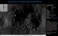
A fantastic new picture today, Tsiolkovsky's central peak, with approximately a zillion boulder trails...
The caption ask the question - are the blocks from the peaks, or were they thrown there by distant impacts? I think we can safely say they are local. If rocks were thrown around as the question implies, flat areas would be covered with them too. But on the flat areas away from fresh craters and slopes they are rare. And rocks scattered all over this region could hardly collect preferentially on steep slopes and summits. In fact they should preferentially collect elsewhere because most rocks falling on slopes would roll off immediately.
Phil
Posted by: James Fincannon Sep 1 2009, 08:49 PM
The caption ask the question - are the blocks from the peaks, or were they thrown there by distant impacts? I think we can safely say they are local. If rocks were thrown around as the question implies, flat areas would be covered with them too. But on the flat areas away from fresh craters and slopes they are rare. And rocks scattered all over this region could hardly collect preferentially on steep slopes and summits. In fact they should preferentially collect elsewhere because most rocks falling on slopes would roll off immediately.
Phil
Its awfully nice of them to be providing these nice images with lots of boulder trails for us to ponder.
Posted by: Hungry4info Sep 1 2009, 10:22 PM
These LRO images are purely amazing. Zoomed fully in and sliding around, the images seem to go on forever. I've spent literally half an hour with some of these recent ones (especially the Necho crater) going through constant cycles of "What's over there?" [sliding the mouse] "Oh wow."
Truly amazing.
Posted by: 2amazing Sep 1 2009, 10:55 PM
Relaese date 1 sept 09.
Image captured 31 jul 09.
When we become the high res images (0.5 meter per pixel)?
Or is there a problem with the LRO?
update excel file (see attachment)
Posted by: Stu Sep 1 2009, 11:35 PM
Here we go again... ![]()
People really, I mean really, need to be more patient re image releases. Seriously, compared to The Old Days we are spoiled rotten.
Posted by: mcaplinger Sep 2 2009, 03:09 AM
Thanks, Stu. Frankly, if I were moderating I would ban this topic, because the debate is not going to reach closure in this forum.
Note that LRO is not scheduled to be put into the circular 50 km mapping orbit until 15 Sept. I haven't worked out the ground track speed in the present orbit, but it may exceed the max clock rate of the NAC for square pixels.
Posted by: eoincampbell Sep 2 2009, 03:50 AM
What's everyone's thoughts as to why lots of big boulders like to sit atop lunar mountains ? (except the ones that roll doon!)
Thanks for pointing to these fascinating close ups Stu
Posted by: Stu Sep 2 2009, 06:38 AM
The topic doesn't need banning. What needs to happen is people need to stop being so ******* impatient and ungrateful. Yes, it's frustrating not to have EVERY mission release EVERY raw image taken within hours or days of them being taken, like the MER and Cassini missions do, but really, come on, we're not entitled to it, and the people working on these missions are very, very busy. MER broke the mould, but we can't expect every other mould to be broken too.
I went around JPL, saw the people working there, I know just how busy people like them are. Trust me, the people behind space missions have better things to do than make sure enthusiasts like us have a daily fix of pictures to look at when we get *back* from work. We should be grateful for anything and everything we get, and not get all narky when the flow from the data pipe slows down sometimes.
And before anyone says anything, yes, I know the argument about "Well, we've paid for them so we deserve to see them!" but that's not how the world works. "We" also pay for our governments' scientists to develop new medicines, alloys, plastics etc for us, but we don't moan and groan about not having access to their daily lab test results, graphs and meeting minutes, do we? The only difference here is that NASA's missions produce easily-understood, gorgeous pictures that we 1) we can work on on our home computers, and 2) go "oooh!" over when we see them.
No new images from LRO today? Go look at the Cassini raw page and marvel at pictures of Saturn's rings streaked with the tapering shadows of its moons. No new Cassini raw images yet? Go take a look at the SOHO site and enjoy amazing views of coronal mass ejections and solar prominences. No new SOHO images yet? Go take a look at NASA's Planetary Photojournal, where you'll find new images from other missions... If nothing there takes your fancy, go back to Exploratorium and click on some of the links to raw image pages you missed because you were busy that day, there'll be something new for you to see there. Then there are blogs from mission scientists to read, papers to download, podcasts to listen to. Come on people! The internet is a Stargate we can all step through. We're spoiled for choice!
I don't want to dampen anyone's enthusiasm for image viewing and armchair exploring but seriously, I wish I had a time machine, so I could take some of the young 'uns here back to the days of Voyager, when we had to wait literally months before we were able to drool over encounter images... ![]()
Posted by: djellison Sep 2 2009, 08:40 AM
Can we move on please. Further posts on this will be deleted.
Posted by: John Moore Sep 2 2009, 12:19 PM
A look at the bigger picture ![]()
A http://wms.lroc.asu.edu/lroc_browse/view/M101291859 of Tsiolkovskiy's south-eastern, outer rim sector can be 'searched' for in these other, impressible (AND 'zoomable') moon-surface resources -- http://wms.lroc.asu.edu/apollo/view?image_id=AS15-M-0481 orhttp://wms.lroc.asu.edu/apollo/view?image_id=AS15-M-1324.
John
Posted by: Zvezdichko Sep 2 2009, 12:24 PM
God, it would be damn difficult to scan the whole floor of this huge crater ![]()
Posted by: charborob Sep 2 2009, 12:50 PM
Two nice boulder tracks on Tsiolkovskiy's peak. I like the one made by the elongated boulder.
Posted by: James Fincannon Sep 2 2009, 01:05 PM
Here is an odd set of boulders, sitting in the the middle of a area of craters, but not part of a crater. Is it one boulder that fractured on landing?
Posted by: charborob Sep 2 2009, 01:15 PM
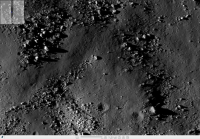
Here's a spectacular group of huge boulders near the top of Tsiolkovskiy's peak. Must be quite a scenery seen from the ground. Can you imagine yourself hiking in there?
Posted by: marsbug Sep 2 2009, 01:52 PM
I can imagine some 1/6 g rock scrambling and bouldering going on there! Looking at such rough terrain makes me wonder if there are any (much) smaller versions of the permanantly shadowed craters at the poles? A crevice or crater in the middle of such an outcrop would be sheltered from sunlight at comparatively low lattitudes I imagine.
Posted by: Phil Stooke Sep 2 2009, 02:05 PM
That's a very interesting point. In effect it's what the Apollo 16 astronauts looked for at Shadow Rock, south of North Ray crater, but that was really not a very good candidate. One objection to the idea of volatiles collecting in a crevice in a rock pile is that they may not last long enough. Small impacts probably break up boulders often enough that the crevices change or disappear, or get filled with ejecta, on too short time scales. Still, it's certainly possible. Makes me wonder about the much-talked-about idea of lava tubes as habitats - would they contain ice patches too?
Phil
Posted by: marsbug Sep 2 2009, 02:40 PM
I'd think so... in fact seeing as how easy it would be to make a lunar cold trap there should be a lot of them in various forms. It'd just be a case of picking the oldest and least disturbed. An ancient cold trap that got hit by a meteorite would probably leave a fingerprint of volatile species in the lunar exosphere.
Posted by: PDP8E Sep 2 2009, 04:02 PM
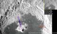
here is a context image for the Tsiolkovskiy image...I am not sure were to lay the strip, but I see now why there are boulder tracks and collections of boulders
Posted by: Zvezdichko Sep 4 2009, 06:27 PM
http://lroc.sese.asu.edu/news/?archives/103-Who-slammed-the-barn-door.html
New featured image. Measuring jitter.
Posted by: John Moore Sep 4 2009, 09:47 PM
Surely...the jitter-bug ![]()
Those LROC guys just don't get in enough dance routines in between uploading images, I'm thinking ![]()
John
Posted by: charborob Sep 9 2009, 07:18 PM
A new image: Timocharis crater.
http://wms.lroc.asu.edu/lroc_browse/view/M102242995R
Posted by: Phil Stooke Sep 15 2009, 03:04 AM
New data from all LRO instruments are expected to be released on Thursday... should be good!
Phil
Posted by: elakdawalla Sep 15 2009, 03:09 AM
Really? Awesome. Guess I'll have something productive to do during our Thursday morning staff meeting ![]()
--Emily
Posted by: Phil Stooke Sep 17 2009, 04:32 PM
A nice new image of part of Shackleton at LROC today.
Phil
Posted by: elakdawalla Sep 17 2009, 04:47 PM
COOL. Thanks for the heads up. I love the "The full NAC mosaic reveals a shelf on the southeast flank of the crater that is more than two kilometers across and perfectly suitable for a future landing."
--Emily
Posted by: Phil Stooke Sep 17 2009, 05:04 PM
... though I'm not sure what "southeast" means in this context.
Phil
Posted by: James Fincannon Sep 17 2009, 06:40 PM
--Emily
I think this is the area they are talking about (toward the bottom of the image). As Phil points out, directions are kind of useless near the Poles. But the upper part of the image is better illuminated due to the downward slope/Sun direction...so its the crater wall... not a good spot to land. So the more flat rim portion at the bottom of the image is a more likely spot to land, although it may not be near the best site to place the base (if we base it on having the shortest annual night period). I still need to get oriented on the image.
Didn't find any rolling boulders yet!!! Drat!!
Posted by: Phil Stooke Sep 17 2009, 07:27 PM
Earth must be generally towards the bottom of the image, from the location of the pole.
Phil
Posted by: stewjack Sep 17 2009, 11:26 PM
The Lunar Reconnaissance Orbiter Press Conference.
In case anybody missed it (like me) - an ASF video file can be downloaded at -
116 MB ASF file
http://www.space-multimedia.nl.eu.org/
or
http://bit.ly/Ahe4Y
Also replay tomorrow on http://www.nasa.gov/multimedia/nasatv/MM_NTV_Breaking.html
12:00 GMT
September 18, Friday
8 a.m. Eastern Time - Replay Lunar Reconnaissance Orbiter Press Conference - GSFC (Public and Media Channels)
Jack
Posted by: Phil Stooke Sep 18 2009, 12:43 AM
Comparing the MiniRF mosaic and the LOLA topo map... the big massifs in the LOLA map, the red areas (they are South Pole-Aitken basin ring mountains) look unusually dark in the MiniRF. I don't see it as just topographic shading, but can't figure out what it is yet.
Phil
Posted by: Stu Sep 18 2009, 10:42 PM
New image of Mare Insularum is up... now that's what I call a shadow! ![]()
Posted by: James Fincannon Sep 21 2009, 02:45 PM
FULL INLINE QUOTE REMOVED - ADMIN
Anyone trying to download the entire 504 Mb file should note the name is incorrect. It is...
http://lroc.sese.asu.edu/data/pr/tiff/nacl00001431.tif.tif
Posted by: 2amazing Sep 21 2009, 11:16 PM
I'am still waiting on new images with a high resolution in low orbit
Last relaesed image 25-aug.
Why must we wait so long for data? In 1969 we have live tv from the moon.
Of is there a direct link too these images?
Posted by: Phil Stooke Sep 21 2009, 11:48 PM
Patience! They have released plenty of images already. The new ones from half the height will not look very different for most targets. If you check the LRO website, the Operations Journal, you can read this:
"My name is Andrew, and I am currently an undergraduate Industrial, Systems and Operations Engineering student at Arizona State University, where LROC operations are based. At LROC, I am currently employed as the web developer. This means I am the person who is primarily responsible for maintaining, developing and making updates and additions to the LROC website (as well as other websites for associated projects)."
Bearing in mind that they are getting a Niagara of data every day, and the website is updated by a busy student, I think they are doing a great job already. There's just too much downlink to have every image, every day the way MER does it.
Phil
Posted by: charborob Sep 22 2009, 02:07 AM
A new image has been posted: a spectacular oblique limb view:
http://wms.lroc.asu.edu/lroc_browse/view/M106797147
Posted by: James Fincannon Sep 28 2009, 06:01 PM
"nother LRO image
http://wms.lroc.asu.edu/lroc_browse/view/M104419352R
"The linear rille Rima Ariadaeus is found on the nearside of the Moon, nestled between Mare Tranquillitatis and Mare Vaporum."
Posted by: Stu Sep 29 2009, 07:17 PM
Ooohh!! "Apollo 11 Second Look"... ![]()
http://wms.lroc.asu.edu/lroc_browse/view/M104362199R
Posted by: Phil Stooke Sep 29 2009, 07:46 PM
Cool! And still in the commissioning orbit, so the final views will be twice as good.
Phil
Posted by: eoincampbell Sep 30 2009, 05:09 AM
So ... what's best for finding the actual site with Stu's Zoomify link?
Posted by: remcook Sep 30 2009, 07:29 AM
This is something like 'Where's Waldo' to me ![]()
Posted by: Stu Sep 30 2009, 07:32 AM
Over on the dedicated LRO/Apollo landing site images thread I posted a link to a pic that will help you find the landing site ![]()
Posted by: charborob Oct 7 2009, 08:19 PM
Three LROC images have been released in the last week or so.
http://wms.lroc.asu.edu/lroc_browse
Are we getting bored already, or maybe the images are not spectacular enough? Anyway, they are not arousing much response here. Spoiled kids that we are!
Posted by: James Fincannon Oct 7 2009, 08:51 PM
I've been downloading and looking at them. But with no boulder tracks, I have little to report.
Also, you gotta agree that your eyes start to cross if you look at the entire image at full resolution (by stepping through it) and that if you have seen alot of craters and a few boulders, its hard to get that excited unless you really are looking for something.
I was hoping for more images near the south pole.
I am excited about the data on this page from the LOLA instrument!
http://svs.gsfc.nasa.gov/vis/a000000/a003600/a003633/
Posted by: Phil Stooke Oct 12 2009, 07:44 PM
http://lroc.sese.asu.edu/news/?archives/122-Ejecta-sweeps-the-surface.html
This looks like the first image from the lower orbit to be released. Very high sun, so no shadows but interesting albedo variations.
Phil
Posted by: Zvezdichko Oct 12 2009, 08:53 PM
Very bright impact ejecta which is natural for fresh craters. Wonder what the spectrometers will tell us about composition
Posted by: Gsnorgathon Oct 12 2009, 09:54 PM
Holy cow! I'm awfully cynical about the moon sometimes (boring old atmosphere-less dry rock with hardly any volcanoes to liven things up), but these are just gorgeous. Who needs shadows?
Posted by: Zvezdichko Oct 14 2009, 10:19 AM
http://lroc.sese.asu.edu/news/?archives/126-Asymmetric-Ejecta.html
You missed this ![]()
Asymmetric ejecta
Posted by: Phil Stooke Oct 15 2009, 07:53 PM
Fabulous collection of rolling and bouncing boulder trails on the latest LROC image...
http://wms.lroc.asu.edu/lroc_browse/view/M107985155LE
Phil
Posted by: James Fincannon Oct 15 2009, 08:40 PM
Wow, those are great! The "bouncing boulder" tracks seem to go on pretty far. Does that make sense? The sustained dynamics over such a long distance seem to be unlikely. Yet there they are!
Posted by: Phil Stooke Oct 20 2009, 01:06 AM
Rolling rock alert, James!
http://wms.lroc.asu.edu/lroc_browse/view/M104227032L
Phil
Posted by: James Fincannon Oct 20 2009, 04:49 PM
These rolling boulders are interesting. Note how the one I show here (went ~1.2 km on this image) doesn't seem too bothered by a crater but gets a course change by another toward the end. Probably due to alot of energy early in the rolling. This would make a good dynamics analysis to figure out.
What is the maximum distance a boulder could roll or bounce? I haven't seen (or can't remember seeing) that being done.
Posted by: kenny Oct 20 2009, 08:44 PM
Distance rolled would depend on whether it's travelling under gravity down a slope (maybe after being dislodged by a quake or ground shaking from a nearby impact ), or whether it's an ejecta boulder with sideways kinetic energy addtional to anything deriving from gravity. Thrown stones skipping across a pond come to mind...
Posted by: AndyG Oct 21 2009, 09:10 AM
You'd need to find evidence of ejecta rolling: perhaps examples of tracks starting on the level, or going substantially up-slope beyond a starting potential energy.
But bear in mind that the moment of inertia for a rolling rock is mainly dependent on its mass (since we need "round" rocks to roll at all, the shape's effect on inertia is less crucial).
The likelihood for a rolling rock to embed itself and stop rolling is partly dependent on the surface material and its ability to support the rock - this naturally relates to the weight of the rock.
So the Moon's clearly a better choice compared to the Earth: mass is the same, weight is not; the surface is largely homogenous: no damp, no vegetation, no atmosphere to help braking.
While it's tempting to think that the longest of these trails are perhaps caused by ejecta hitting the ground at shallow angles - ejecta which already has a roll imparted at launch, that can aid such long track-making - I'm not sure that's necessarily the case. The Moon's just a better place for <ahem> rock and roll.
Andy
Posted by: James Fincannon Oct 21 2009, 03:25 PM
The likelihood for a rolling rock to embed itself and stop rolling is partly dependent on the surface material and its ability to support the rock - this naturally relates to the weight of the rock.
From a prior LRO offering (http://wms.lroc.asu.edu/lroc_browse/view/M107985155LE), one of the tracks showed an oblong boulder that somehow bounced a considerable distance (I attach an excerpt at 2X), ~1.5 km.
I assume the boulders are fairly rigid, so what can I infer about the regolith? I remember seeing the inferred regolith characteristics from boulder tracks and they focused mainly on the width/deepness of the track and the mass of the boulder, but nothing regarding implication of bouncing boulders.
We need to get the LOLA data to understand these slopes better and start doing these calculations in earnest.
Posted by: Phil Stooke Oct 22 2009, 12:51 AM
Another rolling boulder...
http://lroc.sese.asu.edu/news/?archives/134-Bright-Boulder-Trail.html
But unlike any lunar image I've ever seen before. LROC is amazing - it's like a whole new moon.
I think slope processes like those on view all over this image are some of the most visually striking things we're seeing in these images.
Phil
Posted by: nprev Oct 22 2009, 01:10 AM
That's an interesting one. You can see what look like several older boulder trails as well in the image.
Wonder if we'll get lucky & get some before & after shots of an event. This looks like something that happens relatively frequently!
Posted by: climber Oct 22 2009, 05:04 AM
We even get one seen close by by Apollo 17! Do we know when this one rolled down?
Posted by: jasedm Oct 22 2009, 05:58 AM
I seem to recall that the huge boulder at Taurus Littrow in that well-known Apollo 17 photo, was thought to be an ejecta block - so was 'flung' rather than rolled into position.
Posted by: Phil Stooke Oct 22 2009, 10:09 AM
I'm not aware of any statement like that in the literature.
Phil
Posted by: kenny Oct 22 2009, 10:43 AM
My earlier speculation on the movement of the Apollo 17 Morth Massif Split Rock and its descent trail was that it has moved as a result of incremental thermal creep, by preferential expansion in the downhill direction of least soil resistance, due to heating in the lunar day. The slope there seems to me not to be steep enough for such an enormous and unevenly shaped boudler to roll (when it was one piece before it split apart).
If this is correct, or at least plausible, we may have 3 methods of boulder transport which leave trails, in decreasing order of speed:
- ejecta bouncing across surfaces
- gravity tumbling/rolling/ sliding
- thermal creep over millennia.
Posted by: Phil Stooke Oct 22 2009, 11:31 AM
"The slope there seems to me not to be steep enough "
Do you mean the slope at Station 6, where the rock is now? That's where it stopped rolling, not where it started, so we might expect it to be 'not steep enough' to roll.
Phil
Posted by: kenny Oct 22 2009, 01:25 PM
I mean my general impression of the immediate part of the slope leading down to the boulder at Station 6, over which the rock rolled or slid, apparently gouging out a deep track or channel. The boulder track is evident as a sort of channel leading towards the boulder from the right side of this pan. The astronauts walked through this channel, as their footprints show.
http://www.hq.nasa.gov/alsj/a17/a17.1653338_pan.jpg
My admiitedly superficial impression is that the general slope angle is low for a gravity roll, but as you say, it ran out of energy and stopped here, perhaps for that reason. However, the depth of the track is very considerable, and I wonder if such a depth could really have been made by a boulder rolling over the surface - as opposed to my alternative thought that it was a partially embedded boulder moving downhill by creep over long periods of time.
http://cumbriansky.files.wordpress.com/2009/07/lroc_a17_station_6-p-stooke.jpg
I can't find your orginal post of this picture, but the above is a re-post. Looking at it again, I think seeing the track from above does suggest the rolling of an irregular boulder rather than the uniform track width which the "ploughing boulder" might generate.
So I'm coming back to a rolling stone (!).... but still curious as to whether the ploughing boulder pehnomenon, caused by thermal expansion creep, might be seen elsewhere on the moon.
Posted by: jasedm Oct 22 2009, 09:48 PM
Phil
I was curious as to why I remembered reading that the boulder was assumed to have been thrown from a nearby crater, so checked in some of my books. Sure enough, in 'Planetary Geology' (1979 edition Guest, Butterworth, Murray, O'Donnell) the authors assert this most confidently. The fact that the boulder is in two pieces in situ perhaps made this seem the most likely explanation at the time. (i.e it split in two when it re-impacted)
However, having now seen the boulder and associated furrow from LRO, it's clearly rolled or bounced into position.
Jase
Posted by: kenny Oct 22 2009, 10:15 PM
Well done for finding that significant reference!
Science is natural selection... the evolution of ideas.
Posted by: peter59 Oct 31 2009, 06:30 PM
Very atypical picture, I can't recognize that this is a photo of the Moon. Looks rather like Mars image.
http://lroc.sese.asu.edu/news/uploads/LROCiotw/M110383422L_fi.png
Posted by: Fran Ontanaya Nov 6 2009, 03:35 AM
Oh, Lunar gullies. Dry or wet? ![]()
http://lroc.sese.asu.edu/news/index.php?/archives/141-Landslides-in-Marius-Crater.html
Posted by: kenny Nov 6 2009, 06:10 PM
http://lroc.sese.asu.edu/news/uploads/LROCiotw/M110383422L_fi.png
It doesn't look like melt, it looks like slump fractures.
(actually, it also looks like a dirty glacier flowing over a rock bench, but we won't go there...!)
Posted by: charborob Nov 18 2009, 12:14 AM
An interesting oblique view across the N rim of Cabeus crater:
http://wms.lroc.asu.edu/lroc_browse/view/M109937747
Posted by: Phil Stooke Nov 20 2009, 06:48 PM
This isn't LROC... sorry! But check out a new radar image:
http://www.nasa.gov/mission_pages/Mini-RF/multimedia/featured_image_20091110.html
Phil
Posted by: Stu Nov 21 2009, 10:28 AM
You want boulders? Here ya go...
http://wms.lroc.asu.edu/lroc_browse/view/M109305653LE
![]()
Posted by: sgendreau Nov 21 2009, 05:01 PM
FULL INLINE QUOTE REMOVED - ADMIN
That camera is incredible. Has it re-imaged any of the gullies in the old lunar pictures, to compare to martian gully morphology?
http://www.lpi.usra.edu/meetings/lpsc2006/pdf/1345.pdf for discussion of Moon gullies in photos taken by Lunar Orbiter V (1967.) They superficially resemble martian gullies, which therefore (per the author) could be dry landslides.
Maybe so, but Stu, you put up a HiRISE-imaged colorization of a martian gully with an island in it. Bet they don't find that on the Moon.
Posted by: Phil Stooke Dec 2 2009, 09:36 PM
Again not LROC, but I'm not sure we need a radar thread...
http://www.nasa.gov/mission_pages/Mini-RF/multimedia/featured_image_20091119.html
Nice radar images of craters, not polar but interesting. Comparisons between these and polar shadow craters may be useful later on.
Phil
Posted by: Phil Stooke Dec 3 2009, 03:15 PM
Some great new presentations about LRO among other things here:
http://www.lpi.usra.edu/meetings/leag2009/presentations/index.shtml
See especially two presentations by Mark Robinson, one with high resolution LROC images of the interior of Shackleton.
Phil
Posted by: charborob Dec 4 2009, 03:33 AM
A new image showed up on the LROC site: interesting debris flows and more rolling boulders.
http://lroc.sese.asu.edu/
Posted by: Phil Stooke Dec 4 2009, 03:48 AM
Yes, I love the debris flows on this one, especially on the right side.
Phil
Posted by: Phil Stooke Dec 4 2009, 01:34 PM
One thing from the LEAG presentations - the first LROC data release to PDS will be mid-March 2010. That will be fun!
Phil
Posted by: NGC3314 Dec 4 2009, 07:49 PM
Full inline quote removed - ADMIN
And very shortly thereafter, watch for Moon Zoo from some of the same folks who brought you Galaxy Zoo. Craters and boulders and peaks, oh my!
Posted by: Phil Stooke Dec 11 2009, 01:05 AM
If you go to the main LROC page:
http://lroc.sese.asu.edu/
and mouse over the featured image, you see that it's now referred to as 'Image of the Week' . Uh-oh - not a good sign. C'mon LROC, you can do better than that! And after I'd defended you so much in the past as well.
On the bright side, we might see some releases for the AGU meeting.
Phil
Posted by: peter59 Dec 19 2009, 03:31 PM
LROC NAC Image Prerelease
Over 700 NAC frames in PDS EDR format are now available for download:
http://lroc.sese.asu.edu/data/LRO-L-LROC-2-EDR-PRERELEASE/COM/
Browse (tiff)
http://lroc.sese.asu.edu/data/LRO-L-LROC-2-EDR-PRERELEASE/EXTRAS/BROWSE
Posted by: Phil Stooke Dec 22 2009, 11:39 AM
Darn! I'm travelling and can't play with these new images. But obviously lots of goodies here. I'll get into them in the new year.
PS check out the LEAG presentations at the LPI website... a couple were added recently, including a great one by Mark Robinson with a fab high sun image of Apollo 16.
Phil
Posted by: TerryH Dec 29 2009, 01:30 PM
Over 700 NAC frames in PDS EDR format are now available for download:
http://lroc.sese.asu.edu/data/LRO-L-LROC-2-EDR-PRERELEASE/COM/
Browse (tiff)
http://lroc.sese.asu.edu/data/LRO-L-LROC-2-EDR-PRERELEASE/EXTRAS/BROWSE
I downloaded a couple of LROC NAC Prerelease TIF images but am unable to open them in Photoshop. I get a message 'Could not open because of a problem parsing the TIFF file'. Should I be able to open them in Photoshop? If not, is there a viewer I could use instead. I have tried NASA View but that doesn't appear to allow me to create layers or annotate the images.
Posted by: peter59 Dec 29 2009, 02:03 PM
Just use Irfan View.
Posted by: James Fincannon Dec 29 2009, 03:06 PM
I just downloaded one of the tiff browse images and used Adobe Photoshop CS2 to open it. Perhaps you downloaded it in ASCII or the download was just bad or something.
Posted by: Phil Stooke Jan 2 2010, 12:58 PM
I downloaded the metadata file accompanying the new LROC release and plotted the locations of images (very roughly - only meant as a rough guide) - the things I wanted are not here but lots of other stuff is. The browse images are 50% resolution,which is pretty good. I'd love a clickable map interface!
Phil
Posted by: Phil Stooke Jan 3 2010, 02:41 PM
Nice LROC image of Apollo 16 with a high sun angle. This is from Mark Robinson's presentation at LEAG last fall.
Phil
Posted by: peter59 Jan 3 2010, 08:40 PM
Mare Orientale viewed with high resolution.
1. Lunar Orbiter 4 - image 4184_med
2. Lunar Orbiter 4 - image 4195_h1
3. Lunar Reconnaissance Orbiter - image M102788040RE_pyr
Posted by: charborob Jan 14 2010, 09:02 PM
At last! My favorite: the floor of Tycho crater imaged by LROC
http://wms.lroc.asu.edu/lroc_browse/view/M102230053LE
Lots of interesting structures.
Posted by: Phil Stooke Jan 14 2010, 09:12 PM
Beautiful! But not such a good place to drive around in..
Phil
Posted by: helvick Jan 14 2010, 10:23 PM
Oh my God! It's full of ..... boulders!
And a lot of dust too. Beautiful certainly but traversing it would be quite a challenge alright.
Posted by: volcanopele Jan 14 2010, 10:38 PM
Some of those cracks in the regolith remind me a lot of those on Enceladus (a great indication of just how fresh Tycho is).
Posted by: charborob Jan 15 2010, 12:52 AM
Quite a challenge to land there in the first place.
Posted by: Phil Stooke Jan 31 2010, 04:52 PM
There's a new LROC pre-release out today. I downloaded the metadata file and plotted image locations - here's a map. Most of the new stuff is over the far side, including SPA.
Phil
I haven't done anything with it yet, but there are enough pics of the south pole to search for Chandrayaan' MIP's impact site, maybe, or possibly some of the other farside impacts such as Ranger 4.
PS I've found it useful to download the big data file, put it in Excel, strip out all the columns except the image number and one corner lat-long pair, and sort by longitude. Then for any location of interest I can look for its longitude, and find any latitude that might be useful for me, and check the image number. Then into the browse folder to find that image.
Posted by: Phil Stooke Feb 1 2010, 02:37 AM
In quite a lot of the polar images I find I can see details in the shadows in LROC images. It will be good to see the LCROSS area at LROC resolution... or Lunar Prospector.
Phil Stooke
Posted by: James Fincannon Feb 1 2010, 02:59 PM
Phil Stooke
Alot of interesting images.
I came across what I like, which are side views (perhaps called limb views)....M103290270L and M103290270R;M103261640L and M103261640R. I could not find any others in the set with similar orientation.
If you adjust the contrast on these tif images, you see a slightly lighter area above the horizon. Could this be related to the levitated dust (which I don't believe has been confirmed for near the poles) or is it an artifact of the camera or even the image processing?
Posted by: djellison Feb 1 2010, 03:19 PM
Simplest explanation is internal reflections etc. within the camera. If the levitated lunar dust were that obvious - we'd have amateur astronomers seing it all the time from the Earth.
Posted by: Phil Stooke Feb 1 2010, 03:22 PM
Yes, Doug - and also proper calibration, subtracting dark images etc - personally I think the dust issue is being exaggerated. In general, not in James's post.
Phil
Posted by: Stu Feb 4 2010, 07:05 PM
(very crudely! hah!) stitched together some screengrabs from a wander across this rather fascinating image...
"Impact Melt Flow NE of Byrgius A Crater" http://wms.lroc.asu.edu/lroc_browse/view/M102573276L
Posted by: kenny Feb 4 2010, 10:32 PM
Now that is astonishing - it must be one of the freshest non-bombardment features on the moon? There's hardly a crater on it... it looks Hawaii.
Posted by: hendric Feb 5 2010, 04:57 PM
Speaking of which, I can't recall if any "fresh" natural lunar craters have been spotted yet. Have any of the orbiters found any clearly new craters since orbital surveys were started?
Posted by: charborob Feb 5 2010, 06:20 PM
I suppose you are talking about natural craters, and not those that were created by the various pieces of hardware that were crashed on the Moon on purpose by humans.
It would mean comparing Lunar Orbiter and Apollo metrics with LRO or Kaguya images.
Maybe we can try to find http://science.nasa.gov/headlines/y2006/13jun_lunarsporadic.htm in LROC images.
Posted by: Phil Stooke Feb 5 2010, 06:59 PM
That comparison will be done, but it hasn't been done (or reported on) yet - we may get some news at LPSC.
Phil
Posted by: hendric Feb 5 2010, 11:05 PM
Charbob,
Thanks for that link! I went ahead and took their GIF animation and stacked it to try to locate the strike.
I stacked all 19 frames. My best estimate of where to look is -24.84, -19.79 according to Google Earth in Moon mode. It was hard because the curvature of the moon was difficult to handle between the GIF and Google Earth. I imagine you imagesmiths here can really goto town on it with Celestia etc.
http://target.lroc.asu.edu/output/lroc/lroc_page.html
I didn't see any pending request for the exact area I had selected, although I did see some green markers nearby.
Posted by: nprev Feb 5 2010, 11:13 PM
One thing that might affect recent crater detection is that the 'background noise' of impacts on the Moon is much higher than that of Mars: very few indigenous surface modification mechanisms with considerably less regional influence that just that of Mars' minimal atmosphere.
Still, LRO should theoretically find a few, esp. if there's to be a series of extended missions. I wonder what effect the Earth has on the modern lunar cratering rate; we're kind of the Jupiter-wannabe in the inner solar system, after all.
Posted by: Phil Stooke Feb 22 2010, 02:14 PM
This isn't LROC, but we're in a lull in LROC data release while the ASU website is down. So instead, here are a couple of recent releases from the Mini-RF imaging radar:
http://www.nasa.gov/mission_pages/Mini-RF/multimedia/featured_image_Herodotus.html
http://www.nasa.gov/mission_pages/Mini-RF/multimedia/featured_image_Hadley_Rille.html
It's a very nice instrument. I'm looking forward to seeing the full resolution data from the LCROSS site and other areas like that - Lunar Prospector too.
Phil
Posted by: Phil Stooke Feb 25 2010, 02:09 PM
The LROC website is still down, though it should be fixed very soon. Meanwhile people might find this new gallery of LRO releases (mostly LROC but including others as well) useful.
http://www.nasa.gov/mission_pages/LRO/multimedia/lroimages/LROMoonImages_archive_1.html
There is also a bit of raw Diviner data here:
http://www.diviner.ucla.edu/data.html
Phil
Posted by: Stu Mar 2 2010, 08:18 PM
Lava tube "skylight" spotted..?
http://wms.lroc.asu.edu/lroc_browse/view/M114328462R
Posted by: Phil Stooke Mar 2 2010, 09:06 PM
They showed another one at LPSC, in Mare Tranquillitatis, where the sun reached the bottom in a small area. I think it was about 100 m across and 100 m deep. Not released yet.
Phil
Posted by: Phil Stooke Jun 23 2010, 08:54 PM
The second LROC release is now available via the PDS.
http://pds-imaging.jpl.nasa.gov/
Phil
Posted by: James Fincannon Jun 24 2010, 03:18 PM
http://pds-imaging.jpl.nasa.gov/
Phil
Phil,
Do you have any overlay maps generated for the south pole region yet? We seem to have enough images, but at least for me, my computer/Photoshop doesn't have enough memory (at resolution) to assemble more than 4.
James
Posted by: Phil Stooke Jun 24 2010, 03:48 PM
No, not yet, and I wasn't planning to make one, hoping it would just magically appear instead.
Phil
Posted by: James Fincannon Jun 24 2010, 05:09 PM
Phil
Probably USGS will do one eventually. But I am surprised some go-getter hasn't done it yet. I liked the one you did from Clementine images!
Powered by Invision Power Board (http://www.invisionboard.com)
© Invision Power Services (http://www.invisionpower.com)

