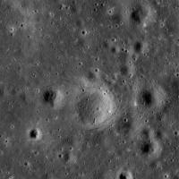
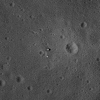
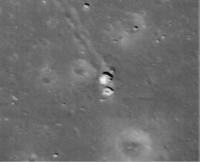
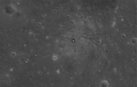
Printable Version of Topic
Click here to view this topic in its original format
Unmanned Spaceflight.com _ LRO & LCROSS _ Apollo Sites from LRO
Posted by: djellison Jul 17 2009, 02:52 PM
Thought this deserved a new thread- we can't talk about EVERY LRO target in the one thread ![]()
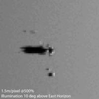
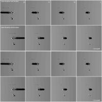
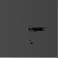
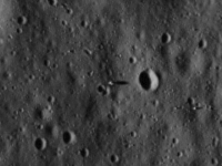
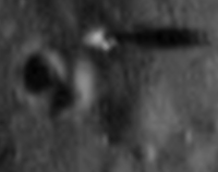
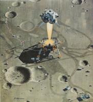
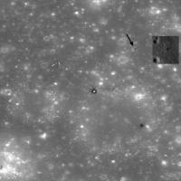
I made a mistake in this one - I didn't include the thruster plume guards. My MER/MPF simulation for HiRISE seemed to come out about right - so fingers crossed that this will be there or there abouts as well. Still in a comissioning phase, something of a slant angle - I'd expect approx 1.5m/pixel if it's at the 120km figure mentioned earlier.
Posted by: Phil Stooke Jul 17 2009, 04:10 PM
First glimpse...:
http://www.spaceref.com/news/viewnews.html?id=1338
(bottom of the page)
Phil
Posted by: Paolo Jul 17 2009, 04:21 PM
http://www.nasa.gov/mission_pages/LRO/multimedia/lroimages/apollosites.html
I had been expecting something better...
Posted by: Phil Stooke Jul 17 2009, 04:23 PM
And more:
http://www.nasa.gov/mission_pages/LRO/multimedia/lroimages/apollosites.html
(same as above) - remember the instrument's still being calibrated and the final orbit will be half the height, or even less.
Phil
Posted by: NGC3314 Jul 17 2009, 04:26 PM
Are those LRV tracks from Apollo 17? They look about right for one of the EVAs, headed east and then curving north around the crater, but I can't put my mouse on a large-enough scale traverse map to be sure that's the right place.
Posted by: Stu Jul 17 2009, 04:27 PM
Expected better? Sorry there are no individual footprints to be seen for you...! ![]()
These are AMAZING pictures when you think of what they represent. Better will follow. Let's enjoy these for now! :-)
Posted by: Tubo Jul 17 2009, 04:29 PM
Hello everybody!
Finally the images arrived!
Do you think we could expect any greater resolution, maybe through the lroc image browser?
Posted by: Paolo Jul 17 2009, 04:30 PM
yes of course! I just expected to see for example rovers and instruments...
Posted by: FordPrefect Jul 17 2009, 04:39 PM
Wow, this is so cool!
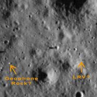
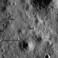
I don't know, I suspect the LRV of Apollo 17 should be a bit less south, it was finally parked about 154 meters east of the LM. My guess yet:
Posted by: djellison Jul 17 2009, 04:43 PM
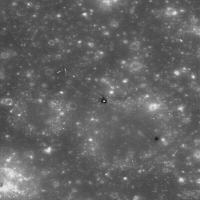
I was expecting a bit better. You can see the seismometer's western solar array just about. It's not map-projected, and calibration hasn't kicked in to fix that interlacing-look to the pictures.
MUCH better is to come - that's for sure.
This is roughly with the same illumination.
Posted by: djellison Jul 17 2009, 04:45 PM
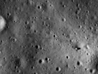
No. These thumbnails are at full resolution. We have to wait for the spacecraft to get into its final orbit before we go from these 1.2-ish m/pixel images to 50cm/pixel.
Posted by: Phil Stooke Jul 17 2009, 04:46 PM
Apollo 15 - certainly see the tracks all around ALSEP.
Phil
Posted by: Phil Stooke Jul 17 2009, 04:48 PM
Fordprefect - no, Geophone rock is casting the shadow just above left of your rock.
Phil
Posted by: nprev Jul 17 2009, 04:55 PM
It'll get better, but for now I'm really happy just to see these old friends from my youth again. ![]()
I'm only disappointed that they haven't snapped A12 & Surveyor 3 yet, but apparently that's gonna happen in a few weeks.
Posted by: Phil Stooke Jul 17 2009, 04:57 PM
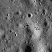
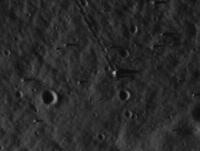
Here's Apollo 17, first quick look.
Phil
The LRV location is a bit vague... is it possible it's the object with a shadow just above my 'LRV' text?
Posted by: Ian R Jul 17 2009, 05:06 PM
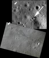
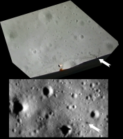
LRO view of Apollo 15 compared to mosaic made from ascent footage - the white arrow points to a piece of the descent stage insulation that was blown off during liftoff.
Posted by: Tubo Jul 17 2009, 05:08 PM
So far it seems that the Apollo 14 Landing site shot has got the greatest resolution, aren't the MET tracks the ones visible?
Posted by: djellison Jul 17 2009, 05:10 PM
A combination of shuffling astronauts and dragged met.
Posted by: Phil Stooke Jul 17 2009, 05:11 PM
Now you can zoomify the whole images at the LROC site - here's the Apollo 17 Station 6 boulder:
(Zoomify uses a compressed image so there are artifacts)
Phil
Posted by: Paul Fjeld Jul 17 2009, 05:11 PM
YeeHAHHH!!
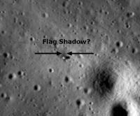
Great stuff! I make out the '11 site LM at about 200 pixels, some of the others, slightly less. You can clearly see the nozzle shadow going to the bulk of the stage with the plume deflectors very light. I'm trying to convince myself I see the flag - more to study. And they almost got all the sites! Really look forward to the best stuff to come - oh, yah... and all the new places to land and explore.
Posted by: Phil Stooke Jul 17 2009, 05:16 PM
The north end of the Apollo 11 image came within about 6 km of the Surveyor 5 site - so close...
(PS - how am I supposed to get any work done?)
Phil
Posted by: FordPrefect Jul 17 2009, 05:22 PM
Yes Phil, I concur with the Geophone rock shadow! ![]()
I know this is a wild guess for the Apollo 14 image, but could this be the...
Posted by: belleraphon1 Jul 17 2009, 05:43 PM
Luv It!
Craig
Posted by: Ian R Jul 17 2009, 05:57 PM
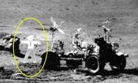
Apollo 16 ascent footage frame / LRO comparison:
Curiously, the LRV itself isn't visible, although the shadow it casts towards the east certainly is.
Posted by: Paul Fjeld Jul 17 2009, 05:57 PM
Or maybe the big S-band deployable antenna...
Posted by: jmknapp Jul 17 2009, 06:05 PM
Wow. LRO has really come out of the gate hitting on all cylinders. Very evocative shots.
Posted by: Tubo Jul 17 2009, 06:05 PM
I would go for the antenna too, even though it wouldn't cast a so distinct shadow...
Do you think the nylon of the flag would survive 40 years up there?
Posted by: Ian R Jul 17 2009, 06:06 PM
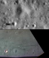
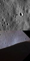
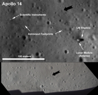
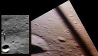
Apollo 14 ascent / LRO comparison - the black arrow in both images is pointing toward Turtle Rock:
Posted by: Ian R Jul 17 2009, 06:26 PM
Apollo 11 descent footage frame compared to LRO view. Both have been oriented so that west is 'up':
Posted by: Ian R Jul 17 2009, 06:31 PM
Probable locations of LRVs (definite in the case of Apollo 16):
Posted by: Paul Fjeld Jul 17 2009, 07:05 PM
The main NASA LRO site has larger views centered around the landing sites:
http://www.nasa.gov/mission_pages/LRO/multimedia/lroimages/apollosites.html
This one, from '11:
http://www.nasa.gov/images/content/369440main_lroc_apollo11_lrg.jpg
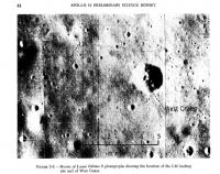
...really shows West crater and those big boulders Armstrong decided against landing next to.
Posted by: FordPrefect Jul 17 2009, 07:06 PM
Do you think the nylon of the flag would survive 40 years up there?
Maybe. One should remember though that the S-Band antenna blew over during the hot-fire jets check shortly prior lift-off. MET shadow?
Posted by: Paul Fjeld Jul 17 2009, 07:09 PM
Even on its side, its bigger than the MET...
I think you nailed 'em.
Posted by: Tubo Jul 17 2009, 07:16 PM
Yes, let's wait for higher res images.
Guys, I'm so excited with these yet!
Posted by: Paul Fjeld Jul 17 2009, 07:46 PM
Anybody else having trouble finding the landing sites from the Zoomify big pictures on the LROC site? Man! I keep scrolling, hunting, but I can't find anything yet. Maybe I'm too excited. I'm using the larger scale maps from Lunar Orbiter for context, putting the image in Lat/Long focus around the published location for the site, and still no use... I thought I had a good eye! If anybody can give me a rough location on the big strip for Apollo 14, I would be much obliged.
Posted by: Phil Stooke Jul 17 2009, 07:51 PM
Look on the extreme right side - Triplet crater only just makes it onto the image.
Phil
Posted by: Paul Fjeld Jul 17 2009, 08:18 PM
Thanks! Maybe an eighth of the image height above the center.
I was scanning for Cone crater and Triplet but, of course, no Cone crater. We'll have to look for the later shots to see exactly where Al and Ed ended up before turning back down the mountain without that view...
Posted by: jmknapp Jul 17 2009, 08:19 PM
I see a lot of parking tickets under the wiper.
Posted by: belleraphon1 Jul 17 2009, 08:36 PM
I was scanning for Cone crater and Triplet but, of course, no Cone crater. We'll have to look for the later shots to see exactly where Al and Ed ended up before turning back down the mountain without that view...
Yeah... I finally found it. Not easy. What clued me in was a comment from the teleconference that Cone Crater was out of view on the image track to the east. So I scrolled up the right side of the image until I saw Triplet.
Interesting that we can see the tracks from EVA 1 but I see nothing to the east for EVA 2. I assume the lighting might have something to do with it, or it is because EVA 1 was more scuffed up and traveled?
Can't wait for the highr res including the Cone crater traverse.
Craig
Posted by: belleraphon1 Jul 17 2009, 08:39 PM
Ok... I just submitted post #41 and now I think I do see a very faint track to the east on the Apollo 14 image.
Craig
Posted by: dilo Jul 17 2009, 09:59 PM
Sirs, I am speechless, first due to these LRO images (and perfect timing of release) and second for the great identification effort you're doing...
Is like to see man on the moon for the second time! ![]()
Posted by: dvandorn Jul 17 2009, 11:21 PM
Seems strange to see the sites with sun from the west, though. Never saw these sites in afternoon sun before!
I am *really* looking forward to the pics that will come down from the science orbit!
-the other Doug
Posted by: PDP8E Jul 17 2009, 11:51 PM
Here is an attempt to enhance the immediate Apollo 11 site from LROC
The striping of the camera system is apparent; just pushing noise around at this altitude and with no calibration
Cheers
Posted by: charborob Jul 18 2009, 12:26 AM
Here's an interesting view: a crop of the Apollo 16 image showing North Ray crater and House Rock (in the center of the image). For me, one of the highlights of the whole Apollo expeditions.
Posted by: jmknapp Jul 18 2009, 12:47 AM
Maybe they'll wait until they get even closer to look in earnest, but one of the science goals of reimaging the sites also photographed at close range by the Apollo cameras is to look for evidence of fresh impacts, to get a handle on how often they occur & quantify the risk to a moon base.
Posted by: ElkGroveDan Jul 18 2009, 12:52 AM
Imagine the reaction after all this talk about historical preservation, if we finally got a look at the A11 site and it was occupied by a large fresh new crater and nothing else. Fortunately that didn't happen (yet).
Posted by: nprev Jul 18 2009, 12:58 AM
One of my nightmares, too.
Fortunately, I'm optimistic that the meter-thick transparent artificial diamond dome over the entire site will be completed on schedule by the fourth quarter of fiscal year 2329... ![]()
EDIT: It is my sad duty to report the passing today of legendary newsman http://www.chicagotribune.com/news/nationworld/sns-ap-us-obit-walter-cronkite,0,2702457.story, who was iconic to US viewers as the face of TV coverage for the Apollo 11 flight. How bitterly ironic. ![]()
Posted by: jekbradbury Jul 18 2009, 01:02 AM
Another attempt on the A11 image, using GIMP's Destripe filter and two runs of the NEDI upscaling algorithm:
Posted by: jmknapp Jul 18 2009, 01:07 AM
Well, I can say I heard it first on UMSF.
<taking off glasses>
Posted by: Paul Fjeld Jul 18 2009, 01:08 AM
One of LRO's goals is to characterize possible future unmanned and manned landing sites - what constitutes a hazard and where are you pretty much guaranteed to drop something in comfortably. Looking at the Apollo 11 approach, I wonder if such a characterization would not include the area before Baby West. It's clear that Armstrong looked there and changed his mind to overfly the last crater (not a small risk in itself), but I can't see anything at this rez which should hurt a landing. We need the higher resolution from the lower orbits of course, but I wonder what this will do to landing zone criteria or if it will just start silly debates and Monday morning (40 years later) quarterbacking, which I am endeavoring not to do here. ![]()
Posted by: Paul Fjeld Jul 18 2009, 01:23 AM
That is stupendous! I think that when all of the sites are shot and processed to their best, it will be a very great pleasure to put on a DVD and watch the EVAs with these images on hand. Perhaps someone will generate a really fine quality 3d environment from them and we can even, one day, walk along with those explorers.
Posted by: dvandorn Jul 18 2009, 01:31 AM
Paul, I think I see a higher population of boulders in the relatively clear area you've outlined than in the area where the LM is located. And seeing as there are fewer boulders visible on the rim and ramparts of West in the LROC image than can be seen on the descent film, I'd imagine that the actual boulder population short of Little West was the determinant in Neil's choice to continue on downrange.
IIRC, you can see the boulder population throughout that area short of Little West in the descent film, and it seems to me that it was the natural outlying fan of ejecta from West. I can certainly understand if Neil, seeing the boulder field thin out, would want to overfly the ejecta field entirely.
-the other Doug
Posted by: Paul Fjeld Jul 18 2009, 01:39 AM
Very good point. So it will be interesting when the highest resolution images come down of that area before Little West to see if those boulders are visible. If not, then how do you characterize a safe landing site from these images?
I've seen a paper somewhere (wish I could remember) describing a system with LIDAR images that are scanned and analyzed automatically for safe zones - perhaps you put in some smarts that adds a buffer to ejecta blankets (call the routine ArmstrongSmarts)?
Posted by: PDP8E Jul 18 2009, 01:54 AM
Jekbradury...awesome de-stripe-ing!!
Posted by: stevesliva Jul 18 2009, 01:55 AM
On this day, of all days, Walter Cronkite dies... crazy!
Posted by: robspace54 Jul 18 2009, 02:03 AM
Armstrong's said something like that the auto-targeting was taking them into a boulder strewn crater. And a pilot's adage "When in doubt, land long." He did land long, and that worked just fine, thank you very much. If Eagle had been a robot, she would have gone down in that crater, likely to no good end...
Also rememebr that at that point in their descent (you'd have to overlay the ground track under the altitude and velocity profile) they were not in a hover and still had some horizontal velocity to shed. So old Neil put the descent engine thrust more vertical and flew Eagle to a better spot. I guess he was right! :-)
These are fantastic photos and I am enjoying this side discussion very much.
Rob
Posted by: Paul Fjeld Jul 18 2009, 02:09 AM
No question he was right! My interest is in how LRO data will characterize an area we know a person would not consider good - are half-meter boulders okay? Armstrong thought not, even though he had already gone past the serious danger of the big West's boulder field and had shed most of his forward velocity by the time he arrived near Little West.
Posted by: robspace54 Jul 18 2009, 02:14 AM
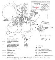
This one is a vertical view from the Eagle during rendezvous. Note the CM below and the "estimated" landing point.
Posted by: glennwsmith Jul 18 2009, 08:51 AM
Belleraphon1, even before reading your posts re the Apollo 14 landing site, I was pretty sure I saw tracks wandering off to the east/north east. And this is exactly in the direction of Cone Crater! BTW, I am not as up on my Apollo history as I should be, but the edge of Cone Crater is about 1 km from the landing site. That's pretty nervy, walking that distance from the [relative] security of the LEM!
robspace54, i's a very useful diagram you've dug up, of the various camera angles etc. around the Apollo 11 landing site.
Posted by: ilbasso Jul 18 2009, 12:41 PM
Does anyone else see a black dot in the approximate location the flag was? Can't tell if it's a small crater, a processing artifact, or if something is actually casting a shadow. I know that the LMP said the flag blew over - I just think this is an interesting coincidence.
Posted by: robspace54 Jul 18 2009, 01:26 PM
robspace54, i's a very useful diagram you've dug up, of the various camera angles etc. around the Apollo 11 landing site.
As for nervy, think about where they were and what they were doing!
I can also see that black dot, but based on the "map" it looks too close to the descent stage. BUT... if you look almost due south about 3 "LMs" away the EASEP seismometer is visible. It is a rectangular looking blob, long axis north-south, with a shadow to the east.
I also "see" the LRRR just meters north of the seismometer.
Rob
Posted by: jekbradbury Jul 18 2009, 04:30 PM
Here's the Apollo 14 landing site, with the same processing:
Posted by: ilbasso Jul 18 2009, 04:40 PM
This processing technique "doubles" some of the small craters, does it? I assume it's due to the compression? Or is it just my imagination too? Both this and the A11 site look like they have rabbit or deer prints across them.
Posted by: Phil Stooke Jul 18 2009, 04:41 PM
A bit more on Apollo 14:
The tracks from Station A to Station B are very clear, even the little loop they did at Station B around a little crater. Tracks from LM to A are visible too. I can't see the return tracks from Station G around North Triplet at all.
(no crater doubling here - it's all in how you deal with the stripes!)
Phil
Posted by: belleraphon1 Jul 18 2009, 04:52 PM
I can also see that black dot, but based on the "map" it looks too close to the descent stage. BUT... if you look almost due south about 3 "LMs" away the EASEP seismometer is visible. It is a rectangular looking blob, long axis north-south, with a shadow to the east.
I also "see" the LRRR just meters north of the seismometer.
Rob
glennwsmith and robspace54.... yeah that is why Apollo 14 is one of my favorite missions. They were really extending their EVA reach, given no Rover.
Any yeah, I am pretty confidant now those are the tracks going NE. They follow the mission plot pretty well.
Cannot wait to see Cone Crater.
Listen to the transcipts here
http://history.nasa.gov/alsj/a14/a14.html
Posted by: Paul Fjeld Jul 18 2009, 05:25 PM
Amazing processing! It almost seems dead certain that all of the site images will have clear EVA trails when LRO is done.
Rob, you've convinced me about the '11 seismometer.
(I've gotta get back to work!)
Posted by: lyford Jul 18 2009, 06:04 PM
Can't wait for Apollo 12 and the images of an actual unmanned spacecraft ![]()
BTW, this thread is phenomenal. I am in awe at how fast board members update the imagery with the dialog- moving at the speed of thought!
Posted by: Phil Stooke Jul 18 2009, 08:19 PM
This is Apollo 17 station 6, the big split boulder. If you compare it with my first view of it (page 2 of this thread), this is much better. This is from the raw TIFF file, which is much better to work with than the zoomify version. Thanks, Mark Robinson, for letting us have this so soon.
Phil
PS - there's a fantastic mountaintop south of the valley at this site with a huge cluster of boulders on it.
Posted by: Phil Stooke Jul 18 2009, 09:11 PM
This is Apollo 17 station 5 on the edge of Camelot crater. It's the place where the famous images of an astronaut in a dramatic boulder field were taken. The rocks are visible along the rim, but no tracks I can make out.
Phil
Posted by: Stu Jul 18 2009, 09:48 PM
This one..?
http://www.lpod.org/wp-content/uploads/2007/12/Ap17-pan.jpg
Posted by: Phil Stooke Jul 18 2009, 09:56 PM
Yes, that one. Pretty nice, huh?
Phil
Posted by: Stu Jul 18 2009, 10:35 PM
One of my personal fave images, actually. Showed it in my talk last night, and it always impresses people. I think it's the contrast between the fragile-looking, puffy spacesuit and the OMG They Look Sharp! pointy rocks in the foreground... ;-)
Posted by: NickF Jul 19 2009, 11:01 AM
Any yeah, I am pretty confidant now those are the tracks going NE. They follow the mission plot pretty well.
Cannot wait to see Cone Crater.
Listen to the transcipts here
http://history.nasa.gov/alsj/a14/a14.html
New Scientist has a nice gallery feature ("What if the Eagle had landed on Earth") showing the area covered during the respective moonlandings superimposed on a map of central London. The Apollo 14 map is http://www.newscientist.com/gallery/dn17461-moon-landings-in-london-ny-sydney/4
Posted by: climber Jul 19 2009, 11:49 AM
I like it. Anyway, what would be nice will be to put the LM at Victoria near Duck's bay entrance and do the same for the 6 landings.
This will put it more in a UMSF perspective. ![]()
Posted by: Lightning Jul 19 2009, 12:07 PM
Very nice job guys, the images are really great !
Posted by: Stu Jul 19 2009, 12:18 PM
Stunning image processing work guys, I'm in awe of your skills, as usual...!
Thanks to everyone who gave me permission to use their work in my CS blog post about these fantastic images from LRO... ![]()
http://cumbriansky.wordpress.com/2009/07/18/apollo-revisited.
Posted by: Zvezdichko Jul 19 2009, 02:07 PM
Broken link
Posted by: Stu Jul 19 2009, 06:17 PM
Aaggghhh! Apologies anyone who tried to access that; glitch meant that Wordpress didn't accept the change from Private to Public status of the post. Working now at http://cumbriansky.wordpress.com/2009/07/18/apollo-revisited
Posted by: nprev Jul 19 2009, 06:26 PM
Working fine now, Stu. Excellent post! ![]()
Posted by: dvandorn Jul 19 2009, 06:36 PM
I know it has a lot to do with a variety of factors, including sun angle and such, but I'm impressed that the MET tracks in the Fra Mauro images are more visible than LRV tracks are in the Hadley, Descartes and Taurus-Littrow images.
Perhaps the tracks at Fra Mauro are more visible because they are accompanied by a track of footprints (which are more visible in the J-mission site images than are areas where you would only find LRV tracks). But I'm a little surprised that LRV tracks, when unaccompanied by footprint tracks, are far less visible than I would have expected.
-the other Doug
Posted by: dvandorn Jul 19 2009, 06:41 PM
BTW -- my roommate seemed a little disappointed with the Fra Mauro image.
"Where's the golf ball?" is what he said to me.
![]()
-the other Doug
Posted by: John Moore Jul 19 2009, 08:21 PM
http://www.hq.nasa.gov/alsj/a14/a14det9337.jpg one
John
Posted by: kenny Jul 19 2009, 10:01 PM
At the beginning of this thread there is some discussion about the visiblity of the flags. Doubtless this will be re-visited when higher-res images of the sites become available. If still upright, we'd perhaps be looking for a shadow, or if fallen over (as at the Apollo 11 site), we'd expect to see a bright rectangular object.
HOWEVER, in the opinion of the guy whose company made the flags out of nylon and sold them to NASA for $5.50 each.... they will have gone brittle, disintegrated and turned to "ashes". I suppose here might be a stain left, but maybe not even that.
http://www.airspacemag.com/space-exploration/Finding_Apollo.html
Posted by: mcaplinger Jul 19 2009, 10:34 PM
With all due respect, it's not like this guy is a materials scientist or anything -- I doubt he has much idea of what vacuum exposure and temperature extremes will do to nylon (and I don't either, but I suspect the lunar environment is more benign than one might think -- most degradation of nylon on LDEF was from atomic oxygen, which is totally absent on the Moon.) We use nylon tie-wraps on instrument cables routinely.
Fading of the flag from UV exposure seems almost inevitable, though.
Posted by: nprev Jul 20 2009, 12:13 AM
<shaking fist> @$%# LUNAR RODENT!!!
Posted by: dvandorn Jul 20 2009, 12:59 AM
Which reminds me -- I would have to imagine that the LROC images will be good enough that we'll be able to make out the enormous mousetrap built by the lost Apollo crew at Sinus Medii, right?
![]()
-the other Rod Serling
Posted by: Stu Jul 20 2009, 10:16 AM
Some very interesting stuff on this forum's LRO thread. Can't read French but the analysis of the LRO pics is fascinating...
http://www.forum-conquete-spatiale.fr/la-lune-f33/apollo-17-par-lro-t8404.htm
Posted by: jmknapp Jul 20 2009, 12:04 PM
http://www.forum-conquete-spatiale.fr/la-lune-f33/apollo-17-par-lro-t8404.htm
Babelfish does a pretty good translation job though:
http://babelfish.yahoo.com/translate_url?doit=done&tt=url&intl=1&fr=bf-home&trurl=http://www.forum-conquete-spatiale.fr/la-lune-f33/apollo-17-par-lro-t8404.htm&lp=fr_en&btnTrUrl=Translate
Posted by: climber Jul 20 2009, 12:15 PM
This is easy French actually. Putting the mouse on the world you are looking for translation is enough. I can help with Rocher=Rock and Ombre=Shadow the rest in the pictures is evident.
I agree it's fascinating...and link has been already posted here (post#79 by lightning)
Posted by: climber Jul 20 2009, 12:21 PM
OK, you're right... except Maintenant which means "NOW" and not Maintaining
Posted by: Paul Fjeld Jul 20 2009, 01:05 PM
Some really good analysis "a la française."
Ariane 68 complains that his sister (he's not so sure now she really is his sister), about the LRO pics and the landings, is certain "c'est du pipo" (as he bangs his head against a brick wall).
I don't know what pipo means, but I think the Hoaxers are certainly "du pipo."
And how come we don't have a head-banging-a-brick-wall emoticon?
Posted by: Stu Jul 20 2009, 01:32 PM
Because it would get used so much here that there's a very real possibility we might break the internet.
Posted by: jmknapp Jul 20 2009, 05:35 PM
C'est une petite étape pour un homme, un saut géant pour l'humanité.

Posted by: Phil Stooke Jul 20 2009, 05:48 PM
Thanks! You've done your good deed for the day...
Phil
Posted by: Gsnorgathon Jul 20 2009, 05:53 PM
Perhaps the tracks at Fra Mauro are more visible because they are accompanied by a track of footprints (which are more visible in the J-mission site images than are areas where you would only find LRV tracks). But I'm a little surprised that LRV tracks, when unaccompanied by footprint tracks, are far less visible than I would have expected.
-the other Doug
I wonder if the LRV obscures its own tracks as it goes, by scattering a layer of regolith over the freshly laid tracks. Presumably this would be less of a factor with footprints, MET tracks, Lunokhod tracks, and MER tracks, because of a slower rate of travel.
Posted by: MahFL Jul 20 2009, 06:10 PM
I seem to recall the LRV did kick up a lot of soil as it sped along, it did indeed go pretty fast sometimes.
Posted by: Paul Fjeld Jul 20 2009, 06:19 PM
I don't think the dust raining down obscured them very much, but there were two tracks from the rover (essentially) but each one was less obvious than an astronaut's I think:
http://www.hq.nasa.gov/office/pao/History/alsj/a17/AS17-140-21357.jpg
Posted by: disamuel Jul 21 2009, 10:36 AM
This might be of interest. I was at the Franklin Institute in Philadelphia on Sunday, and while driving around looking for parking I noticed that there is a life size LEM outside the building on the south side of the building. When I went home I went to Google Earth to see if I could compare the view of the LEM at the museum to the Eagle. It looks like the Google "eye altitude" that the Eagle picture was taken at was between 2500-3500'. This of course would refer to the apparent altitude of the LRO taking into account the magnification of the LROs zoom lens and or processing.
You can see the Franklin Institute LEM here:
http://maps.google.com/maps?f=q&source=s_q&hl=en&geocode=&q=Franklin+Institute,&vps=6&jsv=166d&sll=39.957715,-75.172775&sspn=0.002969,0.006035&ie=UTF8&radius=0.16&ei=h5dlSqOjPIuqNe6kgfUL&sig2=aD5ur9ZzznydqkonsLEM0Q&cd=6&cid=5512096824570806595&li=lmd
If you have trouble locating it, it is on the Race Street side of the building between North 20th Street, and North 21st Street.
Posted by: Astro0 Jul 21 2009, 01:23 PM
That's cool disamuel ![]()
A nice way to reference LRO's LM images.
Any other outdoor LMs that people know about?
Posted by: Big Joe Jul 21 2009, 06:49 PM
Great idea about the Franklin Institute LM
Here is a link about LM 14
http://www.fi.edu/learn/sci-tech/lunar-module/lunar-module.php?cts=space-flight
Posted by: imipak Jul 21 2009, 07:26 PM
It's http://maps.google.com/maps?f=q&source=s_q&hl=en&geocode=&q=Franklin+Institute,&sll=39.957715,-75.172775&sspn=0.002969,0.006035&ie=UTF8&radius=0.16&ei=h5dlSqOjPIuqNe6kgfUL&sig2=aD5ur9ZzznydqkonsLEM0Q&cd=6&cid=5512096824570806595&li=lmd&ll=39.957748,-75.173483&spn=0,359.998633&t=h&z=20&layer=c&cbll=39.957563,-75.173541&panoid=cq2NhwznCgtD7U1VLV-QBw&cbp=12,8.16,,0,-1.89, too.
Posted by: Phil Stooke Jul 22 2009, 01:41 AM
A new stereo view of Taurus-Littrow is on the LROC site now.
Phil
Posted by: Ron Hobbs Jul 22 2009, 09:25 PM
Rob
And being a good pilot, he knew it at the time:
04 07 05 32 CMP (Collins) When in doubt, land long.
04 07 05 _8 CDR (Armstrong) So we did.
Interchange between Collins and Armstrong from the http://www.jsc.nasa.gov/history/mission_trans/AS11_TEC.PDF pg. 322 (324 of pdf)
Posted by: dvandorn Jul 23 2009, 12:42 AM
When landing *anything* on what is essentially a horizontal flight profile for all but the last 100 feet, manned or unmanned, it is always easier to land long. Stopping short means taking out more of your horizontal velocity than planned, more quickly and higher than planned. That maneuver inevitably ends up costing more in fuel than any of the alternatives for steering away from your targeted site. Landing long costs you a little less fuel, and gives you more time to find an acceptable site.
I'm hoping that this kind of thinking is being applied to automated landing systems -- you don't always have a parachute system to kill your horizontal velocity, after all.
-the other Doug
Posted by: jmknapp Jul 23 2009, 02:19 AM
More fundamentally, Armstrong later said "I was just absolutely adamant about my God-given right to be wishy-washy about where I was going to land."
Posted by: Phil Stooke Jul 24 2009, 09:40 PM
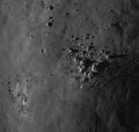
Here's a nice big pile of rocks, on a hilltop south of the Taurus-Littrow Valley.
Phil
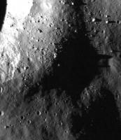
Posted by: Phil Stooke Jul 26 2009, 12:20 PM
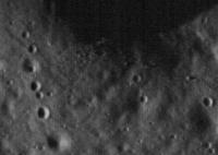
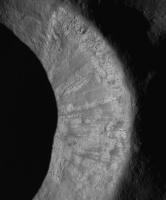
Love these landslides on a crater wall south of the Apollo 14 site.
Phil
Posted by: Stu Jul 27 2009, 04:20 PM
Poem celebrating LRO's portrait of Tranquility Base: http://twitpic.com/btqo5
Posted by: John Moore Jul 27 2009, 08:19 PM
Very nice Stu!
..."Here Mankind left the slavery of Terra's tyrannical gravity
Behind and dipped its first, trembling toe in the surf
Surging at the very edge of that ocean of the night,
And first caught sight of our own bright reflection
In the cosmos' curious eyes."
Caught a moment there alright.
Wonder how future poets living on the Moon will write about it -- on the reduced gravity, the continuous black inky sky, the earth rises and sets, and, of course, the landscape? Ahead...new thoughts and new experiences for a new Mankind.
John
Posted by: kenny Jul 27 2009, 10:16 PM
I noticed those slides, indeed lovely, and wondered if their apparent freshness (unlike the boulder tracks of Split Rock at Taurus Littrow) is deceptive. Would you hazard a guess at an age, Phil?
Posted by: dvandorn Jul 27 2009, 10:50 PM
Phil, I have a question and several others here may enjoy hearing the answer.
When the Fra Mauro site was designated for Apollo 13, they had designed traverses for various landing locations, including a traverse in case the LM landed long, to the west of the Doublet craters. This would have put Cone crater out of range for a crew exploring on foot, so the primary EVA-2 objective from this western location would have been something called Star crater. (When Lovell was leaving the Moon, he made a comment that he was "still looking for Star crater," so I know the crew was very aware of it.)
I've only ever seen Star crater labeled on a map within the Apollo 13 presskit in PDF format, in which you really can't pick out the crater itself. Do you have any way of determining which crater is Star and identifying it on the LRO images? As it was west of Doublet, I would have to imagine it's in the current LRO image of the Fra Mauro region.
-the other Doug
Posted by: kenny Jul 27 2009, 11:12 PM
I followed the subtle switches in EVA options from 13 to 14 at the time, and I have also looked for Star crater a few times. I had a feeling, perhaps wrong, that it was north of the 13 landing site. The crew also named other craters out west of Doublet - I think one was Sunrise. I have them somewhere in old magazines, not readilly accessible at the moment, but perhaps with some foraging...
Posted by: dvandorn Jul 28 2009, 12:52 AM
Yeah -- the 13 main traverse plan was nearly identical to the 14 plan (the primary aim point was moved back east about 60m from 13 to 14, which would have put Aquarius on a fairly steep forward-pitching slope in the "deep depression" that Shepard and Mitchell walked through en route from their LM to their ALSEP site).
But the 13 traverse planning began before Apollo 12 demonstrated the pinpoint landing capability, and so some traverse planning was done for various dispersions. They had plans for over- and under-shoots of as much as a kilometer or two; ISTR seeing a traverse plan for a landing short of Cone Ridge, one for a landing in the valley between Cone and Triplet, the final 14 plan for the landing between Doublet and Triplet, and yet another for a landing downrange of Doublet. However, I also STR that there were no significant north-south dispersions considered, just uprange-downrange. (Any links or examples you might have, Phil, of/to the original 13 traverse plans would be most welcome indeed...)
I have to wonder if Lovell expected an overshoot in the primary guidance, since only an overshoot would put Star on their traverse maps, and Lovell was on the record as being determined to do very little LPD-ing and to allow the automatic system land the LM without going into P66 to take manual control. He wanted to demonstrate that the LM was able to land automatically. (Note that every single other CDR in Apollo took over manual control and hand-flew their LMs to their final touchdown points. They used varying degrees of manual control, most of which let the computer control the descent rate while the CDR tooled the LM around with attitude changes. But no one let the LM land in P64, fully automatic mode. Lovell was the only one willing to try it.)
One reason I'd enjoy seeing where Star is located is that it was obviously considered a valuable sampling site, and if we land an unmanned Moon rover near to the Fra Mauro site, we'll want to land it a ways away from the Doublet-Triplet-Cone operations area. I'm thinking it would be really kewl to have such a rover do a geologic investigation of Star before moving in to observe the Apollo artifacts to its east from a respectful distance.
-the other Doug
Posted by: Phil Stooke Jul 28 2009, 03:12 AM
I'll get to it tomorrow.
Phil
Posted by: AndyG Jul 28 2009, 09:44 AM
Earth'll wax and wane, for those who can see it: but it'll not rise and set for most locations on the Moon.
Andy
Posted by: jmknapp Jul 28 2009, 09:54 AM
Behind and dipped its first, trembling toe in the surf
Or, as Buzz Aldrin put it:
"Contact light."
We never got the chance to send poets to the Moon, alas.
Posted by: John Moore Jul 28 2009, 10:49 AM
Ah, Andy...you're one of those Nearsider occupants
I have condo's at both poles, and two luxury villas -- each one located on the eastern and western limbs of the Moon (as viewed from Earth) respectively. So both latitudinal and longitudinal 'libration' effects of the Moon allows me to see Earth rises and sets, roughly, every 14 days or so
I've currently set up renting options for all properties, so give me a ring sometime
John
Posted by: John Moore Jul 28 2009, 12:30 PM
There's a reference here (http://history.nasa.gov/alsj/a14/A14BoulderCommCheck.pdf) to 'Star Crater' in this Oct 5, 1970 Traverse changes PDF file (see image -- orietated and annoated to view better).
It mentions in page three "In Test 1, traverse into and across Star Crater, a small but relatively deep crater..."
The image in the PDF file (some pages down) is very poor, but it does show mention of "Star Rim", however, the exact location isn't very clear. Just below the image page in Table I, there's also a mention on the EVA 1 (extensions), and one sold, roughly, wrk out where Star Crater is from this , as they write "Continue from Star Crater to flat region NE of Star Crater and return to LM."
John
Posted by: Phil Stooke Jul 28 2009, 01:39 PM
It's all in the atlas!
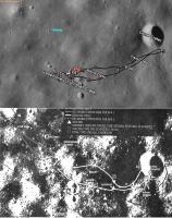
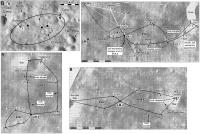
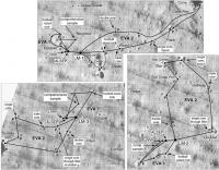
I've attached two composites of figures from my book. First Apollo 13:
It includes an overview identifying Star and Sunrise craters, the main substitutes for Cone if they had to land long. But the very fresh Cone was always the preferred target. Lovell couldn't have seen Star crater - the 'Star' at Fra Mauro was in darkness during both of his trips to the Moon, and they only saw the far side on Apollo 13 (there's a map of planned and actual image coverage in my book too). It wouldn't have been if they had landed, obviously, but it was during the Apollo 13 flyby. I never saw a landing target east of Cone, I think Doug is mistaken on that point.
And Apollo 14:
Showing slightly modified landing points and EVAs.
These EVA plans are taken from the flight plans for each mission with some additions (there were several versions of the route in the Doublet crater area). All those plans were seen at the LPI library.
To answer Doug's original question, Star and Sunrise are in the LROC image, and my overview will make it easy to find them.
Phil
Posted by: belleraphon1 Jul 28 2009, 04:16 PM
[quote name='Phil Stooke' date='Jul 26 2009, 07:20 AM' post='143881']
Love these landslides on a crater wall south of the Apollo 14 site.
Phil
Me Too...
with the LROC resolution, will be great to compare sites with HRIS on Mars. Dust slides on Selene with similar morphologies on Mars. What constitutes a 'gully' made by possible volatiles, vs a dry dust slide as on Selene...
Comparative planetology, Babie!!!!
Craig
Posted by: Sir Mildred Pierce Jul 29 2009, 06:37 AM
I gotta say the more and more I look at the LRO pics, they are beginning to far exceed my expectations. The thread that blew my mind was http://www.forum-conquete-spatiale.fr/la-lune-f33/apollo-17-par-lro-t8404.htm posted earlier in this thread. A certain poetic phrase caught my eye, ombre double du rocher 1...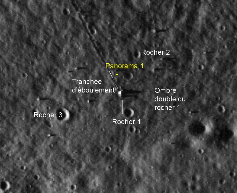
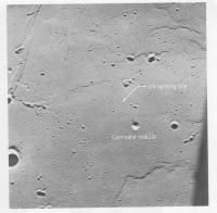
ombre double du rocher 1... the double shadow of Rock 1... Two white lines darting over to what is most certainly a rock at the end of a very strange and obviously straight trench, a boulder path. The two white lines are covering up the two shadows. Laying scattered across the moon like a giant golf ball settling in to a sand trap, likely flung off from another larger impact site some ways away. This is the great rocks of Geology Station 6, a beautiful vista and home of one of the strangest and most easily identified objects from the Apollo missions. Here's a fun diagram of the rocks you should look at before looking at the LRO photo again.
In the diagram we can see the rock has split into a few big junks, two big bits essentially laying next to eachother with a big gap in between, a gap that runs straight east and west. NASA really did us a favor taking it with the sun so low, in les ombres the features of everything in the LRO pics just pop. Okay now check it out without the labels and take in the double shadow of Rock 1, running along east and west.
And of course Rocher 1 can be seen quite nicely in this gorgeous panoramic taken at the bottom of that deep sand-trap on the Apollo 17 mission (the spot where it is taken is annotated on the first pic), our two chunks of the discarded golf ball, even at this noon hour with the sun high in the sky le ombre double is quite evident.
This one's huge so i'll just post a link:
http://upload.wikimedia.org/wikipedia/commons/3/38/Apollo_17%2C_station_6.jpg
A smaller version avec les annotes francais:
I like to make that one huge on my monitor and just stare at the whole vista for a quarter hour just taking in the beauty and the realness of this huge natural but clearly alien landscape. Everything sounds better in french, Trancheé d'éboulement sounds better than 'boulder path'.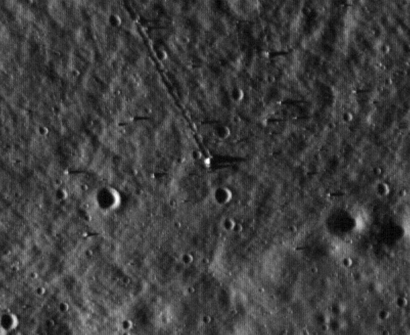

Rocher 1 is either a meteor or a bit of moon kicked up by the collision of a meteor, but it is also a unique monument placed there on the moon, by the moon. We have some very good pictures of it from both high up and up close on to the ground and it is a strikingly recognisable from any angle and any elevation. The gap gives it away, like a brutalist lunar Stonehenge; the gap marking out east and west as it dances with the sun, throwing out l'ombre double. Even at the disappointment educing initial shots level of resolution of the LRO pics (pictures NASA managed to get to us quite a bit sooner than I think anyone was really expecting, and there's no disappointment in that...hats off to you, NASA!) it stands out quite nicely.
Christmas day isn't here yet tho, we'll get to open our real presents soon though ![]() This is just the preview!
This is just the preview!
Anyway, I have been really mulling over the great stuff in this thread and joined the website, and wanted to share some really cool evidence that really physically connects you to a place they just took a picture of from a camera in the sky, a place we've been before, without a doubt. Figure that'll make a good first post.
-- SMP
p.s. there is a second panorama taken from a spot just west of the big chunk and we can see the sun high in the eastern sky, roughly in line with the gap.
and here's the http://img30.imageshack.us/img30/2719/pano2f.jpg for lunar meditation.
Posted by: kenny Jul 29 2009, 08:40 AM
The rock is not a meteor, it's a melt breccia created by meteor impact. Someone has added a jokey cut-out figure next to the LRV in the big version of the last pan.
Posted by: Sir Mildred Pierce Jul 29 2009, 09:08 AM
I can't wait for the nutters to construct a conspiracy theory around http://en.wikipedia.org/wiki/Flat_Stanley. Surely whatever middleschool class printed this out and asembled it is in on it with NASA. More sinister though is what I'm pretty sure is a bright photoshop lens flare covering up probably the real lens flares of the real sun which might be a wee bit up more, the 7th grade photoshop guru is heading up the caper. Since these are a bunch of little photos put together as a panoramic each picture would have it's own little lens flare. I think i've seen other moon pano's like that.
Posted by: Phil Stooke Jul 29 2009, 11:58 AM
It's common to fix the messy sky in panoramas - many of our UMSF colleagues have done the same with Mars Rover panoramas. But what's the problem with the figure near the rover in the big pan? Looks like Gene to me...
Phil
PS for the record, Dale Hubert of Flat Stanley fame is my neighbour here in London, Ontario.
Posted by: centsworth_II Jul 29 2009, 03:33 PM
Posted by: Phil Stooke Jul 29 2009, 04:02 PM
Oh, THAT figure! I'm going to have to have a word with Dale.
Phil
Posted by: dvandorn Jul 29 2009, 05:19 PM
Ah, Photoshop -- so many nice things one can do with it... ![]()
Thanks for the Fra Mauro details, Phil. Looking at it now, I can see why Star crater was never very visible in the photocopy-quality images I've seen in .pdf files. It's not very big at all, just has a rather bright halo (making me believe it would have been difficult to find from the surface, akin to how difficult it was to find Halo crater for the 12 crew). Looks to me like Sunrise would have been a much better choice for getting deep samples.
Also good to see that the planning for 14 also included some downrange-dispersion EVA plans. By the time we got to the official Apollo 14 press kit and such, they were really only showing the prime site and EVA routes.
I do have to wonder, though, whether you might get some different types of rocks from Sunrise vs. Cone. The Imbrium basin ejecta blanket on which the Fra Mauro site is located was rather ropy in texture, emplacing itself in thick, ropy ridges and leaving apparently thinner layers in the valleys between the ridges. Cone was created by a later impact onto the top of one of the thick, ropy ridges (named by the Apollo planners after the crater, Cone ridge). Sunrise seems to have been a similar impact (roughly the same size as Cone, no more than 20% smaller) but into the inter-ridge valley terrain. While I don't believe that either impact could have drilled down beneath the Imbrium ejecta blanket, it would be interesting to compare the mineralogy of samples from the Cone rim to samples from Sunrise's rim. It could tell us whether the uneven-ness of the ejecta, as emplaced, is simply a function of the motion of the ejecta as it re-impacted the surface (wave dynamics and such) or whether there are compositional differences in the possibly thinner, less viscous material that filled in the valleys from the thicker, more viscous material that created the ropy ridges.
-the other Doug
p.s. -- I think that Lovell's comment of "still looking for Star crater" was more along the lines of exaggeration for effect -- rather like someone who had a layover at the San Francisco airport on a very foggy day at the Bay, saying to friends asking about the trip "Well, I'm still looking for the Golden Gate bridge." ![]() -dvd
-dvd
Posted by: Steve G Jul 29 2009, 05:59 PM
Are there any traverse maps for the original Apollo 14 landing site at Littrow? (had Apollo 13 been successfull)
Posted by: dvandorn Jul 29 2009, 06:42 PM
IIRC, traverse planning was done for both the H-mission Littrow site and for the H-mission Censorinus site. Had Apollo 14 been able to fly in July of 1970 (per the original every-four-month schedule following the first successful landing), I believe the Littrow site would have been unavailable, and the Censorinus site would have been used. For the October, 1970 date that was settled on after the flights were spread out to every five to six months, Littrow was to have been the site.
Phil likely has the traverse plans for both sites. I just recall that the Censorinus landing point was a kilometer or less west of the crater proper, and the second EVA would have taken then back east to the crater rim. The Littrow site was, I want to say, about 20 km west of the mouth of the valley of Taurus-Littrow, near a wrinkle ridge. The second EVA at that site would have been a walking tour of the wrinkle ridge.
-the other Doug
Posted by: Phil Stooke Jul 29 2009, 06:48 PM
I've looked at more EVA plans than most people still alive, and I never saw a specific EVA plan for Littrow - it was abandoned too early for that. But there were studies of sampling areas. They would have landed at the south edge of the 'ghost crater' where a wrinkle ridge meets the elevated dark mantle area, and would have sampled the mare, the dark-mantle hills and the wrinkle ridge. (Fig. 192 in my book).
Phil
Posted by: kenny Jul 29 2009, 07:40 PM
I did this a couple of years ago without the benefit of Phil's lovely book. It is a frame from the A14 descent movie showing an oblique view towards the western EVA traverse areas planned for A13. I think I have Star correct, and you can see from this angle why apparently it was so named, given its brightness. The white line beyong Doublet is the rim of Sunrise.
Posted by: jmknapp Aug 1 2009, 07:48 PM
I wonder if they plan to image the sites where Saturn IVB/IU stages impacted the Moon? That kind of encounter would have a big footprint I imagine. For example the SIVB/IU from Apollo 17 impacted at 4.23S 12.36W according to post-flight reports.
Posted by: Phil Stooke Aug 1 2009, 08:26 PM
The Apollo 13 and 14 SIVB impact craters and ejecta were imaged back at the time, so we know what to look for. I can confirm that all these types of site are LROC targets.
Phil
Posted by: volcanopele Aug 1 2009, 08:39 PM
I assume that is so they can get a handle on what a very fresh, small impact crater looks like on the moon?
Posted by: dvandorn Aug 1 2009, 09:10 PM
Actually, the impacts from known hardware are useful to observe. We can calculate pretty accurately the mass of the impactor, the speed of the impactor at time of impact, and the trajectory.
Remember, our theories on impact processes are based primarily on theoretical physics, with experimental results limited to very small impactors in laboratory conditions. Exacting measurements and analyses of relatively large-scale impacts (at least, larger than can be achieved in a lab setting) are valuable to the testing and verification of our theories on how impact processes actually work.
-the other Doug
Posted by: jmknapp Aug 2 2009, 12:15 AM
Should be interesting to see. The info I have is that the Apollo 17 Saturn IVB hit at an angle of 34 degrees from the vertical and a speed of 2.5 km/sec, with a mass of 12,900 kg empty. A quick calculation gives 4*10^10 J of kinetic energy or about 10 tons of TNT. As they say on Mythbusters, that's what I'm talkin' about!
LCROSS is due to hit at a similar speed but with less mass (2,366 kg), about 5x less. More bang for the buck hopefully though, in terms of scientific payoff.
Posted by: As old as Voyager Aug 2 2009, 02:18 PM
The impact crater left by the ascent stage of the Apollo 17 LM should be visible up on the (south?) massif near the landing site. That'd be cool to see. Has anyone identified it yet? Such a shame the rover didn't get to see the actual impact.
Posted by: Phil Stooke Aug 2 2009, 04:51 PM
I have searched for this in Clementine, HST and Earth-based radar images, and seen nothing. There were no Apollo 17 images of the landing site after the impact, unfortunately. The first Taurus-Littrow LROC image doesn't show the area (it's off the west edge and would probably be in shadow anyway). The Taurus-Littrow stereo image released after the first landing site image might be far enough west but we don't have the full version of that yet.
I suspect that the LM ascent stage did not impact exactly where it was predicted to, but who knows? Finding this and other impact sites is a high priority for me.
Phil
Posted by: dvandorn Aug 2 2009, 06:00 PM
Well, we have a lot of Apollo 15 and Apollo 17 pan camera high-resolution imagery of the Taurus-Littrow site, so we ought to be able to identify any new crater in the LRO images.
This might be a good situation for doing a photographic subtraction in Photoshop. If you can get roughly similar sun angles, a subtraction of the LRO image from an A15 or A17 image of the same area would highlight any major changes to the terrain. In fact, that's something we want to do in a variety of areas, I think -- it will let us get good empirical data on the cratering rate (down to sub-meter cratering events) over a period of nearly 40 years.
-the other Doug
Posted by: jmknapp Aug 2 2009, 11:46 PM
They had direct measurements from tracking stations, and they figured an accuracy of 3km in the impact point. According to the post-flight report:
Apollo/Saturn V Postflight Lunar Impact Trajectory -- AS-512 S-IVB/IU, April 11, 1973
PTC stands for passive thermal control, referring to when they set the S-IVB tumbling on three axes after the last propulsive maneuver 12 hours after liftoff.
EDIT: Oops, you were talking about the LM ascent stage, never mind.
Posted by: kenny Aug 7 2009, 08:01 AM
Anyone have any intelligence on when the Apollo 12/Surveyor 3 site was due to be imaged? LRO must have passed over it in daylight by now. At low sun angles (sunrise and sunset) Surveyor is invisible in the crater shadow, but the LM descent stage should be vsiible in any lighting conditions.
Posted by: Phil Stooke Aug 7 2009, 11:46 AM
Surveyor 3 will not be in shadow because the sun is coming from the west in images at the moment, and higher above the horizon than in the first images. I think we have to wait a week or so to get another attempt.
Phil
Posted by: Zvezdichko Aug 20 2009, 10:44 AM
http://lroc.sese.asu.edu/news/index.php?/archives/91-Trail-of-Discovery-at-Fra-Mauro.html
LRO successfully photographed Apollo 14 site again. ALSEP and the trails are visible.
Posted by: John Moore Aug 20 2009, 12:02 PM
The change in lighting conditions.
Left: July 17 2009 Right: A month later
John
Posted by: ElkGroveDan Aug 20 2009, 12:59 PM
I'd do an a anaglyph with those two, but I'm rushing off early right now. Stu?
Posted by: Stu Aug 20 2009, 01:35 PM
Would love to anaglyphalise (did I just invent a word? Cool!) those pics but I'm away from home and my software right now... came up to my mother's to celebrate her 70th birthday, bought her a hot air balloon ride, but mission control just informed us that launch has been scrubbed due to high winds... ![]()
Posted by: charborob Aug 20 2009, 03:28 PM
Look cross-eyed at John Moore's images and you'll see the 3D effect. The LM stands out nicely.
Posted by: gwiz Aug 21 2009, 09:56 AM
Nice, except I had to wear my glasses upside down.
Posted by: kenny Aug 21 2009, 10:56 AM
The large image is stunning. You can see the entire outbound segment of EVA2 and much of the return track. Weird Rock is clear, as is the "large boulder" I indicated in my previously-posted descent movie image (post no. 136). My "large boulder" is the one directly south of the last r in the label Weird Crater, not the even larger boulder to its Northeast.
I see an intriguing long bright artefact apparently lying oriented N-S just South of Saddle Rock, near the arrow showing the outbound track. I at first thought this might be the Lunar Portable Magnetometer experiment on legs which was abandoned in this vicinity, but perhaps not... they discussed abandoning it further east, across the nearby crater.
Posted by: ElkGroveDan Aug 21 2009, 03:59 PM
Good point.
Posted by: Astro0 Aug 22 2009, 08:13 AM
>GWIZ: Nice, except I had to wear my glasses upside down.
>EGD: Good point.![]() Yes, but I'm in the Southern Hemisphere remember
Yes, but I'm in the Southern Hemisphere remember ![]()
![]()
Posted by: Phil Stooke Aug 22 2009, 11:21 AM
I wore my glasses back to front. How do you account for that?
Phil
Posted by: Astro0 Aug 22 2009, 01:04 PM
Same reason we drive on opposite sides of the road? ![]()
This discussion would be much better if someone just took the time to redo the image with the correct left and right. ![]()
Posted by: Phil Stooke Aug 22 2009, 01:20 PM
Oh yeah - never thought of that...
(not quite as effective because it emphasizes the shadow more)
Phil
Posted by: ElkGroveDan Aug 22 2009, 02:20 PM
Having someone hold your monitor upside down works too.
Posted by: John Moore Aug 22 2009, 03:53 PM
The cross-eyed technique on the double set of images works best of all for this observer -- the 3D effect gets better and better as ones eyes relax into the cross-eyed position.
But as to how one un-crosses the headache afterwards, I don't know ![]()
![]()
John
Posted by: Paul Fjeld Aug 23 2009, 01:36 AM
I too prefer the cross-eye technique. The glasses never work as well for me. I always see a slight ghosting. Of course staring comfortably cross-eyed for long stretches makes me worry that I am rewiring my brain - never mind the headaches!
What strikes me about the image is how deep the large craters to the southeast seem to be in this 3-D image. That can't be right? The low angle light shadow in the first image makes me think the upper crater, for example, is much more shallow.
Posted by: PhilCo126 Sep 1 2009, 10:10 AM
Here's an interesting comparison: Lunar Orbiter III & LROC
http://www.moonviews.com/archives/2009/08/loirp_and_lro_confirm_that_hum.html
Posted by: ilbasso Sep 1 2009, 02:53 PM
http://www.moonviews.com/archives/2009/08/loirp_and_lro_confirm_that_hum.html
Yeah, I posted that one a couple of days ago in http://www.unmannedspaceflight.com/index.php?s=&showtopic=6070&view=findpost&p=145395. It's an excellent side-by-side comparison at very nearly the same resolution. It's hard to dispute that something made some pretty significant changes to the moonscape in the intervening years!
Posted by: PhilCo126 Sep 1 2009, 04:09 PM
The most amazing thing for me is the fact that the wheelbarrow Apollo 14 astronauts used, made such good tracks ![]()
Posted by: Phil Stooke Sep 1 2009, 05:31 PM
I would expect most of that track to be their footprints and soil kicked around by their feet. I doubt if the MET tracks contribute very much. It will be interesting to compare these tracks with Apollo 12 when we get that image. That will show the contribution of MET.
Phil
Posted by: Sir Mildred Pierce Sep 2 2009, 09:57 AM
Does anyone know if the area where Lunokhod 1 (likely) ended up and Lunokhod 2 did end up has been imaged by LROC yet? I'd be interested to see if the tracks from those rovers can be seen yet.
Been going back and forth with some Hoax Shills who are claiming the tracks we can see in the A14 pics from LROC were probably made by a rover.. I know, pretty absurd... But it would be interesting to compare the Lunokhod tracks to the A14 tracks.
Posted by: djellison Sep 2 2009, 10:57 AM
They've not been imaged yet, as far as I know ( they've not been released, certainly ).
I think it's best to wait for the final orbit before we chomp at the bit for more 'hardware' images.
Posted by: Sir Mildred Pierce Sep 3 2009, 03:28 AM
"I think it's best to wait for the final orbit before we chomp at the bit for more 'hardware' images."
Aaaahh, I had assumed that it had settled in to it's low orbit by now, when can we expect that to happen?
Posted by: elakdawalla Sep 3 2009, 04:16 AM
Mid-September.
Posted by: Zvezdichko Sep 3 2009, 06:37 PM
http://lroc.sese.asu.edu/news/?archives/98-First-Look-Apollo-12-and-Surveyor-3-.html
Apollo 12 - Surveyor 3!
Posted by: Bernard Sep 3 2009, 07:04 PM
At last.
Thanks !!!
Posted by: Phil Stooke Sep 3 2009, 07:27 PM
Another hero of this mission was Ewen Whitaker of the Lunar and Planetary Laboratory, University of Arizona, who found Surveyor 3 by comparing images from Surveyor with Lunar Orbiter images until he found common features. As he described it to me, very soon after the landing they were at JPL and Gene Shoemaker came in with prints of the very first images, several wide angle shots of part of the horizon. The height of the horizon (unexpectedly high) showed they were in a depression, apparently a few hundred m across. Whitaker identified a couple of small craters and a big rock that should be resolved in the orbiter image, and looked at all the craters of about that size near the tracking position of the spacecraft until he found features which matched them. Then when the site was chosen as the target for Apollo 12 he hoped he hadn't made a mistake.
Surveyor rode down on a retro-rocket, then discarded it and set down gently on small vernier rockets. That retro-rocket (especially its big spherical fuel tank) is somewhere near here, waiting to be discovered. I might predict that it will be the first piece of exploration hardware to be discovered in an LROC image, if a Lunokhod doesn't come along first.
Phil
Posted by: Phil Stooke Sep 3 2009, 08:17 PM
This is a crop of the raw TIFF. The tracks will let us revise the EVA map - it's wrong in several places. I have marked what looks like a saturated pixel about 500 m north of the Surveyor - could it be the fuel tank? I'm not sure how away we would expect it to be.
Phil
Posted by: charborob Sep 3 2009, 08:31 PM
I could't find an image of Surveyor showing the retro tank, but I found this document:
http://ntrs.nasa.gov/archive/nasa/casi.ntrs.nasa.gov/19690008399_1969008399.pdf
It gives the specifications for the Surveyor system. On p. 35 is a table detailing the main retro burnout conditions. I wonder if it may be possible, using those numbers, to calculate the trajectory of the spent tank and determine at least an approximate crash zone.
Posted by: Zvezdichko Sep 3 2009, 08:39 PM
Looks like a cosmic ray hit.
Posted by: Phil Stooke Sep 3 2009, 09:20 PM
That's true! But so does the Surveyor itself.
Phil
Posted by: Zvezdichko Sep 3 2009, 09:41 PM
No. We know where Surveyor is. We don't know where the retrorocket is.
Posted by: ugordan Sep 3 2009, 09:47 PM
That doesn't change the fact both objects look similar. Hence if one is real, maybe the other one is as well.
FWIW, I'm personally inclined to think the object above is real and not a cosmic hit.
Posted by: kenny Sep 3 2009, 10:23 PM
Phil's right, of course. But the post-mission EVA route map is pretty good, albeit wrong in a couple of small points. I notice they went on the west side of Halo Crater traveling north from their southern detour, whereas the old map shows them taking the east side. And they took a more northerly track back to the LM from Block Crater. Extraordinary to be able to see this after all these years.
Regarding the jettisoned retro rocket casing, I'd have expected evidence of an impact feature and displaced soil around it, which I don't see at the suggested spot. But I'm sure it's around here somewhere.
Posted by: djellison Sep 3 2009, 10:24 PM
That's not a CRH. Doesn't look anything like one. It looks just like a Surveyor sized object on the ground.
Posted by: kenny Sep 3 2009, 10:42 PM
On Surveyor 3 the retro rocket was jettisoned 2 mins 6 secs before landing at an altitude of 32,900 feet, a little to the east of the landing site, when the spacecraft was traveling in a westwards direction. The spacecraft continued its descent a little off the vertical (with a westward drift) on vernier engines, and bounced a couple of times in a westerly directly upon landing. The postion of the bright mark does seem to me fairly consistent with the dynamics of the landing as given in the Post-Mission Report, and abbreviated in Dave Harland's "Paving the Way for Apollo 11" (Springer Praxis 2009).
Posted by: nprev Sep 3 2009, 10:51 PM
So I guess this thing with a shadow must be a good-sized isolated rock, then?
Posted by: kenny Sep 3 2009, 11:01 PM
It sure is. You can see it here on the right horizon, on this pan taken by the Apolo 12 crew on the surface. They are standing on the edge of the big subdued crater west of the ALSEP station, which has your big rock on its north rim.
http://www.hq.nasa.gov/alsj/a12/a12.1181809_pan.jpg
P.S. This is unmanned spaceflight, with manned back-up!
Posted by: Hungry4info Sep 3 2009, 11:19 PM
Are there any images from Surveyor 3 anywhere? I can only find images of Surveyor 3 v_v.
Posted by: kenny Sep 3 2009, 11:26 PM
I went through all the high-res versions of the Hassleblad pics making up a panorama taken by Pete Conrad at the ALSEP site. It shows the complete horizon to the north of the LM, including the area where the bright spot is visible from LRO. There is no sign of the bright object on the horizon. However the surface is slightly undulating and if that is indeed the retro casing, and it's flattened by impact, then it could easily be out of sight in a hollow.
Posted by: Phil Stooke Sep 3 2009, 11:27 PM
Check out Emily's Blog!
If that object, or a similar but smaller one a bit west of it, are real they are not on the pre-landing Lunar Orbiter image.
Phil
Posted by: kenny Sep 3 2009, 11:44 PM
To aid interpretation, some more parameters for the spent retro-casing - it was a sphere 0.94 meters in diameter, made of steel, with a large protruding nozzle coming out the bottom. The one on Surveyor 1 weighed 146 pounds after burn-out, so presumably that for Surveyor 3 was similar. And as noted earlier, it fell free after being jettisoned at about 33,000 feet altitude.
Posted by: dvandorn Sep 4 2009, 01:10 AM
If that object, or a similar but smaller one a bit west of it, are real they are not on the pre-landing Lunar Orbiter image.
I agree, those things weren't in the LO images of the area. But while these *may* be the tank, they don't *have* to be.
First off, note that we see five apparently man-made objects that are bright and reflective. There is the LM descent stage, the Surveyor, a piece of the ALSEP (likely the top of the central station, though it could possibly be the skirt around the PSE), and the two items that people are saying might be the retro tank. ("Tank" being a bit of a misnomer -- it's the casing or shell from a spherical solid rocket motor.)
If you recall the liftoff movie from Apollo 15 (and verbal comments from other crews), big pieces of thermal blanket (the MESA blanket, for example) have been known to blow out and away from the LM upon APS ignition. On Apollo 15, a big blanket narrowly missed knocking over the ALSEP central station and flew on downrange at least another half a kilometer or more.
It's just as likely that the bright spots to the north of the Snowman are thermal blankets blown out from the LM as it is that they are pieces of Surveyor's retro rocket. I'm not saying these spots are not the spent rocket casing -- just that there is an alternative explanation that is just as likely. So... don't stop looking for the spent motor, guys! It might be somewhere else.
-the other Doug
p.s. -- it might be instructive to search other landing site LROC images, especially that of the A15 site, to see if we can find other examples of ejected thermal blankets. Seeing what they look like, how far they were blown away from the LM, etc., might shed some light on what we're seeing here. DVD
Posted by: Gsnorgathon Sep 4 2009, 01:19 AM
Good call on the thermal blanket, other Doug. I'd think the Surveyor descent stage ought to have at least a wee bit of a "splat" around it from the impact. There doesn't appear to be any disturbed regolith around that bright what-ever-it-is.
And while we're on disturbed regolith - is it possible to see where Surveyor 3 made its first bounce? Are there any Apollo 12 images of it from the surface?
Posted by: dvandorn Sep 4 2009, 01:40 AM
As I recall, the bounce marks where the verniers disturbed the wall of Surveyor crater weren't very visible during A12 operations, since they were on a wall of the crater that was under a very low sun angle. They are much more obvious under a high sun angle. I remember seeing them identified in S-III panoramas of the crater wall taken while the sun angle on the wall was pretty high. (That panorama might well be in "Exploring Space with a Camera," for those who still have a copy.)
The LROC image of the area shows the wall where Surveyor bounced under a very high sun angle. You'd think they would be pretty obvious in this image.
-the other Doug
Posted by: ilbasso Sep 4 2009, 02:37 AM
I'm not sure what angle the Surveyor was coming in for its landing, but if the engine dropped out at 33,000 feet, I would expect it to be farther away from the actual landing site than this.
FYI, for comparison's sake here are a couple of photos of Surveyors - http://history.nasa.gov/alsj/a12/AS12-48-7100.jpg as seen by the Apollo 12 crew, and from almost the same angle, http://collections.nasm.si.edu/media/full/A19700294000Cp01.JPG. I looked back at my photo of the same test article taken in 1971 http://s407.photobucket.com/albums/pp155/texwardo/?action=view¤t=surveyorengineeringvehicle.jpg, and I'm not sure it has the large engine and fuel tank on it.
If the fuel tank was less than a meter in diameter, and the picture's resolution is a little over 1 meter for pixel, I think it would be really hard to find the fuel tank unless it pancaked (unlikely for a pressure vessel) or created a crater.
Posted by: dvandorn Sep 4 2009, 03:41 AM
Just to be completely clear -- I think we should stop referring to a "tank," as it seems some people are envisioning tankage that fed liquid propellants into a combustion chamber complete with attached nozzle extension.
The Surveyor main retro motor was a solid rocket motor. It was a sphere a little less than a meter in diameter that was filled with between 1,200 and 1,300 pounds of solid propellant. A star-shaped core opened out to a throat and nozzle that, when the spacecraft was properly aligned, faced into the velocity vector. Ignition charges would ignite the fuel down into the core, the fuel burns from the core out to the casing, and the rest is a simple application of the Rocket Principle.
While the motor is a "pressure vessel" in the same way that any SRBs are pressure vessels (they must contain the pressure of the expanding gases as the solid fuel burns), it's not what comes to my mind when I think of a pressure vessel. My conception of a pressure vessel is a tank that holds a liquid at pressure. (After all, other SRBs are referred to as "motors" when filled and "casings" when empty, but never referred to as "tanks"...)
It's hard to say how much impact force a burned-out solid rocket motor casing, with only a few pounds of fuel left inside, could withstand without pancaking. But the assembly did have a big open throat when it impacted, and was vented to vacuum inside and out, so we'd only be talking about the inherent tensile strength of the metal and the welds after they had been heated dramatically by the burning of the fuel and been stressed by containing the pressure of the burning fuel (in all directions except through the nozzle, of course). It would not have the same kind of resistance to pancaking that a pressurized tank would have.
-the other Doug
p.s. -- no, Ilbasso, the mock-up you have pictured doesn't include the retro motor. The motor nestled in a cavity exactly in the middle of the landing legs. The sphere extended below the plane of the footpads, and the nozzle, of course, extended even further down than that. Any Surveyor model you see that doesn't have a big sphere sticking out like a potbelly from between its legs doesn't include the retro motor. DVD
Posted by: Ian R Sep 4 2009, 04:01 AM
That very piece of insulation was indeed imaged by LRO:
Posted by: mcaplinger Sep 4 2009, 04:04 AM
http://historicspacecraft.com/Photos/Probes/Surveyor_NASM_RK_2008_3.jpg is a nice view of the cavity where the SRM went, and http://historicspacecraft.com/Photos/SRM/Surveyor_Motor_CMSI_RK_2008_2.jpg a reasonable picture of the motor itself.
Posted by: monty python Sep 4 2009, 05:44 AM
I can't believe i have never seen a surveyor from below before! Thanks for the picture.
That SRM was a good hunk of the total volume and mass of the package, and it could have made some kind of splat.
Posted by: nprev Sep 4 2009, 06:40 AM
Me neither; a great shot!
IMO, the Surveyors never got nearly the love they deserved; these were some really amazing little spacecraft!
Posted by: dilo Sep 4 2009, 07:39 AM
Great LRO shot! I think this can help to identify landing location in the original frame:
In the last image, I eliminated the "vertical interlace" and improved contrast...
Posted by: lollipop Sep 4 2009, 07:45 AM
"If you recall the liftoff movie from Apollo 15 (and verbal comments from other crews), big pieces of thermal blanket (the MESA blanket, for example) have been known to blow out and away from the LM upon APS ignition. On Apollo 15, a big blanket narrowly missed knocking over the ALSEP central station and flew on downrange at least another half a kilometer or more."
Remarkable footage seen here on Youtube. http://www.youtube.com/watch?v=BbOq-fRp5YI
Posted by: Phil Stooke Sep 4 2009, 11:27 AM
ODoug's right about the word tank - I was the culprit, but now I withdraw it. Henceforth I shall call it 'the big round thingy'. He's also right about thermal blankets, they are a possibility for these bright spot or spots. I'll keep looking further out for other objects.
I think the second bounce area is the bright spot immediately uphill from the Surveyor itself. That was identified in the Surveyor images (as footpad prints, not a bright spot). I don't see an obvious first bounce location yet. It was just over the rim and not visible to the spacecraft.
Phil
Posted by: Phil Stooke Sep 4 2009, 02:05 PM
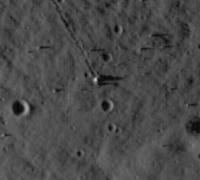
Here's a blow-up of the area near the LM. I have noticed other bright spots including two some distance west of the LM, and one thing I see is that every small bright spot has a second spot immediately to its west, presumably a CCD artifact. The LM itself is big enough that the two are merged.
Phil
Posted by: ilbasso Sep 4 2009, 03:02 PM
Is there a spot just at the 11:00 position next to the LM...maybe the S-Band antenna?
Posted by: PDP8E Sep 5 2009, 02:06 AM
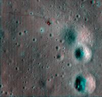
Here is an image of the Apollo 12 site
I wrote a program to destripe (thanks to all the guys at MIT this afternoon in Rm 514 when we talked about how to approach it.... I know you lurk!)
It's blown up just a little...
Cheers
Posted by: ilbasso Sep 5 2009, 02:40 AM
Amazing!!! If I squint, I can make out the octagonal shape of the Descent Stage! Are you planning to run this process for the other Apollo site photos?
Posted by: PDP8E Sep 5 2009, 02:42 AM
here is a de-striped close-up of the Descent stage, the Alsep and the Surveyor lander
Cheers
Posted by: PDP8E Sep 5 2009, 03:04 AM
I suspect that the object at the 11:00 position by the lander are the disposed lunar backpacks (what is the technical name? its been a long time!) The wireframe dish antenna is anyone's guess. We can't wait until LROC gets to its final low orbit!
Posted by: mcaplinger Sep 5 2009, 03:09 AM
PLSS, pronounced "pliss" -- Portable Life Support System.
Posted by: PDP8E Sep 5 2009, 03:36 AM
PLSS that's it! (thanks Mcapinger!)
Posted by: PDP8E Sep 5 2009, 03:49 AM
Hi Ilbasso, I will give a try...but we all waiting for the low orbit....
cheers!
Posted by: PDP8E Sep 6 2009, 01:46 AM
Here is the Apollo 11 site from LROC with a home brew de-striper and a try at an initial calibration.
It has been zoomed by 3X
cheers
Posted by: PDP8E Sep 6 2009, 02:32 AM
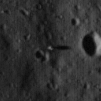
Here is the processed Apollo 14 landing site
(destriped, rough cal)
Cheers
Posted by: dvandorn Sep 6 2009, 02:50 AM
Nice work, PDP! In particular, the A14 image really shows the contours of the old, extremely subdued crater that Antares landed in. It's also obvious that all of the Triplet craters, even the subdued-itself North Triplet, are an awful lot younger than the old, extremely subdued craters, as North is directly superposed on the landing site crater's northeast rim.
-the other Doug
Posted by: PDP8E Sep 6 2009, 03:11 AM
Thanks Doug (as a fellow Apollo witness, these are truly good times)
Here is the Apollo 15 LROC site (same processing)
cheers
Posted by: ilbasso Sep 6 2009, 03:15 AM
-the other Doug
It also appears to me that you can see the shadows of the RCS plume deflectors that were mounted on the descent stage.
Posted by: PDP8E Sep 6 2009, 03:45 AM
Here is the LROC Apollo 16 site (with the same processing)
cheers
Posted by: PDP8E Sep 6 2009, 04:11 AM
and here is the last ...Apollo 17 landing site for LROC (same processing)
cheers
(and to bed!)
Posted by: climber Sep 6 2009, 12:04 PM
cheers
Incredible! We can even make the ladder's shadow on the right
Seriously, thank so much.
Posted by: kenny Sep 6 2009, 09:47 PM
Those images are astonishing. On A16, but also on A17 and possibly A14, you can actually see the 2 shadows of the thin blast deflectors from the RCS thrusters, which stand up from the descent stage at 2 corners. We know from the lunar lift-off TV on A15, 16 and 17 that these structures survived the blast from the departure of the LM ascent stage.
Posted by: PDP8E Sep 7 2009, 01:05 AM
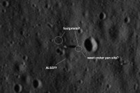
Here is an annotated image of the Apollo 11 landing site.
After processing and looking at the map of 'where things should be' at the site, I have annotated what I think are footprints and the location of the ALSEP. Now, as we get to a lower orbit and re-image I could be totally wrong, but still, I present them for your inspection and careful scrutiny.
your mileage may vary
cheers
Posted by: kenny Sep 7 2009, 07:30 AM
That crater is actually Little West Crater, and the bigger West Crater is out of shot to the right. Confusingly, on some maps, Little West is actually called East Crater because it is east of the landing site. Armstrong's pan location was right on the rim, so a little east of where you mark it.
Your ALSEP looks about right for the PSE, but the LRRR was closer to the LM. Amazing if the actual PSE instrument is visible, which I think it is.
This post mission A11 map has most of the features:
http://www.hq.nasa.gov/alsj/a11/a11_lpi_trvrsmap.gif
Posted by: Phil Stooke Sep 9 2009, 11:50 PM
That Apollo 11 map is a bad copy of this original (USGS drawing, Defense Mapping Agency publication):
http://www.lpi.usra.edu/resources/mapcatalog/LPST/ap_11_12_14/
Using the same map as a source, in this image I have superimposed the Apollo 12 traverse on the LROC image (copied from one of the above posts) and attempted to map out in red the tracks we can see with LROC. In some areas it's not easy to see where the tracks are so there's some guesswork involved, but in many areas they are clear. More troubling, you can find linear markings - subtle topographic shading - in places that were never walked on, so care has to be taken in interpreting the faint trails. It shows where the traverse was reconstructed accurately and where it was not - the EVA mapping was based on debriefing done weeks after the events, and you can try mapping an off-trail hike from memory to see how difficult it is.
One thing that never made it onto the EVA maps was a very quick run around at the end of EVA 2 in the general area north of the LM, using Tom Gold's Lunar Surface Close-Up Camera to take stereo images. Some of the tracks and spots north of the LM come from that.
Phil
Posted by: dvandorn Sep 10 2009, 12:57 AM
Ah, Phil... exquisite! And let me say, you're the only guy here I know of who would know to correctly identify Middle Crescent Crater. ![]()
Now what I'm really looking forward to is seeing how well we can see Rover tracks on Hadley Delta, Stone Mountain and the North and South Massifs, and whether or not we can see sets of footprint tracks at the sampling stations at Hadley, Descartes and Taurus-Littrow. (The instance we do have, of Station 6 from A17, doesn't show much in terms of tracks of any kind, a fact which I'm tempted to attribute to the sun angle.)
-the other Doug
Posted by: Phil Stooke Sep 10 2009, 01:20 AM
Thanks, oDoug. Here's a look at another site, Apollo 17 Station 8 on the Sculptured Hills. Tracks are faintly visible if you know what to look for - this is located based on an original sketch in the USGS Professional paper on Apollo 17 and the derived version in my atlas. 'SWP' is a crater named after the 'Science Working Panel' (successor to GLEP, the Group for Lunar Exploration Planning) which defined science activities at the landing sites.
Phil
Posted by: kenny Sep 10 2009, 09:48 PM
Hey, c'mon... he's not the only one familiar with Middle Crescent. I mentioned it in Post #185 .
But I truly concur ... his work IS exquisite!
Posted by: Phil Stooke Sep 10 2009, 11:20 PM
Oh, go on, you guys - I bet you say that to all the cartographers.
Phil
Posted by: ElkGroveDan Sep 11 2009, 12:10 AM
Phil
Let's be honest. It's your long curvy topo-lines that everyone admires Phil.
Posted by: dvandorn Sep 11 2009, 12:45 AM
Thanks for reminding me that you had referenced Middle Crescent, Kenny. Sorry I missed it!
As for the crater itself, I'm only impressed because the crater itself wasn't even named on half of the crew maps of the landing site, and IIRC was never referred to as Middle Crescent during conversations between the crew and Houston. Heck, due to the loss of the TV camera and subsequent lack of media coverage, there wasn't even much public awareness at the time that the crew made a short little geology walk after deploying the ALSEP.
I think you'd likely have to have pored over the ALSJ as much as I have to be familiar with the name Middle Crescent. IIRC, there's no real definitive source of the name, either -- just one set of maps that showed up one day that labeled three large craters arrayed in a crescent after their positions in the crescent. I don't recall off the top of my head if the other two were Upper and Lower or Right and Left or whatever, but that's generally what I recall. And again, this was on a somewhat larger-scale map than the map of the Snowman, to be used, I guess, if the crew landed significantly off-target.
Of course, these are all unofficial names, anyway. Am I right in thinking, Phil, that the names of the craters at the A12 site were never proposed to the IAU for official recognition?
-the other Doug
Posted by: Phil Stooke Sep 12 2009, 03:43 AM
No, actually many of the names, maybe all of them, on that green map I linked to, are official. USGS has a nomenclature website which lists all 'landing site names' which are official:
http://planetarynames.wr.usgs.gov/jsp/FeatureTypes2.jsp?system=Earth&body=Moon&systemID=3&bodyID=11
Phil
Posted by: Phil Stooke Sep 14 2009, 02:02 AM
Here is an attempt to compare the Apollo 14 tracks with the old EVA map on the green map I linked to above. It's uncertain in places, especially below Flank crater.
Later missions will have to wait until we have higher sun images of their landing sites.
Phil
Posted by: kenny Sep 15 2009, 12:18 PM
Nice.. I too had wondered about the apparent extra crossing of outbound and inbound tracks on EVA2, and some of those other deviations. But all in, the post-mission analysis guys in 1971 did a pretty good job, given the astronauts themselves were frequently unaware of their location...
Posted by: PDP8E Sep 17 2009, 02:51 AM
Here is a an update de-stripe, a better calibration (?) , plus a 3x blow up of the Apollo 12 site.
(waiting for that lower orbit ...)
Cheers
Posted by: Phil Stooke Sep 19 2009, 01:46 AM
The Apollo 16 site... here are all the sampling stations. Missing numbers are stations that were dropped for lack of time. I'm not certain about Station 13 (Shadow Rock) - this looks the most likely of all the big rocks in the vicinity to be Shadow Rock, but it's not guaranteed.
Phil
Posted by: Sunspot Sep 19 2009, 01:34 PM
Are they planning to take images of the Apollo sites from the lower science orbit of 50km to get the 50cm/pixel resolution.
Posted by: Phil Stooke Sep 19 2009, 01:46 PM
Yes, repeatedly in stereo at different sun angles.
Phil
Posted by: PDP8E Sep 30 2009, 01:19 AM
29-Sept-2009 Apollo 11 , LRO
Here is an attempt at taking the new raw TIFF, stretching the range, then destripe, and a little blow up.
(I don't think I got the dynamic range from the TIFF to PNG right...)
Cheers
Posted by: Paolo Sep 30 2009, 05:09 AM
oh my this is cooool!!
Posted by: Stu Sep 30 2009, 05:43 AM
Anyone wanting to find Eagle on the "Zoomify" image for themselves, take a look at this screengrab: you can see a little box superimposed on the strip, to left. That's where you have to zoom in to to find Eagle.
http://twitpic.com/jn0i4/full
Posted by: ilbasso Sep 30 2009, 05:17 PM
Aww, come on, Stu! Real men don't need finder charts! True space geeks have the surrounding terrain for all of the landing sites for all probes memorized!
Posted by: eoincampbell Oct 1 2009, 12:09 AM
Thanks Stu. ![]()
Posted by: charborob Oct 1 2009, 01:26 PM
I see http://lroc.sese.asu.edu/whereislro/ that LRO just flew over the Apollo 17 site. I wonder if the site has been re-imaged, this time at 0,5m/pixel. It is around local noon there at the moment. There should be a good contrast between the pristine lunar soil and the soil disturbed by the astronauts.
Posted by: JRA Oct 1 2009, 11:11 PM
I noticed that as well. I hoping they got some new images of it too. I noticed a few days ago that they also passed over several Russian Luna sites (16, 18, 20 and 24). And it looks like the LRO will pass over or close to Apollo 11 in about 45mins from the time of this post as well.
I'm really looking forward to seeing the images from the mission orbit.
Posted by: Geert Oct 6 2009, 11:28 AM
I have been trying to find out how much could be gained by combining the old Apollo SIM bay images and the LRO images, especially in trying to find out whether anything had changed in between.
To do so I aligned the SIM bay images (from after the LM ascent) with the new LRO image, cropped them to show exactly the same area at the same scale, then normalized them so they gave same average brightness, and finally set some small software to work out the differences. Below is the result for Apollo 15.
Image is centered on LM descent stage. Red marks area's where the software finds a significant difference in brightness between LRO and Apollo image. All of these differences seem to be easily explainable as shadows, and effects caused by different lightning conditions.
I can't find any new craters or other changes, the images seem to match very well. If I can find the time I'll see if I can find anything at the A16 and A17 sites, which are also sufficiently images during the Apollo days.
Posted by: Phil Stooke Oct 8 2009, 08:03 PM
New LRO image - the Apollo 14 SIVB impact crater. Here's a detail with the location diagram at top left to help locate it.
Phil
Posted by: ElkGroveDan Oct 8 2009, 09:04 PM
Now I want to see the Apollo 13 S-IVB site. The only part of 13 that made it to the surface of the moon!
Posted by: nprev Oct 8 2009, 09:07 PM
Sweet...it even kicked out a few rays, apparently!
Wonder if LCROSS' Centaur will do the same, although it's not as massive. Will the impact speeds be comparable?
Posted by: elakdawalla Oct 8 2009, 09:32 PM
I'm trying to figure out what the mass of the Apollo 14 S-IVB when it crashed was, but am having a little difficulty. Can anyone help me out? I did turn up a nice Apollo 16 image of the same crash site: http://www.hq.nasa.gov/office/pao/History/SP-362/ch5.2.htm (scroll down to figure 120, near the bottom)
Posted by: elakdawalla Oct 8 2009, 09:34 PM
Hum, http://wiki.answers.com/Q/What_objects_are_on_the_moon_that_have_been_sent_there_or_left_there_by_man says 14016 kg -- that's dry weight. Did it still have any fuel onboard when it crashed?
EDIT: OK, I should have read the entire LROC image caption ![]() It says:
It says:
Posted by: nprev Oct 8 2009, 09:52 PM
And here I was scouring the Net for S-IVB info! ![]()
Pretty big difference, all right. Might leave a ray or two still, though. Geeky thought: Hope LRO gets a few good passes shortly thereafter just in case any putative rays have enough volatile content to fade rather quickly...?
Posted by: ugordan Oct 8 2009, 09:54 PM
Some 12 tons dry for S-IVB and another 2 tons for the Instrument Unit on top of it, sounds about right. Remaining propellants were vented through the engine, but some small fraction probably remained onboard, along with other consumables like helium.
Posted by: nprev Oct 8 2009, 11:28 PM
My primitive calculations (sans info on the impact angle) seem to say that LCROSS will hit with less than a fifth of the A14 S-IVB's kinetic energy, around 1.2 exp 10 joules.
Of course I had to take my shoes off to do the math, so won't vouch for accuracy! ![]()
Posted by: Reed Oct 9 2009, 04:23 AM
Which instrument would see them ? AFAIK the shadowed crater floor is too dark for LROC, and the others wouldn't have the resolution.
Posted by: nprev Oct 9 2009, 04:26 AM
This would be to search for any possible post-impact ejecta (rays) that might extend into the lit areas. It's a long shot, no doubt, but worth a look if feasible.
Posted by: Phil Stooke Oct 28 2009, 07:38 PM
Fantastic new Apollo 17 image from LROC!
http://lroc.sese.asu.edu/news/?archives/137-Exploring-the-Apollo-17-Site.html
Phil
Posted by: Sunspot Oct 28 2009, 08:00 PM
The Flag !!! ![]()
Posted by: Decepticon Oct 29 2009, 12:19 AM
Wow much better resolution!
Are the rest of the apollo landing sites to be imaged?
Posted by: Phil Stooke Oct 29 2009, 12:24 AM
Yes, and at different sun angles.
Phil Stooke
Posted by: Hungry4info Oct 29 2009, 04:44 AM
More like the flag pole. The flag itself should have been destroyed after ~37 years of exposure, and in looking at that image, I can't find any evidence for the flag itself.
Posted by: S_Walker Oct 29 2009, 12:18 PM
You wouldn't see the flag directly, as it's vertical, and LROC is looking at it from straight above. But, you do see the flag's shadow. I seriously doubt the pole would make such a broad shadow. I doubt it has been destroyed by micrometeorites.
Here's a version of the image I deconvolved and upsampled.
Posted by: charborob Oct 29 2009, 02:21 PM
Not by micrometeorites, but the material could have decomposed under the harsh UV from the Sun.
Posted by: S_Walker Oct 29 2009, 04:07 PM
Regardless, something is still attached to the pole.
Posted by: AndyG Oct 29 2009, 04:59 PM
Good to see geophone rock again, too. Last seen in the post-launch video pan:
Posted by: Hungry4info Oct 29 2009, 05:15 PM
I'm not convinced about the shadows. Shadows seem to be to to the upper right of objects in the picture, yet what appears to be the flag pole's shadow extends to the left. I'm guessing that the "shadow" is an artifact of the enhancing method for that image.
Posted by: S_Walker Oct 29 2009, 05:24 PM
I think it's the shadow from the flag itself, not the pole; the pole is too thin to resolve at this scale (50cm per pixel).
I've attached a crop of the raw frame if anyone wants to give it a whirl. By the way, the LROC team claimed it's the flag.
Posted by: Hungry4info Oct 29 2009, 05:43 PM
Alright yeah, it makes sense that the pole shouldn't be resolvable.
But really? Could it be that after all these years, the flag is still there and not disintegrated?
Posted by: charborob Oct 29 2009, 05:43 PM
I wonder why the LRV shows up as a dark patch. I was expecting it to be brighter than its surroundings. Is it a shadow effect?
Posted by: S_Walker Oct 29 2009, 05:49 PM
But really? Could it be that after all these years, the flag is still there and not disintegrated?
Sure, why not?
I bet its bleached white from the UV bombardment, but the material is probably still clinging on to the poles (plural, because there's a pole at the top of the flag to keep it unfurled).
Posted by: Phil Stooke Oct 29 2009, 07:48 PM
The dark spot at the rover is probably a combination of disturbed soil adjacent to the rover plus shadows of parts of the rover seen through the open structure. I'm wondering about the dark spot just south of the LM... I'll have to go look that up.
Phil
Posted by: Ian R Oct 29 2009, 08:38 PM
Compare the new view of the flag to its appearance in the ascent film mosaic:
Posted by: Hungry4info Oct 29 2009, 08:42 PM
Amazing, just absolutely amazing how everything matches up and everything still looks the same. You guys convinced me, the flag is apparently still there.
Posted by: AndyG Oct 29 2009, 10:02 PM
It's been nicked and that's just an oil stain?
Andy
Posted by: S_Walker Oct 29 2009, 10:56 PM
Andy
LOL good one! I think it's there, it's just not as big or reflective as the descent module. Download that raw file I posted and see if you can detect a hint of it on there.
Posted by: PDP8E Oct 30 2009, 01:31 AM
Here is the Apollo 17 site, from the raw TIFF (253MEG!), cropped, brightened, destriped, and blown up 3x
Cheers
Posted by: PDP8E Oct 30 2009, 02:52 AM
Here is a 'hyper-processed' image of the Apollo 17 Lunar Rover Vehicle
I believe you can see the approximate outline
Cheers
Posted by: Greg Hullender Oct 30 2009, 03:28 PM
I dunno about this one. You could have told me it was the Greater Magellanic Cloud and I'd have believed you.
--Greg :-)
Posted by: sgendreau Oct 30 2009, 05:19 PM
Footpaths. (thud)
sgendreau the newbie
getting Stendhal Syndrome
Posted by: Geert Oct 30 2009, 05:57 PM
One of the things which surprises me is the more or less 'darkened' area around the descent stage, which MIGHT have been caused by either the descent engine or the ascent engine. If you compare this image with the Apollo 11 2nd image, the area around the A17 lander seems considerably larger. A11 landed with its engine still running, while the A17 engine was cutoff on sensor-contact, so you would expect the 'blast' area around A11 to be bigger..
On the other hand, this 'darkened' area might just be all the footprints around the descent stage..
Posted by: PDP8E Oct 30 2009, 06:15 PM
--Greg :-)
Greg - all you need to do is squint, tilt your head back and forth, and have a bottle of Jack Daniel's sipping whiskey handy...I mean really...its child's play!
Posted by: JRA Oct 31 2009, 12:59 AM
That's what I believe it to be, since all the trails leading away seem to be a similar shade of grey. I think this photo illustrates it fairly well http://www.hq.nasa.gov/office/pao/History/alsj/a17/AS17-140-21373HR.jpg. Anywhere they walked, seems to have darkened the surface (due to there feet kicking up lots of the soil).
The rover tracks don't seem to disturb the soil as much, which is unfortunate. It makes it a bit harder to see where they drove, but so far I've found stations 6 and 7 and possibly 'turning point rock'. I think I also may have spotted some tracks near steno crater, but I'm not 100% certain. It's kind of fun trying to find it all though.
Posted by: Geert Oct 31 2009, 01:45 AM
Yes, I had also expected clearer tracks for the rovers, on some of the movies they seem to be kicking up a lot of dust but apparently they didn't really disturb the soil that much.
On Mars is similarly difficult to find the tracks of Spirit and Oppy, but that's probably mostly due to wind and dustdevils covering up the tracks, you shouldn't have that problem on the moon.
I'm impatiently waiting for the first images of the Lunokhods, watching the panorama pics those tracks should be clear enough I would guess.
Posted by: gndonald Oct 31 2009, 04:28 PM
I'd rather see the Crash site for Luna's 15 & 18, the landing sites 16,17,20, 23 & 24.
Posted by: djellison Oct 31 2009, 05:02 PM
And given time we'll see both.
Posted by: PhilCo126 Oct 31 2009, 05:37 PM
Curious to see how 'close' Luna 15 cam to the Apollo 11 landing site ![]()
Posted by: Paolo Oct 31 2009, 07:35 PM
and don't forget 9 and 13 as well, the only ones for which we have decent images!
Posted by: Phil Stooke Oct 31 2009, 09:27 PM
Luna 15's the least well known of the lot... but I can assure Philco that it's nowhere near Apollo 11. It is in Mare Crisium. There's almost no chance LRO can find it.
Phil
Posted by: Geert Nov 1 2009, 02:02 AM
Yep, but probably also the one's which we are least certain of the location (except L15 crash side).
Finding Luna 9 will be the big price I guess, but it is almost certainly not on the stated location and then it will be very hard to find..
Posted by: Phil Stooke Nov 5 2009, 03:24 AM
A new very high sun Apollo 12 image... does it show the elusive Surveyor 3 descent rocket thingy?
Phil
Posted by: PDP8E Nov 5 2009, 03:24 AM
Here is the new low orbit Apollo 12 site, with an almost overhead sun!
(destriped and enhanced)
Check out the annotated image on the LROC site.
The black splotch that is Surveyor is a mystery (to me)
My only other observation is the the dark spot with rays to the north east of lander, and almost in-line with Surveyor ... could this be the spent descent motor from Surveyor? ( a blink with the other image may be interesting...)
Cheers
Posted by: PDP8E Nov 5 2009, 03:46 AM
Phil Stooke!
you and I posted the exact same picture the exact same minute with the exact same observation!
(I knew I shouldn't have taken my dog out a few minutes before hitting return!)
Cheers
Posted by: Phil Stooke Nov 5 2009, 11:51 AM
Hah! And I was fuming because just as I made that image but before I could post it, my wife needed the computer. But I just managed to get it back a millisecond before you!
Phil
Posted by: djellison Nov 5 2009, 04:14 PM
Looks much like the fresh impacts we've seen with HiRISE - could very well be just what you say.
Posted by: kenny Nov 5 2009, 04:24 PM
Surely that is it..... the direction of travel on impact, however, appears to be eastwards, whereas the Mission Reports (according to Dave Harland's latest book, Paving the Way for Apollo 11, which sumarises them) suggest the spent casing was travelling with a small westwards component. However if it was tumbling on impact the disturbed material could have sprayed out in any direction, I suppose.
I just reviewed the surface panoramas taken by the astronauts around the LM and the ground level in that direction is undulating, with no sign of anything man-made evident.
Posted by: Phil Stooke Nov 5 2009, 04:33 PM
Unfortunately there is a subdued crater rim just north of the landing site, with the location of this dark spot hidden behind it, so I don't think it will be visible from the LM area.
Phil
Posted by: Phil Stooke Nov 5 2009, 04:51 PM
How about this before and after comparison? The Lunar Orbiter image was taken before Surveyor 3 landed. The LROC image shows our dark spot - even with the difference in illumination, it looks like it was not there in the older image.
Phil
Posted by: djellison Nov 5 2009, 05:08 PM
I'd consider that a positive result - good work ![]()
Posted by: kenny Nov 5 2009, 06:13 PM
Now THAT is good..... !
Your're right, Phil, the lunar surface shots taken from astronaut chest height are too low to see over the surface bumps. BUT, they also took shots out of the LM window in that direction, from about 5 metres off the ground. Some are blurry, but at least one is cranked right round to peer over the right thruster and out in a partly backwards direction. And the LM was yawed 10 degrees to the right on landing, which helps see further round in that direction.
I think this is the best of the bunch, taken after EVA2. If the general location is in view, it's at the far right side of this frame. I see a few things out there, but nothing conclusive...?
http://www.hq.nasa.gov/alsj/a12/AS12-48-7165HR.jpg
Posted by: Phil Stooke Nov 5 2009, 08:31 PM
Good sleuthing... but based on a reprojection of that lovely image, I don't think it gets quite far enough around. It would be perfect if it did. Too bad there was no SEVA as on Apollo 15!
Phil
Posted by: As old as Voyager Nov 6 2009, 09:39 AM
Phil
That's fantastic!
Am I right in thinking you have just discovered the smallest artificial impact site seen on the Moon so far?
Powered by Invision Power Board (http://www.invisionboard.com)
© Invision Power Services (http://www.invisionpower.com)
