Printable Version of Topic
Click here to view this topic in its original format
Unmanned Spaceflight.com _ MSL _ First drill stop: John Klein in Yellowknife Bay
Posted by: Airbag Jan 24 2013, 01:41 AM
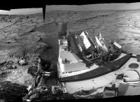
Sol 166 NAVCAM Left http://curiosityrover.com/imgpoint.php?name=NLA_412233713EDR_F0060000NCAM00350M_. This one went down kicking and screaming; tons of parallax with such close in images....
Airbag
Posted by: EdTruthan Jan 24 2013, 10:44 PM
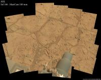
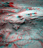
New foreground details from Sol 166...
MC 100 (6902 x 5418 px - 5.4MB):
http://www.edtruthan.com/mars/Sol166-MC100-Foreground-6902x5418px.jpg
MC 34/100 anaglyph (6902 x 5418 px - 6.74MB):
http://www.edtruthan.com/mars/Sol166-MC100-Foreground-Anaglyph-6902x5418px.jpg
Posted by: iMPREPREX Jan 24 2013, 11:30 PM
I was hoping for something like that as well! Shooting images rapidly as the rover is driving - then making it into a movie like we did with the MAHLI images. It would be incredible to see a motion picture like that from Mars!
And my take on Sol 166, MR. GigaPan - while I'm here ![]() :
:
http://gigapan.com/gigapans/122180
Posted by: iMPREPREX Jan 25 2013, 09:49 PM
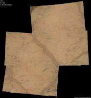
Here's a MAHLI mosaic made from some of today's (Sol 168) MAHLI shots:
http://i.imgbox.com/acpwtCWL.jpg
Posted by: serpens Jan 25 2013, 10:20 PM
Nice Ed. Mayhap it is just that I am more comfortable with false color manipulation of Opportunity's images compared to Curiosity, but doesn't Glenelg seem to lack rind formations which would possibly indicate either less chemical weathering even than at Meridiani, or higher levels of mechanical/thermal weathering?
Posted by: iMPREPREX Jan 25 2013, 10:29 PM
Here's an awesome view of the bay. Sol 166 NavCam Right:
http://i.imgbox.com/acxhdz6R.jpg
Posted by: Gladstoner Jan 25 2013, 11:27 PM
.
Posted by: wildespace Jan 26 2013, 11:52 AM
Sol 168 Navcam left full 360-degree panorama. Great view of the Yellowknife bay!
Full-res: http://www.pictureshack.us/images/32727_s168_navleft_stitch.jpg
Interactive panorama: http://photosynth.net/view.aspx?cid=1973d63e-0e4a-4ca0-9379-ae51e1dae9bf
Do you guys thing Yellowknife bay used to be a small lake at some point?
Posted by: Ant103 Jan 26 2013, 12:59 PM
Just one more frame to go, and the full panoramic will be complete ![]() .
.
http://www.db-prods.net/marsroversimages/Curiosity/2013/Sol168_pano.jpg
Posted by: Gladstoner Jan 26 2013, 09:34 PM
.
Posted by: Airbag Jan 26 2013, 10:52 PM
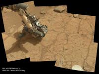
Color view of sol 168's proceedings (with some APXS action) via a Mastcam-34 pano:
This same target http://mars.jpl.nasa.gov/msl-raw-images/msss/00169/mhli/0169MH0205001000E1_DXXX.jpg, but was it already brushed for the sol 168 APXS observation?
Airbag
Posted by: iMPREPREX Jan 26 2013, 10:52 PM
Hey folks. I took 6 of the left HazCam images and made them into an animated GIF (Sol 169).
But... Do I see a star, planet, or moon directly over Mount Sharp in the last 3 or so frames?
That would be cool if it weren't an artifact... ![]()
http://makeagif.com/media/1-26-2013/wJFQCl.gif
Edit - I appreciate the answer below. Thanks...
Posted by: Airbag Jan 26 2013, 11:03 PM
One test - does it also show up in the corresponding right hand image? It does not in this case, so it must be an artifact specific to the left hand image (plus the sky is too bright for any such object anyway).
Airbag
Posted by: Ant103 Jan 26 2013, 11:37 PM
My take on Sol 168 color mosaic of the robotic arm analysing the soil with the APXS tool :
http://www.db-prods.net/marsroversimages/Curiosity/2013/Sol168_Mastcam34.jpg
Posted by: djellison Jan 26 2013, 11:48 PM
No.
http://mars.jpl.nasa.gov/msl-raw-images/proj/msl/redops/ods/surface/sol/00169/opgs/edr/fcam/FLA_412494215EDR_F0060000FHAZ00206M_.JPG
http://mars.jpl.nasa.gov/msl-raw-images/proj/msl/redops/ods/surface/sol/00169/opgs/edr/fcam/FRA_412494215EDR_F0060000FHAZ00206M_.JPG
Compare the two. It's an imaging artifact
Posted by: iMPREPREX Jan 26 2013, 11:54 PM
Yeah, I definitely found out the hard way on that one. Sorry folks. ![]()
Posted by: wildespace Jan 27 2013, 11:04 AM
In case the missing frame doesn't turn up, you can cheat by using a cropped version of this frame: http://mars.jpl.nasa.gov/msl/multimedia/raw/?rawid=NRA_412416119EDR_F0060000NCAM12754M_&s=168 as it gives the required coverage.
Here's a crop of the resulting panorama, although the software I use (Microsoft ICE) hasn't done a very good job. Maybe you can do better.
Posted by: Phil Stooke Jan 27 2013, 02:55 PM
A new brush job:
http://mars.jpl.nasa.gov/msl-raw-images/msss/00169/mhli/0169MH0205001000E1_DXXX.jpg
Phil
Posted by: Ant103 Jan 27 2013, 03:05 PM
How about seeing Mount Sharp in this panorama ? ![]()
http://www.db-prods.net/marsroversimages/curiosity-2013.html#38
Posted by: udolein Jan 27 2013, 03:38 PM
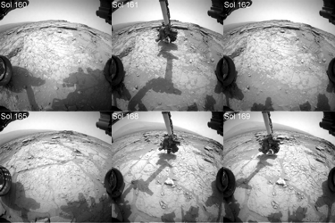
Activities between Sols 160 and 169:
http://www.marspages.eu/media/archive4/science_laboratory/23yellowknifedrillarea/Sol160-169Movie-br.gif
Cheers, Udo
Posted by: Airbag Jan 27 2013, 04:51 PM
Zooming in (animation) on the brushed area (this was the same area that was http://www.unmannedspaceflight.com/index.php?s=&showtopic=7535&view=findpost&p=197286):
Airbag
Posted by: Ant103 Jan 27 2013, 05:53 PM
And the obligatory postcard :
http://www.db-prods.net/blog/2013/01/27/curiosity-a-john-klein-carte-postale/
Posted by: mhoward Jan 27 2013, 07:46 PM
A couple anaglyph perspective views, facing southeast and south:
http://www.flickr.com/photos/marscat/8421324220/
http://www.flickr.com/photos/marscat/8421324220/ on Flickr
http://www.flickr.com/photos/marscat/8421336908/
http://www.flickr.com/photos/marscat/8421336908/ on Flickr
Posted by: EdTruthan Jan 27 2013, 08:40 PM
Stunning views everyone. Ahhh yes... Mt. Sharp. Here's yet one more in 3D...
http://www.edtruthan.com/mars/Sol168-169-Navacam-Mt-Sharp-View-Anaglyph.jpg
With so much time spent scrutinizing ground details, whenever the whole of Mt. Sharp can be integrated into the view, it just reminds one of things to come; getting over to that behemoth and uncovering it's majesty and mystery close up. Taking a step back in perspective, it still astonishes me how remarkable it is that this incredible machine was actually flown to - and landed safely - in this amazing place.
Posted by: wildespace Jan 27 2013, 08:52 PM
Stunning view! Here's a Photosynth for you folk: http://photosynth.net/view.aspx?cid=a66e3c9d-5d9e-4c51-a36e-0dbbb8678e15
Posted by: James Sorenson Jan 27 2013, 10:31 PM
Here is my versions of these lovely Navcam and Mastcam Panorama's ![]()
http://www.flickr.com/photos/43581439@N08/8421895808/
http://www.flickr.com/photos/43581439@N08/8420799043/
http://www.flickr.com/photos/43581439@N08/8421896822/
EDIT: I like this view XD
http://www.flickr.com/photos/43581439@N08/8420954909/
Posted by: Doc Jan 28 2013, 11:14 AM
Sol 170 front hazard cams show positioning exercises being done with the drill.
Also, looking at http://astrogeology.usgs.gov/news/item/sol-167-update-on-curiosity-from-usgs-scientist-ken-herkenhoff-ready-to-drill they seem to have finished most of the activities needed before pressing in for the kill so to speak. There are two favoured targets according to the sol 167 blog post.
BTW loving the views James
Posted by: jmknapp Jan 28 2013, 11:59 AM
Hugin rectilinear projection of APXS measuring the potential drill site--click for zoom.it version:
http://curiosityrover.com/gallery/sol168apxs.html
Posted by: Ant103 Jan 28 2013, 12:08 PM
168 & 169 updated with the latest frames :
http://www.db-prods.net/marsroversimages/curiosity-2013.html#38
Posted by: Gerald Jan 28 2013, 12:55 PM
Region of http://mars.jpl.nasa.gov/msl-raw-images/msss/00169/mhli/0169MH0163000003R0_DXXX.jpg with brightness stretched almost to black/white:
Posted by: jmknapp Jan 28 2013, 01:06 PM
MAHLI mosaic, sol 168--click for zoom.it version:
http://curiosityrover.com/gallery/sol168mh.html
Posted by: Phil Stooke Jan 28 2013, 04:26 PM
Looking at the brushed area in 169 and 170 images, it looks as if the target was brushed twice on sol 169, with the DRT offset a bit between them, and then a third brushing across the middle of them on the same sol. Then on 170 the left end of the brushed area was brushed again.
Phil
(Thanks jmknapp for that nice mosaic and your new route plot in the map thread)
Posted by: Airbag Jan 29 2013, 03:01 AM
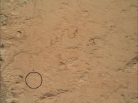
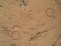
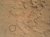
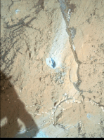
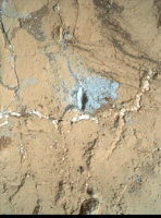
There are two sets of very similar (other than time of day) MAHLI images from sols 170 and 171, and based on what I read http://astrogeology.usgs.gov/news/item/sol-170---171-update-on-curiosity-from-usgs-scientist-ken-herkenhoff-preload-testingI assumed they were the before and after images of where the drill's "stand off" (pre-load) posts were in contact with the surface. And sure enough, what I think must be the characteristic tell-tale indentations of thehttp://mars.jpl.nasa.gov/msl-raw-images/msss/00065/mcam/0065MR0334001000E1_DXXX.jpg are visible in for instance these areas:
Close ups before and after (animations):
I will leave it as an exercise for the reader to find the equivalent sets in the other three image pairs
Airbag
Posted by: eoincampbell Jan 29 2013, 03:44 AM
Anyone know which direction (wrt MAHLI images) the DRT brushes rotate? Have some concretions become dislodged since brushing?...
Posted by: elakdawalla Jan 29 2013, 04:28 AM
As of sol 166 they've incremented the site counter to 6, and it now seems that they do that when they're getting ready to stay a while and do some serious sampling activity. (They incremented to 4 when they pulled up to the CAP 2 spot on sol 29, and to 5 when they arrived at Rocknest for the first soil sample on sol 57.) So it seems to me to be a good spot to break off the "traveling to Glenelg" thread and start a new one. Happy drilling, Curiosity!
http://www.unmannedspaceflight.com/index.php?showtopic=7442&view=findpost&p=197228
Posted by: Phil Stooke Jan 29 2013, 02:19 PM
and the last set:
The second point in the post two above is still eluding me...
Phil
Posted by: James Sorenson Jan 29 2013, 03:01 PM
A sneek peak at the Beautiful 360 degree Mastcam panorama that Curiosity took on Sol-170. ![]()
http://www.flickr.com/photos/43581439@N08/8426242351/
Posted by: Phil Stooke Jan 29 2013, 05:26 PM
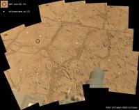
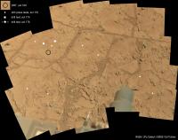
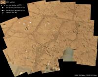
This is a mash-up of several images - jmknapp's MAHLI mosaic, James Sorenson's recent mosaic, and some of the recent sites noted above. There's one more image with drill press marks that I have not yet found on here. (it's off to the lower left from here)
Phil
Posted by: Phil Stooke Jan 29 2013, 06:38 PM
... and now all the locations (except the one I can't see yet) plotted on Edtruthan's mosaic.
Phil
Posted by: centsworth_II Jan 29 2013, 07:02 PM
Posted by: Airbag Jan 29 2013, 07:03 PM
Phil
You get an "A-" Phil; it would have been an full "A" if you had found the last one too
BTW, I just came across a http://www.esmats.eu/amspapers/pastpapers/pdfs/2010/okon.pdf for all you fellow gearheads out there.
Airbag
Posted by: Phil Stooke Jan 29 2013, 07:17 PM
The site counter tells you what coordinate system is being used to locate the rover and targets. Back at the landing site the first images could be used to make a base map showing where everything is, so the cameras, ChemCam etc. can be pointed to specific locations. After the rover drove a short distance on sol 16, and again on sol 21, the same coordinate system still works for new observation planning. But eventually you get too far away and you have to set up a new coordinate system. That's a new site. The counter gets incremented as each new one is established.
Spirit and Opportunity have had hundreds of sites between them. Eventually Curiosity will have lots as well.
Phil
Posted by: mhoward Jan 29 2013, 07:22 PM
Funny you should mention it, http://www.planetary.org/blogs/emily-lakdawalla/2013/01290831-curiosity-sol-171-placing-drill.html (see the last three paragraphs or so).
This isn't something new to MSL, by the way; the same system is used on MER, and
(Oops, didn't see Phil's earlier post.)
Posted by: centsworth_II Jan 29 2013, 08:02 PM
Posted by: RoverDriver Jan 29 2013, 10:47 PM
It is a convenience. After you drive for a while, the rover coordinates, and the coordinates of various targets, start to have many significant digits and it is easy to make mistakes when manually checking large numbers. Therefore, we periodically reset the origin of the coordinate system and we refer the new X, and Y coordinates to the new "site index" to avoid confusing the same coordinates but relative to a different origin. These coordinate systems are always parallel to each other, that is, X is always pointed to North and Y is always pointed to East but the location of coordinate 0, 0 changes at each site index.
Paolo
Posted by: elakdawalla Jan 29 2013, 11:52 PM
http://www.midnightplanets.com/web/MSL/00172/CR0_412763753EDR_F0060000CCAM15011M_.html coming down now! Neato.
http://www.midnightplanets.com/web/MSL/00172/CR0_412765708EDR_F0060000CCAM15010M_.html begs the question, which one is scarier to have pointed at you -- a percussive drill or a laser beam?
Posted by: Astro0 Jan 30 2013, 12:11 AM
![]() I'll take MSL's laser over the drill anyday. Mainly for the less blood and gore factor
I'll take MSL's laser over the drill anyday. Mainly for the less blood and gore factor ![]()
Posted by: Phil Stooke Jan 30 2013, 12:24 AM
This just in - the rock which was brushed a few sols ago is called Wernecke (from the 'where is Curiosity' part of the MSL website).
It's really bugging me that i can't find that last drill contact location. Anyone else see it?
Phil
Posted by: iMPREPREX Jan 30 2013, 01:01 AM
Here's an animated GIF of the drill bit (ChemCam - Sol 172). ![]()
http://makeagif.com/media/1-29-2013/OzNl2F.gif
Posted by: Airbag Jan 30 2013, 02:52 AM
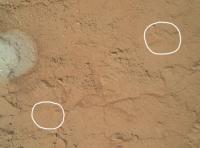
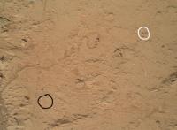
I think I found the missing contact point (circled in white); looks like the post rested on a small pebble which then moved just a little bit - it is more than just the shadow moving. I used lines on each image to verify that is was indeed the pebble that moved, and the distance vector between the locations is almost identical to that in the other images (which assumes MAHLI was at the same height).
Blink animation, scaled 200%:
Airbag
Posted by: Phil Stooke Jan 30 2013, 02:57 AM
I think you're right!
Phil
Posted by: effects Jan 30 2013, 04:58 AM
http://makeagif.com/media/1-29-2013/OzNl2F.gif
Forgive me as I'm a noob. But I do know rock "Hiliti" type drills (only in Concrete and Granite type rock). This looks like the fouling they were worried about.
EDIT: I realize now that the angle makes the flukes look fouled. But that is not the case.
Posted by: EdTruthan Jan 30 2013, 05:35 PM
Here's a preliminary look at the very nice (and huge!) Sol 170 MC34 panorama. Interestingly, it seems the big 15 frame block that's missing at upper right seems to have been purposefully skipped, as the row sequence numbers do not show any numeric break across the 3 rows of the gap. This faces the low sun angle, so not sure if that was a consideration or not. The other two missing frames at right have thumbs down so presumably will be in soon, and there are two more missing frames that appear to extend the far upper right of the pan. There's a small stitching anomaly at the left flank and base of Mt.Sharp I'll try and fix in the final version. There's a ton of detail in here of areas not previously covered by the MC's on the flat of bay.
Click thumb for half resolution version (15000 x 4285 px - 9.24MB):
http://www.edtruthan.com/mars/Sol170-MC34-Mt.Sharp-Yellowknife-Panorama-15000x4285px.jpg
The original came in at just over 32,000 pixels so I reduced it to 30,000 for now to save the JPG easily after PS post-processing. Will render a full sized version when the missing frames are in. For now, the near full resolution version (30000 x 8569 px - 26.72MB - ZIP File) is here: http://www.edtruthan.com/mars/Sol170-MC34-Mt.Sharp-Yellowknife-Panorama-30000x8569px.zip
Posted by: mcaplinger Jan 30 2013, 05:50 PM
The big block at the lower left also appears to have been purposefully skipped
Seriously, I don't know why they would skip a big area like that; perhaps it was covered by some earlier sequence or that's the divide between multiple sequences which will be filled in shortly?
Posted by: elakdawalla Jan 30 2013, 07:31 PM
This is a seriously scenic spot; it would be absolutely crazy not to fill in that "missing block at lower left"!! There's gotta be something we can do to make some noise about that.
Posted by: Phil Stooke Jan 30 2013, 07:37 PM
Patience! We'll be here for weeks.
Phil
Posted by: fredk Jan 30 2013, 07:46 PM
It may just be that they wanted to shoot that area in the upper right later at a smaller phase angle, either to avoid seeing mostly shadows or to keep chemcam pointed well away from the sun. (Does anyone know how close to the sun they'll allow chemcam to be pointed? That could be compared with the size of the missing block, considering the sun's very low elevation at the time the mosaic was taken.)
Unfortunately for the aesthetisists here, that would likely mean the block in question will look obviously different from the rest of the mosaic, even with colour corrections.
Non-aesthetisists need not be concerned.
Posted by: iMPREPREX Jan 30 2013, 10:03 PM
Whatever the case is, I can't wait to see someone work their magic on that Sol 170 panorama by filling in that block.
Here is my take on the 170 ML panorama (the block is not filled in, of course). I didn't mess with the exposure settings, as things seemed to get "washed out".
GigaPan link:
http://gigapan.com/gigapans/122501
Small preview:
Posted by: wildespace Jan 30 2013, 10:40 PM
Um... maybe somebody can fill the gap with colourised Navcam images?
Posted by: iMPREPREX Jan 30 2013, 10:59 PM
As far as the bottom is concerned (the part with the arm and turret), It seems Sol 168 ML fits in there. The turret is in a different position for each Sol, but it still works for the most part.
Here is my attempt at combining these two Sols together. There are some artifacts near the turret.
GigaPan link (I kept the original as well):
http://gigapan.com/gigapans/7ec9b161c194aaebbe321504b1638e7d
Edit - fixed stitching problem transitioning from Sol 170 to 168 but still not perfect.
Posted by: Deimos Jan 31 2013, 12:12 AM
Under certain conditions, Chemcam can be pointed arbitrarily close to the Sun. Under others, images intended to be far from the Sun can be deemed unsafe. Those conditions can be managed, but that can require both planning time and duration on Mars. So one could imagine that some images might be omitted one sol, but could be taken under the same lighting conditions another sol.
Posted by: Astro0 Jan 31 2013, 01:12 AM
"Colourised", them's fightin' words round these parts
I'm sure the appropriate colour images will come to fill the void. As Phil said, 'let's all be patient'.
Posted by: Phil Stooke Jan 31 2013, 01:47 AM
http://astrogeology.usgs.gov/news/item/sol-174-update-on-curiosity-from-usgs-scientist-ken-herkenhoff-fully-charged
Drilling tomorrow - tosollow - whatever.
Phil
Posted by: SFJCody Jan 31 2013, 03:54 AM
Have wondered about this point myself. Yestersol and tosol seem straightforward enough, but what to do about the word tomorrow?
Posted by: mcaplinger Jan 31 2013, 03:59 AM
"Solorrow." http://www.planetary.org/blogs/emily-lakdawalla/2012/09191521-Curiosity-sol-43.html
Posted by: RoverDriver Jan 31 2013, 05:53 AM
Never heard about Solorrow. Morrowsol a few times. Tosol and yestersol are quite common and since MSL I am beginning to hear Soliday more often.
Paolo
Posted by: walfy Jan 31 2013, 06:28 AM
How about "tomarsol"
Posted by: xflare Jan 31 2013, 08:34 AM
Some strange surface textures on these rocks
sol 172: http://mars.jpl.nasa.gov/msl-raw-images/proj/msl/redops/ods/surface/sol/00172/opgs/edr/ccam/CR0_412779778EDR_F0060000CCAM03172M_.JPG
sol 170 http://mars.jpl.nasa.gov/msl-raw-images/msss/00170/mcam/0170ML0905069000E1_DXXX.jpg
Posted by: jmknapp Jan 31 2013, 11:47 AM
The panorama block at lower left is largely parts of the rover, yes? Maybe there's a philosophy that images of the rover are generally not scientifically relevant.
Posted by: MahFL Jan 31 2013, 12:01 PM
No point in taking photos of the rover everytime, we came here to explore Mars not photograh Curiosity every day like tourists !
Posted by: drz1111 Jan 31 2013, 12:51 PM
sol 172: http://mars.jpl.nasa.gov/msl-raw-images/proj/msl/redops/ods/surface/sol/00172/opgs/edr/ccam/CR0_412779778EDR_F0060000CCAM03172M_.JPG
sol 170 http://mars.jpl.nasa.gov/msl-raw-images/msss/00170/mcam/0170ML0905069000E1_DXXX.jpg
If those were on Earth, no one would call them strange. Strange to see them in a world without liquid water, though.
Posted by: mcaplinger Jan 31 2013, 02:11 PM
But those photos have never been taken with Mastcam, which was my point. The extra data volume is pretty small compared to the outreach benefits. Sometimes pretty pictures are worth taking.
Posted by: paraisosdelsistemasolar Jan 31 2013, 02:18 PM
I created a DEM from three MAHLI images. It's a little noisy due to changing light conditions, but enough to show the relative depth of this structure.
Posted by: fredk Jan 31 2013, 03:42 PM
sol 172: http://mars.jpl.nasa.gov/msl-raw-images/proj/msl/redops/ods/surface/sol/00172/opgs/edr/ccam/CR0_412779778EDR_F0060000CCAM03172M_.JPG
Isn't that chemcam shot showing overlapping "craters" from the laser? There's no "before" shot down yet to confirm.
Posted by: elakdawalla Jan 31 2013, 05:43 PM
A philosophy you won't find any disagreement with here. They wouldn't even need to return them at full-res. But I want that full-color deck pan, and this panorama would be a really good choice for it, I think. With Curiosity facing west, most of the view would be pretty well sunlit in an afternoon pan.
Posted by: Actionman Jan 31 2013, 05:43 PM
Perhaps the drill's chair post scratching the rock surface during a surface stability test ?
Posted by: Phil Stooke Jan 31 2013, 05:49 PM
Earlier I posted a comment about the brushing - saying it looked like there was a second DRT on sol 170 after the main one on sol 169. That was based on a partial MAHLI view which showed a change between sols. The newest MAHLI images suggest there was no brush on sol 170, but that loose dust was moved, maybe by a gust of wind. Dust piled around the edge of the brushed area and ouitside it was removed, and some piled up in a line across the DRT patch. Was that wind or something else? Related to the overnight drill test?
EDIT - I may have the answer already - comparing 169 and 173 MAHLI images, I see that there is a pattern of ChemCam dots in the brushed area (but outside the 170 MAHLI image). Presumably that blew the dust around a bit.
Phil
Posted by: Airbag Jan 31 2013, 05:58 PM
Ahttp://www.midnightplanets.com/latestImagesMSL.html were posted more than half an hour ago and I don't see a panorama yet???![]()
Airbag
Posted by: iMPREPREX Jan 31 2013, 07:15 PM
Airbag
Come on, Sir. We know you have made yours already.
And since you mention it...
http://gigapan.com/gigapans/122539
I have a feeling (or hope, rather) this is part of a series - like how it was done with Sols 137, 138, and 141 (MR)...
Posted by: EdTruthan Jan 31 2013, 07:28 PM
Yes, we're sorry for the delay! Had to grab some breakfast and well you know... that other morning stuff. Here's the Sol 172 pano in all its hi-res MC100 (spot-free) glory. The small missing block at bottom, like the Sol 170 pano seems to have been purposefully not imaged as the sequence numbers skip right across the gap. The tracks left from the trip to Costello and back between Sols 127 to 132 are visible at upper right along with some of the damage done to rocks along the way, including one reasonably good sized slab at far right center that seems to have fractured right across the middle (lower right of http://mars.jpl.nasa.gov/msl-raw-images/msss/00172/mcam/0172MR0924020000E1_DXXX.jpg).
Click thumb for half sized version (11425 x 2246 - 5.17MB):
http://www.edtruthan.com/mars/Sol172-MC100-North-Looking-Foreground-11425x2246px.jpg
Full resolution version is here in a 16.67MB Zip: http://www.edtruthan.com/mars/Sol172-MC100-North-Looking-Foreground-22850x4491px.zip
Edit: Judging by the thumbnails down so far this pano series appears to have at least an additional 36 frames not yet down - AND - an entire set of dedicated MC34's to boot for ananglyphing.
Posted by: Airbag Feb 1 2013, 12:53 AM
http://mars.jpl.nasa.gov/msl-raw-images/proj/msl/redops/ods/surface/sol/00174/opgs/edr/fcam/FRA_412941161EDR_F0060000FHAZ00190M_.JPG, sol 174 HAZCAM.
Airbag
Posted by: EdTruthan Feb 1 2013, 01:44 AM
... and so it is! 'Tis certainly a worthy enough occasion for an anaglyph - with "Mt. Sharp Superstar" as a backdrop....
http://www.edtruthan.com/mars/Sol174-Hazcam-First-Drill-Anaglyph.jpg
Posted by: EdTruthan Feb 1 2013, 03:17 AM
I confess - I'm a z-axis junkie. But I couldn't resist trying this while waiting for the additional Sol 172 MC100's and their dedicated MC34 companions to arrive. Here's the two overlapping portions of Sol 170's big MC34 pano paired with Sol 172's MC 100 pano. Time of day was close enough to work reasonably well, and so far as I remember some of these areas have never had any good MC stereo views. The Sol 170 light was quite diffuse so there's some slight shadow mismatching and it'll of course render infinitely better when the dedicating Sol 172 pairings are in. Still, not too bad for a cursory 3D perusal I guess...
12,415 x 4,491 px - 10.51MB:
http://www.edtruthan.com/mars/Sol170-(MC34)-Sol172-(MC100)-Northerly-Anaglyph-1-12415x4491px.jpg
8,635 x 4,491 px - 8.41MB:
http://www.edtruthan.com/mars/Sol170-(MC34)-Sol172-(MC100)-Northerly-Anaglyph-2-8635x4491px.jpg
Posted by: PaulH51 Feb 1 2013, 06:10 AM
Animated GIF created using 2 HazCam images, before and after extending the drill body and placing the drill bit onto the surface.
Images taken on Sol 170 and Sol 174.
(http://makeagif.com/i/hO3YXy)
Paul
EDIT : JPL have now uploaded HAZCAM images of the 'before and after' taken on Sol 174 with a gap of around 6 minutes, so shadow movement is lessened between the images, but I will leave the original GIF in this post...
Posted by: walfy Feb 1 2013, 07:58 AM
Images taken on Sol 170 and Sol 174.
Seems the whole rover lifts just a bit when the drill went down, the arm putting down some extra force. Everything shifts between frames except for the equipment on upper right that is attached to the main body along with the camera. Very cool!
Posted by: Ant103 Feb 1 2013, 08:57 AM
My take on this Sol 171 Mastcam34 pan :
http://www.db-prods.net/marsroversimages/curiosity-2013.html#39
I didn't have the time before because Wednesday I was invited to the IRAP / FIMOC, at Toulouse, at the french control center side of the rover, and where ChemCam was conceived. Greats moments ![]()
Posted by: PaulH51 Feb 1 2013, 09:43 AM
I think the small upward shift we are seeing in the GIF is probably created by a marginal misalignment. When I compare the 'before and after' images of the drill extending/retracting on Sol 174, I do not observe any uplifting, so I guess they had the downward force balanced throughout. Note : The sol 174 'retracted' image was not loaded when the GIF was created, that's why I used Sol 172
Paul
Posted by: iMPREPREX Feb 1 2013, 10:27 AM
This is definitely getting juicy. Here is the rest of Sol 172 - MR:
http://gigapan.com/gigapans/122594
Posted by: climber Feb 1 2013, 02:02 PM
Wouha Damien, congratulations! We expect some kind of feed-back....it'll be ok even in French
Posted by: fredk Feb 1 2013, 02:52 PM
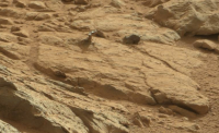
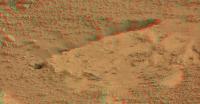
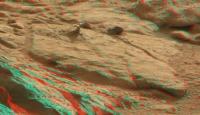
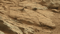
Shiny prong from the big 173 MR pan, near top centre:
http://mars.jpl.nasa.gov/msl-raw-images/msss/00173/mcam/0173MR0926020000E1_DXXX.jpg
Posted by: nprev Feb 1 2013, 03:53 PM
Well, there's gonna be a whole lot of "what the hell is that?", so I'll make the first guess: A crystalline silicate?
EDIT: The more I look at it, the more this seems to be a perspective illusion. I think the dark void in front of the left-most shiny spot is a hollow in the foreground rock, and the two shiny spots are actually on the rock behind that big one; makes the left-most spot look elevated.
Looking forward to a stereo view....
Posted by: Actionman Feb 1 2013, 06:30 PM
The shadow says it's a one piece statued something or other... twine goblets of gypsum.
Clip color adjusted and enlarged X2.
Posted by: Phil Stooke Feb 1 2013, 07:10 PM
Where is this thing? It's probably visible in images from other locations.
Phil
Posted by: dvandorn Feb 1 2013, 07:16 PM
I think I'm going to refer to this unusual item as Italy, as it resembles a little booted foot (albeit upside-down).
Nick, I thought the same thing you did, that the shadow may just be a hollow. But on further examination, it truly looks like this is a positive-relief feature. It seems to cast a shadow that conforms to the boot-like shape. Look for the hammerhead-like shape at the end of the shadow...
-the other Doug
Posted by: EdTruthan Feb 1 2013, 08:10 PM
The object in question is at the extreme far right of this partial mosaic from the Sol173 MC100 shoot (yellow circle in thumb below). The pano looks almost exactly due south. This area is in area of the 15 frame blank spot in the big Sol 170 MC34 pano, and thus there doesn't appear to be a good MC34 counterpart for stereo viewing yet, unless it was covered by some earlier shoot (I'll check). Below is only the first 58 frames or so of what appears (from current thumbnails) to be a dedicated 140 frame MC34/100 panorama.
Click thumb for half sized version (11,172 x 1,692 - 4.59MBMB):
http://www.edtruthan.com/mars/Sol173-MC100-Partial-Pano-11172x1692.jpg
Full resolution version is here in a 22,345 x 3,385 px - 14.27MB Zip: http://www.edtruthan.com/mars/Sol173-MC100-Partial-Pano-22345x3385px.zip
Posted by: mhoward Feb 1 2013, 08:13 PM
The image is to the southwest, in the white square in the attached view. There's a corresponding M-34 that hasn't been downlinked yet, but no other good images of it yet that I can see. This is the closest Curiosity has been to it.
Looks pretty cool, but of course there are a number of shiny rock surfaces around here, and obviously a lot of erosion.
Posted by: Phil Stooke Feb 1 2013, 08:35 PM
Sadly it's hidden by a foreground rock on sol 137.
Phil
Posted by: EdTruthan Feb 1 2013, 09:00 PM
Some new stereo to peruse.... Here's the portion of the partially complete MC100 Sol 173 pano that currently overlaps the big Sol 170 MC34 pano. The rock of recent interest is not in here (but yes, it does appear to have a Sol 173 MC34 frame pending download):
Click thumb for half sized version (9,957 x 1,693 px - 5MB):
http://www.edtruthan.com/mars/Sol173-MC100-Partial-Pano-Anaglyph-9957x1693px.jpg
Full resolution version is here in a 19,914x3,385px - 16MB Zip: http://www.edtruthan.com/mars/Sol173-MC100-Partial-Pano-Anaglyph-19914x3385px.zip
Posted by: dvandorn Feb 1 2013, 10:22 PM
I found another example of two apparent clasts or concretions on a little pedestal, just below where Little Italy is located, so I think we're looking at some process that left little pedestals.
-the other Doug
Posted by: Greenish Feb 1 2013, 10:47 PM
Sol 171 ML pair of filter images stitched. Facing WSW.
(I think it's L642 but they didn't use all filters so 6 could be 5; 4 might be 3)
Posted by: Actionman Feb 2 2013, 01:03 AM
I'm thinking the wheels of Curiosity must have been in the area rolled over this thin rock and flipped it on edge.
This Sol 173 photo show Curiosity's wheel tracks http://mars.jpl.nasa.gov/msl-raw-images/msss/00173/mcam/0173MR0926000000E1_DXXX.jpg ![]()
Posted by: Hungry4info Feb 2 2013, 01:32 AM
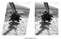
Looks like we've got our first drilling done.
Pre-contact: http://mars.jpl.nasa.gov/msl-raw-images/proj/msl/redops/ods/surface/sol/00174/opgs/edr/fcam/FLA_412940782EDR_F0060000FHAZ00206M_.JPG
Post-dril: http://mars.jpl.nasa.gov/msl-raw-images/proj/msl/redops/ods/surface/sol/00174/opgs/edr/fcam/FLA_412941161EDR_F0060000FHAZ00190M_.JPG
A scattering of sand appears in the second image and seems to have been displaced by wind toward the rover.
Posted by: CosmicRocker Feb 2 2013, 03:56 AM
Good catch.
That's really interesting.
Posted by: elakdawalla Feb 2 2013, 03:57 AM
You know, there is a lot of stuff moving between those two frames. And there are several cracks that seem to darken, which means either whole blocks of rock are shifting or there's dust that is descending into void spaces, maybe? It also seems to me that the left prong (but not the right) has sunk slightly, as though the rock underneath it is fragmenting under the preload force. It's all very puzzling.
Here's a blink gif, cropped to the places where I see the most change, and enlarged 300% by a nearest neighbor method so as not to mess with individual pixel values.
Posted by: djellison Feb 2 2013, 08:20 AM
Percussion on a rock could trigger such motion. I believe the first drill use is percussion only. Later a small drill - followed by a large drill.
Posted by: PaulH51 Feb 2 2013, 01:31 PM
Confirmed, Sol 174 Mastcam image show some fragmentation of the bedrock at that test site, we can also see that the witness mark left by the percussion test of the drill tip on the surface. I suspect that this particular rock will not be selected for deep drilling as the sleeve on the drill that collects the tailings could jam the drill if the rock was to move during drilling.
http://mars.jpl.nasa.gov/msl-raw-images/msss/00174/mcam/0174ML0638000000E1_DXXX.jpg
Paul
Posted by: Airbag Feb 2 2013, 06:57 PM
There is a second ML image, making a mini-pano of that same scene to provide some more context:
Airbag
Posted by: fredk Feb 2 2013, 07:08 PM
We've seen many times flat, platey rocks shift around when we drive on them, even with the much lighter MERs, so that wouldn't be too surprizing. But also the vibration might simply be settling sand/dust deeper into cracks, as you say.
Edit: The fact we're seeing little pebbles shifting quite far away from the drill contact indicates that the vibration is propagating at least that far. That suggests to me that the slab under the drill isn't loosely sitting on sand, but part of a larger piece of rock. So I vote for the settling sand idea. If we had MC before the operation that might confirm negligible displacement of the rocks.
Posted by: fredk Feb 2 2013, 08:29 PM
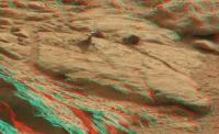
Maybe the old standby navcams can tell us something while we wait for MC34. Here's a flicker gif of the "shiny prong" from the sol 168 L/R pair, stretched and zoomed 4x (ugh; it's only the fact that we get stereo info that justifies such a zoom):
The prong is at dead centre. It looks pretty clear that the dark "stalk" below the shiny part is standing upright, rather than a hollow in the rock, as some have suggested. But the resolution isn't quite there to distinguish the shiny part with certainty.
I'm going to stick with my original interpretation, though I won't be shocked if I'm wrong...
Posted by: serpens Feb 2 2013, 10:38 PM
Being MER indoctrinated I'm a bit dimensions challenged with respect to Curiosity's images. Just how large is the inverted Italy feature?
Posted by: Greenish Feb 3 2013, 04:22 AM
Rough guess is about 3-4cm tall? Estimating about 8-10m away (which is hard because it's off of Phil's highest-res maps). MC100 pixel resolution is .074 mrad/pix, and it's ~50 px high.
I tried using an estimated declination angle but that came out closer to 30m, which I'm sure is too far looking at the HiRise images. It makes sense that it's closer due to rising terrain in that direction.
Posted by: mhoward Feb 3 2013, 05:06 AM
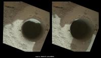
Some MAHLI http://www.midnightplanets.com/web/MSL/sol/00176.html are down. It looks very much like there are two percussion sites, unless I'm really missing something.
Edit: Looks like the second drilling took place today on sol 176; there are before and after MAHLI images.
Posted by: elakdawalla Feb 3 2013, 05:18 AM
To my eye the second spot looks like it was a bit more resistant than the first one was. The first one looks almost like an impression of the drill bit pressed into clay!
Posted by: eoincampbell Feb 3 2013, 05:25 AM
Hope it's as powdery as the dust streak suggests...
Posted by: iMPREPREX Feb 3 2013, 05:34 AM
I can't wait to check out those new MAHLI images.
So here's both sols 172 and 173 (MastCam 100). We just need a mosaic facing NE - SE to make these two connect, which would indeed be incredible... ![]()
Gigapan: http://gigapan.com/gigapans/122731
"Preview":
Posted by: Astro0 Feb 3 2013, 05:57 AM
Before and after animation on the drill/percussion site.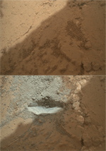
Larger versions to download http://astro0.files.wordpress.com/2013/02/drill_v2.gif or http://astro0.files.wordpress.com/2013/02/drill_v1.gif gifs
Posted by: iMPREPREX Feb 3 2013, 06:42 AM
Nice MAHLI shots! And thanks for that before and after animated GIF! Here is a collage (images have been sharpened a tad):
http://i.imgbox.com/adhtEBLW.jpg
MAHLI images are upside-down... You live and you learn. ![]() I hope my posts aren't trash and they come in handy to someone somehow. Please let me know if I should stop, and I will.
I hope my posts aren't trash and they come in handy to someone somehow. Please let me know if I should stop, and I will. ![]()
Posted by: PaulH51 Feb 3 2013, 01:42 PM
Yes, by appearance, possibly a fine clay. I was sort of hoping that the drill tailings would be coarser, so that these tailings could more effectively help clean out the CHIMRA (sample handling system). Sol 173 MastCam images show extensive contamination of large areas of CHIMRA's chambers. This contamination is residue from the multiple scooped samples at Rocknest. The contamination (Regolith) has excellent cohesive properties. Let's hope the drill tailings can remove enough of the Regolith to ensure accurate science from CHEMIN and SAM, and that the tailings are not as cohesive to cause issues later in the mission.
Posted by: Julius Feb 3 2013, 02:33 PM
Its amazing how martian dust can colour everything red. Who would have thought that this part of Mars was so grey!
Posted by: Actionman Feb 3 2013, 05:44 PM
![]() Wind blown clean. Very powdery
Wind blown clean. Very powdery ![]()
ADMIN NOTE: Different drill/percussion area to the one above.
Posted by: Airbag Feb 3 2013, 06:20 PM
Nice range of depth in this http://curiosityrover.com/imgpoint.php?name=NRA_412866868EDR_F0060000NCAM00322M_.
Airbag
Posted by: udolein Feb 3 2013, 09:42 PM
My version of Sol174 first drill MAHLI zoom:
http://www.marspages.eu/media/archive4/science_laboratory/24firstdrill/Sol176_Movie1_1.gif
Corresponding MAHLI zoom of Sol 176 second drill:
http://www.marspages.eu/media/archive4/science_laboratory/24firstdrill/Sol176_Movie2_1.gif
Note the hexagonal ChemCam laser marks in the upper left edge of the enlarged first image of each sequence ...
Posted by: Airbag Feb 3 2013, 10:35 PM
Are you referring to those two sets of indentations in opposite corners and equidistant from the drill point? I think those are the marks left by the drill's pre-load support posts. In the earlier tests only up to three "points" were seen for each post but presumably the drill's vibration (and perhaps higher pre-load forces than before?) has left nice "constellations" of marks.
Airbag
[Edit: see pages 3 and 4 of this thread for more info]
Posted by: mhoward Feb 4 2013, 05:20 AM
Mastcam images of the work area on sol 176 are down. Here's a quick stereogram and anaglyph.
http://www.flickr.com/photos/marscat/8442887307/ http://www.flickr.com/photos/marscat/8442887047/
Posted by: EdTruthan Feb 4 2013, 07:00 AM
YOWSERS! Look what just came down. -- MAHLI self-portrait #2 -- Here's a quickly rendered draft - reduced to 3294 x 2655 px... yeah baby.
http://www.edtruthan.com/mars/Sol177-MAHLI-Self-Portrait-Draft-3294x2655px.jpg
...and there's more. Full resolution below at 7818 x 2471 px...
http://www.edtruthan.com/mars/Sol177-MAHLI-Wheels-View-1-7818x2471px.jpg
Posted by: James Sorenson Feb 4 2013, 09:50 AM
My take on "Wall-eeeee!" ![]()
http://www.flickr.com/photos/43581439@N08/8443311415/
http://www.flickr.com/photos/43581439@N08/8443310315/
Posted by: EdTruthan Feb 4 2013, 11:30 AM
Very well done James. Here's my take on the full resolution version (with complete removal of the MAHLI lens schmutz):
Click thumb for Quarter-sized version (5500 x 4250 px - 2.93MB):
http://www.edtruthan.com/mars/Sol177-MAHLI-MSL-Self-Portrait-5500x4250px.jpg
Half-sized version (11,000 x 8,500 px - 9.29MB) http://www.edtruthan.com/mars/Sol177-MAHLI-MSL-Self-Portrait-11000x8500px.jpg.
Full Resolution version (22,000 x17000 px - 22.94MB - Zipped) http://www.edtruthan.com/mars/Sol177-MAHLI-MSL-Self-Portrait-22000x17000px.zip.
Posted by: wildespace Feb 4 2013, 12:57 PM
Great mosaics guys
Here's my Photosynth panorama: http://photosynth.net/view.aspx?cid=ce79e739-b975-44b2-9000-d6ca5ac7fcc1
Posted by: jmknapp Feb 4 2013, 01:16 PM
Yet another (click for zoom.it version):
http://curiosityrover.com/gallery/roverselfportrait.html
Posted by: Phil Stooke Feb 4 2013, 02:50 PM
Great self-portraits - and here is an updated view of the activities here at John Klein.
Phil
Posted by: Greenish Feb 4 2013, 03:19 PM
These are great, you folks must have the processing pipeline pretty well sorted by now to do such large mosaics so quickly! And maybe this means the MAHLI team has this pointing sequence scripted so we can look forward to more selfies in other scenic spots, maybe where they happen to have a runout sol....
Pretty neat that one can actually see the drill point impressions below the camera - gives an idea of how wide-angle this view really is.
Posted by: Gerald Feb 4 2013, 04:13 PM
Some white-balancing of a region of http://mars.jpl.nasa.gov/msl-raw-images/msss/00173/mcam/0173MR0926038000E1_DXXX.jpg
Posted by: Phil Stooke Feb 4 2013, 04:45 PM
http://astrogeology.usgs.gov/news/item/sol-176-update-on-curiosity-from-usgs-scientist-ken-herkenhoff-anomaly
A bit of news from Ken Herkenhoff: the sol 176 drill test was designed to repeat sol 174 after an anomaly (probably not serious) on sol 174. Typically these kinds of problems only mean a software setting was wrong, or a warning flag was triggered, and it is resolved very quickly.
Phil
Posted by: Ant103 Feb 4 2013, 08:42 PM
Here's my take on the awesome shots :
http://www.db-prods.net/marsroversimages/Curiosity/2013/Sol177_MAHLI_2.jpg
http://www.db-prods.net/marsroversimages/Curiosity/2013/Sol177_MAHLI.jpg
No full res on the selfportrait, because I was actually following some debate at the french National Assembly ![]() .
.
Posted by: udolein Feb 4 2013, 09:34 PM
I've spent some more looks on the subject - and yes, you are competely right ! The marks are not caused by the ChemCam. The support posts made it.
Cheers, Udo
Posted by: udolein Feb 4 2013, 10:55 PM
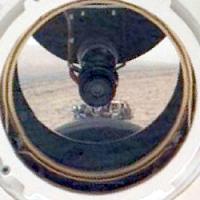
Aeolis Mons in ChemCam mirror - weird !
http://www.marspages.eu/media/archive4/science_laboratory/24firstdrill/Sol177MastCams.jpg
Cheers, Udo
Posted by: mhoward Feb 5 2013, 01:48 AM
FYI, it looks like the gap in the sol 170 M-34 panorama (as discussed a few pages back) has been filled on http://www.midnightplanets.com/web/MSL/sol/00176.html, although the full images haven't been downlinked just yet. The images were taken about an hour earlier in the sol than on sol 170.
Posted by: jmknapp Feb 5 2013, 01:56 AM
Here's a YouTube video of the movements of the rover in for the last 30 sols or so, overlaid on Phil Stooke's map, along with animation of the CHEMCAM laser shots (pew! pew!), according to the NAIF data:
http://www.youtube.com/watch?v=wbqpPz5NhdY
EDIT: updated video with a couple more effects
Posted by: Astro0 Feb 5 2013, 02:02 AM
Joe, that was brilliant and with the sound effects also extremely funny ![]()
pew pew pew pew!
Ant, and everyone, brilliant self-portraits.
Ant, I used your versions to create a side-by-side from Sol 84 and now Sol 177.
Not quite the same stitching but adequate to note the small changes since the last 'selfy'.
More dust noticeable on surfaces and some of the 'gravel' from landing moved or gone.
Posted by: CosmicRocker Feb 5 2013, 02:46 AM
Joe: That was incredible!
It has to be one of my all-time favorite creations from the halls of UMSF. ![]()
![]()
![]()
Posted by: Airbag Feb 5 2013, 02:49 AM
My version (hey, I was at work!) selfishly projected, cropped and scaled specifically for my 1920x1200 desktop:
Airbag
[Edit: pano updated with a couple more images]
Posted by: Phil Stooke Feb 5 2013, 03:00 AM
Joe - where have you been all my life?
Phil
Posted by: Explorer1 Feb 5 2013, 04:11 AM
The fact that they've nailed down technique means that as the years pass we'll have quite the album of self-portraits with shifting backgrounds (like that gnome taken on vacation). The Roaming Rover! Astro0's http://www.unmannedspaceflight.com/index.php?showtopic=7591&view=findpost&p=197670...
Posted by: CosmicRocker Feb 5 2013, 07:34 AM
Getting back to the drill, http://mars.jpl.nasa.gov/msl-raw-images/msss/00176/mcam/0176MR0941000000E1_DXXX.jpg as if they tried three spots, each at a different Z distance.
One, in the lower left, may have barely touched the surface, and then the other two which have been discussed.
Posted by: Phil Stooke Feb 5 2013, 12:00 PM
No, the lower left area is where they used the brush earlier.
Phil
Posted by: jmknapp Feb 5 2013, 12:48 PM
Phil, just keep those hi-res maps coming (about 1cm/pixel!).
Posted by: Ant103 Feb 5 2013, 12:48 PM
Full resolution available now. It tooks less time that I was expecting to process ![]()
http://www.db-prods.net/marsroversimages/curiosity-2013.html#41
Posted by: Gerald Feb 5 2013, 04:15 PM
Trying to get some Sol 178 MAHLI stereo image using regions of two displaced images:
The angles, from witch the two images were taken, were almost similar, so there is just a little 3d-effect.
I think, this one is easier to see:
EDIT: The latter as animated gif, makes parallaxe visible, and may give some 3d-impression for one-eyeds:
Posted by: PaulH51 Feb 5 2013, 11:26 PM
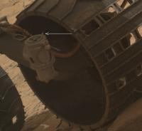
While reviewing the Sol 177 MAHLI images of the rover, I spotted what could be a small perforation in the metal rim of one of the rovers front wheels, it could also be an imaging anomaly? Maybe some of the imaging folk here can throw some light on this observation?
[http://mars.jpl.nasa.gov/msl-raw-images/msss/00177/mhli/0177MH0109002000E1_DXXX.jpg]
[http://i.imgbox.com/adwlZbHu.jpg]
Posted by: djellison Feb 5 2013, 11:35 PM
Nope - that's wheel damage. Entirely expected and nothing to worry about. These wheels will be very beaten up after a few 10km's - it'll happily keep on truckin.
Posted by: fredk Feb 6 2013, 12:10 AM
This frame shows your catch a bit better:
http://mars.jpl.nasa.gov/msl-raw-images/msss/00177/mhli/0177MH0110002000E1_DXXX.jpg
Two ideas apart from a perforation: A bit of bright material inside the wheel, or bright light reflecting from a dent. You can clearly see examples of this latter idea on the inside of the wheel, catching the sunlight, in this image:
http://mars.jpl.nasa.gov/msl-raw-images/msss/00177/mhli/0177MH0106002000E1_DXXX.jpg
Edit: another example:
Posted by: Astro0 Feb 6 2013, 02:32 AM
On the possible interpretation of the wheel being perforated or light reflection...
Stretching the image that fredk posted shows that there are 'bright spots' in both wheels (front and center). I've inset the unenhanced images of those sections to illustrate.
The forward wheel's 'glint' seems associated with a part of the rover attached to the 'axel' (for want of a better word), as does the one on the centre wheel (though less obvious that it's associated with the 'axel'). This suggests at least that it may be reflection as fredk proposed.
Of course, both could be coincidental alignments of camera, 'axel' and wheel inner surface. There are undoubtedly lots of dents in the wheels as seen in numerous images and as experienced on the Earth-based rover twin. It's wheels have certainly been perforated in the Mars-yard at JPL. It will most certainly happen on Mars too.
What we need to confirm whether there are punctures in Curioisty's wheels right now, will be views of the same areas from other camera angles, particularly from the outer surface of the wheels.
It's an interesting exercise in spotting changes to the rover, but as Doug said, it's expected and not a problem for the foreseeable mission.
Posted by: James Sorenson Feb 6 2013, 07:53 AM
Another MAHLI view of it's Calibration target on Sol-179.
http://www.flickr.com/photos/43581439@N08/8449148169/
Posted by: iMPREPREX Feb 6 2013, 07:57 AM
Very cool, James. ![]() I was thinking the same thing (as far as a collage is concerned).
I was thinking the same thing (as far as a collage is concerned). ![]()

Full resolution:
http://i.imgbox.com/adj4cpJe.jpg
Posted by: Gerald Feb 6 2013, 10:51 AM
Six sol 179 MAHLI images taken from different distances can be used for a "zoom in / zoom out" (size 50%):
Posted by: jmknapp Feb 6 2013, 12:03 PM
Gerald: MAHLI thrill-cam?
A mosaic of two MASTCAM LEFT images from sol 170 (current location):
http://curiosityrover.com/gallery/mastcam_sol170.html
Posted by: fredk Feb 6 2013, 04:15 PM
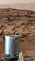
Shiny-blobs-on-a-stick, in MC L/R stereo.
Edit: I've posted improved versions a few posts below.
Anaglyph:
Side-by-side:
Flicker:
Posted by: mhoward Feb 6 2013, 04:27 PM
Fredk: nice.
A public service announcement ![]() : the http://www.midnightplanets.com/web/MSL/sol/00176.html images that complete the sol 170 M-34 panorama have now been downlinked.
: the http://www.midnightplanets.com/web/MSL/sol/00176.html images that complete the sol 170 M-34 panorama have now been downlinked.
Posted by: Fran Ontanaya Feb 6 2013, 07:15 PM
The images have shown several crevices in the area already. How do they remain clean with so much dust going around?
Posted by: fredk Feb 6 2013, 08:25 PM
Update to my shiny blob images. I've averaged the original sol 173 ML frame with a new one from 176 to beat down the jpeg noise in the zoomed left channel. The results are definitely better, but not dramatically.
Anaglyph:
Side-by-side:
Flicker:
Posted by: iMPREPREX Feb 7 2013, 12:07 AM
Here is a giant mosaic collage including my version of the self portrait. ![]()
http://gigapan.com/gigapans/123015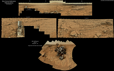
Posted by: CosmicRocker Feb 7 2013, 02:24 AM
Outstanding. That's a nice demonstration of how that camera can work.
Posted by: CosmicRocker Feb 7 2013, 04:07 AM
Oooh! The best yet.
Posted by: iMPREPREX Feb 7 2013, 04:46 AM
That is great. Thank you as well, Fred. ![]()
Posted by: PaulH51 Feb 7 2013, 09:28 AM
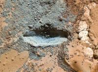
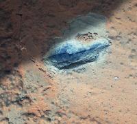
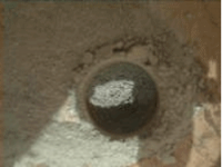
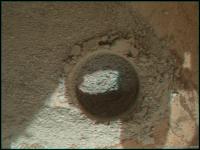
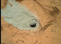
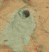
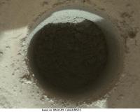
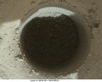
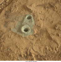
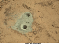
'Mini Drill' : First MAHLI image of the first drilled hole is in ![]()
The tailings appear to be perfect for processing through CHIMRA..... More science to follow ![]() Follow link below...
Follow link below...
[http://mars.jpl.nasa.gov/msl-raw-images/msss/00180/mhli/0180MH0211000000R0_DXXX.jpg]
Posted by: jmknapp Feb 7 2013, 10:06 AM
How about a gypsum "desert rose"?
http://www.southampton.ac.uk/~imw/jpg-Sabkhas/11SBK-Fan-Cleavage-Gypsum-Umm-Said.jpg
Posted by: Ant103 Feb 7 2013, 11:01 AM
Sol 170 Mastcam34 pan, updated with Sol 176 images.
http://www.db-prods.net/marsroversimages/curiosity-2013.html#39
But what I still can't understand why Sol 176 were took with a direct sunlight, instead of the soft light of twilight. It's like it's deliberated, to avoid some kind of "overexposure" (overexposure of what ? The blue-ish tint of the sky there at this time of the sol ?). IMO, I think it's time to stop recording rocks pictures and take some images with a strong public impact, like sunset (or -rise), at 100 mm and 34 mm, starfielfds, self-portrait of the Mast assembly in foreground of twilight or dawn, etc. Some pictures that could say to public : Curiosity IS on Mars, and she's doing amazing things here !
Sorry for the off-topic, but with half an earth year on Mars, and so few great pictures to deal with (to dream with if I dare say), except a lot of rock collections, I think it's sad.
Posted by: xflare Feb 7 2013, 11:13 AM
[http://mars.jpl.nasa.gov/msl-raw-images/msss/00180/mhli/0180MH0211000000R0_DXXX.jpg]
There's a lot of it......I wonder if they could use the scoop to get some of that material into the chimra and then into the rover rather than up through the drill..?
Posted by: paraisosdelsistemasolar Feb 7 2013, 11:32 AM
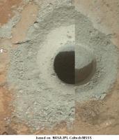
My take on the Sol 180 drill:
The original size image can be found here: https://www.dropbox.com/s/5151rhkt159d66u/taladrosol180.jpg
Posted by: PaulH51 Feb 7 2013, 11:32 AM
I think the plan is to first drill a full depth hole, but not collect the tailings into CHIMRA, then if they consider that test OK and the tailings suitable for entry in CHIMRA, they will perform another series of drilling for collection, but that will be used to clean the drill, its sleeve and the tailings collection chambers inside CHIMRA of any contamination from earth and then the rest of the chambers of the remaining Regolith from the scooped samples taken at Rocknest. Only when they are happy with all that cleaning will they process samples for SAM and or CHEMIN
Posted by: Gerald Feb 7 2013, 12:44 PM
A Sol 180 example of the subtle MAHLI focus stacking mechanism, using 16 low-res images (size 130%):
Posted by: PaulH51 Feb 7 2013, 01:36 PM
Nice GIF Gerald! It's a pity that some of the tailings are still in the hole, or maybe we could have estimated the full depth of the hole using this method?
Posted by: djellison Feb 7 2013, 02:12 PM
One could calculate the dpeth by the position of the shadow and the local solar time.
Posted by: mcaplinger Feb 7 2013, 02:18 PM
with half an earth year on Mars, and so few great pictures to deal with (to dream with if I dare say), except a lot of rock collections, I think it's sad.
Wow. You having a bad day?
It's hard to take images near dawn and sunset because of thermal and Chemcam sun-pointing constraints. The ops people have been very conservative about focus, exposure, and data volume and that's led to fewer sequences that take longer than I was expecting.
That said, I think we've done pretty well considering, and your criticism is a bit over the top. I'd have thought that you, if anyone, would appreciate that.
Posted by: Phil Stooke Feb 7 2013, 02:37 PM
Here's the location of the new drill hole on the mosaic posted earlier by EdTruthan.
Phil
Posted by: fredk Feb 7 2013, 03:28 PM
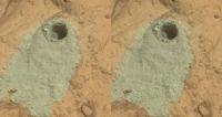
Here's the MH view in stereo. Not perfect because of different shadows between the two frames:
Posted by: fredk Feb 7 2013, 03:44 PM
If I may add to the OT, your own mosaics, Ant, prove your words wrong! And your latest 170/176 late afternoon mosaic is perhaps the best yet! The fact that there's a patch shot at different sun angle proves that this is not easy, like shooting panoramas from the Eiffel Tower would be. This is Mars.
Posted by: Greenish Feb 7 2013, 03:53 PM
Here's a comparison of the hole to the calibration target/penny with both resized to the same scale (assumed hole = 16mm which is just larger than the 5/8-inch drill bit diameter; it could be a bit larger).
Posted by: paraisosdelsistemasolar Feb 7 2013, 04:13 PM
Maybe my math is wrong due to scale issues, but could the hole be 0.85 cm. (0.33 inches) deep?
I was using my own DEM to do this calculations.
Posted by: Greenish Feb 7 2013, 04:22 PM
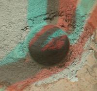
And here are 3D views (anaglyph/crosseye) of the first hole synthesized from MAHLI depthmap.
Posted by: eoincampbell Feb 7 2013, 04:37 PM
From the http://mars.jpl.nasa.gov/msl/news/whatsnew/index.cfm?FuseAction=ShowNews&NewsID=1419 this mini-drill test was to penetrate less than eight-tenths of an inch...
Posted by: Paul Fjeld Feb 7 2013, 04:53 PM
I want to be careful here... Damien, I feel your frustration. Personally I wish that all NASA programs had a deliberate policy of "pretty pictures", not by accident but by design. So you'd lose maybe one percent of your science time and go for the most telling, dramatic images you could design - your ideas are a good start. But I'm grateful that the MSL team shares what it does and that some of the participates are here commenting. I'm tremendously grateful that you and the others are doing such great stuff with what is out there.
Posted by: elakdawalla Feb 7 2013, 05:02 PM
Damien, I have to say I just don't agree with you at all here. Step back a moment -- everyone -- and remind yourself how amazing it is to be seeing any images within hours of their being snapped on the surface of another world, much less images from cameras with the quality of the Mastcams and MAHLI. Much less from a landscape with the geologic quality of this one. I may complain from time to time about the pace of the mission, but not about the images, or about my access to them.
How could photos of bedrock on the surface of Mars strike anyone as banal?
Posted by: djellison Feb 7 2013, 05:03 PM
Yes - it really is such a shame that they've not taken pictures with a great public impact.
Apart from the three self portraits - or each time they've gone back and added Mt Sharp into a panorama - or the fact we already have several MastCam 360's when actually, the plan wasn't really to get many at all.
Given the engineering contraints - ESPECIALLY as we're still comissioning the vehicle - we have, frankly, been spoiled.
Posted by: Ant103 Feb 7 2013, 05:25 PM
Yes, I totally understand that's it is always a challenge to take pictures on Mars, and I -we- have to be satisfied of what these amazing cameras bring us from Mars.
So, forgive me if I may have been out of the lines. I respect, and will always, respect the work of the enginers, and all of the MSL's team. I didn't mean to hurt someone, I was just giving some of my personnal feelings about.
But I'm still keeping the hope to see sunset, dawn and/or twilight pictures ![]() .
.
Posted by: belleraphon1 Feb 7 2013, 05:26 PM
I remember the Mariner 4 images (when they were first presented).
The imaging we get now from the rover and orbiter assets we currently have at Mars ..... every grain and pebble looks precious to me!
And I am no geologist.
Craig
Posted by: Eyesonmars Feb 7 2013, 05:33 PM
How could photos of bedrock on the surface of Mars strike anyone as banal?
Emily, Doug: I'm sure almost everyone on this forum, including myself, agrees with you 100%. So you are preaching to the choir so to speak. But I think Damien's (ant103) suggestion is intended to be viewed from the perspective of the scientifically curious general public. From their perspective your comment might fall on deaf ears . To be frank, I am having trouble keeping my friends interested.
Posted by: djellison Feb 7 2013, 05:40 PM
A pretty picture or two wont change that - I promise you.
Posted by: machi Feb 7 2013, 05:44 PM
I think that we can expect such pictures sometime in future. Patience!
Posted by: Paul Fjeld Feb 7 2013, 05:46 PM
If I could, I would give Damien a camera, a spacesuit, and one full SOL with Curiosity. I think we would be amazed at what Gale still has to offer...
Posted by: Paul Fjeld Feb 7 2013, 05:58 PM
Let me amend that: I'd give him a camera - and - a hammer and a bag and tell him to run like those grocery store winners who have 10 minutes and a shopping cart.
Question: what would the scientists prefer - a hammer and a bag but no camera (no context) or a camera but no sampling?
Posted by: fredk Feb 7 2013, 06:05 PM
I was using my own DEM to do this calculations.
Posted by: Eyesonmars Feb 7 2013, 06:07 PM
Perhaps, but it is the atmospheric landscape type of shots with the topography fading into the haze, for instance, that get people's attention ( from my experience).
And to be fair, many of the images called "pretty" do have some scientific value.
One image I'm looking forward to will be taken when Curiosity is up a ways on the flank of Mt. Sharp gazing out at the horizon with Mt. Sharp and the rim of Gale crater rising up thru the fog. We know from orbital images that ground ice fogs are present at sunrise in low lying equatorial regions around aphelion. So it is not out of the question.
Posted by: paraisosdelsistemasolar Feb 7 2013, 06:18 PM
I created the DEM and after that I taken the estimate of the diameter of the drill hole and applied the calculation to the depth of the hole observed in my DEM. I think today I'm not explaining as well as I would
Posted by: jmknapp Feb 7 2013, 06:26 PM
Cassini has long since put "Kodak Moments" in their imaging plans--they even have the tag KODAKMM or something like that. Since many of Curiosity's sensors are Kodak issue, it's particularly apt to do likewise here! The self portraits and MASTCAM pans definitely qualify. Have to admit, I don't have the finely-honed aesthetic of a geologist who can look at a group of desert rocks and marvel at the "beauty." It's when the experts add the interpretation that it comes alive. Hopefully more of that when they turn to Mt Sharp.
Posted by: paraisosdelsistemasolar Feb 7 2013, 06:31 PM
Sorry for my auto-reply:
For making the measure, as I stated before, I created the DEM from the images. After that I extracted a profile (crossing the hole). As far as I know, Curiosity drill is 1.6 cm in diameter, so I taken this measure and made a rule of three with the depth estimation from the profile (because my profile is in arbitrary units).
The point is I don't have more information, so that's my best guess.
Posted by: erwan Feb 7 2013, 06:43 PM
Damien, i think You should realize that YOU are taking MSL images with a strong public impact.
Posted by: wildespace Feb 7 2013, 06:56 PM
And to be fair, many of the images called "pretty" do have some scientific value.
One image I'm looking forward to will be taken when Curiosity is up a ways on the flank of Mt. Sharp gazing out at the horizon with Mt. Sharp and the rim of Gale crater rising up thru the fog. We know from orbital images that ground ice fogs are present at sunrise in low lying equatorial regions around aphelion. So it is not out of the question.
There are plenty of Mastcam shots with the horizon and a bit of sky visible. But due to the dusty atmosphere, you can't see very far. You can just about make out the rim of the crater from Curiosity's location.
I'm not a geologist of any kind, and even I find the martian terrain captivating.
Posted by: paraisosdelsistemasolar Feb 7 2013, 06:58 PM
Now the dimensions of the hole are avaiable on Planetary Photojournal: http://photojournal.jpl.nasa.gov/catalog/PIA16761
It says the hole is 1.6 cm in diameter and 2 centimeters deep, but, maybe it's a perspective error, I think it's wider than deeper. Am I wrong?
Posted by: fredk Feb 7 2013, 08:33 PM
It's possible that tailings in the hole make it look shallower than it was drilled.
But it's also possible that there's only a thin coating of tailings in the hole. Without knowing some engineering numbers we can't know how deep the hole is from these images. (As you said, the depth axis in your DEM is arbitrary units.)
Posted by: Gerald Feb 7 2013, 09:32 PM
Does someone know, whether the MAHLI motor count is available for one of the stacked images? Using the preliminary(?) motor count - focus depth map of one of the MAHLI papers might allow a good estimate for the depth axis scaling.
EDIT: I took the 5cm distance of the Photojournal, estimated the motor count to about 14500 from an available plot of the above map, estimated the motor count difference to about 400 from http://mars.jpl.nasa.gov/msl-raw-images/msss/00180/mhli/0180MH0211000001S0_DXXX.jpg (about half the range of 16 images with respective motor count difference of about 50), meaning a motor count of about 14100 for the floor of the hole. The plot of the map is very close to 7cm working distance (for my eyes). So I regard a hole depth of about 2cm as consistent with results of this very preliminary method.
Posted by: fredk Feb 7 2013, 10:50 PM
Joe, are you able to extract the displacement between the two stereo MH frames:
http://mars.jpl.nasa.gov/msl-raw-images/msss/00180/mhli/0180MH0146001001E1_DXXX.jpg
http://mars.jpl.nasa.gov/msl-raw-images/msss/00180/mhli/0180MH0146001000E1_DXXX.jpg
Knowing the distance from mahli to the hole (since we know the hole diameter and MH fov), we could easily extract the depth of the hole from the parallax between the bottom and the rim.
Posted by: dilo Feb 7 2013, 11:11 PM
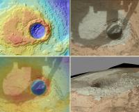
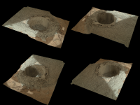
Four renderings of the drill-hole focus depth map, made with PovRay:
(each view is rotated by 90° around vertical axis)
Posted by: PDP8E Feb 7 2013, 11:11 PM
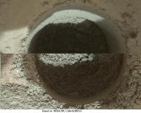
Here is the test hole. I combined two MAHLI images and warmed it up a bit.
Is there a mechanical reason for the preferred fallout pattern of the drill tailings?
They all seem to drift to the upper left...
NEWS FLASH: Martian rocks are grey, all that red stuff is dust
Posted by: Gerald Feb 7 2013, 11:12 PM
From the hole diameter and the optical displacement, the absolute displacement should be close to 6mm, same pointing assumed. But the rim is higher than the surrounding plate.
EDIT: I get an expected parallaxe of about 2.4 mm, or 15% the hole diameter; something must be wrong with this.
We have at least to add some unknown length to the working distance for a valid parallaxe calculation.
Posted by: djellison Feb 8 2013, 12:04 AM
So no one has tried taking the known diameter of the hole and the location of the shadow at the bottom in conjunction with the known local solar time to figure out the depth?
I'm travelling so can't bash out the numbers myself. It's not that hard though, surely.
Posted by: Airbag Feb 8 2013, 12:34 AM
Speaking of images of rocks ![]() here is ahttp://curiosityrover.com/imgpoint.php?name=0179ML0986001000E1_DXXX:
here is ahttp://curiosityrover.com/imgpoint.php?name=0179ML0986001000E1_DXXX:
The lower left rock is quite undercut and almost looks like it is floating when seen from different angles; I remember seeing it from the side before but for now the best one I can find http://mars.jpl.nasa.gov/msl-raw-images/msss/00162/mcam/0162ML0873000000E1_DXXX.jpg.
Airbag
[Edit: Ah, just noticed there is a set of matching full size MR images for this location too]
Posted by: Gerald Feb 8 2013, 01:27 AM
(EDIT: The following calculation is incomplete, because of Marsian obliquity of 25.2°!)
By the "shadow" method I get a lower bound of 19 mm from the floor to the rim:
The image was taken at 12:47:11 P.M. LMST. That means about 12:45:00 P.M. LTST. An angle of 11.25° to 90°. MSL is 4.5° south. By Pythagoras I get an angle of 12.1° of the sun from zenith. The elevation of the hole is likely near 83.5° (90°-6.5°). Together a maximum angle of 18.6°. The shadow has a visually estimated length of about 6.4mm. Dividing 6.4mm by the tangens of 18.6° yields 19mm.
Considering the bearing of the hole will yield a deeper hole. An assumed elevation of the hole of -90° yields about 30mm from the floor to the rim.
Posted by: Reed Feb 8 2013, 03:08 AM
In this gif http://photojournal.jpl.nasa.gov/catalog/PIA16762 the dust in the crevice around the block being drilled sinks quite noticeably. Neat.
Edit:
link to photojournal page rather than gif
Posted by: RoverDriver Feb 8 2013, 03:32 AM
Is there a mechanical reason for the preferred fallout pattern of the drill tailings?
They all seem to drift to the upper left...
...
Hmmm... I think it is called gravity and I believe it is available on Mars ;-) I was confused as well until you look at the Mastcam instead of MAHLI.
Paolo
Posted by: PaulH51 Feb 8 2013, 03:36 AM
They all seem to drift to the upper left...
An animated GIF recently issued by JPL seems to answer that question for you. It indicates that the direction of the pattern for the tailings is caused by gravity due to the gentle incline of the bedrock towards the rover, this movement would have been greatly amplified by the percussive action of the drill. In addition to the tailings we can see some small pebbles and a quantity of dark fine particles on the same rock moving in the same direction.
[http://photojournal.jpl.nasa.gov/archive/PIA16762.gif]
Posted by: PDP8E Feb 8 2013, 04:16 AM
Paolo
Hey Paolo, PaulH51,
That's what I like about this place, ask a question, and get the answer.
For the curious, Mars gravity is 3.71 m/s*s, while here on Earth it is 9.78 m/s*s
So my 91 kg (~200 lb) mass would only weigh about 35 kg (~76 lb) on Mars!
thanks for the NASA GIF link
Posted by: nprev Feb 8 2013, 04:22 AM
True. But don't forget to try Google first for the easy ones....
(And, yeah, that is an awesome .gif!!!)
Posted by: fredk Feb 8 2013, 05:10 AM
I can see the tailings moving downslope because of the vibrations. But another possibility is wind - we've seen that blow the scoop contents around.
You might think this uncertainty would have only a small effect, but these pics were taken with the sun near zenith, like you said. So a small error in hole direction can have a huge effect on the depth you calculate.
Posted by: ChrisC Feb 8 2013, 05:24 AM
Just a warning: Megan Garber at The Atlantic wrote about this Thursday night, and I'm starting to see it make the social media rounds.
Um, What's This Weird Hunk of Metal We Just Found on Mars?
http://www.theatlantic.com/technology/archive/2013/02/um-whats-that-weird-hunk-of-metal-we-just-found-on-mars/272972/
Posted by: Gerald Feb 8 2013, 06:55 AM
You might think this uncertainty would have only a small effect, but these pics were taken with the sun near zenith, like you said. So a small error in hole direction can have a huge effect on the depth you calculate.
It's even worse: Mars is now near solstice, so obliquity has to be considered; I neglected that unintentionally in an unjustified way.
The 83.5 degrees are taken from parameters of images, where the axis of vision is almost identical to the axis of the drill hole, e.g. http://mars.jpl.nasa.gov/msl-raw-images/msss/00180/mhli/0180MH0145003000E1_DXXX.jpg, bearing about 223°.
Are you able to improve those calculations using a planetarium software to get the exact angle between sun and drill hole axis?
Posted by: jhagen Feb 8 2013, 08:37 AM
Shadow reduction on the sol 180 MH drillhole images to improve the anaglyph version a bit.
Of course, some value artifacts are introduced...
Posted by: xflare Feb 8 2013, 09:17 AM
Um, What's This Weird Hunk of Metal We Just Found on Mars?
http://www.theatlantic.com/technology/archive/2013/02/um-whats-that-weird-hunk-of-metal-we-just-found-on-mars/272972/
Weird to watch a news story spread.... that "story" started on here lol
Posted by: vikingmars Feb 8 2013, 10:11 AM
I read this interesting exchange of views and I must admit that I fully agree with Damien & EyesonMars' opinions.
I've recently checked this issue with the French Press (daylies and weeklies) and TVs. I know what I'm speaking about, having helped a lot for the setting up of the Mars Outreach Program at JPL with Cheick Diarra from 1993 (and the Planetary Exploration outreach in France at Societe Astronomique de France with TPS since 1982)... The conclusion is that the Press feels really bored now in France (although we share two important MSL experiments with NASA) and they do not see any beauties in the rocks, we are drooling for.
You may not understand those opinions, because we are all "aficionados" here sharing the same passion about Mars and about this outstanding mission. In other terms, as we say also : "a fish does not know what it is to be wet"...
Anyway, the cameras are great, the images are of outstanding quality, so sharp that you can almost count dust grains on the rocks... But, please remember that it is not the camera that make nice pictures, it is the person behind it...
This is why I would kindly suggest, if I may, that we let the Mars Outreach people doing their work and fine-tune their strategies towards the public
Posted by: ngunn Feb 8 2013, 10:47 AM
It's interesting that absolutely nothing beyond that moves. The blocks must be well vibration-insulated from their neighbours
Posted by: xflare Feb 8 2013, 11:48 AM
That's just the way the press works. I wouldn't expect a press organisation to follow any science endeavour in great detail. I would expect occasional reporting when interesting discoveries are made.
Posted by: jmknapp Feb 8 2013, 11:56 AM
While I can get the orientation of the MAHLI shots, I'm at a loss to figure out the SPICE code to get the XYZ position of the camera--it keeps giving an error when I try to use spkpos_c(), which works well enough for, say, the rover itself.
FWIW, the sun elevation at the time of the MAHLI shots was 67.2 degrees. Taking http://mars.jpl.nasa.gov/msl-raw-images/proj/msl/redops/ods/surface/sol/00180/opgs/edr/fcam/FRA_413471035EDR_F0060000FHAZ00210M_.JPG as reference for the drill orientation, I get an angle between the drill ("powder acquisition and drill system," MSL_PADS) vector and the sun vector at the time of the MAHLI shots of 27.2 degrees. So, if the MAHLI shot is more or less directly over the hole and the shadow is 6.5mm, then the depth is 6.5/tan(27.2) = 12.6 mm.
Assuming no errors!
Posted by: PaulM Feb 8 2013, 12:13 PM
Jan van Driel
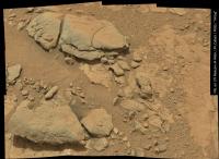
I like the impression this picture gives me of a Roman road leading to the base of Mount Sharp. I wonder when we will be headed that way?
Posted by: jmknapp Feb 8 2013, 12:15 PM
How did Nancy Atkinson at Universe Today (or her source) get this?:
Read more: http://www.universetoday.com/99750/another-weird-shiny-thing-on-mars-2/#ixzz2KJDqghX7
Is that right?
Posted by: Mr Valiant Feb 8 2013, 12:21 PM
Amazing Giff. Interesting to see the 'Brasil Nut' effect. Is there an Earthly analogue for the hammer drill.
I generally drill wood, rarely use the hammer drill. Not on 'rocks' at any rate.
As for fredk's protuberence, it is things like this that do generate public interest. It may turn out not to
be C3PO's foot, and I'm sure we will have a closure look and better evaluation. People like a mystery. Our best
movies and works of art draw people into their strangeness and suspense.
I must admit, when I was much younger, I to felt that 'maybe', a small maybe, the 'Face on Mars' had merit that
warranted further examination, and I mentally urged the follow up probes to make the investigation. Did
not President Clinton also request MGS to make a close look asap?
That's exploration. Why climb that mountain?
As much as we hold true to scientific method, surely the occasional bit of the old 'gung ho', 'hey, let's check this out',
is what the paying public wants.
Posted by: mcaplinger Feb 8 2013, 02:12 PM
What's the error message? You loaded one of the "ra" kernels, I assume? And you also need to load "msl_struct_v01.bsp"
But I don't know if this will work, I haven't tried it myself yet.
Posted by: Greenish Feb 8 2013, 02:51 PM
I don't think so but to be sure I grabbed the NAVCAM pics and re-measured the distance using AlgorimancerPG. Confirmed distance is about 8.8-9 meters. Given the extent of about 50 pixels in the M-100 image, I continue to estimate it around 3.3 cm tall (say 3-4 cm to be safe).
Posted by: jmknapp Feb 8 2013, 03:26 PM
Someone made a wonderful 3D computer model of Curiosity, available for $15:
http://www.renderosity.com/mod/bcs/mars-rover-curiosity/95997
The one on TurboSquid is more detailed, but goes for $200:
http://www.turbosquid.com/3d-models/3d-mars-curiosity-rover-model/685402
Could open up a chance for some cool visualizations, particularly if driven by actual rover NAV data.
Here's a test animation I did with the renderosity model and Poser Pro 2010 animation software--a drilling sequence, apropos to this thread:
http://www.youtube.com/watch?v=Z6zaToRu5bc
Posted by: fredk Feb 8 2013, 04:08 PM
Posted by: paraisosdelsistemasolar Feb 8 2013, 04:19 PM
I agree with jmknapp about the depth of the hole. With the new MastCam images I get around 1.1-1.2 cm. deep.
Posted by: jmknapp Feb 8 2013, 04:21 PM
The engineering data doesn't have any marker that says "we started drilling at this time" so I needed a image that showed the drill approximately in position. Given the time of that HAZCAM image the orientation of the drill (MSL_PADS) comes out of the engineering data.
It's much like getting camera pointing, except that camera images conveniently have a time stamp, and drill events don't (publicly).
I was thinking it was hard to tell if part of the shadow included a side of the hole, if the MAHLI shot wasn't directly overhead--maybe not.
Posted by: fredk Feb 8 2013, 04:39 PM
I see; thanks Joe. It sounds like that's going to be our best estimate.
MC perhaps gives a better sense of the depth of the hole (subject to the usual depth perception ambiguity):
Posted by: Gerald Feb 8 2013, 06:47 PM
Four Sol 181 activities, as seen from Front Hazcam Right A, 700x500 pixel region, no further processing:
Posted by: jmknapp Feb 8 2013, 08:26 PM
I have the struct kernel at least--here's my kernel file:
http://curiosityrover.com/rover2.txt
Using the date of the MAHLI image 07FEB2013 1:43:31 UTC gives an et of 413473478.
With that et, the follwoing call works fine to get the rotation matrix between MSL_MAHLI and MSL_TOPO
pxform_c("MSL_MAHLI","MSL_TOPO",et,cmat) ;
But this call to get the MAHLI state fails:
spkezr_c("MSL_MAHLI",et,"MSL_TOPO","NONE","MSL_LANDING_SITE",mahlistate,<) ;
Posted by: mcaplinger Feb 8 2013, 08:39 PM
http://curiosityrover.com/rover2.txt
I think you need http://naif.jpl.nasa.gov/pub/naif/MSL/kernels/spk/msl_struct_v01.bsp which you don't seem to have; the IK file you do have is not the same thing.
Posted by: Ant103 Feb 8 2013, 08:55 PM
I've dreamed to do this since the Mastcam34 images were released. Sol 176 images bring me closer to that dream. And a little Gimp sausage, and here we go ! A new postcard, at twilight times, from Yellowknife Bay ![]() .
.
Enjoy !
http://www.db-prods.net/blog/2013/02/08/crepuscule-sur-glenelg-sol-170-176/
Posted by: jmknapp Feb 8 2013, 09:38 PM
Hey, that works--thanks so much. Now to fredk's question, here are the XYZ coordinates (north, east, elev relative to landing site) of the MAHLI camera in meters and rotation angles in degrees for the two shots:
http://mars.jpl.nasa.gov/msl-raw-images/msss/00180/mhli/0180MH0146001000E1_DXXX.jpg 2013 FEB 07 01:46:35 UTC XYZ [ 0.561 444.523 -17.372 ] roll -4.39, pitch 4.69, yaw 47.94
http://mars.jpl.nasa.gov/msl-raw-images/msss/00180/mhli/0180MH0146001001E1_DXXX.jpg 2013 FEB 07 01:49:36 UTC XYZ [ 0.566 444.527 -17.371 ] roll -4.38, pitch 4.70, yaw 48.12
Not sure offhand what the best coordinate system is for figuring out the stereo, but those are some numbers anyway!
Posted by: PaulH51 Feb 9 2013, 08:54 AM
Drill testing continues with another success on Sol 182, so far only a small sequence of MAHLI thumbnails are available of the hole, so difficult to judge the depth, but it appears somewhat deeper than the first one. Like the 'mini drill', there appears to be some tailings at the bottom of the hole ![]()
Posted by: Gerald Feb 9 2013, 10:56 AM
XYZ [ 0.566 444.527 -17.371 ]
From this we can at least derive the distance of the two points to sqrt(5²+4²+1²)mm=sqrt(42)mm=6.48mm, in good correspondence with the visual inference of the displacement, regarding the 1mm precision; pointing changed just 0.18 degrees.
Damien: Great! We can begin to dream of the trip to Mount Sharp.
Posted by: Gerald Feb 9 2013, 11:51 AM
A region of a Sol 182 MAHLI image:
Visually, I get a quotient of the bottom by the top diameter projection of about 0.73. May be this can be used to estimate the relative depth of the two drill holes.
EDIT: For a better comparison of the two holes:
and
The distances of the two MAHLI images from the rims seem to be almost the same 5cm.
Posted by: Gerald Feb 9 2013, 01:05 PM
http://mars.jpl.nasa.gov/msl-raw-images/msss/00182/mhli/0182MH0230003000E1_DXXX.jpg
seems well-suited for a "relative" shadow method:
I get a bit more than double the depth for the second hole, 2.25-fold as a first draft, comparing the lengths of the shadows relative to the diameter of the respective hole floors.
Posted by: PaulH51 Feb 9 2013, 01:46 PM
I now think that the perceived depth is is not as important as I first imagined... I suspect the hole still has a large quantity of tailings inside it. This because I believe that the drill test has actually reached very close to its maximum depth of around 50 mm (2"). My reasoning behind this assumption is that it appears that the 'Forward Sample Chamber' of the drill sleeve has left a smooth 'disk like' impression on the mound of tailings surrounding the hole, this smoothing effect stops abruptly a short distance from the hole in approximately the position I would expect considering the short chamfered lead and inward tapered profile of the F.S. Chamber. However, as always such interpretations are open for debate ![]()
Posted by: Gerald Feb 9 2013, 01:59 PM
Some Sol 182 MAHLI focussing (size 180%):
I don't know how to accurately infer the quantity of tailings inside the hole by vision.
Posted by: iMPREPREX Feb 9 2013, 05:34 PM
I love those! That is such a good idea!
Posted by: Gerald Feb 9 2013, 06:32 PM
Thanks! Nice, when others like the same things.
Here a preliminary before/after blink for the second drill hole. It is based on a slightly rotated sol 180 and a sol 182 MAHLI image.
The high resolution version of the final blink seems to be not yet downlinked.
Posted by: fredk Feb 9 2013, 06:37 PM
http://mars.jpl.nasa.gov/msl-raw-images/msss/00180/mhli/0180MH0146001001E1_DXXX.jpg 2013 FEB 07 01:49:36 UTC XYZ [ 0.566 444.527 -17.371 ] roll -4.38, pitch 4.70, yaw 48.12
Thanks again, Joe, those are just what we need. A displacement of 6.5 mm and a distance from MH to hole of 14.9 cm (from hole angular diameter and MH fov), together with a directly measured parallax angle of 0.15 degrees between rim and bottom, then gives 0.93 cm for depth from rim to top of tailings in hole.
An alternative method uses just the sol 180 MR image. The distance (using angular diameter and fov) was about 229 cm. The angle corresponding to the projected hole depth can be measured straight from the image as 0.15 degrees (that's just the angular depth of the far side of the hole). Using Joe's elevation angle of -49.19 degrees, that can be de-projected into an actual depth, assuming a vertical drill hole, of 0.89 cm.
Both of these are well below the stated drilling depth of 2 cm, so we can estimate that the tailings are around 1 cm deep.
Like Gerald says, the new MH image lets us directly compare this to the depth of the new hole.
Posted by: Gerald Feb 9 2013, 07:24 PM
Tough work, Fred!
So by assuming a cylindrical hole with radius 8mm we get a volume of about 2 cubic centimeter of tailings in the first hole (V = r² x pi x h).
The depth of the second hole from rim to top of tailings should be near 2.0 cm; if the hole turns out to be actually 5cm deep, as Paul suggested, we get a tailing depth of 3cm and a tailing volume in the hole of about 6 cm³.
This was the easier part.
Posted by: Gerald Feb 9 2013, 08:14 PM
Now, a before/after blink based on two Sol 182 MAHLI images, taken from almost the same position, is available:
A size adjustment of about 0.5% was necessary.
Posted by: charborob Feb 9 2013, 08:52 PM
More info about the drilling in http://mars.jpl.nasa.gov/msl/news/whatsnew/index.cfm?FuseAction=ShowNews&NewsID=1423
The hole is 1.6 cm wide and 6.4 cm deep.
Posted by: serpens Feb 9 2013, 09:41 PM
Given that this drill will have undergone test and trials to the nth degree, can we safely assume that the drilling resistance (based on the relationships of penetration depth for revolutions, force, torque etc) can provide an accurate assessment of the cohesion or 'hardness' of this rock?
Posted by: JohnVV Feb 9 2013, 10:00 PM
from sol 182
the hand cam has some Z-axis depth maps
-- mind you they are jpg's so...
http://mars.jpl.nasa.gov/msl/multimedia/raw/?s=182&camera=MAHLI
---
http://mars.jpl.nasa.gov/msl/multimedia/raw/?rawid=0182MH0212000007S0_DXXX&s=182
http://mars.jpl.nasa.gov/msl-raw-images/msss/00182/mhli/0182MH0212000007S0_DXXX.jpg
and
http://mars.jpl.nasa.gov/msl-raw-images/msss/00182/mhli/0182MH0212000003S0_DXXX.jpg
Posted by: Gerald Feb 9 2013, 10:15 PM
An image not quite trivially composed of the two sol 182 MAHLI images http://mars.jpl.nasa.gov/msl-raw-images/msss/00182/mhli/0182MH0150004000E1_DXXX.jpg and http://mars.jpl.nasa.gov/msl-raw-images/msss/00182/mhli/0182MH0150001000E1_DXXX.jpg:
So the floor of the second hole becomes visible.
Posted by: mcaplinger Feb 9 2013, 10:26 PM
Perhaps grossly, but given all the things the drill has to do, I suspect that making this sort of measurement was secondary at best.
See http://www.esmats.eu/amspapers/pastpapers/pdfs/2010/okon.pdf for a very interesting and detailed account of the drill mechanism design.
Posted by: MahFL Feb 9 2013, 11:00 PM
It's amazing what the designers had to think of to cover as many bad situations as possible and for the general day to day use.
Posted by: stone Feb 10 2013, 03:32 PM
The ChemCam holes are larger than I tought they would be.
Posted by: Phil Stooke Feb 10 2013, 03:51 PM
It's very fluffy loose dust. Holes on solid rock are very small, on regular soil are bigger. It will vary a lot what kind of material the target is made of.
Phil
Posted by: elakdawalla Feb 10 2013, 07:46 PM
Related to that, I've been wondering -- although we can calculate to death the volume of the hole Curiosity's excavating, that doesn't tell us anything except a minimum for the volume of powder that makes available to be sorted in CHIMRA. Evidently it's plenty for three rinse-and-spit maneuvers plus dropoffs to Chemin and SAM. I'm also curious to know whether the powder that they get comes from all depths or predominantly from the deepest part of the hole.
Posted by: Ant103 Feb 10 2013, 10:08 PM
ChemCam mosaic, the first I've ever made. We can see the hole drill, and some LASER shots conducted by the french instrument !
http://www.db-prods.net/marsroversimages/Curiosity/2013/Sol183_ChemCam.jpg
Posted by: Gerald Feb 10 2013, 10:25 PM
Plausible to me and probably intended is a fifo (first-in/first-out)-behaviour (queueing), although not perfectly deterministic. So it will depend on the way the tailings are processed afterwards, i.e. whether drilling and portioning/analysis is done stepwise. Analysis should be possible to be done layer by layer with some blur. To a certain degree it should be possible to subtract away some of the blur by appropriate data analysis (knowing the degree to which layers are mixed by the drilling). By repeating the experiment and imitating it on earth, together with statistical methods, reliability (confidence level) might be improvable in some cases (distinct layering).
That's my personal educated guess; MSL technical engineers may be able to explain it better-founded.
EDIT: In short: Some hysteresis between rock and measurement will be likely; hysteresis curves will be subject to fluctuations; both can be investigated by experiment.
Damien: I knew, you would do that. Good result!
Posted by: Jam Butty Feb 10 2013, 10:34 PM
Some MAHLI stereo from sol 181
Illuminated crack...
Some nicely rounded cobbles...
An embedded cobble/nodule...
Posted by: JohnVV Feb 11 2013, 12:02 AM
from post #266
a slightly better looking mix of the normal and over expose images
you can see the bottom better ,though there are some artifacts still on the edges of the highlight
[attachment=29742:4000E1_1000E1.jpg]
Posted by: jmknapp Feb 11 2013, 10:41 AM
How about another nighttime UV shot to see if anything fluoresces? They've taken a few multispectral sequences of the drill site, for example this sequence using 6 narrow filters plus RGB:
http://curiosityrover.com?q=+drill1&thumbSize=large&tzsel=UTC&orderby=ettaken&sortdir=asc
I'm guessing that the order is R1-R6 from http://www.lpi.usra.edu/meetings/lpsc2012/pdf/2541.pdf, so the second grayscale image where the tailings pile is very bright might be R2--the blue filter at 440μ.
Posted by: EdTruthan Feb 11 2013, 12:40 PM
Well done, http://www.unmannedspaceflight.com/index.php?s=&showtopic=7591&view=findpost&p=197873. It harks of sunset dreams from other worlds. Disturbingly real.
Posted by: Greenish Feb 11 2013, 02:52 PM
Here are R312 and R632 composites of the drill hole pictures Joe referenced above.
As usual individually adjusted channel contrast. I am looking forward to the PDS release so I can do some kind of calibration and/or meaningful post-processing of these images.
Posted by: Blue Sky Feb 11 2013, 04:17 PM
How many times can Curiosity analyze drilled or scooped samples? I seem to recall that some little 'crucibles' are used to heat the sample, and there must be a finite supply of these..
Posted by: elakdawalla Feb 11 2013, 04:32 PM
http://curiosityrover.com?q=+drill1&thumbSize=large&tzsel=UTC&orderby=ettaken&sortdir=asc
I'm guessing that the order is R1-R6 from http://www.lpi.usra.edu/meetings/lpsc2012/pdf/2541.pdf, so the second grayscale image where the tailings pile is very bright might be R2--the blue filter at 440μ.
Be very careful here. When something on Mars looks bright in the blue channel it usually means it's just a lot less red than the rest of the dusty stuff you're looking at. That is, it's likely gray (maybe very light gray but still gray), not blue. Which is what Ken Edgett was warning people about, about not over-interpreting those nighttime UV-illuminated images.
Posted by: Gerald Feb 11 2013, 04:46 PM
Sol 182 / 183 Mastcam Right before/after ChemCam shots:
Joe, I agree with you about R2, wavelength seems to be shorter than the RGB blue.
But that's no hint to fluorescent properties, imho.
Posted by: jmknapp Feb 11 2013, 06:13 PM
Emily,
Here's what I get for the relative radiance (R1=1.00) for the (presumably) R1-3 filters:
tailings:
R1 green 1.00
R2 blue 1.49
R3 red 0.97
dust:
R1 green 1.00
R2 blue 1.09
R3 red 1.15
Seems like the largest effect is more blue--obviously uncalibrated and radiance instead of reflectance, just three narrow bands, etc..
Posted by: Phil Stooke Feb 11 2013, 06:45 PM
Yet another updated version of Edtruthan's mosaic with the new drill site and names.
Phil
Posted by: mcaplinger Feb 11 2013, 06:46 PM
I'm not sure what you think this is telling you that R0 isn't telling you. Since you don't know the R1-3 exposure times and they are almost certainly different, you can't make a proper comparison, even relatively.
Posted by: Gerald Feb 11 2013, 07:09 PM
ChemCam shot montage based on Sol 183 Mastcam Right and ChemCam image:
Posted by: jmknapp Feb 11 2013, 07:37 PM
Mike,
Wouldn't the levels all go up proportionally with exposure--i.e., if the intensity is up for the tailings because of exposure alone, shouldn't it also be up for the dust, from a different part of the same image?
On another topic, I made some progress on using NAIF data to drive a 3D animation of the rover. Here's a YouTube animation of the arm movements during the recent self-portrait:
http://www.youtube.com/watch?v=6jH8bXaqfSs&feature=youtu.be
Pretty cool, although at one point the arm rotates right through its shoulder joint--not sure if that's a bug or maybe a problem with the NAIF data.
Posted by: Gerald Feb 11 2013, 08:16 PM
Joe, you are getting better and better!
Did you check for the sign of the rotation?
Posted by: mcaplinger Feb 11 2013, 08:33 PM
Yes, but it looked to me like you were trying to normalize values from one image to another. Maybe I was mistaken about what your intent was. I myself have always been unsure about what science utility, if any, the visible Mastcam filters have compared to the Bayer pattern.
Posted by: RoverDriver Feb 11 2013, 08:50 PM
Pretty cool, although at one point the arm rotates right through its shoulder joint--not sure if that's a bug or maybe a problem with the NAIF data.
It is not a bug on your part. Some of the MAHLI images of the self portrait can be taken using the RA with the shoulder in one configuration but the remaining part needs to be taken with the other should configuration. In order to go from one shoulder configuration to the other one we use intermediate steps for which you do not have a corresponding image. I'm not sure I can tell you the details but if you look at some recent Sols, the RA was left in these configurations overnight. We call them "shoulder in" and "shoulder out" but just to confuse things the part that is "in" or "out" is the motor not the joint itself. They are pretty easy to spot and if you insert these intermediate steps you will see there is no self-collision of the RA.
Paolo
Posted by: Actionman Feb 11 2013, 09:18 PM
Color adjusted, contrast extended ![]()
Some clays really are blue colored.
Narrow spectrum filters will pass less light calling for a longer exposure for full contrast. But the detail will still be less... as the narrow blue filter also blocks blue light that is likewise visible and necessary.
Posted by: Gerald Feb 11 2013, 11:35 PM
An extremely color-enhanced version of a sol 183 Mastcam RGB image, trying to avoid changing the hue:
The color of the trailings looks almost grey, as Emily already stated, might be with some greenish or bluish touch.
If that hue is not just an artifact, it ressembles a bit of that of melanterite (a hydrated iron(II)-sulfate) to my eyes. But that's far from evident at the moment. There exist other minerals of similar color, e.g. copper sulfate.
We just have to wait for the analysis results of CheMin and SAM to know, what minerals are actually contained in relevant quantities.
Posted by: jmknapp Feb 12 2013, 01:13 AM
Mike--I was comparing two regions of the same image--or rather, actually a composite of the six images.
I've been fooling around with doing "hyperspectral" (if that's the proper term) analysis of the filtered images, without really great results, but for example get this from the R1-6 images of the two holes:
The technique is to assign pixels to one of 16 different clusters based on the response in the six filters. The color assigned to a cluster is arbitrary and doesn't have any particular meaning, just that pixels with the same color are similar. Ideally this would identify different minerals but it seems to be sensitive to just lighting variations too. Not really sure about the utility of such analysis. Anyway, the numbers I quoted previously are from the yellow cluster ("tailings") and red cluster ("dust").
The average response in all six filters for each cluster:
tailings: 1.00 1.49 0.97 0.95 0.95 0.94
dust: 1.00 1.09 1.15 1.16 1.17 1.15
The latter three filters are infrared--looks like the dust is "hotter."
Paolo: Great to know--saves me from going on a wild bug chase, although now I need to figure out the tai chi you're talking about--don't worry, a wink is as good as a nod...
Posted by: elakdawalla Feb 12 2013, 01:38 AM
The usual way to remove lighting variations is to perform a principal components analysis. PC1 is usually light-and-shadow variation. Other principal components may or may not provide any information that we don't already know (for instance, I'd predict PC2 to split the red dust from the gray borehole dust, but you don't need to do a principal components analysis to discriminate those).
Posted by: mcaplinger Feb 12 2013, 02:04 AM
http://www.lpi.usra.edu/meetings/lpsc2013/pdf/1417.pdf might provide some insight into how the science team is using multispectral Mastcam images.
Note, BTW, that the near-IR from ~800 nm to 1.1 microns sensed by Mastcam has nothing to do with the temperature of the target; for that you need to detect the thermal IR from about 3.5 to 20 microns; see http://www.msss.com/brochures/ecam-ir1.pdf for a fine MSSS product that can do that (advertisement.)
Posted by: Gerald Feb 12 2013, 07:09 AM
On Earth, on a sunny day, sky is blue, so shadows look bluish, pure sunshine looks yellowish. On Mars sky looks reddish, so shadows will tend to look reddish; sunshine may adopt almost the complementary color, i.e. greenish. Inappropriate white balancing may turn greenish to bluish. So we have to be careful with conclusions about the "real" color of objects on Mars.
EDIT: The right version of a Sol 182 MAHLI image is brightness and saturation modified; hue is the same as in the origin, without white-balancing; compare the greenish region of the right image with the sunny region of the left:
The effect for some white-balanced version:
For the unbalanced version, I get a hue shift of about 14/240 between sun and shadow relative to the hue distance from red to blue. This corresponds to a shift of somewhere between 10 and 15nm for the dominant wavelength near 580nm (yellow).
Posted by: vikingmars Feb 12 2013, 01:08 PM
Damien's work is just great, as usual.
Please, see here is my own interpretation of the vision of Mars at sunset taken on Sols 170 and 176 by MSL/Curiosity with a careful mosaicking with each picture processed individually first (this is a much reduced version to fit in the Forum).
I must admit that the pics taken on Sol 176 were difficult for me to paste inside because they were taken with a Sun higher in the Martian sky than the rest of those taken on Sol 170 and, thus, I had to delete most of the shadows of the rocks and re-calculate their global tint (luminosity, contrast and color) before integrating them on the final panoramic picture.
But here is the final result : an "Impression Soleil Couchant" on Mars at Yellowknife Bay with the Martian sky having its delicate blue halo above the Sun, which reflects also on the landscape, having a more “rosy” (i.e. bluer) tint which is seen on the original images. Enjoy ! ![]()
Posted by: Gerald Feb 12 2013, 01:48 PM
Left Mastcam was preparing a new pan at Sol 184:
(EDIT: The gif was not intended to be played inline, but it does with my browser. I don't know why.)
Vikingmars: Impressive!
Powered by Invision Power Board (http://www.invisionboard.com)
© Invision Power Services (http://www.invisionpower.com)

