Printable Version of Topic
Click here to view this topic in its original format
Unmanned Spaceflight.com _ MSL _ Geomorphology of Gale Crater
Posted by: ngunn Sep 26 2012, 10:22 PM
I'd like a discussion thread about the geology detatched from the time limits of current MSL threads. We had a 'Geomorphology of Cape York' thread that attracted a lot of interesting posts. How about 'Geomorphology of Gale Crater'? I have one or two ideas but many more questions, and I'd like to post them in a longer-running thread away from the day to day imaging discussion. Any other takers?
For starters, does anybody have a contour map of this place like the one at Meridiani with 5m intervals?
ADMIN: You have your wishes fulfilled on UMSF (sometimes) 
Posted by: Eyesonmars Sep 27 2012, 12:42 AM
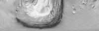
I'm a little confused about the layers on Mt. Sharp. Could one of you geology types set me straight?
a) the thinking is that the mound is a remnant of the vast sediment that once filled gale crater
correct? If so, wouldn't most if not all of the sedimentary layers be flat since no tectonic activity has occured?
Perhaps it is a trick of perspective but all of the layers I can see in the buttes and mesas below the discontinuity are uniformily tilted up toward Mt. Sharp.
So I'm wondering if the layers have nothing to do with the original deposition but are an artifact of more recent aeolian erosion.
Posted by: Ondaweb Sep 27 2012, 01:25 AM

I like that idea. I, too, have some questions perhaps better posted there.
Posted by: Phil Stooke Sep 27 2012, 01:25 AM
Sediment settling out of a fluid onto a flat surface might make horizontal layers, but other situations can make tilted layers from the start. In particular, if the surface is already tilted and you start depositing layers of wind-born material (sand, volcanic ash etc.) on it, each layer could follow the slope of the ground underneath it for quite a while until upper layers became more level.
Another possiblity - layers form fairly horizontally over uneven topography. Then over time they gradually compact under their own weight, but more so in areas of deeper sediment fill ("differential compaction"), resulting in deformed layers.
So we can't just assume layers would be horizontal.
Phil
Posted by: dvandorn Sep 27 2012, 03:16 AM
One rim of Gale Crater is quite a bit higher above mean than the other, right? Even though it appears to be a regular ringwall kind of structure, not breached nor significantly out of circular. It could be that much of Mt. Sharp was deposited in horizontal layers and the overall ground mass below the entire crater could have tilted before the deflation that exposed the central mound and revealed the horizons we now see as the floor. The entire subsurface table tilting would account for the different heights of the rim between north and south.
As to what could have caused the entire subsurface below Gale to tilt -- well, the Tharsis bulge was responsible for enormous deformations of the crust. Also, if this area of Mars ever went through extensive glaciations, the entire subsurface could have been pushed down by the weight of the glaciers during the deposition of Mt. Sharp's layers, and has since recovered its original elevation and orientation via isostatic rebound.
Finally, if the material that supposedly infilled the entire crater (and has since been deflated) was emplaced by a rapidly moving force, such as the rush of waters or repeated pyroclastic flows from the same vent area, well, that material could have piled up on the far wall and filled back from there. If the force emplacing the materials was consistently from the same vector, you would get layers that are tilted in a sort of compromise between the gravity vector and the emplacement vector.
In other words, there are a lot of ways on Mars that you can get tilted and discontinuous rock beds, you don't have to assume tectonic processes.
-the other Doug
Posted by: Explorer1 Sep 27 2012, 03:20 AM
Could we figure out a ballpark estimate for the size of the original impactor that formed Gale, or is it too degraded?
There's online simulators but they're for Earth impacts only...
Posted by: serpens Sep 27 2012, 04:34 AM
Great idea ngunn.
To appreciate the variations in layering we need to take into account the sheer size of this crater (some 18,000 square kilometres) and the necessary presence of a central uplift which could possibly be a factor in Mt Sharp resisting erosion. Seemingly lots of water early on with aeolian deposition/erosion subsequently. Being on the slope at the edge of the dichotomy there would have been a gravitational gradient towards the north. Couple this with cycles of depositition, variable lithification and differential erosion over billions of years and as impied by dvandorn and Phil, flat layers without variation rather than uneven layering would be the eyebrow raiser.
Posted by: ngunn Sep 27 2012, 07:39 AM
(Thanks admin  )
)
I have been wondering about the 'high thermal inertia' region that is now in front of us. It looks like it has been somehow scoured clean of loose material. Noting also that it is located ahead of the margin of a presumed alluvial fan, I have been wondering if that 'fan' could actually be the remains of a long-outrun avalanche that formed very rapidly, sending a powerful shock wave ahead of it that blasted the soil off this area.
Posted by: jmknapp Sep 27 2012, 10:11 AM
The operative sentence from the http://marsjournal.org/contents/2010/0004/files/anderson_mars_2010_0004.pdf paper:
Posted by: ngunn Sep 27 2012, 06:03 PM
Also in that paper (pp107-8) is discussion of the low-thermal-inertia/high-thermal-inertia fan formations and the nature of the boundary between them. We are approaching the margin of the HTIF Glenelg. We'll soon have some new data to match against the proposed interpretation.
Posted by: Chmee Sep 27 2012, 08:25 PM
Great idea for this thread.
Since there is no obvious outlet along the rim wall for water / glaciers etc to have eroded the crater bed to, I lean in favor of the theory that the floor of the crater actually dropped, instead of eroding away (with some later minor depositing which smoothed the floor out). Since Mt Sharp sat atop the old central peak of the original crater, it did not sink like the rest of the crater floor. My two and one-half cents 
Posted by: djellison Sep 27 2012, 08:30 PM
Why must it have been water? The theories I have seen suggest wind.
Posted by: ngunn Sep 27 2012, 08:45 PM
Add to that the possibility of quite a lot of ice in the original crater fill and you have sublimation as another removal mechanism.
Posted by: Eyesonmars Sep 27 2012, 09:16 PM
Also note that Curiosity is sitting on or very near the lowest spot on the planet (outside of Hellas).
How did it get that way ? There are far larger craters along the global dichotomy. I suspect that the uniqueness of Mt. Sharp and the fact that it is immediately adjacent to this global low spot ... is not a coincidence
Posted by: serpens Sep 28 2012, 05:10 AM
Not unique. Emily did a rather nice presentation on this.
http://www.planetary.org/blogs/emily-lakdawalla/2011/3144.html
Posted by: Don1 Sep 28 2012, 05:48 AM
Anybody like the idea of a mud volcano for Mt Sharp? Looking at the way the upper layers are tilted, it looks like something came out of the top and flowed down the flanks. In fact I think I recall reading something about a hydrothermal spring as an origin theory for the mound.
Somebody asked about the size of the impactor that made the crater. Gale is about the same size as Chicxulub, which is linked to the extinction of the dinosaurs, and is said to have been made by a 6 mile diameter asteroid.
Posted by: xflare Sep 28 2012, 08:41 AM
What kind of theories and ideas are floating around to possibly explain the composition and origin of the Glenelg/high thermal emission region? It seems to be right at the base of the Alluvial fan. Perhaps it's where that water pooled into a small lake.
Posted by: ngunn Sep 28 2012, 10:46 AM
See the discussion I referred to in post 10 for starters, plus the MSL team's conclusion that the fan extends to the landing site, i.e. beyond the margin of HTIF.
Posted by: Eyesonmars Sep 28 2012, 01:18 PM
http://www.planetary.org/blogs/emily-lakdawalla/2011/3144.html
I based my comment on many hours of using the VERY cool app "Mars Globe" by M. Howard and brought to my attention by E. Lakdawalla. It is a must have app on the iPad. (everyone I show it to is fascinated by it)
While I do see quite a few craters with what might be central sedimentary mounds. Most of them could also be remnant central peaks and are much smaller compared to their craters than Mt. Sharp.
Posted by: Art Martin Sep 28 2012, 08:01 PM
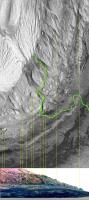
I'm having a hard time reconciling from the newly released pictures where exactly Glenelg is in them. When I look at the overhead route updates it appears the rover is moving East (I'm assuming North is to the top of the image) along the base of Mt Sharp with Glenelg further to the East. Logic says that if we're facing Glenelg and targeting it in the images, Mt Sharp should be to the left and yet all the images being returned are looking to the left of Mt Sharp or at its left-most flanks. Could someone show an overhead route map that includes where Mt. Sharp is in context of our journeys and what direction these latest images are pointing.
Posted by: ngunn Sep 28 2012, 08:05 PM
Here:
http://www.unmannedspaceflight.com/index.php?showtopic=7020&view=findpost&p=192020
Posted by: Phil Stooke Sep 28 2012, 08:08 PM
Art, Mt Sharp runs all around the south horizon from due east to south to southwest. It's really big! The pics ngunn linked to show that well.
Phil
Posted by: elakdawalla Sep 28 2012, 08:08 PM
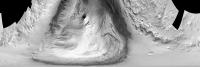
I made this two days ago -- it's an un-polar projection (if that makes sense) of the CTX image of Gale, centered on Curiosity's landing site. The bottom edge of the image is Curiosity's location (the "pole," if you will); the top edge is about 18 kilometers away. Everything along the same horizontal line in this image is at the same distance from the rover. Due south is in the center of the image; due north is at the edges.
The sand dunes skirting the mountain occupy about 160 degrees of Curiosity's point of view, which means you'll see the mountain on your right if you're looking east, on your left if you're looking west, and in front of you if you're looking south; the only time the mountain wouldn't be in your field of view is if you're looking north.
|
Posted by: Art Martin Sep 28 2012, 08:41 PM
Thanks, so much clearer now. I just had no idea of the scale of things before. The link from ngunn put things into perspective and spun me around the right direction. Amazing image Emily, thanks. The lines showing our travels wouldn't even show up on your picture other than maybe a pixel. Ok back to lurking in amazement.
Posted by: ngunn Sep 28 2012, 09:40 PM
I really like these. James Canvin used them effectively to identify horizon features seen by Opportunity and he calls them 'inverse polars'. I think that's a good term for them. Any chance of extending yours to include the crater rim?
Posted by: elakdawalla Sep 28 2012, 10:17 PM
That is precisely what I was using it for. Don't know when I'll get to finish this, so here's a preliminary version, featuring a touch of Phil-O-Vision.
It'd be easy to make a version extending to the rim. How many pixels wide would be useful? Is 3600 enough? 7200?
|
Posted by: fthurber Sep 28 2012, 10:57 PM
It'd be easy to make a version extending to the rim. How many pixels wide would be useful? Is 3600 enough? 7200?
WOW! Nice job. BTW, the dragon's teeth at the bottom of the sulfate layer look like nunateks, but, of course, they are not. I assume that the vertical scale in the bottom picture is exaggerated, right?
Posted by: elakdawalla Sep 29 2012, 12:15 AM
Here you go. Attached version is 3600 pixels wide (10 pixels per degree) and somewhat compressed. https://planetary.s3.amazonaws.com/assets/images/4-mars/2012/gale_unpolar_crater-rim.jpg The original data for this one was at about 55 meters per pixel, so it's of lower quality in the near field, but it's fine at the distance of the crater rim.
|
Posted by: atomoid Sep 29 2012, 01:34 AM
i'd always thought Hellas was an ancient ancient impact resulting in a sort of unsuspecting ocean basin much later, though i don't know if theres much evidence of that.
Makes me wonder on how much Gale's similarly lower elevation affected atmospheric pressure back during that thicker warmer atmosphere? im curious what models might suggest as far as atmospheric pressure at Gale vs the mean elevation during that time and if it makes sense to expect that to have much impact on making a Gale lake more habitable.
Or the processional inclination at the time might have kept the Gale interior iced over with Vostok-style lake beneath but probably heated by plenty of geothermal activity. how much glaciation and erosion of the crater walls would be expected under that scenario and if extensive, could evidence of that type have been erased by now.
ok, too many stray hairs, i wont even get started on Mt Sharp, its all too enigmatic..
Posted by: dvandorn Sep 29 2012, 02:36 AM
I used to think along those lines, too. But the orbiters (especially Odyssey) have seen almost no indication of hydrogen in Hellas -- i.e., no indication of subsurface ice or even strongly hydrated materials.
Instead of harboring water in the past, these results tend to indicate that Hellas has never seen much water at all. I think that's likely why it has never been considered as an attractive landing site, even though it is such a low spot that the atmospheric pressure there is higher at the surface than just about anywhere else on Mars.
Hellas would be a wonderful landing site if you're looking to examine Martian mantle materials, because it is certainly deep enough to have exhumed mantle rocks. Geologically speaking, it's very attractive. But since the main interest in Mars is (and, I think, always has been) the investigation of water, habitability and life, the geologic questions that drove the exploration and analysis of the Moon are taking a back seat to the water- and life-seekers when it comes to Mars.
-the other Doug
Posted by: fthurber Oct 1 2012, 01:47 AM
Hi Doug
Was Hellas was thought to have some glacial formations? Maybe the ice is covered so deep by rock debris and dust that it cannot be picked up by the spectrometer. However my source is Wikipedia so that may be wrong. http://en.wikipedia.org/wiki/Hellas_Planitia#Possible_glaciers/ Supposedly MROs radar sounder saw it.
Posted by: drz1111 Oct 1 2012, 05:59 PM
A question about redox and sedimentary paleoenvironments on Mars:
One of the things I've been thinking about the last few days is that my instincts w/r/t paleoenvironments is all wrong when it comes to Mars.
Take "hottah" - when I saw that, I immediately thought "oh, its cool as hell, but I see why they didn't stop there - fluvial conglomerates are notoriously poor environments to preserve organics".
But that's wrong, or rather, potentially wrong, on Mars, isn't it? It's true on earth in post-proterozoic rocks b/c the atmosphere is oxic and sediment deposited in well-mixed water will lead to oxidized organics, most likely through biologic activity.
But who-the-hell-knows what the Mars atmosphere was like when those conglomerates were deposited? Wouldn't it be more likely that the conglomerates were deposited in a reducing environment, like those auriferous precambrian conglomerates in south africa? Is that necessarily a bad environment for preservation of organics?
Which leads me to my next point, color. When you look at some of the finely-bedded outcrops that the pictures are showing, they're clearly darker and, more importantly, greyer than the overlying rocks (e.g. compared to the hottah, which seems to be a light tan). Earth-instincts; that's a shale or shale-like rock, deposited in an anoxic environment.
But why would that be so on Mars? I guess EVERY lacustrine-type depositional environment on Mars could be anoxic, but, that's not consistent with where Mars eventually evolves to and what MER observed. Redox is all a big mystery, right? We don't know the chemsistry, and one thing that seems likely is that the biologicially mediated redox chemistry that you see in sediments in Earth is unlikely to apply there. And do our usual Earth-honed instincts about color & redox state of the paleoenvironment hold true?
And, to sum it all up, to the extent we don't know much about any of the above, how the heck do we know where to look for preserved organics?
Posted by: elakdawalla Oct 1 2012, 07:03 PM
Re: Hottah, that's a good question, and there were a lot of talks at landing site selection meetings about what kinds of rocks were good for preserving organics. Grotz's emphasis through the last three rounds of meetings was preservation, preservation, preservation. High-energy environments like mountain streams are not good places. Fine sediment settling in deltaic environments are good, which was why Eberswalde was the other favored landing site. So you're probably right, Hottah was cool but not the paleo-environment they were looking for. Glenelg has better potential.
Mars doesn't have an oxygen atmosphere but it does have strong oxidizers acting at the surface, so some of the chemistry is analagous. That goes out of my depth though. Check the http://marsoweb.nas.nasa.gov/landingsites/, there are probably some presentations addressing Martian aqueous chemistry.
Posted by: Eyesonmars Oct 1 2012, 08:50 PM
The area Curiosity has been traversing has quite a few small, mostly ghostly, circular features ( looking at the route map). Assuming they are impact related - are they primary or secondary impacts ? Do they date from the time of creation of the deposit or have they been created after/during erosion exposed the surface. I'm surprised at how dense they area. Our eventual target area, the phyllosilicate area, also has these craters in abundance. They seem to have a maximum size cutoff.
What do they tell us ?
Posted by: drz1111 Oct 1 2012, 09:11 PM
Mars doesn't have an oxygen atmosphere but it does have strong oxidizers acting at the surface, so some of the chemistry is analagous. That goes out of my depth though. Check the http://marsoweb.nas.nasa.gov/landingsites/, there are probably some presentations addressing Martian aqueous chemistry.
Mars has strong oxidizers acting at the surface now. IIRC, however, the redox chemistry is thought to have been totally different back when clays may-or-may not have been being deposited. I would presume in a higher-Ph surface environment, most sedimentary settings would be reducing - like Precambrian earth.
Posted by: ngunn Oct 1 2012, 09:31 PM
Eyesonmars: Interesting question. Here's an off-the shelf response based on the conventional story about impact crater counts and age of surfaces. No big craters means a spell of significant deposition or erosion since heavy bombardment ceased. Many small craters means little net deposition or erosion for a very long time after the reworking of the surface that erased the big ones.
This being Mars you'd have to add that these little craters must have formed into a relatively dry surface since the little impactors couldn't have penetrated a significant thickness of water or ice.
Like you, I think the peculiar density of craters here, just above the Glenelg boundary, is significant. It could signify the exposure of an ancient surface neither mantled (as at Bradbury Landing) nor scoured away (Glenelg high thermal inertia unit). I note its similarity to the third type of terrain to the SE of Glenelg.
Posted by: Eyesonmars Oct 2 2012, 07:41 PM
Pure conjecture here: If this dense crater network is an ancient feature that has been exhumed recently can we infer that the atmosphere must have been quite thin at this time? As I understand it there is a relationship between minimum crater size and mass of an atmosphere. IF so, and ( another IF) the cratered surface dates to roughly the time of the next surface below - our alluvial fan/stream bed - does this fact influence our interpretation of what we assume (almost certainly) is the water carved/deposited features in front of us ??
Posted by: ngunn Oct 4 2012, 08:39 PM
I've just come across this detailed thermal inertia map. Let's see if the link works:
http://www.nasa.gov/images/content/692124main_Grotzinger-4-pia16159-43_946-710.jpg
EDIT Well it sort of worked, but it leaves out the caption and the link to the bigger version. I'll have another go . .
http://www.nasa.gov/mission_pages/msl/multimedia/pia16159.html#
Posted by: djellison Oct 4 2012, 09:34 PM
Yes - the full size is here : http://www.nasa.gov/images/content/692127main_Grotzinger-4-pia16159-full_full.jpg
I find the NASA HQ websites very hard to navigate so I tend to use the photojournal where you'll find it also
http://photojournal.jpl.nasa.gov/catalog/PIA16159
(PS Base map from Fred Calef, annotation by me )
Posted by: ngunn Oct 4 2012, 09:56 PM
Brilliant! Thanks Doug. While you're on the line, can you point us to a contour map of this place (my quest in post 1)? We're in an enclosed basin and since ancient liquid water is in play I'd like to get a sense of which direction is down and where the bottom is.
Posted by: djellison Oct 4 2012, 10:10 PM
Contour - no - but there is this - http://photojournal.jpl.nasa.gov/jpeg/PIA16158.jpg
You could have found it by going to the first page under 'Mars' on the photojournal.
Posted by: ngunn Oct 4 2012, 10:30 PM
That's good, and there's also this:
http://blogs.esa.int/mex/2012/08/03/gale-crater-in-3d/
However they're not really at the level of detail required to help us 'on the ground'.
Posted by: Eyesonmars Oct 4 2012, 11:12 PM
True. But even at 100 meters/pixel you can just make out the channel where it enters Gale crater and the upper portions of the alluvial fan.
(we are looking southwest so the channel enters from the far right)
Posted by: elakdawalla Oct 4 2012, 11:17 PM
http://www.petergrindrod.net/archives/858
Posted by: ngunn Oct 5 2012, 08:48 AM
Just what I was looking for, thanks Emily.
Posted by: ngunn Oct 6 2012, 09:30 AM
I am particularly intrigued by the enclosed depression on the right of Peter's contoured elevation map:
http://petergrindrod.net/wp-content/uploads/2012/08/Gale-GIS-HiRISE-landing-site-topo.png
The depression coincides exactly with the outer margin of the high thermal inertia fan (HTIF). I'm also curious about where the substantial quantity of flowing water that formed the fan was actually flowing to. I'm toying with the idea that it spread out and froze in place, forming over time a substantial ice deposit. I don't know the proper name for such a thing so for now I'm calling it an 'ice snout'. Maybe all of the HTIF is a marker for the former extent of the ice snout. Sublimation of volatiles is widely invoked to explain hollows. Here we appear to have a hollow and a ready supply of volatile material at some time in the past. There are what look like polygonal markings on the bottom of the depression. Where have we seen that before? I can't wait to get down there.
Posted by: Eyesonmars Oct 6 2012, 07:26 PM
http://petergrindrod.net/wp-content/uploads/2012/08/Gale-GIS-HiRISE-landing-site-topo.png
Sublimation of volatiles is widely invoked to explain hollows.
Hmm - The peculiarity of the craterlet density in the unit covering the area SE of Glenelg has been mentioned earlier in this thread. Notice the complete saturation and fairly uniform size of these little hollows in the eastern part of this unit.
Could this unit be a remnant of a sediment saturated outflow that was deposited more or less all at once ?? Assuming the slurry is near the triple point pressure of H20, small variations in conditions within the slurry could result in explosive boiling one place while a few meters away the slurry is still liquid. At the same time it is rapidly freezing on its surface so that the little craterlets that are left behind as the vapor bubble breaks the surface are flash frozen in place. IF the slurry is thick enough the craterlets might still be discernible as the remaining H20 slowly sublimates away and the remaining dry deposit settles.
(this is somewhat consistent with your "ice snout" idea)
Posted by: ngunn Oct 6 2012, 08:53 PM
It's fun to look at those craterlets and imagine the kind of one-off event you describe, although I'm having difficulty with the idea of individual bubbles of the required size. There's a long timespan and a wide range for climate parameters (including, crucially, the total mass of the atmosphere) available as possible conditions for the processes that formed this landcape so it's open season for imaginative suggestions, I think.
EDIT: I've looked again and the crater sizes go right down there: too small for impacts under any kind of atmosphere. Interesting.
Posted by: Eyesonmars Oct 6 2012, 09:08 PM
I agree. It is great fun to try to imagine processes that are beyond our earth biased experiences.
Over on the "Temperature and Pressure" topic I've been making trouble with the goal of perhaps gaining some insight into the subject of this thread.
It is hard to imagine how water might behave around the triple point on a large scale in a low g environment since it is beyond our earthly experience. But small changes can have major phase consequences. In addition, in the low Martian gravity I would imagine the bubbles would grow larger than on earth .... true?
Posted by: Eyesonmars Oct 6 2012, 09:30 PM
Also - as you queried - Where is the water flowing to
I've always been struck by the apparent contradiction between the ubiquitous, planet-wide evidence of flowing liquids on Mars but the almost complete lack of any strong evidence of any standing liquids on Mars at any time in Martian history. Mars is trying to tell us something.
Posted by: ngunn Oct 6 2012, 10:12 PM
I don't think that's quite true. I'm fairly persuaded by the the northern ocean shorelines. But you're right. It is the nature of water on Mars to do its deed and disappear, into space no doubt but also under ground (perhaps not very far).
Posted by: serpens Oct 7 2012, 03:22 AM
The evidence of long lasting fluvial activity around and in gale would seem to indicate that the pressure and temperature 3 to 4 billion years ago was significantly different to today. From the apparent inverted channels it seems that most recently Gale has gone through a significant deflationary cycle. The topography during the fluvial period may have been quite different to today and some of the effects such as the hollows could be attributable to differential erosion.
The low/high thermal inertia units look like part of the same fan. An alluvial fan that transitioned to an alluvial fan delta when it encountered standing water? Stranger things have happened.
Posted by: ngunn Oct 7 2012, 07:40 AM
Another interesting idea.
Does the LTIF/HTIF boundary follow a topgraphic contour, and if so, how big an area does that contour enclose? We will need a more extensive map to answer such questions.Here's a variation on my 'ice snout' suggestion. In warmer conditions the fan could have terminated in a 'salt snout' rather than an icy one. Flood the whole area at a later epoch and the salt redissolves - another way to form a hollow perhaps. (Would that count as differential erosion?)
Posted by: Fran Ontanaya Oct 7 2012, 08:59 AM
Mmh, is the assumed order of events: 1) the last sulfate layers of Mt Sharp were deposited; 2) Mt Sharp was eroded; 3) The fan was deposited on the new floor of Gale Crater?
In that case the fan would be from an age long after conditions were suitable for the standing acidic water that created Mt Sharp layers, and after a dry period in which all the erosion happened. Maybe the atmosphere was gone already, and they were just seasonal flash streams from molten ice that then sublimated away.
Posted by: serpens Oct 7 2012, 02:00 PM
The filled then excavated crater hypothesis seems a logical explanation for the reasonably thick clay layer exposed at the base of Mount Sharp (neutral pH), beneath the sulphates. The clay layer could be a lacustrine deposition and if so then the fan would possibly have formed at that time, been covered and then excavated. Curiosity will probably be able to clarify with ground truth.
Posted by: Ondaweb Oct 7 2012, 09:30 PM
That's the question I wanted to ask on this forum also. I'm interested in identifying the lowest point in Gale between here and where we expect to head up to Sharp for two reasons: 1. It may be where some water went as some time in the geological history of Gale and 2. It could/should be the point where we'd expect to find the oldest layers in the stratigraphy of Gale/Sharp. I didn't identify any mention of such a location in the Anderson paper (not that that means it isn't there). It would seem orienting to me to know where that is and what's already know about what's there (for orbital images, spectroscopic studies, etc.)
Posted by: ngunn Oct 7 2012, 09:51 PM
There are contours derived from CTX by Peter Grindrod here:
http://petergrindrod.net/wp-content/uploads/2012/08/Gale-GIS-CTX-context.png
That shows we are right on the edge of an enclosed depression. I don't know whether it's the deepest in the whole crater, but if water flowed over the alluvial fan today I think it would have nowhere to go except into the hollow we are overlooking now.
Posted by: pgrindrod Oct 8 2012, 04:16 PM
After a few requests, I've made some base maps of Gale and the Bradbury Landing site at a few different zoom levels.
They're all linked over http://www.petergrindrod.net/archives/886, with a bit of an accompanying explanation.
A scaled down example of what's there:
|
Hopefully they might be of some use in discussions like those above.
Pete
Posted by: ngunn Oct 8 2012, 07:10 PM
Extremely helpful and much, much appreciated.
Posted by: Ondaweb Oct 9 2012, 01:23 AM
Thanks Pete, very helpful indeed. One of the things I keep wondering about is the much bigger inflow channel (and alluvial fan?) coming in from the southwest crater rim. These maps show there is a very big "sink" at the end of the "fan" (roughly due west of the peak of Sharp), much bigger than the one at Glenelg. It would seem that deposits from that channel would not come into play at Glenelg by my reading, but I'm not sure of that. If the SW channel is the older one, I guess it's possible that it's deposits did reach Glenelg.
Posted by: jmknapp Oct 16 2012, 02:30 AM
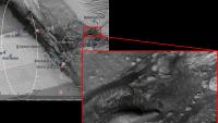
A https://gsa.confex.com/gsa/2012AM/finalprogram/abstract_211271.htm from the MSL team to be delivered at the Geological Society of America conference in Charlotte next month talks about an area on Mt Sharp containing "boxwork" structures:
Curious to know where that is on the HiRISE imagery. Might it be this area in the large (what appears to be) outflow channel?
|
Other ideas?
Posted by: Stellingwerff Oct 16 2012, 05:34 AM
Hi Joe,
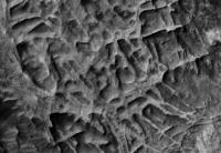
I think you are slightly too high up the mount. I believe they are talking about the polygonal structures as shown on page 30 of: http://marsoweb.nas.nasa.gov/landingsites/msl/workshops/5th_workshop/talks/Tuesday_AM/Anderson_Gale_Traverse_compressed_final_opt.pdf
Greetings,
Ludo.
Posted by: CosmicRocker Oct 16 2012, 06:16 AM
Posted by: jmknapp Oct 16 2012, 11:24 AM
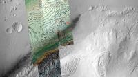
Ludo, thanks for that--looks like a good inference, based on the caption. Here's a full-res HiRISE detail from the area:
|
I'd imagine that rover driver skills would be taxed to get into that maze of twisty passages.
CosmicRocker--beyond amazing pictures, the other instruments could probably feast on the crystalline minerals formed in the cracks.
Posted by: Zelenyikot Nov 5 2012, 05:24 AM
Greetings from Russia
I want to share my observation.
I looked at pictures and noticed that many of the stones are similar to volcanic.
http://www.keepme.ru/upload/images/2012/11/05/c9177f8eb4497c200437d459b4fb5395.jpg
It seems even that lava river.
http://www.keepme.ru/upload/images/2012/11/05/d7cb44164e5852983c3805212e7fb4da.jpg
So close to be a volcano?
This is clearly not Elysium Mons
In the north-west is the mountain, which can be a volcano?
http://www.keepme.ru/upload/images/2012/11/05/f0c8f86801602cae93e913c5b4989614.jpg
It turns out it can be a source of the alluvial fan and inverted (lava?) channels?
http://www.keepme.ru/upload/images/2012/11/05/ca44cdcdb6153cdbf3c6c80897f78d22.jpg
Posted by: acastillo Nov 5 2012, 06:06 PM
Hi, my first post.
The problem with a volcanic interpretation of these landforms is the conglomerates already discovered. Conglomerates only form in alluvial environments, where water has flowed and rounded the cobbles. I agree that some of the rocks look like volcanic in nature, but the closeup images taking with the MARDI they show no mineral grains. This means the grains are smaller, at least on the surface, than the resolving power of MARDI, which is pretty small. The only volcanic rocks that I have seen with no visible grains is volcanic glass. Since volcanic glass is not stable, at least on Earth, it should have devitrified by now, and show some crystallization of the rock.
Of course reality is probably a mix of both alluvial processes and volcanic process were involved with the formations we see today. Which makes this area probably the more exciting spot explored on Mars so far, sorry opportunity.
Mod: Excessive quoting removed. Read http://www.unmannedspaceflight.com/index.php?act=boardrules please.
Posted by: dvandorn Nov 28 2012, 04:35 PM
Well... the one end of the depression that is obvious in the most recent pans that have been assembled, here, looks rather circular. Anything that describes a partial or complete circle on Mars, with its higher impact rate than we are accustomed to on Earth, could be the remnants of an impact crater. The flow lines etched into the rock working into the depression could just be the result of eons of aeolian modification.
However -- and this is a big however -- the overall morphology of the region is indicative of alluvial activity, i.e., modification from flowing water. So, even though the edge of this depression is circular and may still represent the remnants of an impact crater, with the clues to alluvial action we can see in the aerial images, it looks to me that the initial modification of the terrain is more likely from water flowing and then ponding in the topographic low point of the depression. Multiple episodes of flash flooding, or continuous drainage from the central mound, could have resulted in the patterns we see.
In any event, the original forces that carved the topography here at Glenelg has since been modified by many, many eons of aeolian erosion since the last of the flowing water was seen here.
-the other Doug
Posted by: elakdawalla Nov 28 2012, 04:48 PM
One feature very common to Gale crater, both its floor and on the central mound, is "inverted topography," where there is something that looks like a stream valley (with dendritic tributary or distributary features), except that it stands higher than the surrounding terrain, rather than lower. That is generally interpreted to mean that there once was a valley, whose fill was, for whatever reason, more resistant to erosion than the material into which it carved. The fact that it stands high now tells you that the whole surrounding landscape has been deflated, eroded away, since the last time there was significant fluvial activity here.
Posted by: ddan Nov 28 2012, 05:12 PM
One thing that I don't quite understand is where did all the eroded surface go? Does it have places where it accumulates preferentially? How many meters of surface can we expect to be removed in 2-3 billion years? At some point the erosion stops because the landscape is already covered with sand, so there must be some upper and lower limits to this phenomenon.
Posted by: Phil Stooke Nov 28 2012, 05:41 PM
At some point if the debris breaks down into sufficiently small particles it can be removed from the vicinity, even lifted out of Gale crater completely. So it might not remain in this area to choke off further erosion.
We had a small move, slightly backwards and to the left, so a rock slab that was immediately adjacent to the left front wheel is now slightly further away and right of center where the arm can work on it. Following common practice in the past I expect it backed up a bit, turned, moved forwards again to the desired location, and turned to face the rock. It's hardly enough of a move to warrant updating the route map just yet.
Phil
Posted by: mcaplinger Nov 28 2012, 06:25 PM
Good question. I don't think anyone knows yet. From Malin and Edgett, "Sedimentary rocks of early Mars", Science, 2000, http://www.sciencemag.org/content/290/5498/1927.full?ijkey=Om41DCf.8LI0M&keytype=ref&siteid=sci (italics mine)
Posted by: SteveM Nov 28 2012, 08:08 PM
The uniformitarian in me gets nervous when I read an appeal to "processes not acting on the planet today".
But as a historian of science, what do I know. Steve
Posted by: ngunn Nov 28 2012, 08:27 PM
It's a great phrase isn't it? Get's you out of any problem - except that it doesn't. With its 'impossible' central mound Gale crater is the perfect place to seek real answers to that big Martian mystery.
Meanwhile at Glenelg we have a smaller mystery but one whose resolution should also prove enlightening. Why did the removal process, whatever it was, selectively target the outer margin of an alluvial fan?
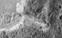
Posted by: Zelenyikot Nov 29 2012, 02:52 AM
My thought involves this element. It looks as a wave or stream consequence.
|
Posted by: Actionman Nov 29 2012, 01:10 PM
I would think that would be a good reason not to to go here... which in all honesty means i should have a theory/hypothesis but I don't see the word "glacial" mused much.
Here it goes: Rock slipping inward to the center from a thick ice glacier.
Some of these rock seem to show frost heave to me.
Posted by: djellison Nov 29 2012, 03:02 PM
Are you suggesting that Mt Sharp is just a pile of terminal moraine?
Where is the evidence for the glaciers themselves - the glacial valleys?
Posted by: Actionman Nov 29 2012, 05:41 PM
yes, maybe
glacial cone/funnel
Some evidence would be that much of the surface rocks the larger ones we see has little or no impact signatures like they would have landed on snow or ice. Flat sediment slabs we're seeing right now don't have many rocks on them, sled off.
Posted by: Phil Stooke Nov 29 2012, 05:50 PM
There is plenty of evidence for glaciers elsewhere on Mars, but none here. Let's try to keep the focus of this forum on the images, that's where it really shines.
Phil
Posted by: Chmee Nov 29 2012, 06:45 PM
One thing that I don't quite understand is where did all the eroded surface go?
Well, I can think of 2 methods:
1. Ice / Glaciers - After Gale formed, water entered the crater, creating a lake, which then froze over with the central mount sticking out. Sediment accumulated over the ice in layers (and the central peek), essentially filling the crater 'to to the brim'. Later, perhaps as the Martian atmosphere lost most of it's density (or the polar tilt moved Gale from polar region to equatorial) the ice sublimed away, sinking the floor down, but maintaining the central peek.
2. Fractured/Soft Material - When Gale formed, the rock under the crater floor had less strength then the central peek. The crater filled up with sediment over time, again near the rim of the crater. However, over the eons, all that weight compressed the original material in the crater floor, in effect sinking or slumping the floor away from the rim and central peek.
Just my 2 cents!
Posted by: serpens Nov 29 2012, 09:13 PM
That seems a bit harsh. There are pretty clear indications that early Mars was a very energetic environment, predominantly aeolian with at least episodic fluvial periods. Living as we do in a corrosive and energetic erosional environment I guess that most of us have difficulty really understanding just how benign present day Mars is, or the immense amount of time that has elapsed since that more energetic environment. The statement processes not acting on the planet today seems appropriate given the current lack of any significant mechanical or chemical erosion.
There is pretty clear evidence of massive erosional/depositional cycles across ancient Mars. I think all agree that the Gale central mound is sedimentary (possibly with a remnant central uplift core) and most of this material would have come from somewhere else. The deposition appears to have taken an extended time since the changes as we go up the mound could potentially map the changing depositional environment. Heresy perhaps but the ESA definitions of the Martian eras actually seem to make more sense (intuitively at least) than the traditional nomenclature. http://www.esa.int/esaCP/SEM117OFGLE_index_0.html
Despite the remnant fluvial valleys and inverted channels, the lack of transport pathways out of the crater indicates that fluvial influences would not seem to have been significant in the excavation process. Aeolian seems the culprit. I could imagine the crater partially filled by deposited materiel and I wonder if a vortexing effect around the rim could have actually moved material from rimward to the central area resulting in the moat around the mound. That would account for some of the eroded material. Where did the rest go? Mars wide, Arabia Terra and Meridiani alone account for hundreds of thousands of cubic kilometres of sedimentary material and there are probably a lot of sedimentary traps across the surface of Mars. I guess a lot ended up in the Northern plains.
Posted by: Actionman Nov 30 2012, 12:20 AM
It's a cinch we're not going to be finding bedrock, NASA came here looking for bedrock.. didn't they.
Bedrock should be at the bottom of a deep crater, shouldn't it.
We would like to fine something solid some place.
No bedrock on lake affect... if the area is below the frost line.
Posted by: djellison Nov 30 2012, 12:36 AM
I don't think bedrock means what you think it means.
The definition I've found
"solid rock underlying loose deposits such as soil or alluvium."
We have clearly already seen that at Gale crater - from the surface and from orbit.
Posted by: centsworth_II Nov 30 2012, 02:34 AM
Posted by: elakdawalla Nov 30 2012, 05:50 AM
I don't want to have to add a rule to section 2 that tells people not to post if they don't know what they are talking about. I feel that that should be obvious.
Posted by: Actionman Nov 30 2012, 12:13 PM
I'm sorry elakda for making it sound too you like i'm talking about the Flintstones.
Bedrock on Mars as far as I know, now you correct me if I'm wrong: basalt.
Not to be confused will the surface photos of conglomerate and limestone sediment slabs we see.
We see chucks of basalt everywhere BUT what we don't see is the primal intact basalt global covering if there is one. Basalt like all the surface basalt littering the surface indicates there should be basalt in the floor a deep crater it should be revealed or even to have been blasted clean through.
Bedrock is not compressed sediment. At lest not the type of bedrock I was talking about.
NASA will be drilling for subsurface basalt NMHO.
Posted by: ngunn Nov 30 2012, 12:43 PM
I think the term you want is 'basement rock' rather than 'bedrock'.
Posted by: Stellingwerff Nov 30 2012, 01:04 PM
If you refer to the Anderson and Bell paper on this subject: http://marsjournal.org/contents/2010/0004/files/anderson_mars_2010_0004.pdf,
you'll find on page 122 a very nice graph showing exactly why we don't see the basalt yet. It's close, but MSL will need to drive towards the mount to find an exposed trough all the way down to the basalt unit. (In many places the dark dunes are actually covering the basalt floor, instead of on the sediment layers, see image 34a on page 109)
Greetings,
Ludo.
Posted by: Actionman Nov 30 2012, 01:14 PM
And thank you Ludo.
Make it so
Posted by: centsworth_II Nov 30 2012, 01:45 PM
NASA will be drilling for subsurface basalt....
Edit: http://mars.jpl.nasa.gov/msl/mission/timeline/prelaunch/landingsiteselection/galecrater2/ is a short description of why MSL went to Gale Crater. Notice, no mention of basalt.
Posted by: djellison Nov 30 2012, 04:36 PM
They will not. I was right - you don't know what bedrock means.
I'm going to repeat Emily's excellent words from earlier... this sentence proves that you just don't know what you are talking about. I suggest you stop talking about geology, and just listen instead. You could really learn a lot here.
Posted by: Ant103 Nov 30 2012, 05:46 PM
Can I ask something ? Not very important, but for me it is. Modifiy the thread from "Geomorphology" to "Areomorphology". As "Geo" came frome "Gaia", the Earth in Greek mythology, so as "Areo" from "Arès", Mars in Greek mythology. But I will understand that's not necessary for the quality of this thread. After all, we use specific word to qualify a day on Mars like "sol" .
Posted by: ElkGroveDan Nov 30 2012, 05:54 PM
Not a good idea. The science of geology is what is being discussed here. If you drop one Greek root then you have to drop them all and it starts to sounds like nonsense.
Posted by: Actionman Nov 30 2012, 05:54 PM
In this GIF from the above Mr. Anderson and James F. Bell paper they illustrate their view of the basal layer with the possibility of some of which maybe exposed. The examination of any of this is mandatory NMHO. More over I don't think it will be visible. Out of sight out of mind, apparently. 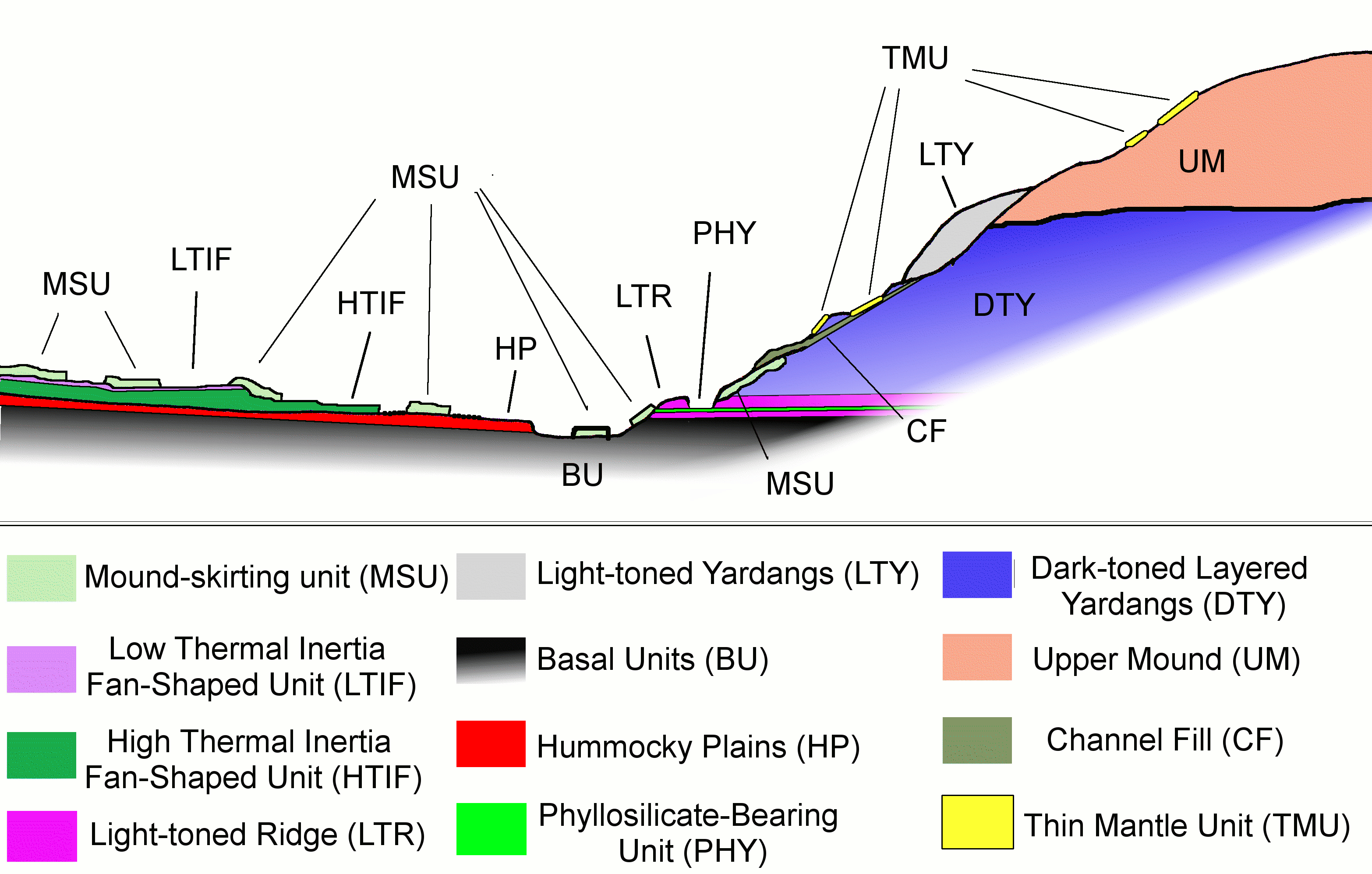
Posted by: djellison Nov 30 2012, 06:01 PM
What would you call Phobos geology. Deimos. Venus. Europa. Dione. Our own Moon. Titan. Nix. Hydra. Tempel 1. Itokawa. There are hundreds and thousands of worlds out there for us to explore, study and understand - and the science we will be practicing is geology / geomorphology / geochemistry etc etc.
Having a different word for the same scientific discipline just because it's a different place is nonsensical.
Posted by: Ant103 Nov 30 2012, 06:06 PM
Okay, I understand totaly I was just asking. It's funny because in french, when you land a probe onto a surface, we use the word "Atterrissage", with the root "Terre" aka Earth in english. And I'm against using word like "Amarsissage" when you land something on Mars. So then, yeah, I think I was a little too bit enthousiast . Nevermind . And thanks for the answers.
Posted by: djellison Nov 30 2012, 06:16 PM
You know that Basal and Basalt are not the same thing, right?
Not visible? They've already seen it (and attempted to characterise it) from orbit!
From Page 105-106 of their paper ( for those unfamiliar - it's available here - http://www.marsjournal.org/contents/2010/0004/ )
"Light-toned basal unit
The light-toned basal unit is distinguished from the crater floor units by a sharp drop of ~10 m (Figure 34a). The light-toned basal unit has a CTX albedo of up to 0.20, and is primarily composed of fractured rock that in some locations has a subtle texture suggestive of layering (Figure 39b). It has a moderate thermal inertia ranging from roughly 500-540 J m-2 K-1 s-1/2. Mesas of mound- skirting unit are common on top of the light-toned basal unit (Figure 34b), and much of the basal unit is covered by dark-toned mafic dunes. The light-toned basal unit slopes upward in a series of poorly-defined fractured, light-toned layers to form the northwestern side of the light-toned ridge unit (Figure 36a).
Dark-toned basal unit
The dark-toned basal unit (Figure 39) has a higher thermal inertia (~780 J m-2 K-1 s-1/2) than the light-toned basal unit. It has an albedo of 0.15-0.16 and occurs to the southwest of the landing ellipse and the light-toned basal unit. The transition between the light and dark-toned basal units (Figure 40) is sharp and the dark-toned basal unit appears to be topographically lower than the light-toned basal unit. This suggests that it is either stratigraphically lower or that the dark-toned unit is younger and fills a depression that had been eroded into the light-toned basal unit."
Plus - the paper goes on explicitly define a location to visit to help in characterizing it is an important stop on any MSL traverse.
Posted by: Actionman Nov 30 2012, 06:38 PM
Basal and basalt are important distinctions both of which are said to scattered on the surface.
Any intact strata should be checked for type. That's all I'm saying.
And no, basal strata in large thick strata placements are not visible from space here at Gale Crater.
Posted by: djellison Nov 30 2012, 06:44 PM
You can not scatter 'basal' on the surface. Basal is a descriptor derived from location. The basal unit is the bottom unit. It's not a type of material - it's a placement.
The basal unit IS visible from space. How do you think they mapped it and characterized it from orbit. Read the paper. Heck - just read the description I cited above.
Posted by: ngunn Nov 30 2012, 07:09 PM
With the Anderson and Bell diagram easily to hand could somebody clarify for me which geologic unit we actually landed on? Bradbury Landing is located beyond the outer margin of the HTIF yet the rocks on the traverse have been identified as fan deposits. So did we land on a detached portion of LTIF? A patch of MSU?
Posted by: djellison Nov 30 2012, 07:14 PM
We're (I think) in the area where the HP, HTIF and LTIF all meet - that three way junction at Glenelg. I'm guessing we landed on LTIF. Broken up fan deposites with lots of sand/fines etc would show up as low TI I would expect ( which is what we've seen) The brighter material to the N/E of us is the HTIF I believe. When we head south, we'll be on HP.
Posted by: ngunn Nov 30 2012, 07:37 PM
That's fine for HTIF and HP, but going on Anderson and Bell's map there should be no LTIF at our current location. They have the LTIF mapped to the north of the HTIF while we are to the south of it, hence my query.
http://martianchronicles.files.wordpress.com/2010/09/figure7.jpg
Posted by: JRehling Nov 30 2012, 09:22 PM
I've been thinking that the landing site was HP, having missed the fan, as you say, to the north. But our confusion is, I think, owing to the inherent complexity:
The distinctions we're talking about are not necessarily visible or even rigorously meaningful. Thermal inertia is a property that can vary from place to place on the basis of any combination of changes in composition or fine-scale morphology in potentially-wicked interaction between the visible surface and the near subsurface. Maybe MSL landed outside the area that Anderson and Bell colored as "fan" on their map, but is nonetheless in an area where the fan material is present, but in combination with other stuff so as to give it a different thermal inertial. In fact, there's no logical disconnect between these labels: "high thermal", "fan unit", "hummocky", and "plains" are potentially overlapping in any combination because they four different kinds of property.
I think MSL missed the region that A&B labeled as being the fan, but may in fact have some of that fan material all around, in some fraction, anyway.
On a very similar theme, I was surprised, having read A&B carefully, how difficult I find it to see the units on Mt. Sharp, which seem apparently in the B&W images taken from orbit, in the images from MSL. There are many possible reasons for this, including the viewing geometry, the image properties (such as gamma), my lack of field geography savvy, etc.
A&B did a good job of imposing some logic and order on Gale, but in both the MSL landing site and the distant views of Mt. Sharp, things seem a little more chaotic up-close.
Posted by: elakdawalla Nov 30 2012, 10:06 PM
I was having the same issue you were in seeing the units on Mt. Sharp until I realized that most of the interesting stuff -- the clays and sulfates -- is actually in a trough at the base of Mt. Sharp and mostly not visible from where the rover landed.
Working out some comparisons of the A&B units to images from HiRISE and pointing out locations on the landing site panorama has been on my list of blog entries to write for a long time, but it's a big project and I haven't made much progress yet.
Posted by: ngunn Nov 30 2012, 10:11 PM
(Replying to JR) All good points. I agree that the views from the ground are taking us into a post-A&B era. But the meeting of three distinct terrain types at Glenelg is most clearly seen in the orbital images so it didn't take Curiosity to show us that.
High thermal inertia is, I think, indicative mainly of a lack of loose cover over the bedrock. In Anderson and Bell that is identified with a particular rock unit, but why would one particular type of rock preferentially remain clear of debris? I think ithe HTI
disribution may be controlled more by the geographical context of the removal process and the ease of removability of whatever material used to cover the bedrock.
EDIT
Emily: good luck with that project - I look forward to seeing the results
Posted by: stewjack Dec 1 2012, 12:42 AM
In the conclusion section of the abstact for Anderson and Bell III: Mars 5, 76-128, 2010 open access paper,
there is the following sentence -"Some layers in the mound are traceable for >10 km, suggesting that a
spring mound origin is unlikely."
My understanding of that would be that Mt Sharp was not cemented together by underground (upwelling) mineral water flows during,
I guess, - the period when Gale crater was buried in sediment. Because earlier it is said "The rim of Gale Crater is dissected by
fluvial channels, all of which flow into the crater with no obvious outlet." As well as, I guess, that hot springs would be variable in flow,
time and location? After doing some Googling apparently hot spring can create mounds using nothing but precipitated minerals. However;
I don't now how that would relate to the 10 km layers. Would be enough to say that a mound with many layers wasn't created by hot springs?
Or am I completely misunderstanding what the sentence is trying to communicate?
Posted by: serpens Dec 1 2012, 01:06 AM
Most of what we see on Mars has a basaltic provenance but as implied by djellison I think that we could be a little more careful in our use of the word. The Anderson and Bell paper refers to the Basal Unit. Basal is by (USGS) definition located at the bottom of a geological unit which in this case I would think is the bottom of the post impact crater fill sequence. I am not sure why the reference to basalt crept in. The final crater floor would have been made up of allogenic breccias and impact melt and I guess this is the Basal Unit referred to by Anderson and Bell. At least that is what I assumed when I first read the paper, which on re-reading, only mentions basalt once in reference to the makeup of dunes. That final crater fill would be pretty deep and beneath that would be fractured pre impact material that, given the size of the impactor, would probably have been subject to a degree of impact metamorphism.
Posted by: dvandorn Dec 1 2012, 01:30 AM
Yep, Mars' surface is primarily basaltic, no doubt. And like the Moon, much of the original crust has been highly brecciated by the Late Heavy Bombardment (the "event" which likely resulted in the Gale impact, among tens of thousands of other impacts of similar size).
Analysis of basalts, where they were emplaced, would give us a nice feel for what was happening in Mars' mantle while the majority of the basaltic eruptions occurred and the basalt was emplaced on the surface. Sort of a snapshot of the mantle during the period(s) of heavy volcanism. However, it is the alterations and re-depositions of that basaltic set of "building blocks" that tell us about the climate and conditions on the surface after the basalts were originally emplaced.
So... Gale is not a good place at all to survey variations in directly emplaced basalt flows. The occasional unaltered chunks of basalt lying on Gale's floor were likely transported from somewhere else (be it a few kilometers to hundreds of kilometers from where a rock might rest right now). It is, however, a wonderful place to look at the history of re-deposition and alteration of rock beds (and even deflation of covering beds), much of which (it seems to me) has to have happened when the alteration, deposition and deflation processes that went on were far more active than they are now.
Since one of the main purposes of Curiosity is to try and characterize those processes (because those processes, once understood, then highly constrain the climate and environment in which they occurred), Gale is a very good place. Precisely because this is a place where we can study the history of those processes and try to understand them.
-the other Doug
Posted by: Zelenyikot Dec 1 2012, 04:03 AM
I think that rock high thermal inertia is a lava stream, from a volcano about which I wrote http://www.unmannedspaceflight.com/index.php?s=&showtopic=7481&view=findpost&p=194143. Ancient eruption caused a wave of a lava which became HTI. After eruption were weaker and began only water flows from the melted glaciers. So appeared the alluvial fan.
This hypothesis is hasty, but it seems to me logical.
Hope we discover soon.
Posted by: JRehling Dec 1 2012, 04:38 AM
Replying to stewjack, re: 10 km layer seemingly disproving a spring origin:
I remember encountering this passage for the first time. My interpretation was that a layer which extends 10 km and remains roughly constant in altitude indicates, if sedimentary, a massive reservoir of water filling the crater like a lake, whereas a spring would have a small origin and would not supply adequate water to create a level surface across such a great area. In fact, that seems like a profound understatement, although I suppose that depends entirely on how large the volume of a "spring" may be.
Since we only see the edges, I suppose, also that you could have a level visible edge at some distance away from and below the source of the spring (as the edge of, say, Olympus Mons is far away from, but below, the vent, and is nonetheless relatively level), but then Olympus Mons is hardly a "spring."
Posted by: stewjack Dec 1 2012, 03:15 PM
I remember encountering this passage for the first time. My interpretation was that a layer which extends 10 km and remains roughly constant in altitude indicates, if sedimentary, a massive reservoir of water filling the crater like a lake, whereas a spring would have a small origin and would not supply adequate water to create a level surface across such a great area.
Thanks! I bet that sentence took a while to construct. Leaving out "roughly constant in altitude," avoids discussion of sloped layers.
Posted by: serpens Dec 1 2012, 10:03 PM
There are a couple of other reasons why attributing Mount Sharp as a spring mound will not hold water. The lower half of the mound transitions from phyllosillicates to sulphates but the upper half of the mound is a aeolian deposition. So a spring would not explain Mt Sharp. Further, if this was a spring mound then we are considering a huge volume of water - probably enough to fill the crater given the size of Mt Sharp, which would have almost certainly have resulted in a breach of the Northern crater wall. No such breach exists. Well that's my take anyway.
Posted by: nprev Dec 1 2012, 10:44 PM
Is there any real evidence that Mt Sharp is anything but a typical central crater peak, albeit with modified surface units due to subsequent environmental variations?
If that's true then the areas of interest are these modifications and the processes that made them, not the mountain's origin.
Posted by: ngunn Dec 1 2012, 11:44 PM
The peak is too big and other similar size craters nearby don't have them so it's definitely atypical, probably the most extreme example of its kind on Mars.
I'm thinking about the possibility that Gale crater once had a much higher northern rim, at least as high as the top of the horizontal beds on Mt Sharp. If it formed at the edge of a frozen ocean maybe the north rim was largely composed of ice which has gone now.
Posted by: serpens Dec 2 2012, 12:27 AM
nprev. I'm with you in that Mount Sharp probably has a central uplift core, but the bulk of the mountain is sedimentary. Have a look at a couple of the complex Lunar craters such as Maunder to get an idea of the relative size of a pretty much pristine central uplift.
The puzzle (and I deliberately avoid the word mystery) is why the sediment ended up as a central mound. I have difficulty accepting the explanation that the crater was overfilled to the height of (or greater than) Mt Sharp and then excavated, despite the credentials and credibility of the proposers. That hypothesis requires that the sediment that must have covered the rest of the crater and the surrounding area was totally removed while that on Mount Sharp was significantly more resistant. I'm backing a shallow crater lake for the phyllosilicates and a vortexing effect for the remainder. I don't have the smarts to model something so complex so take the last as being accompanied by wild guestures from the depths of an armchair.
Posted by: dvandorn Dec 2 2012, 01:49 AM
If I don't say this as smoothly as I might otherwise, please forgive me. The thought racing around my brain delves into areas of physics about which I'm not completely confident.
First, it has struck me that dust devils form more easily on Mars than they do here on Earth. Considering how thin the air is and how cold the overall environment is, you would think there would be more energy available on Earth for such vortex formation than on Mars.
But, I says to myself -- Mars spins around its axis at roughly the same speed as Earth spins about her own axis. But Mars is significantly smaller. Its surface is rather closer to the center of rotation than is ours.
Would this not, based on conservation of angular momentum, mean that the coriolis force would be noticeably stronger on Mars? The spinning skater spins faster and faster as her arms are drawn towards her, and on Mars the difference in rotational speed between me and the spot 10 meters to the north or south is greater than at the same distance on Earth. And, if I understand the coriolis force correctly, it is this difference in rotational speed that drives everything from typhoons to dust devils to the swirl of water running down the drain.
So -- if I'm reading this right and the coriolis force on Mars is noticeably greater than on Earth, encouraging a lot more atmospheric vortex formation, how would this affect simple aeolian erosion patterns on an early Mars with a much thicker atmosphere than now?
Consider that in 6mb air pressure a modern Martian dust devil can pick up and entrain a pretty impressive mass of dust and pebbles. This process keeps much of the Martian surface swept clean of the ubiquitous orange-brown-yellow dust, the darker gray rock beds thus exposed forming the dark markings visible in telescopic images of Mars for more than a century.
How much more erosive would a thicker atmosphere be, if an increased coriolis force makes it tend to form vorteces at every opportunity?
This relates to the previous posts thus -- imagine Gale crater nearly filled with some form of fill. Then imagine a racetrack wind pattern running around inside the crater walls, breaking up into hordes of large dust devils which, due to the thicker air, are able to pick up tons of material and toss it high into the air?
You'd have a pretty dusty atmosphere all the time (which would tend to cool the surface, I imagine), but such a wind pattern might be able to deflate an *awful* lot of material out of a crater in a pretty short time, at least in geologic terms.
Maybe it was such a dust devil breakout phase that deflated a lot of crater fill on Mars?
-the other Doug
Posted by: stevesliva Dec 2 2012, 02:15 AM
^ I tend to wonder if there was a relatively long timescale (like Milankovitch, not seasonal) dust cycle, in which dust was deposited in strata in low energy periods, and excavated by aeolian processes during high solar energy time periods. Throw localized water into the mix, and I wonder if a little water created some inverted channels that were more resistant to the wind erosion that removed the surrounding dust.
It would be interesting with a thicker, dustier atmosphere perhaps also including volcanic ash, whether you could come up with a plausible model for craters being filled with thick dry strata of dust in a period of relatively calm winds, followed by a clearer, windier epoch in which convection and winds undo what was done.
Posted by: ngunn Dec 2 2012, 10:18 AM
An internal heat source beneath Gale can do more than locally hardening the sediments once formed. It could be the reason they formed in the first place. Imagine a largely frozen Mars with plenty of water in the form of ice or ice-capped seas. Now in Gale Crater picture a geothermally heated lake that is at least sometimes ice-free. The liquid surface acts as an effective dust trap 'quickly' filling the whole thing with horizontal sediments. This avoids the need to bury and exhume a similar pile of sediments on a planet-wide scale.
Posted by: schaffman Dec 2 2012, 02:17 PM
-the other Doug
When I think of geomorphic processes on Mars, I think of ice as well as wind. Aeolian deflation as the mechanism for removing large volumes of sediment from the floor of Gale is probably only part of the story. Ask yourself what type of material disappears at the edges first, leaving a behind a central core with little hint of where the missing material went. To me, that would be a big block of melting or sublimating ice. Perhaps a modern analog for the Gale crater mound are the central ice mounds present in polar craters such as Korolev.
So, at one time, the bulk of the interior deposits of Gale was probably ice with some admixture of dust. With a shift in climate, the ice sublimated leaving a residuum of dust at the periphery that was deflated. The central core, being more cemented (perhaps by precipitants from mineralized liquid water deep within the core of the mound) was more resistant to erosion and persisted until the present.
One problem with this scenario is that the crater mounds like those in Gale cover a largely equatorial swath from Meridiani across Arabia Terra to Gale. It seems unlikely that obliquity-driven climate change alone could account for such large amounts of equatorial ice, and some other mechanism, such as true polar wander, is needed.
Posted by: fredk Dec 2 2012, 06:06 PM
Anyway, pardon the myth-busting excursion into physics - we now return you to the regularly scheduled geomorphology...
Posted by: djellison Dec 2 2012, 06:22 PM
Fred - thank you.
And Other Doug.....I've never had a visit to the dry deserts of California when I didn't see dust devils. They're very very common here on Earth. Far more common than you think.
Posted by: Don1 Dec 2 2012, 09:15 PM
I still like the spring mound idea.
The rover is currently seeing a lot of rocks which look spongy and porous. What if there is a thick layer of such rock underlying Gale Crater? In wet, high atmospheric pressure climates these rocks would fill up with water, creating a large aquifer.
Then the atmospheric pressure drops quickly, due to carbon dioxide freezing out at the poles.
The drop in pressure reduces the boiling point of water, and the water in the aquifer starts to boil. The porous beds slope upwards towards the center of the crater, so the warmer less dense fluids migrate in that direction. They erupt from Mt Sharp, leaving behind an evaporite deposit.
The chemistry of the evaporite depends on the chemistry of Martian water and the atmosphere at the time. When the atmosphere was rich in sulfur dioxide, sulphates were formed. More recently, another mineral, maybe carbonates was deposited. Martian winds have eroded Mt Sharp over time, giving the deposits an aeolian appearance.
The lowest clay bearing layers might be old lakebed deposits which were covered and protected from erosion by later materials.
Mt Sharp could be the result of a long history of oscillations in atmospheric pressure which alternately filled an aquifer and then dropped the pressure enough to boil it.
Posted by: nprev Dec 2 2012, 09:20 PM
I dunno; sounds like a bit of a reach to me.
Meh; we'll know a LOT more about Gale in a couple of years, certainly enough to constrain these hypotheses based on actual data.
Posted by: serpens Dec 3 2012, 04:37 AM
Maybe. But despite Curiosioty's impressive capability compared to the MER she is still pretty much constrained to analysing the immediate surface. Translating findings to the macro environment of the far past may be a bit of an ask.
Posted by: nprev Dec 3 2012, 04:43 AM
Didn't say 'solve'; just constrain.
Posted by: serpens Dec 3 2012, 08:39 AM
Oh yeah. Gotcha. Duuh - put it down to a senior moment.
Posted by: JRehling Dec 10 2012, 05:55 PM
As currently conceived, scientific value vis-a-vis the structure of Mt. Sharp is that the most interesting stuff is the oldest materials which are at the bottom. First Curiosity has to get there. Then, as Curiosity ventures higher, it will basically be visiting more recent areas in martian history and perhaps arrive at the same location/era that typified Meridiani - wet but acidic. This is a bit less interesting for several reasons, not least of which that Opportunity already spent years exploring it (with a poorer set of instruments), and that acidic water is in various ways less earthlike and perhaps depleted in other interesting dynamics. Additionally, the structure of Mt. Sharp appears to have much, much thicker layers representing more recent layers, so even given a constant speed of march in terms of terrain, the rate of march into more recent martian history will slow dramatically; in essence, the upper layers appear to be less diverse than the lowest layers.
All of that, is of course based on the best speculation. There's no guarantee that the most interesting single rock on Mars isn't perched high on Mt. Sharp. But rational planning will be based on weighing the expectations with the effort and the risk.
This is all simply to say that when (if we are fortunate enough for all to proceed with success for decades) Curiosity reaches a certain high location on Mt. Sharp, there will probably be a desire to bring it back down, and that will probably be slowed by terrain.
So if I had to place my bets, it'll be that we'll have a wait for the most interesting stuff, then we'll have a long bonanza of peak interest followed by diminishing returns before Curiosity reaches a peak altitude and the decision is made to bring it down to explore the lower altitudes laterally. While layers are emplaced according to chronology, this arrangement is "patchy"; whichever route it takes up, there'll be other units on other paths. Anderson and Bell describe two ascent routes with similar but non-identical attractions. I think we'll have to wait through a relatively boring descent, before a "second coming" when Curiosity gets back down to the layers of primary interest and finds some of the things it missed on the way up.
And of course, this is only an educated guess. The most interesting thing(s) Curiosity finds may come at any time and in any place. That's why it's exploration.
Posted by: Explorer1 Dec 10 2012, 06:42 PM
'Relatively boring descent' is relative, of course. The roads to Victoria and Endeavor certainly weren't!
Posted by: Gerald Dec 18 2012, 02:10 PM
I think, the spongy-looking surface of those rocks may be explained by conglomerates similar to those at Bradbury Landing. Easily weatherable rounded stones might be embedded in a more resistant material. As soon as the conglomerate is exposed to the acidic and oxidizing environment, embedded stones fall out of their holes or weather rapidely.
To an explanation of the embedded stones being more weatherable might contribute acidity: Embedded stones are older than embedding rock. So they probably will be more basic (alkaline) due to increasing acidity of the Marsian surface over time; they might be more basic, if they are of magmatic or plutonic origin (basalt), as well. Alkaline rocks will tend to weather more easily today than acidic ones.
Water will freeze out first, before carbon dioxide. Freezing produces warmth. So a runaway freezing at the poles looks to me rather unlikely.
Some water might evaporate or sublimate; boiling might have occurred in the context of vulcanism. Capillar forces are too weak to drive water upward more than a few hundred meters, I think. Pressure from shrinking rocks will erupt surface water at most once, thereafter the pores will allow less water contents. Repeated formation of new pores by solvents probably leads to a net shrinkage of the mountain. The only way, I can imagine, able to change this may be periodic hot vulcanism. The other question is: Why doesn't the water flow sideward as ground water on a layer of clay and form springs at the laterals of Mt. Sharp?
Normally carbonates will tend to be more alkaline than sulfates. So I guess, that carbonates might have formed in the Noachian, i.e. early in Marsian history, together with clay minerals. Later, in the Hesperian, sulfur oxides might have transformed some of the carbonates and clay minerals to sulfates or sulfites.
Many sulfates are more water-solvable than the corresponding carbonates or clay minerals. So acidic weathering sounds rather plausible to me.
Acidic weathering, together with acidic deposites in riverbeds, might also contribute to the inverted river and pool beds, because acidic beds within more alkaline surrounding rock will tend to be more resistant under the present acidic conditions. Same with reduced stuff under oxidizing conditions.
I could imagine an ice cap or permafrost helping prevent Mt. Sharp from fast erosion, much the same as mountains on Earth.
Posted by: Don1 Dec 19 2012, 07:30 AM
I like the idea of acidic weathering being responsible for some of the spongy rocks, but I don't know if the present environment is acidic. The soil at the Phoenix landing site was alkaline, so recent Martian conditions might be more suitable for forming carbonates. I think Glenelg makes most sense if viewed as a big stack of magnesium/iron carbonates with a variety of concretions. For earth examples of a carbonate terrain, see https://www.dmr.nd.gov/ndgs/ndnotes/concretions/concretions.asp .
A result from the Grail mission caught my eye, which was that the crust of the moon is about 12% void to a depth of several km below the surface due to it being fractured by impact. If the ancient Martian crust is similar, then at one time there should have been a huge amount of water in subsurface aquifers. At past Martian surface pressures, hydrothermal is going to mean something different from what is found on earth. At 60mb pressure, water will boil at 36C, so you don't need a lot of volcanic heat to drive a hydrothermal system.
Drop the pressure to 10mb, and water boils at 7C. Previously stable aquifers will boil until they cool below 7C. For a mixture of 90% rock and 10% water, 14% of the water will turn to vapor, if the system starts out at 36C.
An interesting question is what happens if the pressure falls below the triple point pressure of 6mb. If a cup of water starts out at a little above 0C, I think 12% of the water will end up as vapor and the rest will turn to ice.
How much vapor do you get if you start with 1 cubic km of aquifer with a 10% void fraction and turn 10% of the water in the voids to steam over 100 years? That works out to 3kg/s of steam, which should give you a small geyser.
True, water will freeze first, and water is a greenhouse gas. The result is a dryer and cooler planet, so I think that runaway freezing at the poles is quite possible. The present Martian atmosphere varies by about 25% in mass over the course of a year, so significant changes may be possible over a 100 year period.
Posted by: Gerald Dec 19 2012, 06:03 PM
Thanks for sharing the idea of acidic weathering of some of the spongy rocks!
I like the paper 'Concretions and nodules of North Dakota', you pointed to. Several features look rather similar to features near Yellowknife Bay. I had been looking for some paper of that kind, because it may explain the "bubbles" and more.
I can duplicate your calculations, under the given assumptions.
Nevertheless, several things are not quite conclusive to me. Still open is especially: How is the water forced to the mountain top, although there will be needed a hydrostatic pressure of more than 100 bar at the foot of the mountain in porous material? I'd expected a fountaine there, at the foot.
Posted by: Don1 Dec 20 2012, 09:08 AM
I think you've found the flaw in my scheme. I don't have the pressure to get water to the top of the peak. I can get steam out of the top, which could condense to water or ice when it hits the cold air. This could provide enough moisture to cement the Martian dust into a layer that won't blow away. Or I can entrain some droplets of moisture and salt particles into the gas flow if the velocity is high enough. There should be quite a lot of nitrogen and CO2 in addition to steam because dissolved gases will come out of solution when the pressure drops.
Posted by: stewjack Dec 20 2012, 05:45 PM
As a non-geologist I wonder if sedimentary rocks can tell MSL anything about their compression history?" Would they have a different signal depending on either a history of being overlain by a couple of kilometers of sediment for a billion years or so OR a more recent formation, and therefore a less deeply buried history. I understand that this entails the assumption of Gale crater being significantly buried.
Edit I did some research and discovered some better terminology, lithification & metamorphism, but can the extent of lithification or metamorphism, due to pressure, be indicated directly or indirectly by MSL. Some of these rocks look pretty weak!
Posted by: Gerald Dec 20 2012, 08:02 PM
Metamorphim, of course, by CheMin, because metamorphism changes crystal structure. That is well detectable by X-ray diffraction, I'm almost shure.
I cannot give a unique answer to the determination of the degree of lithification, because weathering might make things ambiguous, imho, probably the reason, why some rocks look weak.
Posted by: Gladstoner Dec 20 2012, 10:20 PM
.
Posted by: Gladstoner Dec 20 2012, 10:35 PM
.
Posted by: stewjack Dec 20 2012, 11:06 PM
Then I guess it isn't pure coincidence that we happen to have a x-ray diffracting, drilling into rocks, Science Laboratory Rover available. I love it when i can connect some activities to some questions.
Thanks Gerald
Posted by: ngunn Dec 20 2012, 11:38 PM
Gladstoner: I'm not sure but I think it's a 'no'. There has to be a special way of accumulating mound sediments - dampness?
Posted by: Gladstoner Dec 20 2012, 11:58 PM
.
Posted by: stewjack Dec 21 2012, 12:12 AM
Once again I will say I am not a geologist, but I may be able to get you on the right track. You don't explain why you are interested in this subject. If I asked you to explain New York City to me you would have a lot of different approaches. You might spend hours writing a reply and I might not even be interested in the subjects you chose to write about.
Are you talking about the bottom phyllosilicate material, the middle sulfate material, or the top "dust" material.
1. As far as the phyllosilicate material the answer is yes, but quite near the base of the mountain.
Phyllosilicate-bearing Trough p 105 Anderson and Bell III
Observations. The phyllosilicate-bearing trough (mapped in Figure 17) is a depression that parallels the south-east side of the light-toned ridge, and shows a clear nontronite signature in CRISM observations (Milliken et al. 2010). The same phyllosilicate signature is not clearly visible on the opposite (northwest) side of the light-toned ridge, but a thin bed with a similar signature has been detected in the large canyon in the western mound (Milliken et al.2010).
2. As far as the sulfates go I don't know.
3. The wind blown material is probably just common dust that is blown all over Mars in dust storms. It may not be very interesting. I doubt it would stand out in orbital observations.
You don't give us any background of your level of understanding. It would be a help if we knew if you are familiar with the consensus view of the history of Gale Crater. It has been explained on more than one NASA briefing. Someone could probably provide a link to an archived briefing.
I notice that you have some experience as an amateur astronomer. Are you familiar with the concept of a "central peak"crater? If you are familiar with the consensus view of the history of Gale Crater, you would probably not be surprised to learn that the official name is Aeolis Mons (Wind Mountain) It is not a central (?rebound?) peak, or at least, if it exists, it is hidden within the (wind blown) sediments.
Now watch me get cut to pieces for massive errors. I will ignore all criticism unless it is quite a massive error.
Posted by: Gladstoner Dec 21 2012, 12:44 AM
.
Posted by: serpens Dec 21 2012, 03:42 AM
On the contrary - it was a most reasonable query. As far as crater mounds go (as opposed to central uplift) Mount Sharp is not an orphan but we need to keep the scale in mind. Mount Sharp is 5.5 kilometers high and so we are talking about massive volume of material with structural and geochemical clues that indicate deposition spanning a range of environmental conditions. We can see from the remnant fluvial channels that the material we are currently traversing came from the rim and surrounds (which covers a heck of a lot of square miles/kilometers).
There are a couple of things to think about. Central peaks (and inner rings for really complex craters) should rebound no more than the pre impact surface level. Potentially Mount sharp outer circumference could have been determined by the inner ring. The structure and geochemistry will become clearer as Curiosity climbs but I guess we can already surmise that the clays reflect an initial, neutral pH wet (possibly lake) environment. Then came the sulphate environment we have come to love in Meridiani (mainly aeolian with potential volcanic fall contributing) followed by aeolian diminishing as the atmosphere vanished and the current benign environment began ( a long time ago). Mount Sharp formative hypothesese based on current atmospheric pressures, temperatures,etc have little to recommend themselves as, when Mount Sharp (and surrounds) formed, Mars was it seems, a really dynamic, warmer and wetter place with a thick atmosphere. Personally I don't think that we have any real understanding of the young sun or even orbital parameters billions of years ago - but the evidence is that both Earth and Mars were a lot warmer and wetter (liquid water) than we expected.
I do not agree with stewjack that there is a consensus view of the history of Gale crater. I mentioned previously that despite the credentials and credibility of those proposing an area burial and then exhumation to form the mound, there is no compelling evidence for this. Anyhow keep an open mind and post your thoughts.
Posted by: ngunn Dec 21 2012, 09:12 AM
Exactly - but note my question mark.
Posted by: Zelenyikot Dec 21 2012, 01:31 PM
Interesting picture Nicholson Crater of http://spaceinimages.esa.int/Images/2005/07/Colour_nadir_view_of_Nicholson_Crater. Shows that Mount Sharp - not unique formation on Mars.

|

|
Posted by: serpens Dec 21 2012, 09:51 PM
I linked this blog entry of Emily's previously but it is probably worth repeating to stress the fact that Mount Sharp, while enigmatic, is not an orphan.
http://www.planetary.org/blogs/emily-lakdawalla/2011/3144.html
Posted by: atomoid Dec 22 2012, 12:39 AM
I havent read enough of the right papers to know if the following is ruled-out, but i'd considered that such a rebound effect could be exaggerated somewhat by a the rebound areas serving as perhaps the only large scale 'relief-valve' areas for geothermal energy to expend itself (since the crust in general is thick and locked-up), so a shattered crust should perhaps help magma push up and expend to shove the central mound up higher than typical rebound effects would, building up something like Mt Sharp, which should probably deform the crust under its weight like Mauna Loa since some of that does appear to be going on at least locally around the base of mt Sharp. So even though Olympus Mons apparently doesnt exhibit such crustal deformation suggesting the crust is too thick, here it may perhaps be damaged enough by impact faults that such a thing may be possible at Gale or other impacts and epochs.
Of course, under-baked ideas remain compelling under dim illumination, so please do dispense with them as best to impart us armchair geologists with an improved perspective.
Posted by: Zelenyikot Dec 22 2012, 12:48 AM
Of course I read Emily's blog, but Nicholson crater more suitable example seems to me. More similarities in size and form of the mountain.
I just wanted to confirm your words "Mount Sharp is not an orphan"
Posted by: Eyesonmars Dec 22 2012, 12:57 AM
Thanks for that post serpens. Somehow i had missed that entry in Emily's blog. That huge central dust covered mound in emily's blog brings to mind http://arxiv.org/abs/1205.6840 paper i recently found.
Growth and form of the mound in Gale Crater, Mars: Slope-wind enhanced erosion and transport
Edwin S. Kite, Kevin W. Lewis, Michael P. Lamb. July 2012
The authors propose that slope winds alone might be capable of forming and maintaining these central mounds even under current martian conditions.
One appealing feature of this hypothesis is that it no longer requires the deposition and removal of thousands of cubic kilometers of material and all the related issues. Another thing of note is that it is consistent with the outward dipping mesas and buttes in the lower flanks of Mt. Sharp. ( the larger ones toward the base even look a bit concave to me)
Posted by: Gerald Dec 22 2012, 07:26 PM
Line 47 of the paper estimates an erosion of 10 to 50 micrometers per year. That means 30 to 150 kilometers of erosion in 3 billion years. So, many things may be possible.
Posted by: serpens Dec 22 2012, 11:00 PM
Thanks for the link - as a broad brush approach that katabatic driven deposition makes a lot of sense and this describes the vortexing effect that I previously admitted to not having the smarts to model. But I'm not sure what effect the model start premise that the crater floor was non-erodible basalt has, since it was more likely erosion susceptible breccia/suevite. Given the clay beds at the lower level of the mound perhaps the start point should be a fluvio-deltaic period. I also wonder what would be the effect on the model if a warmer environment with reasonably high atmospheric pressure was used, which would increase wind energy.
Another possible consideration is whether adiabatic warming could cause temperature overshoot, where the katabatic wind on exit would end up warmer and less dense than the air at the crater floor, providing lift to aid central deposition. Throw into the mix effects like valley exit winds which would reduce erosion of the outer crater floor and the need for pretty extensive sensitivity analysis in the model becomes clear..
Overall this seems a a more satisfying concept than area infill and selective erosion.
Posted by: Bill Harris Dec 23 2012, 01:18 AM
So once again we see aeolian processes at work as a major force on Mars. I see a pattern emerging...
--Bill
Posted by: dvandorn Dec 23 2012, 01:30 AM
That depends on what filled the crater after it was formed. The floor is obviously made of some kind of fill -- Gale at present is nowhere near as deep as it would be if the floor was the original impact-melt-lined bowl.
If water and wind transport caused the entire crater fill, then at the very beginning of the process, you're right, it would be filling directly onto a brecciated floor covered by a relatively thin layer of impact melt. However, if the impact opened up a vent to an active lava conduit, the floor of Gale could have been filled in with a solid basaltic plug before the slower deposition and deflation processes began to carve and rearrange what was left. I get the feeling this is the kind of start point the model you mention is positing.
-the other Doug
Posted by: serpens Dec 23 2012, 05:38 AM
Yeah, that's a possible scenario although I'm not sure that it is a common outcome in a final crater bowl? But my reservation was more on the effect on the model of a single start point (I assume the initial floor type is of some significance else why mention it in such a short article). Based on the apparent clay beds and the nature of the terrain Curiosity is currently investigating the possibility of initial lacustrine/deltaic sediments would seem worth consideration. Or if there was an inner ring, even a start scenario of a water filled moat between crater wall and inner ring, with mound building internal to the inner ring. Intuitively an inner ring would create some interesting interactions with katabatic winds flowing from the circumference towards the centre.
Posted by: fredk Dec 24 2012, 06:59 PM
Sorry if this was discussed already, but there's a http://www.sciencemag.org/content/338/6114/1522.1.summary (subscription required, unfortunately) that talks about the history of Gale according to Kevin Lewis and Edwin Kite.
Posted by: Eyesonmars Dec 24 2012, 07:41 PM
Yes. I posted a link to their paper a couple days ago. No paywall. Look back a dozen or so posts
Posted by: edwinkite Dec 24 2012, 08:21 PM
That was our submitted version. The in-press version is here: http://gps.caltech.edu/~kite/doc/Kite_et_al_Gale_Mound.pdf
We made several relatively minor changes in response to a useful review by Ryan Anderson, and also ran some 3D simulations as a sanity check on the assumptions in the 1D model.
Posted by: Eyesonmars Dec 24 2012, 09:33 PM
The fact that the very dark (black) supposedly basaltic sand dunes that partially surround the mound
are completely devoid of red dust has puzzled me. This may help explain it. Assuming the dunes are heavier sand.
Also. The bulk of the mound appears to be shifted north of the crater center. Stronger katabatic winds from the
higher crater rim to the south might explain this. Interestingly the very top of the mound seems to shift back toward the crater center
Posted by: dvandorn Dec 25 2012, 01:26 AM
Very dark to black sand dune structures aren't all that uncommon on Mars. In fact, we've studied one closely -- El Dorado at Gusev.
It would seem that certain Martian wind shadows set up a process that sorts for the grain size of the black sands.
-the other Doug
Posted by: JRehling Dec 25 2012, 05:11 AM
Indeed, and I had the pleasure of riding a bicycle into a dust devil once (with appropriate safeguards: goggles and kerchief).
Also, I learned when I once saw tumbleweeds appear to be juggled by an invisible giant, dust devils are often there without the dust. We only see them when the cyclone has some dust to grab. Which happens to be common in some places.
Posted by: SFJCody Dec 25 2012, 05:42 AM
Weirdly, the only time I've ever actually seen a dust devil here on Earth was when I was standing watching of one of the big DSN antennas at the Madrid DSCC as it was pointed towards Mars. It looked just like the ones that Spirit saw!
Posted by: serpens Dec 27 2012, 10:20 PM
Yep, aeolian sorting and accumulation based on grain size/density is a feature of sandy deserts on Earth and from what we have observed, on Mars. From observation by Spirit and Opportunity silt surfaces/dunes are armored by a thin veneer of larger sand sized grains (and in the case of Meridiani smaller concretions and fragments). Potentially the size of these armoring grains could provide an indication of the wind velocity at the time that the dunes froze. Since the upper reaches of Mount Sharp are presumably made up of unconsolidated deposits including some dunes, correlation of observed armor grain size to wind speed could be an interesting data point.
Posted by: iMPREPREX Dec 28 2012, 01:43 AM
Do we know what these "mini volcanoes" are and how they came about?
From my Sol 137 mosaic. I annotated a few of them with black arrows.
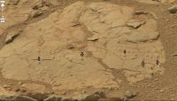
|
Posted by: Gladstoner Dec 28 2012, 02:26 AM
.
Posted by: dvandorn Dec 28 2012, 04:23 AM
Yep, these look an awful lot like eroded clasts to me. What fascinates me even more then the bubblies, though, is the overall look of the terrain. I've seen undercut rocks like this many times, in both wet and dry streams here on Earth.
Here is a rather basic question -- the aerial views of this region appear to show alluvial features here. And the ground-based images show what strongly resemble water-cut rock overhangs. However, when we discuss surface rock erosion, it seems like you get Looked At Funny if you speak about the possibility of water erosion, as if suggesting that any close-in surface feature shows any remnant of water erosion just means you don't understand that Mars has been arid for billions of years.
If it looks like water erosion from above and from the surface, don't we have to at least give serious consideration to the possibility that at least some of the terrain we see around us is, in fact, the direct result of flowing water? Perhaps preserved for billions of years, but water-cut nonetheless? Sort of following the logic path of "if it looks like a duck and quacks like a duck, maybe it is a duck."
-the other Doug
p.s. -- I'm visiting family for the holidays, and the only way I really have of following the forum is via my Kindle Fire, and it's a longer process than normal trying to type with the on-screen keyboard, so I won't be posting a huge amount. Great for looking at the pictures, though.
Posted by: Gerald Dec 28 2012, 07:07 AM
I'm trying to get comfortable with the idea, that the supposed liquid may have been sulfuric acid with solved sulfates, and quartz suspension.
Posted by: Eyesonmars Dec 28 2012, 04:01 PM
There are two articles in the most recent issue of Icarus that we all might take a look at that might influence our interpretation of curiosity's current environs. Using the latest spectroscopic parameters for CO2 as well as a detailed cloud microphysics parameterization the authors make the case for an extremely cold ancient Mars in which the periodic collapse of the atmosphere might occur even with up to 7 bars of CO2. Imagine what might happen at the base of a Co2 glacier say 100 meters or greater in thickness if a modest amount of geothermal heating lifts the base temperature to 224K.
Im on a ski trip doing this on my iphone so pardon my brevity and for not posting links
Posted by: Gerald Dec 28 2012, 05:04 PM
The "missing links" to the articles about early Mars climate:
http://arxiv.org/abs/1210.4216
http://arxiv.org/pdf/1210.4216v1.pdf
http://www.sciencedirect.com/science/article/pii/S0019103512004290
EDIT: For the Hesperian, I think, one should take into account the acidity of water. Sulfuric acid may decrease the freezing point of water.
Posted by: serpens Dec 28 2012, 10:40 PM
Is the outcome of this a re-run of Nick Hoffman's white mars hypothesis? He made a good hypothetical case, but the physical and geochemical indications garnered by Opportunity over the years present compelling evidence for long lasting liquid groundwater with periodic surface exposure. As far as Curiosity's current environment is concerned I'm in the Other Doug's camp with respect to the fluvial provenance of this area. But keeping an open mind, the cementing agent in the sediment (and what appears to be significant variations in lithification) will provide a good indication of the environment in which it formed.
Posted by: dburt Dec 29 2012, 12:16 AM
That particular interpretation is still open to debate, and has already been debated extensively here and in various published articles over 5 years ago. Widespread clay minerals, reported in Gale but not Meridiani, presumably provide the best evidence for some type of liquid water or steam. The cementing agents for the weak clastic sediments visited by the first two exploration rovers on Mars appear to be various reactive, soluble salts, including acid salts - not exactly compelling evidence for persistent surface or ground water. I'll leave it at that. Please PM me if you wish clarification or a longer discussion.
- dburt
Posted by: drz1111 Dec 29 2012, 01:18 PM
I'm very sceptical of models of what climate "should" have been for early Mars. Similar models completely fail to explain the undisputed evidence for widespread liquid water, and modern-type fluvial erosion, on Hadean earth. There's a bug in our understanding of that time.
Posted by: serpens Dec 30 2012, 09:50 PM
I share your scepticism. Given the track record of climate modellers on Earth where outcomes do not reflect predictions despite the ability to empirically measure input constants and variables, it is difficult to accept at face value the output of models directed billions of years into the past for an alien planet where many of the inputs must, of necessity, be guestimates.
Posted by: drz1111 Dec 30 2012, 11:24 PM
It's more than that. Climate models for the contemporary earth are quite good, unless we're talking about regional details not particularly relevant to an analysis of the global Mars climate. Heck, the models seem to do a pretty good job back through the entire Phanerozoic; they even can go beyond that and describe the "Snowball Earth".
But those same models can't handle the Hadean - specifically, the existence of sufficient quantities of liquid water to support modern-type sedimentary processes and/or the generation of felsic crust - based upon best estimates of insolation at that time, without some pretty improbable assumptions. And if they can't describe Earth, it's hard to imagine why they'd get Mars right. We're missing a piece of the puzzle.
Posted by: Gerald Dec 31 2012, 08:40 AM
Pure climate models will be insufficient for a description of early telluric planets, I think. They should be extended e.g. by gravitational shrinkage heat, radioactive decay heat, impact heat, chemical reaction heat like serpentinization to become more appropriate, imho.
Posted by: Zelenyikot Dec 31 2012, 11:08 PM
Somebody has access to the full text? Interestingly about what it.
http://www.sciencemag.org/content/338/6114/1522.1.summary
Posted by: Eyesonmars Dec 31 2012, 11:33 PM
We made several relatively minor changes in response to a useful review by Ryan Anderson, and also ran some 3D simulations as a sanity check on the assumptions in the 1D model.
Are you referring to this?
Posted by: Explorer1 Dec 31 2012, 11:37 PM
This is essentially a news article, so I'm wondering why it's behind a paywall. No matter, I have access through my university. In essence: the researchers say that since the mound's sediment layers are inclined 2-4 degrees from the horizontal (according to MRO observations), as well as the fact that none of the eroded beds reaches the crater wall, the mound is not a remnant of a sediment layer (from an old lake, say) that completely filled Gale.
Instead, they say it was primarily aeolian processes building up an enormous pile of dust. Intense winds from solar heating and air movement could have propelled its' creation from essentially nothing. Water may have been involved at some point, but only marginally.
I hope this helps.
Posted by: Zelenyikot Jan 1 2013, 06:53 AM
Yes, thanks, for an explanation.
Posted by: Gerald Jan 1 2013, 03:11 PM
Inclination might be a result of erosion and creeping, or a result of preferred sedimentation near the mound. Indications for clay minerals in the lower layers of Mt. Sharp still have to be explained. High D/H ratio and a high level of chemically bound water (Rocknest soil) indicate a water-rich past (Noachian) of Mars. The conglomerate finding at Curiosity's landing site strongly indicates a water-rich period. A layer in Yellowknife Bay looks much like containing bound water from the Hesperian (to be confirmed). The crater rim probably is younger as Mt. Sharp, this was assumed before. Science is an adventure; I don't feel any damper.
Posted by: Eyesonmars Jan 1 2013, 07:29 PM
And don't forget the fairly extensive "box works".
Posted by: serpens Jan 1 2013, 09:31 PM
The clay at the base of the mound has been identified as nontronite, indicating a wet, neutral pH environment when it formed. When Curiosity gets to the trough we should get an idea of how the smectite bearing layer formed but the extensive indications of water inflow from the rim and on the floor make a shallow lake a real possibility. Smectites consume acidity and the rate of mineral dissolution increases as the pH falls, the end product being amorphous silica. So the survival of the smectites indicates that they were protected from acid waters during the sulphate period. From Ryan Anderson and James Bell's analysis, what they term as the light toned ridge material sandwiches the nontronite layer. I guess that if it was a smectite dissolution product that would have been identifiable so it must have been impermeable.
The katabatic / slope winds hypothesis makes a lot of sense, particularly for the upper mound, but the early history seems fluvial.
Posted by: elakdawalla Jan 1 2013, 11:15 PM
One thing I would want to check is the direction of the tilt and how that relates to the long-term changes in Mars' shape due to, say, the construction of the Tharsis volcanic complex. The MESSENGER team has shown how lava-filled craters near Mercury's pole now have tilted floors that must once have been horizontal, due to tectonic activity. My own work on Venus dealt with the same thing, measuring current topography of lava surfaces that you assume started out as flat in order to get at ancient tectonics. I'm sure the same could happen on Mars. We certainly know Mars' shape has changed in the past, and it's been suggested that the entire crust has reoriented (true polar wander). I'd love to see if the tilting observed here is consistent with geophysical work on Mars' tectonics -- or inconsistent, which would be just as interesting.
Posted by: Eyesonmars Jan 2 2013, 01:06 AM
If "true polar wander" did occur in the past that means GALE crater could have been at a higher latitude when some of these fluvial features were created. Are there any constraints on this imposed by the formation of the tharsis bulge ( which wants to be on the equator i assume)? Do we even know if Gale and/or its fluvial geomorphology formed before, during, or after Tharsis?
Posted by: chuckclark Jan 2 2013, 01:18 AM
Sound like a puzzle that might be unscramble-able with constant-scale natural boundary mapping. If the tilting blocks can be identified (say by constructing the medial axis of all the surface that is not the Tharsis complex, and using that topological skeleton to form the edge of the CSNB map (same as, or similar to, the way the foldable asteroid maps were laid out), then we'd have, perhaps (I'm just making this up as I go along), an ideal map in which to contemplate all the data and speculations about tilt.
And then again, the inverse map, the one that uses critical boundaries within Tharsis complex as the CSNB map edge may be better to project the stresses to the antipodes, which would then by in the middle of the Tharsis-edged map. See some tilting scenarios may be seen as more likely than others.
The nice point is that the two topological skeletons would be complementary to each other, so all sorts of analysis by numerical and (with the handy constant-scale critical boundary format) geometrical, i.e., waterlines, (the old Victorian mapmaking treatment of watery shorelines) which would project stresses (and carry second order stresses) onto the other skeleton.
May not even be necessary to have the map, but then a picture's worth, what? I forget the math . . .
Posted by: serpens Jan 2 2013, 03:38 AM
Since Edwin Kite's article generated this discussion it is interesting that he (and others) also wrote a paper on true polar wander a few years ago.
http://www-eaps.mit.edu/faculty/perron/files/Kite09.pdf
Posted by: serpens Jan 2 2013, 10:06 PM
Based on analysis of tectonic structures,topography and gravity as well as crustal magnetism Zhong Migration of Tharsis volcanism on Mars caused by differential rotation of the lithosphere concludes that that the main Tharis Bulge had migrated to its current location by the end of the Noachian. I think Gale is assessed as being formed in the late Noachian/early Hesperian and if Zhong is correct then Gale has always been equatorial and the tilt in layers would not be attributable to polar wander although I guess that gradual change to the equatorial bulge following the Tharsis realignment could have some influence.
Emily has an impressive ability to generate, with few words, an incentive to research topics that were previously of minor interest.
Posted by: Gerald Jan 10 2013, 03:15 PM
Several of the rocks near the border of Yellowknife Bay look to me like creeping.
Seasonal temperature cycling might lead to a creeping of the top layer in the direction of the net force, if the top layer consists of material sufficiently different from the layer below.
Might it be, that slope winds exert a force to the top-layer rocks strong enough to result in a net movement towards the crater rim?
An annual creeping of 1mm will be sufficient to exceed aeolian abrasion (0.01 to 0.05 mm per year estimated) twenty- to one hundredfold.
A rough sample calculation, assuming one creeping step per (Earth) year, i.e. two per Marsian year, a difference of the linear thermal expansion coefficients of the two layers of 10 ppm per Kelvin, a seasonal temperature difference of 20 Kelvin, and a length of a rock fragment of five meters yields
0.00001/K x 20 K x 5000mm x 0.5 = 0.5 mm
annual creeping. (Factor one half, because I have to look at the center of the rock.)
For small and thin rocks, even diurnal creeping may occur.
Posted by: JRehling Jan 10 2013, 06:14 PM
This may touch only tangentially on the case of Gale, but I was struck recently upon learning that a 100 km lunar crater, Icarus, also has a central peak that is higher than its rim. Because, obviously, the Moon lacks many of the mechanisms that act on Mars, it offers a far narrower set of possible explanations. In fact, I'm not sure if anyone has explained the case of Icarus. I see a citation of one article I can't read without disbursing some cash:
http://www.sciencedirect.com/science/article/pii/0019103573900237
That said, it is certain that Mt. Sharp has undergone a lot of phenomena that could not be shared between the two cases, but it's interesting to note the lunar case when trying to piece together the logic of Mt. Sharp.
Posted by: Phil Stooke Jan 10 2013, 06:27 PM
Save your cash! There's nothing in that paper about the crater Icarus - it was published in the journal Icarus! (is that where a search led you astray?) There is also absolutely nothing in that paper about any central peak higher than the rim of its crater. LOLA data will allow this topic to be explored much better than any past studies have done.
Phil
Posted by: elakdawalla Jan 10 2013, 06:54 PM
Sorry, Gerald, what you're describing makes no physical sense, and multiplying a couple of numbers together doesn't make it any more sensible. I encourage you to read a physical geology textbook and then ideally a geophysics textbook -- or take some classes -- before trying to do quantitative geophysics. I like both Press & Siever (Earth) and Monroe & Wicander (Physical Geology) as introductory texts, though my textbooks are aging now and there may be better ones out there.
As Phil has said before this forum is better at image processing than geology.
Posted by: JRehling Jan 10 2013, 07:31 PM
Thanks for the tip, Phil. Actually, it was not an errant search, but a comment online by the author of the article who cited it in reference to that crater, but the relevance he inferred to the case of the crater Icarus may have been largely (or entirely) overstated. There may be no scholarly work at all on the case of the lunar crater Icarus.
Posted by: Gerald Jan 10 2013, 08:32 PM
Thanks Emily, for the hints to appropriate literature! It's difficult to find literature, that is not based on conditions observed on Earth.
I looked for investigations of soil creeping on Earth in the web, before I wrote the post. Unfortunately on Earth there is almost always water involved, which leads to additional expansion and shrinking by binding and releasing water to rock containing clay minerals, so that those processes may lead to an estimated soil creeping of about 1cm per year, less than solifluction, so it is mostly negligible on Earth. This may not be obvious for Mars. Therefore I redid the calculations based purely on temperature cycling. Normally such creeping occurs on slightly inclined layers or even within a layer. So the creeping will per se be a valid physical process. The question to me is, whether the thin atmosphere of Mars can exert a net force.
If the creeping as a valid process looks questionable, I may describe the mechanics behind that. In literature it is mostly sketched very briefly, because it's rather easy.
The idea of soil creeping on Mars is not quite new, see http://www.lpi.usra.edu/meetings/lpsc2009/pdf/1190.pdf
Posted by: drz1111 Jan 10 2013, 09:37 PM
As Phil has said before this forum is better at image processing than geology.
QFT. Sigh.
Posted by: Gerald Jan 10 2013, 09:56 PM
Thanks JRehling, thanks Phil, thanks Emily, thanks drz1111 for your assessments, and for being honest!
The idea is either too brilliant, or nonsensical, probably the second.
I'll return to image processing.
EDIT: Luckily, I came across the literature, where I originally found an explanation of soil creeping, including quantitative estimates:
David John Briggs, Peter Smithson: "Fundamentals of Physical Geography", p. 325.
Just in case, someone is interested.
Posted by: ngunn Jan 10 2013, 11:18 PM
Speculating about processes on other planets is a better way to spend your time than many others. I do it a lot and in the case of Mars I know I'm 'getting warm' when one or more of the real geologists here responds. There have on many occasions been good geological discussions on this forum even if it isn't what we're best at.
On another tack: crowd sourcing is becoming fashionable in science, mainly for searching through large data sets. I think it can apply also to ideas if similar filtering processes are employed. This forum is perhaps a precursor for what could be done more generally. In the meantime the admins have to keep judging their interventions. It's hard work done for free and I respect them greatly for it.
Posted by: SFJCody Jan 11 2013, 03:57 AM
I'm with ngunn. I enjoy sticking my oar into areas I have no strong specialist knowledge of (hey, it's a fun mission, sometimes one can get a little over-excited!) but I'm even happier to be corrected by the better read among us.
Posted by: TheAnt Jan 11 2013, 10:58 AM
A good find there, and you're right it takes humidity in the soil for creeping, in the lower arctic forests the trunks of birch trees get a funny bent shape in such areas. With the temperature as low as they are, and frozen in subsurface layers I thought creeping would not occur, I am all happy again to be proven wrong. =)
Posted by: ngunn Feb 1 2013, 11:02 PM
My favourite LPSC abstract (so far, I'm still reading) : http://www.google.co.uk/url?sa=t&rct=j&q=&esrc=s&source=web&cd=1&ved=0CDIQFjAA&url=http%3A%2F%2Fwww.lpi.usra.edu%2Fmeetings%2Flpsc2013%2Fpdf%2F1322.pdf&ei=kUgMUZGcPKWx0AXnvICYCA&usg=AFQjCNFazWO9F0iCs1_YVuTC9aAZh11iQQ&bvm=bv.41867550,d.d2k&cad=rja
Posted by: jmknapp Feb 21 2013, 07:57 PM
In lieu of movement towards Mt. Sharp, here's an attempt at what a scene might look like from an aerial view when the rover gets there (anaglyph):

|
That's reprojected from a HiRISE image, using the digital terrain model on the HiRISE site. The location is in the large outflow channel that Curiosity may go up to get to the "non-conformity" boundary (at the upper left half of the image), looking kinda like lava flows.
Posted by: Fran Ontanaya Mar 15 2013, 10:27 PM
Can this inconclusive blue green spotty pattern on CRISM where Curiosity has found carbonates be extrapolated to what is seen higher on Mount Sharp, past the blue and magenta sulfates (as seen here: http://www.planetary.org/multimedia/space-images/mars/crism-map-of-gale-crater.html)? It would be something if under the dust it was all phylosillicates, except for a sulfates apron.
Posted by: serpens Jul 12 2016, 06:39 AM
Suffering from a mild case of cabin fever from being stuck inside due to dreadful weather I thought I would resurrect this thread to throw out a few ideas on the dating of Gale. pdf attachment for brevity of post.

Posted by: Gerald Jul 12 2016, 09:46 AM
Re 3: Reliably tracking back the orbits of the planets of our solar system more than about 0.5 billion years isn't currently feasible, afaik. Adding the excentricity of Mars' orbit, I don't see convincing evidence for the implicite assumption, that the Martian orbit has been 3.7 billion years ago where it is today.
So, I'd think that there is sufficient space to play with resonances and close encounters with other planets, which may or may not still be present in our solar system. Some planets/planetesimals might have been ejected from the solar system, swallowed by the Sun or the gas giants, or fused to today's planets.
Over long time scales close encounters with other stars might have disturbed the orbits of our planets, too.
The faint sun hypothesis is a hypothesis, and despite theoretical evidence, data are lacking. The activity of stars can vary.
And radiogenic heat has generally been considerably higher in the young solar system than today; so we get the Martian interior as a source of heat.
There is of course still quite some uncertainty about the composition and density of the early Martian atmosphere, as well as of its albedo.
Hence I agree, that an early warm Mars is a mystery, but not because there is a lack of possible solutions, but because there are too many solutions.
Therefore I'd take it as valid to assume surface temperatures as inferred from geology, no matter for which particular physical reason.
Posted by: Don1 Aug 27 2016, 08:07 AM
@Gerald: I recently came across another very interesting possible explanation for the faint young sun paradox. In his "Lectures on physics", Feynman discussed the possibility that the gravitational constant G had changed over time. It turns out that the luminosity of the Sun is strongly affected by changes in G, with the luminosity proportional to G to the sixth power. Feynman points out that this would have made the ancient earth far too warm. However Feynman wrote that in 1962, which was a few years before the faint young sun paradox was identified. It turns out that a warmer earth is just what we need.
I did some digging around on the internet and it appears the current observational constraints on G can't rule out the possibility of G changing by enough to solve the faint young Sun paradox. So the idea that G has always been constant is really an assumption.
Posted by: Don1 Aug 27 2016, 08:35 AM
From the GSA meeting abstracts:
"LONG-LIVED DEEP LAKES IN EARLY MARS: SEDIMENTOLOGICAL EVIDENCE FROM THE CURIOSITY ROVER AT GALE CRATER"
"... the Striated and the Murray formations represent a subaqueous fan in a large lake, estimated to be 1 - 3 km deep. Fining-upward layers of the Striated formation are coarse-grained turbidites deposited on the proximal part of the fan by sediments delivered by floods through the northern rim of the crater. The Murray formation formed on the distal part of the fan and extended into the center of the lake in waters so deep that bottom sediments were unaffected by wave actions, lake-level fluctuations, and storm activities....."
"The rhythmic nature of layering indicates a regulated flow of flood waters into the lake, possibly controlled by changes in climate. The most likely forcing mechanism was variations in obliquity. Floods occurred during hothouse periods when the Martian climate was warmer than Present. The lake became saline at least to gypsum saturation during subsequent cold and/or dry climate of icehouse intervals and precipitated sulfate-rich nodules in the Murray formation. "
My comment: This was a deep lake. Other abstracts indicate that it likely lasted for millions of years.
"TESTING A MECHANICAL MODEL OF FRACTURE FORMATION BY COMPACTION-RELATED BURIAL IN GALE CRATER, MARS; IMPLICATIONS FOR THE ORIGIN OF AEOLIS MONS"
"These results imply that formation of these fractures [in the Murray and Stimson rocks] requires at least one significant burial event in the evolution of Mt. Sharp, providing key insight into the geologic history of Gale crater. "
My comment: After the lake dried up, sand dunes formed which later became the Stimson formation. Then the crater filled in and the pressure fractured the rocks.
"DIAGENESIS ALONG FRACTURES IN AN EOLIAN SANDSTONE, GALE CRATER, MARS"
" The mineralogy and geochemistry of the altered sandstone suggest a complicated history with several (many?) episodes of aqueous alteration under a variety of environmental conditions (e.g., acidic, alkaline). "
My comment: More water flowed through the fractures and altered the rocks.
"MINERALOGY OF MUDSTONE AT GALE CRATER, MARS: EVIDENCE FOR DYNAMIC LACUSTRINE ENVIRONMENTS"
" At the time of writing, CheMin has analyzed 14 samples, seven of which were drilled from lacustrine deposits. The mineralogy from CheMin, combined with in-situ geochemical measurements and sedimentological observations, suggest an evolution in the lake waters through time, including changes in pH and salinity and transitions between oxic and anoxic conditions. "
My comment: The mention of "oxic conditions" is interesting. Anoxic conditions are not surprising on a planet with a CO2 atmosphere. However, what produced the oxic conditions? Where did the oxygen come from?
Posted by: serpens Aug 27 2016, 11:50 AM
Re your comment on "TESTING A MECHANICAL MODEL.....". The Stimson Murray interface is an erosional unconformity covered by an fragile aeolian dune deposit that does not seem to demonstrate any significant compaction or lithification. Rather than being an early construct buried by crater infill the Stimson deposit was potentially laid down following the erosion of the crater infill with a large contribution from landslips from a degrading Mount Sharp. In other words the Murray formation is an erosional endstate for the mudrock (mudstone/siltstone because it is hard to tell the difference) lacustrine Murray formation and the easily eroded sandstone of the Stimpson is a late feature (in Mount Sharp erosional terms) .
Posted by: Gerald Aug 27 2016, 12:49 PM
Although G isn't known very accurately, varying G over (space)time would challenge present cosmological models, including the https://en.wikipedia.org/wiki/Einstein_field_equations. Missions like EUKLID might eventually narrow down according constraints.
Feynman hadn't access to astronomical and astrometrical data as we have today. I don't think, that with contemporary knowledge Feynman would have suggested to assume G as variable within our observable universe (might be except very close to the Big Bang).
I'm sure, that the faint young sun paradox will turn out to be soluble within established standard physics.
[MOD: Agreed, and a reminder to all to review rule 1.9 as well as to stay on topic.]
Posted by: Don1 Aug 27 2016, 08:52 PM
@serpens....Yes, I was wondering about that when I wrote the post. I thought Stimson was supposed to be young, but the abstract didn't read that way. I went back this morning and took another look at it, and the authors do seem to be arguing that the cracking in Stimson was produced by burial in the same way that the cracking in Murray was produced. It seems to me that that would only be possible if Stimson is old.
The authors by the way are Watkins, Grotzinger and Avouac at Caltech.
"TESTING A MECHANICAL MODEL OF FRACTURE FORMATION BY COMPACTION-RELATED BURIAL IN GALE CRATER, MARS; IMPLICATIONS FOR THE ORIGIN OF AEOLIS MONS"
" Large fractures which exhibit complex banding structures with distinct chemical trends (e.g. halos) are primarily found in the Stimson formation, but do extend into the Murray formation in one location. Smaller, sulfate-filled fractures are most prevalent in the Murray but are also associated with haloed fractures in the Stimson."
Posted by: serpens Aug 28 2016, 12:42 AM
The Watkins, Grotzinger and Avouac paper in no way precludes the probability that the Stimpson was laid down subsequent to a significant burial and then exhumation of the crater. The extension of minor fractures into the Stimpson with limited examples of larger fractures can be readily explained through reactivation.
A possible scenario would be that the initial fractures in the Murray formation occurred as a kilometres thick overburden was removed through erosion and pore water was released. Subsequent deposition of the Stimpson material would have provided a compression force on the Murray formation, albeit at a comparatively minor level. The catastrophic channel outflow events, combined with a surge in volcanic activity would have provided sufficient acidic water through groundwater recharge and limited precipitation to replenish pore water to a degree, as well as (poorly) lithify the Stimpson. Subsequent erosion of the Stimpson would have caused a change in pore pressure in the underlying Murray sequence which could cause the pre-existing fractures to propagate up into the overlying Stimpson rock. This propagation could be assisted by pore water at the fracture tip causing chemical weakening of the overlying rock. Fracture propagation would have been restricted by the limited availability of acidic pore water due to the minor compression unloading.
Posted by: MarkG Aug 28 2016, 11:49 PM
In reading this, please keep in mind the profound ancient-ness of these landforms.
Posted by: tty Sep 1 2016, 06:57 PM
"The mention of "oxic conditions" is interesting. Anoxic conditions are not surprising on a planet with a CO2 atmosphere. However, what produced the oxic conditions? Where did the oxygen come from?"
There is actually an abiotic mechanism for producing appreciable amounts of oxygen photochemically in a cold glacial/interglacial environment. UV light will produce small quantities of hydrogen peroxide which will be stable enough at low temperatures to be stored in ice. When an interglacial arrives and the ice melts the hydrogen peroxide decomposes into water and oxygen.
Posted by: serpens Sep 1 2016, 11:28 PM
Probably photodissociation of CO2 and H2O. This recent release by JPL provides some substantiation.
http://www.jpl.nasa.gov/news/news.php?feature=6544
Posted by: tty Sep 2 2016, 08:29 AM
Yes. The process has actually been rather extensively discussed in the literature in connection with Archaean/Proterozoic glaciations ("Snowball Earth") since there is evidence for oxic conditions immediately after the glaciations. And hydrogen peroxide is actually found in measurable amounts in snow in Antarctica. Incidentally the quantity deposited increases in early summer when ozone is low.
http://rstb.royalsocietypublishing.org/content/363/1504/2755
http://www.pnas.org/content/103/50/18896
https://www.academia.edu/15042568/Production_of_hydrogen_peroxide_in_the_atmosphere_of_a_Snowball_Earth_and_the_origin_of_oxygenic_photosynthesis
http://web.gps.caltech.edu/~jkirschvink/pdfs/RaubKirschvink08DeglaciationOxidationReviewAndModel.pdf
Posted by: Greg Malone Dec 22 2016, 12:24 AM
Looks good enough to have on my breakfast cereal. More seriously, it looks somewhat out of place, but it's a small frame so can't see context. Will find the source image and see what's up.
LATER:
That individual berry-looking object is pretty unique in that immediate area, though there appear to be fragments of similar material nearby in same frame.
While scanning for similar objects in the immediate area on 1553, I did spot this little gem:

Sol 1553 13:12 Site 59/3004 1553ML0079770020604748E01_DXXX
Posted by: serpens Dec 22 2016, 04:19 AM
The thing is that if these items are extremely resistant to erosion as seems the case then they could have been emplaced at any level of the kilometres of material that overlaid the current surface.
Posted by: Gladstoner Dec 22 2016, 06:38 AM
Stony-iron meteorite?
Posted by: HSchirmer Dec 22 2016, 03:16 PM
[attachment=40555:1555MLcontext.jpg]
Yep, looks like mudcracks, but what's really interesting is the variation in polygon size,
there are small .5 cm polygons and medium 2-3 cm polygons and what seem to be 10 cm polygons.
That suggests a very interesting interplay between the available water, the available sediment, and depth.
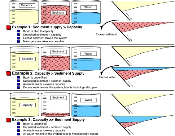
image is from Columbia University's earth sciences page about basin filling
https://www.ldeo.columbia.edu/~polsen/nbcp/breakupintro.html
The thick deposits of mudstone made of thin sheets of sun dried mud is paradoxical when you think about it...
Shouldn't a crater fill up with deep lake sediments, then shallow lake, then mud, then sand?
It does raise a neat question, involving faults and geology...
On earth, you get thick deposits of shallow water sediments in extensional basins;
when a half-graben opens up, the land drops slowly, so it starts shallow and stays shallow,
in contrast a crater, should start deep, then gets shallower as it fills in.
http://www.lpi.usra.edu/meetings/lpsc2013/pdf/3106.pdf
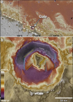
|
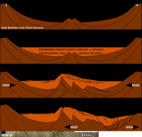
|
Posted by: serpens Dec 22 2016, 09:54 PM
Shouldn't a crater fill up with deep lake sediments, then shallow lake, then mud, then sand?
http://www.lpi.usra.edu/meetings/lpsc2013/pdf/3106.pdf
It would be reasonable to expect that the water availability in the Gale lake would vary as would the amount of available sediment, particularly airfall. But this very thin sheet of cracked material does seem to be an anomaly and difficult to reconcile to dessication. Chemcam should reveal something about the makeup of the sheet as it could be possible that these cracks formed sub aqueous in a thin, possibly localised layer of clay rich sediment. Subsequent settling of underlying sediment causing the cracking would explain the variation in shape and size.
Posted by: HSchirmer Dec 22 2016, 10:32 PM
I really find the juxtapositions interesting.
Surface precipitation might weather clays, but IS need to move sediment, as in peace vallis.
Ground water might weather clays, but IS probably needed for later mineral veins.
https://www.youtube.com/watch?v=xq65TVKDZXs&feature=youtu.be&t=11
Gives a really excellent over view of the issues.
Well, if you've got a valley network, availability of water, and sediment are a bit easier to estimate...
http://authors.library.caltech.edu/57475/
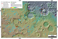
|
Posted by: wildespace Dec 25 2016, 04:06 PM
Any idea what is this spherical object?
Posted by: PDP8E Dec 25 2016, 05:19 PM
Hematite? (aka Squyers' blueberries)
Posted by: Steve5304 Dec 28 2016, 04:00 AM
To big...process may be similiar but material is probably different.... Don't think we have all the pieces to the puzzle I hope curl does some sciene on that. We passed two others that looked identical on sol 937, 1185, in different sorts of terrain. Pretty strange formation it would be about the size of a marble.
Posted by: HSchirmer Dec 28 2016, 06:29 PM
...
Pretty strange formation it would be about the size of a marble.
Well, it looks very similar in size to the low grade copper concretions that occur along the US east coast.
Triassic mudstones + igneous intrusions = marble sized ore concretions, usually copper, silver, gold, arsenic.
In my experience, they're usually within about 1 km of the igneous contact.
When the contact is is folded, (scallop shell) instead of flat (clam shell)
they mudstone ores seem to occur more in the peaks (anticlines).
You can see concretions in situ and some spherical voids where others weathered out.
US penny for scale.
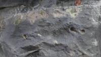
|
Posted by: Steve5304 Dec 28 2016, 07:20 PM
Triassic mudstones + igneous intrusions = marble sized ore concretions, usually copper, silver, gold, arsenic.
In my experience, they're usually within about 1 km of the igneous contact.
When the contact is is folded, (scallop shell) instead of flat (clam shell)
they mudstone ores seem to occur more in the peaks (anticlines).
You can see concretions in situ and some spherical voids where others weathered out.
US penny for scale.
Thank you for that.
Not to sound like a jerk but i think we should run this thing over and take the chemcam see what it really is.Somebody from nasa is reading i hope!
Posted by: serpens Dec 28 2016, 09:47 PM
After the exhaustive work to identify the provenance of Opportunity's berries there is a tendency to consider small spherical objects seen on Mars as concretions. This particular example is isolated so if it is a concretion then transport was involved. However we cannot rule out other causes such as an impact artefact, molten material with a reasonably high ferric component that assumed a spherical shape and cooled in flight, possibly quenched by fall into water. Note Greg Malone's post #810, page 54 on 22 December.
Posted by: Steve5304 Dec 29 2016, 12:27 AM
If that was formed by water it would not be on the surface..it would be below I would think. That had to have broken off or out in the last 100,000 years. Again...I would think but
Posted by: HSchirmer Dec 29 2016, 12:55 AM
Eh, remember that there would be a cycle that repeats thousands or millions of times:
dry lake bed, playa, shallow lake, deep lake, shallow lake, playa - dry lake
The dry to wet cycle is nicknamed a https://www.ldeo.columbia.edu/~polsen/nbcp/cyclcicity.html, in the best studied mudstone basins on earth, one cycle is ~20k years, and about 1 meter thick.
Expect you'd have something similar on mars - gale probably went from lake to dry lake and back many times,
based on orbit and eccentricity. there could be "wet" areas both above and below
[what appear to be] the current mud flats.
Yes, there is a tendency to consider small spherical things on mars as concretions,
however, we're looking at fractured mudstones, and experience on earth shows that
fluids moving through cracked mudstones are good at making concretions.
They're common in earth mudstones, so it's acceptable to expect they're common on mars as well...
Posted by: serpens Dec 29 2016, 02:33 AM
We have to climb around another hundred metres of Murray formation mudstone and sixty metres or more above that to the hematite ridge. Nicolas Steno's principle of lateral continuity holds that this strata would have originally covered Curiosity's current position, requiring significant water influence over a long period of time. As an aside, the more I look at the hematite ridge the more I wonder whether it could be an inverted bed of what was a reasonably well oxidised stream.
Posted by: Julius Dec 29 2016, 07:52 AM
Simply brilliant stuff!
Posted by: Greg Malone Dec 29 2016, 06:34 PM
To add to the mix of ideas about dessicated mudcracks is the notion of syneresis, believed to have possibly been active at some sites investigated in Gale -- where differential salinity in interstitial water causes lower salinity water (I believe) to migrate out of the muds being replaced by denser higher salinity water, creating cracks that are somewhat similar to dessication cracks... all the while the entire environment being saturated with subsurface water... i.e. not a 'drying out' or dessication.
Posted by: Greg Malone Dec 29 2016, 06:42 PM
I've since noticed a couple of other features that, to the eye, appear possibly similar to the mentioned 'meteorite', in the same general location. Clearly not enough info to really know what we're seeing here, but still fun to muse on.

Posted by: HSchirmer Dec 29 2016, 10:53 PM
and sixty metres or more above that to the hematite ridge.
Good point. There are still hundreds of meters of strata to climb.
My point was that it takes a long time, (eh 3-30 million years?) and a huge amount of water
to transport the sediment that is eventually compressed to become those 100 meters of mudtone and 60 meters of hematite.

So, we should see orbital and processional effects (roughly 100k and 1.25 million years) in the lake levels,
as the lake in Gale goes from overflowing to a "dead sea", and goes from a salt lake to playa.
Yes, I guessed about 3-30 million years for 160 km of rock strata. So, gale crater is sedimentary basin.
The gale basin (90-100 miles) is close to the size of the well studied Newark basin (90-100 miles) on Earth.
We can calculate that the Newark rift basins filled in with about one meter of rock per 20k years under
Triassic Earth conditions (dry and hot, not too far from Mar's dry but cool..)
So, rough estimate, the optimal wet Martian climate at gale would be, at best, comparable to Earth's dry Triassic climate and take 3 million to fill 160 meters, but leave a 10x range, erosion during a wet period on Mars would still take ten times longer than erosion during a dry age on Earth, which gives 30 My.
What we see on Earth is that celestial mechanics creates 20ky patterns and 404ky patterns, and other effects create patterns within the patterns of climate that create wet / dry swings.
Same for Mars, but it seems that Mars has 100 thousand year and 1.25 million year patterns
requiring significant water influence over a long period of time.
The lake in Gale crater may have been there for 10 thousand years, or 10 million years.
On Mars, is that a long time, or is that a short time?
Mars seems to have a 1.25 Million year climate cycle, built out of smaller ~100k year cycles.
http://www2.physics.ox.ac.uk/sites/default/files/2011-06-15/milankovic_on_mars2013_pdf_93344.pdf
You'd expect wet to dry climate to be a direct progression, like a piano scale exercise. Down the scale.
That is not what happens.
Climate happens in the moment; it is patterns within patterns, within patterns, within patterns-
Mars rotates each day, Mars revolves each year, Mars' poles shift each age,
and Mars' orbit bends to the will of the other planets sailing and circumnavigate the celestial ocean.
Mars' climate is not playing scales, it is playing Bach, patterns within patterns within patterns.
Goethe once said "Architecture is solidified music”
I think it's safe to say that geology is solidified climate...
Consider the diagram below, each section is an octave on a piano....

|
Posted by: serpens Dec 31 2016, 02:06 AM
Basically a closed system I expect. One needs to pull back a bit to see the big picture. Aeolis Serpens to the NE of Gale is an inverted river complex over 500 kilometres long that spans a period somewhere between 1 to 20 million years with evidence of varying water and sediment supply and occasional desiccation. It would have terminated at the northern ocean and this would imply a shoreline to the north of Gale. Groundwater at Gale could reasonable be expected to reflect the level of the Northern ocean, creating a lake, while impact tsunami could also have overflowed the northern crater wall.
The problem is that empirical data from the rovers and orbiters prove an early warm wet Mars with a complex hydrological cycle spanning millions of years. No model of plausible environments can explain this. But Curiosity has a long way to climb and hopefully more clues will be found to help complete the jigsaw.
Posted by: dburt Dec 31 2016, 04:24 AM
Umm. The conflict with plausible environments may be more apparent than real. I remind you here that it is important not to confuse actual data with interpretations based on that data. Furthermore, much of the martian "data" (e.g., the detection of clay minerals) is itself based on interpretations of analytical or spectroscopic data. And the mere detection of clays gives no indication of how or when the clay minerals formed. Another example would be the imaging of channels or fans interpreted to have been formed exclusively by flowing water. Such interpretations, in some cases, prove nothing other than the bias of the observer. In science, multiple working hypotheses should dominate, although in practice they rarely do. A new year's resolution for Mars, perhaps.
DBurt
Posted by: HSchirmer Dec 31 2016, 02:33 PM
...
Groundwater at Gale could reasonable be expected to reflect the level of the Northern ocean, creating a lake, while impact tsunami could also have overflowed the northern crater wall.
...
The problem is that empirical data from the rovers and orbiters prove an early warm wet Mars with a complex hydrological cycle spanning millions of years.
Good summary,
I've cleaned up my prior post a bit, but basically-
Laying down 90 miles of mudstone outcrop takes millions of years' worth of water.
Celestial mechanics suggests that Mars dries up every 1.25 million years,
when there is no water, erosion just halts and waits for a wet epoch to return.
Hmm, interesting point about tsunami, I hadn't thought of the possibility before...
The central mound in gale crater might be tidal wave debris.
Posted by: HSchirmer Dec 31 2016, 02:50 PM
[attachment=40595:1526_52_flb_crop1.gif]
I like the advancing mini ripples.
Neat, was that a drill dump?
Thinking of drills, we've seen that rocks react strangely to vibration...
And there's actually a paper about erosion by vibration....

Seismicity and the strange rubbing boulders of the Atacama Desert, northern Chile
http://geology.gsapubs.org/content/40/9/851.abstract
Posted by: HSchirmer Jan 2 2017, 01:49 PM
The problem is that empirical data from the rovers and orbiters prove an early warm wet Mars with a complex hydrological cycle spanning millions of years. No model of plausible environments can explain this. But Curiosity has a long way to climb and hopefully more clues will be found to help complete the jigsaw.
Since the discussion has been clipped out -
A new paper about the morphology of gale, compared to other high peaked craters....
GALE CRATER MORPHOLOGY COMPARED TO OTHER HIGH CENTAL PEAK CRATERS ON
MARS.
http://www.hou.usra.edu/meetings/lpsc2016/pdf/2822.pdf
Should also note that the central mound at Gale appears to be within the elevation (global -4087m to -3191) which has been suggested to be within the reach of norther ocean tidal waves.
http://www.nature.com/articles/srep25106
Interesting to think of a martian sea, not stirred by tides, but stirred by impact events.
http://www.lpl.arizona.edu/~shane/publications/daubar_etal_icarus_2013.pdf
Posted by: HSchirmer Jan 3 2017, 02:40 PM
... i.e. not a 'drying out' or dessication.
Good call on the syneresis folds and cracks.
Just noticed, we have what appear to be iron concretions in Mars Gale crater images...
Looks fairly similar to copper concretions in Earth Newark basin...
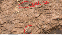
|

|
Posted by: Julius Jan 12 2017, 09:41 PM
Sulphates on Earth require oxygen to form either by volcanic eruptions or the action of sulphate reducing bacteria. Deposits of iron pyrite have been attributed to rising levels of atmospheric oxygen. Varying sulphur isotopes have been regarded as biosignitures.
What do findings of sulphates, gypsum, manganese oxide and haematite on Mars tell us about climatic condition's with regard to atmospheric and water oxygen levels? Is Curiosity rover equipped to measure isotope ratios?
Posted by: serpens Jan 13 2017, 11:14 PM
SAM has the capability to conduct isotopic analysis of the lighter elements. You have a few misconceptions in that sulphate reducing bacteria uses sulphates as an energy source, producing sulphides. Iron pyrite forms in a reducing, not a oxidising environment and on Mars probably formed through melt separation during magma crystallisation.
With respect to your question on what rover and orbital findings indicate about previous environments, these have been the subject of a huge number of erudite papers and articles by acknowledged experts in their fields and address the dramatically different environments encountered by the landers and rovers. A good search engine and some careful culling to separate the grain from the chaff will provide you with your answers and attempting to paraphrase these would take up immense space and justifiably draw the wrath of the overworked moderators.
Posted by: dburt Jan 14 2017, 12:02 AM
Julius, I agree with what Serpens said, but to try to save you a bit of trouble, let me summarize (with some trepidation) what you are likely to find in an exhaustive literature search. In short, sulfates don't tell you a great deal about environments. Yes, they are oxygen-bearing, but so are virtually all the other minerals that make up planetary crusts, such as silicates and carbonates. Sulfates require a tad more oxygen than most, to avoid forming sulfides instead, but not much more. There are igneous and hydrothermal sulfates as well as sulfides, so sulfates are not unique to a particular environment (at least on Earth). Some elements (e.g., calcium) form sulfates more easily than others (e.g., iron), but you didn't ask about that.
Manganese oxides and hematite on the surface of Mars probably don't tell you a great deal either, because the surface of Mars is believed to be locally far more oxidizing than the inside, owing to the influence of solar ultraviolet light, not from an oxygen-rich atmosphere (as on Earth). It doesn't take a great deal of oxygen to form either type of oxide. Finding manganese or iron oxides inside a rock can tell you that it or its ingredients were formerly exposed to sunlight at the paleo-surface, and presumably to some moisture (to assist their growth), but nothing more.
I won't address sulfur isotopes, because there is no data and they are not my area of expertise.
Posted by: Julius Jun 7 2017, 02:41 AM
The consensus up to now seems to have been that sulphate minerals tend to rest on top of more ancient clay minerals and has been interpreted as reflecting a climatic change on Mars from neutral water environment to a time when the planets water turned acidic indicating a drier environment. The finding of jarosite at Pahrump hills and lack of clay minerals sandwiched if you like between abundant clay containing Yellowknife bay rocks and abundant clays found in Murray buttes would seem to contradict this . Any thoughts about this?
Posted by: Gerald Jun 7 2017, 06:38 AM
My first thought about the silica enrichment has been a process connected to the hematite enrichment at Vera Rubin ridge, kind of leaching and precipitation cycle. But there are lots of gaps, of course, and those two layers could have formed independently. I don't see an immediate connection to the overlying sulfate layer thus far.
One may also conclude, that we are going to learn more about the details of Martian history, but our understanding of the long-term geological structure doesn't need to be challenged.
Posted by: serpens Jun 7 2017, 08:40 AM
Julius, I think that Curiosity will need to get up close and personal with the clay bearing trough before they can assess how and when it was formed. In their brilliant Geological mapping and characterisation of Gale as a potential landing site, Anderson and Bell depicted the clay as a thin bedding plane with a segment exposed by the trough and that characterisation has carried forward. As I understand it the clay signature seems to indicate smectites. The overlying hydrated sulphates would likely have formed in an acidic environment and smectites are pretty good at consuming acidity with the end product being amorphous silica. So if the smectites had been exposed to the acidic waters during sulphate deposition, wouldn't hydrated silica and kaolinite have been detected, unless the clay had been covered by an impervious layer? An alternative is that the clay was formed following deposition of the sulphates as a function of erosion of the sulphate and formation of the fan. Could this clay be a localised deposit formed from pooled water that had leached Mg from the higher sulphate deposits? Both the hematite ridge and the clay trough are going to tell interesting stories.
Posted by: serpens Nov 9 2018, 12:14 AM
QUOTE (HSchirmer @ Nov 8 2018, 05:06 PM
...Given the elevation of Gale crater, and recent northern-ocean papers, is there any way to differentiate whether Gale was lacrustine or perhaps an interior estuary?
All evidence to date implies lacustrine. Dichotomy elevation differences aside, the northern crater rim is heavily degraded compared to the northern rim and the area directly north of Gale is somewhat atypical compared to adjoining topography. it is possible that it was overtopped by lake water or by catastrophic events such as impact driven tsunami although there is no evidence of such. The rim is above the elevation assessed for proposed shorelines for the northern ocean(s).
Hmm, reminds me of the Newark Basin paradox- a 2-mile deep deposit of shallow water mudstone interbedded with fanglomerates and sandstones. (It is a paradox because with a 2-mile deep basin [~about the average depth of the Atlantic or Pacific] you'd expect to start with deep water sediments which get shallower as you fill in the basin over time. Instead, the Newark basin was shallow during the entire time that 2 miles of sediment were deposited.)
I thought the Newark basin was the result of a slow graben process? As the land sank the rate was matched by shallow lake deposition.
Posted by: HSchirmer Nov 9 2018, 12:57 AM
Curious about that, a recent paper suggested that early shorelines make sense, IF you remove the Tharsis bulge, and the corresponding antipodal bulge near Gale.

That puts the Arabia shorline (purple line) right around the elevation of Gale
Yep. Newark is a hanging wall/graben.
Which is interesting with the possible faulting/slumping of Gale's north crater wall.
But the twist for Newark - clays interbedded with fanglomerates and sand, might illuminate what happened at Gale.
If you have sediment from 2 sources, young rivers cutting into the hanging wall side, providing mineral rich fanglomerates; while flat rivers from the Martian interior providing weathered clay sediments.
Earlier papers discuss the hypothesis of an Elysium lake overtopping the north rim,
https://vdocuments.mx/hydrogeologic-evolution-of-gale-crater-and-its-relevance-to-the-exobiological.html
but either way, the notch in the north crater rim would let north draining rivers flow into Elysium lake/Arabia sea during wet periods,
but would/should also result in shallow areas to the north draining fine clays back INTO Gale-
I'm thinking of the paradox that ~250 million years ago, US east coast rivers- Potomac, Susquehenna, Schuylkill and Delaware, initially drained NORTHWEST.
When the Atlantic ocean opened up, the rivers reversed course and began cutting back from the new ocean, causing the same valleys to drain SOUTHEAST.
I wonder if something similar applies to Peace Vallis, where the notch in the northern rim allowed drainage from the southern highlands into Elysium lake or Arabia sea,
but when those streams dried up, the notch allowed the lake and sea to drain back into Gale.
http://spaceref.com/mars/curiousmars-box-shaped-martian-features-and-deep-water-lake-deposits-offer-new-rover-destinations.html

Posted by: serpens Nov 11 2018, 05:33 AM
I suspect that this would represent the maximum fill with your suggested high ocean level, with the northern rim less degraded and above water level. Occasional tsunami drain back cutting the few possible channel like features but who knows. Certainly the mount would not exist at this time and the central uplift would be the sole feature within the lake. There is some evidence from tsunami features that the proposed first ocean was not iced over although the second, shallower ocean was.
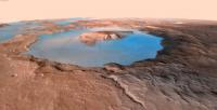
|
Posted by: HSchirmer Nov 11 2018, 04:12 PM
Theory - Gale Crater was a bay when the Arabia Ocean filled the northern lowlands of Mars.
Perhaps but if Gale was a beach environment, why wouldn\'t there be sand, and perhaps dunes?
If there was an ocean, then there had to be an atmosphere, and had to be wind, and had to be waves,
and had to be sand, and sand plus wind means dunes.
If there was a northerly wind, why wouldn\'t the central peak of Gale trap a static barchan style dune?
Is there a name for the barchan-dune looking half-crater north of the Gale notch?
A bit of digging finds that early plaotting of the "Arabia Sea" aka "Contact 1" goes right through Gale crater.
Parker et al. (1989, 1993) also proposed an older, higher-standing Contact 1, later on
renamed Arabia shoreline (Clifford and Parker, 2001). This shoreline, which would be of
Noachian age (see Clifford and Parker, 2001), is roughly coincident with the Martian
dichotomy separating the lowlands from the highlands,
figure #2 from the paper is enlarged as the first image below
At the Arabia shoreline, Gale crater would have been a bay.
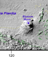
|
Posted by: HSchirmer Nov 11 2018, 05:27 PM
Actually, "just overtopping" is the Arabia Ocean level, Meridiani would be higher, making Gale the entrance to an estuary.
Figure 1: Three lake levels at Gale:at - 2277 m spilling over the northern rim
The shorelines suggest 3 oceans, Deuteronilus, Arabia, and Meridiani.
A zoom in from the Paeloshorelines paper shows the various shorelines in black in the images attached below-
-2.09 km, and c) -3.792 km elevation levels.Three images below (which of course are out of order...) To judge the ocean height, look at Elysium.
Working left to right- Gale crater is due north of the left most yellow dot at the bottom center of the images.
At the Arabia shorline, (left image) Elysium is an island with wide flanks, and Gale is a circular bay.
At the lowest shoreline Deuteronilus, (middle image) Elisum is still attached to the continent, and Gale is a notch at the fall-line.
At hightest shoreline, Meridiani, (right image) Elysium is a small island, and Gale is the entrace to a large estuary including the lowlands to the east.

|

|

|
Posted by: HSchirmer Feb 2 2019, 03:17 PM
Reaching way back to discussions about the thickness of sediment deposits in Gale-
But this very thin sheet of cracked material does seem to be an anomaly and difficult to reconcile to dessication. Chemcam should reveal something about the makeup of the sheet as it could be possible that these cracks formed sub aqueous in a thin, possibly localised layer of clay rich sediment.
Subsequent settling of underlying sediment causing the cracking would explain the variation in shape and size.
Well, now it looks like the Gale crater was NOT filled to the brim with sediment-
Thanks to some creative re-purposing of accelerometers and gyroscope to go gravity/density measurements-
https://www.jpl.nasa.gov/news/news.php?feature=7323
The rocks aren't compressed in the way that would be expected if they were deeply buried-and-then-excavated.
http://science.sciencemag.org/content/363/6426/535.abstract?ijkey=xakdRhWj7CWEE&keytype=ref&siteid=sci
So, what process raised Mount Sharp? Nice summary of depositional models at
https://marsoweb.nas.nasa.gov/landingsites/msl/workshops/5th_workshop/talks/Tuesday_AM/Sumner_Gale_opt.pdf
Initial expectations mentioned possible contact with non-sedimentary basement-basalt.
I may have missed it, but was there any outcrop or exposure that looked like basement-rock basalt?
http://marsjournal.org/contents/2010/0004/files/anderson_mars_2010_0004.pdf
Anybody have a link to the most recent stratigraphic mapping?
Posted by: serpens Feb 4 2019, 05:53 AM
The basal/basalt misinterpretation was explained, in fact done to death in pages 7 to 9 of this thread. Let's not resurrect it.
The accelerometer analysis by Lewis et al is innovative although I am not certain that their conclusion on the extent of overburden considers all the variables. I do not question their methodology or measurement results. However I do note that during the ascent of Mount Sharp the Murray formation has consisted primarily of mudstone with some sandstone lenses. Depositional muds have high porosity (up to 65- 70%) due to the nature of the particles and electrostatically bound water and compaction of such in Mars' low gravity takes significant overburden. Given the thickness of the mudstone significant pore fluids may have been retained, retarding compaction and retaining density indicative of shallower depth than was the case.
Posted by: atomoid Feb 5 2019, 10:04 PM
As referenced in an https://www.sciencenews.org/article/nasa-curiosity-mars-rover-weighed-mountain-its-climbing accelerometer-based gravity readings suggest:
"...the rock beneath Curiosity's wheels is less dense than its mineral composition led them to expect. It's "more like the density of soil than a fully cemented rock," Lewis says. That means the crater must never have completely filled with rock — the upper layers would have crushed the lower ones — and supports the windblown sands theory for how Mount Sharp formed...
...suggests there were two different periods of mountain-building in Gale Crater, one that laid down lake sediments and a drier one that built Mount Sharp's peak. Curiosity might find the transition point as it keeps climbing...
...measurements suggest that the rocks beneath Curiosity are riddled with holes. “But the rover doesn’t see any holes,” Kite says. Either the pores are too small for Curiosity to see, less than 10 micrometers wide, “or there’s something unusual about the rocks right at the surface where Curiosity is driving.”..."
Assuming an accelerometer measurement wouldn't be able to discriminate between holes/pores at surface vs subsurface... so seems simpler that the subsurface pore fluids desiccating could lead to mineral solidification of their environs preventing the sedimentary compaction due to pore collapse could help explain away some of the missing mass?
Posted by: serpens Feb 6 2019, 01:27 AM
The hardness of the Jura and upper Pettegrove Point members combined with CRISM results indicate that they are well cemented with iron oxide, primarily hematite. This localised and comparatively shallow phenomena most likely occurred post lithification and the erosion resistant upper surface of the ridge is indeed different to the underlying Murray formation. Mudstone is a bit of an anomaly where compaction is concerned because the platy particles compact at surfaces rather than points, significantly reducing porosity. But this reduction means that the remaining pore water is retained despite increases in load, so bulk density is not necessarily an accurate yardstick to measure load (overburden).
Posted by: serpens Feb 9 2019, 04:08 AM
Just in case anyone missed it, Emily provided an update on Curiosity's investigations including the intriguing Rock Hall drill initial results. http://www.planetary.org/blogs/emily-lakdawalla/2019/curiosity-update-sols-2257-2312.html with a link to the LSPC abstract. https://www.hou.usra.edu/meetings/lpsc2019/pdf/1127.pdf
Sheer conjecture, but the decreasing phyllosilicates and increasing amorphous with elevation at VRR combined with the identification of akaganeite would seem to strengthen the case for volcanic outgassing providing precipitation, acid snow perhaps including dissolved HCl. Subsequent melting and interaction with groundwater would provide ferrous and chloride ions in acidic conditions.
Posted by: HSchirmer Mar 17 2019, 03:22 PM
Curious if a new theory about the Pathfinder site might be relevant for Curiosity...
The Pathfinder landing site may have been shaped by water overflowing from Mar's northern ocean into a depression.
- The 1997 Mars Pathfinder Spacecraft Landing Site: Spillover Deposits from an Early Mars Inland Sea
J. A. P. Rodriguez, V. R. Baker, T. Liu, M. Zarroca, B. Travis, T. Hui, G. Komatsu, D. C. Berman, R. Linares, M. V. Sykes, M. E. Banks & J. S. Kargel
Scientific Reportsvolume 9, Article number: 4045 (2019)

“Our paper shows a basin, with roughly the surface area of California, that separates most of the gigantic Martian channels from the Pathfinder landing site. Debris or lava flows would have filled the basin before reaching the Pathfinder landing site. The very existence of the basin requires cataclysmic floods as the channels’ primary formational mechanism” said Rodriguez.
Given that Gale may have been close to the shoreline
- Martian Oceans Formed Earlier than Thought, Geophysicists Say - Mar 20, 2018 by News Staff
http://www.sci-news.com/space/planetaryscience/martian-oceans-05833.html
and a Martian ocean would have waves capable of sediment transport,
- https://gsa.confex.com/gsa/2017AM/webprogram/Paper303500.html
WIND, WAVES, AND SHORELINE DEVELOPMENT ON MARS
Our results indicate that winds ranging from 5-35 m/s blowing across fetch distances from 10 – 100 km would have generated breaking wave velocities ranging from about 1 – 4 m/s. These velocities, in turn, would have been capable of transporting basalt boulders up to about 50 cm.
Could Gale basin have occasionally been filled from the ocean side?
- CuriousMars: Box Shaped Martian Features and Deep Water Lake Deposits Offer New Rover Destinations
By Craig Covault

I'm curious, has anybody modeled whether an asteroid or comet impact into an early Mars ocean would generate a Tsunami?
We see many references to sudden "mega floods" carving channels along the Martian coastlines, which are often attributed to impacts melting ices and releasing melt waters. What sort of water movement would an ocean impact generate?
Posted by: HSchirmer Mar 17 2019, 08:45 PM
The puzzle (and I deliberately avoid the word mystery) is why the sediment ended up as a central mound. I have difficulty accepting the explanation that the crater was overfilled to the height of (or greater than) Mt Sharp and then excavated, despite the credentials and credibility of the proposers. That hypothesis requires that the sediment that must have covered the rest of the crater and the surrounding area was totally removed while that on Mount Sharp was significantly more resistant. I'm backing a shallow crater lake for the phyllosilicates and a vortexing effect for the remainder. I don't have the smarts to model something so complex so take the last as being accompanied by wild guestures from the depths of an armchair.
Yep, quoting from quite a while back, but I thought that given recent papers about a possible Mars- groundwater-level, and about possible "slush-tsunami" it was appropriate to go back to early questions about Gale Crater.
Gale, crater combines two (perhaps three) interesting elements: a deep depression AND equatorial location AND (maybe) proximity to the Northern ocean (shoreline within reach of Tsunami waves expected from asteroid and comet strikes.)
- Gale's equatorial location is roughly analagous to an East African rift valley lake on Earth, Lake Turkana, that generates it's own wind due to the thermal inertia of the water versus the land.
- Gale seems to be deep enough to tie into any local, regional and planetary groundwater level, and it's depth and warnth would allow liquids over a long, long time.
- Gale's location near a possible shoreline might tie-in with a Northern ocean Tsunami theory.
Lake Turkana- https://en.wikipedia.org/wiki/Lake_Turkana
"On-shore and off-shore winds can be extremely strong, as the lake warms and cools more slowly than the land. Sudden, violent storms are frequent."
Mount Sharp-
We known that equatorial lakes in deserts can create their own microclimate and strong local wind patterns- during the day winds blow from the lake onto the shore, at night the wind reverses and blows from the shore onto the lake
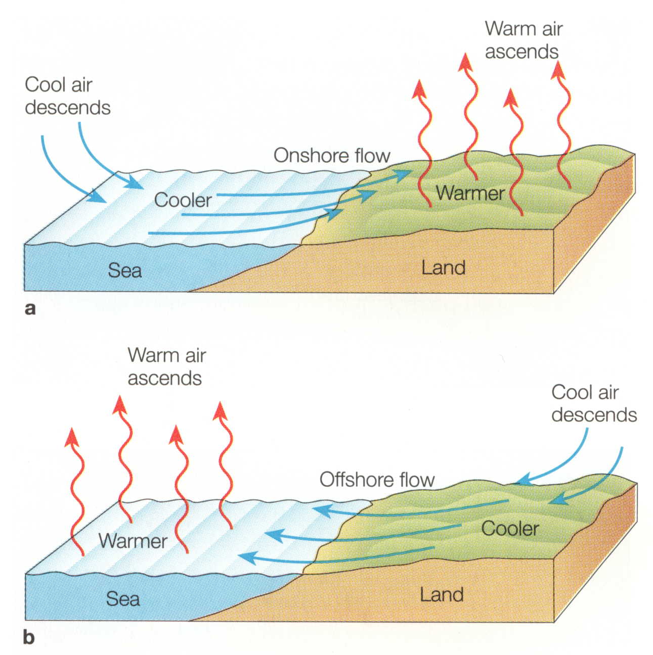
Lake Turkana Wind Power Station- https://en.wikipedia.org/wiki/Lake_Turkana_Wind_Power_Station
The Lake Turkana Wind Farm Project - M. Burlando, F. Durante; DEWI GmbH, Branch in Italy, Genoa, ItalyL. Claveri; DEWI GmbH, Oldenburg
https://www.dewi.de/dewi_res/fileadmin/pdf/publications/Magazin_37/02.pdf
"A semipermanent low pressure cell centered over Lake Victoria forces the main airstreams of both the monsoons, which are roughly parallel to the coastline over eastern Kenya, to flow zonally westward over northwestern Kenya. This thermallyinduced synopticscale deflection interacts with the orography of Eastern Africa to generate some convergence zones over the Ethiopian and Kenyan highlands. Just in between the Ethiopian and Kenyan highlands, the TurkanaMarsabit Corridor occurs, which is one of the windiest among these convergence zones. "
I wonder if crater lake microclimates might help explain Mount Sharp and other "tall mound" craters.
Theory is, during the day, the rocks around the lake warm up, that warm air rises and that draws cool dry air down onto the crater lake and peak. This creates a cool microclimate at the central peak, and a cool moist microclimate around the crater lake. The moist climate around the lake shore should accellerate weathering.
During the night, relatively warm moist air rises from the lake, that rising air kicks up wind that carries dust from the surrounding area onto the central peak. Dust should stick to any snow or moist soil on the central peak. Any extra dust or very fine dust is carried by rising moist air, the dust nucleates snow, snow falls on the central peak. When the snow eventually melts, it leaves behind the dust.
Repeat for aeons, and you should get a net transfer of dust from the surrounding shoreline onto a snow capped central peak.
Depth is important for two reasons - first it appears that the crater would be deep enough to tap into local and regional groundwater networks. It's ALSO deep enough and warm enough that it would have been one of the last places where liquid water was stable as the Martian atmosphere thinned out. If Mars had an atmospheric cycle of freeze-deflate and thaw-inflate then Gale would conversely be one of the first areas to "thaw out".
Equatorial location is important becase this means Gale crater one of the best places on Mars for insolation, heat, and therefore evaporation of liquid water.
Coastline is interesting because this puts Gale within possible reach of Tsunami or slushie-Tsunami effects.
- Tsunami waves extensively resurfaced the shorelines of an early Martian ocean
J. Alexis P. Rodriguez, Alberto G. Fairén, Kenneth L. Tanaka, Mario Zarroca, Rogelio Linares, Thomas Platz, Goro Komatsu, Hideaki Miyamoto, Jeffrey S. Kargel, Jianguo Yan, Virginia Gulick, Kana Higuchi, Victor R. Baker & Natalie Glines
Scientific Reports volume 6, Article number: 25106 (2016)
https://www.nature.com/articles/srep25106
"The simulations also show that bolide impacts causing craters ~30 km in diameter would have generated tsunami waves with typical onshore heights of ~50 m and local variations from ~10 m to as much as ~120 m..."
Interesting twist - if an impact occurs during a warm to mild conditiions, a 150-360 foot tall Tsunami hits the shore, waves of water flow in, then flow out. If Mars is cold to cryogenic, you get an "ice surge" https://www.youtube.com/watch?v=OgMBQFf64JM which his basically a one-time long-run-out glacier. In between temperatures, and you might get a Tsunami where liquid water flows inland and then freezes in place.
So, perhaps we have a good Earth analog for Gale?
https://www.spectator.co.uk/2018/03/to-those-with-a-taste-for-desolation-lake-turkana-may-be-the-most-beautiful-place-on-earth/]To those with a taste for desolation, Lake Turkana may be the most beautiful place on Earth
A postcard from Kenya
Matthew Parris[/url]

Posted by: serpens Jun 7 2019, 06:33 AM
HSchirmer, could I perhaps suggest that you may like to post images as thumbnails, it would make your posts easier to read.
It is now clear that Vera Rubin Ridge was laid down as part of the Murray formation and the erosion resistance is a product of post deposition diagenetic/alteration episodes. The comparative hematite, phyllosilicate, amorphous and opal CT proportions with elevation combined with the identification of akaganeite is indicative of low pH fluids infiltrating from above. The likely formation candidates from the options proposed to date are a springline during the Mount Sharpe erosion process or a much earlier, low energy stream after the lake dried.
It is pretty clear that clay rich Glen Torridon is not associated with the Murray formation, is possibly cemented with clay and does not seem to have undergone significant compaction. I retain the belief that this formed following the erosion of the Murray formation on both sides of the resistant ridge, and is potentially a function of the formation of the fan. Basalt buffered water and sediment originating in upper Mount Sharp pooling in the hollow between ridge and mount. In the absence of tidal influences the rhythmic laminations or “bundling” could well reflect a shallow lake with annual ice cover. During winter dust collects on the ice and on thawing settles to form the thin laminations. During summer ice on the mount melts and a thicker layer of sediment is deposited.
Or it could be something completely different which the experts, having actual data to work with will advise in due course.
Posted by: HSchirmer Jun 9 2019, 10:14 PM
Already received that admonition from a Mod.
Curious,
Why a preference for low pH from ABOVE, rather than BELOW?
Posted by: serpens Jun 10 2019, 12:35 AM
Why a preference for low pH from ABOVE, rather than BELOW?
Taking a very broad brush approach from the depths of an armchair, smectites are sensitive to acid leaching and the result of this decomposition is amorphous silica. As can be seen from the Chemin results the phyllosilicates decrease with elevation while the amorphous silica proportion increases which is indicative of top down infiltration of low pH water
https://www.hou.usra.edu/meetings/lpsc2019/pdf/1127.pdf
I used the term indicative because is obvious that while the Murray formation which includes the ridge has been subject to complex diagenetic/alteration processes the alteration of the ridge was anomalous. The only thing we can be sure of while the professionals unravel the data is that during the early modification of Gale crater there was quite literally water, water everywhere.
Posted by: jccwrt Jun 10 2019, 04:38 PM
In addition, acidic waters rapidly neutralize in basaltic systems due to weathering reactions. Groundwater flowing up from below would need to interact with a far greater volume of rock than water coming from above, so it is less likely to contain strongly acidic fluids. There would have been a very clear acidic alteration signature in the underlying stratigraphy associated with the level of alteration seen at VRR if it were groundwater.
Posted by: HSchirmer Jun 10 2019, 08:10 PM
Good point, but wouldn't acidic groundwater working through a deep fissure weather the basalt to silicate and "skin over" the reactive surface? Rather like aluminum is so reactive that it doesn't rust?
Given Gale's proximity to a possible highstand ocean shoreline, does the possibility that the crater
had significant interaction with a Martian northern ocean/saltwater change the chemistry a bit?
I'm specifically thinking about how slumping effects and saltwater lenses might be tied to groundwater chemistry.
"Chesapeake Bay impact structure:Morphology, crater fill, and relevance for impact structures on Mars" from 2006.
Posted by: serpens Jun 11 2019, 01:55 AM
There is no indication that the northern ocean interacted directly with Gale crater and in any case it would be highly unlikely to be salty at its maximum extent. But jccwrt's point is germane regarding acidic alteration signatures in the underlying sedimentary Murray formation. All data indicates top down infiltration.
We know that Vera Rubin Ridge is part of the Murray formation and it would be safe to assume that the lake and hence the Murray formation extended to the central uplift, at a height pretty much commensurate with the top of VRR. So the problem is when and how did acidic water interact with a discrete , long and thin section of the formation. One critical data point we do not have and unfortunately cannot get is the length of the altered section because quite limited cover would hide the signature from orbit. Increased length would imply a stream because even the length of the visible portion would be unusual for a springline.
Posted by: HSchirmer Jun 11 2019, 04:51 AM
So the problem is when and how did acidic water interact with a discrete , long and thin section of the formation.
Well, since AFAIK, Mars lack creeks or rivers that happen to run in a straight line for ~6.5 km, the most likely explanation would seem to be a fault in the area.
TECTONIC FORMATION OF MOUNT SHARP, GALE CRATER, MARS.
http://www.lpi.usra.edu/meetings/lpsc2013/pdf/3106.pdf
Recent Mars grounwater level research https://agupubs.onlinelibrary.wiley.com/doi/full/10.1029/2018JE005802
notes that early Mars had a groundwater network.
Recent work on the Chesapeake bay impact crater

https://pubs.usgs.gov/circ/2003/circ1262/#figurecaption45212960
raises the interesting point that there would have been a "breccia aquifer" UNDER mount sharp. So, impact-heated breccia, interacting with a regional groundwater system, should give you plenty of hot, wet, altered rock under Mount sharp, as well as brines enriched in minerals, salts or perhaps acids.
Posted by: serpens Jun 12 2019, 02:47 AM
The proportional change in phyllosilicate and amorphous content is just one indicator of what influenced VRR. Once again taking a generalist approach, based on the evidence the groundwater within the Murray formation would have had a reasonably neutral pH (6-7) and low Eh voltage. This would provide for a stable, high level ferrous solution. Now if this groundwater mixed with precipitation from volcanic activity, say acid snow melt the following would take place.
4Fe++ + O2 + 4H+ ------> 4Fe+++ + 2H2O
There is then a pathway to hematite through Ferric Oxide Trihydrate to Goethite or even direct to hematite if the pH of the mixed solution, mitigated by the phyllosilicate consumption of acidity, is around 5.
Top down infiltration really is the only process that fits.
Posted by: jccwrt Jun 12 2019, 05:13 AM
I'm not sure we can entirely discount a contribution from acidic groundwater traveling along a fault - especially since Gale Crater seems to host some diverse evidence of igneous activity (float rocks from an igneous suite on the northwest rim, K-rich sedimentary layers apparently derived from a different source region, a possible(?) exposed intrusion at Ireson Hill [my memory is fuzzy on this one, I remember an LPSC talk in 2018 talking about finding a new kind of igneous float rock there] and tridymite detections). In addition we do see extensive alteration haloes in places in the Murray which are also suggestive of acidic groundwater.
That said, I'm not sure that points to a bottom-up process - a regional/global groundwater system should be at or neutral pH given the sheer volume of rock it needs to travel through, so it would need to be something local to Gale Crater. I'd wager that for the most part even the local groundwater was neutral. There's a hydrofractured interval in the Murray that suggests considerable groundwater content at some point in the crater's history, and these don't appear to be associated with much alteration.
So I think it comes down to the existence of an acidic brine reservoir, the existence of which is difficult to prove. Offhand I could think of a couple of tests: 1) check for highly altered rocks in Ellipse Edge Crater and Slagnos Crater ejecta, 2) do a geochemical balance to see how much acid you need to reach equilibrium with the surrounding rocks and still remain acidic (or failing that, how long an acidic solution would last before neutralizing).
And even if you have a pathway, you also need a mechanism to get a dense brine moving towards the surface - a brine pool has persisted in Chesapeake Bay so long precisely because it is dense and hard to dislodge.
I think on the balance, a top-down alteration pattern is a more convenient explanation. We're not stratigraphically far below a sequence of rocks containing abundant evidence for a more acidic environment, and we also saw evidence for surface conditions starting to slide towards more water-limited and oxidizing conditions on the approach to VRR. Something weird happening along a redox interface within the lake or some sort of alteration process that managed to proceed deeper along a fault-line seems more likely to me.
Posted by: HSchirmer Jun 12 2019, 09:16 PM
The mechanism would be freeze distillation of an impact created acidic mineral brine.
Ten minutes after impact, you've got hot-basin filled with breccia.
That breccia basin has a huge surface area, a huge pore area, and a huge amount of latent heat.
As Martian groundwater percolates back in, it would initially boil off, creating fumaroles, geysers and
chemically enriched geyser deposits.
As the groundwater level rebounds, perhaps hot springs and black-smokers along any faults at the bottom of the crater lake.
Summary, as the impact site cools, you get, eh, a few million years of steam and geysers, then circulating hot water, then still warm water, then still cold water, and finally a frozen aquifer.
That progression seems likely to create deposits of enriched minerals, then mineral enriched or acid enriched brines.
Eventually, as the aquifer freezes, hydrostatic pressure forces brines to the surface, rather like the Occator salt deposits on Ceres.
Posted by: ngunn Jun 13 2019, 08:41 AM
In such well informed company I have nothing to add except to say how much I am appreciating the quality of this discussion, not only for the insights shared but for the the clarity and accessible language of the posts. Anyone following could not fail to have their imagination stirred about past and present geological processes on Mars. It's a perfect example of the best that happens on this forum, alongside the image work.
Posted by: HSchirmer Jun 13 2019, 02:15 PM
to say how much I am appreciating the quality of this discussion, not only for the insights shared but for the the clarity and accessible language of the posts. Anyone following could not fail to have their imagination stirred about past and present geological processes on Mars. It's a perfect example of the best that happens on this forum, alongside the image work.
Good post, the images are breathtaking, but the conversations have lagged a bit of late.
Here is some interesting modeling of the aquifers under Martian impact craters.
A study modeled 100km and 180km craters, for reference, Gale crater is ~154km.
The length of time an impact site stays warm and the potential volume of warm-wet-rock is quite interesting.
"that the most extensive hydrothermal alteration would have occurred in the central peak (for smaller craters) or the peak ring (for larger craters), and the modification zone where fluid flow is facilitated by faults."
System lifetimes ... were ...290,000 years for the 100-km crater, and 380,000 for the 180-km crater.
(snip)
These lifetimes provide ample time for ... impact-induced hydrothermal systems ... volume reaches a maximum of 6,000 km 38,500 years after the impact in the 180-km crater model.
https://www.lpi.usra.edu/science/abramov/papers/abramov_kring_2005.pdf
The most interesting point for this discussion is probably at pages 10-11. During the time when the crater is cooling, "dry model" has no crater lake only groundwater, "wet model" has a crater lake.
That certainly raises a neat question- what if Vera Rubin Ridge is an arc of sediment deposited over top of an earlier peak ring of hydrothermally altered rock? Wet sand and mud at VRR would leach minerals and acidic compounds from the groundwater directly beneath them.
Second interesting point.
So, without a crater lake, we might expect a long-term upwelling of warm groundwater under the center of the crater. "
Well, that seems like a perfect mechanism for a humid micro-climate inside Gale crater, trapping dust to form Mt. Sharp.
Posted by: HSchirmer Jun 13 2019, 06:18 PM
Perhaps Gale crater was, for perhaps half-a-million-years, like the Dallol hydrothermal field?
Hot basalt mixing with marine sediments can generate some REALLY nasty water.
https://en.wikipedia.org/wiki/Dallol_(hydrothermal_system)
Cite is Kotopoulou, Electra; et al. (2018-12-06). "A poly-extreme hydrothermal system controlled by iron: the case of Dallol at the Afar Triangle". ACS Earth and Space Chemistry. 3: 90–99. doi:10.1021/acsearthsacechem.8b00141.
https://pubs.acs.org/doi/10.1021/acsearthspacechem.8b00141
It does create a stunning landscape.

With some rocks and minerals that we've heard of at Gale crater-
Here's the cited paper
Geochemistry and mineralogy of the hyper-acidic hydrothermal system of Dallol, Ethiopia
Conference Paper (PDF Available) · January 201
https://www.researchgate.net/publication/317568424_Geochemistry_and_mineralogy_of_the_hyper-acidic_hydrothermal_system_of_Dallol_Ethiopia
Posted by: serpens Jun 14 2019, 12:33 AM
Given the height of the Gale crater central peak the development of a peak ring is unlikely since this is predicated on the collapse of the central peak.
There is clear evidence that the sedimentary formations investigated by Curiosity since landing predominantly reflect fluvial lacustrine environments and the accessible 300 metre odd thickness of the Murray formation was laid down over some considerable time in a reasonably deep, neutral pH lake. We do not know just how deep the Murray formation extends; or indeed if it is actually the basal layer of Mount Sharp or whether beneath it is a sedimentary formation reflecting the environment you describe. Certainly the veins and halos indicate that there have been extensive hydraulic fracturing and deposition incidents, primarily alkaline but in the lower levels acidic on occasion.
The clear transition from the phyllosilicate bearing Murray formation to the sulphate bearing layers represents a change in the local environment from water dominated to arid, acidic conditions. But there is clear evidence of significant water, both surface features and groundwater well into the Mount Sharp erosion period. For example hydraulic fractures extend across the contact between the Murray formation and the much later, aeolian Stimson.
The thing I think we all struggle with is the timescale represented by the sedimentary layers of Mount Sharp and the subsequent erosional end state of Gale crater. On Earth we have only fragments of the Eoarchean crust which date to the time of the Gale impact. The evidence of long standing surface water on Mars presents a real challenge to the traditional view of the early solar system.
Posted by: HSchirmer Jun 14 2019, 02:45 PM
Hypothesis - Vera Rubin Ridge's odd chemistry is the result of the ridge's location above the inner ring of Gale crater; hydrothermal activity concentrates at crater peaks and rings, so the ring is associated with mineral deposits. Water flowing down through sediments leached minerals into the overlying strata which alter the overburden to create the erosion-resistant Vera Rubin Ridge.
Not necessarily, the peak ring can also be an uplift effect.
Gale’s central peak and peak ring were emplaced immediately after the impact, and influenced the subsequent history of deposition and erosion that formed Mt. Sharp
(snip)
Spray et al { Spray J. et al (2013) LPS XLIV, Abs. #2959.} suggested that a peak ring in Gale crater could have influenced the location Mt. Sharp’s lower segment by localizing the deposition of sediments. This effect could account for the fact that the northern, eastern, and western boundaries of Mt. Sharp correspond to a ~ 80 km diameter circle (Fig. 4).
https://ntrs.nasa.gov/archive/nasa/casi.ntrs.nasa.gov/20150001905.pdf
Also important - Gale crater's rim and floor tilt down towards the North. Assuming this is not due to post-impact subsidence, that suggests the breccia reservoir is also tiled, and the Northern edge of the reservoir is deeper than the southern edge.
It seems that rain or surface water could flow into the central ring, so water in the sloped 80km diameter inner ring would have collected into a crescent-shaped lake along the Northern edge of the inner ring. That water would have percolated through the warm outer ring breccia, experience hydrothermal alterations, and then exited at roughly the location of the current Vera Rubin Ridge.
Surface water from a large area enters Gale from the southwest and flows clockwise across the area between the inner and outer ring. This would seem to suggest that 2 different types of water 1-hydrothermal springs associated with the northern arc of the inner ring, and 2- surface water flowing across the crater floor from the west, would have mixed in roughly the location where we now find Vera Rubin Ridge.
The early hydrothermal system could have created acidic mineral deposits along faults and along the inner crater ring.
Those minerals could leech out and cement later lake sediments.
Another interesting article on impact crater hydrothermal systems, this one specific to Gale Crater
Gale Crater: Formation and post-impact hydrous environments
https://www.sciencedirect.com/science/article/pii/S0032063312001274?via%3Dihub
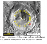
|
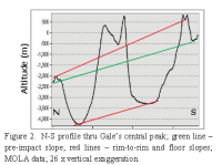
|
Posted by: HSchirmer Jun 15 2019, 02:54 AM
Here's a thought- Ahuna Mons on Ceres seems to the result of mud burping up from an underground chamber.
- Ahuna Mons aka the Lonely Mountain is a plume-driven mud volcano.(three articles linked)
http://www.unmannedspaceflight.com/index.php?showtopic=7789&view=findpost&p=244998
Immediately after the impact, Gale crater would have had an underground chamber of hot-to-partially melted breccia.
As water percolated into the chamber (groundwater, surface water, or perhaps an "Arabian sea" at ~-3707 meters)
the result is hot basalt mixing with water, which creates an underground chamber of hot silicate mud.
That should trigger more subsidence as the mud is forced to the surface as the breccia chamber collapses on itself.
Perhaps Mount Sharp is like Ahuna Mons, the end result of mud being forced out of an underground chamber onto the surface as an underground chamber slowly collapsed?
Posted by: serpens Jun 16 2019, 04:31 AM
On Earth it would be a reasonably simple matter to confirm or deny your hypothesis of Vera Rubin Ridge being an artefact of a peak ring. However while the visual and analytical data from Curiosity is frankly stunning, it is also extremely limited with respect to the footprint investigated and the fact that such investigation is skin (or at least drill) deep. Regardless any hypothesis, by definition, should reflect the available empirical data. This data reflects a transition to a more acidic influence with elevation. If the ridge were the result of covering a peak ring then the influence would be evident across the entire ridge slope. As far as Mount Sharp being a mud volcano is concerned, this was a hypothesis put forward very early on but was dismissed based on the evidence.
Jccwrts 12 June comment regarding tridymite detection jogged my memory with respect to the detection of not insignificant amounts of opal CT in the Highfield drill sample. Presumably caused by diagenesis under burial of amorphous silica Opal A to the micro-crystalline SiO2 polymorphs cristobalite and tridymite. I wonder if estimation of the transition depth for Opal A to Opal CT under Mars gravity could give a wet finger estimate of the overburden.
Posted by: HSchirmer Jun 16 2019, 11:18 PM
There is clear evidence that the sedimentary formations investigated by Curiosity since landing predominantly reflect fluvial lacustrine environments and the accessible 300 metre odd thickness of the Murray formation was laid down over some considerable time in a reasonably deep, neutral pH lake.
(snip)
There is a caveat there, layers of sediment on the bottom of a lake sample the conditions at the bottom of the lake.
If there's a neutral pH salt spring in an otherwise acidic or basic lake, the sediments record the neutral pH, because the neutral salt spring water is denser and accumulates in the depths of the lake.
Same problem with seasonal temperature and lake turnover.
Lake sediments in freeze-thaw climates are deposited at only two temperatures:
EITHER 4 Celcius wich is where water is densest, during winter, spring and summer, OR when the lake "turns over" in fall when the water is average ambient temperature.
Let's imagine a Mars where there is fine hydrophobic dust and fine hydrophilic dust.
You'll have a buoyancy gradient between those chemical particles, a constant wind might give you "tiger-stripes"
so that different chemicals from dust concentrate along the lake surface and only some reach the lake bottom.

Posted by: serpens Jun 18 2019, 01:30 AM
I don't think that a pseudo Langmuir circulation effect has any relevance to the Murray formation or indeed to the sum of data and analysis covering Curiosity's traverse.
[Edit] Apologies if that comment seems terse but concepts must at least bear some relation to the features. Stack, Grotzinger, Gupta, Edgar et al. "Evidence for plunging river plume deposits in the Pahrump Hills member of the Murray formation" assessed Pahrump hills to be deposits from hyperpycnal flow (turbidity currents) attributed to rivers from the rim plunging into the lake. Hyperpycnal plumes can travel significant distances before dropping entrained sediment loads so this does not constrain the size of the lake, but it does mean that it lasted a very long time
Posted by: HSchirmer Jun 18 2019, 04:33 PM
[Edit] Apologies if that comment seems terse but concepts must at least bear some relation to the features. Stack, Grotzinger, Gupta, Edgar et al. "Evidence for plunging river plume deposits in the Pahrump Hills member of the Murray formation" assessed Pahrump hills to be deposits from hyperpycnal flow (turbidity currents) attributed to rivers from the rim plunging into the lake. Hyperpycnal plumes can travel significant distances before dropping entrained sediment loads so this does not constrain the size of the lake, but it does mean that it lasted a very long time
No problem, terse is accurate; but sometimes "not relevant" means nobody thought to look?
A bit more reading shows that it's likely languir circulation would be more important for mixing material, rather than separating material. The important point is that hydrothermal flow should keep an early warm lake mixed, while wind-driven circulation could have kept a later lake mixed for much longer.
We see evidence of steady winds in the yardangs, and the sheer amount of material at the central mound at Gale crater;
those steady winds should have kept an open water lake stirred up as well. This should have kept clay and silt in suspension, but also 'mixed' the lake vertically. This suggests that pulses of fine sediment or water that are basic, salty, or acidic would have time to achieve chemical equilibrium with the bulk properties of the lake because the silt and clay sediment stay suspended in the lake long enough to reach chemical equilibrium with the previously laid down lake sediments.
Another point is that a freezing and thawing lake would experience 2 annual sedimentation events; spring and fall.
Dirt, sand, and dust accumulate on the frozen lake, when the ice thaws, the heavier material settles to form a new coherent layer across the lake bottom. However, the fine clays should stay in suspension thanks to wind-driven water circulation.
At the onset of winter, as the lake freezes over, wind-driven circulation stops, and the fine clays precipitate out (IIRC clays stay suspended for 1-3 weeks under earth gravity, not sure about Mars).
- Langmuir circulation driving sediment entrainment into newly formed ice: Tank experiment results with application to nature (Lake Hattie, United States; Kara Sea, Siberia)
"Uzaki and Matsunaga [2000] suggested that Lc plays a role in near coastal sediment transport processes, and Gargett et al. [2004] showed that Langmuir cells penetrating a shallow water column down to the seabed are an important mechanism for major sediment resuspension (redistribution of bottom sediment throughout the water column) and sediment transport events on midlatitude continental shelves."
https://agupubs.onlinelibrary.wiley.com/doi/full/10.1029/2005JC003259
Langmuir Supercells: A Mechanism for Sediment Resuspension and Transport in Shallow Seas
"Recent measurements at a cabled sea-floor node in 15 meters of water off the coast of New Jersey suggest that Langmuir supercells, Langmuir circulations that achieve vertical scales equal to the water depth under extended storms, are an important mechanism for major sediment resuspension events on the extensive shallow shelves off the eastern U.S. coast. "
https://science.sciencemag.org/content/306/5703/1925
Posted by: HSchirmer Jun 18 2019, 07:45 PM
Let me take a step back-
I've been thinking about some great ideas from earlier parts of this discussion-
- Phil Stooke
At some point if the debris breaks down into sufficiently small particles it can be removed from the vicinity, even lifted out of Gale crater completely. So it might not remain in this area to choke off further erosion.
- ngunn
An internal heat source beneath Gale can do more than locally hardening the sediments once formed. It could be the reason they formed in the first place. Imagine a largely frozen Mars with plenty of water in the form of ice or ice-capped seas. Now in Gale Crater picture a geothermally heated lake that is at least sometimes ice-free. The liquid surface acts as an effective dust trap 'quickly' filling the whole thing with horizontal sediments. This avoids the need to bury and exhume a similar pile of sediments on a planet-wide scale.
- elakdawalla
One thing I would want to check is the direction of the tilt and how that relates to the long-term changes in Mars' shape due to, say, the construction of the Tharsis volcanic complex. The MESSENGER team has shown how lava-filled craters near Mercury's pole now have tilted floors that must once have been horizontal, due to tectonic activity. My own work on Venus dealt with the same thing, measuring current topography of lava surfaces that you assume started out as flat in order to get at ancient tectonics. I'm sure the same could happen on Mars. We certainly know Mars' shape has changed in the past, and it's been suggested that the entire crust has reoriented (true polar wander). I'd love to see if the tilting observed here is consistent with geophysical work on Mars' tectonics -- or inconsistent, which would be just as interesting.
They're all interesting because they've all recently gotten some support,
A- A regional Martian groundwater level, which could supply sufficient water to a crater hydrothermal system to dissolve basalt breccia into sufficiently small particles to blow away, or perhaps flow way as muddy ground water.
B- If Gale crater had 1,800 cubic KM of impact melt in a magma chamber, we'd expect it to stay warm and wet for a long time, such that the lake, any peak ring, and the central mound, would all initially have fumaroles and brines and hydrated minerals to trap dust to create Mount Sharp. As the site cooled and a crater lake formed, expect more dust to accumulate.
C- Earlier modeling of boxwork features around -3600 elevation might make more sense if we consider a possible -3707 level for a Northern "Arabian Ocean" once the Olympus Mons bulge is removed. Alternate idea, work backwards to figure out the the volume of water moving through the 500 km long watershed, into Farah Vallis and into Gale.
Posted by: serpens Jun 23 2019, 03:08 AM
Immediately following the Gale impact there would have been a lava pool on the crater floor and intense hydrothermal activity. But the final crater floor is well below the current floor and a consideration is how long it took for at least a kilometre of sediment to build up. Certainly by the time the Pahrump Hills sediment was deposited hydrothermal influences do not seem to have been significant. All indications are that this deposition was traction controlled in deep, neutral pH water.
During the 7 years since the inception of this thread Curiosity has revealed important information, not the least of which is the evidence of a fluvial / lacustrine mudstone dominated environment across the transit. Kimberly revealed a delta that would have defined the edge of a lake at that point in time. This is some 60 metres below Pahrump hills and 350 metres below the top of the ridge. By the time the sediments were deposited at the level of the ridge the lake must have covered most of the crater. Impact heat and associated hydrothermal activity may have lasted a couple of hundred thousand years. The Crater Lake would have had to have lasted closer to a million. Though an apples and watermelon comparison, Lake Malawi sediment cores dating back a million years were taken at a depth of around 300 metres.
Posted by: HSchirmer Jun 23 2019, 09:13 AM
the evidence of a fluvial / lacustrine mudstone dominated environment across the transit.
Kimberly revealed a delta that would have defined the edge of a lake at that point in time. This is some 60 metres below Pahrump hills and 350 metres below the top of the ridge.
...
The Crater Lake would have had to have lasted closer to a million.
(snip)
Probably MUCH longer, filling Gale crater with the material for 350 meters of rock in only 1 million years would require sedimentation rates 2.5x faster than what has been measured for rift basins on Earth at Newark basin.
- The NSF funded Newark Basin Coring Project (NBCP) (Fig. 3.2.2.1) resulted in the recovery of about 6.8 km of continuous core from 7 coring sites making up a combined 4.7 km stratigraphic section spanning nearly all of the Late Triassic age strata of the Newark rift basin (Olsen et al., 1996a). Additional core from the Army Corps of Engineers, completed the Jurassic age part of the Newark basin section (Olsen et al., 1996b). This core spans roughly 32 million years
https://www.ldeo.columbia.edu/~polsen/nbcp/cyclcicity.html
So, 32 million years of erosion into a similar sized dead-end basion on Earth creates 4.7 km of sediment, 350 meters of sediments under Earth conditions would take ~2.4 million years. However, those "Earth conditions" erosion numbers are from the Triassic/Jurassic period during the opening of the Atlantic ocean allowed seasonal monsoons to begin eroding the former northern central desert of Gondwanaland-
That level of rain and erosion is something that is unlikely to have occurred at Gale crater.
One of the recent papers about regional hydrology at Gale raised the possibility that the crater wall was breached by Fara Vallis only AFTER Mount sharp was in place, based on on the morphology of the "pancake delta" and other landforms along the southwestern crater rim, which are light blue below
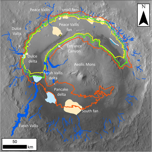
Sequence and relative timing of large lakes in Gale crater (Mars) after the formation of Mount Sharp - 2016
https://agupubs.onlinelibrary.wiley.com/doi/full/10.1002/2015JE004905
If that is the case, then you wouldn't have sediment transport into Gale via river valley networks until much later when the crater was mostly filled.
So, I do agree that comparing Gale Crater to the Newark Basis is an "apples to watermelons" comparison, but it's the best data-point I know of for a "piano tuner problem" where you don't have the data on Martian climate or erosion.
Posted by: serpens Jun 24 2019, 11:50 PM
The introduction of the paper you link indicates that the authors believed that the lower section of Mount Sharp (the Murray formation) was Aeolian, formed from erosion of sediments identified during Curiosity’s transit and evidence of surface inflow to Gale occurred following the formation of Mount Sharp. However we now have empirical evidence that deposition at least to the level of Vera Rubin Ridge was lacustrine.
Over a few billion years erosion has removed much evidence but my wet fingered guess would be that evidence of inflow dates to the Murray formation lake and any later inflow following the formation of Mount Sharp involved reactivation. The fan dates from this period and we are going to get a good look at it. Any concept or hypothesis should reflect current data.
To put the depth of sediment and the size of the lake in context, unless Mr Steno got it wrong the sediment would have been deposited across this view to at least the same level at the crater rim. Water level would have been higher.

|
Posted by: ngunn Jun 25 2019, 08:24 AM
Maybe it's worth noting that we see absolutely no sign of any former shoreline on the rim mountain range. Of course being steeply sloping we would expect plenty of erosion there in the meantime, but viewing now on a level with it one might think that some features could have lined up.
Posted by: serpens Jun 25 2019, 01:52 PM
In their supplementary materials for their paper "deposition, exhumation, and paleoclimate of an ancient lake deposit, Gale crater, Mars", Grotzinger, Gupta, Malin et al provided the results of topographic analysis of Gale and the power law relations for the calculated “fresh” final crater conditions. They estimate the rim horizontal back stepping distance through erosion to be 4.8 km. That is a heck of a lot of material. How much of this occurred before the lake filled and how much after it dried is unknown but given the amount transferred to form Mount Sharp, erosive conditions after the lake dried must have been pretty severe, removing evidence that might have been visible from a distance.
Posted by: stevesliva Jun 25 2019, 03:05 PM
The hillside shorelines you see in the Great Basin are mere thousands of years old....
Posted by: serpens Jul 4 2019, 11:41 PM
Some interesting and thought provoking abstracts from the Ninth International Conference on Mars.
https://www.hou.usra.edu/meetings/ninthmars2019/pdf/ninthmars2019_program.htm
I found the abstracts from sessions on Tuesday covering Geology and Geochemistry of Gale and the Glaciers, Oceans, Rivers, Lakes of particular interest with respect to this thread. Reading these abstracts and also back through the thread which covers 7 years I am struck by the extent to which Curiosity's ground truth has altered and refined the perceptions of Gale crater's history. With the MER and MSL, NASA/JPL have established a baseline for value for money.
Posted by: HSchirmer Jul 8 2019, 01:47 AM
https://www.hou.usra.edu/meetings/ninthmars2019/pdf/ninthmars2019_program.htm
I found the abstracts from sessions on Tuesday covering Geology and Geochemistry of Gale and the Glaciers, Oceans, Rivers, Lakes of particular interest with respect to this thread. Reading these abstracts and also back through the thread which covers 7 years I am struck by the extent to which Curiosity's ground truth has altered and refined the perceptions of Gale crater's history. With the MER and MSL, NASA/JPL have established a baseline for value for money.
Um, that seems like a rather long lead in for a post, which then omits any discussion about what the papesr actually found.
I read through most of the papers, and my take-away was that basically everyone is saying, there's a possibility of IMPORTANT science, but at this stage nothing is definitive, we need more research (i.e. funding).
Which is perfectly fine as graduate papers go, but, eh, less than stirring as far as actually stating findings.
But, I could be wrong.
Are there any important findings or definitive conclusions about Mars in these papers? Something that I might have missed?
Posted by: jccwrt Jul 8 2019, 03:01 AM
I'd expect most of the new science results were shown at LPSC back in March. The Mars conference is more about reviewing the last several years of science and getting a community sense of the directions that Mars research is going. It's more of a "here's the big picture and problems we need to address" conference rather than a "here's what we found this year" conference.
Posted by: serpens Jul 8 2019, 04:03 AM
Exactly.
Posted by: PaulH51 May 17 2020, 10:45 AM
This open source paper appears to address some of the early questions in this thread, well at least for the Vera Rubin Ridge...
"Regional Structural Orientation of the Mount Sharp Group Revealed by In Situ Dip Measurements and Stratigraphic Correlations on the Vera Rubin Ridge"
https://agupubs.onlinelibrary.wiley.com/doi/full/10.1029/2019JE006298
Posted by: serpens May 17 2020, 11:25 PM
Thanks for that link. The conclusion that "the possibility that VRR members are distinguished primarily by diagenetic processes that did not follow strata boundaries" seems to be supported by Chemin results (link below). The difference between Grey Jura and Red Jura with significant akaganeite in Rock Hall would seem to indicate a localised concentration of chloride rich acidic fluid within the Jura member.
https://www.hou.usra.edu/meetings/lpsc2020/pdf/1601.pdf
Posted by: PaulH51 May 20 2020, 01:48 AM
Curiosity Rover Finds Clues to Chilly Ancient Mars Buried in Rocks (NASA Goddard News Release) https://www.nasa.gov/feature/goddard/2020/nasa-s-curiosity-rover-finds-clues-to-chilly-ancient-mars-buried-in-rocks
Associated paper (pay-walled) https://www.nature.com/articles/s41550-019-0990-x
Posted by: serpens May 20 2020, 01:08 PM
I don't feel there is any contradiction with the Gale crater sediment requiring millions to tens of millions of years to form in warm, humid conditions and some of the carbonates within that sediment possibly being formed in icy conditions. For the last 3 million years or so Earth has experience cyclical glaciation with shorter, warm and humid interglacials, initially on a 41 kyr cycle and then, for currently unknown reasons, switching to a 100kyr period. Even during interglacials there are significant temperature variations. It would probably be more surprising if there were no indications of temperature variability.
Posted by: serpens Mar 1 2021, 04:35 AM
An interesting abstract from LPSC 2021 which includes possible flooding of Gale by breaches in the Northern crater rim.
https://www.hou.usra.edu/meetings/lpsc2021/pdf/1605.pdf
Posted by: HSchirmer Mar 1 2021, 05:05 PM
https://www.hou.usra.edu/meetings/lpsc2021/pdf/1605.pdf
Sort of amazing to realize "the eroded north rim of gale crater" could have been eroded by ocean waves.
|
Posted by: climber Sep 19 2022, 10:43 AM
Not sure its the right section
From lake to river, open access paper from Gwénaël Caravaca : https://agupubs.onlinelibrary.wiley.com/doi/10.1029/2021JE007093
Posted by: serpens Oct 28 2022, 05:29 AM
Another possible indication of a northern ocean with implications for potential flooding of Gale crater.
https://www.psu.edu/news/research/story/traces-ancient-ocean-discovered-mars/
Posted by: Gladstoner Nov 17 2022, 10:29 PM
Trying to make sense of the geologic context of the various units...
A major angular unconformity can be discerned by the truncation of the bench-forming sandstone (red). The Greenheugh Pediment sandstone (green) appears to be the basal unit of the overlying sequence:
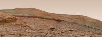
|
Unmarked:
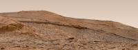
|
Closer:
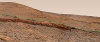
|
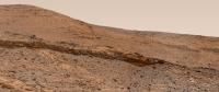
|
The above images were derived from Neville's Gigapan 'MSL 3485 -3520 MR'
Map with possible field relations:
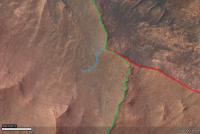
|
|
There is a possibility the Greenheugh Sandstone instead outcrops along the feature marked as blue.
Posted by: Gladstoner Nov 17 2022, 10:31 PM
Wider map view:
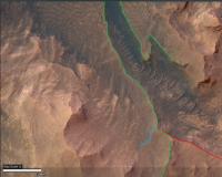
|

|
Posted by: Gladstoner Nov 18 2022, 10:10 PM
Possible northward extension of the Marker horizon (lavender):
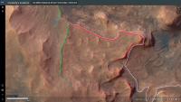
|
The bench-forming sandstone appears to become less prominent to the south.
Point of contact of the (possible) marker horizon with the Greenheugh Pediment bed:
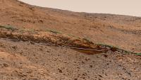
|
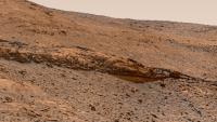
|
Powered by Invision Power Board (http://www.invisionboard.com)
© Invision Power Services (http://www.invisionpower.com)