Printable Version of Topic
Click here to view this topic in its original format
Unmanned Spaceflight.com _ Chang'e program _ China to the Moon - Chang'e 1 and 2
Posted by: GravityWaves Aug 24 2006, 05:03 PM
Lunar Programme To Be Open To World
Although China is still in the "initial stage" in tapping the moon and outer space when compared with the United States, Russia and Europe, the nation is catching up, Luan said.
http://www.spacedaily.com/dragonspace.html
The first phase of the Chang'e Project was solely accomplished by China through its own technology, products and designs, said Luan, former director of the China National Space Administration (CNSA).
However, lunar scientists from Europe, the United States and Russia have expressed their willingness to co-operate with China in its research of the moon and deep space exploration, he said.
Chinese scientists are assembling, integrating and testing to ensure that the mission of the nation's first lunar explorer, Chang'e-1, goes smoothly, a top space official said yesterday.
http://english.people.com.cn/200607/26/eng20060726_286707.html
"Fundamental development has been achieved in all five related systems ranging from the satellite, the rocket, tracking and control, ground applications and the launch centre since it was approved two years ago," said Sun Laiyan, head of the China National Space Administration.
The lunar orbiter is scheduled to blast off next year from the Xichang Satellite Launch Centre in Southwest China's Sichuan Province, Sun said at the ongoing eighth International Lunar Exploration Working Group (ILEWG) Conference in Beijing.
The spacecraft will be 2350 kilograms in weight.
According to the plan, the program will go through four phases.
1. Send a satellite to orbit the Moon
2. Conduct exploration on the surface of the moon through the soft landing of a detector.
3. Collect Moon surface samples using a robot, which will then return to the Earth.
4. Manned missions.
http://en.wikipedia.org/wiki/Chang'e_program
According to the schedule, detailed program design of the first step will be completed by September 2004. Research and development of a prototype probe and relevant testing of the probe will be finished before the end of 2005. Design, manufacture, general assembly, test and ground experiments of the lunar probe satellite will be finished before December 2006. In 2007 the Chang'e 1 will blast off.
Posted by: climber Oct 12 2006, 09:24 PM
Here's the link to China's lunar program : http://210.82.31.82
Home page is nice where you can see foot prints crossing the moon as well as Chang'E nice logo. I red that the Logo "CLEP" look like the pictogram "Yue" which means "Moon".
Not very informative but nice to see.
Enjoy
Posted by: PhilCo126 Oct 13 2006, 05:29 PM
Well the Chinese will certainly get to the Moon, as their hardware is Soyuz-based and the Russians are working to re-engineer the Soyuz vehicle to last for another century ![]() ... Héh even for a lunar mission
... Héh even for a lunar mission ![]()
Posted by: GravityWaves Feb 28 2007, 08:31 PM
'People's Daily Opinion'
http://english.people.com.cn/200702/07/eng20070207_348107.html
Why does China want to probe moon?
Soyuz sized rockets can also launch small-medium sized probes like Russia's Venera or Europe's Venus-Express, the Chinese LongMarch rocket family may be used for upcoming interplanetary missions
Posted by: NMRguy Mar 7 2007, 08:08 AM
http://news.bbc.co.uk/2/hi/science/nature/6423323.stm
A short story from BBC. China looks to launch Chang'e before the end of the year.
Posted by: yaohua2000 Mar 7 2007, 08:48 PM
A short story from BBC. China looks to launch Chang'e before the end of the year.
In fact, the launch is only 40 days away. Chang'e 1 will be blasted off on April 18, can vary by ±1 day.
Posted by: elakdawalla Mar 7 2007, 08:53 PM
That was the plan, but the latest information I've heard is that it won't be until October at least. (This is from Lou Friedman, who got it through personal communication with folks in China.)
--Emily
Posted by: dvandorn Mar 8 2007, 01:41 AM
You know what I find really fascinating? I'm pretty sure that, given subtle changes in how we transliterate Chinese names these days, Chang'e is named after the same character described by the Houston Capcom to the Apollo 11 crew the morning of Landing Day, July 20, 1969:
Collins: Okay. We'll keep a close eye out for the bunny girl.
-the other Doug
Posted by: edstrick Mar 8 2007, 09:20 AM
Perhaps the most interesting data from Chang'e will be the microwave radiometry. Thermo-physical mapping of the moon has been rather neglected since the classic 1960's thermal imagery during a total lunar eclipse showed high-rock abundance areas as "anomalies" due to their higher thermal inertias. The microwave radiometry will penetrate deeper and give some idea of the diurnal temperature variations at probably a few centimeters depth, and thus the density/thermal-conductivity or some such measure of regolith.
Nobody else seems to have been or be planning long wavelength infrared or microwave radiometry and they'll get a unique dataset. (I think one of the other missions, maybe Recon Orbiter or the Japanese Selene may have infrared radiometry/spectrometry at long enough wavelengths to get the pre-dawn signal, but I think most IR work is in the short wave <mostly> reflected IR data.
Apollo 17 carried an scanning IR radiometer, but the PI basically abandoned the data without producing any science results and some attempt later in the 80's or so ran into problems getting the data or something... Somebody tried but I never heard of results.
Posted by: remcook Mar 8 2007, 10:00 AM
Lunar Diviner will go up to 200 micron...
http://nssdc.gsfc.nasa.gov/database/MasterCatalog?sc=LUNARRO&ex=2
Posted by: edstrick Mar 9 2007, 06:24 AM
"Lunar Diviner will go up to 200 micron"
Excellent. That covers temperature ranges of cold high latitude regolith at pre-dawn temperatures.
The multispectral capabilities give them some real ability to sort out rock and "fines" populations on the basis of different temperatures, much the way Viking and follow-on Mars orbiters have done thermal inertia maps, and then "fines thermal inertia" and rock abundance maps.
You have to go to much longer wavelengths to probe below the surface "monolayer" of grains, which the chinese instrument appears to be planned. Later missions need to fly decimeter and meter wavelength sounding instrumentes (like Sharad, and Marsis), together with real ability to measure sub-surface thermal emissions, which may give the ability to observe and map regional heat flow abilities.
Posted by: AlexBlackwell Jun 12 2007, 11:13 PM
Excerpt from the June 11, 2007, issue of Aviation Week & Space Technology:
QUOTEWorld News & Analysis
China Delays Moon Mission
Aviation Week & Space Technology
06/11/2007, page 31
Craig Covault
Cape Canaveral and Houston
Chinese problems thrust Japan to forefront in Asian Moon race
Printed headline: Moon Mission Delay
China will postpone its first unmanned mission to the Moon by at least 5-6 months, a delay that under current scheduling means Japan will beat China to lunar orbit with a far more ambitious triple-spacecraft launch.
Posted by: kenny Oct 13 2007, 09:16 AM
Chang'e launch appears to be imminent. The craft is at the launch site (I don' think they mean pad) and they're selling tickets to Chinese nationals to watch it for about $100.
http://www.spacedaily.com/reports/China_offers_public_chance_to_view_first_moon_launch_999.html
and Leonard David's blog says it will launch by the end of October
http://www.livescience.com/blogs/author/leonarddavid
Kenny
Posted by: ustrax Oct 13 2007, 12:57 PM
One of this days they'll get us all by surprise when they announce the launch of the first human towards Mars...
Posted by: nprev Oct 14 2007, 01:06 AM
Huh. Well, it seems that we should have at least a week's notice before launch, then; gotta give people time to get there, make reservations, etc.
Posted by: yaohua2000 Oct 14 2007, 04:05 PM
I booked a seat last Friday, and they told me I will be notified 3 days before the launch.
Posted by: nprev Oct 15 2007, 01:44 AM
Thanks for the info, Yao.
Gee, that's sure not much time to arrange travel & find accomodations, though; hopefully there are a lot of hotels nearby & good transportation available to the site.
Posted by: SpaceListener Oct 15 2007, 10:19 PM
Does the China Agency Space follow same rules as the NASA for launching rockets? No cloudy, no much winds, and so forth
However, I have checked the weather forecast for Xichang city up to October 25. From now up to Oct 25, there will be showers and light rain. The precipitation chance does not lower than 60% for all these days.
http://www.weather.com/outlook/travel/businesstraveler/tenday/CHXX0363?from=36hr_fcst10DayLink_business
Posted by: kenny Oct 16 2007, 09:55 PM
Now they have narrowed down and announced the date for next week...
http://science.monstersandcritics.com/news/article_1365775.php/China_to_launch_its_moon_probe_next_week
Posted by: yaohua2000 Oct 17 2007, 05:00 AM
However, I have checked the weather forecast for Xichang city up to October 25. From now up to Oct 25, there will be showers and light rain. The precipitation chance does not lower than 60% for all these days.
http://www.weather.com/outlook/travel/businesstraveler/tenday/CHXX0363?from=36hr_fcst10DayLink_business
The space center is located 45 km northeast to Xichang city, however.
Posted by: tedstryk Oct 22 2007, 04:58 PM
http://news.yahoo.com/s/ap/20071022/ap_on_sc/china_lunar_probe;_ylt=AuiykK9eL2waO8FC6.RQ7VSs0NUE
Not much longer now!
Posted by: yaohua2000 Oct 24 2007, 03:25 AM
I have arrived in Xichang city at 2007-10-24 08:02 CST (2007-10-24 00:02 UTC) this morning, and will take bus to the satellite launch center at noon.
It was raining lightly here this morning, but now the sun is shining. Hope it launch on time.
Posted by: mchan Oct 24 2007, 04:50 AM
It would be good if you can blog the launch. The things that go on in a Chinese launch would be interesting to hear about in comparison to other launches.
Posted by: 4th rock from the sun Oct 24 2007, 09:24 AM
China's CCTV-9 channel is broadcasting live ![]()
http://www.cctv.com/english/index.shtml
Posted by: ngunn Oct 24 2007, 09:50 AM
Tried, but can't get that on our system. Can you post what's happening?
Posted by: Toma B Oct 24 2007, 10:20 AM
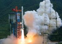
FLASH: CHINA'S LUNAR PROBE CHANG'E-1 BLASTS OFF
China launched its first lunar probe on Wednesday, first step into its ambitious three-stage moon mission, marking a new milestone in the country´s space exploration history.
http://news.xinhuanet.com/english/2007-10/24/content_6936966.htm
Congratulations China!!! ![]()
![]()
![]()
Posted by: 4th rock from the sun Oct 24 2007, 10:31 AM
I'm watching via satellite :-) So far so good, nice 3d rendered real time animation of the probe as is flies over the tracking stations and ships. The probe has now separated from the booster and all seems ok! The animations show telemetry exchanges from and to the probe from tracking ships over the Pacific, and the probe doing course corrections.
Low earth orbit is achieved!
Posted by: Toma B Oct 24 2007, 10:33 AM
First image of the launch!
Full video of the launch can be seen here
http://www.nasaspaceflight.com/_files/%5BNSF%5D-CZ3A-15-Launch-20071024.wmv of the launch is now avaiable...
Posted by: kenny Oct 24 2007, 10:52 AM
The spacecraft is now in a high earth orbit in preparation for subsequnet trans-lunar engine firings....
Xinhua says: "The Chang'e-1 moon orbiter has entered into a 16-hour orbit at 205 km perigee and 50,930 km apogee, statistics from the Beijing Aerospace Control Center (BACC) shows. The 2,300-kg satellite will experience four accelerations and is expected to enter earth-moon transfer orbit on Oct. 31 and arrive in the moon's orbit on Nov. 5. "
Posted by: ustrax Oct 24 2007, 10:58 AM
Congratulations to the People's Republic of China! ![]()

Why do I have this funny feeling that this is just the beggining of something extraordinary?... ![]()
Posted by: remcook Oct 24 2007, 11:25 AM
everyone's going back to the moon! yay!
Posted by: NMRguy Oct 24 2007, 11:32 AM
We indeed seem to be off to our second Renaissance of lunar exploration. I welcome the exposure and interest to our nearest neighbor. ![]()
Here's a spacedaily.com article.
http://www.spacedaily.com/reports/Asias_space_race_heats_up_as_China_launches_first_lunar_probe_999.html
Posted by: general Oct 24 2007, 11:53 AM
http://news.bbc.co.uk/2/hi/asia-pacific/7059356.stm
Posted by: Toma B Oct 24 2007, 12:52 PM
Latest News:
China's first lunar probe Chang'e-1 solar panels was unfolded as planned.
Posted by: GravityWaves Oct 24 2007, 01:00 PM
http://www.nasaspaceflight.com/content/?cid=5262
....
After leaving Earth orbit on October 31, Chang'e-1 will initiate a five day journey until arrive into lunar orbit on November 5. The first image of the surface is expected at the end of November.
Upcoming robotic Lunar landers and Sample returns ?
Details of Chang'e instruments and objectives
Objectives also include the ability to detect and analyze the content and distribution of useful elements and types of materials on the lunar surface; to detect the characteristics of lunar soil and calculate the depth of lunar soil on the surface; to explore the space environment between the earth and the moon, and to record initial solar wind data and study the effect of solar activities on earth-moon space environment.
The Chinese probe is equipped with six payloads, with a total of 25 devices in eight instruments. These include and optical imaging system (CCD stereo camera and interferometer spectrometer imager), laser altimeter, Gamma and X-Ray spectrometers, Microwave detector, a space environment monitoring system (with a high-energy solar particle detector and a low-energy ion detector), and a system for the payload data management.
To achieve all its objectives, the Chang'e-1 will have to be manoeuvred to a specific orbital path around the Moon. The probe will achieve a low lunar polar orbit within altitudes of 100 km to 200 km.
There is also talk of a new line of Heavy Lift Rockets. Might not be long before we see some manned circumlunar flight in the Shenzhou, I wonder if they will be reading from Genesis or Leon Trotskiy's books ?
Posted by: charborob Oct 24 2007, 01:54 PM
I'm also excited about this so-called "Moon race", but I am keeping a wait-and-see attitude concerning Chang'e. Secretive as the Chinese are, we may only get a few spectacular pictures published for propaganda purposes, and not much else. I hope not, because after 35 years of waiting, I'm starved!
Posted by: tedstryk Oct 24 2007, 02:54 PM
I hope this is the beginning of a sustained effort by China.
Posted by: remcook Oct 24 2007, 04:11 PM
so far the chinese have kept their promises and their schedule doesn't look too insane, though there's bound to be some slips. they seem to have a quite ambituous, but realistic program.
Posted by: nprev Oct 24 2007, 11:46 PM
![]() Congrats & a big thank you to the people of China! Looking forward to the imagery...
Congrats & a big thank you to the people of China! Looking forward to the imagery...
Posted by: Paolo Nov 1 2007, 11:15 AM
very nice ed on the Asian Moon race in today's Nature
http://www.nature.com/nature/journal/v450/n7166/full/450002a.html
manned exploration fans beware! ![]()
Posted by: yaohua2000 Nov 5 2007, 03:54 PM
http://www.yaohua2000.org/blog/2007/11/trip-to-xichang.html
Posted by: ustrax Nov 5 2007, 04:23 PM
http://www.chinaview.cn/rygc/index.htm ![]()
Posted by: PhilCo126 Nov 5 2007, 07:55 PM
Moreover: ESA transmits first-ever telecommands to Chinese lunar satellite:
http://www.esa.int/esaCP/SEMQVVMHE8F_index_0.html
![]()
Posted by: charborob Nov 7 2007, 04:56 AM
Chang'e-1 reaches its final working orbit.
http://news.xinhuanet.com/english/2007-11/07/content_7023941.htm
Posted by: RJG Nov 8 2007, 12:49 PM
yaohua2000,
That's one heck of a train journey! Glad you made it. Look forward to the next installment.
Rob
Posted by: charborob Nov 23 2007, 03:00 PM
China to publish first picture of the Moon in 3 days.
http://news.xinhuanet.com/english/2007-11/23/content_7133451.htm
Posted by: Phil Stooke Nov 26 2007, 03:04 AM
Here it is:
http://www.cnsa.gov.cn/n615709/n620682/n639462/132125.html
Phil
Posted by: ngunn Nov 26 2007, 09:59 AM
I'm having no luck getting that picture. Anybody else managed it?
Posted by: djellison Nov 26 2007, 10:17 AM
The direct link ( http://www.cnsa.gov.cn/n615709/n620682/n639462/images/1798638.jpg ) is slightly more reliable - but still exceptionally slow - first one to get it in full, attach it to a post here
Doug
Posted by: Phil Stooke Nov 26 2007, 01:51 PM
From http://news.xinhuanet.com/english/2007-11/26/content_7145873.htm
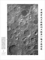
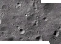
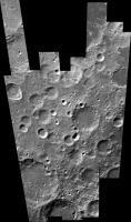
" The area covered by the picture, about 460 kilometers in length and 280 km in width, was located within a 54 to 70 degrees south latitude and 57 to 83 degrees east longitude, according to the BACC.
The area pictured was part of the moon's highland and was mainly composed of plagioclase, a common rock-forming element. On the surface were craters of different sizes, shapes, structures and ages, the BACC sources said.
"The dark patch in the picture's upper right side shows the surface blanketed by basalt, a hard and dense volcanic rock," the sources said.
Sun Laiyan, chief of the China National Space Administration, said the picture was very clear and of very good quality.
"It shows that the camera and the ground control and application systems are all working normally," said Sun at a press conference on Monday afternoon.
The picture was pieced together by 19 images, each covering a width of 60 kilometers on the moon's surface. The far right of the picture was the first area to be captured by the CCD camera aboardChang'e-1.
All the image data was collected on Nov. 20 and Nov. 21 and processed into a three-dimensional picture in several days after being transmitted back to Earth. "
Phil
Posted by: yaohua2000 Nov 27 2007, 04:07 PM
The text on the right reads "中国首次月球探测工程第一幅月面图像" (Literally: China's first-time lunar exploration project first lunar surface picture)
The text on the bottom-left is too small, but some characters are still readable, google search the characters that readable reveal the full text: "中国首次月球探测工程第一幅月面图像是由嫦娥一号卫星上的CCD立体相机获得的。CCD相机采用线阵推扫的方式获取图像,轨道高度约200km,每一轨的月面幅宽60km,像元分辨率120m。中国第一幅月面图像共由19轨图像制作而成,位于月表东经83度到东经57度,南纬70度到南纬54度,图幅宽约280km,长约460km。图中右侧60公里宽的条带,是CCD相机开机获得的第一轨图像。" (Translation: China's first-time lunar exploration project first lunar surface picture was captured by the CCD stereo camera of the Chang'e 1 satellite. CCD camera uses the method "xiàn zhèn tuī sǎo" (literally: "linear, matrix, push, scan", not sure how to translate :-( ) to capture images, the orbit altitude was about 200 km, each orbit lunar surface width was 60 km, per pixel resolution was 120 m. China's first lunar surface picture was made up from 19-orbit's image, located at longitude 83 to 57 degrees east, latitude 70 to 54 degrees south, the mosaic image's width is 280 km, height is 460 km. The 60 km wide square-shape bar on the right of the picture was the first image that captured after the CCD was turned on.)
Posted by: yaohua2000 Nov 27 2007, 04:14 PM
This is a comparison between Chang'e 1's image and Google Moon:
http://bbs1.people.com.cn/postDetail.do?id=84087365&boardId=1
Here is a bigger version of the image:
http://news.sina.com.cn/pc/2007-11-26/326/419.html
Posted by: djellison Nov 27 2007, 04:40 PM
I assume they mean Pushbroom like MOC, HRSC, HiRIS etc.
Doug
Posted by: elakdawalla Nov 27 2007, 06:35 PM
yaohua2000, thank you so much for the link to the full-resolution image and the translation of the text!
Here's a question: the full-resolution image is a color JPEG. Is the image actually a color image or a grayscale one? I'm pretty sure it's grayscale, but thought I'd check with wiser image processors...comparing the channels, there seems to be no more than 3-4 DN variation between them, but I know that the Moon is a gray place and am wondering if such small variations in DN could be an artifact of the JPEG compression.
--Emily
Posted by: PhilCo126 Nov 27 2007, 06:38 PM
Does that photo show the Biela crater and surroundings?
Posted by: elakdawalla Nov 27 2007, 06:45 PM
I'm just tracking that down now. With comparisons to the Lunar Orbiter atlas, I find:
The 66-kilometer-diameter crater Gill is just to the lower right of center in this image. Cut off at the upper left side is 91-kilometer Pontecoulant. At the bottom edge is 94-kilometer Helmholtz.
See
http://www.lpi.usra.edu/resources/lunar_orbiter/bin/info.shtml?86
and
http://www.lpi.usra.edu/resources/lunar_orbiter/bin/info.shtml?524
--Emily
Posted by: tedstryk Nov 27 2007, 09:24 PM
I am not sure, but I think it is colorized. However, it also may be a color image balanced around an arbitrary neutral point and with most variation in color beyond the limits of discernment. The color variations don't seem to recognize the dark mare material boundaries (or any morphological features), which leads me to say it is colorized. However, it could be that it is truly a color image of a relatively colorless scene, in which case the variations are due to instrument noise.
Posted by: charborob Dec 3 2007, 03:05 PM
Here's an interesting piece of news from Xinhua (http://news.xinhuanet.com/english/2007-12/02/content_7187500.htm)
Data from Chinese lunar orbiter available to all
SHANGHAI, Dec. 2 (Xinhua) -- Scientists and astronomy enthusiasts all over the country all have access to data sent back from China's first lunar orbiter Chang'e-I, a leading scientist in the program said here Sunday.
Ouyang Ziyuan, academician of the Chinese Academy of Sciences (CAS) and chief scientist of the lunar exploration program, said at present the scientific instruments on board Chang'e-1 have all gone into operation and the satellite is sending back 3 trillion of data per second. The total data volume will reach 28 T (1 T is equivalent to 1,000 G) next year.
"The money used for the Chang'e project comes from the taxpayers and, therefore, the data should also be made public. Any scientist or astronomy lover can apply to the state in accordance with certain procedures to obtain data he needs," Ouyang said.
It seems that you need to be a Chinese citizen to have access to the data. The article doesn't mention what are the "certain procedures" to follow in order to obtain the data. Any Chinese UMSF member care to look into this?
Posted by: GravityWaves Dec 3 2007, 05:05 PM
I see that a lot of news agencies today seem to be running with the story that China's lunar photo is a fake. The news report is based on internet rumors which say its a copy of a photo taken in 2005 by NASA
Posted by: djellison Dec 3 2007, 06:02 PM
http://www.telegraph.co.uk/news/main.jhtml?xml=/news/2007/12/03/wchina103.xml
The two are obviously not the same image, and if confirmed, that extra crater is an astonishing find.
Doug
Posted by: Phil Stooke Dec 3 2007, 07:25 PM
The 'new' crater doesn't look at all fresh in the high resolution version. Is is a bad seam in the mosaic? I can't see any other evidence of a bad seam, but it might be.
Phil
Posted by: Zvezdichko Dec 3 2007, 08:24 PM
Well, this photo is obviously *not* fake, because it's difficult to "Photoshop" the angles of the shadows.
And I don't think this is the right place to discuss conspiracy theories. I'm tired of this awful Apollo Moon Hoax, because the situation in Bulgaria is bad enough and every time I start to talk about astronautics I get the same - the "Americans never went to the Moon." I really don't want to hear any more rumours that even unmanned Moon missions are fake.
I have a web site that was supposed to be dedicated to spaceflight. Now it's a place to debunk hoax theories and it's sad that people believe in this nonsence.
Posted by: elakdawalla Dec 3 2007, 08:46 PM
Also, what NASA spacecraft would have taken a picture in 2005? Perhaps they refer to a Clementine mosaic released in 2005 -- is that it? I think that they are in fact showing part of the Clementine base map.
Here is an original Clementine image (not from the base map) of the same area. It's a 750 nm UVVIS image. (http://www.nrl.navy.mil/devclem/reformatted/lun141/luxxxxxx/luxxxxxc/lub0712c.gif)
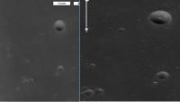
The Telegraph article showed a crop from a low-res version of the Chang'e image. Here is a crop from the full-res Chang'e image, which does indeed seem to show a new feature in the position highlighted in the article. What do you think, Phil?
A closeup on the area:

My two cents: look how much more detail is visible in the Chang'e image, even though they are at similar resolutions, and even though the Chang'e image has been JPEG-compressed, while the Clementine one is original data presented in GIF format, so it's losslessly compressed...
--Emily
Posted by: elakdawalla Dec 3 2007, 09:36 PM
Aha -- I figured it out! The apparent new feature is a result of an image seam, as Phil suggested. Here's a sloppily reconstructed version.
--Emily
Posted by: tedstryk Dec 3 2007, 09:44 PM
It is clearly a double image of the same crater, caused by improper assembly of the mosaic - this is common on early releases in a mission.. On the new image, you may notice that the crater within the crater on the left side is visible, just as in the Clementine image, but the crater abruptly fades out to the right. On the "upper crater" in China's new image, the crater fades out at about the same place horizontally in the image, which in this case is on the left side. If you look at the little crater along the rim at the 2:00 position, it is in exactly the same place in both images. Looking below the crater, you will also notice the slightly diagonal (close to vertical) little trough visible in the Clementine image is also double.
Posted by: tedstryk Dec 3 2007, 09:45 PM
--Emily
You beat me to it while I was typing
Posted by: nprev Dec 4 2007, 12:21 AM
Bravo...not only imagesmiths, but imagesleuths! ![]() Well done, Emily & Ted!
Well done, Emily & Ted!
Posted by: nop Dec 4 2007, 04:02 AM
I found cool 3-D images taken by Chang'e at a Chinese news site:
http://news.sina.com.cn/c/2007-12-02/150914433606.shtml
Posted by: Tom Tamlyn Dec 4 2007, 11:31 PM
Alan Boyle, MSNBC's science blogger, offers Emily some well-deserved http://cosmiclog.msnbc.msn.com/archive/2007/12/04/495870.aspx for her sleuthing and her characteristically clear and persuasive http://www.planetary.org/blog/article/00001248/, which should be definitive.
TTT
Posted by: mps Dec 5 2007, 08:48 AM
msnbc cosmic log says: "Lakdawalla's explanation would be embarrassing for Beijing, but it makes the most sense as the solution to this week's moon photo mystery."
I wouldn't want to be the poor guy who processed that image...
Posted by: remcook Dec 5 2007, 02:40 PM
amazing story on the blog Emily. well done! This kind of stuff really brings solar system exploration to your own living room!
Posted by: elakdawalla Dec 5 2007, 06:46 PM
Thanks for the compliments, guys. I think the lesson here is that when there are whole data sets available on the Internet in an unprocessed format, it's not hard for regular people to argue against conspiracy theories. I think the Chinese might benefit from posting some of the original image strips in question so you can see what the raw materials were for their beautiful image.
--Emily
Posted by: Moon Saloon Dec 6 2007, 02:52 AM
.
Posted by: Phil Stooke Dec 10 2007, 12:51 AM
New Chang-e 1 images here:
http://news.xinhuanet.com/english/2007-12/09/content_7221256.htm
(go to page 3 for the new item, the Alphonsus area of the central nearside)
Come on Kaggers! They're going to ovetake you in the PR stakes.
Phil
Posted by: elakdawalla Dec 10 2007, 05:18 PM
With a little help from some Chinese readers I found a couple other interesting sites with images.
Here's a different view of the first image released:
(From http://post.baidu.com/f?kz=295227195)
And a large http://www.clep.org.cn/index.asp?modelname=index%5Fzt%5Fkxtc&titleno=cggxiang.
Anybody want to wade through it with Google translator and see what we're looking at?
--Emily
Posted by: elakdawalla Dec 13 2007, 07:58 PM
Here's a pretty image:
http://www.clep.org.cn/index.asp?modelname=zt%5Fkxtc%5Fcggx%5Fnr&FractionNo=&titleno=cggxiang&recno=24
The Google translation of the caption is less than clear.
Can any of you who read Chinese help? Has this image been posted elsewhere at higher resolution?
--Emily
Posted by: Paolo Dec 13 2007, 08:19 PM
Full inline quote removed --Emily
It has also been posted here http://www.lpod.org/?m=20071212
Posted by: Phil Stooke Jan 31 2008, 05:17 PM
Here's a link to a new Chang-e 1 image. A polar region. Only a low res version initially, but it should come out at full resolution soon. Maybe our Cinese colleagues can help us find it.
Phil Stooke
http://www.cnsa.gov.cn/n615708/n620172/n677078/n751578/143044.html
Posted by: PhilCo126 Feb 6 2008, 04:56 PM
Nothing new 'Made in China' since last week? ![]()
Well at least we'll have Chandrayaan-1 (India) passing the Moon next April and Lunar Reconnaissance Orbiter (USA) taking a look at the South Pole by November of this year...
Posted by: elakdawalla Feb 6 2008, 05:18 PM
A very happy New Year to all our Chinese members! It seems singularly appropriate to this board that it should now be the Year of the http://www.honeybeerobotics.com/rat.html ![]()
(PhilCo, this may be why there has not been much news lately from the East. You don't get much out of the West over Christmas holidays either.)
--Emily
Posted by: mps Feb 24 2008, 08:46 PM
http://news.xinhuanet.com/english/2008-02/22/content_7647480.htm
Posted by: Phil Stooke Mar 26 2008, 09:14 PM
A hint from a source I cannot identify... that Chang-e 1 may be having data transmission difficulties. I don't know if this means on the spacecraft itself, though it sounds like it. To be honest I know nothing, but this statement is circulating.
Phil
Posted by: europanorama May 22 2008, 12:49 AM
Phil
where are the promised 3d-stereo-images? at least anaglyphs?
michael przewrocki
Posted by: Phil Stooke May 22 2008, 01:11 AM
Only fair to add now that the hints I spoke of may have been wrong! Sorry about that.
As for the stereo etc. - you can expect to wait years for that, except for occasional press releases or big conferences.
Phil
Posted by: charborob Jul 8 2008, 01:19 PM
This short article on Xinhua news agency about Chang-e:
http://news.xinhuanet.com/english/2008-07/07/content_8501164.htm
I'm wondering if we will ever see any pictures.
Posted by: Zvezdichko Aug 4 2008, 04:47 PM
http://www.spacedaily.com/reports/China_To_Release_700_Hours_Of_Change_1_Data_999.html
That's interesting...
Where to expect the information?
Posted by: djellison Aug 4 2008, 04:59 PM
Sounds like it'll be a fairly controlled release. I wouldn't hold my breath.
Posted by: PhilCo126 Aug 6 2008, 03:34 PM
They planned to release something during the Games ... ![]()
Posted by: Zvezdichko Aug 17 2008, 12:49 PM
Well, almost two weeks passed, and nothing new...
Posted by: Hungry4info Aug 17 2008, 05:27 PM
I remember a while back that someone found that one of the Chang'e 1 images of the lunar surface was doctored up a little. I wonder how accurate this "700 hours" of data would be. But then again, I desperately want a nice lunar map for Celestia...
The information is being sent
I don't know which would be harder, getting the information from the Chinese, or the ESA.
Posted by: ugordan Aug 17 2008, 09:05 PM
The seams between imaging strips were blended in to make the result more aesthetically pleasing. The pointing/position knowledge wasn't good enough to do this automatically at that point in time.
You'd be surprised how much many of the other space images are "doctored" before release.
Posted by: scalbers Aug 17 2008, 09:46 PM
This one might work for the time being, based on Clementine data...
http://laps.noaa.gov/albers/sos/sos.html#MOON
Steve
Posted by: Hungry4info Aug 17 2008, 11:57 PM
full inline quote removed
That's the one I use currently. I'm hoping once LRO is finished, we can get a better map. I mean not to devalue your work, you do a lot of good work with your maps and I do appreciate it. I'm one of those, though, that wants to be able to see gum on the sidewalk in my virtual textures for Celestia.
My Earth texture is 32,000 x 16,000 px (if anyone knows where to find one that is larger, please say something). I deeply desire a lunar map of similar proportions with excellent resolution. I figure that a 32,000 x 16,000 px map for the moon should give a resolution of somewhere around 300 m per pixel.
I guess the thing to do is head over to the USGS Map-a-planet and download a bunch of pictures and stitch them together later, lol. I'll go do that now.
Posted by: Hungry4info Aug 18 2008, 02:25 AM
I found new toys at the USGS site. If anyone wants a 16,384 x 8,192 px map of the moon, you can get it here until Aug 20.
http://pdsmaps.wr.usgs.gov/order/I_Am_Alive_ATM/moon00n000.html
Posted by: scalbers Aug 23 2008, 03:42 PM
Thanks for your comments Hungry...
I usually stick to 8K maps as that is the biggest I can easily produce and/or display (e.g. with Celestia). Good to know about the larger moon one at the USGS, and the potential with the Chinese probe data.
I think the Blue Marble Next Generation from NASA would be a good one to check for Earth. It supposedly goes up to 500m resolution, so if that's true it would be quite a lot of pixels.
Steve
Posted by: jekbradbury Aug 23 2008, 08:01 PM
I happen to have a 20K x 10k map (same Clementine/USGS Map A Planet source) lying around from an attempt to create a moon overlay for Google Earth; I have uploaded it in case it will be of use to anyone (it's centered 180 degrees off from the USGS ones, and is too big (104 Mb) for me to edit).
http://www.transferbigfiles.com/Get.aspx?id=94b13aa9-3ee0-45ea-94a0-5913890be569
It should be available until the 28th.
Posted by: Phil Stooke Nov 12 2008, 12:01 PM
http://news.xinhuanet.com/english/2008-11/12/content_10347379.htm
Chang-e's big global photomosaic on dispay. Let's hope we get to see it online at some point.
Phil
Posted by: Phil Stooke Nov 25 2008, 10:29 PM
Here's a bigger version
http://images.spaceref.com/news/2008/chinamoonmap.l.jpg
Phil
Posted by: djellison Nov 25 2008, 10:47 PM
Forgive my ignorance - but if it ever gets 'out' of China - will this represent a better base map than, for example, the Clementine stuff on map-a-planet?
Doug
Posted by: Phil Stooke Nov 25 2008, 10:56 PM
My impression is that it will be similar in lighting and resolution to Clementine. 100 m/pixel, fairly high sun at low latitudes. But that's not to say it will be identical. It is multispectral, and may sample different spectral bands than Clementine. Clementine has some poor areas where missed strips were filled in from higher altitude images, this might not. Also near the poles the lighting will be a bit different depending on the lunar seasons - Clementine only mapped for a couple of months so it saw limited seasonal variation. (for instance, the south rim of Shoemaker is visible here but not in Clementine). If we do get the full data set released, as China says we will - it will be complementary to Clementine.
Phil
Posted by: Phil Stooke Dec 10 2008, 02:29 PM
Reports now that Chang-e 1 has lowered its orbit to 100 km for a period of higher resolution imaging, to be followed by another drop in altitude to test systems for future landers - presumably navigation towards a final impact. So next year we'll probably see five lunar impacts - Kaguya's relay satellite, Kaguya itself, LCROSS's rocket stage and observation satellite, and Chang-e 1. Not necessarily in that order.
Phil
Posted by: Phil Stooke Dec 10 2008, 06:56 PM
... and you might like to see what this update says about future missions, and data access:
http://www.lpi.usra.edu/features/chang_e/mapComplete/
Phil
Posted by: Zvezdichko Jan 3 2009, 01:21 PM
http://yolearnchinese.com/archives/chinese-moon-map-from-change-released#comment-8074
Do you notice something weird?
EDIT: Everything is OK now. A credit line is given and a hyperlink to unmannedspaceflight.com was added.
Posted by: Zvezdichko Jan 10 2009, 11:58 AM
http://news.xinhuanet.com/english/2009-01/08/content_10625458.htm
According to this publication Chang'e will impact the Moon in proper time, but not detail is given, as usual ![]()
Posted by: Geert Mar 1 2009, 12:32 PM
Chang'e has impacted the moon after de-orbit burn
see http://www.chinadaily.com.cn/china/2009-03/01/content_7523687.htm
Regards,
Geert
Posted by: Phil Stooke Mar 1 2009, 03:12 PM
Another point on the map! This is in Mare Fecunditatis, about 120 km west of the Luna 16 landing site.
Phil
Posted by: nprev Mar 1 2009, 09:25 PM
Anybody know why Chang'e was deliberately deorbited @ EOM? I'm just wondering why they'd bother; it wasn't targeted towards a suspected volatile-rich area or anything like that.
Posted by: Phil Stooke Mar 2 2009, 03:13 AM
Lunar spacecraft may be removed from orbit so they won't interfere with other missions - a second Chinese orbiter will follow this one and they may need to avoid communications issues - and also, they may be brought down in a controlled manner, if it's possible, to avoid damaging historic sites.
Phil
Posted by: nprev Mar 2 2009, 04:25 AM
Thanks, Phil. I sort of thought that was why, but lunar orbit is hardly crowded these days. Concur with the historical site aviodance rationale, of course.
Posted by: dvandorn Mar 2 2009, 05:13 AM
Although, I have to wonder -- what are the odds against an unguided impact by Chang'e (or anything else, for that matter) hitting an area of historical importance?
How many of these locations are there? Six Apollo sites, five Surveyor sites, two Lunakhod sites, three Luna sample return sites and two simple Luna lander sites -- a total of 18 sites, over the entire surface area of the Moon. (This assumes you're not going to count impact sites -- many of them unidentified -- of other hardware, from Luna 2 through Chandrayaan's MIP. I find it hard to imagine a tourist viewing platform to observe what appears to be just another crater out of quadrillions, just because it was made by a man-made vehicle. Though I might make an exception for Luna 2.)
I understand that a vehicle in polar orbit does eventually overfly most all of the Moon. But that also means it has the entire surface area of the whole body on which to impact, raising the odds significantly against an unguided impact coming within a hundred km of *any* given spot.
The idea of historic site preservation is a good one, but I just have to wonder what the odds of an inadvertent impact really are... ![]()
-the other Doug
Posted by: centsworth_II Mar 2 2009, 06:34 AM
We recently experienced an "improbable" mid orbit collision here at Earth. And the volume of possible lunar orbits is a lot smaller.
Someone at the BAUT forum indicated that Chinese media reported the de-orbit was used as training for future landing missions.
(Link to post below)
http://www.bautforum.com/space-exploration/85440-chinas-change-1-successfully-hit-moon-surface.html#post1446047
EDIT: link to the Chinese news report from http://planetary.org/blog/article/00001859/:
"The planned impact was designed to accumulate experience for landing of China's second lunar probe." http://www.chinadaily.com.cn/china/2009-03/01/content_7523687.htm</a>
Posted by: Zvezdichko Mar 2 2009, 08:34 AM
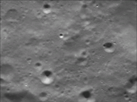
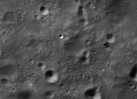
Some people report that the landing was recored by the CCD camera. Do you have any idea whether any pictures will be published, or as usual, nothing will appear?
Posted by: Zvezdichko Mar 2 2009, 11:25 AM
I'm asking and I'm answering myself:
http://www.youtube.com/watch?v=Pw15rDMeYko
Take a look of the 29 and 30s second of the clip. Are these images of the impact?
Posted by: Phil Stooke Mar 2 2009, 11:52 AM
They may have been taken during the descent, or may be oblique views from another orbit.
Replying to dvandorn's point above - of course the chance of an unintended strike on a historic site is minimal. Communication interference, or learning to track a descent trajectory, are more likely. But there is an agreement to deorbit in a controlled way if possible rather than leaving things to chance.
Phil
Posted by: Phil Stooke Mar 2 2009, 02:52 PM
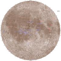
Here's an updated map of the lunar near side with the recent impacts on it. I included Chandrayaan 1 but I don't know its true location - Goswami says 88 south, but does not specify a longitude. It came in along roughly the 15 east meridian, but it might have made it to the far side if it overflew the pole.
Phil
Posted by: Geert Mar 2 2009, 02:56 PM
Remembering all the problems that mascons gave on earlier lunar landings, tracking a descent trajectory might indeed be worthwhile.
Which immediately leads to another question: given that mascons are very local interferences, it stands to reason that you would like to track the same trajectory that you're lander is supposed to follow, otherwise tracking a descent wouldn't teach you much. So possibly the Chinese lander will land somewhere in the same region as this crash??
And one more item, this position is not far from the Luna 16 position, and those sample-return landingpoints were chosen as only from this longitude you can fly a direct ascent trajectory back to earth without having to do midcourse burns. I don't suppose the Chinese will try a sample-return on their very first landing, but IF they are intending to land somewhere in this vicinity it is at least remarkable that they select a location which allows a direct ascent trajectory..
Regards,
Geert.
Posted by: Zvezdichko Mar 2 2009, 03:50 PM
http://img80.imageshack.us/my.php?image=change11.png
http://g.imageshack.us/img80/change11.png/1/
Photo Credit : CCTV/CNSA
http://img228.imageshack.us/my.php?image=change12.png
http://g.imageshack.us/img228/change12.png/1/
Photo Credit : CCTV/CNSA
These are the candidate images that were probably taken during impact.
Posted by: djellison Mar 2 2009, 04:30 PM
It's not going to be DURING impact. Just before it, perhaps, but not during.
Posted by: Phil Stooke Mar 3 2009, 05:01 AM
A stretched out version - easier to try to locate it. But I don't recognize the area. This has north up, from the lighting direction, if it's taken on the last orbit.
Phil
Posted by: Paolo Aug 6 2009, 03:13 PM
http://english.peopledaily.com.cn/90001/90781/90876/6719913.html
Posted by: Paolo Sep 28 2009, 08:56 PM
This Aviation Week article http://www.aviationweek.com/aw/generic/story_generic.jsp?channel=awst&id=news/china092809.xml is mostly about MSF, but it does say that Chang'e 2 will fly in October 2010.
"Improvements include a better camera with a resolution of 5 meters (16.4 ft.) at the surface, they say."
Posted by: Zvezdichko Nov 27 2009, 10:13 AM
http://www.novosti-kosmonavtiki.ru/content/news.shtml
Novosti-Kosmonavtiki confirms launch in October 2010 and it is also said that Chang'e 2 will be 100 kms closer to the lunar surface. It's also said that the instruments will be even more sophisticated and powerful, but I don't know about the resolution of the camera.
Chang'e 2 will be based on a back-up spacecraft for Chang'e 1 already built. Initially it was supposed to be launched as-is, as a clone of Chang'e 1, but now it's confirmed it will carry more powerful instruments.
Novosti-Kosmonavtiki also says the moon rover will be launched no later than 2013. The moon rover will study the local resources, particularly minerals. The rover will be a stepping stone to a human mission to the Moon, which has to occur no later than 2030.
Posted by: Zvezdichko Dec 2 2009, 01:39 PM
http://www.spacedaily.com/reports/Change_1_Has_Blazed_A_New_Trail_In_China_Deep_Space_Exploration_999.html
A new article plus a thumbnail of the topographic map. Do you have any idea if we already have a bigger version somewhere?
http://www.physorg.com/newman/gfx/news/hires/change1hasbl.jpg
Posted by: nprev Dec 3 2009, 01:50 AM
100 km closer using the same spacecraft bus & upgraded instruments, eh? They don't seem too worried about thermal problems.
Posted by: Hungry4info Dec 3 2009, 02:10 PM
Perhaps with the information gained from their first lunar mission, they're confident they'll be able to handle it. On the other hand, if they suddenly consider raising altitude for a better view, we'll know what's happening ![]()
Posted by: Phil Stooke Dec 3 2009, 03:11 PM
LRO's at 50 km and it's not bothering them.
Phil
Posted by: nprev Dec 4 2009, 01:45 AM
Surely. I was being kind of elliptical; it appears that they are quite confident in their basic design is what I meant.
Posted by: IM4 Dec 5 2009, 11:47 AM
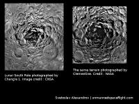
Yes, we have. See attachments below. First one is topographical map from Chang'e Laser Altimeter with North/South pole views presented. Second one is a kind of microwave map at 37 GHz. I can't translate the title, but I suppose it presents a microwave emissivity of the moon regolith.
Posted by: Hendrik Dec 5 2009, 03:19 PM
微波月亮 34Ghz 白天正面/背面
microwave moon 34Ghz Daytime Frontside/Backside
Posted by: Phil Stooke Aug 25 2010, 10:16 PM
(checking in from vacation)
(like, who can stay away from UMSF even if a vacation is supposed to be happening?)
So now I hear that Chang-e 2, the Moon orbiter due to launch in October this year, will be carrying a small lunar impact probe, as Chandrayaan 1 did. Presumably it will be testing tracking, altimetry etc., and maybe imaging down to the surface in support of the lander scheduled for 2013.
Phil
Posted by: rlorenz Aug 28 2010, 02:37 PM
Microwave brightness temperature (there is a color scalebar in K on the plot..)
This has an emissivity contribution, but is dominated by the physical temperature
which in this case is dominated by latitude.
There have been a few papers published on these (nice) data - possibly some of the
most solid results from Chang'e so far, or at least results complementary to what
everyone else has flown.
e.g. LPSC abstract http://www.lpi.usra.edu/meetings/lpsc2010/pdf/1331.pdf
Posted by: Paolo Sep 21 2010, 06:34 PM
Lunar microwave temperature maps presented at EPSC
http://lunarscience.arc.nasa.gov/articles/the-first-microwave-image-of-the-complete-moon
Posted by: yaohua2000 Sep 30 2010, 01:47 PM
Chang'e 2 will be launched at 10:59:57 UTC, tomorrow.
Wikipedia: http://en.wikipedia.org/wiki/Chang'e_2
Pictures: http://slide.news.sina.com.cn/c/slide_1_15699_13288.html
Posted by: Astro0 Oct 1 2010, 11:25 AM
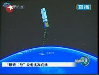
http://english.people.com.cn/98373/98389/99061/7156252.html (in english) from CCTV seems to show a successful launch for Chang'e 2. Launch and booster sep all on time.
Posted by: climber Oct 1 2010, 01:49 PM
More infos from Spaceflightnow.com: http://www.spaceflightnow.com/news/n1010/01change2launch/
Posted by: climber Oct 1 2010, 05:46 PM
Watching launch on Emily's bog: http://www.planetary.org/blog/article/00002693/ , I can't believe the guy realy press the button to make the lift off happen! I'd say that's for show up purposes instead. What do you think?
Posted by: OWW Oct 1 2010, 05:58 PM
Listening to that tv-host is hilarious. So clueless... ![]()
Posted by: Paolo Oct 1 2010, 08:21 PM
There is an interesting sentence in the Spaceflight Now page:
This remembers me of Clementine, the lunar orbiter that was to encounter two asteroids in deep space...
Posted by: yaohua2000 Oct 6 2010, 01:18 AM
TCM-2 and TCM-3 canceled. LOI is expected in 1.5 hours.
Posted by: nprev Oct 6 2010, 01:22 AM
Good shooting! ![]() Thanks for the update, Yaohua.
Thanks for the update, Yaohua.
Posted by: Hungry4info Oct 6 2010, 03:25 AM
Interesting. I sure hope that works out.
I'm quite eager to see new images from the lunar surface.
Posted by: yaohua2000 Oct 6 2010, 04:17 AM
The 490-Newton thrust main engine started at 03:05:59 UTC, burned for 1942 seconds. Chang'e 2 is now in lunar orbit at an altitude of 100 km.
Posted by: nprev Oct 6 2010, 04:30 AM
Congratulations to CSNA & the people of China! ![]()
Posted by: charborob Oct 6 2010, 01:40 PM
To be precise, Chang'2 entered a preliminary 12-hour orbit. Two more adjustments are needed before it reaches the 100-km working orbit.
http://news.xinhuanet.com/english2010/china/2010-10/06/c_13544216.htm
Posted by: Phil Stooke Oct 25 2010, 03:55 PM
Chang-e 2 has been operating in its 100 km circular orbit for a while, probably testing its instruments and maybe collecting some data. Yesterday it began testing the camera system, and tomorrow it will drop into its 100 by 15 km low pass over Sinus Iridum for the first time.
This from a report in the People's Daily today.
Phil
Posted by: elakdawalla Oct 25 2010, 04:51 PM
Link please Phil?
Posted by: Phil Stooke Oct 25 2010, 05:09 PM
Sorry!
http://english.people.com.cn/90001/90776/90881/7176368.html
Phil
Posted by: Phil Stooke Oct 27 2010, 03:57 AM
http://english.people.com.cn/90001/90776/90881/7178577.html
The spacecraft is in its 100 by 15 km orbit and will image Sinus Iridum tomorrow (Wednesday)
Phil
Posted by: Paolo Oct 27 2010, 05:15 AM
this time they seem even less willing to release pics than they were with CE-1
Posted by: Hungry4info Oct 27 2010, 10:54 AM
Have they taken any yet?
We're told that imaging of the landing site will be today. There may simply not be much to release yet.
Posted by: Phil Stooke Oct 27 2010, 01:14 PM
Right - as I understand it there are only test images so far. This is not a global mapping mission (with the camera, maybe it is with the other instruments), it is intended to focus on specific future landing sites. So Chang-e 2 has dropped into its lower perilune orbit for a short imaging period, maybe only a few orbits. Then I assume they will raise perilune again and wait until the groundtrack crosses another target under good lighting conditions, drop it again and so on. They have lots of fuel, so they can presumably do several of these sessions. Presumably the target areas will also be imaged under optimal lighting conditions from 100 km for wider coverage at intermediate resolution.
No word yet on the suggested impactor. A page on technical innovations referred to a 'landing camera', which might be part of it.
Phil
Posted by: elakdawalla Oct 27 2010, 05:41 PM
Got this via email today from Yong-Chun Zheng at National Astronomical Observatories, Chinese Academy of Sciences
Engineers of Beijing Aerospace Command & Control Centre (BACC) have maneuvered Chang'E-2 into the 100km x 15km orbit in the night of 26, Oct, 2010 (Beijing Local Time). BACC is the commanding, decision-making and control centre of the key space flight missions in China. This action of Chang'E-2 was begun at the farside of the Moon, and reqiure high accuracy of orbit control.
In the 100km x 15km orbit, Chang'E-2 is taking images for the Sinus Iridum, or Bay of Rainbows, where will be selected as the site for the soft landing of Chang'E-3. In the future several days, Chang'E-2 will obtain high resolution images of this regions. After taken photoes for Sinus Iridum, Chang'E-2 will go back to the 100km x 100km orbit, where it will stay for half a year to explore the lunar surface.
Posted by: Phil Stooke Nov 3 2010, 02:29 PM
Latest news - Chang-e 2 has been raised to its long term orbit and will now do more imaging and other mapping from that altitude. No more news on the low altitude results yet. I had assumed they would repeat the low altitude imaging elsewhere but apparently not, as Emily's reported email had also said. We'll learn more later... too bad it's so slow coming out.
Phil (still at the Cape hoping for a Friday launch, assuming Thursday will be prevented by bad weather)
Posted by: nprev Nov 3 2010, 04:49 PM
Thanks for the update, Intrepid Correspondent, and best of luck on your launch! ![]()
Interesting. So have they completely ruled out any future low-alt passes now?
Posted by: Paolo Nov 5 2010, 08:29 PM
The paper http://www.cjss.ac.cn/qikan/manage/wenzhang/2010-05-02.pdf is available for free on the website Chinese Journal of Space Science. I am not sure that there is anything new in there
Posted by: Phil Stooke Nov 8 2010, 12:02 PM
http://news.xinhuanet.com/english2010/china/2010-11/08/c_13596211.htm
Finally! A report with image and coordinates. No word on that rumor of an impact probe.
Phil
Posted by: Phil Stooke Nov 8 2010, 02:30 PM
Higher resolution versions of the same images here at People's Daily:
http://english.people.com.cn/90001/90776/90881/7191608.html
Phil
Posted by: Paolo Nov 9 2010, 06:49 PM
more images at a decent resolution
http://moon.bao.ac.cn/templates/T_yestem_articelcontent/index.aspx?nodeid=13&page=ContentPage&contentid=190
yes, we definitely must add a drooling emoticon!
Posted by: Paolo Nov 13 2010, 10:22 PM
just found on a French forum, a series of amazing videos from CE2's monitoring cameras
http://tv.people.com.cn/img/2010tv_flash/player.swf?xml=/pvservice/xml/2010/11/8/a6e91edb3eec0935.ptv&key=%E4%BA%BA%E6%B0%91%E7%94%B5%E8%A7%86:/144357/150722/%22e=1
http://tv.people.com.cn/img/2010tv_flash/player.swf?xml=/pvservice/xml/2010/11/8/da15d6fa4d8b3796.ptv&key=%E4%BA%BA%E6%B0%91%E7%94%B5%E8%A7%86:/144357/150722/%22e=1
http://tv.people.com.cn/img/2010tv_flash/player.swf?xml=/pvservice/xml/2010/11/8/4a589ee17b28f2ea.ptv&key=%E4%BA%BA%E6%B0%91%E7%94%B5%E8%A7%86:/144357/150722/%22e=1
http://tv.people.com.cn/img/2010tv_flash/player.swf?xml=/pvservice/xml/2010/11/8/74b1dfac0e8c3a74.ptv&key=%E4%BA%BA%E6%B0%91%E7%94%B5%E8%A7%86:/144357/150722/%22e=1
http://tv.people.com.cn/img/2010tv_flash/player.swf?xml=/pvservice/xml/2010/11/8/6c89667e11fa11b6.ptv&key=%E4%BA%BA%E6%B0%91%E7%94%B5%E8%A7%86:/144357/150722/%22e=1
Posted by: elakdawalla Nov 14 2010, 04:20 AM
Holy cow! Those are awesome!!
Posted by: eoincampbell Nov 14 2010, 04:44 AM
Really fascinating movies, thanks for sharing. I love the thruster glow...
Posted by: hendric Nov 14 2010, 05:08 AM
Be sure to watch the first one until the end! I almost stopped once the panels deployed, but skipped ahead and then had to rewatch the whole thing again. ![]()
I really like the trend of "engineering" cameras such as these, Mars Express' VMC and Ikaros DCAMs!
Posted by: djellison Nov 14 2010, 07:59 AM
For some reason - none of those links work - (the entire domain doesn't exist at my end)
http://www.youtube.com/watch?v=nWHU4VMGDDM
However - that YouTube link contains all of them, I think ![]()
Posted by: Paolo Nov 14 2010, 08:14 AM
there is also a commented video on the deployment of the HGA
http://news.cntv.cn/china/20101113/101677.shtml
if you can survive the pink tie of the anchorman... ![]()
Posted by: nprev Nov 14 2010, 10:31 AM
Oh, WOW. Those were a real trip; very, very impressive!
Posted by: belleraphon1 Nov 16 2010, 12:14 AM
Truly Awesome...
Slow em down a bit and add some 2001 music....
Wow
Craig
Posted by: Paolo Mar 10 2011, 07:59 PM
two papers (in Chinese, unfort.) on Chang'e 1 have been released in the Chinese Journal of Space Science
http://www.cjss.ac.cn/qikan/epaper/zhaiyao.asp?bsid=15235
http://www.cjss.ac.cn/qikan/epaper/zhaiyao.asp?bsid=15255
Posted by: LCROSS88 Apr 3 2011, 09:58 AM
These are all really awesome, thanks! Has there been any more news on the planned landing for 2013? You know, sometimes I wonder why China, India, Russia, Europe, Brazil? etc. are undertaking all these expensive lunar missions...I mean its not like there's isnt already a lot of data out there from NASA and ESA. Do those countries just want their own set of data, but why? Is it a matter of trust? Or a matter of pride and accomplishment? A matter of "owning a piece of the moon"? I know, everyone tells us we live in the global age, bilateral and multilateral agreements, etc etc. But it makes you wonder if all the data gets shared freely or not.... Sorry if this is drifting off into politics.
Posted by: Phil Stooke Apr 3 2011, 11:20 AM
It's about mastering the technology in preparation for bigger things in the future.
The landing in 2013 appears to be on track. A lander with a rover will land in Sinus Iridum. In about 2014 or 2015 a second lander and rover, perhaps with more autonomy, will land at another site. Then in about 2017 a sample return mission will be flown, and a year or two later a second sample return. That much is established, but human missions are being considered for about 2025 or slightly later.
Phil
Posted by: Paolo Apr 4 2011, 05:11 PM
http://english.peopledaily.com.cn/90001/98649/7338836.html. Still no word of a possible extended mission in solar orbit
Posted by: Phil Stooke Apr 4 2011, 06:26 PM
... or either of the other possible extended missions which have been discussed: return to Earth orbit or extended lunar operations ending in impact. The latter looks more likely to me.
Phil
Posted by: Paolo Apr 4 2011, 07:13 PM
of course an impact is more likely, but a solar mission would give them some experience in navigating and most of all communicating with a truly deep space probe. and that would be invaluable for Yinghuo when it reaches Mars next year.
Posted by: Phil Stooke Apr 4 2011, 07:21 PM
True, but at the cost of additional lunar science.
You're right of course that the solar orbit option was mentioned, but so were the other two options. No word yet on which one will actually be used. There's also no word on whether or not the previously described impact probe on Chang-E 2 even exists.
Phil
Posted by: yaohua2000 May 18 2011, 04:53 AM
Chang'e 2 may depart lunar orbit on June 16 for L2.
Reference: http://news.xinmin.cn/rollnews/2011/05/17/10777705.html (in Chinese)
Posted by: Paolo May 18 2011, 05:08 AM
a nice article on the IEEE site: http://spectrum.ieee.org/automaton/aerospace/robotic-exploration/how-china-plans-to-send-robots-to-the-moon
Posted by: Tesheiner May 18 2011, 05:15 PM
Reference: http://news.xinmin.cn/rollnews/2011/05/17/10777705.html (in Chinese)
Ok, so L2 is on the far side of the Moon. My [perhaps uninformed] question is how will they communicate with the spacecraft?
Article on Emily's blog: http://www.planetary.org/blog/article/00003037/
Posted by: Phil Stooke May 18 2011, 05:23 PM
L2 is not a point - it's a broad region, and the spacecraft orbit loosely around it, almost never hidden by the Moon. Right now NASA's ARTEMIS mission has two spacecraft, one orbiting L1 and one orbiting L2, waiting to go into lunar orbit in a few months for particles and fields studies.
Phil
Posted by: Hungry4info May 18 2011, 06:57 PM
From Emily's blog post
Several images are http://www.planetary.org/blog/article/00002773/.
Posted by: centsworth_II May 18 2011, 10:14 PM
Emily says in that post with the Chang'E 2 images that "... none of the versions of the images that I have found to be available online are anything close to their full stated resolution."
So the quality of any lunar map based on the originals is still unknown.
Posted by: elakdawalla May 18 2011, 10:36 PM
Um, yeah, that's what I meant.
Posted by: yaohua2000 May 19 2011, 07:35 AM
This is a guideline how you can apply for these datasets: http://www.clep.org.cn/index.asp?modelname=sjfbu000%5Fnr&FractionNo=&titleno=sjfbu000&recno=6 (in Chinese)
Normal users can only download "processed data products" (level-3 datasets) by sign up at http://159.226.88.59:7779/CE1OutWeb/ . For those have cooperation with the program, they can apply for raw datasets (level 0,1,2).
Posted by: gwiz Jun 8 2011, 06:52 PM
Phil
According to the current Aviation Week, it's going to the Sun-Earth L2 point, not the Earth-Moon one. As far as I understand the machine-translated original Chinese announcement, this is correct.
Posted by: Phil Stooke Jun 9 2011, 03:23 PM
Thanks - that's useful. Same point is true about it bing a large zone rather than a point - in fact it's much larger! What will it do after that, I wonder? Return to Earth orbit or Lunar orbit? Or go further out?
Phil
Posted by: remcook Jun 9 2011, 05:48 PM
In theory, L2 is in fact a point. However, spacecraft never actually 'sit'in this point, but move in large orbits ( http://en.wikipedia.org/wiki/Halo_orbit ) around it. The point itself is dynamically unstable anyway (as opposed to the L4 and L5 points), so it would take effort to maintain your position there. In theory, halo orbits are stable, but in practise they get perturbed.
Posted by: centsworth_II Jun 9 2011, 10:02 PM
L2 could be compared to a body, like the Earth, around which objects can orbit. Although the the center of Earth's gravitational field is a point, many objects can orbit it. In the same way, although the center of L2's influence is a point, many objects can orbit it. (That's how I see it anyway.)
Posted by: nprev Jun 10 2011, 01:00 AM
I'm kind of wondering why they're going there. Navigation practice is my best guess. Wonder if they ever considered trying for an NEO flyby (assuming that there are any that Chang'e 2 could reach)?
Posted by: remcook Jun 10 2011, 07:34 AM
My guess is that it's just hitting the highway http://www.cds.caltech.edu/~shane/superhighway/description.html
Also check out the Genesis mission for this. http://www.whydomath.org/node/space/secondary/amsci_genesis.html
Posted by: stevesliva Jun 10 2011, 05:34 PM
Clementine was thinking along the same lines.
Posted by: Paolo Aug 29 2011, 05:13 PM
http://www.china.org.cn/video/2011-08/28/content_23299752.htm
Posted by: Paolo Aug 31 2011, 05:08 PM
http://www.chinadaily.com.cn/cndy/2011-08/31/content_13224280.htm
Oh my...
Posted by: ugordan Aug 31 2011, 05:11 PM
Scientists discussing something makes it far from certain that that something will actually ever happen. Sadly.
Posted by: Paolo Sep 1 2011, 11:08 AM
Just published in the latest issue of the Chinese Journal of Space Science the paper http://www.cjss.ac.cn/qikan/epaper/zhaiyao.asp?bsid=15307
the paper itself is in Chinese (but there is a nice English abstract) but it contains quite a few Chang'e 1 pictures that I had never seen before
Posted by: Paolo Sep 21 2011, 06:07 PM
an update on Chang'e 2:
http://news.xinhuanet.com/english2010/china/2011-09/21/c_131152022.htm
Posted by: Paolo Sep 21 2011, 07:32 PM
the release is accompanied by a nice graph (in Chinese)
Posted by: Paolo Nov 7 2011, 08:24 PM
what next for CE-2?
according to this interview (in Chinese) http://news.xinhuanet.com/politics/2011-09/21/c_122063243.htm it will remain at L2 until the end of next year. Then, depending on the remaining fuel it may fly to the Sun-Earth L1 point, flyby a near Earth asteroid or comet, or return to the Moon
Posted by: Paolo Feb 6 2012, 06:07 PM
anybody seen this site before?
http://159.226.88.59:7779/CE1OutENGWeb/ce2files.jsp
"thumbnails" are actually full resolution images. under Mozilla: click right and then select "view image"
Posted by: Phil Stooke Feb 6 2012, 10:23 PM
I had looked at that and some similar pages, but it never occurred to me to try and save the little thumbnail (since it didn't obviously link to anything). Now I'm happy!
Phil
Posted by: yaohua2000 Feb 7 2012, 11:18 PM
Recently released lunar global map, in JP2 format (1.4 GB compressed): ftp://DataRelease:1q2w124@159.226.88.39/CE2/Global-50m-sc.rar
You can also find some other Chang'e 2 stuffs on this FTP server.
An online viewer: http://159.226.88.30:8080/CE2release/cesMain.jsp
Left: Google Moon; Right: Chang'e 2
Posted by: Phil Stooke Feb 8 2012, 04:03 PM
The new map is very nice. I have just put a comment on LPOD about this but I'll repeat it here. The zoomable map works like the LROC Quickmap, except it does not have the extra level of detail provided by the LROC NAC frames. But when I zoom in on areas I know very well, I can see that the new Chinese map is better than the LROC WAC mosaic. The sun angle is higher, so topography is not so clearly seen, but the resolution is better than LROC WAC.
Phil
Posted by: Paolo Jun 14 2012, 06:48 AM
according to the google translation of a post on a Chinese forum http://www.9ifly.cn/forum.php?mod=viewthread&tid=62&page=104#pid203109
the same forum points at main belt (3179) Beruti as the target. sounds strange, I would rather have expected a NEO!
I am hoping they got confused with (4179) Toutatis! I have been waiting to see Toutatis ever since the first radar images were released 20 years ago!
Posted by: Paolo Jun 14 2012, 09:47 AM
it now seems that Toutatis is indeed the target! the flyby will occur just weeks after the NEO has made a close approach within 0.046 AU of Earth.
I was wondering whether the Chinese have developed a moving target tracking algorithm to collect any data from the flyby or they will have to image all of the uncertainty volume of the asteroid in order to be sure of capturing it as Galileo did. any idea?
of course such software is not needed for a lunar orbiter...
Posted by: Phil Stooke Jun 14 2012, 12:48 PM
Very interesting. There is a mirror-image ambiguity in the radar image reconstructions, and it will be very interesting to see it resolved in optical images. I think the ambiguity continues into the shape models as well, certainly in the earlier versions.
Phil
Posted by: yaohua2000 Jun 14 2012, 04:00 PM
Here is the full video of the presentation by Ouyang Ziyuan:
http://www.cas.cn/zt/hyzt/16thysdh/zb/fdsp/201206/t20120614_3598219.shtml
Posted by: Paolo Jun 15 2012, 05:24 AM
more info from NASAspaceflight forum, where I first saw the new, to give them proper credit (I am user plutogno) http://forum.nasaspaceflight.com/index.php?topic=19644.225
CE2 left the Lagrangian point on 15 April and will flyby Toutatis on 6 January next year
Posted by: tedstryk Jun 15 2012, 04:08 PM
I sure hope this is true (and, if so, successful) http://translate.google.com/translate?hl=en&sl=pt&u=http://astropt.org/blog/2012/06/14/change-2-a-caminho-de-toutatis/&sa=X&ei=h4vaT56hNoSS9gSx47GZBA&ved=0CFsQ7gEwAw&prev=/search%3Fq%3DChang%2527E%2Btoutatis%26hl%3Den%26client%3Dfirefox-a%26hs%3DiFM%26sa%3DX%26rls%3Dorg.mozilla:en-US:official%26biw%3D1280%26bih%3D696%26prmd%3Dimvnsu
Posted by: elakdawalla Jun 15 2012, 09:20 PM
According to a commenter on my blog who says he speaks Chinese and listened to the presentation, the future encounters (Tukmit, Apophis, etc) are for future missions, not Chang'E 2.
Posted by: Paolo Jun 15 2012, 09:46 PM
to answer my question about autonomous tracking, I asked JPL's Horizons the 3-sigma error ellipse semiaxes in right ascension and declination for the day of the encounter for an observer located at the center of the Earth. It turns out Toutatis' orbit is extremely well known (thanks to radar observations, no doubt) and probably CE will simply need to point at the spot in the sky where the asteroid is supposed to be.
The orbital elements in fact have very small 1-sigma uncertainties (down to 1E-10 for the semimajor axis and eccentricity): http://ssd.jpl.nasa.gov/sbdb.cgi?sstr=4179;orb=0;cov=0;log=0;cad=0#discovery
From Horizons, it turns out the 3-sigma error ellipse on encounter day is a mere 0.025 x 0.010 arcseconds wide. That is 1.21E-7 x 4.85E-8 radians. The distance from Earth at that time will be 0.1887 AU or 28.2 million kilometers.
From simple trigonometry, the error ellipse is just 28.2E6 sin (1.21E-7) = 3.4 km wide at maximum.
did I make any mistake? am I missing something?
Posted by: Paolo Jun 23 2012, 09:22 AM
while waiting for details and news on the Toutatis mission (note that it's been more than a week since the story was leaked, and Chinese mainstream press has not yet picked it up), I have found an interesting if quite technical paper on Moon-to-L2 navigation
http://info.scichina.com:8083/sciFe/EN/abstract/abstract507363.shtml
Posted by: Paolo Jun 28 2012, 07:41 AM
at last the story has been picked up by Chinese news sites!
http://tech.sina.com.cn/d/2012-06-27/14427317706.shtml
nothing new as far as I can tell from the Google translation, beside the first mention of a planned flyby distance of 1000 km. I also find it interesting that they mention a flyby near the end of this year or early next year, as if the date was not yet fixed
Posted by: Paolo Jul 19 2012, 07:40 PM
still nothing new on CE-2 to Toutatis, so I was performing some calculation.
I found the specs of the camera in the paper http://tech.scichina.com:8082/sciEe/EN/abstract/abstract504170.shtml.
It is quite different from the camera on CE-1. It consists of a refracting optics mated to two 6144 pixel linear arrays: a forward looking and a rearward looking one. at a distance of 1,000 km from Toutatis, each picture will be 430 km wide and will have a resolution of 70 m per pixel. Unfortunately, the linear array camera is well suited for an orbiter, but not for a flyby probe. either CE-2 will have to rock back and forth to build images, or it will have to collect long swaths as the asteroid crosses the field of view. Moreover, it is not particularly suitable for optical navigation. In any case, I would not expect more than a handful of pics.
Data return should be slow but not painfully so. At L2 CE-2 returned data at 750 kilobits per second, and some 20 times more distant at Toutatis it should return at several kilobits per second, comparable to Stardust.
Posted by: Paolo Jul 24 2012, 07:55 PM
I am puzzled... Chinese news sites are now reporting a Toutatis flyby in March next year instead of January!
see for ex http://news.sina.com.cn/c/2012-07-25/021924837262.shtml
Posted by: Phil Stooke Jul 24 2012, 08:17 PM
That must be wrong - Toutatis will be very far away by then. I would guess a reporter misunderstanding. I am assuming the spacecraft will remain in the vicinity of Earth and probably return to the Earth-Moon system later, though no idea yet what its fate will be.
Phil
Posted by: tolis Jul 29 2012, 10:47 PM
Phil
Hopefully adding some confidence to the details of the encounter:
The event is mentioned in the Goldstone radar's schedule:
http://echo.jpl.nasa.gov/asteroids/Toutatis2012/Toutatis2012_planning.html
It must be on then..
Regards to All,
Tolis.
Posted by: Paolo Aug 14 2012, 04:51 AM
actually, I wrote an email to the guy who maintains the JPL asteroid radar site last month and he told me that he has no first-hand info. all he knows about the flyby is what can be learned from Emily's blog
Posted by: elakdawalla Aug 14 2012, 01:53 PM
OK, that's funny. The Wikipedia effect at work.
I have spoken with American scientists working with the Chinese on this flyby, so it is for real, but I have no more details than I did before.
Posted by: SFJCody Aug 15 2012, 02:55 AM
PanSTARRS observations of Chang'e suggest it will be at Toutatis by December.
http://www.projectpluto.com/pluto/mpecs/cheprobe.htm
Posted by: Paolo Aug 15 2012, 09:34 AM
thanks! solid info at (long) last!
Posted by: Paolo Aug 20 2012, 11:43 AM
the http://www.projectpluto.com/pluto/mpecs/cheprobe.htm has been updated:
meanwhile I have received an email from a Chinese engineer working on orbit design for CE-2. although he did not give me the precise date, nor the targeted flyby distance, he told me that the encounter is expected to take place 7 million kilometers (0.0468 AU) from Earth, which closely fits the 13 December date.
Some more details on orbital design: CE-2 entered solar orbit directly from L2, without any Moon or Earth flybys, with a delta-v of several m/s. At the end of the L2 "excursion", the remaining delta-v was about 120 m/s. Four course corrections will precisely target the Toutatis flyby and establish a geometry that's convenient for imaging and communications. The relative speed at closest approach will be about 11 km/s.
Posted by: climber Aug 20 2012, 02:55 PM
Interesting info
Posted by: Phil Stooke Aug 20 2012, 02:57 PM
We should probably move this section of the thread to a dedicated asteroid section.
Phil
Posted by: Paolo Aug 20 2012, 03:13 PM
oops...
Posted by: Paolo Sep 29 2012, 05:14 AM
google translation of an interview with Ouyang Ziyuan on Chang'e 1 and 2 lunar science and data mining
http://translate.google.com/translate?hl=en&sl=zh-CN&u=http://news.china.com.cn/live/2012-09/29/content_16460009.htm&prev=/search%3Fq%3D%25E5%25AB%25A6%25E5%25A8%25A5%2B4179%26hl%3Den%26lr%3D%26tbs%3Dqdr:d%26prmd%3Dimvns&sa=X&ei=8IFmULC3LY6YhQftyYHgAg&ved=0CE8Q7gEwAg
Posted by: Paolo Sep 29 2012, 08:45 PM
and a related youtube video
http://www.youtube.com/watch?feature=player_embedded&v=w58_INahqpk#!
it looks like poster presentations at some kind of congress
Posted by: yaohua2000 Nov 10 2012, 05:35 AM
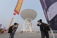
Massive radio telescope to assist China’s moon missions: http://www.globaltimes.cn/content/740942.shtml
Posted by: Phil Stooke Nov 10 2012, 05:40 PM
Very interesting news - thanks for posting these links.
Phil
Posted by: Paolo Apr 20 2013, 07:22 AM
open access paper:
http://www.nature.com/srep/2013/130408/srep01611/full/srep01611.html
Posted by: Paolo Sep 15 2013, 12:19 PM
developing a Chinese "Google Moon" using Chang'E data:
http://phys.scichina.com:8083/sciGe/EN/abstract/abstract508397.shtml
Posted by: Paolo Nov 14 2013, 08:26 PM
meanwhile, Chang'E 1 is still producing a few papers: http://phys.scichina.com:8083/sciGe/EN/abstract/abstract508184.shtml
Posted by: elakdawalla Dec 16 2013, 05:45 PM
Folks, I've just done some long-overdue forum housekeeping: http://www.unmannedspaceflight.com/index.php?showforum=74
I split this very long Chang'e thread into four:
- This, original thread is now for the Chang'e 1 and 2 orbiters.
- http://www.unmannedspaceflight.com/index.php?showtopic=7759
- http://www.unmannedspaceflight.com/index.php?showtopic=7758; we'll start a new thread for the second lunar day of operations when that happens.
- http://www.unmannedspaceflight.com/index.php?showtopic=7760
- And there is, as promised, a http://www.unmannedspaceflight.com/index.php?showtopic=7756. The usual rules for that one apply -- no chit-chat in there, keep it clean for just route map updates.
Posted by: John Moore Dec 24 2020, 07:00 PM
This paper from Nature Communications https://www.nature.com/articles/s41467-020-20215-y concerns identification (size and age) of lunar craters using CE-1 and CE-2 data.
It is 'open access', so no subscription necessary to read the full paper. Nat Commun 11, 6358 (2020). https://doi.org/10.1038/s41467-020-20215-y
John
Powered by Invision Power Board (http://www.invisionboard.com)
© Invision Power Services (http://www.invisionpower.com)

