Printable Version of Topic
Click here to view this topic in its original format
Unmanned Spaceflight.com _ Past and Future _ Virtual Viking
Posted by: Phil Stooke Sep 4 2008, 02:29 PM
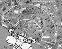
In the past we've had some good Viking images here. Soon - all too soon - we will not have Phoenix any more, but despair not! Now we can re-live Viking by playing with old images. They can be searched by sol at the PDS.
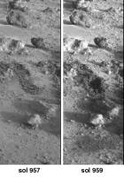
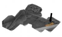
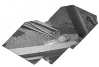
As an example, I've made a composite of the very last Surface Sampler activities at either Viking site. This is work done on Viking 2 sol 957 and imaged on sol 957 and 959. (someone can animate it if they like!)
We see two separate trenching activities at the same place, and a soil dump (bottom) and a conical soil pile made by the second dump (middle). (more obvious in an animation, I just can't make one on this machine).
Phil
Posted by: imipak Sep 4 2008, 06:47 PM
Attempt at an animation - not terribly good I'm afraid, I'm a clumsy beginner at this image processing lark.
Posted by: PhilCo126 Sep 5 2008, 11:15 AM
Great idea Phil... that will bring back some childhood memories.
1976 was a great year for a 10-year old ![]()
Posted by: Phil Stooke Sep 5 2008, 01:13 PM
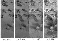
This is a set of four images documenting that last sampler activity. It is labelled with sol dates. The first trench was dug more than a year before the final digging event.
(EDIT: I have replaced the previous image with a corrected one, and fixed the text describing it)
This last digging event came so late in the mission that it is not documented in the trench maps published by Hank Moore et al. If anyone knows a final trench map that includes it I'd be pleased to know about it. Otherwise I will be making one myself in due course. Note - images 2 and 3 show no surface difference, just different lighting.
I will assemble other surface activity sequences like this, and I'd like to encourage others to join me.
Phil
Posted by: tedstryk Sep 5 2008, 10:27 PM
Ricardo Nunes and I worked together on some images. I made the grayscale images and he did he color.
You can see them on his site under the "super resolution RGB" tab. You can also see his work under other tabs.
http://www.astrosurf.com/nunes/explor/explor_vik.htm
Posted by: Phil Stooke Oct 13 2008, 07:21 PM
Here's a bit more Virtual Viking - reliving the Viking missions to make up for the impending loss of Phoenix.
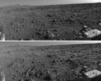
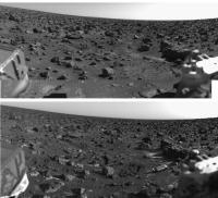
This is a comparison of the Viking 1 sample field - right side - seen before the arm operations began and after they ended. There are lots of changes - trenches dug, rocks moved, soil piles constructed (one at far left is on top of a rock).
Phil
Posted by: Phil Stooke Oct 13 2008, 08:23 PM
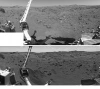
... and here's the left side of the Viking 1 workspace, before and after.
Phil
Posted by: lyford Oct 13 2008, 11:40 PM
Thanks Phil these are quite nice....
Posted by: Phil Stooke Oct 14 2008, 03:08 AM
I have just edited post 4 above - and replaced its image with a corrected version.
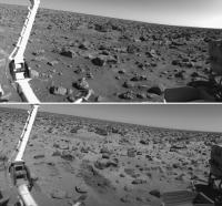
Here is the Viking 2 before and after trench image - right side of the workspace. Lots of frost spots in the lower image.
Phil
Posted by: Phil Stooke Oct 14 2008, 03:59 AM
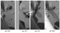
Here's another digging sequence from Viking 2. First, a view before anything happens. Then two views on sol 471, before and after a rock called Snow White was moved. The before image (left) also shows a disturbance just below the sampler arm, suggesting an arm touchdown on the surface some time between sols 454 and 471 (possibly on sol 471 just before the image was taken - but I can't find any documentation of it). The last image shows that the dark scrape made on sol 471 as the arm was retracted has been enlarged. This was the XRFS sample no. 12, but it failed to collect a proper sample.
Phil
EDIT - the touchdown in the second image was made just before the image was taken. The arm touched the surface, was raised up, then extended to push the rock. As it was retracted it scuffed the surface to leave a scrape mark seen in the third image. The XRFS trench was dug later, but the arm struck a buried rock and did not penetrate enough to collect a sample.
Phil
Posted by: PhilCo126 Nov 15 2008, 02:41 PM
Nice work, reading " A Passion for Mars " by Andrew Chaikin made me dug up some old treasures ![]()
Posted by: Phil Stooke Nov 18 2008, 01:30 AM
Here's a pic from Viking:
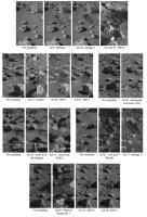
It's the full set of trench operations for Viking 2 in the primary mission.
Phil
Posted by: tedstryk Nov 18 2008, 03:56 AM
Wow...I don't think I have ever seen those together.
Posted by: PhilCo126 Nov 22 2008, 02:19 PM
The goldmine(s) for Viking Lander images:
Lander Picture Catalogs of Experiment Data Record - NASA Reference Publication 1068
Posted by: tedstryk Nov 23 2008, 03:07 AM
Lander Picture Catalogs of Experiment Data Record - NASA Reference Publication 1068
Why? The images are all on the PDS.
Posted by: PhilCo126 Nov 23 2008, 12:56 PM
Does one need a password to access the Planetary Data System ( PDS ) ?
http://pds.jpl.nasa.gov/
![]()
Posted by: djellison Nov 23 2008, 05:08 PM
No.
http://pds-geosciences.wustl.edu/geo/vl1_vl2-m-lcs-2-edr-v1/vl_0002/browse/
http://pds-geosciences.wustl.edu/geo/vl1_vl2-m-lcs-2-edr-v1/vl_0001/browse/
Posted by: Phil Stooke Nov 23 2008, 05:16 PM
I prefer this source, from which images can be selected by sol, or by clicking on mosaics for each camera to select pictures of a given area.
http://pds-imaging.jpl.nasa.gov/vikingl/vl_images.html
Phil
Posted by: Phil Stooke Apr 21 2009, 02:23 PM
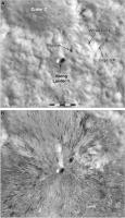
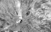
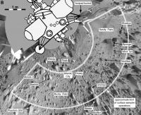
The Viking 1 site mapped in a new way... This is the polar projection of the landing site, which I posted some time ago, reprojected to HiRISE geometry. In this comparison, HiRISE is at the top and the reprojected Viking pan is below it. Mapping from ground-level images is very difficult, and grotesque distortions are inevitable, but this is the best I can do after several weeks and far too many iterations. The original is detailed enough to make a full photomap of the sampling area, and in that area the mosaic is controlled to fit the original mission map.
Phil
Posted by: Phil Stooke May 11 2009, 07:30 PM
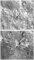
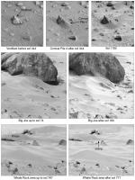
I'm still perfecting that reprojected Viking 1 site map. Meanwhile here's a composite of images showing surface changes at the Viking 1 site. There were a few changes in soil patches on the lander itself as well, otherwise these were the only changes seen by Viking 1. For the first one, of course, the change I'm drawing attention to is the erosion by wind of Conical Pile 4 late in the mission. Several other artificial piles of soil were made and monitored but didn't change.
Phil
Posted by: Phil Stooke May 23 2009, 03:46 AM
Another of the things we can do so much better now than in the old days...
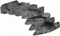
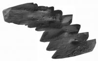
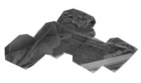
The Vikings carried mirrors on the sampler arm, and one of them could be viewed by one of the cameras to see underneath the lander. Seven images of the mirror were taken by Viking 1 on sols 528, 550, 582 and 594. They can be combined to produce a mosaic of the area underneath Engine 2 (the one right under the cameras) to look at the erosion effects of the engine during landing. The version made during Viking times was really bad! But now we can do it much better. This image contains two separate mosaics - they are supposed to fit together, but right now I don't have the old mosaic with me to compare and figure it out. They have been reversed to take the reflection into account and enlarged 2x. The bottom mosaic shows an erosion pit where loose soil has been blown away to reveal harder crusty stuff underneath. (EDIT: I found the location and fixed the mosaic)
Phil
Posted by: Phil Stooke May 23 2009, 10:59 PM
Here's the Viking 2 mosaic underneath Engine 2. The images were taken on sols 57 and 555.
Phil
Posted by: lyford May 24 2009, 01:30 AM
Those are truly special, Phil!
Posted by: nprev May 24 2009, 01:54 AM
They are indeed! ![]() I'm gonna start saving my pennies for your forthcoming atlas...
I'm gonna start saving my pennies for your forthcoming atlas...
Posted by: Phil Stooke May 26 2009, 01:58 AM
I have edited my post above with the Viking 1 mirror mosaic - took out the old attachment and replaced it with one showing the two halves joined correctly. I found one 'accidental' mirror image from Viking 2 as well, that adds to coverage there, but I don't know exactly where the new frame fits. It doesn't actually overlap the mosaic. For reference these mirror mosaics cover an area roughly 20 by 60 cm across.
Phil
Posted by: Phil Stooke May 28 2009, 09:07 PM
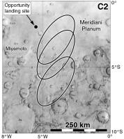
Another bit of Viking history now we are all thinking about the amazing views out past Endeavour crater in the Opportunity thread. After the Viking landing sites had been chosen in 1973 people began to have concerns about their safety. They looked for some extra-safe sites (as determined from earth-based radar) near the equator, the so-called C sites (A sites were at 20 north for the first mission, B sites at 44 north for the second mission. C would be used if A crashed or if all sites at those latitudes looked too rough in Viking images). C1 was just north of Capri Chasma, C3 at Schiaparelli crater, but C2 was at Meridiani. Here's a map showing three possible ellipses described in the minutes of the Landing Site Staff during Viking site certification in 1976. The top one just touched Endeavour crater.
Phil
Posted by: nprev May 29 2009, 12:23 AM
Fascinating (not a word I use lightly), Phil; did not know that.
One can only imagine how the Mars exploration strategy might have evolved had V1 landed in Meridiani on top of a nice piece of sedimentary pavement...
Posted by: Phil Stooke May 29 2009, 01:16 AM
There's a lot of good stuff in those committee minutes. My next step is to go through the Viking landing Site Working Group minutes from c. 1970-1974.
Phil
Posted by: vikingmars May 29 2009, 10:19 AM
Phil
Thanks Phil !
And to complement your good info, here is what was written a while ago + how Meridiani would have looked to the Viking Lander camera.
http://www.unmannedspaceflight.com/index.php?s=&showtopic=4830&view=findpost&p=105769
Enjoy !
Posted by: Phil Stooke Jun 16 2009, 06:37 PM
A good panorama for Viking 2 is hard to find. I have gone through the online CR-ROMs at PDS and extracted everything useful, and combined it here in one panoramic image.
For each camera I took morning and afternoon pans, and for camera 1 also a noon pan. Then, for each camera, I made a composite of the multiple views, with flaws or gaps in one fixed from one of the others. The tricky part after that was to combine Camera 1 and Camera 2. My intention is to mimimize obstructions by spacecraft components and maximize the visible surface, plus to combine the two views of the foreground into a full view of the sampling area. This cannot be done without introducing distortion in this view. Later I will rubbersheet the image to fit proper ground control for a photomap of the sampling field.
Phil
Posted by: nprev Jun 16 2009, 07:41 PM
Everytime I look at the Viking sites I still marvel at how lucky we were. Beautiful work as always, Phil.
Quick question: How did you account for V2's site slope in this view? IIRC the lander had something like an 8-deg tilt, so would have expected a very shallow parabola across the top of the FOV. Was this sort of "washed out" by the distant topography in your rendering?
Just curious, and forgive me if it's a silly question; my abject lack of image processing skills matches my lack of understanding of them!
Posted by: Phil Stooke Jun 16 2009, 08:22 PM
The tilt was already corrected for in the assembled panoramas I worked from. They were made at JPL and saved in a rather chaotic collection of archived files in the PDS. The hard part was finding suitable files to use.
Right now I'm trying to project the pan onto a HiRISE image to make a photomap.
Phil
Posted by: Stu Jun 16 2009, 09:49 PM
Gorgeous pic Phil, great work as usual. I could - and probably will! - stare at that for yonks! ![]()
Posted by: Phil Stooke Jun 17 2009, 03:26 PM
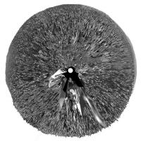
Here's the Viking 2 pan wrapped into a circle with exaggerated horizon relief - greatly exaggerated, or you don't see anything. I did this for Viking 1 a while ago.
Phil
Posted by: mhoward Jun 17 2009, 04:10 PM
Awesome job on both.
Posted by: tedstryk Jun 26 2009, 03:08 PM
Amazing!
Posted by: Phil Stooke Jun 27 2009, 12:40 AM
Thanks! I am doing some improvements to the panorama to get more uniform lighting - I just used the contemporary mosaics, now I'm making my own camera 2 pan with better morning lighting. Meanwhile, also working on step by step arm activity illustrations similar to some posted earlier. I must have Viking 2 finished by the end of July to stay on track.
Phil
Posted by: SpaceListener Jun 27 2009, 05:08 AM
Unique scenary. Surface is very rocky. That leads me to think on how lucky was Viking with landing!
Posted by: vikingmars Jun 29 2009, 09:02 PM
![]()
![]()
![]()
![]()
![]() As a tribute to Phil's gorgeous work, here is a VL2 controlled mosaic made in 2001 for a Mars educational exhibit built for the French section of the Mars Society... Enjoy !
As a tribute to Phil's gorgeous work, here is a VL2 controlled mosaic made in 2001 for a Mars educational exhibit built for the French section of the Mars Society... Enjoy ! ![]()
Posted by: vikingmars Jun 29 2009, 09:16 PM
![]()
![]()
![]()
![]()
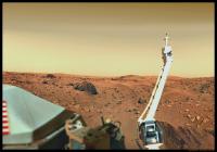
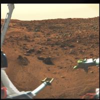
![]() ...and now for VL1 (especially made to show to the public the technical aspects of the robotic arm/soil sampler). Enjoy also !
...and now for VL1 (especially made to show to the public the technical aspects of the robotic arm/soil sampler). Enjoy also ! ![]()
Posted by: nprev Jun 30 2009, 02:25 AM
Those were AWESOME, VM, thanks!!!
Never, ever saw that V1 pan before; the arm was a beast indeed!
Posted by: SpaceListener Jun 30 2009, 02:58 AM
Spectaculars pictures. The VL2 landing is terrific. How lucky was VL2. Thanks Vikingmars.
Posted by: climber Jun 30 2009, 09:26 AM
Merci Olivier... the quality of the panos is absolutely stuning
Posted by: Phil Stooke Jul 1 2009, 03:46 AM
Speaking of Viking... next week I'm at Brown University, going through the papers of Tim Mutch in their archives. I'm looking for the minutes of the Viking Landing Site Working Group and related materials. Should be fun. ![]()
Phil
Posted by: nprev Jul 1 2009, 05:01 AM
Ooo...gotta be some good stuff in there, Phil, happy hunting!
Admit that I'm most curious to know just how close they came to selecting Meridiani as the V1 landing site.
Posted by: Phil Stooke Jul 13 2009, 08:38 PM
OK, back from Providence with lots of goodies.
Nprev - they didn't get close to choosing site C2 - Meridiani. They had three sites at that latitude, Capri, Meridiani and Schiaparelli (C1, C2, C3), but they never considered any but C1 seriously.
C1 was called Capri, but it was not in Capri Chasma, part of Valles Marineris. It was on the plateau north of the canyon. A similar site was considered for Mars '84, an ambitious rover mission.
Phil
Posted by: scalbers Jul 13 2009, 09:30 PM
For each camera I took morning and afternoon pans, and for camera 1 also a noon pan. Then, for each camera, I made a composite of the multiple views, with flaws or gaps in one fixed from one of the others. The tricky part after that was to combine Camera 1 and Camera 2. My intention is to mimimize obstructions by spacecraft components and maximize the visible surface, plus to combine the two views of the foreground into a full view of the sampling area. This cannot be done without introducing distortion in this view. Later I will rubbersheet the image to fit proper ground control for a photomap of the sampling field.
Phil
Phil I assume you worked with hi-res images? For comparison at this MSSS link are some VL2 mosaics (bottom of page). These are later versions of the ones I worked on during my internship at JPL in 1977.
http://www.msss.com/mars/pictures/viking_lander/viking_lander.html
I have just photographic prints/negatives of the earlier versions, unfortunately they aren't in digital form.
Nice to hear you got a chance to look at Tim Mutch's papers. He was certainly a great person to have had the privilege of working with.
Posted by: nprev Jul 13 2009, 11:48 PM
Welcome back, and thanks for checking that out, Phil! ![]()
So, when's the book coming out? Gotta admit that the hindsight gained from everything since Viking makes the project's history even more fascinating. 'There were giants in those days!'
Posted by: Phil Stooke Jul 14 2009, 12:12 PM
My current plan is to submit the manuscript at the end of 2011, for publication a year later. That would be for Volume 1, up to Mars Express. Volume 2 would follow about 3 years later. But a final decision on a 1 or 2 volume format has not been made yet, and if it's a single large volume it will take 5-6 years.
Phil
Posted by: Phil Stooke Aug 10 2009, 01:14 AM
Here's a little goodie from my visit to Brown University earlier this summer (and big thanks to everybody there for the help, both in the archives in the John Hay Library and in the RPIF).
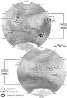
This map shows the first serious effort to pick landing sites for Viking. If you read the NASA history volume 'On Mars', by Ezell and Ezell, those authors mention a meeting late in 1970 when the members of the Viking Landing Site Working Group proposed 'several lists of sites, including six by Carl Sagan'. But Ezell and Ezell don't identify the sites. I hoped to find the committee minutes, among Tim Mutch's papers in the archives. I did get to see his papers, but mostly material on Mars 1984 (a rover mission) plus some interesting personal things about his Himalayan expeditions before the one he died on.
But in the RPIF I found - or rather Peter Nievert found for me - a real gem. Ezell and Ezell had written a much more complete account of the site selection process, in a hand-annotated typescript. It must have been condensed for the later history volume, but this version had all the missing bits in it - very nice indeed. So here is a map of those sites, chosen when the only spacecraft data were from Mariners 4, 6 and 7 (so plotted on a Mariner basemap).
Phil
Posted by: machi Nov 9 2009, 05:40 PM
"High speed" panorama from Viking 1. Its low-res, not so good as from vikingmars (really awesome job!).
But its all around panorama.
Posted by: machi Nov 10 2009, 03:31 PM
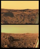
Morning on Mars from Viking 2 lander. First image was transferred to Earth without middle part.
Posted by: scalbers Nov 15 2009, 09:17 PM
http://www.msss.com/mars/pictures/viking_lander/viking_lander.html
I have just photographic prints/negatives of the earlier versions, unfortunately they aren't in digital form.
Nice to hear you got a chance to look at Tim Mutch's papers. He was certainly a great person to have had the privilege of working with.
Here by the way is a montage of the quadrant pairs in the MSSS versions of the VL2 Camera 1 pm mosaic. These are less than the full resolution however they are corrected for the VL2 tilt.
Steve
Posted by: scalbers Nov 15 2009, 09:29 PM
...and the same for camera 2.
As a reminder I have links to the full resolution VL1 mosaics from the JPL photojournal about halfway down in this web page:
https://stevealbers.net/albers/viking.html
Also noted is Calvin Hamilton's mosaic from VL2 (full resolution, corrected for tilt). I had worked on VL2 hi-res mosaics for morning, noon, and afternoon with each camera (as available) so it would interesting to see these all assembled into one place.
Posted by: Stu Nov 15 2009, 11:19 PM
scalbers, Machi - just fantastic work, guys, genuinely thrilling to see those images. I wonder what amazing sights we'd enjoy if we - and by "we" I obviously mean geniuses like you! - went back through the all Viking data and used modern image processing techniques on the lesser-known images...
Posted by: scalbers Nov 16 2009, 01:09 AM
Stu - one "modern" thing I've long been interested in would be to combine low-res color information with the hi-res mosaic intensities. This might look pretty good if the lighting were close enough in each.
Steve
Posted by: Phil Stooke Nov 16 2009, 03:54 AM
All these ideas are very good - and exactly what I was hoping to encourage when I started this thread. I'll dig out some more of my stuff too...
Phil
Posted by: 4th rock from the sun Nov 16 2009, 10:51 AM
Steve
I've tried it and it's very hard to do. You have to correct the lowres color for tilt and camera distortions. Then, light doesn't match at all most of the time.
My guess is that the best approach would be to reconstruct a full mosaic using only color images with consistent lighting and at the best possible resolution.
Posted by: scalbers Nov 21 2009, 02:41 PM
Yes I can appreciate the hi-res color mosaics might be challenging, yet I believe the effort may be worthwhile. The hi-res is three times the angular resolution of the low-res so there is a significant gain in detail (9 times the pixels). I recall back in 1977 that this type of combining was done at least in the context of individual hi-res images and it looked pretty good. It was done at JPL/IPL using VICAR so any geometric corrections would have been doable (e.g. with the GEOCAM program).
I wonder if the original imagery can still be reprocessed with http://www-mipl.jpl.nasa.gov/external/vicar.html somehow. Otherwise something like IDL or other languages can fairly easily correct for camera tilt. The other camera distortions might require something like what VICAR/GEOCAM did if they are significant. If there are offsets in shadows then maybe a fancier program can be put together that would use "nearby" color information when needed.
Looking online, here are some http://nssdc.gsfc.nasa.gov/photo_gallery/photogallery-mars.html#surface from Mary A. Dale-Bannister.
Here's http://www.astrosurf.com/nunes/explor/viking/12d089cal.jpg from http://www.astrosurf.com/nunes/explor/explor_vik.htm who also worked with Ted Stryk's super-resolution images as mentioned in post #5 of this thread.
The black and white mosaics do have fairly consistent lighting, so I'm checking whether there are any wide angle panoramic color images (or mosaics) from similar times of day where this can be attempted. Using Phil's PDS link in post #19 I was able to construct this fairly wide angle low-res color view. I can see the lighting and geometry issues when matching to the hi-res mosaic. The missing vertical lines need to be filled in as well - there used to be a VICAR program called FILLVL to do this.
That's what I've found so far.
Steve
Posted by: Phil Stooke Jan 21 2010, 06:34 PM
Can anyone help me with this? I'm trying to find out how many images were taken by Viking Orbiter 1 and how many by Viking Orbiter 2. All I can find is the combined value.
Phil
Posted by: elakdawalla Jan 21 2010, 06:38 PM
Sorting the CUMINDEX.TAB file for Viking Orbiter on SPACECRAFT_NAME, I get
34918 VIKING_ORBITER_1
15582 VIKING_ORBITER_2
Does this sound reasonable?
Posted by: Phil Stooke Jan 21 2010, 07:00 PM
That was quick! Thanks very much. Yes, very reasonable because VO1 lasted twice as long as VO2.
Phil
Posted by: Phil Stooke Jan 21 2010, 07:07 PM
Just to follow up, that number may not include some approach views, calibration images, satellite and ring search images etc. (Yes, there was a satellite and ring search at some point fairly late in the mission) - but it seems to match the archived image totals - as of course the source would suggest it should. I have a suggestion that 1039 images are not included in those totals. That may also include some which were either lost in transmission, and lost or unreadable on the old tapes.
Phil
Posted by: elakdawalla Jan 21 2010, 07:36 PM
It includes the following:
547 VO1 images targeted at "STAR" or "MARS" during cruise -- there's your approach and calibration images;
8 VO1 images of the bicentennial emblem;
I don't see any VO2 approach "STAR" images, but there are the PRE_ORBIT images of MARS, 91 of them.
One thing I know for sure that the PDS archive does not include is the Earth-Moon departure images. I tried to inquire with someone at the geosciences node about these but I don't think she understood that I was looking for original data, not cruddy old press-release images; she didn't seem interested in pursuing them.
You can explore the file for yourself here:
ftp://pdsimage2.wr.usgs.gov/cdroms/viking_orbiter/vo_1064/index/ (cumindex.tab and cumindex.lbl)
--Emily
Posted by: Phil Stooke Jan 21 2010, 07:51 PM
Thanks again!
Phil
Posted by: Phil Stooke Jan 28 2010, 06:21 PM
This is an image that, as far as I know, has never been compiled or published before. Earlier I posted mosaics of images taken underneath the two Viking landers using small mirrors on the sampler arm. This is another one. It's from Viking Lander 2, showing images taken over three sols far apart in the mission, looking at the area near Footpad 2. This footpad carried a temperature sensor. They needed to know if it was buried or not - Viking 1's was buried, this one is not. The sensor is near the right end of the mosaic, but I couldn't tell you which object it is.
Phil
(EDIT: I changed 'left' to 'right' in the last sentence - it's correct now. I forgot I had flipped it to remove the mirror reversal.)
Posted by: lyford Jan 28 2010, 07:37 PM
Very cool - I have been transported in time AND space! ![]()
Posted by: vikingmars Jan 30 2010, 12:05 AM
Phil, I'm pretty sure : this is the temp sensor
Posted by: vikingmars Jan 30 2010, 12:07 AM
...And by the way, phil : you did a GREAT work ! ![]()
![]()
![]()
![]()
![]()
Posted by: JohnVV Jan 30 2010, 09:03 AM
i would say that the temp sencer is this ( in red ) and it's cable ( in green )
[attachment=20535:vik2_foo...d_images.png]
Posted by: Phil Stooke Jun 1 2010, 03:51 PM
Here is the comparable mosaic of images of the footpad temperature sensor from Viking 1. This sensor, on Footpad 2, was found to be buried (or partly buried?) in the fine drift material which covered the footpad itself. Like the Viking 2 mosaic, I don't think this was ever previously assembled like this and published. The images were taken on sols 40, 203 and 520.
Phil
Posted by: Vanden Dec 11 2010, 04:18 PM
Hello,
Thank you all, especially those that process and share their pictures !
Oliver, The Viking High-resolution panorama are magnificent !!
The few Viking Lander high-resolution color images of good quality that I saw were also Olivier :
VL1:
http://vandenk.free.fr/VLHDColor/visions-mars07-1280x1024.jpg
http://vandenk.free.fr/VLHDColor/visions-mars07-1440x900.jpg
http://orbitmars.futura-sciences.com/galerie_missions/img/goursac/Goursac-Mars8.jpg
http://vandenk.free.fr/VLHDColor/visions-mars08-1280x1024.jpg
http://vandenk.free.fr/VLHDColor/visions-mars08-1440x900.jpg
http://orbitmars.futura-sciences.com/galerie_missions/img/goursac/Goursac-Mars11.jpg
http://vandenk.free.fr/VLHDColor/pano_sunset.jpg
http://vandenk.free.fr/VLHDColor/evening2.jpg
http://www.unmannedspaceflight.com/index.php?act=attach&type=post&id=1385
VL2 :
http://orbitmars.futura-sciences.com/galerie_missions/img/goursac/Goursac-Mars15.jpg
http://orbitmars.futura-sciences.com/galerie_missions/img/goursac/Goursac-Mars13.jpg
http://vandenk.free.fr/VLHDColor/visions-mars09-1280x1024.jpg
http://vandenk.free.fr/VLHDColor/visions-mars09-1440x900.jpg
There are also "old" cited in post # 61:
http://nssdc.gsfc.nasa.gov/photo_gallery/photogallery-mars.html#surface
But quality is not perfect ...
So I tried (for testing) the assembly of the luminance of the panorama of Olivier (post # 41) and the color of the Scalbers image (Post # 61), it is not perfect for several reasons:
- There is not color image with the arm in this position
- Several holes and pebbles are moved between the two.
- The sun is not at the same position.
But in a small piece, This is not bad :
now I try to make a low-resolution color panorama which corresponds more to high-resolution panorama ...
To be continued ...
Posted by: ElkGroveDan Dec 11 2010, 04:25 PM
To be continued ...
Thanks for sharing your nice work Vanden. Next time please post your image as an attachment rather than a link to the full image. (your post above has been edited to do so.) A lot of people use slow connections or browse with their handhold phones and these large images can present a problem. Best to give people the choice of viewing the entire image.
Posted by: Vanden Dec 11 2010, 04:35 PM
Ok, I had not seen ...
Here is my low resolution color panorama :
Posted by: nprev Dec 13 2010, 01:14 AM
Beautiful. Thanks!
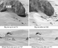
Always love looking at Big Joe...wonder how he looks now. IIRC, V1 observed that a small part of his sand-cap fell off at one point.
Posted by: Phil Stooke Dec 13 2010, 03:42 AM
Not his cap but the drift at his base!
Phil
Posted by: nprev Dec 13 2010, 04:13 AM
Was it? I always thought that a piece of the cap fell off & impacted the base dune, but by now I should know better than to trust a 30+ yr.-old memory.
(My God...I'm old now!!!) ![]()
Thanks, Phil. ![]()
Posted by: Phil Stooke Dec 13 2010, 05:01 AM
The only visible change was at the base, no change on top, so that can't be right. I'll post pics tomorrow.
Phil
Posted by: nprev Dec 13 2010, 06:17 AM
Oh, I believe you, man; love to see the pics!
As I recall, NASA stated that this was the first example of small-scale natural erosion on another world ever observed (actually, unless the MERs or Pathfinder saw something as well it might still be the only one. Not sure if the sublimation seen by Phoenix counts, and can't call the polar landslides "small-scale".)
Posted by: ElkGroveDan Dec 13 2010, 08:08 AM
Regardless of the cause, the fresh gullies identified with MGS probably should be included, and some of them are very small. I guess it's all about where you draw the line and what falls in the category of erosion. Certainly the disappearing rover tracks is a form of natural erosion.
Posted by: Phil Stooke Dec 13 2010, 12:13 PM
Viking 1 saw a second similar change later, as well. Spirit saw the little dust ripples move during a dust storm, with a nice animation posted on here at the time. We also saw tracks filling in with dust where we crossed old tracks (Home Plate, exiting Endurance, etc.) Pathfinder wasn't on the surface long enough to catch anything, and normally the MER rovers were not in one place long enough to see any changes.
Phil
Posted by: Phil Stooke Dec 13 2010, 02:43 PM
Here are the two Viking 1 changes with a little bit of super-resolution to sharpen them. This is from the forthcoming Mars Exploration atlas - first draft now finished.
Phil
Posted by: Phil Stooke Dec 13 2010, 08:42 PM
I should add that the Viking Lander imagery is ripe for re-analysis, looking for smaller overlooked changes. It can be tricky getting the lighting similar enough, but there's lots to do here.
Phil
Posted by: nprev Dec 14 2010, 01:49 AM
Awesome. I forgot all about the Whale slump.
Thanks, Phil; anxiously awaiting publication of your atlas!!! ![]()
Posted by: Phil Stooke Jan 13 2011, 06:03 PM
Here's another comparison image showing changes at the VL1 site:
Conical Piles 2, 3 and 5 were constructed to see if wind would erode them during the mission. In the long automated mode imaging period late in the mission, one of the targets they covered was this area with three soil piles. Sure enough, more than 2000 sols into the mission, all three piles were found to have disappeared. Ray Arvidson et al. described the change in a paper in Science in 1983.
Phil
Posted by: Stu Jan 13 2011, 06:22 PM
That's fascinating Phil, thanks. I honestly wasn't aware they'd even done that.
Posted by: scalbers Jan 15 2011, 11:45 PM
Vanden, very nice to see your efforts as I'm catching up on this thread. Glad to see the lowres / hires combination is working. Seeing all the details that Viking showed, and in color really does better justice to the imagery.
Posted by: vikingmars Jan 17 2011, 05:21 AM
How nice Vanden !
To help you, here are some versions I made in 2001 extracting the colors from a low-res (BLU, GRN and RED diodes) mosaic and paste them on the b&w hi-res BB3 & BB4 diodes mosaic (one of the versions you know already). For the "Sandy Flats" pic (the one you are working on), was added a low-res BLU diode "sky dynamics" image above the meteorological mast (pic taken earlier).
=> Your results show really good improvements in color quality and paste... Congratulations to you !
Posted by: vikingmars Jan 17 2011, 08:49 PM
...And another one, done using the same techniques, and just found in my archives. Enjoy too ! ![]()
Posted by: eoincampbell Jan 18 2011, 01:43 AM
Tremendous, I really dig that last one... ![]()
... thanks for posting...
Posted by: Vanden Feb 23 2011, 12:10 AM
Thank you for these images and explanations.
I like see "new" images of old missions !!
Here is the complete panorama :http://infonetservices02.chez.com/VL1_Cam1_Color_HD.jpg

Posted by: Oersted Feb 23 2011, 09:35 AM
Wauw! to that complete panorama, new desktop!
Posted by: machi Feb 23 2011, 11:15 AM
Finally full size, high-res, color panorama from Viking. Spectacular! ![]()
Posted by: vikingmars Feb 26 2011, 09:25 PM
Thanks Vanden : how nice to see my old b&w mosaic now in full colors, thanks to your wonderful work. You did it greeeaaaat !!!
Posted by: Phil Stooke Jul 7 2011, 05:55 PM
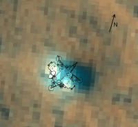
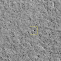
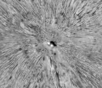
A little experiment. This is a super-resolution composite of five HiRISE images of Viking Lander 2.
Phil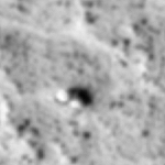
Posted by: ElkGroveDan Jul 7 2011, 06:28 PM
Wow. That is sharp.
Posted by: vikingmars Feb 23 2013, 09:09 PM
When I processed and built the Curiosity dusk panorama
http://www.unmannedspaceflight.com/index.php?s=&showtopic=7591&view=findpost&p=198007 ,
I knew that a similar imaging experiment was done during the Viking Lander 1 mission.
It was ordered by Carl Sagan himself who was a Member of the Lander Imaging team and who wanted to see how the Martian landscape looked like at dusk...
Here is his panoramic picture taken on Sols 163 and 164 (BB4 diode), fully processed and colorized using the real colors retrieved from images taken at sunset.
A tribute to Carl Sagan and to the Planetary Society. Enjoy ! ![]()
PS : The darkest band in the sky close to the horizon is real : its shows the shadow of the planet Mars reaching out in space 180° away from the Sun...
Posted by: Tom Dahl Feb 24 2013, 01:51 AM
That's a very nice result! Thanks for working on it.
Posted by: Phil Stooke Feb 24 2013, 06:57 PM
Very nice, Olivier!
Phil
Posted by: vikingmars Feb 24 2013, 09:37 PM
Thanks a lot Phil and Tom for your kind comments.
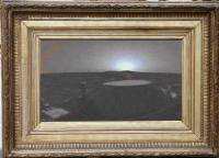
Now as a tribute to your superb work, here is, fully reconstructed, the famous 1976 "Viking Sunset" picture embedded inside a late-afternoon panorama with colors fully corrected also... Enjoy my friends ! ![]()
Posted by: Ant103 Feb 24 2013, 11:53 PM
Ahhh, that's very nice Olivier ! ![]() Thanks for doing this work !
Thanks for doing this work !
With Viking pictures, there is something mythic, legendary, that the other landers on Mars don't have IMHO. We can truely sense the feeling of the wind of exploration, the very beggining of things to come. This is images like these -processed by you Olivier- that gave me chills down my spine, and the envy later to process my own pictures. Thank you for doing this ![]() .
.
Posted by: vikingmars Feb 25 2013, 10:15 AM
Many thanks Ant103.
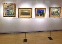
...and here is the famous original painting from Monet and from which the Viking image was made : "Plaine de Chryse, coucher de soleil" seen in the collections at the Marmottan Museum in Paris.
Enjoy !
Posted by: tasp Feb 25 2013, 02:40 PM
I think the value of that razor sharp pan is considerable. Seeing the entire area in context to itself is really different than in seeing just segments of it. My impression all along was that landing site was pretty level all around, but it isn't. Looking at the whole thing you really see the dips and rises and and elevation changes and appreciate just how much topography is there. The site is FAR more interesting than it was 30+ years ago, LOL.
Posted by: vikingmars Jan 1 2014, 06:18 PM
A frosty view of the Red Planet to wish you an Happy New Year 2014 to you all at the UMSF Forum
Posted by: Phil Stooke Jan 2 2014, 02:34 PM
Thanks! It's nearly as cold as Mars here in Ontario this morning.
Phil
Posted by: Glevesque Dec 2 2014, 05:51 PM
Viking 1
http://nousnesommespasseuls.xooit.com/image/96/5/7/0/figure-18-3e09e54.jpg.htm
Viking 2
http://nousnesommespasseuls.xooit.com/image/97/4/e/1/figure-23-3e09e5f.jpg.htm
Posted by: 4th rock from the sun Dec 2 2014, 11:54 PM
I like your panorama site / book. I really hope you get it published.
Posted by: Glevesque Dec 3 2014, 04:06 PM
Merci 4th rock from the sun,
J'ai les dates (Sols) pour les expériences "Labeled Release" des Vikings, et je cherches celles pour les expériences de "Gas Exchange" et "Pyrolytic Release". J'aimerais bien pouvoir ajouter un tableaux qui résumerais bien toutes cette série d'expérience dans le livre et à la fin du chapitre sur les Panoramiques des Vikings !
Depuis le temps que je cherches ces informations sans les trouver !!!
________________________________________________________
Thank you 4th rock from the sun,
I have dates ( Soils) for experiments " Labeled Release" of the Vikings, and I searched for those experiences " Gas Exchange " and " Pyrolytic Release" . I wish I could add tables summarize all of this series much experience in the book and at the end of the chapter on Panoramic Vikings !
Since the time I searched without finding this information !!!
Posted by: Phil Stooke Dec 3 2014, 07:04 PM
This gives some Gas Exchange information:
http://onlinelibrary.wiley.com/doi/10.1029/JS082i028p04669/pdf
(if you have access)
And this has information on the Pyrolytic Release (Carbon Assimilation) experiment:
http://onlinelibrary.wiley.com/doi/10.1029/JS082i028p04659/pdf
Also, I have some information in text and tables in my International Atlas of Mars Exploration.
Phil
Posted by: sittingduck Jan 15 2015, 12:51 PM
Does anybody know where I could learn what the final orientation of the Viking 2 high-gain antenna and surface sampler boom housing were when its batteries died?
I am attempting to align a 3D-model of the lander created by n1ckdrake with PSP_001976_2280. Knowing the position of these moving parts would help make the match.
I have tilted the lander 8.2° down in the direction specified by the "Generalized Working Map of Sample Field" and matched the virtual camera orientation with the emission angle of HiRise.
Attached is a current best-fit. Any suggestions for improvements?
Posted by: Phil Stooke Jan 15 2015, 02:19 PM
The sampler was last used on sol 958, and as far as I can tell it was fully retracted with the housing facing pretty much straight ahead. Looking quickly at images taken after that date, that is my impression.
I don't know about the HGA, but if it ran searches for Earth after loss of communication (which I assume might be possible) we wouldn't know its orientation. It is small enough that it's not going to make any difference to your fit.
Phil
Posted by: alex_k Jan 18 2015, 04:02 PM
I processed five HiRise images of Viking 2 landing site: PSP_001501_2280, ESP_016665_2280, ESP_037974_2280, PSP_001976_2280, PSP_002055_2280.
Source part of PSP_001501_2280:
The result of x8 superresolution:
(uploads limit exceeded...)
Posted by: alex_k Jan 20 2015, 03:51 PM
Comparing with a model (found https://picasaweb.google.com/113792041573871319555/VikingLanderDiagrams?feat=directlink&noredirect=1):
Two cameras seem clearly visible, HGA seems to be turned. Probabliy legs are drifted by sand.
Posted by: RachelVL3 Nov 1 2015, 04:34 PM
Phil and others interested in Viking, we are (slowly) curating the largest (and growing) collection of original Viking artifacts, documents, images, etc...
The purpose is to educate the public AND provide access to preserve the history, engineering, science, and artifacts, and to prevent further loss and inaccessibility, of the same.
You can see a tiny bit of our curated materials on our website, Facebook and Twitter.
Let us know if you have particular interest areas and keep in touch. We will showcase individuals work using Viking materials, as well as making the originals available for research and non commercial use.
Rachel Tillman
Daughter of Viking, James E. Tillman
Founder of The Viking Mars Mission Education and Preservation Project
http://www.thevikingpreservationproject.org
https://www.facebook.com/VikingMarsMission
https://twitter.com/MarsVikingTeam
https://www.tumblr.com/blog/marsvikings
Inspire - Educate - Collaborate
Posted by: JohnVV Nov 1 2015, 07:07 PM
for those using "No-script"
h t t p : / / w w w . thevikingpreservationproject.org
is using a third party site( h t t p s : / / sharepointonline.com )
this is a unreachable site -- no web site at that address
this unknown site MUST be allowed to run software on your computer in order for thevikingpreservationproject site to work
there are no malicious security warnings listed for sharepointonline but there is also no information about what they DO or what software they run in your browser
other than something to do with maybe Microsoft Office 365
Posted by: RachelVL3 Nov 1 2015, 08:18 PM
h t t p : / / w w w . thevikingpreservationproject.org
is using a third party site( h t t p s : / / sharepointonline.com )
this is a unreachable site -- no web site at that address
this unknown site MUST be allowed to run software on your computer in order for thevikingpreservationproject site to work
there are no malicious security warnings listed for sharepointonline but there is also no information about what they DO or what software they run in your browser
other than something to do with maybe Microsoft Office 365
Hi,
We are new to this forum. Apologies for confusion or if I misposted the url. The website is set up using Sharepoint and Office 365. It requires the full url http://www to resolve. Not elegant, but more secure than other options.
You can google or bing search on our name if you prefer. "The Viking Mars Missions Education and Preservation Project".
We are an all volunteer organization committed to preserving Viking. We have done oral history interviews with more than 80 Vikings across the country (and a few internationally), among other efforts.
Please dont hesitate to ask questions.
Posted by: vikingmars Nov 2 2015, 02:36 PM
We are new to this forum. Apologies for confusion or if I misposted the url.
The website is set up using Sharepoint and Office 365. It requires the full url http://www to resolve. Not elegant, but more secure than other options. You can google or bing search on our name if you prefer. "The Viking Mars Missions Education and Preservation Project".
We are an all volunteer organization committed to preserving Viking. We have done oral history interviews with more than 80 Vikings across the country (and a few internationally), among other efforts.
Please dont hesitate to ask questions.
Thanks a lot RachelVL3 for those nice posts, much appreciated !!!
Posted by: Vanden Jan 12 2016, 03:18 PM
Happy New Year !
In the beginning of 2016 I suggest you rediscover the Viking Lander 2 site in high resolution and color !
Viking Lander 2 Camera 1
NOON HIGH RESOLUTION COLOR MOSAIC :
This project failed well never produce : I really totally/completely underestimated the time needed !!!
EDIT
21i091 HIGH RESOLUTION COLOR (Frost) :
EDIT2
Viking Lander 2 Camera 2
(Native) HIGH RESOLUTION COLOR (Mosaic) :
Posted by: Vanden Jan 12 2016, 10:33 PM
I add links to all high-resolution color images :
VL1 (Olivier):
http://www.unmannedspaceflight.com/index.php?act=attach&type=post&id=1377 http://www.unmannedspaceflight.com/index.php?act=attach&type=post&id=1385 http://www.unmannedspaceflight.com/index.php?act=attach&type=post&id=1390
http://www.unmannedspaceflight.com/index.php?act=attach&type=post&id=23664 http://www.unmannedspaceflight.com/index.php?act=attach&type=post&id=23665 http://www.unmannedspaceflight.com/index.php?act=attach&type=post&id=23672
http://www.unmannedspaceflight.com/index.php?act=attach&type=post&id=29831 http://www.unmannedspaceflight.com/index.php?act=attach&type=post&id=29840 http://vandenk.free.fr/VLHDColor/visions-mars07-1440x900.jpg
VL2 (Olivier) :
http://orbitmars.futura-sciences.com/galerie_missions/img/goursac/Goursac-Mars15.jpg
http://orbitmars.futura-sciences.com/galerie_missions/img/goursac/Goursac-Mars13.jpg
http://vandenk.free.fr/VLHDColor/visions-mars09-1280x1024.jpg
http://vandenk.free.fr/VLHDColor/visions-mars09-1440x900.jpg
There are also "old" cited in post # 61:
http://nssdc.gsfc.nasa.gov/photo_gallery/photogallery-mars.html#surface
But quality is not perfect ...
Two other images of Ted Stryk :
http://planetimages.blogspot.fr/2011/04/view-from-viking-1.html
http://planetimages.blogspot.fr/2014/07/thirty-eight-years-ago-today-viking-1.html
Posted by: vikingmars Jan 13 2016, 12:14 PM
In the beginning of 2016 I suggest you rediscover the Viking Lander 2 site in high resolution and color !
Yes it's time -consuming. But your work is very nice indeed.
Thanks a lot Vanden to share it with us and congratulations !!!
Posted by: scalbers Jan 17 2016, 08:24 PM
Nice to see Vanden's persistence and new result with the VL2 noon color hi-res panorama!
Posted by: Vanden Jan 29 2016, 01:46 AM
Thanks !
I edited my post "NOON HIGH RESOLUTION COLOR MOSAIC" to add a new high resolution color image : http://vandenk.free.fr/VLHDColor/21i091_HIGH_RESOLUTION_COLOR.jpg
Although modest in size it is a part of the famous/historical/mythical low-resolution color image (official version): http://photojournal.jpl.nasa.gov/jpeg/PIA00571.jpg
For information here's how raw images (mainly used) are :
- Low-resolution color: http://vandenk.free.fr/21i093RAW.jpg
- High-Resolution black & white : http://vandenk.free.fr/VLHDColor/21i091RAW.png
My Low Resolution version (21i090+21i093+21d224-225-226) :
Posted by: vikingmars Jan 29 2016, 11:22 AM
I edited my post "NOON HIGH RESOLUTION COLOR MOSAIC" to add a new high resolution color image : http://vandenk.free.fr/VLHDColor/21i091_HIGH_RESOLUTION_COLOR.jpg
Although modest in size it is a part of the famous/historical/mythical low-resolution color image (official version): http://photojournal.jpl.nasa.gov/jpeg/PIA00571.jpg
How nice Vanden ! Thanks a lot !
Posted by: Vanden Feb 21 2016, 12:49 AM
Viking Lander 2 Camera 2 Low Résolution FROST Color Images :
http://vandenk.free.fr/VLLRColor/22i067_netoyee-calibree.png
http://vandenk.free.fr/VLLRColor/22i109_netoyee-calibree.jpg
Panorama 22i103-104-105-109 (Sol 1028, 1030 and 1050 between 11:34 and 12:40) :
http://vandenk.free.fr/VLLRColor/22i103-104-105-109(Frost).jpg
I used a low-resolution panorama of Oliver (thank) as a basis for color calibration.
Viking Lander 2 Camera 2 Low Résolution SKY AT SUNRISE :
http://vandenk.free.fr/VLLRColor/SKY-AT-SUNRISE-(22b023).jpg
http://vandenk.free.fr/VLLRColor/SKY-AT-SUNRISE(22h093).jpg
Viking Lander 1 Camera 2 Low Résolution SKY AT SUNRISE :
https://upload.wikimedia.org/wikipedia/commons/d/d7/12e189%28Sol379-7.84%29.jpg
Posted by: vikingmars Feb 22 2016, 09:09 AM
Thanks a lot Vanden for those good processings of yours ! How NICE they are ! Your 'frost' pan is gorgeous
The picture you show ('Low Resolution SKY AT SUNRISE') is a very interesting one indeed !
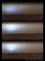
It is the 1st of three images taken more than ten minutes apart on Chryse Planitia by Viking Lander 1 on Sol 379 at 07:50 a.m, 08:03 a.m. and 08:15 a.m. respectively (see the 'triptych' herewith).
The fog had settled in over the entire area and it was dense enough so that the Sun was not visible above the horizon until the last image where it made a shy appearance (elevations respectively of 0.0°, 2.7° and 5.4°).
Like on Earth, sunrise on Mars often sees frost and patches of fog and low clouds made of water ice crystals.
These images were the first direct, visible evidence of water exchange (moisture) between the Martian surface and its atmosphere.
Sometimes, the cold nighttime temperatures lead to saturation of water vapor with fog formation that extends to altitudes of 60 m (97 feet) to 80 m (262 feet) above the surface during the night.
Usually, the fog disperses within two hours after sunrise.
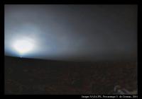
About your good idea of processing VL2's nice Sol 631 sunrise, here is the full story of this picture : the goal was then to capture the blue aureole of the Martian sky above the horizon.
So, the Viking Lander Imaging Team members programmed camera # 2 to avoid imaging the Sun itself and the risk of damaging the delicate sensors.
But, the timing of the sequence was calculated without enough margin. When the camera started to record the scene, the Sun was not yet visible.
But when the mirror scanned the place where the Sun had to be, this one had just popped up over the horizon !
This small inaccuracy resulted in the making of one of the most ‘iconic’ picture ever recorded by the Viking Landers : the first picture showing a sunrise on Mars.
Please, note that the banding in the sky is an artifact produced by the subtle brightness levels that cannot be accurately captured by the camera imaging scan system.
Also, some oblique delicate wispy markings in the sky crossing the aureole are thin cirrus clouds made of small water ice particles and believed to be drifting at an altitude of 10 to 15 km (6.20 to 9.30 miles) above the surface.
This picture was the very first to capture Martian clouds from the surface.
At the lower right of the picture, part of the Lander’s leg #3 support structure can be seen (herebelow here is my version)
Posted by: Vanden Feb 22 2016, 12:07 PM
Thank you for the information !
Small correction my Viking Lander 1 Camera 2 'Low Resolution SKY AT SUNRISE' 12E189 is the second of three images taken more than ten minutes apart on Chryse Planitia by Viking Lander 1 on Sol 379 at :
12E188 : 07:38
12E189 : 07:50
12E190 : 08:02
I have long wondered what is the white "spot" in the sky in 12e190 picture !!!
In all first I thought is noise (the sun is not visible 12 minutes earlier) but it's too big and too concentrated for make this possible.
I also thought the sun (see a star) but the sun should overexpose the sensor and should have been visible 12 minutes earlier ...
But thanks to your explanation, all become more understandable ! Thank you !
Also thank you for your version of the 22H093 picture (and the explanation), I am inspired me to correct my version (minimization of overexposure in the blue and green channel).
The link remains the same (see my previous post)
Posted by: vikingmars Feb 22 2016, 03:28 PM
===> Yes ! Congratulations : this is it !
Posted by: Vanden Mar 2 2016, 01:48 AM
Panorama Viking Lander 2 Camera 2 in native High resolution colors :
- http://vandenk.free.fr/VLHDColor/HIGH-RESOLUTION-COLOR-RAW.jpg
- http://vandenk.free.fr/VLHDColor/HIGH-RESOLUTION-COLOR.jpg
Posted by: Vanden Mar 5 2016, 12:10 AM
I made a nice http://vandenk.free.fr/Anim_HTML5Canvas.html that shows the different modes of the camera :
- Low Resolution Color (NOON SEVEN MULTISPECTRAL FILTER MOSAIC 22a190) @ 600%
- High Resolution Color (HIGH RESOLUTION COLOR 22b-089-100-103) @ 200%
- High Resolution Black and white (for luminance) and High Resolution Color (for color) (NOON MOSAIC 22b057.bb1) @ 200%
Here also the first frame of NOON MOSAIC 22b057.bb1 panorama with the color layer of (Native) HIGH RESOLUTION COLOR (Mosaic) panorama : http://vandenk.free.fr/VLHDColor/22b057BB1&HighColorX2.jpg
I think the 2/3 (right) of NOON MOSAIC panorama is feasible with the same quality ... for the rest it will be much more complicated !
Posted by: Vanden Apr 11 2016, 08:37 PM
Hello,
I made a website to present my images: http://www.astrosurf.com/marsimages/VikingLander2.htm
There are also all raw panoramas of viking lander 2 camera 2: http://www.astrosurf.com/marsimages/VikingLander2RAW.htm
Posted by: Antdoghalo May 1 2021, 06:04 PM
Phil
Sorry to bring up a zombified Martian post but, do you by chance have separate images of these polar projections for both landers? I'd like to use them in my Google Earth project.
Posted by: Phil Stooke May 1 2021, 08:11 PM
Hi - do you mean the polar projections themselves or the versions reprojected to a HiRISE base?
Phil
Posted by: Antdoghalo May 1 2021, 08:30 PM
Polar mapped on top of the HiRISE base.
Posted by: Phil Stooke May 5 2021, 10:47 PM
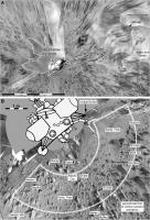
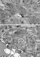
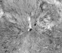
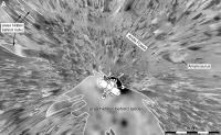
OK, I am posting four images illustrating this mapping, two for each lander. Spread over 3 posts.
Phil
Viking 1 close-up:
Posted by: Phil Stooke May 5 2021, 10:54 PM
OK... over 2 posts - the first two were combined into one.
Phil
Posted by: Antdoghalo May 6 2021, 04:23 PM
That is epic! You have a lot of skill doing this! Could you post them separately so I can use them as overlays for part of my Google Earth project?
Posted by: Phil Stooke May 6 2021, 06:01 PM
Hi - it should be easy to crop each one as needed. They are in pairs because they had to fit the pages of a book. Try cropping yourself first, I will help if you can't do it.
Phil
Posted by: Phil Stooke May 13 2021, 02:22 AM
At Antdoghalo's request I will post maps like these for some other sites, but as they are not Viking I will post them under 'Martian Cartography'.
Phil
Posted by: Glevesque Jun 25 2023, 02:43 PM
Hi Phil, do you have a link for the topic 'Martian Cartography'
Posted by: Tom Tamlyn Jun 25 2023, 03:42 PM
I suspect that Phil means this:
Unmanned Spaceflight.com > Mars & Missions > Mars > Martian Cartography
http://www.unmannedspaceflight.com/index.php?showtopic=2743
Powered by Invision Power Board (http://www.invisionboard.com)
© Invision Power Services (http://www.invisionpower.com)
