Printable Version of Topic
Click here to view this topic in its original format
Unmanned Spaceflight.com _ Past and Future _ HiRISE and Mars Polar Lander
Posted by: Sunspot Dec 6 2006, 02:05 PM
Looking at the images of the Spirit/Opportunity landing site, it seems many of the features such as tracks and rocket blast markings have faded considerably often to the point of being invisible in the nearly three years since landing.
This had me thinking about the MGS images taken in the hope of finding MPL. Initially it was reported that MGS had spotted the lander, one image had a white spot/streak interpreted as the parachute and a dark patch with a spot in the centre not too far off, taken to be the blast zone of the rockets with the lander in the centre.
However another image taken 5 years later seemed to discount this theory - the features had faded or changed significantly. BUT, seeing how much the rover sites have changed in an even shorter time, wouldn't the same happen to the MPL site in 5 years - perhaps to an even greater degree with the more extreme seasonal changes at that location. Also, the latest HiRISE images show just how difficult it has been to spot the landers on the surface with MGS, the Viking sites in particular.
I hope HiRISE takes another look at this spot.
Mars Polar Lander NOT Found, MSSS article:
http://www.msss.com/mars_images/moc/2005/10/17/
Posted by: Zvezdichko Dec 13 2007, 09:59 AM
Digging up this thread. The Sun has returned to the south pole so maybe it's time to search for the Mars Polar Lander.
I wonder how climate changes described in an article yesterday have affected the hardware of MPL.
Posted by: elakdawalla Dec 13 2007, 04:55 PM
I think it's a good idea to collect links to HiRISE images that cross the MPL landing ellipse. For starters, here are the MOC pages that describe the search and show the search region:
http://www.msss.com/mars_images/moc/12_99_MPLsearch/index.html
http://www.msss.com/mars_images/moc/1_24_00_polarlander/index.html
http://www.msss.com/mars_images/moc/oct_2000_sampler/polar_site/index.html
These images unfortunately do not include any latitude/longitude information. However, here's a page from the MOLA team that does, suggesting that a useful box to consider is 75 to 77 south and 164 to 166 east.
http://ssed.gsfc.nasa.gov/tharsis/mpl.html
--Emily
Posted by: slinted Dec 13 2007, 11:52 PM

So far, it looks like there are at least 3 images inside that box:
http://hirise.lpl.arizona.edu/PSP_002846_1040 color bands available (and a little whoops in the label..."Possible Phoenix Lander Landing Site"?)
http://hirise.lpl.arizona.edu/PSP_003690_1035 red filter
http://hirise.lpl.arizona.edu/PSP_004336_1035 red filter, heavily clouded over
Posted by: Charles Feb 7 2008, 08:29 PM
I am wondering if the MPL (Mars Polar Lander) did not crash but sank into the the ice. I read as one of the possible causes was that the landing sensor thought it landed.
Just my small thought.
Posted by: Zvezdichko May 11 2008, 09:24 AM
Help them find Mars Polar Lander!
article written by Mr. Phil Plait : http://www.badastronomy.com/bablog/2008/05/10/help-find-mars-polar-lander/
and the publication on HiRISE website: http://hirise.lpl.arizona.edu/HiBlog/?p=134
Regards,
Svetlio
Posted by: Sunspot May 12 2008, 10:45 AM
I do find it odd that absolutely no trace of Mars Polar Lander has been spotted within HiRISE images so far. If the failure scenario proposed by the investigation team is correct, the parachute deployed successfully, the heatshield was jettisoned and the lander separated from the backshell. All of those components are VERY striking in images of the MER landing sites, in fact you can see them without having to view the images at a "one to one" scale, you certainly didn't need to search for them.
How would several Martian polar winters have affected those components visibility, would they "weather " differently to those at lower latitudes such as Spirit and Opportunity, is that the reason they haven't been spotted I wonder? I suppose it's also possible that something else went wrong during EDL - the parachute failed to deploy for example.
Posted by: Phil Stooke May 12 2008, 11:01 AM
Yesss... but we knew where those sites were! The descent images brought us very close, and the surface images clinched it. Here, we have no clue where to look across those vast images. Well, a clue, the target ellipses. But there's a lot of territory to search.
Phil
Posted by: ugordan May 12 2008, 11:02 AM
Has the entire landing ellipse even been covered by HiRise? If the image on the blog linked to above is anything to go by, about 2/3 of the landing ellipse is covered to this date. It's possible they looked at the "wrong" places to find it or it's possible it's there, but lost in some of that terrain - from what I've seen it's not exactly featureless in that MPL would jump out right at you.
Posted by: djellison May 12 2008, 11:14 AM
It's parachute would.
Posted by: Sunspot May 12 2008, 12:08 PM
Phil
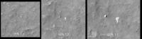
Yes... but the point I was trying to make is that it wouldnt have taken long, "seconds" probably to identify the various components in the MER landing site images, even without images from the rovers on the ground. The parachutes are visible when the images are viewed at 25% scale, at 100% you can see the folds in them!!! It seems like we will need to search the MPL site at the single pixel scale.
Spirit's parachute and Backshell are shown below at various scales.
|
Posted by: Zvezdichko May 12 2008, 12:57 PM
Also, if you are unable to view the big jp2 images, you may start a quick search using the grayscale .jpg images. Rover tracks are visible, so you may be even able to spot the rocket blast zone of MPL.
Posted by: Phil Stooke May 12 2008, 01:23 PM
It's only easy if you know what you're looking for, and where to look. We know nothing about the state of the vehicle - I'm not sure we even know if the DS2 probes were deployed, though I might be wrong about that, not having looked it up. And we don't know where to look.
But put that aside... can anybody identify in HiRISE the feature initially interpreted as MPL in MOC images? I've only glanced, but not found it yet.
Phil
Posted by: Sunspot May 12 2008, 04:54 PM
Phil
But if the failure scenario favoured by the investigation team is correct, the lander probably made it to the surface in one piece with the rest of the EDL hardware in the surrounding area.
Posted by: Phil Stooke May 12 2008, 07:19 PM
That's true! But we don't know that's what happened, and one explanation for the difficulty in finding it would be...
Phil
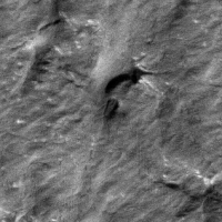
Posted by: ugordan May 12 2008, 08:22 PM
Sigh, I think looking for this thing is an exercise in futility AND a recipe to get mad. The amount of topography and albedo differences in some images is crazy, looking for a tiny object down there is madness. I just gave one single image almost a full going-over and I swear I'm starting to see things. Tell me I'm nuts, these things in the image below can't be the parachute and the lander. I know the "lander" is just too big to be real, but you've gotta admit it looks out of place there and almost even shows blast marks underneath! In reality I'd expect MPL to appear the same pixel size as in the half-res context above, not twice that.
http://www.fileden.com/files/2007/9/14/1431389/HiRISE_weird.png
Posted by: Juramike May 12 2008, 08:47 PM
I dunno.
But I think you might have the perfect image for the worlds most evil jigsaw puzzle.

Posted by: nprev May 13 2008, 01:36 AM
I like C!
I dunno, man, just don't know. They look more compelling to me than other purported finds...in fact, the "lander" almost looks like it made a successful descent. That topography is just a mess, though, and definitely promotes the Rorschach Effect.
We might need to send a cam with 1 cm resolution to find the damn thing in this stuff. Guess there's still a possibility we might get super-lucky and catch a specular reflection if there's some reasonably bare metal exposed & the geometry happens to be right.
Posted by: ugordan May 13 2008, 11:08 AM
Neglecting the feasibility of actually acquiring that dataset, can you imagine what an effort it would be to inspect the entire landing ellipse at 1cm resolution? We're talking about a 600 times larger pixel area than even this (already huge) amount. That would undoubtedly require a computer pattern recognition algorithm, no human would venture into sifting through that systematically. All the more because we don't even know what we're looking for - deployed chutes, broken heat shields or just a single crater. It's not that easy to tell a computer "find everything out of the ordinary!" either.
I wonder what effects to metal surfaces (or parachute) a 9 year exposure to this environment would produce. Are we even sure this sublimation and frosting process didn't already bury all hardware or at least coat it with a thin layer of dust and rendered it part of that environment? Additionally, how does albedo in this region compare to equatorial sites, are we expecting metal surfaces and the parachute to jump out or is the terrain here much brighter (apart from certain very dark areas)?
So many unknowns...
Posted by: tedstryk May 13 2008, 12:48 PM
I am choosing to ignore this thread until Phoenix is safely on the ground 
Posted by: tim53 May 13 2008, 08:34 PM
Hi folks!
I don't know if it's been said elsewhere, but the easiest way to display these huge jpeg2000 files is to download a copy of ExpressView from Lizardtech.com.
I've been using that for searching for hardware, even though I have Photoshop CS3 with the jpeg2000 plugin installed, as Expressview is a lot faster at opening the files.
In my own search of the MPL site (and other lander hardware) images, I found it takes me about 4 hours to search each HiRISE image.
I have a "candidate" possibility for MPL, but there are problems with that set of objects being the lander, not the least of which is that nothing stands out in the MOC images of that same area taken within weeks of the loss of MPL. Sadly, it's dark there now, and it will be several months before any search imaging can resume.
I'll tell you where this object is, but it might be more fun to see if someone else notices it - sort of a qualitative eyeball calibration exercise, in effect!
-Tim.
Posted by: MarsIsImportant May 13 2008, 08:35 PM
I found a candidate site for the lander. Currently, I'm downloading the source JP2 file so that I can get a much better look; but the feature is totally out of place. It could still be part of a cave entrance of some sort, so I need a much better look. It appears to be about the correct size and has maybe created a very small crater.
I'm excited...it is by far the most promising feature I've seen after review about half of all the HRISE images in this area. Not all of the terrain is as bad as some suggest.
Posted by: climber May 13 2008, 08:39 PM
I have a "candidate" possibility for MPL, but there are problems with that set of objects being the lander, not the least of which is that nothing stands out in the MOC images of that same area taken within weeks of the loss of MPL. Sadly, it's dark there now, and it will be several months before any search imaging can resume.
-Tim.
Well, can you at least point out THE image ?
Oups, I notice, while typing tha Marsisimportant has one too! I hope it's the same image! Can you share the image and see what we'll see?
Posted by: elakdawalla May 13 2008, 09:05 PM
Just to be clear, is your "candidate" the lander, an impact site, or the parachute? I'm preparing a Web page with info for the search and I was going to tell people that the parachute/backshell was the best object to be searching for, with examples of what they look like at the successful landing sites -- should I also try to give examples of what the lander/crash site should look like? If so I'll need some help from image magicians here to come up with sample images.
--Emily
Posted by: ugordan May 13 2008, 09:05 PM
Indeed, I seem to have picked out the worst image to start. About the only thing interesting in that whole image I could see is this funny-looking rock:
|
Almost looks like a black bathtub, pretty out of place for that whole region. I hope others are having more luck.
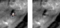
Posted by: MarsIsImportant May 13 2008, 09:17 PM
I finally have a real close-up view of my feature. It is strange. I'm not so sure it is the lander, unless the parachute landed on top of it and is completely draped over it.
Here is a view.
|
There is nothing like this anywhere near. Most other features nearby are dark colored sand dunes.
Posted by: djellison May 13 2008, 09:20 PM
Remember, the MPL lander dropped away from the backshell and chute before landing. It would have to be a quite exceptional coincidence for either, the parachute to land right on top of the lander, or, the landing process to work fine until the lander was due to separate and then fail. Also, the parachute should be much much brighter than that. Even pathfinders 10+ year old parachute is whiter than white to HiRISE
Doug
Posted by: ugordan May 13 2008, 09:28 PM
Someone over at the Bad Astronomy site has shown that same area, which image is that? I haven't ran across a feature like that. It looks like a hill to me, do you know what direction the illumination is from?
Doug, if only we could be 100% positive there was a chute deployed. For all we know, the lander could have blown up the minute after last contact prior to entry and we'd still only have the most likely cause to assume (40 meter high crash).
Posted by: djellison May 13 2008, 09:39 PM
Oh - I agree with that point, we don't know if the parachute deployed. However, if it did, it's going to be very big, very bright and very obvious indeed. You would find it easily with HiRISE. There wont be an 'is that the parachute' sort of moment - it'll be 'that IS the parachute'. I was saying, in response to 'unless the parachute landed on top of it' that there's no way the parachute would be a not-obvious object.
If the situation arises when we've got the full ellipse in HiRISE and there's no Parachute and backshell, then the failure mode has to be backed up to between cruise stage sep, and chute deployment. i.e. the entry process.
Doug
Posted by: Sunspot May 13 2008, 09:44 PM
Some areas of the landing site look VERY dangerous, I suppose it's possible MPL failed at touchdown after a successful Entry and Descent.
Posted by: MarsIsImportant May 13 2008, 09:52 PM
Doug, if only we could be 100% positive there was a chute deployed. For all we know, the lander could have blown up the minute after last contact prior to entry and we'd still only have the most likely cause to assume (40 meter high crash).
I found this on my own. The suggestion of 'bad astronomy' was not a very nice comment.
This is an image from HRISE and closer to the center of the landing ellipse. I believe Mars time is about 2:30 PM.
It looks like a possible parachute. I thought of a hill but the folds suggest otherwise. I may have found the parachute draped over a rock of some sort. Regardless, the feature is very strange and does not appear to be natural in origin, especially given the surrounding terrain.
I've just noticed some other nearby targets--just a little further away (they don't look like this, but who knows what I will find). I'm going to get a closer look at them. They are much smaller in size.
Meanwhile I have other things to do. I will get back with you later.
Posted by: tim53 May 13 2008, 10:04 PM
--Emily
MPL searchers beware: Potential spoilers to follow!
The image my gizmoid is in is PSP_005536_1030. The objects look similar to a "lander" and "backshell", but they're too big. The putative backshell object is about 5 meters across, whereas the actual backshell is just over half that size. So, if it's real hardware, it's sitting on a rise that's similar in brightness and shape, so that it resembles a single conical object 5 meters across at the base - not impossible, but reducing the chances (and definitely the certainty) that it's hardware. The putative lander object does not match the shading I get when I illuminate a lander model with the same lighting geometry as the HiRISE image, though I initially thought it did, when I compared it to a simulated image produced by MSSS during the search with MOC. Still, not impossible for it to be a lander, particularly if it's tilted or oriented or mangled in a manner that's hard to anticipate. But the poor match to the model does reduce the possibility that it's hardware and not a natural object.
When I first saw these objects last fall, I got pretty excited by their apparent similarities to other lander hardware we've seen in HiRISE images and the fact that they're within a few kilometers of the center of the Nav ellipse. But in addition to the scales and lighting issues, there is no bright patch near the putative backshell that might be a parachute. So, I wondered if it might be dust mantled after all this time. And so I've searched corresponding MOC image coverage (specifically M1104140, taken less than 2 months after the loss of MPL), and there aren't any anomalously bright OR dark spots at the locations of these features. The color coverage by HiRISE does run over these features but, unlike the other hardware we've seen in color, neither of these objects appears blue-tinted in color - they match the surrounding surface color.
So, if this is the lander, it was more or less "successful" at reaching the surface intact, it's oriented wrong by about 45 degrees or so, possibly tilted, and it was mantled so as to not stand out from its surroundings rather quickly after the landing... ...in other words, it's not bloody likely to be the lander.
Early on in my search, I identified a dark spot in a CTX image to the south (and thus downrange) of the center of the nav ellipse, and a few hundred meters beyond the HiRISE coverage. It'll be interesting to see this spot in HiRISE come spring, in the off chance it's an impact site. There is no MOC coverage of this feature (at least not of sufficient resolution, IIRC), as it was just outside the search area for MPL. But except that this is an isolated dark spot in that image (beyond a field of dark splotches in that area), there's nothing particularly remarkable about it, and it might just be a site of defrosting or a dark dust streak, and thus a natural feature.
-Tim.
Posted by: ugordan May 13 2008, 10:05 PM
There's nothing wrong with Phil Plait's http://www.badastronomy.com/bablog/2008/05/10/help-find-mars-polar-lander/#comments. I didn't allude you stole that image, I just wanted to say I saw that feature posted earlier and wanted to know which image it apears in. I didn't come across it in the several images I looked at and it does look hard to miss. Without knowing context, that still looks to me like topography
Posted by: tim53 May 13 2008, 10:07 PM
Here is a view.
|
|
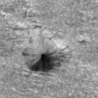
There is nothing like this anywhere near. Most other features nearby are dark colored sand dunes.
That's a conical pit. There is another one in the region. I remember wondering whether this might be the lander, sunk into the ice. But it's a pretty big hole. I think I measured it around 50 meters across. I think other similar pits can be found elsewhere in this terrain, though I don't think there were any near this one.
-Tim.
Posted by: elakdawalla May 13 2008, 10:45 PM
Anybody else suddenly having problems with the HiRISE website?
--Emily
Posted by: MarsIsImportant May 13 2008, 10:48 PM
Here context for the feature I showed.
|
(I had another image in mind but it is too large of a file.)
There is a lot of dust in the area. A bright parachute would be mostly covered in that dust.
The source file is PSP_005114_1035_RED.NOMAP.JP2
The feature cannot be a conical pit because the lighting is all wrong for that at this time of day. At 2:30, the sun light is coming from the top left corner of the image. A hill is more believable; but the radiating folds suggest something more complex. The hills in the area are relatively smooth with dark sand dunes on top.
Posted by: ugordan May 13 2008, 10:50 PM
It stopped working for me about half an hour ago. What's worse is IASViewer won't even start up due to this...
Posted by: tim53 May 13 2008, 11:06 PM
|
|
(I had another image in mind but it is too large of a file.)
There is a lot of dust in the area. A bright parachute would be mostly covered in that dust.
The source file is PSP_005114_1035_RED.NOMAP.JP2
The feature cannot be a conical pit because the lighting is all wrong for that at this time of day. At 2:30, the sun light is coming from the top left corner of the image. A hill is more believable; but the radiating folds suggest something more complex. The hills in the area are relatively smooth with dark sand dunes on top.
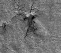
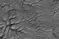
Acually, the sunlight is from the lower right. The sample you show is of one of the "spider" features first identified by MOC. These are sinuous radial troughs that are deeper near the center of the "spiders" and shallowing outward where they branch and disappear. In stereo, these are similar to dilation cracks in frost heave structres in the arctic, "pingos". But pingos typially have much lower base:height ratios than the "spiders" do.
-Tim.
Posted by: elakdawalla May 13 2008, 11:10 PM
Yay, the website seems to be back up.
--Emily
Posted by: MarsIsImportant May 13 2008, 11:18 PM
Sorry, but the illumination is not from lower right. It is from the upper left. That I am absolutely sure of.
Posted by: tim53 May 13 2008, 11:38 PM
Check the label.
North azimuth is listed as 95° for the NOMAP version of that image. The north azimuth is measured clockwise from the right side of the frame (0°). Subsolar azimuth is listed as 50.6°, so sun illumination is from the bottom right of the scene.
Again, the feature you show in the cropped area is a depression, not a high.
-Tim.
Posted by: elakdawalla May 14 2008, 04:36 AM
MarsIsImportant, I was also completely confused about what the north azimuth meant for HiRISE images until I had a conversation with some of the HiRISE folks. As Tim says, the north azimuth for the non-map-projected images (which are the ones I would recommend for performing these searches, as they represent non-resampled data) are measured clockwise from the right side of the frame (which I find counterintuitive enough; it gets worse). For map-projected images, it's the same, as long as you're dealing with an image that is not close to one of the poles. Polar images are in a polar stereographic projection, in which lines of latitude make concentric circles around the pole, and lines of longitude are straight, intersecting at the pole. So in the map-projected images of places close to the pole, north is not necessarily up. Which direction north is depends upon what longitude you're looking at. If you're looking at a place near longitude 0, north will be up. However, the Mars Polar Lander landing site is at 165, which is to say very close to longitude 180, so the map-projected images have north almost straight down. For the one you are looking at, PSP_005114_1035, the direction to north is given as 75 degrees, which (when you measure it clockwise from the right side of the frame) gives you a north direction that is only 15 degrees to the right of straight down.
I think http://science.jpl.nasa.gov/people/Parker/ would be the first to admit that he is not always right. But I think that if Tim says he's sure about something, you should consider it to be pretty likely that he's right.
--Emily
Posted by: MarsEngineer May 14 2008, 05:05 AM
Hi friends (and Hi Tim ... we have to stop meeting like this),
My thoughts are:
1) We really do not know what caused MPL to disappear. While the MPL failure review board identified the "most probable cause" as a premature shutdown of the descent engines at about 40 m above the ground due to a software bug, that bug was only one of several possible failure modes that were identified then and since. We can not make too many assumptions as to what the lander looks like. (But I do think it is there somewhere.)
2) Unless Mars itself camouflages the vehicle (e.g. by overlaying layers of dust in the annual CO2 ice deposit, or the lander has fallen into one of the larger "spiders"), I think we should see something. The lander's design (including heat shield and backshell) used a lot of highly reflective MLI (multi-layer insulation) blanketing in many key places. I suspect that regardless of how it landed, there should be pieces of highly reflective material that are exposed and would result in one or more "hot pixels". Check out the image of the airbag cover from 1997 Mars Pathfinder's landing on slide 6 or 7 as well as the Mars Pathfinder heat shield debris here http://hirise.lpl.arizona.edu/HiBlog/wp-content/uploads/Parker_HiRISE_talk.pdf.
Note how bright that 1 meter round piece of airbag cover MLI is. We saw it in the distance in 1997 but it was only after we got the view from HiRISE that we realized that it was airbag cover debris.
3) We have not yet covered the landing ellipse with HiRISE images. I think we have covered more than 50% but there is still room to believe that MPL landed outside the areas imaged so far. The HiRISE/MRO team stopped imaging the MPL area once the southern summer sun set. As Tim suggests, the lander could be a km from one of the edges of any of these images.
I am betting on next year! While our eyes are sore (especially Tim's) and our image processing software did not yield anything, we could be wrong ... these images cover a lot of territory. Please let the HiRISE gang know if you find something! Our inquiring minds want to know!
Take care!
-Rob Manning
***************
These comments are solely those of the author and do not reflect the views of JPL, Caltech nor NASA.
Posted by: MarsIsImportant May 14 2008, 05:23 AM
Emily,
The azimuth on the label Tim pointed out for the non-map image that I posted is 95 degrees. It points north relative to the map. That is basically a right angle that points North. That clearly points to the right of the image. West is toward the top of the image. East is on the bottom of the image. The South Pole is toward the left of the image as you face it.
I am correct. I have no doubt.
Posted by: MarsIsImportant May 14 2008, 06:23 AM
I've been taking a look around that same JP2 image. Many spiders appear to be depressions and cracks. Others are dunes.
Also the lighting appears to change in different parts of the image. Perhaps this is because it is so close to the South Pole. Perhaps the azimuth is only good for the center of the image. Or the label is wrong, which would have led me astray in my conclusions. Some parts of the image appear to be lighted from the bottom right. Or it maybe just too late at night and my eyes are playing tricks.
Posted by: MarsIsImportant May 14 2008, 06:56 AM
Something is not right with this image projection. So with that in mind, I will consider it possible I don't have everything completely accurate.
I need to get some sleep. Tomorrow I will look some more. So if I am wrong, then I apologize to Tim now instead of later. The truth is what we are after. It's not a popularity contest.
Posted by: djellison May 14 2008, 07:51 AM
I've tidied this thread up a little - MIP, please be more careful before jumping to a conclusion so contrary to the collective wisdom, and then stating quite so forcefully.
The killer point is that if stereo imagery describes the feature as a depression, then the label is irrelevant - illumination is from the lower right. As another post ( which made no sense during clear up, so was culled ) - you must be carefull assuming that MRO is heading south, and the East is to the right. This could be an ascending observation where the geometry would be inverted.
Doug
Posted by: climber May 14 2008, 07:52 AM
-Rob Manning
Hi Rob,
Looking forward to Phoenix landing, I'm wondering if the behaviour of the atmosphere at high latitude is harder to modelize or less "well known" (lack of experience) so this could give us some hope to still find MPL away from the center of the elipse?
Posted by: Phil Stooke May 14 2008, 10:40 AM
MIP: "Something is not right with this image projection"
Most HiRISE images are given in a cylindrical projection, north straight up. but near-polar images like these are in polar stereographic, and north is in a different place. All the information you need is in the table with each image.
Phil
Posted by: ugordan May 14 2008, 10:59 AM
Furthermore, if the dataset in question is non-map projected (NOMAP), there is no projection involved. As others have said, depending on whether the observation took place on the ascending or descending node, the illumination for these products would generally seem to come from diametrically opposite directions. If you feel the illumination suddenly "changes direction" across a single swath, that's just your brain being tricked by reverse topography (e.g. hills turning into depressions).
Posted by: climber May 14 2008, 11:23 AM
Doug
Is there any possibility that this could be the crash site of MPL then?
I would go for a full MPL including heat shield etc that would have hitten the ground
Posted by: ugordan May 14 2008, 11:46 AM
Tim53 said in a earlier post there's another one of those conical pits in the area suggesting this has nothing to do with MPL. If this is an impact crater, its morphology seems inconsistent with what I'd expect of a hypersonic impact into hard or rough soil. The pit itself is too large, this one is supposedly 50 meters across. I wouldn't expect a small object travelling at say 400 m/s to produce a crater that big.
If I had to put my money on it (Murphy's law!), I'd say the lander is either in the heavily clouded-over images we have now or in the rest of the ellipse that hasn't been covered yet. Other than that, anything suspicious would have probably already jumped out at the HiRISE team, at least when looking at your typical, fairly flat and dull terrain here (though I am wondering how systematic their search was so we can modify our "expectations"). On the other hand, images like PSP_005536_1030 (especially the top part of NOMAP version) have pretty big albedo variations and small-scale topography so in principle, something just might be hiding over there.
Posted by: climber May 14 2008, 12:26 PM
I agree on this but I thought may be heat would have melted the ice around the impact so the crater would have grown bigger.
Ok, if there's another conical pit around, unless MPL did a bounce as Soyuz TMA-11 did ...
Posted by: nprev May 14 2008, 12:31 PM
Argh. As Gordan said earlier, "so many unknowns"! Seems as if this manifest fact will be compounded by the fact that there well might be active geology at the site; those pits sure look like something related to the CO2 geysers to me, or some other outgassing/collapse mechanism.
Posted by: ugordan May 14 2008, 12:38 PM
I might be wrong about this, but if you're thinking about heat shield heat, there might not be that much heat at all. If the heat shield is ablative, the part that heats up is the part that's ablated away, which is a mechanism for keeping the shield cool. The shield material is a very good heat insulator so it doesn't store too much heat during reentry. If you're talking about impact-induced heating, my gut feeling tells me there isn't that much produced. A Mach 2 impact is likely to compress/scatter soil rather than heat it up significantly. Also, keep in mind that water ice (if it's water) has a high specific melting heat so it would take a LOT of heat to melt that large a volume.
Posted by: climber May 14 2008, 01:49 PM
Yes, I concur. Ablative material (sort of "cork" as they say in Phoenix video) won't let heatshield very hot.
So, we're back on the search
Posted by: tim53 May 14 2008, 02:18 PM
So, we're back on the search
I thought about the possibility that these pits might indicate sublimation of loose ice by a warm lander and heatshield landing on it (there are two in this area, IIRC - the one that Marsisimportant posted, and a smaller one some hundreds of meters away, again IIRC). But it would have to be pretty loosely consolidated, and ice has a tremendous capacity for absorbing heat. Then, perhaps the real clincher is that other regions of polar terrain show similar pits in abundance.
They are intriguing features in their own right, though.
-Tim.
P.S. Hi Rob!
PPS. Emily - I thought I was wrong once, but apparently I was mistaken!
Posted by: hendric May 14 2008, 03:08 PM
What kind of effect would the downed lander have on the surrounding area over time? There are a ton of possibilities here I imagine, anything from growing a pit in the ice to growing a hill of dust.
Posted by: remcook May 14 2008, 04:19 PM
A friend of mine went to Greenland a while back and he showed this fascinating, yet depressing, picture of a big hole in the snow made by a single Mars bar wrapper. MPL is not that dark though I would think.
Posted by: MarsEngineer May 14 2008, 05:21 PM
Hi Climber,
You are correct. There was and continues to be a lot of uncertainty in our knowledge of the density variations in the altitude range that the entry vehicle does most of its deceleration (mostly between 20 and 50 km). Given that these machines enter at very shallow entry flight path angles - around 13.5 degrees for MPL - only a few percent uncertainty in our estimates of the atmosphere density means the difference of many 10s of km on the surface. The ellipse shown on the HiRISE site (made by Tim) is based on our best guess of where the vehicle was when it reached the top of the atmosphere (based on our radiometric tracking data taken in the hours and days before landing). We think these estimates were pretty good and do not depend much on what failures may have happened to the vehicle. We then use computer simulations to model entry, descent and landing using one atmosphere model (as well as slight variations in the entry initial conditions), we then do the simulation again and again using slightly different models (correctly selected statistics-wise) and then we look to see how these are scattered on the surface. The ellipse that Tim placed on that HiRISE map at the HiRISE site represents about a 2-sigma ellipse (see Emily's Blog from yesterday). So we believe that there is about an 86% probability that MPL is inside that ellipse.
Of course, people ask me; What if the cruise stage never came off? or What if the parachute did not open? What if it tumbled during entry? Well it turns out that these cases do not make a huge difference in the position and shape of the 2-sigma ellipse. It makes it a tad longer (probably moves it further south a few km as well ). As you suggest Climber, one place that we could be very wrong and would make a bigger difference in the ellipse is the atmosphere. You will also notice that the HiRISE images do not cover the right side of the ellipse. That was due to a mistake I made (an unfortunate change of longitude definitions occurred just after the post-MPL trajectory reconstruction that I was not aware of ... it resulted in our estimates of where the ellipse was painted on the surface moving a few km to the east after the HiRISE image "campaign" was well under way).
As I said before, it is there somewhere and I have some faith that it will eventually be seen. While I could be wrong (I have been many times in this biz), I doubt that it would have made a crater that did not leave equipment visibly scattered on the surface (unless subsequently covered by dust or other Mars material). Even without a parachute, it would have slowed down to very nearly it's Mars "terminal velocity" which for this vehicle is around 220 - 300 m/s (depending on tumbling attitude). That is fast but not fast enough to poke a deep hole in Mars! 
If it is a needle in a haystack, I *think* it will be a bright needle. (My friends think I am an optimist.)
Cheers!
-Rob M
***************
These comments and opinions are solely those of the author and do not reflect the views of JPL, Caltech nor NASA.
Posted by: hendric May 14 2008, 05:59 PM
Remcook,
Yes, that's exactly what I'm thinking as well. I'll bet that reflective or not, the net effect would be to make a depression in ice. If it's not reflecting the light it absorbs heat would tend to make a hole, and since the sides of the hole would be more vertical than the surface, the sides would tend to enlarge over time. And if does reflect the light, said light would mostly impact nearby, making the surface around the lander slightly hotter due to the reflections.
I'm betting MPL will be in a small depression, larger than the size of the lander, whether it landed correctly or not.
To do this properly, I created a spreadsheet on the Yahoo groups site with picture names across the top, and ppl checking them going down vertically. Post here which photos you have searched and to how far (Y pixel number), and I'll try to update the file. This way efforts can be divided appropriately.
Link http://tech.groups.yahoo.com/group/unmannedspaceflight/files/.
BTW, as a suggestion for future futile searches, adding some false positives to the mix is a good idea. Maybe 25-100 every picture might cut out the boredom, and give ppl something to score each other on.
Posted by: ugordan May 15 2008, 08:36 PM
Argh. I can't find a trace of your objects in the said image and that image is the most studied one by me yet. I also looked at the IRB version since you said there's color coverage, but found nothing remotely interesting. Would you mind showing us how your objects look (not necessarily giving locations) so we can see what they're supposed to look like?
Plus, this is just driving me crazy
Posted by: tim53 May 15 2008, 09:22 PM
Plus, this is just driving me crazy
Okay, here ya go!
They're in opposite corners of this cropped frame from that image. And they live near the north end of the image. In this case, north is toward the bottom of the scene.
And remember, though the file is titled with MPL and backshell in the file name, it really can't be hardware, because of the things I noted above...
...unless it is. We'll see when the sun comes back around.
But seriously, though I have looked at all the HiRISE images taken thus far, I might have missed something. I'd love to hear what all y'all might find!
-Tim.
|
Posted by: Juramike May 16 2008, 12:05 AM
Wow. I give up. I see nothing in that image even remotely out of place.
(Savagely beautiful, yes; out of the "ordinary", no.)
Do you have an annotated image you could post?
-Mike
Posted by: tim53 May 16 2008, 12:26 AM
(Savagely beautiful, yes; out of the "ordinary", no.)
Do you have an annotated image you could post?
-Mike
I've got to hit the freeways now, but maybe tomorrow I could do that.
-Tim.
Posted by: Juramike May 16 2008, 01:02 AM
-Tim.
Cool. That gives us all 24 hours to find the missing lander in the image....
Posted by: remcook May 16 2008, 08:48 AM
I'm glad I'm not in charge of these kinds of searches, because I also wouldn't have spotted anything 'unusual' in that figure... 
Posted by: Juramike May 16 2008, 03:13 PM
(Has anyone else noticed that the deposit structure resembles a http://en.wikipedia.org/wiki/Neuron?)
(I was kinda using that nomenclature to work my way down one axon then on to another during my search.)
-Mike
Posted by: tim53 May 16 2008, 05:32 PM
(Savagely beautiful, yes; out of the "ordinary", no.)
Do you have an annotated image you could post?
-Mike
Actually, this is pretty straightforward, so no annotation should be needed. The object that I propose "might" be the lander (but probably isn't) is the "double-bump" looking feature near the upper left corner of that cropped image. The possible backshell object is in the lower right corner. In this region, there aren't many objects that look like this - though there are some. And this is the only case I've found where two suspicious objects are within a few hundred meters of one another.
This is the simulated image I used to convince myself that this might be the lander. But again, there are problems with the lighting/shading. The fixed solar panels should shade most of the upper deck of the lander if it's in this orientation and more or less "level". Also, the "downsun" solar panel would be completely shaded with the sun geometry of this image, and the object doesn't match this expectation.
|
Posted by: elakdawalla May 16 2008, 09:05 PM
Well, it took me way too long to do this, but I have finally posted a page on the search:
http://www.planetary.org/explore/topics/mars_reconnaissance_orbiter/hirise_lander_search.html
There's more that I want to do, but I figured this was a good start. I, too, had had the idea of having people report which images they were searching, or ask to be assigned one, but hendric beat me to it. Still, if you want to let me know which images you are searching, do pop me a PM or an email and I'll maintain a tally.
One thing I want to do is create my own base map and see where there are areas of overlap between images. One good test for the viability of a candidate is to see how it looks under different lighting geometry, which you can do if you are lucky enough to have found a candidate near the edge of an image where it may have overlapped another.
--Emily
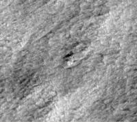
Posted by: Phil Stooke May 17 2008, 12:45 AM
Just a quick one... probably nothing, of course. Same image as Tim's.
Phil
|
Posted by: tim53 May 17 2008, 05:04 AM
Phil
|
|
Hi Phil:
Yeah, that's the frustrating thing about this search. Some places are just chock full of hardware! ...or so it might seem.
-Tim.
Posted by: Phil Stooke May 17 2008, 01:28 PM
So perhaps we should call this place 'The Boneyard'...
Yes, I was struck, not by the paucity of candidates but by their profusion. if any little lump might be a spacecraft it really is a boneyard. And proving anything will be really hard. Color might do the trick, though, as you say.
I liked it better in the old days when we were just comparing surface and orbital images!
Phil
Posted by: climber May 17 2008, 04:39 PM
Only another 10 more days and you'll do it again on the other pole
Posted by: djellison May 17 2008, 04:44 PM
That'll be much MUCH easier with the triangulation we'll get via UHF
Doug
Posted by: ugordan May 17 2008, 05:24 PM
How accurate is that, anyway?
Posted by: djellison May 17 2008, 05:33 PM
http://www.msss.com/mer_mission/finding_mer/ - and I'm sure it's improved since then. I'm sure it'll be enough to say 'it's in THIS HiRISE image' giving us a realistic chance of identifying the site from local features / rock patterns etc.
Doug
Posted by: ugordan May 17 2008, 06:52 PM
That's pretty cool, I didn't know the orbiting spacecraft relays could even measure the Doppler shift. Techniques like this really give the term "nailing it down" meaning.
Posted by: jamescanvin May 17 2008, 07:58 PM
This caught my eye, back-shell top-left, parachute bottom-right:

|
I don't think it can be though as they are separated by 80m, I assume the parachute lines were a lot shorter than this?
James
Posted by: djellison May 17 2008, 08:05 PM
Yeah, more like 10m, not 80. That looks like what would happen if someone tried to fake a backshell and chute out of rock
Posted by: jamescanvin May 17 2008, 08:32 PM
Yeah thought so, the MPL landing ellipse seems to be littered with rock carvings of back-shells, parachutes and landers!
This is going to be hard...
Posted by: Reed May 17 2008, 08:38 PM
--Emily
This may help: http://global-data.mars.asu.edu/bin//hirise.pl?clat=-76.0625&clon=164.8374161200139&res=5&psz=1&rel=0&bgrnd=3&cookie=0 although the zoom is pretty limited. If you click a point with the select tool, you get a list of images covering that point. Actually finding the corresponding point on the images will still be a bit of work.
You can also select MOC images on the same site, which probably aren't high enough res to see the lander but might provide useful context.
Posted by: djellison May 17 2008, 08:42 PM
MOC should, however, resolve the backshell and the parachute. It did with Spirit and Opportunity. When I go MPL hunting - that's what I look for. - If you compare the 'how far it got' elements of EDL, with what you should be able to find on the surface..
DOA / entry failure : Aeroshell impacts at speed, crater, probably unidentifiable.
Failure of chute : probably same as above
Chute deploys, rest a failure : chute and backshell
Lander seperates, but then fails : chute, backshell, heatshield impact site and small probably unidentifiable impact
So in almost any failure mode, the chute and backshell should be visible. What impact the climate would have w.r.t. burying them, covering them etc I don't know, but the Pathfinder chute is clearly visible to HiRISE.
Doug
Posted by: centsworth_II May 17 2008, 08:50 PM
What exactly are you saying?

Posted by: djellison May 17 2008, 09:05 PM
That nature can play tricks on people. When you're looking for a backshell, all the rocks look like backshells.
Doug
Posted by: Sunspot May 18 2008, 09:18 AM
Having looked at parts of the landing site with HiRISE images, some of it looks treacherous.... I wonder, had the MPL team had images with that resolution available to them when planning the landing, would they have chosen a different area?
Also, illustrations of what MPL would look like from orbit show it with the solar arrays deployed, if it did fail during the entry phase, deployment is unlikely to have happened ? - making it even harder to see.
Posted by: ugordan May 18 2008, 10:48 AM
I've now gone through all the images, all of them at half resolution except two ones (on of them being PSP_005536_1030), concentrating on rougher and brighter terrains where it would be easier to miss something. I operated under the assumption that given the jumbled look of some of the terrain with large albedo variations, my best bet would just be looking for a backshell and/or parachute. If the EDL sequnce didn't get as far as parachute deployment, finding the crash site is going to be tough to say the least. If there is a parachute and backshell somewhere, it would be readily apparent even at 50 cm/pix and this speeds up the search significantly. There was (to my eye) not a single candidate for the backshell in any of the images. Given the roughness of some of this terrain, I'd say the lander tipping over at touchdown is a pretty plausible failure scenario as well. I'm left to conclude that it either isn't located in these images (or, by some sick chance, it's in one of the data dropout gaps) or there is no backshell.
How high was MGS coverage of the landing ellipse and at what resolution? MGS later resolved the MER chutes, but that was using cPROTO.
Posted by: Zvezdichko May 18 2008, 03:26 PM
Gordan: Check up this: http://mars.jpl.nasa.gov/mgs/msss/camera/images/1_24_00_polarlander/index.html
The resolution was about 1.5 m per pixel. "Thus, the MOC team is basically trying to distinguish one or two pixels from nearly 150 million. One team member has remarked that this is like "trying to find a specific needle in...a haystack-sized pile of needles."
Posted by: tim53 May 18 2008, 03:32 PM
ugordon:
Indeed this is a difficult search! The MOC coverage is pretty good over the terrain where MPL was expected to have touched down if all went according to plan. I can't remember the number of images that overlapped at the "candidate object" I talk about above, but it was probably at least 2 or 3. The earliest of these was taken within 2 or 3 weeks of landing, and since it doesn't show anything unusual at that location, I have to believe that the candidate is most likely a frustratingly-lander-looking natural feature. Or (and this isn't very likely), dust accumulation was so fast as to mask the brightness of the parachute that soon after landing. And even in that overly-optimistic scenario, if the lander made it to the ground and deployed its solar panels, why didn't we hear from it? At least briefly?
The MOC coverage of the MPF landing site is particularly interesting in regards to searching for MPL, because imaging the landing site began within a year of the landing. So it's possible to look at changes in the visibility of things like the parachute over time. Because the backshell and parachute weren't visible from the ground, I didn't think the bright splotch at that location taken by MOC (http://www.msss.com/moc_gallery/ab1_m04/images/SP125603.html) was anything unusual (you can't really identify the backshell as obvious "hardware" in any of the MOC images for this reason). But since there are multiple images here, taken over many years, you can see how these objects "fade" with time.
Again, the best chance of finding MPL is if the parachute did in fact deploy, as it's potentially the most expansive piece of spacecraft hardware and ought to be verifiable in MOC images taken shortly after the landing. Since nothing unusual was identified during that search, it seem more likely that the lander crashed, or it landed outside the MOC search images - which would require it to have not landed where it was supposed to. Or the chute did deply, but may not be spread out on the surface, but clumped into a small area.
-Tim.
Posted by: climber May 18 2008, 03:49 PM
What about if the chute deployed and failed in pieces like for the MER first envisioned chute?
May be in this configuration, the whole spacecraft slowed down so the crach was not at full speed. A failed parachute (in piece) may have never been visible to MGS and now to HiRise. So, if the spacecraft is still in the back+heat shield, are they both white? Is there any chance that the colour was not bright enought and the landing not hard enough both to be visible by MGS?
Posted by: djellison May 18 2008, 03:58 PM
Even a shreded chute like those Boise MER tests would still be a fairly big target - and the backshell might, I expect, survive the impact - especially if the lander seperated before landing.
Doug
Posted by: ugordan May 18 2008, 05:14 PM
Thanks, Zvezdichko and Tim for the pointers. Just for fun, here's the original place MPL was believed to have been found in 2005 (see http://www.msss.com/mars_images/moc/2005/05/05/index.html), seen by HiRISE (quick'n'dirty "map projection"):
http://i108.photobucket.com/albums/n15/ugordan/hirise_moc_mpl.jpg
Later that year, the MSSS team got another look at the candidate site using cPROTO: http://www.msss.com/mars_images/moc/2005/10/17. It illustrates that to reasonably be able to pick up the lost lander (primarily its chute), cPROTO-like coverage would be needed across the ellipse. In other words, all is probably not lost just yet. The lack of chute detection by MGS might constrain the actual location to more chaotic terrain seen by HiRISE where the feature would not readily stand out to MGS.
BTW, is it me or are the MGS images less contrasted compared to HiRISE? Higher solar elevation in MGS images or something else?
Posted by: Reed May 18 2008, 10:41 PM
Doug
One thing I've been wondering is how the albedo of the stuff that appears bright at other landing sites (parachutes etc) compares to the bright (frost ?) areas we see in polar terrain. Then there's the question of seasonal frost forming on things we are looking for

Gordan
Nice work, I was hoping someone would do that.
Posted by: elakdawalla May 19 2008, 10:14 PM
Someone wrote to correct Rob Manning's math in my http://planetary.org/blog/article/00001425/ -- I'm posting the comments here so that people whose minds are less dulled by parenthood can take a look and see if the criticism is correct.
where erf is the so-called "error function".
If you plug this in to some maths software like Mathematica or matlab, or look up a table (cringe), you get:
the probability of being within 1 sigma = 46.6% the probability of being within 3 sigma = 99.5% So the numbers presently given in the blog are qualitatively right anyway, I guess
 but the maths fans might balk...
Anybody have a response?
--Emily
Posted by: nprev May 19 2008, 10:30 PM
Well...dusting off my brain here, I'd say that the critic is right but so is Rob (he says so himself). The error function basically invokes an additional Gaussian distribution overlay on the overall uncertainty, but its magnitude is pretty small in this instance. The correction does not appear to be at all significant except to purists, and in any case is subsumed by the larger uncertainty envelope (landing ellipse).
Posted by: Mike Dorward Jun 1 2008, 06:16 PM
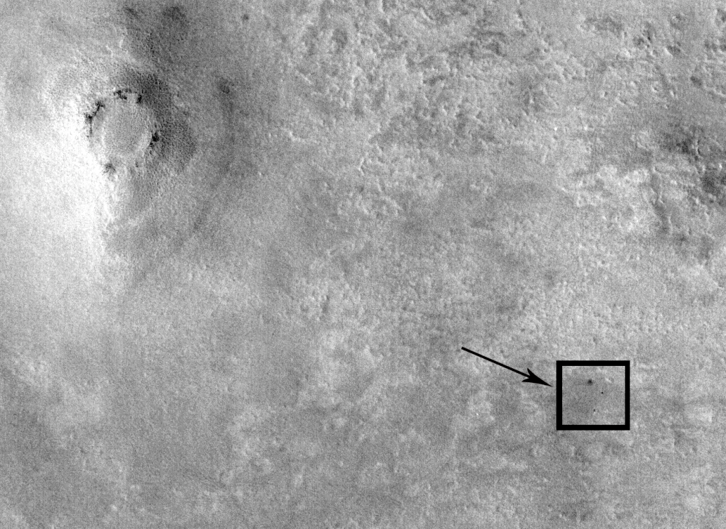
Attached is a 2X HiRISE image showing the Polar Lander resting on its side (the whiter pixels at the "top" of the shadow) and a shadow indicating an object approximately 1 meter wide and 3 meters tall. If you look closely at the far end of the shadow you can see a weak cross, which I believe to be the antennae of the spacecraft.
PSP_005536_1030_RED.QLOOK.JP2
The spacecraft is at 33802,67855
Mike Dorward

|
|
Posted by: nprev Jun 1 2008, 06:23 PM
Sorry...not seeing it. Pretty sweeping claim, and you need to produce more convincing supporting evidence.
Posted by: djellison Jun 1 2008, 06:24 PM
All looks totally natural to me.
Posted by: ugordan Jun 1 2008, 06:37 PM
This one is probably completely natural as well, but it does look interesting enough to mention. Below's a flicker gif between an object in 005536 and Spirit's backshell for reference. The sizes match pretty well, but the location seems too convenient as there are occasionally other round objects inside these trenches, especially in "corners" like this one. Non-map projected image rotated 180 deg to get a more reasonable illumination angle from top left.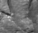
Posted by: nprev Jun 1 2008, 06:53 PM
Cool...but I think we're getting into some deep kimchi here in a lot of ways. We don't know the rate of dust deposition in this area, for one, and geometrically similar objects are abundant.
Hate to say it, but I'm becoming more and more convinced that somebody's gonna find MPL by tripping over it around 2430.
(Usually when I say such things I'm immediately proven wrong, so here's to the power of negative luck... )
Posted by: Reed Jun 1 2008, 09:42 PM
Agreed. There are plenty of ~8-12 pixel diameter bright spots that could conceivable be part of MPL, but don't have any features that allow a definitive conclusion.
I'm still somewhat optimistic about finding it. As previously mentioned, a good part of the predicted MPL ellipse has not been imaged by HiRISE. It may be sitting there plain as day. The evolution of the Phoenix site over the next season may give us a hint as to how realistic this is. If the parachute is undetectable after the first spring, that will bode poorly for finding MPL.
Posted by: Sunspot Jun 1 2008, 11:13 PM
How much of the landing ellipse did MGS cover?, I think the parachute ought to be fairly obvious even with MGS. With Phoenix landing so far down range of it's target - almost outside its landing ellipse infact, perhaps the same happened to MPL, and as others have suggested, we still don't have images of the area it lies in.
I wonder, if the failure scenario reached by the review team is correct, could MPL have survived the landing in some functional condition? Would the solar panels have been deployed? If not the lander will appear even smaller than illustrations indicate.
I know there was some excitement a few weeks after landing when reviews of communications attempts with MPL suggested they may have received some very weak signals, enough evidence at the time for them to re start communications attempts.
Posted by: claurel Jun 2 2008, 03:29 AM
Another backshell rock sculpture from 005536_1030? Or an actual piece of MPL?
|
(zoom is 100%)
This sure looks bright and shiny, but I think it might be too large to be the backshell. Also, the way it's conveniently nestled into an indentation in the side of the fracture suggests a natural origin.
What is the exact size of the MPL backshell?
--Chris
Posted by: djellison Jun 2 2008, 06:10 AM
The MPF, MER, MPL and Phoenix backshells are about 2.6 metres diameter. The Viking backshells are about 3.5m diameter
Posted by: claurel Jun 2 2008, 06:35 AM
Thanks. Looks like that rock is nearly 2x larger than the MPL backshell then.
--Chris
Posted by: lyford Jun 2 2008, 03:59 PM
Regardless, that is a cool feature
Posted by: On_2_Vesta Sep 11 2009, 05:01 PM
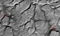
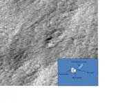
There is a roughly circular bright object at pixel 36359,42905 of image ESP_013289_1035_RED.jp2. Within this object, on the right side, is a smaller white circle that might be the backshell and which measures 8 or 9 pixels (~ 2-2.25 m) in diameter. It is most brightly lit roughly in its center. Bunched up against this putative backshell, mostly on its left side, would then be the lumpy collapsed parachute. Stretching to the upper right for about 10 meters is a faint stringy-looking feature that would then be the parachute cords laid out and then doubled back. Judging from the HiRise image which includes Phoenixs parachute cords, so the length here is about right.
This information was presented to the HiRise principal investigator who dismissed it, but he made several errors in his short reply. He apparently looked at the whole object, measured it at 4.5 meters and then stated that nothing on MPL was that large. In fact, the inflated parachute could measure as much as 8.4 meters across, so 4.5 m would seem plausible for a collapsed parachute plus backshell. His second argument was that the candidate was not sufficiently different from the terrain. This is a subjective call, but at the 1:1 scale, or a few steps up or down, there is nothing in the terrain resembling it in the field of view. It does catch the eye. Mine, at least.
Finally, as near as I can make out its lat/lon, it is at 76.55 S, 165.45 E. This is very near the center of the 2 sigma ellipse for the reconstructed trajectory.
I dont know that it is a part of the MPL hardware, but that after scouring through several HiRise images of the area, this was the only plausible candidate I saw.
P. Fieseler
|
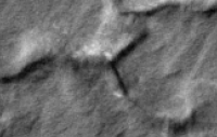
Posted by: vikingmars Oct 23 2009, 09:40 AM
P. Fieseler
Very interesting and great search.But looking at it closely, it seems that this "white circle" casts NO shadows, unlike other features nearby (and unlike other backshells saw on MOC images).
Also, the "parachute" is not really different from lighter ground nearby...
Bon courage for your search !
Posted by: ElkGroveDan Oct 23 2009, 03:13 PM
Of course if you dropped something from 100 meters it would tend to acquire a flattened shape and therefore cast no shadows
I will say that this is the most interesting of any of the candidate objects I've seen. My sense is that it's too big?
Posted by: On_2_Vesta Oct 23 2009, 10:26 PM
Thanks for taking the time to respond. It is admittedly an ambiguous object, but I wonder if people are seeing the shapes the way that I am. I will attempt to repost the image with a cartoon of what I see (or imagine that I see). The details, especially the parachute cords, are clearer in the viewer than these posted jpegs.
A parachute flat on the ground would not cast a shadow. An intact back-shell should, however. Perhaps the soil there is soft or mobile.
|
Posted by: nprev Oct 23 2009, 11:01 PM
Vesta, I think your "parachute cords" are actually a small bluff, and are the lower right edge of a small hill on which your interestingly VERY round small thing on top of a bigger round thing lies.
Definitely worth another look, preferably with a different illumination angle.
Posted by: vikingmars Oct 25 2009, 08:15 PM
Not crushed as flat as this, being slowed down at least a little by a parachute. All other backshells came down fairly intact as seen on images taken for other missions by MRO (Viking, Pathfinder, MER) and the lander themselves (MER) (

Posted by: Greg Hullender Oct 25 2009, 11:53 PM
Always beware the mind's incredible ability to see patterns where none exists.
http://www.unmannedspaceflight.com/index.php?s=&showtopic=4927&view=findpost&p=108306
Especially on Mars!
--Greg :-)
Posted by: ElkGroveDan Oct 26 2009, 12:03 AM
I was sort of joking, imagining a coyote-roadrunner cartoon. But the present theory is that the descent thrusters cut off when the landing legs deployed around 100 feet prior to touchdown, so the parachute was long gone. One could imagine however a soft soil where the craft did a combination of collapsing and embedding such that you have a debris pile that casts little or no shadow.
Posted by: nprev Oct 26 2009, 12:39 AM
A thought just occurred to me: If the thrusters did cut off prematurely as in one of the leading theories, would MPL still have been aerodynamically stable during the fall?
I don't know if the atmosphere would have had any significant effect during that short distance (even if it was windy), nor do I know where the vehicle's center of gravity was located. Did MPL have static stability, or were the thrusters totally necessary to keep it normal to Mars' gravity at this stage of the descent?
This could definitely have some bearing on how the wreckage might appear from MRO.
Posted by: Geert Oct 26 2009, 01:10 AM
I think a lot will also depend on how Phoenix looks to MRO after the ice has disappeared. The wreckage of MPL has been embedded in ice at least once before most of the available images were made, so how much effect does this have on for instance the parachute, will this still be visible after one winter or will it be completely covered by dust and dirt?
The terrain at the MPL site is just terrible, you can easily hide hundreds of landers over there. Quite apart from that, there is so much uncertainty about the final fate that we can't be sure what we are searching for, if the engines indeed did cut off 100 feet of so above the ground then I would guess we will be looking at a mostly intact craft, more or less similar to Phoenix, but if it failed very early in the EDL then you might never recognize it. One point is, if it failed very late, why didn't we ever hear anything from the two penetrator-probes which were released very early?
Posted by: ElkGroveDan Oct 26 2009, 03:07 AM
From what I heard those probes were so badly designed and not tested to the standards we might expect, that had MPL succeeded we probably never would have heard from them anyway. But I'm just reporting anecdotal recollections. I'll have to look up the specifics.
Posted by: djellison Oct 26 2009, 08:11 AM
The most likely failure as the investigation concluded, would be an early shut down of thrusters. This means, on the surface, there should be a heatshield, like Phoenix, a Backshell and Parachute, like Phoenix, and a crashed lander.
I'm still looking at the PHX landing sites HiRISE images of the new season, trying to find the landing site - and can't.
Posted by: imipak Oct 26 2009, 08:07 PM
Whilst casually poking around to see if I could turn up a copy of that report, I came across http://www.skyandtelescope.com/news/3310281.html reporting Michael Malin "possibly" identifying the MPL wreckage. Has this site been reimaged by HiRISE? I haven't found subsequent news on this site, probably my google-fu is weak...
Posted by: Phil Stooke Oct 26 2009, 08:12 PM
Yes it has been seen by HiRISE, but even before that it was re-imaged by MGS. Malin withdrew his interpretation of that feature, and now we don't know where it is. The HiRISE image is on here somewhere if you look back.
Phil
Posted by: tharrison Jan 10 2010, 10:48 PM
If you want to expand your search beyond the MPL landing ellipse, you might try looking at CTX images as well, as the Phoenix hardware is all visible in CTX.
Posted by: Sunspot Jan 11 2010, 01:32 PM
Has the entire landing ellipse been covered by HiRISE now? If the hardware were as obvious on the surface as those of phoenix/MER etc, I would have thought something would have been seen by now. Im wondering if we will ever find it now. Or perhaps something else went wrong in the early decent and it was destroyed in the atmosphere.
Posted by: Phil Stooke Jan 11 2010, 04:34 PM
The last comment I saw from Tim Parker was that a small spot in a CTX image outside the HiRISE coverage would be looked at in HiRISE as the season became favorable again.
Phil
Posted by: tharrison Jan 12 2010, 02:51 AM
Yes, it has, and CTX acquired continuous coverage of a good area outside of the ellipse as well. As one of the CTX science operations team members, I can tell you that we've looked at all of the CTX and MOC images in and around the ellipse and haven't found anything particularly promising. I'll be interested to see what the spot is that Tim Parker is referring to.
Posted by: elakdawalla Jan 12 2010, 03:08 AM
Tanya, let me be the first to welcome you to unmannedspaceflight.com! I'm sure I can speak for all the members when I say I'm looking forward to your perspective on stuff in space! CTX doesn't get nearly enough love -- just by posting here you'll help to get it a little more attention.
[But ewww, a Wesleyan grad. Go Ephs.]
Posted by: mcaplinger Jan 12 2010, 06:34 AM
I think that may depend on your definition of "entire landing ellipse"; there were several based on various assumptions of atmospheric conditions and entry state, some larger than others. See http://www.msss.com/mars_images/moc/1_24_00_polarlander/index.html though I am not sure what current thinking about this is.
Posted by: tharrison Jan 13 2010, 01:36 AM
[But ewww, a Wesleyan grad. Go Ephs.]
Thanks!
CTX is definitely under-appreciated by both the public and the scientific community. It is an AMAZING dataset, and the images are simply stunning. Part of my job is to look at every image that comes back from CTX each day, and I never get tired of it.Here is a CTX image (P22_009725_2484_XI_68N125W) of Phoenix from back in August 2008; admittedly, this doesn't showcase the CTX at its best as the image is a bit murky, but that's hard to avoid at the Phoenix landing site:
Posted by: elakdawalla Jan 13 2010, 03:03 AM
That's cool, it certainly stands out! -- and an advantage of lower resolution is that the image doesn't look as cruddy as the HiRISE images from the same time period
To get to the full CTX frame knowing any image number, append "http://viewer.mars.asu.edu/planetview/inst/ctx/" to the front, so this one is
http://viewer.mars.asu.edu/planetview/inst/ctx/P22_009725_2484_XI_68N125W
Posted by: algorimancer Nov 10 2011, 06:48 PM
I was just reading this article on the difficulties of finding/identifying non-human artifacts around the solar system (http://news.discovery.com/space/our-solar-system-might-be-littered-with-alien-artifacts-111109.html), which included this picture of the 14 ft wide Lunar Surveyor 6 lander, as seen by the LRO:
http://blogs.discovery.com/.a/6a00d8341bf67c53ef0162fc415b68970d-800wi
The low sun angle really makes this lander stand-out clearly as a spike of shadow. Certainly it could be confused with a boulder, but at least in this case there're not a lot of boulders around to confuse the issue. This leads me to wonder whether the search for the Mars Polar Lander might be revisited using low sun angle images from MRO. Or was this an aspect of the existing search?
Posted by: djellison Nov 10 2011, 07:11 PM
Given the latitude of the MPL landing site - the sun is always at a low angle.
Posted by: algorimancer Nov 10 2011, 08:01 PM
I estimate that it could range from about 0 to 50 degrees depending on season and time of day. I would consider low sun angle to be less than approximately 15 degrees to yield a real benefit in feature recognition. If the terrain is as flat as what Phoenix observed, MPL should leave a very prominent spike of shadow at such a low sun angle. Obviously this would be less-so in rocky or high-relief terrain. Scattering from dust in the atmosphere would weaken the contrast of the shadow at all sun angles, so images during times when there is little dust in the atmosphere would be optimal.
Posted by: djellison Nov 10 2011, 10:01 PM
When the SNR will be poor because it's so dark.
It isn't.
After a decade of seasonal frost crushing?
If you didn't know where PHX was....could you find it in the pictures taken a martian year after landing? Now make that 5x worse. I doubt it'd be visible at all.
Posted by: algorimancer Nov 11 2011, 02:33 AM
Clearly there would be some optimal balance between solar angle and optimal shadow SNR, as a function of atmospheric dust load. It seemed to work rather well on the low albedo lunar surface, I'm not sure how that compares with the lower insolation on the higher albedo Mars in combination with scattering from atmospheric dust.
Clearly there is a blend of topography, some regions rather flat, others less so.
Good question. I don't know. Possibly this completely invalidates the notion. Has it been modeled?
Definitely more challenging considering the additional dust cover and crushing. On the other hand, the combination of a suggestive spike of shadow from a recent low solar incidence angle image, with a clearer image from the original search campaign, might be sufficient to firm-up an identification.
I don't have all the answers. It may or may not be worth doing, which I why I put it out there for (ideally, constructive) discussion.
Powered by Invision Power Board (http://www.invisionboard.com)
© Invision Power Services (http://www.invisionpower.com)