LROC news and images |

  |
LROC news and images |
 Oct 22 2009, 01:10 AM Oct 22 2009, 01:10 AM
Post
#241
|
|
|
Merciless Robot  Group: Admin Posts: 8783 Joined: 8-December 05 From: Los Angeles Member No.: 602 |
That's an interesting one. You can see what look like several older boulder trails as well in the image.
Wonder if we'll get lucky & get some before & after shots of an event. This looks like something that happens relatively frequently! -------------------- A few will take this knowledge and use this power of a dream realized as a force for change, an impetus for further discovery to make less ancient dreams real.
|
 |
 
|
|
Oct 22 2009, 05:04 AM
Post
#242
|
|
|
Senior Member Group: Members Posts: 2920 Joined: 14-February 06 From: Very close to the Pyrénées Mountains (France) Member No.: 682 |
We even get one seen close by by Apollo 17! Do we know when this one rolled down?
-------------------- |
|
|
|
|
Oct 22 2009, 05:58 AM
Post
#243
|
|
 Member Group: Members Posts: 655 Joined: 22-January 06 Member No.: 655 |
I seem to recall that the huge boulder at Taurus Littrow in that well-known Apollo 17 photo, was thought to be an ejecta block - so was 'flung' rather than rolled into position.
|
|
|
|
|
Oct 22 2009, 10:09 AM
Post
#244
|
|
|
Solar System Cartographer Group: Members Posts: 10151 Joined: 5-April 05 From: Canada Member No.: 227 |
I'm not aware of any statement like that in the literature.
Phil -------------------- ... because the Solar System ain't gonna map itself.
Also to be found posting similar content on https://mastodon.social/@PhilStooke Maps for download (free PD: https://upload.wikimedia.org/wikipedia/comm...Cartography.pdf NOTE: everything created by me which I post on UMSF is considered to be in the public domain (NOT CC, public domain) |
|
|
|
|
Oct 22 2009, 10:43 AM
Post
#245
|
|
 Member Group: Members Posts: 547 Joined: 1-May 06 From: Scotland (Ecosse, Escocia) Member No.: 759 |
My earlier speculation on the movement of the Apollo 17 Morth Massif Split Rock and its descent trail was that it has moved as a result of incremental thermal creep, by preferential expansion in the downhill direction of least soil resistance, due to heating in the lunar day. The slope there seems to me not to be steep enough for such an enormous and unevenly shaped boudler to roll (when it was one piece before it split apart).
If this is correct, or at least plausible, we may have 3 methods of boulder transport which leave trails, in decreasing order of speed:
|
|
|
|
|
Oct 22 2009, 11:31 AM
Post
#246
|
|
|
Solar System Cartographer Group: Members Posts: 10151 Joined: 5-April 05 From: Canada Member No.: 227 |
"The slope there seems to me not to be steep enough "
Do you mean the slope at Station 6, where the rock is now? That's where it stopped rolling, not where it started, so we might expect it to be 'not steep enough' to roll. Phil -------------------- ... because the Solar System ain't gonna map itself.
Also to be found posting similar content on https://mastodon.social/@PhilStooke Maps for download (free PD: https://upload.wikimedia.org/wikipedia/comm...Cartography.pdf NOTE: everything created by me which I post on UMSF is considered to be in the public domain (NOT CC, public domain) |
|
|
|
|
Oct 22 2009, 01:25 PM
Post
#247
|
|
|
Member Group: Members Posts: 547 Joined: 1-May 06 From: Scotland (Ecosse, Escocia) Member No.: 759 |
I mean my general impression of the immediate part of the slope leading down to the boulder at Station 6, over which the rock rolled or slid, apparently gouging out a deep track or channel. The boulder track is evident as a sort of channel leading towards the boulder from the right side of this pan. The astronauts walked through this channel, as their footprints show.
Station 6 pan, Apollo 17 My admiitedly superficial impression is that the general slope angle is low for a gravity roll, but as you say, it ran out of energy and stopped here, perhaps for that reason. However, the depth of the track is very considerable, and I wonder if such a depth could really have been made by a boulder rolling over the surface - as opposed to my alternative thought that it was a partially embedded boulder moving downhill by creep over long periods of time. Phil's crop of LRO, Station 6, Apollo 17 I can't find your orginal post of this picture, but the above is a re-post. Looking at it again, I think seeing the track from above does suggest the rolling of an irregular boulder rather than the uniform track width which the "ploughing boulder" might generate. So I'm coming back to a rolling stone (!).... but still curious as to whether the ploughing boulder pehnomenon, caused by thermal expansion creep, might be seen elsewhere on the moon. |
|
|
|
|
Oct 22 2009, 09:48 PM
Post
#248
|
|
|
Member Group: Members Posts: 655 Joined: 22-January 06 Member No.: 655 |
QUOTE (Phil Stooke @ Oct 22 2009, 11:09 AM)  I'm not aware of any statement like that in the literature. Phil I was curious as to why I remembered reading that the boulder was assumed to have been thrown from a nearby crater, so checked in some of my books. Sure enough, in 'Planetary Geology' (1979 edition Guest, Butterworth, Murray, O'Donnell) the authors assert this most confidently. The fact that the boulder is in two pieces in situ perhaps made this seem the most likely explanation at the time. (i.e it split in two when it re-impacted) However, having now seen the boulder and associated furrow from LRO, it's clearly rolled or bounced into position. Jase |
|
|
|
|
Oct 22 2009, 10:15 PM
Post
#249
|
|
|
Member Group: Members Posts: 547 Joined: 1-May 06 From: Scotland (Ecosse, Escocia) Member No.: 759 |
Well done for finding that significant reference!
Science is natural selection... the evolution of ideas. |
|
|
|
|
Oct 27 2009, 10:30 PM
Post
#250
|
||
 The Poet Dude Group: Moderator Posts: 5551 Joined: 15-March 04 From: Kendal, Cumbria, UK Member No.: 60 |
Nice new bouncing boulder...
-------------------- |
|
|
|
|
|
|
Oct 31 2009, 06:30 PM
Post
#251
|
|
 Member Group: Members Posts: 568 Joined: 20-April 05 From: Silesia Member No.: 299 |
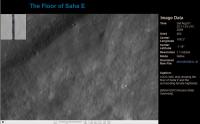
Very atypical picture, I can't recognize that this is a photo of the Moon. Looks rather like Mars image.
Frozen impact melt flows on the floor of Moore F, a farside highlands crater. -------------------- Free software for planetary science (including Cassini Image Viewer).
http://members.tripod.com/petermasek/marinerall.html |
|
|
|
|
Nov 6 2009, 03:35 AM
Post
#252
|
|
|
Member Group: Members Posts: 293 Joined: 22-September 08 From: Spain Member No.: 4350 |
|
|
|
|
|
Nov 6 2009, 06:10 PM
Post
#253
|
|
|
Member Group: Members Posts: 547 Joined: 1-May 06 From: Scotland (Ecosse, Escocia) Member No.: 759 |
QUOTE (peter59 @ Oct 31 2009, 06:30 PM) Very atypical picture, I can't recognize that this is a photo of the Moon. Looks rather like Mars image. Frozen impact melt flows on the floor of Moore F, a farside highlands crater. It doesn't look like melt, it looks like slump fractures. (actually, it also looks like a dirty glacier flowing over a rock bench, but we won't go there...!) |
|
|
|
|
Nov 18 2009, 12:14 AM
Post
#254
|
|
|
Senior Member Group: Members Posts: 1074 Joined: 21-September 07 From: Québec, Canada Member No.: 3908 |
An interesting oblique view across the N rim of Cabeus crater:
http://wms.lroc.asu.edu/lroc_browse/view/M109937747 |
|
|
|
|
Nov 20 2009, 06:48 PM
Post
#255
|
|
|
Solar System Cartographer Group: Members Posts: 10151 Joined: 5-April 05 From: Canada Member No.: 227 |
This isn't LROC... sorry! But check out a new radar image:
http://www.nasa.gov/mission_pages/Mini-RF/...e_20091110.html Phil -------------------- ... because the Solar System ain't gonna map itself.
Also to be found posting similar content on https://mastodon.social/@PhilStooke Maps for download (free PD: https://upload.wikimedia.org/wikipedia/comm...Cartography.pdf NOTE: everything created by me which I post on UMSF is considered to be in the public domain (NOT CC, public domain) |
|
|
|
|

|
Lo-Fi Version | Time is now: 25th April 2024 - 01:04 PM |
|
RULES AND GUIDELINES Please read the Forum Rules and Guidelines before posting. IMAGE COPYRIGHT |
OPINIONS AND MODERATION Opinions expressed on UnmannedSpaceflight.com are those of the individual posters and do not necessarily reflect the opinions of UnmannedSpaceflight.com or The Planetary Society. The all-volunteer UnmannedSpaceflight.com moderation team is wholly independent of The Planetary Society. The Planetary Society has no influence over decisions made by the UnmannedSpaceflight.com moderators. |
SUPPORT THE FORUM Unmannedspaceflight.com is funded by the Planetary Society. Please consider supporting our work and many other projects by donating to the Society or becoming a member. |
|