

MSL landing site: Gale Crater |

  |
MSL landing site: Gale Crater |
 Jul 24 2012, 11:14 PM Jul 24 2012, 11:14 PM
Post
#211
|
|
 Senior Member  Group: Members Posts: 1465 Joined: 9-February 04 From: Columbus OH USA Member No.: 13 |
QUOTE (RoverDriver @ Jul 24 2012, 05:08 PM)  Now, if *you* want to share it on UMSF, that one is "royalty" free. Unfortunately, I'm tubes-challenged. Just checked photobucket--their maximum image size is 20 MB and the mosaic is 233 MB! -------------------- |
 |
 
|
|
Jul 24 2012, 11:58 PM
Post
#212
|
|
|
Member Group: Admin Posts: 976 Joined: 29-September 06 From: Pasadena, CA - USA Member No.: 1200 |
QUOTE (jmknapp @ Jul 24 2012, 03:14 PM) Unfortunately, I'm tubes-challenged. Just checked photobucket--their maximum image size is 20 MB and the mosaic is 233 MB! Joe What happens to the file size if you use kdu_compress and generate a JP2 image? Mine compresses by about 4.6 times. Paolo -------------------- Disclaimer: all opinions, ideas and information included here are my own,and should not be intended to represent opinion or policy of my employer.
|
|
|
|
|
Jul 25 2012, 01:18 AM
Post
#213
|
|
|
Solar System Cartographer Group: Members Posts: 10153 Joined: 5-April 05 From: Canada Member No.: 227 |
You could also crop out the central portion where all the action is going to be and post that.
Phil -------------------- ... because the Solar System ain't gonna map itself.
Also to be found posting similar content on https://mastodon.social/@PhilStooke Maps for download (free PD: https://upload.wikimedia.org/wikipedia/comm...Cartography.pdf NOTE: everything created by me which I post on UMSF is considered to be in the public domain (NOT CC, public domain) |
|
|
|
|
Jul 25 2012, 02:32 AM
Post
#214
|
|
|
Senior Member Group: Members Posts: 1465 Joined: 9-February 04 From: Columbus OH USA Member No.: 13 |
QUOTE (Phil Stooke @ Jul 24 2012, 08:18 PM) You could also crop out the central portion where all the action is going to be and post that. Maybe so, assuming they stick the landing. On closer inspection I think it needs a little more work, as the images don't quite line up properly. The way that Paolo uses netpbm above I think involves compositing pairs of images together using a "max" function where there's overlap so the bright areas get duplicated if they don't line up, which allows you to see the amount of error. For example, here's a crop of a small area of overlap: 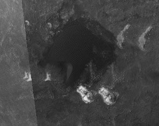 BTW, the full mosaic in pbm format is like 1.4 GB, in jpg 240 MB. -------------------- |
|
|
|
|
Jul 25 2012, 02:55 AM
Post
#215
|
|
|
Member Group: Admin Posts: 976 Joined: 29-September 06 From: Pasadena, CA - USA Member No.: 1200 |
QUOTE (jmknapp @ Jul 24 2012, 06:32 PM) Maybe so, assuming they stick the landing. On closer inspection I think it needs a little more work, as the images don't quite line up properly. The way that Paolo uses netpbm above I think involves compositing pairs of images together using a "max" function where there's overlap so the bright areas get duplicated if they don't line up, which allows you to see the amount of error. For example, here's a crop of a small area of overlap: BTW, the full mosaic in pbm format is like 1.4 GB, in jpg 240 MB. I realized that the orthos as published on the HiRiSE server are slightly different from the ones I have, this is why the canvas size was not large enough. What I would do it to work West to East and merge two images first, then add a third one and so on. To correct the offset you could pick easily recognizable features visible in the common part and measure an appropriate offset. It would be quite tedious, but doable. To ease the pain you can either crop the images or reduce the resolution even further. Paolo -------------------- Disclaimer: all opinions, ideas and information included here are my own,and should not be intended to represent opinion or policy of my employer.
|
|
|
|
|
Jul 25 2012, 04:49 AM
Post
#216
|
|
 Senior Member Group: Admin Posts: 3108 Joined: 21-December 05 From: Canberra, Australia Member No.: 615 |
QUOTE (jmknapp @ Jul 25 2012, 09:14 AM) Unfortunately, I'm tubes-challenged. Just checked photobucket--their maximum image size is 20 MB and the mosaic is 233 MB! Joe Hi Joe, great conversation with Paolo and impressive programming work from both of you on the mosaic. If you're wanting to host the image somewhere, could I suggest getting yourself a free Wordpress site where they give you 3Gb for nothing to store images on. You're limit for file types, but if you only want to host a jpg of the mosaic, then this might be the easiest solution for this or anything else you want to post/host. 
|
|
|
|
|
Jul 25 2012, 03:37 PM
Post
#217
|
|
|
Senior Member Group: Members Posts: 1465 Joined: 9-February 04 From: Columbus OH USA Member No.: 13 |
QUOTE (RoverDriver @ Jul 24 2012, 09:55 PM) I realized that the orthos as published on the HiRiSE server are slightly different from the ones I have, this is why the canvas size was not large enough. What I would do it to work West to East and merge two images first, then add a third one and so on. To correct the offset you could pick easily recognizable features visible in the common part and measure an appropriate offset. It would be quite tedious, but doable. To ease the pain you can either crop the images or reduce the resolution even further. OK, so that will take some time. Actually I just tried it with a couple of the orthos & it appears that there's some warpage across the images--i.e., I can get it to line up in one area but then it's off again at another point in the image. Roughly it seems like there's about 20 meters variation. So I guess that it won't be possible to get it perfect with just translations in X and Y. But 20 meters slop (about 1 arcsecond) just along the edges is pretty good for armchair work. Given that there will be some unavoidable misregistration of the images I'm thinking that blending them with pamarith isn't the way to go, as it can lead to doubling of features across a wide overlap area--I was pretty sure I was getting astigmatism, with moire-like patterns in dune fields, etc.! Maybe use the netpbm pamcomp command which lays one image on top of the other. That command allows you to specify an alpha mask so the black (empty) areas of the images can be filtered out. Thanks to astro-nought for the wordpress suggestion! They don't seem to have any bandwidth limit. -------------------- |
|
|
|
|
Jul 25 2012, 08:00 PM
Post
#218
|
|
|
Senior Member Group: Members Posts: 1465 Joined: 9-February 04 From: Columbus OH USA Member No.: 13 |
Per astro0's suggestion, I created a wordpress blog for the purpose of serving large images like the HiRISE mosaic:
Here's a post with links to a tight crop of the landing area (13000x10000 pixels 40 MB) along with the large view of the mosaic (30017×46254 pixels 240 MB): http://mslfan.wordpress.com/2012/07/25/hir...l-landing-area/ 'Course, at this rate, the 3GB of free storage won't last long... -------------------- |
|
|
|
| Guest_Oersted_* |
Jul 25 2012, 10:15 PM
Post
#219
|
|
Guests |
That was fast! - Beautiful site you threw together there, congrats, and thanks for allowing us to download your work (per the best traditions of UMSF).
|
|
|
|
|
Jul 26 2012, 02:10 AM
Post
#220
|
|
|
Member Group: Admin Posts: 976 Joined: 29-September 06 From: Pasadena, CA - USA Member No.: 1200 |
Thanks Joe for doing this. These days have been quite hectic but I will try to give some advice on things to try on the HiRISE images. Is anyone trying to localize the rover after landing? I'm not sure what images will be released to the public but you never know...
Paolo -------------------- Disclaimer: all opinions, ideas and information included here are my own,and should not be intended to represent opinion or policy of my employer.
|
|
|
|
|
Jul 26 2012, 04:36 AM
Post
#221
|
|
|
Solar System Cartographer Group: Members Posts: 10153 Joined: 5-April 05 From: Canada Member No.: 227 |
If we get even a navcam-resolution panorama early on, I'll be looking for it.
Phil -------------------- ... because the Solar System ain't gonna map itself.
Also to be found posting similar content on https://mastodon.social/@PhilStooke Maps for download (free PD: https://upload.wikimedia.org/wikipedia/comm...Cartography.pdf NOTE: everything created by me which I post on UMSF is considered to be in the public domain (NOT CC, public domain) |
|
|
|
|
Jul 26 2012, 04:47 AM
Post
#222
|
|
|
Founder Group: Chairman Posts: 14432 Joined: 8-February 04 Member No.: 1 |
Don't expect a panorama until late on sol 2 ( 48hrs after landing ) as the Mast isn't even deployed till then.
Infact, to be honest, I'd expect a HiRISE image of hardware on the surface before we get a panorama to nail it down. A MARDI frame or two on Sol 1 might narrow things down a bit though. |
|
|
|
|
Jul 26 2012, 05:15 AM
Post
#223
|
|
|
Solar System Cartographer Group: Members Posts: 10153 Joined: 5-April 05 From: Canada Member No.: 227 |
I agree, Doug, a HiRISE image is much more likely to find the site, as with Phoenix.
Phil -------------------- ... because the Solar System ain't gonna map itself.
Also to be found posting similar content on https://mastodon.social/@PhilStooke Maps for download (free PD: https://upload.wikimedia.org/wikipedia/comm...Cartography.pdf NOTE: everything created by me which I post on UMSF is considered to be in the public domain (NOT CC, public domain) |
|
|
|
|
Jul 26 2012, 05:46 AM
Post
#224
|
|
|
Founder Group: Chairman Posts: 14432 Joined: 8-February 04 Member No.: 1 |
The fun will be finding ALL the hardware
Probably to the East 6 Entry Ballast Mass impacts (which could be a meter or so across, each. 25kg of tungsten. They accelerate forward from the entry capsule when jettisoned, and it's doing 400m/sec+ at the time) Heatshield Could be anywhere Backshell and Parachute To the W / NW / N Descent Stage And, of course Rover (without the shadow of an upright mast) The hardware to the east may end up on the far side of the thin dune field that crosses the east end of the ellipse |
|
|
|
|
Jul 26 2012, 07:20 AM
Post
#225
|
|
|
Senior Member Group: Members Posts: 2920 Joined: 14-February 06 From: Very close to the Pyrénées Mountains (France) Member No.: 682 |
QUOTE (djellison @ Jul 26 2012, 07:46 AM) Parachute Yep floating around blown by the wind...didn't YOU show this in the MSL video? 
-------------------- |
|
|
|
|

|
Lo-Fi Version | Time is now: 28th April 2024 - 04:46 PM |
|
RULES AND GUIDELINES Please read the Forum Rules and Guidelines before posting. IMAGE COPYRIGHT |
OPINIONS AND MODERATION Opinions expressed on UnmannedSpaceflight.com are those of the individual posters and do not necessarily reflect the opinions of UnmannedSpaceflight.com or The Planetary Society. The all-volunteer UnmannedSpaceflight.com moderation team is wholly independent of The Planetary Society. The Planetary Society has no influence over decisions made by the UnmannedSpaceflight.com moderators. |
SUPPORT THE FORUM Unmannedspaceflight.com is funded by the Planetary Society. Please consider supporting our work and many other projects by donating to the Society or becoming a member. |
|


