

The Start of the Drive East, Up to Cambridge Bay |

  |
The Start of the Drive East, Up to Cambridge Bay |
 Jun 18 2010, 05:23 PM Jun 18 2010, 05:23 PM
Post
#46
|
|
|
Senior Member  Group: Moderator Posts: 4279 Joined: 19-April 05 From: .br at .es Member No.: 253 |
Actually, it's several sols in the past.
The latest info on this subject has been tweeted by Scott Maxwell: Yesterday's uplink did not make it onboard. We're not sure why it happened this time, but it does happen. Today: repeat yesterday's drive. AFAIK, it means no drive on sol 2275 (i.e. right now) but on sol 2276. |
 |
 
|
|
Jun 18 2010, 09:33 PM
Post
#47
|
|
 Senior Member Group: Members Posts: 1619 Joined: 12-February 06 From: Bergerac - FR Member No.: 678 |
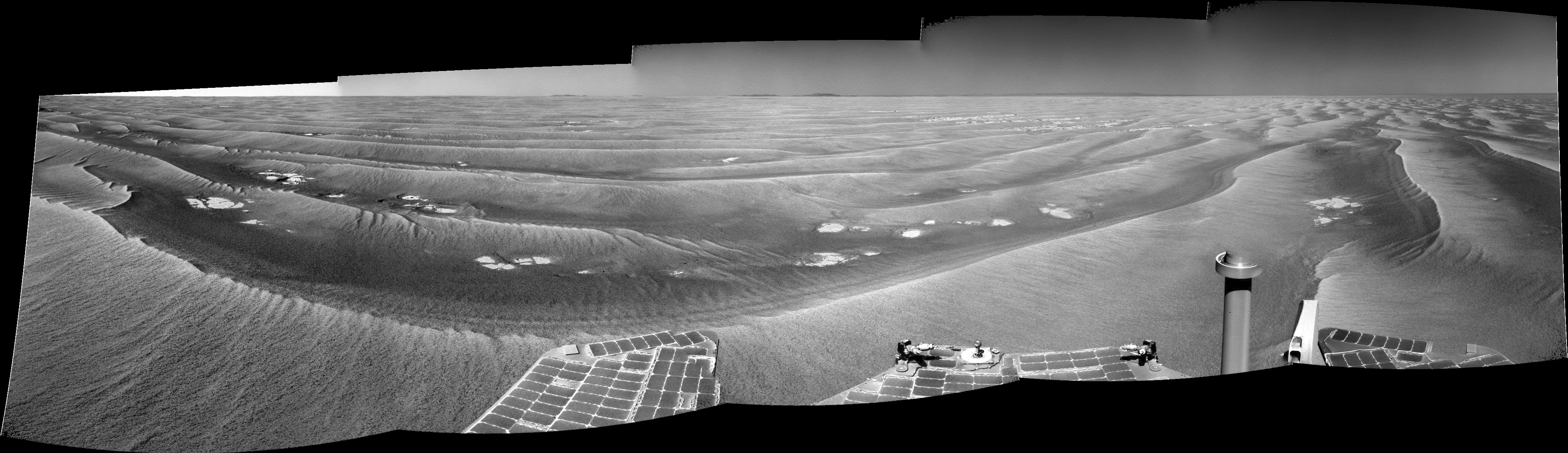
Sol 2272
 Still have a very good transparency  . .
-------------------- |
|
|
|
|
Jun 21 2010, 02:46 PM
Post
#48
|
|
|
Senior Member Group: Members Posts: 1619 Joined: 12-February 06 From: Bergerac - FR Member No.: 678 |
Sol 2274 navcam. The sky is to be particulary in a good transparency.
-------------------- |
|
|
|
|
Jun 22 2010, 08:45 AM
Post
#49
|
|
|
Member Group: Members Posts: 877 Joined: 7-March 05 From: Switzerland Member No.: 186 |
Yes, fine weather currently, also the shadows are so dark.
On the MER website we've got now a nice east corridor http://marsrovers.jpl.nasa.gov/mission/tm-...nity/index.html -------------------- |
|
|
|
|
Jun 22 2010, 09:15 PM
Post
#50
|
|
 Senior Member Group: Members Posts: 4247 Joined: 17-January 05 Member No.: 152 |
The latest images include multispectral pancams of this area:
http://marsrovers.jpl.nasa.gov/gallery/all...00P2555R1M1.JPG Potential meteorite, roughly centred, one quarter down from top of frame? |
|
|
|
|
Jun 23 2010, 09:37 AM
Post
#51
|
|
|
Senior Member Group: Moderator Posts: 4279 Joined: 19-April 05 From: .br at .es Member No.: 253 |
We'll see. It's roughly located SE of that position and the last move, during sol 2279, was more or less in that same direction.
BTW, I *think* this pancam sequence was automatically triggered by the new AEGIS software. |
|
|
|
|
Jun 23 2010, 01:22 PM
Post
#52
|
|
|
Senior Member Group: Members Posts: 3516 Joined: 4-November 05 From: North Wales Member No.: 542 |
Regarding the change of direction I note that prior to the move we had just rejoined the proposed route line and the latest move tracks that line very closely. I wonder how closely we will be following it from here onward?
|
|
|
|
|
Jun 23 2010, 01:37 PM
Post
#53
|
|
|
Solar System Cartographer Group: Members Posts: 10172 Joined: 5-April 05 From: Canada Member No.: 227 |
Don't put too much store in the 'proposed route', it only denotes the general direction. The actual route will have to zigzag between small obstacles like larger than average drifts and (later) Anatolia-style troughs, with occasional sidesteps to look at items of interest.
Phil -------------------- ... because the Solar System ain't gonna map itself.
Also to be found posting similar content on https://mastodon.social/@PhilStooke Maps for download (free PD: https://upload.wikimedia.org/wikipedia/comm...Cartography.pdf NOTE: everything created by me which I post on UMSF is considered to be in the public domain (NOT CC, public domain) |
|
|
|
|
Jun 23 2010, 09:09 PM
Post
#54
|
|
|
Senior Member Group: Moderator Posts: 4279 Joined: 19-April 05 From: .br at .es Member No.: 253 |
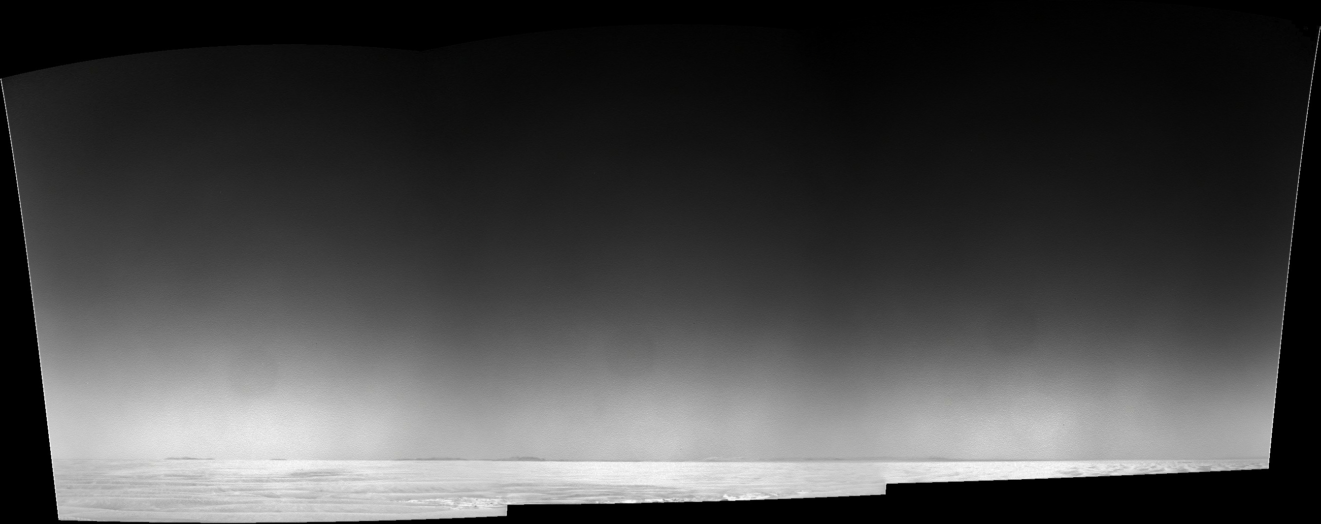
The images taken during sol 2279 are already available on the JPL site.
Curiously, the navcams (http://marsrovers.jpl.nasa.gov/gallery/all...nity_n2279.html) are tilted *up* 19 deg. instead of the usual 17 deg. down. It reminds me of that drive which was planned for X meters in one direction but was actually commanded on the opposite way.
|
|
|
|
|
Jun 23 2010, 11:52 PM
Post
#55
|
|
|
Senior Member Group: Members Posts: 4247 Joined: 17-January 05 Member No.: 152 |
Those navcams are odd. I wondered about cloud imaging - on the same sol there was a cloud in the fhazcam:
http://marsrovers.jpl.nasa.gov/gallery/all...FAP1205R0M1.JPG But cloud navcams are usually a series of downsampled frames. Maybe they're looking at sky transparency - those navcams show nicely how much the sky darkens as you move up from the horizon. To eliminate the effects of vignetting, which is symmetric about the frame centre, compare the brightness of sky the same distance from the top and bottom of the frame. Edit - of course these jpegs are auto stretched, so they don't reflect how much the sky really darkens with height. |
|
|
|
|
Jun 24 2010, 12:22 AM
Post
#56
|
|
|
Senior Member Group: Members Posts: 1619 Joined: 12-February 06 From: Bergerac - FR Member No.: 678 |
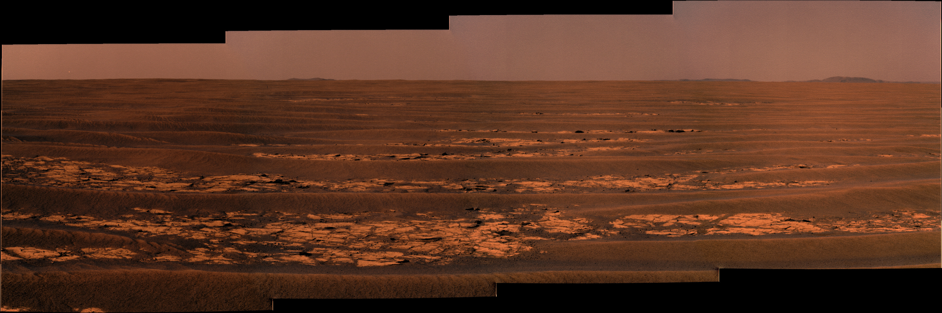
The pano. Personnaly, I like this kind of view
.
-------------------- |
|
|
|
|
Jun 24 2010, 05:16 AM
Post
#57
|
|
 The Poet Dude Group: Moderator Posts: 5551 Joined: 15-March 04 From: Kendal, Cumbria, UK Member No.: 60 |
QUOTE (Ant103 @ Jun 24 2010, 01:22 AM)  The pano. Personnaly, I like this kind of view .I know exactly what you mean. Wide open spaces... can't beat 'em...
-------------------- |
|
|
|
|
Jun 24 2010, 05:36 AM
Post
#58
|
|
 Senior Member Group: Admin Posts: 4763 Joined: 15-March 05 From: Glendale, AZ Member No.: 197 |
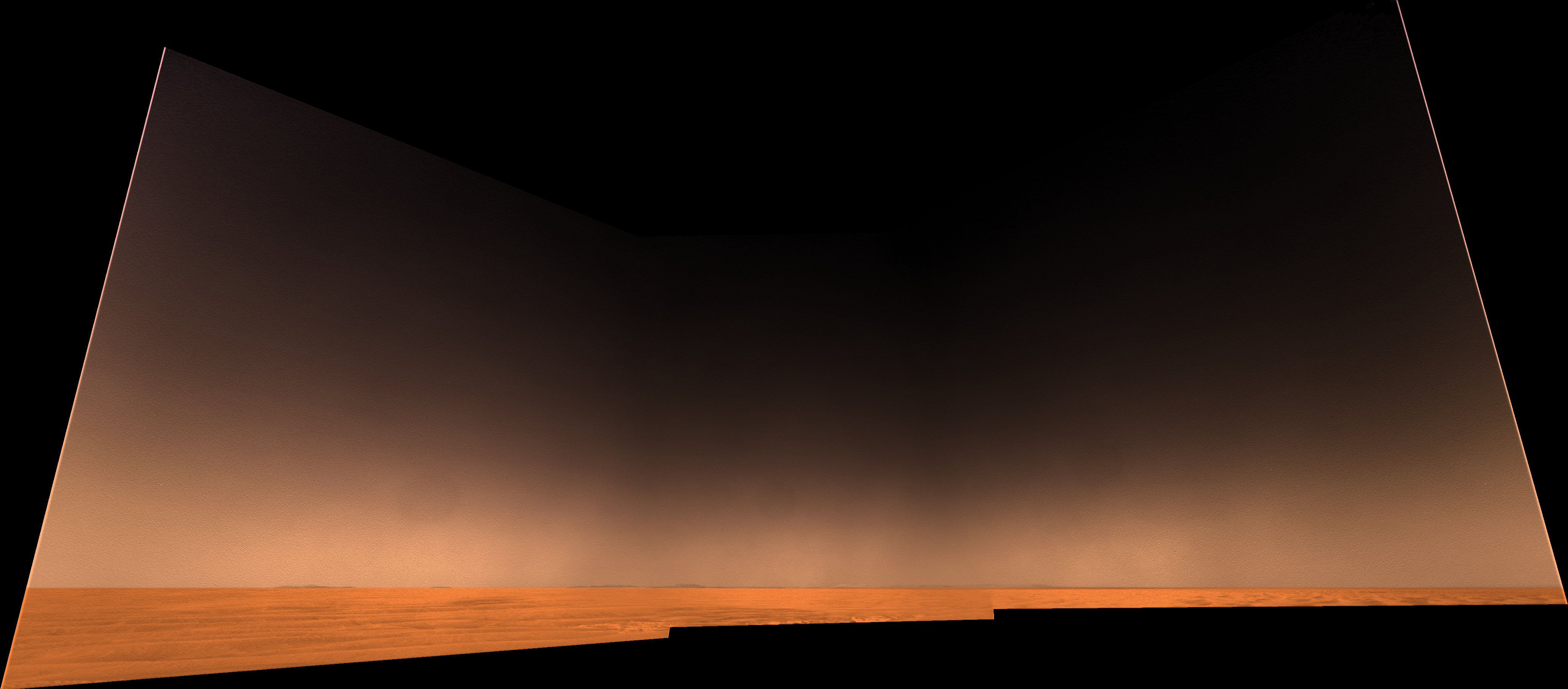
I've been gazing at Ant's desktop image from a couple of days ago on my second monitor. It looks so clear and those hills so tantalizing that if I were standing there in person I'd swear the hills were only two or three miles away (instead of the 20 mile distance that the far rim is sitting at.) You almost want to break into a run.
-------------------- If Occam had heard my theory, things would be very different now.
|
|
|
|
|
Jun 24 2010, 04:56 PM
Post
#59
|
|
|
Senior Member Group: Members Posts: 2998 Joined: 30-October 04 Member No.: 105 |
Didn't we have a discussion in "Distant Vistas" about being able to see hills clearly from long distances (20-90 miles), even here on Earth? I'm thinking mid-March of this year.
--Bill -------------------- |
|
|
|
|
Jun 24 2010, 05:13 PM
Post
#60
|
|
|
Senior Member Group: Members Posts: 1619 Joined: 12-February 06 From: Bergerac - FR Member No.: 678 |
Can't resist more
Color based on my last desktop pic.
-------------------- |
|
|
|
|

|
Lo-Fi Version | Time is now: 29th May 2024 - 06:37 PM |
|
RULES AND GUIDELINES Please read the Forum Rules and Guidelines before posting. IMAGE COPYRIGHT |
OPINIONS AND MODERATION Opinions expressed on UnmannedSpaceflight.com are those of the individual posters and do not necessarily reflect the opinions of UnmannedSpaceflight.com or The Planetary Society. The all-volunteer UnmannedSpaceflight.com moderation team is wholly independent of The Planetary Society. The Planetary Society has no influence over decisions made by the UnmannedSpaceflight.com moderators. |
SUPPORT THE FORUM Unmannedspaceflight.com is funded by the Planetary Society. Please consider supporting our work and many other projects by donating to the Society or becoming a member. |
|


