Journey to Mt Sharp - Part 5: Into the Valleys, Sol 706-752, Aug 1-Sep 17, 2014 |

  |
Journey to Mt Sharp - Part 5: Into the Valleys, Sol 706-752, Aug 1-Sep 17, 2014 |
 Aug 1 2014, 04:15 PM Aug 1 2014, 04:15 PM
Post
#1
|
|
 Senior Member  Group: Members Posts: 4247 Joined: 17-January 05 Member No.: 152 |
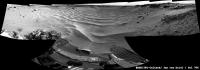
Toe-dip into the Hidden Valley ripples on 706:
 ...Maybe a good time for a new thread? |
 |
 
|
|
Aug 1 2014, 04:25 PM
Post
#2
|
|
 Administrator Group: Admin Posts: 5172 Joined: 4-August 05 From: Pasadena, CA, USA, Earth Member No.: 454 |
I think it's time for a new topic! It looks like we have indeed arrived in Hidden Valley, ending the southward drive from the Kimberley. It's time to take a right turn, heading west-southwest in valley floors, paralleling the black basaltic dunes, until we reach Murray Buttes.
-------------------- My website - My Patreon - @elakdawalla on Twitter - Please support unmannedspaceflight.com by donating here.
|
|
|
|
|
Aug 1 2014, 05:33 PM
Post
#3
|
||
 Member Group: Members Posts: 404 Joined: 5-January 10 Member No.: 5161 |
Descent into the valley!
|
|
|
|
|
|
|
Aug 1 2014, 05:59 PM
Post
#4
|
|
|
Member Group: Members Posts: 201 Joined: 16-December 13 Member No.: 7067 |
|
|
|
|
|
Aug 1 2014, 06:11 PM
Post
#5
|
|
|
Administrator Group: Admin Posts: 5172 Joined: 4-August 05 From: Pasadena, CA, USA, Earth Member No.: 454 |
QUOTE (anticitizen2 @ Aug 1 2014, 10:59 AM)  The subtitle gave me goosebumps Just investing this adventure with the drama it deserves 
-------------------- My website - My Patreon - @elakdawalla on Twitter - Please support unmannedspaceflight.com by donating here.
|
|
|
|
|
Aug 1 2014, 07:22 PM
Post
#6
|
||
|
Founder Group: Chairman Posts: 14432 Joined: 8-February 04 Member No.: 1 |
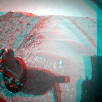
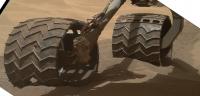
705 Toe Dip!
(Full Size - http://dougellison.smugmug.com/Landscapes/...ity/i-QRFgw57/O )
Attached thumbnail(s)
|
|
|
|
|
|
|
Aug 1 2014, 07:41 PM
Post
#7
|
|
|
Merciless Robot Group: Admin Posts: 8784 Joined: 8-December 05 From: Los Angeles Member No.: 602 |
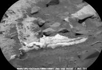
What a scene!!! That big layered guy with the white highlight at 1 o'clock from the POV is just begging for a close-up...the surrounding dunes look a bit forbidding, though.
-------------------- A few will take this knowledge and use this power of a dream realized as a force for change, an impetus for further discovery to make less ancient dreams real.
|
|
|
|
|
Aug 1 2014, 07:54 PM
Post
#8
|
|
 Senior Member Group: Members Posts: 1465 Joined: 9-February 04 From: Columbus OH USA Member No.: 13 |
Not much slippage per the speed plot and the track above looks good.
-------------------- |
|
|
|
|
Aug 1 2014, 08:10 PM
Post
#9
|
|
 Senior Member Group: Members Posts: 1619 Joined: 12-February 06 From: Bergerac - FR Member No.: 678 |
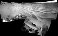
My take on this wonderful view
-------------------- |
|
|
|
|
Aug 2 2014, 05:02 AM
Post
#10
|
|
 Senior Member Group: Members Posts: 2228 Joined: 1-December 04 From: Marble Falls, Texas, USA Member No.: 116 |
QUOTE (fredk @ Aug 1 2014, 11:15 AM) Toe-dip It looks like we made a favorable "first impression." -------------------- ...Tom
I'm not a Space Fan, I'm a Space Exploration Enthusiast. |
|
|
|
|
Aug 2 2014, 03:44 PM
Post
#11
|
||
|
Solar System Cartographer Group: Members Posts: 10166 Joined: 5-April 05 From: Canada Member No.: 227 |
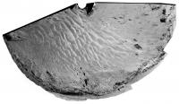
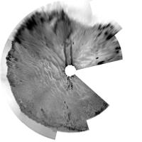
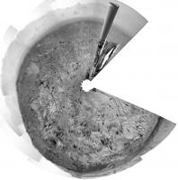
This is a circular version of Damia's mosaic from sol 706.
Phil
-------------------- ... because the Solar System ain't gonna map itself.
Also to be found posting similar content on https://mastodon.social/@PhilStooke Maps for download (free PD: https://upload.wikimedia.org/wikipedia/comm...Cartography.pdf NOTE: everything created by me which I post on UMSF is considered to be in the public domain (NOT CC, public domain) |
|
|
|
|
|
|
Aug 2 2014, 04:32 PM
Post
#12
|
|
 Senior Member Group: Moderator Posts: 3431 Joined: 11-August 04 From: USA Member No.: 98 |
QUOTE (elakdawalla @ Aug 1 2014, 12:11 PM) Just investing this adventure with the drama it deserves I think you nailed the title. I'm going to borrow that one, if you don't mind. |
|
|
|
|
Aug 2 2014, 04:41 PM
Post
#13
|
|
|
Administrator Group: Admin Posts: 5172 Joined: 4-August 05 From: Pasadena, CA, USA, Earth Member No.: 454 |
Considering just how much I'm relying on your website for my book, I certainly don't mind!
-------------------- My website - My Patreon - @elakdawalla on Twitter - Please support unmannedspaceflight.com by donating here.
|
|
|
|
|
Aug 2 2014, 05:17 PM
Post
#14
|
||
|
Solar System Cartographer Group: Members Posts: 10166 Joined: 5-April 05 From: Canada Member No.: 227 |
This is the sol 705 pan from the most recent press release, in circular form.
Phil
-------------------- ... because the Solar System ain't gonna map itself.
Also to be found posting similar content on https://mastodon.social/@PhilStooke Maps for download (free PD: https://upload.wikimedia.org/wikipedia/comm...Cartography.pdf NOTE: everything created by me which I post on UMSF is considered to be in the public domain (NOT CC, public domain) |
|
|
|
|
|
|
Aug 2 2014, 10:09 PM
Post
#15
|
|
|
Senior Member Group: Moderator Posts: 3431 Joined: 11-August 04 From: USA Member No.: 98 |
QUOTE (elakdawalla @ Aug 2 2014, 09:41 AM) I certainly don't mind! Thanks; it's good to know that it's useful. |
|
|
|
|
Aug 3 2014, 12:23 PM
Post
#16
|
|
|
Member Group: Members Posts: 154 Joined: 21-April 05 From: Rochester, New York, USA Member No.: 336 |
I seems appropriate that Curiosity will be spending much of August on the beach.
|
|
|
|
|
Aug 4 2014, 05:16 PM
Post
#17
|
|
|
Administrator Group: Admin Posts: 5172 Joined: 4-August 05 From: Pasadena, CA, USA, Earth Member No.: 454 |
I moved several wheel-related posts to the Monitoring wheel changes over time thread.
-------------------- My website - My Patreon - @elakdawalla on Twitter - Please support unmannedspaceflight.com by donating here.
|
|
|
|
|
Aug 4 2014, 08:10 PM
Post
#18
|
|
|
Administrator Group: Admin Posts: 5172 Joined: 4-August 05 From: Pasadena, CA, USA, Earth Member No.: 454 |
Hmmm. Wondering if we're seeing another excessive slip event on sol 709. If it is, it doesn't look as excessive as the one back on sol 672.
-------------------- My website - My Patreon - @elakdawalla on Twitter - Please support unmannedspaceflight.com by donating here.
|
|
|
|
|
Aug 4 2014, 08:33 PM
Post
#19
|
|
|
Senior Member Group: Members Posts: 4247 Joined: 17-January 05 Member No.: 152 |
I suppose this will be the kind of view we have for a while...
 Sure makes you appreciate the usefulness of orbital imagery. |
|
|
|
|
Aug 4 2014, 08:56 PM
Post
#20
|
|
|
Member Group: Members Posts: 808 Joined: 10-October 06 From: Maynard Mass USA Member No.: 1241 |
what is this little valley?
ancient riverbed? (will there be cobbles in the banks?) a rift? just wondering... -------------------- CLA CLL
|
|
|
|
|
Aug 4 2014, 09:01 PM
Post
#21
|
||
|
Senior Member Group: Members Posts: 2833 Joined: 22-April 05 From: Ridderkerk, Netherlands Member No.: 353 |
Sol 706
Hidden Valley Jan van Driel
|
|
|
|
|
|
|
Aug 4 2014, 10:14 PM
Post
#22
|
|
 Senior Member Group: Members Posts: 2429 Joined: 30-January 13 From: Penang, Malaysia. Member No.: 6853 |
QUOTE (elakdawalla @ Aug 5 2014, 04:10 AM) Wondering if we're seeing another excessive slip event on sol 709. If it is, it doesn't look as excessive as the one back on sol 672. The drive distances published by Joe and Midnight Planets (MP) are rarely aligned as MP reports point-to-point movement, with Joe reporting the drive distance using NAIF wheel turn data that includes donuts during the drive. Looking at the images we have so far, the sol 709 drive appears straight with one partial donut (turn) at the beginning of the drive. Comparing the distances 14.1m by MP and 26m from Joe along with the spacing of the marks left by the cleats in the wheel track it appears we have had some slip, but apparently not enough to trigger a halt in the drive which looks like good news for a traverse through these valley systems. I note that this drive took the rover closer to the southern wall of the valley, HiRISE images suggest the ripples are smaller on that side of the valley I wonder if they would offer less slip? Or it could just be that the southern wall is not as steep as the north wall and could be used to exit the floor if required. |
|
|
|
|
Aug 4 2014, 11:09 PM
Post
#23
|
|
|
Senior Member Group: Members Posts: 2346 Joined: 7-December 12 Member No.: 6780 |
Part of this press release sounds almost like the announcement of a waypoint:
QUOTE ...an appetizer outcrop of a base layer of the mountain lies ... less than one-third of a mile (500 meters) from Curiosity. The rover team is calling the outcrop "Pahrump Hills." ...
|
|
|
|
|
Aug 4 2014, 11:21 PM
Post
#24
|
|
|
Administrator Group: Admin Posts: 5172 Joined: 4-August 05 From: Pasadena, CA, USA, Earth Member No.: 454 |
Hmmmmm. I'd buy that. "Appetizer" sounds like they're thinking about eating something
-------------------- My website - My Patreon - @elakdawalla on Twitter - Please support unmannedspaceflight.com by donating here.
|
|
|
|
|
Aug 5 2014, 12:22 AM
Post
#25
|
|
|
Solar System Cartographer Group: Members Posts: 10166 Joined: 5-April 05 From: Canada Member No.: 227 |
My interpretation of the final waypoint from the original waypoint map was that it was on this same valley floor unit, so I think this may just be the first exposure of the same unit along this new path.
Phil -------------------- ... because the Solar System ain't gonna map itself.
Also to be found posting similar content on https://mastodon.social/@PhilStooke Maps for download (free PD: https://upload.wikimedia.org/wikipedia/comm...Cartography.pdf NOTE: everything created by me which I post on UMSF is considered to be in the public domain (NOT CC, public domain) |
|
|
|
|
Aug 5 2014, 01:31 AM
Post
#26
|
||
|
Senior Member Group: Members Posts: 1465 Joined: 9-February 04 From: Columbus OH USA Member No.: 13 |
Check the speed plot from this drive--it looks like maybe slip detection kicked in at t=1850. The way I'm interpreting such data anyway is that spikes of more than a few cm/sec represent slip, and those usually occur (if they do) at the beginning of a drive pulse (makes sense I guess). Usually the slip is short-lived and the rover continues forward but at 1850 there's no action after the big pulse of 45 cm. That's still just a fraction of a rotation of the wheel. But then it seems to proceed OK. There was some zig-zagging at the end, at least according to the raw SPICE data:
Never sure how much to take that as gospel though. -------------------- |
|
|
|
|
|
|
Aug 5 2014, 01:49 AM
Post
#27
|
||
|
Solar System Cartographer Group: Members Posts: 10166 Joined: 5-April 05 From: Canada Member No.: 227 |
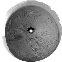
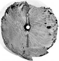
A very rough circular view to get our current location:
Phil -------------------- ... because the Solar System ain't gonna map itself.
Also to be found posting similar content on https://mastodon.social/@PhilStooke Maps for download (free PD: https://upload.wikimedia.org/wikipedia/comm...Cartography.pdf NOTE: everything created by me which I post on UMSF is considered to be in the public domain (NOT CC, public domain) |
|
|
|
|
|
|
Aug 5 2014, 09:27 AM
Post
#28
|
|
|
Senior Member Group: Members Posts: 2346 Joined: 7-December 12 Member No.: 6780 |
QUOTE (jmknapp @ Aug 5 2014, 03:31 AM) Check the speed plot from this drive--it looks like maybe slip detection kicked in at t=1850. The time for the pause seems to match with this NavCam Left B image. So I'm considering, that the stop (at t=1850) has been intentional to do some imaging. The last driving phase took about 600s, like the one before. This gives me some hope, that the termination of the drive hasn't been triggered by slipping, presuming periodic imaging stops. But when looking at the right front wheel (driving backward), there may be an augmented risk of excessive slippage. |
|
|
|
|
Aug 5 2014, 11:50 AM
Post
#29
|
|
|
Senior Member Group: Members Posts: 2346 Joined: 7-December 12 Member No.: 6780 |
One of the Sol 708 MARDIs in an enhanced version, to provide a look to the ground:
 (and to indicate, how beautiful MARDIs can look, sometimes) |
|
|
|
|
Aug 5 2014, 05:30 PM
Post
#30
|
|
|
Member Group: Members Posts: 201 Joined: 16-December 13 Member No.: 7067 |
Sol 706 NavCam during wheel inspection - watch the lengthening shadows
709 drive into the valley   looks really nice as an anaglyph looks really nice as an anaglyph_____________________________________________________________________________ EDIT: 710 is starting to come down Backing up from the Rear HazCams - Anaglyph version |
|
|
|
|
Aug 5 2014, 08:30 PM
Post
#31
|
|
|
Senior Member Group: Members Posts: 2346 Joined: 7-December 12 Member No.: 6780 |
The puzzle about the slippage has been resolved by Ken Herkenhoff's recent post:
QUOTE The Sol 709 drive was not as long as planned because the minimum 2 meters of progress out of 4.5 meters commanded was not achieved. This software check may be disabled for future drives across sandy material, to allow more slippage before the rover stops driving. So the criteria in this case seems to have been the overall progress in contrast to a short-term excessive slippage. |
|
|
|
|
Aug 5 2014, 08:33 PM
Post
#32
|
||
|
Senior Member Group: Members Posts: 2833 Joined: 22-April 05 From: Ridderkerk, Netherlands Member No.: 353 |
The Navcam view on Sol 709.
Jan van Driel
|
|
|
|
|
|
|
Aug 5 2014, 09:55 PM
Post
#33
|
||
|
Solar System Cartographer Group: Members Posts: 10166 Joined: 5-April 05 From: Canada Member No.: 227 |
... and a circular view of it - thanks, Jan!
Phil
-------------------- ... because the Solar System ain't gonna map itself.
Also to be found posting similar content on https://mastodon.social/@PhilStooke Maps for download (free PD: https://upload.wikimedia.org/wikipedia/comm...Cartography.pdf NOTE: everything created by me which I post on UMSF is considered to be in the public domain (NOT CC, public domain) |
|
|
|
|
|
|
Aug 6 2014, 02:01 AM
Post
#34
|
|
|
Senior Member Group: Members Posts: 4247 Joined: 17-January 05 Member No.: 152 |
Have we seen flatfielded images on the jpl jpeg site before?
http://mars.jpl.nasa.gov/msl/multimedia/ra...mera=CHEMCAM%5F |
|
|
|
|
Aug 6 2014, 02:55 AM
Post
#35
|
|
 Member Group: Members Posts: 691 Joined: 21-December 07 From: Clatskanie, Oregon Member No.: 3988 |
Those images are not flat-fielded. But I do see possible sky-flats that can be turned into rough flat-fields
. Those type of images appear like all others on the raw page. You will not see of coarse calibrated images that have been flat-fielded. Those have to wait until they hit the PDS.
|
|
|
|
|
Aug 6 2014, 03:06 AM
Post
#36
|
|
|
Senior Member Group: Members Posts: 4247 Joined: 17-January 05 Member No.: 152 |
Compare these two images:
  It's clear the second one is a flatfielded version of the first. The filenames differ only in the text codes (EDR vs PRC and M_ vs L1). The paths are also different. I don't recall anything like this before. Either a glitch or a new policy (hopefully the latter!). |
|
|
|
|
Aug 6 2014, 03:11 AM
Post
#37
|
|
|
Member Group: Members Posts: 691 Joined: 21-December 07 From: Clatskanie, Oregon Member No.: 3988 |
Oh wow! I didn't scroll down far enough to see that! You are right, those have been flat-fielded in the enhanced section.
That is interesting! |
|
|
|
|
Aug 6 2014, 03:34 AM
Post
#38
|
|
|
Administrator Group: Admin Posts: 5172 Joined: 4-August 05 From: Pasadena, CA, USA, Earth Member No.: 454 |
OOOOOOOOOO!
-------------------- My website - My Patreon - @elakdawalla on Twitter - Please support unmannedspaceflight.com by donating here.
|
|
|
|
|
Aug 6 2014, 02:41 PM
Post
#39
|
||
|
Senior Member Group: Members Posts: 2833 Joined: 22-April 05 From: Ridderkerk, Netherlands Member No.: 353 |
The Navcam L panoramic view on Sol 710.
Jan van Driel
|
|
|
|
|
|
|
Aug 6 2014, 03:02 PM
Post
#40
|
|
|
Senior Member Group: Members Posts: 2346 Joined: 7-December 12 Member No.: 6780 |
QUOTE (fredk @ Aug 6 2014, 05:06 AM) ... I don't recall anything like this before. Either a glitch or a new policy (hopefully the latter!). It's RDRs -- in PNG format -- in addition to EDR JPGs, great! It makes RMI images much easier to use. |
|
|
|
|
Aug 6 2014, 03:03 PM
Post
#41
|
|
|
Senior Member Group: Members Posts: 4247 Joined: 17-January 05 Member No.: 152 |
QUOTE (algorithm @ Jul 29 2014, 08:53 PM) Is driving straight down the middle the only route? What about tip-toeing around the edge It looks like driving along the edges is indeed the plan acording to this release: http://mars.jpl.nasa.gov/msl/multimedia/vi...index.cfm?v=209 |
|
|
|
|
Aug 6 2014, 03:11 PM
Post
#42
|
|
|
Senior Member Group: Members Posts: 4247 Joined: 17-January 05 Member No.: 152 |
QUOTE (Gerald @ Aug 6 2014, 03:02 PM) in PNG format Yeah - there was a good argument to be made for providing flatfielded images, since this camera suffers from such severe vignetting and typically clipping near the centre in the jpl jpegs. But png is icing on the cake! |
|
|
|
|
Aug 6 2014, 04:08 PM
Post
#43
|
|
|
Member Group: Members Posts: 201 Joined: 16-December 13 Member No.: 7067 |
I combined the 709-710 out and back drives
Rear Haz looking into the valley - Anaglyph Front Haz looking out of the valley - Anaglyph NavCam - Anaglyph |
|
|
|
|
Aug 6 2014, 04:15 PM
Post
#44
|
||
|
Solar System Cartographer Group: Members Posts: 10166 Joined: 5-April 05 From: Canada Member No.: 227 |
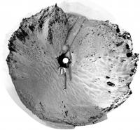
Jan's sol 710 pan in circular format. Thanks, Jan.
Phil
-------------------- ... because the Solar System ain't gonna map itself.
Also to be found posting similar content on https://mastodon.social/@PhilStooke Maps for download (free PD: https://upload.wikimedia.org/wikipedia/comm...Cartography.pdf NOTE: everything created by me which I post on UMSF is considered to be in the public domain (NOT CC, public domain) |
|
|
|
|
|
|
Aug 6 2014, 07:12 PM
Post
#45
|
|
|
Member Group: Members Posts: 201 Joined: 16-December 13 Member No.: 7067 |
|
|
|
|
|
Aug 6 2014, 07:34 PM
Post
#46
|
|
|
Member Group: Members Posts: 279 Joined: 19-August 07 Member No.: 3299 |
I am surprised to see the sand marked by the wheels of the rover so dark. It looks like that the under surface is wet for the so arid zone. I am supposing that the sand under surface would be about the same colour as the surface ones.
|
|
|
|
|
Aug 6 2014, 07:34 PM
Post
#47
|
|
 Member Group: Members Posts: 334 Joined: 11-December 12 From: The home of Corby Crater (Corby-England) Member No.: 6783 |
QUOTE (anticitizen2 @ Aug 6 2014, 08:12 PM) Ok, I'm a little nervous This baby probably has more torque per (Something!) than a Bugatti Veyron, so if you can see the axle then everything is probably cool.  |
|
|
|
|
Aug 6 2014, 08:26 PM
Post
#48
|
|
|
Senior Member Group: Members Posts: 4247 Joined: 17-January 05 Member No.: 152 |
QUOTE (SpaceListener @ Aug 6 2014, 08:34 PM) I am surprised to see the sand marked by the wheels of the rover so dark. We've seen this before - I guess it's just that the top surface has a coating of the ubiquitous light coloured dust. |
|
|
|
|
Aug 7 2014, 02:28 AM
Post
#49
|
|
|
Member Group: Admin Posts: 976 Joined: 29-September 06 From: Pasadena, CA - USA Member No.: 1200 |
QUOTE (algorithm @ Aug 6 2014, 12:34 PM) This baby probably has more torque per (Something!) than a Bugatti Veyron, so if you can see the axle then everything is probably cool. About 740 ft lb. About three times my car has. Paolo -------------------- Disclaimer: all opinions, ideas and information included here are my own,and should not be intended to represent opinion or policy of my employer.
|
|
|
|
|
Aug 7 2014, 08:33 AM
Post
#50
|
||
|
Member Group: Members Posts: 282 Joined: 18-June 04 Member No.: 84 |
Impressive layering - SOL 710
Attached thumbnail(s)
|
|
|
|
|
|
|
Aug 7 2014, 09:11 AM
Post
#51
|
|
 Senior Member Group: Admin Posts: 3108 Joined: 21-December 05 From: Canberra, Australia Member No.: 615 |
Why am I hearing the theme to Jaws again?
 |
|
|
|
|
Aug 7 2014, 01:48 PM
Post
#52
|
|
|
Member Group: Members Posts: 201 Joined: 16-December 13 Member No.: 7067 |
Stirling has now been run over a few times
Curiosity summits Stirling - Anaglyph Lots of large sandy walls, plenty of opportunities to spot material slides http://mars.jpl.nasa.gov/msl-raw-images/ms...525E01_DXXX.jpg Can't wait to see the valleys post-Curiosity with HiRISE |
|
|
|
|
Aug 7 2014, 07:28 PM
Post
#53
|
||
|
Member Group: Members Posts: 334 Joined: 11-December 12 From: The home of Corby Crater (Corby-England) Member No.: 6783 |
QUOTE (xflare @ Aug 7 2014, 09:33 AM) Impressive layering - SOL 710 Impressive indeed.
Attached thumbnail(s)
|
|
|
|
|
|
|
Aug 7 2014, 07:43 PM
Post
#54
|
||
|
Senior Member Group: Members Posts: 2833 Joined: 22-April 05 From: Ridderkerk, Netherlands Member No.: 353 |
Sol 711
2 ChemCam images stitched together. Jan van Driel
|
|
|
|
|
|
|
Aug 7 2014, 08:45 PM
Post
#55
|
||
|
Member Group: Members Posts: 866 Joined: 15-March 05 From: Santa Cruz, CA Member No.: 196 |
the fin lurks yonder (crosseye)
|
|
|
|
|
|
|
Aug 8 2014, 10:23 AM
Post
#56
|
|
|
Senior Member Group: Members Posts: 2921 Joined: 14-February 06 From: Very close to the Pyrénées Mountains (France) Member No.: 682 |
QUOTE (RoverDriver @ Aug 7 2014, 04:28 AM) About three times my car has. Paolo Is this yet another new Nasa measurement unit ?  
-------------------- |
|
|
|
|
Aug 8 2014, 01:58 PM
Post
#57
|
|
|
Senior Member Group: Members Posts: 1044 Joined: 17-February 09 Member No.: 4605 |
Foot pounds? I thought given the US membership of BIPM and the fate of the Mars Polar Orbiter the MKS system would be compulsory in all mission aspects?
|
|
|
|
|
Aug 8 2014, 02:51 PM
Post
#58
|
||
|
Senior Member Group: Members Posts: 2833 Joined: 22-April 05 From: Ridderkerk, Netherlands Member No.: 353 |
The Navcam L view on Sol 711.
Jan van Driel
|
|
|
|
|
|
|
Aug 8 2014, 09:26 PM
Post
#59
|
|
|
Member Group: Admin Posts: 976 Joined: 29-September 06 From: Pasadena, CA - USA Member No.: 1200 |
QUOTE (serpens @ Aug 8 2014, 06:58 AM) Foot pounds? I thought given the US membership of BIPM and the fate of the Mars Polar Orbiter the MKS system would be compulsory in all mission aspects? Yes, the actual specs say 1000 Nm. I converted to ft lb since most of the US readers are probably familiar with that unit. Paolo -------------------- Disclaimer: all opinions, ideas and information included here are my own,and should not be intended to represent opinion or policy of my employer.
|
|
|
|
|
Aug 8 2014, 09:55 PM
Post
#60
|
|
|
Member Group: Members Posts: 201 Joined: 16-December 13 Member No.: 7067 |
Back out of the valley!
http://i.imgur.com/DmkA36H.gif From the latest USGS post, it sounds like there has been a lot of staring at HiRISE images over the last few days |
|
|
|
|
Aug 8 2014, 10:42 PM
Post
#61
|
|
|
Senior Member Group: Members Posts: 1044 Joined: 17-February 09 Member No.: 4605 |
Is this a case of a reverse Kipling "Out of the valley of death rode the 600"?
|
|
|
|
|
Aug 8 2014, 11:04 PM
Post
#62
|
|
|
Senior Member Group: Members Posts: 2517 Joined: 13-September 05 Member No.: 497 |
I thought they had done a lot of testing of driving on sand, so to be concerned about it seems odd. Is there something unusual about this particular sand?
-------------------- Disclaimer: This post is based on public information only. Any opinions are my own.
|
|
|
|
|
Aug 8 2014, 11:25 PM
Post
#63
|
|
|
Senior Member Group: Members Posts: 4247 Joined: 17-January 05 Member No.: 152 |
QUOTE (anticitizen2 @ Aug 8 2014, 09:55 PM) it sounds like there has been a lot of staring at HiRISE images over the last few days Maybe more likely poring over the numbers from the Hidden Valley drives and comparing with the test drives. These are the first MSL drives on substantial Martian sand, and I guess there's nothing like the "ground truth".
|
|
|
|
|
Aug 8 2014, 11:32 PM
Post
#64
|
|
|
Member Group: Members Posts: 201 Joined: 16-December 13 Member No.: 7067 |
Right, but the strategic planning had been through the valleys - I was guessing they didn't have a solid "next best route" over the terrain they were trying to avoid beginning at the Hidden Valley entrance.
It wasn't any serious analysis, just a comment to relieve some anxiety over the 180 I hope they show some of the shredded wheels from the Mars Yard still functioning to reassure wheel-worriers |
|
|
|
|
Aug 9 2014, 12:11 AM
Post
#65
|
|
|
Senior Member Group: Members Posts: 2086 Joined: 13-February 10 From: Ontario Member No.: 5221 |
Wasn't the plan to drive as close to the cliff edge as possible, so that there was solid ground right underneath in case of slippage? I'm sure it was mentioned in one of the earlier posts but I can't find it now...
|
|
|
|
|
Aug 9 2014, 12:14 AM
Post
#66
|
|
|
Senior Member Group: Members Posts: 4247 Joined: 17-January 05 Member No.: 152 |
Yep - check out this post. I guess it's still a question of what the ground is like near the sides - in particular, how steep is it?
|
|
|
|
|
Aug 9 2014, 01:02 AM
Post
#67
|
|
|
Senior Member Group: Members Posts: 1465 Joined: 9-February 04 From: Columbus OH USA Member No.: 13 |
QUOTE (Explorer1 @ Aug 8 2014, 07:11 PM) solid ground right underneath in case of slippage Though perhaps all it would take is one little divot with deeper sand the catch a wheel? QUOTE (anticitizen2 @ Aug 8 2014, 07:32 PM) wheel-worriers As reported over the last months, that category would include much of the mission team. Wouldn't envy the person who signs off on the plan to go into the sand drifts though. Better the devil you know? BTW, here's the egress: http://curiosityrover.com/tracking/drivetr...hp?drivenum=228 -------------------- |
|
|
|
|
Aug 9 2014, 03:49 AM
Post
#68
|
|
|
Administrator Group: Admin Posts: 5172 Joined: 4-August 05 From: Pasadena, CA, USA, Earth Member No.: 454 |
QUOTE (mcaplinger @ Aug 8 2014, 04:04 PM) I thought they had done a lot of testing of driving on sand, so to be concerned about it seems odd. Is there something unusual about this particular sand? I did not have the impression they expected so much slip on the sand in these valleys. They crossed Dingo Gap with little problem. At the same time, it does seem to me that they were making enough progress and almost all the way through the ripples on sol 709 that it seems like they should've made it if they kept going -- but that clearly wasn't good enough. Apparently they're still at work today as I type. Sometimes Mars is hard. -------------------- My website - My Patreon - @elakdawalla on Twitter - Please support unmannedspaceflight.com by donating here.
|
|
|
|
|
Aug 9 2014, 01:17 PM
Post
#69
|
||
|
Senior Member Group: Members Posts: 2346 Joined: 7-December 12 Member No.: 6780 |
QUOTE ... do we keep trying to drive in the sand in Hidden Valley, or do we drive on the rocky surface of Zabriskie plateau? of Ryan Anderson's USGS post. My guess would be, after looking at features like this funnel(?)
(Sol 710) they'll prefer taking the predictable and manageable risk of Zabriskie plateau over the fuzzy risk of the sand. |
|
|
|
|
|
|
Aug 9 2014, 05:08 PM
Post
#70
|
|
 Member Group: Members Posts: 103 Joined: 12-February 05 From: Utah Member No.: 167 |
If they have to go out of Hidden Valley, where is the point on the Zabriskie plateau where the "caprock" ends? And are they going to still try to reach that nearby outcrop they think is Mt. Sharp material? (Pahrump Hills as mentioned a couple of pages back)
-------------------- - My signature idea machine is busted right now.
|
|
|
|
|
Aug 9 2014, 05:30 PM
Post
#71
|
|
|
Member Group: Members Posts: 507 Joined: 10-September 08 Member No.: 4338 |
Is there a third alternative? Perhaps the dark sands of the "moat" (if I may call it that) below Mount Sharp might be more stable than the light sands in Hidden Valley?
|
|
|
|
|
Aug 9 2014, 05:36 PM
Post
#72
|
|
|
Senior Member Group: Members Posts: 4247 Joined: 17-January 05 Member No.: 152 |
I've wondered about the dark sands too. Looking at the orbital imagery, there actually looks like a finger of the dark sands reaching into a southern fork of Hidden Valley, only a couple hundred metres to our south. But the problem with that might be that if the dark sands are found to be not traversable, then you may have to do substantial backtracking to avoid them.
Isn't back seat driving so much fun?
|
|
|
|
|
Aug 9 2014, 07:55 PM
Post
#73
|
||
|
Senior Member Group: Members Posts: 2346 Joined: 7-December 12 Member No.: 6780 |
QUOTE (Bubbinski @ Aug 9 2014, 07:08 PM) If they have to go out of Hidden Valley, where is the point on the Zabriskie plateau where the "caprock" ends? And are they going to still try to reach that nearby outcrop they think is Mt. Sharp material? (Pahrump Hills as mentioned a couple of pages back) Based on a screenshot of Joe's site (basing on HiRISE/SPICE in this screenshot), here a version enhancing (radius 2) hipass features as red:
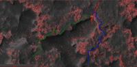
Hipass features should correlate to surface roughness, although using a DTM would be more appropriate. I wouldn't rule out, that there may exist routes avoiding the Hidden Valley, but still reaching to the nearby outcrop. I've marked the beginning of two such out-of-the-hip route candidates, both not free of risk. |
|
|
|
|
|
|
Aug 9 2014, 08:42 PM
Post
#74
|
|
|
Member Group: Members Posts: 103 Joined: 12-February 05 From: Utah Member No.: 167 |
Thanks Gerald! That green route looks like it passes too close to the valley edge for comfort (having a nightmare vision of a tumbling rover).
-------------------- - My signature idea machine is busted right now.
|
|
|
|
|
Aug 9 2014, 08:48 PM
Post
#75
|
|
|
Senior Member Group: Members Posts: 2228 Joined: 1-December 04 From: Marble Falls, Texas, USA Member No.: 116 |
I just wanted to make everyone aware of the fact that next week (Aug. 14 & 15) there will be a Von Karman Lecture about Curiosity's second year on Mars. It bears the intriguing title "Curiosity's Second Year: The Epic and Occasionally Bogus Journey to the Foothills of Mt. Sharp."
The lecture will be in Pasadena, CA, but it looks like it will also be webcasted on Ustream. -------------------- ...Tom
I'm not a Space Fan, I'm a Space Exploration Enthusiast. |
|
|
|
|
Aug 9 2014, 09:45 PM
Post
#76
|
|
|
Member Group: Members Posts: 103 Joined: 12-February 05 From: Utah Member No.: 167 |
Just took a look at sol 714 raw images. Looks like they're on the plateau and away from Hidden Valley entirely.
-------------------- - My signature idea machine is busted right now.
|
|
|
|
|
Aug 9 2014, 10:56 PM
Post
#77
|
|
|
Senior Member Group: Members Posts: 3516 Joined: 4-November 05 From: North Wales Member No.: 542 |
It seems there are many different types of sand drift on Mars. Some are solid enough you could just about cut steps with your boots while on others you're immediately up to your thighs. I wonder if it has to do with how long they've been immobile (I mean the dark sand, not the rusty dust on top)?
|
|
|
|
|
Aug 10 2014, 01:17 AM
Post
#78
|
|
|
Senior Member Group: Members Posts: 4247 Joined: 17-January 05 Member No.: 152 |
QUOTE (Bubbinski @ Aug 9 2014, 10:45 PM) Looks like they're on the plateau and away from Hidden Valley entirely. Yeah, and I can't imagine why we'd drive this far out of HV if the valley route was still considered an option: 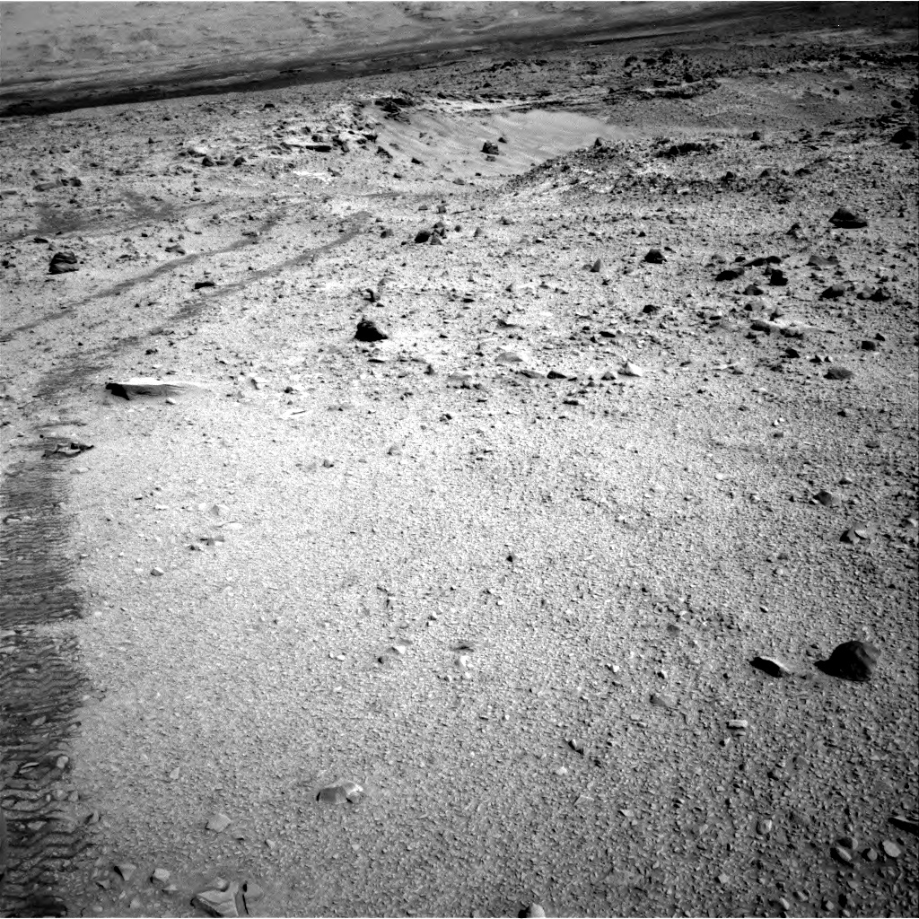
|
|
|
|
|
Aug 10 2014, 12:44 PM
Post
#79
|
||
|
Senior Member Group: Members Posts: 2833 Joined: 22-April 05 From: Ridderkerk, Netherlands Member No.: 353 |
The Navcam view on Sol 713.
Jan van Driel
|
|
|
|
|
|
|
Aug 11 2014, 12:04 AM
Post
#80
|
|
|
Member Group: Members Posts: 691 Joined: 21-December 07 From: Clatskanie, Oregon Member No.: 3988 |
An apparent radiation storm? A whole sequence of Rear Hazcam images with salt and pepper noise. Sol-710
http://mars.jpl.nasa.gov/msl-raw-images/pr...RHAZ00233M_.JPG |
|
|
|
|
Aug 11 2014, 02:56 AM
Post
#81
|
|
|
Senior Member Group: Members Posts: 4247 Joined: 17-January 05 Member No.: 152 |
It looks to me like the extra noise you see when longer exposures are taken. But this sequence was just after 3pm local time, when you shouldn't need long exposures.
|
|
|
|
|
Aug 11 2014, 03:46 AM
Post
#82
|
|
|
Merciless Robot Group: Admin Posts: 8784 Joined: 8-December 05 From: Los Angeles Member No.: 602 |
Lossy uplink due to a poor look angle? They've begin moving orbiters around in preparation for the comet encounter, I believe.
Could be a few things, though. -------------------- A few will take this knowledge and use this power of a dream realized as a force for change, an impetus for further discovery to make less ancient dreams real.
|
|
|
|
|
Aug 11 2014, 04:56 AM
Post
#83
|
||
|
Solar System Cartographer Group: Members Posts: 10166 Joined: 5-April 05 From: Canada Member No.: 227 |
Here is a circular view of sol 714's location. Looks like we may drive across that outcrop and into "Neil Armstrong's footpint" as it was described earlier.
Phil
-------------------- ... because the Solar System ain't gonna map itself.
Also to be found posting similar content on https://mastodon.social/@PhilStooke Maps for download (free PD: https://upload.wikimedia.org/wikipedia/comm...Cartography.pdf NOTE: everything created by me which I post on UMSF is considered to be in the public domain (NOT CC, public domain) |
|
|
|
|
|
|
Aug 11 2014, 03:13 PM
Post
#84
|
|
|
Member Group: Members Posts: 201 Joined: 16-December 13 Member No.: 7067 |
Anaglyph of the tracks in the valley - Cross-eyed
Sol 714 anaglyph album looking across the valley and at the 'bootprint' - Stretched |
|
|
|
|
Aug 11 2014, 04:01 PM
Post
#85
|
|
|
Senior Member Group: Members Posts: 4247 Joined: 17-January 05 Member No.: 152 |
The noise in rhaz can't be cosmic rays or lossy uplink, because the bright pixels are at the same position sols apart - compare, eg, these frames:
http://mars.jpl.nasa.gov/msl-raw-images/pr...RHAZ00233M_.JPG http://mars.jpl.nasa.gov/msl-raw-images/pr...RHAZ00311M_.JPG My guess is, given the location of rhaz, radiation damage to the CCD from the RTG. It's been gradually getting worse, but is more noticable with longer exposures. Given the fixed nature of the damage, it should be easy to code a filter to remove the hot pixels quite effectively. |
|
|
|
|
Aug 11 2014, 05:46 PM
Post
#86
|
|||
|
Member Group: Members Posts: 334 Joined: 11-December 12 From: The home of Corby Crater (Corby-England) Member No.: 6783 |
My first attempt at making a HDR version of an image.
The original NavCam image from sol 713
and the 'HDR' version.
I chose this image at random so it may produce better results on others, I do think it has definitely brought out some 'hidden' details in certain areas though.
|
||
|
|
|
||
|
Aug 11 2014, 05:54 PM
Post
#87
|
|
|
Administrator Group: Admin Posts: 5172 Joined: 4-August 05 From: Pasadena, CA, USA, Earth Member No.: 454 |
I encourage people interested in this kind of processing to return to the PDS versions of images once they become available, because the data in the PDS have much higher bit depth to begin with.
-------------------- My website - My Patreon - @elakdawalla on Twitter - Please support unmannedspaceflight.com by donating here.
|
|
|
|
|
Aug 11 2014, 06:24 PM
Post
#88
|
||
|
Senior Member Group: Members Posts: 2833 Joined: 22-April 05 From: Ridderkerk, Netherlands Member No.: 353 |
The Navcam panoramic view on Sol 714.
Jan van Driel
|
|
|
|
|
|
|
Aug 11 2014, 06:35 PM
Post
#89
|
|||
|
Member Group: Members Posts: 334 Joined: 11-December 12 From: The home of Corby Crater (Corby-England) Member No.: 6783 |
I thought I would try the same thing on a colour image.
Original pan
HDR version
It seemed to work better in some areas than others. I think I'll practice a bit more. |
||
|
|
|
||
|
Aug 11 2014, 06:53 PM
Post
#90
|
|
|
Senior Member Group: Members Posts: 4247 Joined: 17-January 05 Member No.: 152 |
What exactly do you mean by "HDR"? Normally HDR means combining different exposures (or perhaps starting with higher than 8 bpp bitdepth). But for these images we only have single 8 bpp frames available so far. Maybe you're just doing a levels/gamma adjustment?
|
|
|
|
|
Aug 11 2014, 07:05 PM
Post
#91
|
|
|
Member Group: Members Posts: 334 Joined: 11-December 12 From: The home of Corby Crater (Corby-England) Member No.: 6783 |
QUOTE (fredk @ Aug 11 2014, 07:53 PM) What exactly do you mean by "HDR"? Normally HDR means combining different exposures (or perhaps starting with higher than 8 bpp bitdepth). But for these images we only have single 8 bpp frames available so far. Maybe you're just doing a levels/gamma adjustment? Adjust the exposure settings up and down by equal ammounts(stops) saving each as a separate file then recombining as a single enhanced HDR image.
|
|
|
|
|
Aug 11 2014, 07:35 PM
Post
#92
|
|
|
Founder Group: Chairman Posts: 14432 Joined: 8-February 04 Member No.: 1 |
Why bother going thru that process? Just load the single image into, say, Photomatix and work with it there. You're just tone-mapping an 8-bit image - there's nothing to be gained from trying to fake different exposures.
|
|
|
|
|
Aug 11 2014, 07:52 PM
Post
#93
|
|
|
Senior Member Group: Members Posts: 2517 Joined: 13-September 05 Member No.: 497 |
QUOTE (James Sorenson @ Aug 10 2014, 05:04 PM) A whole sequence of Rear Hazcam images with salt and pepper noise. Technically this isn't salt and pepper noise because there are no dark pixels, only bright ones. (No pepper, only salt.) So these are unlikely to be transmission errors (they couldn't be anyway because image compression causes transmission errors to look completely different) but hot pixels. Hot pixels are worse with longer exposure and with higher camera head temperature. As noted the rear hazcams are closer to the RTG and also to the other neutron source on the rover, DAN. -------------------- Disclaimer: This post is based on public information only. Any opinions are my own.
|
|
|
|
|
Aug 11 2014, 07:59 PM
Post
#94
|
|
|
Member Group: Members Posts: 334 Joined: 11-December 12 From: The home of Corby Crater (Corby-England) Member No.: 6783 |
QUOTE (djellison @ Aug 11 2014, 08:35 PM) Why bother going thru that process? Just load the single image into, say, Photomatix and work with it there. You're just tone-mapping an 8-bit image - there's nothing to be gained from trying to fake different exposures. Fortunately I don't have a clue what you are talking about. Seems like my HDR days are over though. |
|
|
|
|
Aug 11 2014, 08:35 PM
Post
#95
|
|
|
Founder Group: Chairman Posts: 14432 Joined: 8-February 04 Member No.: 1 |
Not questioning the results - just wondering what your pipeline is that requires making faked +/-ev pictures first.
|
|
|
|
|
Aug 11 2014, 09:10 PM
Post
#96
|
|
|
Member Group: Members Posts: 866 Joined: 15-March 05 From: Santa Cruz, CA Member No.: 196 |
yes i do like the nice HDR-ish contrast enhancements resulting from algorithm's approach, its hard to say whether or not photoshop level adjustments on a single image wouldn't be capable of producing identical results.
Nice dry mass-wasting example on SOL712, this 'micro-RSL' most reminiscent of the large-scale variety popularly misconceived as brine flows.. |
|
|
|
|
Aug 11 2014, 09:26 PM
Post
#97
|
|
 Senior Member Group: Members Posts: 1639 Joined: 5-March 05 From: Boulder, CO Member No.: 184 |
I thought HDR (high dynamic range) would generally reduce the contrast of the features from multiple images to fit the brightness range of a single image. Or as I gather from the above, some type of contrast adjustment or hi-pass filtering (i.e. tone mapping), done as pseudo-HDR on a single original image? I can follow the point that the post-processing normally done with merged images might still enhance the equivalent of a single image.
-------------------- Steve [ my home page and planetary maps page ]
|
|
|
|
|
Aug 11 2014, 11:46 PM
Post
#98
|
|
|
Founder Group: Chairman Posts: 14432 Joined: 8-February 04 Member No.: 1 |
There are two HDR techniques. One is simply exposure fusion - compressing multiple exposures to capture detail in both highlight and shadow regions of photographs.
The other is tone mapping- this, at some given radius, adjusts the brightness/contrast/gamma etc of the image area by area such that everywhere can express more detail (i.e. brighten areas in shadow to see detail there, darken areas like skies to see detail in clouds) I dabble in landscape photography and I'm pretty fond of what the latter, done with a little subtlety, can do. http://dougellison.smugmug.com/Landscapes/...int/i-3hKxSfc/A |
|
|
|
|
Aug 12 2014, 01:28 AM
Post
#99
|
|
 Member Group: Members Posts: 754 Joined: 9-February 07 Member No.: 1700 |
It has been a little over one earth year since MSL departed from Glenelg, traveling about (edit: 7km) "as the rover drives" across the plains to her current location.
From the July 2013 article: QUOTE NASA chose Gale Crater as the landing site specifically to dispatch Curiosity to investigate the sedimentary layers of Mount Sharp because in surveys from Mars orbit it exhibited signatures of clay minerals that form in neutral water and that could possibly support the origin and evolution of simple Martian life forms, past or present. Mount Sharp lies about 5 miles (8 kilometers) distant – as the Martian crow flies. And Curiosity must also pass through a potentially treacherous dune field to get there. I'm happy to leave it to more qualified UMSFers to estimate the current distance to Mt. Sharp "as the crow flies". btw, big thanks to nogal for providing the wonderful Google Mars MSL Route map! For those of us (like me) who always have it in the back of our minds how cool it'd be to see how high and far MSL can climb up Mt. Sharp - MSL's driving distance is encouraging news. Big congrats to the drivers! Given that the power supply has a good decade of life left, there's plenty of time to dilly-dally around with all that science stuff in the process though I must confess to having a great deal of Curiosity about the terrain MSL will be crossing in the ongoing journey to Mt Sharp! (p.s. - I still like Aeolis Mons)
|
|
|
|
|
Aug 12 2014, 05:46 AM
Post
#100
|
|
 Senior Member Group: Members Posts: 1281 Joined: 18-December 04 From: San Diego, CA Member No.: 124 |
Friends -
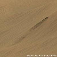
De-lurking after many moons to just ask if anyone has commented on the darker streaks we have seen such as these on sol 712? I scrolled through some past posts but I may have missed it. I know it may just be a slump or darker sand being funneled down but it sure reminds me of some other Martian imagery with darker streaks down crater or canyon walls....  Anyway, back to the being quiet and contributing to the healthy s/n ratio.  Lyford -------------------- Lyford Rome
"Zis is not nuts, zis is super-nuts!" Mathematician Richard Courant on viewing an Orion test |
|
|
|
|

|
Lo-Fi Version | Time is now: 23rd May 2024 - 06:53 PM |
|
RULES AND GUIDELINES Please read the Forum Rules and Guidelines before posting. IMAGE COPYRIGHT |
OPINIONS AND MODERATION Opinions expressed on UnmannedSpaceflight.com are those of the individual posters and do not necessarily reflect the opinions of UnmannedSpaceflight.com or The Planetary Society. The all-volunteer UnmannedSpaceflight.com moderation team is wholly independent of The Planetary Society. The Planetary Society has no influence over decisions made by the UnmannedSpaceflight.com moderators. |
SUPPORT THE FORUM Unmannedspaceflight.com is funded by the Planetary Society. Please consider supporting our work and many other projects by donating to the Society or becoming a member. |
|