Pluto Surface Observations 1: NH Post-Encounter Phase, 1 Aug 2015- 10 Oct 2015 |

  |
Pluto Surface Observations 1: NH Post-Encounter Phase, 1 Aug 2015- 10 Oct 2015 |
 Aug 1 2015, 05:53 PM Aug 1 2015, 05:53 PM
Post
#1
|
|
|
Merciless Robot  Group: Admin Posts: 8784 Joined: 8-December 05 From: Los Angeles Member No.: 602 |
This topic will contain images & discussion of same as they arrive during the extended download period. Similar threads will be opened in coming months as required as acquired data & discussion proceeds.
-------------------- A few will take this knowledge and use this power of a dream realized as a force for change, an impetus for further discovery to make less ancient dreams real.
|
 |
 
|
|
Aug 2 2015, 07:54 AM
Post
#2
|
|||||
 Junior Member Group: Members Posts: 82 Joined: 13-July 15 Member No.: 7579 |
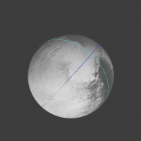
User torque_xtr (http://www.astronomy.ru/forum/index.php?action=profile;u=28931) proposed the idea that Sputnik Planum is basin filled from the atmosphere by nitrogen. In this regard, I simulate the amount of heat obtaned by Pluto from sun irradiation.
For a start I make the map, in which replaced the central part of unexplored region near the south pole into Sputnik Planum vicinity, so you can see how much energy is absorbed bright and dark areas near the south pole. Figure shows amount of energy absorbed by surface of Pluto in one turn around the Sun.
Colour picture shows the solar irradiation in the projection relative to the rotation axis of Pluto.
Next pictures was made in projection relative the axis perpendicular both to the rotation axis and direction of Charon:
At the center of second projection is a south pole, the north pole is on the left and right edge of the picture, the upper and lower edge are equatorial points with longitude 90° and 270°. Due to the large inclination of the rotation axis of Pluto to the orbital plane, Pluto's polar regions on average much hotter then equatorial region, so that in contrast to the Earth and Mars "polar cap" have to look at the equator. Minimum insolation during the plutonian year gives 1.703 gigajoules per square meter, the maximum - gives 1.952 GJ/m^2. Area Tombaugh absorbs a minimal amount of solar energy over the entire all surface of the planet. If it is assumed that the emissivity in the far infrared range varies less than in the optical range, Sputnik Planum would be cooler in which there is a continuous deposition of gases from the atmosphere occure. And this process is the driven force for glacier flow. |
||||
|
|
|
||||
|
Aug 2 2015, 05:58 PM
Post
#3
|
|
|
Junior Member Group: Members Posts: 82 Joined: 13-July 15 Member No.: 7579 |
Excuse me, is there somewhere information about exposures of LORRI and MVIC images of Pluto from the night side? It will be seen night side of Pluto surface in Charonshine?
|
|
|
|
|
Aug 2 2015, 06:19 PM
Post
#4
|
|
 Senior Member Group: Members Posts: 1639 Joined: 5-March 05 From: Boulder, CO Member No.: 184 |
There are images (yet to be downlinked) of Pluto lit by Charon, and the central area lit would be near latitude 0 / longitude 0
Interesting to note minimum insolation at the equator over the course of a Plutonian year. Does the tilt of Pluto's axis vary over geological time scales? I'm wondering why the deepest blue in your upper Pluto color image (area of minimum absorbed solar radiation) seems longitudinally offset from Tombaugh Regio? -------------------- Steve [ my home page and planetary maps page ]
|
|
|
|
|
Aug 3 2015, 08:24 AM
Post
#5
|
||
|
Junior Member Group: Members Posts: 82 Joined: 13-July 15 Member No.: 7579 |
Color pictures give density of irradiated solar energy, not absorbed solar radiation. Density of absorbed energy are shown in black-and-white pictures (it is simple multiplication of irradiated density by (1-albedo)). The variation of color along the equator has a numerical nature, and the real variation due to solar eclipses significantly less.
Next picture shows eclipse term.
Source of variation in previous version of pictures was non-constant time step of integration (the algorithm decrease time step during solar eclipse by Charon) and fractional turns of Pluto around it axis in one orbital period. Now these shortcomings are eliminated. The radiation can be considered constant along the equator, and the formation of the Tombaugh Regio can be explained by large impact feature, which was the seed for the condensation of gas (due to opened lighter surface). The presence of the "equatorial cap", together with the formation of impact has led to a redistribution of the masses, so that the pendulum has swung Pluto along the line passing through the center of the masses of Pluto and Charon. |
|
|
|
|
|
|
Aug 3 2015, 10:14 AM
Post
#6
|
|
 Member Group: Members Posts: 423 Joined: 13-November 14 From: Norway Member No.: 7310 |
In Pluto's north, there are these dark smudges (native res and enlarged) that I wonder if could be geysers or geyser remnants:
  Further north (I think..) is another smudge (and an apparent linear feature next to it, thrown in for good measure):   (between them sits this obvious smudge feature, but it looks somewhat unrelated)  One can find other similar features in the area. Further south, we do of course also have all these smudges in Burney crater:  One of them clearly looks like it has a tail:  Then there are those other numerous things with dark centres and bright haloes  they look like craters, but their distribution is a bit odd (there are what looks like a bit like tail features (streaks) in picture above, also). Most of them look relatively spherical, but some might be more irregular in shape:  There are also these really messy areas (not far from the previous feature) that could be related:   For comparison, here are some dark smudges in the geyser region of Triton:  
-------------------- |
|
|
|
|
Aug 3 2015, 02:11 PM
Post
#7
|
|
|
Senior Member Group: Members Posts: 2998 Joined: 30-October 04 Member No.: 105 |
QUOTE Interesting to note minimum insolation at the equator over the course of a Plutonian year. Yes. ... --Bill -------------------- |
|
|
|
|
Aug 3 2015, 02:30 PM
Post
#8
|
||
|
Junior Member Group: Members Posts: 82 Joined: 13-July 15 Member No.: 7579 |
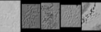
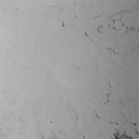
Another interesting feature of relief: small dimples. I suppose that it is an analogue of the dunes in the desert, caused not by the wind but solar irradiation conditions.
Oriented to the Sun the north side evaporates and on the shady south sides condensation occurs. Thus, the instability of a flat surface develops and slowly creeping dunes to the south (when in the northern hemisphere is summer). Therefore, the perpendicular meridians orientation of formations can be observed.
Attached thumbnail(s)
|
|
|
|
|
|
|
Aug 3 2015, 04:34 PM
Post
#9
|
|
|
Senior Member Group: Members Posts: 1639 Joined: 5-March 05 From: Boulder, CO Member No.: 184 |
QUOTE (Bill Harris @ Aug 3 2015, 02:11 PM)  The insolation at any point will be the product of the solar intensity (x) a function of the solar elevation (x) a factor of the Sun's time above the horizon (x) whatever I've not thought of. I suspect that we'd need some sort of Calculus to describe that, with sine/cosine wheels to vary things. Dang. What a can o'worms. Much easier to crank out purty pictures, but less fun.  Maybe an additional assumption of a circular orbit would help provide a useful analytical expression to help picture this? -------------------- Steve [ my home page and planetary maps page ]
|
|
|
|
|
Aug 3 2015, 06:44 PM
Post
#10
|
|
 Senior Member Group: Members Posts: 2530 Joined: 20-April 05 Member No.: 321 |
I expect Pluto's axis of rotation to be very stable because of the gyroscopic effect of Charon in the Pluto-Charon system. Also, the resonant orbital behavior with respect to Neptune should be stable.
Note that Europa has an icy crust which is decoupled from its interior and rotates very slowly, at a rate that has not been established, with respect to Europa's interior. I don't know if that possibility exists for Pluto or Charon. |
|
|
|
|
Aug 3 2015, 07:48 PM
Post
#11
|
|
|
Senior Member Group: Members Posts: 2998 Joined: 30-October 04 Member No.: 105 |
QUOTE an additional assumption of a circular orbit would help provide a useful analytical expression That would help and could easily be added in later. QUOTE Europa has an icy crust which is decoupled from its interior... don't know if that possibility exists for Pluto or Charon Possible. Without a significant interior heat source to actually melt an icy mantle, at-depth and away from STP (Std Temp Press), the various ices (water plus whatever else) and gases could make a high-viscosity flow which could decouple crust+mantle over geological time frames. At first look Pluto's surface looks smooth and flexy and may well be mobile at-depth, but Charon, with the Mordor region crater and the equatorial Chasmas would seem to be cold, frozen and solid. IMO. --Bill -------------------- |
|
|
|
|
Aug 4 2015, 12:13 AM
Post
#12
|
|
|
Senior Member Group: Members Posts: 3516 Joined: 4-November 05 From: North Wales Member No.: 542 |
I don't think the surface is decoupled from the interior here, though I'd like to be wrong.
|
|
|
|
|
Aug 4 2015, 01:00 AM
Post
#13
|
|
|
Senior Member Group: Members Posts: 2998 Joined: 30-October 04 Member No.: 105 |
There is no evidence either way, but I don't think so either. 'Tis a possibility.
-------------------- |
|
|
|
|
Aug 4 2015, 10:02 AM
Post
#14
|
|
|
Newbie Group: Members Posts: 18 Joined: 4-January 07 Member No.: 1558 |
"Plutos insolation history: Latitudinal variations and effects on atmospheric pressure" by Earle and Binzel in April's edition of Icarus is probably the last word on Pluto's insolation history. They've done all the calculus so we don't have to!
For those without access there are various papers on Arxiv which touch on the subject. |
|
|
|
|
Aug 4 2015, 01:36 PM
Post
#15
|
|
|
Senior Member Group: Members Posts: 2998 Joined: 30-October 04 Member No.: 105 |
Yes! I'm planning to read that once I get into town to the Library.
It is the last word as of April, but I'm sure that there will be many other words post-encounter. --Bill -------------------- |
|
|
|
|
Aug 4 2015, 05:27 PM
Post
#16
|
|
|
Junior Member Group: Members Posts: 82 Joined: 13-July 15 Member No.: 7579 |
QUOTE (scalbers @ Aug 2 2015, 11:19 PM) There are images (yet to be downlinked) of Pluto lit by Charon, and the central area lit would be near latitude 0 / longitude 0 I check LORRI trajectories in the NASA's Eyes software and conclude to my big regret, that all post-encounter frames was taken at the limb area and have exposure about 0.1 s, but not at least 10 s which neсessary to obtaining a good night side picture... I'm wrong? |
|
|
|
|
Aug 4 2015, 05:49 PM
Post
#17
|
|
 Senior Member Group: Members Posts: 1887 Joined: 20-November 04 From: Iowa Member No.: 110 |
I read somewhere that the Charonshine images of Pluto would be MVIC images near close approach and LORRI images at a distance where Pluto would fill most of the frame. Also the LORRI images would be many short images which would be added, this will allow them to avoid smearing of the images and bleeding from the overexposed parts of the images.
|
|
|
|
|
Aug 4 2015, 06:04 PM
Post
#18
|
|
|
Senior Member Group: Members Posts: 2530 Joined: 20-April 05 Member No.: 321 |
Checking the orbital positions, there were Charonshine opportunities for imaging Pluto on July 14, July 20, etc. and Plutoshine opportunities for imaging Charon on July 17, July 23, etc.
If we get some regional albedo information for the mid-southern latitudes, that would be great. A bonus would be if we get some details and/or could see if Charon has a dark region at the other pole, too. I'd love to see something like the Saturnshine images of Iapetus, but I'm not getting my hopes up. |
|
|
|
|
Aug 4 2015, 07:26 PM
Post
#19
|
|
|
Senior Member Group: Members Posts: 2346 Joined: 7-December 12 Member No.: 6780 |
QUOTE (Gennady Ionov @ Aug 4 2015, 07:27 PM) I check LORRI trajectories in the NASA's Eyes software and conclude to my big regret, that all post-encounter frames was taken at the limb area and have exposure about 0.1 s, but not at least 10 s which neсessary to obtaining a good night side picture... I'm wrong? If my memory serves me right, long-exposure 4x4 binned images should have been taken for this purpose. I thought, this has been hinted at in one of the press conferences. We'll know for sure before the end of the year, after the browser images will be downlinked. |
|
|
|
|
Aug 4 2015, 08:04 PM
Post
#20
|
|
|
Junior Member Group: Members Posts: 82 Joined: 13-July 15 Member No.: 7579 |
Alan, Gerald, thank you very much for this encouraging information about night side pictures!!!
Once again I watch my animation of New Horizons FlyBy https://www.youtube.com/watch?v=GYpw4joQPzo trying to imagine how those will look like night shots :-) |
|
|
|
|
Aug 6 2015, 09:06 PM
Post
#21
|
|
|
Senior Member Group: Members Posts: 1887 Joined: 20-November 04 From: Iowa Member No.: 110 |
I believe these are the MVIC and LORRI Charonshine images listed in the New Horizon's Full Activity List
QUOTE July 14 08:08:13 EDT New Horizons is taking an image of Pluto with MVIC from 20323.226 km away at est. resolution 0.40 km/pix.
July 14 21:47:42 EDT New Horizons is taking 180 images of Pluto with LORRI 4x4 from 692198.32 km away at est. resolution 14 km/pix. July 14 21:57:27 EDT New Horizons is taking 180 images of Pluto with LORRI 4x4 from 700250.68 km away at est. resolution 14 km/pix. New Horizons is 31.9 AU from Earth. July 14 22:11:53 EDT New Horizons is taking 90 images of Pluto with LORRI 4x4 from 712170.95 km away at est. resolution 14 km/pix. July 14 22:16:53 EDT New Horizons is taking 90 images of Pluto with LORRI 4x4 from 716300.37 km away at est. resolution 14 km/pix. New Horizons is 31.9 AU from Earth. July 14 22:21:53 EDT New Horizons is taking 90 images of Pluto with LORRI 4x4 from 720429.80 km away at est. resolution 14 km/pix. July 14 22:25:00 EDT New Horizons' track ending with Madrid 70 m (DSS-63) July 14 22:26:53 EDT New Horizons is taking 90 images of Pluto with LORRI 4x4 from 724559.23 km away at est. resolution 14 km/pix. New Horizons is 31.9 AU from Earth. |
|
|
|
|
Aug 6 2015, 10:11 PM
Post
#22
|
|
|
Senior Member Group: Members Posts: 2530 Joined: 20-April 05 Member No.: 321 |
According to Solar System Simulator, Charon was at half phase as seen from Pluto during those images, and decreasing with passing time. So those should be Charonshine images not the best lit, but good resolution. It seems like several hours earlier would have been a better opportunity, but perhaps the thin daylit crescent of Pluto would have been a problem at that time.
|
|
|
|
|
Aug 7 2015, 06:47 PM
Post
#23
|
|
|
Senior Member Group: Members Posts: 1887 Joined: 20-November 04 From: Iowa Member No.: 110 |
So roughly half of Pluto in Charonshine then.
|
|
|
|
|
Aug 7 2015, 07:55 PM
Post
#24
|
|
|
Senior Member Group: Members Posts: 2530 Joined: 20-April 05 Member No.: 321 |
QUOTE (alan @ Aug 7 2015, 11:47 AM) So roughly half of Pluto in Charonshine then. All of Pluto's Charon-side in the light of a half Charon. The portion of Pluto facing Charon never changes, so there's no variation in that regard whatsoever. At any point in time that Charon isn't "new" as seen from Pluto, that entire half of Pluto will get some Charonshine. Only the quantity of illumination will vary, not the areas on Pluto that are illuminated. |
|
|
|
|
Aug 7 2015, 08:17 PM
Post
#25
|
|
|
Senior Member Group: Members Posts: 1639 Joined: 5-March 05 From: Boulder, CO Member No.: 184 |
A key part of this point is that half of the night side of Pluto will be illuminated by Charon.
-------------------- Steve [ my home page and planetary maps page ]
|
|
|
|
|
Aug 7 2015, 08:42 PM
Post
#26
|
|
|
Solar System Cartographer Group: Members Posts: 10166 Joined: 5-April 05 From: Canada Member No.: 227 |
Another point to consider: since the illumination is coming largely from the northern hemisphere of the reflecting body, it will be barely able to illuminate the south pole itself. And the bodies are pretty close to each other. Imagine you are at Pluto's south pole - can you see Charon at all? Or is it below the horizon, as Phobos and Deimos are from Mars's poles? In fact it will be below the horizon out to a certain distance from the pole, and for an additional distance, only the night side of Charon would be above the horizon, so not illuminating anything. It's intriguing to speculate on the appearance of Pluto from Charon's south pole - in some range of latitudes Pluto's night side would be above the horizon, its illuminated portion still below the horizon, but arcs of faintly lit atmospheric haze might reach up from the horizon as we saw in the backlit view. They might not make a full circle because of the geometry.
As for the range of longitudes, as the system rotates the illuminated night half will sometimes be better placed for viewing, sometimes less so. Light bleed from the sunlit crescent will be a problem, so when the Charonshine region is adjacent to the sunlit crescent we should have better viewing geometry but worse light pollution. When it's opposite the sunlit crescent it will be foreshortened but less contaminated. So a lot depends on the timing of imaging. I would like to see some simulations of this. Phil -------------------- ... because the Solar System ain't gonna map itself.
Also to be found posting similar content on https://mastodon.social/@PhilStooke Maps for download (free PD: https://upload.wikimedia.org/wikipedia/comm...Cartography.pdf NOTE: everything created by me which I post on UMSF is considered to be in the public domain (NOT CC, public domain) |
|
|
|
|
Aug 7 2015, 08:56 PM
Post
#27
|
|
|
Senior Member Group: Members Posts: 2998 Joined: 30-October 04 Member No.: 105 |
QUOTE half of the night side of Pluto will be illuminated by Charon. A half-phase Pluto should be illuminated by a half-phase Charon, according to what was said about the Solar System Simulator model. With the Earth-Moon duo, the phase of the Earth, seen from the Moon, is an inverse-mirror. A Crescent Moon, it "sees" a Gibbous Earth, and a Gibbous Moon sees a Crescent Earth. On our Moon, First or Last Quarter Earthshine is quite dim, and is somewhat overwhelmed by the illuminated half of the Moon. It may show something but my expectations are not high. --Bill -------------------- |
|
|
|
|
Aug 7 2015, 09:44 PM
Post
#28
|
|
|
Senior Member Group: Members Posts: 3516 Joined: 4-November 05 From: North Wales Member No.: 542 |
All the posters here clearly understand the geometry but not all visitors will. Can anyone provide a simple diagram for the Charonshine imaging showing which parts of the 'planet' will and won't be seen?
|
|
|
|
|
Aug 7 2015, 10:04 PM
Post
#29
|
|
|
Senior Member Group: Members Posts: 2086 Joined: 13-February 10 From: Ontario Member No.: 5221 |
One could take a map like the ones we already have and outline the Charon-facing hemisphere on it too. That would show exactly how much of the southern hemisphere could be illuminated/imaged.
|
|
|
|
|
Aug 7 2015, 10:22 PM
Post
#30
|
|
|
Senior Member Group: Members Posts: 1639 Joined: 5-March 05 From: Boulder, CO Member No.: 184 |
Yes the approximate region on the Pluto maps would be between -90 and +90 longitude. On my map (centered on 180 longitude) this would be within 90 degrees of the left and right edges, or the left quarter and the right quarter. The latitude range as Phil pointed out would be not quite all the way to the poles, related to how many Pluto radii Charon lies at. It would be interesting to map this out in terms of the illumination, being proportional to the sine of Charon's angular altitude from each point on Pluto's surface. This altitude reaches a maximum at the zenith at latitude 0 longitude 0.
We could also import a Pluto map into Celestia, position the observer near Charon (on its Pluto facing side) and take a look at what portions of Pluto show up. This Charon illuminated portion will be fixed as a function of time, even though the sunlit phases of Pluto and Charon will vary. Meng-'Po Macula is at the best location. -------------------- Steve [ my home page and planetary maps page ]
|
|
|
|
|
Aug 7 2015, 11:41 PM
Post
#31
|
|||
 IMG to PNG GOD Group: Moderator Posts: 2251 Joined: 19-February 04 From: Near fire and ice Member No.: 38 |
QUOTE (alan @ Aug 6 2015, 09:06 PM) I believe these are the MVIC and LORRI Charonshine images listed in the New Horizon's Full Activity List QUOTE July 14 08:08:13 EDT New Horizons is taking an image of Pluto with MVIC from 20323.226 km away at est. resolution 0.40 km/pix. July 14 21:47:42 EDT New Horizons is taking 180 images of Pluto with LORRI 4x4 from 692198.32 km away at est. resolution 14 km/pix. Assuming that the information above is correct, the illumination for the two observations listed above would be like this:
The upper image (the one simulating the MVIC geometry) has a FOV of 10 degrees and the lower one a FOV of 0.2907 degrees (the LORRI FOV). I made no attempts to make the brightness of the Charonshine areas correct relative to the bright sunlit limb. These test renders are primarily intended to approximate which areas are in Charonshine. Charon is modeled as a point source but that doesn't make a big difference (in reality the illuminated area should be slightly bigger). |
||
|
|
|
||
|
Aug 8 2015, 09:29 AM
Post
#32
|
||||
|
Junior Member Group: Members Posts: 82 Joined: 13-July 15 Member No.: 7579 |
With the use of map
http://www.unmannedspaceflight.com/uploads...19373_thumb.png I simulate the frame http://pluto.jhuapl.edu/soc/Pluto-Encounte...0x632_sci_3.jpg and got a picture
(To comparision the original frame are placed in the last right and difference between the original and the simulated image can be seen on an middle picture) There is some distortion of the image is apparently due to the different definitions of the rotation axis and the longitude, as well as slight map distortion. QUOTE (Phil Stooke @ Aug 8 2015, 01:42 AM) As for the range of longitudes, as the system rotates the illuminated night half will sometimes be better placed for viewing, sometimes less so. Light bleed from the sunlit crescent will be a problem, so when the Charonshine region is adjacent to the sunlit crescent we should have better viewing geometry but worse light pollution. When it's opposite the sunlit crescent it will be foreshortened but less contaminated. So a lot depends on the timing of imaging. I would like to see some simulations of this. Also I plan to simulate other LORRI and MVIC frames (include Charonshine frames)... |
|||
|
|
|
|||
|
Aug 8 2015, 12:17 PM
Post
#33
|
||
|
IMG to PNG GOD Group: Moderator Posts: 2251 Joined: 19-February 04 From: Near fire and ice Member No.: 38 |
I have been experimenting with generating DEMs of Pluto from stereo imagery, mainly to see if there are any large scale elevation differences (e.g. from subtle impact basins). The images available so far aren't exactly optimal for this and also my stereo match software is very sensitive to compression artifacts.
So far I have tried two stereo pairs: lor_0299174713_0x632_sci_5.jpg and lor_0299148167_0x632_sci_3.jpg lor_0299175145_0x632_sci_7.jpg and lor_0299148167_0x632_sci_3.jpg (again) These pairs are far fram optimal since the resolution of lor_0299148167_0x632_sci_3.jpg isn't high and the resolution difference between the images is large (differs by a factor of ~6). Sputnik Planum is also almost featureless in the lower-res image, making it difficult to find matching features. The resulting DEM is noisy and too ugly to post here but at least there is one possible result: Sputnik Planum is *probably* not a depression, its elevation is *probably* comparable to the elevation of the surrounding, dark terrain (if Sputnik Planum is despite this really a depression it would probably be a very gentle depression, much more so than big craters and basins on e.g. Rhea). But I want to emphasize the word "probably" in everything here - the DEM is noisy and of low quality. I also experimented with the lor_0299148167_0x632_sci_3.jpg / lor_0299124574_0x632_sci_1.jpg pair but without any useful results. The resolution is too low and compression artifacts mess things up. By the way, one of the most interesting features I noticed when I was doing the DEM work was this in image lor_0299174713_0x632_sci_5.jpg, slightly sharpened here:
Here the stuff in Sputnik Planum has apparently been flowing into a crater. This reminds me of terrestrial glaciers - seeing higher-res images of Sputnik Planum's edge is going to be really interesting. Of course the vast majority of the really interesting (i.e. hi-res) images are still aboard the spacecraft. As interesting and exciting as everything has been so far, the real fun really doesn't start until September when downlinking of the imaging data starts. |
|
|
|
|
|
|
Aug 8 2015, 07:04 PM
Post
#34
|
|
 Member Group: Members Posts: 684 Joined: 24-July 15 Member No.: 7619 |
QUOTE (Bjorn Jonsson @ Aug 8 2015, 12:17 PM) ... Here the stuff in Sputnik Planum has apparently been flowing into a crater. This reminds me of terrestrial glaciers - seeing higher-res images of Sputnik Planum's edge is going to be really interesting. Can't wait to see the topgraphy! Does it appear to anybody else that the hill-ice field boundary appears like the N2 ice is dissolving the rough terrain, not flowing over it? E.g., the dark swirls look like chocolate terrain dissolving into the milky N2 ices? The flow patters seem more like dark material being drawn into the lighter colored ice field, not like white ice advancing over a dark terrain. If liquid phases of N2 are stable a few meters down, you'd have a glacier that "skated" on the liquid layer and also dissolved the surrounding terrain. There should be some very interesting "geology" err, "iceology" here, solid solutions, eutectic solutions might create icy analogs of sedimentary or igneous rocks. Grains of different ices held together in a matrix of another ice or mixture of ice. |
|
|
|
|
Aug 8 2015, 07:19 PM
Post
#35
|
|
|
Solar System Cartographer Group: Members Posts: 10166 Joined: 5-April 05 From: Canada Member No.: 227 |
The dark swirls may be due to grain size changes, or areas of transparent ice. When we are looking at nitrogen ice, carbon monoxide ice and so on, it's very difficult to know what would dissolve in what, so I prefer a physical explanation at the moment.
Phil -------------------- ... because the Solar System ain't gonna map itself.
Also to be found posting similar content on https://mastodon.social/@PhilStooke Maps for download (free PD: https://upload.wikimedia.org/wikipedia/comm...Cartography.pdf NOTE: everything created by me which I post on UMSF is considered to be in the public domain (NOT CC, public domain) |
|
|
|
|
Aug 8 2015, 08:11 PM
Post
#36
|
|
|
Merciless Robot Group: Admin Posts: 8784 Joined: 8-December 05 From: Los Angeles Member No.: 602 |
Agreed, Phil. These wide-view images don't provide nearly enough detail to understand what's going on at the process/mechanism level yet. Hopefully there will be clues worthy of hypothesis formation found in the most detailed pics yet to come.
-------------------- A few will take this knowledge and use this power of a dream realized as a force for change, an impetus for further discovery to make less ancient dreams real.
|
|
|
|
|
Aug 8 2015, 09:20 PM
Post
#37
|
|
|
IMG to PNG GOD Group: Moderator Posts: 2251 Joined: 19-February 04 From: Near fire and ice Member No.: 38 |
Speaking of ices, glaciers, flow patterns etc., a lot of examples of how terrestrial glaciers can appear can be seen in a big mosaic I did a few years ago of southern Greenland from Landsat 7 images: http://www.planetary.org/blogs/guest-blogs...nd-jonsson.html
There appear to be some superficial similarities but it must be kept in mind that the resolution of the Pluto images is much lower (the resolution of the Landsat mosaic is ~30 m/pixel). |
|
|
|
|
Aug 8 2015, 09:25 PM
Post
#38
|
|
|
Senior Member Group: Members Posts: 3516 Joined: 4-November 05 From: North Wales Member No.: 542 |
I'm not yet convinced there is flowing ice here. Light and dark dust being wafted around in the thin air seems more likely.
|
|
|
|
|
Aug 8 2015, 09:32 PM
Post
#39
|
|
|
IMG to PNG GOD Group: Moderator Posts: 2251 Joined: 19-February 04 From: Near fire and ice Member No.: 38 |
I'm not either - as I mentioned above, the resolution of the Pluto images really isn't very high yet. The highest-res images will be really interesting, plus surface composition measurements (LEISA data).
|
|
|
|
|
Aug 9 2015, 04:32 PM
Post
#40
|
|
|
Member Group: Members Posts: 684 Joined: 24-July 15 Member No.: 7619 |
QUOTE (Bjorn Jonsson @ Aug 8 2015, 10:32 PM) I'm not either - as I mentioned above, the resolution of the Pluto images really isn't very high yet. The highest-res images will be really interesting, plus surface composition measurements (LEISA data). Has anybody done a montage of similar scale / resolution images of ice features? Say, Tombaugh with 20 mile size bar, then Enceledaus, then Europa, then Martian chaos terrain, then Earth arctic? Idea being, even with physical chemistry that is fundamentally different, Titan has features which are recognizable, presumably because the materials are different, but the math and the patterns remain the same. |
|
|
|
|
Aug 10 2015, 11:38 AM
Post
#41
|
|
|
Member Group: Members Posts: 137 Joined: 16-June 15 Member No.: 7507 |
QUOTE If liquid phases of N2 are stable a few meters down That shouldn't be possible. N2 requires a minimum of around 15-20 meters of ice at Pluto's pressure and gravity at an optimal temperature. Eutectics may have a significant impact on the required temperature range, but they're unlikely to lower the pressure requirements, esp. since nitrogen has much lower pressure requirements than CO, Ne, etc. I wouldn't be surprised if there are actual liquids there rather than just flowing solids (though the boundary between liquids and solids is kind of fuzzy in this context). But if so they're going to be a lot deeper than just a couple meters. It'd also mean that temperatures would either have to be a bit warmer than Pluto's average solar equilibrium temperature, or that eutectics would need to lower the triple point temperature. Neither are unrealistic possibilities, but there's no guarantees either - and the high albedo of Tombaugh works against it. I really want to see closeups of the "crack" patterning on Sputnik. I'm really curious as to whether they'll appear to be something filled in by liquid. Too bad there's no radar data to be able to get an idea of surface texture... I'd love to know if there's any "cryolava pillowing" going on if liquids ever reach the surface. Then again, nitrogen may not be able to form a sturdy enough shell to form pillows - we've all seen the videos of how it behaves when it's rapidly evaporatively cooled. |
|
|
|
|
Aug 10 2015, 01:38 PM
Post
#42
|
|
|
Member Group: Members Posts: 153 Joined: 20-December 14 From: Eastbourne, UK Member No.: 7372 |
Since the older surface and the "glaciers" are suggested to be both made of mainly N2 ice, might it not be better to think in terms of "lava" flow rather than "Glacial" flow. Glacial flow requires lubrication, which could be possible under the main icecap, but towards the edges the lubrication would freeze and the "glacier" analogue looks less applicable.
The Northern part of Tombaugh Regio seems to be a large impact basin, one that has been largely filled in with Carbon Monoxide ice. The Nitrogen ice making up the majority of Pluto's surface, has two allotropes, one with a hexagonal type crystal structure, the other has a cubic structure, the same as diamond. This second form only forms at high pressure. It is reasonable to propose that the rim of the crater and the basin itself, is composed of this "harder" form of Nitrogen ice and is covered in the "softer", "normal" Nitrogen and Carbon Monoxide ice. This softer ice does not have the mechanical strength to sustain the height of the crater rim and so has "slumped" in a more "plastic" flow, over the more solid layer below. One might guess the "diamond" form of Nitrogen ice might be close to transparent too. Not sure if the Ralph or Alice data could differentiate between the two forms of Nitrogen ice, it could be very informative if they can. The shock wave travelling through the surrounding ice could also create "ridges" of harder Nitrogen ice. G.I.'s image suggests this possibility in the area to the North West of Tombaugh (5 O'Clock in the image). |
|
|
|
|
Aug 10 2015, 02:38 PM
Post
#43
|
||
|
Member Group: Members Posts: 684 Joined: 24-July 15 Member No.: 7619 |
QUOTE (Nafnlaus @ Aug 10 2015, 12:38 PM) QUOTE If liquid phases of N2 are stable a few meters down That shouldn't be possible. N2 requires a minimum of around 15-20 meters of ice at Pluto's pressure and gravity at an optimal temperature. Eutectics may have a significant impact on the required temperature range, but they're unlikely to lower the pressure requirements, esp. since nitrogen has much lower pressure requirements than CO, Ne, etc. I wouldn't be surprised if there are actual liquids there rather than just flowing solids (though the boundary between liquids and solids is kind of fuzzy in this context). But if so they're going to be a lot deeper than just a couple meters. Correct, it's a few tens of meters, not just a few meters. QUOTE (Sherbert @ Aug 10 2015, 02:38 PM) The Nitrogen ice making up the majority of Pluto's surface, has two allotropes, one with a hexagonal type crystal structure, the other has a cubic structure, the same as diamond. This second form only forms at high pressure. It is reasonable to propose that the rim of the crater and the basin itself, is composed of this "harder" form of Nitrogen ice and is covered in the "softer", "normal" Nitrogen and Carbon Monoxide ice. This softer ice does not have the mechanical strength to sustain the height of the crater rim and so has "slumped" in a more "plastic" flow, over the more solid layer below. One early suggestion was that with a-phase and b-phase ice, you would get "phase change fronts" moving across the surface and into the subsurface in response to changes in heat and sunlight. I suspect that a phase change would result in a volume change, that stress could be an effective mechanism to erode the surface There's a later paper that estimates where each form of N2 ice is stable during each orbit. http://www.lpl.arizona.edu/~yelle/eprints/Stansberry99a.pdf Stansberry & Yelle, “Emissivity and the Fate of Pluto's Atmosphere,” Icarus 141: 299-306, 1999 Interesting that their calculations predict a "phase cliff" about 20 years past perihelion, (roughly now) where the southern hemisphere abruptly switches from B-ice being stable to A-ice being stable.
Attached thumbnail(s)
|
|
|
|
|
|
|
Aug 10 2015, 07:00 PM
Post
#44
|
|||
|
Junior Member Group: Members Posts: 82 Joined: 13-July 15 Member No.: 7579 |
With the use of metadata of LORRI frames I clarify trajectory of New Horizons (error is about 0.000002 on distancies to Pluto at snapshots momens). After that it made possible to simulate all frames with subpixel accuracy. Here for example, two of these frames:
As a bonus Pluto radius was determined: R=240.89 km * u, where 'u' is LORRI pixel size in microradians. If we assume that the under-Charon avarage point has longitude 0°, then the map of Pluto (for example http://www.unmannedspaceflight.com/index.p...t&id=37374) is offset by 1.6 ° to the east. So I had to make such correction to map, that the image consistent with LORRI frames. Nevertheless, clear to see that there are still quite a strong distortion in the map. |
||
|
|
|
||
|
Aug 10 2015, 07:25 PM
Post
#45
|
|
|
IMG to PNG GOD Group: Moderator Posts: 2251 Joined: 19-February 04 From: Near fire and ice Member No.: 38 |
QUOTE (Gennady Ionov @ Aug 10 2015, 07:00 PM) With the use of metadata of LORRI frames I clarify trajectory of New Horizons (error is about 0.000002 on the current distance to Pluto). After that it made possible to simulate all frames with subpixel accuracy. Here for example, one of these frames: As a bonus Pluto radius was determined: R=240.89 km * u, where 'u' is LORRI pixel size in microradians. This translates to 1193.6 km, consistent with the 1185 +/- km measured by the NH team a day before the flyby (interestingly, I got a value of 1194 km km back then). Regarding NH's trajectory, if I remember correctly the flyby didn't occur at exactly the planned time (off by some seconds but well within the required accuracy) and this makes it more tricky to use the metadata to accurately determine the viewing geometry (especially in the hi-res images) until an updated trajectory (SPICE kernels) becomes avvailable. |
|
|
|
|
Aug 10 2015, 08:06 PM
Post
#46
|
|
|
Junior Member Group: Members Posts: 82 Joined: 13-July 15 Member No.: 7579 |
QUOTE (Bjorn Jonsson @ Aug 11 2015, 12:25 AM) Regarding NH's trajectory, if I remember correctly the flyby didn't occur at exactly the planned time (off by some seconds but well within the required accuracy) and this makes it more tricky to use the metadata to accurately determine the viewing geometry (especially in the hi-res images) until an updated trajectory (SPICE kernels) becomes avvailable. At first I tried to use the data from http://ssd.jpl.nasa.gov/horizons.cgi#top but I found that the position of NH was displaced approximately 120 seconds, so I used the least squares method (with using distances to Pluto, Charon, Nix and Hydra up to 2,000,000 km) to made a correction of 3D position (about 1,665 kilometers) and velocity vector (about 11.6 m/s) so that the simulated distances become coincide to metadata with an error of about 0.1 km. |
|
|
|
|
Aug 12 2015, 11:40 AM
Post
#47
|
|
|
Junior Member Group: Members Posts: 39 Joined: 9-August 12 From: London, UK Member No.: 6521 |
Hi all, I rarely post, but had a question on this amazing mission for those more knowledgeable.
When I look at the excellent simulation in "Eyes", I can see that at approx 15 mins. before closest approach, Charon "sets" behind Pluto", then at 9 minutes, it rises. Eyes doesn't show any photos taken at all of these events, in fact NH doesn't appear to be pointing at anything. These would have not only made dramatic pictures, but presumably at the Charon-rise point would highlight features on the limb? Am I missing something (probably), or would these images have been of no value? |
|
|
|
|
Aug 12 2015, 12:38 PM
Post
#48
|
|
|
Junior Member Group: Members Posts: 82 Joined: 13-July 15 Member No.: 7579 |
Michael, I, too, for a long time the question arose.
As specially missed Charon set, while Pluto was carried out for all the cameras shooting Charon was behind, ahead of Charon, and its rise is also not hit in images. |
|
|
|
|
Aug 12 2015, 04:26 PM
Post
#49
|
|
|
Merciless Robot Group: Admin Posts: 8784 Joined: 8-December 05 From: Los Angeles Member No.: 602 |
Imaging this was suggested several years ago, but I don't know if it actually happened. Priority obviously had to be given to high-value science data acquisition at that time so I really doubt that made the cut.
-------------------- A few will take this knowledge and use this power of a dream realized as a force for change, an impetus for further discovery to make less ancient dreams real.
|
|
|
|
|
Aug 12 2015, 04:47 PM
Post
#50
|
|||||
|
Junior Member Group: Members Posts: 82 Joined: 13-July 15 Member No.: 7579 |
What kind of scientific data loss can be a question if deviation on Charonset
is 133 seconds, and at Charonrise
just 50 seconds? Judging by the nature of scanning at once by RALPH, LORRI and Alice, the images of Charonset and Charonrise were obtained. Just NASA's Eyes bit not exactly show the real program running by NH. Due to the motion of Charon relative Pluto while TDI of MVIC camera Charon could slightly smeared. But this adds even natural tableau. |
||||
|
|
|
||||
|
Aug 12 2015, 05:00 PM
Post
#51
|
|
|
Junior Member Group: Members Posts: 39 Joined: 9-August 12 From: London, UK Member No.: 6521 |
QUOTE (Gennady Ionov @ Aug 12 2015, 05:47 PM) ...Judging by the nature of scanning at once by RALPH, LORRI and Alice, the images of Charonset and Charonrise were obtained. Just NASA's Eyes bit not exactly show the real program running by NH. I hope so - I'm thinking of the Apollo 8 earthrise shots; ok, it's not the Earth, but NASA needs all the publicity it can get if it is to keep and hopefully increase the budget for continuing exploration. |
|
|
|
|
Aug 12 2015, 05:11 PM
Post
#52
|
|
|
Senior Member Group: Members Posts: 1639 Joined: 5-March 05 From: Boulder, CO Member No.: 184 |
QUOTE (nprev @ Aug 12 2015, 04:26 PM) Imaging this was suggested several years ago, but I don't know if it actually happened. Priority obviously had to be given to high-value science data acquisition at that time so I really doubt that made the cut. Indeed, weren't "Kodak moments" discussed on this forum to help the NH Team with image planning? -------------------- Steve [ my home page and planetary maps page ]
|
|
|
|
|
Aug 12 2015, 05:40 PM
Post
#53
|
|
|
IMG to PNG GOD Group: Moderator Posts: 2251 Joined: 19-February 04 From: Near fire and ice Member No.: 38 |
QUOTE (MichaelJWP @ Aug 12 2015, 05:00 PM) I hope so - I'm thinking of the Apollo 8 earthrise shots This would have been difficult due to the narrow field of view of NH's cameras. |
|
|
|
|
Aug 12 2015, 05:56 PM
Post
#54
|
|
|
Founder Group: Chairman Posts: 14432 Joined: 8-February 04 Member No.: 1 |
QUOTE (Gennady Ionov @ Aug 12 2015, 09:47 AM) just 50 seconds? The uncertainty of the C/A time in the week leading up to the flyby was more than that. That should basically answer your question. |
|
|
|
|
Aug 12 2015, 05:57 PM
Post
#55
|
|
|
Junior Member Group: Members Posts: 82 Joined: 13-July 15 Member No.: 7579 |
QUOTE (Bjorn Jonsson @ Aug 12 2015, 10:40 PM) This would have been difficult due to the narrow field of view of NH's cameras. MVIC (green rectangle) covers almost all Pluto disk and scans the very long image... |
|
|
|
|
Aug 12 2015, 08:11 PM
Post
#56
|
|
 Administrator Group: Admin Posts: 5172 Joined: 4-August 05 From: Pasadena, CA, USA, Earth Member No.: 454 |
AFAIK shooting these images was briefly considered but there was just too much going on near C/A; it would've cost too much valuable science at that moment.
In general, it was a lot harder to make "Kodak Moments" at Pluto than it was at Jupiter, because of the angle of approach -- recall that all the Jupiter Kodak Moments were mutual events, and those didn't happen from New Horizons' point of view on Pluto except for that one moment at C/A when it had other things to do. -------------------- My website - My Patreon - @elakdawalla on Twitter - Please support unmannedspaceflight.com by donating here.
|
|
|
|
|
Aug 13 2015, 03:07 AM
Post
#57
|
|
|
Junior Member Group: Members Posts: 82 Joined: 13-July 15 Member No.: 7579 |
QUOTE (elakdawalla @ Aug 13 2015, 01:11 AM) AFAIK shooting these images was briefly considered but there was just too much going on near C/A; it would've cost too much valuable science at that moment. What is valuable science measurement might suffer if all the same, and the rising and setting of the whole fit into the one 8 minute scan, taken with a large margin (margin of 1 Pluto disc on both sides)? On the contrary, picture of Charonset could provide additional information about the atmosphere of Pluto (Charon may have slightly dimming to near the edge of Pluto) and on the topography on the limb. |
|
|
|
|
Aug 13 2015, 03:53 AM
Post
#58
|
|
|
Merciless Robot Group: Admin Posts: 8784 Joined: 8-December 05 From: Los Angeles Member No.: 602 |
Lacking any direct knowledge, I cannot say for certain that such imagery was not acquired, but given the very tight window combined with the uncertainly in arrival times Doug mentioned as well as numerous other critical demands on the spacecraft during this period it is vanishingly unlikely. If that was the NH team's judgement--as seems very, very likely--then that's the way it is, and we are not going to argue about it. Period. -------------------- A few will take this knowledge and use this power of a dream realized as a force for change, an impetus for further discovery to make less ancient dreams real.
|
|
|
|
|
Aug 13 2015, 04:41 AM
Post
#59
|
|
|
Senior Member Group: Members Posts: 2086 Joined: 13-February 10 From: Ontario Member No.: 5221 |
We could always simulate the view at any rate, right? Once all the actually taken data is received and we have accurate hi-res maps of the appropriate areas, like in the Cassini thread when predicting which parts of a particular icy satellite getting a close flyby the next rev will be mapped.
|
|
|
|
|
Aug 13 2015, 08:58 AM
Post
#60
|
|
|
Junior Member Group: Members Posts: 39 Joined: 9-August 12 From: London, UK Member No.: 6521 |
QUOTE (Explorer1 @ Aug 13 2015, 05:41 AM) We could always simulate the view at any rate, right? Once all the actually taken data is received and we have accurate hi-res maps of the appropriate areas, like in the Cassini thread when predicting which parts of a particular icy satellite getting a close flyby the next rev will be mapped. Once mapping is complete we can indeed simulate any such view with a simple setup. I raised the original question about the Charon-set/rise images, and although disappointed, I'm quite happy the the science team has decided there are greater priorities. Famous images such as Pale Blue Dot or the Day the Earth Smiled have only been gathered when all primary science has been completed. A spacecraft in orbit is a completely different case to a fly-by such as this, which is a one-and-only chance to grab as much science data as possible. All indications so far are that the bounty of information collected exceeds all expectations. |
|
|
|
|
Aug 13 2015, 03:30 PM
Post
#61
|
|
|
Member Group: Members Posts: 153 Joined: 20-December 14 From: Eastbourne, UK Member No.: 7372 |
QUOTE (HSchirmer @ Aug 10 2015, 03:38 PM) There's a later paper that estimates where each form of N2 ice is stable during each orbit. http://www.lpl.arizona.edu/~yelle/eprints/Stansberry99a.pdf Stansberry & Yelle, Emissivity and the Fate of Pluto's Atmosphere, Icarus 141: 299-306, 1999 Very illuminating paper that. The amount of exposed alpha N2 ice would seem to have an effect on the equilibrium of the whole atmosphere. Most interesting is that the two phases can exist as a mixture. This suggests to me, Nitrogen frost build up to levels above a few metres results in a gradual phase transition, first to the denser, alpha ice allotrope and at even greater depths there is the possibility of liquid Nitrogen forming, perhaps in cracks and voids in the ice. A process similar to ice crystals building a glacier. This "liquid aquifer" might one would think, be trapped below the alpha phase Nitrogen ice, similar to oil and natural gas underground on Earth capped by an impervious rock layer, allowing pressure build up. All sorts of interesting possibilities arise if this is the case, especially if some heat is still emanating from the core below, or the "aquifer" is penetrated by an impact. |
|
|
|
|
Aug 13 2015, 07:51 PM
Post
#62
|
|
 Member Group: Members Posts: 259 Joined: 23-January 05 From: Seattle, WA Member No.: 156 |
QUOTE (Explorer1 @ Aug 12 2015, 09:41 PM) We could always simulate the view at any rate, right? [snip] Bjorn posted a jaw-dropping animation in the Pluto Atmospheric Observations: NH Post-Encounter Phase, 1 Aug 2015- TBD thread. It's fast - blink and you'll miss it - but, well, holy cow is about the most coherent thing I can manage to say about it right now. |
|
|
|
|
Aug 14 2015, 04:41 PM
Post
#63
|
|
|
Member Group: Members Posts: 684 Joined: 24-July 15 Member No.: 7619 |
QUOTE (Sherbert @ Aug 13 2015, 03:30 PM) Very illuminating paper that. The amount of exposed alpha N2 ice would seem to have an effect on the equilibrium of the whole atmosphere. Most interesting is that the two phases can exist as a mixture. ... Well, thats the amazing thing, if Pluto's surface N2 is a solid solution, e.g. it changes from alpha to beta N2-ice and back again, raises some weird possibilities. Phase transitions make great buffering solutions because of latent heat, literally "hidden heat". That is, you can measure the temperature of the system with precision, but you won't know how much energy is stored in the system. Or to paraphrase my old chemistry professor, "burn your fingerprints off pyrex test tubes look like normal pyrex test tubes"... Point is, a feature that is N2 ice at, say 40 kelvin, you won't know whether it's thin coat of frost on frigid H20 mountain, or the last coat of frost on a N2 mud-pot geyster that is about to blow sky high. |
|
|
|
|
Aug 15 2015, 02:08 PM
Post
#64
|
|
|
Member Group: Members Posts: 153 Joined: 20-December 14 From: Eastbourne, UK Member No.: 7372 |
The video below shows liquid Nitrogen freezes initially into an amorphous, "glass" like solid, before assuming the hexagonal Beta phase. There is a possibility, given the right temperature and pressure, of all three phases existing on the surface of Pluto should the postulated liquid Nitrogen from below, flow onto the surface in large volumes.
https://www.youtube.com/watch?v=c0rK2bLTimQ The differing optical properties and grain sizes of crystals of Alpha and Beta N2 ice in a mixture are going to be relevant to its visible appearance. Phil suggested earlier grain sizes and transparency as a possible explanation for the appearance of the Northern Tombaugh "glaciers". Altitude of the terrain is important in determining the ratios of the two phases, which tends to suggest to me that this idea combined with "plastic" flow, possibly of amorphous ice, is along the right lines. Another issue is sintering of surface ices and its effect on its physical and visual properties. On top of all that is contamination of the Nitrogen ice with other molecules. More data definitely required. |
|
|
|
|
Aug 16 2015, 12:00 PM
Post
#65
|
|
 Member Group: Members Posts: 101 Joined: 3-May 12 From: Massachusetts, USA Member No.: 6392 |
Fascinating video, thank you for sharing it.
|
|
|
|
|
Aug 16 2015, 01:25 PM
Post
#66
|
|
|
Member Group: Members Posts: 423 Joined: 13-November 14 From: Norway Member No.: 7310 |
Not sure if this has been brought up already, but Krun looks much younger than Cthulhu. Krun displays few, if any, well-preserved craters at the current resolution. That said, there are lot of candidates for eroded craters.
This gives me more faith in the idea that the dark equatorial areas to a large extent simply are equatorial highlands (Krun, like Cthulhu, does appear to be elevated above Sputnik), possibly with different origins. Related or not, here are some valleys cutting into Krun: 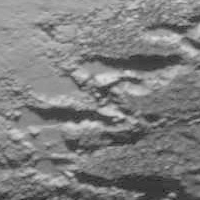 This (western) part of Krun also appears to have a rather rough texture, and appears very young. -------------------- |
|
|
|
|
Aug 16 2015, 03:44 PM
Post
#67
|
|
|
Senior Member Group: Members Posts: 2998 Joined: 30-October 04 Member No.: 105 |
It seems that the "Southern Outcrops" on Pluto are somewhat different than the "Northern Outcrops", although it might be that the Northern area is simply frostier. Krun seems to be old, eroded terrain, although southward it develops a "tiger stripe" exuded texture. With fuzzy images, it's too early to tell for certain.
And, oddly enough, Charon seems to have a similar N-S bedrock dichotomy with the added mystery of an equatorial rift zone. What odd little worlds. --Bill -------------------- |
|
|
|
|
Aug 16 2015, 04:32 PM
Post
#68
|
|
|
Member Group: Members Posts: 684 Joined: 24-July 15 Member No.: 7619 |
QUOTE (Bill Harris @ Aug 16 2015, 03:44 PM) And, oddly enough, Charon seems to have a similar N-S bedrock dichotomy with the added mystery of an equatorial rift zone. What odd little worlds. The norther and southern hemispheres of Pluto and Charon may experience "seasons" differently because of the interplay of orbital speed and axial tilt. An article about 2 years ago had a good summary of the possible outcomes- http://planetary.s3.amazonaws.com/assets/i...sons_apj-21.png One possibility is that northern hemisphere retains a polar cap year round, e.g. "permafrost" but the southern hemisphere doesn't develop an ice cap, and experiences "freeze thaw". |
|
|
|
|
Aug 16 2015, 04:41 PM
Post
#69
|
||
|
Member Group: Members Posts: 684 Joined: 24-July 15 Member No.: 7619 |
Here's the link to the article on Pluto and seasonal ice caps-
http://www.planetary.org/blogs/emily-lakda...w-horizons.html Roughly speaking: Southern hemisphere experiences a warm up from when Pluto is far away and moving slowly. Northern hemisphere experiences a warm up when Pluto is close and moving quickly. Hemispheres experience slow cool, quick warm, or vice versa. Edit - Ahh, never quite occurred to me, Pluto is like Asimov's "Nightfall" North pole has a 60 year night, then has 40 years of perihelion twilight, then a 60 year day, and 80 years of apehelion twilight. Equator is even weirder, 60 years of twilight, 40 years at hot-equinox with 144 hour days, then another 60 years of twilight, and 80 years at cold-equinox with 144 hour days.
Attached thumbnail(s)
|
|
|
|
|
|
|
Aug 16 2015, 09:31 PM
Post
#70
|
|
|
Senior Member Group: Members Posts: 1887 Joined: 20-November 04 From: Iowa Member No.: 110 |
From the activity timeline:
QUOTE New Horizons is taking radio reflectance data of Pluto with REX from 29958.281 km away. New Horizons is 31.9 AU from Earth. What is this being used to determine? |
|
|
|
|
Aug 17 2015, 07:19 PM
Post
#71
|
|
|
Senior Member Group: Members Posts: 2998 Joined: 30-October 04 Member No.: 105 |
I don't know. REX is a passive device assoc with the main antenna and is designed for atmospheric studies., Possibly it's doing high altitude/atmospheric depth studies as the spacecraft is conducting normal comms?
That activity timeline blurb almost makes it seem to be acting like radar with reflected signals. At least I presume that the main beam is so well-collimated that there will be little scatter to Pluto to reflect with normal Earth-comms. --Bill -------------------- |
|
|
|
|
Aug 17 2015, 07:37 PM
Post
#72
|
|
|
Senior Member Group: Members Posts: 1583 Joined: 14-October 05 From: Vermont Member No.: 530 |
IIRC, REX can be active, so the receiver may be on earth.
|
|
|
|
|
Aug 17 2015, 09:03 PM
Post
#73
|
|
|
Senior Member Group: Members Posts: 3516 Joined: 4-November 05 From: North Wales Member No.: 542 |
QUOTE (HSchirmer @ Aug 16 2015, 05:41 PM) Edit - Ahh, never quite occurred to me, Pluto is like Asimov's "Nightfall" North pole has a 60 year night, then has 40 years of perihelion twilight, then a 60 year day, and 80 years of apehelion twilight. Equator is even weirder, 60 years of twilight, 40 years at hot-equinox with 144 hour days, then another 60 years of twilight, and 80 years at cold-equinox with 144 hour days. Great description of the situation, thanks! Let's hope there are no 'intelligent' inhabitants to find a problem with the lighting arrangements. |
|
|
|
|
Aug 20 2015, 05:24 AM
Post
#74
|
||
|
Junior Member Group: Members Posts: 82 Joined: 13-July 15 Member No.: 7579 |
It calculates a series of animations about the New Horizons flyby:
1. Like the LORRI imaging (+motion blur): https://youtu.be/N9LTFsSulUw 2. Color motion blur: http://youtu.be/XSHlcw0ead4 3. Color motion blur, large scaling: https://youtu.be/VXJqTAVeAgs 4. Color, fast: https://youtu.be/rUiH8tq2zjc You can download source files from ftp://gionov:NG@46.45.15.20/Movie/ As example a frame just after solar eclipse:
|
|
|
|
|
|
|
Aug 20 2015, 09:26 AM
Post
#75
|
|
 Lord Of The Uranian Rings Group: Members Posts: 798 Joined: 18-July 05 From: Plymouth, UK Member No.: 437 |
Gennady, those movies are AMAZING! Utterly breathtaking.

-------------------- |
|
|
|
|
Aug 20 2015, 11:36 AM
Post
#76
|
|
|
Junior Member Group: Members Posts: 82 Joined: 13-July 15 Member No.: 7579 |
QUOTE (Ian R @ Aug 20 2015, 02:26 PM) Gennady, those movies are AMAZING! Utterly breathtaking. Thanks! They have much better ... For example, start simulation with exit of NH to the orbit around Pluto. And remake flyby animations to remove some bugs... |
|
|
|
|
Aug 20 2015, 03:23 PM
Post
#77
|
|
|
Member Group: Members Posts: 423 Joined: 13-November 14 From: Norway Member No.: 7310 |
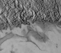
I was intrigued by what appears to be 'cells' in Sputnik that have plenty of dark stuff covering them, making them appear very dark:
 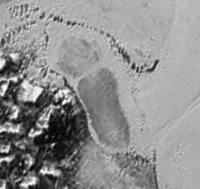 Then it struck me that almost all of them were adjacent to mountains (and none of them far from mountains). Many of the mountains look quite steep and probably undergo rockfall and similar erosion processes. On the top of the slopes, dark stuff could accumulate (or be produced) and subsequently get carried down to surrounding plains on Sputnik by e.g. rockfall. The sharp boundaries of the 'cells' would then, I presume, be a sign of topography - the 'cells' would either be concave or convex in shape with clear boundaries between them. The simplest explanation would be that the boundaries of 'cells' were elevated relative to them, acting like fences to trap the dark particles within the 'cells'. Further north, the cells are larger, allowing the particles to be carried further away by wind and preventing them from saturating the 'cells'. In the process, the prevailing wind direction in the area is also revealed: 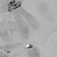
-------------------- |
|
|
|
|
Aug 20 2015, 03:57 PM
Post
#78
|
|
|
Junior Member Group: Members Posts: 82 Joined: 13-July 15 Member No.: 7579 |
QUOTE (Habukaz @ Aug 20 2015, 08:23 PM) I was intrigued by what appears to be 'cells' in Sputnik that have plenty of dark stuff covering them, making them appear very dark: I think the bright surface of Sputnik - it's just a white frost, but dark "cells" - the same as the dark flow to the northeast from Sputnik. These are places where the frost has sublimated over the summer and drew partly transparent ice (but water ice, not solid nitrogen). The density of the atmosphere is too low to wind could blow not quite large particles, but the picture looks like sublimation. Over the cliffs (due to turbulence), and on the hills sublimation going faster. |
|
|
|
|
Aug 20 2015, 10:42 PM
Post
#79
|
|
|
IMG to PNG GOD Group: Moderator Posts: 2251 Joined: 19-February 04 From: Near fire and ice Member No.: 38 |
QUOTE (Gennady Ionov @ Aug 20 2015, 05:24 AM) It calculates a series of animations about the New Horizons flyby: Great animations. Image/data processing products like these are a good example of why releasing spacecraft imagery in near-real time is a good idea. |
|
|
|
|
Aug 21 2015, 06:38 AM
Post
#80
|
||
|
Junior Member Group: Members Posts: 82 Joined: 13-July 15 Member No.: 7579 |
QUOTE (Bjorn Jonsson @ Aug 21 2015, 03:42 AM) Great animations. Image/data processing products like these are a good example of why releasing spacecraft imagery in near-real time is a good idea. Thank you very much for map! http://www.unmannedspaceflight.com/index.p...st&id=37406 Which I used in my animations. New version of flyby animation: https://youtu.be/tKHYGvv-204
|
|
|
|
|
|
|
Aug 21 2015, 08:22 AM
Post
#81
|
|
|
Member Group: Members Posts: 423 Joined: 13-November 14 From: Norway Member No.: 7310 |
QUOTE (Gennady Ionov @ Aug 20 2015, 05:57 PM) The density of the atmosphere is too low to wind could blow not quite large particles, but the picture looks like sublimation. The winds at Triton were considered responsible for giving geysers there trails. As I understand it, the surface pressure on Pluto can reach similar values to Triton (although the exact numbers appear to be a hot topic with the earliest REX data). -------------------- |
|
|
|
|
Aug 21 2015, 12:50 PM
Post
#82
|
|
|
Junior Member Group: Members Posts: 82 Joined: 13-July 15 Member No.: 7579 |
QUOTE (Habukaz @ Aug 21 2015, 01:22 PM) The winds at Triton were considered responsible for giving geysers there trails. Geysers can produce very small haze particles, but particles produced by erosion should be larger... |
|
|
|
|
Aug 21 2015, 01:56 PM
Post
#83
|
|
|
Member Group: Members Posts: 423 Joined: 13-November 14 From: Norway Member No.: 7310 |
The idea was not that the dark particles were created by erosion, but moved downslope by it; e.g. by hitching a ride on a falling rock. I am presuming that the dark stuff is a (relatively) thin layer covering parts of the mountains, not what they are made of (something the brighter exposed slopes agree with).
-------------------- |
|
|
|
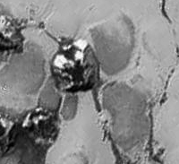
|
Aug 21 2015, 04:25 PM
Post
#84
|
|
|
Junior Member Group: Members Posts: 82 Joined: 13-July 15 Member No.: 7579 |
So if the Pluto mountains consist of water ice, we agree to the material composition of the dark "cells". :-)
|
|
|
|
|
Aug 21 2015, 04:52 PM
Post
#85
|
|
|
Senior Member Group: Members Posts: 2530 Joined: 20-April 05 Member No.: 321 |
My sense is that the production of this terrain was extremely kinetic, and things were moving pretty fast, not due to regular-occurring winds but to a single catastrophic blast, like the production of many water channels on Mars (and some on Earth). Accordingly, I'd interpret the "leeward" features as places where the patterns in the deposition reflect the explosion's interaction with terrain, more like rays forming around an impact crater than anything blowing in the wind.
|
|
|
|
|
Aug 21 2015, 05:05 PM
Post
#86
|
|
 Member Group: Members Posts: 495 Joined: 12-February 12 Member No.: 6336 |
QUOTE (JRehling @ Aug 21 2015, 06:52 PM) My sense is that the production of this terrain was extremely kinetic, and things were moving pretty fast, not due to regular-occurring winds but to a single catastrophic blast, like the production of many water channels on Mars (and some on Earth). Accordingly, I'd interpret the "leeward" features as places where the patterns in the deposition reflect the explosion's interaction with terrain, more like rays forming around an impact crater than anything blowing in the wind. I strongly agree with the interpretation by JRehling, the question is if such "blow outs" of quickly subliming material are seasonal or one time events. |
|
|
|
|
Aug 21 2015, 07:18 PM
Post
#87
|
|||
|
Member Group: Members Posts: 684 Joined: 24-July 15 Member No.: 7619 |
QUOTE (Habukaz @ Aug 16 2015, 02:25 PM) ... Related or not, here are some valleys cutting into Krun: This (western) part of Krun also appears to have a rather rough texture, and appears very young. The rought textured areas of Pluto resemble rough textured areas on comet 67p. Recent Rosetta photos show crack patters that look very similar. http://blogs.esa.int/rosetta/files/2015/08/Fig.2.jpg While the scale of the cracks is much different, I find it interesting that some studies found that surface N2 ice grains on Triton (and by inference Pluto) should be, on average, around a meter in size. Think mexico's crystal cave or superman's fortress of solitude
Attached thumbnail(s)
|
||
|
|
|
||
|
Aug 22 2015, 05:35 PM
Post
#88
|
|
|
Member Group: Members Posts: 423 Joined: 13-November 14 From: Norway Member No.: 7310 |
QUOTE (JRehling @ Aug 21 2015, 06:52 PM) My sense is that the production of this terrain was extremely kinetic, and things were moving pretty fast, not due to regular-occurring winds but to a single catastrophic blast, like the production of many water channels on Mars (and some on Earth). Accordingly, I'd interpret the "leeward" features as places where the patterns in the deposition reflect the explosion's interaction with terrain, more like rays forming around an impact crater than anything blowing in the wind. So you think Sputnik and related mountains and features formed very recently? I don't see those wind streak-like features lasting many orbits around the sun without being part of an ongoing process. -------------------- |
|
|
|
|
Aug 23 2015, 01:17 PM
Post
#89
|
|
|
Senior Member Group: Members Posts: 2530 Joined: 20-April 05 Member No.: 321 |
QUOTE (Habukaz @ Aug 22 2015, 10:35 AM) I don't see those wind streak-like features lasting many orbits around the sun without being part of an ongoing process. You're supposing a lot. What if those features aren't wind streaks but are due to boulders bigger than a fist? They could last eons. You're using the supposition that they're wind streaks to validate the idea that they're wind streaks. Mind you, the absence of craters speaks to the relative recency of their formation. It wasn't eons ago. But we have no basis to conclude that these features are mere feathery deposits of dust. |
|
|
|
|
Aug 23 2015, 02:27 PM
Post
#90
|
|
|
Member Group: Members Posts: 423 Joined: 13-November 14 From: Norway Member No.: 7310 |
QUOTE (JRehling @ Aug 23 2015, 03:17 PM) You're using the supposition that they're wind streaks to validate the idea that they're wind streaks. No, that is trying to interpret what exactly your theory/idea is, hence the question for clarification. You did not specify object/particle size at that point. There are ways such dark trails could disappear over a relatively short period of time, even if we are dealing with trails of big rocks. For example, mission scientists suggested that the ices of Sputnik are flowing. I haven't seen any guesses or estimates on the velocities of this supposed flow, but unless they are really low in this area, trails would get bent out of shape and/or dissolve in a geologically short period of time. In general, I do not see how one could expect the surface of a body of ice to preserve such patterns over longer periods of time. But if Sputnik just has a thin cover of ice (and e.g. the dark stuff is actually sitting on the ground beneath the ice), then things would be different. Again, I do not know which interpretations of Sputnik you are using in your analysis. -------------------- |
|
|
|
|
Aug 24 2015, 07:43 AM
Post
#91
|
|||
 Member Group: Members Posts: 714 Joined: 3-January 08 Member No.: 3995 |
The bubble-like 'cells' in north Sputnik:
remind me of pillow lava that has been sheared off:
(Image from: https://notnecessarilygeology.wordpress.com...alt-bencorragh/ ) However, the vastly greater scale implies some other process altogether. Perhaps there is some intrusive process involved?.... As for the dark patches/streaks, I think they could be lag left behind after sublimation. |
||
|
|
|
||
|
Aug 24 2015, 10:28 AM
Post
#92
|
|
|
Member Group: Members Posts: 137 Joined: 16-June 15 Member No.: 7507 |
It's common for glaciers to have some sort of patterning around their edges - for example:
 The pattern isn't exactly the same, but neither are the materials, gravity, scale, ambient pressure... etc. |
|
|
|
|
Aug 24 2015, 12:04 PM
Post
#93
|
|
|
Senior Member Group: Members Posts: 2530 Joined: 20-April 05 Member No.: 321 |
QUOTE (Habukaz @ Aug 23 2015, 07:27 AM) In general, I do not see how one could expect the surface of a body of ice to preserve such patterns over longer periods of time. But if Sputnik just has a thin cover of ice (and e.g. the dark stuff is actually sitting on the ground beneath the ice), then things would be different. Again, I do not know which interpretations of Sputnik you are using in your analysis. Crater ray systems can last for eons, and we don't know that this isn't similar to that, but produced by an internal explosion rather than an impact, which a much higher volume of ejecta. The absence of smaller impacts on Sputnik means that it is certainly very new, no matter what the origin of it was at least in terms of whatever the cratering rate is at Pluto. That means that whatever happened, it is either a one-time event that happened recently in those terms or a cyclically-repeating event. But neither of those inform the details of how fine the substrate is that causes the differences in the "down-wind" direction of obstacles. It could be like powder, or it could be like boulders. Our resolution is far too poor to know yet. In none of these cases do we have to suppose that wind at any time besides the last, potentially violent, emplacement of material was the agent making the streaks. |
|
|
|
|
Aug 24 2015, 01:32 PM
Post
#94
|
|
|
Member Group: Members Posts: 684 Joined: 24-July 15 Member No.: 7619 |
QUOTE (JRehling @ Aug 24 2015, 01:04 PM) Crater ray systems can last for eons, and we don't know that this isn't similar to that, but produced by an internal explosion rather than an impact, which a much higher volume of ejecta. The absence of smaller impacts on Sputnik means that it is certainly very new, no matter what the origin of it was at least in terms of whatever the cratering rate is at Pluto. That means that whatever happened, it is either a one-time event that happened recently in those terms or a cyclically-repeating event. But neither of those inform the details of how fine the substrate is that causes the differences in the "down-wind" direction of obstacles. It could be like powder, or it could be like boulders. Our resolution is far too poor to know yet. In none of these cases do we have to suppose that wind at any time besides the last, potentially violent, emplacement of material was the agent making the streaks. Basically, the streaks could be: something dark on top of white N2 ice, something dark under clear N2 ice. different grain sizes of N2 ice, different forms of N2 ice crystals (hexagon or square), locations with a mix of the hex and square crystals locations where latent heat in solid ice is causing patterns locations where sunlight is causing scalloped ice or suncups |
|
|
|
|
Aug 25 2015, 03:26 PM
Post
#95
|
|
|
Member Group: Members Posts: 137 Joined: 16-June 15 Member No.: 7507 |
Another case where it's so unfortunate that NH wasn't radar equipped like Cassini.
Not that there was any way that was ever going to happen, but still... If you want to know about fine surface texture, you either land or you use radar. But, at least we've got better spectral data coming |
|
|
|
|
Aug 25 2015, 05:42 PM
Post
#96
|
||
|
Member Group: Members Posts: 684 Joined: 24-July 15 Member No.: 7619 |
QUOTE (Nafnlaus @ Aug 25 2015, 03:26 PM) (snip) If you want to know about fine surface texture, you either land or you use radar. But, at least we've got better spectral data coming Agreed, can't discount texture. And sublimating ice (at least h2o ice) under a constant source of illumination does some amazing things
Attached thumbnail(s)
|
|
|
|
|
|
|
Aug 25 2015, 05:50 PM
Post
#97
|
|
|
Member Group: Members Posts: 423 Joined: 13-November 14 From: Norway Member No.: 7310 |
Next image from NH might arrive Saturday next week (5 September) :-0
QUOTE Alan Stern: 95% of Pluto data still on NH spacecraft, data downloads resume end of next week. I was told previously next pix arrive Sept. 5. https://twitter.com/StephenClark1/status/636229769168711680 -------------------- |
|
|
|
|
Aug 25 2015, 06:50 PM
Post
#98
|
|
|
Member Group: Members Posts: 128 Joined: 10-December 06 From: Atlanta Member No.: 1472 |
QUOTE (Nafnlaus @ Aug 25 2015, 10:26 AM) Another case where it's so unfortunate that NH wasn't radar equipped like Cassini. Note that the radar signal strength is inversely proportional to the fourth power of the distance. Cassini generally uses radar when flying below 1000 km. NH closest approach was over 12,000 km, resulting in ~20000 times weaker signal (assuming the same transmitter). This is just before getting into the problems with the high relative speed of the flyby. |
|
|
|
|
Aug 25 2015, 08:19 PM
Post
#99
|
|
|
Member Group: Members Posts: 684 Joined: 24-July 15 Member No.: 7619 |
QUOTE (siravan @ Aug 25 2015, 06:50 PM) Note that the radar signal strength is inversely proportional to the fourth power of the distance. (snip) New Horizons doesn't carry radar, but could it detect a radio signal from earth that bounced off Pluto/Charon. Does Arecibo transmit any frequencies that New Horizons receives? Could it detect "Tufnel scattering" Turn Arecibo volume up to 11, Point at Pluto/Charon Play a signal as loud as you can. Hope NH can hear the radar echo. So, variables are Arecibo signal strength, beam width in radians, time to aim dish. Pluto/Charon visibility based on alt/azimuth at 24hour day. Pluto Charon surface changes at 6 day/144 hour rotation period. So, blast a radio signal at Pluto at the same time every day, New Horizons hears it about 4 hours later. Do this for 6 days, you get rough data on 60' slices of Pluto/Charon |
|
|
|
|
Aug 26 2015, 12:22 PM
Post
#100
|
||
|
Junior Member Group: Members Posts: 82 Joined: 13-July 15 Member No.: 7579 |
QUOTE (Sherbert @ Aug 26 2015, 06:41 AM) An impact scenario, possibly including an "airburst", bringing Carbon Monoxide to the surface is my pick as a possible explanation, on the evidence available so far anyway. Even before the appearance of detailed pictures, in early July, I advanced the hypothesis that the Charon's genesis more likely not in direct collision of a body with Pluto, while close flyby and dividing the body by tidal forces into at least three parts. One part flew away from Pluto carrying away the excess angular momentum. The second part is Charon. The third part (I called it Acheron - about 400 km in diameter) was closer to Pluto than Charon, therefore, strongly decelerate due to higher tide on Pluto and warmed his equatorial region. Soon it became a circular orbit and approached to the surface of Pluto. Speed relative to the surface in view of the accelerated rotation of Pluto is about 700 m/s. Touching the surface of Pluto Acheron jumped a few times and then buried in the mantle of Pluto. The upper part of it smashed on the equator of Pluto. Location of Acheron stopping should be mascon, should therefore be on the line passing through the centers of Pluto and Charon. This is my crazy idea... When there were photos with high resolution, confidence in such a scenario has increased. If you look along the equator from zero longitude, there are traces of bounces, and then - the equatorial deceleration trench (Cthulhu) and then stopping place (what was my astonishment when it was called Sputnik - i.e. satellite), then smeared the substance flows. The main question in this scenario - flowing of Acheron's water ice mantle under the increasing influence of tidal forces. I am currently working on this model.
Attached thumbnail(s)
|
|
|
|
|
|
|

|
Lo-Fi Version | Time is now: 23rd May 2024 - 03:46 AM |
|
RULES AND GUIDELINES Please read the Forum Rules and Guidelines before posting. IMAGE COPYRIGHT |
OPINIONS AND MODERATION Opinions expressed on UnmannedSpaceflight.com are those of the individual posters and do not necessarily reflect the opinions of UnmannedSpaceflight.com or The Planetary Society. The all-volunteer UnmannedSpaceflight.com moderation team is wholly independent of The Planetary Society. The Planetary Society has no influence over decisions made by the UnmannedSpaceflight.com moderators. |
SUPPORT THE FORUM Unmannedspaceflight.com is funded by the Planetary Society. Please consider supporting our work and many other projects by donating to the Society or becoming a member. |
|