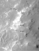
Exploring Murray Ridge, Sol 3600 - 3743 (March 11, 2014 - August 5, 2014) |

  |
Exploring Murray Ridge, Sol 3600 - 3743 (March 11, 2014 - August 5, 2014) |
 Mar 11 2014, 05:28 PM Mar 11 2014, 05:28 PM
Post
#1
|
||
|
Senior Member  Group: Members Posts: 1074 Joined: 21-September 07 From: Québec, Canada Member No.: 3908 |
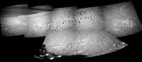
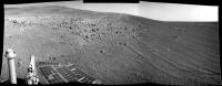
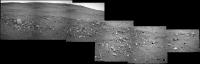
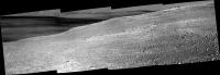
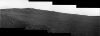
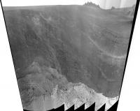
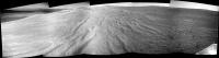
Sol 3600 right navcam pan:
--- Apr 24, 2014. This thread is dedicated to the rover activities after the winter campaign at / around Cook Haven. Moved several pages from that thread here. Tesheiner (Moderator) |
|
 |
 
|
|
|
Mar 11 2014, 11:29 PM
Post
#2
|
||
|
Solar System Cartographer Group: Members Posts: 10185 Joined: 5-April 05 From: Canada Member No.: 227 |
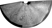
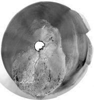
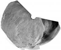
Circular view of Charborob's pan.
Phil
-------------------- ... because the Solar System ain't gonna map itself.
Also to be found posting similar content on https://mastodon.social/@PhilStooke Maps for download (free PD: https://upload.wikimedia.org/wikipedia/comm...Cartography.pdf NOTE: everything created by me which I post on UMSF is considered to be in the public domain (NOT CC, public domain) |
|
|
|
|
|
|
Mar 12 2014, 08:24 PM
Post
#3
|
|||
|
Senior Member Group: Members Posts: 2837 Joined: 22-April 05 From: Ridderkerk, Netherlands Member No.: 353 |
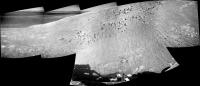
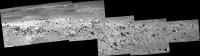
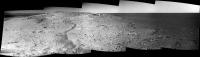
The Sol 3600 Left Navcam view.
and the Sol 3601 Left Navcam view.
Jan van Driel |
||
|
|
|
||
|
Mar 12 2014, 09:30 PM
Post
#4
|
|||
|
Member Group: Members Posts: 866 Joined: 15-March 05 From: Santa Cruz, CA Member No.: 196 |
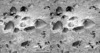
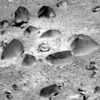
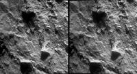
the surreal negative shading effect of filter 2 on the dusty little campfire ring rock garden from SOL3601
..seemed a good candidate for gif illusion (epileptics probably should NOT open)
|
||
|
|
|
||
|
Mar 12 2014, 10:43 PM
Post
#5
|
|
|
Senior Member Group: Members Posts: 1074 Joined: 21-September 07 From: Québec, Canada Member No.: 3908 |
These rocks look like ventifacts.
|
|
|
|
|
Mar 18 2014, 10:30 PM
Post
#6
|
||
|
Senior Member Group: Members Posts: 1045 Joined: 17-February 09 Member No.: 4605 |
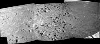
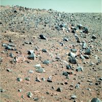
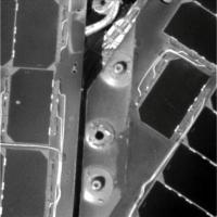
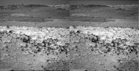
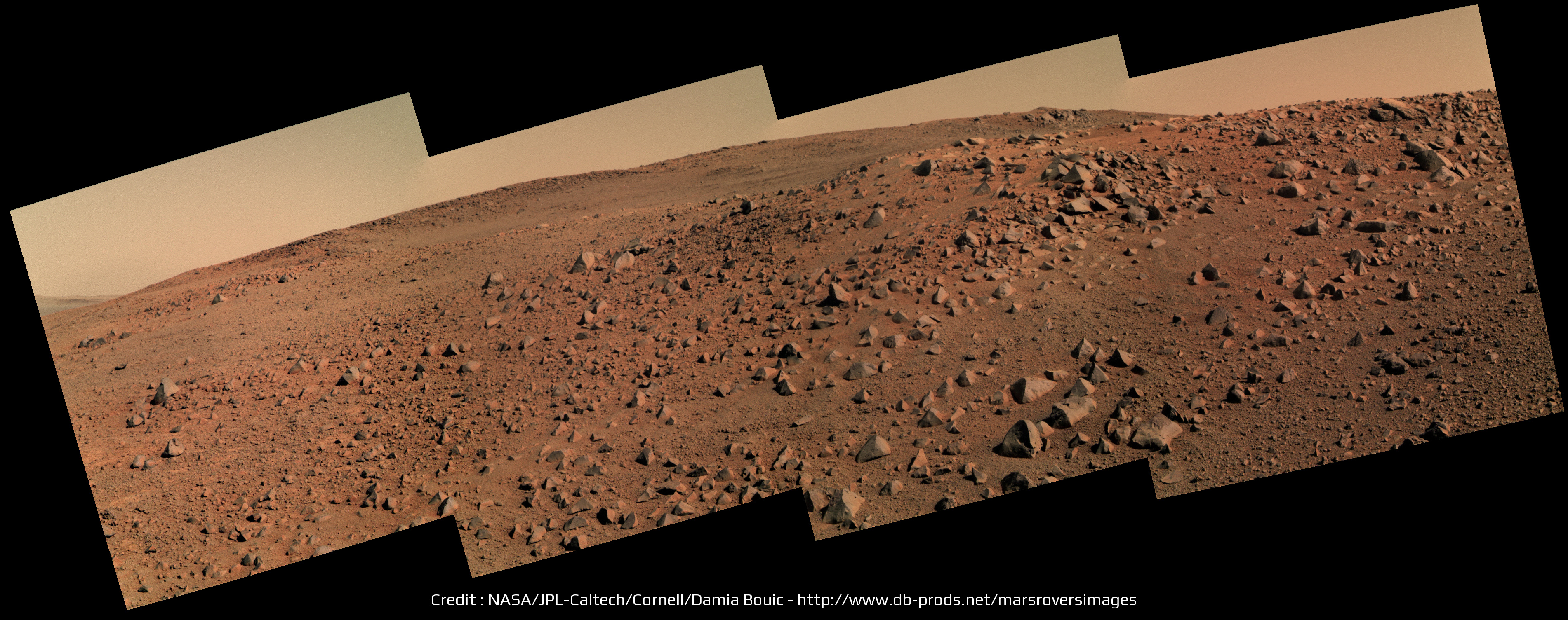
Curiosity might be getting all the attention but for me Opportunity remains the doyen of Mars rovers. Yet another change of scenery in the rock garden at McClure Beverlin West. Lithic breccia clasts eroding out of a sandy matrix?
Attached thumbnail(s)
|
|
|
|
|
|
|
Mar 19 2014, 01:46 AM
Post
#7
|
|
|
Senior Member Group: Members Posts: 2090 Joined: 13-February 10 From: Ontario Member No.: 5221 |
Hey, when'd we drive to Gusev so fast? No one told me!

|
|
|
|
|
Mar 21 2014, 01:58 AM
Post
#8
|
||
|
Member Group: Members Posts: 866 Joined: 15-March 05 From: Santa Cruz, CA Member No.: 196 |
sol3609: its nice to finally get a peek over the top
look! up in the sky, is it a cross-eyed cloud? is it schmutz? sort of, its just an amateur job at filling missing sky pixels. |
|
|
|
|
|
|
Mar 21 2014, 06:31 AM
Post
#9
|
||
 Senior Member Group: Admin Posts: 3108 Joined: 21-December 05 From: Canberra, Australia Member No.: 615 |
Sol3609 - another fine day on Mars

NB: Sky added for effect |
|
|
|
|
|
|
Mar 21 2014, 01:42 PM
Post
#10
|
||
|
Senior Member Group: Members Posts: 2837 Joined: 22-April 05 From: Ridderkerk, Netherlands Member No.: 353 |
The Sol 3610 L0 Navcam view.
Jan van Driel
|
|
|
|
|
|
|
Mar 21 2014, 02:55 PM
Post
#11
|
|||
|
Senior Member Group: Members Posts: 2837 Joined: 22-April 05 From: Ridderkerk, Netherlands Member No.: 353 |
The Navcam Lo view on sol 3608
and on Sol 3609
Jan van Driel |
||
|
|
|
||
|
Mar 21 2014, 03:08 PM
Post
#12
|
|
 Senior Member Group: Members Posts: 4252 Joined: 17-January 05 Member No.: 152 |
I'm not sure exactly where we are, but I think this new view is just over a small ridge on Solander, and we can't yet see to the highest part of Solander, or beyond to Tribulation.
But we did see some real clouds tosol: http://qt.exploratorium.edu/mars/opportuni...0M1.JPG?sol3610 |
|
|
|
|
Mar 21 2014, 03:21 PM
Post
#13
|
||
|
Senior Member Group: Members Posts: 2837 Joined: 22-April 05 From: Ridderkerk, Netherlands Member No.: 353 |
For the complete view I have added the images from Sol 3607
to the panorama taken on Sol 3608. Jan van Driel
|
|
|
|
|
|
|
Mar 21 2014, 03:32 PM
Post
#14
|
||
|
Senior Member Group: Members Posts: 4252 Joined: 17-January 05 Member No.: 152 |
Actuallly I'm willing to guess where we are - this is not based on data at all, I just stared at navcams and the orbital view for a bit:
It makes sense as we head south to stay close to the plains-side of Solander - smoother driving and longer line-of-sight views for planning. |
|
|
|
|
|
|
Mar 21 2014, 04:35 PM
Post
#15
|
||
|
Senior Member Group: Members Posts: 1074 Joined: 21-September 07 From: Québec, Canada Member No.: 3908 |
Sol 3609 pancam pan (similar to jvandriel's pan but with one more image on the left side):
|
|
|
|
|
|
|
Mar 21 2014, 06:00 PM
Post
#16
|
||
|
Senior Member Group: Moderator Posts: 4279 Joined: 19-April 05 From: .br at .es Member No.: 253 |
QUOTE (fredk @ Mar 21 2014, 04:32 PM)  Actuallly I'm willing to guess where we are - this is not based on data at all, I just stared at navcams and the orbital view for a bit: I just extracted the latest info from the pancam website and this is the result. I did no manual corrections at all for the time being but most probably will have to. Your guess based on the navcams should be more accurate.
|
|
|
|
|
|
|
Mar 21 2014, 09:13 PM
Post
#17
|
|
|
Solar System Cartographer Group: Members Posts: 10185 Joined: 5-April 05 From: Canada Member No.: 227 |
Right... that whole track needs to be shifted to the left about one diameter of that crater at the top left edge of the image.
Do we have enough images for a 360 pan from the recent stop at Augustine? Phil -------------------- ... because the Solar System ain't gonna map itself.
Also to be found posting similar content on https://mastodon.social/@PhilStooke Maps for download (free PD: https://upload.wikimedia.org/wikipedia/comm...Cartography.pdf NOTE: everything created by me which I post on UMSF is considered to be in the public domain (NOT CC, public domain) |
|
|
|
|
Mar 24 2014, 08:36 AM
Post
#18
|
||
|
Senior Member Group: Members Posts: 2837 Joined: 22-April 05 From: Ridderkerk, Netherlands Member No.: 353 |
Here is the complete panoramic view from images taken on Sol 3607 and Sol 3608
with the L0 Navcam. Jan van Driel
|
|
|
|
|
|
|
Mar 25 2014, 03:20 AM
Post
#19
|
||
|
Solar System Cartographer Group: Members Posts: 10185 Joined: 5-April 05 From: Canada Member No.: 227 |
Fantastic - thanks. And with a little bit of geometric magic, it becomes a circular version of the area.
Phil
-------------------- ... because the Solar System ain't gonna map itself.
Also to be found posting similar content on https://mastodon.social/@PhilStooke Maps for download (free PD: https://upload.wikimedia.org/wikipedia/comm...Cartography.pdf NOTE: everything created by me which I post on UMSF is considered to be in the public domain (NOT CC, public domain) |
|
|
|
|
|
|
Mar 25 2014, 04:23 AM
Post
#20
|
|
|
Senior Member Group: Members Posts: 4252 Joined: 17-January 05 Member No.: 152 |
Power levels up to 574 Whrs - that was a good level at the best part of this past summer!
|
|
|
|
|
Mar 25 2014, 04:41 AM
Post
#21
|
||
|
Senior Member Group: Members Posts: 1045 Joined: 17-February 09 Member No.: 4605 |
Sparkly clean.
Attached thumbnail(s)
|
|
|
|
|
|
|
Mar 25 2014, 12:21 PM
Post
#22
|
||
|
Senior Member Group: Members Posts: 1074 Joined: 21-September 07 From: Québec, Canada Member No.: 3908 |
Sol 3613 pancam pan:
|
|
|
|
|
|
|
Mar 25 2014, 02:10 PM
Post
#23
|
|
 Senior Member Group: Members Posts: 1619 Joined: 12-February 06 From: Bergerac - FR Member No.: 678 |
I don't totally forget Opportunity, and I found myself processing this color panorama of Sol 3609
-------------------- |
|
|
|
|
Mar 25 2014, 03:36 PM
Post
#24
|
||
|
Senior Member Group: Members Posts: 2837 Joined: 22-April 05 From: Ridderkerk, Netherlands Member No.: 353 |
The Pancam L 2 view on Sol 3613.
Jan van Driel
|
|
|
|
|
|
|
Mar 25 2014, 03:41 PM
Post
#25
|
|
|
Solar System Cartographer Group: Members Posts: 10185 Joined: 5-April 05 From: Canada Member No.: 227 |
Spectacular! What a great place. That picture just makes me think I could walk right up to that ridge and peek over it. It seems that we have still not seen the layers under the impact ejecta that we saw at Cape York (Whitewater etc.) - obviously we were very lucky to find that exposure. But there's lots more crater rim to explore.
Phil -------------------- ... because the Solar System ain't gonna map itself.
Also to be found posting similar content on https://mastodon.social/@PhilStooke Maps for download (free PD: https://upload.wikimedia.org/wikipedia/comm...Cartography.pdf NOTE: everything created by me which I post on UMSF is considered to be in the public domain (NOT CC, public domain) |
|
|
|
|
Mar 25 2014, 04:28 PM
Post
#26
|
|
|
Senior Member Group: Members Posts: 1045 Joined: 17-February 09 Member No.: 4605 |
They identified those layers as the pre impact surface / sub surface, only a few metres above the Burns formation level, so I don't think we could reasonably expect to see it high on Solander. The interesting thing is that Larry Crumpler's LPSC paper identifies that the unconformity between impactites and the pre-impact surface had a dip of some 11 +/- 2 degrees towards the crater centre. This correlates quite nicely to Parker and Bills paper hypothesising that the bench does in fact reflect a previously level coastal geomorphology and there was subsequent tilting towards the crater. Circumstantial, but worthy of thought.
|
|
|
|
|
Mar 25 2014, 04:33 PM
Post
#27
|
|
|
Senior Member Group: Members Posts: 1619 Joined: 12-February 06 From: Bergerac - FR Member No.: 678 |
Sol 3613 Pancam panoramic
Is that some crater we have behind the crest ?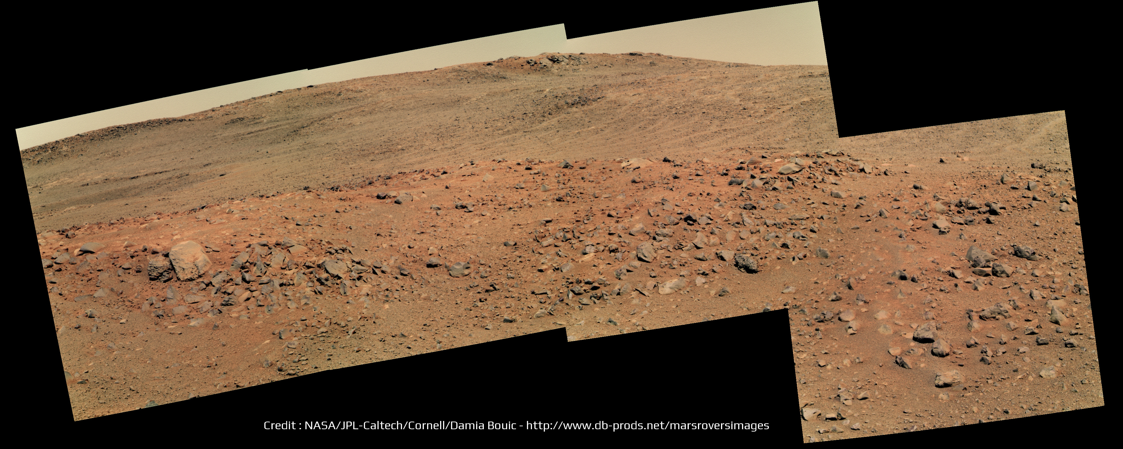
-------------------- |
|
|
|
|
Mar 25 2014, 05:40 PM
Post
#28
|
|
 Member Group: Members Posts: 815 Joined: 3-June 04 From: Brittany, France Member No.: 79 |
Very nice mosaic Damia! Oppy is really doing mountain hiking
There is indeed what looks like a crater on the left part of your panorama. But I can't figure out where it is located on fredk map. -------------------- |
|
|
|
|
Mar 25 2014, 06:01 PM
Post
#29
|
|
 Interplanetary Dumpster Diver Group: Admin Posts: 4404 Joined: 17-February 04 From: Powell, TN Member No.: 33 |
QUOTE (Ant103 @ Mar 25 2014, 04:33 PM) Sol 3613 Pancam panoramic Is that some crater we have behind the crest ?Wow, beautiful! The best view from Oppy I've seen in a long time. -------------------- |
|
|
|
|
Mar 25 2014, 06:32 PM
Post
#30
|
||
|
Senior Member Group: Members Posts: 4252 Joined: 17-January 05 Member No.: 152 |
Nice view indeed. I think this is the crater in question over the near crest:
I don't think we've moved much since the 3610 location. |
|
|
|
|
|
|
Mar 26 2014, 02:07 PM
Post
#31
|
|
|
Solar System Cartographer Group: Members Posts: 10185 Joined: 5-April 05 From: Canada Member No.: 227 |
I agree with that crater location. And it was only a small move, 3 m or so.
Phil -------------------- ... because the Solar System ain't gonna map itself.
Also to be found posting similar content on https://mastodon.social/@PhilStooke Maps for download (free PD: https://upload.wikimedia.org/wikipedia/comm...Cartography.pdf NOTE: everything created by me which I post on UMSF is considered to be in the public domain (NOT CC, public domain) |
|
|
|
|
Mar 28 2014, 01:09 AM
Post
#32
|
||
|
Member Group: Members Posts: 866 Joined: 15-March 05 From: Santa Cruz, CA Member No.: 196 |
concur-o-gram
|
|
|
|
|
|
|
Mar 28 2014, 11:28 PM
Post
#33
|
||
|
Member Group: Members Posts: 866 Joined: 15-March 05 From: Santa Cruz, CA Member No.: 196 |
sort of interesting detail of "Turnagain Arm" back on sol 3598 makes me forget im not looking at a HiRise of kimberly
|
|
|
|
|
|
|
Mar 30 2014, 08:09 PM
Post
#34
|
||
|
Junior Member Group: Members Posts: 41 Joined: 27-May 09 From: Burgundy Member No.: 4798 |
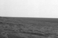
Any idea of what we are seeing West on the horizon ?
http://www.midnightplanets.com/web/MERB/im...0P1777R0M1.html
|
|
|
|
|
|
|
Mar 31 2014, 02:57 AM
Post
#35
|
||
|
Solar System Cartographer Group: Members Posts: 10185 Joined: 5-April 05 From: Canada Member No.: 227 |
Not sure about that... but we are about here at the moment.
Phil
-------------------- ... because the Solar System ain't gonna map itself.
Also to be found posting similar content on https://mastodon.social/@PhilStooke Maps for download (free PD: https://upload.wikimedia.org/wikipedia/comm...Cartography.pdf NOTE: everything created by me which I post on UMSF is considered to be in the public domain (NOT CC, public domain) |
|
|
|
|
|
|
Mar 31 2014, 08:04 PM
Post
#36
|
||
|
Member Group: Members Posts: 808 Joined: 10-October 06 From: Maynard Mass USA Member No.: 1241 |
Hi Bill,
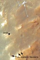
Here is a Phil-O-Vision (10x stretch, vertical only) of that navcam 3618?
I don't know how to obtain azimuths from the pictures (some here do I think) If I had a bearing we could consult a HiRise image for possibilities First Guess:: it looks like a rock. It is as dark if not darker that the surrounding 'horizon stuff', a more distant object could be lighter than the horizon material since there is more atmosphere and dust to see through. cheers -------------------- CLA CLL
|
|
|
|
|
|
|
Mar 31 2014, 09:59 PM
Post
#37
|
|
|
Senior Member Group: Members Posts: 3516 Joined: 4-November 05 From: North Wales Member No.: 542 |
I don't know if we can see out across the plains yet but if so there is a candidate small crater in that general direction that is quite prominent. I gave it the nickname Rockaway when we first saw it. It does look darker than its distance suggests.
|
|
|
|
|
Mar 31 2014, 10:47 PM
Post
#38
|
||
|
Solar System Cartographer Group: Members Posts: 10185 Joined: 5-April 05 From: Canada Member No.: 227 |
A little bogus-malogus colour image of Point Bede.
Phil
-------------------- ... because the Solar System ain't gonna map itself.
Also to be found posting similar content on https://mastodon.social/@PhilStooke Maps for download (free PD: https://upload.wikimedia.org/wikipedia/comm...Cartography.pdf NOTE: everything created by me which I post on UMSF is considered to be in the public domain (NOT CC, public domain) |
|
|
|
|
|
|
Apr 1 2014, 02:44 PM
Post
#39
|
||
|
Senior Member Group: Members Posts: 2837 Joined: 22-April 05 From: Ridderkerk, Netherlands Member No.: 353 |
The 360 degree Navcam L0 panoramic view on Sol 3618.
Jan van Driel
|
|
|
|
|
|
|
Apr 2 2014, 01:47 PM
Post
#40
|
||
|
Senior Member Group: Members Posts: 2837 Joined: 22-April 05 From: Ridderkerk, Netherlands Member No.: 353 |
and the Pancam L2 view on Sol 3618.
Jan van Driel
|
|
|
|
|
|
|
Apr 3 2014, 09:24 PM
Post
#41
|
|
|
Member Group: Members Posts: 866 Joined: 15-March 05 From: Santa Cruz, CA Member No.: 196 |
|
|
|
|
|
Apr 4 2014, 11:08 AM
Post
#42
|
||
|
Senior Member Group: Members Posts: 2837 Joined: 22-April 05 From: Ridderkerk, Netherlands Member No.: 353 |
The Navcam L0 panoramic view on Sol 3621.
Jan van Driel
|
|
|
|
|
|
|
Apr 5 2014, 01:54 AM
Post
#43
|
|
|
Senior Member Group: Members Posts: 4252 Joined: 17-January 05 Member No.: 152 |
Some crazy-looking "raked" or washboard terrain from pre-drive 3621:
http://qt.exploratorium.edu/mars/opportuni...5M1.JPG?sol3621 I assume we're just seeing lots of fine ripples perpendicular to the line of sight. The ripples are hardly visible in the corresponding navcam: http://marsrovers.jpl.nasa.gov/gallery/all...00P0673R0M1.JPG That's the same nameless 5-10 metre crater we've been eyeing for some time now. |
|
|
|
|
Apr 5 2014, 04:38 AM
Post
#44
|
|
|
Senior Member Group: Members Posts: 4252 Joined: 17-January 05 Member No.: 152 |
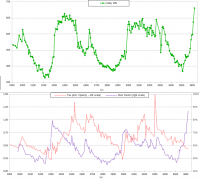
And now we're almost at 90% dust factor!
 The cleanest panels since 2006! From Crumpler's latest post. |
|
|
|
|
Apr 5 2014, 05:37 AM
Post
#45
|
||
 Senior Member Group: Members Posts: 2492 Joined: 15-January 05 From: center Italy Member No.: 150 |
Very impressive!
As visible from following plots, in the last 5 years dust factor never went above 79.5% (record set on Sol 2313 or July 27, 2010):
-------------------- I always think before posting! - Marco -
|
|
|
|
|
|
|
Apr 5 2014, 06:43 AM
Post
#46
|
|
|
Member Group: Members Posts: 206 Joined: 15-August 07 From: Shrewsbury, Shropshire Member No.: 3233 |
QUOTE (fredk @ Apr 5 2014, 04:38 AM) ... From Crumpler's latest post. This anouncement in Crumpler's post is very interesting: "After we take a look at the local outcrops up here on the ridge crest, and maybe drive to the local summit for a good view of the crater, we will start driving south along the west side of the rim." Given the uneven terrain on the Western side of the rim this means for the next few Years Oppy will always be within a few 100m of a North facing slope, which I think is a good decision |
|
|
|
|
Apr 5 2014, 11:33 AM
Post
#47
|
|
|
Senior Member Group: Members Posts: 2492 Joined: 15-January 05 From: center Italy Member No.: 150 |
QUOTE (PaulM @ Apr 5 2014, 07:43 AM) ...for the next few Years Oppy will always be within a few 100m of a North facing slope, which I think is a good decision In fact, they shows 3 possible paths in this region, while "next long-term target is about 600 m south along the west side of the crater rim"; however, the 10-26 sol drive time seems optimistic to me (unless they refers only to full, long drive sols!) -------------------- I always think before posting! - Marco -
|
|
|
|
|
Apr 5 2014, 03:32 PM
Post
#48
|
|
|
Senior Member Group: Members Posts: 4252 Joined: 17-January 05 Member No.: 152 |
But the path in question (path "A") stays away from the rough ridge of Solander and would probably be easy driving like out on the plains (and much easier than our climb up Solander so far). So that drive time sounds realistic, considering how fast we drove from Nobby's Head to Solander.
Of course in practice the limiting factor for the drive time will be the science stops. |
|
|
|
|
Apr 7 2014, 12:04 PM
Post
#49
|
||
|
Senior Member Group: Members Posts: 1074 Joined: 21-September 07 From: Québec, Canada Member No.: 3908 |
Sol 3625 pancam filter 2 pan:
|
|
|
|
|
|
|
Apr 7 2014, 12:45 PM
Post
#50
|
|
 Senior Member Group: Members Posts: 1089 Joined: 19-February 05 From: Close to Meudon Observatory in France Member No.: 172 |
QUOTE (charborob @ Apr 7 2014, 02:04 PM) Sol 3625 pancam filter 2 pan: Thanks a lot Charborob. The view on the plains on the other side of the crater starts to be terrific ! I hope they will image it with the "L7" filter soon to gain more details far away. Thanks again
|
|
|
|
|
Apr 7 2014, 02:14 PM
Post
#51
|
|
 Member Group: Members Posts: 691 Joined: 21-December 07 From: Clatskanie, Oregon Member No.: 3988 |
I'm working on processing the color images for the deck pan, but here is an L4 mosaic of what I got sofar.
|
|
|
|
|
Apr 7 2014, 03:02 PM
Post
#52
|
||
|
Senior Member Group: Members Posts: 1074 Joined: 21-September 07 From: Québec, Canada Member No.: 3908 |
QUOTE (vikingmars @ Apr 7 2014, 07:45 AM) Thanks a lot Charborob. The view on the plains on the other side of the crater starts to be terrific ! I hope they will image it with the "L7" filter soon to gain more details far away. Thanks again Here is the left filter 7 pan on sol 3625 (the last image on the right is incomplete; I had to adjust the curves to make it more or less match the others). Are there really more details visible?
|
|
|
|
|
|
|
Apr 7 2014, 04:40 PM
Post
#53
|
|
|
Senior Member Group: Members Posts: 1619 Joined: 12-February 06 From: Bergerac - FR Member No.: 678 |
Same view, in colors. Very good sighting there !
-------------------- |
|
|
|
|
Apr 8 2014, 03:09 AM
Post
#54
|
|
|
Senior Member Group: Members Posts: 1045 Joined: 17-February 09 Member No.: 4605 |
An interesting update from A. J. S Rayl.
http://www.planetary.org/explore/space-top...cook-haven.html |
|
|
|
|
Apr 8 2014, 11:26 AM
Post
#55
|
|
|
Member Group: Members Posts: 154 Joined: 21-April 05 From: Rochester, New York, USA Member No.: 336 |
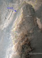
Is there a map of "the bench" referred to in the above article?
|
|
|
|
|
Apr 8 2014, 01:36 PM
Post
#56
|
|
|
Senior Member Group: Members Posts: 1089 Joined: 19-February 05 From: Close to Meudon Observatory in France Member No.: 172 |
QUOTE (charborob @ Apr 7 2014, 05:02 PM) Are there really more details visible? Thanks a lot Charborob ! Yes indeed : some craters on the far horizon are readily much more visible (as horizontal dark markings)
|
|
|
|
|
Apr 8 2014, 06:11 PM
Post
#57
|
||
 Senior Member Group: Members Posts: 2173 Joined: 28-December 04 From: Florida, USA Member No.: 132 |
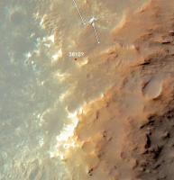
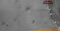
QUOTE (craigmcg @ Apr 8 2014, 07:26 AM) Is there a map of "the bench" referred to in the above article? I've indicated the bench in this image from Larry Crumpler's April 3 Planetary Society Blog. It is well defined at the north end where Opportunity arrived at Solander Point, but seems to be less well defined to the South. This could be due to some extent to lighting.
|
|
|
|
|
|
|
Apr 8 2014, 07:34 PM
Post
#58
|
||
|
Senior Member Group: Members Posts: 2837 Joined: 22-April 05 From: Ridderkerk, Netherlands Member No.: 353 |
The Pancam L7 view on Sol 3625.
Jan van Driel
|
|
|
|
|
|
|
Apr 8 2014, 10:48 PM
Post
#59
|
|
|
Member Group: Members Posts: 691 Joined: 21-December 07 From: Clatskanie, Oregon Member No.: 3988 |
Almost finished with processing the color images that will be added to this but here is the L4 deckpan sofar.
|
|
|
|
|
Apr 9 2014, 05:37 AM
Post
#60
|
|
|
Member Group: Members Posts: 691 Joined: 21-December 07 From: Clatskanie, Oregon Member No.: 3988 |
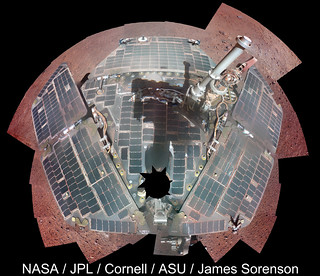 
|
|
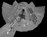
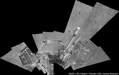
|
|
|
Apr 9 2014, 08:52 AM
Post
#61
|
|
|
Member Group: Members Posts: 815 Joined: 3-June 04 From: Brittany, France Member No.: 79 |
Really nice work James ! I didn't expect the solar panels to be so clean.
-------------------- |
|
|
|
|
Apr 9 2014, 12:58 PM
Post
#62
|
|
|
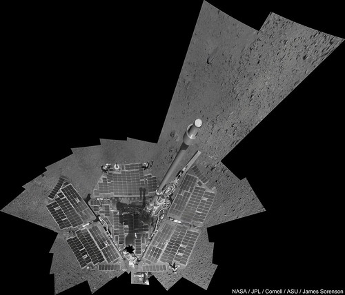
Senior Member Group: Admin Posts: 3108 Joined: 21-December 05 From: Canberra, Australia Member No.: 615 |
Opportunity: Doing 'selfies' since 2004
 
|
|
|
|
|
Apr 11 2014, 03:05 AM
Post
#63
|
|
|
Solar System Cartographer Group: Members Posts: 10185 Joined: 5-April 05 From: Canada Member No.: 227 |
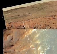
A long-awaited moment (by me at least) - Cape Tribulation viewed over the top of Murray Ridge:
http://www.midnightplanets.com/web/MERB/im...3P1835L0M1.html Phil -------------------- ... because the Solar System ain't gonna map itself.
Also to be found posting similar content on https://mastodon.social/@PhilStooke Maps for download (free PD: https://upload.wikimedia.org/wikipedia/comm...Cartography.pdf NOTE: everything created by me which I post on UMSF is considered to be in the public domain (NOT CC, public domain) |
|
|
|
|
Apr 11 2014, 07:51 AM
Post
#64
|
|
|
Senior Member Group: Members Posts: 3516 Joined: 4-November 05 From: North Wales Member No.: 542 |
Long awaited by me as well. I'm looking out for another glimpse of the Miyamoto 'Mule Ears' off to the SSW. They were not visible in navcams before but we're a bit closer now. There are some camdidate bumps among the noise but nothinjg more so far. I'm hoping that the planned panorama from the local summit will be a full 360 and not just the view into the crater.
|
|
|
|
|
Apr 11 2014, 08:02 AM
Post
#65
|
|
 Senior Member Group: Moderator Posts: 2262 Joined: 9-February 04 From: Melbourne - Oz Member No.: 16 |
Yay! I was hoping that this drive would finally reveal it and there it is. Nice to see where we're going.

-------------------- |
|
|
|
|
Apr 11 2014, 09:54 AM
Post
#66
|
|
 Junior Member Group: Members Posts: 73 Joined: 10-May 06 From: Spain Member No.: 770 |
|
|
|
|
|
Apr 11 2014, 10:06 AM
Post
#67
|
|
|
Senior Member Group: Admin Posts: 3108 Joined: 21-December 05 From: Canberra, Australia Member No.: 615 |
Just wondering if any of our mapping gurus (Tesh, Phil etc) would be able to point to places on the horizon that would be headings for craters like Santa Maria, Victoria etc?
Not expecting them to be visible, just interested in directions. |
|
|
|
|
Apr 11 2014, 03:19 PM
Post
#68
|
||
|
Solar System Cartographer Group: Members Posts: 10185 Joined: 5-April 05 From: Canada Member No.: 227 |
Great pan, Dig - here's a circular view of it to help locate us on the hill.
Phil
-------------------- ... because the Solar System ain't gonna map itself.
Also to be found posting similar content on https://mastodon.social/@PhilStooke Maps for download (free PD: https://upload.wikimedia.org/wikipedia/comm...Cartography.pdf NOTE: everything created by me which I post on UMSF is considered to be in the public domain (NOT CC, public domain) |
|
|
|
|
|
|
Apr 12 2014, 01:43 AM
Post
#69
|
|
 Senior Member Group: Moderator Posts: 3431 Joined: 11-August 04 From: USA Member No.: 98 |
Opportunity Update - sols 3622-3629, April 02, 2014-April 09, 2014: Getting in Place for a Better View of 'Endeavour Crater'
QUOTE On Sol 3628 (April 8, 2014), the rover drove about 69 feet (21 meters) to the south in an approach to a local ridge top, a vantage point that offers a view with an entire sweep of Endeavour Crater. Once there, the plan is to collect a spectacular color panorama of Endeavour. 
|
|
|
|
|
Apr 12 2014, 04:44 AM
Post
#70
|
|
 Member Group: Members Posts: 399 Joined: 28-August 07 From: San Francisco Member No.: 3511 |
I wonder just how much more spectacular it could get
 ... ...
-------------------- 'She drove until the wheels fell off...'
|
|
|
|
|
Apr 14 2014, 04:43 PM
Post
#71
|
|
|
Senior Member Group: Members Posts: 1619 Joined: 12-February 06 From: Bergerac - FR Member No.: 678 |
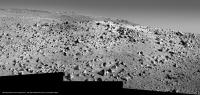
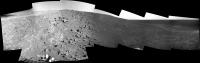
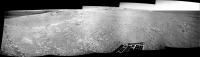
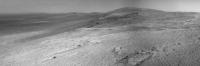
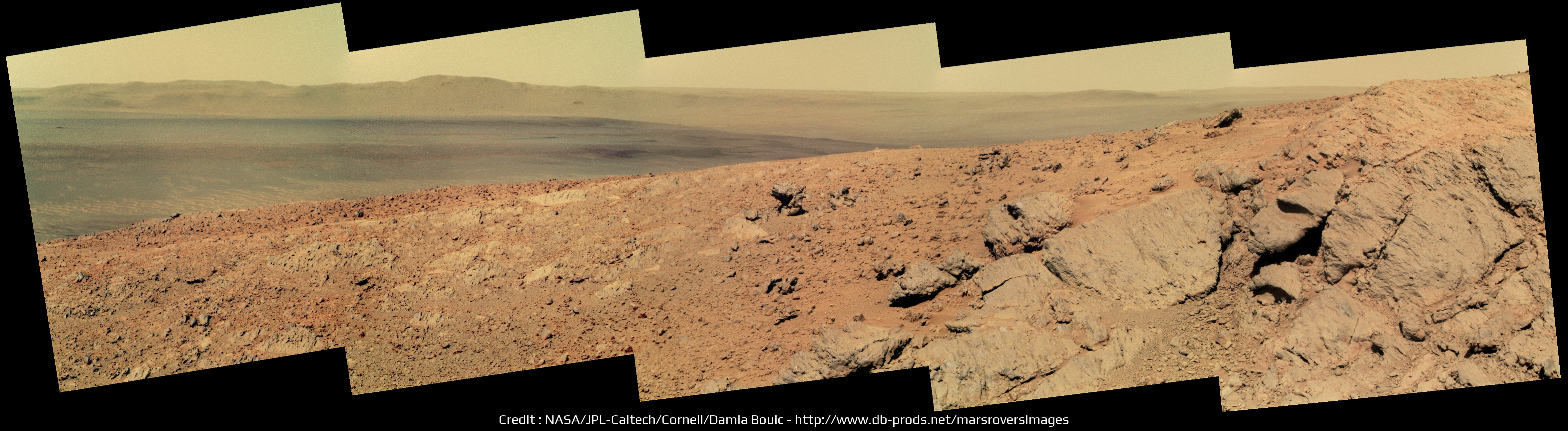
Sol 3633 Pancam panoramic. The view is astounding !
We can see Cape York there !
-------------------- |
|
|
|
|
Apr 14 2014, 07:42 PM
Post
#72
|
|
|
Member Group: Members Posts: 913 Joined: 4-September 06 From: Boston Member No.: 1102 |
Nice, I love the tracks winding up the hill!
-------------------- |
|
|
|
|
Apr 14 2014, 08:12 PM
Post
#73
|
||
|
Senior Member Group: Members Posts: 2837 Joined: 22-April 05 From: Ridderkerk, Netherlands Member No.: 353 |
The Navcam L0 view on Sol 3632.
Jan van Driel
|
|
|
|
|
|
|
Apr 14 2014, 09:00 PM
Post
#74
|
||
|
Senior Member Group: Members Posts: 2837 Joined: 22-April 05 From: Ridderkerk, Netherlands Member No.: 353 |
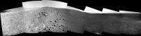
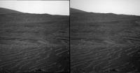
Pancam L7 panorama of the wheeltracks on Sol 3632.
Jan van Driel
|
|
|
|
|
|
|
Apr 15 2014, 12:00 AM
Post
#75
|
||
|
Solar System Cartographer Group: Members Posts: 10185 Joined: 5-April 05 From: Canada Member No.: 227 |
Great view, Damia - here's a stretched perspective view of it to make it easier to identify things.
Phil
-------------------- ... because the Solar System ain't gonna map itself.
Also to be found posting similar content on https://mastodon.social/@PhilStooke Maps for download (free PD: https://upload.wikimedia.org/wikipedia/comm...Cartography.pdf NOTE: everything created by me which I post on UMSF is considered to be in the public domain (NOT CC, public domain) |
|
|
|
|
|
|
Apr 15 2014, 01:42 AM
Post
#76
|
|
 Member Group: Members Posts: 754 Joined: 9-February 07 Member No.: 1700 |
The ~absolutely gorgeous~ pic assembled by Ant103 in Post #254 shows the crater I've always wanted to be named the Far Side Crater in honor of Gary Larsen. True?
 Fun fact - I premiered a concerto for electronic keyboards and orchestra with the LA Phil in 1989. Someone taped this cartoon to the curtain where I was to pass thru to receive my soloist's applause. LOL It's the higher crater, IIRC. |
|
|
|
|
Apr 15 2014, 02:33 PM
Post
#77
|
|
|
Senior Member Group: Members Posts: 1619 Joined: 12-February 06 From: Bergerac - FR Member No.: 678 |
New pictures are down today, the occasion to complete the full panoramic over Endeavour crater
 Thank you James
-------------------- |
|
|
|
|
Apr 15 2014, 07:58 PM
Post
#78
|
||
|
Senior Member Group: Members Posts: 2837 Joined: 22-April 05 From: Ridderkerk, Netherlands Member No.: 353 |
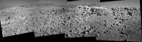
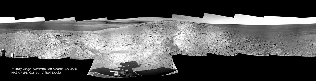
The complete 360 degree Navcam L0 panoramic view taken on
Sol 3630 and Sol 3632. Jan van Driel
|
|
|
|
|
|
|
Apr 16 2014, 07:49 AM
Post
#79
|
|
|
Member Group: Members Posts: 691 Joined: 21-December 07 From: Clatskanie, Oregon Member No.: 3988 |
My take sofar on the Endeavour Pan. There is a circular donut area on the left most part of the Pancam images that at leased for me isn't removable with current flat-fields unless however I brush them out. I have noticed this for quite awhile.
|
|
|
|
|
Apr 16 2014, 10:03 AM
Post
#80
|
|
|
Senior Member Group: Members Posts: 3516 Joined: 4-November 05 From: North Wales Member No.: 542 |
Now as I was hoping we see the horizon to westward included in the pan.
I assume the blip near the middle of this image is the same feature discussed in posts 235-8 above but still awaiting firm ID.http://qt.exploratorium.edu/mars/opportuni...LCP2415L7M1.JPG I see no very distant features here such as Bopolu or Miyamoto. Perhaps we're still not high enough even on this summit, or perhaps the air is just not clear enough at present. |
|
|
|
|
Apr 16 2014, 04:08 PM
Post
#81
|
||
|
Senior Member Group: Members Posts: 1074 Joined: 21-September 07 From: Québec, Canada Member No.: 3908 |
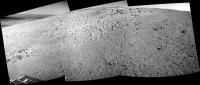
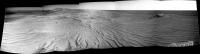
Sol 3635 navcam view:
We're almost at the top! |
|
|
|
|
|
|
Apr 16 2014, 05:30 PM
Post
#82
|
|
|
Member Group: Members Posts: 866 Joined: 15-March 05 From: Santa Cruz, CA Member No.: 196 |
|
|
|
|
|
Apr 16 2014, 07:57 PM
Post
#83
|
||
|
Solar System Cartographer Group: Members Posts: 10185 Joined: 5-April 05 From: Canada Member No.: 227 |
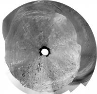
A circular semicircle from sol 3635, just west of the prominent crater at the top of the ridge.
Phil
-------------------- ... because the Solar System ain't gonna map itself.
Also to be found posting similar content on https://mastodon.social/@PhilStooke Maps for download (free PD: https://upload.wikimedia.org/wikipedia/comm...Cartography.pdf NOTE: everything created by me which I post on UMSF is considered to be in the public domain (NOT CC, public domain) |
|
|
|
|
|
|
Apr 17 2014, 08:18 AM
Post
#84
|
|
|
Senior Member Group: Members Posts: 3516 Joined: 4-November 05 From: North Wales Member No.: 542 |
Thanks Phil. From your circular pan we can now see that the blip on the horizon is on a bearing close to 241 degrees. This means it can't be 'Rockaway' which should be near 272 degrees. My best guess for the blip is now a crater about half the size of Victoria and about 15 km distant. If I'm matching up the contour map with CTX correctly that crater and 'Rockaway' are located on the same gentle N-S rise which I think forms our western skyline from this viewpoint.
|
|
|
|
|
Apr 17 2014, 05:00 PM
Post
#85
|
|
|
Member Group: Members Posts: 815 Joined: 3-June 04 From: Brittany, France Member No.: 79 |
@James : really nice colour mosaic! I'm looking forward to the final panorama
@atomoid : there is a really good 3D effect on your xeye particularly between the foreground and the background. I love these little dunes
-------------------- |
|
|
|
|
Apr 17 2014, 10:42 PM
Post
#86
|
||
|
Member Group: Members Posts: 866 Joined: 15-March 05 From: Santa Cruz, CA Member No.: 196 |
QUOTE (ngunn @ Apr 17 2014, 12:18 AM) ...best guess for the blip is now a crater about half the size of Victoria and about 15 km distant... So the 'blip' crater would seem to be this apparently younger one (arrow), not the eroded scalloped one (Rockway?) closer in.
@neo56: if only I could get the clumsy sw I have to not mangle the seams, I was trying for a bit wider vantage of that scene.. |
|
|
|
|
|
|
Apr 18 2014, 01:04 AM
Post
#87
|
||
|
Member Group: Members Posts: 691 Joined: 21-December 07 From: Clatskanie, Oregon Member No.: 3988 |
I've been doing some minor fine tuning of control points in my rover deck pan template and I added the rest of the images. Still some fine tuning left to do. Here is the L4 mosaic. The JPL version looks great
EDIT: Whoops! sorry please move this post. ADMIN: Done! |
|
|
|
|
|
|
Apr 18 2014, 06:35 AM
Post
#88
|
|
|
Senior Member Group: Members Posts: 3516 Joined: 4-November 05 From: North Wales Member No.: 542 |
Atomoid: That's the one I'm suggesting but I'm using nothing more sophisticated than a school protractor laid on my computer screen. I'm awaiting confirmation or just as likely correction by someone with better tools. I note that this crater has wind streaks extending southeastward from each side suggesting there is significant relief there. The larger crater farther east is more eroded and furthermore lies in a hollow so I don't expect to see it.
[Incidentally 'Rockaway' is not that crater but the much smaller fresh one that appears as a dark spot at the top of your image almost directly above the arrowed feature. If you're interested you can find its original ID in post 259 of 'Distant Vistas' and a good view of it from near Concepcion in post 201 of that same thread.] EDIT: And the contour map in post 123. |
|
|
|
|
Apr 18 2014, 08:58 AM
Post
#89
|
|
|
Senior Member Group: Members Posts: 3516 Joined: 4-November 05 From: North Wales Member No.: 542 |
QUOTE (ngunn @ Apr 18 2014, 07:35 AM) The larger crater farther east is more eroded and furthermore lies in a hollow so I don't expect to see it. Maybe I'm wrong about that. Checking the latest images I see a feature which could be that crater just below the horizon and just to the right of the foreground slope: http://qt.exploratorium.edu/mars/opportuni...MZP2417R1M1.JPG |
|
|
|
|
Apr 18 2014, 02:50 PM
Post
#90
|
||
|
Senior Member Group: Members Posts: 2837 Joined: 22-April 05 From: Ridderkerk, Netherlands Member No.: 353 |
The Navcam L0 view on Sol 3635.
Jan van Driel
|
|
|
|
|
|
|
Apr 18 2014, 03:08 PM
Post
#91
|
||
|
Senior Member Group: Members Posts: 2837 Joined: 22-April 05 From: Ridderkerk, Netherlands Member No.: 353 |
and the one on Sol 3637.
Jan van Driel
|
|
|
|
|
|
|
Apr 18 2014, 04:08 PM
Post
#92
|
|||
|
Solar System Cartographer Group: Members Posts: 10185 Joined: 5-April 05 From: Canada Member No.: 227 |
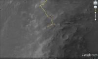
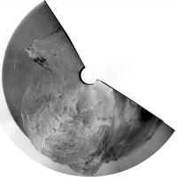
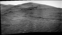
I really like this ripply landscape, believe it or not. Here's a circular version of Jan's nice panoramic view for sol 3637, and a map showing where we are.
Phil
-------------------- ... because the Solar System ain't gonna map itself.
Also to be found posting similar content on https://mastodon.social/@PhilStooke Maps for download (free PD: https://upload.wikimedia.org/wikipedia/comm...Cartography.pdf NOTE: everything created by me which I post on UMSF is considered to be in the public domain (NOT CC, public domain) |
||
|
|
|
||
|
Apr 18 2014, 04:23 PM
Post
#93
|
||
|
Senior Member Group: Members Posts: 3516 Joined: 4-November 05 From: North Wales Member No.: 542 |
Here is an enlarged crop showing the dark streak close to the horizon that I think may be part of the 'Victoria-twin' crater 8 km to the SW of us. I say part because the whole thing should subtend a horizontal angle of about 6 degrees or one-third of a pancam image.
Attached thumbnail(s)
|
|
|
|
|
|
|
Apr 18 2014, 09:34 PM
Post
#94
|
|||
|
Member Group: Members Posts: 866 Joined: 15-March 05 From: Santa Cruz, CA Member No.: 196 |
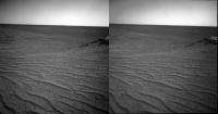
selected ripply sol3637 pair stereo. tried to make stereo pan but my tools (and chops) cant handle making the needed adjustments that work so well in jvandriel's fine work, im including sample at right below anyway if for no other than comedic purposes.
|
||
|
|
|
||
|
Apr 18 2014, 10:11 PM
Post
#95
|
||
|
Member Group: Members Posts: 808 Joined: 10-October 06 From: Maynard Mass USA Member No.: 1241 |
Here is an image of the objects on the WSW horizon.
It is from Pancam on sol 3635 I rotated the image 4.66 degrees CW to get the horizon level(ish). I then used a high pass filter (line detector with 6 pixel radius) to accentuate the darks (darker) and brights (brighter) at the high frequency pixels on the horizon, and then stretch it vertically (Phil-O-Vision). A histogram of a high pass filtered image is centered on DN 128 and is normal, with long tails the object on the right looks like a crater note the smaller (smaller? farther?) object on the left
-------------------- CLA CLL
|
|
|
|
|
|
|
Apr 19 2014, 07:10 AM
Post
#96
|
|
|
Senior Member Group: Members Posts: 3516 Joined: 4-November 05 From: North Wales Member No.: 542 |
The size you show for the crater is right, I think, for a 500m crater at 15km.
Regarding the smaller feature on the left, the topography suggests that it should be at a similar distance. There is indeed a smaller crater a bit to the east of the 500m one, as seen here, on a line with the 'Victoria-twin': http://marsrover.nasa.gov/gallery/press/op...saic_notext.tif |
|
|
|
|
Apr 19 2014, 07:05 PM
Post
#97
|
||
|
Senior Member Group: Members Posts: 1074 Joined: 21-September 07 From: Québec, Canada Member No.: 3908 |
Nice pancam view of Cape Tribulation on sol 3637:
|
|
|
|
|
|
|
Apr 19 2014, 07:58 PM
Post
#98
|
|
|
Senior Member Group: Members Posts: 1619 Joined: 12-February 06 From: Bergerac - FR Member No.: 678 |
In colors
-------------------- |
|
|
|
|
Apr 20 2014, 06:04 PM
Post
#99
|
||
|
Senior Member Group: Members Posts: 2837 Joined: 22-April 05 From: Ridderkerk, Netherlands Member No.: 353 |
The Navcam L0 view on Sol 3639.
Jan van Driel
|
|
|
|
|
|
|
Apr 20 2014, 07:01 PM
Post
#100
|
||
|
Solar System Cartographer Group: Members Posts: 10185 Joined: 5-April 05 From: Canada Member No.: 227 |
Checking in from the UK with a circular version of Jan's pan. I still haven't located it.
Phil
-------------------- ... because the Solar System ain't gonna map itself.
Also to be found posting similar content on https://mastodon.social/@PhilStooke Maps for download (free PD: https://upload.wikimedia.org/wikipedia/comm...Cartography.pdf NOTE: everything created by me which I post on UMSF is considered to be in the public domain (NOT CC, public domain) |
|
|
|
|
|
|

|
Lo-Fi Version | Time is now: 5th June 2024 - 09:46 PM |
|
RULES AND GUIDELINES Please read the Forum Rules and Guidelines before posting. IMAGE COPYRIGHT |
OPINIONS AND MODERATION Opinions expressed on UnmannedSpaceflight.com are those of the individual posters and do not necessarily reflect the opinions of UnmannedSpaceflight.com or The Planetary Society. The all-volunteer UnmannedSpaceflight.com moderation team is wholly independent of The Planetary Society. The Planetary Society has no influence over decisions made by the UnmannedSpaceflight.com moderators. |
SUPPORT THE FORUM Unmannedspaceflight.com is funded by the Planetary Society. Please consider supporting our work and many other projects by donating to the Society or becoming a member. |
|