MSL Post-conjunction: Drilling at Cumberland, Revisiting Point Lake and Shaler, site 6 cont'd, sols 272-323, May 12, 2013-July 4,2013 |

MSL Post-conjunction: Drilling at Cumberland, Revisiting Point Lake and Shaler, site 6 cont'd, sols 272-323, May 12, 2013-July 4,2013 |
 May 10 2013, 03:34 AM May 10 2013, 03:34 AM
Post
#1
|
|
|
Solar System Cartographer  Group: Members Posts: 10173 Joined: 5-April 05 From: Canada Member No.: 227 |
-------------------- ... because the Solar System ain't gonna map itself.
Also to be found posting similar content on https://mastodon.social/@PhilStooke Maps for download (free PD: https://upload.wikimedia.org/wikipedia/comm...Cartography.pdf NOTE: everything created by me which I post on UMSF is considered to be in the public domain (NOT CC, public domain) |
 |
 
|
 |
|
May 26 2013, 02:23 PM
Post
#2
|
||
|
Senior Member Group: Members Posts: 2346 Joined: 7-December 12 Member No.: 6780 |
Thanks! Strange, it works for me.
Does this link work? If not, here a copy hosted on UMSF, it's not too large:
|
|
|
|
|
|
 Phil Stooke MSL Post-conjunction: Drilling at Cumberland, Revisiting Point Lake and Shaler May 10 2013, 03:34 AM
 Gerald This is the according raw Sol 192 Mastcam Right im... May 10 2013, 11:48 AM brellis Regarding cross-contamination mentioned in the art... May 11 2013, 07:19 AM
 PaulH51 If you recall some welds broke on a filter screen ... May 11 2013, 08:06 AM jmknapp Two-meter drive this morning:
QUOTE Drive 43: 2.0... May 12 2013, 11:50 PM Phil Stooke OK, back to work on Monday!
If the RHaz pics ... May 13 2013, 12:48 AM jmknapp Also now oriented 228° (was 166°). Might that not ... May 13 2013, 11:50 AM Gerald After the drive (12:22:47 p.m. LMST) Cumberland is... May 13 2013, 12:38 PM Doc QUOTE (Gerald @ May 13 2013, 03:38 PM) bu... May 14 2013, 10:18 AM Ant103 And my take on this panoramic, after James -good- ... May 13 2013, 08:43 PM Ant103 Sol 274 Navcam pan taken today is here . May 14 2013, 10:06 PM fredk Bump forward on 274:
http://mars.jpl.nasa.gov/msl-... May 14 2013, 10:43 PM EdTruthan These just in from Sol 275...
Mt. Sharp Panorama.... May 15 2013, 08:37 PM Explorer1 Is the drought over? May 16 2013, 05:20 AM climber Not sure, they plan to dig another hole in the gro... May 16 2013, 08:14 AM Ant103 And my take on this wheel MAHLI mosaic : May 16 2013, 11:46 AM EdTruthan Sol 275 - MC100 four frame mosaic. The new drill s... May 16 2013, 08:01 PM Gerald A Sol 276 animated gif made of two raw Hazcam Fron... May 17 2013, 11:06 AM EdTruthan QUOTE (Gerald @ May 17 2013, 04:06 AM) It... May 17 2013, 06:31 PM Gerald QUOTE (EdTruthan @ May 17 2013, 08:31 PM)... May 17 2013, 11:06 PM djellison QUOTE (Gerald @ May 17 2013, 04:06 AM) th... May 17 2013, 06:38 PM marsophile Reply 376 in the "YellowKnife Bay" threa... May 17 2013, 05:27 PM EdTruthan Kind of off topic, but does anyone know if the lef... May 17 2013, 09:00 PM elakdawalla When it's a bright streak on one camera and no... May 17 2013, 09:02 PM fredk QUOTE (elakdawalla @ May 17 2013, 09:02 P... May 18 2013, 02:38 PM EdTruthan Thanks Emily. From reviewing several "comic r... May 17 2013, 11:05 PM jvandriel The Navcam NL B panoramic view from images taken o... May 18 2013, 02:40 PM EdTruthan With the four Sol 275 MC-34's now in, here... May 18 2013, 04:14 PM fredk Thanks for the context pic, Ed. It looks like the... May 18 2013, 05:45 PM dvandorn You know, when we first got to Yellowknife Bay, I ... May 18 2013, 05:50 PM Phil Stooke Hmm, so I can be wrong!
Phil May 18 2013, 06:41 PM Zelenyikot Cumberland in colored ChemCam on Sol 277 May 19 2013, 12:29 PM Phil Stooke Very nice - I am glad to see some more of these.
... May 19 2013, 04:36 PM Actionman What do you see in this now Phil? May 19 2013, 11:35 PM Phil Stooke QUOTE (Actionman @ May 19 2013, 07:35 PM)... May 21 2013, 06:06 PM Actionman Disregarding these what it looks like we now have ... May 20 2013, 02:05 PM mcaplinger QUOTE (Actionman @ May 20 2013, 07:05 AM)... May 20 2013, 02:16 PM Actionman QUOTE (mcaplinger @ May 20 2013, 09:16 AM... May 20 2013, 04:38 PM mcaplinger QUOTE (Actionman @ May 20 2013, 09:38 AM)... May 20 2013, 09:26 PM ElkGroveDan QUOTE (Actionman @ May 20 2013, 07:05 AM)... May 20 2013, 09:58 PM Gerald I can also see a new artifact.
This one:
Link ... May 20 2013, 02:29 PM EdTruthan Sol 279 -
Close-up anaglyph of the drill hole. Se... May 20 2013, 05:48 PM Gerald A zoom-in to the Cumberland drill hole created fro... May 20 2013, 08:48 PM brellis In the Sol 275 PanCam image Emily uses in her rece... May 20 2013, 11:59 PM dvandorn QUOTE (brellis @ May 20 2013, 06:59 PM) .... May 21 2013, 12:29 AM Gerald Drilling the Sol 279 hole in time-lapse, as seen f... May 21 2013, 10:01 AM Gerald Drill powder vibrated in scoop, Sol 279:
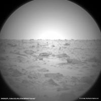
Link to ... May 21 2013, 02:08 PM EdTruthan Sol 279 - MC34/MC100 anaglyph of the drill area in... May 21 2013, 11:19 PM Gerald Seems, as if they applied the complex ChemCam LIBS... May 22 2013, 07:17 AM djellison Hole fired closed to the rover will 'look bigg... May 22 2013, 02:02 PM Gerald That's true. So we have to check the distance.... May 22 2013, 08:09 PM PaulH51 QUOTE (Gerald @ May 23 2013, 04:09 AM) Th... May 23 2013, 02:00 AM Gerald QUOTE (PaulH51 @ May 23 2013, 04:00 AM) .... May 24 2013, 04:21 PM PaulH51 QUOTE (Gerald @ May 25 2013, 12:21 AM) Ma... May 25 2013, 01:09 AM Gerald QUOTE (PaulH51 @ May 25 2013, 03:09 AM) M... May 26 2013, 08:45 AM PaulH51 QUOTE (Gerald @ May 26 2013, 04:45 PM) Ye... May 26 2013, 09:11 AM fredk I'm sure that the size of the laser mini-crate... May 22 2013, 08:31 PM EdTruthan Sol 281 - MC34/MC100 anaglyph of ChemCam hits on n... May 23 2013, 12:06 AM Gerald QUOTE (EdTruthan @ May 23 2013, 02:06 AM)... May 23 2013, 09:10 AM Phil Stooke "Maybe they have established an optimal dista... May 23 2013, 04:06 AM djellison QUOTE (Phil Stooke @ May 22 2013, 09:06 P... May 23 2013, 04:33 AM effects I am curious about the small light coloured object... May 23 2013, 04:18 PM djellison QUOTE (effects @ May 23 2013, 09:18 AM) I... May 23 2013, 05:47 PM fredk Judging by its colour, it's a shard of drill t... May 23 2013, 05:28 PM fredk Some action on sol 284 - make your favourite laser... May 24 2013, 02:43 PM effects Thank you for the explanation. You guys are amazin... May 24 2013, 04:17 PM Gerald Impression of Martian sunset on Sol 283:
Link to ... May 24 2013, 05:06 PM Phil Stooke Really nice - thanks for doing these GIFs.
Phil May 24 2013, 07:11 PM Gerald Many people have been working together to make it ... May 24 2013, 09:24 PM Ant103 Sol 283 Mastcam34 mosaic of Cumberland Hole drill... May 25 2013, 09:04 AM Gerald Sol 283 MAHLI stitch with some more details, a reg... May 25 2013, 07:43 PM Zelenyikot Colored ChemCam of a drilled hole. Sol 285 May 26 2013, 09:35 AM Gerald ... Sample on observation tray on Sol 284
(link t... May 26 2013, 09:37 AM PaulH51 QUOTE (Gerald @ May 26 2013, 05:37 PM) ..... May 26 2013, 10:55 AM fredk QUOTE (Gerald @ May 26 2013, 09:37 AM) Ch... May 26 2013, 05:11 PM PaulH51 QUOTE (fredk @ May 27 2013, 01:11 AM) Yep... May 26 2013, 09:40 PM Gerald The really exciting thing for me is, that this ser... May 26 2013, 11:25 AM PaulH51 QUOTE (Gerald @ May 26 2013, 07:25 PM) Th... May 26 2013, 02:09 PM Zelenyikot Colored ChemCam horizon and imitation colored suns... May 26 2013, 12:47 PM Gerald Great! I knew, you would do colorizing.
Alth... May 26 2013, 12:58 PM PaulH51 QUOTE (Gerald @ May 26 2013, 10:23 PM) Th... May 26 2013, 09:36 PM Gerald This post is a rather subtle one. And it's no ... May 28 2013, 12:51 PM PaulH51 QUOTE (Gerald @ May 28 2013, 08:51 PM) Th... May 28 2013, 01:58 PM MahFL Is that part of the rover swaying in the wind ? May 28 2013, 05:26 PM elakdawalla You're looking there at part of the sample han... May 28 2013, 06:26 PM Gerald I couldn't find any other changes as image noi... May 28 2013, 07:45 PM Explorer1 Press-con on the 30th, 11:30 PST, on RAD findings.... May 28 2013, 11:58 PM Gerald Probably extensive APXS measurements on Cumberland... May 29 2013, 12:17 PM Zelenyikot Dust on body: 14, 90, 196, 286 sols. May 29 2013, 02:06 PM Gerald After APXS, returning to ChemCam activities in the... May 30 2013, 09:44 PM Gerald
Link to gif.
Fortunately, this time USGS Scienti... May 31 2013, 09:23 AM PaulH51 QUOTE (Gerald @ May 31 2013, 05:23 PM) Fo... May 31 2013, 11:08 AM nprev That's a bit of a leap, to be frank about it. ... May 31 2013, 11:16 AM Airbag Hmm, literally hundreds of Sol 289 overexposed ML ... May 31 2013, 08:20 PM Gerald The timestamps and the large number of images supp... May 31 2013, 11:19 PM mcaplinger QUOTE (Gerald @ May 31 2013, 04:19 PM) It... Jun 1 2013, 03:39 AM Gerald Thanks a lot, Mike! So we'll get details a... Jun 1 2013, 09:15 AM Gerald ... this makes me curious, whether we'll later... Jun 1 2013, 02:48 PM xflare So, I believe they will be taking a closer look at... Jun 2 2013, 07:57 AM
PaulH51 If you recall some welds broke on a filter screen ... May 11 2013, 08:06 AM jmknapp Two-meter drive this morning:
QUOTE Drive 43: 2.0... May 12 2013, 11:50 PM Phil Stooke OK, back to work on Monday!
If the RHaz pics ... May 13 2013, 12:48 AM jmknapp Also now oriented 228° (was 166°). Might that not ... May 13 2013, 11:50 AM Gerald After the drive (12:22:47 p.m. LMST) Cumberland is... May 13 2013, 12:38 PM Doc QUOTE (Gerald @ May 13 2013, 03:38 PM) bu... May 14 2013, 10:18 AM Ant103 And my take on this panoramic, after James -good- ... May 13 2013, 08:43 PM Ant103 Sol 274 Navcam pan taken today is here . May 14 2013, 10:06 PM fredk Bump forward on 274:
http://mars.jpl.nasa.gov/msl-... May 14 2013, 10:43 PM EdTruthan These just in from Sol 275...
Mt. Sharp Panorama.... May 15 2013, 08:37 PM Explorer1 Is the drought over? May 16 2013, 05:20 AM climber Not sure, they plan to dig another hole in the gro... May 16 2013, 08:14 AM Ant103 And my take on this wheel MAHLI mosaic : May 16 2013, 11:46 AM EdTruthan Sol 275 - MC100 four frame mosaic. The new drill s... May 16 2013, 08:01 PM Gerald A Sol 276 animated gif made of two raw Hazcam Fron... May 17 2013, 11:06 AM EdTruthan QUOTE (Gerald @ May 17 2013, 04:06 AM) It... May 17 2013, 06:31 PM Gerald QUOTE (EdTruthan @ May 17 2013, 08:31 PM)... May 17 2013, 11:06 PM djellison QUOTE (Gerald @ May 17 2013, 04:06 AM) th... May 17 2013, 06:38 PM marsophile Reply 376 in the "YellowKnife Bay" threa... May 17 2013, 05:27 PM EdTruthan Kind of off topic, but does anyone know if the lef... May 17 2013, 09:00 PM elakdawalla When it's a bright streak on one camera and no... May 17 2013, 09:02 PM fredk QUOTE (elakdawalla @ May 17 2013, 09:02 P... May 18 2013, 02:38 PM EdTruthan Thanks Emily. From reviewing several "comic r... May 17 2013, 11:05 PM jvandriel The Navcam NL B panoramic view from images taken o... May 18 2013, 02:40 PM EdTruthan With the four Sol 275 MC-34's now in, here... May 18 2013, 04:14 PM fredk Thanks for the context pic, Ed. It looks like the... May 18 2013, 05:45 PM dvandorn You know, when we first got to Yellowknife Bay, I ... May 18 2013, 05:50 PM Phil Stooke Hmm, so I can be wrong!
Phil May 18 2013, 06:41 PM Zelenyikot Cumberland in colored ChemCam on Sol 277 May 19 2013, 12:29 PM Phil Stooke Very nice - I am glad to see some more of these.
... May 19 2013, 04:36 PM Actionman What do you see in this now Phil? May 19 2013, 11:35 PM Phil Stooke QUOTE (Actionman @ May 19 2013, 07:35 PM)... May 21 2013, 06:06 PM Actionman Disregarding these what it looks like we now have ... May 20 2013, 02:05 PM mcaplinger QUOTE (Actionman @ May 20 2013, 07:05 AM)... May 20 2013, 02:16 PM Actionman QUOTE (mcaplinger @ May 20 2013, 09:16 AM... May 20 2013, 04:38 PM mcaplinger QUOTE (Actionman @ May 20 2013, 09:38 AM)... May 20 2013, 09:26 PM ElkGroveDan QUOTE (Actionman @ May 20 2013, 07:05 AM)... May 20 2013, 09:58 PM Gerald I can also see a new artifact.
This one:
Link ... May 20 2013, 02:29 PM EdTruthan Sol 279 -
Close-up anaglyph of the drill hole. Se... May 20 2013, 05:48 PM Gerald A zoom-in to the Cumberland drill hole created fro... May 20 2013, 08:48 PM brellis In the Sol 275 PanCam image Emily uses in her rece... May 20 2013, 11:59 PM dvandorn QUOTE (brellis @ May 20 2013, 06:59 PM) .... May 21 2013, 12:29 AM Gerald Drilling the Sol 279 hole in time-lapse, as seen f... May 21 2013, 10:01 AM Gerald Drill powder vibrated in scoop, Sol 279:
Link to ... May 21 2013, 02:08 PM EdTruthan Sol 279 - MC34/MC100 anaglyph of the drill area in... May 21 2013, 11:19 PM Gerald Seems, as if they applied the complex ChemCam LIBS... May 22 2013, 07:17 AM djellison Hole fired closed to the rover will 'look bigg... May 22 2013, 02:02 PM Gerald That's true. So we have to check the distance.... May 22 2013, 08:09 PM PaulH51 QUOTE (Gerald @ May 23 2013, 04:09 AM) Th... May 23 2013, 02:00 AM Gerald QUOTE (PaulH51 @ May 23 2013, 04:00 AM) .... May 24 2013, 04:21 PM PaulH51 QUOTE (Gerald @ May 25 2013, 12:21 AM) Ma... May 25 2013, 01:09 AM Gerald QUOTE (PaulH51 @ May 25 2013, 03:09 AM) M... May 26 2013, 08:45 AM PaulH51 QUOTE (Gerald @ May 26 2013, 04:45 PM) Ye... May 26 2013, 09:11 AM fredk I'm sure that the size of the laser mini-crate... May 22 2013, 08:31 PM EdTruthan Sol 281 - MC34/MC100 anaglyph of ChemCam hits on n... May 23 2013, 12:06 AM Gerald QUOTE (EdTruthan @ May 23 2013, 02:06 AM)... May 23 2013, 09:10 AM Phil Stooke "Maybe they have established an optimal dista... May 23 2013, 04:06 AM djellison QUOTE (Phil Stooke @ May 22 2013, 09:06 P... May 23 2013, 04:33 AM effects I am curious about the small light coloured object... May 23 2013, 04:18 PM djellison QUOTE (effects @ May 23 2013, 09:18 AM) I... May 23 2013, 05:47 PM fredk Judging by its colour, it's a shard of drill t... May 23 2013, 05:28 PM fredk Some action on sol 284 - make your favourite laser... May 24 2013, 02:43 PM effects Thank you for the explanation. You guys are amazin... May 24 2013, 04:17 PM Gerald Impression of Martian sunset on Sol 283:
Link to ... May 24 2013, 05:06 PM Phil Stooke Really nice - thanks for doing these GIFs.
Phil May 24 2013, 07:11 PM Gerald Many people have been working together to make it ... May 24 2013, 09:24 PM Ant103 Sol 283 Mastcam34 mosaic of Cumberland Hole drill... May 25 2013, 09:04 AM Gerald Sol 283 MAHLI stitch with some more details, a reg... May 25 2013, 07:43 PM Zelenyikot Colored ChemCam of a drilled hole. Sol 285 May 26 2013, 09:35 AM Gerald ... Sample on observation tray on Sol 284
(link t... May 26 2013, 09:37 AM PaulH51 QUOTE (Gerald @ May 26 2013, 05:37 PM) ..... May 26 2013, 10:55 AM fredk QUOTE (Gerald @ May 26 2013, 09:37 AM) Ch... May 26 2013, 05:11 PM PaulH51 QUOTE (fredk @ May 27 2013, 01:11 AM) Yep... May 26 2013, 09:40 PM Gerald The really exciting thing for me is, that this ser... May 26 2013, 11:25 AM PaulH51 QUOTE (Gerald @ May 26 2013, 07:25 PM) Th... May 26 2013, 02:09 PM Zelenyikot Colored ChemCam horizon and imitation colored suns... May 26 2013, 12:47 PM Gerald Great! I knew, you would do colorizing.
Alth... May 26 2013, 12:58 PM PaulH51 QUOTE (Gerald @ May 26 2013, 10:23 PM) Th... May 26 2013, 09:36 PM Gerald This post is a rather subtle one. And it's no ... May 28 2013, 12:51 PM PaulH51 QUOTE (Gerald @ May 28 2013, 08:51 PM) Th... May 28 2013, 01:58 PM MahFL Is that part of the rover swaying in the wind ? May 28 2013, 05:26 PM elakdawalla You're looking there at part of the sample han... May 28 2013, 06:26 PM Gerald I couldn't find any other changes as image noi... May 28 2013, 07:45 PM Explorer1 Press-con on the 30th, 11:30 PST, on RAD findings.... May 28 2013, 11:58 PM Gerald Probably extensive APXS measurements on Cumberland... May 29 2013, 12:17 PM Zelenyikot Dust on body: 14, 90, 196, 286 sols. May 29 2013, 02:06 PM Gerald After APXS, returning to ChemCam activities in the... May 30 2013, 09:44 PM Gerald
Link to gif.
Fortunately, this time USGS Scienti... May 31 2013, 09:23 AM PaulH51 QUOTE (Gerald @ May 31 2013, 05:23 PM) Fo... May 31 2013, 11:08 AM nprev That's a bit of a leap, to be frank about it. ... May 31 2013, 11:16 AM Airbag Hmm, literally hundreds of Sol 289 overexposed ML ... May 31 2013, 08:20 PM Gerald The timestamps and the large number of images supp... May 31 2013, 11:19 PM mcaplinger QUOTE (Gerald @ May 31 2013, 04:19 PM) It... Jun 1 2013, 03:39 AM Gerald Thanks a lot, Mike! So we'll get details a... Jun 1 2013, 09:15 AM Gerald ... this makes me curious, whether we'll later... Jun 1 2013, 02:48 PM xflare So, I believe they will be taking a closer look at... Jun 2 2013, 07:57 AM |

|
Lo-Fi Version | Time is now: 1st June 2024 - 08:49 PM |
|
RULES AND GUIDELINES Please read the Forum Rules and Guidelines before posting. IMAGE COPYRIGHT |
OPINIONS AND MODERATION Opinions expressed on UnmannedSpaceflight.com are those of the individual posters and do not necessarily reflect the opinions of UnmannedSpaceflight.com or The Planetary Society. The all-volunteer UnmannedSpaceflight.com moderation team is wholly independent of The Planetary Society. The Planetary Society has no influence over decisions made by the UnmannedSpaceflight.com moderators. |
SUPPORT THE FORUM Unmannedspaceflight.com is funded by the Planetary Society. Please consider supporting our work and many other projects by donating to the Society or becoming a member. |
|