
MSL Post-conjunction: Drilling at Cumberland, Revisiting Point Lake and Shaler, site 6 cont'd, sols 272-323, May 12, 2013-July 4,2013 |

MSL Post-conjunction: Drilling at Cumberland, Revisiting Point Lake and Shaler, site 6 cont'd, sols 272-323, May 12, 2013-July 4,2013 |
 May 10 2013, 03:34 AM May 10 2013, 03:34 AM
Post
#1
|
|
|
Solar System Cartographer  Group: Members Posts: 10193 Joined: 5-April 05 From: Canada Member No.: 227 |
-------------------- ... because the Solar System ain't gonna map itself.
Also to be found posting similar content on https://mastodon.social/@PhilStooke Maps for download (free PD: https://upload.wikimedia.org/wikipedia/comm...Cartography.pdf NOTE: everything created by me which I post on UMSF is considered to be in the public domain (NOT CC, public domain) |
 |
 
|
 |
|
May 31 2013, 09:23 AM
Post
#2
|
|
|
Senior Member Group: Members Posts: 2346 Joined: 7-December 12 Member No.: 6780 |
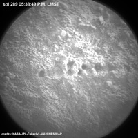 Link to gif. Fortunately, this time USGS Scientist Ken Herkenhoff provides the explanation, better than I ever could, in Sol 289 Update On Curiosity From USGS Scientist Ken Herkenhoff: Heating Up: QUOTE Yesterday I was Geology/Mineralogy Science Theme Lead for the first time in months, so I was a bit rusty. We tried to fit some MAHLI imaging into the plan, along with overnight CheMin analysis of the Cumberland drill sample, but didn't have enough power. However, we were able to plan a high-priority ChemCam observation of the drill tailings during the day (when warm) and early the next morning (when cold), to look for changes in hydrogen due to daily absorption/desorption of water vapor. The early morning ChemCam observation required pointing the instrument at the target the previous evening, to avoid having to heat and move the remote sensing mast at night. Thanks Paul, for pointing to Ken Herkenhoff's update via PM! 
|
|
|
|
|
May 31 2013, 11:08 AM
Post
#3
|
|
 Senior Member Group: Members Posts: 2430 Joined: 30-January 13 From: Penang, Malaysia. Member No.: 6853 |
QUOTE (Gerald @ May 31 2013, 05:23 PM)  Fortunately, this time USGS Scientist Ken Herkenhoff provides the explanation, better than I ever could, in Sol 289 Update On Curiosity From USGS Scientist Ken Herkenhoff: Heating Up: Thanks Paul, for pointing to Ken Herkenhoff's update via PM! Nice Gif Gerald, I've re-published it on the FB page. Probably be some time before we see the formal results for the presence of hydrogen. So time for a little speculation here The early morning image of the laser strike area is much larger and appears to have a different profile than any of the earlier laser strikes on drill tailings. It actually looks more like an impact crater. So I speculate that the test may show that some moisture (maybe a heavy overnight frost?) was present on or within the surface which resulted in the generation of large quantity of gas by the laser induced plasma which vigorously ejected the surface materials resulting in the formation of this mini crater. Only 1 theory, let's see if anyone has a better one
|
|
|
|
 Phil Stooke MSL Post-conjunction: Drilling at Cumberland, Revisiting Point Lake and Shaler May 10 2013, 03:34 AM
 Gerald This is the according raw Sol 192 Mastcam Right im... May 10 2013, 11:48 AM brellis Regarding cross-contamination mentioned in the art... May 11 2013, 07:19 AM
 PaulH51 If you recall some welds broke on a filter screen ... May 11 2013, 08:06 AM jmknapp Two-meter drive this morning:
QUOTE Drive 43: 2.0... May 12 2013, 11:50 PM Phil Stooke OK, back to work on Monday!
If the RHaz pics ... May 13 2013, 12:48 AM jmknapp Also now oriented 228° (was 166°). Might that not ... May 13 2013, 11:50 AM Gerald After the drive (12:22:47 p.m. LMST) Cumberland is... May 13 2013, 12:38 PM Doc QUOTE (Gerald @ May 13 2013, 03:38 PM) bu... May 14 2013, 10:18 AM Ant103 And my take on this panoramic, after James -good- ... May 13 2013, 08:43 PM Ant103 Sol 274 Navcam pan taken today is here . May 14 2013, 10:06 PM fredk Bump forward on 274:
http://mars.jpl.nasa.gov/msl-... May 14 2013, 10:43 PM EdTruthan These just in from Sol 275...
Mt. Sharp Panorama.... May 15 2013, 08:37 PM Explorer1 Is the drought over? May 16 2013, 05:20 AM climber Not sure, they plan to dig another hole in the gro... May 16 2013, 08:14 AM Ant103 And my take on this wheel MAHLI mosaic : May 16 2013, 11:46 AM EdTruthan Sol 275 - MC100 four frame mosaic. The new drill s... May 16 2013, 08:01 PM Gerald A Sol 276 animated gif made of two raw Hazcam Fron... May 17 2013, 11:06 AM EdTruthan QUOTE (Gerald @ May 17 2013, 04:06 AM) It... May 17 2013, 06:31 PM Gerald QUOTE (EdTruthan @ May 17 2013, 08:31 PM)... May 17 2013, 11:06 PM djellison QUOTE (Gerald @ May 17 2013, 04:06 AM) th... May 17 2013, 06:38 PM marsophile Reply 376 in the "YellowKnife Bay" threa... May 17 2013, 05:27 PM EdTruthan Kind of off topic, but does anyone know if the lef... May 17 2013, 09:00 PM elakdawalla When it's a bright streak on one camera and no... May 17 2013, 09:02 PM fredk QUOTE (elakdawalla @ May 17 2013, 09:02 P... May 18 2013, 02:38 PM EdTruthan Thanks Emily. From reviewing several "comic r... May 17 2013, 11:05 PM jvandriel The Navcam NL B panoramic view from images taken o... May 18 2013, 02:40 PM EdTruthan With the four Sol 275 MC-34's now in, here... May 18 2013, 04:14 PM fredk Thanks for the context pic, Ed. It looks like the... May 18 2013, 05:45 PM dvandorn You know, when we first got to Yellowknife Bay, I ... May 18 2013, 05:50 PM Phil Stooke Hmm, so I can be wrong!
Phil May 18 2013, 06:41 PM Zelenyikot Cumberland in colored ChemCam on Sol 277 May 19 2013, 12:29 PM Phil Stooke Very nice - I am glad to see some more of these.
... May 19 2013, 04:36 PM Actionman What do you see in this now Phil? May 19 2013, 11:35 PM Phil Stooke QUOTE (Actionman @ May 19 2013, 07:35 PM)... May 21 2013, 06:06 PM Actionman Disregarding these what it looks like we now have ... May 20 2013, 02:05 PM mcaplinger QUOTE (Actionman @ May 20 2013, 07:05 AM)... May 20 2013, 02:16 PM Actionman QUOTE (mcaplinger @ May 20 2013, 09:16 AM... May 20 2013, 04:38 PM mcaplinger QUOTE (Actionman @ May 20 2013, 09:38 AM)... May 20 2013, 09:26 PM ElkGroveDan QUOTE (Actionman @ May 20 2013, 07:05 AM)... May 20 2013, 09:58 PM Gerald I can also see a new artifact.
This one:
Link ... May 20 2013, 02:29 PM EdTruthan Sol 279 -
Close-up anaglyph of the drill hole. Se... May 20 2013, 05:48 PM Gerald A zoom-in to the Cumberland drill hole created fro... May 20 2013, 08:48 PM brellis In the Sol 275 PanCam image Emily uses in her rece... May 20 2013, 11:59 PM dvandorn QUOTE (brellis @ May 20 2013, 06:59 PM) .... May 21 2013, 12:29 AM Gerald Drilling the Sol 279 hole in time-lapse, as seen f... May 21 2013, 10:01 AM Gerald Drill powder vibrated in scoop, Sol 279:
Link to ... May 21 2013, 02:08 PM EdTruthan Sol 279 - MC34/MC100 anaglyph of the drill area in... May 21 2013, 11:19 PM Gerald Seems, as if they applied the complex ChemCam LIBS... May 22 2013, 07:17 AM djellison Hole fired closed to the rover will 'look bigg... May 22 2013, 02:02 PM Gerald That's true. So we have to check the distance.... May 22 2013, 08:09 PM PaulH51 QUOTE (Gerald @ May 23 2013, 04:09 AM) Th... May 23 2013, 02:00 AM Gerald QUOTE (PaulH51 @ May 23 2013, 04:00 AM) .... May 24 2013, 04:21 PM PaulH51 QUOTE (Gerald @ May 25 2013, 12:21 AM) Ma... May 25 2013, 01:09 AM Gerald QUOTE (PaulH51 @ May 25 2013, 03:09 AM) M... May 26 2013, 08:45 AM PaulH51 QUOTE (Gerald @ May 26 2013, 04:45 PM) Ye... May 26 2013, 09:11 AM fredk I'm sure that the size of the laser mini-crate... May 22 2013, 08:31 PM EdTruthan Sol 281 - MC34/MC100 anaglyph of ChemCam hits on n... May 23 2013, 12:06 AM Gerald QUOTE (EdTruthan @ May 23 2013, 02:06 AM)... May 23 2013, 09:10 AM Phil Stooke "Maybe they have established an optimal dista... May 23 2013, 04:06 AM djellison QUOTE (Phil Stooke @ May 22 2013, 09:06 P... May 23 2013, 04:33 AM effects I am curious about the small light coloured object... May 23 2013, 04:18 PM djellison QUOTE (effects @ May 23 2013, 09:18 AM) I... May 23 2013, 05:47 PM fredk Judging by its colour, it's a shard of drill t... May 23 2013, 05:28 PM fredk Some action on sol 284 - make your favourite laser... May 24 2013, 02:43 PM effects Thank you for the explanation. You guys are amazin... May 24 2013, 04:17 PM Gerald Impression of Martian sunset on Sol 283:
Link to ... May 24 2013, 05:06 PM Phil Stooke Really nice - thanks for doing these GIFs.
Phil May 24 2013, 07:11 PM Gerald Many people have been working together to make it ... May 24 2013, 09:24 PM Ant103 Sol 283 Mastcam34 mosaic of Cumberland Hole drill... May 25 2013, 09:04 AM Gerald Sol 283 MAHLI stitch with some more details, a reg... May 25 2013, 07:43 PM Zelenyikot Colored ChemCam of a drilled hole. Sol 285 May 26 2013, 09:35 AM Gerald ... Sample on observation tray on Sol 284
(link t... May 26 2013, 09:37 AM PaulH51 QUOTE (Gerald @ May 26 2013, 05:37 PM) ..... May 26 2013, 10:55 AM fredk QUOTE (Gerald @ May 26 2013, 09:37 AM) Ch... May 26 2013, 05:11 PM PaulH51 QUOTE (fredk @ May 27 2013, 01:11 AM) Yep... May 26 2013, 09:40 PM Gerald The really exciting thing for me is, that this ser... May 26 2013, 11:25 AM PaulH51 QUOTE (Gerald @ May 26 2013, 07:25 PM) Th... May 26 2013, 02:09 PM Zelenyikot Colored ChemCam horizon and imitation colored suns... May 26 2013, 12:47 PM Gerald Great! I knew, you would do colorizing.
Alth... May 26 2013, 12:58 PM Gerald Thanks! Strange, it works for me.
Does this li... May 26 2013, 02:23 PM PaulH51 QUOTE (Gerald @ May 26 2013, 10:23 PM) Th... May 26 2013, 09:36 PM Gerald This post is a rather subtle one. And it's no ... May 28 2013, 12:51 PM PaulH51 QUOTE (Gerald @ May 28 2013, 08:51 PM) Th... May 28 2013, 01:58 PM MahFL Is that part of the rover swaying in the wind ? May 28 2013, 05:26 PM elakdawalla You're looking there at part of the sample han... May 28 2013, 06:26 PM Gerald I couldn't find any other changes as image noi... May 28 2013, 07:45 PM Explorer1 Press-con on the 30th, 11:30 PST, on RAD findings.... May 28 2013, 11:58 PM Gerald Probably extensive APXS measurements on Cumberland... May 29 2013, 12:17 PM Zelenyikot Dust on body: 14, 90, 196, 286 sols. May 29 2013, 02:06 PM Gerald After APXS, returning to ChemCam activities in the... May 30 2013, 09:44 PM nprev That's a bit of a leap, to be frank about it. ... May 31 2013, 11:16 AM Airbag Hmm, literally hundreds of Sol 289 overexposed ML ... May 31 2013, 08:20 PM Gerald The timestamps and the large number of images supp... May 31 2013, 11:19 PM mcaplinger QUOTE (Gerald @ May 31 2013, 04:19 PM) It... Jun 1 2013, 03:39 AM Gerald Thanks a lot, Mike! So we'll get details a... Jun 1 2013, 09:15 AM Gerald ... this makes me curious, whether we'll later... Jun 1 2013, 02:48 PM xflare So, I believe they will be taking a closer look at... Jun 2 2013, 07:57 AM
PaulH51 If you recall some welds broke on a filter screen ... May 11 2013, 08:06 AM jmknapp Two-meter drive this morning:
QUOTE Drive 43: 2.0... May 12 2013, 11:50 PM Phil Stooke OK, back to work on Monday!
If the RHaz pics ... May 13 2013, 12:48 AM jmknapp Also now oriented 228° (was 166°). Might that not ... May 13 2013, 11:50 AM Gerald After the drive (12:22:47 p.m. LMST) Cumberland is... May 13 2013, 12:38 PM Doc QUOTE (Gerald @ May 13 2013, 03:38 PM) bu... May 14 2013, 10:18 AM Ant103 And my take on this panoramic, after James -good- ... May 13 2013, 08:43 PM Ant103 Sol 274 Navcam pan taken today is here . May 14 2013, 10:06 PM fredk Bump forward on 274:
http://mars.jpl.nasa.gov/msl-... May 14 2013, 10:43 PM EdTruthan These just in from Sol 275...
Mt. Sharp Panorama.... May 15 2013, 08:37 PM Explorer1 Is the drought over? May 16 2013, 05:20 AM climber Not sure, they plan to dig another hole in the gro... May 16 2013, 08:14 AM Ant103 And my take on this wheel MAHLI mosaic : May 16 2013, 11:46 AM EdTruthan Sol 275 - MC100 four frame mosaic. The new drill s... May 16 2013, 08:01 PM Gerald A Sol 276 animated gif made of two raw Hazcam Fron... May 17 2013, 11:06 AM EdTruthan QUOTE (Gerald @ May 17 2013, 04:06 AM) It... May 17 2013, 06:31 PM Gerald QUOTE (EdTruthan @ May 17 2013, 08:31 PM)... May 17 2013, 11:06 PM djellison QUOTE (Gerald @ May 17 2013, 04:06 AM) th... May 17 2013, 06:38 PM marsophile Reply 376 in the "YellowKnife Bay" threa... May 17 2013, 05:27 PM EdTruthan Kind of off topic, but does anyone know if the lef... May 17 2013, 09:00 PM elakdawalla When it's a bright streak on one camera and no... May 17 2013, 09:02 PM fredk QUOTE (elakdawalla @ May 17 2013, 09:02 P... May 18 2013, 02:38 PM EdTruthan Thanks Emily. From reviewing several "comic r... May 17 2013, 11:05 PM jvandriel The Navcam NL B panoramic view from images taken o... May 18 2013, 02:40 PM EdTruthan With the four Sol 275 MC-34's now in, here... May 18 2013, 04:14 PM fredk Thanks for the context pic, Ed. It looks like the... May 18 2013, 05:45 PM dvandorn You know, when we first got to Yellowknife Bay, I ... May 18 2013, 05:50 PM Phil Stooke Hmm, so I can be wrong!
Phil May 18 2013, 06:41 PM Zelenyikot Cumberland in colored ChemCam on Sol 277 May 19 2013, 12:29 PM Phil Stooke Very nice - I am glad to see some more of these.
... May 19 2013, 04:36 PM Actionman What do you see in this now Phil? May 19 2013, 11:35 PM Phil Stooke QUOTE (Actionman @ May 19 2013, 07:35 PM)... May 21 2013, 06:06 PM Actionman Disregarding these what it looks like we now have ... May 20 2013, 02:05 PM mcaplinger QUOTE (Actionman @ May 20 2013, 07:05 AM)... May 20 2013, 02:16 PM Actionman QUOTE (mcaplinger @ May 20 2013, 09:16 AM... May 20 2013, 04:38 PM mcaplinger QUOTE (Actionman @ May 20 2013, 09:38 AM)... May 20 2013, 09:26 PM ElkGroveDan QUOTE (Actionman @ May 20 2013, 07:05 AM)... May 20 2013, 09:58 PM Gerald I can also see a new artifact.
This one:
Link ... May 20 2013, 02:29 PM EdTruthan Sol 279 -
Close-up anaglyph of the drill hole. Se... May 20 2013, 05:48 PM Gerald A zoom-in to the Cumberland drill hole created fro... May 20 2013, 08:48 PM brellis In the Sol 275 PanCam image Emily uses in her rece... May 20 2013, 11:59 PM dvandorn QUOTE (brellis @ May 20 2013, 06:59 PM) .... May 21 2013, 12:29 AM Gerald Drilling the Sol 279 hole in time-lapse, as seen f... May 21 2013, 10:01 AM Gerald Drill powder vibrated in scoop, Sol 279:
Link to ... May 21 2013, 02:08 PM EdTruthan Sol 279 - MC34/MC100 anaglyph of the drill area in... May 21 2013, 11:19 PM Gerald Seems, as if they applied the complex ChemCam LIBS... May 22 2013, 07:17 AM djellison Hole fired closed to the rover will 'look bigg... May 22 2013, 02:02 PM Gerald That's true. So we have to check the distance.... May 22 2013, 08:09 PM PaulH51 QUOTE (Gerald @ May 23 2013, 04:09 AM) Th... May 23 2013, 02:00 AM Gerald QUOTE (PaulH51 @ May 23 2013, 04:00 AM) .... May 24 2013, 04:21 PM PaulH51 QUOTE (Gerald @ May 25 2013, 12:21 AM) Ma... May 25 2013, 01:09 AM Gerald QUOTE (PaulH51 @ May 25 2013, 03:09 AM) M... May 26 2013, 08:45 AM PaulH51 QUOTE (Gerald @ May 26 2013, 04:45 PM) Ye... May 26 2013, 09:11 AM fredk I'm sure that the size of the laser mini-crate... May 22 2013, 08:31 PM EdTruthan Sol 281 - MC34/MC100 anaglyph of ChemCam hits on n... May 23 2013, 12:06 AM Gerald QUOTE (EdTruthan @ May 23 2013, 02:06 AM)... May 23 2013, 09:10 AM Phil Stooke "Maybe they have established an optimal dista... May 23 2013, 04:06 AM djellison QUOTE (Phil Stooke @ May 22 2013, 09:06 P... May 23 2013, 04:33 AM effects I am curious about the small light coloured object... May 23 2013, 04:18 PM djellison QUOTE (effects @ May 23 2013, 09:18 AM) I... May 23 2013, 05:47 PM fredk Judging by its colour, it's a shard of drill t... May 23 2013, 05:28 PM fredk Some action on sol 284 - make your favourite laser... May 24 2013, 02:43 PM effects Thank you for the explanation. You guys are amazin... May 24 2013, 04:17 PM Gerald Impression of Martian sunset on Sol 283:
Link to ... May 24 2013, 05:06 PM Phil Stooke Really nice - thanks for doing these GIFs.
Phil May 24 2013, 07:11 PM Gerald Many people have been working together to make it ... May 24 2013, 09:24 PM Ant103 Sol 283 Mastcam34 mosaic of Cumberland Hole drill... May 25 2013, 09:04 AM Gerald Sol 283 MAHLI stitch with some more details, a reg... May 25 2013, 07:43 PM Zelenyikot Colored ChemCam of a drilled hole. Sol 285 May 26 2013, 09:35 AM Gerald ... Sample on observation tray on Sol 284
(link t... May 26 2013, 09:37 AM PaulH51 QUOTE (Gerald @ May 26 2013, 05:37 PM) ..... May 26 2013, 10:55 AM fredk QUOTE (Gerald @ May 26 2013, 09:37 AM) Ch... May 26 2013, 05:11 PM PaulH51 QUOTE (fredk @ May 27 2013, 01:11 AM) Yep... May 26 2013, 09:40 PM Gerald The really exciting thing for me is, that this ser... May 26 2013, 11:25 AM PaulH51 QUOTE (Gerald @ May 26 2013, 07:25 PM) Th... May 26 2013, 02:09 PM Zelenyikot Colored ChemCam horizon and imitation colored suns... May 26 2013, 12:47 PM Gerald Great! I knew, you would do colorizing.
Alth... May 26 2013, 12:58 PM Gerald Thanks! Strange, it works for me.
Does this li... May 26 2013, 02:23 PM PaulH51 QUOTE (Gerald @ May 26 2013, 10:23 PM) Th... May 26 2013, 09:36 PM Gerald This post is a rather subtle one. And it's no ... May 28 2013, 12:51 PM PaulH51 QUOTE (Gerald @ May 28 2013, 08:51 PM) Th... May 28 2013, 01:58 PM MahFL Is that part of the rover swaying in the wind ? May 28 2013, 05:26 PM elakdawalla You're looking there at part of the sample han... May 28 2013, 06:26 PM Gerald I couldn't find any other changes as image noi... May 28 2013, 07:45 PM Explorer1 Press-con on the 30th, 11:30 PST, on RAD findings.... May 28 2013, 11:58 PM Gerald Probably extensive APXS measurements on Cumberland... May 29 2013, 12:17 PM Zelenyikot Dust on body: 14, 90, 196, 286 sols. May 29 2013, 02:06 PM Gerald After APXS, returning to ChemCam activities in the... May 30 2013, 09:44 PM nprev That's a bit of a leap, to be frank about it. ... May 31 2013, 11:16 AM Airbag Hmm, literally hundreds of Sol 289 overexposed ML ... May 31 2013, 08:20 PM Gerald The timestamps and the large number of images supp... May 31 2013, 11:19 PM mcaplinger QUOTE (Gerald @ May 31 2013, 04:19 PM) It... Jun 1 2013, 03:39 AM Gerald Thanks a lot, Mike! So we'll get details a... Jun 1 2013, 09:15 AM Gerald ... this makes me curious, whether we'll later... Jun 1 2013, 02:48 PM xflare So, I believe they will be taking a closer look at... Jun 2 2013, 07:57 AM |

|
Lo-Fi Version | Time is now: 18th June 2024 - 06:05 PM |
|
RULES AND GUIDELINES Please read the Forum Rules and Guidelines before posting. IMAGE COPYRIGHT |
OPINIONS AND MODERATION Opinions expressed on UnmannedSpaceflight.com are those of the individual posters and do not necessarily reflect the opinions of UnmannedSpaceflight.com or The Planetary Society. The all-volunteer UnmannedSpaceflight.com moderation team is wholly independent of The Planetary Society. The Planetary Society has no influence over decisions made by the UnmannedSpaceflight.com moderators. |
SUPPORT THE FORUM Unmannedspaceflight.com is funded by the Planetary Society. Please consider supporting our work and many other projects by donating to the Society or becoming a member. |
|


