Journey to Mt Sharp - Part 4: Beyond the Kimberley, Sol 634 [May 19, '14] to 706 [Jul 31, '14] |

Journey to Mt Sharp - Part 4: Beyond the Kimberley, Sol 634 [May 19, '14] to 706 [Jul 31, '14] |
 May 19 2014, 07:00 PM May 19 2014, 07:00 PM
Post
#1
|
||
 Administrator  Group: Admin Posts: 5172 Joined: 4-August 05 From: Pasadena, CA, USA, Earth Member No.: 454 |
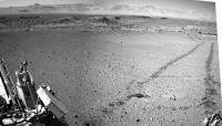
I'd say that the sol 634 drive put the Kimberley in the rear-view mirror, so it's time for a new thread! Let's see how fast they can move toward Murray Buttes now!
Attached thumbnail(s)
-------------------- My website - My Patreon - @elakdawalla on Twitter - Please support unmannedspaceflight.com by donating here.
|
|
 |
 
|
|
 |
|
May 23 2014, 06:06 PM
Post
#2
|
|
 Senior Member Group: Members Posts: 1465 Joined: 9-February 04 From: Columbus OH USA Member No.: 13 |
Floyd: roughly I get that the rock is 14.5 meters away and covers an angle of about 8.1 degrees in the NAVCAM frame. That would make it about 2 meters across at the base.
EDIT: I got the distance estimate using 38 pixels of shift in position between NAVCAM L and R, baseline of .414m: d=(.414/2)/tan(45.33/1024*38/2) -- Fred's estimate using the map could be closer, who knows. -------------------- |
|
|
|
|
May 24 2014, 05:41 AM
Post
#3
|
|
 Senior Member Group: Members Posts: 4250 Joined: 17-January 05 Member No.: 152 |
QUOTE (jmknapp @ May 23 2014, 06:06 PM)  Floyd: roughly I get that the rock is 14.5 meters away and covers an angle of about 8.1 degrees in the NAVCAM frame. That would make it about 2 meters across at the base. EDIT: I got the distance estimate using 38 pixels of shift in position between NAVCAM L and R, baseline of .414m: d=(.414/2)/tan(45.33/1024*38/2) -- Fred's estimate using the map could be closer, who knows. OK, I checked and got similar numbers using parallax: 13.8 +/- 0.5 metres, and 39.5 +/- 3 metres for the farther rock. I used a navcam separation of 42.4 cm from "The Mars Science Laboratory Engineering Cameras", Maki etal. If these numbers are correct, you should shrink the men by around 10-15% in my image. Either way these are big rocks. |
|
|
|
|
May 24 2014, 11:01 AM
Post
#4
|
|
|
Senior Member Group: Members Posts: 1465 Joined: 9-February 04 From: Columbus OH USA Member No.: 13 |
QUOTE (fredk @ May 24 2014, 12:41 AM) Either way these are big rocks. That's the bottom line--without a reference appearances are often deceiving, but not in this case. BTW, my calculation above getting the parallax by counting pixels of offset between L and R doesn't take into account any possible toe-in or -out of the respective optical axes. -------------------- |
|
|
|
|
May 24 2014, 10:44 PM
Post
#5
|
|
|
Senior Member Group: Members Posts: 4250 Joined: 17-January 05 Member No.: 152 |
QUOTE (jmknapp @ May 24 2014, 11:01 AM) my calculation above getting the parallax by counting pixels of offset between L and R doesn't take into account any possible toe-in or -out of the respective optical axes. I took that into accound, as well as 0.35 degrees of relative field rotation between L and R. (I just aligned the L and R frames until the distant slopes coincided.) But I didn't use the proper pixel scale - I just assumed 45 degrees/1024 pixels, when it actually varies quite a bit across the field. The reference I cited above gives a pixel scale of 0.82 mrad/pixel at the centre of the frame, which is where the near rock is. That gives a distance of 12.9 +/- 0.5 metres, which now is pretty much consistent with the estimate from Phil's map. |
|
|
|
 elakdawalla Journey to Mt Sharp - Part 4: Beyond the Kimberley May 19 2014, 07:00 PM
 Dig To release the new thread.
Although there are s... May 19 2014, 07:44 PM atomoid getting perspective on the egress to the wild open... May 19 2014, 08:56 PM anticitizen2 First half of the 634 drive into the crater:
http:... May 19 2014, 10:38 PM Phil Stooke A circular version of Dig's partial panorama. ... May 19 2014, 10:59 PM Phil Stooke Here I have 'borrowed' jmknapp's nice ... May 20 2014, 12:50 AM jvandriel Looking back on Sol 634 with the Navcam L camera.
... May 20 2014, 06:01 AM Ant103 Sol 634 complete panoramic : May 20 2014, 09:57 AM Dig Damia, you've passed by a few minutes.
Well... May 20 2014, 10:47 AM jmknapp I figured out how to get a higher-res topo map out... May 20 2014, 11:01 AM
Dig To release the new thread.
Although there are s... May 19 2014, 07:44 PM atomoid getting perspective on the egress to the wild open... May 19 2014, 08:56 PM anticitizen2 First half of the 634 drive into the crater:
http:... May 19 2014, 10:38 PM Phil Stooke A circular version of Dig's partial panorama. ... May 19 2014, 10:59 PM Phil Stooke Here I have 'borrowed' jmknapp's nice ... May 20 2014, 12:50 AM jvandriel Looking back on Sol 634 with the Navcam L camera.
... May 20 2014, 06:01 AM Ant103 Sol 634 complete panoramic : May 20 2014, 09:57 AM Dig Damia, you've passed by a few minutes.
Well... May 20 2014, 10:47 AM jmknapp I figured out how to get a higher-res topo map out... May 20 2014, 11:01 AM
 anticitizen2 Here is the Sol 635 anaglyph pan.
http://imgur.com... May 20 2014, 07:22 PM anticitizen2 Completed Sol 634 drive, HTML5 link - Right click ... May 20 2014, 02:01 PM Phil Stooke Finally getting back to normal. Here's a circ... May 20 2014, 04:23 PM jvandriel The Navcam L view on Sol 634.
Jan van Driel
May 20 2014, 06:07 PM jvandriel The Navcam L view on Sol 635.
Jan van Driel
May 21 2014, 06:28 AM jmknapp A little different view of the terrain, with the l... May 21 2014, 12:19 PM Phil Stooke Here is Jan's panorama in circular form, showi... May 21 2014, 02:33 PM charborob The large rock in the middle of this image seems a... May 21 2014, 06:37 PM anticitizen2 Sol 636 images are coming down, here is the beginn... May 21 2014, 06:53 PM Phil Stooke That big rock does look enticing! I think we... May 21 2014, 07:26 PM elakdawalla Random note: a few weeks ago I learned that the DA... May 22 2014, 12:39 AM anticitizen2 Finished the Sol 636 anaglyph pan albums with the ... May 22 2014, 04:08 PM jvandriel Chemcam panorama taken on Sol 636.
Jan van Driel
... May 22 2014, 06:41 PM Phil Stooke Another drive on sol 637, and it looks from the Ha... May 22 2014, 07:27 PM jvandriel Navcam NL B view on Sol 636.
Jan van Driel
May 22 2014, 07:27 PM jvandriel The Mastcam L view on Sol 636.
Jan van Driel
May 23 2014, 07:41 AM jvandriel The Navcam L view on Sol 637.
Jan van Driel
May 23 2014, 08:36 AM jmknapp Anaglyph looking south:
May 23 2014, 10:48 AM Floyd Nice!! Joe, what do you estimate the size... May 23 2014, 02:58 PM jvandriel Part of the Sol 637 Navcam panorama in Stereo.
Ja... May 23 2014, 03:11 PM fredk Here's a quick job, using Phil's map to es... May 23 2014, 06:01 PM Phil Stooke At this stage my position is only accurate to with... May 23 2014, 06:25 PM Floyd Thank you Fred and Joe! Like Phil, I certain... May 23 2014, 07:18 PM charborob ChemCam had a look at the "big rock" (lo... May 23 2014, 10:13 PM PaulH51 QUOTE (charborob @ May 24 2014, 06:13 AM)... May 23 2014, 11:18 PM fredk QUOTE (charborob @ May 23 2014, 11:13 PM)... May 24 2014, 12:02 AM J.J. Looks like another iron, but I'm hoping it... May 23 2014, 10:27 PM neo56 Panorama taken on sol 637 with MastCam 34mm: May 24 2014, 09:50 AM neo56 Two animations showing Curiosity roving between so... May 24 2014, 12:32 PM anticitizen2 Great multi-Sol comparisons! The large rock-le... May 24 2014, 05:05 PM jvandriel Here is the complete Sol 637 Navcam panoramic view... May 24 2014, 08:02 PM atomoid stitch of micro-graben from sol637 dirt shot seque... May 25 2014, 09:14 AM Floyd I guess with the holiday weekend we won't move... May 25 2014, 06:51 PM James Sorenson Definitely a metal object! May 26 2014, 10:34 AM jmknapp Is there a compelling scientific reason for MSL to... May 26 2014, 10:50 AM PaulH51 QUOTE (jmknapp @ May 26 2014, 06:50 PM) I... May 26 2014, 11:01 AM jmknapp QUOTE (PaulH51 @ May 26 2014, 06:01 AM) A... May 26 2014, 03:47 PM serpens QUOTE (jmknapp @ May 26 2014, 10:50 AM) I... May 26 2014, 10:35 PM chuckclark QUOTE (serpens @ May 26 2014, 05:35 PM) .... May 26 2014, 11:12 PM dvandorn QUOTE (serpens @ May 26 2014, 04:35 PM) .... May 28 2014, 03:06 AM serpens QUOTE (dvandorn @ May 28 2014, 04:06 AM) ... May 28 2014, 08:49 AM jmknapp QUOTE (serpens @ May 28 2014, 03:49 AM) a... May 28 2014, 10:08 AM charborob Sol 637 mastcam 100 view of the two "rocks... May 26 2014, 12:05 PM mhoward The bumps aren't spurious (I don't think);... May 26 2014, 03:52 PM Phil Stooke The short bumps are not spurious, they are doing w... May 26 2014, 03:57 PM Phil Stooke These are circular views from sols 636 and 637 sho... May 26 2014, 04:01 PM anticitizen2 Hopefully ChemCam got some good distance zaps in, ... May 26 2014, 10:47 PM jmknapp Looks like 42m to the northwest--Murray Buttes bec... May 27 2014, 12:05 AM Phil Stooke Very quick circular pan and sketch map - proper ma... May 27 2014, 12:06 AM anticitizen2 MAHLI sequence of the wheel exam:
The right re... May 27 2014, 03:05 AM jmknapp Found an interesting paper: The Scientific Rationa... May 27 2014, 12:27 PM charborob Views of the meteorites here and here. May 27 2014, 12:53 PM neo56 It has not been posted yet, so here is a mosaic of... May 27 2014, 04:31 PM Art Martin QUOTE (neo56 @ May 27 2014, 09:31 AM) It ... May 27 2014, 06:11 PM neo56 QUOTE (Art Martin @ May 27 2014, 06:11 PM... May 27 2014, 06:19 PM SteveM Interesting inclusions.
What do the geologists ... May 27 2014, 06:32 PM neo56 An outcrop located southwest of Wesley Yard imaged... May 27 2014, 04:55 PM neo56 My take on the MC100 mosaic of the two meteorites ... May 27 2014, 05:16 PM jvandriel The Navcam L view on Sol 641.
Jan van Driel
May 27 2014, 06:23 PM charborob Sol 641 mastcam 34 view ahead:
May 28 2014, 01:57 AM James Sorenson I overlayed the single M100 color image that is do... May 28 2014, 07:49 AM neo56 Very nice picture James! Here is my take on th... May 28 2014, 10:26 AM Phil Stooke " would we expect it to be "rusty... May 28 2014, 12:02 PM PaulH51 QUOTE (Phil Stooke @ May 28 2014, 08:02 P... May 28 2014, 12:22 PM jmknapp QUOTE (Phil Stooke @ May 28 2014, 07:02 A... May 28 2014, 12:41 PM djellison QUOTE (jmknapp @ May 28 2014, 04:41 AM) B... May 28 2014, 03:45 PM jvandriel The 360 degree Navcam L panoramic view on Sol 641.... May 28 2014, 03:23 PM anticitizen2 Completed Sol 641 anaglyph album - http://imgur.co... May 28 2014, 03:47 PM Phil Stooke And we get a name from Fred Calef's latest map... May 28 2014, 07:57 PM elakdawalla Indeed, Fred said on Twitter we went into a new qu... May 28 2014, 08:47 PM ngunn Quads: I've dug down and found out about the ... May 28 2014, 09:39 PM elakdawalla I've been asking for a map with the quad names... May 28 2014, 10:03 PM serpens I feel that it would be a mistake to use the ... May 28 2014, 11:02 PM elakdawalla OK guys, when was the last time Curiosity used Aut... May 28 2014, 11:15 PM Phil Stooke This is a quick guess at the new location. If it... May 29 2014, 12:22 AM jmknapp That's pretty much the spot--85 meters: Drive ... May 29 2014, 01:10 AM jmknapp Emily: I think the last time hazcams were mixed wi... May 29 2014, 08:55 AM neo56 Lebanon meteorite pictured with MC100 on sol 640:
... May 29 2014, 03:05 PM infocat13 It sure does look like metallic class May 29 2014, 07:59 PM jvandriel Part of the Sol 643 Navcam L view.
Jan van Driel
... May 29 2014, 07:53 PM serpens Is it my imagination or are the erosional patterns... May 29 2014, 11:02 PM Phil Stooke A good drive today, already past the two small cra... May 30 2014, 02:11 AM charborob Sol 644: anaglyph of the two small craters:
May 30 2014, 12:47 PM anticitizen2 Very nice stitched view of the craters!
Here ... May 30 2014, 02:19 PM fredk Lovely view out the rear view window:
May 30 2014, 02:39 PM Dig Navcam Right Sol 644 May 30 2014, 06:45 PM
anticitizen2 Here is the Sol 635 anaglyph pan.
http://imgur.com... May 20 2014, 07:22 PM anticitizen2 Completed Sol 634 drive, HTML5 link - Right click ... May 20 2014, 02:01 PM Phil Stooke Finally getting back to normal. Here's a circ... May 20 2014, 04:23 PM jvandriel The Navcam L view on Sol 634.
Jan van Driel
May 20 2014, 06:07 PM jvandriel The Navcam L view on Sol 635.
Jan van Driel
May 21 2014, 06:28 AM jmknapp A little different view of the terrain, with the l... May 21 2014, 12:19 PM Phil Stooke Here is Jan's panorama in circular form, showi... May 21 2014, 02:33 PM charborob The large rock in the middle of this image seems a... May 21 2014, 06:37 PM anticitizen2 Sol 636 images are coming down, here is the beginn... May 21 2014, 06:53 PM Phil Stooke That big rock does look enticing! I think we... May 21 2014, 07:26 PM elakdawalla Random note: a few weeks ago I learned that the DA... May 22 2014, 12:39 AM anticitizen2 Finished the Sol 636 anaglyph pan albums with the ... May 22 2014, 04:08 PM jvandriel Chemcam panorama taken on Sol 636.
Jan van Driel
... May 22 2014, 06:41 PM Phil Stooke Another drive on sol 637, and it looks from the Ha... May 22 2014, 07:27 PM jvandriel Navcam NL B view on Sol 636.
Jan van Driel
May 22 2014, 07:27 PM jvandriel The Mastcam L view on Sol 636.
Jan van Driel
May 23 2014, 07:41 AM jvandriel The Navcam L view on Sol 637.
Jan van Driel
May 23 2014, 08:36 AM jmknapp Anaglyph looking south:
May 23 2014, 10:48 AM Floyd Nice!! Joe, what do you estimate the size... May 23 2014, 02:58 PM jvandriel Part of the Sol 637 Navcam panorama in Stereo.
Ja... May 23 2014, 03:11 PM fredk Here's a quick job, using Phil's map to es... May 23 2014, 06:01 PM Phil Stooke At this stage my position is only accurate to with... May 23 2014, 06:25 PM Floyd Thank you Fred and Joe! Like Phil, I certain... May 23 2014, 07:18 PM charborob ChemCam had a look at the "big rock" (lo... May 23 2014, 10:13 PM PaulH51 QUOTE (charborob @ May 24 2014, 06:13 AM)... May 23 2014, 11:18 PM fredk QUOTE (charborob @ May 23 2014, 11:13 PM)... May 24 2014, 12:02 AM J.J. Looks like another iron, but I'm hoping it... May 23 2014, 10:27 PM neo56 Panorama taken on sol 637 with MastCam 34mm: May 24 2014, 09:50 AM neo56 Two animations showing Curiosity roving between so... May 24 2014, 12:32 PM anticitizen2 Great multi-Sol comparisons! The large rock-le... May 24 2014, 05:05 PM jvandriel Here is the complete Sol 637 Navcam panoramic view... May 24 2014, 08:02 PM atomoid stitch of micro-graben from sol637 dirt shot seque... May 25 2014, 09:14 AM Floyd I guess with the holiday weekend we won't move... May 25 2014, 06:51 PM James Sorenson Definitely a metal object! May 26 2014, 10:34 AM jmknapp Is there a compelling scientific reason for MSL to... May 26 2014, 10:50 AM PaulH51 QUOTE (jmknapp @ May 26 2014, 06:50 PM) I... May 26 2014, 11:01 AM jmknapp QUOTE (PaulH51 @ May 26 2014, 06:01 AM) A... May 26 2014, 03:47 PM serpens QUOTE (jmknapp @ May 26 2014, 10:50 AM) I... May 26 2014, 10:35 PM chuckclark QUOTE (serpens @ May 26 2014, 05:35 PM) .... May 26 2014, 11:12 PM dvandorn QUOTE (serpens @ May 26 2014, 04:35 PM) .... May 28 2014, 03:06 AM serpens QUOTE (dvandorn @ May 28 2014, 04:06 AM) ... May 28 2014, 08:49 AM jmknapp QUOTE (serpens @ May 28 2014, 03:49 AM) a... May 28 2014, 10:08 AM charborob Sol 637 mastcam 100 view of the two "rocks... May 26 2014, 12:05 PM mhoward The bumps aren't spurious (I don't think);... May 26 2014, 03:52 PM Phil Stooke The short bumps are not spurious, they are doing w... May 26 2014, 03:57 PM Phil Stooke These are circular views from sols 636 and 637 sho... May 26 2014, 04:01 PM anticitizen2 Hopefully ChemCam got some good distance zaps in, ... May 26 2014, 10:47 PM jmknapp Looks like 42m to the northwest--Murray Buttes bec... May 27 2014, 12:05 AM Phil Stooke Very quick circular pan and sketch map - proper ma... May 27 2014, 12:06 AM anticitizen2 MAHLI sequence of the wheel exam:
The right re... May 27 2014, 03:05 AM jmknapp Found an interesting paper: The Scientific Rationa... May 27 2014, 12:27 PM charborob Views of the meteorites here and here. May 27 2014, 12:53 PM neo56 It has not been posted yet, so here is a mosaic of... May 27 2014, 04:31 PM Art Martin QUOTE (neo56 @ May 27 2014, 09:31 AM) It ... May 27 2014, 06:11 PM neo56 QUOTE (Art Martin @ May 27 2014, 06:11 PM... May 27 2014, 06:19 PM SteveM Interesting inclusions.
What do the geologists ... May 27 2014, 06:32 PM neo56 An outcrop located southwest of Wesley Yard imaged... May 27 2014, 04:55 PM neo56 My take on the MC100 mosaic of the two meteorites ... May 27 2014, 05:16 PM jvandriel The Navcam L view on Sol 641.
Jan van Driel
May 27 2014, 06:23 PM charborob Sol 641 mastcam 34 view ahead:
May 28 2014, 01:57 AM James Sorenson I overlayed the single M100 color image that is do... May 28 2014, 07:49 AM neo56 Very nice picture James! Here is my take on th... May 28 2014, 10:26 AM Phil Stooke " would we expect it to be "rusty... May 28 2014, 12:02 PM PaulH51 QUOTE (Phil Stooke @ May 28 2014, 08:02 P... May 28 2014, 12:22 PM jmknapp QUOTE (Phil Stooke @ May 28 2014, 07:02 A... May 28 2014, 12:41 PM djellison QUOTE (jmknapp @ May 28 2014, 04:41 AM) B... May 28 2014, 03:45 PM jvandriel The 360 degree Navcam L panoramic view on Sol 641.... May 28 2014, 03:23 PM anticitizen2 Completed Sol 641 anaglyph album - http://imgur.co... May 28 2014, 03:47 PM Phil Stooke And we get a name from Fred Calef's latest map... May 28 2014, 07:57 PM elakdawalla Indeed, Fred said on Twitter we went into a new qu... May 28 2014, 08:47 PM ngunn Quads: I've dug down and found out about the ... May 28 2014, 09:39 PM elakdawalla I've been asking for a map with the quad names... May 28 2014, 10:03 PM serpens I feel that it would be a mistake to use the ... May 28 2014, 11:02 PM elakdawalla OK guys, when was the last time Curiosity used Aut... May 28 2014, 11:15 PM Phil Stooke This is a quick guess at the new location. If it... May 29 2014, 12:22 AM jmknapp That's pretty much the spot--85 meters: Drive ... May 29 2014, 01:10 AM jmknapp Emily: I think the last time hazcams were mixed wi... May 29 2014, 08:55 AM neo56 Lebanon meteorite pictured with MC100 on sol 640:
... May 29 2014, 03:05 PM infocat13 It sure does look like metallic class May 29 2014, 07:59 PM jvandriel Part of the Sol 643 Navcam L view.
Jan van Driel
... May 29 2014, 07:53 PM serpens Is it my imagination or are the erosional patterns... May 29 2014, 11:02 PM Phil Stooke A good drive today, already past the two small cra... May 30 2014, 02:11 AM charborob Sol 644: anaglyph of the two small craters:
May 30 2014, 12:47 PM anticitizen2 Very nice stitched view of the craters!
Here ... May 30 2014, 02:19 PM fredk Lovely view out the rear view window:
May 30 2014, 02:39 PM Dig Navcam Right Sol 644 May 30 2014, 06:45 PM |

|
Lo-Fi Version | Time is now: 4th June 2024 - 05:36 PM |
|
RULES AND GUIDELINES Please read the Forum Rules and Guidelines before posting. IMAGE COPYRIGHT |
OPINIONS AND MODERATION Opinions expressed on UnmannedSpaceflight.com are those of the individual posters and do not necessarily reflect the opinions of UnmannedSpaceflight.com or The Planetary Society. The all-volunteer UnmannedSpaceflight.com moderation team is wholly independent of The Planetary Society. The Planetary Society has no influence over decisions made by the UnmannedSpaceflight.com moderators. |
SUPPORT THE FORUM Unmannedspaceflight.com is funded by the Planetary Society. Please consider supporting our work and many other projects by donating to the Society or becoming a member. |
|