Exploring Mt Sharp north of the dunes - Part 2: Beyond Big Sky, Site 50-51, sol 1148-1171, October 29, 2015-November 23, 2015 |

Exploring Mt Sharp north of the dunes - Part 2: Beyond Big Sky, Site 50-51, sol 1148-1171, October 29, 2015-November 23, 2015 |
 Oct 30 2015, 12:46 AM Oct 30 2015, 12:46 AM
Post
#1
|
||
|
Solar System Cartographer  Group: Members Posts: 10193 Joined: 5-April 05 From: Canada Member No.: 227 |
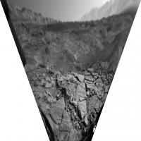
A drive on sol 1148 - looks like we are near the southern bend of Cut Bank Valley. This perspective view of a hazcam image is the only visual cue I have so far of its location. It looks along the west-running branch of the valley and its southern side.
Phil
-------------------- ... because the Solar System ain't gonna map itself.
Also to be found posting similar content on https://mastodon.social/@PhilStooke Maps for download (free PD: https://upload.wikimedia.org/wikipedia/comm...Cartography.pdf NOTE: everything created by me which I post on UMSF is considered to be in the public domain (NOT CC, public domain) |
|
 |
 
|
|
 |
|
Nov 13 2015, 04:29 AM
Post
#2
|
|
 Senior Member Group: Members Posts: 2430 Joined: 30-January 13 From: Penang, Malaysia. Member No.: 6853 |
Another Drive Planned : Mission Update: Sols 1162-1163: Approaching Bagnold Dunes by Ken Herkenhoff LINK
QUOTE Today is a holiday for some of us, but not the MSL tactical operations team! The 55-meter drive planned for Sol 1160 completed as planned, and another 41-meter drive is planned for Sol 1162. Before the next drive, Mastcam and ChemCam will observe a small, sandy drift named "Arris" and a bedrock target dubbed "Tsumeb." Mastcam will also acquire two mosaics, one of nearby outcrops and one of more distant rocks. The drive should place the rover between two of the Bagnold Dunes, so the vehicle will turn to a heading that will maximize the chances of acquiring good REMS measurements of wind speed and direction. This observation is part of the dune study campaign that has been developed over the past year, with an overall goal of better understanding how winds on Mars form and modify dunes. Observations of the dunes from orbit show that they are active, so many members of the MSL science team are looking forward to detailed measurements of the winds and their effects on the sand dunes and nearby terrain, as winds are currently the most significant agent of erosion on Mars. On Sol 1163, Mastcam will take pictures of the rover deck to allow tracking of changes in the distribution of dust and sand on the top of the vehicle, and image the sun to measure the amount of dust in the atmosphere. Navcam will also observe the sky and search for dust devils.
|
|
|
|
 Phil Stooke Exploring Mt Sharp north of the dunes - Part 2: Beyond Big Sky Oct 30 2015, 12:46 AM
 PaulH51 There will be a one-week suspension of MROs commu... Oct 30 2015, 08:04 AM jvandriel The Navcam L panoramic view on Sol 1148.
Jan van ... Oct 30 2015, 10:22 AM Phil Stooke Great pan, thanks! Here is a circular reproje... Oct 30 2015, 01:22 PM nogal This is such a dificult terrain to be driving on (... Oct 30 2015, 04:18 PM Herobrine NAVCAM travel animation for Sol 1148 is 45 frames.... Oct 30 2015, 08:33 PM PaulH51 Mission Update from Ryan Anderson: Sols 1148-1152:... Oct 31 2015, 01:30 AM PaulH51 Sol 1148 L-MastCam 'drive direction mosaic... Oct 31 2015, 12:48 PM jccwrt I stitched together the mosaic of McLeod from Sol ... Oct 31 2015, 07:04 PM
PaulH51 There will be a one-week suspension of MROs commu... Oct 30 2015, 08:04 AM jvandriel The Navcam L panoramic view on Sol 1148.
Jan van ... Oct 30 2015, 10:22 AM Phil Stooke Great pan, thanks! Here is a circular reproje... Oct 30 2015, 01:22 PM nogal This is such a dificult terrain to be driving on (... Oct 30 2015, 04:18 PM Herobrine NAVCAM travel animation for Sol 1148 is 45 frames.... Oct 30 2015, 08:33 PM PaulH51 Mission Update from Ryan Anderson: Sols 1148-1152:... Oct 31 2015, 01:30 AM PaulH51 Sol 1148 L-MastCam 'drive direction mosaic... Oct 31 2015, 12:48 PM jccwrt I stitched together the mosaic of McLeod from Sol ... Oct 31 2015, 07:04 PM
 elakdawalla QUOTE (jccwrt @ Oct 31 2015, 11:04 AM) I ... Nov 1 2015, 09:40 PM dvandorn QUOTE (elakdawalla @ Nov 1 2015, 03:40 PM... Nov 2 2015, 07:35 PM PaulH51 Lovely Lamination's: Sol 1148 L-MastCam. Rough... Nov 1 2015, 08:42 AM jccwrt I think this MAHLI shot from Sol 1150 was taken of... Nov 1 2015, 11:06 PM elakdawalla Some of them seem to have darker colored centers? Nov 1 2015, 11:09 PM jccwrt Yeah. At first glance they look a lot like ooids t... Nov 1 2015, 11:28 PM fredk Lovely view on 1151. Anaglyph:
And cross-eyed:
Nov 2 2015, 05:20 AM jccwrt The sparkliness of granite mostly comes from light... Nov 2 2015, 10:53 PM PaulH51 Mission Update from Ryan Anderson: Sol 1153-1154: ... Nov 3 2015, 08:51 AM jvandriel Looking in the drive direction.
Navcam L view on S... Nov 3 2015, 02:17 PM Phil Stooke Nice view, thanks, Jan. Here is a rough reproject... Nov 3 2015, 02:46 PM algorithm From Sol1151, a bit too close to the edge for me ... Nov 3 2015, 05:55 PM jvandriel The Navcam L view on Sol 1153.
Jan van Driel
Nov 4 2015, 08:34 AM PaulH51 Sol 1151: RMI-ChemCam target 'Ennis'? 4 ov... Nov 4 2015, 11:48 AM Phil Stooke Nce views - here is Jan's image in circular fo... Nov 4 2015, 01:27 PM Phil Stooke This is what the Hazcams show for location-finding... Nov 4 2015, 03:14 PM PaulH51 Curiosity Mission Update from Ryan Anderson - Sol ... Nov 5 2015, 07:41 AM atomoid some stereo takes on sections of the sol1153 navca... Nov 6 2015, 02:04 AM MarsInMyLifetime QUOTE (atomoid @ Nov 5 2015, 08:04 PM) so... Nov 6 2015, 03:21 AM Phil Stooke A drive on sol 1155 - this reprojected Hazcam view... Nov 6 2015, 01:50 PM Herobrine Sols 1150 - 1155 travels
135 right NAVCAM thumbna... Nov 6 2015, 07:01 PM PaulH51 Mission Update from Ryan Anderson - Sol 1157-1159:... Nov 7 2015, 08:11 AM jvandriel The complete Navcam L panoramic view on Sol 1151.
... Nov 7 2015, 08:46 PM jvandriel and the complete Navcam L view on Sol 1153-1154.
... Nov 7 2015, 09:57 PM PaulH51 Sol 1155: Drive Direction? L-MastCam looking SW. R... Nov 8 2015, 05:19 AM jvandriel The Navcam L Panoramic view on Sol 1155.
Jan van ... Nov 8 2015, 12:52 PM Phil Stooke Here are circular projections of Jan's latest ... Nov 8 2015, 03:31 PM PaulH51 Sol 1157: DRT in action at 'Augusta'
Flic... Nov 9 2015, 08:17 AM PaulH51 Sol 1158: Curiosity completes a 64 meter drive (Mi... Nov 9 2015, 09:35 AM climber QUOTE (PaulH51 @ Nov 9 2015, 10:35 AM) So... Nov 9 2015, 11:54 AM Bill QUOTE (climber @ Nov 9 2015, 12:54 PM) Do... Nov 23 2015, 07:36 PM PaulH51 Some very interesting long/thin structures in this... Nov 9 2015, 10:29 AM Gerald QUOTE (PaulH51 @ Nov 9 2015, 12:29 PM) So... Nov 10 2015, 01:08 PM PaulH51 QUOTE (Gerald @ Nov 10 2015, 09:08 PM) Sc... Nov 10 2015, 10:54 PM Actionman (1157 GIF) Looks like this is Augusta Nov 9 2015, 01:17 PM Phil Stooke This is Paul's half panorama in circular form,... Nov 9 2015, 02:11 PM jvandriel Here is the complete 360 degree Navcam L Panoramic... Nov 9 2015, 10:15 PM Phil Stooke Thanks, Jan - and when it is reprojected you can s... Nov 10 2015, 01:57 AM PaulH51 Mission Update: Sol 1160-1161: Brandberg by Ken He... Nov 10 2015, 07:27 AM PaulH51 Something unusual with the supply of engineering r... Nov 12 2015, 07:16 AM PaulH51 Still no Navigation camera images from the drive o... Nov 13 2015, 06:15 AM PaulH51 Joe Knapp's MSL drive page is showing the plan... Nov 13 2015, 01:14 PM PaulH51 Mission Update from Ken Herkenhoff - Sols 1164-116... Nov 14 2015, 03:14 AM PaulH51 Sol 1162 L-MastCam, Drive Direction mosaic, roughl... Nov 14 2015, 09:21 AM PaulH51 Sol 1162, post drive ground directly in front of t... Nov 14 2015, 10:15 AM PaulH51 Interesting jump / spike in the reported air press... Nov 14 2015, 11:14 PM Gerald The pressure jump doesn't look physical.
Calib... Nov 15 2015, 07:11 PM PaulH51 QUOTE (Gerald @ Nov 16 2015, 03:11 AM) Th... Nov 16 2015, 01:38 AM Gerald QUOTE (PaulH51 @ Nov 16 2015, 03:38 AM) T... Nov 18 2015, 10:41 AM PaulH51 QUOTE (Gerald @ Nov 18 2015, 06:41 PM) RE... Nov 18 2015, 03:18 PM PaulH51 8x4 R-MastCam mosaic, sol 1150. Lovely layers and ... Nov 16 2015, 08:07 AM PaulH51 Does anyone here know why the public release of Cu... Nov 16 2015, 01:15 PM Phil Stooke Yes... I hope it will be fixed soon. At least we ... Nov 16 2015, 03:35 PM PaulH51 QUOTE (Phil Stooke @ Nov 16 2015, 11:35 P... Nov 17 2015, 02:59 AM Phil Stooke Meanwhile, here's a look at some distant featu... Nov 16 2015, 07:33 PM PaulH51 Mission Update from Ryan Anderson - Sol 1165: Upli... Nov 17 2015, 04:32 AM jccwrt A couple postcard views now that we've got a b... Nov 17 2015, 07:52 AM PaulH51 East Glacier: Sol 1153. 36 R-MastCam's stitche... Nov 17 2015, 03:08 PM jvandriel The Navcam L Panoramic view on Sol 1160.
Jan van ... Nov 17 2015, 09:10 PM jccwrt Curiosity took a 360 degree MastCam panorama on So... Nov 18 2015, 12:37 AM atomoid beautiful 360. thanks for that. here is a quick lo... Nov 18 2015, 12:44 AM Phil Stooke Here is Jan's panorama from sol 1160 in circul... Nov 18 2015, 01:07 AM PaulH51 Midnight Planets is reporting : Curiosity moved ap... Nov 18 2015, 10:37 AM jvandriel The Navcam L panorama on Sol 1162.
Jan van Driel
... Nov 18 2015, 12:57 PM Phil Stooke Jan's 1162 panorama in circular format.
Phi... Nov 18 2015, 03:46 PM Herobrine NAVCAM travel animation for Sol 1160 is 47 frames.... Nov 18 2015, 05:37 PM jccwrt Sol 1158 postcard, looking out over Brandenburg
... Nov 18 2015, 07:55 PM PaulH51 Before its drive on 1167, curiosity used its RMI t... Nov 19 2015, 10:13 AM Phil Stooke Reprojecting the sol 1168 Hazcams helps to locate ... Nov 19 2015, 04:40 PM atomoid a couple of stereograms (parellel) from sol1168 to... Nov 19 2015, 09:34 PM PaulH51 Sol 1167: 4-frame merged focus MAHLI Mosaic of ... Nov 20 2015, 06:47 AM jvandriel The Navcam L panoramic view on Sol 1167.
Jan van ... Nov 20 2015, 09:39 AM PaulH51 Sol 1155: R-Mastcam processed mosaic assembled in ... Nov 20 2015, 09:55 AM jvandriel and the Panoramic view on Sol 1168.
Jan van Driel... Nov 20 2015, 12:35 PM Phil Stooke And this is the sol 1168 panorama in circular form... Nov 20 2015, 04:51 PM Phil Stooke And Jan's pan for sol 1167 gets the same treat... Nov 20 2015, 05:02 PM algorithm Well said. Nov 20 2015, 07:53 PM atomoid exceptionally bright vein segment sol1168 navcam a... Nov 20 2015, 09:12 PM PaulH51 Mission Update from Lauren Edgar - Sols 1170-1172:... Nov 21 2015, 01:36 AM PaulH51 One of the ChemCam targets from sol 1169 shown in ... Nov 21 2015, 08:14 AM jvandriel Nice Navcam L view on Sol 1169.
Jan van Driel
Nov 21 2015, 01:06 PM Explorer1 Memories of El Dorado at Gusev... Will Curiosity b... Nov 21 2015, 05:25 PM Phil Stooke Almost certainly the rover would not be in one pla... Nov 21 2015, 05:42 PM fredk The movement is on the order of 1 m/yr, or 1 cm pe... Nov 21 2015, 06:30 PM serpens Well Curiosity's ability to determine wind dir... Nov 21 2015, 10:19 PM jvandriel The Navcam L images taken on Sol 1168 and Sol 1169... Nov 22 2015, 01:52 PM PaulH51 1158 L-MastCam, 27x1 preview of the 360 degree pan... Nov 23 2015, 03:32 AM Julius I note that it was mentioned that the study of the... Nov 23 2015, 10:28 AM PaulH51 Just for fun.... The Bagnold Dunes: EDL to Sol 117... Nov 23 2015, 11:53 AM Herobrine Combined NAVCAM travel animation for Sols 1167-116... Nov 23 2015, 03:55 PM
elakdawalla QUOTE (jccwrt @ Oct 31 2015, 11:04 AM) I ... Nov 1 2015, 09:40 PM dvandorn QUOTE (elakdawalla @ Nov 1 2015, 03:40 PM... Nov 2 2015, 07:35 PM PaulH51 Lovely Lamination's: Sol 1148 L-MastCam. Rough... Nov 1 2015, 08:42 AM jccwrt I think this MAHLI shot from Sol 1150 was taken of... Nov 1 2015, 11:06 PM elakdawalla Some of them seem to have darker colored centers? Nov 1 2015, 11:09 PM jccwrt Yeah. At first glance they look a lot like ooids t... Nov 1 2015, 11:28 PM fredk Lovely view on 1151. Anaglyph:
And cross-eyed:
Nov 2 2015, 05:20 AM jccwrt The sparkliness of granite mostly comes from light... Nov 2 2015, 10:53 PM PaulH51 Mission Update from Ryan Anderson: Sol 1153-1154: ... Nov 3 2015, 08:51 AM jvandriel Looking in the drive direction.
Navcam L view on S... Nov 3 2015, 02:17 PM Phil Stooke Nice view, thanks, Jan. Here is a rough reproject... Nov 3 2015, 02:46 PM algorithm From Sol1151, a bit too close to the edge for me ... Nov 3 2015, 05:55 PM jvandriel The Navcam L view on Sol 1153.
Jan van Driel
Nov 4 2015, 08:34 AM PaulH51 Sol 1151: RMI-ChemCam target 'Ennis'? 4 ov... Nov 4 2015, 11:48 AM Phil Stooke Nce views - here is Jan's image in circular fo... Nov 4 2015, 01:27 PM Phil Stooke This is what the Hazcams show for location-finding... Nov 4 2015, 03:14 PM PaulH51 Curiosity Mission Update from Ryan Anderson - Sol ... Nov 5 2015, 07:41 AM atomoid some stereo takes on sections of the sol1153 navca... Nov 6 2015, 02:04 AM MarsInMyLifetime QUOTE (atomoid @ Nov 5 2015, 08:04 PM) so... Nov 6 2015, 03:21 AM Phil Stooke A drive on sol 1155 - this reprojected Hazcam view... Nov 6 2015, 01:50 PM Herobrine Sols 1150 - 1155 travels
135 right NAVCAM thumbna... Nov 6 2015, 07:01 PM PaulH51 Mission Update from Ryan Anderson - Sol 1157-1159:... Nov 7 2015, 08:11 AM jvandriel The complete Navcam L panoramic view on Sol 1151.
... Nov 7 2015, 08:46 PM jvandriel and the complete Navcam L view on Sol 1153-1154.
... Nov 7 2015, 09:57 PM PaulH51 Sol 1155: Drive Direction? L-MastCam looking SW. R... Nov 8 2015, 05:19 AM jvandriel The Navcam L Panoramic view on Sol 1155.
Jan van ... Nov 8 2015, 12:52 PM Phil Stooke Here are circular projections of Jan's latest ... Nov 8 2015, 03:31 PM PaulH51 Sol 1157: DRT in action at 'Augusta'
Flic... Nov 9 2015, 08:17 AM PaulH51 Sol 1158: Curiosity completes a 64 meter drive (Mi... Nov 9 2015, 09:35 AM climber QUOTE (PaulH51 @ Nov 9 2015, 10:35 AM) So... Nov 9 2015, 11:54 AM Bill QUOTE (climber @ Nov 9 2015, 12:54 PM) Do... Nov 23 2015, 07:36 PM PaulH51 Some very interesting long/thin structures in this... Nov 9 2015, 10:29 AM Gerald QUOTE (PaulH51 @ Nov 9 2015, 12:29 PM) So... Nov 10 2015, 01:08 PM PaulH51 QUOTE (Gerald @ Nov 10 2015, 09:08 PM) Sc... Nov 10 2015, 10:54 PM Actionman (1157 GIF) Looks like this is Augusta Nov 9 2015, 01:17 PM Phil Stooke This is Paul's half panorama in circular form,... Nov 9 2015, 02:11 PM jvandriel Here is the complete 360 degree Navcam L Panoramic... Nov 9 2015, 10:15 PM Phil Stooke Thanks, Jan - and when it is reprojected you can s... Nov 10 2015, 01:57 AM PaulH51 Mission Update: Sol 1160-1161: Brandberg by Ken He... Nov 10 2015, 07:27 AM PaulH51 Something unusual with the supply of engineering r... Nov 12 2015, 07:16 AM PaulH51 Still no Navigation camera images from the drive o... Nov 13 2015, 06:15 AM PaulH51 Joe Knapp's MSL drive page is showing the plan... Nov 13 2015, 01:14 PM PaulH51 Mission Update from Ken Herkenhoff - Sols 1164-116... Nov 14 2015, 03:14 AM PaulH51 Sol 1162 L-MastCam, Drive Direction mosaic, roughl... Nov 14 2015, 09:21 AM PaulH51 Sol 1162, post drive ground directly in front of t... Nov 14 2015, 10:15 AM PaulH51 Interesting jump / spike in the reported air press... Nov 14 2015, 11:14 PM Gerald The pressure jump doesn't look physical.
Calib... Nov 15 2015, 07:11 PM PaulH51 QUOTE (Gerald @ Nov 16 2015, 03:11 AM) Th... Nov 16 2015, 01:38 AM Gerald QUOTE (PaulH51 @ Nov 16 2015, 03:38 AM) T... Nov 18 2015, 10:41 AM PaulH51 QUOTE (Gerald @ Nov 18 2015, 06:41 PM) RE... Nov 18 2015, 03:18 PM PaulH51 8x4 R-MastCam mosaic, sol 1150. Lovely layers and ... Nov 16 2015, 08:07 AM PaulH51 Does anyone here know why the public release of Cu... Nov 16 2015, 01:15 PM Phil Stooke Yes... I hope it will be fixed soon. At least we ... Nov 16 2015, 03:35 PM PaulH51 QUOTE (Phil Stooke @ Nov 16 2015, 11:35 P... Nov 17 2015, 02:59 AM Phil Stooke Meanwhile, here's a look at some distant featu... Nov 16 2015, 07:33 PM PaulH51 Mission Update from Ryan Anderson - Sol 1165: Upli... Nov 17 2015, 04:32 AM jccwrt A couple postcard views now that we've got a b... Nov 17 2015, 07:52 AM PaulH51 East Glacier: Sol 1153. 36 R-MastCam's stitche... Nov 17 2015, 03:08 PM jvandriel The Navcam L Panoramic view on Sol 1160.
Jan van ... Nov 17 2015, 09:10 PM jccwrt Curiosity took a 360 degree MastCam panorama on So... Nov 18 2015, 12:37 AM atomoid beautiful 360. thanks for that. here is a quick lo... Nov 18 2015, 12:44 AM Phil Stooke Here is Jan's panorama from sol 1160 in circul... Nov 18 2015, 01:07 AM PaulH51 Midnight Planets is reporting : Curiosity moved ap... Nov 18 2015, 10:37 AM jvandriel The Navcam L panorama on Sol 1162.
Jan van Driel
... Nov 18 2015, 12:57 PM Phil Stooke Jan's 1162 panorama in circular format.
Phi... Nov 18 2015, 03:46 PM Herobrine NAVCAM travel animation for Sol 1160 is 47 frames.... Nov 18 2015, 05:37 PM jccwrt Sol 1158 postcard, looking out over Brandenburg
... Nov 18 2015, 07:55 PM PaulH51 Before its drive on 1167, curiosity used its RMI t... Nov 19 2015, 10:13 AM Phil Stooke Reprojecting the sol 1168 Hazcams helps to locate ... Nov 19 2015, 04:40 PM atomoid a couple of stereograms (parellel) from sol1168 to... Nov 19 2015, 09:34 PM PaulH51 Sol 1167: 4-frame merged focus MAHLI Mosaic of ... Nov 20 2015, 06:47 AM jvandriel The Navcam L panoramic view on Sol 1167.
Jan van ... Nov 20 2015, 09:39 AM PaulH51 Sol 1155: R-Mastcam processed mosaic assembled in ... Nov 20 2015, 09:55 AM jvandriel and the Panoramic view on Sol 1168.
Jan van Driel... Nov 20 2015, 12:35 PM Phil Stooke And this is the sol 1168 panorama in circular form... Nov 20 2015, 04:51 PM Phil Stooke And Jan's pan for sol 1167 gets the same treat... Nov 20 2015, 05:02 PM algorithm Well said. Nov 20 2015, 07:53 PM atomoid exceptionally bright vein segment sol1168 navcam a... Nov 20 2015, 09:12 PM PaulH51 Mission Update from Lauren Edgar - Sols 1170-1172:... Nov 21 2015, 01:36 AM PaulH51 One of the ChemCam targets from sol 1169 shown in ... Nov 21 2015, 08:14 AM jvandriel Nice Navcam L view on Sol 1169.
Jan van Driel
Nov 21 2015, 01:06 PM Explorer1 Memories of El Dorado at Gusev... Will Curiosity b... Nov 21 2015, 05:25 PM Phil Stooke Almost certainly the rover would not be in one pla... Nov 21 2015, 05:42 PM fredk The movement is on the order of 1 m/yr, or 1 cm pe... Nov 21 2015, 06:30 PM serpens Well Curiosity's ability to determine wind dir... Nov 21 2015, 10:19 PM jvandriel The Navcam L images taken on Sol 1168 and Sol 1169... Nov 22 2015, 01:52 PM PaulH51 1158 L-MastCam, 27x1 preview of the 360 degree pan... Nov 23 2015, 03:32 AM Julius I note that it was mentioned that the study of the... Nov 23 2015, 10:28 AM PaulH51 Just for fun.... The Bagnold Dunes: EDL to Sol 117... Nov 23 2015, 11:53 AM Herobrine Combined NAVCAM travel animation for Sols 1167-116... Nov 23 2015, 03:55 PM |

|
Lo-Fi Version | Time is now: 16th June 2024 - 01:52 PM |
|
RULES AND GUIDELINES Please read the Forum Rules and Guidelines before posting. IMAGE COPYRIGHT |
OPINIONS AND MODERATION Opinions expressed on UnmannedSpaceflight.com are those of the individual posters and do not necessarily reflect the opinions of UnmannedSpaceflight.com or The Planetary Society. The all-volunteer UnmannedSpaceflight.com moderation team is wholly independent of The Planetary Society. The Planetary Society has no influence over decisions made by the UnmannedSpaceflight.com moderators. |
SUPPORT THE FORUM Unmannedspaceflight.com is funded by the Planetary Society. Please consider supporting our work and many other projects by donating to the Society or becoming a member. |
|