Lakes in the limelight, the 2013 image bonanza continues |

Lakes in the limelight, the 2013 image bonanza continues |
 Sep 13 2013, 02:20 PM Sep 13 2013, 02:20 PM
Post
#1
|
|
|
Senior Member  Group: Members Posts: 3516 Joined: 4-November 05 From: North Wales Member No.: 542 |
A fantastic collection of new images of the northern lakes has just arrived: http://saturn.jpl.nasa.gov/photos/raw/rawi...?imageID=298704
|
 |
 
|
 |
|
Dec 24 2016, 11:34 PM
Post
#2
|
|
|
Senior Member Group: Members Posts: 3516 Joined: 4-November 05 From: North Wales Member No.: 542 |
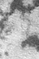
Agreed, that's a superb view. The channel connecting Jingpo Lacus to Kraken Mare is particularly striking. Also the view of the 'toe of Italy' area, not well imaged by SAR, is pretty good. It could be a separate lake linked to Kraken by a similar channel.
|
|
|
|
|
Dec 29 2016, 10:24 PM
Post
#3
|
||
|
Member Group: Members Posts: 701 Joined: 1-April 08 From: Minnesota ! Member No.: 4081 |
QUOTE (ngunn @ Dec 24 2016, 05:34 PM)  Agreed, that's a superb view. The channel connecting Jingpo Lacus to Kraken Mare is particularly striking. Also the view of the 'toe of Italy' area, not well imaged by SAR, is pretty good. It could be a separate lake linked to Kraken by a similar channel. I wonder if the channel going from Jingpo to Kraken is more the result of the lower resolution of the ISS image. We have good views of the area from the T 25 SAR and a very nice denoised view of the beginning of the channel from Antoine Lucas version of Jingpo Lacus shown in Photojournal here: http://photojournal.jpl.nasa.gov/catalog/PIA19053 (BTW the caption for the image contains an error stating The three leftmost image pairs show bays and spits of land in Ligea Mare, one of Titan's large hydrocarbon seas. The rightmost pair shows a valley network along Jingpo Lacus, one of Titan's larger northern lakes. Id suggest this should read: the two left most image pairs show bays and spits of land in Ligeia Mare, the next pair are of Jingpo Lacus and the rightmost pair show a valley network along Kraken. Anyway the figure below overlays the T-25 SAR on IAN Rs processed mosaic from UMSF (sharpened and enhanced) and identifies seas, islands and more obvious channels. Changes may have occurred since the T-25 SAR to dampen the broad area making it appear as a channel, but a continuous channel it appears not likely.
|
|
|
|
|
|
 ngunn Lakes in the limelight Sep 13 2013, 02:20 PM
 Ian R September 23rd:
Sep 27 2016, 04:46 AM Ian R October 10th:
Oct 12 2016, 03:39 PM Ian R October 15th:
Oct 17 2016, 12:54 AM Ian R I've processed 36 frames of Titan taken over a... Nov 2 2016, 11:50 AM
Ian R September 23rd:
Sep 27 2016, 04:46 AM Ian R October 10th:
Oct 12 2016, 03:39 PM Ian R October 15th:
Oct 17 2016, 12:54 AM Ian R I've processed 36 frames of Titan taken over a... Nov 2 2016, 11:50 AM
 JRehling That video of cloud dynamics is great, Ian! Nov 2 2016, 05:12 PM Phil Stooke I'm really impressed with this work, Ian - ple... Nov 3 2016, 12:22 AM Ian R Thanks fellas! I'm endlessly fascinated ... Nov 3 2016, 10:01 AM ngunn A belated thank you from me too for the superb wor... Nov 4 2016, 04:46 PM titanicrivers AWESOME images IAN! I can only echo the great... Nov 4 2016, 10:24 PM volcanopele My processed version of this observation is now up... Nov 4 2016, 11:22 PM Decepticon Jaw dropping!
This image stacking works well ... Nov 4 2016, 11:42 PM Ian R Way to totally trump me, Jason! Awesome work... Nov 5 2016, 12:15 AM volcanopele Yes, there is fog or faint clouds moving over Lado... Nov 5 2016, 03:16 PM ngunn QUOTE (volcanopele @ Nov 5 2016, 04:16 PM... Nov 5 2016, 10:55 PM Ian R QUOTE (ngunn @ Nov 5 2016, 10:55 PM) Is t... Nov 13 2016, 05:18 AM ngunn Thanks for the links. I have been examining the... Nov 16 2016, 11:04 AM jccwrt Here's a mosaic of Titan taken during the T-99... Dec 16 2016, 05:01 AM Ian R This two-frame mosaic from December 20th appears t... Dec 22 2016, 08:28 PM volcanopele I think this is probably the best view of Kraken M... Dec 24 2016, 03:24 AM JRehling I think there's a lot of subtle detail here th... Dec 27 2016, 06:47 AM Ian R Very neat trick, J. I wish I had thought of that... Dec 28 2016, 04:06 AM JRehling Processing my own astrophotography falls, usually,... Dec 28 2016, 04:28 AM antipode This beautiful image seems to cover a few areas th... Dec 28 2016, 06:45 AM ngunn Another thing I've noticed in Ian's stacke... Dec 28 2016, 01:01 PM JRehling Thanks for the addition of the close-up, ngunn. Th... Dec 29 2016, 06:42 PM ngunn Refering to the circular feature: maybe impact sho... Dec 29 2016, 10:54 PM Ian R QUOTE (ngunn @ Dec 29 2016, 10:54 PM) Ref... Dec 30 2016, 04:58 AM ngunn There is a big difference between what the RADAR s... Dec 29 2016, 10:49 PM Ian R With the new year comes changes on Titan: just loo... Jan 3 2017, 08:17 AM JRehling QUOTE (Ian R @ Jan 3 2017, 01:17 AM) With... Jan 3 2017, 04:54 PM rlorenz QUOTE (JRehling @ Jan 3 2017, 11:54 AM) C... Jan 4 2017, 04:42 AM alan animation of clouds
https://twitter.com/kevinmgil... Jan 4 2017, 10:13 PM ngunn More superb views of lakes and clouds today: https... Feb 19 2017, 04:24 PM titanicrivers Juramike (Mike Malaska) has a new article in Icaru... Mar 16 2017, 02:24 AM JRehling This fizzy seas result is one of the most science-... Apr 22 2017, 03:45 AM Ian R 2017-03-20 Titan A Double Take
2017-03-21 C... Mar 25 2017, 02:02 PM TheAnt The features that appeared then to disappeared in ... Apr 21 2017, 04:24 PM rlorenz QUOTE (TheAnt @ Apr 21 2017, 11:24 AM) Th... Apr 22 2017, 03:40 PM nprev Much of this work was done by UMSF moderator Juram... Apr 21 2017, 08:52 PM Juramike Yeah. A funny thing happened on the way to the Uni... Apr 22 2017, 11:45 PM Webscientist Thanks Ralph and Mike for your courageous experime... Apr 23 2017, 12:28 PM ngunn I have a question about the way patches of bubbles... Apr 23 2017, 07:23 AM rlorenz QUOTE (ngunn @ Apr 23 2017, 02:23 AM) I h... Apr 23 2017, 07:52 PM Juramike No, a bubble plume due to compositional mixing wou... Apr 24 2017, 05:35 AM rlorenz QUOTE (Juramike @ Apr 24 2017, 01:35 AM) ... Apr 24 2017, 10:21 PM ngunn Thanks for the informative replies.
QUOTE (rloren... Apr 24 2017, 08:11 AM Juramike QUOTE So it seems to me we have two separate quest... Apr 28 2017, 06:02 AM stevesliva I find myself wondering whether gravels entrained ... Apr 24 2017, 08:20 PM Juramike Oh! And I just realized my paper is freely ava... Apr 28 2017, 06:05 AM ngunn Thanks Mike. We're off on holiday today so ... Apr 28 2017, 07:49 AM hendric So, how long before you guys wrangle a stream/sand... May 3 2017, 03:20 PM Juramike Nitrogen is perfectly happy to stay in liquid meth... May 5 2017, 02:14 PM ngunn Recent views of the lakes and seas have been some ... Aug 14 2017, 04:49 PM atomoid thanks! i wonder if this white blotchy streak ... Aug 15 2017, 01:19 AM ngunn Right at the last minute more wonderful lake portr... Sep 13 2017, 04:06 PM atomoid EDIT: i posted to the wrong thread, so here is a s... Sep 19 2017, 10:56 PM alan Saturns moon Titan sports phantom hydrocarbon lak... Apr 15 2019, 07:46 PM atomoid More speculation being the lakes could seep into p... Apr 16 2019, 11:52 PM rlorenz Short new paper out in JGR (Open Access) summarizi... Apr 10 2021, 12:32 AM JRehling Those are some fantastically interesting results, ... Apr 10 2021, 03:42 PM JRehling I notice that for the three northern tracks, where... Apr 11 2021, 01:51 AM rlorenz QUOTE (JRehling @ Apr 10 2021, 09:51 PM) ... Apr 11 2021, 05:32 PM nprev Fascinating that ethane is being framed as a salt ... Apr 10 2021, 06:25 PM HSchirmer QUOTE Fascinating that ethane is being framed as a... Apr 10 2021, 06:44 PM
JRehling That video of cloud dynamics is great, Ian! Nov 2 2016, 05:12 PM Phil Stooke I'm really impressed with this work, Ian - ple... Nov 3 2016, 12:22 AM Ian R Thanks fellas! I'm endlessly fascinated ... Nov 3 2016, 10:01 AM ngunn A belated thank you from me too for the superb wor... Nov 4 2016, 04:46 PM titanicrivers AWESOME images IAN! I can only echo the great... Nov 4 2016, 10:24 PM volcanopele My processed version of this observation is now up... Nov 4 2016, 11:22 PM Decepticon Jaw dropping!
This image stacking works well ... Nov 4 2016, 11:42 PM Ian R Way to totally trump me, Jason! Awesome work... Nov 5 2016, 12:15 AM volcanopele Yes, there is fog or faint clouds moving over Lado... Nov 5 2016, 03:16 PM ngunn QUOTE (volcanopele @ Nov 5 2016, 04:16 PM... Nov 5 2016, 10:55 PM Ian R QUOTE (ngunn @ Nov 5 2016, 10:55 PM) Is t... Nov 13 2016, 05:18 AM ngunn Thanks for the links. I have been examining the... Nov 16 2016, 11:04 AM jccwrt Here's a mosaic of Titan taken during the T-99... Dec 16 2016, 05:01 AM Ian R This two-frame mosaic from December 20th appears t... Dec 22 2016, 08:28 PM volcanopele I think this is probably the best view of Kraken M... Dec 24 2016, 03:24 AM JRehling I think there's a lot of subtle detail here th... Dec 27 2016, 06:47 AM Ian R Very neat trick, J. I wish I had thought of that... Dec 28 2016, 04:06 AM JRehling Processing my own astrophotography falls, usually,... Dec 28 2016, 04:28 AM antipode This beautiful image seems to cover a few areas th... Dec 28 2016, 06:45 AM ngunn Another thing I've noticed in Ian's stacke... Dec 28 2016, 01:01 PM JRehling Thanks for the addition of the close-up, ngunn. Th... Dec 29 2016, 06:42 PM ngunn Refering to the circular feature: maybe impact sho... Dec 29 2016, 10:54 PM Ian R QUOTE (ngunn @ Dec 29 2016, 10:54 PM) Ref... Dec 30 2016, 04:58 AM ngunn There is a big difference between what the RADAR s... Dec 29 2016, 10:49 PM Ian R With the new year comes changes on Titan: just loo... Jan 3 2017, 08:17 AM JRehling QUOTE (Ian R @ Jan 3 2017, 01:17 AM) With... Jan 3 2017, 04:54 PM rlorenz QUOTE (JRehling @ Jan 3 2017, 11:54 AM) C... Jan 4 2017, 04:42 AM alan animation of clouds
https://twitter.com/kevinmgil... Jan 4 2017, 10:13 PM ngunn More superb views of lakes and clouds today: https... Feb 19 2017, 04:24 PM titanicrivers Juramike (Mike Malaska) has a new article in Icaru... Mar 16 2017, 02:24 AM JRehling This fizzy seas result is one of the most science-... Apr 22 2017, 03:45 AM Ian R 2017-03-20 Titan A Double Take
2017-03-21 C... Mar 25 2017, 02:02 PM TheAnt The features that appeared then to disappeared in ... Apr 21 2017, 04:24 PM rlorenz QUOTE (TheAnt @ Apr 21 2017, 11:24 AM) Th... Apr 22 2017, 03:40 PM nprev Much of this work was done by UMSF moderator Juram... Apr 21 2017, 08:52 PM Juramike Yeah. A funny thing happened on the way to the Uni... Apr 22 2017, 11:45 PM Webscientist Thanks Ralph and Mike for your courageous experime... Apr 23 2017, 12:28 PM ngunn I have a question about the way patches of bubbles... Apr 23 2017, 07:23 AM rlorenz QUOTE (ngunn @ Apr 23 2017, 02:23 AM) I h... Apr 23 2017, 07:52 PM Juramike No, a bubble plume due to compositional mixing wou... Apr 24 2017, 05:35 AM rlorenz QUOTE (Juramike @ Apr 24 2017, 01:35 AM) ... Apr 24 2017, 10:21 PM ngunn Thanks for the informative replies.
QUOTE (rloren... Apr 24 2017, 08:11 AM Juramike QUOTE So it seems to me we have two separate quest... Apr 28 2017, 06:02 AM stevesliva I find myself wondering whether gravels entrained ... Apr 24 2017, 08:20 PM Juramike Oh! And I just realized my paper is freely ava... Apr 28 2017, 06:05 AM ngunn Thanks Mike. We're off on holiday today so ... Apr 28 2017, 07:49 AM hendric So, how long before you guys wrangle a stream/sand... May 3 2017, 03:20 PM Juramike Nitrogen is perfectly happy to stay in liquid meth... May 5 2017, 02:14 PM ngunn Recent views of the lakes and seas have been some ... Aug 14 2017, 04:49 PM atomoid thanks! i wonder if this white blotchy streak ... Aug 15 2017, 01:19 AM ngunn Right at the last minute more wonderful lake portr... Sep 13 2017, 04:06 PM atomoid EDIT: i posted to the wrong thread, so here is a s... Sep 19 2017, 10:56 PM alan Saturns moon Titan sports phantom hydrocarbon lak... Apr 15 2019, 07:46 PM atomoid More speculation being the lakes could seep into p... Apr 16 2019, 11:52 PM rlorenz Short new paper out in JGR (Open Access) summarizi... Apr 10 2021, 12:32 AM JRehling Those are some fantastically interesting results, ... Apr 10 2021, 03:42 PM JRehling I notice that for the three northern tracks, where... Apr 11 2021, 01:51 AM rlorenz QUOTE (JRehling @ Apr 10 2021, 09:51 PM) ... Apr 11 2021, 05:32 PM nprev Fascinating that ethane is being framed as a salt ... Apr 10 2021, 06:25 PM HSchirmer QUOTE Fascinating that ethane is being framed as a... Apr 10 2021, 06:44 PM |

|
Lo-Fi Version | Time is now: 21st June 2024 - 04:40 PM |
|
RULES AND GUIDELINES Please read the Forum Rules and Guidelines before posting. IMAGE COPYRIGHT |
OPINIONS AND MODERATION Opinions expressed on UnmannedSpaceflight.com are those of the individual posters and do not necessarily reflect the opinions of UnmannedSpaceflight.com or The Planetary Society. The all-volunteer UnmannedSpaceflight.com moderation team is wholly independent of The Planetary Society. The Planetary Society has no influence over decisions made by the UnmannedSpaceflight.com moderators. |
SUPPORT THE FORUM Unmannedspaceflight.com is funded by the Planetary Society. Please consider supporting our work and many other projects by donating to the Society or becoming a member. |
|