South to Vera Rubin Ridge, (Sites 62-63, Sols 1659-1726, Apr 6 2017-Jun 14 2017) |

South to Vera Rubin Ridge, (Sites 62-63, Sols 1659-1726, Apr 6 2017-Jun 14 2017) |
 Apr 7 2017, 07:24 PM Apr 7 2017, 07:24 PM
Post
#1
|
|
|
Solar System Cartographer  Group: Members Posts: 10229 Joined: 5-April 05 From: Canada Member No.: 227 |
OK, we have left the dunes, and it's time for a new chapter in our story as we head south to Vera Rubin (formerly known as Hematite) Ridge.
Phil -------------------- ... because the Solar System ain't gonna map itself.
Also to be found posting similar content on https://mastodon.social/@PhilStooke Maps for download (free PDF: https://upload.wikimedia.org/wikipedia/comm...Cartography.pdf NOTE: everything created by me which I post on UMSF is considered to be in the public domain (NOT CC, public domain) |
 |
 
|
 |
|
Apr 12 2017, 04:34 AM
Post
#2
|
|
 Administrator Group: Admin Posts: 5172 Joined: 4-August 05 From: Pasadena, CA, USA, Earth Member No.: 454 |
I don't have time to do this myself, but: take the CTX mosaic of the Curiosity landing site, crop it so that Curiosity's current position is at the center, use Photoshop polar > rectangular filter to "unwrap" the horizon, stretch or shrink it vertically as needed to make the horizon legible, and compare it to a Navcam panorama to locate the peaks. (If you don't use PShop I'd be shocked if GIMP didn't have a similar filter.)
-------------------- My website - My Patreon - @elakdawalla on Twitter - Please support unmannedspaceflight.com by donating here.
|
|
|
|
|
Apr 12 2017, 05:39 AM
Post
#3
|
||
 Senior Member Group: Members Posts: 2431 Joined: 30-January 13 From: Penang, Malaysia. Member No.: 6853 |
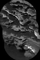
QUOTE (elakdawalla @ Apr 12 2017, 12:34 PM)  ....CTX mosaic of the Curiosity landing site... Thanks Emily, I look at that process.... Meanwhile Curi has driven as planned, no distance data yet but we have a few end of drive NavCam frames, I will stitch what I can soon. Here is a RMI mosaic acquired before the drive to Site 62/0690 of what I believe to be The 'Exposure of Bedding dubbed 'Great Wass Island' mentioned in the recent USGS update. The pointing is currently shown as above the horizon so I cant accurately locate on the NavCams, nor scale it at the moment, but likely close to the rover.
|
|
|
|
|
|
 Phil Stooke South to Vera Rubin Ridge Apr 7 2017, 07:24 PM
 Phil Stooke OK, we are on the road, and here is a circular ver... Apr 7 2017, 08:19 PM PaulH51 Mission Update from Ryan Anderson: Sols 1661-1663:... Apr 8 2017, 09:39 PM PaulH51 Not much here really (1662 L-NavCam partial) but i... Apr 10 2017, 10:39 AM fredk DD activity has been quiet recently, but here... Apr 10 2017, 07:23 PM jvandriel The Navcam L view on Sol 1662.
Jan van Driel
Apr 10 2017, 08:40 PM Phil Stooke Thanks, Jan. Here is a circular version. We are ... Apr 10 2017, 09:15 PM PaulH51 Curiosity Rover Mission Update: Sols 1664-1665: Ke... Apr 11 2017, 05:12 AM atomoid ICe stitch of the sol1661 chemcam. i think that se... Apr 12 2017, 03:02 AM
Phil Stooke OK, we are on the road, and here is a circular ver... Apr 7 2017, 08:19 PM PaulH51 Mission Update from Ryan Anderson: Sols 1661-1663:... Apr 8 2017, 09:39 PM PaulH51 Not much here really (1662 L-NavCam partial) but i... Apr 10 2017, 10:39 AM fredk DD activity has been quiet recently, but here... Apr 10 2017, 07:23 PM jvandriel The Navcam L view on Sol 1662.
Jan van Driel
Apr 10 2017, 08:40 PM Phil Stooke Thanks, Jan. Here is a circular version. We are ... Apr 10 2017, 09:15 PM PaulH51 Curiosity Rover Mission Update: Sols 1664-1665: Ke... Apr 11 2017, 05:12 AM atomoid ICe stitch of the sol1661 chemcam. i think that se... Apr 12 2017, 03:02 AM
 PaulH51 QUOTE (atomoid @ Apr 12 2017, 11:02 AM) I... Apr 12 2017, 03:51 AM Phil Stooke If there was any move at all it can only have been... Apr 12 2017, 01:08 PM PaulH51 QUOTE (Phil Stooke @ Apr 12 2017, 09:08 P... Apr 12 2017, 01:39 PM jvandriel The Navcam L view on Sol 1664.
Jan van Driel
Apr 12 2017, 08:14 PM PaulH51 Sol 1666: The short drive up to 'Moosehead Lak... Apr 14 2017, 03:06 AM HSchirmer QUOTE (PaulH51 @ Apr 14 2017, 03:06 AM) S... Apr 14 2017, 09:36 PM PaulH51 QUOTE (HSchirmer @ Apr 15 2017, 05:36 AM)... Apr 14 2017, 10:10 PM PaulH51 USGS Mission Update by Ryan Anderson Sols 1668-167... Apr 15 2017, 01:34 AM jvandriel The Navcam L view on Sol 1666.
Jan van Driel
Apr 15 2017, 01:38 PM Phil Stooke Thanks, Jan. Here is a circular view of it. The ... Apr 15 2017, 03:17 PM PaulH51 1666 MS ICE L-MastCam 'arm workspace' with... Apr 16 2017, 02:17 AM PaulH51 A pair of 'colour-boundary' targets dubbed... Apr 16 2017, 11:33 PM PaulH51 And the 1669 drive images all came down in one sho... Apr 17 2017, 08:19 AM PaulH51 One of the 1668 'Moosehead Lake' focus mer... Apr 17 2017, 08:51 AM Floyd Sand crepes. It looks like the delicates crepe is... Apr 17 2017, 11:42 AM PaulH51 QUOTE (Floyd @ Apr 17 2017, 07:42 PM) San... Apr 17 2017, 12:06 PM Phil Stooke Thanks for the panorama, Paul - here is a circular... Apr 17 2017, 12:09 PM jvandriel Here is my view of the Sol 1669 Panorama.
Jan van... Apr 17 2017, 01:55 PM atomoid crosseyed/parallel version of that deliciously und... Apr 18 2017, 10:38 PM serpens The "crepes" are really quite lovely. I... Apr 19 2017, 02:15 AM Phil Stooke Just a few metres drive on sol 1671.
Phil Apr 19 2017, 12:44 PM jvandriel The Navcam L view on Sol 1671.
Jan van Driel
Apr 20 2017, 08:18 PM PaulH51 1673 Drive: EDIT : 'Curiosity moved approximat... Apr 21 2017, 07:54 AM Phil Stooke An invaluable source of day to day news about Curi... Apr 22 2017, 12:44 AM PaulH51 QUOTE (Phil Stooke @ Apr 22 2017, 08:44 A... Apr 22 2017, 12:50 AM elakdawalla QUOTE (Phil Stooke @ Apr 21 2017, 04:44 P... Apr 24 2017, 04:18 PM PaulH51 Sol 1673 L-MastCam mosaic of the rover's weeke... Apr 22 2017, 11:09 AM jvandriel Thhe Navcam L view on Sol 1672.
Jan van Driel
Apr 22 2017, 02:27 PM jvandriel and the L Navcam view on Sol 1673.
Jan van Driel
... Apr 22 2017, 07:19 PM PaulH51 Another periodic check of the deck mounted Rover E... Apr 24 2017, 03:34 AM PaulH51 Sol 1676 drive of ~26 minutes, partial NavCam pan ... Apr 24 2017, 07:37 AM Phil Stooke Reprojected hazcams for the sol 1676 drive. They ... Apr 24 2017, 12:04 PM PaulH51 QUOTE (Phil Stooke @ Apr 24 2017, 08:04 P... Apr 24 2017, 01:17 PM Phil Stooke Also, the JPL site contains archives all the way b... Apr 24 2017, 04:29 PM Sean Here is a still from a movie I'm cooking up sh... Apr 24 2017, 06:16 PM PaulH51 A short YouTube video 'How To Not Break A Mars... Apr 25 2017, 01:31 AM PaulH51 Drive on sol 1677 : L-NavCam Partial Pan (MS ICE),... Apr 25 2017, 01:19 PM jvandriel The MAHLI view on Sol 1675.
Jan van Driel
Apr 25 2017, 03:02 PM PaulH51 My take on the 1675 MAHLI mosaic, rotated and scal... Apr 26 2017, 02:35 AM PaulH51 Curiosity Rover Total Traverse Passes The 10 Mile ... Apr 26 2017, 03:56 AM PaulH51 Curiosity Rover USGS Mission Update: Sol 1678: A S... Apr 26 2017, 09:11 AM PaulH51 1678 partial pan L-NavCam using MS ICE, will add d... Apr 26 2017, 10:23 AM PaulH51 Sol 1679 L-NavCam partial pan in MS ICE, drive was... Apr 27 2017, 11:36 AM PaulH51 Sol 1678 L-MastCam mosaic (arm workspace) MS-ICE
Apr 27 2017, 12:07 PM jvandriel The complete Navcam L view on Sol 1676.
Jan van D... Apr 27 2017, 07:26 PM jvandriel and the complete one taken on Sol 1677.
Jan van D... Apr 27 2017, 08:17 PM PaulH51 Crocker Mountain? Sol 1678 RMI and R-MastCam monta... Apr 28 2017, 06:49 AM jvandriel The Navcam L view on Sol 1678.
Jan van Driel
Apr 28 2017, 02:13 PM Phil Stooke Here is Jan's latest panorama in circular form... Apr 28 2017, 06:07 PM jvandriel and the view, with missing data, on Sol 1679.
Jan... Apr 28 2017, 08:11 PM Phil Stooke Thanks, Jan - here is a circular view of it (I fil... Apr 30 2017, 01:48 AM jvandriel The complete Navcam L view on Sol 1679.
( Added th... Apr 30 2017, 07:50 PM jvandriel and the view on Sol 1680.
Jan van Driel
Apr 30 2017, 08:43 PM PaulH51 Partial NLB 1683, with a little data drop out. M-P... May 1 2017, 09:25 PM atomoid anaglyph and reduced crosseye of sol1683 navcam pa... May 2 2017, 09:04 PM jvandriel The Navcam L view on Sol 1684.
Jan van Driel
May 3 2017, 09:09 AM PaulH51 Short Drive? Partial NLB 1685 in MS ICE, the missi... May 3 2017, 02:25 PM Phil Stooke Here is your half-panorama in circular form. My m... May 3 2017, 03:49 PM jvandriel The last complete image is down and here is the Na... May 3 2017, 07:41 PM vikingmars Thank you very much jvandriel for this very intere... May 4 2017, 07:04 AM PaulH51 'May the 4th be with your Megaripples...'
... May 4 2017, 02:39 PM jvandriel The Navcam L View on Sol 1685.
Jan van Driel
May 4 2017, 07:33 PM atomoid anaglph and crosseye excerpt of stitches of the ou... May 4 2017, 09:53 PM Phil Stooke This is Jan's 1685 panorama in circular form, ... May 5 2017, 12:04 AM jvandriel The Navcam L view on Sol 1686.
Jan van Driel
May 5 2017, 10:26 AM verfkwast Thanks 4 the great pictures Jan, Paul, Phil, atom ... May 5 2017, 01:28 PM Art Martin I see that we're ascending a hill because the ... May 5 2017, 02:03 PM scalbers QUOTE (Art Martin @ May 5 2017, 02:03 PM)... May 5 2017, 09:59 PM PaulH51 QUOTE (Art Martin @ May 5 2017, 10:03 PM)... May 6 2017, 03:13 AM Art Martin QUOTE (PaulH51 @ May 5 2017, 08:13 PM) Th... May 6 2017, 11:17 PM Phil Stooke Jan's sol 1686 panorama in circular form. Com... May 5 2017, 06:57 PM Art Martin Some 3D from Sol 1686
1686 Ripples Anaglyph 2
16... May 7 2017, 12:38 AM PaulH51 Sol 1682 : A mosaic of focus merged MAHLIs assembl... May 7 2017, 02:24 AM PaulH51 Meagaripple grains, sol 1688 MAHLI,
Edit: One of ... May 7 2017, 10:42 AM PaulH51 Sol 1688: a crop from a mosaic of two R-MastCam fr... May 8 2017, 03:17 AM charborob The complete sol 1688 Rmastcam panorama: May 8 2017, 10:11 AM PaulH51 1690 L-NavCam: Quick & very dirty in MS ICE, b... May 9 2017, 12:52 AM Phil Stooke Paul's panorama in a circular version - I crop... May 9 2017, 01:27 AM jvandriel The Navcam L view on Sol 1690.
Jan van Driel
May 9 2017, 04:56 PM Phil Stooke Sol 1691 - a short drive, just a few metres, south... May 9 2017, 06:29 PM atomoid layer flake stereo of sol1688, presumably one of t... May 9 2017, 08:34 PM fredk QUOTE (atomoid @ May 9 2017, 09:34 PM) th... May 9 2017, 10:10 PM Phil Stooke "I'm not sure what the story is with that... May 9 2017, 10:45 PM Phil Stooke This is Jan's panorama from sol 1690 in circul... May 10 2017, 03:08 AM jvandriel The Navcam L view on Sol 1691.
Jan van Driel
May 10 2017, 11:30 AM PaulH51 One of a series of pre-drive focus merged MAHLI... May 10 2017, 12:04 PM Gerald For the focus-stacked images, the motor count for ... May 10 2017, 02:15 PM PaulH51 QUOTE (Gerald @ May 10 2017, 10:15 PM) I... May 10 2017, 11:05 PM PaulH51 1691 L-MastCam of Curiosity's workspace, assem... May 10 2017, 11:14 PM
PaulH51 QUOTE (atomoid @ Apr 12 2017, 11:02 AM) I... Apr 12 2017, 03:51 AM Phil Stooke If there was any move at all it can only have been... Apr 12 2017, 01:08 PM PaulH51 QUOTE (Phil Stooke @ Apr 12 2017, 09:08 P... Apr 12 2017, 01:39 PM jvandriel The Navcam L view on Sol 1664.
Jan van Driel
Apr 12 2017, 08:14 PM PaulH51 Sol 1666: The short drive up to 'Moosehead Lak... Apr 14 2017, 03:06 AM HSchirmer QUOTE (PaulH51 @ Apr 14 2017, 03:06 AM) S... Apr 14 2017, 09:36 PM PaulH51 QUOTE (HSchirmer @ Apr 15 2017, 05:36 AM)... Apr 14 2017, 10:10 PM PaulH51 USGS Mission Update by Ryan Anderson Sols 1668-167... Apr 15 2017, 01:34 AM jvandriel The Navcam L view on Sol 1666.
Jan van Driel
Apr 15 2017, 01:38 PM Phil Stooke Thanks, Jan. Here is a circular view of it. The ... Apr 15 2017, 03:17 PM PaulH51 1666 MS ICE L-MastCam 'arm workspace' with... Apr 16 2017, 02:17 AM PaulH51 A pair of 'colour-boundary' targets dubbed... Apr 16 2017, 11:33 PM PaulH51 And the 1669 drive images all came down in one sho... Apr 17 2017, 08:19 AM PaulH51 One of the 1668 'Moosehead Lake' focus mer... Apr 17 2017, 08:51 AM Floyd Sand crepes. It looks like the delicates crepe is... Apr 17 2017, 11:42 AM PaulH51 QUOTE (Floyd @ Apr 17 2017, 07:42 PM) San... Apr 17 2017, 12:06 PM Phil Stooke Thanks for the panorama, Paul - here is a circular... Apr 17 2017, 12:09 PM jvandriel Here is my view of the Sol 1669 Panorama.
Jan van... Apr 17 2017, 01:55 PM atomoid crosseyed/parallel version of that deliciously und... Apr 18 2017, 10:38 PM serpens The "crepes" are really quite lovely. I... Apr 19 2017, 02:15 AM Phil Stooke Just a few metres drive on sol 1671.
Phil Apr 19 2017, 12:44 PM jvandriel The Navcam L view on Sol 1671.
Jan van Driel
Apr 20 2017, 08:18 PM PaulH51 1673 Drive: EDIT : 'Curiosity moved approximat... Apr 21 2017, 07:54 AM Phil Stooke An invaluable source of day to day news about Curi... Apr 22 2017, 12:44 AM PaulH51 QUOTE (Phil Stooke @ Apr 22 2017, 08:44 A... Apr 22 2017, 12:50 AM elakdawalla QUOTE (Phil Stooke @ Apr 21 2017, 04:44 P... Apr 24 2017, 04:18 PM PaulH51 Sol 1673 L-MastCam mosaic of the rover's weeke... Apr 22 2017, 11:09 AM jvandriel Thhe Navcam L view on Sol 1672.
Jan van Driel
Apr 22 2017, 02:27 PM jvandriel and the L Navcam view on Sol 1673.
Jan van Driel
... Apr 22 2017, 07:19 PM PaulH51 Another periodic check of the deck mounted Rover E... Apr 24 2017, 03:34 AM PaulH51 Sol 1676 drive of ~26 minutes, partial NavCam pan ... Apr 24 2017, 07:37 AM Phil Stooke Reprojected hazcams for the sol 1676 drive. They ... Apr 24 2017, 12:04 PM PaulH51 QUOTE (Phil Stooke @ Apr 24 2017, 08:04 P... Apr 24 2017, 01:17 PM Phil Stooke Also, the JPL site contains archives all the way b... Apr 24 2017, 04:29 PM Sean Here is a still from a movie I'm cooking up sh... Apr 24 2017, 06:16 PM PaulH51 A short YouTube video 'How To Not Break A Mars... Apr 25 2017, 01:31 AM PaulH51 Drive on sol 1677 : L-NavCam Partial Pan (MS ICE),... Apr 25 2017, 01:19 PM jvandriel The MAHLI view on Sol 1675.
Jan van Driel
Apr 25 2017, 03:02 PM PaulH51 My take on the 1675 MAHLI mosaic, rotated and scal... Apr 26 2017, 02:35 AM PaulH51 Curiosity Rover Total Traverse Passes The 10 Mile ... Apr 26 2017, 03:56 AM PaulH51 Curiosity Rover USGS Mission Update: Sol 1678: A S... Apr 26 2017, 09:11 AM PaulH51 1678 partial pan L-NavCam using MS ICE, will add d... Apr 26 2017, 10:23 AM PaulH51 Sol 1679 L-NavCam partial pan in MS ICE, drive was... Apr 27 2017, 11:36 AM PaulH51 Sol 1678 L-MastCam mosaic (arm workspace) MS-ICE
Apr 27 2017, 12:07 PM jvandriel The complete Navcam L view on Sol 1676.
Jan van D... Apr 27 2017, 07:26 PM jvandriel and the complete one taken on Sol 1677.
Jan van D... Apr 27 2017, 08:17 PM PaulH51 Crocker Mountain? Sol 1678 RMI and R-MastCam monta... Apr 28 2017, 06:49 AM jvandriel The Navcam L view on Sol 1678.
Jan van Driel
Apr 28 2017, 02:13 PM Phil Stooke Here is Jan's latest panorama in circular form... Apr 28 2017, 06:07 PM jvandriel and the view, with missing data, on Sol 1679.
Jan... Apr 28 2017, 08:11 PM Phil Stooke Thanks, Jan - here is a circular view of it (I fil... Apr 30 2017, 01:48 AM jvandriel The complete Navcam L view on Sol 1679.
( Added th... Apr 30 2017, 07:50 PM jvandriel and the view on Sol 1680.
Jan van Driel
Apr 30 2017, 08:43 PM PaulH51 Partial NLB 1683, with a little data drop out. M-P... May 1 2017, 09:25 PM atomoid anaglyph and reduced crosseye of sol1683 navcam pa... May 2 2017, 09:04 PM jvandriel The Navcam L view on Sol 1684.
Jan van Driel
May 3 2017, 09:09 AM PaulH51 Short Drive? Partial NLB 1685 in MS ICE, the missi... May 3 2017, 02:25 PM Phil Stooke Here is your half-panorama in circular form. My m... May 3 2017, 03:49 PM jvandriel The last complete image is down and here is the Na... May 3 2017, 07:41 PM vikingmars Thank you very much jvandriel for this very intere... May 4 2017, 07:04 AM PaulH51 'May the 4th be with your Megaripples...'
... May 4 2017, 02:39 PM jvandriel The Navcam L View on Sol 1685.
Jan van Driel
May 4 2017, 07:33 PM atomoid anaglph and crosseye excerpt of stitches of the ou... May 4 2017, 09:53 PM Phil Stooke This is Jan's 1685 panorama in circular form, ... May 5 2017, 12:04 AM jvandriel The Navcam L view on Sol 1686.
Jan van Driel
May 5 2017, 10:26 AM verfkwast Thanks 4 the great pictures Jan, Paul, Phil, atom ... May 5 2017, 01:28 PM Art Martin I see that we're ascending a hill because the ... May 5 2017, 02:03 PM scalbers QUOTE (Art Martin @ May 5 2017, 02:03 PM)... May 5 2017, 09:59 PM PaulH51 QUOTE (Art Martin @ May 5 2017, 10:03 PM)... May 6 2017, 03:13 AM Art Martin QUOTE (PaulH51 @ May 5 2017, 08:13 PM) Th... May 6 2017, 11:17 PM Phil Stooke Jan's sol 1686 panorama in circular form. Com... May 5 2017, 06:57 PM Art Martin Some 3D from Sol 1686
1686 Ripples Anaglyph 2
16... May 7 2017, 12:38 AM PaulH51 Sol 1682 : A mosaic of focus merged MAHLIs assembl... May 7 2017, 02:24 AM PaulH51 Meagaripple grains, sol 1688 MAHLI,
Edit: One of ... May 7 2017, 10:42 AM PaulH51 Sol 1688: a crop from a mosaic of two R-MastCam fr... May 8 2017, 03:17 AM charborob The complete sol 1688 Rmastcam panorama: May 8 2017, 10:11 AM PaulH51 1690 L-NavCam: Quick & very dirty in MS ICE, b... May 9 2017, 12:52 AM Phil Stooke Paul's panorama in a circular version - I crop... May 9 2017, 01:27 AM jvandriel The Navcam L view on Sol 1690.
Jan van Driel
May 9 2017, 04:56 PM Phil Stooke Sol 1691 - a short drive, just a few metres, south... May 9 2017, 06:29 PM atomoid layer flake stereo of sol1688, presumably one of t... May 9 2017, 08:34 PM fredk QUOTE (atomoid @ May 9 2017, 09:34 PM) th... May 9 2017, 10:10 PM Phil Stooke "I'm not sure what the story is with that... May 9 2017, 10:45 PM Phil Stooke This is Jan's panorama from sol 1690 in circul... May 10 2017, 03:08 AM jvandriel The Navcam L view on Sol 1691.
Jan van Driel
May 10 2017, 11:30 AM PaulH51 One of a series of pre-drive focus merged MAHLI... May 10 2017, 12:04 PM Gerald For the focus-stacked images, the motor count for ... May 10 2017, 02:15 PM PaulH51 QUOTE (Gerald @ May 10 2017, 10:15 PM) I... May 10 2017, 11:05 PM PaulH51 1691 L-MastCam of Curiosity's workspace, assem... May 10 2017, 11:14 PM |

|
Lo-Fi Version | Time is now: 26th September 2024 - 11:07 AM |
|
RULES AND GUIDELINES Please read the Forum Rules and Guidelines before posting. IMAGE COPYRIGHT |
OPINIONS AND MODERATION Opinions expressed on UnmannedSpaceflight.com are those of the individual posters and do not necessarily reflect the opinions of UnmannedSpaceflight.com or The Planetary Society. The all-volunteer UnmannedSpaceflight.com moderation team is wholly independent of The Planetary Society. The Planetary Society has no influence over decisions made by the UnmannedSpaceflight.com moderators. |
SUPPORT THE FORUM Unmannedspaceflight.com is funded by the Planetary Society. Please consider supporting our work and many other projects by donating to the Society or becoming a member. |
|