Martian Cartography |

Martian Cartography |
 May 15 2006, 04:16 PM May 15 2006, 04:16 PM
Post
#1
|
|
|
Member  Group: Members Posts: 147 Joined: 14-April 06 From: Berlin Member No.: 744 |
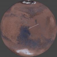
I have recently freaked out a little bit about Martian maps of all sorts. And finally I was astonished with those highly detailed beauties that I list below. Nonetheless. some of them have huge inconsistencies (crater names) easily noticed when we compare the surroundings of Gusev crater. Enjoy:
http://www.ralphaeschliman.com/ http://planetologia.elte.hu/1cikkeke.phtml...arsmapinte.html http://pubs.usgs.gov/imap/i2782/ -------------------- |
 |
 
|
 |
|
Mar 15 2021, 02:36 PM
Post
#2
|
||
 Member Group: Members Posts: 349 Joined: 20-June 07 From: Slovenia Member No.: 2461 |
There is really no mystery here, only an age old geographical problem. Compromises need to be made in order to render spherical planetary surface onto a 2d surface.
First we need to see how HiRise images are produced. Camera images the surface of Mars while in orbit around the planet looking straight down, so images are really in orthographic (OR) projection. But as images cover very small part of spherical surface of the planet, it is possible to approximate it as a 2d picture in equirectangular (EQ) projection with central longitude and latitude near the center of the imaged area (in essence we treat this area as it would be flat). That's why different HiRise images come all with the same EQ projection, but varying central longitudes and latitudes. EQ projection also has true scale latitude defined, which means only at this latitude scale will be in true meters. On this map straight lines looking to be of the same length but located at different latitudes would have different lengths in reality. Also lines are that are always straight in EQ projection will be curved in reality (except at central long/lat point). To get straight lines straight in reality as well as on the map you have to choose orthographic projection with central long/lat at the center of the area of interest. That's way Perseverance's HiRise mosaic used for driving comes in OR projection with central long/lat at 77.4298/18.4663. This particular coordinate is at the center of HiRise mosaic as well as very near to a predicted landing spot. So what you get is a map with approximates very well the spherical surface as a 2d Cartesian space. In essence you get x/y grid defined with parallel longitudes and latitudes. So when planning rover's traverse you can simply plot a straight line from point A to B and be sure the this line is also straight on the surface of Mars. Pretty important when navigating a 2.2 billion dollar rover on Mars. Coming back to geoJSON data and why it uses ER projection coordinates. Well OR projection really doesn't have a true scale, so if you want to measure a distance in meters you have to reproject it into ER with appropriate true scale latitude. Only then will your measurment be in true scale meters. Thats's why easting and northing in geoJSON file are given in ER projection with central long/lat at 77.4298/18.4663. I hope this helps.
Mars in OR projection with central long/lat at 77.4298/18.4663. Note that extent of Perseverance's mosaic (yellow rectangle) is totally rectangular in this projection. |
|
|
|
|
|
 karolp Martian Cartography May 15 2006, 04:16 PM
 Greenish Regarding the map projection & registration, f... Mar 8 2021, 05:09 AM
 Andreas Plesch QUOTE (Greenish @ Mar 8 2021, 12:09 AM) R... Mar 8 2021, 02:10 PM Greenish Great, I'm glad you were able to make some use... Mar 9 2021, 07:16 AM Andreas Plesch Wow, another document covering similar topics.
So... Mar 10 2021, 01:27 AM Greenish QUOTE (Andreas Plesch @ Mar 9 2021, 08:27... Mar 10 2021, 03:18 AM kymani76 On the subject of Percy's geoJSON precision. I... Mar 12 2021, 03:01 PM Andreas Plesch QUOTE (kymani76 @ Mar 12 2021, 10:01 AM) ... Mar 12 2021, 05:47 PM Greenish Thanks for finding and posting this direct JSON li... Mar 13 2021, 01:51 AM Andreas Plesch I am trying to figure out the easting and northing... Mar 13 2021, 10:08 PM Andreas Plesch https://pds-imaging.jpl.nasa.gov/data/msl/M...CES_... Mar 13 2021, 11:20 PM markril QUOTE (Andreas Plesch @ Mar 13 2021, 03:2... Mar 14 2021, 05:13 AM Andreas Plesch QUOTE (markril @ Mar 14 2021, 12:13 AM) .... Mar 14 2021, 09:03 PM markril QUOTE (Andreas Plesch @ Mar 14 2021, 01:0... Mar 15 2021, 07:17 AM Andreas Plesch Another way to look at it is to assume that the re... Mar 14 2021, 05:15 AM Phil Stooke Here are some maps of the Pathfinder site. One ov... May 13 2021, 02:29 AM Phil Stooke And 2 more:
.
Phil May 13 2021, 02:31 AM Phil Stooke And a last one - should have been first, really.
P... May 13 2021, 02:37 AM Phil Stooke Some Phoenix maps.
Phil
and a third one:
May 16 2021, 10:22 PM Antdoghalo Stookes Pathfinder HiRISE/Pano reprojection May 20 2021, 09:42 PM Antdoghalo Separate images for first two Sojourner path maps. May 23 2021, 03:19 AM Phil Stooke I have started posting some things on:
https://m... Dec 2 2023, 06:14 PM kymani76
I recently noted that a new Mars Express global ... Dec 9 2023, 10:49 AM kymani76
The same for Jezero crater region. Both maps are... Dec 9 2023, 10:52 AM Antdoghalo It looks weird because Themis is mainly an infrare... Dec 9 2023, 01:12 PM
Andreas Plesch QUOTE (Greenish @ Mar 8 2021, 12:09 AM) R... Mar 8 2021, 02:10 PM Greenish Great, I'm glad you were able to make some use... Mar 9 2021, 07:16 AM Andreas Plesch Wow, another document covering similar topics.
So... Mar 10 2021, 01:27 AM Greenish QUOTE (Andreas Plesch @ Mar 9 2021, 08:27... Mar 10 2021, 03:18 AM kymani76 On the subject of Percy's geoJSON precision. I... Mar 12 2021, 03:01 PM Andreas Plesch QUOTE (kymani76 @ Mar 12 2021, 10:01 AM) ... Mar 12 2021, 05:47 PM Greenish Thanks for finding and posting this direct JSON li... Mar 13 2021, 01:51 AM Andreas Plesch I am trying to figure out the easting and northing... Mar 13 2021, 10:08 PM Andreas Plesch https://pds-imaging.jpl.nasa.gov/data/msl/M...CES_... Mar 13 2021, 11:20 PM markril QUOTE (Andreas Plesch @ Mar 13 2021, 03:2... Mar 14 2021, 05:13 AM Andreas Plesch QUOTE (markril @ Mar 14 2021, 12:13 AM) .... Mar 14 2021, 09:03 PM markril QUOTE (Andreas Plesch @ Mar 14 2021, 01:0... Mar 15 2021, 07:17 AM Andreas Plesch Another way to look at it is to assume that the re... Mar 14 2021, 05:15 AM Phil Stooke Here are some maps of the Pathfinder site. One ov... May 13 2021, 02:29 AM Phil Stooke And 2 more:
.
Phil May 13 2021, 02:31 AM Phil Stooke And a last one - should have been first, really.
P... May 13 2021, 02:37 AM Phil Stooke Some Phoenix maps.
Phil
and a third one:
May 16 2021, 10:22 PM Antdoghalo Stookes Pathfinder HiRISE/Pano reprojection May 20 2021, 09:42 PM Antdoghalo Separate images for first two Sojourner path maps. May 23 2021, 03:19 AM Phil Stooke I have started posting some things on:
https://m... Dec 2 2023, 06:14 PM kymani76
I recently noted that a new Mars Express global ... Dec 9 2023, 10:49 AM kymani76
The same for Jezero crater region. Both maps are... Dec 9 2023, 10:52 AM Antdoghalo It looks weird because Themis is mainly an infrare... Dec 9 2023, 01:12 PM |

|
Lo-Fi Version | Time is now: 22nd June 2024 - 11:16 PM |
|
RULES AND GUIDELINES Please read the Forum Rules and Guidelines before posting. IMAGE COPYRIGHT |
OPINIONS AND MODERATION Opinions expressed on UnmannedSpaceflight.com are those of the individual posters and do not necessarily reflect the opinions of UnmannedSpaceflight.com or The Planetary Society. The all-volunteer UnmannedSpaceflight.com moderation team is wholly independent of The Planetary Society. The Planetary Society has no influence over decisions made by the UnmannedSpaceflight.com moderators. |
SUPPORT THE FORUM Unmannedspaceflight.com is funded by the Planetary Society. Please consider supporting our work and many other projects by donating to the Society or becoming a member. |
|