
JunoCam projection code aimed at mosaicing |

JunoCam projection code aimed at mosaicing |
 Dec 15 2021, 08:08 PM Dec 15 2021, 08:08 PM
Post
#1
|
|
|
Newbie  Group: Members Posts: 4 Joined: 19-November 21 Member No.: 9121 |
Hello!
I wanted to share a code that I've been working on to project and mosaic JunoCam images. The code is written in Python and uses the SPICE library: https://github.com/ramanakumars/JunoCamProjection. I thought people in this forum might be interested in using it or comparing with existing pipelines. The goal of this code is to generate mosaics by stacking multiple images for a given perijove pass with little manual labor. An example of both the projection and the mosaicing process is in the examples folder. Here is an example of a mosaic from PJ27 data: 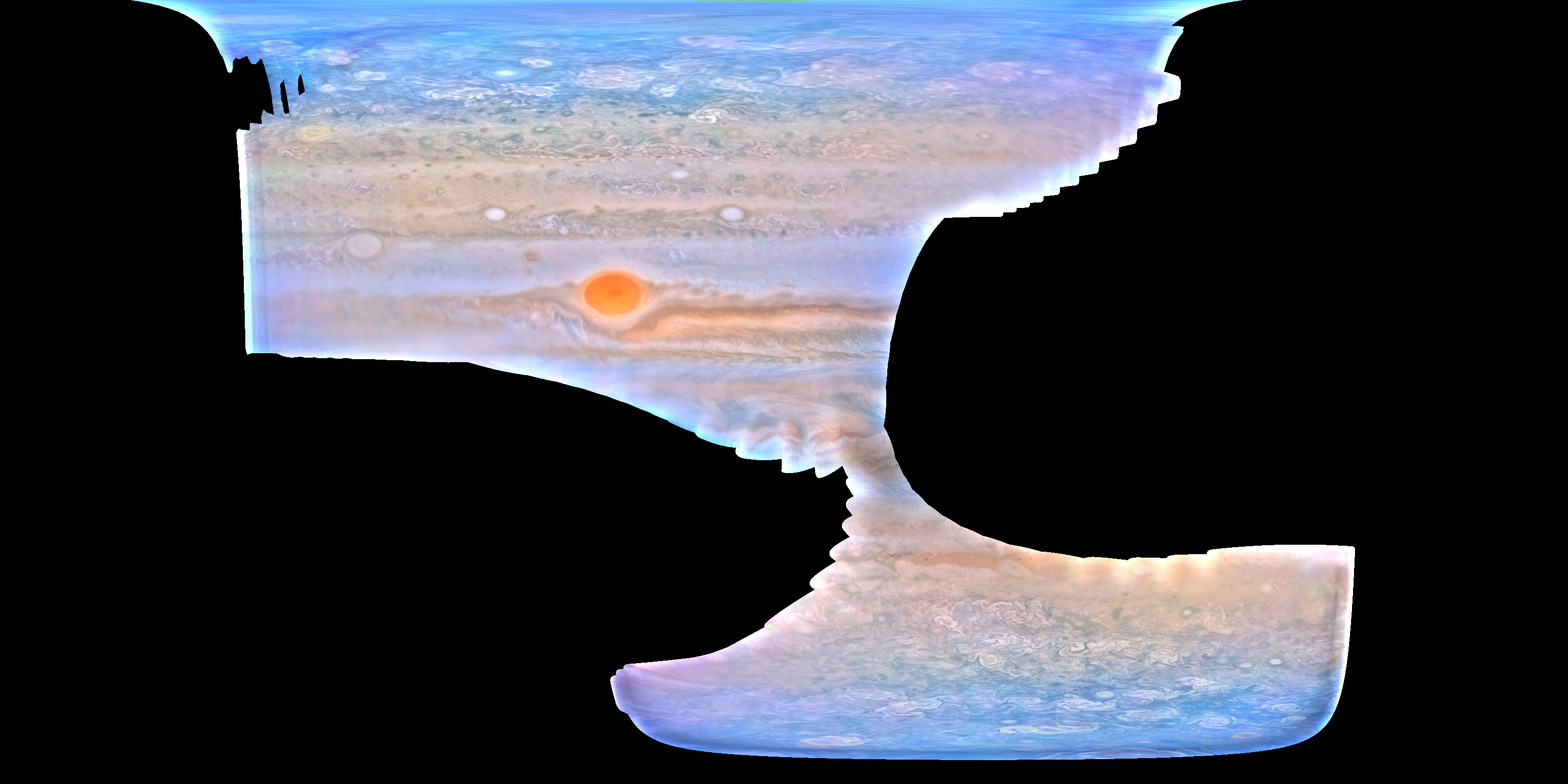 Ramana |
 |
 
|
 |
|
Dec 16 2021, 08:06 PM
Post
#2
|
|
|
Newbie Group: Members Posts: 4 Joined: 19-November 21 Member No.: 9121 |
Thank you!!
QUOTE Though the color is a little too heavy on the blue, I am not sure if it is the program or the raw images causing that. Yeah, that is an artifact of the color correction and histogram equalization. The code outputs a "raw" mosaic which goes through a color correction function. I think it should be possible to get better representations by post-processing the raw image directly rather than getting the output from the color correction step. I use the color correction function to de-haze the mosaic since I'm interested in uniform image representations across multiple perijoves, so my use case tends to be less aesthetic. QUOTE Seems like you have a lot of blending artifacts in the mosaic, only to be expected. Yes, and it's much more noticeable near the poles. I've been trying to figure out a way out of this. I fixed a lot of the artifacts a while ago by doing jitter correction (by fitting the limb of Jupiter in each image to find the start time offset). That might not be accurate enough for polar latitudes. I also think it's due to the changing resolution with latitude... I don't have a clear fix for that right now, except for doing lower resolution reconstruction. |
|
|
|
 ramana JunoCam projection code aimed at mosaicing Dec 15 2021, 08:08 PM
 Antdoghalo That is not bad! Though the color is a little ... Dec 16 2021, 03:39 PM mcaplinger QUOTE (ramana @ Dec 15 2021, 12:08 PM) I ... Dec 16 2021, 07:49 PM
 mcaplinger QUOTE (ramana @ Dec 16 2021, 12:06 PM) I ... Dec 16 2021, 11:10 PM Bjorn Jonsson At least in my experience, 2-3 pixels is typical f... Dec 17 2021, 12:34 AM ramana QUOTE You might compare what your code produces fo... Dec 17 2021, 01:32 AM
 |

|
Lo-Fi Version | Time is now: 31st May 2024 - 05:00 PM |
|
RULES AND GUIDELINES Please read the Forum Rules and Guidelines before posting. IMAGE COPYRIGHT |
OPINIONS AND MODERATION Opinions expressed on UnmannedSpaceflight.com are those of the individual posters and do not necessarily reflect the opinions of UnmannedSpaceflight.com or The Planetary Society. The all-volunteer UnmannedSpaceflight.com moderation team is wholly independent of The Planetary Society. The Planetary Society has no influence over decisions made by the UnmannedSpaceflight.com moderators. |
SUPPORT THE FORUM Unmannedspaceflight.com is funded by the Planetary Society. Please consider supporting our work and many other projects by donating to the Society or becoming a member. |
|


