3D MRO |

  |
3D MRO |
 Jun 18 2007, 11:10 AM Jun 18 2007, 11:10 AM
Post
#1
|
|
 The Poet Dude  Group: Moderator Posts: 5551 Joined: 15-March 04 From: Kendal, Cumbria, UK Member No.: 60 |
Has anyone else been drooling over the images here..?
Mars Unearthed 3D MRO images If anyone has, then can they tell me if this image is "vertically stretched" somehow? It looks very, um, spiky... 
-------------------- |
 |
 
|
|
Jun 18 2007, 01:11 PM
Post
#2
|
|
|
Senior Member Group: Members Posts: 3516 Joined: 4-November 05 From: North Wales Member No.: 542 |
That site's great fun to explore. My impression is that all the HiRISE anaglyphs (at least the ones I've dipped into) are vertically stretched. It would be useful to know by how much and whether this factor varies.
|
|
|
|
|
Jun 18 2007, 03:04 PM
Post
#3
|
|
 Member Group: Members Posts: 345 Joined: 2-May 05 Member No.: 372 |
They have to be "vertically stretched." If they were taken at normal human eye separation, there wouldn't be any relief visible! So, the baseline used for the images is much greater than that of human eyes. This exaggerates height differences, and the larger the baseline, the greater the effect. So, yes, it is exaggerated, and yes, it probably varies.
It doesn't make a lot of sense to use the term "vertically stretched," as the only stretching done was horizontal (wider baseline). |
|
|
|
|
Jun 18 2007, 07:49 PM
Post
#4
|
|
|
Senior Member Group: Members Posts: 3516 Joined: 4-November 05 From: North Wales Member No.: 542 |
QUOTE (um3k @ Jun 18 2007, 04:04 PM)  It doesn't make a lot of sense to use the term "vertically stretched," as the only stretching done was horizontal (wider baseline). Well it may not be couched in scientific language and it may not reflect the subtle (and interesting) details of the imaging and viewing geometry that actually produce the 3D illusion but I think it's a perfectly comprehensible and useful everyday term. A perfect cube sitting on mars looks like a tall 1x1x5 cuboid when the anaglyph is viewed: that's a 5 times vertical stretch to me. It's an important parameter that I would prefer to know the value of whilst viewing in 3D. Perhaps anaglyphs need virtual scale-cubes (or pyramids) in one corner to fulfil the role of linear scale-bars for flat images. |
|
|
|
|
Jun 18 2007, 08:44 PM
Post
#5
|
|
 Member Group: Members Posts: 701 Joined: 3-December 04 From: Boulder, Colorado, USA Member No.: 117 |
Note that the apparent "vertical exaggeration" depends on your distance from the screen- the closer your eyes are to the screen, the less steep the relief appears (try it!). That's because the topography will appear realistically when the convergence angle of your eyes (defined by the ratio between your eye separation and the distance to the image) is equal to the convergence angle of the two images that went into making the stereo pair. A scale-cube would indeed be a great way to show the exaggeration.
These images are wonderful- I'm waiting for someone to make a full-res DEM from a HIRISE stereo pair and transform the image into a "rover's eye" surface view (with atmospheric haze but without vertical exaggeration, please!). The result could be really stunning for some of these landscapes- there are so many amazing places on Mars where we'll never put a real rover on the surface, and this would be the next-best thing. John. |
|
|
|
|
Jun 18 2007, 08:51 PM
Post
#6
|
|
|
Founder Group: Chairman Posts: 14432 Joined: 8-February 04 Member No.: 1 |
The moment the DEM's are out and about and I can get them in to 3ds max....
 Doug |
|
|
|
|
Jun 19 2007, 12:39 AM
Post
#7
|
|
|
Junior Member Group: Members Posts: 37 Joined: 12-January 07 Member No.: 1587 |
Actually, the "vertical stretching" has more to do with the amount of angular separation between the two images combined in the stereo pair. With HiRISE, the angular separation between the two images is often larger than what would be seen by the human eye. So most of the anaglyphs will show a vertical stretch. There are a few anaglyphs where the separation is so large that it's hard to even get your eyes to converge on the image. There's an anaglyph of a crater that comes to mind that suffers from this problem, I don't remember the observation id off hand. I had to sit and stare at the thing for a good minute before I could make head or tail of what I was looking at.
I think to get a best idea of the height is to go to the DEM's when they are available. The anaglyphs are cool to look at, but they can be misleading. |
|
|
|
|
Jun 19 2007, 04:21 AM
Post
#8
|
|
 Senior Member Group: Members Posts: 2228 Joined: 1-December 04 From: Marble Falls, Texas, USA Member No.: 116 |
I think vertical exaggeration is the proper term. To me, saying the image was stretched implies that it was somehow manipulated, but I knew what Stu meant. This topic came up a while back regarding the vertical exaggeration of the Victoria Crater HiRise anaglyph, and I discovered that it is pretty easy to calculate the V.E. if you know the angle from vertical the images were take at and the height of the camera. The Excel spreadsheet that I posted will do the calculation if you know the "emission angle," which is listed for each HiRise image.
DataMiner: You may be thinking of the anaglyph of Ada Crater It appears quite exaggerated vertically. To return to Stu's original post, thanks for pointing out that excellent site. If you can determine which two Candor Chasma images were used in that anaglyph, we should be able to estimate the V.E. -------------------- ...Tom
I'm not a Space Fan, I'm a Space Exploration Enthusiast. |
|
|
|
|
Jun 19 2007, 02:26 PM
Post
#9
|
|
|
Junior Member Group: Members Posts: 37 Joined: 12-January 07 Member No.: 1587 |
QUOTE (CosmicRocker @ Jun 18 2007, 09:21 PM) DataMiner: You may be thinking of the anaglyph of Ada Crater It appears quite exaggerated vertically. Yeah, that's the one... |
|
|
|
|
Jun 19 2007, 07:57 PM
Post
#10
|
|
 Senior Member Group: Members Posts: 2492 Joined: 15-January 05 From: center Italy Member No.: 150 |
Thanks Steward for the fantastic link. I'm amazed by the anaglyphs and, in particular this one of Elysium Tholus Summit is stunning.. look at this deep hole, would be nice to explore it!
 Addendum: not to speech of this, from Meridiani Planum: the central part of image, with all these textures, stratification and dunes, makes me screaming: If this isn't art, is very close to it! -------------------- I always think before posting! - Marco -
|
|
|
|
|
Jun 19 2007, 09:18 PM
Post
#11
|
|
|
Member Group: Members Posts: 122 Joined: 19-June 07 Member No.: 2455 |
I'm curious, if one had the original left and right images and the orbital dynamics of when the images were shot, if it wouldn't be possible to construct a computer algorithm that would rebuild those left and right images based upon what the human eyes would truly see or at least a reasonable representation. It certainly seems like all the mathematical info is there to do such a thing.
I know a great deal of the relief would be washed out since the distances are significant but it would be interesting to construct anaglyphs truly representing what it would look like from orbit to a true set of human eyes. I'll bet some of those 3D images would still retain enough depth to still be amazing. Art Martin |
|
|
|
|
Jun 19 2007, 09:36 PM
Post
#12
|
|
|
Founder Group: Chairman Posts: 14432 Joined: 8-February 04 Member No.: 1 |
Well - with good stereo you can generate a DEM, and from that you can make anything you want really.
Doug |
|
|
|
|
Jun 20 2007, 12:10 AM
Post
#13
|
|
 IMG to PNG GOD Group: Moderator Posts: 2251 Joined: 19-February 04 From: Near fire and ice Member No.: 38 |
I've been frustratingly close to generating DEMs of Saturn's satellites for some time using my own software that generates DEMs from stereo pairs. The problem is that the resulting 'DEMs' are far too noisy and contain too many spurious features and artifacts to be useful. If just this $%#% thing worked as I want it to I would also be able to generate DEMs of Mars using two images (a stereo pair).
If anyone knows of any free/cheap software that can do this properly I'd like to know although I'm not particularly optimistic. One possibly interesting piece of code I found yesterday though: http://cat.middlebury.edu/stereo/code.html I haven't looked at this carefully enough to know if it's interesting in this context but I'm not particularly optimistic. If anyone is curious, here is my 'DEM' of one of Rhea's many craters:  Ugly, noisy and contains lots of noise, gaps and spurious features/artifacts/peaks (some real features are also simply missing!) but at least the program has managed to clearly detect two craters. Related topics have been discussed before (in other words, this is not the first time I'm frustrated by my inability to generate nice DEMs ;-) ): http://www.unmannedspaceflight.com/index.p...2&hl=stereo http://www.unmannedspaceflight.com/index.p...4&hl=stereo http://www.unmannedspaceflight.com/index.p...8&hl=stereo http://www.unmannedspaceflight.com/index.p...3&hl=stereo |
|
|
|
|
Aug 22 2007, 08:48 AM
Post
#14
|
||
|
Junior Member Group: Members Posts: 61 Joined: 5-June 05 From: 46.283N 11.433E :)) Member No.: 401 |
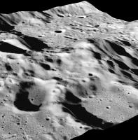
QUOTE (Bjorn Jonsson @ Jun 20 2007, 02:10 AM) I've been frustratingly close to generating DEMs of Saturn's satellites for some time using my own software that generates DEMs from stereo pairs. The problem is that the resulting 'DEMs' are far too noisy and contain too many spurious features and artifacts to be useful. If just this $%#% thing worked as I want it to I would also be able to generate DEMs of Mars using two images (a stereo pair). http://www.unmannedspaceflight.com/index.p...3&hl=stereo Hello Bjorn! I wrote myself a software that generated DEMs from stereo pairs. It isn't perfect but noise isn't so high in most of the images. I posted a work on the Moon section of this forum.. check here: Stereo from Apollo Can you give me your stereo pairs where you tested your program? Ciao, Alessio
|
|
|
|
|
|
|
Aug 22 2007, 09:44 PM
Post
#15
|
|
 Member Group: Members Posts: 241 Joined: 22-August 05 From: Stockholm Sweden Member No.: 468 |
QUOTE (Bjorn Jonsson @ Jun 20 2007, 02:10 AM) I've been frustratingly close to generating DEMs of Saturn's satellites for some time using my own software that generates DEMs from stereo pairs. The problem is that the resulting 'DEMs' are far too noisy and contain too many spurious features and artifacts to be useful. If just this $%#% thing worked as I want it to I would also be able to generate DEMs of Mars using two images (a stereo pair). If anyone knows of any free/cheap software that can do this properly I'd like to know although I'm not particularly optimistic. One possibly interesting piece of code I found yesterday though: www.unmannedspaceflight.com/index.php?showtopic=1203&hl=stereo]http://www.unmannedspaceflight.com/index.p...3&hl=stereo[/url] there are a number of papers on on integrating shape from stereo and shape from shading that might be of help. http://www.cvip.louisville.edu/wwwcvip/res...16-ICIP1999.pdf /M |
|
|
|
|

|
Lo-Fi Version | Time is now: 30th May 2024 - 10:36 AM |
|
RULES AND GUIDELINES Please read the Forum Rules and Guidelines before posting. IMAGE COPYRIGHT |
OPINIONS AND MODERATION Opinions expressed on UnmannedSpaceflight.com are those of the individual posters and do not necessarily reflect the opinions of UnmannedSpaceflight.com or The Planetary Society. The all-volunteer UnmannedSpaceflight.com moderation team is wholly independent of The Planetary Society. The Planetary Society has no influence over decisions made by the UnmannedSpaceflight.com moderators. |
SUPPORT THE FORUM Unmannedspaceflight.com is funded by the Planetary Society. Please consider supporting our work and many other projects by donating to the Society or becoming a member. |
|