Printable Version of Topic
Click here to view this topic in its original format
Unmanned Spaceflight.com _ Cassini's ongoing mission and raw images _ 2007-09-10 Iapetus (rev 49): Pre-flyby discussion
Posted by: TritonAntares Jan 20 2007, 11:35 PM
Hi,
let me open this thread on the closest Iapetus flyby on September 10th later this year.
Hopefully we'll get some more clues to solve the mysteries of this odd moon, like the origin of the equatorial ridge and the brightness differance...
First, some new infos given by Tilmann Denk from FU Berlin:
CASSINI will pass Iapetus in roughly 1600 km.
An UVIS star occultation of sigma Sagitarii will now occur about 1 hour before closest approach - instead of during it.
This will now allow an additional window for high resolved pics of the highest known parts of the equatorial ridge at 160°
(phase between ~140° and ~30°) now, apparently a decisive approvement of this encounter.
Detailed planing can be started soon... 
http://ciclops.org/media/ir/2005/1739_4389_0.jpg
Bye.
Posted by: scalbers Feb 13 2007, 07:12 PM
I may have posted this view somewhere using my map along with Celestia, illustrating the unseen terrain to be imaged...
http://laps.noaa.gov/albers/sos/saturn/iapetus/iapetus_sep2007.jpg
Posted by: Rob Pinnegar Mar 18 2007, 02:50 PM
This new abstract on the "White Mountains" has popped up on the Voyager-Pioneer thread recently:
http://www.lpi.usra.edu/meetings/lpsc2000/pdf/1596.pdf
The notion that these mountains could have been created by a large meteorite that hit Iapetus at low speed and broke into pieces seems awfully weak. Is that supposed to explain why most of them are lined up with the "belly band", and why they're white while most of the terrain around them is black?
Iapetus seems to be good at getting people to grab at straws when it comes to theorizing. Sometimes it's better simply to admit that you don't know. Given that we've never seen those mountains in decent detail, there's no shame in that.
Posted by: TritonAntares Mar 19 2007, 11:34 AM

Sometimes it's better simply to admit that you don't know.
Given that we've never seen those mountains in decent detail, there's no shame in that.
But with a lack of well resolved imagery - what should be expected else?
Referring to the 'white mountains', here a point I posted about a year ago:
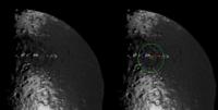
Visible is a large bassin in the western part of CR (inside the large green circle)
cut by the part of the ridge with the 'white peaks' (red line).
|
My impression is that its central peak (small green circle) doesn't coincide with the 'white peak' NW of it and it is also lower.
Thus the crater must be older than the 'white mountains'.
This 'white peak' seems to cast an enormous shadow (blue quadrangle) to its western side.
Is the equatorial ridge interrupted there?
Is there any ridge at all or only these 'white peaks'?
We'll see on September 10th ...

Till then, a 3-dimensional topographic analysis of the shadow casting in this region would be quite interesting I guess.
Anyone out there taking the task?
Bye.
Posted by: TritonAntares Apr 12 2007, 09:34 PM
Hi,
a global mosaic of the trailing side consisting of 15 footprints is now fixed. Resolution will be 422-456 m/pxl.
Final planning on other mosaics (particularly the 'White Mountains') will be completed in May.
Bye.
Posted by: TritonAntares Apr 22 2007, 10:29 PM
Hi again,
some more infos on the september fly-by:
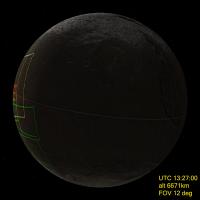
The observation window for the VIMS/ISS-request during closest approach will be about 4 hours (13:27 - 17:16 UTC),
image resolution of the ISS-telecamera 40...10...148 m/pxl.
A 2+2+3-mosaic of the equatorial ridge at 140° will first be taken under high phase angle.
Then the 'White moutains' (higher then 20 km?) will be imaged by WAC (~150 m/pxl).
During closest approach as phase angle will rapidly decline the equator region at 165° will be observed.
(at this longitude the ridge is presumably coming to an abrupt end).
After closest approach a scan with CIRS-spectrometer will be conducted at 12°S/168°W ('average dark terrain'), followed by a CIRS-Scan at 42°S/209°W ('average bright terrain').
Next a 1x6-mosaic of the 'White moutains' - now at low phase angle - will be taken. 1 hour after closest approach NAC resolution will be 40-50 m/pxl for this mosaic.
After that some infrarotspectrometer (VIMS) observations will be conducted, longitude hasn't been chosen so far.
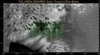
A large mosaic of the equatorial transition zone from west (~190°W) to east (~250°W) as 3x4 + 3x3 mosaic will be taken next. Duration roughly 1 hour, resolution 80-130 m/pxl.
Next there will be a 'terminator mapping' at 300°W, followed by the attempt to capure the 'Moat' in saturnshine.
Other observations will follow, e.g. the mentioned global mosaic of the trailing side consisting of 15 footprints (422-456 m/pxl).
Final planning for the fly-by will be finished by end of May, as Tilmann Denk from FU Berlin informed me.
Bye.
Posted by: TritonAntares Apr 27 2007, 08:34 AM
...some additional infos I recieved from Tilmann Denk yesterday:
During approach (Iapetus in high phase) polar regions of the saturn facing side should be imaged in saturnshine - resolution ~480 m/pxl.
Then the 'White moutains' (higher then 20 km?) will be imaged by WAC (~150 m/pxl).

Luckily 1-2 NACs could show the sun averted side of one of those peaks.
Saturnshine imaging of the 'Snowman' will be conducted from 24000 km, 77000 km and 101000 km, maximal resolution ~150 m/pxl, for sure an improvement to saturnshine pics from 2005-01-01.
As blurring from radial movement is roughly about 2 pixels the closest series will be exposed for only 18 sec - hopefully long enough...
The nearly unknown large basin in southern Roncevaux Terra will eventually get some attention around closest approach - resolution then ~250 m/pxl. But planning isn' t fixed so far...
A global sight (1.6 km/pxl) showing the whole trailing side - and certainly the basin - will be shot from 260000 km after the fly-by.
|
All information is primarily and there could/will be some changes and additions until the end of may.
Perhaps then we will also enjoy a new 'footprint map'...

Bye.
Posted by: ugordan Apr 27 2007, 08:44 AM
I'm really looking forward to this flyby. We should get some spectacular imagery, hopefully topping even Phoebe and Hyperion closeups. After several years of blurry looks through Titan's haze and bland/grayish moons, a little albedo difference and color should remind us just what ISS is capable.
I just hope those pesky http://en.wikipedia.org/wiki/Gremlin#The_airplane_gremlin_legend won't decide to jump in on this unique opportunity and spoil the fun.
Posted by: TritonAntares Apr 27 2007, 09:52 AM
I'm still surprised about the fact that the 'white mountains' won't fit the field of view of the NACs 15 minutes apart from closest approach... 
But I remember this Dione view from 2005-10-11:
|
It's part of this mosaic taken from ~20000 km distance:
http://www.unmannedspaceflight.com/index.php?act=Attach&type=post&id=1840
Simply breathtaking...
And now imagine, CASSINI will pass Iapetus in 1600 km minimum distance -
what a sight of this white peaks, the equatorial ridge and a structure not mentioned so far,
the 'dark triangle' seen in this simulation:
|
What the heck is this?
Bye.
Posted by: ugordan Apr 27 2007, 10:45 AM
What the heck is this?
Posted by: TritonAntares Apr 27 2007, 04:45 PM
Yes, of course the 'dark triangle' (green) has the same brownish color as Cassini Regio.
It seems to be made up of the dark floors of 2 midsized craters.
Other dark floored impacts (orange circles) join them in the bright area around.
High interesting region to get more information about the origin of the dark material and probably solve this mystery.
I marked the 'White peaks/Voyager Mountains' with blue crosses - some of them may be questionable.

|
And a series of some old Voyager pics showing the peaks at the limb:
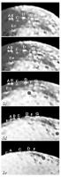
|
I tried to mark them in the part of Steve's map (A-G).
Also visible on the map is this old large crater in the west of Cassini Regio I mentioned in http://www.unmannedspaceflight.com/index.php?showtopic=3782#4.
It seems to be older than the white peaks inside and thus older than the equatorial ridge of which the peaks are presumably part of.
Bye.
Posted by: TritonAntares Apr 27 2007, 09:13 PM
While having a closer look at Steve's map I got aware of a structure not mentioned before as far as I remember:

|
If it's real it must be the largest basin on Iapetus.
The northern part of Roncevaux Terra was imaged in saturnshine, so contrast is rather low
and you don't really get aware of its rim compared to that of the basin in eastern Cassini Regio.
Bye.
Posted by: TritonAntares Apr 28 2007, 10:08 AM
Btw.,
some nomenclature of craters in northern Roncevaux Terra:
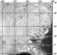
|
All craters are named after characters from the http://en.wikipedia.org/wiki/The_Song_of_Roland -
the oldest major work of French literature, composed between 1075 and 1110.
This link also offers a list of all acting characters - so we've got some names left for all those craters in Roncevaux Terra still unnamed...
After Sep.10th IAU will hopefully eventually carry on giving offical iapetean designations.
Bye.
Posted by: scalbers May 5 2007, 03:08 PM
TritonAntares that's an interesting image you are showing in post #12 with the possible basin outlines. I have part of that region on my map, and I wonder if the image you are showing can be filtered enough to remove the glare (if it can add territory to the map).
By the way I've made a new Iapetus map update. Time flies as it's the first update in about 11 months. I was able to refer to Ugordon's image to get my bearings better and the new map has more consistent navigation of the images in the southern portions of the Saturn facing hemisphere (near the edges at zero degrees longitude). I may try making some south polar views to help check/refine things further.
http://laps.noaa.gov/albers/sos/sos.html#IAPETUS
Posted by: TritonAntares May 5 2007, 04:29 PM
Hi Steve,
I must admit it was not your map I used for this section of northern Roncevaux Terra... 
|
|
Compare these 2 maps:
http://photojournal.jpl.nasa.gov/jpeg/PIA07778.jpg
http://laps.noaa.gov/albers/sos/saturn/iapetus/iapetus_rgb_cyl_www.jpg
-click to enlarge-
Bye.
Posted by: TritonAntares May 13 2007, 09:22 PM
Hi,
here a nice animation Tilmann Denk posted lately:
|
It shows the area (yellow line) visible from Cassini 20 min before until 20 min after closest approach. C/A at 2007-09-10, 14:15:40 UTC (16:15:40 MESZ).
As the field of view of both cameras (NAC & WAC) is much smaller than the theoretical observable area we'll only get images of some parts inside - exact footprints can hopefully be added soon.
The blue line marks the terminator - images in saturnshine are planned as mentioned above, but in a later stage of the encounter.
SSP -> sub-solar point
S/C -> sub-spacecraft point
Bye.
Posted by: tasp May 14 2007, 02:50 AM
{Sorry if this has already been asked and answered}
Have we pinned down whether or not Cassini can take a picture faster than once a minute ??
Posted by: ugordan May 14 2007, 08:25 AM
The long answer would be: depends.
There are a number of factors determining the timeout for the next picture, for an explanation of the specifics refer to http://pubs.giss.nasa.gov/docs/2004/2004_Porco_etal.pdf, section 3.7 (page 457). Depending on whether NAC and WAC are used simultaneously, image compression type, telemetry pickup rates and other instrument (VIMS, CIRS... ) simultaneous operation, a typical 1x1 binned ISS frame will take somewhere from 30 to 60 seconds before the next one can be taken. 45-ish seconds is a good rule of thumb IIRC.
I think it's reasonable to expect no more than 50 frames from WAC and NAC (so 100-ish total) in the 40 minute timeframe of the above animation.
Posted by: TritonAntares May 24 2007, 06:27 AM
Hi,
I think I should put this here:
|
Really deep hit there - but also the height of the equatorial mountain range above the 'Snow Man' is striking!
Bye.
Posted by: Exploitcorporations May 24 2007, 07:11 AM
Thought you might enjoy that one. If anyone is an advocate for snowmen, it's you.
Posted by: ugordan May 24 2007, 07:23 AM
Whoa. What's the source for that image?
EDIT: Ah, nevermind, found it. 
Posted by: TritonAntares May 26 2007, 04:19 PM
Hi,
lately arrived - these two 'footprint maps' of the fly-by:
(1) Inbound before C/A:
|
...
Posted by: TritonAntares May 26 2007, 04:23 PM
...
(2) Outbound after C/A:
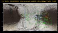
|
I'll add some infos about resolution (different footprint colors) and camera types (NAC/WAC) later...
Bye.
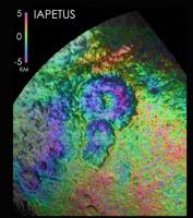
Posted by: Phil Stooke May 26 2007, 04:37 PM
Comparing the DEM and the global maps, we see another segment of the equatorial mountain ridge. It really is global, as TritonAntares said above. Truly bizarre. I'm not happy with any of the suggestions for its formation, but I draw a complete blank when I try to figure it out.
Phil
Posted by: Rob Pinnegar May 26 2007, 05:10 PM
Could someone put up a link to the source of that topographic map? I've looked in several of the usual places for it, and can't find it for some reason. Is there more where that came from?
Edit: Never mind, here's the link; and there *isn't* more where that came from:
http://www.lpi.usra.edu/meetings/lpsc2007/pdf/2305.pdf
Posted by: TritonAntares May 26 2007, 11:58 PM
I'll add some infos about resolution (different footprint colors) and camera types (NAC/WAC) later...
(1) Inbound:
|-> equatorial ridge under high phase (~120° ) / ~30 m/pxl (NAC)
|-> Voyager mountains under 90° phase at the horizon in WAC
|-> observations around C/A: phase 83° to 29° in 18,25 minutes / 10 m/pxl (NAC)
yellow lines-> change of limb from CASSINI
blue lines-> terminator
(2) Outbound:
|-> observations around C/A: phase 83° to 29° in 18,25 minutes / 10 m/pxl (NAC)
|-> dark-bright transition zone at medium latitudes, ~250 m/pxl (WAC)/ ~50 m/pxl (NAC)
|-> Voyager mountains, NAC ~45 m/pxl (NAC) + 1 WAC
|-> 2 small boxes more left, 25 minutes for VIMS-spectrometer
|-> mosaic of equatorial transition zone, ~1h / ~100 m/pxl (NAC) + 1 WAC
|-> terminator left / ~140 m/pxl (NAC) + Snowman in saturnshine (low phase)
|-> 15 pics mosaic, ~440 m/pxl (NAC)
Borders for last series:
yellow lines-> limb from CASSINI
blue lines-> terminator
We'll see a variety of surface structures, only one image (orange box) is sadly missing in the light green and blue mosaics:
|
The great southern Roncevaux Terra Basin will show up under lower resolution in pic 3, 4, 5 and 6.
Finally let me thank Tilmann Denk for sharing these 2 illustrations!
Bye.
Posted by: mchan May 27 2007, 06:23 PM
And thanks, Trtion Antares, for sharing them in UMSF. I have looked forward to this encounter from before SOI, and the excitement continues to build.
Posted by: ugordan May 29 2007, 11:53 AM
There's a new Iapetus color image on Cassini's home page: http://saturn.jpl.nasa.gov/multimedia/images/image-details.cfm?imageID=2621
It hasn't appeared on CICLOPS yet, probably within an hour of two.
As far as I know, this is the first actually "natural" color image of Iapetus released by the imaging team where they used RGB filters instead of infrared/ultraviolet filters. While the image itself is magnified and Cassini Regio is barely visible, it shows what I've been pointing out for a while, the color of the dark stuff is much subtler than the "cool" chocolate appearance portrayed in all previous CICLOPS composites.
This latest color image is more consistent with approx. natural color composites such as http://flickr.com/photos/ugordan/443822486/ and http://m1.freeshare.us/126fs4520674.jpg. See http://ciclops.org/view.php?id=1707 for a typical example of previous false color views for comparison.
Posted by: CAP-Team May 29 2007, 12:59 PM
Wow, almost a black and white image!
Posted by: ugordan May 29 2007, 02:01 PM
That particular image looks b/w because the bright ice is so much brighter than Cassini Regio the latter turns out very dark and color is practically lost. It does have color (even a bit of detectable color variation in approx. natural colored images), but it's best seen on views centered on the leading side (basically all earlier Cassini views) so image brightness can be optimized for low albedo material without overexposing the brighter (some 10x brighter) ice. If the color were as pronounced as in those enhanced color views, there still would be color visible even in this low resolution view.
Had that image been scaled up to brightnesses of http://ciclops.org/view.php?id=707, the "clean" ice visible would be severely overexposed. Iapetus is all about contrast.
Posted by: TritonAntares May 30 2007, 01:29 PM
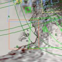
We'll see a variety of surface structures, only one image (orange box) is sadly missing in the light green and blue mosaics:

|
The great southern Roncevaux Terra Basin will show up under lower resolution in pic 3, 4, 5 and 6.
Fortunately now there will be a 250 m/pxl look at this basin - not highest resolved, but a 3 color summation mode and a full-resolution clear image...

|
This footprint was luckily added ahead of the VIMS_049IA_IAPETUS013_PRIME images (rectangles above).
Bye.
Posted by: TritonAntares May 30 2007, 07:27 PM
...btw,
as Celestia isn't installed on my Computer right now - and I'm to sluggish to do it this evening - may be SOMEBODY on this forum could be so kind to create and post an animation of September's fly-by using this map:

|
(180° correction was done)
THX & Good night!
Posted by: TritonAntares Jun 23 2007, 09:23 AM
Hi - after a while...
A pity no one using Celestia was able to animate a fly-by sequence with my map so far... 
Couldn't anybody be so kind ?
THX & bye.
Posted by: volcanopele Jun 23 2007, 09:41 AM
I can give it a try tomorrow
Posted by: TritonAntares Jun 23 2007, 10:42 AM
Would be tremendous...
|
|
Posted by: BrianJ Jun 30 2007, 10:54 AM
Thought this might be fun, so I gave it a go, hope it's OK to post the results here.
Images rendered in Orbiter (graphics not as slick as Celestia, but does the job). Cassini vectors and orbital elements for Iapetus from JPL Horizons. Note: Horizons gives two different values for the radius of Iapetus, 718km or 734.5km - I use the latter.
Animation:
4.9Mb animated .gif (600 x 800), 1 frame per 100s simulation time, 30deg FOV (top to bottom), covers 3.5 hours from 20 mins before close approach
http://images.canoop.com/images/nkmmydaexmydmzxi5od5.gif
(download speed is a little slow, so you may find it easier to right-click link and "save target as" and view at your leisure)
Stills:
The .gif is not that clear in the later stages of flyby, so here's a few screenshots (600 x 600 .jpg)
http://img161.imageshack.us/img161/9579/cassiap1nw3.jpg
http://img515.imageshack.us/img515/7343/cassiap2we2.jpg
http://img161.imageshack.us/img161/5696/cassiap3ox7.jpg
http://img515.imageshack.us/img515/4346/cassiap4mz3.jpg
http://img507.imageshack.us/img507/2824/cassiap5ig6.jpg
http://img161.imageshack.us/img161/2382/cassiap6so3.jpg
Cheers.
Posted by: TritonAntares Jun 30 2007, 06:14 PM
Hi Brian,
many thanks for this nice work... 
Bye.
Posted by: volcanopele Jun 30 2007, 06:30 PM
I'm sorry I was never able to get that done. Celestia kept crashing whenever I tried that map. I think it might have something to do with the fact that it isn't one of the standard sizes for the maps Celestia uses. Celestia is supposed to handle those now so I suspect this is another issue one could chalk up to my slow laptop.
Posted by: hendric Jul 1 2007, 03:46 AM
Jason,
Any chance we could get a Kodak Moment as Saturn is rising over the edge of Iapetus? I noticed it during the animation, but I don't know what kind of footprint a WAC frame would make at that range.
ObFunny: At first, reading Belleraphon1's comment about "except they will have to put up with my tears and crying when I see a Saturn rise.....", I was thinking, "When did Cassini get a picture of that?!? Wait, it's an Apollo movie, maybe they took a picture of Saturn rising above the horizon...But the only photo I can think of is of Earth rising....Waitasec -*SMACK*-  Duuuuuuuuuuhhhhhh. Sometimes I miss the glaringly obvious...
Posted by: TritonAntares Jul 13 2007, 07:33 PM
Hi once again,
as Titan 048TI (T34) Mission Description for July 19th has been published,
I'm wondering when such a paper will follow for Iapetus 049IA ?
Shouldn't be that far away...?
Bye.
Posted by: Rob Pinnegar Jul 18 2007, 02:33 AM
There's an interesting little piece up today on the Cassini main website regarding the history of Iapetus. Short version: It asserts that the "belly band" is primordial and dates back 4.5 Gyr at least.
If this notion is borne out by the September flyby, it is going to have some *major* repercussions for the various theories regarding the "late heavy bombardment". Models that require a lot of chaos in the outer Solar System due to Jupiter/Saturn 2:1, or late formation of Uranus and Neptune, are going to have to explain how the bellyband managed to survive -- even in its current beat-up state -- with so much debris flying around out there.
It could provide an indirect boost to the Planet V hypothesis, I suppose. Process of elimination and all that.
Posted by: scalbers Jul 21 2007, 04:31 PM
|
|
This footprint was luckily added ahead of the VIMS_049IA_IAPETUS013_PRIME images (rectangles above).
Bye.
Glad to see this was recently included for ISS imagery. Among other things, this should show the "face" region (see the "New Iapetian image series" thread) located at the lower right corner of the bottom green VIMS rectangle.
I hope to soon be able to post an updated full resolution Iapetus map along with Celestia view for this encounter.
Posted by: scalbers Jul 23 2007, 05:36 PM
Here's my updated Iapetus map at this URL that has images from July 8, 2007 and October 2004 added:
http://laps.noaa.gov/albers/sos/sos.html#IAPETUS
Posted by: scalbers Jul 28 2007, 06:11 PM
Here with the help of Celestia is my reckoning for how Iapetus will look to Cassini on September 12. Since it's the weekend I'll try and see if I can upload/attach this image directly...

|
Posted by: TritonAntares Jul 28 2007, 06:51 PM
What a massiv basin it really is - nearly a third of Iapetus diameter... 
Posted by: scalbers Jul 28 2007, 10:53 PM
I'll try attaching a quick Celestia movie if it can fit in the size limit... iapetus6.avi ( 481.5K )
: 967
iapetus6.avi ( 481.5K )
: 967
Posted by: scalbers Jul 28 2007, 11:03 PM
Here's a second version of the movie that focuses more on the closest approach...
iapetus7.avi ( 475K )
: 959
EDIT:
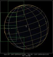
I've made a longer version of the movie (3MB) as well at the link shown below. Celestia has the closest approach too far away at about 5000km, though at farther ranges the animation should be fairly realistic.
http://laps.noaa.gov/albers/sos/saturn/iapetus/iapetus9.avi
Posted by: MarcF Aug 1 2007, 07:50 AM
Some more informations about the September flyby :
http://www.cosis.net/abstracts/EPSC2007/00406/EPSC2007-A-00406.pdf?PHPSESSID=d590e745f486da49f076ebb8f800aea1
A SAR observation will be performed, the only one of an icy satellite.
Will it help to determine the thickness of the dark material (or reveal hidden structures) ?
Marc.
Posted by: tasp Aug 1 2007, 02:04 PM
Wow !!
Perhaps we can characterize the surface roughness for a possible Iapetan rover someday with a SAR observation.
I would love to see a scan of Atlas too, maybe it would reveal new info on the accumulated ring materials.
Posted by: scalbers Aug 4 2007, 06:59 PM
A fast moving view covering the entire month before encounter, then some time afterwards...
Posted by: Decepticon Aug 5 2007, 01:24 AM
Are there night side images planned?
Posted by: nprev Aug 5 2007, 01:37 AM
I'm thinking that the radar obs are going to be primarily conducted during C/A for surface mapping, mostly due to the fact that it will be dark there...good use of resources!
Posted by: TritonAntares Aug 5 2007, 10:17 AM
As far as I'm informed there'll be some attempts to catch the Snowman at the western limb hours after C/A.
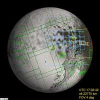
|
5 images along the terminator (blue line) and 2 pics of the 3 craters in saturnshine area.
Before C/A there is no possibility of saturnshine images, because CASSINI is observing the anti-saturn hemisphere, I guess.
A perfect opportunity for radar mapping...
|
Bye.
Posted by: Rob Pinnegar Aug 5 2007, 12:29 PM
There probably wouldn't be much point in trying to get Saturnshine images of the Snowman. The last set required some pretty long exposures, but since they were taken from 100 000 kilometres out, that didn't cause any problems.
For this encounter, though, Cassini will be so much closer in that any attempt to take Saturnshine images would probably lead to some awful smudging. This would be due to changes in the apparent size and shape of image features during the course of the exposure -- so tracking the camera wouldn't help.
So using the SAR instead seems like a really good idea.
Posted by: TritonAntares Aug 5 2007, 01:55 PM
For this encounter, though, Cassini will be so much closer in that any attempt to take Saturnshine images would probably lead to some awful smudging.
This would be due to changes in the apparent size and shape of image features during the course of the exposure -- so tracking the camera wouldn't help.
|
They'll definitly try to do these two saturnshine shots with a resolution of ~140 m/pxl (NAC).
Maybe somebody can calculate the appendent distance.
We'll see how smeared they actually are. As this is the only opportunity to have a close look at the Snowman, it should better not be missed.
A bad pic is better than none...
Btw., the eastern edge of Snowman C will be in sunlight at the limb.
The dark green lined 15-image-mosaic will be taken hours later at ~440 m/pxl (NAC).
Bye.
Posted by: Rob Pinnegar Aug 5 2007, 10:43 PM
I suppose it'll be okay as long as the images are taken long enough before closest approach. I guess that when Cassini is near closest approach, there won't be time for long exposures, anyways.
It'll be interesting over the next 40 days to see Iapetus get closer and closer.
Posted by: scalbers Aug 5 2007, 10:48 PM
Possibly even daylight images would be challenging right at closest approach. Is it true that the closest imagery planned is for the Voyager mountains? If so what would be the range of Cassini for those images?
Posted by: ugordan Aug 5 2007, 10:52 PM
140 m/pix translates into roughly 23 000 km range. Alternatively, if they plan on doing a 2x2 binning mode (useful if smear is expected to be >1 pix) that would be halved. A 2x2 bin has an additional advantage in that it increases the s/n ratio 4 times for the same exposure, but at the expense of spatial resolution. Even at 23 000 km the smear would probably less than one pixel for an exposure on the order of a couple of seconds.
Steve, I don't think daylight images will present a problem for Cassini. Remember the flyby speed will be much lower than typically at Titan (6 km/s) and especially Enceladus. Cassini managed to keep pretty stable pointing & tracking for the haze-penetrating CB3 filter even at those speeds and even with thrusters. The CB3 filter requires quite a long exposure to achieve good s/n ratio so this is indicative of the performance we can expect at a more leisurely flyby.
Posted by: scalbers Aug 5 2007, 11:04 PM
Hi Gordan. Good points - I was thinking that the closest approach is around 1200km and that it'd be unlikely images would be right at that distance. There is some background info in post #7 about some close images that are so close the Voyager mountain targeting would be uncertain. Perhaps those are only at 2000km range that would be quite a bit closer than Enceladus.
Posted by: ugordan Aug 5 2007, 11:20 PM
Ahh, I see post #7 has all the relevant information about saturnshine images as well. My impression from that post is that it's the targetting that's uncertain, not the camera's ability to produce smear-free images. Once targetted, Cassini can inertially track very well. In fact I'd say the limiting factor in the encounter will be the slow camera image rate and the lack of a scan platform for quick mosaicking several overlapping footprints a-la Galileo. Even if the NAC misses the white peaks, we'll still get pretty good context from the WAC I imagine. Remember the Rhea flyby when that 'splat' crater was of interest - even the WAC frame got some seriously high resolution at some 500 km distance.
A WAC frame at 1500 km is still 10x higher resolution than the best NAC coverage we got on New Year's Eve!
Posted by: Rob Pinnegar Aug 6 2007, 02:13 PM
Ohhhh, right -- I had forgotten about this when typing my earlier post.
The flyby geometry is really interesting. In early September, the apoapsis of Cassini's orbit will be just a little bit further out than Iapetus' distance from Saturn, but the semimajor axis of Cassini's orbit will of course be much smaller. This means that, when Cassini is furthest from Saturn, it will be a bit farther away from the planet than Iapetus, and will also be moving much more slowly than Iapetus.
This allows Cassini to pass "in front" of Iapetus on the outbound leg, and then watch as Iapetus overtakes it. Then Cassini drops back towards Saturn as Iapetus moves away. This allows quite a variety of observing angles during the whole encounter.
Posted by: scalbers Aug 6 2007, 02:56 PM
Interesting - this might be worth a Celestia animation or something. Another aspect of the great planning is that while it is of course passing over the daylit side, Cassini is traveling around Iapetus in the same direction that each terminator is moving so we end up seeing more than 180 degrees of longitude that is sunlit over the encounter.
Posted by: Rob Pinnegar Aug 6 2007, 05:55 PM
A little bit, yes. In the first few days after C/A, Cassini will recede from Iapetus at almost exactly 200 000 kilometres per day. You can check this easily in the Solar System Simulator.
[Edit, Aug 10th: The point of this is that Cassini will be fairly close to Iapetus for several days, so, as Steve noted above, we'll get a bit more than 180 degrees of coverage. I didn't make that very clear the first time.]
This means that we'll be getting about 14-15 hours' worth of images that will all be better than the ones from the New Year's flyby.
Posted by: mchan Aug 7 2007, 02:03 AM
That would be great. Now only if there is sufficient data storage for Cassini to continue taking data instead of having to transmit earlier stored data to free up space.
Posted by: TritonAntares Aug 10 2007, 07:27 AM
Cassinis journey at Saturn continues with Rev 49, its 50th orbit of the ringed planet. Cassini has a full plate during this more than one-month-long orbit, as the spacecraft observes Saturn, its ring system, and four of its satellites: Titan, Tethys, Rhea, and Iapetus.
.....
Fast approaching is Iapetus. Cassini will perform its only targeted encounter with the two-toned moon on September 10. Several observations are planned for Iapetus as Cassini approaches, during the first 10 days of September.
Check back on September 6 for more details on this exciting encounter.
Onward to Iapetus!
Be patient, we'll have to wait a while...
Posted by: Rob Pinnegar Aug 10 2007, 01:52 PM
This bit about Cassini making observations of Iapetus in the days leading up to the encounter must have to do with Saturnshine observations. So maybe we'll get a better look at Snowman after all.
Posted by: scalbers Aug 11 2007, 04:52 PM
...and perhaps the Snowman and environs to the SE will get some interesting viewing angles after closest approach. Even though Cassini is moving away there are several days where the terminator is marching so we can watch the sunrise at Snowman.
And here's an initial take on a Celestia animation over the next month looking from above. The sunlight comes from the top with Cassini and Iapetus at the "C" and "I", respectively.
iapetus16.avi ( 717K )
: 290
Posted by: ugordan Aug 15 2007, 05:23 PM
Emily's latest http://www.planetary.org/blog/article/00001081/ has some info on the upcoming flyby, she apparently talked about it in detail with Tilmann Denk himself.
Posted by: MarcF Aug 16 2007, 09:29 PM
Ices, oceans, and Fire: Satellites of the Outer Solar System (2007)
Tilmann Denk's abstract about the Iapetus flyby:
http://www.lpi.usra.edu/meetings/icysat2007/pdf/6049.pdf
Eleven ISS mosaics are planned for the time period -55 to +180 min around closest approach.
Spatial resolution down to 10 m/pxl with ISS.
And a lot of scientific highlights with all the other instruments (SAR, UVIS, CIRS VIMS, ...).
Less than one month to wait !!
Marc.
Posted by: scalbers Aug 16 2007, 10:41 PM
I was also at the Outer Planet Satellite conference - a local one for me in Boulder. I had a chance to talk about Iapetus a bit with Tilmann Denk (and saw Emily there as well). One item relevant to targeting is how close the Voyager mountains are to the equator. The yellow outlined footprints (post #32) are centered just a bit south of the equator. In my map (that could be off a couple of degrees), they are south of the equator in the southern part of the imaging footprint. Tilmann thinks they may actually lie more exactly on the equator that would bring them up into the northern part of the footprint. Either way, hopefully they will indeed show up in that rather high resolution mosaic.
He mentioned they have some ability to tweak the timing of the imaging sequence until very near the encounter based on the latest navigation updates. There was a very nice table of the images on his poster that Emily alludes to in her blog.
Tilmann had on his poster a few RGB filter images. One of these was from the July 2007 encounter showing the Roncevaux Terra basin region near the limb having nice contrast without the JPEG artifacts. We also had a good exchange about the "basin gap" question, though perhaps we'll have to wait until the September imaging to reach a consensus about what is really going on in terms of possible double rims/basins
[EDITED Aug 18 1600 UTC]
Posted by: Tom Tamlyn Aug 17 2007, 04:17 AM
http://www.lpi.usra.edu/meetings/icysat2007/pdf/6049.pdf
Thanks for posting that url. Quoting Denk's abstract:
>the only SAR observation of an icy satellite (RADAR); *** best-ever examination of
>outer-solar system dark material (VIMS);
I haven't been following the icy satellites as closely as many UMSF members, but it seems odd that this is the only time that SAR is being used to observe an icy satellite. If that's correct, what's the reason?
And what is "outer-solar system dark material?" Is that just another way of referring to the dark side of Iapetus?
TTT
P.S. I'll take this opportunity to thank Emily for her indefatigable blogging of the Ices, Oceans & Fire conference in Boulder. Much appreciated. Why can't they schedule one of these conferences for NYC?
Posted by: remcook Aug 17 2007, 08:36 AM
I think the dark material is also for instance the stuff found on Phoebe:
http://www.nasa.gov/lb/mission_pages/cassini/multimedia/pia06400.html
but I'm not sure...
"Why can't they schedule one of these conferences for NYC"
next year's DPS is in Ithaca, which is as close as you're going to get it I guess.
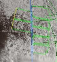
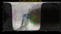
Posted by: TritonAntares Aug 17 2007, 09:34 AM
Hi,
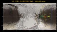
the following footprint-map (taken from Tilmann Denk's above mentioned abstract) shows a 4x3 and 3x3 NAC-mosaic of 82-131 m/pxl resolution:
|
Any idea of the WAC-resolution of the large field on this map?
This image could be crucial for major findings in this transition region, as the area is over 3 times larger than the one covered by the mosaic.
THX & Bye.
Posted by: TritonAntares Aug 18 2007, 09:02 AM
Hello again,
there will be 4 footprints of the Iapetus cresent (map also from Tilmann Denk's abstract) taken hours before C/A at about 490 m/pxl:
|
Here what Solar System Simulator shows for the time window of the 4 images:

|
|
Distance will be between 70000 and 69000 km.
I'm just wondering about the saturnshine hemisphere...
|
If I'm right, Saturn should illuminate the 'backside' of the of Iapetus at inferior conjunction,
thus the hemisphere shown at superior conjunction (270°-90°) - most of Cassini Regio and the Snowman.
There seems to be no try to catch parts of this saturnlit hemisphere before C/A -
I assume the cresent images won't be overexposed - from this distance !?
Otherwise, there do exist numerous pics of Cassini Regio by now.
Bye.
Posted by: Rob Pinnegar Aug 18 2007, 04:33 PM
Regarding the "basin gap" question, check out this old abstract by Denk et al:
http://ciclops.org/media/ma/2007/2748_7462_0.pdf
If you look on Page 2, the second figure from the top shows several low-resolution, distant shots of the Roncevaux Terra basin during a multi-day sunrise.
I can't see a double-basin rim, myself.
Posted by: scalbers Aug 18 2007, 05:39 PM
Fascinating set of Aug 2004 images Rob that I see here for the first time. This will be worth analyzing further. Hopefully (in spite of some travel plans) I'll have the time to do this before mid September! Quite the central peak showing up on the terminator. I could try and add some of the images to my map to help the intepretation. Would anyone happen to have any images (or at least dates), say from the PDS? The Cassini raw images page appears to be overexposed and perhaps is incomplete.
What I've been showing as the eastern member of the pair of basin rims may have too low of a contrast with the higher solar elevation angle (and greater limb foreshortening) to show up at the ~50 km/pix resolution of the August 2004 images. Running this in Celestia is helpful - I think I can identify the "dark triangle" feature as a reference. Below is a possible fit to the second image in the row from Tilmann's abstract. In this scenario the central peak near the terminator in Tilmann's image isn't showing up in the July 2007 imagery as the solar elevation also was higher there.
|
(post edited 1832 UTC Aug 18)
Posted by: ugordan Aug 18 2007, 06:45 PM
|
And here are the 12 opnavs you want taken in August 2004, the bottom row is sharpened:
|
|
Both composites are 16-bit PNGs, not that it matters much. No resizing done.
And a quick, 4x magnified animation of all 13 frames:

Posted by: TritonAntares Aug 18 2007, 06:55 PM
Damn, now I remember reading Tilmann Denk's abstract in 2005 and especially those far distant image series showing the large Roncevaux Terra basin... 
|
|
Doesn't really look like double impact structure any more - but the extent of the central peak is enormous!
Steve, the "dark triangle" is certainly visible in the two pics on the left.
Bye.
Posted by: scalbers Aug 18 2007, 07:19 PM
Ugordon's 13 frame animation is pretty cool. I think the first frame or two have better lighting conditions and actually display a bit of shadowing that betrays the presence of a second eastern basin rim
Posted by: Phil Stooke Aug 18 2007, 10:34 PM
I must confess that the animation seems to me to show just the one rim plus the central mound, not a double rim. I still hold out for one rim. But time will tell.
Phil
Posted by: scalbers Aug 18 2007, 10:39 PM
Yes, the nice thing about this question is that it is likely to be definitively answered in a few weeks. I wonder though what that shading east of the main rim is that shows up in the first frame of the animation? It quickly disappears as the lighting changes, just as the main eastern rim shadow subsequently disappears as its lighting changes.
I would predict that if I project the first frame as an overlay onto my existing map we'd see these two apparent rims match on top of the ones I presently am mapping. Or I could be patient and wait
Posted by: ugordan Aug 18 2007, 11:08 PM
I don't know, I'm inclined to say one rim only judging by these views alone. Bicubic filtering can play tricks as well, here's an old style enlargement:
The data is too low-res to make a good case, but I would expect a different lighting pattern there in case of 2 rims.
T-22 days and counting...
Posted by: scalbers Aug 21 2007, 10:35 PM
I guess I found a little bit of time after all. I added a quick remap of the first of ugordon's frames into the blinking GIF I posted in another Iapetus thread. This illustrates how I see a number of interesting features lining up in the various combinations of images:
http://laps.noaa.gov/albers/sos/saturn/iapetus/iapetus_blink_map_2x_070821a.gif
That's the latest,
Posted by: monitorlizard Aug 22 2007, 06:23 PM
Tom Tamlyn asked why the upcoming Iapetus flyby is the only use of the radar instrument on an icy satellite. This is a question I'm interested in as well. This is an educated guess based on what little I know of Cassini. First of all, SAR uses an enormous amount of Cassini's memory to store its data. I think most of the Titan flybys that imaged in SAR had few other instrument observations, partly because of data storage requirements and partly because Cassini has no scan platform so the entire spacecraft has to change its orientation to use different instruments.
The amazing thing is probably that Cassini WILL use its radar at Iapetus in addition to most of its other instruments. I suspect it will be a very small snapshot, not primarily for imaging but to provide data on the physical characteristics of the surface material.
If radar at Iapetus turns up something unexpected, then perhaps we will see it used for other future icy satellite flybys (keeping in mind it can only be used at close range, I think less than 1000 km). It seems to me that it would be interesting to use it on a close flyby of Enceladus's tiger stripes during the extended mission to further characterize the surface at plume eruption sites.
But all this is just bait to bring in someone who really understands the situation to explain it to us.
Posted by: Michael Capobianco Aug 22 2007, 07:13 PM
That wouldn't be me. I could imagine using SAR to better understand the morphology of the equatorial ridge and white mountains, though.
Posted by: JRehling Aug 22 2007, 07:16 PM
I think these are all clearly factors:
1) RADAR eats up a lot of observing time and even attitude-control propellant. As well as, monitorlizard points out, onboard data storage.
2) RADAR has a much worse spatial resolution than ISS. RADAR returns 300m/pix imagery of Titan at 950km altitude. ISS, in contrast, returned about the same resolution of Iapetus from 55,000 km away. If you don't have the veils of Titan to contend with, the price-performance curve of these two instruments is very lopsided.
3) Nobody's expecting big surprises in the regoliths of the icy satellites. Not at 300m/pix resolution, anyway, if you can get, instead, 10m/pix visible resolution.
While I'm sure that if a full RADAR dataset of the icy satellites existed, they'd want to look at it instead of throw it away, the cost of using RADAR is very slim compared to the expected gain. Even Titan is only going to receive a few dozen RADAR scans -- there's no way they'd want to burn half a dozen more sampling each of the icy satellites, losing the ISS imagery that could have been had.
I might opine that a single RADAR stripe on *one* icy satellite might be a worthwhile peek to see if there are any surprises in the impact-regolith that dominates their surfaces. Again, it's a cost-value decision, I'm sure. Maybe in the extended mission, but I think if they did want to try it, they'd want to examine Enceladus's active features rather than bland impact-cratered highlands.
Final note: radar from Earth can be used on these satellites to determine the gross reflectivity in radar bands. So even that goal would be a waste of Cassini's resources when it can be done at our leisure from a billion miles away. The only use of RADAR would be to map a place much better than from Earth but much worse than ISS.
Posted by: Mariner9 Aug 22 2007, 08:07 PM
I seem to remember reading somewhere that Radar can give you information about surface roughness. In other words, average size of the rocks, pebbles, or snowballs, as the case may be.
Since there is a major debate as to what the difference is between the light and dark regolith on Iapetus, perhaps radar can offer one more (and unique) piece of data to help.
Another factor might be the relatively slow encounter speed. When Cassini is close to the lowest (and fastest) part of it's orbit, it can take only a relatively few measurements of the inner moons furing a flyby. But it will be at it's apehelion when encountering Iapetus, so it will have much more time to cycle between the vastly different pointing requirements of the ISS vs. RADAR.
Posted by: JRehling Aug 22 2007, 08:42 PM
Since there is a major debate as to what the difference is between the light and dark regolith on Iapetus, perhaps radar can offer one more (and unique) piece of data to help.
This should be possible to do from Earth. The resolution would be terrible (pretty much one "pixel" for the whole moon), but since the light and dark surfaces are pretty much two different hemispheres, it should be possible to do some investigation from the good ol' Earth.
In fact, Earth-based radar has been used on Iapetus.
Radar Detection of Iapetus
Gregory J. Black, Donald B. Campbell, Lynn M. Carter, and Steven J. Ostro
Science 23 April 2004:
Vol. 304. no. 5670, p. 553
Cassini RADAR has also been used for radiometry (not SAR) on many of the icy satellites.
Cassini RADAR observations of Enceladus, Tethys, Dione, Rhea, Iapetus, Hyperion, and Phoebe
Ostro, et al
Icarus, Volume 183, Issue 2, p. 479-490.
"Iapetus' 2.2-cm radar albedo is dramatically higher on the optically bright trailing side than the optically dark leading side, whereas 13-cm results reported by Black et al. [Black, G.J., Campbell, D.B., Carter, L.M., Ostro, S.J., 2004. Science 304, 553] show hardly any hemispheric asymmetry and give a mean radar reflectivity several times lower than the reflectivity measured at 2.2 cm. These Iapetus results are understandable if ammonia is much less abundant on both sides within the upper one to several decimeters than at greater depths, and if the leading side's optically dark contaminant is present to depths of at least one to several decimeters."
So the gist is: similar at 13cm, much darker (= smoother?) on the dark side at 2.2 cm. This could tell us about the surface roughness at different scales, or about the composition.
Anyway, SAR mode would tell us something different than radiometry, and it's that kind of observation that is so expensive in terms of operations, etc.
Posted by: monitorlizard Aug 22 2007, 10:06 PM
Radar can tell you if a surface is rough or smooth at a scale equal to the wavelength of the radar. That would provide general information (but not image resolution) better than the ten meter ISS resolution that Cassini will achieve at Iapetus. I'm a little out of my depth here, but I believe I've stated it correctly.
Posted by: JRehling Aug 22 2007, 10:30 PM
That's true, but you can do the same thing from the Earth. You would get data that averages over a large footprint on Iapetus, but that would enable a comparison between the two kinds of surface. Indeed, the citation I provided to an article in Science reports on just such a comparison. Using Cassini to do this can be done from farther away, and needn't be done at the precious encounter. SAR must be done up close -- radiometry can be (and already has been) done from farther away.
Posted by: tasp Aug 22 2007, 10:42 PM
With no particular evidence at all, I had just figured the radar scan would provide surface roughness estimates across it's swath to perhaps support a future rover mission.
If the 'original' Iapetan surface materials are distinguishable in some regard from the (possible) emplaced ringy material making up the ridge structure, that would be interesting to.
If an oblique impactor lofted materials that formed a ring system, the impactor might have had a differing composition and it's incorporation into the ring materials, and the subsequent emplaced structure, might yet be discernable.
Posted by: monitorlizard Aug 23 2007, 06:46 PM
I don't know how Cassini's radar will be used at Iapetus, but here's a thought: if radar imaged a thin strip of the surface that crossed the boundary between the dark and light materials, you could look for changes in surface roughness. You could see if the transition from one region to the other were characterized by a gradational change or sudden change in surface roughness. That could provide evidence to support an endogenic or exogenic origin of the dark material, especially if combined with data from other instruments.
Unfortunately, that sounds like it might use too much data storage, but just maybe the Cassini extended extended mission will look favorably at another close Iapetus flyby.
Posted by: Toma B Aug 24 2007, 10:04 AM
Hi!
I have just noticed what is the "Wikipedia's picture of the day for Sept 1st.
http://en.wikipedia.org/wiki/Wikipedia:Picture_of_the_day/September_2007
That's our Ugordan's image!!!
Posted by: ugordan Aug 24 2007, 12:00 PM
Sweet
I'm not completely satisfied with how it turned out, though, namely a slight hue shift in the clear filter fill bugs me the most. Then again most casual viewers probably won't notice that unless they know what to look for. Touching up that mosaic has been on my to-do list for a while, but I never got around to doing it.
Posted by: TritonAntares Aug 24 2007, 01:32 PM
Hi all,
here a link to FU Berlin I got just seconds ago:
http://www.geoinf.fu-berlin.de/projekte/cassini/cassini_fu_iapetus_flyby.php
There are a timeline, detailed information about bbservation requests and a table showing the flyby geometry included... 
Here an updated overview of the VIMS requests:
|
But I've just to read for myself...
EDIT: Downlink times
A small fraction of the data will be downlinked to Earth on the late evening of Sept., 10. The majority will follow overnight (US) or during daytimes on Sept., 11 (Europe). Since the Iapetus data have a particularly high priority, all data will either be downlinked twice, or received by two stations simultaneously. The intermediate downlink late on DOY 253 allows to collect about 20% more data during the flyby than would be possible otherwise.
Bye.
Posted by: ugordan Aug 24 2007, 02:17 PM
Wow, those are really detailed. It's probably as detailed a description as we'll ever get.
Based on satellite PR shot data - there will be a 1x5 WAC sweep of Saturn and moon system, in addition NAC RGB shots of all the major moons will be provided and a NAC ring scan. Here are simulations on the approximate pixel scales we can expect, note NAC has extra 200 pixels in horizontal direction so it has a bigger window:
http://space.jpl.nasa.gov/cgi-bin/wspace?tbody=601&vbody=-82&month=9&day=9&year=2007&hour=02&minute=30&fovmul=1&rfov=0.2734&bfov=0.2734&porbs=1&showsc=1
http://space.jpl.nasa.gov/cgi-bin/wspace?tbody=602&vbody=-82&month=9&day=9&year=2007&hour=02&minute=40&fovmul=1&rfov=0.2734&bfov=0.2734&porbs=1&showsc=1
http://space.jpl.nasa.gov/cgi-bin/wspace?tbody=603&vbody=-82&month=9&day=9&year=2007&hour=02&minute=30&fovmul=1&rfov=0.2734&bfov=0.2734&porbs=1&showsc=1
http://space.jpl.nasa.gov/cgi-bin/wspace?tbody=604&vbody=-82&month=9&day=9&year=2007&hour=02&minute=40&fovmul=1&rfov=0.2734&bfov=0.2734&porbs=1&showsc=1
http://space.jpl.nasa.gov/cgi-bin/wspace?tbody=605&vbody=-82&month=9&day=9&year=2007&hour=02&minute=30&fovmul=1&rfov=0.2734&bfov=0.2734&porbs=1&showsc=1 - could turn out cool with Saturn's limb near, depending on exact time (closer to 02:40 UTC are better) - similar to Europa rising over Jupiter (except in color )
http://space.jpl.nasa.gov/cgi-bin/wspace?tbody=606&vbody=-82&month=9&day=9&year=2007&hour=02&minute=20&fovmul=1&rfov=0.2734&bfov=0.2734&porbs=1&showsc=1
http://space.jpl.nasa.gov/cgi-bin/wspace?tbody=607&vbody=-82&month=9&day=9&year=2007&hour=02&minute=20&fovmul=1&rfov=0.2734&bfov=0.2734&porbs=1&showsc=1
And a preview of the http://space.jpl.nasa.gov/cgi-bin/wspace?tbody=601&vbody=-82&month=9&day=9&year=2007&hour=02&minute=40&fovmul=1&rfov=2.734&bfov=0.2734&porbs=1&showsc=1 around the time. It'll be nice to see the lit side of rings again along with a moderate phase view of the planet.
Posted by: elakdawalla Aug 24 2007, 03:21 PM
Yes, everyone, run, don't walk, to check out those web pages that TA posted the link to. I've been trying to digest all the information there for the last four days -- sorry I didn't share, but I told Tilmann I wouldn't post a link or blog until he was pretty much done, and not quite everything is up there yet. At this point, it's set for the weekend; there won't be more updates until Tuesday.
I LOVE the animation and map previews of each observation -- wish we had these for every targeted flyby!!!
Here is a preview of my digested version (no illustrations yet, and probably some typos, send me a PM if you notice any glaring errors)...
http://planetary.org/blog/Cassini_Iapetus.html
--Emily
Posted by: volcanopele Aug 24 2007, 04:08 PM
Good grief, will I have to write a book to write the uber-preview for this flyby
Posted by: ugordan Aug 24 2007, 04:21 PM
Lol VP, good luck topping this.
There's just so much information to digest here, it's almost like one step away from giving us spice kernels for the encounter.
The closest approach observation is http://www.geoinf.fu-berlin.de/projekte/cassini/detail_iss_049ia_orshires_vims_2903.html and it has an http://www.geoinf.fu-berlin.de/projekte/cassini/detail_iss_049ia_orshires_vims_2903_img.html, 8 clear filter ISS footprints of the ridge. If Cassini ever provides a view akin to a view from an airplane, this will be it. The view flying literally over the ridge should be absolutely s.p.e.c.t.a.c.u.l.a.r. and allow for some great stereo shots as phase angle reduces from 83 to 29 degrees.
Posted by: scalbers Aug 24 2007, 04:34 PM
Yes - really exciting details from FU Berlin. Thought I'd check whether these closest approach exposure footprints represent simultaneous or near-simultaneous WAC and NAC images? That will be great to see this mosaic at the two different scales.
Posted by: ugordan Aug 24 2007, 04:39 PM
Steve, they're listed as 8 BOTSIMs so yes, they're simultaneous. I imagine the NAC frames will be at too high a resolution to make ends or tails, it's probably the WACs that'll produce the biggest "oooh" factor.
As for the NAC... what if we find boulders on Iapetus, too?
Posted by: Mariner9 Aug 24 2007, 08:12 PM
Oh my gawd. This blog is amazing. It's what I've always wanted for the other Icy moon encounters.
The number of observations is fantastic, and so far I'm just looking at the ISS footprints.
Combined with all the other observations Cassini will be making on this one flyby, I suspect we'll be seeing research papers coming out of this for years.
I'm already looking forward to ordering the special issue of Science magazine (if they do one), so it can go up on my shelf next to the Enceladus issue.
Posted by: Exploitcorporations Aug 24 2007, 11:46 PM
Holy shiskies...we are going to have our hands full after this flyby! Big thanks to TA for keeping us informed, to TD for enough information to choke the organism of your choice, and Emily for a wonderfully succinct blog distillation. Exciting times... a few days to Tethys and Rhea, and then on to the show. Give it up, you two-faced (expletives deleted).
Congrats to Gordan for the Wikipedia pic of the day!
Posted by: belleraphon1 Aug 25 2007, 02:11 AM
Just saw this post.
Holy Freekah Moly!!!!!!!!!!!!!!!! What a site! Thanks indeed TA.
As for the radar observations.... Iapetus has a strange radar signature seen from Earth...
http://www.space.com/scienceastronomy/mystery_monday_040426.html
"It is known that the bright side is mostly water ice, but we find it does not reflect the radar like other icy satellites that we've studied with the radar before," says study leader Gregory Black of the University of Virginia. "The ice on Iapetus appears much less reflective."
We will soon make an intimate connection with this Mistress of Mystery, and yet.... even this will just scratch the surface ............... I just do not think Iapetus is simple.
I CANNOT WAIT!!!!!!!!!!
Craig
p.s. all you UMSF folks are awesome.
Posted by: nprev Aug 25 2007, 02:57 AM
Iapetus is, just maybe, the first example of a large KB object we can see up close. It's definitely got its own vibe, far different from the rest of the moons here...Sept should be a very exciting month indeed!
Posted by: mchan Aug 25 2007, 04:39 AM
It would have had to migrate inward a bit.
Posted by: ugordan Aug 25 2007, 03:09 PM
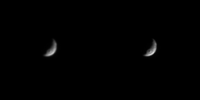
Actually, Phoebe is regarded as the captured KB object in the Saturnian system. Iapetus is weird, no doubt about it, but it actually has more in common with Hyperion than a KBO. The color of the dark stuff on both moons is very similar with the exception of Iapetus having a much lower albedo - probably because more ice has sublimated away (a result of much longer day and higher temps), leaving more dark gunk behind. Compare these two low phase shots brightened to a similar brightness level. Their color remains mutually similar even if you go into UV/IR range.

|
Posted by: Decepticon Aug 25 2007, 03:28 PM
When was that picture of Iapetus taken?
I don't I have that one in my archive.
Posted by: ugordan Aug 25 2007, 03:38 PM
It was taken on June 26, 2006 at a distance of 1.47 million km and phase angle of 10 degrees. It's not an official NASA image (at least I don't think they ever released it), perhaps that's why you haven't seen it. http://m1.freeshare.us/170fs533992.png is the non-overexposed version (16 bit PNG) and a more visually appealing contrast-reduced version http://m1.freeshare.us/170fs534451.png.
Posted by: nprev Aug 25 2007, 05:34 PM
No argument there, UG...but Iapetus might well be another bigger one. Consider its odd orbital inclination as well as its apparent ultra-thick crust...hints that Iapetus came from somewhere else, and also that wherever that was things were a bit colder.
Posted by: monitorlizard Aug 25 2007, 09:40 PM
I'm a bit confused (in other words, in my normal state of mind). The footprint maps of Iapetus I've been seeing for the Sept. flyby seem to be for ISS images, but the word VIMS keeps popping up. Are there in fact any VIMS footprint maps at the Berlin preview page?
Thanks to all at UMSF, it's so great to be able to share my excitement with other space enthusiasts!
Posted by: ugordan Aug 25 2007, 09:50 PM
As far as I know Tilmann Denk's page only shows ISS footprints. Keep in mind VIMS will control the pointing practically throughout the encounter (ISS controls pointing for 1 minute only!) and will basically see what ISS sees - they have the same boresight. We can expect similar coverage, for reference VIMS field-of-view is smaller than the wide-angle camera; see any Titan mission description for illustration. VIMS typically has longer integration times (especially for dark objects) so we'll probably be getting comparatively fewer cubes than images.
BTW, if anyone's in contact with Tilmann it'd be nice to send the guy a big thanks for this. You know... let the man know his effort won't go by unnoticed and unappreciated.
Posted by: elakdawalla Aug 26 2007, 04:10 PM
The VIMS is boresighted with ISS and has a field of view about half the size of the WAC. Here's a diagram that shows all the fields of view, in their proper spatial relation to each other. (I drew this from one of the papers describing the ORS instruments).
VIMS and CIRS are both particularly keen on getting a really good measurement on some emblematic light material and some emblematic dark material, to try to get as good a handle as possible on what they are and how they are different from each other, but of course VIMS is also keen on mapping the composition and how it differs from place to place. Iapetus has more than just the light-dark dichotomy; there's also an overlapping leading-trailing dichotomy, where everything on the leading side (both light and dark material) is redder than everything on the trailing side.
That's gonna be quite a data set. Wish I had the time to puzzle out how to work with VIMS data!
I passed your thanks on to Tilmann, Gordan
--Emily
Posted by: ugordan Aug 26 2007, 06:55 PM
Additionally, Cassini Regio has subtle color variations across its surface. There's a peculiar shift toward greenish hues at the extreme eastern and western edges of the region (color-enhanced IR1/GRN/UV3 views):
http://m1.freeshare.us/view/?170fs839151.jpg
The following crater also displays small scale color variation (an upside-down letter V shape of the sort, maybe it's meant to point "This side up"?):
http://m1.freeshare.us/view/?170fs865951.jpg
That's also the biggest (only?) color splotch as far as I can see, it's also obliquely visible in the upper-right composite.
Posted by: Juramike Aug 27 2007, 03:10 PM
The following crater also displays small scale color variation (an upside-down letter V shape of the sort):
That's also the biggest (only?) color splotch as far as I can see, it's also obliquely visible in the upper-right composite.
That's interesting... Have you used the same color-enhancement view for any of the Hyperion images?
(I wonder if regions on the two moons might look similar. Might give a taste of what VIMS will pick up.)
-Mike
(P.S. Congrats on the wiki pic!)
Posted by: DEChengst Aug 27 2007, 03:43 PM
Could you include the distances at which the mosaics are taken ? This would make it much easier for us to determine what frames go into a mosaic together.
Posted by: tasp Aug 27 2007, 04:02 PM
Would like to take the opprotunity to go over the sides of the equatorial ridge structure.
I had noted before the angle of repose, or the slope angle, evident along the sides of the ridge structure.
Note how the steepness correlates with the height, being most steep at the high end, and a smooth progression to less inclined side surfaces towards the low end. Additionally, less subsequent cratering damage, the slopes to the north and the slopes to the south are perfectly symmetrical along the ridge. (even the interesting 'off ramps' exhibit this characteristic, once you get away slightly from the main ridge)
Assuming for the moment, we are seeing a surface emplaced ring system, is this slope characteristic expected ??
Imagine the ring particles executing their final orbit prior to contacting the highest pinnacle along their equatorial ground track.
At the instant of contact, (and keep in mind if the differential ring spreading process operating in the ring system is deft enough, the contact will be more 'skidding' along the surface, than kaboom into a cliff face) the ring particle will disrupt or shatter. I have seen ice cubes contacting solid surfaces at 5-600 MPH, and they pulverize instantly. So we have a jet of 'snow' (for lack of a better term) now at sub-orbital velocity, blasting along the surface, in a vacuum.
The 'jet' will proceed downrange, interacting with the surface, and since we are considering a rather intense effect here, we will see a very slight divergence, or 'loss of focus' of the 'jet' as it proceeds.
We have 2 variables operating now, we are depositing a steadily decreasing amount of material to the surface as we move along down range, and, the remaining materials are ever so slightly 'defocusing' and are starting to broaden cross range (N-S) as they deposit.
The result is a constant downward slope of the emplaced materials, and a progressive lessening of the amount of material deposited exactly on the center line of the 'jet', thus reducing the resultant slope of the sides of the pile.
We see the (astonishing) remains, emplaced to high mathematical precision, of an orbitally decayed ring system about Iapetus, preserved from long ago, for us to marvel at.
Posted by: JRehling Aug 27 2007, 04:21 PM
[...]
That's also the biggest (only?) color splotch as far as I can see, it's also obliquely visible in the upper-right composite.
Very cool. Reminds me of the re-analysis of Mariner 10 "color" at Mercury.
It looks to me like the yellowish stuff appears where I would expect the ground to be rougher: on slopes and in the ejecta blanket around craters. I'm guessing that the sides of blocks of rubble is receiving solar weathering differently than smoother surfaces.
Posted by: Juramike Aug 27 2007, 05:47 PM
It looks to me like the yellowish stuff appears where I would expect the ground to be rougher: on slopes and in the ejecta blanket around craters. I'm guessing that the sides of blocks of rubble is receiving solar weathering differently than smoother surfaces.
That makes sense.
And the upside down "V" pattern is because the slight dome in the bigger crater basin is shading the central lower section from the debris of the crater impact. So the dome stays in it's original (presumably smoother) state, but the rough blocky debris is scattered around it.
-Mike
Posted by: nprev Aug 27 2007, 06:50 PM
You know, I thought about that as well...but, dammit, Iapetus is WAY far from the modern ring region, and no other moons exhibit a similar feature. If it had intersected the rings as we know them, the rest of the moons save Titan should still be scattered all over the place as a side-effect of its outward migration; it's for certain that we'd have no Trojan moons, for example (Converse facts would have made the problem so much easier...)
I'm inclined (yeah; that's a pun) to accept an endogenic origin for the Equatorial Ridge, with the caveat that tidal braking/heating undoubtedly had a huge role in its formation...still think that Iapetus is a capture. The dark stuff...jury's still out, but evidence to date seems to favor an exogenic origin. The closeups should tell us much more...
Posted by: ugordan Aug 27 2007, 07:24 PM
(P.S. Congrats on the wiki pic!)
Thanks EC and Juramike!
I have tried something similar at Hyperion, but the results basically give what CICLOPS http://ciclops.org/view.php?id=1507 already gives you - darker stuff at the bottom of the craters is generally more reddish/brownish (less blue to be more precise, although this isn't as apparent in the above mosaic as those areas are very dark), while generally higher locations and exposed crater walls have a more bluish tint to them. I don't see any indication of material turning greenish anywhere as is the case on Iapetus.
Posted by: JRehling Aug 27 2007, 08:02 PM
Unless I misread, I thought the theory was that the ridge is the remnant of Iapetus's very own ring system, implying no association with Saturn's ring system.
There's no reason why Saturn's rings would put an equatorial ridge on, say, Tethys, because even a tiny inclination of Tethys's orbit would lead it to cross the rings and so an entire hemisphere would be "painted" at once with every ring plane crossing.
But if Iapetus had its own ring system, then it would make sense that those ring particles would end up tidally-locked into equatorial orbits.
In my mind, the first thing about Iapetus, something so extreme that it's hard to appreciate, is that it orbits MUCH farther from its primary than any other major satellite. It orbits at triple Titan's distance from Saturn and double Callisto's distance from Jupiter, about 9 times the Moon's distance from Earth. Iapetus should have orbits around it that are much more stable than any of the other satellites in the solar system. So the implication is that while all of its ring particle orbits would decay, the decay would take a while, whereas for someplace like Tethys or Io, it would be over before it started -- while those worlds were still accreting and molten, in essence.
Posted by: Juramike Aug 27 2007, 08:25 PM
the sides of the equatorial ridge structure:
Note how the steepness correlates with the height, being most steep at the high end, and a smooth progression to less inclined side surfaces towards the low end. Additionally, less subsequent cratering damage, the slopes to the north and the slopes to the south are perfectly symmetrical along the ridge.
Assuming for the moment, we are seeing a surface emplaced ring system, is this slope characteristic expected ??
Has there been any altimetry of the Iapetian equatorial ridge?
For deposition onto the surface, as you suggested, I would expect a poisson-type distribution, but with a smooth upper ridge. Repeated impacts of ring chunks falling down should make a smooth regolith at the very apex of the structure. There shouldn't be a sharp ridge, it would look more like someone sprayed paint over and over on the same section. (Think Pan).
If the ridge is due to a geologic emplacement, like from a frozen tidal bulge, I would guess that some sections would slide and fold better than others, and it should be a fairly sharp and jagged ridgeline. (Think icebergs).
Just my wild guesses on what observations might differentiate the possibilities....
-Mike
Posted by: ugordan Aug 27 2007, 10:44 PM
Pan (Atlas?) wouldn't be a good analogy. It sweeps up ring material orbiting Saturn and its dimension is comparable to vertical excursions it makes due to its inclination so it sweeps up a broader swath of material. If Iapetus ever did possess its own ring, it would conceivably be equatorial and perturbed by solar pressure and Saturn's gravity to some inclination range. We'd have different mechanisms at work at Pan and at Iapetus.
Posted by: nprev Aug 27 2007, 11:44 PM
Argh; you're right, JR, I misread. Been fixated on the idea of Saturn capturing Iapetus.
However still have to critique that thought (interesting and creative as it is!) of Tasp's. Given the very low orbital velocity of anything around Iapetus plus its very thick crust, could even an infalling ring make this ridge? I would expect a well-defined global crater chain from such an event, but not tectonics.
Posted by: tasp Aug 28 2007, 05:55 AM
Some further info:
For an object in a very low orbit about Iapetus, the velocity is 1547 km/hr
The period is 2 hours, 55 minutes
Iapetan surface gravity is (IIRC) 2 1/2 % of earth's
Iapetus orbits about Saturn at (IIRC) 5500 km/hr
Best concepts for Iapetan ring system:
Ring system orbited 'conventionally' about Iapetus, as seen from the surface, particles would have traveled about Iapetus in the same direction as the ridge decreases in elevation.
Ring system formed from debris lofted by a largish oblique impactor
Ring system formed 3.7 billion years ago
If ring system orbitally decayed (I have been using the term 'emplaced') and deposited 1 cubic meter per second, the volume of the ridge system can be delivered in ~350 years. I consider this a 'maximum' rate and the actual emplacement might have taken much longer
Ring system emplaced onto the surface due to differential ring spreading process. For a fuller description of this natural evolutionary process occuring in ring systems, please refer to The New Solar System chapter on planetary rings
Regardless of the inclination to the Iapetan equator of the original lofted nascent ring materials, due to Iapetan oblateness, the orbits of those materials would have 'collapsed to the Laplacian plane' (coincident with the Iapetan equator) for a fuller description, please refer to TNSS chapter on planetary rings.
Differential ring spreading, while expected to redistribute momentum across the radial extent of the ring system, and to simultaneously deposit materials to the surface and at the Roche limit, apppears to only have done the former and not the latter. This might be atttributed to drag effects on the ring materials preferentially enhancing the depositon onto the surface and inhibiting materials just outside the Roche limit from accumulating.
A possible source crater for the oblique impactor is at the SE margin of Cassini Regio. On 9/10/2007 Cassini will only image the SE 1/3 of this crater that is in sunlight
The 2 diverging 'attendant' ridges, are perfectly symmetrical (not counting random subsequent cratering damage) and describe portions of great circle paths about Iapetus. Expecting internal geological processes of Iapetus to be capable of producing structures like that is unprecedented. Great circle paths (ground tracks) are characteristic of orbits, not tectonics, or hot springs, or thrust faults. If a ring system caused the ridge system, inclined elements in the ring system can cause diverging ridges, keyed to the highest point along the equatorial ridge structure.
The ring system did not precipitate vertically onto the surface of Iapetus. It accumulated horizontally. The lowest orbiting ring particle grazes the very highest spot along the equatorial groundtrack, pulverizes totally, and deposits itself as a jet zipping down along the ridge. The high end is the 'start' and the low end is the termination of the emplacement process.
The symetrical attendant ridges emplace when the high point along the equator penetrates the inclined portion of the ring plane, twice per Iapetan day. Once as the pinnacle passes from the south to the north side of the ring plane, and 180 degrees later when the equatorial pinnacle passes from north to south through the inclined ring elements.
{note: identical symmetrical attendant ridges can also form if there are no inclined elements in the ring system. If, during emplacement, Iapetus suffers a major impact that deflects the rotation access a few degrees, the remainder of the ring system emplaces into 2 symetrical attendant ridges because the ring plane iteslf will remain in it's planar alignment to the fixed stars}
There is also a possible mechanism for causing the ring to accumulate in 'piles' in a few places along the equator. (might explain the 'Voyager Mountains') but, it is getting really late here, and I will contine this later.
Posted by: edstrick Aug 28 2007, 07:41 AM
The spacing and size distribution of Saturn's moons tells us something we don't understand about the system's history. Jupiter and Uranus seem to have the most regular systems... Rings and inner "gravel", then a set of "appropriately" sized moons, big for Jupiter, smaller for Uranus, then (curiously) an abrupt end to the regular satellites and then the outer "gravel".
Saturn is "odd".. the's rings <overabundant>, and inner "gravel", then a nice series of smallish regular icy sats, similar in size to Uranus' batch. Suddenly, there's a BIG gap, followed by a solitary JUMBO sized moon. Outside there, in a resonant orbit <or it wouldn't survive> is Hyperion... almost an asteroid like object dynamically, then a big gap and a solitary icy sat before the outer "gravel" starts.
It's as though Titan somehow scavanged all the material from a wide band of orbital distances but still ended up in a low eccentricity orbit. Iapetus's inclined orbit may be due to interaction between solar and saturnian gravity, the way our moon's orbit is lightly inclined to the ecliptic, not on Earth's equator. But Iapetus shouldn't be there by analogy with the sharp outer edge of Jup's and Uranus' regular sats... Either those cases are odd or Iapetus is odd...
"Curiouser and curiouser", said Alice.
Posted by: tasp Aug 28 2007, 02:03 PM
Deposition can occur at multiple locations around the Iapetan equator thusly:
Ring particles passing over the pinnacle of the ridge system as a lower particle contacts it, might be slightly decelerated by contacting effluent or 'spray' from the other disrupted particle.
They will maintain the majority of their orbital velocity, but will now describe an elliptical path (rather than a circular path they had while still enringed) about Iapetus, dipping lower 180 degrees around, and climbing back up to the altitude of the pinnacle 2 hrs and 55 minutes later.
Depending on the specific decrease in altitude the particle experiences, as it climbs back to altitude from 180 degrees around, it can contact lesser peaks. But only if these peaks exhibit a progression of height as one approaches the highest spot on the equator.
A particle dipping quite low will contact a lower lesser peak just beyond 180 degrees around, while a particle not dipping quite that low might clear that peak, but smack the next higher one along the equator.
There will be a progression in heights, mathematically related to the distance from the pinnacle.
{note: the pinnacle, and the subsidiary peaks can all grow in height simultaneously once this process commences during the formation of the ring system as the random debris cloud collapses to the Laplacian plane}
Something else we might look for is peaks alongside the equatorial ground track that show evidence of transitory contact with orbiting ring materials. This would have occured during the final stages of the collapse process.
Hopefully pictures of the Voyager Mountains will be good enough we can confirm this altitude relationship and perhaps damaged peaks in the Iapetan tropics, too.
Posted by: elakdawalla Aug 28 2007, 10:39 PM
Tilmann just emailed me to say that they've updated the site with more maps and animated GIFs. There are still a few missing items, but his Web guy is going to be out the rest of the week, so the last updates should be done next Tuesday.
Here's the link again: http://www.geoinf.fu-berlin.de/projekte/cassini/cassini_fu_iapetus_flyby.php
--Emily
Posted by: tasp Aug 29 2007, 02:29 PM
Here is the worst diagram ever submitted to UMSF:
a-----------------------------------------------------------------------------------------------------------------
b-------------------------------------------------------------------------------------------------------------->
c--------------------------------------------------------------------------->/\
d----------------------------------------------------->/\ . . . . . . . . . . . ./ . \
e--------------------------->/\ . . . . . . . . . . . . . . / . \ . . . . . . . . . ./ . . . \
___________________/__\____________/____\________/______\______________________
(please ignore the periods)
a is the lower edge of the ring system, still in a circular orbit about Iapetus
b is a particle, very slightly decelled over the contact point of the main ridge system, but not decelled so much that it contacts anything till it makes it back to the highest point on the ridge system
c is a particle somewhat more decelled, and in a slightly more elliptical orbit that makes it almost all the way round Iapetus until contacting an intervening peak nearly as high as the main ridge's highest point
d is a particle even more decelled, in an even more elliptical orbit, that contacts a closer, lower peak
e just like d, but to illustrate that this can happen repeatedly around the Iapetan equator
The ____________ is the Iapetan surface, and /\ are mountains.
Differences in heights amongst the intervening mountains can be quite small, btw.
Posted by: tasp Aug 29 2007, 02:38 PM
I am also curious to examine the full lengths of the great circle paths around Iapetus that coincide with the 2 subsidiary diverging attendent ridges.
That some of the Voyager Mountains may not be exactly on the equator is
[dramatic pause]
[i]interesting . . . .
Posted by: dvandorn Aug 30 2007, 02:26 AM
Unfortunately, tasp, if the ridge was built up like that you wouldn't see the ramparts along the sides of it, you'd see them building up a bigger and bigger wedge-ramp as you went around the globe. I think.
-the other Doug
Posted by: tasp Aug 30 2007, 04:15 AM
The highest pinnacle gets to form the wedge ramp (love that term, btw, wish I had though of it) and since the diverging attendant ridges (the off ramps) are keyed off the same highest point, they form wedge ramps too.
The wedge ramp forms because all the ring particles (and I have used the term particle to mean stuff up to maybe 5 meters or so in diameter) that contact it, do so via grazing contact due to the delicacy of the 'bump' process in the ring system being able to lower the lowest orbiting particle's orbit by perhaps only centimeters per 2 hr, 55 minute orbit. If a particle clears the peak of the ramp by even a centimeter, nothing happens to it, and it gets to make one more orbit. If it overlaps the peak, by even that same centimeter, blammo, we get to add the mass of the particle skidding to a halt from 1550 km/hr along the length of the ridge.
The 'piles' formed around Ipaetus, away from the main ramp structure, are a bit different. I am not thinking they ever get to the state where they are consistently accumulating materials via a glancing, skidding, slide out like we see on the high point. Instead, we are going to see a total instantaneous 'splat' of the particle as it nails a pile of existing 'ring stuff' that has already 'splatted' the same way at that location.
If there are some Voyager Mountains on great circle paths aligned with the 'off ramps', and other Voyager Mountains aligned with the main equatorial ridge . . . .
[swoon]
If this process of ring materials in dipping elliptical orbits beneath the main (circular orbiting) ring system being able to accumulate in 'piles' along their ground track, keep in mind, while the ground track is fixed, existing elevations along that ground track are going to be essentially randomly distributed along it's length. Orientation of these piles will only be evident when we can accurately plot the appropriate great circles on that part of the Iapetan globe. The distances along the ground track between 'piles' will be variable, but the altitudes of these 'piles' along the ground track will have to be consistent with their positions along the ground track. The mountains will get higher as you approach the high end of the ridge.
It is amazing (to me at least) that Cassini is set to photograph this extremely compelling area on Iapetus at high resolution, in just a few days! The only thing I might change is to have more of the big elongated crater on the SE margin of Cassini Regio (my best guess so far as to the source crater of the ring material) in sunlight during the encounter.
Should the flyby come to pass successfully, and we get compelling evidence of an orbitally decayed ring system emplaced on the Iapetan surface, we have to come back to Iapetus during the extended mission.
Things I would like to see imaged then:
* good 360 degree coverage of the equator and the 'off ramps great circles
* thorough search for the source crater
* possible debris field downrange of the source crater
* possible secondary craters from the original impact (and if elongated, their 'skew' to the original crater, and possible confirmation of rotation of Iapetus during the duration of their flight)
* identification of possible nascent ring system contact with peaks out of the equatorial zone
* if we can identify accumulations of ring materials not subsequently stained with the Cassini Regio 'crud' we can study their composition, and compare it with the light portions of Iapetus. Compositional differences might be attributable to the impactor that lofted the ring materials
* the 'scratches' (SE of what I have been calling Landslide Crater). They might not have much to do with a ring system, but they are pretty unusual, and I would like to see them close up. If they are 'keyed' to the landslide crater impactor compressing deep materials and 'splitting' the overburden, that would be a (AFAIK) unique feature at this scale, and worthy of additional study
Posted by: ngunn Aug 30 2007, 10:25 AM
Yes it's great to see these ideas aired again (there will be plenty of viewers who weren't here last time) but now with the exciting prospect of getting some answers very soon. Can tasp or anyone explain to me why a collision origin for the proposed Iapetan ring is preferred to the Roche limit break-up of an inward-migrating sub-satellite? I never really got an answer to that before.
Posted by: ugordan Aug 30 2007, 11:00 AM
When talking about Iapetus' gravity and its effects, gentle is the word I'd use. I'm personally having a hard time buying breakups at the Roche limit and other significant tidal effects induced by Iapetus. My gut feeling tells me solar and Saturnian gravitational perturbations were always a much bigger factor.
Posted by: tasp Aug 30 2007, 02:11 PM
Eerie, I woke up this morning thinking about a 'Phobos' style moon slowly spiraling in over Iapetus and generating a ring.
Well, a few items to consider:
The early forming Iapetus might have been accompanied by 'sub moons'. (I suspect this happened for many planetary satellites, BTW, and we see such objects (tidally relocated by the time of our era) in other regions of the Saturnian system, but not at/from Iapetus. In that distant epoch Iapetus would have had tidal effects on those sub moons. Additionally, Iapetus would have been rotating much faster then. Sub moons in that era above the synchronous altitude for Iapetus would experience an accelerating force (as earth's moon does to this day) that would act to 'repel' the sub moon from Iapetus. Sub moons below the synchronous altitude would experience a force 'pulling' them in to Iapetus. This process 'cleans up' the sub moons from around Iapetus pretty early on. That some of the sub moons 'pulled in' might do some interesting things below the Roche altitude I have no doubt, but we are so far back in time we don't get to see any evidence of this process today.
Without any relevent proof at all (other than supposition) I feel the Iapetan ring system would have been most likely formed in the 'late heavy bombardment' period, 3.7 billion years ago. This would have been after any possible Iapetan sub moons had been zorched or lost.
I had considered the ridge system might have been formed of two sub moons, the first, equatorially orbiting, the larger of the 2, and tidally disrupted as it descended below the Roche altitude formed the main ridge structure. The second sub moon, smaller, higher, and in an orbit inclined a few degrees to the Iapetan equator, came down later, and formed the 'off ramps' we see. My problem with this is it seems more complicated than an impactor lofting debris, and less approved by Occam.
(as complex as all the scenarios are, not sure why Occam suddenly rears his head in all this at this point . . .)
Posted by: ngunn Aug 30 2007, 03:18 PM
Thanks ugordan and tasp for those replies.
On the cohesion and gravity gradient point - we can calculate the latter easily enough but we really haven't a clue about the former. Would inward spiralling moonlets actually reach the Iapetan surface as intact spheres (or whatever)? Somehow I doubt it.
On the timescale for inward and outward migration either side of the rotation-synchronous orbit - as I understand it this process depends on the gravity of the smaller object raising a significant tidal bulge on Iapetus. Again I doubt if this applies here. We know that Iapetus has been very rigid for a very long time, so it's possible that the 'cleaning out' of any Iapetan moonlets took a lot longer than it would have for a more flexible moon, perhaps even requiring the unevenness produced by heavy bombardment to get started at all. Also the rotation period of Iapetus was increasing all the time, so a moonlet could initially have been accelerated outward (very slowly), only to have been decelerated inward at a later stage (perhaps a bit faster by a now battered and irregular Iapetus).
Of course I'll accept either objection if they turn out to be supportable by evidence and calculation. In the meantime, my gut feelings remain different on this one. In my current state of ignorance I could envisage either the moonlet or the collision scenario with equal ease.
Posted by: tasp Aug 30 2007, 05:11 PM
2 sub moons is way cool to think about, especially if the outer one is in an orbit inclined a few degrees to the Iapetan equator to let the symmetrical, diverging attendent wedge ramps form.
I was just sensitive to throwing out too many ideas on this topic, and I have been at least considering
Occam's viewpoint throughout all of this.
With all the other 'sub moon' evidence I think I see around the Satunian system, (Telesto, Helene, Polyduces, Hyperion, etc.) I guess it is a bit funny I didn't want to consider Iapetan submoons as progenitors to an Iapetan ring system.
Posted by: AlexBlackwell Aug 30 2007, 05:25 PM
An interesting paper in press with http://www.sciencedirect.com/science/journal/02731177:
The Iapetuss ridge: possible explanations of its origin
L. Czechowski and J. Leliwa-Kopystyński
Adv. Space Res., In Press, Accepted Manuscript, Available online 17 August 2007.
QUOTEAbstract
Images from the Cassini mission show the existence of a long ridge on Iapetus. It extends at least 1400 km along the great circle defined by the equator. We discuss the possibility that the ridge is a result of extensional forces acting above an ascending current of solid-state convection. A two-cell pattern of convection is a reasonable explanation of the observed feature. Three scenarios of the ridge formation are proposed: spin-orbit resonance scenario, convection in low viscosity-interior scenario, and impact generating flow scenario.
Posted by: tasp Aug 30 2007, 05:29 PM
Distinguishing between wedge ramps resultant from pulverized sub moons and impact lofted debris is going to be tricky.
Two sub moons, and the outer slightly inclined would do the job nicely. There could be a substantial time lapse between formation of the main ridge and the symmetrical diverging attendents. Precise crater counts might show the difference.
The lofted debris concept requires an axial shift of Iapetus to occur during emplacement to generate the attendents. Or, failing that, inclined elements in the ring. We see eccentric ring structure at Uranus, but no gas giant ring system has any materials appreciably out of plane, so we are invoking something 'new' with inclined elements in an Iapetan ring system.
Additionally, for an axial shift of Iapetus to have a chance of occuring during ring emplacement, the duration of the emplacement would have to be lengthy. An emplacement rate of 1 cubic meter per second generates a ridge system in less than 500 years. We might want to look at emplacement rates in the range of 0.01 to 0.001 cubic meters to second to allow enough time for the statistical likelihood of an impact big enough. Also, the 'bump' process opperating in the ring system will definitely cap the maximum duration of emplacement.
Just thought of this: Would an impact on Iapetus big enough to shift the spin axis a few degrees, occuring during ring emplacement, totally disrupt the process ?? Any gases released by that impactor that linger briefly in the Iapetan realm are going to collapse the ring system in quick order.
(BTW, that kind of leads into Ip's thoughts about debris going 360 degrees about Iapetus, a transitory atmosphere will do precisely that. Iapetus may not be Ip's 'moon', but there must be bodies in our galaxy that have undoubtedly experienced that)
If we rule out an impactor lofting nascent ring materials, and yet still have an emplaced ring system to explain, 2 sub moons are looking kinda plausible.
Especially if the outer is inclined in it's orbit a bit.
Posted by: tasp Aug 30 2007, 05:44 PM
Hi Alex Blackwell !
I was hoping to have you back for this exciting lead up to the 9/10 flyby.
I have had trouble digesting all the internal geological explanations offered so far since while they might just barely contrive and contort to pop out a basic 'wedge ramp', the 2 identical (less subsequent cratering damage) diverging attendant ridges are a huge concern.
How does an internal geological process discern great circle paths for a recapitualtion of the original 'wrinkle' ?? And then generate identical structures displaced divergingly ?? Folds, faults, thrusts, volcanos, tectonics, grabens, we just don't see these processes doing anything close to the mathematical precision of this equatorial ridge complex.
Orbits, ground tracks, great circles, these are all externals, and governed by Newton's laws.
It's what we see and measure. The SETI folks are all over this precisely because of the 'machined' look of the thing, I am proposing a kind of (natural) cosmic lathe to explain it.
Posted by: Stu Aug 30 2007, 06:20 PM
Ahem. "SETI folks" aren't; H0agl@nd-worshippers are.
Edit: fixed spelling to confuse search engines
Alan

Posted by: AlexBlackwell Aug 30 2007, 06:31 PM
From the Czechowski and Leliwa-Kopystyński paper:
QUOTEIf the tidal heating is a result of eccentricity of the satellite orbit then the region of extensional tectonics lies in the plane perpendicular to the planet-satellite line. The axis of symmetry of convection should be oriented towards the planet. The ridge would follow the great circle formed by the leading and trailing meridians. If the tidal heating is a result of inclination of the orbit then the region of extensional tectonics lies in the plane of the planet-satellite line and the satellites axis of rotation. The present orientation of the Iapetuss ridge (in its equatorial plane) does not fit any of the orientations mentioned above. However, this fact could be explained as a result of mass redistribution inside the satellite. The mass redistribution resulting from convection could lead to instability and to reorientation of the satellite. Note that the reorientation is not a cataclysmic event. Therefore, we suggest that after a relatively short period of internal activity Iapetus had changed orientation with respect to the planet-satellite line reaching the present position.
Posted by: tasp Aug 31 2007, 03:19 AM
Excerpt refers to the ridge (singular) and I feel the trifurcation of the ridge is the 'brass ring'.
While I might concede the extensional tectonics might have generated one ridge, to have the moon do that 3 times . . .
It's a tough sell.
If we examine an emplacing ring and look at including inclined ring elements in the system, the attendant ridges are emplaced alternately; every 1 hour and 27 1/2 minutes when the 'pinnacle' penetrates the ring plane, we put another layer on an attendent ridge. They automatically come out perfectly matched, form at the same time (alternatingly), and have divergent angles from the center ridge that are exactly the same.
That, to high precision, is what we have on Iapetus.
I recognize the 'tough sell' aspect of this too. That a Newtonian system can 'spontaneously' organize itself after a presumably violent, messy, and splattery impact into something as 'machined looking' as the trifurcate Iapetan ridge system is nothing short of amazing. But it is the amazing precision of the results that force contemplation of orbital ground tracks, rings, inclined elements, Laplacian planes, and dynamical ring spreading in it's origin.
Oh, to have seen this thing while it was running !! Because of the precision with which it was running, it would have been quite safe to have approached the ring system and observed it. Tucked in a small crater in the upper part of the ridge, one could have watched ring particles whizzing by over head. While the attendents were forming, you could walk up the main ridge (all 1500 kms of it!) and approach the pinnacle as closely as you dare, just taking care every hour and a half or so when the pinnacle intersects the ring plane and trips more emplacement.
Whosh !
{note: comments regarding my SETI jab are, of course, accurate and deserved, but as I recall, Doug has forbidden use of the name that must not be named . . . . }
Posted by: tasp Aug 31 2007, 04:21 AM
Need to revise and clarify something;
the location of the highest point we see on the ridge system today (which I call the pinnacle)(and this point is common to the 3 strands) was exactly the same throughout the entire emplacement process of the entire ring system.
Since differential ring spreading is the primary mechanism for 'lowering' ring materials towards the surface, and this process, while relentless, proceeds with almost glacial (pun intended) slowness, it is apparent that ring particles contacting the pinnacle, always do so in a glancing fashion. The amount of altitude loss per orbit is small compared to the average size of the ring particles. No bowling balls smacking vertical cliffs here, just a grazing, glancing, kiss. The particles either pulverize from friction during the slide out, or spin up and shatter. Whatever, the resultant blast of 'snow' goes zipping along the ridge, leaving a thin dusting as it goes.
Over the centuries, it makes quite a pile.
The attendent ridges form when either an inclined element of the ring is emplacing, or if the spin axis of Iapetus shifts a bit during emplacement.
Now we have the pinnacle traversing the ring plane twice, 180 degrees around. The differential process is still occuring very slowly, and despite the lack of 'dwell' time in the ring plane, the pinnacle still experiences grazing contacts with the ring particles as they go over. For the pases going north to south, we deposit a dusting on the south diverging ridge. For the other passes, the south to north ones, we deposit a dusting on the north diverging ridge.
The process generates identical, symmetrical diverging attendant ridges, keyed to the high spot on the main equatorial structure.
Ring particles in the immediate vicinity of the particle in current contact with the ridge pinnacle, if they travers the 'snow' will be slightly decelled, but not enough to fall out of orbit, yet. They get to go round Iapetus one last time. Since a variety of elliptical orbits are possible at this stage due to the degree of interaction with the proceeding particle, the fates of thes particles can take several paths. Depending on their altitudes, the may clear some obstacles on their way back to the pinnacle, but maybe not others. (refer to that horrid diagram of mine a few posts back)
These 'elliptical' stragglers, can occur in regards to emplacement on the main ridge, or in regards to the attendant ridges.
Thus, we might be putting materials on to some of those Voyager Mountains that are not on the equator. They just need to be on a great circle path with an attendant ridge.
Posted by: JRehling Aug 31 2007, 04:58 AM
If the formation took a long time, there would be a pretty good chance that Iapetus would receive the torque of a major unrelated impact. That could shift the poles a few km.
Posted by: CAP-Team Aug 31 2007, 07:09 AM
Since a couple of days this topic is more about the ridge on Iapetus than about the flyby. I recall another topic that discussed the ridge on Iapetus
Within two weeks from now our knowledge of Iapetus will increase greatly.
I sure hope that the RAW images on the Cassini site will be working again then, since the last RAW images are from 23 august.
Posted by: djellison Aug 31 2007, 07:15 AM
There's been a hiatus in raw's because of solar conjunction.
Doug
Posted by: ugordan Aug 31 2007, 07:26 AM
They also added an additional inconspicuous link to the raws page - http://saturn.jpl.nasa.gov/faq/raw-images.cfm#q19 before the search options to answer this obviously common question.
Posted by: MarcF Aug 31 2007, 10:50 AM
In the following LPSC XXXI meeting abstract by T. Denk et al., I heard for the first time about the white equatorial mountains (detected on Voyager 2 pictures) :
http://www.lpi.usra.edu/meetings/lpsc2000/pdf/1596.pdf
"Mountains of Fig. 3: Difficult to explain;
possibly, a big icy meteorite "landed" on the surface
and simply broke into pieces instead of causing
an explosion with subsequent crater formation."
Seems consistent with the "broken satellite" or even the "ring" theory for the formation of the equatorial ridge.
Sometimes the first belief is the right one. Who knows !
Ten days left !!
Marc.
Posted by: ugordan Aug 31 2007, 11:00 AM
To me the "Voyager mountains" being white could have a simple explanation by the sublimation model, they are at the western extent of Cassini Regio and are topographically high so one can imagine them being places where sublimated ice tends to stick around. If Cassini Regio is slowly creeping westward and eastward at the equator, the white peaks could disappear one day. We'd probably see similar white peaks at the eastern extent of the region, but the rigde there is much lower in height so all ice already sublimated away some time ago.
Posted by: tasp Aug 31 2007, 01:17 PM
Understanding exactly what happens at the contact point, the highest elevation along the ring's ground track, has been a long time coming. Realizing the location of the contact point remains fixed on the surface of Iapetus was difficult too, despite the great big clue of all three ridge elements being keyed to the same location. Having all the ring particles experiencing a glancing contact and subsequently sliding down the ridge is what allows the intermittent deposition piles (Voyager Mounatains) to form. The 2005 Cassini pictures also show discontinuities in the ridge past the 'pinnacle'. I had assumed that was due to cratering damage, and it might be, but we need to consider the elliptical stragglers ability to deposit 'piles' off the pinnacle end of the ridge system.
An area I still have trouble visualizing is the interval from the impact that lofted the nascent ring materials till the ring system 'settled down' into a planar system. (neglecting for now the intriguing concept of satellites forming the rings) The Planetary Rings chapter in The New Solar System has a nice (static) diagram, but I would like to watch a CGI simulation of a motley orbiting debris cloud collapsing to the Laplacian plane.
NASA Select has a clip of the Odysseus impact creating earth's moon that they run frequently, but it is (necessarily) severely time compressed, and merely whets my appetitie.
Posted by: tasp Aug 31 2007, 01:36 PM
Regarding the extent of Cassini Regio, there is a mathematical relationship between latitude, longitude, local slope angle, and elevation.
A given point on Iapetus will be darkened to the extent it meets these criteria:
* North and south of the equator (latitude) the angle of the surface of Iapetus to the distant sun must be less than a certain amount
* distance east and west of a point on the equator that is the precise center of the leading hemisphere
* elevation consistent with the following 'rule' : as one approaches the center of the leading hemisphere, the max height of darkening increases smoothly
* local slope angle (referenced to the distant sun) can permit a degree of darkening proportional to the perpendicularity of that surface to the Iapeuts/sun line in addition to the degree of darkening generated by the other criteria.
Examples- the poleward portion of crater bowls in the far northern and southern regions have a more perpendicular angle to the Iapetus/sun line and are darker. A very high peak near the center of the leading hemisphere can be dark all the way to the peak, nearer the edge of that hemisphere, the darkening falls off with height. Even outside of the leading hemisphere, low places can be dark, but extent of the darkening poleward decreases as you move out of the leading hemisphere.
We have a natural version of a 'thermal printer' operating on Iapetus. We get a new (gaseous) ink cartridge every time we pass through the Saturnian magnetotail, and the surface temp (degree of insolation) governs the degree of darkeneing.
Posted by: Holder of the Two Leashes Aug 31 2007, 03:00 PM
Just a quick post to note the fact that Cassini passed by Titan a few hours ago, and now the next destination is Iapetus. The Cassini JPL website is counting down to closest approach.
Posted by: elakdawalla Aug 31 2007, 04:39 PM
I've heard that the site might be "down for a couple of days" -- don't know if that means it will actually be down, or if it just means that we can't expect new images to show up until after Labor Day weekend.
--Emily
Posted by: Gsnorgathon Sep 1 2007, 01:33 AM
Raws aplenty are goin' up. They look awfully underexposed, though.
Posted by: tasp Sep 1 2007, 05:10 AM
I have been thinking about disrupting sub moons about Iapetus today and have been batting about an idea.
A large impactor, stiking a glancing blow upon Iapetus, and lofting materials into orbit, won't preferentially loft those materials exclusively inside the Roche limit, where they can organize into a ring system. There will be materials insufficiently accelerated to achieve orbit, and they will 'splat' back onto the surface of Iapetus. There will also be materials lofted beyond the Roche limit.
Where does that stuff go ??
Well, anything accelerated beyond ~7000 km/hr (with the right direction) is lost to Saturn. But Iapetus has a large Hill Sphere (if use of that term in regards to a moon instead of a planet is OK), and it seems like we have some materials beyond the Roche limit to ponder.
Would we expect such material to form a sub-moon ??
Cautious yes, seems appropriate. Especially considering the Atlas pictures showing the little guy gloming on to ring dust.
What becomes of that moon ??
Seems like over not so longish time periods, we might expect such an object to either be lost to Iapetus, or for it to spiral in. ( I have noted before, orbits about moons don't seem to exhibit much long term stability)
If moon is lost to Iapetus, frankly, I loose interest in it, and move on.
If moon spirals in, hmmmmmmm.
What happens if moon crosses Roche limit ?? Well, it is going to be one of those 'ruble pile' objects we seem to be encountering more and more of lately. I suspect it's mechanical strength might approach that of a the 'imaginary' fluid object Roche himself imagined. So we should expect disruption.
This disruption might occur millenia (or longer) after the original ring system has dissipated itself onto the icy Iapetan surface. And as this object disrupts, we get another ring system. And due to the 'bump' process, this ring system will emplace onto the Iapetan surface just as the first did.
Does anything change in the quiescent period?? The high spot on the equator remains ready to 'nudge' the lowest particles to emplace. But maybe Iapetus has had a major impact and the spin axis is a few degrees off now.
See, this is when we get the 'off ramps'.
Or perhaps instead of an axial tilt, the sub moon managed to form with an orbit a few degrees off the Iapetan equator. Mimas, and Miranda might be analogous objects, and they have managed to (re??) form with such orbits. If a sub-moon, orbiting a couple of degrees off the equatorial plane disrupts and makes rings, does the collapse to the Laplacian plane process work with much vigor ?? For materials originally lofted in a 45 degree inclination, we would get strong forces generating planarity. In this shallow angle case, I don't know. The oblateness of Iapetus, while large, does not gradient strongly >5 degrees to the equator in my view.
So, whether by axial tilt, or inclined orbiting progenitor sub-moon, we get a second ring system, and it emplaces divergingly into the 'off ramps'.
Seems like crater counts (for dating) from the three strands is getting to be a pretty interesting piece of information to have.
Posted by: tasp Sep 1 2007, 02:49 PM
What are we going to see from the 9/10 pictures ??
Well, for the peaks glimpsed previously over the horizon off the west end of the main ridge system, the 'breaks' in the ridge once thought due to subsequent crater damage, might be something else entirely. As suspected, the main 'wedge ramp' can, during it's formation, liberate materials from the lower circular edge of the ring system, and allow them a final elliptical orbit about Iapetus. This final orbit can dip towards the surface 180 degrees around Iapetus and then climb back up to the altitude where the orbital velocity dissipation occured. The particles can exhibit 'dipping' over a range of essentially random amounts, and this allows them the opprotunity to accumulate at various 'debris' piles along the ground track.
This effect can explain gaps in the ridge structure west of the point common to the start of the ridge trifurcation.
If the Cassini pictures of these peaks does not show craters exclusively punctuating the ridge structure in this area, we will possess very compelling evidence we are looking at an orbitally collapsed ring system on the surface of Iapetus, and possibly a ring derived system that was emplaced in 2 sessions.
These peaks, additionally, are an entirely new kind of mountain, something we have not see before. While the main wedge ramp has been emplaced via the relatively gentle 'skidding out' of ring particles encountering its highest elevation, these peaks instead, have accumulated via a process more akin to 'cannon balls splattering against a cliff'. Additionally, these peaks will exhibit a progression of heights as they approach the west end of the wedge ramp.
Considering the precision this process operated with, let's think about something else. The final orbit of the particles destined for these 'piles' is very precisely timed. It takes a maximum of 2 hours and 55 minutes to go around Iapetus, but that assumes an Iapetus stationary in respect to the fixed stars.
The extreme age of this feature should give us a view of Iapetus prior to tide lock with Saturn. On their final ellipse about Iapetus, these particles will encounter surface features displaced relative to their ballistic trajectories. Careful measurements and analysis of the positions and elevations of these peaks may well allow us to compute the length of the Iapetan 'day' at the time of the ridge emplacement.
(BTW, that would involve 'math'. I don't do 'math'. Someone else is entirely welcome to work out that aspect.)
Additionally, should the amount of change in the Iapetan day length between the main ramp emplacement, and the 'off ramps' be sufficient, we may be able to calculate the interval between the 2 stints of emplacement. This technique might confirm any interval possibly suggested by differences in age derived from crater counts on the trifurcted area.
One other effect to look for in the 'Intermittent Mountains', is emplacement shadowing. These peaks sequentially accumulate materials that have 'cleared' other lesser peaks further west. So they 'grow' from their upper reaches, and only on their west sides, back into the incoming stream.
This should generate a rather distinctive looking 'pile', and help us confirm 'rings'.
Posted by: scalbers Sep 1 2007, 05:49 PM
* local slope angle (referenced to the distant sun) can permit a degree of darkening proportional to the perpendicularity of that surface to the Iapeuts/sun line in addition to the degree of darkening generated by the other criteria.
Examples- the poleward portion of crater bowls in the far northern and southern regions have a more perpendicular angle to the Iapetus/sun line and are darker. A very high peak near the center of the leading hemisphere can be dark all the way to the peak, nearer the edge of that hemisphere, the darkening falls off with height. Even outside of the leading hemisphere, low places can be dark, but extent of the darkening poleward decreases as you move out of the leading hemisphere.
Following these examples, the craters in the NE part of Roncevaux Terra show darkness mostly on the northern portion of their floors. Kind of an inverse of the frosty appearance of the southern part of the rims within northern Cassini Regio.
Also the possible western extension of the Voyager mountains looks to be more continuously white for a while (if I'm interpreting the mapping correctly from the foreshortened imagery). As I mentioned elsewhere the wavy appearance of this extension will be interesting to see at higher resolutions with any implications for the ridge origins.
Posted by: tasp Sep 1 2007, 06:05 PM
Interestingly, the 'black crud' is (to my way of thinking) derived from effluents wafting from Titan's atmosphere. The 'black crud's' presence or absence on the 'Intermittent Mountains' will be unrelated to their morphology. So any distinctive topographic features these peaks share, will be evident despite their being black or white, assuming JPL is careful in exposing the Cassini pictures.
Looking at the photo footprint map, at this point, I would like to lament it doesn't appear we get a good closeup of a Voyager mountain from a lower westerly vantage. If I am extrapolating correctly, all those colored boxes look to be shooting more or less vertically down on them. The interesting bits might have enhanced visibility when viewed from a more horizontal angle, looking in the direction of the of the ring stream travels.
Stereographic image pairs would be nice too, if they are planned. If not, one more thing to put on the Extended Mission list.
Posted by: tasp Sep 1 2007, 06:21 PM
I saw a posting on another forum regarding possible elevation differences being related to degree of darkening on Umbriel.
We might have another example of an externally applied darkening agent to ponder.
In Umbriel's case, we might want to consider possible long term low level out gassing (what the heck, let's just say geological activity) from Ariel.
And if we have an 'active' Ariel, we need to ramp up the urgency for a Uranian orbiter. Processes common to Saturn and Uranian small satellites are compellingly fascinating.
As amply demonstrated by Cassini, our understanding of these small bodies increases exponentially with the number of such objects explored. Uranus, with 5 major moons, rings, 'debris' moons, and an eerie, scaled down . . er . . . um . . . scale compared to Jupiter, is a rich target. One that can be cost effectively explored.
Posted by: scalbers Sep 1 2007, 09:58 PM
Regarding tasp's post #160 some of the Voyager mountains should be viewed at about 130m resolution from the west up to about a 45 degree angle:
http://www.geoinf.fu-berlin.de/projekte/cassini/detail_iss_049ia_orshires_vims_2909_img.html
Posted by: tasp Sep 1 2007, 11:32 PM
Thanx for the update.
Maybe that will be the money shot.
Posted by: scalbers Sep 2 2007, 12:46 AM
Greetings,
For grins (while waiting for some additional money shots) I tried using the paint tool on my laptop with a jittery mouse to illustrate the basins I think may show up in this Iapetus mapped view. The annotated one is on the right.

|

|
The blue ring would be the main or newer basin shown nearly completely in the July 8, 2007 imagery (also in August 2004). The red partial ring would be a second eastern rim (shown best in Oct 2004). This is possibly an older basin partially erased by the newer blue one. These solid lines are what I would be more confident about. Possibly there is also a northern portion of the red rim that one can only see hints of at this resolution (much more speculative).
The two eastern rims seem to have differing profiles, so even if any mapping errors were significantly larger than I think they are, one would be called upon to elaborate on how different lighting effects could explain the differing outlines.
Posted by: Greg Hullender Sep 2 2007, 04:57 AM
Tasp, are you talking about the Roche limit of IAPETUS? For stuff with the same density, that's less than 200 km above the surface. Anything large enough to be "fluid" is going to hit Iapetus first.
The "Hill Sphere" of Iapetus will be a good bit bigger, but still only about 6,000 km in radius. Given the perturbations from both Saturn and Titan, I'd expect nearly all orbits in this range to decay over months or maybe a few years. (I can't work this part out for sure, though.)
--Greg
Posted by: tasp Sep 2 2007, 03:28 PM
TNSS chapter on planetary rings has an equation for computing Roche limits for various objects.
Despite this involving 'math', I will give it a go.
In any regards, we have 2 scenarios here for interesting things occuring inside a Roche limit.
* For dissassociated materials 'injected' into a Roche limit, they will be unable to coalesce into a body and will immediately come under the 'jurisdiction' of the collapse to the Laplacian plane process.
* Objects formed outside a Roche limit and then entering it will be subject to a tidal force tending to disrupt the object. The object can 'resist' via mechanical strength (this is what holds the International Space Station together) or by the object's own self gravitation. (or some combination of the 2)
I have been reluctant to discuss possible sub-satellites of Iapetus generating a ring due to your concerns. However, we now have some interesting pictures of Atlas to ponder. This object is essentially a chunky core with a sizeable dust mantle. The mechanical strength of the dust mantle will approximate the 'idealized fluid body' Roche considered. A similar object crossing into the Iapetan Roche limit will 'realize the math' per Roche's idea and disintegrate. While aesthetically unappealling (who doesn't like nice, big, ring systems ??) as long as the object is pulverized prior to reaching the highest altitude of the wedge ramp, we still get an interesting emplaced feature on the Iapetan surface.
Posted by: tasp Sep 2 2007, 03:50 PM
I have been considering identification of the big elongated crater (45 south lat, 0-30 long) as perhaps being the source (along with the impactor) of the materials destined to emplace into the ridge system.
We are looking for 'something new'. We do not have candidate lunar craters suspected of lofting significant materials to space upon formation. We do infer certain meteorites discovered on earth as having a Martian origin, so an 'inefficient' mechanism is confirmed for 'lofting'. But for Iapetus, we are looking at a glancing impact lofting into orbit of a significant amount of materials.
There would be degrees of glancing too. Consider the center point of the impactor. Does this point 'traverse' inside the radius of Iapetus, or does the impactor 'scrape' the surface ??
How does the degree of 'overlap' of the 2 bodies change the proportion of materials splattered onto the surface of Iapetus, injected into the Iapetan Roche limit, lofted into the Hill sphere of Iapetus, lofted outside the Hill sphere of Iapetus, and lofted outside the Hill sphere of Saturn ??
Frankly, materials forever lost to Iapetus are not that interesting to me, and in any regard, I suspect their relative amounts are small.
What do the materials blasted out of the crater (and liberated from the impactor) that failed to achieve orbit look like on the surface of Iapetus today ?? Is it a global dust layer ?? A certain percentage of surface 'chunks' scattered everywhere or in the 'infamous' Butterfly pattern ??
Can the event 'drop' bigger pieces, or does the violence of the process pulverize the impactor and Iapetan surface materials entrained and homogenizes the effluent ??
Should Iapetus offer up more interesting and puzzling surface features, we might want to evaluate them in regards to this.
Posted by: ngunn Sep 2 2007, 04:52 PM
Greg: I can't do those calculations either but I suspect the survival time for Iapetan moonlets to be MUCH longer than your estimates. I believe the Cassini team are on the lookout for material that might still be orbiting there today. It is unique among moons in this regard.
Posted by: tasp Sep 2 2007, 05:34 PM
While I consider orbits about Iapetus to be among the most long term stable orbits around moons of major planets, they are not as stable (below synchronus altitude) (Yeah, a moot point for Iapetus, but I endeavor to be complete) as to allow 'indefinite' orbiting (million years or more).
As much as I would like to see some 'gravel' forward scattering sunlight in some 'insurance' pictures Cassini might be taking, I will be very surprised to see anything orbiting Iapetus today.
The (possible) existence of liberated Iapetus 'debris' yet orbiting Saturn today in the 2 to 10 million KM range is interesting to contemplate (perhaps the Saturnian equivalent of meteor streams we see on earth like the eta Aquirids, etc), but unless Cassini actually smacks a piece (Oh NO !! ) we probably won't find out about such stuff on this mission.
Posted by: tasp Sep 2 2007, 05:39 PM
Regarding a possible 'parent' crater for the ring stuff, we might want to observe great circle path's about Iapetus aligned with the long axis of the candidate craters.
Since we are looking for 'something' downrange, but (at least for myself) are not sure of the specific 'form' of the resulting efflux that failed to orbit, we need to keep an open mind.
Perhaps an abundance of secondary craters ( a percentage elongated themselves) aligned to the long axis of the parent crater is all we are going to get . . .
Posted by: tasp Sep 3 2007, 01:09 AM
Was playing around with different rotation periods for Iapetus during emplacement and thought I would share an example.
If we consider an Iapetus, with a ring system emplacing prior to Iapetus achieving tide lock with Saturn, let's look at what happens. Lets say Iapetus has a 'day' of 29 hours during this era. (this 29 hours is just a random number I used to make the math easy enough to do in my head, the actual # is bound to be different)
Does this effect anything?
We might expect a slight decrease (<10%) in the contact velocity for particles encountering the Iapetan surface. This is probably not particularly significant.
But, for particles interacting at the contact point with the pulverized particles there (these are the elliptical stragglers mentioned above, post 158) they are going to continue on their path below the circularly orbiting remaining ring particles above. They will dip down towards the surface and 180 degrees around, start climbing back up towards the pinnacle.
However-
in the 2 hours and 55 minutes it takes for those particles to return to the (altitude of the) pinnacle, the pinnacle (and the rest of Iapetus) will have rotated an additional 36 degrees downrange.
Let's understand the significance of this.
These particles are not 'synced up' with the pinnacle now.
This will definitely affect the elevations of the accumulations we see around the equator (the Voyager Mountains) as we move around towards the highest point of the wedge ramp.
Once we have the elevations, and the positions along the equator of the specific Voyager Mountains this applies to, assuming the particles accreting upon them can follow ellipses beneath the main ring system as outlined above (post 158), we can 'solve' for the rotation period of Iapetus at the time the ring system was emplacing.
Sweet ??
We see tide locked moons all around the solar system, including Iapetus. Kind of wild if we can 'prove' one of them wasn't always tide locked.
(somewhat less fun, I suppose, is if we wind up proving Iapetus was tide locked during ring emplacement)
Posted by: Greg Hullender Sep 3 2007, 04:41 AM
ngunn: I'm partly going on the fact that lunar orbits are so unstable. For high orbits, it's the Earth that destabilizes them, while for low ones, it's the "Mascons" under the maria. This instability is on the order of weeks or less, if I remember correctly. Saturn has more effect on Iapetus than Earth does on the moon, and, of course, Iapetus has some rather visible irregularities, so it's a reasonable guess that it's not smoother than the moon in gravitational terms.
It's cool that some stable orbits around Iapetus exist, but I'd still expect there to be very few such orbits. If an impactor hit Iapetus, I think nearly all the debris would either be lost to space or impact Iapetus again within a few months. Agreed SOME might find a stable orbit, but I'd be surprised if that could amount to even 0.1% of it. The notion of that tiny mass coalescing into a tiny moonlet of Iapetus seems very unrealistic to me.
If Iapetus does have some body bound to it, I'd expect it to be something captured whole -- not something assembled from fragments. Has anyone seen anything from the experts on this topic? (I.e. a paper we could read?)
--Greg
Posted by: Rob Pinnegar Sep 3 2007, 09:19 AM
As far as I remember, the destabilizing effect of a planet on material orbiting one of its moons depends on tidal forces, whose strength varies as the inverse cube of distance. So let's compare the situations for material orbiting Earth's Moon, and Iapetus.
Saturn is about 100 times more massive than the Earth, but since Iapetus is 10 times further from Saturn than the Moon is from the Earth, Saturn's tidal forces would be weakened by a factor of 1000 way out there. Hence the tidal forces experienced by any material orbiting Iapetus could actually be weaker than what is experienced by material orbiting the Moon.
Beyond this back-of-the-envelope calculation, things will get more difficult. Material orbiting the Moon also experiences not-insubstantial tidal forces from the Sun. Also, the Moon's orbit is twice as elliptical as Iapetus' orbit which should increase the effect of Earth's tides. On the other hand, the Moon is much more massive than Iapetus. So it's a tough call.
Even if it turns out that any material orbiting Iapetus could only stay there for a few hundred thousand to a few million years, it's probably still worth looking for -- since the possibility that Cassini Regio formed very recently still hasn't been ruled out.
Posted by: ngunn Sep 3 2007, 10:11 AM
Thanks Rob I was going to say the tidal disruption at Iapetus is about an order of magnitude less than at Luna. Also some of the possible orbits will have much longer periods in the case of Iapetus and I'd expect the longevity of Iapetan moonlets to increase in line with that as well.
Posted by: Rob Pinnegar Sep 3 2007, 04:33 PM
As I recall, a number of vastly-overexposed images of Iapetus were taken last year. Any substantial moonlets orbiting Iapetus would have been seen in these, probably.
That of course doesn't rule out the possibility of smaller icebergs circling the moon, and it's possible that Cassini might spot these during its close flyby, if indeed they exist. However, I wouldn't want to waste time on that during closest approach. There will be too many other interesting things to photograph.
[Edit: Actually, the best time to look for moonlets should be right before closest approach. At this time, Iapetus will appear to be very large, but will be a thin crescent. If a Sunlit moonlet happened to lie in front of Iapetus' unlit side as seen from Cassini's vantage point, it ought to show up as a bright speck, even if its apparent diameter were at the sub-pixel level. Two images in rapid succession would differentiate something like this from a cosmic ray hit.]
Posted by: nprev Sep 3 2007, 04:43 PM
Hmm. Rob and/or Rlorenz, purely thinking here in extended mission mode, how effective would Cassini's RADAR be at finding any possible moonlets around Iapetus (or any other moon, for that matter) during untargeted distant flybys?
Might be worth trying later on; the search zone's fairly narrow (orbital/equatorial plane), and if a ping is in fact detected then targeted imagery could be attempted during the next favorable rev.
Posted by: Phil Stooke Sep 3 2007, 05:09 PM
That's a very dodgy proposition. If the target's unknown you don't know the time or doppler shift of the reflection. It's not a scanning radar like the old airport system. Imaging is a much better bet.
Phil
Posted by: tasp Sep 3 2007, 09:19 PM
Regarding tidal effects on a ring system inside the Iapetan Roche limit, looking at the system from above, the 'manifestation' of tidal effects upon the ring system is to (subtly) de-circularize the orbits of the ring particles. (we will neglect, for now, out of plane displacement as the ring suystem can 'automatically' correct for this effect)
For a ring system composed of particles not in 100% mutual contact, this manifestation of a tidal effect is to merely enhance the redistribution of angular momentum the differential ring spreading process is already producing.
The net effect is to accelerate emplacement of the ring system upon the surface of Iapetus.
For a ring system that we might have viewed as emplacing in 50,000 years without tidal enhancement, becoming a ring system that emplaces in ~10,000 years with it, it doesn't seem to appreciably alter anything we might be looking at in our era.
Posted by: tasp Sep 3 2007, 09:57 PM
OK, have done some number crunching regarding the Iapetan Roche limit, and for objects of equal density (a nice assumption I will run with) it looks like the Roche limit is roughly 1000km above the Iapetan equator.
Additionally, the 'disruption effect' experienced by items below this height might be greatly lessened by the mechanical strength of the materials making up the debris. However, once the 'first' break occurs, we now have abrasion and collision effects synergistically adding to the effect to 'pulverize' materials during their 'descent'. (Yeah, I had to strongly resist the urge to use the phrase 'death spiral'.)
Even tidal effects from distant bodies (Titan, et al) (if significant to any degree) will enhance the disassociation of the larger pieces via this process.
While this process might aesthetically degrade the outer portions of a ring system, as the materials approach the surface we do achieve a degree of uniformity of the particles in the lower reaches of the ring system.
I had not realized the possibility of an Iapetan ring system being 'ugly' or 'messy' compared to Saturn's, but we are starting to see some 'scaling' effects at Iapetus that are suggesting the system will not have the grace of the system for Saturn.
Another detraction in the appearance would have been the close proximity (at least in the early stages) of the lower edge of the ring system to the Iapetan surface. Even the 20 km gap at the conclusion of the process would not enhance the look too much. Part of the delight of the Satunian system is the sparse and diffuse D ring, lending the strong visual appearance to the rest of the system being unsupported, floating majestically in space, as it were.
Posted by: helvick Sep 3 2007, 10:20 PM
Are you sure of those Roche Limit numbers - I get a number of ~200km from the surface not 1000. ( using this: http://en.wikipedia.org/wiki/Roche_limit ) for an object of the same density as Iapetus itself (1.08 g/cc). Anything denser than ~2.16 g/cc will have a Roche limit below the surface.
Posted by: tasp Sep 3 2007, 11:09 PM
r * 2.423-r = R
Where r = 718
R = ~1000 km
Posted by: marsman Sep 4 2007, 02:02 AM
Tidal forces are often cited as a key driving mechanism for many of the fastastic phenomenon we observe in moons and rings around the gas giants; in particular the possibility of sub-surface oceans under miles of rock and ice. Based on the conservation of energy law, could you experts please explain which planetary body loses energy as a result of a moon gaining energy from tidal forces? That is, does a moon's orbit lose energy or does the planet's rotation or angular momentum get reduced? The latter implies a sustainable source of energy for a very long time, the former perhaps not.
Thanks.
Posted by: tasp Sep 4 2007, 02:29 AM
{we might want to start a seperate thread for this. It's a rather important topic as it pertains to processes that are operative on bodies currently under study}
Angular momentum is conserved (in a closed system). For instance tides raised in Io by Jupiter (and vice versa) may transfer angular momentum betwen the bodies, but the total amount of angular momentum shared by the bodies does not change. (Ignoring the resonance with Ganymede and Europa for the moment)
Heat is produced in Io via friction from conversion of potential energy as Io is 'wrenched' about in the Jupiterian gravitational field. Surprisingly, energy is dissipated inside Jupiter as heat simultaneously from the same process as it occurs inside Io.
Over longish periods, we see Io rising out of Jupiters gravitational field, and Jupiter's rotation slowing, and Io dissipating nearly 4 bazillion watts of heat.
A large radiator on the surface, and pipes beneath the surface of Io with a fluid circulating (molten sulfur springs to mind for some reason) could form the basis of a power plant of some kind.
Transmitting the power to my home theater remains a challenge.
Posted by: helvick Sep 4 2007, 07:01 AM
Oops - my bad. I wasn't paying sufficient attention there Tasp, hadn't realized that you were talking about the fluid case.
Posted by: TritonAntares Sep 4 2007, 08:15 AM
Hi again,
8 Iapetus crescent images are up now on the http://saturn.jpl.nasa.gov/multimedia/images/raw/raw-images-details.cfm?feiImageID=125127. Distance is about 1.45 million km.
Bye.
Posted by: akuo Sep 4 2007, 08:35 AM
This closy flyby is almost like a new mission to an unknown world. Can't wait to see the closeby mountain ridge images. Less than a week to go...
Posted by: tasp Sep 4 2007, 02:30 PM
Upon reviewing pictures of Atlas, it is hard to imagine that poor little thing being able to withstand a vigorous sneeze.
That subsatellites forming in proximity to the Iapetan Roche limit would be similarly frangible doesn't seem to be much of stretch.
Posted by: tasp Sep 4 2007, 02:37 PM
Regarding efficiencies we might expect for a glancing impact to be able to loft significant quantities of materials to orbit, we have the examples of (most likely) Charon and earth's moon.
In our moon's case, with the putative Orpheus being ~10% e, and the resulting moon being ~1% e (keeping the math to a minimum to save wear and tear on my brain) we see an efficiency of ~10%.
For Pluto/Charon, we can rule out efficiencies in the range under 1% due to the mass of the grazing impactor being ridiculously large. Perhaps an upper limit to the efficiency might be expected to have a maximum of less than ~50%.
It seems the possibilities for Iapetus are safely within an interesting range.
Posted by: tasp Sep 4 2007, 02:45 PM
My take for the 'risk' of Iapetan ring system being disproven:
* grazing impactors do seem to have lofted interesting quantities of materials into orbit around other objects
* Iapetus is uniquely isolated among solar system moons, and the reduced tidal effects seems conducive for the scenario, and further, might explain why we don't see this elsewhere
* dissassociated materials orbiting inside a Roche limit will collapse to the Laplacian plane
* upon collapse to a planar form, these materials are subject to a differential spreading process (they 'bump' and redistribute angular momentum)
* as such a system 'spreads', the low edge will eventually come in contact with the highest elevation along the orbital groundtrack
* for a differential ring spreading process operating to the extent that the average particle descends less than the average particle radius per orbit, all contacts at the highest point along the ground track will be of the 'glancing, skidding, variety. 'Cannonballs smacking a cliff' does not occur at this point.
Posted by: tasp Sep 4 2007, 02:50 PM
{the 3 preceeding posts were originally all in one post but the 'Preview Post' feature seems to have 'erased' my original effort. Anyone else having Preview Post problems, or is my computer/ internet acting up ??}
Posted by: AscendingNode Sep 4 2007, 11:52 PM
Here's an animation of the flyby:
http://www.youtube.com/watch?v=PR1P3XTmL70
Posted by: ilbasso Sep 5 2007, 03:00 AM
Oh, sweet lordy mama...we're going to be feasting on Iapetan data and images for years!
That's an amazing video. It really gives you a sense of the kind of choreography that goes into making the most of this encounter
Posted by: Holder of the Two Leashes Sep 5 2007, 11:23 PM
Here is a concise http://photojournal.jpl.nasa.gov/jpeg/PIA08371.jpg posted on the JPL Cassini site showing coverage, color coding the detail.
Also, their latest http://saturn.jpl.nasa.gov/news/press-release-details.cfm?newsID=771.
Edit: There is also a new posting at http://ciclops.org/view.php?id=3692.
Posted by: TritonAntares Sep 5 2007, 11:30 PM
Hello,
here another nice overview about the planned image coverage:
http://photojournal.jpl.nasa.gov/jpeg/PIA08371.jpg
At closest approach Cassini will pass the moon at a speed of ~2.4 km/s in 1640 km distance.
Bye.
Posted by: elakdawalla Sep 5 2007, 11:36 PM
Tilmann says their website is now almost complete.
Here's my crack at the first approach shot:
http://www.planetary.org/blog/article/00001118/
--Emily
Posted by: scalbers Sep 5 2007, 11:55 PM
Very nice processing showing some good detail in Emily's approach shot. To help navigate things I made a couple of Celestia images from roughly the same time. The first should match Emily's geometry fairly well. The second one is rotated around to help see where on Iapetus we should be in the vicinity of the terminator...

|

|
Posted by: Bjorn Jonsson Sep 6 2007, 12:14 AM
A completely different topic: Looking closely at some of the Iapetus images from the 120,000 km flyby, parts of Iapetus' dark terrain remind me a bit of 'Voyager-class' images of Callisto: A generally dark surface but in many cases crater walls and central peaks appear bright (must be exposed ice).
So I can't help wondering whether Iapetus appears relatively smooth at high resolution (at least in the dark terrain) like Callisto - (or maybe contorted and rough like Ganymede??). In any case I wouldn't be surprised if it turned out to appear significantly different from bodies like Rhea and Tethys at high resolution.
This is going to be an interesting flyby, I can hardly wait for the images I will be poring over a week from now.
Posted by: Mariner9 Sep 6 2007, 01:08 AM
Yes. This is a big one.
We only get a truely close look at a new (and largely unknown) target every so often, and I wait with anticipation for each and every one.
The last ones I can remember were all in 2005 when (in an embarassment of riches) we got our first true closeup encounters with Titan (Huygens), Hyperion, Enceladus--, Temple 1 and Itokawa. And while we knew them fairly well already, our first close flybys of Tethys, Dione, and Rhea that same year.
That was truely a spectacular year.
We then had to wait about two years until the Iapetus flyby gives us our next good fix (aside from some close shots of the minor moons at Saturn like Helene).
Looking out in the future after this September we get our first close look at Mercury in 30 years in January of 2008.
Then later that in 2008 we get a comet flyby using the Deep Impact spacecraft.
Then a few years after that is the encounter with Vesta.
One of the problems with having visited so many places in our Solar System is that the time between truely new encounters tends to get longer and longer. That, plus missions like Cassini are becoming once-in-a-lifetime events.
Posted by: Rob Pinnegar Sep 6 2007, 01:29 AM
Could someone point out to the appropriate person that the legend of the "Planned Image Coverage" map contains an error? The 400 m/pixel and 150 m/pixel contours have the same blue colour, and green doesn't appear. (At least, that's how it appears on my computer screen.)
This isn't a huge deal, but it's worth fixing.
Posted by: tedstryk Sep 6 2007, 01:45 AM
Well, to be fair, it is a pretty nice problem to have. DAWN will likely provide us with at least marginal views of several more worlds. In addition, Deep Impact is headed for Comet Boethin and Rosetta will be bagging two Asteroids in the next few years, and then a comet. But we have completed our initial reconnaissance of each major planet and at least one representative of the other classes of worlds (at least if you let Triton sub for the KBOs - a boiled version of its class). By initial reconaissance, I mean we have gotten our first peak that shows enough detail to have an idea of what the world's surface (or clouds in the case of Jupiter, Saturn, Uranus, and Neptune) look like. However, it is instructive to point out that seeing a world closeup as we are about to see Iapetus (or even as we saw at the end of December 2004) - it is a world away from views like these, which were our best up until then (and even these are reprocessed versions).

|

|
Posted by: stevesliva Sep 6 2007, 01:54 AM
Rosetta swings by asteroid 2867 teins next year as well... doesn't the plantary society have a good timeline of future events? I can't find it.
Posted by: elakdawalla Sep 6 2007, 02:21 AM
You might be thinking of the http://planetary.org/blog/calendar.html I maintain on the blog, which is quite idiosyncratic (in that it includes only the stuff I plan on paying attention to). For a truly exhaustive list of future events in space, visit http://www2.jpl.nasa.gov/calendar/.
--Emily
Posted by: Big_Gazza Sep 6 2007, 10:56 AM
I wont be happy until we have global high-res mosaics and ground truth from the forest moon of Tau Ceti 4. I plan to stay alive for as long as it takes...
Posted by: tedstryk Sep 6 2007, 01:07 PM
Hmmmm....looks like you won't be happy for a while
Posted by: CAP-Team Sep 6 2007, 04:14 PM
Here's a "color" image from the IR/GRN/UV3 images from 5 september, found on the raw images site:

|
The ridge is visible on the left.
Posted by: scalbers Sep 6 2007, 05:28 PM
Wonderful that the phase angle had already peaked on August 29, so each image we are seeing now has a wider crescent in addition to being closer...'
Regarding post #199, the coverage for 500m resolution (in purple) might be better represented as a closed curve. It will also be interesting to see which images actually show the area around 150W south of the equator the best. I guess that will be 300-400m resolution eventually.
Posted by: elakdawalla Sep 6 2007, 07:00 PM
I just found a useful diagram on Tilmann's site that shows the resolutions and locations of the inbound images:

|
Animation:

|
I stumbled upon this through the expedient of hitting the site with Wget, because I got tired of running back and forth between all the sub-webpages. Makes it a lot easier to check out all the maps! If, like me, you have to reinvent the wheel every time you try to use Wget, here is the command I used to download all the pretty pictures for the flyby site:
--Emily
Posted by: scalbers Sep 6 2007, 07:16 PM
Pretty neat approach (and wget) info. Maybe Tillman will observe a burst of activity on his site . Just to clarify one of the mapping details, the break in the bellyband that shows up at about 140W is an artifact (that I haven't yet time to fix) and should likely in actuality be more continuous.
Posted by: volcanopele Sep 6 2007, 07:17 PM
The graphics for LIMBTOPOA001 and LIMBTOPOC001 (now on the ground), and IAPETUS001_CIRS (acquired yesterday afternoon), IAPETUS002_CIRS (to be acquired this afternoon), and IAPETUS003_CIRS (to be acquired tomorrow afternoon) are at http://www.geoinf.fu-berlin.de/projekte/cassini/detail_iss_049Ia_InboundGlobal.html
Posted by: volcanopele Sep 6 2007, 11:48 PM
The Looking Ahead page for the Iapetus encounter is now online:
http://ciclops.org/view.php?id=3730
Enjoy!!
Posted by: AlexBlackwell Sep 7 2007, 12:26 AM
The mission description document (http://saturn.jpl.nasa.gov/multimedia/products/pdfs/20070910_Iapetus_mission_description.pdf) is now online.
Posted by: Rob Pinnegar Sep 7 2007, 12:32 AM
http://ciclops.org/view.php?id=3730
So... on the map, what's the resolution inside the green rectangles?
Posted by: Bjorn Jonsson Sep 7 2007, 12:35 AM
http://ciclops.org/view.php?id=3730
From the Looking Ahead page:
I noticed hints of this in the DEM I posted http://www.unmannedspaceflight.com/index.php?showtopic=4546 a few days ago and wondered if it was a real feature. Since I don't have any 'official' DEMs to use as 'ground truth' to check how well my software is working I'm very happy to see that this is not something that only appears in my DEM.
EDIT: Apparently there will be plenty of stereo coverage during the upcoming flyby so more DEMs can be computed
.
Posted by: volcanopele Sep 7 2007, 01:08 AM
150 meters
Posted by: tasp Sep 7 2007, 02:46 AM
Will try to clarify a few things I have been pondering.
One good picture of Voyager Mountains and I predict we will 'grok' the ridge system on Iapetus. (Cassini Regio, I am not so sure)
The Voyager Mountains will be obvious non volcanic forms. I suspect their manner of formation to be a stream of materials on ballistic trajectories from the west, accumulating at the upper elevations, and sliding/slumping as the materials accumulate. This is a new way of making a mountain, something we have not seen before.
The intermittency of the ridge west of the (<-) point common to the trifurcated portion is expected from the manner of formation. While the Voyager Mountains may be crater damaged, they will not be sections of a once continuous ridge subsequently sundered by craters.
We need to consider the 'start up' sequence of an emplacing ring system. Start with orbiting materials about Iapetus, inside the Roche limit, collapsing towards the Lapacian plane. Until the planar form is reached, the dynamical ring spreading process is not operative. The main interaction occuring in the still organizing ring system is collisions over the equator. (refer to the great diagram in TNSS, Planetary Rings chapter) The result of the collisions is to primarily reduce the inclinations of the orbiting materials. The collisions take place in a sphere around Iapetus due to the Iapetan oblateness spreading the originally 'mono' inclined ( a word I just banged up) materials 'all the way' about Iapetus. The collisions continue until all the material is planar. Once that state is achieved, angular momentum can be redistributed throughout the ring system via objects in adjacent orbits bumping. The angular momentum is redistributed such that the lower edge of the ring descends, and the higher edge ascends.
The process proceeds slowly. While the particles on the low edge are spiralling downwards, the amount of drop, per orbit is small compared to the particles individual radii.
As the lower edge of the ring descends, it inevitably comes in contact with the highest point along the equatorial ground track. This point remains fixed (NSE and W, but not in elevation) during emplacement of the ring materials onto the surface. Materials that come into physical contact with the surface are immediately condemned to 'pulverizing and sliding' out into the famous wedge ramp structure we see today.
Additionally, materials still in the ring, that have not yet contacted the high point, but that do interact with the pulverized materials that have contacted the surface just ahead and just below them, ascribe a different path than the non affected particles immediately around them in the ring do. They have suffered a small velocity decrease, but are not in contact with the surface, so they get a final elliptical orbit about Iapetus.
In the early stages of emplacement, before the highest spot along the equatorial ground track gets very high, this 'doomed' population of ring materials probably doesn't make it very far. But as the high spot gets higher, this elliptical orbiting population of ring particles can do something rather amazing. By being able to get back around Iapetus one last time, they have the opprotunity to impact other randomly located spots nearly as high as the original highest spot.
And they accumulate in these places simultaneously as the wedge ramp continues to grow. The amount of materials deposited in these secondary 'piles' depends on their height and spacing. A longer gap along the ground track will allow more materials to accrue.
The heights of all these peaks along the equator will correlate, and the emplaced volumes in these peaks will be proportional to their spacing (assuming a smooth distribution of velocities in the elliptical subset of emplacing ring particles)
Now, let the process run to an exhaustion of ring particles.
Then, after the passage of sufficient time another sub-moon crosses into the Iapetan Roche limit, or another impactor lofts another debris pile, and the ring process starts again. This time, the sub-moon is in a slightly inclined orbit and generates a ring with a similar slight inclination. Or (if that isn't feasible from Laplace's perspective) in the intervening interval, Iapetus has had a few degrees of axial tilt occur, this ring emplaces a bit differently. The highest point along the equator still penetrates the ring plane, but not continuously. It passes through the ring plane twice per rotation. Once from north to south, and 180 degrees later, from south to north. This makes (alternatingly) the perfectly matched, symmetrical, identically diverging, attendant ramps.
But now, the conditions are even more different. We are starting 20 kms up. Not at an existing random highspot along the groundtrack which might have been only slightly higher than some other high-ish spots, but something much, much higher. All the materials emplace on the (short) attendant wedge ramps. The slopes are steeper than an apparent critical angle, so now the high spot doesn't get any higher, and all the emplacement is evenly divided on the 2 attendants.
Also, materials interacting at the high spot with materials in contact with the surface, are not deceled enough to contact anything other than the highest spot along their ground track, the highest spot of the wedge ramp.
There are no 'Voyager Mountains' along the great circle paths you trace out from the attendant ridges.
[Moderator's note: Thread split. A new thread containing actual images from the flyby as well as discussion of the them is http://www.unmannedspaceflight.com/index.php?showtopic=4561]
Posted by: tasp Sep 10 2007, 11:18 PM
This paper was cited in one of our Iapetus threads here:
IAPETUS (1): SIZE, TOPOGRAPHY, SURFACE STRUCTURES, CRATERS
T. Denk, K.-D. Matz, T. Roatsch, U.Wolf, R.J. Wagner, G. Neukum, and R. Jaumann
(DLR, Inst. of Space Sensor Technology and Planetary Exploration, Rutherfordstr. 2, 12489 Berlin, Germany)
And this paragraph has been bothering me ever since I read it:
Mountains of Fig. 3: Difficult to explain;
possibly, a big icy meteorite "landed" on the surface
and simply broke into pieces instead of causing
an explosion with subsequent crater formation.
This was written prior to any thought of a ring system about Iapetus, and if any of us are thinking about rings, I suppose we look at the Voyager Mountains as a result of their emplacement.
And I do too.
However, I will pose this wild and crazy thought as to how this idea in the paper might be accomplished. I am firm in my conviction that this scenario is unlikely in the extreme, but, I can't think of any reason why such an event would be 'forbidden' other than due to the statistical unlikelihood of it happening.
In my consideration of an Iapetan ring system, I have tended to look at the various stages of the ringage emplacement in a modular fashion.
We have seen a collisional hypothesis as being advanced to explain earth's moon and Pluto's moon Charon.
OK, we can have an impactor loft materials into orbit about Iapetus.
Once such materials are in orbit, they collapse to the Laplacian Plane automatically.
Once the planar form is achieved, differential ring spreading takes place and lowers the low edge of the ring system
Inevitably, the low edge of the ring contacts the highest elevation along the equatorial ground track.
Ring emplaces onto surface, toot sweet.
But let's look at 'collapse to the Laplacian Plane' a bit closer.
The primary thing happening is collisions over the equator crushing the inclinations of all the orbiting debris.
What efficiency does this process have in retaining materials in orbit ? For the worst case, 2 equal size chunks in +/- 90 degree orbits, all the materials of both chunks fall straight down. (assuming not much of a 'splat') For a more reasonable +/- 45 degree intersecting collision, (assuming I am doing this correctly in my head) 41% of the stuff comes down while the rest stays in orbit.
In the early stages of the debris orbiting scenario, might these 'chunks' be largish?? And possibly at not too great an altitude ?? They come down to a surface with 2 1/2% e gravity.
So do we have a way of realizing (at least in theory) the idea floated in the discussion of the formation of the Mountains of Fig. 3 ??
( I am not advancing this as an explanation of the Voyager Mountains, but if in centuries to come, and we explore many moons around our end of the galaxy, might we expect to see this process from time to time ? )
Posted by: tasp Sep 11 2007, 05:45 PM
Regarding the dimensions and 'spin down' of Iapetus, I have noted (although I don't have the precise figures handy) that Iapetus deviates from the expected triaxial ellipsoid shape somewhat.
Could we be seeing the effects of one more factor in generating the observed shape of Iapetus ?? As it spun down and cooled and locked in it's polar flattened shape, would proximity of Iapetus to a secondary orbiting body explain the discrepency ??
If we have a 'squashed' Iapetus, we rightly infer freezing then spin down preserving it's primordial form. If in this era we note a 'deformity' in the form of Iapetus, perhaps we are seeing the signature of a 'submoon' frozen in it's form too.
Not sure how accurately the distortion can be characterized, but with a few assumptions regarding distance to the secondary perhaps we could generate a range of expected masses for it.
Powered by Invision Power Board (http://www.invisionboard.com)
© Invision Power Services (http://www.invisionpower.com)