Endeavour Drive - Drivability analysis |

  |
Endeavour Drive - Drivability analysis |
 Sep 22 2008, 07:34 AM Sep 22 2008, 07:34 AM
Post
#121
|
|
|
Member  Group: Members Posts: 877 Joined: 7-March 05 From: Switzerland Member No.: 186 |
QUOTE (RoverDriver @ Sep 21 2008, 02:54 AM)  Unless we find a way to flap the wings of Opportunity's deck it will take quite some time to go around Victoria. So far I heard we should drive CCW around Victoria and that part is already covered by HiRISE. How far from the rim would you keep the rover? Keep in mind that a couple of stops on the rim might be requested. To flap the panels like wings and fly away would make another very cute Rover movie.  <Wish modus on> Speaking of going close to the rim again and the nice late afternoon images of Oppy's shadow spreading down into the crater, wouldn't it be great to have additionally a "large" Navcam sequence of long growing rim shadows in Victoria? I know you have do battle between what's possible (power, data volume, vehicle capabilities) and what would make for the best science and most stunning photos. And that there's a large number of people who are always looking out for the chance to take cool photos/movies. Therefore it's just more to have mentioned it again
-------------------- |
 |
 
|
|
Sep 22 2008, 08:25 AM
Post
#122
|
|
|
Senior Member Group: Moderator Posts: 4279 Joined: 19-April 05 From: .br at .es Member No.: 253 |
QUOTE (SFJCody @ Sep 22 2008, 08:19 AM) A consensus is forming! South it is! Probably yes. The "route" I plotted by the east was made backwards (from Mini-Endurance to Victoria) and from that starting point, north was the preferred path. IMO the only difficult area on it is around the point named M-6, definitely not allowed for long drives, but after that point crossing the ripples should be easy. QUOTE (RoverDriver @ Sep 21 2008, 06:12 PM) I was wondering if there was a way to automate terrain evaluation, I'm mostly worried about ripples. Maybe applying the FFT to patches of the greyscale image can tell us where the scary ripples are. Maybe some other texture filters? QUOTE (SFJCody @ Sep 22 2008, 08:19 AM) like Phil's comparison shots. What I'm thinking of doing now is taking this and extending it by making a colour coded geologic map overlay for the HiRISE frames based purely on ripple types. I just want to check first to see if anyone else is already working on it because it seems to be the obvious next step. Good ideas. A sort of map color-coded according to ripple types would be great! |
|
|
|
|
Sep 22 2008, 10:29 AM
Post
#123
|
||
|
Member Group: Members Posts: 877 Joined: 7-March 05 From: Switzerland Member No.: 186 |
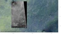
Here an overview with your (over the fence
 ) route map: ) route map:
This is an overview of partly the same area with a resolution that (could) enables roughly search for routes: (1.5 MB) http://www.greuti.ch/oppy/overview1.jpg Top left is Explorer. -------------------- |
|
|
|
|
|
|
Sep 22 2008, 03:05 PM
Post
#124
|
|
|
Member Group: Admin Posts: 976 Joined: 29-September 06 From: Pasadena, CA - USA Member No.: 1200 |
QUOTE (Tesheiner @ Sep 22 2008, 12:25 AM) ... Good ideas. A sort of map color-coded according to ripple types would be great! I knew it! I knew your collective minds would work like clockwork. A color coded map of the current HiRISE would be perfect. I would differentiate between tall ripples (prugatory and above), small ripples, sand/no-ripples, outcrop w/ripples, outcrop. Not more than that, but if it gets too difficult just differentiating between tall ripples and everything else would be a major advantage. Paolo -------------------- Disclaimer: all opinions, ideas and information included here are my own,and should not be intended to represent opinion or policy of my employer.
|
|
|
|
|
Sep 22 2008, 03:14 PM
Post
#125
|
|
|
Member Group: Admin Posts: 976 Joined: 29-September 06 From: Pasadena, CA - USA Member No.: 1200 |
QUOTE (Tman @ Sep 21 2008, 11:34 PM) To flap the panels like wings and fly away would make another very cute Rover movie. <Wish modus on> Speaking of going close to the rim again and the nice late afternoon images of Oppy's shadow spreading down into the crater, wouldn't it be great to have additionally a "large" Navcam sequence of long growing rim shadows in Victoria? I know you have do battle between what's possible (power, data volume, vehicle capabilities) and what would make for the best science and most stunning photos. And that there's a large number of people who are always looking out for the chance to take cool photos/movies. Therefore it's just more to have mentioned it again I was able to get in the plan some imagery for a pure cool factor (like the Duck Bay egress movie) but sometimes it gets really difficult to include these things in the plan. This is one of them: at the end of the sol there are activities that have to be executed at specific times and imaging would interfere with them. When we were close to Cape Verde we did take some late afternoon shots of the area were we tried to get to. Those images were taken for specific reasons (shadowing) not for cool factor and still it was quite a difficult dance with all the daily activities. Some other images were taken for engineering reasons and came out really great pictures. Jim Bell's "postcards from mars" has many of them. More recently the long shadows rear hazcams and the single eye Navcam of the tracks with Cape Verde in the background are also examples of unintended nice pictures. Paolo -------------------- Disclaimer: all opinions, ideas and information included here are my own,and should not be intended to represent opinion or policy of my employer.
|
|
|
|
|
Sep 22 2008, 03:16 PM
Post
#126
|
|
|
Founder Group: Chairman Posts: 14434 Joined: 8-February 04 Member No.: 1 |
Yup - I would go
Green : Flat Soil ( like near Fram ) Yellow : Small Ripples ( like Endurance to James Caird ) Orange : Large Ripples ( like Purgatory ) Red : Dune-like-objects (like the northern rim of Erebus - but not, as understand it, actual dunes by definition) Blue : Outcrop (like East end of Erebus ) Purple : Outcrop with Ripple ( like Erebus-to-Beagle ) AND Mark interesting features, like linear things in the outcrops in some way. |
|
|
|
|
Sep 22 2008, 03:31 PM
Post
#127
|
|
|
Solar System Cartographer Group: Members Posts: 10226 Joined: 5-April 05 From: Canada Member No.: 227 |
This is great... but I have to decline personally. I'm way too busy. So go to it, fellow UMSFers.
Phil -------------------- ... because the Solar System ain't gonna map itself.
Also to be found posting similar content on https://mastodon.social/@PhilStooke Maps for download (free PDF: https://upload.wikimedia.org/wikipedia/comm...Cartography.pdf NOTE: everything created by me which I post on UMSF is considered to be in the public domain (NOT CC, public domain) |
|
|
|
|
Sep 22 2008, 03:33 PM
Post
#128
|
|
 Special Cookie Group: Members Posts: 2168 Joined: 6-April 05 From: Sintra | Portugal Member No.: 228 |
QUOTE (Phil Stooke @ Sep 22 2008, 04:31 PM) This is great... but I have to decline personally. I'm way too busy. So go to it, fellow UMSFers. Phil I'm with Phil on this...unfortunately I'll have to decline also. I'm way too incompetent. 
-------------------- "Ride, boldly ride," The shade replied, "If you seek for Eldorado!"
Edgar Alan Poe |
|
|
|
|
Sep 22 2008, 03:42 PM
Post
#129
|
|
 Senior Member Group: Members Posts: 3419 Joined: 9-February 04 From: Minneapolis, MN, USA Member No.: 15 |
Well... the only reason I don't support the south route is that I've been looking at it from the point of view of driving a rover that's dragging one wheel. I'd bet that we can get 100+ meters a day in such a configuration, but only over the relatively flat, almost-no-ripple kind of terrain we see to the east-northeast.
Phil's images do a wonderful job of showing that there are areas that aren't much worse than what we saw in the Purgatory area -- but my concern is that when Oppy's wheel fails, we need to be somewhere that won't immediately trap us. I simply don't think that Oppy will be able to cross the lowest ripples in a Purgatory-like area while dragging a wheel, and I see enough Purgatory-like ripple country in the straight south route to believe that, even though it would be perfectly trafficable for Oppy with six good wheels, it will become completely impassable with one bad wheel. I guess I'm trying to figure out a good way to get Oppy to Endeavour even if a wheel fails. The south route looks like a good route only if no wheels fail. I'm concerned that it will become a rover trap when the wheel fails. Then again, the only metric by which I can try and forecast wheel failure is what comes out of the MER teams -- and since they decided to get out of Victoria while they still could, I guess I figured the failure was fairly imminent. If it's only imminent while Oppy is inside a crater, nothing in my available data would tell me that...  -the other Doug -------------------- The trouble ain't that there is too many fools, but that the lightning ain't distributed right. -Mark Twain
|
|
|
|
| Guest_Oersted_* |
Sep 22 2008, 03:49 PM
Post
#130
|
|
Guests |
Great idea Cody, that's what I want to see too!
Colouring for area ripple orientation and area ripple height (inferred by spacing) is a good idea, but I have a different suggestion: We could have a "geological" map with differently striped areas, where the striped areas are enlarged images of the prevalent ripple structure in a given area. Either artificially drawn stripes or photographic enlargements of a typical ripple structure in the given area. We'd then have a clear overview map with striped areas, where stripe width and orientation indicate the structure of the given area. I think that would be a nice tool for large-scale planning of this mega-drive, because the underlying ripple/surface structure would be immediately obvious to the eye, with no extra effort required to "translate" colouring to a particular terrain type. Good map-making is about immediately and instinctively being able to infer information. A map that could be printed out in 1x2 meters would be a great "overview" tool to hang on the wall in the rover driver's room. |
|
|
|
|
Sep 22 2008, 04:26 PM
Post
#131
|
|
|
Senior Member Group: Moderator Posts: 4279 Joined: 19-April 05 From: .br at .es Member No.: 253 |
Good idea, BUT ... this mapping process should be automatic otherwise it'll be like painting the Sistine Chapel's ceiling i.e. it would take too much time & effort. Does this kind of software exists in the market?
 oDoug, regarding the "lame duck scenario" I fear it would be game-over even on flat terrain. I suspect the performance would be similar to Spirit's, so driving would be on the 5-15m/sol range. |
|
|
|
|
Sep 22 2008, 04:38 PM
Post
#132
|
|
 Member Group: Members Posts: 813 Joined: 8-February 04 From: Arabia Terra Member No.: 12 |
I've been thinking about this contour map, wondering about how long it will take, worrying about whether people would agree with my interpretation...
and then I thought- wouldn't it be much better, simpler and more objective to do this as a distributed computing project? Here's my idea- take the enormous jpeg2000 HiRISE file and split it up into a huge number of small chunks of about the same size as Phil's example. Decide on several 'representative' terrain examples from this set to use as a guide. Set up a website that will display the half-dozen or so 'guide' squares above one randomly chosen square and a question that says something like 'Which terrain-type does this area show?' The visitor clicks the button for the appropriate square, the answer is recorded and the website refreshes itself! Once we have enough answers the data can be contoured and overlaid on the original image. All thoughts/queries/abuse/offers of help welcome! |
|
|
|
|
Sep 22 2008, 04:46 PM
Post
#133
|
|
 The Poet Dude Group: Moderator Posts: 5551 Joined: 15-March 04 From: Kendal, Cumbria, UK Member No.: 60 |
"Galaxy Zoo" becomes "Dune Zoo". Like it.
-------------------- |
|
|
|
|
Sep 22 2008, 05:22 PM
Post
#134
|
|
|
Member Group: Members Posts: 530 Joined: 21-March 06 From: Canada Member No.: 721 |
Neat idea, but how long to set something like this up, and get a significant amount of classification done? I don't see the MER team waiting for this, to be honest.
|
|
|
|
|
Sep 22 2008, 05:36 PM
Post
#135
|
|
|
Member Group: Members Posts: 206 Joined: 15-August 07 From: Shrewsbury, Shropshire Member No.: 3233 |
I thought that it was worthwhile providing a link to one of the most interesting images in the "After Victoria" thread:
QUOTE (ustrax @ Feb 15 2008, 12:09 PM) I won't forget it until there's a possiblity. I want to see this...: http://www.unmannedspaceflight.com/index.p...st&id=13492 ...Closer... The fact that Oppy can see the rim of Endeavour crater from its present location shows that Endeavour is not really that far away. Note that the vertical scale has been exagerated in this view to allow the shape of this hill to be more clearly seen. |
|
|
|
|

|
Lo-Fi Version | Time is now: 23rd September 2024 - 12:56 PM |
|
RULES AND GUIDELINES Please read the Forum Rules and Guidelines before posting. IMAGE COPYRIGHT |
OPINIONS AND MODERATION Opinions expressed on UnmannedSpaceflight.com are those of the individual posters and do not necessarily reflect the opinions of UnmannedSpaceflight.com or The Planetary Society. The all-volunteer UnmannedSpaceflight.com moderation team is wholly independent of The Planetary Society. The Planetary Society has no influence over decisions made by the UnmannedSpaceflight.com moderators. |
SUPPORT THE FORUM Unmannedspaceflight.com is funded by the Planetary Society. Please consider supporting our work and many other projects by donating to the Society or becoming a member. |
|