Printable Version of Topic
Click here to view this topic in its original format
Unmanned Spaceflight.com _ Opportunity _ The Descent into Victoria
Posted by: glennwsmith Jun 24 2007, 06:17 AM
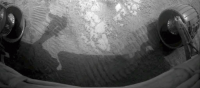
Here's an obvious scenario that better minds can critique: we will descend hugging the clockwise cliff but also at some safe distance from it (lest a rock should become dislodged during the next wind event or daily thermal cycle and fall on the solar panels), occasionally turning to face it (but still at some safe distance) and using the full reach of the instrument arm to RAT and take micrographs and readings.
Posted by: Stu Jun 24 2007, 07:29 AM
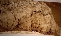
Think we're going to be seeing a LOT of this cliff face in the days ahead...
|
Posted by: BrianL Jun 24 2007, 04:10 PM

Wrong cliff face, methinks. That's St Mary, not Verde. Unless I'm misinterpreting what you mean.
Brian
Posted by: Stu Jun 24 2007, 04:29 PM
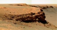
Sorry BrianL, should have been clearer... I know this isn't the bay she'll enter in, I meant that this looks like a good target for Oppy once she's down in the crater, cos of all the layering we can see. 
Of course, this will be our first stopping point...
|
Posted by: abalone Jun 25 2007, 06:28 AM
What impact is this going to have on the energy production due to excessive shading. Maybe we will go in a few metres parallel to the cliff and just "dash in" for a closer look once targets have been identified
Posted by: helvick Jun 25 2007, 11:15 AM
There is a loss due to shading but it's less than you would think. At the moment 40-50% of the insolation is diffuse (and more if Tau is > 0.7) which is not affected by the shade so even if she parks right up against a wall she should not lose more than 20-25% of her potential power.
If she stands back a bit from a cliff so that it directly blocks, say, the rising sun for 3 hours past local dawn that would block approximately 10% of the daily total insolation. In addition there is a positive effect where a cliff that blocks direct morning sun will reflect evening sun so that effective insolation in the afternoon will rise slightly.
Since she is currently generating 800+whr/Sol she has plenty of power margin to do this sort of work right now.
Posted by: fredk Jun 25 2007, 03:16 PM
It depends on what direction the cliff is facing, though. If we were parked right against a steep enough north facing cliff, we'd lose most of the direct sun and nearly half of the diffuse light, since the cliff would be in perpetual shadow now. Fortunately there are no directly north facing cliffs nearby!
The south-facing cliffs of Verde and St. Mary would be ideal for close visits now. I'd be interested in what being parked against a sunlit cliff does to local temperatures.
Still, we're not sure if they intend to inch up to cliffs or just sample the floor of Duck Bay. We've heard that they have a policy to avoid driving onto overhanging cliffs from above. Perhaps they'd be concerned as well about rockfall at the base, especially if they tried ratting the cliffface! 
Posted by: Stu Jun 25 2007, 03:38 PM
Bad idea... just imagine all the damage that could be caused by puddle water dripping onto Oppy's sensitive electronics...

Posted by: As old as Voyager Jun 25 2007, 06:13 PM
I remember once reading that surface temperatures are far higher inside lunar craters than surrounding plains. I wonder if this holds true for Martian craters?
Posted by: dvandorn Jun 25 2007, 06:26 PM
Yes, it generally is true. It's a matter of sunlight reflecting off the crater walls. If you look at THEMIS images from Mars Odyssey, you can see that craters tend to be warmer than the surrounding terrain, especially just after sunset.
-the other Doug
Posted by: AndyG Jun 26 2007, 07:18 AM
...Hmmm. Then the focus of any near-parabolic craters must be an interesting place to be, with regards to the generation of thermals.
Andy
Posted by: dvandorn Jun 26 2007, 07:28 AM
Most craters aren't parabolic, and thus don't have perfect heat-focusing characteristics. But they do, indeed, heat the air above them and create thermals. If you don't believe me, look at the dust devil tracks in Gusev -- they very frequently spin out of craters.
You have to wonder why you see dust devils forming at Gusev and not spinning out of Victoria, here. I imagine there are a lot of factors, but still -- it is odd that some craters spawn dust devils and others don't. None of the craters at Meridiani seem to be spawning DDs, and yet lots of them are formed at Gusev.
-the other Doug
Posted by: Edward Schmitz Jun 26 2007, 03:10 PM
You do see DD's spinning off of craters but, from what I've read, they are more related to turbulance caused by air flowing over the crater. I've not heard anything about there being a heat differential over these crater causing the DD's.
Posted by: fredk Jun 26 2007, 03:15 PM
Looking at wide angle orbital views, even at Gusev there are DDs only in a small region, which we happen to be sitting in the middle of. Why not elsewhere in Gusev? Is it the prevailing wind speeds? Is it that they do occur elsewhere, but the surface underneath the dust is lighter than it is here, so their tracks don't look dark? I seem to recall that we've discussed this before...
As far as crater shape goes, I would think even a somewhat not parabolic shape would still give a decent focus, if only the crater surface could reflect specularly, which unfortunately it can't. 
Posted by: djellison Jun 26 2007, 06:52 PM
1 p.m. EDT, Thursday, June 28
NASA will hold a media teleconference to discuss the scientific reasoning and risks related to the Mars rover Opportunity's planned descent into the massive "Victoria Crater."
Briefing participants are:
-- Alan Stern, NASA associate administrator, Science Mission Directorate, NASA Headquarters, Washington
-- Michael Meyer, lead Mars program scientist, Science Mission Directorate, NASA Headquarters, Washington
-- John Callas, Mars Exploration Rover project manager, NASA's Jet Propulsion Laboratory, Pasadena, Calif.
-- Steve Squyres, principal investigator, Mars Exploration Rover science instruments, Cornell University, Ithaca, N.Y.
Posted by: CosmicRocker Jun 27 2007, 04:26 AM
Thanks for noting that, Doug.  That's exciting news, but it is unfortunate that it was buried it in the NASA internet labyrinth. This is something that should be given more bandwidth. I'm putting it on my calendar.
Posted by: Reckless Jun 27 2007, 08:41 AM
Hi everyone
I couldn't find that NASA briefing I looked in nasa TV special events and it wasn't there.
The date is today isn't it.
Roy
Posted by: djellison Jun 27 2007, 08:56 AM
Tomorrow. I think it will be an audio telecon with slides rather than a full NASA TV program.
Posted by: akuo Jun 27 2007, 09:01 AM
It isn't on http://www.nasa.gov/multimedia/nasatv/MM_NTV_Breaking.html for tomorrow either. Might be audio only, like the final MGS teleconference.
Posted by: Tesheiner Jun 27 2007, 09:50 AM
Here is the http://www.nasa.gov/home/hqnews/2007/jun/HQ_M07073_Rover_and_Victoria_Crater.html. It's audio only.
Posted by: Reckless Jun 27 2007, 10:07 AM
Thanks Doug and Tesheiner
I really thought today was Thursday somedays I don't know what planet I'm on.
Audio is that like stone knives and bearskins
It's bookmarked and Ill try to get it for the ipod.
Roy
Posted by: Stu Jun 28 2007, 05:54 AM
Looking forward to the teleconference today, which I'll have to listen to on my laptop cos my main PC's frakking soundcard has decided today would be a GREAT time to stop working... 
I wonder what thoughts are going through the MER team's minds right now? Excitement? Reluctance? Apprehension? Fear? Impatience? (anyone want to tell us..?) I know Oppy herself isn't really alive (despite what I keep writing!), that she isn't self-aware, but I think that if she was she'd be thinking "Please, let me go in... I want to go in... This is what I was made for... this is what you built me to do, and sent me here to do... this is what I hauled myself out of Eagle Crater for, and trekked all this way south for... this is what I dragged myself through Purgatory Dune for, and dipped into Endurance Crater for... this is what I endured all those freezing martian nights and windy martian days for... this is why I Am, to go into this crater and study it from inside... rocks may fall on me, my wheels might get stuck in the dust, but down there is where I should be, where I need to be... "
At the end of the sol, if Oppy doesn't go in, what is she going to do? Keep scouting around the edge of the crater, looking down at one tantalising just-out-of-reach outcrop and bay after another? Send back countless thousands more images of all those layers and shelves and terraces that hint at wonderous geological stories, but are, too, just out of reach?
I think we all knew this day would come. The interior of VC is It. It's as far as Oppy can go. The rail tracks end here. There are no more targets within - realistic - driving distance.
I know many are worried that Going In might mean she never comes out again, that it's risking a valuable asset, but I think that's seen as acceptable and even necessary now. As much as we convince ourselves here sometimes, Oppy isn't immortal; the martian ghouls could claim her literally any moment, snuffing out her life with something as petty and frustrating as a snapped wire or a circuit failure, or as dramatic as a broken wheel or a lurching topple into a bank of soft dust. But it's time. She didn't come all this way, survive everything that's been thrown at her, to just meekly patter around the edge, like R2D2 trundling through that canyon on tatooine, beeping and tooting forlornly and plaintively, killing time, waiting for time to kill her. She came all this way to explore, to learn, and to teach us. Time to let her do that.
A major dust storm is brewing up on Mars as we've heard, a great billowing mass of red dust is broiling and churning away, getting larger by the second. It could end either of the rovers' missions if it pours over them, the dust choking and clogging them, cutting off their power, killing them as surely as a pillow smothering their faces. So what fate would we rather have for Oppy? To have her end her days rolling safely around Victoria, ticking off the sols, looking down on the geological Alladin's Cave that is VC's interior... or exploring the inside of the deepest hole we've yet reached on Mars? There's amazing science to be done in there... layers to study, dust spills to photograph in detail, rocks to gaze at close-up... cliff faces to peer up at from below, their boulders and ledges jabbing out of the rockface like gargoyles against the pink martian sky... imagine the images we're going to see from inside there...
Enough trundling. Enough peering down. Enough "that might be". Time to let her go and do what she was sent to do.
Go explore, Oppy. The stage is all yours...
Posted by: Geographer Jun 28 2007, 06:45 AM
What an inspiring speech Stu! You should write speeches for Michael Griffin. I'm sold...but I was never a hard sell in the first place.
Posted by: Reckless Jun 28 2007, 11:44 AM
O.K. Stu
You've pushed me over the edge. so to speak.
It's strange that trying to think about the pros and cons kept me hovering but, them gargoyles helped me decide to go for it.

Roy
Posted by: Tesheiner Jun 28 2007, 03:41 PM
The telecon should have already started, but the http://www.nasa.gov/audience/formedia/features/news_audio.html still says "A link to the streaming audio will appear here before the event." and no link is there. 
Posted by: algorimancer Jun 28 2007, 03:54 PM
Here I go, spitting into the wind again. I think it would be great if Oppy couldn't go into VC - off we'd go on another cross-country adventure, hopefully southeast towards Big Crater, wondering day by day what is over the next hill and exactly what route we'll follow. New vistas, new adventures, that's what I'd like to see. A full-color 360 degree panorama from the peak of the western rim of Big Crater - that would be incredible.
But of course there is little double that Oppy is going into VC, and there will undoubtedly be interesting things to see there as well - I'm looking forward to MI close-ups of a vertical cliff. But I anticipate a lot of boring sitting around in one spot for ages, like Spirit has been doing lately.
Posted by: akuo Jun 28 2007, 03:56 PM
The teleconference is still an hour and a bit away.
Posted by: Tesheiner Jun 28 2007, 04:08 PM
I must go back to school! 
1pm + 6h = 7pm and not 5pm.
Posted by: CosmicRocker Jun 28 2007, 04:48 PM
I won't be able to listen to it after all. I see now that there is only a link to a RealAudio stream. Even if I would consider installing Realplayer on this machine, our corporate bit-nazis would not allow me to. Hopefully some nice people will post running comments here so those of us without access can learn of anything interesting being said.
Posted by: Tom Tamlyn Jun 28 2007, 04:48 PM
The press release for the teleconference states that "[s]upporting images and graphics for the teleconference will be posted at: http://www.nasa.gov/rover," but I get "page not found" for that address. Perhaps the page goes live at the last moment?
TTT
Posted by: djellison Jun 28 2007, 04:49 PM
Yes - it'll go live when the conf. starts.
They had sort of 'end of sad movie' music for the Dawn 'on hold' music. This is all a bit more up beat
Doug
Posted by: mhoward Jun 28 2007, 04:54 PM
Currently "You are the sunshine of my life.." - a little syrupy, but still, we do love those rovers.
Posted by: djellison Jun 28 2007, 05:01 PM
http://www.nasa.gov/mission_pages/mer/070628/index.html
Sweet
Doug
Posted by: CosmicRocker Jun 28 2007, 05:01 PM
Images and animations are here, now.
http://www.nasa.gov/mission_pages/mer/070628/index.html
Posted by: akuo Jun 28 2007, 05:06 PM
Nice animation. Didn't think they would go that far really... If it's accurate
Posted by: Oersted Jun 28 2007, 05:09 PM
Hmm, that talk + the vids weren't really tailored to the discerning crowd at UMSF, I think...
Posted by: dvandorn Jun 28 2007, 05:23 PM
I've been able to listen for a bit, here (though I was on the phone with my girlfriend for the first 10 minutes or so). What I got out of Squyres' discussion is that the *only* primary science goal that has been identified for the foray into the crater is the investigation of the "bright band" of evaporite visible in the crater walls. They *think* that this band is contiguous to the layering found in Endurance, and they want to look at compositions (particularly the leeching of certain salts at given depths) to try and both confirm that these layers were laid down at the same time as the layers in Endurance, and to determine if the same processes that leeched some salts at Endurance were also working here, several km away.
They're not saying that once the bright band is explored we'll up and leave VC. Just that this is the primary mission of the foray into the crater. Squyres made it sound like he's certain we'll see other things we want to check out once we get down into the thing.
Now we're hearing a litany of all the things that have broken on the rover since we left Endurance... and commentary on how we had to spend six months looking at the crater to decide that the best place to enter is where we started out...
-the other Doug
Posted by: dvandorn Jun 28 2007, 05:25 PM
Specifics on entry -- they'll go to the southern end of the northern lobe of Duck Bay and do their initial toe-dip at that point, followed by entry. There is a ripple that follows the northern lobe, they want to cross it where it appears thinnest, at its southern tip.
-the other Doug
Edit -- toe-dip (which ought to define "entry") looks like it will happen on Saturday, July 7 or Monday, July 9.
Posted by: CosmicRocker Jun 28 2007, 05:37 PM
Thanks for the summaries, O'Doug.
Posted by: dvandorn Jun 28 2007, 05:40 PM
More updates -- Steve says that the biggest concern about entering Victoria is the greater danger of failure to the drive mechanisms (wheels, steering actuators, etc.) working on the steep slopes. He reminded us that when Oppy worked in Endurance, she was a much younger rover. He flat-out stated that if we lose a wheel inside the crater, when we *know* we'll just barely be able to get out with six good wheels, we'll never get out.
Alan Stern just commented on funding -- he sort of evaded the question by simply saying that the entry into and exploration of Victoria is, for the time being, covered by the currently approved mission extension. He wouldn't go into what might be decided for later extensions. And John Callas followed that up by saying what I've stated -- as long as the MERs remain mobile, every extension is a brand-new mission and would be sold to NASA HQ as such. Leaving unspoken but very strongly implied that an immobile rover would be harder to sell for an extended mission.
-the other Doug
Posted by: dvandorn Jun 28 2007, 05:44 PM
Squyres: "The sole basis of our scientific rules of engagement entering the crater is rover safety. The next priority is finding a safe way to approach the bright band. We will not detour from the safest path for a lot of targets of opportunity, but if we see interesting things along the way, we may stop and do some science. But we won't deviate from our path to look at other interesting things." (Paraphrased.)
-the other Doug
Posted by: djellison Jun 28 2007, 05:47 PM
Something that didn't go unspoken with the first Squyres Q'n'A I did
Doug
Posted by: dvandorn Jun 28 2007, 05:50 PM
Not a problem, though I'll have to leave to go to work here in about 15 minutes. They're taking press questions now, so we're getting some repetition in information as people ask questions that have already been answered in the presentations.
This last question was a sort of muddled one about whether it would be easier and cheaper to cut down on communications with the rovers and just use auto-nav and auto-drive features of the updated software... Callas is emphasizing that we don't use DTE comm all that much, relay through Odyssey is a lot more energy-efficient.
-the other Doug
Posted by: djellison Jun 28 2007, 05:59 PM
Squyres on targets outside of Victoria if/when they get out
- Potato/Fist sized cobbles on the plains. Some have been meteorites, some crater ejecta, some have been 'wierd' - perhaps from distant craters or very deep inside victoria.
- Follow up at Erebus - best evidence of water on the surface. Possibly Terra Nova as well or other deeply eroded craters.
Posted by: dvandorn Jun 28 2007, 05:59 PM
Steve was just asked what goals they might have after finishing with Victoria.
He said there are two science investigations they want to execute out on the plains after we finish with Victoria -- the first is the cobbles we've been blowing by as we've been travelling. The ones we've looked at, some are meteorites, some are local bedrock, and some are just weird. They might be from a long ways away, or they might be from deep down and excavated by Victoria. We want to put together a story about rocks we could never drive to.
Second is following up on discoveries we made at Erebus (festoons and such). He's talking about going to similar ancient, eroded craters like Erebus, but not necessarily back to Erebus.
No mention of any kind of Big Crater/Ithaca.
OK -- I have to run, so that's it for summaries from me for now. I hope people have enjoyed them!
-the other Doug
p.s. -- thanks for taking up the task, Doug!
Posted by: djellison Jun 28 2007, 06:06 PM
- Very confident of getting to the bright rocks.
- Another 'tens' of metres further in - fairly confident.
- Beyond that - all bets are off. We will not venture onto steep sandy slopes unless we know there is bedrock underneath.
- Not sure where this stuff lies compared to Burns cliff - need to do the science to match it up.
- Not going to attempt to get to bright band anywhere else other than Duck Bay. Wouldn't go close to Cape St Vinc. Cliffs are scarey things for little rovers.
- Regional dust storm - about a week old. Tracking it via MRO/MARCI with daily weather updates. It's regional extent - mainly south of Oppy. Don't have predicitive power for it - past experience suggests it may be starting to blow itself out.
- Dust storm blocks out sunlight, less power - but Opportunity is very clean. The storm is a risk- but well position to deal with it.
- Dust levels are the amoung the highest we've ever seen
- Mini-TES of bright band? Not really - from Mini TES it's all rich in sulphates. The differences in Sulphate chemistry we saw at Endurance were only evident in close detail. Primarily the APXS that pulls out the subtle differences. That + microscope. Rat+APXS+MI is what we need to unravel this problem.
- What would be the plan if the dust got worse for Oppportunity? We have experience with Spirit - we had a very dust rover, deep into winter, power levels dip to less than 300Whrs. Before the storm near Opportunity we were at nearly 800whrs, and off the showroom floor it was only around 900Whrs.
- Craig Covault : Anything you want to say about Spirit?
- Steve mainly 'on' Opportunity but jealous of the Spirit stuff. 'Silica Valley'.
- Identified another patch of bright soil but different from Gert.Wei, but right next to it.
- Found rock with crazy nobbly texture ( difficult to IDD with ) - that's also high in Silica.
- Tried to crunch some with the wheel - and nothing happened - but, right next to it, another piece of rock that did break. 'Innocent Bystander'
- After studying that - time to get up onto Home Plate
- Total cost - ongoing cost?
- To date from project inception to 4th extension - a little over $900m
- Current annual rate is $20-24M
- Spirit hit by dust-devil?
- No instruments on when cleaned (were using Mini-TES at the time)
- Last few weeks - several cleaning events - two big ones - Spirit has more than Oppy
- First jump at about 1320 local - possible direct hit from DD.
- Imaged rover duck - pattern of removed dust very patchy. Some clean, some not - perhaps has something to do with DD.
Doug
Posted by: Tom Tamlyn Jun 28 2007, 06:09 PM
Interesting discussion by SS about the team's inability to distinguish, from a distance, between sandy slopes, which the rover cannot traverse if the slope is greater than 12 or so degrees, and rocky slopes with a thin layer of sand, which are almost as traversable as a rocky slope (good up to 32 degrees). In Endurance they didn't realize how good the traversability was until they got close views of the slopes.
TTT
Posted by: volcanopele Jun 28 2007, 06:17 PM
I have been watching the press conference, but the images are up on the photojournal. This one in particular caught my eye:
http://photojournal.jpl.nasa.gov/catalog/PIA09692
When I first saw that, I thought "that has got to be enhanced". But no, the tracks really do stand out that well Very cool.
Posted by: MarsIsImportant Jun 28 2007, 06:30 PM
That was a lot of good information. They asked a lot of good questions, including most that I wanted asked. But one VERY major question was omitted. Nobody asked about the very recent changes in the rover tracks observed from So 1212, 1214, and 1216. These are clear and major changes that have not been observed before during any other time of the mission. The dark streaks appear to suggest the answer to the origin of the large dark streaks to the North of Victoria.
Back to the topic...So ingress will occur sometime around July 7th to the 9th. At least that is what is planned...after a few more tweaks and calibrations including the Rat tool.
Posted by: mars loon Jun 28 2007, 08:00 PM
TTT
look here
http://www.nasa.gov/mission_pages/mer/070628/index.html
Posted by: remcook Jun 28 2007, 09:05 PM
that's a pretty good route map!
Posted by: ToSeek Jun 28 2007, 09:11 PM
But of course there is little double that Oppy is going into VC, and there will undoubtedly be interesting things to see there as well - I'm looking forward to MI close-ups of a vertical cliff. But I anticipate a lot of boring sitting around in one spot for ages, like Spirit has been doing lately.
There is an unfortunate inverse correlation between what the geologists find interesting, and what I find interesting. I want to see new vistas, while they want to find something new and interesting that they can spend weeks analyzing to death.
Posted by: Stu Jun 28 2007, 10:18 PM
I want new vistas too, but I have to admit I've been very, very spoiled this past few months... new vistas every day or so... time for the scientists to have their fun now!
Go get that bright band Oppy!
|
Posted by: ollopa Jun 28 2007, 10:42 PM
Curious: they seem to have pulled the 20-second simulated rover animation that was posted on the briefing page before the teleconference. I wonder why.
Posted by: mars loon Jun 28 2007, 11:54 PM
I just noticed that also. too bad .
anyway, some of you have wondered where these links can be found.
for that, check out the NASA Press release page
http://www.nasa.gov/audience/formedia/features/index.html
otherwise, that was a very informative press conference
and a news summary has appeared at space.com
http://www.space.com/news/070628_opp_victoria.html
ken
Posted by: lyford Jun 29 2007, 12:08 AM
Mods - please let me know if this isn't kosher -
I shrank it from 30 MB to 540K using QuickTime Pro! Seemed like such a huge file for such a short movie...
http://homepage.mac.com/lyford/4umsf/181137main_Opportunity_drive_6-25x640.mp4
Posted by: alan Jun 29 2007, 05:00 AM
According to the those speaking at the conference
sand = bad
They couldn't have an animation of Oppy driving on sand, that would be putting the animated Oppy at unnecessary risk.
Posted by: CosmicRocker Jun 29 2007, 05:06 AM
Thanks for the summaries and comments, people. Even though I couldn't listen to the briefing, with your help I was able to read the high points and still make it to my 1:30 meeting.
lyford: That amazed me. I downloaded the original 30 MB animation and your <1 MB version. I saw little difference. They now have a new version posted that is over 7 MB, but it's quality is quite inferior to your small file. It is also curious to me that they posted an animation of the rover entering the crater and cruising non-stop, straight down toward some of the most treacherous terrain, without even turning toward the bright transition between relatively intact bedrock and the pre-impact surface.
If they enter where we expect them to enter, they will need to only go down a short way and turn to the right to investigate the "bright band." That is the safest initial target of interest.
You guys want vistas? Just wait. The geologists and the photographers should be satisfied.
I'm not sure how to interpret the comments that the little rover is fearful of certain, far away cliffs. Do they intend to go there? I do like the potential, post Victoria plan. It's the most logical choice for an old robotic geologist. No matter where it goes on it's journey of exploration, skillful scientists will make useful observations, and talented photographers will find new vistas. That seems to be the way it works.
Posted by: Stu Jun 29 2007, 06:10 AM
3D of "Bright Band"
|
I was amazed by your movie too lyford, especially after downloading the original mega-file on dialup last night...!! Thanks for that.
I'm not worried about a 'vista-drought' now at all... just one look over Oppy's shoulder as she scoots towards Bright Band will give us all a
moment, I'm sure! By the way, thanks from me too to everyone who posted during the teleconference. My audio was phasing in and out like some message from the Delta Quadrant while I was listening, so you all helped fill in the gaps.
Posted by: Tesheiner Jun 29 2007, 11:25 AM
I'm still trying to understand the planned entry point based on what is written here and from the animation on the NASA web.
Is this the idea?
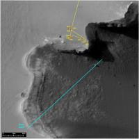
|
Or enter at a point between Sputnik and the sol 952 site?
Posted by: djellison Jun 29 2007, 12:19 PM
My intepretation is this
|
Posted by: MarsIsImportant Jun 29 2007, 02:22 PM
Green marks the entry path. That's my understanding too.
Posted by: Tesheiner Jun 29 2007, 02:26 PM
So that's more or less the same site as of sol 952.
Posted by: djellison Jun 29 2007, 02:29 PM
Just 'left' of it, if that makes any sense.
Posted by: MarsIsImportant Jun 29 2007, 03:17 PM
What I don't understand is that they picked an ingress spot further away from the current rover position than they had too. In fact, the spot they picked requires going over the lip of a dune. Again, that doesn't seem necessary if they had chosen this area marked in red.
|
Again, green arrow points the area of entry as understood through the conference yesterday.
Posted by: djellison Jun 29 2007, 03:51 PM
Slope too steep there perhaps - too close to the cliff edge w.r.t. shadowing solar and comms.
Doug
Posted by: MarsIsImportant Jun 29 2007, 04:10 PM
Well, the slope is not too steep. As for being too close to the cliffs, that would only be true if they were going straight down. I think the reason might be simply because that a straight line is not necessarily the the fastest way to the target. If they went down the area I marked in red, then they would have to traverse the slope for much longer of a distance to get to the intended target. That means a very slow pace on the slope.
The way the MER team intend to go maybe longer in over all distance, but they will have only to go half the distance to the target on a slope. Much of the travel will be quick on flat surface. That is the only reasonable argument for ingress placement that I can think of. Plus, doing the toe dip in and out at that particular place might make it easier for rover to get out again through compression of the soil at that spot. I guess that I'm answering my own questions.
Posted by: dvandorn Jun 29 2007, 05:14 PM
I think you have the right idea, MII. I know that during the telecon yesterday, SS made several statements about how they were planning a very specific route that addresses rover safety above all. He said that they would *not* deviate from this route in order to go after interesting-looking targets, but that they may stop *along* this route to look at interesting targets of opportunity.
Whatever the rationale, this route has been selected to maximize the safety of the rover and to get it to the bright-band exposure that is the top scientific priority of entering the crater. Any deviation from this pre-selected route will come only from rover safety concerns, methinks...
-the other Doug
Posted by: Tom Tamlyn Jun 29 2007, 06:21 PM
For those who missed the press conference, a telephone replay is available until July 2.
http://www.nasa.gov/home/hqnews/2007/jun/HQ_M07073_Rover_and_Victoria_Crater.html
Most of the information has been well summarized in this thread, but it's always a pleasure to admire how clearly SS speaks about rover operations and science, and how well he communicates the enthusiasm of the team. I can't think of anyone else in his league.
TTT
Posted by: Tman Jun 29 2007, 07:24 PM
Surprisingly on the http://www.space-multimedia.nl.eu.org/index.php?option=com_content&task=view&id=2538&Itemid=1 site, that usually has provided only manned spaceflight topic, is it now available - for good I guess. As well the last NASA audio teleconference for the Dawn mission.
Posted by: BrianL Jun 30 2007, 03:55 PM
One thing is not clear to me in what was announced. Do they feel that the bright band is as deep as they can go into the crater to keep the rover safe? That would be very disappointing if they were not able to continue further downslope to get to older layers of exposed rock.
Brian
Posted by: djellison Jun 30 2007, 04:13 PM
It's a case of 'see how we go'. The white band is the only target so far - they have no specific goals beyond that simply because they can't really tell what the terrain is like after that until they get closer to it.
It's probable that there may be a few tens of metres further exposed rock that is easily navigable beyond the white layer. However, if beyond that it's just sand, then they're not going to try 12 degree sand slopes, they're a death trap (see the trouble they had near Wopmay rock in Endurance - many sols of churning and wheels up to the hubs and beyond in sand)
It all depends on what the terrain offers when we get closer. If it's just a tiny bit of sand on top of solid rock, it's doable...otherwise it'll be a case of going as far down as they can, and then coming back out again.
Doug
Posted by: ElkGroveDan Jun 30 2007, 04:22 PM
...perhaps doing the same on other "ramps" where different layers may avail themselves - if navigation is difficult here.
Posted by: CosmicRocker Jul 1 2007, 06:08 AM
BrianL: That bright band is the safest, pre-impact bedrock they can reach. They will probably be able to go deeper than that, but as others have noted, further safe roving will depend on rover observations.
That Space-Multimedia site was a godsend. I was able to download the audio and listen to all of it. Squyres' performance was as amazing as it always is, but everyone else did just as well. That teleconference was one worth waiting for.
I am really excited that Steve noted that Opportunity would be traversing the first ever, good, vertical slice through an ejecta blanket, and did not want to waste the opportunity. I think this is important.
Sorting out the origin of the bright band, and whether it is due to the past atmosphere working down, or the past groundwater working up sounds like a good idea to me.
As for post-Victoria explorations, I can buy into a journey across the plains, looking at eroded craters for flowing water evidence and exotic cobbles along the way. It sounds like a good plan to me.
Posted by: Astro0 Jul 2 2007, 10:52 PM
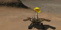
Hi All,
Just before Oppy heads into VC, I thought that I'd share a little SFX image.
The version here includes an inset image from the full-res version which is 6600x2418 and 16.5mb.
The full image is available http://www.zip.com.au/~gjn/MERSFX/indexSFX.html for download.

|
This is just a thumbnail version, see the link above.
I think that the scale is about right.
Thanks to Doug for the MER model used as the base for this image.
Can't wait until we see the real descent next week.
Enjoy
Astro0
Posted by: nprev Jul 3 2007, 02:27 AM
...awesome as always, Astro0! Thanks!
Posted by: CosmicRocker Jul 3 2007, 03:00 AM
Yeah, it's very well done, Astro0.
Posted by: Stu Jul 3 2007, 06:25 AM
Stunning pic Astro! Time and time again you've given us all wonderful "almost like being there watching" views, and I want to say thanks.
Posted by: Astro0 Jul 3 2007, 06:43 AM
Thanks Stu. Time and time again your prose takes me there too
BTW, if anyone would like the full 16.6mb version which at 100dpi would print out nicely at 168x62 centimetres (or 52cms without the title block), then I'd be happy to email it to you if your inbox can handle the file size. Unfortunately, I just don't have the space on a server to put it online for download. If anyone can host the image, that would be great.
Thanks for the feedback.
Astro0
Posted by: ustrax Jul 3 2007, 11:44 AM
You too Oppy?!
Together with the Dawn launch it will turn my birthday this year into something to remember...
Not mentioning non space related happenings...
Posted by: neo56 Jul 3 2007, 12:03 PM
Very beautiful picture Astro0 !
Could you tell me where did you find the photo of Duck Bay? The colors are wonderful.
Thank you
Neo56
Posted by: Pando Jul 3 2007, 06:30 PM
Together with the Dawn launch it will turn my birthday this year into something to remember...
I'm not sure it will happen that soon. The dust storm at Meridiani was pretty nasty, with tau being close to double of anything previously seen by Oppy, and power levels were way down. I think things are improving right now though, once Oppy gets past standdown... whew...
Posted by: maycm Jul 3 2007, 08:15 PM
Suggest you upload it to http://www.sendspace.com and post the link here...
Posted by: Tom Tamlyn Jul 3 2007, 08:52 PM
>once Oppy gets past standdown.
Pando,
Do you mean that the dust storm has delayed the schedule for entering Victoria discussed in the press conference last week?
TTT
EDIT: Just noticed the news release on the jpl site concerning the delay caused by the dust storm.
http://www.jpl.nasa.gov/news/features.cfm?feature=1411
Posted by: helvick Jul 3 2007, 09:18 PM
By my reckoning that means Tau at around 3.5 leading to power dropping from around 680Whr/sol to 340Whr/sol.
Ouch.
Posted by: um3k Jul 3 2007, 09:36 PM
Astro0, I have a suggestion for your image. You should adjust the colors and contrast of Opportunity to match the landscape; i.e. make it redder. As it is, Oppy doesn't fit in at all, and looks like you just pasted it into the image (which you did, but it shouldn't be so obvious). A simple levels adjustment can work wonders.
Posted by: Stu Jul 3 2007, 10:00 PM
That "ripple" looks a bit, um, big, dontcha think..? 

|
Posted by: Sunspot Jul 3 2007, 10:42 PM
Ouch.
This is terrible news... I was wondering why they hadn't made any further progress towards entering the crater lately.
Posted by: Astro0 Jul 3 2007, 11:33 PM
Neo56,
The base image was from the Pancam website.
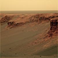
It's the http://marswatch.astro.cornell.edu/pancam_instrument/991B_cape_verde.html linked here.
The image was cropped and enhanced for the final SFX image.
Astro0
Posted by: Pando Jul 3 2007, 11:45 PM
Yeah, that was close - tau of 3.3, and 402Whr... Looks like Oppy got lucky due to the cleaning events prior to the latest dust storm.
Posted by: BrianL Jul 4 2007, 03:53 AM
Nah, if you're really motivated to get to the other side, just keep those wheels churning till you break through it. I don't think it's deep enough to hang her up on her belly.
Just


Brian
Posted by: Tesheiner Jul 4 2007, 09:18 AM
I thought the low activity was due to the US holidays.
It wasn't until this morning that I knew about the press release and the issues with high tau / low power.
Posted by: Tesheiner Jul 4 2007, 03:07 PM
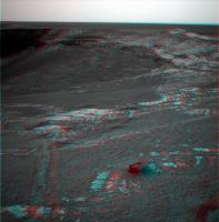
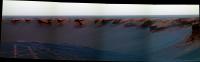
Have a look to these two fhazcam images.
The first one was taken on sol 1216 at 12:44 right after moving on this site, while the second one is from yestersol, sol 1223 at 11:21. The local times are not exactly the same but quite similar and the shadows seen on the first one almost disappeared on the second picture.
http://nasa.exploratorium.edu/mars/opportunity/forward_hazcam/2007-06-26/1F236138654EFF85R9P1151R0M1.JPG http://nasa.exploratorium.edu/mars/opportunity/forward_hazcam/2007-07-03/1F236754890EFF85R9P1154R0M1.JPG

Posted by: Sunspot Jul 4 2007, 03:12 PM
This could be the end of Opportunity.
Posted by: djellison Jul 4 2007, 03:16 PM
We're at a low of 400whrs (175 more than Spirit at its worst), with the atmospheric opacity improving. Reports of death are premature.
But - any sol could be the end of Opportunity to be honest. I don't think this dust storm makes it any more or less likely.
Doug
Posted by: fredk Jul 4 2007, 03:49 PM
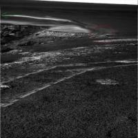
Thanks for that, Tesheiner. I made an animated gif with http://marsrovers.jpl.nasa.gov/gallery/all/1/f/1217/1F236222815EFF85R9P1151R0M1.JPG and http://marsrovers.jpl.nasa.gov/gallery/all/1/f/1223/1F236754890EFF85R9P1154R0M1.JPG They are only 9 minutes apart in local time, and you can just make out the shadow of the right wheel in the 1223 view, but the shadow of the deck is almost invisible. This really gives you a good sense of how dusty the sky must be. Note that the arm has moved between these frames.
|
Posted by: helvick Jul 4 2007, 04:44 PM
Reports of impending doom are definitely premature - the Dust storm is clearing so power levels should climb back up into the 600+ range over the next few weeks so long as there are no more storms.
I was very interested to see that my model of the amount of diffuse insolation noticably underestimates the amount of power available when Tau really rises to high numbers - at the stated Tau=3.3 and the current dust loss of 16% my model predicted 360Whr vs the 402Whr that Pando reported.
Assuming that 12% error holds for higher Tau values then Tau would have to rise past 5 and stay there for Opportunity to be in real trouble.
Posted by: Analyst Jul 4 2007, 06:17 PM
Nice dust storm to calibrate the model.
Posted by: Sunspot Jul 4 2007, 06:20 PM
They should try and get some sunset/sunrise pictures, could be very colourful?
Posted by: Pando Jul 4 2007, 08:52 PM
That was actually from the press release that Tom Tamlyn posted earlier
Posted by: nprev Jul 4 2007, 09:05 PM
|
|
Man...
...what a change in such a short time! I wonder if the dust cloud had a discernible edge as seen from the ground. This is one of the most Earth-like changes we've seen on Mars, IMHO.
Posted by: mhoward Jul 5 2007, 01:58 AM
Some Pancam images were taken on sol 1224, no doubt to study the sky during the dust storm. Of course brightness levels of these stretched JPGs are all over the place, but I think it does look dusty. The time was about 3:20 local Mars time.
http://www.flickr.com/photo_zoom.gne?id=721554190&size=o
http://www.flickr.com/photo_zoom.gne?id=721555414&context=photostream&size=o
Posted by: Bill Harris Jul 5 2007, 04:08 AM
Interesting animation, Fredk. It is also instructive to make an animation of those two images adjusting the levels of the sunlit areas to be similar in addition to the shadow areas being similar as done previously. The on-the-ground effect is that the shadows appear markedly brighter with increased dust.
Rather the difference between LosAngeles and Palm Springs
--Bill
Posted by: CosmicRocker Jul 5 2007, 04:15 AM
The dust seems to have softened the light, making the pancam 1x4 appear prettier than normal on sol 1224. I was waiting for Mike to update the metadata so I could use anti-vignetted images from MMB, but it seems I couldn't fully compensate for the brightness variation between images. I didn't screw with the color balance, because I liked the false color in this set. If someone can correct the brightness banding, this set of pancams will make a gorgeous postcard.
|
Posted by: Stu Jul 5 2007, 05:39 AM
You're right Cosmic, lovely subtle light here at the moment...
|
Posted by: nprev Jul 5 2007, 05:51 AM
Nice, Stu. The lighting reminds me of the diffuse illumination we get here in LA when the marine layer is moderately thick...gives kind of a homey feel to the image, oddly enough.
Posted by: Shaka Jul 5 2007, 06:44 AM
But Mars doesn't make your eyes water.
Posted by: nprev Jul 5 2007, 07:16 AM
I don't know...you get some of this micron-scale dust in your helmet somehow, would put that up against LA smog for sheer eye-watering capability....
Posted by: Tesheiner Jul 5 2007, 07:37 AM
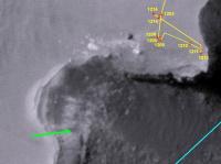
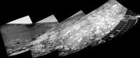
We have a new navcam picture of the tracks.
The first one was taken on sol 1216 and I remember we talked about the remarkable difference between the first set of tracks (from sol 1214) and the second one (from sol 1216). The second picture was taken yestersol (sol 1224).
http://nasa.exploratorium.edu/mars/opportunity/navcam/2007-06-27/1N236139068EFF85R9P1984R0M1.JPG http://nasa.exploratorium.edu/mars/opportunity/navcam/2007-07-04/1N236844860EFF85R9P1963R0M1.JPG


Posted by: MarsIsImportant Jul 5 2007, 09:30 AM
There is no question about it. Large changes are occuring in a relatively short period of time. This is something new. Changes like this have never been seen this dramatically at any other time during the mission.
Posted by: Pertinax Jul 5 2007, 12:24 PM
|
|
Fred,
Thank you for the animation. It is also intriguing to watch the wind effects between the two frames (note the 'ribbing' of the tracks near the left wheel and some of the thin layers of dust on the rocks near image-center for a pair out of many examples).
-- Pertinax
Posted by: Stu Jul 5 2007, 03:41 PM
Been trying for an hour to get these two to merge but it's just not happening, but they're nice individual views anyway...

|

|
And a 456 of the dirty, dirty sky...

|
Posted by: djellison Jul 5 2007, 07:49 PM
Any Storm posts should go in here - http://www.unmannedspaceflight.com/index.php?showtopic=4375&hl= - it's a seperate topic all of its own I think.
Doug
Posted by: Pavel Jul 5 2007, 10:43 PM
The first one was taken on sol 1216 and I remember we talked about the remarkable difference between the first set of tracks (from sol 1214) and the second one (from sol 1216). The second picture was taken yestersol (sol 1224).
Compare the shadows on the mast. It's barely visible on the second image. And the calibration target doesn't seem to have any shadow at all.
Posted by: CosmicRocker Jul 6 2007, 02:53 AM
Posted by: Tesheiner Jul 6 2007, 08:09 AM
... and don't forget to set the "SIFT image size scale" to 100%.
Posted by: MizarKey Jul 7 2007, 08:14 AM
<pictures removed, check the original post>
And a 456 of the dirty, dirty sky...
Stu, I'm a big fan of your imaging work but please retain something of the original filename, even if it's just the Sol the image was taken. When I save images like these, just having 'left-medium' as the file name just kinda sucks. Love the work though.
Posted by: Stu Jul 7 2007, 09:27 AM
Sorry bout that MK, guess I'm just not v organised that way!  I tend to do most of my "imaging work" (more like "messing about" ha!) v v early in the day, before I go out to work at 7am, so giving everything nice neat names has to battle with being awake enough not to drown my keyboard in coffee, but I'll try to do better. Glad you like my efforts tho, thanks. Slowly getting the hang of it I think...
Posted by: fredk Jul 11 2007, 12:16 AM
Some details on the approach to the white layer in http://www.aviationweek.com/aw/generic/story.jsp?id=news/aw070907p2.xml&headline=Rover%20Ready%20for%20Dangerous%20Descent%20After%20Dust%20Storm&channel=space
Posted by: CosmicRocker Jul 11 2007, 05:04 AM
Yeah. I didn't take the time to measure distances with AlgorimancerPG, but apparently they intend to enter at the best place to cross the ripple on the rim, and then traverse the slope in a northeasterly direction toward the northernmost, reachable exposure in the bay. Then they would take a hard right and follow the layer across, to the opposite side. That's one scenario I can imagine would work, and what I suspected they will attempt. The dark/light boundary appears traversable for at least half of it's length.
Then again, we've seen many examples of people tossing around rough estimates in these situations.
Posted by: Astro0 Jul 12 2007, 03:24 AM
If anyone sees that article in Aviation Week, it's worth noting that the online picture and the main image accompanying the printed version, first appeared here on UMSF.
It's the 'Opportunity Descends into Victoria Crater' image that I did a few weeks back before the storm.
The image is credited: Glen Nagle, Doug Ellison, unmannedspaceflight.com.
Thanks to 'marsloon' for helping to make this happen.
Yippee! Another score for the UMSF team.
Astro0
Posted by: Shaka Jul 12 2007, 04:51 AM
How true! The image magicians of UMSF are a science editor's Best Friend. 
Posted by: Bill Harris Jul 13 2007, 11:36 PM
For those still following the exploits of Oppy, she's started to move around to the entry point.
--Bill
Posted by: Geographer Jul 14 2007, 12:24 AM
Awesome! So the storm's blown over and sunlight's streaming in?
Posted by: MarsIsImportant Jul 14 2007, 03:13 AM
No. The storm is not over. But the rover has not been doing much for many days. The batteries could be in good shape, so they decided to use them a little. I think the movement is more for collecting useful data during the storm than actually getting to the entry point.
Posted by: Chmee Jul 14 2007, 02:25 PM
I think an appropriate song at this point would be the Beatles "Here Comes the Sun"
Posted by: Indian3000 Aug 10 2007, 08:57 PM
i dont think this is already posted !
http://www.youtube.com/watch?v=G_WLJtnr4FY
Posted by: nprev Aug 10 2007, 09:54 PM
"It's all right..." yeah, sure hope so for our "little darlin'...
Posted by: ElkGroveDan Aug 10 2007, 11:37 PM
That entry animation is cute, however I think it's going to be like Endurance - two feet and then a RAT under foot, another two feet, another RAT all the way for each obvious layer.
Posted by: glennwsmith Aug 12 2007, 04:46 AM
ElkGroveDan: Agreed -- what would be the point otherwise? Unless they are going directly for the deepest, most quickly reached layer, with the idea that the rest can be filled in on the way out . . .
Posted by: Space Oct 7 2007, 10:48 AM
My second panorama :
http://www.enregistrersous.com/images/107638761420071007124639.jpg
Posted by: dilo Oct 7 2007, 01:41 PM
Nice stitch, Space... which software are you using.
I made this one with Autotstich but I encountered some difficulties in order to reproduce a correct crater slope everywhere:
|
And this is an elaboration (with sharpening) of left portion:
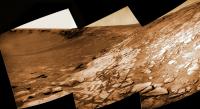
|
(both pictures are 70% original scale)
Posted by: tdemko Oct 9 2007, 11:10 AM
The pans provided by space and dilo show some nice views of eolian erosional features called yardangs:
http://www.tec.army.mil/research/products/desert_guide/lsmsheet/lsyard.htm
The features at Victoria are mico-yardangs, only a few centimeters/ten's of centimeters high.
I wonder if these features set up the pattern that results in the embayed nature of Victoria's rim -- the emabyments and projections are just larger yardangs that have undergone some mass-wasting and undercutting due to differential erosion to make the near vertical cliffs. It would be a satisfyingly fractal landscape evolution story!
Powered by Invision Power Board (http://www.invisionboard.com)
© Invision Power Services (http://www.invisionpower.com)