shape from shade, so i do not take over Bjorn's |

  |
shape from shade, so i do not take over Bjorn's |
 Oct 21 2021, 11:10 PM Oct 21 2021, 11:10 PM
Post
#46
|
||
 Member  Group: Members Posts: 127 Joined: 15-April 21 Member No.: 9009 |
QUOTE (JRehling @ Oct 21 2021, 05:32 PM)  This isn't a DEM, and didn't capture Ganymede very well. Ganymede has tremendous variation in albedo and creating a bump map from that (which is a one-minute project in Photoshop) produces something which is largely fiction. Crater rays aren't cracks nor are they elevations, nor do the transitions from darker terrain to grooved terrain translate to regional depressions or elevation. Moreover, the sun angle obviously varies profoundly across the image, with shadows nearly perpendicular at the terminator and almost overhead at the center of the limb. This effort would only be meaningful if the sun angle were approximately constant when it's about as different from constant as imaginable. Projecting this onto a cylindrical map makes it look like Ganymede has one rough area and another smooth area and that is total fiction. There is plenty of data from previous missions that would enable a more complex process that would produce what this aspired to produce, but this isn't it. There are multiple skilled image processing experts who post here and produce amazing, publishable work, but it's not easy, and there's a lot to learn from the care they put into their work. but than why haven't we seen bigger DEM chunks than really tiny hunks for Ganymede (and Callisto( even fewer for Callisto)) in papers, but for Triton we have most of the cantaloupe terrain (for the approach hemisphere) height mapped, and we have a good chunk of the southern regions height mapped to (all though unreliable), according to this paper, there is plenty of usable PC DEM coverage and stereo DEM coverage (although its not going to be in the best resolution) for callisto there is this blurry DEM from MexLab geoportal (someone turned it into a 3d model and i processed it back into a DEM)
but it could be better though does anyone know of any papers with significant stereo or PC DEM coverage that i haven't seen/found yet, because i am clearly missing something. |
|
 |
 
|
|
|
Oct 21 2021, 11:24 PM
Post
#47
|
|
 Senior Member Group: Members Posts: 2530 Joined: 20-April 05 Member No.: 321 |
QUOTE (TrappistPlanets @ Oct 21 2021, 04:10 PM) but than why haven't we seen bigger DEM chunks than really tiny hunks for Ganymede Possibly nobody finds DEM chunks a really valuable thing to produce. Someone interested in the science of Ganymede's geology can do work like this without trying to publish a map. https://www.sciencedirect.com/science/artic...019103510003945 QUOTE (TrappistPlanets @ Oct 21 2021, 04:10 PM) for callisto there is this blurry DEM from MexLab geoportal Again, this is not a DEM. You seem to think that every bump map generated from albedo is a map of elevation. The bright spots on Callisto are craters with bright subsurface material revealed. Using that brightness to produce a map of elevation is pure fiction. A bump map might happen to be very close to a DEM if a lot of conditions were being met which are not being met in the cases you're playing around with. Eg, fixed albedo, constant illumination geometry, a Lambertian surface or one with minimal specular properties under the given illumination conditions. When those conditions aren't being met, you get a work of fiction. |
|
|
|
|
Oct 22 2021, 11:08 AM
Post
#48
|
|
|
Member Group: Members Posts: 127 Joined: 15-April 21 Member No.: 9009 |
QUOTE (JRehling @ Oct 22 2021, 12:24 AM) Possibly nobody finds DEM chunks a really valuable thing to produce. Someone interested in the science of Ganymede's geology can do work like this without trying to publish a map. https://www.sciencedirect.com/science/artic...019103510003945 Again, this is not a DEM. You seem to think that every bump map generated from albedo is a map of elevation. The bright spots on Callisto are craters with bright subsurface material revealed. Using that brightness to produce a map of elevation is pure fiction. A bump map might happen to be very close to a DEM if a lot of conditions were being met which are not being met in the cases you're playing around with. Eg, fixed albedo, constant illumination geometry, a Lambertian surface or one with minimal specular properties under the given illumination conditions. When those conditions aren't being met, you get a work of fiction. http://cartsrv.mexlab.ru/geoportal/ thats where the original callisto "dem" came from (you haft to do some playing around to get to it, there is also a blurry europa, and Io "dem") before someone turned it into this model https://www.thingiverse.com/thing:3686246 witch i processed a "dem" from how is DEM data not a viable thing, we need to know topography elevation, like if we wanted to land a probe on an object, we need to know its terrain and as much of its climate as possible? |
|
|
|
|
Oct 22 2021, 02:31 PM
Post
#49
|
|
|
Senior Member Group: Members Posts: 2530 Joined: 20-April 05 Member No.: 321 |
First of all, the standard of citing research is to provide an author name of a paper, not that there is a blurry image on a website for people to go looking for with no information about who created it (not "someone"), how their results may be duplicated, what data and method was used to derive it.
QUOTE (TrappistPlanets @ Oct 22 2021, 04:08 AM) how is DEM data not a viable thing, we need to know topography elevation, like if we wanted to land a probe on an object, we need to know its terrain and as much of its climate as possible? And does a blurry image on a website that has none of the above information, hasn't been reviewed, and doesn't indicate what grayscale corresponds to what elevation help mission planners? Not a bit. As far as I know, there are two different consumers of such products: People who provide space art can use a DEM to generate a view of the world in viewing situations that have never actually occurred. We can easily do this with global DEMs of Mars, the Moon, etc. This is fun stuff not particularly essential but also depends on a pretty complete global map. With little fragments that cover a few percent, this doesn't work, unless you only want to show a little fraction of the world, which is also fun stuff, but not really a burning need. People who do real science and want to know, as in the paper I linked to, how the geology of a world is evidenced in its topography, and those people want to know how tall a crater rim is vs. the floor. Not a blurry DEM that someone posted without any of the specific information that I listed above. What you posted is a fiction. It shows that Ganymede is smooth in an area where it isn't smooth it just had different illumination, in one image, on the limb than on the terminator. Who benefits from that fiction? It also shows changes in vertical elevation where bright crater rays exist. Who needs that fiction? Can someone planning a mission look at your image determine what grayscale corresponds to what elevation? Will they bet a billion dollar mission on that? No. People aren't generating those because they're not valuable for any purpose. They aren't even real DEMs. You could just as easily apply the same Photoshop filter to the Mona Lisa and that won't generate a 3D version of a person's face, either. Now an actual DEM where you began to take into account variation in albedo and the variation in illumination across a curved surface might be of some use. That's going to be vastly harder work to come up with than applying a Photoshop filter to an image. For starters, you have to understand that "shape from shade" only works when in the real world, shade is from shape; e.g., that variations in albedo and illumination geometry do not exist. Ganymede and Callisto are utterly disqualified from that category. There's a lot of paying attention to detail that has to occur before products of value emerge. Then a lot of hard work. Those aren't steps to skip. |
|
|
|
|
Oct 22 2021, 04:47 PM
Post
#50
|
|
|
Senior Member Group: Members Posts: 1582 Joined: 14-October 05 From: Vermont Member No.: 530 |
Just FYI... There was this other discussion: http://www.unmannedspaceflight.com/index.p...mp;#entry254805
|
|
|
|
|
Oct 23 2021, 11:53 AM
Post
#51
|
|
|
Member Group: Members Posts: 127 Joined: 15-April 21 Member No.: 9009 |
QUOTE (stevesliva @ Oct 22 2021, 04:47 PM) Just FYI... There was this other discussion: http://www.unmannedspaceflight.com/index.p...mp;#entry254805 i moved it here sense no one replied there and this is a better place to talk about DEMs |
|
|
|
|
Oct 23 2021, 07:00 PM
Post
#52
|
|
|
Solar System Cartographer Group: Members Posts: 10146 Joined: 5-April 05 From: Canada Member No.: 227 |
Schenk, P., McKinnon, W.B., Moore, J. and Nimmo, F., 2021, March. The Topography of Ganymede (and Callisto): Geology, Global Characteristics, and Future Exploration. In Lunar and Planetary Science Conference (No. 2548, p. 2228).
This is a recent discussion of topography on Ganymede and Callisto which shows how very limited the stereo coverage is. Here's a link: https://www.hou.usra.edu/meetings/lpsc2021/pdf/2228.pdf Nobody knows more about icy satellite topography than these authors. Phil -------------------- ... because the Solar System ain't gonna map itself.
Also to be found posting similar content on https://mastodon.social/@PhilStooke NOTE: everything created by me which I post on UMSF is considered to be in the public domain (NOT CC, public domain) |
|
|
|
|
Oct 23 2021, 10:48 PM
Post
#53
|
|
|
Member Group: Members Posts: 127 Joined: 15-April 21 Member No.: 9009 |
QUOTE (Phil Stooke @ Oct 23 2021, 07:00 PM) Schenk, P., McKinnon, W.B., Moore, J. and Nimmo, F., 2021, March. The Topography of Ganymede (and Callisto): Geology, Global Characteristics, and Future Exploration. In Lunar and Planetary Science Conference (No. 2548, p. 2228). This is a recent discussion of topography on Ganymede and Callisto which shows how very limited the stereo coverage is. Here's a link: https://www.hou.usra.edu/meetings/lpsc2021/pdf/2228.pdf Nobody knows more about icy satellite topography than these authors. Phil yeah, i have seen that before, i even tried finding the PC DEM coverage in other papers to make a Ganymede DEM map from the data, but i failed miserably |
|
|
|
|
Oct 23 2021, 11:26 PM
Post
#54
|
|
|
Senior Member Group: Members Posts: 2530 Joined: 20-April 05 Member No.: 321 |
QUOTE (TrappistPlanets @ Oct 23 2021, 03:48 PM) I even tried finding the PC DEM coverage in other papers to make a Ganymede DEM map from the data, but i failed miserably The paper itself makes this clear. They state that less than 20% of the surface has usable data. Those oddly-shaped pieces do not overlap, so it is impossible to calibrate their relative altitudes together. The paper is full of interesting comments about Ganymede's and Callisto's global topography around the overarching fact that our knowledge is spotty for now. |
|
|
|
|
Oct 24 2021, 07:00 PM
Post
#55
|
|
|
Senior Member Group: Members Posts: 2530 Joined: 20-April 05 Member No.: 321 |
Here's the full text of a paper explaining the methodology necessary to use shape-from-shading to produce a local DEM for lunar surfaces. This is 2018 work even though we've had good images of half of the Moon for many decades. It depends upon generating a model of reflectance functions for the lunar surface, estimating the variations in local intrinsic albedo, accounting for said albedo, and the fact that estimates may be checked against data derivable from other sources.
https://www.sciencedirect.com/science/artic...924271617303878 Note, this is much, much more complicated than running a Photoshop filter on an image. It'll be a major research project to attempt the same for Ganymede, etc. And, simply put, a successful mapping campaign from JUICE would certainly enable the production of a detailed, global topographic map of Ganymede and make obsolete anything done prior to that, and we'll see such a map around 2035 if the mission is fully successful. Europa Clipper will similarly, but perhaps not quite so well, give us a global topographic map of Europa. As Van says here, of "medium-resolution": http://futureplanets.blogspot.com/2013/05/...per-update.html JUICE and Europa Clipper will make a total of 21 flybys of Callisto, which would certainly upgrade our coverage of that world far beyond the current status, but almost certainly wouldn't be sufficient to produce a seamless global topographic map. It should give us detailed local topography in many places and perhaps detect any global deviations from sphericity, although Callisto might be a good bet for being one of the most nearly spherical bodies in the solar system. About 15 years from now, we'll hopefully have Ganymede's topography characterized about as well as we now have for terrestrial planets, the maps for Mercury and Venusian will be better than now, we'll have a global topographic map of Europa that's good but not as detailed as we have for the terrestrial planets. Io and Callisto will remain partial and spotty. |
|
|
|
|
Nov 29 2021, 01:41 AM
Post
#56
|
|
|
Member Group: Members Posts: 127 Joined: 15-April 21 Member No.: 9009 |
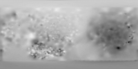
i figured out how to dem process in gimp, but how do i remove streaks in the DEM
 |
|
|
|
|
Nov 29 2021, 03:27 PM
Post
#57
|
|
|
Member Group: Members Posts: 890 Joined: 18-November 08 Member No.: 4489 |
QUOTE (TrappistPlanets @ Nov 28 2021, 08:41 PM) i figured out how to dem process in gimp, but how do i remove streaks in the DEM i do not think that there is a good way to remove that cris-cros hatching in that image a forrier transform might , there is a gimp plugin for that but just finding the " noise" to remove will be difficult |
|
|
|
|
Nov 29 2021, 05:24 PM
Post
#58
|
|
|
Member Group: Members Posts: 127 Joined: 15-April 21 Member No.: 9009 |
QUOTE (JohnVV @ Nov 29 2021, 04:27 PM) i do not think that there is a good way to remove that cris-cros hatching in that image a forrier transform might , there is a gimp plugin for that but just finding the " noise" to remove will be difficult what is the plugin called so i can find it? |
|
|
|
|
Nov 29 2021, 05:41 PM
Post
#59
|
|
|
Member Group: Members Posts: 890 Joined: 18-November 08 Member No.: 4489 |
a google search found the MS windows binaries
https://github.com/rpeyron/plugin-gimp-four...es/tag/v0.4.3-3 |
|
|
|
|
Nov 29 2021, 05:58 PM
Post
#60
|
|
|
Member Group: Members Posts: 127 Joined: 15-April 21 Member No.: 9009 |
QUOTE (JohnVV @ Nov 29 2021, 06:41 PM) a google search found the MS windows binaries https://github.com/rpeyron/plugin-gimp-four...es/tag/v0.4.3-3 tried installing (did it correctly), restarting gimp and the option for it is not appearing how do i make it work? |
|
|
|
|

|
Lo-Fi Version | Time is now: 19th April 2024 - 09:46 AM |
|
RULES AND GUIDELINES Please read the Forum Rules and Guidelines before posting. IMAGE COPYRIGHT |
OPINIONS AND MODERATION Opinions expressed on UnmannedSpaceflight.com are those of the individual posters and do not necessarily reflect the opinions of UnmannedSpaceflight.com or The Planetary Society. The all-volunteer UnmannedSpaceflight.com moderation team is wholly independent of The Planetary Society. The Planetary Society has no influence over decisions made by the UnmannedSpaceflight.com moderators. |
SUPPORT THE FORUM Unmannedspaceflight.com is funded by the Planetary Society. Please consider supporting our work and many other projects by donating to the Society or becoming a member. |
|