Voyager 2 imaging of Triton |

  |
Voyager 2 imaging of Triton |
 Aug 23 2014, 09:34 PM Aug 23 2014, 09:34 PM
Post
#61
|
|
 Member  Group: Members Posts: 207 Joined: 6-March 07 From: houston, texas Member No.: 1828 |
QUOTE (ugordan @ Aug 23 2014, 11:19 AM)  In my experience, calibration with Voyagers is an issue. Compared to Galileo and Cassini images of Jupiter and Saturn targets, it seems to me the relative filter brightnesses are off for all cameras. Green channel typically ends up being too bright compared to other filters which, along with the O/G/B filter combination, can lead to greenish results. A while back I attempted to use Saturn targets like Mimas, Enceladus, Dione and Iapetus to figure out better correction factors, with mixed results. Here's how a quick-n-dirty Triton O/G/B image turned out using those factors and also corrected for OGB -> sRGB filter wavelengths using linear interpolation: [attachment=33593:triton_ogb.jpg] Source images: C1138639, C1138651, C1138703 that is interesting to hear. I wondered about that but we have no other reliable color data for Triton for comparison. perhaps you can send me some of your estimates for how far off the colors might be. in the meantime, i can look at some saturn data. a difficulty s that the cassini and voyager filters are not identical. -------------------- Dr. Paul Schenk, Lunar and Planetary Institute, Houston TX
http://stereomoons.blogspot.com; http://www.youtube.com/galsat400; http://www.lpi.usra.edu/science/schenk/ |
 |
 
|
|
Aug 24 2014, 05:03 PM
Post
#62
|
|
 IMG to PNG GOD Group: Moderator Posts: 2250 Joined: 19-February 04 From: Near fire and ice Member No.: 38 |
I have the same experience as Ted and Gordan, I always need to use various correction/fudge factors to get correct color when doing color composites from the Voyager images. As Gordan mentioned, the green channel is usually too bright. I usually use the calibrated and geometrically corrected images available at the PDS Planetary Rings Node but I get similar results if I start with the raw (*.IMQ) images and calibrate them myself.
I haven't done any systematic analysis to see if this problem varies as a function of time, exposure, gain etc. but I suspect that at least time (or mission phase) is significant. For many targets I can use the global spectrum to check the color but this is especially difficult for Triton since its color varies with time. For Neptune I can use its spectrum plus HST images to check the color and determine the correction factors - using the same processing parameters for Triton might work to get correct color. |
|
|
|
|
Aug 25 2014, 12:17 PM
Post
#63
|
|
 Member Group: Members Posts: 495 Joined: 12-February 12 Member No.: 6336 |
QUOTE (DrShank @ Aug 23 2014, 11:26 PM) ....can't wait to put the pluto map next to it next year. Oh hello there Dr Shank. =) Yes I really would like to see a comparison between those two also to see if they show any signs of having a common origin. I always have considered Triton to have been captured by Neptune even when the ejection hypothesis were the more popular one. A little bit OT for this thread yet some expect Charon to show an interesting surface as well I am a bit pessimistic about that idea, but then again our own moon have recently been found to have a molten core even found today despite the fact it got bound rotation so it might be best never to say never to tidal heating. =) |
|
|
|
|
Aug 26 2014, 01:54 PM
Post
#64
|
|
|
Solar System Cartographer Group: Members Posts: 10151 Joined: 5-April 05 From: Canada Member No.: 227 |
Fantastic new map of Triton, Paul, thanks! It is nice to see the post-encounter crescent images incorporated into it.
Phil -------------------- ... because the Solar System ain't gonna map itself.
Also to be found posting similar content on https://mastodon.social/@PhilStooke Maps for download (free PD: https://upload.wikimedia.org/wikipedia/comm...Cartography.pdf NOTE: everything created by me which I post on UMSF is considered to be in the public domain (NOT CC, public domain) |
|
|
|
|
Aug 29 2014, 02:54 PM
Post
#65
|
|
|
Junior Member Group: Members Posts: 64 Joined: 17-December 12 From: Portugal Member No.: 6792 |
QUOTE (Bjorn Jonsson @ Aug 24 2014, 05:03 PM) I haven't done any systematic analysis to see if this problem varies as a function of time, exposure, gain etc. but I suspect that at least time (or mission phase) is significant. Back at the time I was playing with Voyager images I also noticed that. My guess is that the filter's response changed with time. So it's dependent on mission time, craft and camera. If there are any images of stars taken during the mission (I guess so) perhaps they can be used to infer calibration. "White" satellites (if we have some spectra for them) would also work on distant images that show more than one (for different brightness), so that you could linearize the filters response. Just my 2 cents... -------------------- www.astrosurf.com/nunes
|
|
|
|
|
Aug 1 2018, 09:59 AM
Post
#66
|
|
|
Member Group: Members Posts: 241 Joined: 16-May 06 From: Geneva, Switzerland Member No.: 773 |
Finally a "serious" geological map of Triton:
Triton map "To-date, no peer-reviewed, broad-scale, detailed geologic map exists to characterize, classify, and identify geologic surface units and features on Triton. Mapping of Pluto and Charon is in progress, but as no comparable geologic map of Triton exists, a direct comparison between these two KBOs cannot be performed at a fundamental level. Furthermore, as Triton serves as a bridge between KBOs and icy satellites, characterization of its terrains is important for advancing comparative planetological studies." Can't wait to see the final result. I expect some interesting discoveries, almost 30 years after the voyager II flyby. Best regards, Marc. |
|
|
|
|
Aug 6 2018, 05:14 PM
Post
#67
|
|
|
Member Group: Members Posts: 241 Joined: 16-May 06 From: Geneva, Switzerland Member No.: 773 |
2018 paper with Voyager II Triton images:
Planetary and Space Science Volume 160, 1 October 2018, Pages 19-25 Heat flow in Triton: Implications for heat sources powering recent geologic activity Alvaro Martin-Herrero, Ignacio Romeo, JavierRuiz New analysis of Voyager images reveals that the Raz fossae troughs system continues north of Leviathan patera and Cipango planum and enables to calculate that the surface heat flows values are much higher than those estimated in previous studies. This troughs system reminds me the North-South global ridge/troughs sytem recently discovered on Pluto. I'm convinced that some new great discoderies can be made by reprocessing the almost 30 years old Voyager images, even if a new mission to the Neptunian system is absolutely necessary. Regards, Marc. |
|
|
|
|
Sep 2 2021, 02:12 AM
Post
#68
|
|
|
Merciless Robot Group: Admin Posts: 8783 Joined: 8-December 05 From: Los Angeles Member No.: 602 |
Resurrecting a dormant thread, there's a new paper out concerning Triton's topography. Prime author is Paul Schenk, coauthors include frequent Forum participant & NH PI Alan Stern and Forum moderator Ted Stryk, featuring Ted's image wizardry. Enjoy!

-------------------- A few will take this knowledge and use this power of a dream realized as a force for change, an impetus for further discovery to make less ancient dreams real.
|
|
|
|
|
Sep 2 2021, 07:28 AM
Post
#69
|
|
|
Senior Member Group: Members Posts: 2920 Joined: 14-February 06 From: Very close to the Pyrénées Mountains (France) Member No.: 682 |
As a personal story, I was with TPS for Planetfest 89 at the time of Neptune flyby. We waited late to see the very first Tritons pictures. When they came, around 4 am, I was already back in my hotel and discovered them on TV when I woke up. At that time, I was allowed to enter JPLs reception and check TV screens and get a feeling of the place. We had scientist, no less than Ed Stone himself, giving the last news and picture at the TPS event.
Youre not only resurrecting a thread Nick, but also good memories. At that time, we hopped VII would survive for another 35 years, were close to it. Both Voyagers were launched the year I started working and I retired 5 years ago. -------------------- |
|
|
|
|
Sep 19 2021, 06:29 PM
Post
#70
|
|
 Member Group: Members Posts: 127 Joined: 15-April 21 Member No.: 9009 |
QUOTE (nprev @ Sep 2 2021, 03:12 AM) Resurrecting a dormant thread, there's a new paper out concerning Triton's topography. Prime author is Paul Schenk, coauthors include frequent Forum participant & NH PI Alan Stern and Forum moderator Ted Stryk, featuring Ted's image wizardry. Enjoy! SWEEET! i think i can compile a DEM map out of some of the higher res figures |
|
|
|
|
Sep 19 2021, 07:43 PM
Post
#71
|
||
|
Member Group: Members Posts: 127 Joined: 15-April 21 Member No.: 9009 |
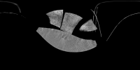
i compiled most of the stuff into the below
|
|
|
|
|
|
|
Nov 7 2021, 02:49 PM
Post
#72
|
|
|
Member Group: Members Posts: 127 Joined: 15-April 21 Member No.: 9009 |
QUOTE (machi @ May 27 2011, 06:18 PM) Second image: i increased brightness (messing with curves) , looking for neptuneshine, and i found this stuff beyond the terminator, is it atmospheric haze lit terrain , neptuneshine, or plain old noise?  i also seen it in the other pic too when i messed with curves 
|
|
|
|
|
Nov 7 2021, 04:23 PM
Post
#73
|
|
|
Member Group: Members Posts: 910 Joined: 4-September 06 From: Boston Member No.: 1102 |
It is not clear to me what what areas you refer to as recovered in your posts. Maybe you could post three image, the original image unmodified, your clean modified image, and the area of interest (ie newly recovered area) circled or specifically delineated. The cloud of dots past the teminator in the image above seem to me to be noise, but maybe that is not the area you are describing.
-------------------- |
|
|
|
|
Nov 7 2021, 04:46 PM
Post
#74
|
|
 Senior Member Group: Members Posts: 2530 Joined: 20-April 05 Member No.: 321 |
By no means is doing this with images that someone has already processed for another purpose the best way to proceed. Whatever artifacts they may have introduced at very low values (0, 1, 2) is part of what you're trying to make something of now. There are multiple obvious artifacts and there's no accounting therefore for what is artifact and what isn't.
Never with work like this should you begin with an image that someone posted after performing undocumented processing to the original. |
|
|
|
|
Nov 7 2021, 07:24 PM
Post
#75
|
|
|
Member Group: Members Posts: 127 Joined: 15-April 21 Member No.: 9009 |
QUOTE (Floyd @ Nov 7 2021, 04:23 PM) It is not clear to me what what areas you refer to as recovered in your posts. Maybe you could post three image, the original image unmodified, your clean modified image, and the area of interest (ie newly recovered area) circled or specifically delineated. The cloud of dots past the teminator in the image above seem to me to be noise, but maybe that is not the area you are describing. yeah, the cloud of dots beyond the teminator is what i am talking about, bummer its just noise |
|
|
|
|

|
Lo-Fi Version | Time is now: 25th April 2024 - 06:31 AM |
|
RULES AND GUIDELINES Please read the Forum Rules and Guidelines before posting. IMAGE COPYRIGHT |
OPINIONS AND MODERATION Opinions expressed on UnmannedSpaceflight.com are those of the individual posters and do not necessarily reflect the opinions of UnmannedSpaceflight.com or The Planetary Society. The all-volunteer UnmannedSpaceflight.com moderation team is wholly independent of The Planetary Society. The Planetary Society has no influence over decisions made by the UnmannedSpaceflight.com moderators. |
SUPPORT THE FORUM Unmannedspaceflight.com is funded by the Planetary Society. Please consider supporting our work and many other projects by donating to the Society or becoming a member. |
|