Printable Version of Topic
Click here to view this topic in its original format
Unmanned Spaceflight.com _ Venus _ Pioneer Venus Radar Images
Posted by: ncc1701d May 13 2011, 08:01 PM
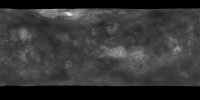
I was looking for the best availble radar images from Pioneer Venus
I think I found them here
http://pds-geosciences.wustl.edu/geo/premgn/mg_1001/pvvenus/radar/
but when I use
NASAVIEW found here it would not open them.
http://pds.jpl.nasa.gov/tools/nasa-view.shtml
Anyone know why?
or know of a better place to find the best/highest res of pioneer radar original images from nasa?
thanks
Posted by: elakdawalla May 13 2011, 09:07 PM
NASAview ver 3.7 worked fine for me (see attached). Did you download the label file with the image you were trying to open? Each image has a detached label with the same file name but *.lbl instead of *.img.
|
Posted by: Phil Stooke May 13 2011, 09:24 PM
Best place by far in my opinion:
http://www.mapaplanet.org/
You can define the resolution and the extent of the area you view. Just choose Venus from the picture menu... and of course you can do it for the Moon and Mars and other worlds too.
Phil
Posted by: ncc1701d May 14 2011, 12:37 AM
I downloaded the .lbl in same directory as the image but it didnt work.
Maybe I dont know how to use the .lbl with the image? I am not that experienced with .lbl
If someone can get it to work for them with the latest version of Nasaview 3.8 then I will know it just me. Let me know.
Or direct me how to get 3.7
Yes mapaplanet is great. I wanted to get though the best largest pioneer radar to fill in the gaps especially in the northern polar areas.
that site I dont think gives me the pioneer or the venera 15/16 that I think I need to fill in gaps.
Does anyone know where to get the venera 15/16 radar images taken of venus?
I thought I found them here
http://nssdc.gsfc.nasa.gov/nmc/datasetSearch.do?spacecraft=Venera%2015&experiment=Venera%2015%20Synthetic%20Aperture%20Radar
to be used with the viewer found here
http://petermasek.tripod.com/venera15.html
but I just get sent in link circles and cant find them.
Any ideas? thanks
Posted by: Phil Stooke May 14 2011, 10:59 AM
Sorry about that - I was not paying attention. When I suggested Mapaplanet I was thinking of Magellan, not Pioneer Venus.
The other thing to do is open the images in Photoshop or other photoediting software, as Raw images using the dimensions found in the label file.
Phil
Posted by: Bjorn Jonsson May 16 2011, 10:17 PM
If you are using Windows the new (beta) version of IMG2PNG can convert this to a 16 bit grayscale PNG image. See http://www.unmannedspaceflight.com/index.php?showtopic=4979 for details (in particular the last message in that thread).
Posted by: JohnVV May 17 2011, 08:38 AM
a question bjorn dose the new img2png work on the old img and imq from the `90's - i do not use it so ?
now from the label in the link in the ops post
these are 32 bit
http://pds-geosciences.wustl.edu/geo/premgn/mg_1001/pvvenus/radar/pven001a.lbl
if all you want is a map
in a link someplace in my sig there is a rgb png map made from the venus radar data ( oops not there )
http://celestiamotherlode.net/catalog/show_addon_details.php?addon_id=1100
but PDS-map-a-planet is a great source
also ncc1701d keep in mind that nasaview ONLY will export to a indexed 256 8bit gif
--- edit added too ---
however you might do better with the mg_3002 data
http://pds-geosciences.wustl.edu/missions/magellan/gxdr/index.htm
the gtdr ( topo),gredr,gedr,
the Global reflectivity data record
http://pds-geosciences.wustl.edu/geo/mgn-v-gxdr-v1/mg_3002/gredr/
all 32 tiles
Posted by: Bjorn Jonsson May 17 2011, 01:57 PM

Yes, it can convert these old files (it even converts the ancient Mariner 9 and 10 files).
Powered by Invision Power Board (http://www.invisionboard.com)
© Invision Power Services (http://www.invisionpower.com)