The Top of Vera Rubin Ridge Part 2, Site 67-73, sol 1944-2297, 24 Jan 2018-22 Jan 2019 |

  |
The Top of Vera Rubin Ridge Part 2, Site 67-73, sol 1944-2297, 24 Jan 2018-22 Jan 2019 |
 Jul 9 2018, 10:48 AM Jul 9 2018, 10:48 AM
Post
#376
|
|
 Senior Member  Group: Members Posts: 2428 Joined: 30-January 13 From: Penang, Malaysia. Member No.: 6853 |
QUOTE (monty python @ Jul 9 2018, 01:44 PM)  Just wondering how this long drive relates to the drilling campaign in this important transition zone Thanks to Emily's most recent Curiosity blog (linked below) we now understand that "The team now plans as many as three more drill stops in the near future, up on top of Vera Rubin ridge." Phil's maps shows the remaining VRR geological members that the team identified at a conference. A post here recently also speculated that one of the previously visited Hematite 'hot spots' could also be on that list, maybe even the location were they tried to drill without hammer? I'm sure the mission updates in the coming days will give us a few clues to the location where the next sample site will be.  EDIT: I should have added that the mission update for 2100-01 told us that the next drill site was located on the "Pettegrove Point" geological member (see Phil's maps), so that appears to rule out Stop 13, as that's likely on the 'Jura member', so I'm going for 'Stop 12' as the next sample site. Note: those that follow my hunches will probably know that my track record on such predictions is nothing short of abysmal  Emily's Blog: http://www.planetary.org/blogs/emily-lakda...-2027-2092.html |
 |
 
|
|
Jul 9 2018, 03:10 PM
Post
#377
|
|
|
Senior Member Group: Members Posts: 1074 Joined: 21-September 07 From: Québec, Canada Member No.: 3908 |
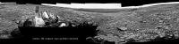
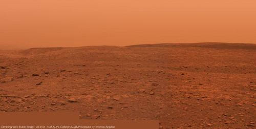
Sol 2104 drive-direction Lmastcam:
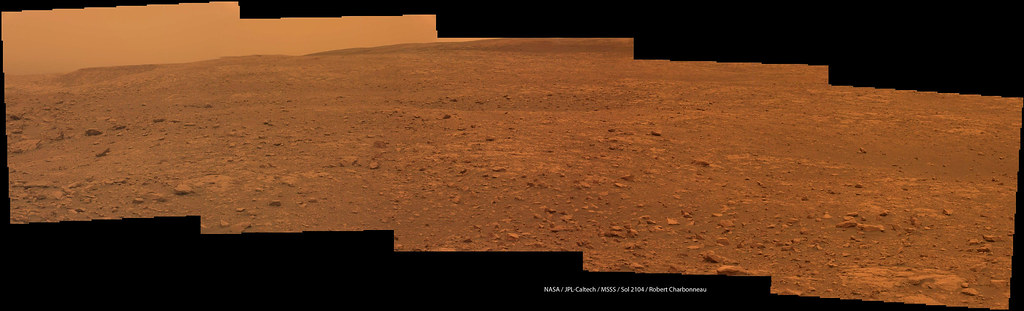 And looking at the rocks nearby: 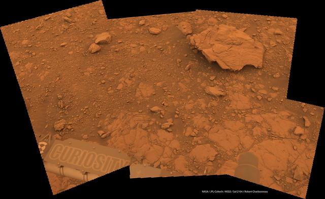
|
|
|
|
|
Jul 9 2018, 04:52 PM
Post
#378
|
||
|
Senior Member Group: Members Posts: 2819 Joined: 22-April 05 From: Ridderkerk, Netherlands Member No.: 353 |
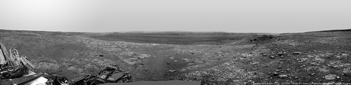
The Navcam L view on Sol 2104.
Jan van Driel
|
|
|
|
|
|
|
Jul 10 2018, 01:11 PM
Post
#379
|
|
 Member Group: Members Posts: 809 Joined: 3-June 04 From: Brittany, France Member No.: 79 |
Mosaics taken with MC34 and NavCam R on sol 2104, with extra-sky:
-------------------- |
|
|
|
|
Jul 10 2018, 11:42 PM
Post
#380
|
||
|
Solar System Cartographer Group: Members Posts: 10151 Joined: 5-April 05 From: Canada Member No.: 227 |
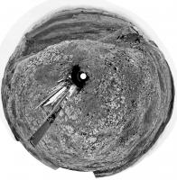
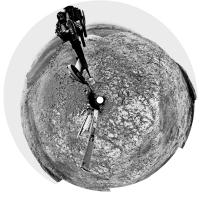
Jan's sol 2104 panorama in circular format.
Phil
-------------------- ... because the Solar System ain't gonna map itself.
Also to be found posting similar content on https://mastodon.social/@PhilStooke Maps for download (free PD: https://upload.wikimedia.org/wikipedia/comm...Cartography.pdf NOTE: everything created by me which I post on UMSF is considered to be in the public domain (NOT CC, public domain) |
|
|
|
|
|
|
Jul 11 2018, 01:01 AM
Post
#381
|
|
|
Senior Member Group: Members Posts: 2428 Joined: 30-January 13 From: Penang, Malaysia. Member No.: 6853 |
QUOTE (Phil Stooke @ Jul 11 2018, 07:42 AM) Jan's sol 2104 panorama in circular format. Nice work Jan, and nice to see Taconite again, as well as the slowly clearing vista of the plains in these great circular views From the drive direction MastCam images it appears we may be heading a little further East or North-Northeast ? Edit: we now know that we're heading back to the location we worked at during sol 2005: https://mars.jpl.nasa.gov/msl/mission/mars-...ission-updates/ |
|
|
|
|
Jul 11 2018, 07:36 PM
Post
#382
|
||
|
Senior Member Group: Members Posts: 2819 Joined: 22-April 05 From: Ridderkerk, Netherlands Member No.: 353 |
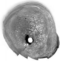
The Navcam L view on Sol 2107.
Jan van Driel
|
|
|
|
|
|
|
Jul 11 2018, 08:22 PM
Post
#383
|
||
|
Solar System Cartographer Group: Members Posts: 10151 Joined: 5-April 05 From: Canada Member No.: 227 |
Thanks, Jan - here is a circular version.
Phil
-------------------- ... because the Solar System ain't gonna map itself.
Also to be found posting similar content on https://mastodon.social/@PhilStooke Maps for download (free PD: https://upload.wikimedia.org/wikipedia/comm...Cartography.pdf NOTE: everything created by me which I post on UMSF is considered to be in the public domain (NOT CC, public domain) |
|
|
|
|
|
|
Jul 12 2018, 05:43 AM
Post
#384
|
||
|
Senior Member Group: Members Posts: 2428 Joined: 30-January 13 From: Penang, Malaysia. Member No.: 6853 |
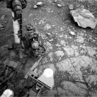
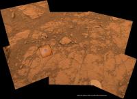
A shorter drive on sol 2108 to the next drill site.
Very impressed that some of the Duluth sample has remained on the engineering tray since they pulled away from the last drill location (sol 2108 pre-drive)
|
|
|
|
|
|
|
Jul 12 2018, 11:02 AM
Post
#385
|
|
|
Senior Member Group: Members Posts: 1074 Joined: 21-September 07 From: Québec, Canada Member No.: 3908 |
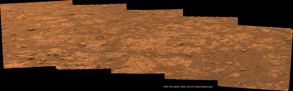
Sol 2017 post-drive Lmastcam:
|
|
|
|
|
Jul 13 2018, 09:54 AM
Post
#386
|
||
|
Senior Member Group: Members Posts: 2819 Joined: 22-April 05 From: Ridderkerk, Netherlands Member No.: 353 |
The Navcam L view on Sol 2108.
Jan van Driel
|
|
|
|
|
|
|
Jul 13 2018, 05:44 PM
Post
#387
|
||
|
Solar System Cartographer Group: Members Posts: 10151 Joined: 5-April 05 From: Canada Member No.: 227 |
Jan's panorama in circular form. If you compare it with the same for sol 2004 we are in almost exactly the ame place, except that the two panoramas are facing in opposite directions, looking at the same foreground features (including Stranraer).
Phil
-------------------- ... because the Solar System ain't gonna map itself.
Also to be found posting similar content on https://mastodon.social/@PhilStooke Maps for download (free PD: https://upload.wikimedia.org/wikipedia/comm...Cartography.pdf NOTE: everything created by me which I post on UMSF is considered to be in the public domain (NOT CC, public domain) |
|
|
|
|
|
|
Jul 14 2018, 12:52 AM
Post
#388
|
|
|
Senior Member Group: Members Posts: 1074 Joined: 21-September 07 From: Québec, Canada Member No.: 3908 |
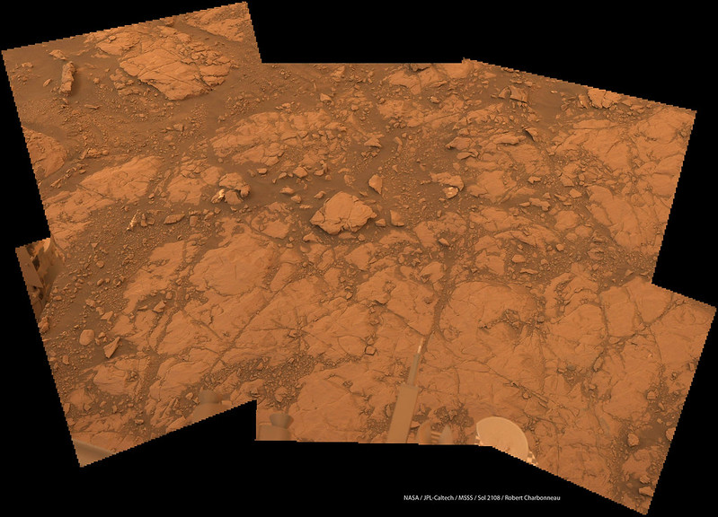
Sol 2108 Lmastcam:
|
|
|
|
|
Jul 15 2018, 02:18 AM
Post
#389
|
|||
|
Solar System Cartographer Group: Members Posts: 10151 Joined: 5-April 05 From: Canada Member No.: 227 |
Very nice, charborob. I took the liberty of using a reduced size version of it to show the location of the current target, and then made a new image showing how the old Stranraer target and the new Voyageurs target overlap.
Phil
-------------------- ... because the Solar System ain't gonna map itself.
Also to be found posting similar content on https://mastodon.social/@PhilStooke Maps for download (free PD: https://upload.wikimedia.org/wikipedia/comm...Cartography.pdf NOTE: everything created by me which I post on UMSF is considered to be in the public domain (NOT CC, public domain) |
||
|
|
|
||
|
Jul 15 2018, 12:15 PM
Post
#390
|
|
|
Senior Member Group: Members Posts: 2428 Joined: 30-January 13 From: Penang, Malaysia. Member No.: 6853 |
QUOTE (Phil Stooke @ Jul 15 2018, 10:18 AM) ... and then made a new image showing how the old Stranraer target and the new Voyageurs target overlap. Great detective work Phil
|
|
|
|
|

|
Lo-Fi Version | Time is now: 25th April 2024 - 11:03 AM |
|
RULES AND GUIDELINES Please read the Forum Rules and Guidelines before posting. IMAGE COPYRIGHT |
OPINIONS AND MODERATION Opinions expressed on UnmannedSpaceflight.com are those of the individual posters and do not necessarily reflect the opinions of UnmannedSpaceflight.com or The Planetary Society. The all-volunteer UnmannedSpaceflight.com moderation team is wholly independent of The Planetary Society. The Planetary Society has no influence over decisions made by the UnmannedSpaceflight.com moderators. |
SUPPORT THE FORUM Unmannedspaceflight.com is funded by the Planetary Society. Please consider supporting our work and many other projects by donating to the Society or becoming a member. |
|