Printable Version of Topic
Click here to view this topic in its original format
Unmanned Spaceflight.com _ Opportunity _ On to Santa Maria!
Posted by: Phil Stooke Oct 29 2010, 03:32 PM
Looks like it's time for a new thread! On to Santa Maria!
Phil
Posted by: Tesheiner Oct 29 2010, 05:28 PM
Done. 
Posted by: fredk Oct 30 2010, 02:21 PM
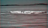
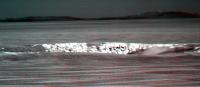
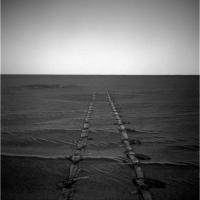
The 2405 hazcams are down: it looks like we've made it to the flat patch:
http://qt.exploratorium.edu/mars/opportunity/forward_hazcam/2010-10-30/1F341693990EFFAU%23%23P1205R0M1.JPG?sol2405
As others have pointed out, this isn't the end of the ripples, but it does give us our first taste of the tarmac surface ahead. 
Posted by: Tesheiner Oct 30 2010, 03:37 PM
Nav/Pancam are expected to be shot and downlinked tomorrow and I expect to see very flat surroundings, at least if I take the HiRISE view as a reference.
|
Posted by: ElkGroveDan Oct 30 2010, 03:44 PM
Holy smokes! Flatness!
Posted by: mhoward Oct 30 2010, 04:33 PM
Very exciting! And these are the images from yestersol (2404) - as Tesh says, 2405's Navcam/Pancam still to come.
http://www.flickr.com/photos/marscat/5129053586/sizes/o/in/photostream/
http://www.flickr.com/photos/marscat/5129052308/sizes/o/in/photostream/
Posted by: Tesheiner Oct 30 2010, 05:49 PM
And the reason why they are expected tomorrow and not today can be clearly seen on mhoward's mosaic. The rover's autonomous attitude knowledge has drifted a lot so it's time to recalculate it again. The mosaics will be shot after that.
Posted by: mhoward Oct 30 2010, 06:30 PM

Seems like it drifts more than it's corrected these days. But maybe that's just because they're moving quickly; I'm okay with that.

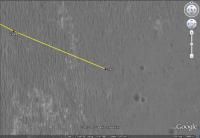
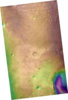
Posted by: jamescanvin Oct 30 2010, 07:59 PM
Here is the full resolution HiRISE image from here to Santa Maria with my ripple map colour overlay showing all the features we have to encounter. It looks like the very flattest bit (greenest on my map) is just ahead. Lots of the parking lot intact has very small ripples, craters, Anatolia like features, more bedrock, etc. Doesn't look like we'll get bored!
http://www.nivnac.co.uk/mer/index.php/b2405_ripple_map
Click image for size options.
James
Posted by: MoreInput Oct 30 2010, 08:42 PM
I hope the nav computer of oppy won't get bored. If the environment doesn't have good identifyable landmarks the computer cannot calculate from the pictures, how far the rover has driven.
We had this problem in the near of Victoria.
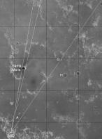
Posted by: fredk Oct 30 2010, 08:44 PM
Agreed. Here's a map showing a few more identifications farther afield, with Phil's 2402 stitch-n-stretch:
|

|
Crater G now appears to be the farthest identifiable feature on the plains - it's about a third of the way to Cape York.
My impression is that we can basically see all of the plains now, up to the near rim of Endeavour. In fact, as we drop down towards Endeavour, the view of the plains may become less impressive. We may now be at the "HOAV" point. This would be a great spot for a superres Endeavour pan...
Posted by: Phil Stooke Oct 30 2010, 09:22 PM
I think you're right, Fred - this may be the optimum shot... until... wow, just wait until we get to that distant rise and finally look down into Endeavour! OK, let's all shout "super-res" and see if anyone hears us.
Phil
Posted by: SFJCody Oct 30 2010, 09:51 PM
We had this problem in the near of Victoria.
<crazy> maybe now is the time to start scheduling super-long blind drives </crazy>
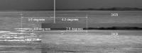
Posted by: Stu Oct 31 2010, 09:24 AM
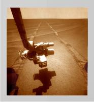
Updated my blog with some pics showing how the ground beneath Oppy's wheels has changed dramatically...
http://roadtoendeavour.wordpress.com/2010/10/31/oppy-on-the-flats
(and thanks to fredk for letting me use his brilliant pics, too)
Posted by: Tesheiner Oct 31 2010, 10:18 AM
Great articles, as usual, Stu.
Just a correction to the second picture, that one with the distances to all little craters up to the "Waypoint": it's about 270m (and not 1.7km) to that crater.
Posted by: Stu Oct 31 2010, 10:44 AM
Just a correction to the second picture, that one with the distances to all little craters up to the "Waypoint": it's about 270m (and not 1.7km) to that crater.
Ah *****! Corrected, thanks. That's what you get for getting up at 6am to catch up on stuff before going to work...
I know we won't be approaching Santa Maria from the south, but I'm struck by some features there... are the "domes" filled-in, older craters? Wind-carved features? They just caught my eye, that's all...
|
Posted by: ustrax Oct 31 2010, 11:23 AM
fredk, looking at that second image of yours...and to think that Endeavour was just a crazy thought some time ago still boggles my mind...
Posted by: Stu Oct 31 2010, 12:23 PM
Just for fun, a pic showing the relative sizes of Santa Maria and Victoria Crater...
|
Posted by: jamescanvin Oct 31 2010, 12:56 PM
Nice comparison Stu. So Santa Maria is kind of Duck Bay sized, that helps me visualise it a lot, thanks.
Posted by: fredk Oct 31 2010, 03:23 PM
The new navcams and pancams are down. Here's a stereo view showing a number of the craters ahead on the plains. In order of distance, the closest is what I labelled D (the "doublet"), then C, then A (the "waypoint"), and finally much farther away is G. Immediately past D is the ultra-flat stretch.

|
(Oh yeah, and even farther away is a little crater known as Endeavour...)
Posted by: mhoward Oct 31 2010, 03:56 PM
Sol 2406
http://www.flickr.com/photos/marscat/5132246296/sizes/o/in/photostream/
Posted by: Poolio Oct 31 2010, 04:22 PM
Nice graphic, Stu. How would you feel about tossing Endurance in there for comparison?
Posted by: paxdan Oct 31 2010, 05:03 PM
Interesting comparison, it looks like santa maria crater is large enough/old enough for the 'capes' and 'bays' formations to form. If that were the case for santa maria then it would indicate that the original crater was smaller than the size we see now.
It would be really interesting to see all the craters above the size of say eagle crater size in Oppys vicinity/on meridiani planum, against each other, a bit like Emily's asteroid montage. It would even be neat to keep the positional relationship to see morphological differences in cratering relating to changes in the plains in which they are punched.
if there is a size correlations with bay formation/depth that would be interesting to see. It might also give some clues as to the erosion rate as larger craters would be expected to be older.
Posted by: fredk Oct 31 2010, 06:14 PM
Actually the fabulous stretched pan was from Phil - I only added the labels.
Posted by: Stu Oct 31 2010, 06:31 PM
sorry Phil! Thanks to everyone who lets me use their pix on my blog. Much appreciated.
Might try to make an 'all craters' montage, when I'm not so busy. Maybe Christmas. 2030!
Posted by: MoreInput Oct 31 2010, 07:22 PM
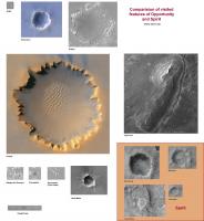
Here it is!
I put famous craters in one picture, grabbed from Google Earth (also grabbed the strange color of endurance). It roughly the same scale, but not really exact.
The point inside the eagle crater is the lander. The rovers are about the same size (3-4 pixels).
I put also the next waypoints to the picture: Santa Maria and Cape York. Interesting: Cape York could fit into Victoria!
Santa Maria crater is a little smaller than endurance, but Bonneville, visited by Spirit, is larger.
The Home Plate, well visited by Spirit, is just as big as Santa Maria.
|
Posted by: Oersted Oct 31 2010, 09:01 PM
Thanks MoreInput!
Funny, I thought Cape York was much much bigger...
Posted by: centsworth_II Nov 1 2010, 09:31 AM
Here's Cape York (circled).
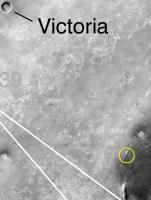
|
http://marsrover.nasa.gov/gallery/press/opportunity/20100629a.html
Posted by: NW71 Nov 1 2010, 01:20 PM
Another really fascinating monthly report by A.J.S. Ryal (with help from Stu and Tesh amongst others) has just been released on The Planetary Society website for October, 2010.
Others will be able to post a link and give a far better synopsis than I but it really does provide a lot of detailed information for the MER fan and scientist alike!
Basically, the excitement level with both rovers is growing - Spirit in anticipation of her regaining contact, Opportunity with Santa Maria and the continuation of the journey to Endeavour.
Thanks again to all those who keep us so well informed and up to date with these missions.
Neil
Posted by: fredk Nov 1 2010, 02:05 PM
Here's our first navcam view of the new terrain:
http://qt.exploratorium.edu/mars/opportunity/navcam/2010-11-01/1N341870521EFFAV00P2880L0M1.JPG?sol2407
Posted by: Phil Stooke Nov 1 2010, 06:53 PM
Special Agent Stooke reporting from Cape Canaveral - this new terrain looks just like the old familiar terrain outside Eagle crater. Presumably the small ripples will provide enough detail for the auto-image-matching software. Looking forward to some lengthy drives.
Phil
Posted by: centsworth_II Nov 1 2010, 07:22 PM
http://www.unmannedspaceflight.com/index.php?s=&showtopic=6717&view=findpost&p=165936
Perhaps an even better name: from the http://planetary.org/news/2010/1031_Mars_Exploration_Rover_Update_Spirit.html (paragraph 16).
"...Opportunity paused this weekend to look out on the sandflat, as Arvidson calls it..."
And we all know what happens on sandflats.

Posted by: algorimancer Nov 1 2010, 09:16 PM
Here's a question for the impact geology experts out there. When we're looking at the rim of Endeavor (like Cape York in MoreInput's great montage on the prior page), are we looking at an uplifted geological section or an inverted geological section? Or perhaps a little of both?
Posted by: Tesheiner Nov 1 2010, 09:25 PM
Here's a comment twitted by Scott about the upcoming drive (on sol 2408 I presume):
Today's focus: drive-by shootings. Driving by several craters, imaging them as we pass. Probably gonna image three or four craters today.
Posted by: CosmicRocker Nov 2 2010, 06:53 AM
In the western rim of Endeavour the geological section appears to be uplifted but not overturned. Where layers in the rock can be discerned, they appear to be dipping away from the center of the crater. It is not so apparent at Cape York, but evidence can be found in segments of the rim south of Cape York. Take a look at the paper about Endeavour's phyllosilicates http://www.unmannedspaceflight.com/index.php?s=&showtopic=6535&view=findpost&p=159464 a few months ago. Figure 1d is a schematic cross section through the rim. Also see figure 3b. It is an anaglyph of a part of the rim clearly showing beds of rock dipping away from the crater.
Of course such dips do not conclusively prove that the section is not overturned. It could be overturned greater than 180 degrees, but that would be pretty unusual in this setting.
Posted by: climber Nov 2 2010, 11:56 AM
Funny, I thought Cape York was much much bigger...
Nice comparison from MoreInput!
I was not too far there regarding Cape York size. I was surprised too to see how "small" it is. See post # 450 here : http://www.unmannedspaceflight.com/index.php?showtopic=6438&st=450
Posted by: algorimancer Nov 2 2010, 01:09 PM
Thanks, that should help a bit with interpretation when we get there.
Posted by: fredk Nov 2 2010, 11:53 PM
http://twitter.com/marsroverdriver/status/29514510710 on the planned drive:
Posted by: Stu Nov 3 2010, 06:12 AM
I had cobbled this togeher before MoreInput's excellent comparisons were posted, but thought some of you might like to see these three places side-by-side...
Santa Maria, Victoria and Cape York...
|
Posted by: vikingmars Nov 3 2010, 09:31 AM
|
|
What is great in your "Philovision" pic is that with (i) facing now a smooth descending slope and (ii) roughly 10 km more to go before reaching our Cape York target, the lowest parts of the features of Endeavour crater are still below the local Martian horizon (located about 4 km away) : a fascinating perspective ! Thanks to your processing, we have a good visual example showing the curvature of Mars...
Posted by: fredk Nov 3 2010, 02:10 PM
It's hard to say for sure, but I'd think we're seeing more the curvature of the surface as it drops into Endeavour than the curvature of Mars. Judging from the contour maps we've seen (low resolution), it looks like the surface doesn't continue flat up to the rim, instead it curves more gradually downwards. And so Cape York seems to be somewhat below the level of the plains.
In this 2409 navcam view:
http://qt.exploratorium.edu/mars/opportunity/navcam/2010-11-03/1N342050865EFFAVC9P0673R0M1.JPG?sol2409
we seem to be sitting very close to the "doublet" crater. We can only see a part of one of the pair on the far right. I believe that's C and B on the left of the frame.
This is about as flat as it gets:
http://qt.exploratorium.edu/mars/opportunity/forward_hazcam/2010-11-03/1F342050592EFFAVC6P1205R0M1.JPG?sol2409
Posted by: Phil Stooke Nov 3 2010, 02:31 PM
The way the ground must curve on the way to Cape York (as you say, Fred) we'll get some nice views of it during the final approach.
Phil
Posted by: Tesheiner Nov 3 2010, 04:22 PM
http://qt.exploratorium.edu/mars/opportunity/navcam/2010-11-03/1N342050865EFFAVC9P0673R0M1.JPG?sol2409
we seem to be sitting very close to the "doublet" crater. We can only see a part of one of the pair on the far right. I believe that's C and B on the left of the
Agree. BTW, the double-crater was named "Paramore" and the next one will probably be "golden hind".
02408::p1871::01::6::0::0::6::0::12::Navcam_3x1_Paramore_3bpp
02408::p1872::00::6::0::0::6::0::12::Navcam_3x1_Golden_Hind_3bpp
...
02409::p1871::01::6::0::0::6::0::12::Navcam_3x1_Paramore_3bpp
Posted by: Stu Nov 6 2010, 02:25 PM
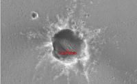
Interesting detail on the far rim of "Waypoint Crater" (no official name yet..?)
|
Posted by: fredk Nov 6 2010, 02:27 PM
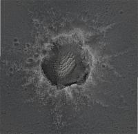
Another drive on 2412. Here's a stereo view peering into crater A/"waypoint crater":
|
We're off the ultra-flat patch, so we're seeing bigger ripples now, but it's still very flat:
http://qt.exploratorium.edu/mars/opportunity/navcam/2010-11-06/1N342315769EFFAV4IP0673R0M1.JPG?sol2412
This is likely what the view will be like for a long time.
Edit: scooped!
Posted by: Stu Nov 6 2010, 02:42 PM
I agree, Fred. Hope you all like the view of this martian "Big Country", this great wide open plain, because This Is It for a long time now. Oppy is on the corner of "No" and "Where", and the next non-ripply thing we see will be Santa Maria, which is still about 1.5km away...
( You'll all be crying out for some meteorites to look at soon, just for a change of scenery, haha! )
|
|
Posted by: Stu Nov 6 2010, 03:47 PM
"Waypoint Crater" compared to Santa Maria...
|
("Waypoint" at 11 o'clock position)
Posted by: Stu Nov 6 2010, 08:11 PM
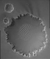
A "new" view of Santa Maria, made from HiRISE image http://hirise.lpl.arizona.edu/ESP_013954_1780
|
This is, I think, the angle we'll be approaching it from (from the bottom of the pic, driving up to the crater, I mean).
Boy, there's some interesting stuff in there, isn't there?
Posted by: mhoward Nov 6 2010, 08:43 PM
Sol 2412, 90 degree field of view
http://www.flickr.com/photos/marscat/5151670779/sizes/o/in/set-72157625201472287/
40 degree field of view
http://www.flickr.com/photos/marscat/5152338054/sizes/o/in/set-72157625201472287/
Posted by: Oersted Nov 7 2010, 01:20 AM
Thanks for the context images!
Man, I can't believe how blasé this little rover has become about craters...
Posted by: Stu Nov 7 2010, 12:19 PM
Don't think we'll tarry too long at this crater, so in advance of Oppy heading east I've made a pic of Santa Maria with some labels, which I hope we can use in our discussions as we look forward to Oppy's arrival at that fascinating-looking crater. No names, just labels for features.
http://roadtoendeavour.wordpress.com/2010/11/07/a-closer-look-at-santa-maria
And, as always, just for fun - not claiming 100000% scientific accuracy - here's a pic showing Endurance (top), Santa Maria (middle) and Victoria roughly to scale...
|
... and finally, a "zoom out" series of images I've wanted to make for ages...
http://roadtoendeavour.files.wordpress.com/2010/11/zoom-out.jpg
Posted by: Stu Nov 9 2010, 06:18 AM
Looks like we have a proper name for "Waypoint crater"...
"Nearly 100m over the weekend. Today, the last 50m to Intrepid Crater, so we can image it. After that, I think we're Santa Maria-bound." (Tweeted by Scott Maxwell)
Posted by: fredk Nov 9 2010, 08:44 PM
Hello Intrepid:
http://qt.exploratorium.edu/mars/opportunity/navcam/2010-11-09/1N342582401EFFAW00P1977R0M1.JPG?sol2415
Posted by: climber Nov 9 2010, 08:56 PM
I'm not bored seeing yet another crater. I'm really looking forward getting to Santa Maria, hopefully before... Santa Claus!
We're "only" miss another 15 "100m's drives".
Posted by: djellison Nov 9 2010, 09:04 PM
Off topic posts moved to the Kitchen Junk Drawer thread.
http://www.unmannedspaceflight.com/index.php?showtopic=6771
Posted by: mhoward Nov 9 2010, 09:24 PM
Sol 2415
100 degree FOV:
http://www.flickr.com/photos/marscat/5161865653/sizes/l/in/set-72157625201472287/
60 degree FOV:
http://www.flickr.com/photos/marscat/5161864459/sizes/l/in/set-72157625201472287/
Posted by: NickF Nov 9 2010, 09:28 PM
Intrepid in anaglyph form

|
Posted by: Vultur Nov 9 2010, 11:15 PM
Intrepid looks really shallow.
Posted by: nprev Nov 10 2010, 06:13 AM
Always strikes me how often these small craters in Meridiani don't look like craters to me from Oppy's viewpoint. They often look like very conventional small eroded depressions & associated knolls that I wouldn't notice twice in many places on Earth.
One wonders.
Posted by: Stu Nov 10 2010, 07:50 AM
Some historical background to Intrepid crater...
http://roadtoendeavour.wordpress.com/2010/11/10/christening-a-martian-crater
Posted by: PaulM Nov 10 2010, 12:58 PM
One wonders.
It looks like a sink hole from limestone country to me.
Posted by: john_s Nov 10 2010, 02:53 PM
Nah, sinkholes don't have raised rims.
John
Posted by: Phil Stooke Nov 10 2010, 03:07 PM
I think if you look back at Apollo images of craters seen at the surface, except for the fresher ones they also look eroded, shallow, irregular etc. (having been pitted by small impacts and showered with ejecta from nearby impacts). These are craters, no question, partly filled with wind-blown material or with rims distorted by superposed drifts.
Phil
Posted by: Phil Stooke Nov 10 2010, 07:08 PM
They are doing a Phobos transit observation today - oops, no, looks like it was yesterday.
Phil
Posted by: charborob Nov 10 2010, 08:58 PM
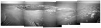
Images of Paramore double crater (taken on sol 2409) just in on Exploratorium. I made this panorama (my first!).

|
Posted by: Phil Stooke Nov 10 2010, 09:31 PM
Very nice job! It inspired me to make a version of it and then do a vertical stretch - the previous ones were looking more towards the west, this one looks south.
Phil

|
Posted by: nprev Nov 10 2010, 09:51 PM
Oh, I don't doubt for a nanosecond that Intrepid & the other small features are craters, Phil. Their appearance does make me wonder how many small-scale unidentified impact features there are on the Earth, though. With our aggressive erosional processes it'd be all but impossible to identify such things consistently, but it's interesting to think about.
Posted by: NW71 Nov 10 2010, 10:08 PM
Phil - thank you for that.
Just so I'm not too disorientated - what/where are those (hills?) in the top left?
Neil
Posted by: Deimos Nov 10 2010, 10:35 PM
Yesterday's Phobos transit (during my pre-lunch telecon, after Opportunity's UHF pass) was the second and last of the season. Preliminary indication is the images will be quite good when they finally make it down (possible annular shot AM 2410, good grazing sequence PM 2415).
Posted by: fredk Nov 10 2010, 10:58 PM
That'd be Iazu crater.
Posted by: SFJCody Nov 10 2010, 11:01 PM
Wouldn't objects small enough to make craters of that size decelerate to terminal velocity in Earth's atmosphere and not produce craters?
Posted by: elakdawalla Nov 10 2010, 11:09 PM
Is this Golden Hind or Yankee Clipper? 1N342132857EFFAVH9P1876L0M and following images, sol 2410.
http://www.planetary.org/image/1N342132857EFFAVH9P1876L0M1ff_pan_sol2410.jpg
Oh, wait, I realized where I could figure that out. It's Golden Hind. They took pics of Yankee Clipper but they're not on the ground yet.
Posted by: SFJCody Nov 10 2010, 11:16 PM
The terrain is giving me some amazing 2004 era deja vu. 
http://qt.exploratorium.edu/mars/opportunity/navcam/2004-04-08/1N134592007EFF1000P1803L0M1.JPG
Posted by: Pertinax Nov 11 2010, 02:26 AM
Deja vu or not I'll happily take it! It's smooth, safe, and speedy!
I hear you though, one could almost expect to see the lander in either GH or Intrepid  .
.
-- Pertinax
Posted by: HughFromAlice Nov 11 2010, 12:59 PM
Nice one! Look forward to you doing more :-)
Posted by: Stu Nov 11 2010, 02:59 PM
Good job! Welcome to the image-processing Lodge...
Posted by: ElkGroveDan Nov 11 2010, 03:14 PM
Cest tiguidou
Posted by: charborob Nov 11 2010, 03:52 PM
Thanks for your good words about my first panorama. Usually, you guys are too quick, and when I check the new posts, the job is already done. I hope I can once in a while add my modest contribution to this fantastic adventure.
Posted by: Stu Nov 11 2010, 05:15 PM
Oh, don't worry about being" scooped"! It's not a race to see who can post the latest image first; I think everyone here just wants to contribute to the 'whole' by posting their take on a particular scene. My images aren't - as is well known by now - as accurate scientifically as those posted by others; I go for a more artistic, more aesthetically-pleasing take on things.
Room for everyone, and no winner's medal for being first. Just enjoy walking alongside Oppy as she approaches, gazes at and then passes each new wonder on the road to Endeavour*...
* Hmmm. Good name for a blog, that...
Posted by: NickF Nov 11 2010, 07:58 PM
A modest anaglyph of Golden Hind, a modest crater

|
Posted by: Stu Nov 11 2010, 09:20 PM
"Yankee Clipper" I presume...

|
Posted by: mhoward Nov 11 2010, 10:07 PM
Metadata says yes.
Posted by: fredk Nov 11 2010, 10:14 PM
Promised notch in the Sun:
http://qt.exploratorium.edu/mars/opportunity/pancam/2010-11-11/1P342122431ESFAVC9P2734R8M1.JPG?sol2410
Posted by: mhoward Nov 11 2010, 10:40 PM
Couple quick ones: 90 degree FOV from Paramore with the next two craterlets, Golden Hind and Yankee Clipper, visible on the left towards the horizon.
http://www.flickr.com/photos/marscat/5167424203/sizes/l/in/set-72157625201472287/
Little look back at Yankee Clipper while looking for dust devils (so says the image tag anyway):
http://www.flickr.com/photos/marscat/5168024600/sizes/l/in/set-72157625201472287/
Posted by: Hungry4info Nov 11 2010, 10:45 PM
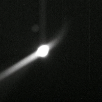
Phobos transit (animated)
|
Posted by: nprev Nov 12 2010, 12:05 AM
Huh. That's kind of different; the transit is much more clearly seen in the secondary reflection. Thank you, Hungry.
Posted by: Floyd Nov 12 2010, 12:57 AM
Sure looks to me like Oppy drove right across a crater http://qt.exploratorium.edu/mars/opportunity/navcam/2010-11-11/1N342221114EFFAVQCP1564L0M1.JPG
|
Posted by: Phil Stooke Nov 12 2010, 01:18 AM
Floyd - yes, it did, and you can see it in the route map here:
http://marsrovers.jpl.nasa.gov/mission/tm-opportunity/images/MERB_Sol2412_1.jpg
- the stop before last on this map, looking back.
Phil
Posted by: elakdawalla Nov 12 2010, 04:04 AM
Oh, neat, I never would have spotted that if it weren't mentioned here!
Posted by: Astro0 Nov 12 2010, 04:46 AM
Just another look at the Phobos transit.
Rather than try and pick it out of the glare, there was a reflection (for want of a better word) off to the upper left on the image.
I pulled that out and after hideously tweaking it, enlarging it etc, created this animated gif.
Posted by: elakdawalla Nov 12 2010, 05:18 AM
Thanks, Astro0; I spent a few minutes trying to do that and gave up.
Posted by: Stu Nov 12 2010, 07:06 AM
It's been a long road... getting from there to here...

|
Posted by: HughFromAlice Nov 12 2010, 07:32 AM
Really really agree. Good on you for saying that Stu, especially as you're one of the main contributors who has been posting here since pretty well the beginning. I really appreciated your comments when I first got going. It motivated me to do more, squeeze time in in the evenings and keep learning!! This is one of the great things about UMSF.
Also I think your site is great...... I visit it from time to time - It keeps getting better and better and more and more comprehensive as you keep learning and expanding your skills and knowledge. It exemplifies what a passionate amateur can do.
Wikipedia - An amateur (French amateur "lover of", from Old French and ultimately from Latin amatorem nom. amator, "lover") is generally considered a person attached to a particular pursuit, study, or science, without pay and often without formal training... and reflects a voluntary motivation to work as a result of personal interest in the activity.
Posted by: djellison Nov 12 2010, 08:29 AM
Yes, it's oft inferred or assumed that amateur is the opposite of professional, when it's not. The driving difference, is a salary.
Posted by: Stu Nov 12 2010, 08:50 AM
Another transit was imaged...
02415 17:32:23 p2735.01. 1 0 0 28 4 28 28 pancam_phobos_transit_L78R28
Here's an animation I made from the thumbnails on the tracking site...
Posted by: Den Nov 12 2010, 09:17 AM
Wow!
I was thinking drivers are avoiding such crossings at all costs - old filled craters might be filled by fine dust, making them dangerous sand (dust?) traps. Is't Spirit sitting in a buried crater trap right now?
I wonder how rover drivers determined that it was safe to cross this crater?
Posted by: NW71 Nov 12 2010, 10:11 AM
Thanks Stu - just shows you how the eyes can play tricks! At first glance you'd swear blind that Phobos is curling round the Sun in those images!
(And yes, I know it does over a Martian year before any pedantic fans leap in there!)
Neil
Posted by: nprev Nov 12 2010, 01:15 PM
Purely for my own edification, what exactly is that 'reflection', then, Astro0? Is it some sort of artifact produced by the CCD array somehow?
Posted by: Poolio Nov 12 2010, 01:41 PM
I find something so compelling about that "Tracks" image. From A afarensis to robots on Mars. To think of those early homonids and the vast future before them, how little they could have imagined about walking on the moon or roving on other planets. The image really underscores the stunning acceleration of human achievement: 450 years since the Copernican model of the universe, 150 years since Darwin explained the diversity of life, 50 years since we tackled the void of space... Makes you wonder what we could accomplish, not in the next 100 or 1000 years, but in the next 10 or 20. Inspiring. You might even consider adding http://news.nationalgeographic.com/news/2010/01/100106-tetrapod-tracks-oldest-footprints-nature-evolution-walking-land/ to the left of your image!
(Sorry for going off-topic, but I simply had to comment on Stu's fantastic image.)
Back to the subject at hand... hopefully not a stupid question: are those stars or camera artifacts (dust?) in the transit image?
Posted by: Pertinax Nov 12 2010, 01:55 PM
While not Astro0, I hope neither mind my jumping in ....
It is an internal reflection off either one of the three lens elements, the sapphire protective 'cover', or the back of the neutral density filter. If I had to guess which I'd say it's a reflection off the front sapphire cover and again off the inside of the ND filter. Little more than a hand-waving guess though from taking a handful of pictures over the years through welding filters with similar kinds of reflections in some shots  !
!
That help at all?
-- Pertinax
Posted by: ElkGroveDan Nov 12 2010, 02:39 PM
You didn't bring a beagle along, did you?
Posted by: Stu Nov 12 2010, 04:37 PM
Ah.
No.
After what happened to the last Beagle sent into space by a Brit, I thought it best not to.
Posted by: fredk Nov 12 2010, 05:49 PM
I'd say almost 7 years driving experience at Meridiani! They've driven through old filled craters before. I agree it's not obvious, though, that it wasn't filled with Purgatory-style dust.
Posted by: fredk Nov 12 2010, 05:50 PM
Hot pixels.
Posted by: Phil Stooke Nov 12 2010, 06:06 PM
That little crater was extremely shallow, so it presented far less of an obstacle than the zillion drifts that have been crossed in the last 2 years.
Phil
Posted by: peter59 Nov 12 2010, 09:01 PM
Nice panoram
|
|
Posted by: charborob Nov 12 2010, 09:01 PM
Panorama of Intrepid.
|
|
Edit: Peter59 just beat me by a few seconds.
Posted by: KrisK Nov 12 2010, 09:07 PM
Dear All I'm new here, although I've been reading news and information posted on this forum for a long time. It is a great source of information for me
I do not wanna be boring with these panoramas but  ...below are my two latest navcam colorized compositions of craters which Opportunity has visited lately. I tried to make colors to look similar to Eagle crater surroundings:
Yankee Clipper
http://www.flickr.com/photos/55907406@N08/5169245293/sizes/l/in/photostream/
Intrepid
http://www.flickr.com/photos/55907406@N08/5169701219/sizes/l/in/photostream/
Posted by: Stu Nov 12 2010, 09:29 PM
First of all, Kris, welcome! Good to have you here!
Secondly...
WOW! They're beautiful!!! Especially love the Intrepid pic, that's really nice.
Looking forward to seeing more of your work!
My go at the latest panorama: http://twitpic.com/368p42/full
Posted by: Stu Nov 12 2010, 10:29 PM
Now this 3D view is pretty special, I think...
http://twitpic.com/369217
Intrepid in the foreground, and Endeavour on the horizn - for the first time, I think, actually looking "distant and solid" in 3D...
Posted by: NickF Nov 12 2010, 10:53 PM
Adding to Stu's post above, here's another view of Intrepid in headache-inducing anaglyph vision
|
|
Posted by: Mirek Nov 12 2010, 10:54 PM
From Opportunity update: "Total odometry is 24,946.12 meters (24.95 kilometers, 15.50 miles)."
Opportunity is now just 1 mile short from surpassing Apollo 16 Lunar Rover travel distance record of 16.50 miles (26.55 km).
Coincidentally we are little less than 1 mile from Santa Maria (approx. 1.5 km in straight line) according to Scott Maxwell http://twitter.com/marsroverdriver/statuses/3156618007019520.
(On the other hand: Apollo 16 Lunar Rover traveled only about 2.8 miles (4.5 km) from landing site)
Posted by: paxdan Nov 12 2010, 11:43 PM
no walk back limit for the MERs, or coms limit like there was for sojourner.
Posted by: HughFromAlice Nov 13 2010, 04:57 AM
Nav Cam panorama featuring Intrepid Crater Sol 2412 on 05-Nov-2010.

|
Posted by: HughFromAlice Nov 13 2010, 06:58 AM
Hazcam fun mucking around on a Saturday avo - which is now all gone!!! Sol 2415 on 08-Nov-2010 looking back at the tracks into the 'desert'
|
Posted by: HughFromAlice Nov 13 2010, 10:21 AM
Quick Anaglyph of Intrepid Navs Sol 2145 08-Nov-2010 for Red-Green
|
For full res http://picasaweb.google.com/102206315340567528232/012415Navs?authkey=Gv1sRgCMOZgfHouZ2Hfg#5538974775277908514
(Stu
)
Posted by: HughFromAlice Nov 13 2010, 11:01 AM
I'm having a fun self indulgent day doing lots of experimenting with pics. Intrepid Crater is beautiful to look at so I thought in addition to Pan Cams I would share this b/w rough stitch of Nav Cams from 2145 on 08-Nov-2010
..........which I am starting work on as a full pic but may not finish for ages as I am going to be v busy the next couple of weeks.
|
For full res download go to http://picasaweb.google.com/102206315340567528232/012415Navs?authkey=Gv1sRgCMOZgfHouZ2Hfg#5538985812322927618
Posted by: Oersted Nov 13 2010, 12:45 PM
What record?
http://en.wikipedia.org/wiki/Lunokhod_2
"Lunokhod 2 operated for about 4 months, covered 37 km (23 miles) of terrain, including hilly upland areas and rilles"
Still a long way to go before Lunokhod 2's distance record is surpassed.
Posted by: Julius Nov 13 2010, 02:00 PM
Any sign of Phyllosilicates?
Posted by: nprev Nov 13 2010, 03:24 PM
IIRC, we've still got several km to go before we encounter those. The next few months are likely to be similar to driving across western Texas...kinda long & monotonous.
Posted by: Deimos Nov 13 2010, 03:59 PM
You all may be interested to know that I've had this same conversation within a science/operations team. I was showing off some especially nice products that I noted were contributed by "amateurs" through this site. There was an objection to that description, since what I was showing was easily better than some comparable pipeline products we had at the time. The term "amateurs" meant, to some, that the work was "amateurish"--maybe that it was done by people paid to do it, but who did it sloppily--while what I showed clearly was not. I clarified that I meant strictly that it was done by people not paid to do it, who did it for the love of doing that sort of thing. This site is a great place to learn that an amateur is unprofessional only in the narrowest sense of being unsalaried, and need not be one bit unskilled or unartful.
Posted by: vikingmars Nov 13 2010, 04:55 PM
My own interpretation of Intrepid Crater... A lovely place indeed on Mars. Enjoy !
|
|
Posted by: Mirek Nov 13 2010, 05:25 PM
http://en.wikipedia.org/wiki/Lunokhod_2
"Lunokhod 2 operated for about 4 months, covered 37 km (23 miles) of terrain, including hilly upland areas and rilles"
Still a long way to go before Lunokhod 2's distance record is surpassed.
I probably shouldn't have used word record.
Point was Oppy is close to total distance traveled by LRV 16 (surpassing somewhere around Santa Maria) then LRV15 (17.3 mi) and LRV17 (22.3 mi) followed by Lunokhod 2 (23 mi)
Posted by: Oersted Nov 13 2010, 05:38 PM
Yes, will be interesting to see if she gets out to 37km.
Posted by: Phil Stooke Nov 13 2010, 06:42 PM
Well, it was an Apollo record... an Apollo 16 record... (looking for other qualifiers as I type)... Of course, having a driver actually on the rover is kind of cheating.
Phil
Posted by: PDP8E Nov 13 2010, 07:36 PM
My own interpretation of Intrepid Crater...Nice Mr. Viking!
you inspire me to take on blending...any tips in 140 chars or less
Posted by: HughFromAlice Nov 13 2010, 10:09 PM
Hey nice work Viking - particluarly love that well matched stitching
Posted by: Stu Nov 14 2010, 10:37 AM
Updated my blog with some new pics, if anyone wants a look...
http://roadtoendeavour.wordpress.com/2010/11/14/interesting-intrepid
Some very interesting dark rocks inside the crater...

|
('nowhere-near-real-colour' image)
... and if anyone's wondering how much bigger than Intrepid Santa Maria is, here are the two craters side by side to the same scale. Intrepid is at the 10 o'clock position.

|
Posted by: NickF Nov 14 2010, 02:51 PM
Another view of Intrepid (pancam L5 filter)
|
|
Posted by: NickF Nov 14 2010, 03:43 PM
A colourised version of #129. Doubtless other UMSF members can make a better stab at it
|
|
Posted by: NW71 Nov 14 2010, 06:20 PM
Judging from the excellent animations that Nick and others have shown us, I wonder how long the powers that be will choose to spend here?
If they feel this crater has anything new for them to investigate there are a number of very interesting and it would appear reasonably accessible sites for them to look at.
Just wets the appetite for what Santa Maria and Endeavour may have in store for us doesn't it? 
Neil
Posted by: fredk Nov 14 2010, 06:28 PM
Judging from Maxell's http://twitter.com/marsroverdriver/status/3156474360500224, we won't be staying at Intrepid:
And this followup:
On another topic, it's been a while since we've been able to see distant views of our tracks like this:
http://qt.exploratorium.edu/mars/opportunity/pancam/2010-11-13/1P342304434EDNAVQFP2292L1M1.JPG?sol2412
Posted by: vikingmars Nov 14 2010, 06:33 PM
Another (colorized) interpretation of Intrepid Crater... I just love the hills range in the background. Enjoy !
Some pics taken at sunset casting loooong shadows would have been just great also (just an idea to our excellent Pancam team)
|
|
Posted by: dilo Nov 14 2010, 07:32 PM
I love it too! excellent work, vikingmars.
Posted by: vikingmars Nov 14 2010, 09:33 PM
Thanks Dilo. I'm also monitoring the northern tip of Endeavour crater (see mosaic hereabove) since its 1st sightings on Sols 790 and 804 and traced back to Sol 774... (herebelow).

|
Now we have it on plain sight !
Posted by: Julius Nov 14 2010, 10:04 PM
It was mentioned that we could encounter different rock types as early as Santa MARIA!! I'm assuming they must have some data from orbit to have mentioned that possibility!
Posted by: Stu Nov 14 2010, 10:55 PM
Wow... who would have thought that humble little Intrepid would have given us all such a photogenic viewpoint! The hills just look incredible from here...
Posted by: NW71 Nov 14 2010, 11:12 PM
That was undoubtedly the plan. However, he's just updated his twitter site. No driving until Wednesday now.

Neil
Posted by: Tesheiner Nov 14 2010, 11:25 PM
Not really. Whenever he talks about driving it means drive planning.
Opportunity should have already left the vicinity of Intrepid by this time but the images are still on the queue.
Posted by: vikingmars Nov 15 2010, 09:09 AM
Neil I'm now dreaming of 2 pics at Intrepid Crater : - a low sun panoramic picture with long shadows on the rocks and dunes ;
- sunset and dusk pictures with the Sun setting behind the hills...
Posted by: djellison Nov 15 2010, 09:13 AM
The hills are to the east.
The sun sets in the west.
Posted by: vikingmars Nov 15 2010, 09:16 AM
OOOOPs ! You're right, of course :
Must be read then "- sunrise and early morning pictures"
Posted by: Pertinax Nov 15 2010, 02:00 PM
Hi Vikingmars,
For the sake of trivia and pride, I think the first sighting was about a week before on http://www.unmannedspaceflight.com/index.php?showtopic=2417&view=findpost&p=49504, again noting the sol 774 image. I've been fond of keeping an eye on those distant peaks as well, even though I lost track of them for a little while. http://www.unmannedspaceflight.com/index.php?showtopic=6438&view=findpost&p=164188 from a little while back was fun in reviewing our view from then 'till now.
Also, not quite the low sun vista you were opining for there was a nice sunset sequence (pancam_twilight_L7R4) taken on sol 2411 starting just before 17:41 LTST, which lasted through just after 18:07, with the sun sinking from ~5 degrees above the horizon, to ~2 degrees below it. I think I'll try and animate it later today, though I really look forward to seeing the calibrated version.
-- Pertinax
Posted by: vikingmars Nov 15 2010, 03:24 PM
Great Pertinax : you beat me with your Sol 782 pic ! When I traced back from Sol 790, I did not see this one...
Now, I can barely see it even a little earlier on a Navcam pic on Sol 765... (herebelow with PhilOvision)

|
http://marsrovers.jpl.nasa.gov/gallery/all/1/n/765/1N196100475EFF65YQP0695L0M1.JPG
Thanks also for the sunset pics link. My dream would be also to have a much larger pan taken with a grazing Sun. I really look forward to see your animation
Posted by: Pertinax Nov 15 2010, 06:11 PM
Nice catch on the sol 765 view! I'd looked over the preceding sols data a few times back in 2006 and again just a few months ago. I'd never stretched them though. Again, nice!
I'm with you on the wish for both the low sun angle pans. I think one of the best and dramatic panoramas taken by either rover was Spirit's low sun angle pan at http://pancam.astro.cornell.edu/pancam_instrument/lowridge_new.html.
I played with the sunset images with the following result: merb2411ss_interp_sm.avi ( 330.54K )
: 439
merb2411ss_interp_sm.avi ( 330.54K )
: 439
[also posted at at Youtube http://www.youtube.com/watch?v=LQVMWqN-JlE]
Images used are from the L7 filter. Interpolated video converts the original images taken every 75 seconds to sequence with a frame every two seconds at 30 fps, resulting in one second of video equaling one minute on mars -- that is if I didn't do something stupid!
I have the full sized version if anyone wants.
-- Pertinax
Posted by: jamescanvin Nov 15 2010, 08:27 PM
My version of the Intrepid Crater mosaic.
http://www.nivnac.co.uk/mer/index.php/b2417
James
Posted by: peter59 Nov 15 2010, 08:41 PM
Excellent as always!
Posted by: vikingmars Nov 15 2010, 08:56 PM
I have the full sized version if anyone wants. -- Pertinax
I could not believe my eyes : so smoothly done !
As if we were witnessing a sunset on Mars !
GREEEEAAAT job, Pertinax !!!
Posted by: vikingmars Nov 15 2010, 10:49 PM
Yes ! You are absolutely right about the dramatic feelings of low-sun angle pans on Mars. Herebelow was my Sol 813 interpretation for Spirit. Just imagine the same kind of illumination on Meridiani !
http://www.unmannedspaceflight.com/index.php?s=&showtopic=2610&view=findpost&p=52380
Posted by: djellison Nov 15 2010, 11:17 PM
We had exactly that back when there was plenty of time and power and little to do, late into the hiatus at the Olympia outcrop during the IDD trouble.
Posted by: fredk Nov 16 2010, 03:01 AM
Judging from the new navcams and pancams (new hazcams aren't down yet, though) there's been a drive:
http://qt.exploratorium.edu/mars/opportunity/navcam/2010-11-15/1N343032148EFFAWNRP0663R0M1.JPG?sol2420
It looks like we've made it to the remnant of exposed bedrock around 100 metres east. A bit of dejavu, huh?
Posted by: mhoward Nov 16 2010, 03:40 AM
Yes, metadata says due east, a respectable distance to be determined.
Posted by: CosmicRocker Nov 16 2010, 06:08 AM
It's been a long time since we've seen a large panorama taken with the L7 filter. We have sharp L7-R1 stereo pairs of Intrepid Crater and the beautiful eastern skyline. Before we get too far away from Intrepid I wanted to post an anaglyph panorama of this lovely scene from sol 2417. I've removed as much vignetting as possible. It is an especially nice view if you have multiple monitors or an extra wide monitor.
|
|
Posted by: nprev Nov 16 2010, 07:34 AM
Great stuff, all, and esp. like your anaglyph, CR; thanks!
There are indeed some intriguing rocks in there...but I hope we don't go in even a little bit, frankly. Those dunes look like the could be pretty deep to me, and the crater slopes are uncomfortably steep.
Posted by: climber Nov 16 2010, 10:49 AM
And there is also a "rock" in the distance right in front of us after last night drive visible in fredk attachment.
Posted by: Tesheiner Nov 16 2010, 12:12 PM
The data were downlinked last night but the drive was executed during sol 2420 i.e. two days ago (see http://www.unmannedspaceflight.com/index.php?s=&showtopic=6788&view=findpost&p=166645).
I'm updating the route map right now...
Posted by: Stu Nov 16 2010, 03:18 PM
Just for fun, based on messing about with skilfully simulating the view using Starry Night, but probably not too far out...
Sunrise Over Endeavour this morning...
|
|
(hope you don't mind me using crop of your gorgeous panorama, James)
Posted by: Gonzz Nov 16 2010, 05:11 PM
That's gorgeous!
Posted by: mhoward Nov 16 2010, 06:32 PM
Sol 2420
http://www.flickr.com/photos/marscat/5182470352/sizes/l/in/set-72157625201472287/
Posted by: Oersted Nov 16 2010, 07:54 PM
Inspirational! ....Isn't it, JPL? *Nudge nudge, wink wink*
Posted by: marsophile Nov 16 2010, 08:59 PM
Since the discussion here:
http://www.unmannedspaceflight.com/index.php?showtopic=6535&view=findpost&p=159419
the dark blue "stain" has enlarged considerably, as seen in this navcam image from Sol 2412.
http://qt.exploratorium.edu/mars/opportunity/navcam/2010-11-06/1N342315769EFFAV4IP0673L0M1.JPG
It seems to be advancing (and occasionally retreating) along clearly defined frontiers. This does not fit well with the explanations proposed earlier, which should result in a more dispersed profile.
In sharpened pancam images that correct defocus blur, posted by Hortonheardawho on his website, the "stain" looks like it might be a layer of dark material on top of the light-colored dust that we see everywhere else on the rover deck.
This suggests the interesting possibility that it involves a phase change in the light-colored dust. Perhaps that is related to the formation of duricrust, which I believe is not well-understood.
Posted by: djellison Nov 16 2010, 09:15 PM
It's simply below the resolving power of Pancam or Navcam to make any meaningful interpretation. There are a thousand things that could cause something to happen. FWIW, my initial gut reaction remains to this day - it looks like clean patch free of dust, not a surficial feature and the word 'stain' has never sat well, imho. However, there are many complex and interesting components and materials involved in building the rover, and some of them we know to be behaving unexpectedly ( such as the delamination of the sundial base ). I would like to see what people do with PDS calibrated data, rather than trying to 'deblur' jpgs - which really is a way to generate feature that simply don't exist.
Short answer - we're never going to know.
Posted by: nprev Nov 16 2010, 09:42 PM
I think that chemical reactions on the surface of Mars (what few that may exist) must happen VERY slowly by terrestrial standards, particularly those that require the interaction of water in any phase. We've seen several iron-nickel meteorites that have clearly been in place for hundreds of thousands (if not millions) of years, and show no signs of corrosion, merely windborne dust build-up.
It therefore doesn't seem reasonable to assume that any sort of detectable chemical alteration has occurred on the MERs during their exceedingly short tenure on Mars, both for that reason and by virtue of the fact that their component materials are much more resistant to such reactions than the meteorites.
Posted by: marsophile Nov 16 2010, 10:08 PM
A clarification: the pancam depth of field is from 1.5 m to infinitiy, so the sundial at 80 cm is slightly out of focus. Thus, a deconvolution algorithm can be used to sharpen the focus.
Posted by: djellison Nov 16 2010, 10:32 PM
It can be used to TRY and sharpen the focus, but you are playing a very tenuous game to try and pull out anything meaningful that you identify in those deconvolved images that isn't apparent in the orig. images.
Posted by: SFJCody Nov 17 2010, 12:00 AM
Had one of those 'woah' moments just now. Looked at the 1.4km distance to Santa Maria while thinking "Oh, that's not so far now. Shouldn't take more than a few weeks."
Then I remembered that 1400m distance is over twice the mission success criterion.
Posted by: NW71 Nov 17 2010, 12:16 AM
I'm glad it's not just me then!
We are still over ten times the mission success criteria away from Endeavour crater with a rover which has completed approximately 28 missions

Neil
Posted by: Astro0 Nov 17 2010, 06:02 AM
Nice Intrepid Crater 'look back' view with the tracks leading up from the distance.

|
Posted by: brellis Nov 17 2010, 07:08 AM
Some future alien explorers might deduce that Oppy dodged that one!
Posted by: Stu Nov 17 2010, 08:22 PM
'Road to Endeavour' blog updated: http://roadtoendeavour.wordpress.com/2010/11/17/25km-and-counting
Posted by: vikingmars Nov 17 2010, 09:30 PM
WOW ! My dream is becoming true !
Here is the link to this fantastic image
http://roadtoendeavour.wordpress.com/2010/11/17/sunrise-over-endeavour/
Posted by: ngunn Nov 17 2010, 10:52 PM
I like that image too, and I have no quarrel with the notion of artistic license. In fact I think artists should have the license/freedom to do almost anything so this is not a complaint. But in my mind's eye Martian sunsets are conceived as always being cold blue affairs, more like a failing fluorescent lamp than a comforting camp fire. (The alliteration is accidental, I promise.)
Posted by: serpens Nov 18 2010, 01:12 AM
Hortonheardawho did some full filter ratio analysis on this with some interesting results. The reflectance of the stain is pronounced in the ultraviolet as opposed to surrounding soil, and a sample of clean deck. He and others on the yellow forum have also identified when the stain started (bottom of Victoria crater) and that it initiated with a feature just visible behind the sundial which then spread. Most likely a dark material spread by wind and covered/uncovered by the ubiquitous dust.
It is disappointing that JPL have not bothered to investigate this, or if they have that they did not think it worth mentioning. They would have all the spectral responses for the pancam filters and it would be interesting to know the makeup of whatever the stain is. Surely anything unusual associated with the Rovers is worth investigating.
Posted by: fredk Nov 18 2010, 01:18 AM
The simplest explanation is that it's an area almost clear of dust. Comparing the spectrum with other almost clear areas of the panels is tricky, even if you used the calibrated data. Thin films of dust could affect the spectrum.
We'd need pretty good reasons to contemplate a new material not seen elsewhere.
Posted by: Astro0 Nov 18 2010, 02:07 AM
ADMIN HAT ON...
I think I'd like to see discussion on the so-scalled "stain" to stop here for now.
There's no further information that anyone can draw upon and any so-scalled "analysis" by the armchair explorers among us is working from less than the full spread of information that will one day be available through various sources. If it's something worth investigating then the mission team will definitely let us know.
There is plenty of "discussion and speculation" going on in other forums, so I believe it can continue there.
At the moment it's cluttering up the "On to Santa Maria!" thread and does not deserve a thread of its own.
Remember that you can always just PM each other if you want to discuss it further.
For now, like Opportunity, let's move on!
Posted by: Pertinax Nov 18 2010, 02:15 AM
...
For now, like Opportunity, let's move on!
Thank you.
-- Pertinax
Posted by: fredk Nov 18 2010, 03:26 AM
From http://twitter.com/marsroverdriver/status/5011615598514176:
Posted by: nprev Nov 18 2010, 03:49 AM
I know I'm gonna sound stupid for asking this, but are the hazcams all right? I assume Scott means that they just didn't get the images down, but it's scarily-phrased.
Posted by: elakdawalla Nov 18 2010, 03:52 AM
Remember, Nick, this is Twitter. No room for detail. I think we can be quite confident that he meant "lack of Hazcam images in the downlinked data." And geez, do we need another warning about overinterpreting Scott's tweets?
Posted by: fredk Nov 18 2010, 04:33 AM
The answer is http://twitter.com/marsroverdriver/status/4944123979108352:
Posted by: nprev Nov 18 2010, 06:31 AM
Yeah, thought so, and sorry for even floating the concept. I must be twitchy today or something.
Posted by: pgrindrod Nov 18 2010, 06:33 PM
I wasn't sure if this should go here, or in the route map thread, so please move if necessary.
Here's a CTX DEM (20 m/px) of Oppy's driving area, made using the fantastic USGS scripts (thanks!) and the old SocetSet pulling-out-your-hair method. Actually, CTX DEMs seem (famous last words) to be working pretty well...there must be something wrong.
First up, a general elevation colour map with CTX image P01_001612_1780_XI_02S005 underneath. The red dot is Oppy on sol 2420, taken from Tesheiner's route map (thanks!).
|
Next, a close-up view of Oppy and the rim of Endeavour, this time with a different colour stretch to highlight the elevation change on the next part of the route.
|
I'm more than happy to share this if anybody thinks they can do something with it.
Pete
Posted by: djellison Nov 18 2010, 06:47 PM
Could you pull out a height profile, from - say, Victoria to the edge of Endeavour including the rim? and/or from our current location to the rim at Cape York. That sort of thing
Posted by: fredk Nov 18 2010, 07:43 PM
Thanks for this! Can you provide an elevation scale for these images as well?
Posted by: Astro0 Nov 18 2010, 10:09 PM
Whenever I see images like this http://qt.exploratorium.edu/mars/opportunity/navcam/2010-11-18/1N342135253EFFAVLNP1877L0M2.JPG, I can't help but think of images like this one....Endeavour Bound!!!

|
Posted by: DFinfrock Nov 19 2010, 12:55 AM
Land Ho!
Wait a minute. Those islands are off the stern. You're sailing the wrong direction Astro0!
It's amazing though, how a change of color in those ripples completely changes what the brain thinks it's seeing.
David
Posted by: mhoward Nov 19 2010, 02:37 AM
Off the port side, actually
Posted by: Astro0 Nov 19 2010, 03:03 AM
DFinfrock: You're sailing the wrong direction Astro0!
No, just a leisurely voyage tacking across the Meridiani 'sea'
Posted by: fredk Nov 19 2010, 03:27 AM
It looks like the hazcam-less drive has taken place:
http://qt.exploratorium.edu/mars/opportunity/forward_hazcam/2010-11-18/1F343384891EFFAW7PP1205R0M1.JPG?sol2424
Posted by: Tesheiner Nov 19 2010, 07:28 AM
130m, according to the rover's mobility data.
Posted by: pgrindrod Nov 19 2010, 10:05 AM
As requested, but I'd avoid reading too much into the actual profiles and the spikes and troughs - there's a fair bit of noise in this DEM as the smooth terrain is great for driving but bad for pixel matching! It does however still give a nice impression of the overall topography.

|
Pete
Posted by: climber Nov 19 2010, 10:08 AM
The mean mileage per sol is consistantly increasing since late August but the more the sols the more the "need" to drive to keep it this way (at least 250m per week at the moment). So, I guess we're "safe" this week
Not a race but giving the feeling that we follow SS statement.
Posted by: jamescanvin Nov 19 2010, 10:56 AM
You can see (I think) in the red profile the same thing I had convinced myself from the MOLA data: That we are currently on a flattish section with a drop-off to Santa Maria a few hundred meters ahead. I think this is why we can't see Santa Maria yet.
I made a prediction to Stu by PM earlier this week regarding this: That I expected Santa Maria to pop into view quite suddenly and dramatically ~400m ahead, since then we have covered around half that distance. So keep your eyes pealed over the next few drives, I'm anticipating a HOAV moment very soon.
James
Posted by: fredk Nov 20 2010, 08:28 PM
I've made some measurements to try to decide whether the double feature we've been seeing is Santa Maria or not. I compared the separations and positions (relative to the distant east rim of Endeavour) of both of the light "bumps" on sols 2409 and 2420. These measurements are entirely relative, ie I didn't use any absolute heading information. The only assumption is for the comparison of bump positions between 2409 and 2420: I assumed that the distant east rim of Endeavour was essentially infinitely far away, so there was no parallax between 2409 and 2420 of that east rim. That parallax should be extremely small. The left-right bump separation measurements are independent of this assumption.
Here are the angles measured from the pancams:
|
And here are the corresponding angles measured from Tesheiner's route map:
|
|
The corresponding angles are consistent with each other, if the two bumps are high points on the north and south rim of Santa Maria. The agreement of the four angles means that both the size and distance agree with Santa Maria. So I'm ready to declare that the two light bumps are Santa Maria.
Posted by: Bobby Nov 21 2010, 04:24 AM
I like your slide show presentation Fred K. I think we should be there by Christmas and what a gift to us all to see Santa Maria by then.
Maybe Santa Clause will stop by and give the Rover a boost of Energy for the coming season.
I can remember the day she landed in Eagle Crater way back then or ages ago. I am amazed what this little golf cart rover has done.
May The Force Be With Her.
I do have a couple Question. Is the top of Santa Maria lower in elevation then the bottom of Victoria Crater and would the bedrock within Santa Maria
be older then anything we saw at Victoria? Is there any possibility that we might go into Santa Maria or just drive around and keep going???
Posted by: Stu Nov 21 2010, 09:49 AM
I had another 'chat' with our favourite rover driver over on my blog, which some of you might find interesting as we head towards Santa Maria...
http://roadtoendeavour.wordpress.com/2010/11/21/a-chat-with-scott-maxwell
Thanks Scott! :-)
Posted by: Stu Nov 21 2010, 01:40 PM
I've also been working on some "artistic impressions" of Endeavour, which I've put on my blog in a different post concering possible future art on Mars. I hope some of you like them.
http://roadtoendeavour.wordpress.com/2010/11/21/we-need-a-bierstadt-on-barsoom
Posted by: BrianL Nov 21 2010, 03:35 PM
I think having Thomas Kinkade on Mars would be a good thing. 
Posted by: Stu Nov 21 2010, 03:39 PM
I didn't recognise the name so I did a Google image search...
...now I wish I hadn't.
Posted by: Floyd Nov 21 2010, 04:28 PM
Stu,
I hope you haven't forgotten the great dawn shot Spirit took looking back at Von Braun. mhoward had a fantastic http://www.unmannedspaceflight.com/index.php?s=&showtopic=5999&view=findpost&p=145084, and some guy colorized it to make it look like something http://www.unmannedspaceflight.com/index.php?s=&showtopic=5999&view=findpost&p=145085would have taken The team has taken quite a few shots at hours where the shadow of rocks and rovers are tens of meters long, and has taken color panoramas of from most every place there has been a HOV
Posted by: fredk Nov 21 2010, 04:57 PM
It's a matter of whether we see new rocks at Santa Maria. If it's just the same old Meridiani bedrock, I think they wouldn't stop for long and almost certainly wouldn't enter Santa Maria.
On the other hand, if they see something new at Santa Maria (hydrated sulfates?), they'd definitely want to spend time studying it. If the new material was only inside Santa Maria and there was very easy access into the crater, then they might enter the crater. But they definitely wouldn't want to put Oppy at any significant risk, with the big prize of Endeavour still ahead.
Posted by: climber Nov 21 2010, 06:18 PM
I get the point fredk. I'd also said that if there is something of interest, Santa MAria would be a goog place to stay (and work) during superior conjunction due by end of January.
Posted by: Stu Nov 21 2010, 06:53 PM
"I think Santa Maria will be a fascinating waypoint on the way to Endeavour I just hope it doesnt slow us down too much. But what are you gonna do, just skip it? If we didnt have Endeavour beckoning us to the horizon, wed be all over Santa Maria, so we might as well give it its due. I guess my personal hope is that Santa Maria gives the science team just enough to keep them busy analyzing data while we complete our trek to the big one!"
- Scott Maxwell
Posted by: antoniseb Nov 21 2010, 07:39 PM
One reason to stop for a while at Santa Maria is to compare the composition of the salts (bedrock) from further North, to see if there is anything special to observe along those lines when we get to the walls of the big crater.
Posted by: Stu Nov 22 2010, 08:13 AM
New panorama...
http://twitpic.com/393kq5/full
... and that has to be parts of the rim of Santa Maria poking over the top there, right..?

|
Posted by: Julius Nov 22 2010, 12:32 PM
looks like it!I agree
Posted by: kenny Nov 22 2010, 01:52 PM
If so, could someone point it out with a wee arrow?
Posted by: Stu Nov 22 2010, 03:36 PM
|
|
Posted by: fredk Nov 22 2010, 04:26 PM
That's definitely Santa Maria. The question is, when will the rest of the crater come into view? James talked about that recently. Looking at Stu's stereo view closely, it looks like most of the rim is blocked by a near horizon (lighter below, darker above). But to me it looks like that "near" horizon is still pretty far away. So it may take a while before we see the full rim.
On the other hand, the topography is so subtle at Meridiani that it's hard to know for sure. I'll bet that if I was there, I could jump up and see the whole rim!
Here's an average of the L2 and R2 frames from 2427 to reduce jpeg noise. We can see some of the rim to the right of the left "bump":

|
Posted by: Phil Stooke Nov 22 2010, 04:36 PM
Nice one, Fred. Here's one of my trademarked vertical stretch jobs. A couple of little craters along the way are showing up, as well as similar-looking bright spots in the distance.
Phil

|
Posted by: fredk Nov 22 2010, 04:58 PM
Thanks for that, Phil. That shows nicely the "near horizon" I mentioned, and a couple of the little craters we'll probably do drive-by imaging of on the way. But looking at the orbital view, there should be more little craters along the line of sight to Santa Maria. Since we can't see them, I'd now estimate the near horizon to be 400-500 metres away (as of 2427). So a good week or so of driving and Santa Maria may be fully revealed...
Posted by: Phil Stooke Nov 22 2010, 05:35 PM
I think you're right. The near horizon seen from here must be around that outcrop area seen in your lines-of-sight image above. The cluster of craters just beyond it is hidden.
Phil
Posted by: kenny Nov 22 2010, 06:17 PM
thanks for the oval-shaped arrow....
Posted by: Stu Nov 22 2010, 07:34 PM
You're welcome
As we're now within sight of Santa Maria, time for a look at what's waiting for us when we get there...

|
( Taken from http://roadtoendeavour.wordpress.com/2010/11/22/approaching-santa-maria-endeavour-base-camp )
I am getting really excited about Santa Maria, now. There's going to be a lot to see there, and it will be a great - ahem - opportunity for the MER team to 1) give Oppy a short rest, after all the hard driving she's been doing recently, and 2) catch their own breath, before striking out for Endeavour. So I really do think we can think of Santa Maria as "base camp" for the final assault on Endeavour, instead of 'just another crater'.
Posted by: Mirek Nov 22 2010, 11:24 PM
Great work Stu.
Completely random thought: looks like "boulder #5" is about the size of Opportunity and judging from the shadow somewhat sundial shaped.
We shall soon see as it appears to be just in the right spot to be directly visible after Opportunity approach to the NW rim of Santa Maria.
Posted by: ngunn Nov 22 2010, 11:33 PM
I've really no idea what the drivers are planning but they could be heading for a patch of ground with bedrock outcrops WSW of the crater because that route offers more reference points for navigation, in which case we'd approach from that direction.
Posted by: Stu Nov 23 2010, 06:30 AM
I'm really looking forward to adding some names to those features as we get closer and then start rover-rummaging around the crater
And I've just noticed that today is Nov 23rd, that means another release of data from the PDS... this release should, if I've read it right, include calibrated pics of Concepcion and the beautiful "Chocolate Hills" rocks.
Image processors... start your engines!
Posted by: MahFL Nov 23 2010, 05:55 PM
It looks like a mini Victoria, nothing new....., drive right on by it !
Posted by: eoincampbell Nov 23 2010, 06:03 PM
Those blocks do look big, I'm thinking rover sized chocolate hills... can't wait to see...
Posted by: ustrax Nov 23 2010, 06:29 PM
Dune fields? Everyone can see that those are abysses man...haven't you learned anything in these last years?
About the names...hmm...
http://en.wikipedia.org/wiki/Santa_Mar%C3%ADa_(ship)#First_crew
(their names or towns of origin)
or names related to where the Santa Maria ran aground on December 25, 1492: Cap Haitien, Haiti.
http://en.wikipedia.org/wiki/Cap_Haitien
Posted by: jamescanvin Nov 23 2010, 08:59 PM
Intrepid Crater from the other side:
http://www.nivnac.co.uk/mer/index.php/b2420
Posted by: MarkG Nov 23 2010, 10:58 PM
Re: Intrepid Crater
It is interesting that this small crater displays (in a modest fashion) the same erosional forms as Victoria -- "Capes and Bays".
Santa Maria might be likewise categorized.
Posted by: Oersted Nov 23 2010, 11:10 PM
( Taken from http://roadtoendeavour.wordpress.com/2010/11/22/approaching-santa-maria-endeavour-base-camp )
Whoa, free-lying boulders the size of the rover! Didn't know we would see that. Definitely interesting. Thx, Stu, for the annotated image and the chat with Scott.
Posted by: Stu Nov 23 2010, 11:19 PM
You're welcome, but please bear in mind that I'm only guesstimating the size of those boulders, based on my own
Posted by: djellison Nov 23 2010, 11:22 PM
It certainly looks comparable in size to something like Wopmay back up at Endurance.
Posted by: Stu Nov 23 2010, 11:29 PM
I think the big guy inside the crater is actually bigger than Wopmay. As for the ones outside the crater, I think... think... a couple are just under rover sized, but time will tell.
Posted by: nprev Nov 24 2010, 12:37 AM
These boulders might well be the first compositionally different rocks we've seen in years @ Meridiani...can't see them being made of the usual crumbly sulfates.
Posted by: OWW Nov 24 2010, 12:54 AM
Wasn't 'Marquette Island' compositionally different as well? Can't remember what it was made of...
Posted by: nprev Nov 24 2010, 12:57 AM
IIRC, Marquette was a meteorite. I omitted those, meant native martian rocks.
EDIT: Oops, I'm a dork. Yeah, you're right, OWW. Marquette was a deep crustal rock, mostly basalt, and that wasn't quite a year ago. Time flies...
Posted by: Astro0 Nov 24 2010, 01:19 AM
Phil-O-Vision version of James' Sol2424 panorama.

|
Posted by: fredk Nov 24 2010, 05:14 AM
Santa Maria on sol 2429, showing a bit more of the rim. Average of L2/R2 frames:

|
Posted by: Stu Nov 24 2010, 11:40 AM
Ok, this is the best I can do, comparing Oppy to Santa Maria and surroundings...
http://twitpic.com/39posk
Posted by: Floyd Nov 24 2010, 12:35 PM
Well, we can now see Santa Maria and our current location on the zoomed in view of http://www.unmannedspaceflight.com/index.php?act=attach&type=post&id=22891 (on my screen resolution). The high point in our approach looks to be about 400 m ahead next to a cluster of 3 small craters and oucrop (50 m west of the 3km E grid line). I think that will be our best view until we are actually at Santa Maria looking in.
Posted by: MarkG Nov 24 2010, 03:49 PM
(Marquette Island was a secondary meteorite from elsewhere on Mars, and it was a Gabbro -- Coarse-grained Olivine + other stuff.)
Posted by: eoincampbell Nov 24 2010, 04:08 PM
The dune field on Santa Maria's northern slope is intriguing. I don't remember seeing inclined, "mesh" type dunes (esp. inside craters) on our travels...
Posted by: fredk Nov 24 2010, 04:21 PM
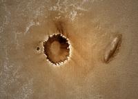
Peeking inside Southern Cross crater, a particularly rocky crater, on sol 2404, pancam stereo:

|
Posted by: centsworth_II Nov 24 2010, 04:24 PM
Posted by: djellison Nov 24 2010, 04:38 PM
Unless I'm missing something - these dunes are not significantly different to those in Endurance and Victoria.
Posted by: OWW Nov 24 2010, 05:06 PM
The dunes near the north rim of Santa Maria do look a bit like the northeast corner of Spirit's El Dorado.
Posted by: MarkG Nov 24 2010, 05:45 PM
Although it is likely that MI is ejecta, it is not definitive, and may never be known with certainty. It cannot be ruled out that MI could have been ejected into space for a period of time before recapture, or even came from a parent body other than Mars that we have insufficient knowledge to recognize.
Posted by: MarkG Nov 24 2010, 05:53 PM
The large number of crater interiors and other steep south-facing slopes in various equatorial areas with deposits of dark sandy material bespeaks of some sort of episode in the Martian past that would transport and deposit this material. An interesting problem.
Of note is that Victoria had dark windblown material blowing from inside its northern rim. Maybe the dark stuff (as dunes up against the North rim?) is there too, but buried by more-recent dust and debris except where a few spots are eroding....
Posted by: djellison Nov 24 2010, 05:54 PM
I don't think MI's been through an entry - it has no symptoms of being meteoritic (fusion crust etc ) and indeed its angular edges would almost preclude such an adventure would they not?
Posted by: MarkG Nov 24 2010, 05:59 PM
We simply do not know what has spalled or broken off of this rock.
Posted by: Phil Stooke Nov 24 2010, 06:33 PM
That's true, but 'we don't know' is not evidence of anything. It is much more likely that this is a simple ejecta block. It's easy to invent additional possibilities, but it gets you nowhere in the absence of specific evidence.
Phil
Posted by: centsworth_II Nov 24 2010, 06:43 PM
Let's just say we agree on this point.
Posted by: jvandriel Nov 25 2010, 12:32 PM
Nice view from Endeavour crater.
Taken on Sol 2429 with the L2 pancam.
Jan van Driel
http://www.unmannedspaceflight.com/index.php?act=attach&type=post&id=23079
Posted by: sgendreau Nov 25 2010, 06:50 PM
Sorry, I got an error message.
Posted by: MoreInput Nov 25 2010, 07:07 PM
Just one month, and we have Christmas. Here's a calendar to shorten the waiting time ...
Couldn't resist to open the door of the Advent calendar a week to early ...

|
Posted by: Tesheiner Nov 25 2010, 08:30 PM
Welcome back, jvandriel!
It was a looooong time without news from Holland.
Yummy.
Posted by: nprev Nov 25 2010, 08:47 PM
'Tis the season; best advent calendar ever, thanks!!!
Posted by: akuo Nov 25 2010, 09:45 PM
Haha, that's excellent!
Posted by: Stu Nov 26 2010, 10:56 AM
Just for fun...
Ever wondererd how big Endeavour crater is compared to Gusev crater, landing site of Spirit..?
This big...

|
Posted by: fredk Nov 26 2010, 04:08 PM
Thanks, Stu. And the Phobos shadow is a nice touch, too.
Posted by: Stu Nov 26 2010, 04:17 PM
That shadow's real
http://www.unmannedspaceflight.com/index.php?s=&showtopic=480&view=findpost&p=167079
Posted by: nprev Nov 26 2010, 04:46 PM
Great comparison, Stu, you compulsive science educator, you (and the shadow's nice too! )
Posted by: fredk Nov 26 2010, 04:50 PM
I never thought otherwise, Stu!
On another topic, if you look at Tesheiner's route map, the latest drive (2428) took a bit of a jog to the south. Looking closely, there's an Anatolia-like feature between the 2427 and 2428 locations, and the jog took us around it. I'm a bit surprized they took this diversion, since the feature looks pretty harmless to me along a straight route. But obviously a short diversion is a small price to pay for reduction of any risk. There are several more such features ahead, so it'll be interesting to see how they make their way around them...
Posted by: Stu Nov 26 2010, 05:43 PM
One possible route, Fred...
http://twitpic.com/3aegob
(handy for people who don't have / can't use Google Earth/Mars)
Actually most of the Anatolia-like features are in one specific area, and Oppy can skirt around that without too much trouble or time. It's pretty much a straight road to Santa Maria now, unless Oppy spots any beautiful shiny meteorites off to either side -
Oh, alright. Just me then...!
Posted by: climber Nov 27 2010, 06:39 AM
Very handy map Stu!
Thanks Fredk for the explanation. I was about to ask is this kind of trajectory was for technical reasons. It makes sense now.
Posted by: Stu Nov 27 2010, 08:02 AM
A colourised look back at some of the 'pebbles' imaged on Sol 2419 (Nov 13th)...

|

|
Posted by: Hungry4info Nov 27 2010, 08:47 AM
Nice, though, a question: why does one have a "UMSF" watermark, and not the other?
Posted by: Stu Nov 27 2010, 08:54 AM
Well spotted!
I've got a lot of Outreach talks coming up before Christmas, and am just trying something new for my presentations: I'm showing people I talk to that some images are 'official' NASA images, and others are ones I (and other people here) have "made" using the raws. I'm hoping it will show people just how much good work is being done by people in the space enthusiast community with the data NASA (and other agencies) releases so generously. Not blowing any trumpets, just making the point that anyone and everyone can use the raw data to participate in the exploration, you know? It'll either work or it won't. Worth a try.
Posted by: Hungry4info Nov 27 2010, 10:31 AM
Ah that makes sense. It's not too obvious so as to take away from the image. It's well done.
Posted by: Stu Nov 27 2010, 11:52 AM
Just messing about... A hint of what we'll see before too long?

|
Posted by: fredk Nov 27 2010, 07:01 PM
One of my favourite bits of Endeavour's rim is the north part (the first part of Endeavour we saw, some 4.5 years ago!). Here's an average of 4 pancam frames, the L7 and R1 frames on sols 2417 and 2424, and magnified 2x:
|
|
We're starting to see some nice structure.
Edit: Btw, it looks to me like we're starting to drop in elevation. A month or so ago, we could see the distant plains on the far side of Endeavour to the right of the north rim peaks, eg see this image from 2393:
http://marsrovers.jpl.nasa.gov/gallery/all/1/p/2393/1P340625485EFFATIZP2422R1M1.JPG
In my new image above, it looks like the near rim of Endeavour is now blocking the view beyond.
Posted by: eoincampbell Nov 27 2010, 07:32 PM
Have all of Endeavour's capes/major features been named? A search for annotated images doesn't show a name for this northerly one...
Posted by: ngunn Nov 27 2010, 07:41 PM
Nice image fredk! Stu's pointed out the similarity in size between Endeavour and Thira. I have long thought that the resemblence doesn't stop there - something he may have been hinting at also. Here's the corresponding part of Thira for comparison with your image: http://www.google.co.uk/imgres?imgurl=http://apod.nasa.gov/apod/image/0509/husbandhill_spirit_big.jpg&imgrefurl=http://apod.nasa.gov/apod/ap050907.html&usg=__tCwHzqY1Vvo6OcIy2M1DvkV1gVA=&h=983&w=3595&sz=321&hl=en&start=0&zoom=1&tbnid=7kAD9aVumLTRbM:&tbnh=71&tbnw=258&prev=/images%3Fq%3DThira%2Bcrater%2BMars%26um%3D1%26hl%3Den%26client%3Dfirefox-a%26sa%3DN%26rls%3Dorg.mozilla:en-GB:official%26biw%3D1280%26bih%3D825%26tbs%3Disch:1&um=1&itbs=1&iact=hc&vpx=352&vpy=195&dur=11344&hovh=117&hovw=430&tx=57&ty=143&ei=tFzxTNWuPMyIhQfLwcWcBA&oei=tFzxTNWuPMyIhQfLwcWcBA&esq=1&page=1&ndsp=28&ved=1t:429,r:1,s:0
Posted by: Stu Nov 28 2010, 12:06 AM
Some more bloggy thoughts on what we might see when we reach Santa Maria...
http://roadtoendeavour.wordpress.com/2010/11/28/what-might-we-see-at-santa-maria
Posted by: PDP8E Nov 28 2010, 12:40 AM
This is an image of Santa Maria from HiRise (PSP_004289_1780) that I attempted to clean up a little bit

|
cheers
Posted by: Phil Stooke Nov 28 2010, 01:19 AM
Very nice! This is what it might look like with a lower sun...
Phil

|
Posted by: SFJCody Nov 28 2010, 05:57 AM
That's an excitingly messy looking crater! Oppy will have some fun here.
Posted by: Stu Nov 28 2010, 07:02 AM
Best I've been able to make so far...

|
Posted by: brellis Nov 28 2010, 07:57 AM
Stu, according to your ~wonderful~ blog, it appears unlikely Oppy will dive in to SM. Just a few photo ops, let her take a couple deep breaths and off we go. I cringe thinking about the risks involved, but what if she finds something special inside?
Posted by: Stu Nov 28 2010, 08:28 AM
Well, she'll only find something wonderful inside if she actually went in, and I get the impression there's not much chance of that. All eyes are on Endeavour now, and the possibility of finding and studying phylosillicates there is just too much to risk by taking detours into craters, or stopping too long to look at meteorites or other rocks, along the way. I think they'll take a good look at Santa Maria, driving at least part of the way around it to image it from different angles, but they won't actually go in. If you look at the images being posted here, by various people, there's a LOT of dust piled up in that crater, and quite a few blocks on the slopes too. With Endeavour now so close - relatively speaking - I very much doubt they'll risk taking Oppy into SM. But, of course, all this is just my own personal opinion, based on recent blog interviews with Scott. If Oppy gets to SM and finds something too good to pass by there, well, you never know! But my money is on a pretty thorough photo shoot of the crater, a chance for Oppy to rest her wheels and the MER team to take a breather from driving, and then off we go.
Update: new images in... Santa Maria not *hugely* bigger...
http://twitpic.com/3ayz2n/full
Posted by: peter59 Nov 28 2010, 09:09 AM
Another crater on the road to Santa Maria is behind us.
http://qt.exploratorium.edu/mars/opportunity/navcam/2010-11-28/1N344179766EFFAXR4P1935L0M5.JPG
Posted by: jvandriel Nov 28 2010, 12:53 PM
Tesheiner,
indeed it was a long time but there was a reason.
First I was retired for 4 years and then working
again for 3 years and buying and moving to a
new house and now I am retired again.
So more time to do stitches.
Jan van Driel
Posted by: centsworth_II Nov 28 2010, 02:32 PM
I don't think there will be anything interesting enough inside the rim of Santa Maria to even consider sending the rover in. But that cluster of large rocks off the South rim is interesting. I can't wait for them to start showing up in the approach shots.
Posted by: NickF Nov 28 2010, 02:54 PM
This may be a naive question, but I don't remember seeing such ejecta around Victoria crater. Is that because Santa Maria is a more recent impact feature (i.e. less erosion)?
Posted by: centsworth_II Nov 28 2010, 03:06 PM
Posted by: jvandriel Nov 28 2010, 03:25 PM
Here is the view from Endeavour Crater taken on Sol 2427 with
the L0 navcam.
Jan van Driel

|
Posted by: jvandriel Nov 28 2010, 03:45 PM
and again ( because the link did not work, my mistake )
the pancamview from Sol 2429 taken with
the L2 pancam.
Jan van Driel

|
Posted by: fredk Nov 28 2010, 04:45 PM
Good to see your mosaics again, Jan.
Here's the latest view of Santa Maria, averaged over the L2 and R2 pancam frames to reduce noise:

|
We can see bits of the rim all the way across the crater now, and it's starting to actually look like a crater, to my eyes at least...
Posted by: jvandriel Nov 28 2010, 05:09 PM
Sunset on Mars.
Taken with the L7 Pancam on Sol 2428
Jan van Driel

|
Posted by: PDP8E Nov 29 2010, 01:18 AM
(Stu & Phil, I love your overhead shots of SM!)
Here is Santa Maria in the spirit of Phil-o-vision
source: 1P344180252EFFAXR4P2352R2M1

|
Posted by: climber Nov 29 2010, 06:25 AM
and it's starting to actually look like a crater, to my eyes at least...
OK, yes NOW I can see it!
..and I join to welcome back Jan
Posted by: jvandriel Nov 29 2010, 12:36 PM
The panoramic view from Endeavour Crater and Santa Maria.
Taken with the L2 Pancam on Sol 2433.
Jan van Driel

|
Posted by: NickF Nov 29 2010, 08:27 PM
Small impact feature on the way to Santa Maria, sol 2433. R2 pancams and L5/R2 anaglyph.

|

|
Posted by: Stu Nov 29 2010, 09:19 PM
Some Santa Maria-related thoughts from Steve Squyres...
http://roadtoendeavour.wordpress.com/2010/11/29/steve-squyres-looks-forward-to-reaching-santa-maria
Posted by: dot.dk Nov 29 2010, 09:39 PM
Always nice to hear from Steve
One funny thing. Your Wikipedia link says: The term is often incorrectly spelled as "principle investigator", which would refer to someone who investigates principles or precepts. The correct term is "principal investigator", where "principal" means 'primary' or 'leading'.
And you jumped into it with both feet
Posted by: Stu Nov 29 2010, 09:48 PM
Oh, thanks... I'm sat here, full of cold, looking like a cross between Swamp Thing and The Creature From The Black Lagoon, with a throat full of razor blades and gunk pouring out of my nose like some kind of Ghostbusters special effect and you pick me up on my grammar...
Kick a guy when he's down, why dontcha...!
(But well spotted, I'll correct the post)
Posted by: jvandriel Nov 30 2010, 12:09 PM
Panoramic view of small crater and Endeavour
in the background.
Taken on Sol 2433 with the L0 navcam.
Jan van Driel

|
Posted by: Stu Nov 30 2010, 01:38 PM
Wonder if SM will look something like this, soon...

|
Posted by: Tesheiner Nov 30 2010, 02:12 PM
For those who are not regularly following Scott Maxwell's blog on the MERs, http://marsandme.blogspot.com/2010/11/spirit-sol-678.html to yesterday's blog entry, basically dealing with the IDD stall 5 years ago while Opportunity was at Erebus crater.
Oh, it also has a nice paragraph at the end.
Posted by: Stu Nov 30 2010, 02:15 PM
Awww, that's nice!
But wow... 5 years ago... that's insane...
Posted by: charborob Nov 30 2010, 02:26 PM
This may not be the proper place for my question, but I don't want to resurrect an old thread. I've been using the MER filename decoder on this Web page: http://www.greuti.ch/oppy/html/filenames_ltst.htm# mainly to determine the sol number of Opportunity's images. But now it doesn't seem to work. When I insert the filename and click on "Decode", I obtain "NaN" for the sol number, and also "NaN" appears in various other places. Are you guys using any other filename decoder?
Posted by: Stu Nov 30 2010, 02:48 PM
Hmmm. Used that same site this morning and it worked perfectly...
Posted by: ElkGroveDan Nov 30 2010, 03:10 PM
Oh, it also has a nice paragraph at the end.
Here are http://www.unmannedspaceflight.com/index.php?act=attach&type=post&id=2068 (one went to Cornell)
Posted by: fredk Nov 30 2010, 04:27 PM
Another nice view of the north rim hills, this time averaged over the 16 L6 frames from 2424, after magnifying 2x and registering:
|
|
Posted by: jamescanvin Nov 30 2010, 07:59 PM
Hecla Crater:
http://www.nivnac.co.uk/mer/index.php/b2344
Posted by: Hungry4info Dec 1 2010, 02:32 PM
Very nice!
Posted by: fredk Dec 1 2010, 04:42 PM
We can see quite a bit more of Santa Maria as of 2436. Here's an average of L2/R2 to reduce noise:

|
Powered by Invision Power Board (http://www.invisionboard.com)
© Invision Power Services (http://www.invisionpower.com)