Journey to Mt Sharp - Part 1: Site 7 to Waypoint 1, Sol324 [Jul4,'13] to Sol391 [Sep12,'13] |

  |
Journey to Mt Sharp - Part 1: Site 7 to Waypoint 1, Sol324 [Jul4,'13] to Sol391 [Sep12,'13] |
 Jul 6 2013, 04:30 PM Jul 6 2013, 04:30 PM
Post
#1
|
|
 Member  Group: Members Posts: 813 Joined: 8-February 04 From: Arabia Terra Member No.: 12 |
http://astrogeology.usgs.gov/news?id=news/...nhoff-road-trip
QUOTE We have started the long traverse to the base of Mt. Sharp (Aeolis Mons), the long-term goal of the mission! It may take a year to get there, depending on how many interesting features we find along the way. The challenge for the science team will be to identify the most important targets along the way, and to study them without delaying drive progress too much. Today we are planning targeted observations, followed by another drive over the weekend.   Here we go then! Mountain bound! Looks like a new thread may be in order, too. |
 |
 
|
|
Jul 6 2013, 04:41 PM
Post
#2
|
|
 Senior Member Group: Moderator Posts: 3431 Joined: 11-August 04 From: USA Member No.: 98 |
The journey has begun! Time for a new topic. The title and description may change as we get more information about Curiosity's immediate next steps.
|
|
|
|
|
Jul 6 2013, 07:07 PM
Post
#3
|
|
 Member Group: Members Posts: 222 Joined: 7-August 12 From: Garberville, CA Member No.: 6500 |
Nice views Airbag. Those appear to have MC34 (for stereo) counterparts not yet in too! Sweet.
Navcam Stereo Anaglyph of the old Sol 120 and new tracks - taken leaving Shaler Sol 324:  -------------------- "We shall not cease from exploration, and the end of all our exploring will be to arrive where we started and know the place for the first time." -T.S. Eliot
|
|
|
|
|
Jul 7 2013, 12:18 AM
Post
#4
|
|
|
Senior Member Group: Members Posts: 2106 Joined: 13-February 10 From: Ontario Member No.: 5221 |
It's funny, parts of it look almost traversable from this distance. If there's an actual safe corridor through it would be a serious shortcut; the dune field is not just one giant purgatory, is it? At the very least they're worth a closer look.
|
|
|
|
|
Jul 7 2013, 12:32 AM
Post
#5
|
|
|
Solar System Cartographer Group: Members Posts: 10226 Joined: 5-April 05 From: Canada Member No.: 227 |
Not so much of a short cut, because the actual place they want to reach is down there to the west where there's a way through anyway. I dare say they will take a peek at a bit of dune sand on the way through. (And yes, I DO love those Mastcam mosaics)
Phil -------------------- ... because the Solar System ain't gonna map itself.
Also to be found posting similar content on https://mastodon.social/@PhilStooke Maps for download (free PDF: https://upload.wikimedia.org/wikipedia/comm...Cartography.pdf NOTE: everything created by me which I post on UMSF is considered to be in the public domain (NOT CC, public domain) |
|
|
|
|
Jul 7 2013, 01:57 PM
Post
#6
|
|
 Senior Member Group: Members Posts: 1619 Joined: 12-February 06 From: Bergerac - FR Member No.: 678 |
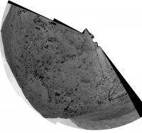
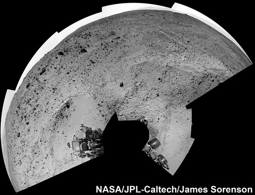
And the Navcam panoramic from Sol 324
 "Are we there yet ??" 
-------------------- |
|
|
|
|
Jul 7 2013, 02:23 PM
Post
#7
|
||
|
Solar System Cartographer Group: Members Posts: 10226 Joined: 5-April 05 From: Canada Member No.: 227 |
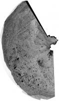
Very nice - it's going to be exciting to follow this long drive. Here's a circular version of that panorama - or should I say semi-circular? Rocknest is at the top.
Phil
-------------------- ... because the Solar System ain't gonna map itself.
Also to be found posting similar content on https://mastodon.social/@PhilStooke Maps for download (free PDF: https://upload.wikimedia.org/wikipedia/comm...Cartography.pdf NOTE: everything created by me which I post on UMSF is considered to be in the public domain (NOT CC, public domain) |
|
|
|
|
|
|
Jul 8 2013, 03:17 AM
Post
#8
|
|
 Member Group: Members Posts: 691 Joined: 21-December 07 From: Clatskanie, Oregon Member No.: 3988 |
Nice work Airbag and Ed on the Sol-323 Pan
Here is the Sol-325 M34 mosaic of the wheel tracks. Spherical  Vertical 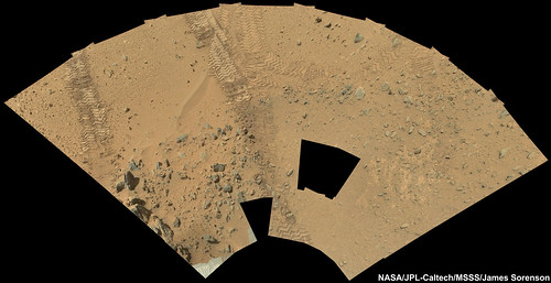 EDIT: My take on the Sol-323 M100 Dunefield pan.  |
|
|
|
|
Jul 8 2013, 09:03 AM
Post
#9
|
|
|
Member Group: Members Posts: 691 Joined: 21-December 07 From: Clatskanie, Oregon Member No.: 3988 |
Another Drive.
  EDIT: Admins I should have posted this and possibly my previous post in the new drive to Mount Sharp thread. Feel free to move this. |
|
|
|
|
Jul 8 2013, 09:59 AM
Post
#10
|
|
 Member Group: Members Posts: 276 Joined: 11-December 07 From: Dar es Salaam, Tanzania Member No.: 3978 |
QUOTE (Phil Stooke @ Jul 7 2013, 03:32 AM)  Not so much of a short cut, because the actual place they want to reach is down there to the west where there's a way through anyway. I dare say they will take a peek at a bit of dune sand on the way through. (And yes, I DO love those Mastcam mosaics) Phil Righto. Just to emphasise Phil's statement as far as how much trekking there's going to be before we strike for the base, here is a CTX annotated image showing the corridor of opportunity. -------------------- |
|
|
|
|
Jul 8 2013, 11:02 AM
Post
#11
|
|
|
Senior Member Group: Members Posts: 1619 Joined: 12-February 06 From: Bergerac - FR Member No.: 678 |
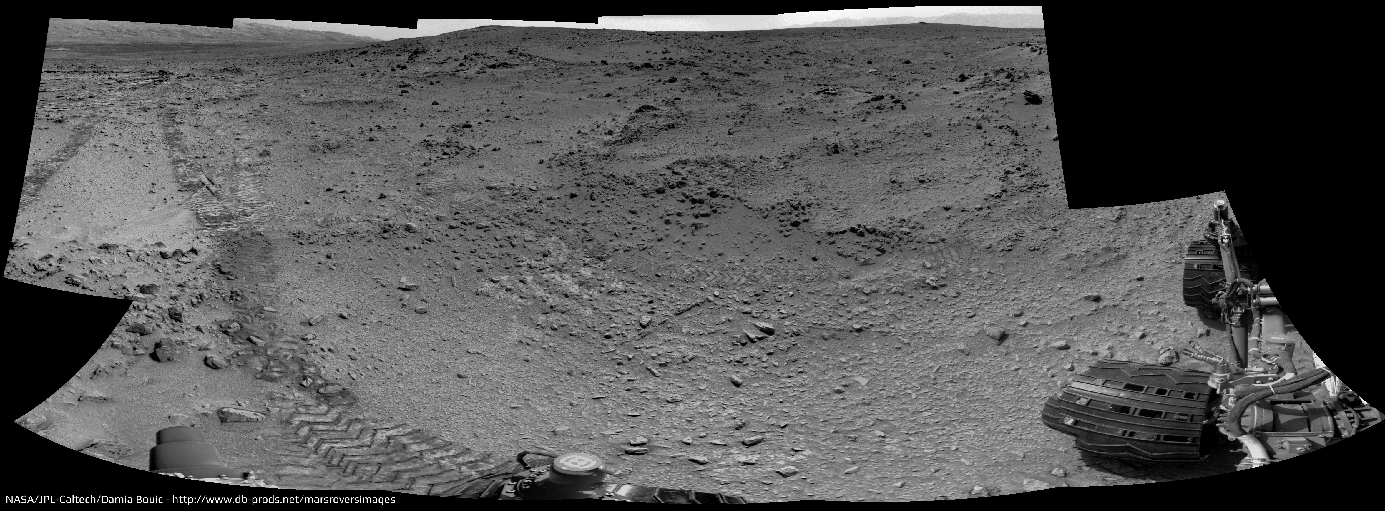
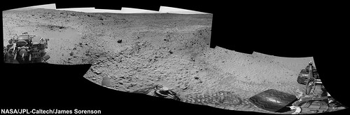
Sol 327 Navcam panoramic. We are on the road for good
.
-------------------- |
|
|
|
|
Jul 8 2013, 11:08 AM
Post
#12
|
|
|
Solar System Cartographer Group: Members Posts: 10226 Joined: 5-April 05 From: Canada Member No.: 227 |
Nice. The bright area where the old tracks go is Bathurst Inlet, sol 52.
Phil -------------------- ... because the Solar System ain't gonna map itself.
Also to be found posting similar content on https://mastodon.social/@PhilStooke Maps for download (free PDF: https://upload.wikimedia.org/wikipedia/comm...Cartography.pdf NOTE: everything created by me which I post on UMSF is considered to be in the public domain (NOT CC, public domain) |
|
|
|
|
Jul 8 2013, 01:50 PM
Post
#13
|
||
|
Solar System Cartographer Group: Members Posts: 10226 Joined: 5-April 05 From: Canada Member No.: 227 |
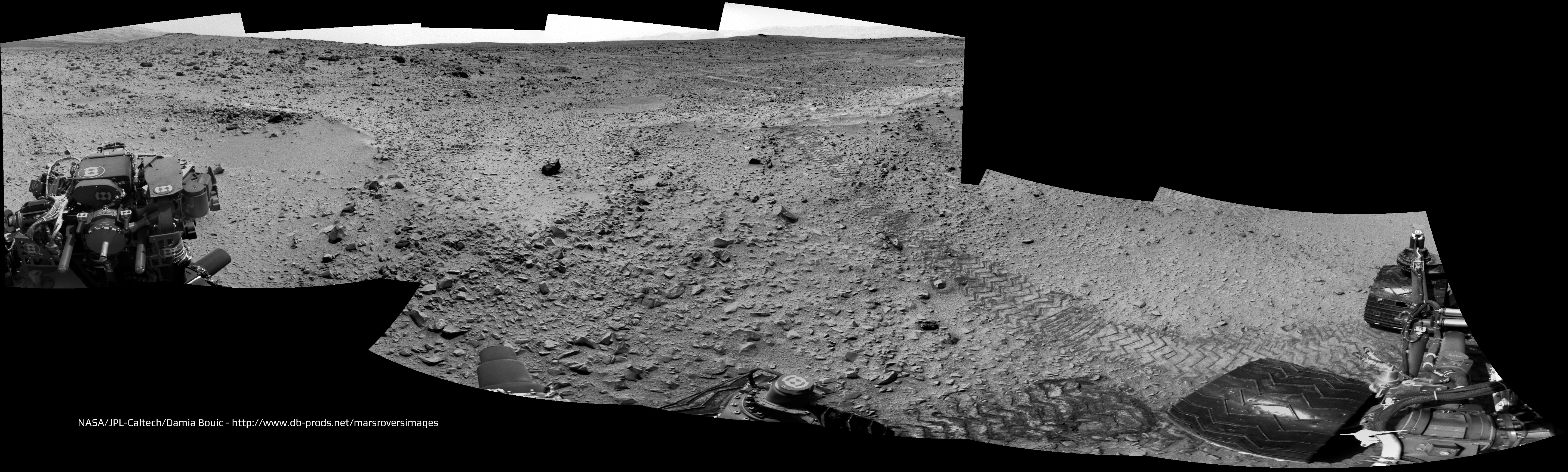
Ant103's pan in circular form. The rear wheel is touching the south edge of the old track. Incidentally the rear hazcam shows Rocknest, but not very clearly.
Phil
-------------------- ... because the Solar System ain't gonna map itself.
Also to be found posting similar content on https://mastodon.social/@PhilStooke Maps for download (free PDF: https://upload.wikimedia.org/wikipedia/comm...Cartography.pdf NOTE: everything created by me which I post on UMSF is considered to be in the public domain (NOT CC, public domain) |
|
|
|
|
|
|
Jul 8 2013, 04:08 PM
Post
#14
|
|
|
Member Group: Members Posts: 222 Joined: 7-August 12 From: Garberville, CA Member No.: 6500 |
SOL 327 - Hazcam Anaglyhs from the post-drive position, and yup, Rocknest is top center in the rear view, though not much detail is discernible...
Front:  Rear: 
-------------------- "We shall not cease from exploration, and the end of all our exploring will be to arrive where we started and know the place for the first time." -T.S. Eliot
|
|
|
|
|
Jul 9 2013, 08:26 AM
Post
#15
|
|
|
Member Group: Members Posts: 691 Joined: 21-December 07 From: Clatskanie, Oregon Member No.: 3988 |
The Sol-327 Chemcam mosaic of the base of Mount Sharp and the dunes.
. I'll attempt to overlay mastcam color over this next.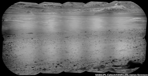 EDIT: The chemcam mosaic isn't in this image, but here is the single frame MAHLI image taken on Sol-327 as well. 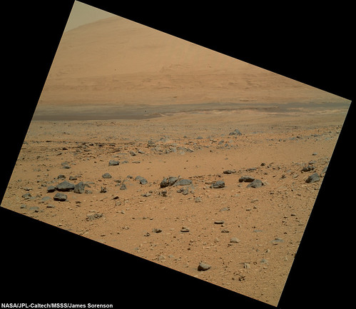 |
|
|
|
|

|
Lo-Fi Version | Time is now: 23rd September 2024 - 08:58 PM |
|
RULES AND GUIDELINES Please read the Forum Rules and Guidelines before posting. IMAGE COPYRIGHT |
OPINIONS AND MODERATION Opinions expressed on UnmannedSpaceflight.com are those of the individual posters and do not necessarily reflect the opinions of UnmannedSpaceflight.com or The Planetary Society. The all-volunteer UnmannedSpaceflight.com moderation team is wholly independent of The Planetary Society. The Planetary Society has no influence over decisions made by the UnmannedSpaceflight.com moderators. |
SUPPORT THE FORUM Unmannedspaceflight.com is funded by the Planetary Society. Please consider supporting our work and many other projects by donating to the Society or becoming a member. |
|