Charon Surface Observations: NH Post-Encounter Phase, 1 Aug 2015- TBD |

  |
Charon Surface Observations: NH Post-Encounter Phase, 1 Aug 2015- TBD |
 Sep 29 2015, 11:53 PM Sep 29 2015, 11:53 PM
Post
#31
|
|
|
Senior Member     Group: Members Posts: 3009 Joined: 30-October 04 Member No.: 105 |
Still, that is good. The recent images have so much going on. Later images transmitted and images on-the-ground-but-going-to PDS can only sweeten things.
https://univ.smugmug.com/New-Horizons-Missi..._5x1--annot.png --Bill -------------------- |
|
|
|
 Oct 1 2015, 05:06 PM Oct 1 2015, 05:06 PM
Post
#32
|
|
 Member    Group: Members Posts: 571 Joined: 20-April 05 From: Silesia Member No.: 299 |
-------------------- Free software for planetary science (including Cassini Image Viewer).
http://members.tripod.com/petermasek/marinerall.html |
|
|
|
 Oct 1 2015, 05:07 PM Oct 1 2015, 05:07 PM
Post
#33
|
|
|
Junior Member   Group: Members Posts: 80 Joined: 14-February 04 Member No.: 32 |
And more details: -------------------- - Lars
|
|
|
|
 Oct 1 2015, 05:18 PM Oct 1 2015, 05:18 PM
Post
#34
|
|
 Member    Group: Members Posts: 423 Joined: 13-November 14 From: Norway Member No.: 7310 |
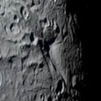
Didn't notice this one earlier. Curious feature:
 moat without a mountain. -------------------- |
|
|
|
 Oct 1 2015, 07:47 PM Oct 1 2015, 07:47 PM
Post
#35
|
|
 Senior Member     Group: Members Posts: 1887 Joined: 20-November 04 From: Iowa Member No.: 110 |
|
|
|
|
 Oct 1 2015, 08:08 PM Oct 1 2015, 08:08 PM
Post
#36
|
|
|
Member    Group: Members Posts: 220 Joined: 13-October 05 Member No.: 528 |
What is the highest resolution we expect? I recall reading it in a journal article that I no longer have a link to. Something around 140 M/pixel is what comes to mind.
|
|
|
|
 Oct 1 2015, 11:29 PM Oct 1 2015, 11:29 PM
Post
#37
|
|
|
Senior Member     Group: Members Posts: 3009 Joined: 30-October 04 Member No.: 105 |
Whoa. Great images today for us Charon-ites.
Good color: http://pluto.jhuapl.edu/Multimedia/Science...mp;image_id=323 The hi-res track with color: http://pluto.jhuapl.edu/Multimedia/Science...mp;image_id=324 Charon and Pluto: http://pluto.jhuapl.edu/Multimedia/Science...mp;image_id=325 A CGI riff: http://pluto.jhuapl.edu/Multimedia/Science...mp;image_id=326 And of course, that '70's Gold to hum along with, by The Knack: "My Charona": www.youtube.com/watch?v=g1T71PGd-J0 I'll be up for air by Sunday... --Bill -------------------- |
|
|
|
 Oct 2 2015, 11:42 AM Oct 2 2015, 11:42 AM
Post
#38
|
|
|
Member    Group: Members Posts: 137 Joined: 16-June 15 Member No.: 7507 |
Does anyone know, at what point on Charon's surface is the center of the Pluto-facing side?
|
|
|
|
 Oct 2 2015, 12:49 PM Oct 2 2015, 12:49 PM
Post
#39
|
|
|
Senior Member     Group: Members Posts: 3009 Joined: 30-October 04 Member No.: 105 |
Zero lat, zero longitude?
-------------------- |
|
|
|
 Oct 2 2015, 01:43 PM Oct 2 2015, 01:43 PM
Post
#40
|
|
|
Member    Group: Members Posts: 941 Joined: 4-September 06 From: Boston Member No.: 1102 |
That would certainly be a logical convention for mapping... and I believe the correct one. The caption to the first Charon map released by nasa was:
Global map of Charon as of July 30, 2015. The map is in simple cylindrical projection, with zero longitude (the Pluto-facing direction) in the center. It includes all available resolved images of the moon’s surface captured between July 7-14, 2015 on the anti-Pluto facing hemisphere. Image credit: NASA / Johns Hopkins University Applied Physics Laboratory / Southwest Research Institute. -------------------- |
|
|
|
 Oct 3 2015, 02:24 AM Oct 3 2015, 02:24 AM
Post
#41
|
|
 Senior Member     Group: Members Posts: 1453 Joined: 26-July 08 Member No.: 4270 |
Could you add a link? (If you did, I can't see it from my device).
-------------------- -- Hungry4info (Sirius_Alpha)
|
|
|
|
 Oct 3 2015, 05:41 AM Oct 3 2015, 05:41 AM
Post
#42
|
|
 Senior Member     Group: Members Posts: 2173 Joined: 28-December 04 From: Florida, USA Member No.: 132 |
|
|
|
|
 Oct 3 2015, 12:24 PM Oct 3 2015, 12:24 PM
Post
#43
|
|
|
Member    Group: Members Posts: 941 Joined: 4-September 06 From: Boston Member No.: 1102 |
Yes, the maps in posts #6 & #7. Link
-------------------- |
|
|
|
 Oct 3 2015, 01:06 PM Oct 3 2015, 01:06 PM
Post
#44
|
|
 Senior Member     Group: Members Posts: 1453 Joined: 26-July 08 Member No.: 4270 |
Got it. I thought you were suggesting there was a newer map that included the most recently released imagery.
-------------------- -- Hungry4info (Sirius_Alpha)
|
|
|
|
 Oct 3 2015, 04:25 PM Oct 3 2015, 04:25 PM
Post
#45
|
|
|
Member    Group: Members Posts: 941 Joined: 4-September 06 From: Boston Member No.: 1102 |
The recently released image is so beautiful, I'm not really looking forward to seeing it embedded in a cylindrical map with the low resolution fuzz all around...
-------------------- |
|
|
|
  |

|
Lo-Fi Version | Time is now: 31st October 2024 - 10:50 PM |
|
RULES AND GUIDELINES Please read the Forum Rules and Guidelines before posting. IMAGE COPYRIGHT |
OPINIONS AND MODERATION Opinions expressed on UnmannedSpaceflight.com are those of the individual posters and do not necessarily reflect the opinions of UnmannedSpaceflight.com or The Planetary Society. The all-volunteer UnmannedSpaceflight.com moderation team is wholly independent of The Planetary Society. The Planetary Society has no influence over decisions made by the UnmannedSpaceflight.com moderators. |
SUPPORT THE FORUM Unmannedspaceflight.com is funded by the Planetary Society. Please consider supporting our work and many other projects by donating to the Society or becoming a member. |

|