LROC news and images |

LROC news and images |
| Guest_Zvezdichko_* |
 Jun 19 2009, 11:25 AM Jun 19 2009, 11:25 AM
Post
#1
|
|
Guests |
I know it may be too early for such a thread, but an announcement has to be made.
The official website of the LROC camera is: http://lroc.sese.asu.edu/ A brief description plus status is available here: http://www.msss.com/lro/lroc/index.html |
 |
 
|
 |
|
Jun 23 2009, 02:49 PM
Post
#2
|
|
|
Senior Member  Group: Members Posts: 1018 Joined: 29-November 05 From: Seattle, WA, USA Member No.: 590 |
At the moment, they're saying not to expect images until early July (which is just a week away). That makes some sense, I guess, since they have commissioning to do.
--Greg |
|
|
|
|
Jun 24 2009, 10:20 AM
Post
#3
|
|
 Member Group: Members Posts: 593 Joined: 20-April 05 Member No.: 279 |
Curious as to the soon-to-be demonstrated LROC resolution, I've brewed up a "50cm/pixel" image of the Apollo 15 landing site, taken from the ascent 16mm film.
 It's going to be fascinating to see what state the descent stages and tracks are now in, after ~ 500 cycles of -150C to 100C. (Descent stages were never manned - does that make it ok for UMSF, Doug? ;-)) |
|
|
|
|
Jun 24 2009, 10:56 AM
Post
#4
|
|
|
Member Group: Members Posts: 163 Joined: 16-March 05 From: Oakville, Ontario, Canada Member No.: 201 |
|
|
|
|
|
Jun 24 2009, 01:59 PM
Post
#5
|
|
|
Senior Member Group: Members Posts: 1018 Joined: 29-November 05 From: Seattle, WA, USA Member No.: 590 |
QUOTE (AndyG @ Jun 24 2009, 02:20 AM)  Descent stages were never manned - does that make it ok for UMSF, Doug? ;-) Using the yardstick that UMSF is about amateurs producing cool images from raw data from unmanned space probes, I'm hoping this will be fine. These are historical sites now, and that's a big part of what makes the images "cool". Digging through the raw data looking for these things (whether we process them or not) is a cool way to participate. If people want to get into a discussion about what Apollo did, what value it had, whether it really happened(!), etc., then, yeah, I'd expect someone to pull the plug ASAP. But I can't imagine there'd be a problem just looking for the images of the landing sites. If nothing else, I think it's something 99% of us are eagerly looking forward to seeing! Of course it ultimately comes down to whatever Doug says, but I think he likes a good rationale. :-) --Greg |
|
|
|
|
Jun 24 2009, 02:40 PM
Post
#6
|
|
|
Forum Contributor Group: Members Posts: 1372 Joined: 8-February 04 From: North East Florida, USA. Member No.: 11 |
I look forward to the LRO images of the human hardware on our Moon.........
I still chuckle at Buzz punching that reporter  ....not that I condone physical violence of course...... ....not that I condone physical violence of course......
|
|
|
|
|
Jun 24 2009, 03:08 PM
Post
#7
|
|
 Member Group: Members Posts: 753 Joined: 23-October 04 From: Greensboro, NC USA Member No.: 103 |
I'm very much looking forward to those photos, too. Don't hold your breath that any unbelievers will be swayed...they'll just claim that these photos were doctored. The rest of us will cherish the opportunity to see not only the Apollo but also the unmanned lander sites. This is a thrilling time!!
-------------------- Jonathan Ward
Manning the LCC at http://www.apollolaunchcontrol.com |
|
|
|
|
Jun 24 2009, 03:18 PM
Post
#8
|
|
|
Founder Group: Chairman Posts: 14432 Joined: 8-February 04 Member No.: 1 |
The admin call is yeah - it's good to talk about the Apollo hardware. It's a history subject rather than a manned spaceflight subject
But we can knock the conspiracy stuff on the head. No data is going to convince them otherwise. VERY pointless even giving them a passing thought. |
|
|
|
|
Jun 24 2009, 03:53 PM
Post
#9
|
|
|
Member Group: Members Posts: 593 Joined: 20-April 05 Member No.: 279 |
QUOTE (djellison @ Jun 24 2009, 04:18 PM) The admin call is yeah - it's good to talk about the Apollo hardware. It's a history subject rather than a manned spaceflight subject I think it's also going to be valuable science with practical applications - with a forty-year view over a number of sites spread across the Moon, it'll be interesting to see how the (presumably swept-clean during ascent) lander stages have fared, and how quickly lunar gardening subsumes tracks. Andy |
|
|
|
| Guest_Zvezdichko_* |
Jun 24 2009, 06:13 PM
Post
#10
|
|
Guests |
QUOTE (djellison @ Jun 24 2009, 03:18 PM) The admin call is yeah - it's good to talk about the Apollo hardware. It's a history subject rather than a manned spaceflight subject But we can knock the conspiracy stuff on the head. No data is going to convince them otherwise. VERY pointless even giving them a passing thought. Well, if anybody is interested of talking with me and others on the subject, I have created two threads: http://www.bautforum.com/conspiracy-theori...coming-end.html http://apollohoax.proboards.com/index.cgi?...amp;thread=2418 I hope this is not considered an ad here. And yes, I do believe that some of the naysayers may be convinced |
|
|
|
|
Jun 24 2009, 07:33 PM
Post
#11
|
|
 Member Group: Members Posts: 813 Joined: 8-February 04 From: Arabia Terra Member No.: 12 |
I would like to get a look at the ALSEP packages. The Apollo 12 ALSEP holds the longevity record for continuous operation on the surface of another world, longer even than Viking 1! The Apollo 14 ALSEP was also in operation for longer than Viking 1.
|
|
|
|
|
Jun 24 2009, 07:39 PM
Post
#12
|
|
 Member Group: Members Posts: 754 Joined: 9-February 07 Member No.: 1700 |
I already can't wait for a surface visit to these historic sites, and I really can't wait for Google Moon to get the LRO pics!
|
|
|
|
|
Jun 24 2009, 08:49 PM
Post
#13
|
|
|
Member Group: Members Posts: 813 Joined: 29-December 05 From: NE Oh, USA Member No.: 627 |
Speaking historically,
hope LRO can tell how close the APOLLO 14 astronauts actually got to the rim of Cone Crater. Perhaps they scuffed up the regolith enough for LRO to detect the tracks they made. Though that is a long shot. Craig |
|
|
|
|
Jun 24 2009, 09:00 PM
Post
#14
|
|
 Senior Member Group: Members Posts: 3419 Joined: 9-February 04 From: Minneapolis, MN, USA Member No.: 15 |
Actually the A14 EVA-2 track is quite well worked out, based on the pics the crew took on the surface during the EVA. What I'm more interested in seeing is if the MET tracks are visible. LRV tracks will likely be easier to spot in LRO images than the MET tracks, since the open-mesh LRV tires disturbed the soil more and spun up rooster tails. The MET had actual rubber tires, which left smooth tracks. I'll be mighty interested in seeing if MET tracks are visible (or are as visible as LRV tracks).
Then I want to see those compared to Lunakhod tracks... -the other Doug -------------------- The trouble ain't that there is too many fools, but that the lightning ain't distributed right. -Mark Twain
|
|
|
|
|
Jun 24 2009, 10:33 PM
Post
#15
|
|
 Senior Member Group: Members Posts: 1281 Joined: 18-December 04 From: San Diego, CA Member No.: 124 |
-------------------- Lyford Rome
"Zis is not nuts, zis is super-nuts!" Mathematician Richard Courant on viewing an Orion test |
|
|
|
|
Jun 24 2009, 11:06 PM
Post
#16
|
|
|
Member Group: Members Posts: 813 Joined: 29-December 05 From: NE Oh, USA Member No.: 627 |
QUOTE (lyford @ Jun 24 2009, 06:33 PM) Well we have an good before and after.... Thanks lyford!!! The Lunar Orbiter III Frame 133-H2 labeled frame is priceless. Lunar Orbiter Image Recovery Project (LOIRP) wonderful project. I am also interested in whether the MET tracks are visible. I know that for portions of the trek up the rim of Cone crater they actually had to carry the MET to make progress up the slope. Craig |
|
|
|
|
Jun 25 2009, 01:58 AM
Post
#17
|
|
|
Member Group: Members Posts: 753 Joined: 23-October 04 From: Greensboro, NC USA Member No.: 103 |
In addition to the 400+ heating and cooling cycles, I'm really interested to see if there has been any visible evidence of electrostatically-induced movement of dust. There was speculation that the day/night cycle caused electrostatic transport of dust particles - I don't know how big those dust particles are, but 40 years elapsed time may be enough to result in reduced reflectivity on some of the hardware.
-------------------- Jonathan Ward
Manning the LCC at http://www.apollolaunchcontrol.com |
|
|
|
|
Jun 25 2009, 01:58 AM
Post
#18
|
|
|
Solar System Cartographer Group: Members Posts: 10164 Joined: 5-April 05 From: Canada Member No.: 227 |
Actually we know how close the Apollo 14 crew got to Cone Crater's rim, because we can compare the boulders seen in their surface images at Station C1 with the Lunar Orbiter images of the same boulders. They didn't know at the time, but we know it now. They were about 40 m from the rim but couldn't see over it into the depression. It will still be great to see these places at unprecedented resolution, but it won't change our ideas about the location of C1.
Phil -------------------- ... because the Solar System ain't gonna map itself.
Also to be found posting similar content on https://mastodon.social/@PhilStooke Maps for download (free PD: https://upload.wikimedia.org/wikipedia/comm...Cartography.pdf NOTE: everything created by me which I post on UMSF is considered to be in the public domain (NOT CC, public domain) |
|
|
|
|
Jun 26 2009, 11:22 AM
Post
#19
|
|
|
Member Group: Members Posts: 813 Joined: 29-December 05 From: NE Oh, USA Member No.: 627 |
QUOTE (Phil Stooke @ Jun 24 2009, 09:58 PM) It will still be great to see these places at unprecedented resolution, but it won't change our ideas about the location of C1. It will indeed.... I can't wait to see what we can see at C1 and all the rest Thanks Phil Craig |
|
|
|
|
Jun 26 2009, 05:00 PM
Post
#20
|
|
|
Member Group: Members Posts: 156 Joined: 22-May 09 From: Ireland Member No.: 4792 |
QUOTE (ilbasso @ Jun 25 2009, 02:58 AM) I don't know how big those dust particles are, but 40 years elapsed time may be enough to result in reduced reflectivity on some of the hardware. A research paper of possible, related interest that appeared in Geophysical Research Letters last April might be something to have a look at -- titled "Direct active measurements of movements of lunar dust: Rocket exhausts and natural effects contaminating and cleansing Apollo hardware on the Moon in 1969" The paper does get quite technical in parts, however, to have a read go HERE, or for a more 'readable' version see this ScienceDaily article. John |
|
|
|
|
Jun 26 2009, 05:11 PM
Post
#21
|
|
|
Member Group: Members Posts: 156 Joined: 22-May 09 From: Ireland Member No.: 4792 |
QUOTE (John Moore @ Jun 26 2009, 06:00 PM) A research paper of possible, related interest that appeared in Geophysical Research Letters last April might be something to have a look at -- titled "Direct active measurements of movements of lunar dust: Rocket exhausts and natural effects contaminating and cleansing Apollo hardware on the Moon in 1969" The paper does get quite technical in parts, however, to have a read go HERE, or for a more 'readable' version see this ScienceDaily article. John ADDENDUM: Sorry Space Angel if you're having problems accessing the first link as I don't want to point you to a subscripe/purchase option -- which it does. I did a check on the availability of it using the link at the end of the ScienceDaily article and I swear I got acces to the complete article after clicking on 'Full Article' in Geophysical Research Letters. But for some reason it doesn't allow me in anymore on a second try. You might try it at your end as it may have only allowed me access it once (I tried it again just now but, darn it, I'm being put into the subscribe'purchase link. Sorry if it doesn't work...but the ScienceDaily article does work okay. John |
|
|
|
|
Jun 27 2009, 11:54 PM
Post
#22
|
|
|
Member Group: Members Posts: 753 Joined: 23-October 04 From: Greensboro, NC USA Member No.: 103 |
Also potentially pertinent to the appearance of the Apollo lunar surface hardware is the work that is currently underway at the National Air and Space Museum to replace all the Kapton foil on LM-2, which has been sitting in sunlight at least part of every day for the past 33 years. There's a more detailed summary of the restoration work underway at collectspace.com, but what I thought was particularly interesting was this little snippet:
QUOTE They bagged the Descent Stage with a giant sheet of polyethylene, then hung some sheets of 2 mil Aluminized Kapton which crumbled after 33 years in the sun! Some samples of that are being analyzed, and the rest is trash unfortunately. It just broke apart and was covered in dust and filth! If the Kapton crumbled after 33 years in a climate-controlled environment, even with partial sun every day, one wonders as to the state of the Kapton that has been sitting in lunar conditions for 40 years, and if any of this deterioration might be visible from LROC. -------------------- Jonathan Ward
Manning the LCC at http://www.apollolaunchcontrol.com |
|
|
|
|
Jun 28 2009, 03:36 AM
Post
#23
|
|
|
Merciless Robot Group: Admin Posts: 8784 Joined: 8-December 05 From: Los Angeles Member No.: 602 |
Indeed. There's mounting evidence that Kapton isn't really very durable over time, esp. when exposed to extreme heat. I suspect that the material on the descent stages may have long since crumbled away.
-------------------- A few will take this knowledge and use this power of a dream realized as a force for change, an impetus for further discovery to make less ancient dreams real.
|
|
|
|
|
Jun 28 2009, 07:11 AM
Post
#24
|
|
|
Member Group: Members Posts: 599 Joined: 26-August 05 Member No.: 476 |
How much of that evidence is at 1 std atm vs near vacuum? Is it just extreme heat or extreme heat + reacting gases?
|
|
|
|
|
Jun 28 2009, 08:32 AM
Post
#25
|
|
|
Founder Group: Chairman Posts: 14432 Joined: 8-February 04 Member No.: 1 |
Just look at Hubble Insulation. It's crumbling off. It may be going thru more rapid thermal cycles than Apollo hardware - but there's evidence that long space exposure does end up ruining that sort of insulation material.
|
|
|
|
|
Jun 28 2009, 09:03 AM
Post
#26
|
|
|
Merciless Robot Group: Admin Posts: 8784 Joined: 8-December 05 From: Los Angeles Member No.: 602 |
There are a lot of other interesting potential variables to consider, too. For example, the Apollo stuff's obviously exposed directly to the solar wind while Hubble isn't, but at the same time HST is exposed to monatomic oxygen in LEO. Does any of that make any difference? Dunno.
All we seem to know with high confidence is that kapton looks very stable for 5-10 years--long enough for most nominal missions to date--of exposure to the inner Solar System space environments we've spent the most time in, but prospects don't look promising for much longer durations. -------------------- A few will take this knowledge and use this power of a dream realized as a force for change, an impetus for further discovery to make less ancient dreams real.
|
|
|
|
| Guest_Zvezdichko_* |
Jun 28 2009, 10:23 AM
Post
#27
|
|
Guests |
|
|
|
|
|
Jun 28 2009, 03:03 PM
Post
#28
|
|
|
Senior Member Group: Members Posts: 2517 Joined: 13-September 05 Member No.: 497 |
QUOTE (djellison @ Jun 28 2009, 01:32 AM) Just look at Hubble Insulation. It's crumbling off. That was silver FEP (Teflon), not Kapton. I'm quite doubtful that LROC will be able to resolve the state of the blankets on the Apollo hardware. -------------------- Disclaimer: This post is based on public information only. Any opinions are my own.
|
|
|
|
| Guest_Zvezdichko_* |
Jul 1 2009, 06:04 AM
Post
#29
|
|
Guests |
http://lroupdate.blogspot.com/
LROC camera turned on for a series of preliminary measurements. Images are expected to be taken on 3rd July. LOLA laser altimeter successfully turned on. |
|
|
|
|
Jul 2 2009, 02:16 PM
Post
#30
|
|
 Member Group: Members Posts: 150 Joined: 3-June 08 From: McLean, VA Member No.: 4177 |
I was the contractor on the LM-2 job. I was really shocked at the quality of the sun-facing Kapton sheets. They only had the 2 mil aluminized Kapton on LM-2 and it broke apart in your hands - not brittle, just a kind of mushy break. It was very dull - looked a bit like the Vbar side of the Kapton coverings from the early Shuttle flights (the elbow camera on the arm for example) which got "eaten" away by atomic oxygen in low earth orbit. For LM-2 we replaced the old stuff with proper variations of Kapton (1/2, 2 and 5 mil thicknesses) so if the complete restoration is not done soon, we might get some idea about how different thicknesses of Kapton handle the heat and light in the relatively benign environment of the museum.
QUOTE (nprev @ Jun 27 2009, 10:36 PM) Indeed. There's mounting evidence that Kapton isn't really very durable over time, esp. when exposed to extreme heat. I suspect that the material on the descent stages may have long since crumbled away. Well, the multi-layer blankets (~20-30 sheets) were constrained around standoffs and were well built with taped seams and different hardware to hold them together. We might see the outer layer, which was screwed to the standoffs, crumble, but the inner layers will peel in sections - my guess is that there will be quite a bit left on the spacecraft once the exterior sheets have popped off from the stresses of their attachment. |
|
|
|
|
Jul 2 2009, 05:41 PM
Post
#31
|
|
|
Member Group: Members Posts: 163 Joined: 16-March 05 From: Oakville, Ontario, Canada Member No.: 201 |
|
|
|
|
|
Jul 2 2009, 05:52 PM
Post
#32
|
|
 The Poet Dude Group: Moderator Posts: 5551 Joined: 15-March 04 From: Kendal, Cumbria, UK Member No.: 60 |
Thanks for that!
Gorgeous... just gorgeous... Time to buy a new portable hard drtive, I think...! 
-------------------- |
|
|
|
| Guest_Zvezdichko_* |
Jul 2 2009, 05:58 PM
Post
#33
|
|
Guests |
These images came early
|
|
|
|
| Guest_Zvezdichko_* |
Jul 2 2009, 06:33 PM
Post
#34
|
|
Guests |
|
|
|
|
|
Jul 2 2009, 07:09 PM
Post
#35
|
|
 Member Group: Members Posts: 568 Joined: 20-April 05 From: Silesia Member No.: 299 |
Nice and convenient method for viewing large images.
http://wms.lroc.asu.edu/lroc_browse/view/nacl000000fd -------------------- Free software for planetary science (including Cassini Image Viewer).
http://members.tripod.com/petermasek/marinerall.html |
|
|
|
|
Jul 2 2009, 07:10 PM
Post
#36
|
|
|
Member Group: Members Posts: 813 Joined: 8-February 04 From: Arabia Terra Member No.: 12 |
For some reason these remind me of Cassini's hi-res images of Phoebe.
How strange it is to look at somewhere just next door and think of something far more distant and alien. Surely a sign of just how long it's been since we last had lunar imagery of this kind. |
|
|
|
|
Jul 2 2009, 09:11 PM
Post
#37
|
|
|
Member Group: Members Posts: 156 Joined: 22-May 09 From: Ireland Member No.: 4792 |
WOW...incredible.
If these early images are anything to go, we're in for a treat over the next year or so John |
|
|
|
|
Jul 2 2009, 10:18 PM
Post
#38
|
|
|
Solar System Cartographer Group: Members Posts: 10164 Joined: 5-April 05 From: Canada Member No.: 227 |
Yes, a real treat!
Phil -------------------- ... because the Solar System ain't gonna map itself.
Also to be found posting similar content on https://mastodon.social/@PhilStooke Maps for download (free PD: https://upload.wikimedia.org/wikipedia/comm...Cartography.pdf NOTE: everything created by me which I post on UMSF is considered to be in the public domain (NOT CC, public domain) |
|
|
|
|
Jul 3 2009, 02:16 AM
Post
#39
|
|
|
Senior Member Group: Members Posts: 3419 Joined: 9-February 04 From: Minneapolis, MN, USA Member No.: 15 |
I'm impressed that the first calibration image, from the "commissioning" orbit (higher than the final science orbit, IIRC) is stated to have a resolution of 73cm per pixel.
Wow! -the other Doug -------------------- The trouble ain't that there is too many fools, but that the lightning ain't distributed right. -Mark Twain
|
|
|
|
|
Jul 3 2009, 03:19 AM
Post
#40
|
|
|
Senior Member Group: Members Posts: 2517 Joined: 13-September 05 Member No.: 497 |
The current orbit is 30kmx199km. Periapsis is at the south pole. The science orbit is nominally 50km circular. So this image, assuming that the resolution is listed correctly, was taken at a lower altitude than the science orbit. The nominal resolution is 50 cm from 50 km (1 m summed).
-------------------- Disclaimer: This post is based on public information only. Any opinions are my own.
|
|
|
|
|
Jul 4 2009, 06:51 AM
Post
#41
|
||
|
Junior Member Group: Members Posts: 29 Joined: 11-May 09 Member No.: 4772 |
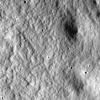
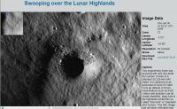
On July 3, LRO officially entered the Instrument Commissioning Phase. See http://lroupdate.blogspot.com/ for further details.
A first LROC picture taken on July 3 has been issued as well (a region south-east of Clavius); see page http://lroc.sese.asu.edu/news/?archives/66...-Highlands.html
Attached thumbnail(s)
|
|
|
|
|
|
|
Jul 4 2009, 05:25 PM
Post
#42
|
|
|
Senior Member Group: Members Posts: 3419 Joined: 9-February 04 From: Minneapolis, MN, USA Member No.: 15 |
Fascinating -- this surface strongly resembles the "elephant-skin" surface observed in some of the Ranger IX photos of Alphonsus and around Gassendi. Among many other places.
My understanding of the best speculation on what forms this kind of surface is that we're looking at debris flow patterns from large-scale ejecta events (i.e., basin ejecta emplacement events). If this is in the Clavius region, would that imply we're looking at Aiken Basin ejecta debris flow? -the other Doug -------------------- The trouble ain't that there is too many fools, but that the lightning ain't distributed right. -Mark Twain
|
|
|
|
|
Jul 5 2009, 03:06 PM
Post
#43
|
|
|
Member Group: Members Posts: 156 Joined: 22-May 09 From: Ireland Member No.: 4792 |
I like the 'debris flow' hypothesis -- very interesting.
There definitely are series of striations running diagonally across the picture from upper-left to lower-right. However, depending on the exact location of this lovely shot, I wonder would these be due to Tycho's influence -- just north of Clavius, or, are they, an integrated effect of the above flow hypothesis? John |
|
|
|
|
Jul 6 2009, 10:51 AM
Post
#44
|
|
 Senior Member Group: Members Posts: 1431 Joined: 26-July 08 Member No.: 4270 |
Goldschmidt D in a new LROC image.
http://lroc.sese.asu.edu/news/?archives/68...he-shadows.html -------------------- -- Hungry4info (Sirius_Alpha)
|
|
|
|
|
Jul 6 2009, 11:39 AM
Post
#45
|
|
|
The Poet Dude Group: Moderator Posts: 5551 Joined: 15-March 04 From: Kendal, Cumbria, UK Member No.: 60 |
Many thanks for that heads-up. That's a nice image, very abstract and sparse... like it a lot. I get the feeling that we're going to get quite a few unintentionally "arty" shots from LRO.
-------------------- |
|
|
|
|
Jul 6 2009, 03:56 PM
Post
#46
|
||
|
The Poet Dude Group: Moderator Posts: 5551 Joined: 15-March 04 From: Kendal, Cumbria, UK Member No.: 60 |
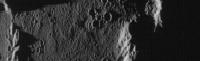
Crop from image http://wms.lroc.asu.edu/lroc_browse/view/iom20090703 shoing some nice boulders around a crater...
-------------------- |
|
|
|
|
|
| Guest_Sunspot_* |
Jul 6 2009, 05:42 PM
Post
#47
|
|
Guests |
Hmmmm that zoomify image doesn't load anymore
|
|
|
|
|
Jul 7 2009, 05:55 AM
Post
#48
|
|
|
The Poet Dude Group: Moderator Posts: 5551 Joined: 15-March 04 From: Kendal, Cumbria, UK Member No.: 60 |
Quite a few pics up now...
http://wms.lroc.asu.edu/lroc_browse "Zoomify" is working fine for me here right now... -------------------- |
|
|
|
|
Jul 7 2009, 07:59 AM
Post
#49
|
|||
|
Founder Group: Chairman Posts: 14432 Joined: 8-February 04 Member No.: 1 |
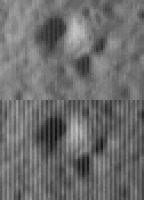
Is it just me, or - when loading the TIF's at full res, there appears to be some sort of interlacing (vertically). i.e. one column of pixels is bright, the next dark..bright, dark etc etc.
Attached zoom from http://wms.lroc.asu.edu/lroc_browse/view/nacl00000145 I guess some sort of adaptive amplification to create a pseudo enhanced dynamic range might be involved....or it might be a processing error, or it might be just something to do with the TIF's. You can sort of back it out with some VERY rudimentary Photoshopping (doesn't quite get the shadows...someone cleverer than I could do it). I'd expect proper calibration (which is, after all, the point of these early images) would eliminate it. I found a different chunt and had a go at it
Attached thumbnail(s)
|
||
|
|
|
||
|
Jul 7 2009, 09:18 AM
Post
#50
|
|
 Senior Member Group: Members Posts: 3648 Joined: 1-October 05 From: Croatia Member No.: 523 |
Definitely looks like something a flatfield (or possibly a dark model) would fix so I wouldn't worry about it much. Reminds me a bit of the awful dark current noise in VIMS visual channel.
-------------------- |
|
|
|
|
Jul 7 2009, 11:27 AM
Post
#51
|
|
 Member Group: Members Posts: 550 Joined: 1-May 06 From: Scotland (Ecosse, Escocia) Member No.: 759 |
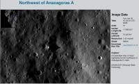
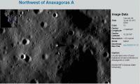
Rim of Anaxagorus A About one third of the way down from the top of this frame is a truly gigantic boulder with a very smooth sun-facing side, triangular or diamond in shape, casting a very long shadow. |
|
|
|
|
Jul 7 2009, 01:56 PM
Post
#52
|
|
|
Member Group: Members Posts: 279 Joined: 19-August 07 Member No.: 3299 |
Nice pictures. The most intriguing thing is that the skin of elephant is very common on the Moon surface. In spite of the fact, these might be originated by any kind of erosion that happens in the Earth.
I seems that they might be occurring when the below surface might have fractures where the regolith sink and it is smoothed by the solar bombard of particles. The others suppositions are that the boulders caused by the impacts are rounded or disintegrated by the solar influence after thousands millions years. Hope this mystery would be cleared up soon. |
|
|
|
|
Jul 7 2009, 03:01 PM
Post
#53
|
|
|
Senior Member Group: Members Posts: 2517 Joined: 13-September 05 Member No.: 497 |
QUOTE (djellison @ Jul 6 2009, 11:59 PM) Is it just me, or - when loading the TIF's at full res, there appears to be some sort of interlacing (vertically). i.e. one column of pixels is bright, the next dark..bright, dark etc etc. As with CTX and MOC, even and odd pixels go through separate signal chains and the offset between them is still being adjusted in these early images. BTW, the story of how we were able to make NAC run almost 4x faster than CTX with only minimal changes to the hardware is yet to be published -------------------- Disclaimer: This post is based on public information only. Any opinions are my own.
|
|
|
|
|
Jul 7 2009, 03:16 PM
Post
#54
|
|
|
Member Group: Members Posts: 279 Joined: 19-August 07 Member No.: 3299 |
Useful link to ubicate where is LRO?
|
|
|
|
|
Jul 7 2009, 03:19 PM
Post
#55
|
|||
|
The Poet Dude Group: Moderator Posts: 5551 Joined: 15-March 04 From: Kendal, Cumbria, UK Member No.: 60 |
Quite impressive pinnacles and spikes around Anaxagoras A...
How high is this feature, anyone?
-------------------- |
||
|
|
|
||
|
Jul 7 2009, 04:49 PM
Post
#56
|
|
|
Member Group: Members Posts: 808 Joined: 10-October 06 From: Maynard Mass USA Member No.: 1241 |
QUOTE (Stu) How high is this feature, anyone? back of the envelope, right triangle problem... ~50 pixels long shadow at 2 meters per pixel resolution == 100Meters shadow...low sun angle (?) degrees (shadow may be running on a downhill slope, making it longer...) my guess is 4-8 meters tall (WAG) -------------------- CLA CLL
|
|
|
|
|
Jul 7 2009, 05:05 PM
Post
#57
|
|
|
Senior Member Group: Members Posts: 2517 Joined: 13-September 05 Member No.: 497 |
QUOTE (Stu @ Jul 7 2009, 07:19 AM) Quite impressive pinnacles and spikes around Anaxagoras A... Beware anomalist thinking. The sun angle is likely to be so low that these could well be quite ordinary boulders or clumps. Without knowing the sun angle and even the local topography, you just can't tell. -------------------- Disclaimer: This post is based on public information only. Any opinions are my own.
|
|
|
|
|
Jul 7 2009, 05:59 PM
Post
#58
|
|
|
Member Group: Members Posts: 150 Joined: 3-June 08 From: McLean, VA Member No.: 4177 |
QUOTE (djellison @ Jul 7 2009, 02:59 AM) Is it just me, or - when loading the TIF's at full res, there appears to be some sort of interlacing (vertically). i.e. one column of pixels is bright, the next dark..bright, dark etc etc. I noticed that on a couple of the images but not all. More interesting is that the Zoomify image on the LROC website doesn't show that artifact. |
|
|
|
|
Jul 7 2009, 06:23 PM
Post
#59
|
|
|
Founder Group: Chairman Posts: 14432 Joined: 8-February 04 Member No.: 1 |
Zoomify does....but it only zooms to 100%. If you screen grab and zoom in more - the same effect is in there.
|
|
|
|
|
Jul 7 2009, 06:39 PM
Post
#60
|
|
|
The Poet Dude Group: Moderator Posts: 5551 Joined: 15-March 04 From: Kendal, Cumbria, UK Member No.: 60 |
QUOTE (mcaplinger @ Jul 7 2009, 06:05 PM) Beware anomalist thinking. Anomalist? Moi?!  How VERY dare you!!! How VERY dare you!!! Why, I'm a monolith of scientific scepticism!  Point taken. Still cool pics tho. 
-------------------- |
|
|
|
|
Jul 7 2009, 07:42 PM
Post
#61
|
|
|
Senior Member Group: Members Posts: 2517 Joined: 13-September 05 Member No.: 497 |
QUOTE (Paul Fjeld @ Jul 7 2009, 09:59 AM) I noticed that on a couple of the images but not all. You won't notice it on summed images because for those the even and odd pixels are averaged in the instrument. And as Doug says, you have to zoom all the way in to see it on a full-res image, and even then it's less noticeable on some images than others. -------------------- Disclaimer: This post is based on public information only. Any opinions are my own.
|
|
|
|
|
Jul 8 2009, 01:07 AM
Post
#62
|
|
|
Member Group: Members Posts: 150 Joined: 3-June 08 From: McLean, VA Member No.: 4177 |
I guess my point was that the LROC folks are doing a good job of modifying the raw data so that the striping effect is almost non-existent on the Zoomify images. I went and zoomed up to the pixel limit, grabbed the image and dug deeper. Yes, there is a hint of that striping in some of the image "blocks" but it looks more like a "jpeg-ing." They're very nice anyway!
|
|
|
|
|
Jul 8 2009, 07:03 AM
Post
#63
|
|
|
Founder Group: Chairman Posts: 14432 Joined: 8-February 04 Member No.: 1 |
QUOTE (Paul Fjeld @ Jul 8 2009, 02:07 AM) so that the striping effect is almost non-existent on the Zoomify images. Some images have it - some don't - as Mike explained. For those that have it - it IS in the Zoomify images, you just need to zoom in more than Zoomify can. There's no gradient between existing and non existing. It's one or the other. |
|
|
|
|
Jul 8 2009, 11:39 AM
Post
#64
|
||
|
Founder Group: Chairman Posts: 14432 Joined: 8-February 04 Member No.: 1 |
Tiny bit of LROC WA mosaic from the calib image released.
It'd be interesting to see if we can pull out a bit of colour variation
Attached thumbnail(s)
|
|
|
|
|
|
|
Jul 8 2009, 06:20 PM
Post
#65
|
|
|
Member Group: Members Posts: 753 Joined: 23-October 04 From: Greensboro, NC USA Member No.: 103 |
There's a 'flyover' movie posted on YouTube today.
-------------------- Jonathan Ward
Manning the LCC at http://www.apollolaunchcontrol.com |
|
|
|
|
Jul 8 2009, 07:16 PM
Post
#66
|
|
 Senior Member Group: Members Posts: 1729 Joined: 3-August 06 From: 43° 35' 53" N 1° 26' 35" E Member No.: 1004 |
I am speechless...
|
|
|
|
|
Jul 8 2009, 09:37 PM
Post
#67
|
|
 Senior Member Group: Members Posts: 1465 Joined: 9-February 04 From: Columbus OH USA Member No.: 13 |
QUOTE (mcaplinger @ Jul 7 2009, 01:05 PM) Beware anomalist thinking. The sun angle is likely to be so low that these could well be quite ordinary boulders or clumps. Without knowing the sun angle and even the local topography, you just can't tell. I ran the photo's particulars through SPICE and get a sun elevation of 0.42 degrees, so it's just sitting practically on the horizon and rising. 30JUN2009 16:04:33 UTC, center lon -7.890545, center lat 72.20735 -> sun elevation 0.422, sun azimuth 89.395 -------------------- |
|
|
|
|
Jul 9 2009, 09:48 AM
Post
#68
|
|
|
Member Group: Members Posts: 156 Joined: 22-May 09 From: Ireland Member No.: 4792 |
This is a stupid query, but why are all the images North down and South up
 The usual views of presenting images is to have North up and West on the left -- in accordance to the cardinal points as laid down for the Moon by the IAU in 1961. Will future images see a change in orintation? John |
|
|
|
|
Jul 9 2009, 10:41 AM
Post
#69
|
|
|
Senior Member Group: Members Posts: 3648 Joined: 1-October 05 From: Croatia Member No.: 523 |
Uncalibrated, raw imaging swaths taken on a descending node in a polar orbit will have north pointed down. Map-projected products take care of this.
-------------------- |
|
|
|
| Guest_Zvezdichko_* |
Jul 10 2009, 06:52 AM
Post
#70
|
|
Guests |
|
|
|
|
|
Jul 11 2009, 08:24 AM
Post
#71
|
|
|
The Poet Dude Group: Moderator Posts: 5551 Joined: 15-March 04 From: Kendal, Cumbria, UK Member No.: 60 |
-------------------- |
|
|
|
|
Jul 11 2009, 03:02 PM
Post
#72
|
|
|
Member Group: Members Posts: 279 Joined: 19-August 07 Member No.: 3299 |
What instrument will be able to "see" the dark parts of Moon, as the bottom of the Compton crater?
|
|
|
|
|
Jul 11 2009, 03:58 PM
Post
#73
|
|
|
Senior Member Group: Members Posts: 1465 Joined: 9-February 04 From: Columbus OH USA Member No.: 13 |
QUOTE (SpaceListener @ Jul 11 2009, 10:02 AM) What instrument will be able to "see" the dark parts of Moon, as the bottom of the Compton crater? The LAMP instrument takes advantage of background ultraviolet (Lyman Alpha hydrogen emission) coming from all directions from stars & also scattered from hydrogen clouds nearer the solar system to see in otherwise dark areas. Pretty fancy I'd say! -------------------- |
|
|
|
| Guest_Zvezdichko_* |
Jul 11 2009, 03:59 PM
Post
#74
|
|
Guests |
SpaceListener: Mini-RF. This instrument is also flying aboard Chandrayaan-1 and we already have maps:
http://www.nasa.gov/mission_pages/Mini-RF/...edia/index.html BTW I'm amazed to see objects as small as rocks on the surface on the Moon! These NAC photographs are AWESOME. |
|
|
|
|
Jul 11 2009, 04:45 PM
Post
#75
|
|
|
Senior Member Group: Members Posts: 3419 Joined: 9-February 04 From: Minneapolis, MN, USA Member No.: 15 |
QUOTE (Zvezdichko @ Jul 11 2009, 10:59 AM) BTW I'm amazed to see objects as small as rocks on the surface on the Moon! These NAC photographs are AWESOME. I dunno -- some of those rocks are likely the size of a football stadium, if not larger. -the other Doug -------------------- The trouble ain't that there is too many fools, but that the lightning ain't distributed right. -Mark Twain
|
|
|
|
| Guest_Zvezdichko_* |
Jul 11 2009, 04:55 PM
Post
#76
|
|
Guests |
Knowing the fact the current resolution is about 1 meter per pixel at least and these rock are larger than a pixel (or even a few pixels), you are right. But they look cool

|
|
|
|
| Guest_Zvezdichko_* |
Jul 13 2009, 11:05 PM
Post
#77
|
|
Guests |
OK, on topic:
http://lroc.sese.asu.edu/news/?archives/74...gle-Camera.html A new WAC image has been published |
|
|
|
|
Jul 14 2009, 11:31 PM
Post
#78
|
|
|
Senior Member Group: Members Posts: 1465 Joined: 9-February 04 From: Columbus OH USA Member No.: 13 |
Didn't see this recent news item mentioned here:
http://www.spaceflightnow.com/news/n0907/06kaguya/ "Japan's now-finished lunar mission found no water ice" QUOTE "However, [Selene imaging] indicates that exposed relatively pure water-ice deposits are lacking on the floor [of Shackleton Crater]," according to the Japanese report. Japanese scientists said in Houston they could not find water ice anywhere else in craters near the Moon's rugged south pole, one of the primary NASA justifications for flying the LCROSS mission. The LRO press kit mentions two competing theories for why Clementine saw decreased neutron flux at the poles, both involving absorption of same by hydrogen: either in water form, or alternatively hydrogen deposited from solar wind could be more stable and accumulate more due to the cold polar temperatures. -------------------- |
|
|
|
|
Jul 15 2009, 01:14 AM
Post
#79
|
|
|
Senior Member Group: Members Posts: 3419 Joined: 9-February 04 From: Minneapolis, MN, USA Member No.: 15 |
I don't think anyone has ever anticipated finding glaciers of white ice just sitting in the bottoms of polar lunar craters. Exposed ice would sublimate quite quickly when exposed to the vacuum.
Instead, I believe the expectation is to find an "icy regolith" layer (something like a permafrost layer) underneath a completely dry layer of regolith. The minute gaps between the grains of the covering regolith cap would be enough for the tiny amount of sublimation that results in the hydrogen signature detected by Clementine and Lunar Prospector. -the other Doug -------------------- The trouble ain't that there is too many fools, but that the lightning ain't distributed right. -Mark Twain
|
|
|
|
|
Jul 15 2009, 02:00 AM
Post
#80
|
|
|
Senior Member Group: Members Posts: 1465 Joined: 9-February 04 From: Columbus OH USA Member No.: 13 |
QUOTE (dvandorn @ Jul 14 2009, 09:14 PM) I don't think anyone has ever anticipated finding glaciers of white ice just sitting in the bottoms of polar lunar craters. Exposed ice would sublimate quite quickly when exposed to the vacuum. Instead, I believe the expectation is to find an "icy regolith" layer (something like a permafrost layer) underneath a completely dry layer of regolith. When the Lunar Prospector announcement was made the figure of "1% water" or something like that was given, which added up to a lake's worth if the total input is a gazillion tons or whatever. Later it was pointed out that hard concrete has a similar amount of water, so extracting drinking water seemed less plausible. Let's hope the figure is quite a bit above that! BTW, according to the materials for the LAMP instrument: QUOTE The Lunar Reconnaissance Orbiter (LRO) Lyman-Alpha Mapping Project (LAMP) is a UV spectrograph designed to address how water is formed on the moon, transported through the lunar atmosphere, and deposited in permanently shaded regions (PSRs). Its main objectives are to 1) identify exposed water frost in PSRs, 2) characterize landforms and albedos in PSRs, 3) demonstrate the feasibility of using natural starlight and sky-glow illumination for future lunar surface mission applications, and 4) assay the lunar atmosphere and its variability. The production and transport of lunar atmosphere constituents (e.g., H, Ar, and potentially others) will be investigated by observation of their resonantly scattered FUV emissions. LAMP albedo maps of PSR landforms and potential surface water ice will be used to investigate the intriguing processes that occur within PSRs. Potential sites of active outgassing such as the Aristarchus crater and the Ina structure are targets of special interest for LAMP spectral map products. Would that imply that LAMP is only suited for detecting surface ice/frost? -------------------- |
|
|
|
| Guest_Zvezdichko_* |
Jul 22 2009, 10:23 AM
Post
#81
|
|
Guests |
|
|
|
|
|
Jul 23 2009, 03:54 AM
Post
#82
|
|
|
Member Group: Members Posts: 233 Joined: 21-April 05 Member No.: 328 |
Yes, Dvandorn, I think the situation on the moon will be similar to what Phoenix found on Mars -- ice (or an ice rich regolith) covered by a relatively thin layer of dry regolith.
|
|
|
|
|
Jul 23 2009, 10:47 AM
Post
#83
|
|
|
Member Group: Members Posts: 156 Joined: 22-May 09 From: Ireland Member No.: 4792 |
Very nice bit here on the whole LCROSS cruise phase setup -- flight director for LCROSS. Well worth a read.
John ------------ |
|
|
|
|
Jul 29 2009, 03:34 AM
Post
#84
|
|
|
Solar System Cartographer Group: Members Posts: 10164 Joined: 5-April 05 From: Canada Member No.: 227 |
A couple of nice new LROC images posted on their site in the last couple of days. This is a really nice camera!
Phil -------------------- ... because the Solar System ain't gonna map itself.
Also to be found posting similar content on https://mastodon.social/@PhilStooke Maps for download (free PD: https://upload.wikimedia.org/wikipedia/comm...Cartography.pdf NOTE: everything created by me which I post on UMSF is considered to be in the public domain (NOT CC, public domain) |
|
|
|
|
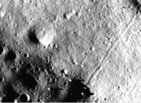
Jul 29 2009, 01:49 PM
Post
#85
|
||
|
Solar System Cartographer Group: Members Posts: 10164 Joined: 5-April 05 From: Canada Member No.: 227 |
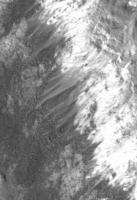
This is a tiny detail from the upper wall of Burg crater in the latest LROC image. Nice dust streamers - I don't recall anything like this in Apollo or Lunar Orbiter images.
Phil
-------------------- ... because the Solar System ain't gonna map itself.
Also to be found posting similar content on https://mastodon.social/@PhilStooke Maps for download (free PD: https://upload.wikimedia.org/wikipedia/comm...Cartography.pdf NOTE: everything created by me which I post on UMSF is considered to be in the public domain (NOT CC, public domain) |
|
|
|
|
|
|
Jul 30 2009, 04:48 AM
Post
#86
|
|
|
Merciless Robot Group: Admin Posts: 8784 Joined: 8-December 05 From: Los Angeles Member No.: 602 |
Hmm. And you of all people would certainly know, Phil.
That's really interesting. If they are in fact dust streamers, what's the sorting mechanism to generate them? It's gotta be a thermal expansion/contraction thing, but nothing obvious springs to mind. -------------------- A few will take this knowledge and use this power of a dream realized as a force for change, an impetus for further discovery to make less ancient dreams real.
|
|
|
|
|
Jul 30 2009, 10:21 AM
Post
#87
|
|
|
Member Group: Members Posts: 156 Joined: 22-May 09 From: Ireland Member No.: 4792 |
Yes...hmmm...I wonder would quakes be a contributing factor?
Phil, is it odd that the albedo of these streamers is lower than from where they originated from -- I would have thought the layer of dust that rolled down wouldn't have changed it much? John |
|
|
|
|
Jul 30 2009, 11:05 AM
Post
#88
|
|
|
Solar System Cartographer Group: Members Posts: 10164 Joined: 5-April 05 From: Canada Member No.: 227 |
Particle size and surface texture affect reflectivity as well as albedo. We can't separate those factors yet and say the albedo is different.
Electrostatic effects might move dust while leaving coarser material, allowing it to slide downhill on its own. Phil -------------------- ... because the Solar System ain't gonna map itself.
Also to be found posting similar content on https://mastodon.social/@PhilStooke Maps for download (free PD: https://upload.wikimedia.org/wikipedia/comm...Cartography.pdf NOTE: everything created by me which I post on UMSF is considered to be in the public domain (NOT CC, public domain) |
|
|
|
|
Jul 30 2009, 11:29 AM
Post
#89
|
|
|
Senior Member Group: Members Posts: 1465 Joined: 9-February 04 From: Columbus OH USA Member No.: 13 |
How long ago might such a landslide/deposit have taken place? A billion years? Only when the crater formed? Or perhaps more recent?
-------------------- |
|
|
|
|
Jul 30 2009, 11:54 AM
Post
#90
|
|
|
Solar System Cartographer Group: Members Posts: 10164 Joined: 5-April 05 From: Canada Member No.: 227 |
I would guess that the large wall slumps defining the crater terraces occurred immediately after crater formation, the small local landslides which form rubbly deposits on the terraces take place sporadically every few million years, and that these dust treamers are formed by gradual, continual (or short timescale episodic, like every year or two) ongoing processes.
There are some nice rolling boulder tracks below this area. Phil -------------------- ... because the Solar System ain't gonna map itself.
Also to be found posting similar content on https://mastodon.social/@PhilStooke Maps for download (free PD: https://upload.wikimedia.org/wikipedia/comm...Cartography.pdf NOTE: everything created by me which I post on UMSF is considered to be in the public domain (NOT CC, public domain) |
|
|
|
|
Jul 30 2009, 12:26 PM
Post
#91
|
||
|
Member Group: Members Posts: 156 Joined: 22-May 09 From: Ireland Member No.: 4792 |
Thanks Phil
OT: The half-covered crater just on the boundary in the Frigoris Image is simply excellent at very high res...WOW. John PS...I see the color camera is now working fine...yeah...sacrilegious, I know
|
|
|
|
|
|
|
Jul 30 2009, 05:30 PM
Post
#92
|
|
|
Member Group: Members Posts: 813 Joined: 29-December 05 From: NE Oh, USA Member No.: 627 |
QUOTE (Phil Stooke @ Jul 29 2009, 08:49 AM) This is a tiny detail from the upper wall of Burg crater in the latest LROC image. Nice dust streamers - I don't recall anything like this in Apollo or Lunar Orbiter images. Phil The Moon ( or Selene - I just do not feel 'the Moon' does her justice) sure ain't boring... Every time we increase resolution on a planet/moon, a whole new world pops into view. LROC will help reveal processes that operate on a large, airless, volatile free body. How exactly do electrostatic and exospheric efffects operate, long term and short? I expect the unexpected. WOW.. Craig |
|
|
|
| Guest_Zvezdichko_* |
Aug 4 2009, 09:40 AM
Post
#93
|
|
Guests |
|
|
|
|
| Guest_Zvezdichko_* |
Aug 5 2009, 02:59 PM
Post
#94
|
|
Guests |
|
|
|
|
|
Aug 7 2009, 06:47 PM
Post
#95
|
||
|
Junior Member Group: Members Posts: 62 Joined: 30-July 09 Member No.: 4887 |
QUOTE (Zvezdichko @ Aug 5 2009, 02:59 PM) Although its not possible to see in the LRO image browser, this image has many boulder tracks in it if you download the tiff and adjust the contrast/brightness appropriately. I have attached a sample. |
|
|
|
|
|
| Guest_Zvezdichko_* |
Aug 7 2009, 06:53 PM
Post
#96
|
|
Guests |
Yes! This sample is just another example of rock movement.
Because this is what I think has happened while looking at these images. We can clearly seen the trails. But what could have caused this? The Moon is a dead body for millions of years. |
|
|
|
|
Aug 7 2009, 08:17 PM
Post
#97
|
|
|
Solar System Cartographer Group: Members Posts: 10164 Joined: 5-April 05 From: Canada Member No.: 227 |
Seismic shaking caused by nearby impacts?
Phil -------------------- ... because the Solar System ain't gonna map itself.
Also to be found posting similar content on https://mastodon.social/@PhilStooke Maps for download (free PD: https://upload.wikimedia.org/wikipedia/comm...Cartography.pdf NOTE: everything created by me which I post on UMSF is considered to be in the public domain (NOT CC, public domain) |
|
|
|
|
Aug 8 2009, 01:47 PM
Post
#98
|
|
 Member Group: Members Posts: 399 Joined: 28-August 07 From: San Francisco Member No.: 3511 |
Have they mostly slid or tumbled ? Some tracks remind me of Spirits' RF
Eoin -------------------- 'She drove until the wheels fell off...'
|
|
|
|
|
Aug 8 2009, 11:16 PM
Post
#99
|
|
|
Member Group: Members Posts: 315 Joined: 1-October 06 Member No.: 1206 |
Pretty weird seeing craters on the tops of those Tsiolkovsky ejecta blocks. Obviously you know they must be there, but it just seems odd seeing them in 'solid rock' compared to the surrounding regolith.
p |
|
|
|
|
Aug 9 2009, 03:55 PM
Post
#100
|
|
|
Junior Member Group: Members Posts: 62 Joined: 30-July 09 Member No.: 4887 |
QUOTE (Zvezdichko @ Aug 7 2009, 06:53 PM) Yes! This sample is just another example of rock movement. Because this is what I think has happened while looking at these images. We can clearly seen the trails. But what could have caused this? The Moon is a dead body for millions of years. Back in the old Lunar Orbiter days they developed alot of theories for why the boulders eventually rolled downhill. I will have to did up the old reports. I recall thermal cycling and impacts of meteors causing tremors factored into it. My main interest in these is that they permit the deduction of regolith mechanical properties without having to land there. We don't really have any instruments to deduce these mechanical properties remotely. Landers or rovers could of course, but that is way too costly. During the Lunar Orbiter days, they found a slew of these in the very high resolution images (~1-3m/pixel, which only covered a small percentage of the surface) and derived regolith properties in preparation for Apollo landings. One of the concerns about the regolith is how much variation there is in its properties over the entire surface. Since interest exists for the near polar regions, it would be nice to be assured the properties are the same there as near the equator. Rolling boulders should be distributed fairly equally over the surface and if there aren't many near the poles, that is significant. Also, looking at these images, I had supposed there would be many more rocks and boulders (which would be especially visible at some of the shallow Sun elevations for the images), but there seems to be many more craters than boulders (~an order of magnitude). Does this make sense? |
|
|
|
 |

|
Lo-Fi Version | Time is now: 20th May 2024 - 09:38 AM |
|
RULES AND GUIDELINES Please read the Forum Rules and Guidelines before posting. IMAGE COPYRIGHT |
OPINIONS AND MODERATION Opinions expressed on UnmannedSpaceflight.com are those of the individual posters and do not necessarily reflect the opinions of UnmannedSpaceflight.com or The Planetary Society. The all-volunteer UnmannedSpaceflight.com moderation team is wholly independent of The Planetary Society. The Planetary Society has no influence over decisions made by the UnmannedSpaceflight.com moderators. |
SUPPORT THE FORUM Unmannedspaceflight.com is funded by the Planetary Society. Please consider supporting our work and many other projects by donating to the Society or becoming a member. |
|