

Google Mars HiRISE base images for Opportunity |

  |
Google Mars HiRISE base images for Opportunity |
 May 21 2011, 03:59 PM May 21 2011, 03:59 PM
Post
#76
|
|
|
Junior Member  Group: Members Posts: 36 Joined: 31-May 10 From: Poland Member No.: 5362 |
QUOTE (Tesheiner @ May 20 2011, 08:08 AM)  Could you detail it a little bit? Here you can see result: http://www.flickr.com/photos/55907406@N08/...320902/sizes/m/ Finally I decided not to use MapTiler. Instead I wrote my own bash script to create super_overlays. The following link was very helpful: http://code.google.com/intl/pl/apis/kml/do...l#superoverlays At this stage I can say that I almost there: 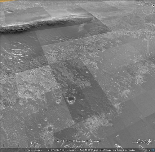 http://www.flickr.com/photos/55907406@N08/...795813/sizes/m/ As you can see there is a brightness difference between tiles. Have to think what is the origin of the problem... Below is the area (size 2^n) that I want to overlay in GE: width = 16384 height = 3x16384 so I have three squares 16384x16384. Currently I work with the first square.  QUOTE (Tesheiner @ May 20 2011, 08:08 AM) That's due to small differences in the lat/long coordinates you are using (in relation to the map I made). I can provide you with some data that should solve it, if you want. Yes please  ...Previously I made the alignment mostly by hand now I have the following strategy: ...Previously I made the alignment mostly by hand now I have the following strategy:1. take N,S,E,W out of LBL for full HiRISE product....DONE 2. recalculate N,S,E,W for my cropped area....DONE 3. add/subtract deltaLAT, deltaLON to perfectly match the existing overlay...TBD So I suppose your data will allow me to finish step 3 right? -------------------- Polish space portal covering up-to-date space news: www.kosmonauta.net
|
 |
 
|
|
May 21 2011, 09:39 PM
Post
#77
|
|
|
Senior Member Group: Moderator Posts: 4279 Joined: 19-April 05 From: .br at .es Member No.: 253 |
Mmm, more or less.
I'm providing some of the data I used to create the 8k x 8k tiles you already see on Google Mars and are hosted by TPS. So, if you use them and extrapolate the coordinates to the 16k x 16k tiles you want to create, they should match 100% with the current map. Note that I'm not saying that they are accurate (they aren't); they are only good for creating new maps matching with the current ones. Lat/Long coordinates of PSP_010341 upper left corner: -2.07473360826446, -5.44490800928163 dLat/dLong of a pixel on the original picture: 4.21926255562616E-06 |
|
|
|
|
May 22 2011, 04:55 PM
Post
#78
|
|
|
Junior Member Group: Members Posts: 36 Joined: 31-May 10 From: Poland Member No.: 5362 |
QUOTE (Tesheiner @ May 21 2011, 11:39 PM) Lat/Long coordinates of PSP_010341 upper left corner: -2.07473360826446, -5.44490800928163 dLat/dLong of a pixel on the original picture: 4.21926255562616E-06 Thanks for the numbers. They were very helpful. It looks I have a perfect match:  http://www.flickr.com/photos/55907406@N08/...683084/sizes/m/ Btw, asking out of curiosity...in LBL we have: MAP_RESOLUTION = 237098.79009322 <PIX/DEG> which gives: 1/237098.79009322=4.21765121452889e-6 but we are using 4.21926255562616e-6 Why is there a difference? Oh and the problem with the brightness among tiles was caused by Google Earth. Somehow GE had problems using png's which I was creating using Image Magick "convert" program. Switching to jpg's resolved that issue. Anyway...FINISHED!!! 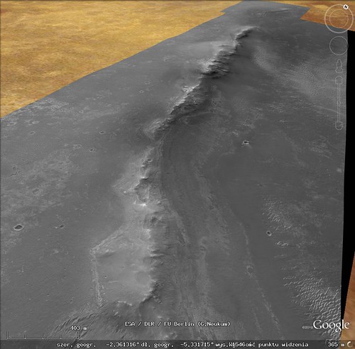 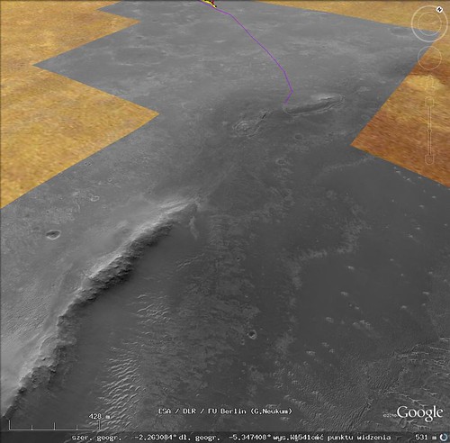 http://www.flickr.com/photos/55907406@N08/...292143/sizes/m/ http://www.flickr.com/photos/55907406@N08/...842018/sizes/m/ Zipped kml's download link: https://rapidshare.com/files/2039227902/end...ur_west_rim.zip Edit: added another link just in case... http://hotfile.com/dl/118744535/aaffb88/en...st_rim.zip.html The only missing thing is the black area which could be removed. I don't know but maybe I'll do it somewhere in the future. -------------------- Polish space portal covering up-to-date space news: www.kosmonauta.net
|
|
|
|
|
May 23 2011, 04:50 AM
Post
#79
|
|
|
Member Group: Members Posts: 139 Joined: 14-October 05 From: Toronto, Canada Member No.: 529 |
Great work! Well done!
-------------------- -- Robin
|
|
|
|
|
May 23 2011, 09:11 AM
Post
#80
|
|
|
Senior Member Group: Moderator Posts: 4279 Joined: 19-April 05 From: .br at .es Member No.: 253 |
QUOTE (KrisK @ May 22 2011, 06:55 PM) Btw, asking out of curiosity...in LBL we have: MAP_RESOLUTION = 237098.79009322 <PIX/DEG> which gives: 1/237098.79009322=4.21765121452889e-6 but we are using 4.21926255562616e-6 Why is there a difference? As I said before, the data may not be accurate but is the one you have to use to match with the previous maps. IIRC, I first calculated that value when attempting to match my version of ESP_011765 (the one covering the western detour) using MapTiler to SFJCody's version of the same map, which in other hand was already registered to the background covering Victoria embedded in GE. Later on, that value was used on subsequent maps to keep them matching together. |
|
|
|
|
Jun 22 2011, 09:34 PM
Post
#81
|
|
|
Newbie Group: Members Posts: 5 Joined: 30-September 10 Member No.: 5465 |
As I had mentioned a long, long time ago, we (the Ames Planetary Content team) were working on constructing new HiRISE/CTX overlays in the Google Earth client for the Opportunity route. We're far enough along that I want to have you guys take them for a spin so that I can get your feedback.
The attached KML file has NetworkLinks that point to our servers at Ames. As far as geo-position goes, we decided to leave Victoria Crater where it is, and adjust the surrounding images. At some point in the future (I've been told "after the mission is over" as a time frame), there will be a giant geolocation solution by members of the MER team, at which point we'd move everything to be consistent with that, but its far enough in the future that I'm not gonna worry about it right now. Also, the HiRISE image that covers the Endeavor rim isn't just any HiRISE image, but an ortho-image made from a HiRISE terrain model, and if things work out the way that I want them to, by the time this basemap makes it into the client (end of summer? fall at the latest, I hope), the HiRISE terrain will be in there, too.
Attached File(s)
|
|
|
|
|
Jun 22 2011, 10:08 PM
Post
#82
|
|
 Director of Galilean Photography Group: Members Posts: 896 Joined: 15-July 04 From: Austin, TX Member No.: 93 |
Works very well from here.
-------------------- Space Enthusiast Richard Hendricks
-- "The engineers, as usual, made a tremendous fuss. Again as usual, they did the job in half the time they had dismissed as being absolutely impossible." --Rescue Party, Arthur C Clarke Mother Nature is the final inspector of all quality. |
|
|
|
|
Jun 22 2011, 10:58 PM
Post
#83
|
|
|
Senior Member Group: Moderator Posts: 4279 Joined: 19-April 05 From: .br at .es Member No.: 253 |
From here too. It runs smoothly through the different levels of detail.
On the topic about geo-positioning there are, obviously and expected, differences with the maps we are using right now but it wouldn't take too much time for me to adjust my record of the route to this new HiRISE background; I only need to reposition some 15 "control points" I currently use on the map and all route points and ground features would be automatically aligned to the new background. |
|
|
|
|
Jun 23 2011, 12:48 AM
Post
#84
|
|
 Member Group: Members Posts: 754 Joined: 9-February 07 Member No.: 1700 |
It's always like Christmas morning surfing through the updated images on Google Mars. Thanks Ross, Tesh et al!
|
|
|
|
|
Jun 23 2011, 04:51 AM
Post
#85
|
|
 Senior Member Group: Members Posts: 2228 Joined: 1-December 04 From: Marble Falls, Texas, USA Member No.: 116 |
QUOTE (Ross Beyer @ Jun 22 2011, 03:34 PM) ... if things work out the way that I want them to, ... the HiRISE terrain will be in there, too. That would be truly awesome. I can hardly wait. Many thanks to you and your team for the excellent work. -------------------- ...Tom
I'm not a Space Fan, I'm a Space Exploration Enthusiast. |
|
|
|
|
Jun 23 2011, 07:43 AM
Post
#86
|
|
 Senior Member Group: Members Posts: 1619 Joined: 12-February 06 From: Bergerac - FR Member No.: 678 |
That's amazing ! Excellent work
!
-------------------- |
|
|
|
|
Jul 17 2011, 03:11 PM
Post
#87
|
|
|
Junior Member Group: Members Posts: 41 Joined: 18-September 09 Member No.: 4946 |
Fantastic job!!!!
|
|
|
|
|
Aug 12 2011, 09:52 PM
Post
#88
|
|
|
Member Group: Senior Member Posts: 136 Joined: 8-August 06 Member No.: 1022 |
QUOTE (Ross Beyer @ Jun 22 2011, 02:34 PM) As I had mentioned a long, long time ago, we (the Ames Planetary Content team) were working on constructing new HiRISE/CTX overlays in the Google Earth client for the Opportunity route. We're far enough along that I want to have you guys take them for a spin so that I can get your feedback. The attached KML file has NetworkLinks that point to our servers at Ames. As far as geo-position goes, we decided to leave Victoria Crater where it is, and adjust the surrounding images. At some point in the future (I've been told "after the mission is over" as a time frame), there will be a giant geolocation solution by members of the MER team, at which point we'd move everything to be consistent with that, but its far enough in the future that I'm not gonna worry about it right now. Also, the HiRISE image that covers the Endeavor rim isn't just any HiRISE image, but an ortho-image made from a HiRISE terrain model, and if things work out the way that I want them to, by the time this basemap makes it into the client (end of summer? fall at the latest, I hope), the HiRISE terrain will be in there, too. Hi Ross: I just completed a new basemap of CTX, MOC and HiRISE images in Arcmap that I'll be using for my localization work on Opportunity (I call this "HiThere!"). This map covers all of our traverse from Eagle Crater through Cape York, as well as all of Endeavour and Iazu Craters (since we can see so much of the interior of Endeavour, and Iazu is on our horizon). I first georeferenced the CTX low emission angle images to the HRSC and MOLA DEMs, then tied the HiRISE images to them (and each other, where they overlap). For Endeavour, there is still an annoying gap in the HiRISE coverage just east of center, so I used a couple of MOC images (3m/pixel) to fill that gap. Next step will be to correct the shading from one image to the next so the seams don't detract from the morphology. I've done this for the CTX background mosaic already, and I'm in the process of adjusting the HiRISE images. Next step will be to tile up and get the basemap into our planning software. But once that's done and the route is on it, exporting the path to applications like Google Mars ought to be straightforward. Much sooner than "after the mission is over", I'm hoping. -Tim. |
|
|
|
|
Aug 13 2011, 02:32 AM
Post
#89
|
|
 Administrator Group: Admin Posts: 5172 Joined: 4-August 05 From: Pasadena, CA, USA, Earth Member No.: 454 |
QUOTE (tim53 @ Aug 12 2011, 02:52 PM) (I call this "HiThere!")  Apart from that, I applaud the rest of your post and hope to see the product before the mission is over! -------------------- My website - My Patreon - @elakdawalla on Twitter - Please support unmannedspaceflight.com by donating here.
|
|
|
|
|
Oct 31 2011, 08:35 PM
Post
#90
|
|
|
Member Group: Senior Member Posts: 136 Joined: 8-August 06 Member No.: 1022 |
QUOTE (elakdawalla @ Aug 12 2011, 07:32 PM) Apart from that, I applaud the rest of your post and hope to see the product before the mission is over! This map is now completed. Stay tuned, as Trent Hare will be posting links to it on the USGS website. While I consider the map "completed", I reserve the right to continue to update it as better/more images are acquired and I can georeference them to the base MOLA and HRSC topography maps. But I need to get cranking on the Gale basemap for localization and planning during Ops! -Tim. |
|
|
|
|

|
Lo-Fi Version | Time is now: 19th April 2024 - 11:43 PM |
|
RULES AND GUIDELINES Please read the Forum Rules and Guidelines before posting. IMAGE COPYRIGHT |
OPINIONS AND MODERATION Opinions expressed on UnmannedSpaceflight.com are those of the individual posters and do not necessarily reflect the opinions of UnmannedSpaceflight.com or The Planetary Society. The all-volunteer UnmannedSpaceflight.com moderation team is wholly independent of The Planetary Society. The Planetary Society has no influence over decisions made by the UnmannedSpaceflight.com moderators. |
SUPPORT THE FORUM Unmannedspaceflight.com is funded by the Planetary Society. Please consider supporting our work and many other projects by donating to the Society or becoming a member. |
|


