Need help resizing USGS map of moon, Clementine/Lunar Orbiter |

  |
Need help resizing USGS map of moon, Clementine/Lunar Orbiter |
 Jan 8 2021, 06:39 AM Jan 8 2021, 06:39 AM
Post
#1
|
|
 Member  Group: Members Posts: 226 Joined: 13-October 09 From: Olympus Mons Member No.: 4972 |
Hello,
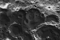
I am trying to find maps of the moon that have the least possible amount of shadows in them. The best I can find is the Clementine map but unfortunately, there are many data gaps in it. The LRO WAC and Kaguya maps on the USGS site have a lot of shadows on them. However, there is a map that combines Clementine and Lunar Orbiter data but the problem is, my computer cannot even render this monster!!! https://astrogeology.usgs.gov/search/map/Mo...saic_Global_59m If someone with a more powerful computer could please help me get a version of this image that is 16384x8192 pixels, that would be great! I don't have access to Map a Planet to be able to get it. -------------------- "Thats no moon... IT'S A TRAP!"
|
 |
 
|
|
Jan 8 2021, 04:55 PM
Post
#2
|
|
|
Senior Member Group: Members Posts: 2511 Joined: 13-September 05 Member No.: 497 |
QUOTE (Antdoghalo @ Jan 7 2021, 10:39 PM)  I am trying to find maps of the moon that have the least possible amount of shadows in them. What about http://wms.lroc.asu.edu/lroc/view_rdr/WAC_EMP ? -------------------- Disclaimer: This post is based on public information only. Any opinions are my own.
|
|
|
|
|
Jan 8 2021, 06:07 PM
Post
#3
|
|
|
Junior Member Group: Members Posts: 45 Joined: 23-July 11 Member No.: 6083 |
China has a whole moon image available from Chang'e-1 which might do the job? It's 4Gb, and you'll need to register:
http://moon.bao.ac.cn/index_en.jsp On the English version of the site, navigate to the lunar map, and look for the 'Download' link under 'base map' on the left hand side. China's images all seem to be at local noon, so there are no (or minimal) shadows. |
|
|
|
|
Jan 8 2021, 06:22 PM
Post
#4
|
|
|
Member Group: Members Posts: 226 Joined: 13-October 09 From: Olympus Mons Member No.: 4972 |
QUOTE (mcaplinger @ Jan 8 2021, 11:55 AM) What about http://wms.lroc.asu.edu/lroc/view_rdr/WAC_EMP ? Cool map but it doesn't go pole to pole. I need a cylindrical map. Though if you could find a cylindrical version that would be amazing! I'm trying to navigate to the Chang'e map but I can't find what you are referring to Threadworm. -------------------- "Thats no moon... IT'S A TRAP!"
|
|
|
|
|
Jan 8 2021, 06:55 PM
Post
#5
|
|
|
Senior Member Group: Members Posts: 2511 Joined: 13-September 05 Member No.: 497 |
QUOTE (Antdoghalo @ Jan 8 2021, 10:22 AM) Cool map but it doesn't go pole to pole. You're going to have a hard time finding a shadowless map of the polar regions. 
-------------------- Disclaimer: This post is based on public information only. Any opinions are my own.
|
|
|
|
|
Jan 8 2021, 08:39 PM
Post
#6
|
|
|
Member Group: Members Posts: 226 Joined: 13-October 09 From: Olympus Mons Member No.: 4972 |
Yeah, Like Mercury, the moon doesn't like exposing it's ends to the sun.
 I like the Clementine map primarily because it mostly has images at high noon and thus doesn't have so many shadows interfering with the coverage to where only at the poles do shadows from craters affect it. -------------------- "Thats no moon... IT'S A TRAP!"
|
|
|
|
|
Jan 9 2021, 07:54 AM
Post
#7
|
||
|
Solar System Cartographer Group: Members Posts: 10151 Joined: 5-April 05 From: Canada Member No.: 227 |
Use the LOLA shaded relief map to get topography in the shadow areas. Registered LROC mosaics and LOLA relief can be merged to give quite nice effects.
Phil (Malapert Mountain at upper left, Amundsen at lower right) - so you can use the LROC-WAC low phase angle mosaic with poles treated this way)
-------------------- ... because the Solar System ain't gonna map itself.
Also to be found posting similar content on https://mastodon.social/@PhilStooke Maps for download (free PD: https://upload.wikimedia.org/wikipedia/comm...Cartography.pdf NOTE: everything created by me which I post on UMSF is considered to be in the public domain (NOT CC, public domain) |
|
|
|
|
|
|
Jan 9 2021, 10:45 AM
Post
#8
|
|
 Senior Member Group: Members Posts: 2530 Joined: 20-April 05 Member No.: 321 |
For half the product that you're looking for, you could project an image taken from Earth of the full Moon to a cylindrical projection. That won't have any shadows in it; combining images with different nutation would give you ~59% of the Moon; and, images up to 10K pixels wide exist (I've even taken them). BUT
hard luck about the back side.
|
|
|
|
|
Jan 9 2021, 06:37 PM
Post
#9
|
|
|
Member Group: Members Posts: 923 Joined: 10-November 15 Member No.: 7837 |
-------------------- |
|
|
|
|
Jan 9 2021, 07:16 PM
Post
#10
|
|
|
Member Group: Members Posts: 226 Joined: 13-October 09 From: Olympus Mons Member No.: 4972 |
Thanks! It looks really cool close up with the merging of 60's and 90's data!!!
QUOTE (JRehling @ Jan 9 2021, 05:45 AM) For half the product that you're looking for, you could project an image taken from Earth of the full Moon to a cylindrical projection. That won't have any shadows in it; combining images with different nutation would give you ~59% of the Moon; and, images up to 10K pixels wide exist (I've even taken them). BUT
hard luck about the back side. The moon is very shy about mooning us with it's posterior.
-------------------- "Thats no moon... IT'S A TRAP!"
|
|
|
|
|
Jan 13 2021, 01:39 AM
Post
#11
|
|
|
Member Group: Members Posts: 100 Joined: 25-April 08 From: near New York City, NY Member No.: 4103 |
For what it's worth, I like the Unified Geological Map of the Moon at
https://astrogeology.usgs.gov/search/map/Mo...of_the_Moon_GIS I downloaded it, then sent it in two pieces to Costco Photo, printed it as a poster and cut and pasted it together. It's up on my wall. Makes a nice poster. bob k |
|
|
|
|
Jan 14 2021, 08:49 PM
Post
#12
|
|
|
Member Group: Members Posts: 156 Joined: 22-May 09 From: Ireland Member No.: 4792 |
Have you tried in using the DEM options in LTVT, where it is possible to show such features from any sun angle -- on the horizon or directly overhead (below,
shows Aristoteles and Eudoxes under various lighting conditions - west and east, while the second image is that of the South Pole). John 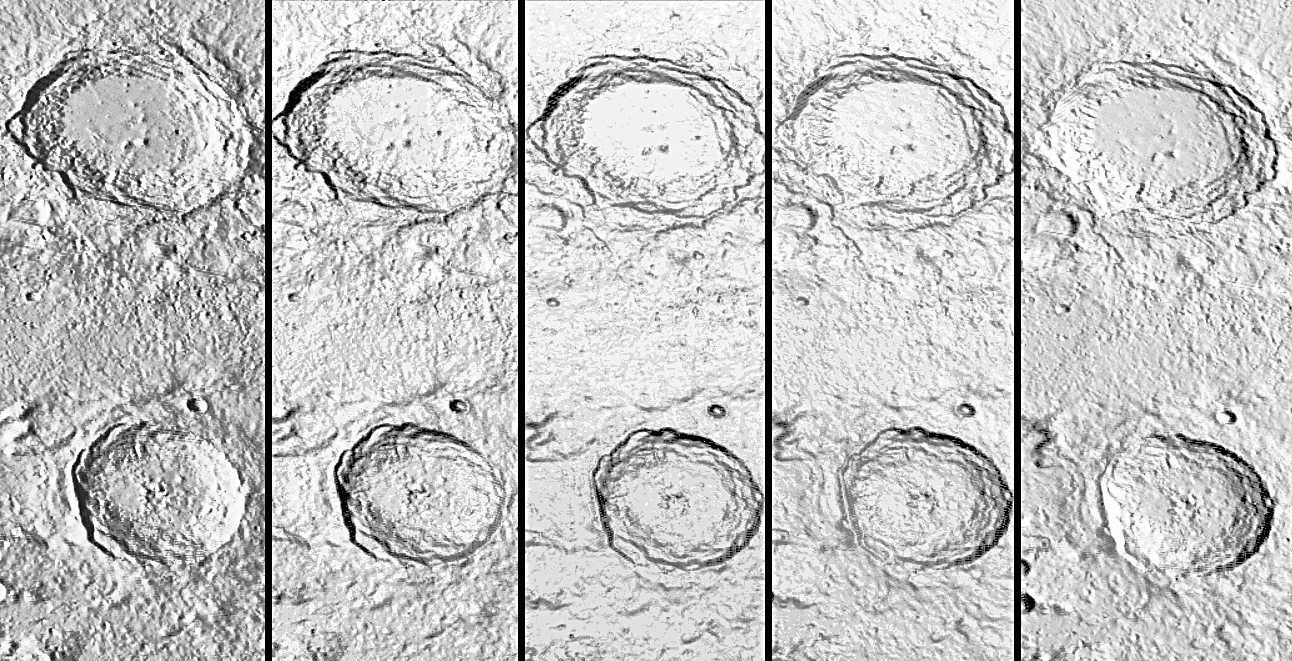 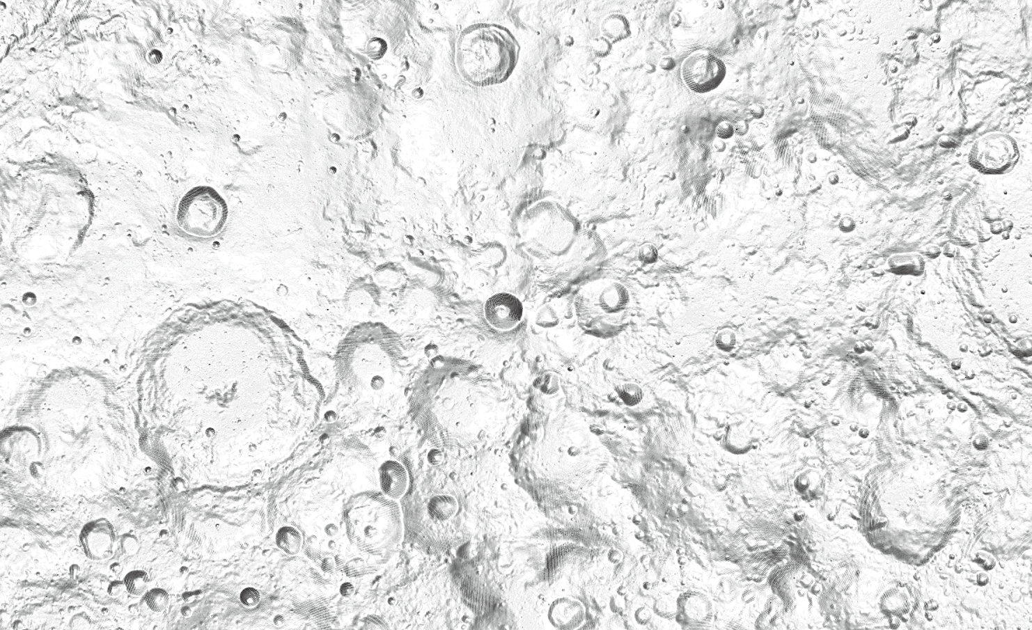
|
|
|
|
|
Feb 24 2021, 02:35 PM
Post
#13
|
|
 Newbie Group: Members Posts: 8 Joined: 21-February 21 Member No.: 8960 |
For bigtiff sattelite images you need to use GDAL. You do not need a powerful computer to process large data.
Here is the gdal command you need to use: https://gdal.org/programs/gdal_translate.ht...anslate-outsize CODE gdal_translate.py -outsize 16384 8192 Lunar_LO_UVVISv2_Hybrid_Mosaic_Global_59m.tif Lunar_LO_UVVISv2_Hybrid_Mosaic_Global_59m_downsampled.tif Or alternatively, if you'd prefer a graphical interface and/or you work with geodata regularly, i'd recommend using QGIS. Edit: I had not realized this was an old thread, sorry |
|
|
|
|

|
Lo-Fi Version | Time is now: 25th April 2024 - 05:30 PM |
|
RULES AND GUIDELINES Please read the Forum Rules and Guidelines before posting. IMAGE COPYRIGHT |
OPINIONS AND MODERATION Opinions expressed on UnmannedSpaceflight.com are those of the individual posters and do not necessarily reflect the opinions of UnmannedSpaceflight.com or The Planetary Society. The all-volunteer UnmannedSpaceflight.com moderation team is wholly independent of The Planetary Society. The Planetary Society has no influence over decisions made by the UnmannedSpaceflight.com moderators. |
SUPPORT THE FORUM Unmannedspaceflight.com is funded by the Planetary Society. Please consider supporting our work and many other projects by donating to the Society or becoming a member. |
|