Enceladus August 11, 2008 encounter, Close-up observations of plume vents |

 Unmanned Spaceflight.com > Outer Solar System > Saturn > Cassini Huygens > Cassini's ongoing mission and raw images
  |
Enceladus August 11, 2008 encounter, Close-up observations of plume vents |
 Aug 17 2008, 03:48 AM Aug 17 2008, 03:48 AM
Post
#256
|
|
 Senior Member  Group: Members Posts: 2530 Joined: 20-April 05 Member No.: 321 |
The color has a lot to do with phase angle. In full-disc images, Europa, for example, seems to have a bluer limb in "true color" imagery, so red is absorbed more when it has to double back through the ice. Note that even though this effect is seen over global scales (because only over global scales on a sphere does the angle of incidence change), it may be taking place in extremely tiny scales -- whether the light penetrates one times epsilon or two times epsilon before it reflects back. Finely granulated surfaces equalizes the situation, because each tiny granule is its own spheroid, whether near the center of the disc or the limb.
Fallout from Enceladus's jets ought to land without any gas between the particles. I would assume that they would eventually fuse pretty thoroughly to the surface, although with Enceladus's weak gravity, tiny ice particles may flow pretty slowly. |
 |
 
|
|
Aug 29 2008, 11:36 AM
Post
#257
|
|
|
Member Group: Members Posts: 401 Joined: 5-January 07 From: Manchester England Member No.: 1563 |
Has anyone heard how long it will take for the CIRS data to be released? I remember for the march flyby it being about a month, has there been any hints whether it will be the same length of time? If I was six I'd be shouting 'are we nearly there yet?'. I'd really like to know which mechanism for the plumes the temperature data supports. I do appreciate it takes time to get these things right, and they need to be right before they get released, but if anyone has a time frame for it it might help control my inner child!
-------------------- |
|
|
|
|
Sep 14 2008, 01:31 PM
Post
#258
|
|
 Senior Member Group: Members Posts: 1624 Joined: 5-March 05 From: Boulder, CO Member No.: 184 |
QUOTE (volcanopele @ Aug 15 2008, 12:31 AM)  Mosaic: Great Southern Land http://ciclops.org/view/5206/Great_Southern_Land Thought I'd revisit the question (perhaps to VP) of how these nifty mosaics are constructed as I may be able to add the color info from this (and similar mosaics) into my Enceladus map. In the caption it mentions an orthographic projection so I assume it means viewing from an infinite distance. I also assume the triaxial shape of Enceladus was taken into account in doing the mapping. Is this mosaic however shown reprojected onto a sphere, or onto the ellipsoid? Overall I'm past the halfway point in renavigating my entire Enceladus map. I'm also adding in several B&W images from the Rev 80 flyby. That's the latest, Steve |
|
|
|
|
Sep 16 2008, 04:24 AM
Post
#259
|
|
|
Member Group: Members Posts: 509 Joined: 2-July 05 From: Calgary, Alberta Member No.: 426 |
I was off at a wedding during the Enceladus flyby, got sidetracked by the frantic preparations for the flight out of Calgary, and only just now got around to going through this thread (and checking out the pictures).
Wow. You go away for a couple of months and everything changes. That's Cassini for you. |
|
|
|
|
Sep 27 2008, 03:22 PM
Post
#260
|
||
|
Senior Member Group: Members Posts: 1624 Joined: 5-March 05 From: Boulder, CO Member No.: 184 |
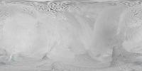
Thought I'd share this "work in progress" version of my Enceladus map. The entire map has been renavigated and 5 images from the August encounter are included to help show the south polar regions at high resolution. Color information has been added from the "Great Southern Lands" mosaic. The full-res map is at http://laps.noaa.gov/albers/sos/sos.html#ENCELADUS. Shown below is a quarter-res version:
Here are a few of the items I'm continuing to look at to try and improve the map: 1) adjust the navigation on the "frame 4" image over the south pole from the August encounter as some mismatches are evident 2) adjust image brightnesses to reduce some of the obvious seams 3) extend coverage of the August imagery over Mosul Sulci 4) attempt to reproject some of the other released color mosaics onto a cylindrical projection so I can utilize the color info. This appears to be a non-trivial exercise for some or the mosaics, compared with the "Great Southern Lands". That's the latest, Steve |
|
|
|
|
|
|
Oct 6 2008, 10:04 PM
Post
#261
|
|
 Member Group: Members Posts: 699 Joined: 3-December 04 From: Boulder, Colorado, USA Member No.: 117 |
QUOTE (marsbug @ Aug 29 2008, 12:36 PM) Has anyone heard how long it will take for the CIRS data to be released? I remember for the march flyby it being about a month, has there been any hints whether it will be the same length of time? If I was six I'd be shouting 'are we nearly there yet?'. I'd really like to know which mechanism for the plumes the temperature data supports. I do appreciate it takes time to get these things right, and they need to be right before they get released, but if anyone has a time frame for it it might help control my inner child! We have now released some information on the temperatures we saw in the August 11th encounter- see the latest Cassini news release. It took us a while, because we had some calibration issues with data from that flyby, but we're now comfortable saying that observed temperatures along the part of Damascus Sulcus that we saw in detail were in the 160 - 167 K range. Temperatures could be hotter elsewhere, of course, and we also can't rule out tiny areas at higher temperatures in the regions where we did look. The press release also says a bit about the magnetometer results from the August flyby, in addition to looking forward to the October flybys. OK, please settle down in the back seat now  John. |
|
|
|
|
Oct 7 2008, 09:31 AM
Post
#262
|
|
|
Member Group: Members Posts: 401 Joined: 5-January 07 From: Manchester England Member No.: 1563 |
Thanks John S and every one working on Cassini, I will now sit quietly and enjoy my goodies!
-------------------- |
|
|
|
|
Jul 1 2009, 12:13 PM
Post
#263
|
|
 Member Group: Members Posts: 568 Joined: 20-April 05 From: Silesia Member No.: 299 |
Raw images are now available.
http://pds-imaging.jpl.nasa.gov/data/cassi...ter/coiss_2047/ -------------------- Free software for planetary science (including Cassini Image Viewer).
http://members.tripod.com/petermasek/marinerall.html |
|
|
|
|

|
Lo-Fi Version | Time is now: 19th April 2024 - 08:39 AM |
|
RULES AND GUIDELINES Please read the Forum Rules and Guidelines before posting. IMAGE COPYRIGHT |
OPINIONS AND MODERATION Opinions expressed on UnmannedSpaceflight.com are those of the individual posters and do not necessarily reflect the opinions of UnmannedSpaceflight.com or The Planetary Society. The all-volunteer UnmannedSpaceflight.com moderation team is wholly independent of The Planetary Society. The Planetary Society has no influence over decisions made by the UnmannedSpaceflight.com moderators. |
SUPPORT THE FORUM Unmannedspaceflight.com is funded by the Planetary Society. Please consider supporting our work and many other projects by donating to the Society or becoming a member. |
|