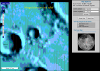
Exploring LROC NAC images |

  |
Exploring LROC NAC images |
| Guest_cassioli_* |
 Sep 18 2010, 01:22 PM Sep 18 2010, 01:22 PM
Post
#1
|
|
Guests |
I found this cool site for LRO images, but I can't unerstand if/how it is possible to know lat/lon of a point in the zoomed image.
If not, is there any site/program which allows to do this? |
 |
 
|
|
Sep 18 2010, 01:33 PM
Post
#2
|
|
|
Solar System Cartographer  Group: Members Posts: 10150 Joined: 5-April 05 From: Canada Member No.: 227 |
The site tells you the lat and long of the top and bottom, left and right corners. A point inside it can be estimated by interpolation. Not very difficult!
Phil -------------------- ... because the Solar System ain't gonna map itself.
Also to be found posting similar content on https://mastodon.social/@PhilStooke NOTE: everything created by me which I post on UMSF is considered to be in the public domain (NOT CC, public domain) |
|
|
|
| Guest_cassioli_* |
Sep 18 2010, 01:37 PM
Post
#3
|
|
Guests |
QUOTE (Phil Stooke @ Sep 18 2010, 01:33 PM)  The site tells you the lat and long of the top and bottom, left and right corners. A point inside it can be estimated by interpolation. Not very difficult! Phil it IS difficult: try finding an object in one of those image, even if you know its coordinates! |
|
|
|
|
Sep 18 2010, 06:12 PM
Post
#4
|
|
 Interplanetary Dumpster Diver Group: Admin Posts: 4404 Joined: 17-February 04 From: Powell, TN Member No.: 33 |
QUOTE (cassioli @ Sep 18 2010, 01:37 PM) it IS difficult: try finding an object in one of those image, even if you know its coordinates! For those who are unwilling to put forth the slightest thought or effort, maybe. It is quite easy to use. -------------------- |
|
|
|
| Guest_cassioli_* |
Sep 18 2010, 06:30 PM
Post
#5
|
|
Guests |
QUOTE (tedstryk @ Sep 18 2010, 06:12 PM) For those who are unwilling to put forth the slightest thought or effort, maybe. It is quite easy to use. being argumentative is useless. answers to my questions are: no, is not possible. no, there is no site/sw which allow doing that. |
|
|
|
|
Sep 18 2010, 06:34 PM
Post
#6
|
|
|
Interplanetary Dumpster Diver Group: Admin Posts: 4404 Joined: 17-February 04 From: Powell, TN Member No.: 33 |
QUOTE (cassioli @ Sep 18 2010, 06:30 PM) being argumentative is useless. answers to my questions are: no, is not possible. no, there is no site/sw which allow doing that. LOL, a multiple choice question? 
-------------------- |
|
|
|
|
Sep 18 2010, 10:09 PM
Post
#7
|
|
 Senior Member Group: Moderator Posts: 2785 Joined: 10-November 06 From: Pasadena, CA Member No.: 1345 |
Something's not quite right here....
-------------------- Some higher resolution images available at my photostream: http://www.flickr.com/photos/31678681@N07/
|
|
|
|
|
Sep 18 2010, 11:10 PM
Post
#8
|
||
|
Senior Member Group: Moderator Posts: 2785 Joined: 10-November 06 From: Pasadena, CA Member No.: 1345 |
Here's part of the problem. The base maps are all offset.
Here is a GIF of a series of screenshots centered on a cute crater* to the northeast of Clavius D: toggling through the different layers, you can see that although the NAC footprints don't move, the background maps are all over the place.
[* Animated GIF: Click to animate *] So this map can get you kinda close, but you'll need to line up features in the actual LRO image to the terrain to see where you really are. Google Earth (Moon) might be your best friend here. *the small bright crater inside this crater has some neat blocks exposed. -------------------- Some higher resolution images available at my photostream: http://www.flickr.com/photos/31678681@N07/
|
|
|
|
|
|
|
Sep 18 2010, 11:20 PM
Post
#9
|
|
 Administrator Group: Admin Posts: 5172 Joined: 4-August 05 From: Pasadena, CA, USA, Earth Member No.: 454 |
This used to be a serious problem for Mars too; it's thanks to the MOLA maps that there is now such good control of image locations. It amazes me every time I go into Google Mars and see how well things generally line up. Locational control of image data sets for the Moon will eventually improve with the help of the LOLA data set.
The point is that latitude and longitude will only get you so far. If you're looking for something in one data set at a given latitude and longitude measured off an image from a different data set, you'll probably have to make your own grid overlaid on both images in which you match features obvious in both data sets, then look for that needle in a haystack at its proper grid location in the new image. It's not as easy as an entire data set being offset by some constant; the locations are imprecise, so one image might be off in one direction, another might be off in a different direction. Phil Stooke might have a handle on just how large this imprecision is for different data sets. -------------------- My website - My Patreon - @elakdawalla on Twitter - Please support unmannedspaceflight.com by donating here.
|
|
|
|
|
Sep 18 2010, 11:33 PM
Post
#10
|
|
|
Senior Member Group: Moderator Posts: 2785 Joined: 10-November 06 From: Pasadena, CA Member No.: 1345 |
Are the NAC images flipped? (left-right reflected) I'm having a hard time getting them to match up to the Google Moon images..but flipping (sometimes upside down AND left-right) seems to do the trick.
-------------------- Some higher resolution images available at my photostream: http://www.flickr.com/photos/31678681@N07/
|
|
|
|
|
Sep 19 2010, 12:39 AM
Post
#11
|
|
 Senior Member Group: Members Posts: 3648 Joined: 1-October 05 From: Croatia Member No.: 523 |
QUOTE (Juramike @ Sep 19 2010, 01:33 AM) but flipping (sometimes upside down AND left-right) seems to do the trick. That's a 180 degree rotation. It's probably due to the simple fact some swaths were taken on ascending and some on descending node so north direction differs by 180 deg. -------------------- |
|
|
|
|
Sep 19 2010, 12:59 AM
Post
#12
|
|
|
Senior Member Group: Moderator Posts: 2785 Joined: 10-November 06 From: Pasadena, CA Member No.: 1345 |
I'm getting an E-W mirroring as well that I can't figure out. (Even after rotating).
-------------------- Some higher resolution images available at my photostream: http://www.flickr.com/photos/31678681@N07/
|
|
|
|
|
Sep 19 2010, 02:56 AM
Post
#13
|
|
|
Administrator Group: Admin Posts: 5172 Joined: 4-August 05 From: Pasadena, CA, USA, Earth Member No.: 454 |
See http://www.planetary.org/blog/article/00002422/ for an explanation of the occasional E-W mirroring (though not, sadly, any useful information on how to tell when the image is flipped, except by comparing it with older photos).
-------------------- My website - My Patreon - @elakdawalla on Twitter - Please support unmannedspaceflight.com by donating here.
|
|
|
|
|
Sep 19 2010, 04:07 AM
Post
#14
|
|
|
Senior Member Group: Moderator Posts: 2785 Joined: 10-November 06 From: Pasadena, CA Member No.: 1345 |
Thanks!
-------------------- Some higher resolution images available at my photostream: http://www.flickr.com/photos/31678681@N07/
|
|
|
|
| Guest_cassioli_* |
Sep 19 2010, 12:23 PM
Post
#15
|
|
Guests |
What I can't understand is how people is able to find in these images ancient spacecraft wrecks just 10 pixel wide, just by knowing which their position should be, if it is so hard to determine lat/lon on these images!
Anyway I found this LTVT program which allows calibrating an image and overlaying it to a moon model. I didn't yet figure out prperly how to use the program... but as far as I unerstand, it requires .LBL files associated to .IMG files, to calibrate the images. But.. where are these files?!? Ok, I can calibrate by hand, but of course a ready-made file would be much more precise! |
|
|
|
|

|
Lo-Fi Version | Time is now: 23rd April 2024 - 08:54 PM |
|
RULES AND GUIDELINES Please read the Forum Rules and Guidelines before posting. IMAGE COPYRIGHT |
OPINIONS AND MODERATION Opinions expressed on UnmannedSpaceflight.com are those of the individual posters and do not necessarily reflect the opinions of UnmannedSpaceflight.com or The Planetary Society. The all-volunteer UnmannedSpaceflight.com moderation team is wholly independent of The Planetary Society. The Planetary Society has no influence over decisions made by the UnmannedSpaceflight.com moderators. |
SUPPORT THE FORUM Unmannedspaceflight.com is funded by the Planetary Society. Please consider supporting our work and many other projects by donating to the Society or becoming a member. |
|