

Ceres Geology |

  |
Ceres Geology |
 Mar 15 2015, 10:13 PM Mar 15 2015, 10:13 PM
Post
#31
|
|
|
Member  Group: Members Posts: 107 Joined: 1-August 14 Member No.: 7227 |
QUOTE (Phil Stooke @ Mar 15 2015, 04:08 AM)  "Final confirmation of volcanism should occur by May or June, when central pits show up in those bright spots." ...could occur, if central pits show up... Phil It looks like there's actually "something high" under the bright spot! hipass of the baked dem ( 0 to 360 mapping) 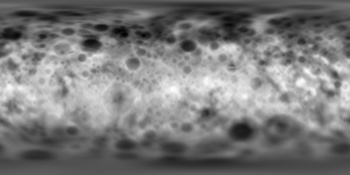 http://www.unmannedspaceflight.com/index.p...st&p=218867 |
 |
 
|
|
Mar 16 2015, 02:01 PM
Post
#32
|
|
|
Member Group: Members Posts: 401 Joined: 5-January 07 From: Manchester England Member No.: 1563 |
QUOTE (mcgyver @ Mar 13 2015, 09:42 AM) Recent paper: "THE POTENTIAL FOR VOLCANISM ON CERES DUE TO CRUSTAL THICKENING AND PRESSURIZATION OF A SUBSURFACE OCEAN." http://www.hou.usra.edu/meetings/lpsc2015/pdf/2831.pdf Having read that paper I'll float (he, he, he.. geddit.. no?)an idea that may be rediculously naive: wouldn't a major impact be good way for a pre existing a crack partway through the crust (due to the mechanism proposed in the paper) to be opened up and form a vent? The paper mentions impacts as a source of fracturing sans tensile cracking, why not combine them? -------------------- |
|
|
|
|
Mar 18 2015, 11:42 AM
Post
#33
|
|
|
Member Group: Members Posts: 107 Joined: 1-August 14 Member No.: 7227 |
Some ceres maps I found around can help studying the bright spots:
  Near infrared mapping of Ceres surface http://www.spaceref.com/news/viewpr.html?pid=21032  The composite albedo deviation maps of Ceres through F555W (upper panel), F330W (middle panel), and F220W (lower panel) filters http://eclipsephase.com/ceres-surface-geography |
|
|
|
|
Mar 18 2015, 12:47 PM
Post
#34
|
|
|
Member Group: Members Posts: 107 Joined: 1-August 14 Member No.: 7227 |
And my 3d reconstruction of bright-spots crater (4 MB animated
 http://i.imgur.com/c7WRvT7.png STL file: http://lc84.altervista.org/vba4.stl |
|
|
|
|
Mar 18 2015, 01:41 PM
Post
#35
|
|
 Senior Member Group: Members Posts: 4256 Joined: 17-January 05 Member No.: 152 |
The DEM has got to be considered very preliminary near "feature 5" (ie the brightest bright spot). For one thing we may be seeing more PSF than real structure, which would affect the calculation of elevations. For another, if, as recent reports claim, the brightness of feature 5 varies with time, that could also affect the DEM, since you'd normally assume that to be constant when calculating the elevations.
|
|
|
|
|
Mar 18 2015, 03:07 PM
Post
#36
|
|
|
Member Group: Members Posts: 107 Joined: 1-August 14 Member No.: 7227 |
QUOTE (fredk @ Mar 18 2015, 02:41 PM) The DEM has got to be considered very preliminary How is it calculated? And what does PSF stand for? |
|
|
|
|
Mar 18 2015, 03:20 PM
Post
#37
|
|
 Senior Member Group: Members Posts: 1729 Joined: 3-August 06 From: 43° 35' 53" N 1° 26' 35" E Member No.: 1004 |
the first result when you google it
en.m.wikipedia.org/wiki/Point_spread_function |
|
|
|
|
Mar 18 2015, 03:56 PM
Post
#38
|
|
|
Senior Member Group: Members Posts: 4256 Joined: 17-January 05 Member No.: 152 |
QUOTE (mcgyver @ Mar 18 2015, 04:07 PM) How is it calculated? Basically you would combine images from different viewpoints (different frames from the rotation sequences). That contains depth information just like an anaglyph does. But if the details of the bright spot aren't reliable then the elevations you get also aren't reliable. |
|
|
|
|
Mar 19 2015, 08:46 AM
Post
#39
|
|
|
Member Group: Members Posts: 107 Joined: 1-August 14 Member No.: 7227 |
Well, then the DEM data in that area are totally useless. :-(
Better focusing, then, on tweets about #LPSC2015 in these days: there's a lot of talking on Ceres, and one tweet on the fact that the bright spot is visible above the rim (in unreleased images) and hence is probably a "geyser" ( http://twitter.com/Laurent_Montesi/status/...0697387008?s=02 ) |
|
|
|
|
Mar 19 2015, 09:06 AM
Post
#40
|
|
|
Member Group: Members Posts: 107 Joined: 1-August 14 Member No.: 7227 |
Nature article on Ceres about icy plume over bright spot:
http://www.nature.com/news/bright-spots-on...=TWT_NatureNews |
|
|
|
|
Mar 19 2015, 03:04 PM
Post
#41
|
|
 Administrator Group: Admin Posts: 5172 Joined: 4-August 05 From: Pasadena, CA, USA, Earth Member No.: 454 |
Great find on the DEM -- I'm really surprised to see it released!
If a DEM is calculated from image pairs, I think positional accuracies are no better than some small number of pixels, right? Which is to say it's not really worthwhile to use this one to analyze the detailed rim and floor structure of the crater that the bright feature is in. -------------------- My website - My Patreon - @elakdawalla on Twitter - Please support unmannedspaceflight.com by donating here.
|
|
|
|
|
Mar 19 2015, 04:23 PM
Post
#42
|
|
 Member Group: Members Posts: 656 Joined: 20-April 05 From: League City, Texas Member No.: 285 |
QUOTE (elakdawalla @ Mar 19 2015, 10:04 AM) If a DEM is calculated from image pairs... I'm not sure how these DEMs were produced, but in principal all the images from the rotation sequence could contribute simultaneously to the DEM, potentially yielding sub-pixel resolution of the topography. Also, the shadowing along the terminator might contribute further. Or it could be all shape-from-shading, in which case take with a grain of salt. Tracking common features in multiple images is tricky and error prone. Anyway, I agree that the bright spots are indeed so poorly resolved that I'd hesitate to make much of their DEMs. |
|
|
|
|
Mar 19 2015, 04:26 PM
Post
#43
|
|
|
Solar System Cartographer Group: Members Posts: 10229 Joined: 5-April 05 From: Canada Member No.: 227 |
The basic rule is always going to be... don't expect reliable results when you are looking at things close to the resolution of the data. For images, we can't interpret reliably if we have fewer than 4 or 5 pixels across the object of interest - and even more would be better. Stereo DEMs are even more removed from the raw data (the images), so their effective resolution is lower still. Their resolution will be determined by the spacing between common points, the identifiable points matched in the two images so parallax can be measured. If you look at the images you can get a sense of how far apart those points would be.
So please don't read too much into tiny details in images or DEMs. Phil -------------------- ... because the Solar System ain't gonna map itself.
Also to be found posting similar content on https://mastodon.social/@PhilStooke Maps for download (free PDF: https://upload.wikimedia.org/wikipedia/comm...Cartography.pdf NOTE: everything created by me which I post on UMSF is considered to be in the public domain (NOT CC, public domain) |
|
|
|
|
Mar 24 2015, 08:37 PM
Post
#44
|
|
|
Member Group: Members Posts: 890 Joined: 18-November 08 Member No.: 4489 |
QUOTE "If a DEM is calculated from image pairs..." -- and this I'm not sure how these DEMs were produced, the dem was extracted from the vertex plate model baked the displacement using blender and compensated for the difference in radi of the mesh and sphere ftp://naif.jpl.nasa.gov/pub/naif/DAWN/misc/ceres the README ftp://naif.jpl.nasa.gov/pub/naif/DAWN/mis...s/aaareadme.txt a 32 bit isis3 cub is here https://drive.google.com/file/d/0B6ZYAd08tZ...iew?usp=sharing |
|
|
|
|
Mar 25 2015, 05:17 PM
Post
#45
|
|
|
Member Group: Members Posts: 656 Joined: 20-April 05 From: League City, Texas Member No.: 285 |
QUOTE (JohnVV @ Mar 24 2015, 03:37 PM) the dem was extracted from the vertex plate model ... To clarify... I was referring to the photogrammetry leading to the creation of the shape (or vertex plate) model. Given that model, the DEM is simply the difference between the shape model and the corresponding ellipsoid fit. Eventually that will be a geoid fit, but these are early days. |
|
|
|
|

|
Lo-Fi Version | Time is now: 26th September 2024 - 09:06 PM |
|
RULES AND GUIDELINES Please read the Forum Rules and Guidelines before posting. IMAGE COPYRIGHT |
OPINIONS AND MODERATION Opinions expressed on UnmannedSpaceflight.com are those of the individual posters and do not necessarily reflect the opinions of UnmannedSpaceflight.com or The Planetary Society. The all-volunteer UnmannedSpaceflight.com moderation team is wholly independent of The Planetary Society. The Planetary Society has no influence over decisions made by the UnmannedSpaceflight.com moderators. |
SUPPORT THE FORUM Unmannedspaceflight.com is funded by the Planetary Society. Please consider supporting our work and many other projects by donating to the Society or becoming a member. |
|


