Post Conjunction: Santa Maria to Cape York, The Journey to 'Spirit Point' |

  |
Post Conjunction: Santa Maria to Cape York, The Journey to 'Spirit Point' |
 Aug 12 2011, 12:03 AM Aug 12 2011, 12:03 AM
Post
#1546
|
|
 Member  Group: Members Posts: 706 Joined: 3-December 04 From: Boulder, Colorado, USA Member No.: 117 |
Is it possible this fissure formed when Opportunity ran over the adjacent piece of rock and displaced it? We've seen similar things before.
Also, as Gibraltar was (I think) a pre-Cape York target, shouldn't it be in the "Post Conjunction..." thread? I understand why that thread was closed to encourage people to move to the new thread, but now that goal has been accomplished, shouldn't it be re-opened for posting of continued discussion of data from the long trek? John |
 |
 
|
|
Aug 12 2011, 01:46 AM
Post
#1547
|
|
|
Junior Member Group: Members Posts: 98 Joined: 17-July 11 From: Pasadena, CA Member No.: 6066 |
QUOTE (john_s @ Aug 11 2011, 04:03 PM)  Is it possible this fissure formed when Opportunity ran over the adjacent piece of rock and displaced it? We've seen similar things before. Not out of the question. There was interest in Wednesday's planning meetings (executing... now, if I am right) in looking back at some because they noticed the wheels had crushed something. Probably a different thing than what you're talking about, but nonetheless it makes the point that it's easily possible. -m |
|
|
|
|
Aug 12 2011, 04:14 AM
Post
#1548
|
|
|
Junior Member Group: Members Posts: 53 Joined: 1-March 11 From: Houston, USA Member No.: 5860 |
QUOTE (Sunspot @ Aug 11 2011, 03:25 PM) Most of the blueberries seem to have holes in them. More like pitted olives than blueberries, maintaining the edible fruit theme. The concretions may have nucleated around something not as hard, but I'm struggling to come up with a mechanism that would expose the center to weathering from just one side. |
|
|
|
|
Aug 12 2011, 04:41 AM
Post
#1549
|
|
|
Senior Member Group: Members Posts: 3008 Joined: 30-October 04 Member No.: 105 |
QUOTE (john_s) Is it possible this fissure formed when Opportunity ran over the adjacent piece of rock and displaced it? We've seen similar things before. Most likely. And this site has other interesting items. Note the rock fragment in upper center, purplish-and brown. As well as the dimpled blueberries.Gibraltar, L257, Sol 2670 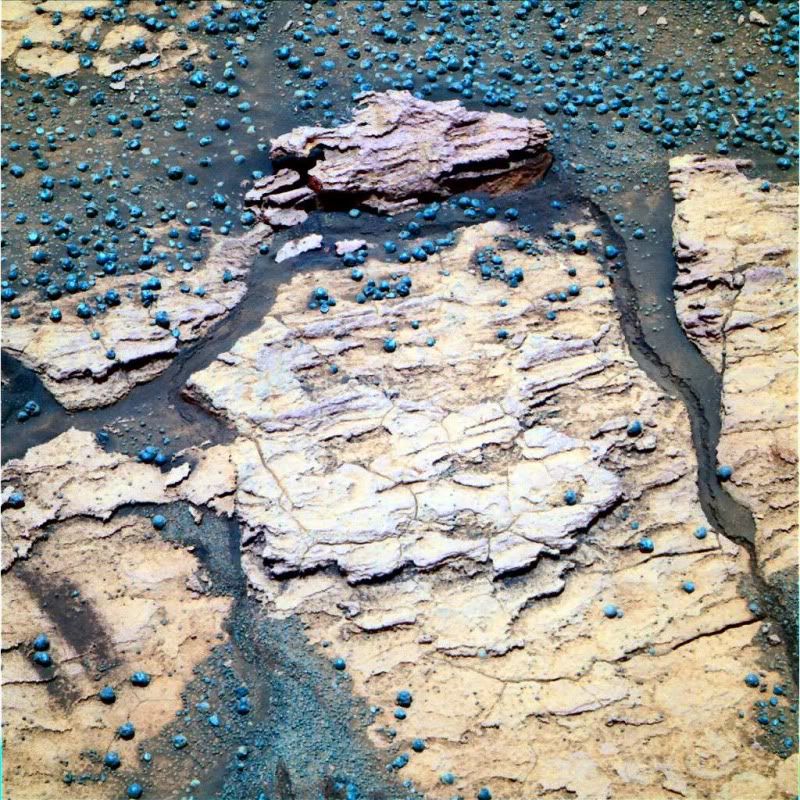 Gibraltar, R721, Sol 2670 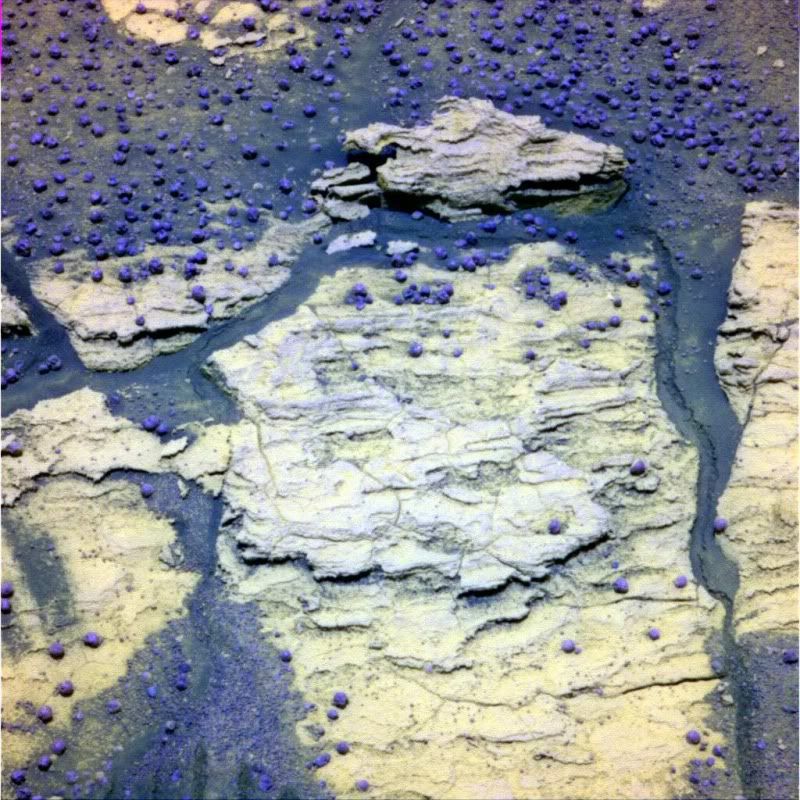 --Bill -------------------- |
|
|
|
|
Aug 12 2011, 07:34 AM
Post
#1550
|
|
|
Senior Member Group: Members Posts: 1057 Joined: 17-February 09 Member No.: 4605 |
From hazcam the left hand wheel ran over the edge of the left hand rock (which seems an integral part of the right hand rock) providing a lever action and the crack outlines the edge of the rock.
For my part the rock at the top of the image seems much more interesting than a mechanical artifact. The left hand tip has broken off revealing what looks like a fill and the implication is that the fill was not bonded in any way to the matrix since it seemingly broke away along the fill boundary. The color of the fill is different to the berries and the rock has that 'burplish' coloration that we have been seeing with increasing regularity, and which makes me wonder about the cation 'flavour' of some of the sulphates. Edit: Apologies. Magnification shows this is just an overhang with s shadow and upper lit section in the background giving an illusion of fill. |
|
|
|
|
Aug 12 2011, 02:51 PM
Post
#1551
|
|
|
Senior Member Group: Members Posts: 3008 Joined: 30-October 04 Member No.: 105 |
> Edit: Apologies. Magnification shows...
Not a problem-- you saw something and comented on. Then looked again and thought some more. We are giddy geologists, just like kids in a candy store...  There is a brownish area on the fracture at that left-hand tip that is reminescent of the elusive "5YR 4/3 outcrop" we've seen. From this first look (here), we don;t know much more, but there will be other examples. I process these images as a "balance-neutral data array" so you can increase or decrease saturation and/or contrast without pushing the image off the edge. --Bill -------------------- |
|
|
|
|
Aug 16 2011, 12:52 PM
Post
#1552
|
||
 Member Group: Members Posts: 819 Joined: 3-June 04 From: Brittany, France Member No.: 79 |
Some pancam images from sol 2663 have been released on the exploratorium. Here is my version of the color panorama (blanks in the sky manually filled).
Attached thumbnail(s)
-------------------- |
|
|
|
|
|
|
Sep 13 2011, 01:10 AM
Post
#1553
|
||
 The Poet Dude Group: Moderator Posts: 5551 Joined: 15-March 04 From: Kendal, Cumbria, UK Member No.: 60 |
Some more old images came back. Here's a rather nice one from July 26th...
-------------------- |
|
|
|
|
|
|
Sep 14 2011, 01:45 AM
Post
#1554
|
||
|
Member Group: Members Posts: 146 Joined: 31-October 08 Member No.: 4473 |
QUOTE (Stu @ Sep 12 2011, 05:10 PM) Some more old images came back. Here's a rather nice one from July 26th...
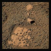
This is actually a very interesting picture, with the sloped layers in the soft bedrock and the two distinct size distributions of "blueberries". Oppy (I want to say "we") was descending gently towards Cape York, but still a ways away. How do these layers orient? |
|
|
|
|
|
|
Sep 14 2011, 09:19 PM
Post
#1555
|
|
|
Senior Member Group: Members Posts: 3008 Joined: 30-October 04 Member No.: 105 |
Last month when data started down the pipline from the hurried time of the approach to Cape York between the sites "Pathfinder Mound" and "Inaccessible Island" on Sols 2666 to 2673 I noticed interesting details about the sand and the Blueberry concretions in certain Pancams. The other day we received the remaining Pancam tricolor images which were combined into L257, L245 and R721 color images.
This unit is a weakly-indurated (-cemented) sand unit, with Blueberry concretions, that is similar to the sand in the ripples. Although the ripple sand can form a weak crust over the loose material, this undurated unit will support the weight fo the Rover's wheels but is friable enough for the wheels to leave tracks. It is clearly not the light-toned kieseritic sandstone but is apparently a weakly-indurated ripple sand. I would suppose that this unit is cemented with the sulfate salt omnipresent in this region, and suggest that it might represent a high groundwater table which saturated this sediment and left the cementing salts behind. Note that this is very low in the Burns Fm section, possibly within a few meters of the ancient Endurance surface. Many of the Blueberry concretions are surrounded by a light-toned ring, and many of the Blueberries have popped out of the matrix, leaving a rounded pit and the light ring. This is likely a reaction zone or a weathering rim around the concretion. There was apparently interest in this area, since this Pancam series was annotated as the "pancam_systematic_foreground_quarter_L234567Rall". I've seen occasional Pancam tricolor image sets taken just ahead of the front wheels for years and this probably has been a continuing study. At my Photobucket Mars/Oppy site I've started a "systematic foreground" subalbum on this subject: http://s142.photobucket.com/albums/r91/wil...ound%20Pancams/ --Bill -------------------- |
|
|
|
|
Sep 14 2011, 11:45 PM
Post
#1556
|
|
|
Member Group: Members Posts: 139 Joined: 14-October 05 From: Toronto, Canada Member No.: 529 |
QUOTE (Bill Harris @ Sep 14 2011, 05:19 PM) I've seen occasional Pancam tricolor image sets taken just ahead of the front wheels for years and this probably has been a continuing study. This may be part of an ongoing soil study that the team has been doing. I recall a few years back when a soil specialist joined the team. This may be part of his work.
-------------------- -- Robin
|
|
|
|
|
Oct 27 2011, 12:34 PM
Post
#1557
|
|
 Member Group: Members Posts: 754 Joined: 9-February 07 Member No.: 1700 |
QUOTE (centsworth_II @ Aug 9 2011, 05:04 AM) My opinion (a two cent value!) is that the mound is the same built up sulphate layers that surround Endeavour and cover all of Meridiani that Opportunity has traversed. The reason it is a mound is because wind patterns, influenced by the crater rim, have eroded away more of the material filling the crater near the crater rim, leaving more in the center. Raises hopes for a cleaning event? |
|
|
|
|
Oct 27 2011, 12:50 PM
Post
#1558
|
|
 Senior Member Group: Members Posts: 2173 Joined: 28-December 04 From: Florida, USA Member No.: 132 |
QUOTE (brellis @ Oct 27 2011, 07:34 AM) Raises hopes for a cleaning event?  Maybe. But the pattern may have changed over the last few hundred million years. |
|
|
|
|
Feb 7 2012, 11:37 PM
Post
#1559
|
||
 Senior Member Group: Members Posts: 1089 Joined: 19-February 05 From: Close to Meudon Observatory in France Member No.: 172 |
[/quote] name='jvandriel' date='Aug 9 2011, 08:24 AM' post='177206'] The complete colourized navcam view of Endeavour Crater on Sol 2679. [/quote]
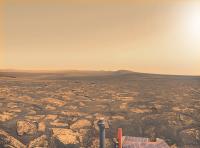
http://www.unmannedspaceflight.com/index.p...st&p=177206 Here is my version, colourized layer by layer with real tints taken from individual colour images. Why such a work ? Because, we decided for various magazines in France to celebrate Oppy's 8th anniversary. When some Editors of large audience magazines saw the colour pan taken recently ("Greeley Panorama"), they found it so "featureless" that they asked me for a special image showing (i) some interesting rock textures, (ii) a breathless view and (iii) looking also like nothing else on Earth... This is why, after a careful viewing of the images taken from the rim of Endeavour Crater, I decided to colourize the NavCams images taken Sol 2678... Not quite from the rim, but truly spectacular. Now, you are really on Mars !!! Enjoy !
|
|
|
|
|
|
|
Feb 8 2012, 07:28 AM
Post
#1560
|
|
|
Member Group: Members Posts: 184 Joined: 2-March 06 Member No.: 692 |
Really breathtaking picture. thanks!
|
|
|
|
|

|
Lo-Fi Version | Time is now: 25th September 2024 - 10:08 AM |
|
RULES AND GUIDELINES Please read the Forum Rules and Guidelines before posting. IMAGE COPYRIGHT |
OPINIONS AND MODERATION Opinions expressed on UnmannedSpaceflight.com are those of the individual posters and do not necessarily reflect the opinions of UnmannedSpaceflight.com or The Planetary Society. The all-volunteer UnmannedSpaceflight.com moderation team is wholly independent of The Planetary Society. The Planetary Society has no influence over decisions made by the UnmannedSpaceflight.com moderators. |
SUPPORT THE FORUM Unmannedspaceflight.com is funded by the Planetary Society. Please consider supporting our work and many other projects by donating to the Society or becoming a member. |
|