MSL "Drive, drive, drive" toward Glenelg, The scientists (mostly) get the keys - sols 38-56 |

  |
MSL "Drive, drive, drive" toward Glenelg, The scientists (mostly) get the keys - sols 38-56 |
 Sep 16 2012, 02:38 PM Sep 16 2012, 02:38 PM
Post
#46
|
|
 Senior Member  Group: Members Posts: 1619 Joined: 12-February 06 From: Bergerac - FR Member No.: 678 |
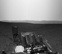
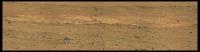
Sol 39 Navcam pan.
-------------------- |
 |
 
|
|
Sep 16 2012, 03:08 PM
Post
#47
|
|
|
Member Group: Members Posts: 470 Joined: 24-March 04 From: Finland Member No.: 63 |
Is anybody attempting to map Curie's positions on sol 39&40? Doing this by eye seems to be more difficult than with MER, since the strategy seems to be to image 360 degrees of navcam thumbnails and full resolution only in the drive direction.
Great to see three sols of back-to-back driving though  -------------------- Antti Kuosmanen
|
|
|
|
|
Sep 16 2012, 03:12 PM
Post
#48
|
|
|
Founder Group: Chairman Posts: 14431 Joined: 8-February 04 Member No.: 1 |
QUOTE (akuo @ Sep 16 2012, 08:08 AM)  Is anybody attempting to map Curie's positions on sol 39&40? Obviously the team at JPL are doing just that, and the amateur efforts will appear here when people have had the time to figure it out http://www.unmannedspaceflight.com/index.p...20&start=20 |
|
|
|
|
Sep 16 2012, 03:40 PM
Post
#49
|
||
|
Senior Member Group: Members Posts: 1619 Joined: 12-February 06 From: Bergerac - FR Member No.: 678 |
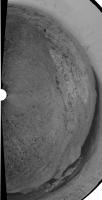
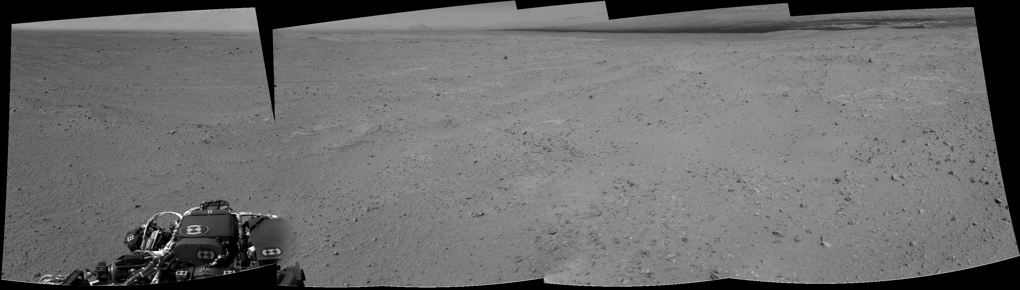
And Sol 40 panoramics. The last with some extra-sky
Attached thumbnail(s)
-------------------- |
|
|
|
|
|
|
Sep 16 2012, 04:03 PM
Post
#50
|
|
|
Solar System Cartographer Group: Members Posts: 10146 Joined: 5-April 05 From: Canada Member No.: 227 |
"Is anybody attempting to map Curie's positions"
Phil reporting from Logan Airport in Boston... finally on my way home. I was just downloading all the nice pans from Ant and others, and by tomorrow I will be busy reprojecting them and estimating locations. Look for a route map update very soon. Right now I am especially interested in any placenames - rock names, Chemcam target names etc. that may have popped up in twitter feeds etc. while my access has been very limited. If anyone has seen anything and can alert me to them \i would appreciate it. Phil -------------------- ... because the Solar System ain't gonna map itself.
Also to be found posting similar content on https://mastodon.social/@PhilStooke NOTE: everything created by me which I post on UMSF is considered to be in the public domain (NOT CC, public domain) |
|
|
|
|
Sep 16 2012, 04:32 PM
Post
#51
|
|
|
Senior Member Group: Moderator Posts: 4279 Joined: 19-April 05 From: .br at .es Member No.: 253 |
QUOTE (akuo @ Sep 16 2012, 05:08 PM) ... the strategy seems to be to image 360 degrees of navcam thumbnails and full resolution only in the drive direction. Not really. If you see a thumbnail almost sure the full-res is there too. It's just a question of downlink queue priorities. The drive-direction images take a higher one while the backwards-looking ones have low prio. |
|
|
|
|
Sep 16 2012, 04:49 PM
Post
#52
|
|
 Senior Member Group: Moderator Posts: 3431 Joined: 11-August 04 From: USA Member No.: 98 |
QUOTE (Tesheiner @ Sep 16 2012, 09:32 AM) Not really. If you see a thumbnail almost sure the full-res is there too. It's just a question of downlink queue priorities. The drive-direction images take a higher one while the backwards-looking ones have low prio. I'd add that this is exactly how it's always worked with MER, except with MER we never got to see the thumbnails on the main raw images page. So this is a nice enhancement, a kind of 'preview' just like the rover team gets. |
|
|
|
|
Sep 16 2012, 08:57 PM
Post
#53
|
|
 Member Group: Members Posts: 222 Joined: 7-August 12 From: Garberville, CA Member No.: 6500 |
Just down within the hour... Six additional full res MC100 frames to fill out the surrounding areas of the interesting Sol 39 Rock formation. Oh my, there's some truly glorious detail in there...

-------------------- "We shall not cease from exploration, and the end of all our exploring will be to arrive where we started and know the place for the first time." -T.S. Eliot
|
|
|
|
|
Sep 16 2012, 10:13 PM
Post
#54
|
|
 Senior Member Group: Members Posts: 1083 Joined: 19-February 05 From: Close to Meudon Observatory in France Member No.: 172 |
QUOTE (Ant103 @ Sep 16 2012, 05:40 PM) And Sol 40 panoramics. The last with some extra-sky How nice ! Thanks a lot Ant 103 for sharing it with us... |
|
|
|
|
Sep 16 2012, 11:43 PM
Post
#55
|
|
|
Senior Member Group: Members Posts: 1619 Joined: 12-February 06 From: Bergerac - FR Member No.: 678 |
And here's my take
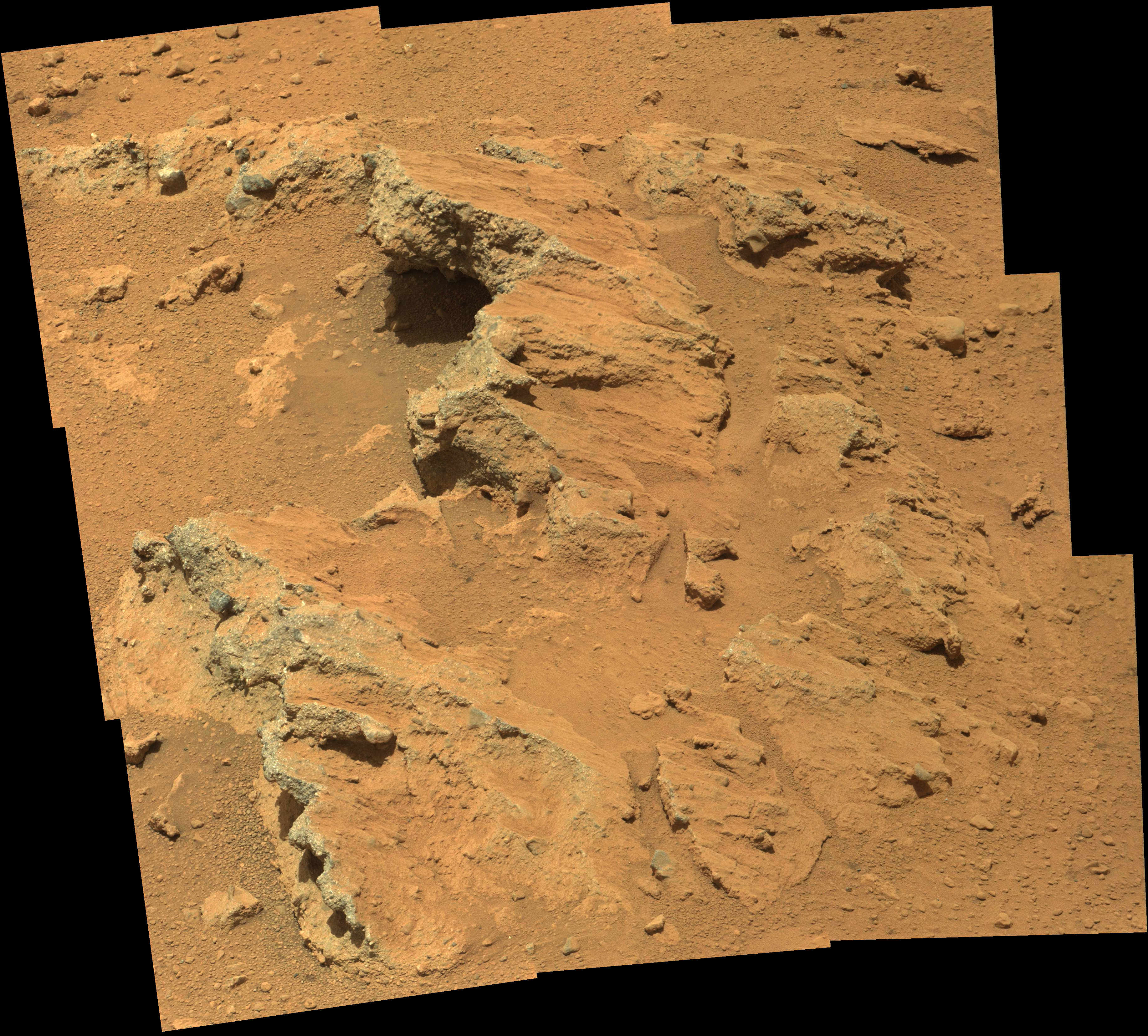 Yes, some good details there, a beautiful rock indeed .Thank you Olivier
-------------------- |
|
|
|
|
Sep 17 2012, 12:57 AM
Post
#56
|
|
 Senior Member Group: Members Posts: 1465 Joined: 9-February 04 From: Columbus OH USA Member No.: 13 |
QUOTE (Ant103 @ Sep 16 2012, 06:43 PM) And here's my take It'd be good to see some ML shots to get 3D views of that. The bedrock or whatever it is kind of looks like asphalt. It seems to be very erodable by the wind/sand, so the pebbles are eroding out of it? -------------------- |
|
|
|
|
Sep 17 2012, 01:27 AM
Post
#57
|
|
 Senior Member Group: Moderator Posts: 2785 Joined: 10-November 06 From: Pasadena, CA Member No.: 1345 |
Very rounded pebbles and cobbles, I might add....
-------------------- Some higher resolution images available at my photostream: http://www.flickr.com/photos/31678681@N07/
|
|
|
|
|
Sep 17 2012, 01:42 AM
Post
#58
|
|||
|
Solar System Cartographer Group: Members Posts: 10146 Joined: 5-April 05 From: Canada Member No.: 227 |
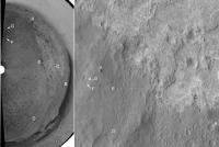
This is Ant103's sol 40 pan in a circular format. I hope we will get the rest of it, but a few points can be matched to HiRISE. The black rock at upper centre is the very prominent block about 200m east of the landing site. Glenelg shows up well, and a prominent crater south of the lighter terrain unit can be seen easily. I have added a key to some of these. (I have not necessarily made the angle of the half-panorama correct, I'll check it later)
Phil
-------------------- ... because the Solar System ain't gonna map itself.
Also to be found posting similar content on https://mastodon.social/@PhilStooke NOTE: everything created by me which I post on UMSF is considered to be in the public domain (NOT CC, public domain) |
||
|
|
|
||
|
Sep 17 2012, 01:49 AM
Post
#59
|
|
|
Senior Member Group: Members Posts: 2998 Joined: 30-October 04 Member No.: 105 |
QUOTE (Juramike) Very rounded pebbles and cobbles Yes indeed, sir. Nice clastics. --Bill -------------------- |
|
|
|
|
Sep 17 2012, 02:52 PM
Post
#60
|
|||
 The Poet Dude Group: Moderator Posts: 5551 Joined: 15-March 04 From: Kendal, Cumbria, UK Member No.: 60 |
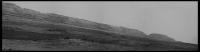
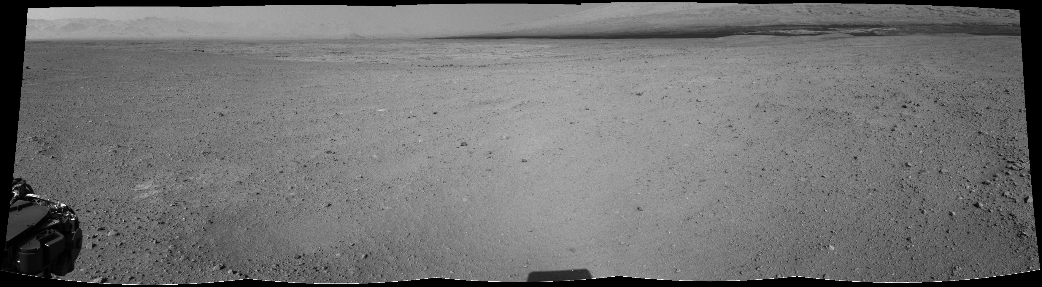
Rather gorgeous view of the foothills of Mt Sharp now...
...and some fascinating geology in view now, too...
-------------------- |
||
|
|
|
||
|

|
Lo-Fi Version | Time is now: 19th April 2024 - 05:11 PM |
|
RULES AND GUIDELINES Please read the Forum Rules and Guidelines before posting. IMAGE COPYRIGHT |
OPINIONS AND MODERATION Opinions expressed on UnmannedSpaceflight.com are those of the individual posters and do not necessarily reflect the opinions of UnmannedSpaceflight.com or The Planetary Society. The all-volunteer UnmannedSpaceflight.com moderation team is wholly independent of The Planetary Society. The Planetary Society has no influence over decisions made by the UnmannedSpaceflight.com moderators. |
SUPPORT THE FORUM Unmannedspaceflight.com is funded by the Planetary Society. Please consider supporting our work and many other projects by donating to the Society or becoming a member. |
|