Printable Version of Topic
Click here to view this topic in its original format
Unmanned Spaceflight.com _ Opportunity _ From Concepción to the "Twin Craters"
Posted by: fredk Mar 10 2010, 03:22 AM
Farewell Conception?
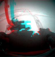
http://qt.exploratorium.edu/mars/opportunity/forward_hazcam/2010-03-09/1F321456654EFFABWUP1211R0M1.JPG
Posted by: Poolio Mar 10 2010, 03:58 AM
Sure looks that way. I reckon she covered about 55m to the WSW. Time for a new thread?
Posted by: BrianL Mar 10 2010, 04:43 AM

I'm really enjoying the view of Concepcion now!

Posted by: Bill Harris Mar 10 2010, 05:28 AM
I may be misinterpreting, but it looks like we've left. I make a heading of Southeast.
Bye bye Concepcion... 
--Bill

|
Posted by: Stu Mar 10 2010, 06:58 AM
As the great man used to say...
Allons-y!!!!
|
Really enjoyed our stay at Concepcion, and think that in years to come the study of the "Chocolate Hills" will come to be seen as one of the mission highlights... wonder what the geologists learned about Mars' history there? ... but yes, time to move on. Wonders await!
Posted by: ustrax Mar 10 2010, 11:43 AM
Is everyone onboard? Next stop: Santa Maria! (with a brief halt at Twin Craters in order to satisfy your physiological needs Meridiani journeyers) 
Posted by: Tesheiner Mar 10 2010, 11:47 AM
There're roughly 600m from our current position to the twin craters and the odometry is now near 19500m, so that means the 20km mark will be reached during this leg.
20km! Unbelievable!
Posted by: ustrax Mar 10 2010, 12:17 PM
Yes, unbelievable but 3 months and 1 week behind schedule according to my predictions...are we there yet?
|
Posted by: Stu Mar 10 2010, 06:12 PM
Hmmm. I like Concepcion... and I also like the Twin Craters... but which is best?
There's only one way to find out...
|
Left hand images (IAS Viewer 1x) to same scale. Right hand images (IAS viewer 4X) to same scale too.
Posted by: Explorer1 Mar 10 2010, 11:16 PM
Is it possible to tell whether they formed at the same time, from one impact event, or are just next to each other by coincidence?
Posted by: Shaka Mar 10 2010, 11:30 PM
If one happened significantly later than the other, it would have mostly filled it (the earlier) in with ejecta.
Posted by: Floyd Mar 10 2010, 11:31 PM
I would guess the same time. If one was formed later, I would think ejectra from the second would be obvious in the first. Good question.
[edit] Shaka posted about 30 seconds faster.
Posted by: ngunn Mar 10 2010, 11:48 PM
Even so, it's likely that one was formed just a fraction sooner than the other as sparated bolides are unlikely to travel at exactly the same speed. I reckon the one on the left is later by half a second (or less).
Posted by: Mirek Mar 11 2010, 12:15 AM
I think that the key is the shape of the "border" wall between those two craters. It looks like both of their shapes have been altered by simultaneous formation.
Posted by: marsophile Mar 11 2010, 09:18 PM
Many if not most of the pancam and navcam images down at exploratorium today are corrupted. Problem with Oppy?
Posted by: Stu Mar 11 2010, 09:27 PM
Not necessarily. **** happens. She still sent back some nice parting shots of Concepcion...
http://twitpic.com/17yy6c
Posted by: Phil Stooke Mar 11 2010, 09:38 PM
Worst ... artifacts .... everrrr!
Phil
Posted by: Stu Mar 11 2010, 10:02 PM
Having a really hard time making anaglyphs out of them...
Posted by: djellison Mar 11 2010, 10:33 PM
A ratty UHF comms pass ( perhaps with the UHF antenna to orbiter line of sight being interrupted by the LGA or PCMA ) and it on'y takes a few dropped packets to corrupt lots of pictures.
Note that the corruption is in lots of images of a wide range of time. They are not all taken today, for example, inferring a problem with transmission or receipt rather than the actual data or the rover itself.
Posted by: Stu Mar 11 2010, 10:51 PM
Maybe a family of gorillas wandering past got too close and accidentally knocked the antennae out of alignment... 
Posted by: Tesheiner Mar 12 2010, 06:47 AM
Nah! Too far from their niche. Oh, perhaps we're talking about the "Gorilla Meridiannii"; that's a different species.
Now, back to business: a 70+ meter drive SW was performed some hours ago. Waiting for the pictures...
Posted by: Louise Sharples Mar 12 2010, 11:41 AM
I'm sure I read in the MER technical guides that UHF passes are always error-free (which if true, points to an orbiter-to-DSN issue). I hope this isn't due to the loss of DSS-14...
Posted by: djellison Mar 12 2010, 12:40 PM
Then you've read wrong. Whatever the problem was, it was clearly temporary as the most recent down link was fine. The UHF passes are pretty damn reliable, but they're not perfect.
http://an.rsl.wustl.edu/mer/merbrowser/browserFr.aspx?tab=res&m=MERA
Four CSV's at the bottom of this page are of UHF passes and have a data quality field, you can see many data dropouts within them.
Posted by: Tesheiner Mar 12 2010, 03:39 PM
It's impossible to warrant zero errors on any kind of electromagnetic transmission, so "error-free" can only mean that errors are detected and not propagated.
Besides, I'm pretty sure that this "error-free" (if true) applies to the telemetry packets exchanged between the rovers and the orbiters; we are not talking about image files but only about the chuncks that will later on be assembled in a file. You may have error-free packets but still only, say, 10% of the packets making an image file correctly transmitted.
Now, with all of this into account, try to imagine how a heavily compressed JPEG picture will look like when 90% of data are missing and the 10% which are there has no errors. Perhaps like this: http://qt.exploratorium.edu/mars/opportunity/navcam/2010-03-11/1N321004676EFFABLNP1665L0M1.JPG
Posted by: Louise Sharples Mar 12 2010, 04:05 PM
Indeed, but the data quality field suggests that '1' could represent DSN issues:
Posted by: Louise Sharples Mar 12 2010, 04:08 PM
Very good point.
Posted by: djellison Mar 12 2010, 04:18 PM
If it were a DSN issue, then we would likely have heard about problems with MRO, MEX and MODY downlink - not just Opportunity.
It would be most strange for a DSN issue to interject occasionally, within the downlink time of the packets from MER UHF passes.
Posted by: Deimos Mar 12 2010, 05:07 PM
Thanks to all posters for this--the good news is I would not have known about it unless I happened to check here. I have forwarded the concern and included it in my downlink report. In a spot check, I see the affected images as being associated with (I cannot speak to causality) the images being reprocessed into the right sol. So, good images exist, and I hope the problem (late) in the pipeline will be resolved soon.
Edit: PS, got a good laugh about UHF passes always being error free... I agree with most of the commentary following that. In theory, all bit errors are trapped and do not propagate, except some small fraction. In practice, there was a time when errors got through all the time. And the images then looked just like what is at Exploratorium now. Since the on-board compression is (usually) a wavelet based one, simple dropouts look different (missing or blurry rectangles) from this and from some JPEG errors.
Posted by: ElkGroveDan Mar 12 2010, 05:27 PM
Ah...in (nerdy) layman's terms those would be the Borg ships we occasionally see, as compared to the monochrome bed quilt http://qt.exploratorium.edu/mars/opportunity/navcam/2010-03-11/1N321004676EFFABLNP1665L0M1.JPG.
Posted by: djellison Mar 12 2010, 05:58 PM
I'm trying to think of the various times we've had few, borked, or no images - apart from ODY safe modes, most of the time it's been problems on the ground with scripts, processing etc rather than a problem inboard the spacecraft.
Posted by: paxdan Mar 12 2010, 06:32 PM
Low temp stopping the PANCAM filter wheel from rotating fully so the frame of the filter wheel was visible is all i can remember. I think you even interviewed Jim Bell about it:
http://www.planetary.org/explore/topics/mars_exploration_rovers/audio.html
Rover Audio Update, April 27, 2006
Pancam Update with Jim Bell
MP3 format (running time 28:27)
Doug Ellison, the host of the online forum unmannedspaceflight.com, interviews Pancam Payload Element Lead Jim Bell about:
* Low Ridge Haven: Pre-planning for Spirit's long winter stay
* Victoria Crater just on the horizon
* Tilt or Latitude for extra power
* Coping with streaks and noise in images
* Taking pictures in the cold: stuck filter wheel
* Albedo and photometry: ground truthing orbital observations
Posted by: Stu Mar 12 2010, 07:20 PM
Outcrop up ahead... our next stop?

|
Posted by: ustrax Mar 12 2010, 07:41 PM
Keep it quiet Stu...maybe they won't notice it...
Posted by: nprev Mar 12 2010, 07:58 PM
Now, now, Rui! The purpose of a journey is not to reach a destination, it is to experience the trip itself...
Posted by: Bill Harris Mar 12 2010, 09:25 PM
We saw many "fracture fills" at Concepcion. This bluff or step may be the surface expression of a fracture or an "Anatolia feature" and remember that some of the Anatolia features trend NW-SW, so this will put it well in line with fractures in the Concepcion area. Not proposing a full-blown science stop, but hoping that we won't breeze right by the outcrop. As far as I can tell, it's right on the projected path (I think... I can't get used to the drive path cutting across ripples).
--Bill
Posted by: Beauford Mar 12 2010, 11:36 PM
I'm a little apprehensive about posting this given the skill level here, but here is my first attempt at an anaglyph using the March 12 navcam images. I suppose this location is a lot like many others, but "standing here" gives me a sense of relaxation.

|
Posted by: walfy Mar 13 2010, 02:49 AM
The left and right eyes are reversed, had to flip my glasses to make it work!
Posted by: Zeke4ther Mar 13 2010, 03:54 AM
No worries. That's what we do here, learn and post.
Welcome to the forum.
Posted by: Phil Stooke Mar 13 2010, 02:17 PM
"Now, now, Rui! The purpose of a journey is not to reach a destination, it is to experience the trip itself... "
Hey, it's a Luno-KHOD, not a Luno-STOP! Oh, sorry, wrong world. But right sentiment!
Phil
Posted by: ElkGroveDan Mar 13 2010, 03:51 PM
Phil I think Rui's point in moving on is just that, moving on. As soon as we get to Endeavor he'll be dreaming about Bopolu Crater.
Posted by: climber Mar 13 2010, 11:29 PM
you're even shortsighted, Dan 
Posted by: Tesheiner Mar 14 2010, 10:02 AM
They didn't. :-P
We're already past it after the last move.
Posted by: nprev Mar 14 2010, 10:11 AM
Huh. I'm actually a bit surprised.
On the other hand, the team may have determined that when you've seen one outcrop of Meridiani bedrock (in Oppy's current region anyhow), you've seen them all. They know there's mineralogically different terrain ahead. The chance to directly examine phyllosilicates might just start trumping stops for anything that's not obviously & radically unusual...
Posted by: Bill Harris Mar 14 2010, 06:08 PM
True, and looking at this area again, the outcrop may be on the rim of a buried eroded crater. "Nothing to see folks, move along..."
As far as I can see the next important stop will be Twin Crater, a major "road cut" on the route. Then things may get interesting-- we get off of the aeolian peneplain we've been on forever and start going downslope. The distant vista will improve and we might start to get lower in the geologic section.
--Bill
Posted by: belleraphon1 Mar 14 2010, 11:16 PM
On the other hand, the team may have determined that when you've seen one outcrop of Meridiani bedrock (in Oppy's current region anyhow), you've seen them all. They know there's mineralogically different terrain ahead. The chance to directly examine phyllosilicates might just start trumping stops for anything that's not obviously & radically unusual...
I have to agree here. Personally I am eager to get to some new geology. Tough, though, when almost every rock and cobble looks so inviting. Wouldn't we all love to pick up some of these, crumble Mars between our fingers. Sigh!
Craig
Posted by: ustrax Mar 15 2010, 08:40 AM
Bopolu Crater?...Isn't this the Valles Marineris trip? Sorry looks like I got in the wrong bus...
Posted by: Stu Mar 17 2010, 06:28 AM
Scott Maxwell Tweeted earlier:
"It's gonna be a lean Martian winter: tomorrow's my first shift in a couple of weeks, but Oppy has too little energy to drive. Recharge sol. "
Posted by: Tesheiner Mar 17 2010, 06:49 AM
I read that too. Note that he's talking about planning so the recharging sol will be tomorrow; today was driving sol and the images might hit the ground in a few hours.
Posted by: Stu Mar 17 2010, 03:44 PM
Love the wind-sculpted patterns of these dunes...

|
Posted by: Tesheiner Mar 17 2010, 05:02 PM
I have the impression, based on these images and the HiRISE too, that the ripples to the SW are becoming smaller.
Flat ground ahead?
Posted by: Sunspot Mar 17 2010, 05:02 PM
It looks so lonely there, poor rover.
Posted by: Bobby Mar 17 2010, 10:22 PM
Just curious about something. After twin crater how much of an elevation change will there be going downhill?
Will the drop in elevation be more then how deep Victoria Crater is? Will the exposed rock still be the
same ones the rover sees now or will they be older as we drop in elevation?
Posted by: Tesheiner Mar 17 2010, 11:27 PM
We're going about 50m downhill from here to Santa Maria and perhaps another 50m from there to Endeavour.
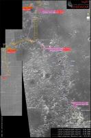
Tim Parker (tim53) posted a topographic map somewhere here... edit: got it! http://www.unmannedspaceflight.com/index.php?s=&showtopic=6438&view=findpost&p=155924
Posted by: Tesheiner Mar 19 2010, 08:45 PM
I think we can see the twins on this today's pancams.

|
Original: http://qt.exploratorium.edu/mars/opportunity/pancam/2010-03-19/1P322251408EFFAD00P2394L6M1.JPG
Only 300m to go. If we keep the current pace that means some 4-5 driving sols or, in other words, next weekend if we're lucky.
BTW, the 20km mark will be crossed soon.
Posted by: fredk Mar 19 2010, 11:55 PM
Or at least one of the twins - they should be about twice as wide as your marker now.
Posted by: Tman Mar 20 2010, 07:13 AM
It seems with the last drive we gained a bit height. The two should be about here:

|
Posted by: nprev Mar 20 2010, 07:35 AM
The dunes are getting a bit, uh 'choppy-looking'.
Interesting; wonder if we're beginning to see some topographic wind effects on their formation patterns.
Posted by: Bill Harris Mar 20 2010, 12:54 PM
I've been thinking the same thing about the dune morphology.
As we approached/ arrived at Concepcion, I noticed that between the usual longitudinal (N-S trending) ripples transverse dunes (ripples) had started to appear. Given a set supply of sand and/or a set wind velocity, the sand will settle into a quasi-stable longitudinal dune configuration. I attributed the appearance of the transverse dunes as a local increase in sand supply as a result of the rubble created by the impact and the weathering at Concepcion.
However, after we left Concepcion I noted that the transverse dunes were still present, clearly "upwind" of any sand created by that impact. As we saw on on the approach and look-back at Concepcion, the crater is on a slight rise. What I am thinking is that the local topographic high has created a small wind shadow with slightly lower wind velocity to the north of Concepcion. Once we passed by Concepcion, the wind velocity increased slightly.
No direct meterological data here, just an observation of how the sand is behaving.
--Bill
Posted by: eoincampbell Mar 20 2010, 02:31 PM
Is there a "prevailing" wind as such at Meridiani?
Posted by: fredk Mar 20 2010, 02:59 PM
Hopefully you're right, Bill - we could use some stronger winds to clean the arrays a bit.
As far as prevailing winds, they do vary seasonally as the streaks emerging from Victoria crater showed.
Posted by: Bill Harris Mar 20 2010, 05:09 PM
Hopefully she will get some array-cleaning winds. A Watt-Hour Zephyr?
One side-observation I've made is noting an accumulation of dust at the top of the Low Gain Antenna starting sometime around Sol 1710, the stopover at Santorini. No idea why a ring of dust would accumulate at this spot, but it ought to serve as an indicator of wind (or lack thereof?). But I digress, I'll open a separate thread on this particular puzzle. Here is a recent Sol 2125 Navcam of the phenom...
http://origin.mars5.jpl.nasa.gov/gallery/all/1/n/2125/1N316834706EFFAA00P1987L0M1.HTML
--Bill
Posted by: Stu Mar 20 2010, 10:55 PM
Are we seeing Twin Craters top left there?

|
Probably not. Seriously, I'm feeling quite lost and disoriented at the moment. About time we found another meteorite to let me get my bearings!
Posted by: fredk Mar 20 2010, 11:05 PM
No, that view's to the north. The giveaway is the bit of tracks you can see in the original image.
Posted by: Astro0 Mar 20 2010, 11:13 PM
Stu? Lost?! Physically in Kendal, Cumbria, UK, and mentally on Mars as always surely!
Posted by: djellison Mar 20 2010, 11:19 PM
He doesn't use MMB 
Posted by: Stu Mar 20 2010, 11:33 PM
Ah, ok, thanks Fred. Think I'll just sit here in the back seat, quietly reading my magazine and listening to my MP3 player; someone give me a shout when we get there...
Posted by: nprev Mar 21 2010, 12:29 AM
That reminded me...I finally just now installed MMB on my new computer (old one couldn't handle it)...WOW!!!
It's truly remarkable, Mike; thanks!!!
Posted by: mhoward Mar 21 2010, 01:28 AM
You're welcome. I actually find it a little embarrassing now, since I don't have time to make it as good as it should be, or even maintain it.
Posted by: brellis Mar 21 2010, 02:31 AM
MMB? Qu'est-ce que sais?
Posted by: nprev Mar 21 2010, 02:58 AM
C'est http://code.google.com/p/midnightmarsbrowser/.
(...and he's embarrassed by it!!! Would that I could accomplish something even a hundredth as embarrassing by that token... )
Posted by: Stu Mar 21 2010, 10:29 AM
Just want to clarify that my lack of MMB is nothing to do with the prog itself! It's just a combination of having a Jurassic era PC that groans in protest if I dare to open Photoshop and Google Earth at the same time, and finding a somewhat perverse enjoyment in manually logging on to Exploratorium every morning when I get up, or when I get back from work later in the day, and having a "yes!!!" moment when I see there are new raws for me to play with. I'm sure I'll download and love MMB when I afford to get a new PC, later this year.
BTW, latest MER-inspired poem here, if anyone wants a look... best to click on "full size" if you want to read it without damaging your eyes...
http://twitpic.com/19zn62
(Text only: http://astropoetry.wordpress.com/2010/03/21/museum-peace )
Posted by: Bill Harris Mar 21 2010, 11:27 AM
I'm the same way. MMB is a great program, but there is a certain aesthetic to logging on and manually collecting Rover gems.
--Bill
Posted by: Tesheiner Mar 21 2010, 03:08 PM
That's what I do too.
Back to the main topic and our next waypoint, we're 70m closer to them. I think the crater is the dark feature visible on the top left corner of this pancam image: http://qt.exploratorium.edu/mars/opportunity/pancam/2010-03-21/1P322432004EFFADFPP2397L6M1.JPG. There's another shot to the left of this one but unfortunately it doesn't cover the whole horizon so we're missing the whole picture.
Posted by: fredk Mar 21 2010, 03:18 PM
This R1 frame shows more of the twins (plus it's a bit sharper than the L6), upper left:
http://qt.exploratorium.edu/mars/opportunity/pancam/2010-03-21/1P322432004EFFADFPP2397R1M1.JPG
I wonder when they'll first look recognizably like craters?
They're also faintly visible as a light streak along the midlle-left horizon in this navcam view:
http://qt.exploratorium.edu/mars/opportunity/navcam/2010-03-21/1N322431506EFFADFPP0705R0M1.JPG
Again lots of duplicate images in the latest exploratorium batch. This time they don't even have the different suffix M7. For example, here's an image that's appeared twice:
http://qt.exploratorium.edu/mars/opportunity/navcam/2010-03-21/1N322251282EFFAD00P0713R0M1.JPG
http://qt.exploratorium.edu/mars/opportunity/navcam/2010-03-19/1N322251282EFFAD00P0713R0M1.JPG
Posted by: Tesheiner Mar 22 2010, 09:21 PM
Pretty low activity (actually zero) on this thread on the last 24h, isn't it?
Let's see if it changes after the next images' downlink which should happen in 18h or so. I'm looking forward new pictures from a point 70m (?) closer to those craters. Hopefully, we'll be there before the weekend.
Posted by: Stu Mar 23 2010, 12:14 AM
Made from some of today's lower quality pancams...
|
|
Posted by: fredk Mar 23 2010, 02:09 AM
Thanks for that, Stu. The north rim of Endeavour should be on the left side of that mosaic, but it's not visible - that shows how we've gone over a ridge at Concepcion and have dropped down a ways.
Posted by: fredk Mar 23 2010, 02:32 PM
Something's there:
http://qt.exploratorium.edu/mars/opportunity/pancam/2010-03-23/1P322605880EFFADNWP2399R1M1.JPG
If it weren't for the orbital imagery I'd never guess it was a pair of craters...
Posted by: Bill Harris Mar 23 2010, 02:49 PM
Let's see if it changes after the next images' downlink which should happen in 18h or so.
I notice a few color Pancams and Navcams of ripples and Rover tracks, which makes me think that they've noticed something new afoot. I'm waiting til tomorrow's imagery is downlinked, but if anyone else has ideas they want to show, go ahead.
--Bill
Posted by: Stu Mar 23 2010, 03:10 PM
Yep, definitely something there...

|
Couple of days away from Quite A View, I reckon...
Posted by: Tesheiner Mar 23 2010, 03:16 PM
I'm pretty much convinced there will be almost nothing but only a few eroded remnants to see.
Get there, take a few pancam shots here and there and
Edit: I was typing the post while you did yours, Stu.
"Couple of days away from Quite A View": Are you talking about the craters or the view that should open to the horizon?
Posted by: marswiggle Mar 23 2010, 06:15 PM
The ground truth will be revealed soon, but before that, let this HiRise anaglyph speak (in 2 x original size). The central ridge between the Twins seems to offer a nice opportunity for some rope-dancing for Opportunity.
P.S. I have included an unusual-looking craterlet or whatever it is at the lower right of this frame.

|
Posted by: elakdawalla Mar 23 2010, 06:21 PM
That's cool -- I definitely had not appreciated how high the inter-crater ridge was before I saw that 3D view. Thanks!
Posted by: fredk Mar 23 2010, 06:42 PM
Quite a thought! I make the central isthmus to be around 1.5 metres wide, and it looks like reasonably flat bedrock. The rover wheelbase is around 1.2 metres.
 Of course, there likely won't be any reason to take that kind of risk, but I suspect any rover driver would salivate at the thought of that kind of precision driving!
Posted by: john_s Mar 23 2010, 09:52 PM
I notice there's also a high ridge on the west side of the western crater of the pair. I therefore would guess that both ridges are aeolian, each resulting from the crater to its east (and therefore probably not great footing for Oppy). We'll know pretty soon.
John
Posted by: marsophile Mar 23 2010, 10:45 PM
The two ridges seem to have a different brightness though, with the west ridge more like the ripples, while the ridge between the craters more resembles the pavement material.
Posted by: Tesheiner Mar 23 2010, 10:57 PM
I see that another consecutive driving sol has been planned. Since we're around 200m from the craters that makes for three driving days, including thisol 2191, to get there and in normal conditions that would mean this weekend. But given the limited energy of Opportunity during this season I'm not sure if a "recharging sol" or two will be needed or not. Let's see.
BTW, the odometer is right now at 19970m so the 20km mark will almost certainly be crossed thisol.
Posted by: Bill Harris Mar 23 2010, 11:59 PM
Assuming that the impacts were simultaneous, I'd suspect that the central ridge is the result of two reinforcing shock fronts and consists of highly fractured and "bulked" bedrock. Seems though, that it would weather/erode more readily than the usual broken ejecta rubble, but we'll see the story in a few sols.
I just did some reminiscing on the approach to the North Rim of Erebus (Sol620-ish). Now, those were DUNES, and it was a skillful task of navigation that got her through that.
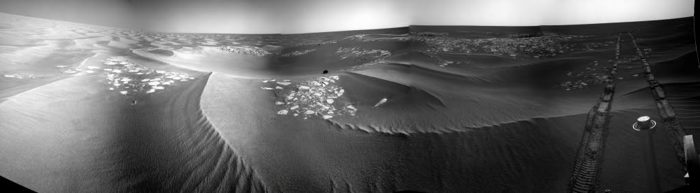
Attached is an annotated 5x-vertical exaggerration of one of today's Pancams of the Twin Craters...
--Bill

|
Posted by: Astro0 Mar 24 2010, 12:12 AM
Hah! Any really talented rover driver wouldn't stop at just driving between the craters!!!

|
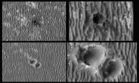
Posted by: Juramike Mar 24 2010, 12:27 AM
There was a few presentations at LPSC 2010 on recent impacts seen by HiRise on Mars. What was wierd to me was that of the new impacts, about 42% are single craters, while 58% are multiple crater.
[Immediately after impact, many are dark from the airburst shockwave pressure-drop "sucking" the dust into the air. (Interestingly enough, the shockwave compressive wave itself is not enough to lift dust - ca. 5 mPa)]
Twin Craters probably looked similar to Figure 3 in the Ivanov abstract right after impact, except probably excavated much deeper and with an intervening pavement ridge thrust up between the two craters. There was likely an impressive parabolic shockwave stained (cleaned) on the surface.:
Ivanov et al. LPSC 41 (2010) Abstract 2020: http://www.lpi.usra.edu/meetings/lpsc2010/pdf/2020.pdf
I wonder if the raised pavement will reveal details of the frozen shock front? Who made the bigger splat? Which hit first?
Posted by: elakdawalla Mar 24 2010, 12:54 AM
Funny, I have a different challenge for the drivers:

|
Posted by: JayB Mar 24 2010, 01:00 AM
the girls (well Oppy at least) get even smarter
http://www.jpl.nasa.gov/news/news.cfm?release=2010-094
very cool stuff
Posted by: ups Mar 24 2010, 01:05 AM

|
Posted by: Bill Harris Mar 24 2010, 02:01 AM
We are finding that many asteroids are complex rubble piles instead of simple large rocks and I wouldn't be suprised if many meteors turned out to be small rubble piles (agglomerations?). Back when, it was thought that many of the meteors seen in Earth's atmosphere were fragile, friable pieces since they disintegrated so easily, so it might be that they are small rubble piles. This might be the reason for the prevalence of multiple impacts on Mars.
We'll know in a few days.
--Bill
Posted by: brellis Mar 24 2010, 04:53 AM
Homer Simpson? George Jetson? I could swear it looked like Elvis was there!
Posted by: Stu Mar 24 2010, 06:23 AM
"Couple of days away from Quite A View": Are you talking about the craters or the view that should open to the horizon?
No, I meant the view of the craters themselves; I think it will be aesthetically pleasing, even if it's not that dramatic, if that makes sense. (i.e. there won't be lots of rocks and boulders and ejecta scattered about, a la Concepcion, but the combination of two craters, that ridge between them and the dust inside them will, I think, make for some uniquely 'martian' pictures, especially if we get some 'low angle lighting' views.) We'll just have to wait and see - shouldn't be long now!
Posted by: Stu Mar 24 2010, 03:46 PM
Getting there...

|

|
Some more pix: http://roadtoendeavour.wordpress.com/2010/03/24/approaching-the-twins
Posted by: Bill Harris Mar 24 2010, 03:52 PM
New navigational PanCams this morning. Here is a pan of two R1, exagerrated 3x and contrast-tweaked. Some detail starting to be seen in the West Twin-- fore and aft rim, the East Twin is still behind the Center Ridge and low in the ripples. We need to get some L257 and R721 on the approach, maybe they'll be downlinked this evening (or later this week).
--Bill

|
Posted by: Tesheiner Mar 24 2010, 04:12 PM
Here's the view looking back at the tracks.

|
Posted by: Bill Harris Mar 24 2010, 04:28 PM
...I thought that she was getting a bit frisky driving over the ripples. You can almost imagine her being a little WALL_E-like and jumping the crests...
http://qt.exploratorium.edu/mars/opportunity/navcam/2010-03-24/1N321006295EFFABMIP1994L0M1.JPG
--Bill
--Inline image changed by link. Mod.
Oh my, I'm sorry-- I did the "URL" tag first but the image didn't show, so I edited it to the "IMG" tag. Age-related "CRS"...
Posted by: kenny Mar 24 2010, 09:01 PM
We knew this 20km was coming up, but seeing it there pointed out by Tesheiner, the impact is more than the intellectual knowledge.... can 20km really be true? 20km !!! Gasp!
Posted by: walfy Mar 24 2010, 10:02 PM
Probably a dumb question, but does the 20km include all the wheel spinning when Oppy got trapped in Purgatory?
Posted by: Tesheiner Mar 24 2010, 10:04 PM
No it doesn't.
Check the odometry included in the status reports covering that timeframe.
Edit: what is does include is the wheel turns when the rover is doing a turn-in-place manouver; the rover spins around with no net advance but only a heading change.
Posted by: Bobby Mar 25 2010, 10:43 PM
I have a question about the Batteries on Opportunity? I thought I read a while back
that they were designed for 2,000 recharges. If they were then where are we at now
for both rovers??? 
Posted by: djellison Mar 26 2010, 12:17 AM
Look for the JPL tech reports. No one designs batteries that last 2000 cycles then suddenly stop working. THey have had a very slow gradual degradation in performance but still have a significant proportion of their orig. capacity remaining.
Posted by: SFJCody Mar 26 2010, 06:55 PM
Patiently awaiting tosols post driving images...
Posted by: SFJCody Mar 26 2010, 08:14 PM
And here they are!
http://qt.exploratorium.edu/mars/opportunity/pancam/2010-03-26/1P322877016EFFAE00P2402L6M1.JPG
The twin craters look a bit more dramatic than I had expected.
Posted by: Sunspot Mar 26 2010, 08:14 PM
http://qt.exploratorium.edu/mars/opportunity/forward_hazcam/2010-03-26/1F322879471EFFAE00P1211R0M1.JPG
Posted by: Tesheiner Mar 26 2010, 08:19 PM
And here's a quick & dirty navcam mosaic.

|
Now, it's time to make a polar view and register it on the route map... http://www.unmannedspaceflight.com/index.php?s=&showtopic=681&view=findpost&p=157653.
A quick look on the mobility info tells the drive was 60+ meters and we are around 70m from the craters.
Agree.
Posted by: climber Mar 26 2010, 08:23 PM
.../... meanwhile, Eduardo's working on the route map .../...
Posted by: Stu Mar 26 2010, 08:37 PM

|

|
Looks like there is some pretty interesting rock exposed over there, Oppy... go get!
Posted by: Explorer1 Mar 26 2010, 08:46 PM
Deeper then we expected, that's for sure.
Is 1 or 2 more drives till arrival a good estimate?
Posted by: ElkGroveDan Mar 26 2010, 08:52 PM
Apparently Hadrians Wall went a lot farther than anyone imagined.
Posted by: Stu Mar 26 2010, 08:54 PM
Never try and "estimate", just look forward to. The moment you put an estimate on anything like this, Mars thinks "Ha! That's what YOU think!" and then gives you a Benny Hill slap on the head then runs away, giggling. Just enjoy the ride!
Posted by: Stu Mar 26 2010, 08:56 PM
Love that!
Hadrian's Wall is pretty impressive, but his Conservatory was a masterpiece...
Posted by: Tesheiner Mar 26 2010, 09:36 PM
I was right now looking to the map in GE and saw the same thing. Well, first SE for some hundreds of meters and then finally due east.
And if you have a look to the map, specially the GE version, there's a sudden drop in the ripples size aprox. 200m after the craters; IMO, this may be due to a change of the wind flow in that area probably because of a different, mmm, angle (?) of the terrain.
Edit: moved to the main thread.
Posted by: SFJCody Mar 26 2010, 09:52 PM
More driving scheduled for sol 2194. I'm amazed she has enough energy!
Posted by: climber Mar 26 2010, 10:01 PM
No energy needed here, we're just going down...
Posted by: Bill Harris Mar 26 2010, 10:36 PM
Here are todays approach Pancams (1P322876942EFFAE00P2402R1M1, et al, Sol 2193) panorama'd, exaggerrated 3-fold and referenced to a HiRise orbital image.
Driving tomorrow? Good!
--Bill

|
Posted by: Tesheiner Mar 26 2010, 10:51 PM
And by this time tomorrow, if not earlier, we'll probably have official names to them.
Posted by: fredk Mar 26 2010, 11:05 PM
I think we're still not seeing much of the far crater of the twins. Here's a crude estimate of where the two craters are (the far ellipse should be lower):

|
Amazing how we're basically on top of the twins and still can't see their full extent.
Mosaic is from Stu.
Posted by: nprev Mar 26 2010, 11:45 PM
Not much in the way of ejecta aprons, it seems. Odd. Then again, Victoria didn't have much of one either.
Posted by: Bill Harris Mar 27 2010, 01:36 AM
> Not much in the way of ejecta aprons, it seems.
This is the great puzzle here. One would assume that the Twins are older and that the ejecta rubble has simply weathered and eroded. But looking at the ejecta at Concepcion, expecially the NE ray, the weathered, still in-place material has a significant volume to be blown away without leaving a trace. By "without a trace", I mean no effect on the pre-existing ripples (except withing a few meters of the crater rims). I'd suspect that we may see a difference in the distribution of the blueberies since they would tend to be left behind after the evaporite matrix is weathered and eroded away.
There is more to this erosional process than what firrst meets the eye.
> Then again, Victoria didn't have much of one either
But it does. Eroded, very smooth, unrippled, it is clearly a blanket over the pre-impact terrain.
--Bill
Posted by: brellis Mar 27 2010, 05:41 AM
hi all,
I tried to search for the answer to these questions, couldn't find 'em.
How many kilometers have the test rovers driven?
Have they tried to drive a test rover on a long trek like this?
Did they attempt anything like such a drive during the mission development stage?
Thanks, and as always, GO TEAM!!
Posted by: djellison Mar 27 2010, 07:19 AM
Similar question has been asked before - but I think the answer was a 'don't know'
As for development? They were designed for 600 - 1000 m so testing them for 20km+ was never going to be a requirement.
Posted by: nprev Mar 27 2010, 07:38 AM
I think maybe a more illuminating set of questions would involve the heritage of the drive system components & whatever testing they were subjected to if they've been used for any terrestrial applications.
Certainly Sojourner must have provided considerable pathfinder (ta dah, dah!) data for the MERs, but obviously all the moving parts are bigger, stronger & faster. Likewise, MSL's drive system is an evolute of MER; the questions are in what specific ways?
(OT for this thread, but very interesting. The engineering results from MER will probably be at least as valuable in their own way as the science over the long term.)
Posted by: AndyG Mar 27 2010, 11:05 AM
That sounds dangerously close to suggesting you'd like a future MER sample/return mission!
Andy, still unable to reply with FF 3.6.2 ...
Posted by: Ant103 Mar 27 2010, 12:22 PM
Hi,
Back from a break (I think you can understood that sometimes we need to rest) of processing pictures, I started to make again (and again) colors of Oppy.
Much more interested by the pretty amazing view of Endurance rims on the horizon, like on Sol 2169 :
http://www.db-prods.net/marsroversimages/Opportunity/2010/Sol2169-pancam.jpg
or Sol 2191
http://www.db-prods.net/marsroversimages/Opportunity/2010/Sol2191-pancam.jpg
And here is the view of the approaching of "Twin Craters" (no names so I presume ?)
http://www.db-prods.net/marsroversimages/Opportunity/2010/Sol2193-pancam.jpg
Posted by: Stu Mar 27 2010, 03:44 PM
Good work, Ant, good work...
Posted by: Tesheiner Mar 27 2010, 05:55 PM
According to the mobility info, we are there! Actually, 10m N of the west crater.
Can't wait for the images!
Posted by: Sunspot Mar 27 2010, 06:14 PM
WOW that was quick, doesn't seem long ago they were 300m away.
Posted by: ngunn Mar 27 2010, 07:39 PM
This is the great puzzle here.
I seem to remember there's thought to be a certain thickness of Meridiani stuff (several metres, I can't remember how many) which erodes down until the covering of residual blueberries is dense enough to halt the process. Any crater too small for it's ejecta apron to exceed that critical thickness might be expected to erode down all the way to the original surface, leaving (as you suggested) an excess of blueberries as it's only trace. I wonder what that critical crater size is?
Posted by: fredk Mar 27 2010, 07:46 PM
Hello twins!
http://qt.exploratorium.edu/mars/opportunity/navcam/2010-03-27/1N322970469EFFAEDXP0717R0M1.JPG
The isthmus runs through the centre of this frame:
http://qt.exploratorium.edu/mars/opportunity/navcam/2010-03-27/1N322970416EFFAEDXP0717R0M1.JPG
Posted by: fredk Mar 27 2010, 08:07 PM
Isthmus in 3D:

|
Still hard to make out the east twin.
Posted by: Mirek Mar 27 2010, 08:37 PM
My first panorama on UMSF:
Twin Craters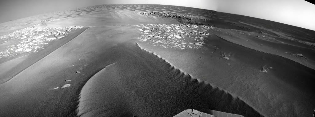
Posted by: Stu Mar 27 2010, 08:43 PM
Thought so... some interesting structure down there...

|
And welcome Mirek, great pan!
Posted by: Bill Harris Mar 27 2010, 08:49 PM
Wonderful. She got there tosol just before sunset.
On today's Navcams, I see new ripples overlying eroded ejecta and possibly overlapping old ripples. This is from the very first look at a few images, but it's an eyebrow-raiser for me WRT ripple formation time constraints and morphology. Just a thought, I'm going to anxiously await more pictures before getting too excited.
Another puzzler is why "Hadrian's wall" in the West Twin is sitting so crisp and sand-free.
Just a thought...
--Bill
Posted by: ngunn Mar 27 2010, 10:54 PM
I'll be following your commentary on the sequence and timescale of the different processes with great interest Bill. In the meantime there's one thing that already bothers me about this site. The eastern crater appears to be lower than the western one. I could understand that if the eastern crater formed first and the western impact went into the eastern crater's raised ejecta blanket. But it's hard to imagine that the two didn't form almost simultaneously, from the same meteoroid. Could there then be enough of a time interval for the difference in levels to be accounted for in this way? I seriously doubt it. The odds against two separate, unrelated events must be huge. So what's going on? I'm flummoxed.
Posted by: marsophile Mar 28 2010, 12:04 AM
The "eastern" crater is actually SE of the west crater. Isn't the terrain sloping down towards the south at this point?
http://marsrovers.jpl.nasa.gov/newsroom/pressreleases/20100324b.html
Posted by: fredk Mar 28 2010, 12:59 AM
The general tilt of the terrain is still extremely subtle. I think what we may be seeing with the Twins is that the rim between the two craters (ie the isthmus) is higher than the rest of the rims. That makes it look like East Twin is lower than West from our current viewpoint.
Posted by: brellis Mar 28 2010, 01:46 AM
Auto-Nav software allows more precise finishing points versus crater edges?
Posted by: Ant103 Mar 28 2010, 01:48 AM
The navcam pan of Sol 2194. Yes ! We see clearly the Eastern Crater now
http://www.db-prods.net/marsroversimages/Opportunity/2010/Sol2194-pano.jpg
And anaglyph because sometimes it's just an obligation to have it :
http://www.db-prods.net/marsroversimages/Opportunity/2010/Sol2194-pano-ana.jpg
Posted by: Bill Harris Mar 28 2010, 02:42 AM
For example, in setting up a blast in a quarry or mine, the spacing of the shot holes, the amount of explosive used or a small (milliseconds) delay between individual holes going off can vastly atler the nature of the effects of the shot. A well-designed shot can fragment the rock and then cast the overburden in a specific direction. An impact is very similar to a mine blast. Both rely on a shock wave to distort and fragnent and move rock. My background in Geology touches upon mining, and I look at impacts as simply a bigga-boom...
--Bill
PS-- here is a good site with introductory material on impacts and impact structures:
http://www.impact-structures.com/understand.html
Posted by: serpens Mar 28 2010, 05:29 AM
Actually if they were separate (unrelated) impacts then the probability that the second would hit next to the first crater is exactly the same as that it would impact in another particular position. I think we need to be careful not to make off the cuff correlations.
Posted by: Explorer1 Mar 28 2010, 05:44 AM
I like to imagine it like flipping a coin. You flip it 10 times, and get heads each time. What is the chance the 11th flip will come up tails? Still 50/50.
We cannot rule out that they might be separate. Oppy's just arrived, who knows what will be found.
Posted by: ngunn Mar 28 2010, 08:47 AM
That probability argument, whilst true as stated, is also misleading and doesn't address the issue. So I'm going with either Bill's well-designed shot or Fred's optical illusion. If millisecond differences can indeed do the trick my money's on Bill because I think the asymmetry of the site was already apparent on the HiRise.
Two other things to mention which I'll try to dig out and come back to. Somebody posted earlier a possible explanation of the apparent asymmetry in terms of prevailing wind. EDIT: http://www.unmannedspaceflight.com/index.php?showtopic=6501&view=findpost&p=157521
And on the Hirise thread there are a couple of nice crops of other multiple craters in the vicinity. EDIT: posts 141 and 142.
Close examination of those might shed some light on the twins.
Posted by: Bill Harris Mar 28 2010, 11:08 AM
This is an illustration from the Impact Structures site of the ejecta surrounding a terrestrial twin impact, Azuara and Rubielos, in Spain.
http://www.impact-structures.com/spain/controversy/pelarda.html
http://www.impact-structures.com/images/imag034.jpg
--Bill
Posted by: AndyG Mar 28 2010, 01:13 PM
It's a while since I took O-level geography, but perhaps arête would be a more suitable term? A sharp topographic ridge left between two areas of erosion.
Andy
Posted by: Bill Harris Mar 28 2010, 02:08 PM
It probably is a more accurate term, but "isthmus" is our informal name for this whatchamacallit.
Fooey. No new images this morning and she's having problems connecting with the relay satellite. Maybe by the "noon run"...
--Bill (on the edge of his seat)
Posted by: fredk Mar 28 2010, 02:29 PM
But there are way more "other particular positions" the second could hit that are far from the first than are adjacent to the first! So it's overwhelmingly likely that two unrelated impacts would be widely separated.
One thing I'd add to my raised-isthmus idea is that the west twin is larger than the east, so presumably had a more substantial raised rim, and so perhaps more of it's raised rim has survived than the east twin's, adding to the impression that west twin is higher than east.
I agree "isthmus" may not be the best term here, but I was inspired by other words we've been using related to the sea, eg capes/bays at Victoria.
Posted by: SFJCody Mar 29 2010, 06:04 AM
"Twin Craters" = San Antonio. There are  images of San Antonio West scheduled for 2196.
Posted by: kenny Mar 29 2010, 07:37 AM
Well, arête is usually an erosional mountain feature, as you say, and what we're seeing is a deposition feature feature, so a different term is apporpriate. Isthmus is probably neutral in this regard.
I think the best term is septum, "a partition separating two cavities or spaces". This is the term used on the moon for a ridge between two adjacent craters.
Posted by: Tesheiner Mar 29 2010, 11:29 AM
images of San Antonio West scheduled for 2196.I think we're talking about a ship from Magellan's expedition. Rui, you're the expert, what do you think?
http://en.wikipedia.org/wiki/Victoria_(ship)
...
The four other ships were Trinidad (110 tons, crew 55), San Antonio (120 tons, crew 60), Concepcion (90 tons, crew 45), and Santiago (75 tons, crew 32).
Posted by: climber Mar 29 2010, 01:50 PM
Arête, as you write it, is a french name which means "ridge" and is more likely to be applied in mountains, not in this case.
Now, if you use it in English (like it's written here), I cannot tell.
Posted by: ustrax Mar 29 2010, 01:52 PM
Yes, looks like it, although I was expecting to see the rest of Magellan's fleet used to name more proeminent features...
Looking forward for Santiago!
Posted by: CryptoEngineer Mar 29 2010, 02:52 PM
Now, if you use it in English (like it's written here), I cannot tell.
The rarity of twin craters on Earth means that the terminology for describing them is poorly developed. "Arête" is probably workable: English isn't shy about using words from other languages (ref James Nicoll). 'Septum' doesn't really work for me, I tend to associate it with anatomical structures. However, if its the accepted term of art, so be it. 'Divider', or 'dividing ridge' seem most descriptive, if unimaginative.
I wonder if its possible to look at the pair and figure out which hit first, or from which direction. Even a few milliseconds difference in arrival time would, I think, produce a difference in shape.
CE
Posted by: AndyG Mar 29 2010, 05:33 PM
I agree (while rubbing my philtrum, under my septum, with my finger.)
I would have thought that things would still be "up in the air" at a few milliseconds after the first impact, during crater formation. But it will be interesting to see the details.
Andy
Posted by: ngunn Mar 29 2010, 06:00 PM
If I understand correctly Bill's post 143 about directed shockwaves in mine blasts, I think "already moving but not yet up in the air" might describe it better.
Posted by: Stu Mar 29 2010, 08:07 PM
Hadrian's Wall looking good over there, Dan...

|
... but not much else to see... this might be a flying visit....
Posted by: fredk Mar 29 2010, 08:13 PM
Unfortunately no new views of the Twins in the latest downlink. But we're seeing many versions of some images - I don't recall ever seeing the "product version number" become a letter, like the "A" at the end of the filename of this image:
http://qt.exploratorium.edu/mars/opportunity/pancam/2010-03-29/1P322866189EFFADVRP2597R1MA.JPG
(Very cool image, I think, with the tracks veering to the left in the choppy see of dunes...)
Posted by: NickF Mar 29 2010, 08:28 PM
If Concepcion was in the order of 10^4 years old, do we have an estimate for the age of the Twins? An order of magnitude older? Two? Older still? (presumably impact features like this fill up with dust eventually)
Posted by: Bill Harris Mar 29 2010, 08:52 PM
Right, fredk, Oppy's been having some trouble with the uplink to the relay satellite and I guess that the "product version numbers" have gotten around to exceeding "9", so they've gone alpha. Anyone "with connectionc" care to venture a guess why?
The ripples have gotten to look like choppy seas, I don't thik this is a effect of the cratering at San Antionio since we've been seeing this since we arrived at Concepcion. We "crested the hilltop" there and are headed downhill-ish so I think that this is an orographic effect.
--Bill
Posted by: ngunn Mar 29 2010, 09:20 PM
Why has all the dust from inside San Antonio West (and East?) been blown out in one particular direction to form a single big dune? Other craters on the same HiRise image don't look like this has happened to them. It doesn't seem to me like the result of a gradual process but rather the effect of a strong wind that blew for a short time, temporarily revealing Hadrian's Wall. Then there's all those choppy dunes - another localised phenomenon. The relief around here is really slight so I can hardly believe that orographic effects alone would produce such striking changes. I have no explanation to offer but I think it's at least worth considering whether something unusual could have happened here fairly recently in Martian terms (post San Antonio but pre Concepcion).
EDIT: Think Tunguska - flattened trees but no crater. A big tornado might also do the trick; we don't really know what happens on smaller scales inside Martian dust storms.
Posted by: BrianL Mar 29 2010, 09:26 PM
All aboard the Opportunity Express. Next stop... Santa Maria. Woo-woo!
Well, I can hope...
Brian
Posted by: Bobby Mar 29 2010, 11:24 PM
How safe does it look like for the Rover to go inside this crater to investigate any exposed bedrock???
Posted by: Floyd Mar 30 2010, 12:51 AM
Dust death trap--no way!
Posted by: nprev Mar 30 2010, 01:24 AM
My sediments exactly. (insert snare-drum rim shot here!)
Posted by: CosmicRocker Mar 30 2010, 05:04 AM
Arête is a geomorphology term with glacial implications. It is a ridge formed between two cirques or two U-shaped glacial valleys. As such, it is probably inappropriate to use it to describe the ridge between these two craters.
Posted by: Stu Mar 30 2010, 05:29 AM
About as safe as it looks for Kevin Bacon to walk across a stretch of open desert...
You should be ashamed of that...
Posted by: Bill Harris Mar 30 2010, 12:13 PM
There isn't a name for a terrestrial equivalent to this feature. What we have here is a feature created by the combination of two ejecta curtains being simultaneously emplaced. We probably need to draw from whatever terminology has been created to describe crater ejecta features-- I shudder to think at the Latin/Greek/archaicEnglish that would get cobbled together for that term.
"Isthmus" is as good as anything. But in keeping with naval terminology, p'haps it can be called a gangplank?
--Bill
Posted by: kenny Mar 30 2010, 01:21 PM
I do believe "Septum" is the correct term , as I said in Post 152. Septum is used in lunar morphology, and also terrestrial volcanic craters. If you Googgle "septum crater" you will find several examples of this usage.
Posted by: Phil Stooke Mar 30 2010, 03:28 PM
Don't worry, people - soon the wretched feature will be far behind us.
Phil
Posted by: centsworth_II Mar 30 2010, 05:19 PM

|
"The elongate crater Torricelli near the north margin of Mare Nectaris was
probably formed by two simultaneous impacts as indicated by the partly
developed septum at A."http://history.nasa.gov/SP-362/ch7.2.htm
Posted by: Tesheiner Mar 30 2010, 06:17 PM
Actually, it already is by a few meters, because Opportunity is now positioned at the east crater.
Pictures should be available soon.
Posted by: Bill Harris Mar 30 2010, 07:10 PM
Sounds like a good plan. The ejecta is eroded, the rock in the southwall is not in-situ bedrock but exhumed ejecta. Nothing to see, move along folks. We'll get the images downlinked. Eventually.
However, just for curiosity, it would be nice to have a Pancam set of the mysterious prancha de grupo between the craters...
--Bill
Posted by: fredk Mar 30 2010, 07:52 PM
I have to say this is one of the prettiest craters we've visited - here's east twin:
http://qt.exploratorium.edu/mars/opportunity/navcam/2010-03-30/1N323231410EFFAEI4P1977R0M1.JPG
Drive direction pancams are looking SE, but could this be a reason to linger: is that a piece of impactor just inside the near rim?
http://qt.exploratorium.edu/mars/opportunity/navcam/2010-03-30/1N323231461EFFAEI4P1977R0M1.JPG
Also notice the big, tall pile of ejecta at the far end of the isthmus/septum/gangplank.
Posted by: ngunn Mar 30 2010, 08:04 PM
A really fine set of images from a much more satisfying vantage point than the previous stop: should make a spectacular panorama (as Stu prophesied). Definitely one for the full treatment and a place on the wall. The septum will be immortalised - septum in saeculo saeculorum!
Posted by: Mirek Mar 30 2010, 08:49 PM
There is a look at Eastern Twin with tracks leading to previous vintage point by Western Twin
Posted by: Stu Mar 30 2010, 09:47 PM

|
Not a bad view after all...
Posted by: Stu Mar 30 2010, 09:51 PM
Better to come from others, I'm sure...
http://twitpic.com/1c1fle
Posted by: Ant103 Mar 30 2010, 09:58 PM
Yes, not a so bad view actually
http://www.db-prods.net/marsroversimages/Opportunity/2010/Sol2197-pano.jpg
Posted by: marsophile Mar 30 2010, 11:10 PM
Even has an ice-cream cone lying on the sand there!
Posted by: Bill Harris Mar 31 2010, 01:57 AM
Here is a 3-image panorama of the Navcams today (Sol 2197) of San Antonio, exaggerated 3x. Interesting structure in the craters.
--Bill

|
Posted by: climber Mar 31 2010, 06:50 AM
The isthmus would have been an easy drive after all.
Posted by: Tman Mar 31 2010, 10:04 AM
Also a drive into the crater(s). They do look like Eagle crater in terms of aging, don't they?
Thanks Damien!
Posted by: Stu Mar 31 2010, 10:26 AM
I'm glad Oppy didn't land within driving distance of Valles Merineris...
"You know, if they're really careful, I'm sure they could drive Oppy down there to the floor..."
Just joking. Oppy is an explorer, her mission is to see new things. But sometimes it does feel like one of those episodes of Star Trek: Voyager, where they spot a swirly, angry, clearly dangerous, potentially starship-devouring "spatial anomoly" and Janeway beams "Let's go take a closer look...!"
Posted by: Bill Harris Mar 31 2010, 11:00 AM
Reminds me of the opening segment of the old 1960's TV series, Mission Impossible: "Jim, your mission, should you decide to accept it..."
But seriously, there is the need to anthropomorphise our Intrepid Explorers. We assign gender, have a mental image of a WALL-E bopping around Mars on a tour. Nothing wrong with that, the Rovers are an extension of all of us. Though, I imagine, a psychologist would have a field day...
Just as when we were younger, Oppy may have also been inclined to try hazardous things in the name of exploration. It is amazing that we all survived adolesence. Now that we and Oppy are "6-score and whatever" we tend to be a bit more careful.
[/philosophical_mode]
I would like to get at the edge of rim for a closer view of That Rock...
--Bill
Posted by: ElkGroveDan Mar 31 2010, 04:44 PM
It looks like a cat. Not just in shape, but how and where it's sitting (right Ted?)
Posted by: AndyG Mar 31 2010, 05:19 PM
Waiting for Opportunity!
There's two tiny stones on the dune to the far left of Ant's wonderful panorama. They're bound to be called Vladimir and Estragon. They they are, sat on the surface of Mars for perhaps thousands and thousands of years, not sure what's going to happen, every day the same old same old, when - all of a sudden - a rover trundles past...
Andy
Posted by: Explorer1 Mar 31 2010, 05:30 PM
Oh yes, Beckett said it right:
"In an instant all will vanish and we'll be alone once more, in the midst of nothingness!"
Almost unsettling how close he got it!
Posted by: fredk Mar 31 2010, 05:55 PM
If it's a cat, it looks like a black cat.
 I wonder if Oppy's hazard avoidance abilities include http://en.wikipedia.org/wiki/Cultural_depictions_of_cats#Europe?
Posted by: fredk Mar 31 2010, 07:55 PM
Here, kitty kitty!
http://qt.exploratorium.edu/mars/opportunity/pancam/2010-03-31/1P323311954EFFAEI4P2404L7M1.JPG
Posted by: Barry Mar 31 2010, 08:22 PM
Now the question is...who left the damn cat in there? (first post but long time reader)
Posted by: climber Mar 31 2010, 09:31 PM
Twin craters = twin blueberries: http://qt.exploratorium.edu/mars/opportunity/micro_imager/2010-03-31/1M299696631EFFA3PGP2936M2M1.JPG
Posted by: Bill Harris Mar 31 2010, 09:52 PM
1M299696631EFFA3PGP2936M2M1= Sol 1932, way way back at Erebus....
EDIT: oops, got timestamp and Sol# confused...thanks, fredk
http://www.greuti.ch/oppy/html/filenames_ltst.htm is a useful filename decoder...
--Bill
PS-- Look at the blocky nature of That Rock. We gotta look closely at this one (I'm sure to get Shunned...). Need to go out this evening, but we've got an L257 Pancam of the rock and isthmus-- have fun.
http://qt.exploratorium.edu/mars/opportunity/pancam/2010-03-31/1P323311893EFFAEI4P2404L2M1.JPG
Posted by: Stu Mar 31 2010, 10:26 PM
Black Cat Rock...

|
No shunning here, Bill, I'd like a look too.
Posted by: fredk Mar 31 2010, 11:34 PM
Not quite as far back as Erebus, more like Absecon/Reeds Bay, not far from Block Island.
Maybe we shouldn't be surprized about finding a cat - remember http://www.stevethecat.com/mars.htm who came to Mars on Phoenix?

Posted by: Bill Harris Apr 1 2010, 05:09 AM
It is still fairly chunky with JPEG artifacts but here is a cropped enlargement, with some increase in saturation, of the L257 Pancam trio of That Rock on Sol 2198. Not any detail to be seen on the shadowed side, it's dark and somewhat bluish which doesn't do much in the faint reddish Martian skylight. It appears to be another erratic rock on the plains, probably much like the Marquette Island rock.
--Bill

|
Posted by: centsworth_II Apr 1 2010, 05:34 AM
We could hope it's another interesting rock from far away to add to the catalog, or we could hope it's nothing new so we can hit the road without delay. I'll leave it to each and all to look within for which is the more pure and honorable hope.
Posted by: PaulM Apr 1 2010, 10:44 AM
--- Full quote removed. Mod. ---
I hope that Oppy will not venture into any more craters other than Endeavour. The cat looks very inviting, but remember how difficult Oppy found the drive out of Eagle crater.
The recent pictures of the hills around Endeavour look very inviting.
My hope is that after Oppy has spent a year investigating the hills around Endeavour crater then it will start another impossibly long drive right down into Endeavour crater to look at the clays.
Posted by: Tesheiner Apr 1 2010, 10:50 AM
No dip into the east crater.
The plan for thisol (2199), as I can see it, is to take a final pancam mosaic of the west crater and leave the area heading southeast.
Posted by: john_s Apr 1 2010, 02:23 PM
I love that word "East"! We are finally pointing towards the ultimate goal.
John
Posted by: MahFL Apr 1 2010, 02:26 PM
I used to have a concrete Black Cat.
Posted by: djellison Apr 1 2010, 02:39 PM
Ustrax - you know it's rude to break into John's UMSF account, right?
Posted by: ElkGroveDan Apr 1 2010, 02:58 PM
No Doug for Rui there is no "ultimate goal." It's all about the journey.
Posted by: Bill Harris Apr 1 2010, 03:22 PM
--Bill
Posted by: Phil Stooke Apr 1 2010, 03:36 PM
Yes, after a complete circumnavigation of the planet!
Phil
Posted by: climber Apr 1 2010, 06:48 PM
John
So, this is the end of the West Side Story...
Posted by: Tesheiner Apr 1 2010, 08:23 PM
Yup. And now, 40m closer to Endeavour. The images should be available on the next Exploratorium update; unfortunately too late for me (zzzzz).
Posted by: SFJCody Apr 1 2010, 08:34 PM
40m closer, but still not quite as close to Endeavour as they were from sol 1927 to 1930. The next drive should be the one to break that record. From that point I think we can pretty much call the western detour over.

|
Posted by: Tesheiner Apr 1 2010, 08:52 PM
I have this point in mind as the next "waypoint". It's about 500m from our current position.
|
There's no special feature at that location, no crater. But if we trust the route plan, that point is, more or less, where we start moving almost due east because we leave behind the ripple fields (you can see those fields NE of that point).
ADMIN: If you want to start a new topic, just call it "Next Waypoint" and we can change the title later once it has some name.
Posted by: marsophile Apr 1 2010, 09:44 PM
I don't think we have yet seen the pancam images from Sol 2197. The exploratorium site seems to be downloading old images from Sol 1931 and the jpl site only shows pancams up to 2196. Can we "get Scotty to kick the engines" on the downloads?
Posted by: Stu Apr 1 2010, 10:12 PM
While we all wait for the latest images, why not read AJS Rayl's latest superb MER update over on the Planetary Society's blog:
http://www.planetary.org/news/2010/0331_Mars_Exploration_Rovers_Update_Spirit.html
Posted by: ElkGroveDan Apr 2 2010, 01:54 AM
Nice Stu!
(nudge, nudge.. Hey I know that Stuart Atkinson guy. No seriously, we are old pals, had a couple of beers one night after nearly getting mugged in downtown L.A., we go way back.)
Posted by: nprev Apr 2 2010, 02:06 AM
Oh, yeah, I remember that night. You guys were annoyingly fast on your feet! 
Posted by: Stu Apr 2 2010, 05:21 AM
We didn't have enough beers, Dan, just cos S & I were both shattered with delayed jet lag. Will have to have a proper night next time we're over there.
Posted by: NickF Apr 3 2010, 03:53 PM
oops - caught out by not paying attention to image dates - post removed.
Posted by: fredk Apr 3 2010, 04:32 PM
That's one of the very old images that's reappeared on exploratorium. It's from sol 1931, way back at Absecon/Reeds Bay.
You can easily check the dates yourself using the excellent filename website:
http://www.greuti.ch/oppy/html/filenames_ltst.htm
Posted by: Bill Harris Apr 3 2010, 04:49 PM
A regolith is a debris layer of rock and mineral fragments, produced by the physical or mechanical break-up of the parent rock. A soil, OTOH, is a mixture of rock and mineral particles mixed with organic matter. In my mind, a soil carries with it the implication of chemical weathering in addition to physical weathering. On Mars we have seen the suggestions of chemical weathering in the surface, but no organic component.
So what would the proper term be? It's more than a simple regolith, but not a full-fledged soil.
--Bill
Posted by: Stu Apr 6 2010, 07:26 AM
Quick n dirty and coloured-in panorama of last San Antonio images...
|
|
Larger version: http://twitpic.com/1dks4s/full
And some more recent pictures here...
http://roadtoendeavour.wordpress.com/2010/04/06/farewell-san-antonio
Posted by: Ant103 Apr 6 2010, 10:14 PM
Sol 2198 L2 pan of San Antonio
http://www.db-prods.net/marsroversimages/opportunity-2010.html#last
Link to some driving directions.
Stu, beautiful productions as usual .
Posted by: jamescanvin Apr 8 2010, 09:34 PM
A bit of catchup.
Here are all the R21 colour drive direction mosaics from the drive between Concepción and San Antonio.
http://www.nivnac.co.uk/mer/index.php/b2199
James
Posted by: Astro0 Apr 13 2010, 12:52 PM
From the latest batch on Exploratorium, a bit of a belated offering from Sol2196.

|
Posted by: Nirgal Apr 13 2010, 01:57 PM
A really beautiful panorama with perfectly seamless stitching again, thanks !
Posted by: Ant103 Apr 13 2010, 02:56 PM
Sol 2198 updated version (colors) of the pan of San Antonio :
http://www.db-prods.net/marsroversimages/Opportunity/2010/Sol2198-SanAntonio-pancam.jpg
Just the horizon part because the bellow part is filled with a lot of black area.
Posted by: Ant103 Apr 15 2010, 09:25 AM
It's finally done, and I'm not very satisfacted about the result, but it's the better I can do with THIS pictures.
So, San Antonio pan in color, on Sol 2196 :
http://www.db-prods.net/marsroversimages/opportunity-2010.html#Sol2196
Posted by: vikingmars Apr 15 2010, 10:19 AM
Il n'est pas parfait, mais il est bien quand même car on se rend compte du terrain. Merci bcp de nous l'avoir posté. Anyway, THANKS for your nice work !
Posted by: nprev Apr 15 2010, 10:38 AM
...yeah, Ant, what VM said! Your work is always a welcome sight, and I look forward to your posts.
Posted by: Bernard Apr 15 2010, 02:52 PM
je plussoie sur Vikingmars
merci fourmi
Posted by: jamescanvin Apr 15 2010, 09:43 PM
My version of the 'east' pan.
http://www.nivnac.co.uk/mer/index.php/san_antonio_east
James
Posted by: Ant103 Apr 15 2010, 11:13 PM
Merci beaucoup
James, your version is way better than mine (not totally stitched at this time). Really appreciate to see your version .
Posted by: climber Apr 16 2010, 06:02 AM
merci fourmi
Je plussoie! Celle-ci risque d'occuper nos amis quelque temps!
Je plussoie aussi d'ailleurs!
Powered by Invision Power Board (http://www.invisionboard.com)
© Invision Power Services (http://www.invisionpower.com)