Distant vistas, Endeavour, Iazu, and beyond |

  |
Distant vistas, Endeavour, Iazu, and beyond |
 Mar 4 2010, 10:48 PM Mar 4 2010, 10:48 PM
Post
#151
|
||
 Senior Member  Group: Moderator Posts: 2262 Joined: 9-February 04 From: Melbourne - Oz Member No.: 16 |
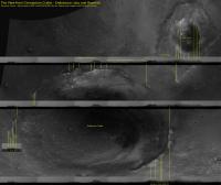
OK I've been poring over these horizon images along with my retrojected orbital HRSC image and other bit and pieces from this thread + Google Mars for ages! I am now pretty confident that I have everything identified correctly (or pretty close).
James -------------------- |
|
 |
 
|
|
|
Mar 4 2010, 10:58 PM
Post
#152
|
|
|
Senior Member Group: Members Posts: 3516 Joined: 4-November 05 From: North Wales Member No.: 542 |
That is a fantastic piece of work James. I did wonder about that part of the skyline beyond Endeavour too. Are we sure it's not part of the Iazu apron?
PS - I wish they'd pan around to the north rim again. |
|
|
|
|
Mar 4 2010, 11:04 PM
Post
#153
|
|
|
Founder Group: Chairman Posts: 14431 Joined: 8-February 04 Member No.: 1 |
Would projected CTX images be of use? The PDS released images are uncalibrated and unprojected, but I've got the process sorted in ISIS3, it's not too bad actualy, so if someone gives me the ob-ID, I'll get them map projected.
|
|
|
|
|
Mar 4 2010, 11:12 PM
Post
#154
|
|
 The Poet Dude Group: Moderator Posts: 5551 Joined: 15-March 04 From: Kendal, Cumbria, UK Member No.: 60 |
That's a brilliant piece of detective work, James. Really brings the whole scene to life.
I wish we had some names - even just working names - for those distant hills and peaks. Maps are so much better with names. Soon tho, I'm sure. 
-------------------- |
|
|
|
|
Mar 4 2010, 11:35 PM
Post
#155
|
|
|
Senior Member Group: Moderator Posts: 2262 Joined: 9-February 04 From: Melbourne - Oz Member No.: 16 |
ngunn,
I don't think the distant horizon can be part of Iazu, it just doesn't stretch that far east. Also, it looks more 'hazy' than the rest of Iazu. Looking at Google Mars it does suggest that we should have an horizon about 10km (ish) beyond Endeavour in that direction. Doug, I'd love to have a CTX base map of the area. Not sure how much time I'll have to do any further analysis, but here are some ID's of CTX images that would cover all of Endeavour and Iazu. P13_006135_1789_XN_01S005W P15_006847_1770_XN_03S005W P17_007849_1793_XN_00S005W Stu, Rui has named everything around here hasn't he?  James -------------------- |
|
|
|
|
Mar 4 2010, 11:38 PM
Post
#156
|
|
|
Founder Group: Chairman Posts: 14431 Joined: 8-February 04 Member No.: 1 |
Anything Rui has not named, will just call it Ultreya A through Z.
I've got those three CTX images downloading (140-250 meg each - and I generate about 4 times that in the CTX processing pipeline) - I'll squirt them out tomorrow...and SEE how hard it is to mosaic them within ISIS...but I wont spend to much time on that. I'll zip up PNGs or something and send you a link. |
|
|
|
|
Mar 5 2010, 12:13 AM
Post
#157
|
|
|
Founder Group: Chairman Posts: 14431 Joined: 8-February 04 Member No.: 1 |
For the P13 ob - ISIS is happy. For the other two, I don't think the kernels have hit the ISIS Rsync server, so I can't project them reliably. I'm going to fudge it assuming nadir-pointing.
|
|
|
|
|
Mar 5 2010, 06:50 AM
Post
#158
|
|
|
Senior Member Group: Moderator Posts: 4279 Joined: 19-April 05 From: .br at .es Member No.: 253 |
Had you tried searching for their correlative HiRISE's? The pointing would be the same.
|
|
|
|
|
Mar 5 2010, 07:37 AM
Post
#159
|
|
|
Founder Group: Chairman Posts: 14431 Joined: 8-February 04 Member No.: 1 |
It would error the same way- tge kernels are external to the images, and HiRISE data would simply be looking for the same missing data. The kernels are quite laggy getting into ISIS, way behind the imaging data.
|
|
|
|
|
Mar 5 2010, 08:17 AM
Post
#160
|
|
|
Senior Member Group: Moderator Posts: 2262 Joined: 9-February 04 From: Melbourne - Oz Member No.: 16 |
There may be others that cover the same area, I just grabbed a few ID's off of Google Mars.
It would be good to have as accurate a map as possible to help with alignment of horizon features - fudging it may just confuse me more than I already am! -------------------- |
|
|
|
|
Mar 5 2010, 08:23 AM
Post
#161
|
|
|
Founder Group: Chairman Posts: 14431 Joined: 8-February 04 Member No.: 1 |
Well - anything starting 13 or less is great. I'm not sure they started imaging that way much before it was decided to head there thigh. CRX is 30km wide though - so we might be in luck.
|
|
|
|
|
Mar 5 2010, 09:04 AM
Post
#162
|
|
|
Senior Member Group: Moderator Posts: 4279 Joined: 19-April 05 From: .br at .es Member No.: 253 |
QUOTE (jamescanvin @ Mar 5 2010, 09:17 AM)  There may be others that cover the same area, I just grabbed a few ID's off of Google Mars. I'm used to search at this site: Mars Global Data. Start with the "webmap" option, zoom to the area of interest, click on the arrow button (select) and then on the map again. |
|
|
|
|
Mar 5 2010, 09:55 AM
Post
#163
|
|
|
The Poet Dude Group: Moderator Posts: 5551 Joined: 15-March 04 From: Kendal, Cumbria, UK Member No.: 60 |
WARNING! If you've never used Mars Global Data before, be very careful. It's dangerous. VERY dangerous. It's the Mars website equivalent of a packet of Pringles or a box of Maltesers - once you start, you can't stop. Oh yes, you go on there thinking "I can handle it, I'll just have a quick look", then you start clicking... and clicking... You tell yourself "Just one more"... click... "Ok, just ONE more..." click... and before you know it it's dark outside, the rest of the family are in bed, and there's a cold cup of coffee on the desk beside you...

-------------------- |
|
|
|
|
Mar 5 2010, 10:04 AM
Post
#164
|
|
 Special Cookie Group: Members Posts: 2168 Joined: 6-April 05 From: Sintra | Portugal Member No.: 228 |
Fantastic work James! I can't believe we have come this far, able to see the hills REALLY unfolding before our eyes...
About the names...we all know they've been chosen for quite some time don't we? Ah!
-------------------- "Ride, boldly ride," The shade replied, "If you seek for Eldorado!"
Edgar Alan Poe |
|
|
|
|
Mar 5 2010, 10:27 AM
Post
#165
|
|
|
The Poet Dude Group: Moderator Posts: 5551 Joined: 15-March 04 From: Kendal, Cumbria, UK Member No.: 60 |
I wasn't discounting your names Rui
I meant more 'official' names so we can all follow the journey. Your names are great. You're going to need some more tho, looks like lots of smaller peaks on top of the main hills. Better start researching if any of those sailors had pet dogs or cats...
-------------------- |
|
|
|
|

|
Lo-Fi Version | Time is now: 16th April 2024 - 10:12 PM |
|
RULES AND GUIDELINES Please read the Forum Rules and Guidelines before posting. IMAGE COPYRIGHT |
OPINIONS AND MODERATION Opinions expressed on UnmannedSpaceflight.com are those of the individual posters and do not necessarily reflect the opinions of UnmannedSpaceflight.com or The Planetary Society. The all-volunteer UnmannedSpaceflight.com moderation team is wholly independent of The Planetary Society. The Planetary Society has no influence over decisions made by the UnmannedSpaceflight.com moderators. |
SUPPORT THE FORUM Unmannedspaceflight.com is funded by the Planetary Society. Please consider supporting our work and many other projects by donating to the Society or becoming a member. |
|