InSight Surface Operations, 26 Nov 2018- 21 Dec 2022 |

  |
InSight Surface Operations, 26 Nov 2018- 21 Dec 2022 |
 Dec 17 2018, 08:25 PM Dec 17 2018, 08:25 PM
Post
#301
|
|
|
Newbie  Group: Members Posts: 17 Joined: 20-April 05 Member No.: 317 |
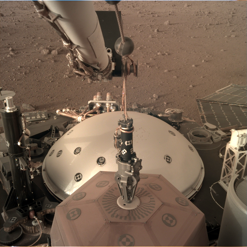
10 new images from Sol 20 are on the raw images page. SEIS has been grappled:
|
 |
 
|
|
Dec 17 2018, 10:31 PM
Post
#302
|
|
 Senior Member Group: Members Posts: 2425 Joined: 30-January 13 From: Penang, Malaysia. Member No.: 6853 |
QUOTE (Zeehond @ Dec 18 2018, 04:25 AM)  .....SEIS has been grappled Looks like the operations schedule provided on the SEIS web page is being maintained:- The critical deployment phase is split into six parts and could take up to two months after landing (with a margin of 20 sols). During this time, the teams will be constantly on hand, unlike during the scientific measurement phase, when the probe will be operating practically on its own. The operations schedule is given below: Sols 0 - 5: initialization of the lander and preparation for instrument deployment. Sols 6 - 18 : characterization by the cameras of the room available for positioning the instruments and selection of the most advantageous potential sites for deployment. Sol 7 (science) : initiation of RISE data acquisition (geodesy). Sols 19 - 31 : deployment of the SEIS seismometer (see details below). Start of measurements in engineering mode. Sols 32 - 43 : deployment of the seismometers Wind and Thermal Shield (WTS). Start of SEIS scientific measurements (monitoring) from sol 40. Sols 44 - 58 : deployment of the HP3 suite. Its mission accomplished, the robotic IDA returns to a stowed position on the lander. Sols 59 - 69 : start of drilling operations with the HP3 mole. Source links English French |
|
|
|
|
Dec 18 2018, 08:55 AM
Post
#303
|
|
|
Junior Member Group: Members Posts: 36 Joined: 28-May 08 Member No.: 4152 |
Long time lurker here - have my contribution to the image processing with a fully room-scale walkabout VR version of InSight's landing site:
https://steamcommunity.com/sharedfiles/file.../?id=1593406277 Basically, I threw all the images into Agisoft PhotoScan and was surprised to get a pretty complete reconstruction of the landscape on one side of the lander. That, combined with some impostor geometry for the sky and terrain going out to the horizon meant a pretty immersive environment to wander around in. Add the lander model from NASA's 3D resources pages, and behold - Mars! (Elysium Planitia is so very flat, isn't it?) I've posted notes for a more complicated version of my process in this older Curiosity scene here: https://steamcommunity.com/sharedfiles/file...s/?id=928142301 (Full disclosure: I work at Valve on SteamVR, but I built this stuff because I'm a complete space nut. Hello!) |
|
|
|
|
Dec 18 2018, 08:58 PM
Post
#304
|
|
|
Senior Member Group: Members Posts: 2920 Joined: 14-February 06 From: Very close to the Pyrénées Mountains (France) Member No.: 682 |
Some news from « sister » ForeSight, they seams to know where to land SEIS: https://www.seis-insight.eu/fr/actualites/4...-mars-sur-terre
-------------------- |
|
|
|
|
Dec 19 2018, 03:14 AM
Post
#305
|
|
 Senior Member Group: Admin Posts: 4763 Joined: 15-March 05 From: Glendale, AZ Member No.: 197 |
QUOTE (climber @ Dec 18 2018, 12:58 PM) Some news from « sister » ForeSight, they seams to know where to land SEIS: https://www.seis-insight.eu/fr/actualites/4...-mars-sur-terre  That is amazing. Merci, vieil ami. That is amazing. Merci, vieil ami. Technology has come a long way since the MER test-bed. -------------------- If Occam had heard my theory, things would be very different now.
|
|
|
|
|
Dec 19 2018, 03:24 AM
Post
#306
|
|
|
Member Group: Members Posts: 866 Joined: 15-March 05 From: Santa Cruz, CA Member No.: 196 |
its in French of course, but maybe this link will work for others too?
https://translate.google.com/translate?sl=f...-mars-sur-terre being automated there are some real gems in there  to start: "...extremely accurate digital terrain model, reproducing each terrain accident." to start: "...extremely accurate digital terrain model, reproducing each terrain accident."
|
|
|
|
|
Dec 19 2018, 05:33 AM
Post
#307
|
|
|
Forum Contributor Group: Members Posts: 1372 Joined: 8-February 04 From: North East Florida, USA. Member No.: 11 |
The grapple is designed to grab, so it's impossible to lose grip.
To open they use a wax actuator. https://www.nextgov.com/emerging-tech/2018/...-lander/152070/ |
|
|
|
|
Dec 19 2018, 09:09 AM
Post
#308
|
|
|
Senior Member Group: Members Posts: 2920 Joined: 14-February 06 From: Very close to the Pyrénées Mountains (France) Member No.: 682 |
QUOTE (atomoid @ Dec 19 2018, 04:24 AM) its in French of course, Hum, on the upper rigth side you can clic to get the english version
-------------------- |
|
|
|
|
Dec 19 2018, 01:03 PM
Post
#309
|
|
|
Senior Member Group: Members Posts: 2425 Joined: 30-January 13 From: Penang, Malaysia. Member No.: 6853 |
QUOTE (climber @ Dec 19 2018, 05:09 PM) Hum, on the upper rigth side you can clic to get the english version Selecting the English version takes me to the SEIS home page. (using my browser) The link converts to English: link |
|
|
|
|
Dec 19 2018, 03:16 PM
Post
#310
|
|
|
Senior Member Group: Members Posts: 1582 Joined: 14-October 05 From: Vermont Member No.: 530 |
I also resorted to google translate (which seemed excellent) after being unable to find the article after clicking through the Union Jack.
|
|
|
|
|
Dec 19 2018, 06:04 PM
Post
#311
|
|
|
Senior Member Group: Members Posts: 2920 Joined: 14-February 06 From: Very close to the Pyrénées Mountains (France) Member No.: 682 |
-------------------- |
|
|
|
|
Dec 19 2018, 06:28 PM
Post
#312
|
|
 Director of Galilean Photography Group: Members Posts: 896 Joined: 15-July 04 From: Austin, TX Member No.: 93 |
QUOTE (Cargo Cult @ Dec 18 2018, 02:55 AM) Long time lurker here - have my contribution to the image processing with a fully room-scale walkabout VR version of InSight's landing site:  This is amazing. Thank you so much! This is amazing. Thank you so much!
-------------------- Space Enthusiast Richard Hendricks
-- "The engineers, as usual, made a tremendous fuss. Again as usual, they did the job in half the time they had dismissed as being absolutely impossible." --Rescue Party, Arthur C Clarke Mother Nature is the final inspector of all quality. |
|
|
|
|
Dec 19 2018, 09:19 PM
Post
#313
|
|
|
Junior Member Group: Members Posts: 29 Joined: 12-February 04 Member No.: 29 |
QUOTE (Cargo Cult @ Dec 18 2018, 03:55 AM) Long time lurker here - have my contribution to the image processing with a fully room-scale walkabout VR version of InSight's landing site: https://steamcommunity.com/sharedfiles/file.../?id=1593406277 Basically, I threw all the images into Agisoft PhotoScan and was surprised to get a pretty complete reconstruction of the landscape on one side of the lander. That, combined with some impostor geometry for the sky and terrain going out to the horizon meant a pretty immersive environment to wander around in. Add the lander model from NASA's 3D resources pages, and behold - Mars! (Elysium Planitia is so very flat, isn't it?) I've posted notes for a more complicated version of my process in this older Curiosity scene here: https://steamcommunity.com/sharedfiles/file...s/?id=928142301 (Full disclosure: I work at Valve on SteamVR, but I built this stuff because I'm a complete space nut. Hello!) Superbe! Great job, would love to see more panoramas portrayed in VR. |
|
|
|
|
Dec 19 2018, 10:07 PM
Post
#314
|
||
 Administrator Group: Admin Posts: 5172 Joined: 4-August 05 From: Pasadena, CA, USA, Earth Member No.: 454 |
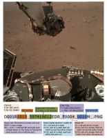
QUOTE (MarkL @ Dec 16 2018, 06:36 AM) Any idea how the raw images are being named? The naming convention is described in this document beginning on page 22. Edit: I decided to make myself an explainer since I figured I'd continually forget the details about mesh and mosaic IDs.
Attached thumbnail(s)
-------------------- My website - My Patreon - @elakdawalla on Twitter - Please support unmannedspaceflight.com by donating here.
|
|
|
|
|
|
|
Dec 20 2018, 02:37 AM
Post
#315
|
|
|
Member Group: Members Posts: 866 Joined: 15-March 05 From: Santa Cruz, CA Member No.: 196 |
Huge thanks for the image decoder cheat-sheet, Emily it is so helpful!! ..now i'm curious what the 'EDR' as well as the 'M' at the end represent.
I never was able to get Cargo Cult's walkabout VR version of InSight's landing site working, just brings up a simple image, perhaps i need SteamVR equipment or something like that? Climber's 360 pano is an amazingly well curated mosaic, i finally feel what its like at the landing site now, thanks! Im assuming the Seis site may only release news in French, as the english version simply lacks a 'News' (Actualités) link. Regarding that wax-actuated grapple, I hadn't considered or read anywhere if it is capable as a sort of off-label use to pick up rocks, which was discussed somewhat earlier in this thread, but so far unsubstantiated, as a means for inducing vibrations (drop rocks by grapple or soil by bucket) at intervals which in conjunction with the Seis could perhaps stereo image the local subsurface environs to detect large subsurface rocks to avoid in order to better position deployment of the HP3.. |
|
|
|
|

|
Lo-Fi Version | Time is now: 24th April 2024 - 02:02 AM |
|
RULES AND GUIDELINES Please read the Forum Rules and Guidelines before posting. IMAGE COPYRIGHT |
OPINIONS AND MODERATION Opinions expressed on UnmannedSpaceflight.com are those of the individual posters and do not necessarily reflect the opinions of UnmannedSpaceflight.com or The Planetary Society. The all-volunteer UnmannedSpaceflight.com moderation team is wholly independent of The Planetary Society. The Planetary Society has no influence over decisions made by the UnmannedSpaceflight.com moderators. |
SUPPORT THE FORUM Unmannedspaceflight.com is funded by the Planetary Society. Please consider supporting our work and many other projects by donating to the Society or becoming a member. |
|